
|
| |||||
|
| |||||
|
| |||||
| ||||
| ||||
"All this is the music of waters." - John Wesley Powell, 1895
"Not to have known - as most men have not - either the mountain or the desert is not to have known oneself." - Joseph Wood Krutch
Tri-Trip overview:
During the Fall of 2011, Kathleen and I enjoyed three car-camp trips sprinkled with
wondrous day hikes. We hiked off the North Rim of the Grand Canyon (GC), in Yellowstone National Park, and a discontinuous
rim-to-rim in Zion National Park. I collected the narrative, photos, movies, and maps in this
one report rather than scatter them about the WV (WildernessVagabond) site. This is one factor that makes it a ramble, one rambles from
report to report. It's a sampler of these three exquisitely fine chunks of public land.
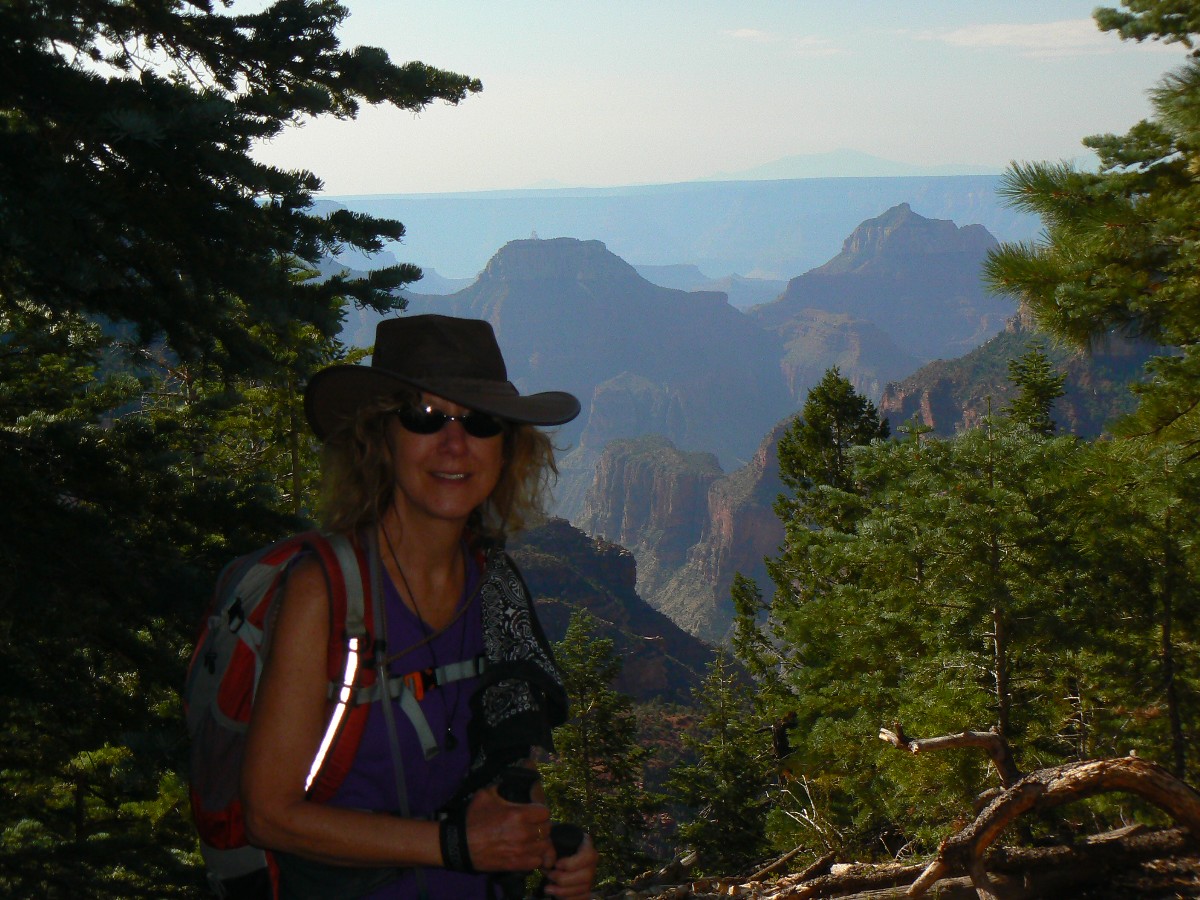
While hiking the North Kaibab trail in the Grand Canyon, I met Lin Xu, and she
is guest authoring her report of a rim-to-rim (South to North Rim of the GC) hike. Lin's report will open the trip
narrative below. After all, guests go first.
There are many photos, panoramas (panos), movies, and maps intermingled in the
day hike reports. Because of fires on the plateau, GC photo quality is not that great. The embedded maps are based on tracks straight out of my Garmin GPS (Global Positioning System) and
may take awhile to load, so please be patient or continue browsing while they load.
None of the photos in this report
have been altered in color, contrast, or color saturation, with the exception of one pano (in which Ben Prepelka
balanced the contrast across overlapping images).
Please consider to start downloading some of the 9 videos while you browse
the still images, panos, and the narratives.
Cheerio and Enjoy, Rob of the WV.
May you prosper in the Year of the Dragon (2012)! Lin Grace Xu of the GC
Lin Xu on the North Kaibab Trail - GC
 |
 |
 |
Rim-to-Rim, Exploring The Grand Canyon! by Lin Grace Xu:
3d Day 29th Aug. Phantom Ranch to North Rim:
Morning and I got up in the ranch at 4am, amazing others also woke up; they
try to go before sunrise. My beginning half hour is still dark; then the rock changes its face so many times, full
of surprises of every turn. It sometimes appears as a castle, sometimes as a wall, the color changes from bottom to
top starting with black, yellow, then green, grey, red sometimes shining red. I see unbelievable different layers,
blocks and shapes. I walk slowly, knowing I have a lot of time, but still I am surprised to arrive at Cottonwoods
at 10am. I feel pretty strong and restless; meanwhile a bit hesitating about how tough and how hot to continue;
how fit am I? So go forward!
I start with an immediate lesson, it is a whole long way up, not too steep but
dry and hot; my bag is so heavy and my shoulder and neck feel the pain. By 10.45am only, I am sweating and exhausted.
I recharge myself with some unhealthy food then move forward; and I sweat most along this path. I miss the water
stops and did not realize this, and I walk more than I realize; of course my water runs out and I do not know how
long before the next water stop. Luckily, I still have an apple to recharge and met two brothers on the way to chat.
The way to the water stop is quite steep and painful and I arrive there around 1.30pm. I meet Rob there, who is an
experienced hiker. I seek his advise on next stops after Grand Canyon.
(1.24pm Home 22nd Jan. 2011) Finally I got to write up this portion of the trip with
the motivation that Rob has been very patient with me for it, even though I have written up my Indian trip by now in
Jan. 2012, I'm still missing part of the Grand Canyon story. Today we are moving to the new Dragon year I do not want
to "own" any promised things to do:+)
Yes, I was lucky that Rob is a very experienced hiker; I seek his advise on how to
spend the rest of my days in Zion and Bryce, with the assumption that I will make it out of The Canyon in one piece.
Rob is very fast and we hiked up 1.7 miles in a very sandy, dusty trail and we try
to escape the horse crew which looks ridiculous along the trail ........ we stop in an overview point (the Supai Tunnel
water stop) to let mules go past and get another bar with calories 240 (I do follow the advise to eat often but
meanwhile worrying too often:+). The last part is much easier with a lot of trees and we end up on top at 3pm, not
bad at all and I am lucky to have Rob chatting to make it easier and enjoyable. So pleased with myself, total time
is 5 hours with a few stops - not bad at all!!! Think of my backpack bag, which is really something and I have to camp
to make it worthwhile! I follow Rob to camp ground where it is such a positive surprise waiting: a nice supermarket
even with ice cream !!! Two of them in the porch is a nice trade-off .........a moment of relaxing and being proud of
myself: good decision to go ahead otherwise I would not have all these nice facilities here: the camp ground is so
well organized, clean and at the best spot of North Rim. If in China, this is where the rich would be - not the
hikers.........
It takes me awhile to set up the tent, not difficult at all; amazed how clean the
toilet is and can not believe I have the last spot in the camp ground for hikers, which has a 270 degrees canyon
view by the cliff; I even have my private bench to overlook the canyon in its sunset moment. So spoiled by the first
camp experience no others can be comparable I am afraid. Meditation is the best thing to do, which I did!
I read a while until completely dark by the canyon, see some others coming for
the sunset............yes they recognize I have the best spot:+). Though when it is completely dark, I feel a bit
uncertain so go to bed at 9pm. Stars are intense but not so packed like in the Yellowstone experience..............
A good closure to all from the determination not giving up the ambitious goal even at certain moment it looks too
ambitious?
(Rob's note - Lin wrote this report of her last day of a three-day Rim-to-Rim hike
of the Grand Canyon. This third day, Lin hiked from Phantom Ranch (near the Colorado River) to the North Rim, via the
North Kaibab Trail, a
distance of 14 miles (23 km), gaining 6,000' (1800 meters). Please note that I was carrying a day pack while Lin
had a full backpack. Therefore, the report that I am a fast hiker must be taken in this context.
Thanks are due Ranger Della Yurcik, who consulted with Lin about the trail and campground.
Because I was chatting with Della in the middle of the North Kaibab Trail, I had the opportunity to meet Lin,
who was hiking up from the Colorado River.)
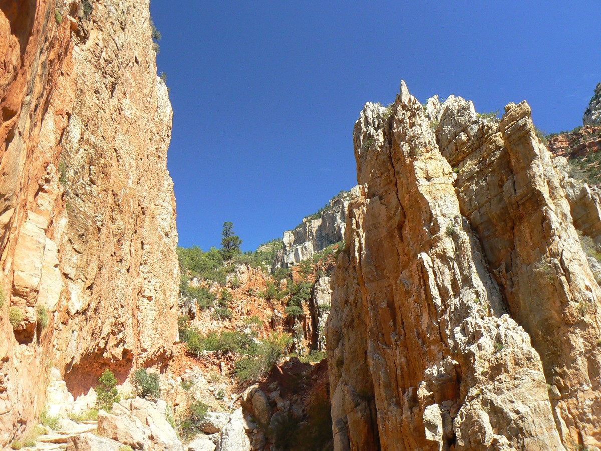
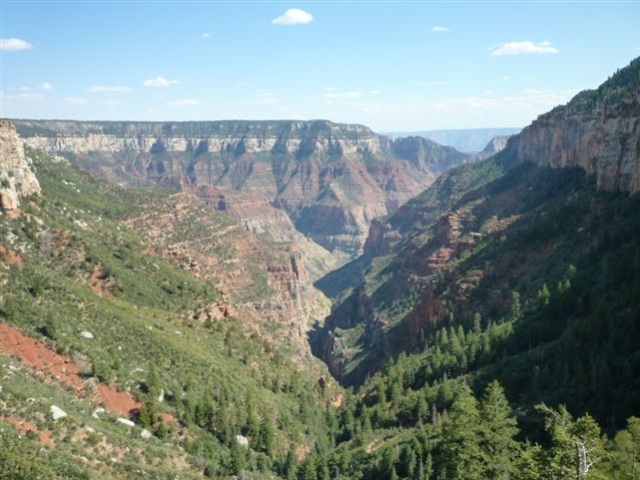
GC Day 1: Transept and Bridle Trails: (reports below by Rob)
Kathleen and I drive to the North Rim of the Grand Canyon (GC) and camp in the
campground (CG). Tall, welcoming, Ponderosa Pines sway gently above as we briefly test the hammock. We rouse
ourselves out of this luxurious rest and hike the Transept and Bridle Trails.
GC Day 2: Widforss Trail:
It's a lovely long 10 miles of rim walking while it heats significantly
down below, in The Canyon. More swinging in the hammock, watching the swaying P-Pines overhead. Lovely.
Hike description: Start at the Widforss Trail TH (trail head), which is just North of the North Kaibab
Trail - it is signed.
This trail is fairly level and maintains its elevation as it rambles past branches
of the Transept to Widforss Point - for views of the South Rim. Look carefully, you can see the South Kaibab Trail
cutting down to the Tipoff across the canyon.
![]() Map -
A map of this GPS track/map of the Widforss Trail can be seen below. Change the map type (topo, terrain, etc.)
and alter the scale
as you wish. Click "bigger map" text below map if you want a larger map.
Map -
A map of this GPS track/map of the Widforss Trail can be seen below. Change the map type (topo, terrain, etc.)
and alter the scale
as you wish. Click "bigger map" text below map if you want a larger map.
GC day hikes - Photos by Rob

"Everyone is entitled to his own opinion, but not his own facts." Daniel Patrick Moynihan
Light travels faster than sound. This is why some people appear bright until you hear them speak.
GC Day 3: Roaring Springs:
Kathleen and I start off for a hike across the Bridle Trail to the North Kaibab
Trail, and into the great abyss. It's a 10+ mile round trip to Roaring Springs and back to the campground, with an
elevation loss and gain of about 3000' (6000' total; or an Energy Required Mile rating of about 22 ERM for the trip).
As the temperature soars, Kathleen turns back to loaf the rim while I continue to Roaring Springs. Lovely shade and
fine water await at the rest stop.
On my way back up, I meet Ranger Della Y. and we chat in the shade of her umbrella
for quite awhile. We talk about the possibility of a combined trip some day. Wondrous. Ranger Della, of course,
is featured in some of the WV reports about The Canyon. Soon, Lin Xu arrives,
hiking cross-canyon, and Lin and I continue to a rest stop at the Supai Tunnel (and water!) while Della continues
her patrol into The Canyon. Della notes that there are new scenic toilets near the Roaring Springs residence, and
I regret not continuing down that far. Might this be something exciting for the next trip?
Talking with the high-powered Lin makes the slog up the powdery dust trail go quickly
and soon we reach the Supai Tunnel and the water stop. This luscious water is pumped up from Roaring Springs. We pause
long enough to allow the swirling dust cloud puffed up by a mule train to settle, then continue into the land of Ponderosa
Pines and the coolness of the North Rim.
Lin continues to the camp registration once we reach the rim, while I head back
to camp. Della has called ahead to reserve a spot for Lin, yet I offer her a spot in our camp if this does not
work out.
Hike description: This hike starts and ends in the North Rim campground (CG). It's about 10 miles of
hiking, with an elevation loss of about 3,000', followed by a gain of 3,000'.
Hike the Bridle Trail from the CG to the TH (trail head) for the North Kaibab Trail.
Drop into the Grand Abyss known as The Grand Canyon.
I was focused on the water at the Supai Tunnel, and forgot to turn on my GPS after
a rest - so the track below actually stops on the way back up to the TH (trail head) at the Supai Tunnel. So, the elevation
gained does not match the elevation lost.
Terrific hike. Start very early or after 2 p.m. (shade more on the trail) during
the Summer.
Track (below) is best viewed in topo mode.
![]() Map -
A map of this GPS track/map of the North Kaibab Trail to Roaring Springs can be seen below. Change the map type (topo, terrain, etc.) and alter the scale
as you wish. Click "bigger map" text below map if you want a larger map.
Map -
A map of this GPS track/map of the North Kaibab Trail to Roaring Springs can be seen below. Change the map type (topo, terrain, etc.) and alter the scale
as you wish. Click "bigger map" text below map if you want a larger map.
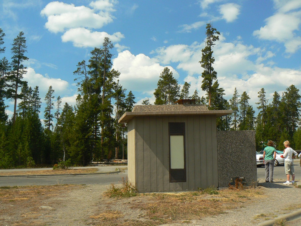
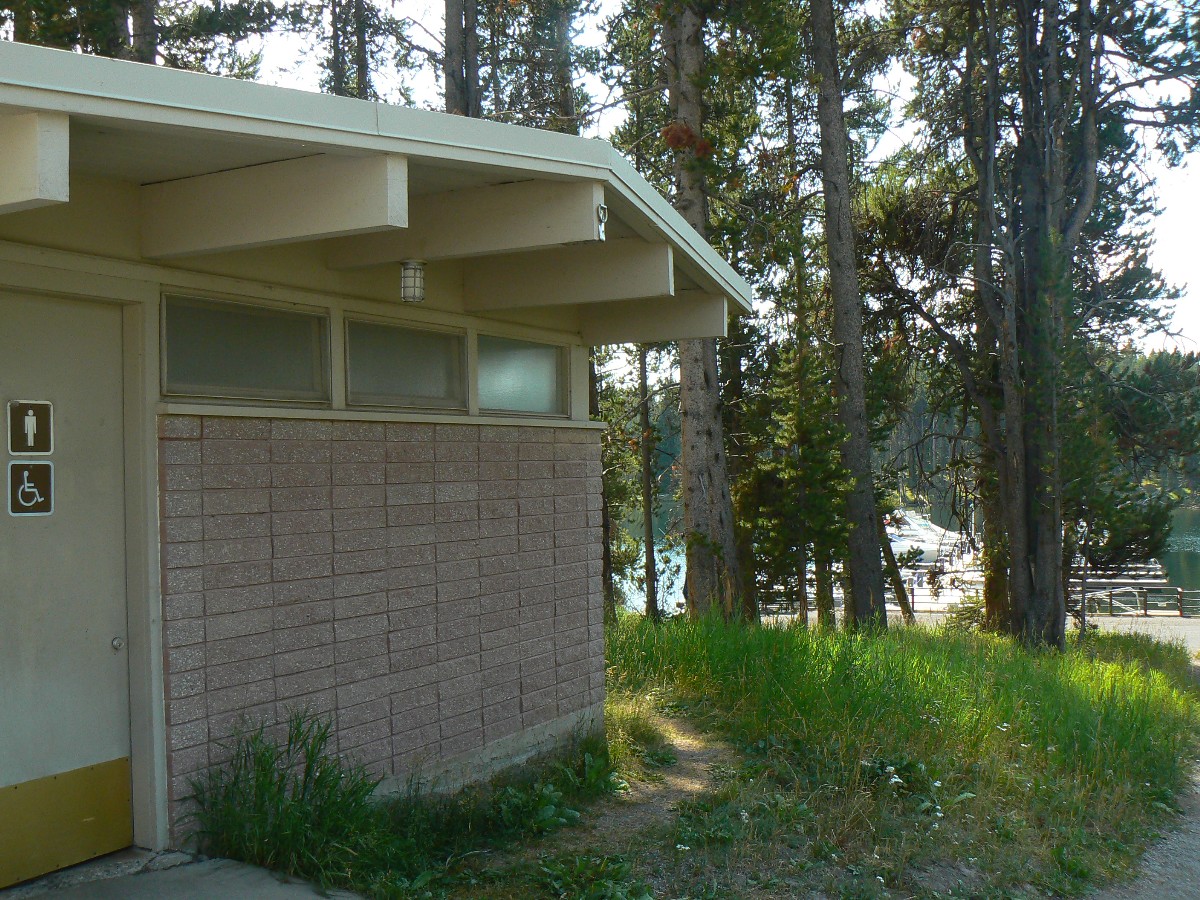
Scenic Toilets of the North Rim - Photos by Rob
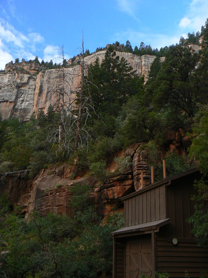
| ||||
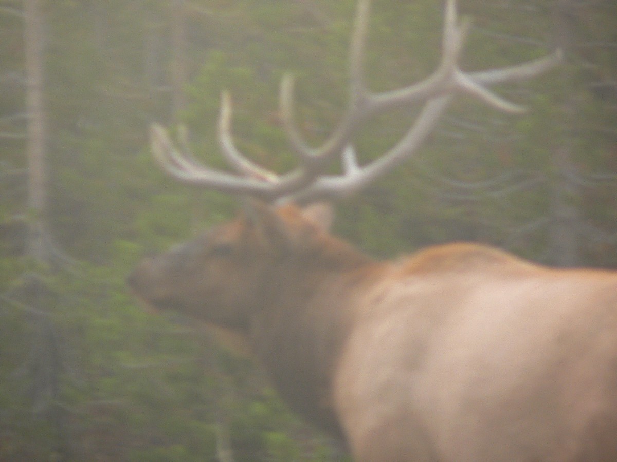
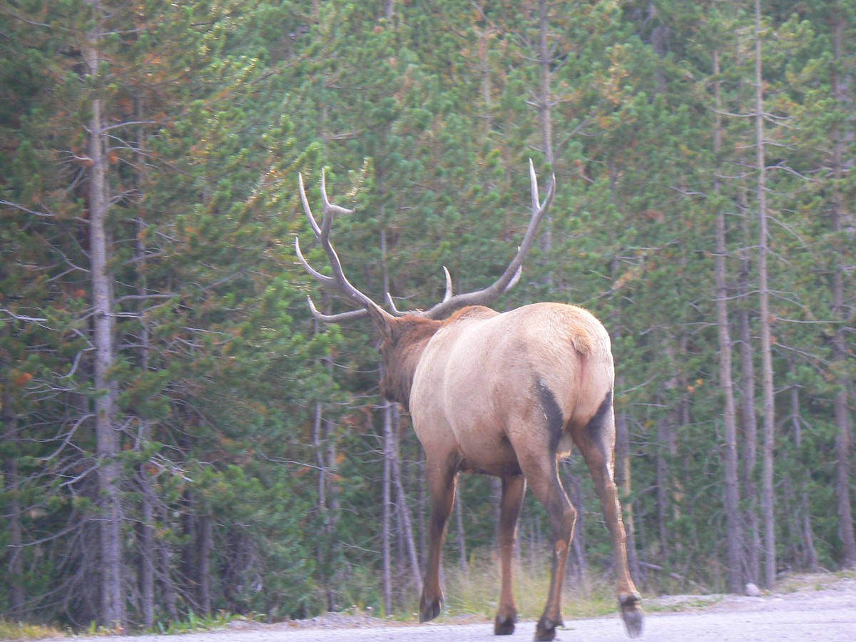
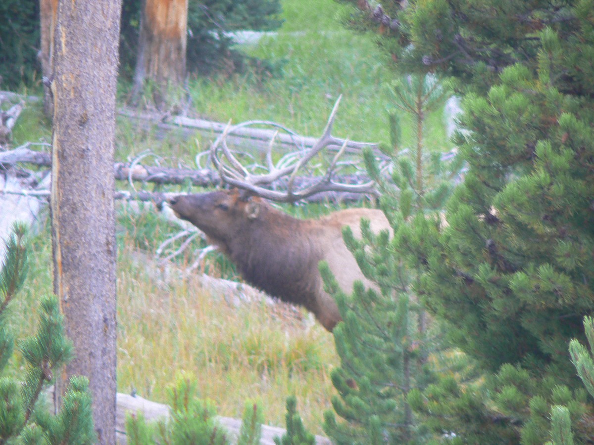
Yellowstone Day 1: Bugle Boardwalk, calling out the cows:
So, Kathleen and I have made it to Yellowstone, driving up through Idaho on the
way up. We plan to return home via Teton National Park and border romp along the Wyoming-Utah divide.
We pause to walk a few boardwalks along the way to camp.
It’s a bit busy in the Park, yet tapering off, so we made advance reservations at
Grants Village. We arrive and begin setting up when that eerie, wondrous, hymn of the forest lets lose in the
Lodgepole Pines in the next camp over. Erroooo-uh – whu- whu! One cannot describe the bugle of the bull elk in
rut, so I will add a link to the (below) links section so you can enjoy it yourself. It is just not Fall without
these friends calling for cows (cow elk, that is, no gengrich stuff for these guys).
Kathleen is the one who rousts me out of my muttering about which way to set
the tent, saying “hey! Who is that calling – wait, it’s a huge elk!” We drop the cooler back in the truck (it
is big bear country after all) and head into the pines in search of this denizen of the West. Soon, we find a
fresh trail with prints denting the forest duff of pine needles, bark bits, and such. And, pausing to listen
and sniff – yes, the big bulls are odiferous – we hear the snorts of the big guy not far away. It is into dusk
and so no good photos are obtained, yet what a joy to follow Mr. Elk as he tours his terrain, calling out the cows.
Hear the elk! Click here for an MP3 sound recording of an elk bugeling
| ||||

Yellowstone Day 1 - Photos by Rob
 |
 |
 |
 |
 |
 |
 |
 |
 |
 |
 |
 |
Hear the elk! Click here for an MP3 sound recording of an elk bugeling
| ||||
| ||||
| ||||
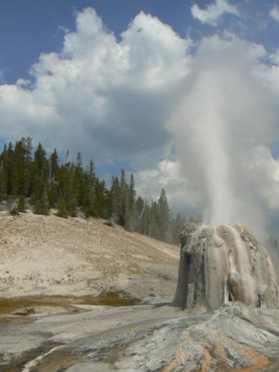
Yellowstone Day 2: Lovely Lonestar:
After a chilly start to the morning, we are off to hike to Lonestar Geyser.
Hiking the idyllic mellow meadows along Spring Creek, it’s an easy tour to Lonestar. Luck again is with us
because we just sit on a log for a snack when the geyser starts a hesitant hiccupping and hissing. Swinging
the trusty Panasonic camera into play, I try for photos and short videos, which we are sharing with you on this
page. Surprisingly, Lonestar leaps into a full eruption and continues to erupt for several minutes, the spouting
waxing and waning.
Then, we travel the short distance to the Old Faithful area and join a Ranger
hike around the old geyser, seeing, smelling, and listening to fumaroles and burbling springs. There are old
bleached bones from days of Winter bison wandering the warm thermal areas, yet falling through the sometimes
thin crust or otherwise having a bad day.
Hike description: Start 3.5 miles South of Old Faithful junction, just SE of the parking for Kepler Cascades.
Easy track along the Firehole River to the intermittent geyser, which errupts
every 3 hours or so.
![]() Map -
A map of this GPS track/map to Lonestar Geyser can be seen below. Change the map type (topo, terrain, etc.) and alter the scale
as you wish. Click "bigger map" text below map if you want a larger map.
Map -
A map of this GPS track/map to Lonestar Geyser can be seen below. Change the map type (topo, terrain, etc.) and alter the scale
as you wish. Click "bigger map" text below map if you want a larger map.
Yellowstone Day 2 - Photos by Rob
| ||||
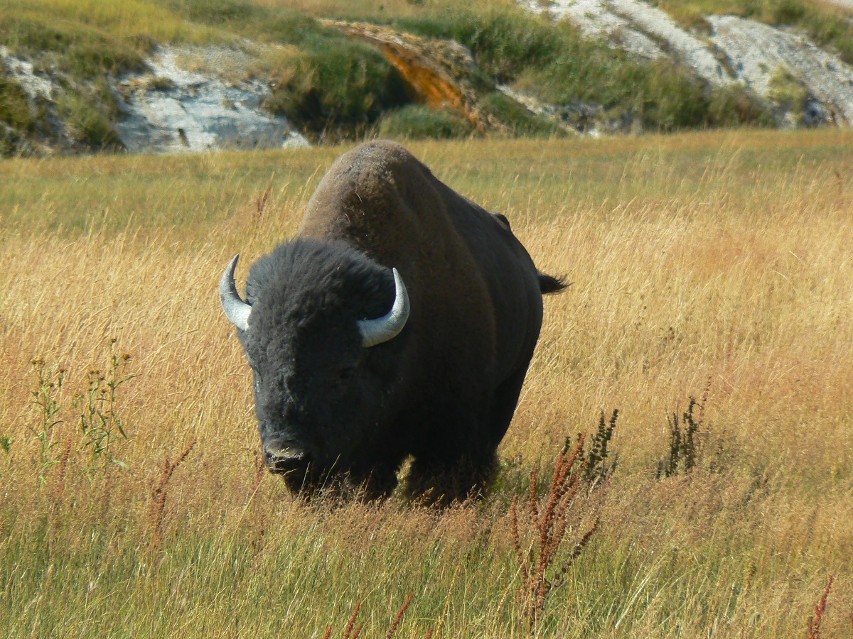
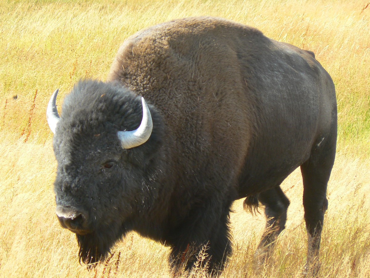
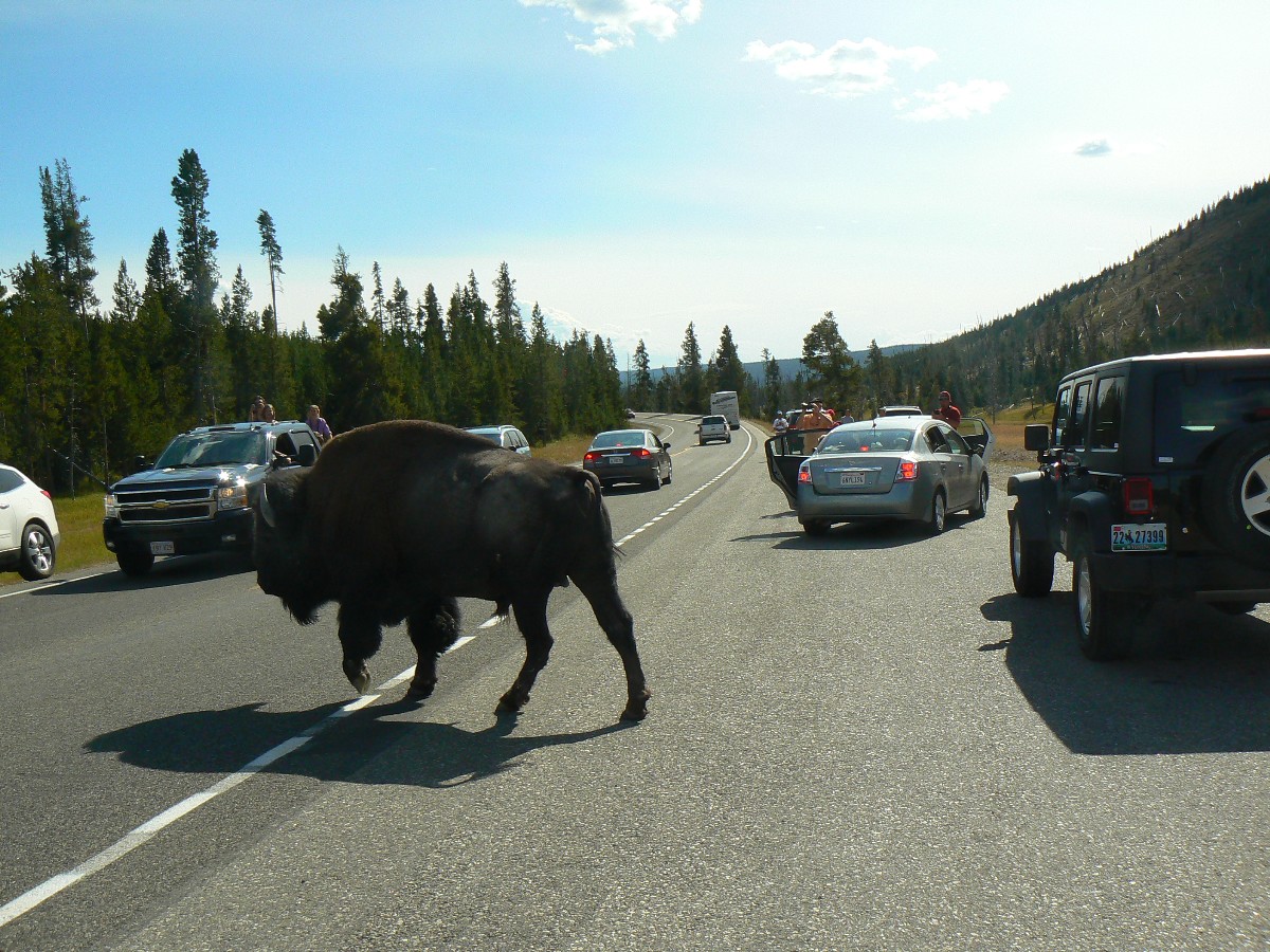
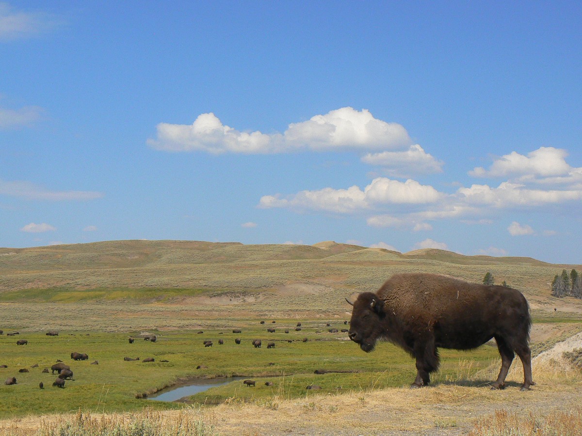
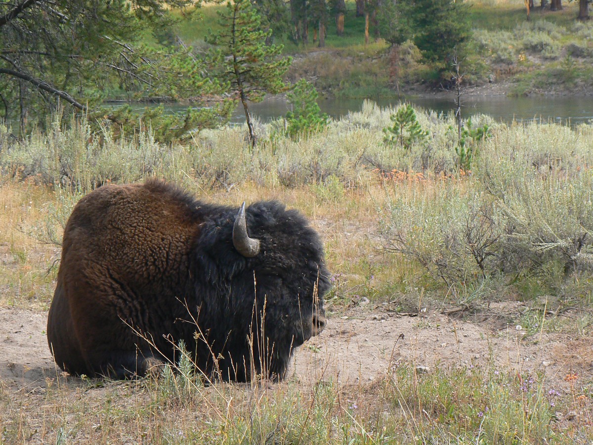
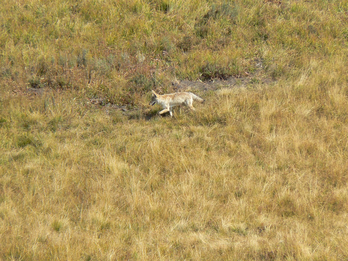
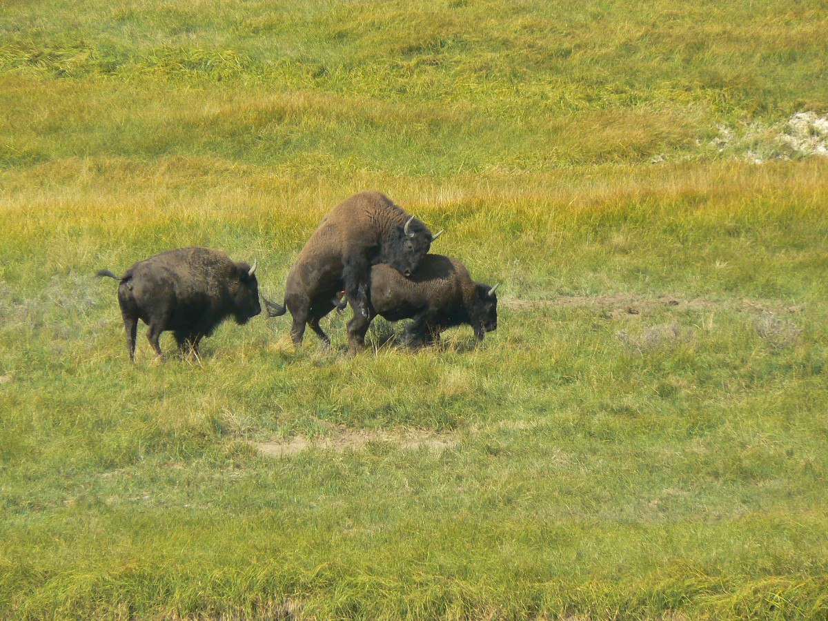
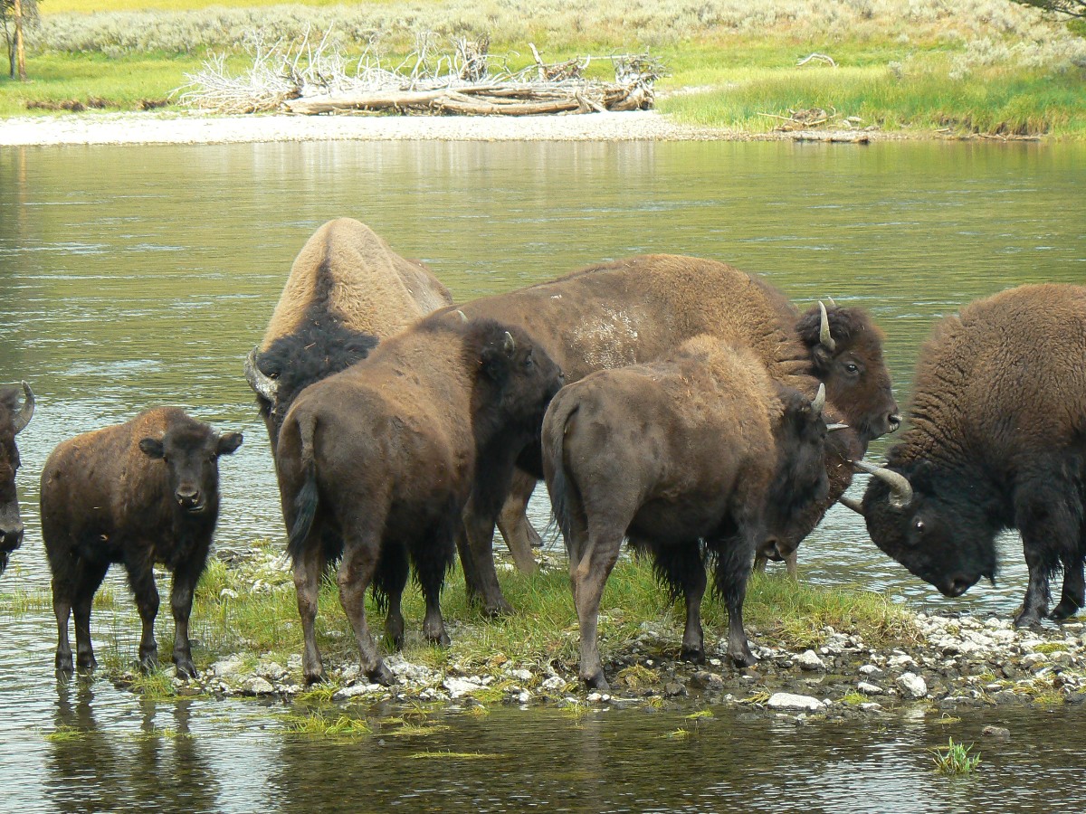
Yellowstone Day 3: Mt. Washburn:
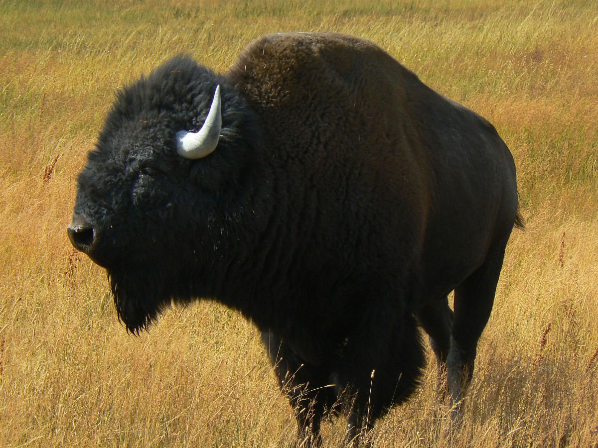
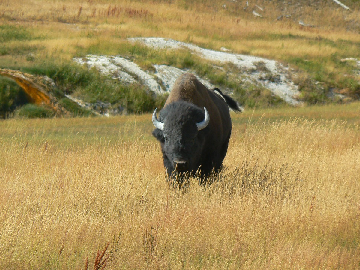
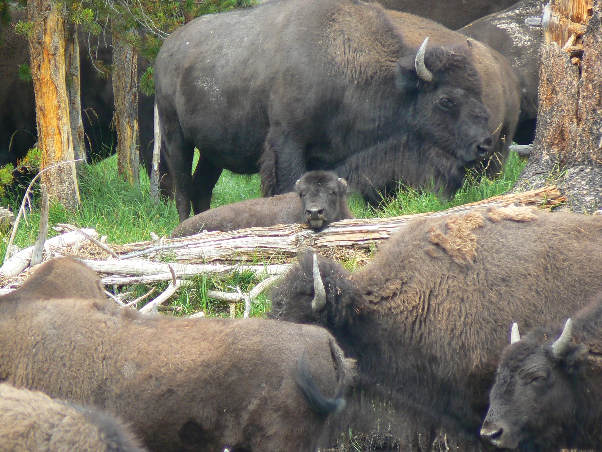
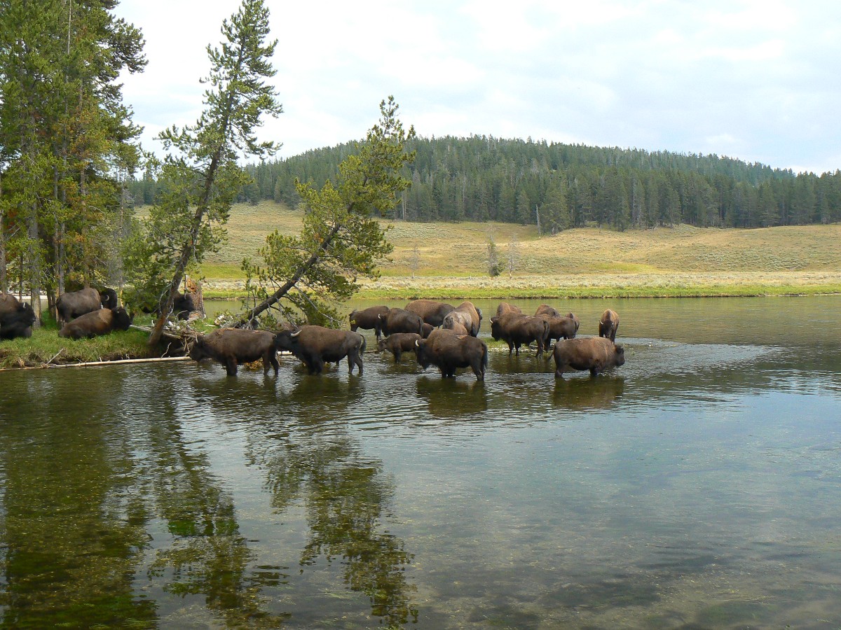
Today starts with bison blockades. The big meadows along creek and river are
intermittently clogged with the shaggy beasts called bison. Tourists and bison lovers call them buffalo, or buffy
buffalo, or just buffy. Coyotes work the fringe of the herd, apparently benefiting from the rodents and big insects
displaced by the dusty bison carpets. Buffy youngsters bounce along behind slow moving adults as they cross the
river. Why does the bison cross the river? Perhaps the grass looks greener on the other side? Or, perhaps the
buffys are tired of the winnehogos and their poisonous emissions?
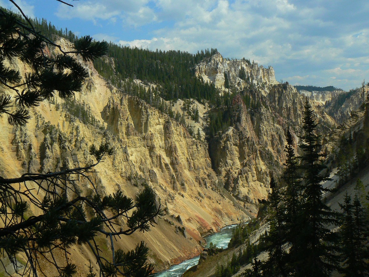
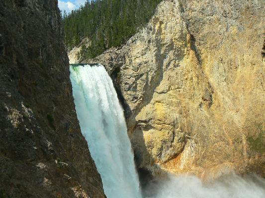
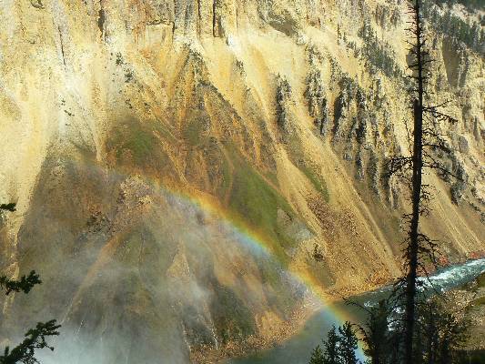
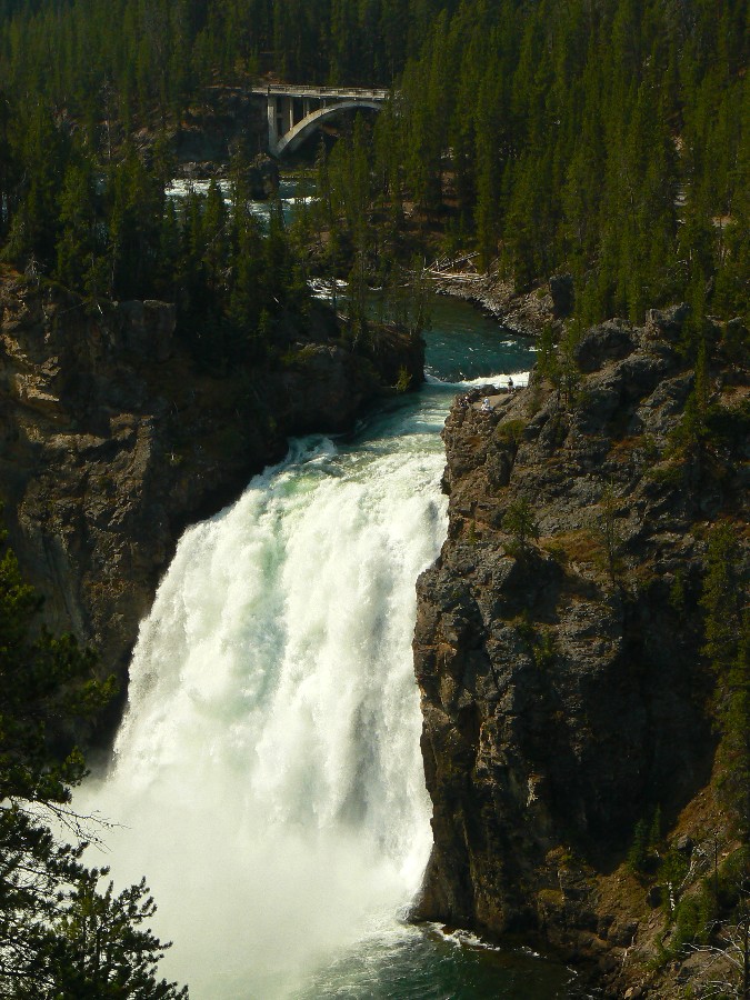
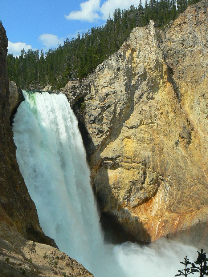
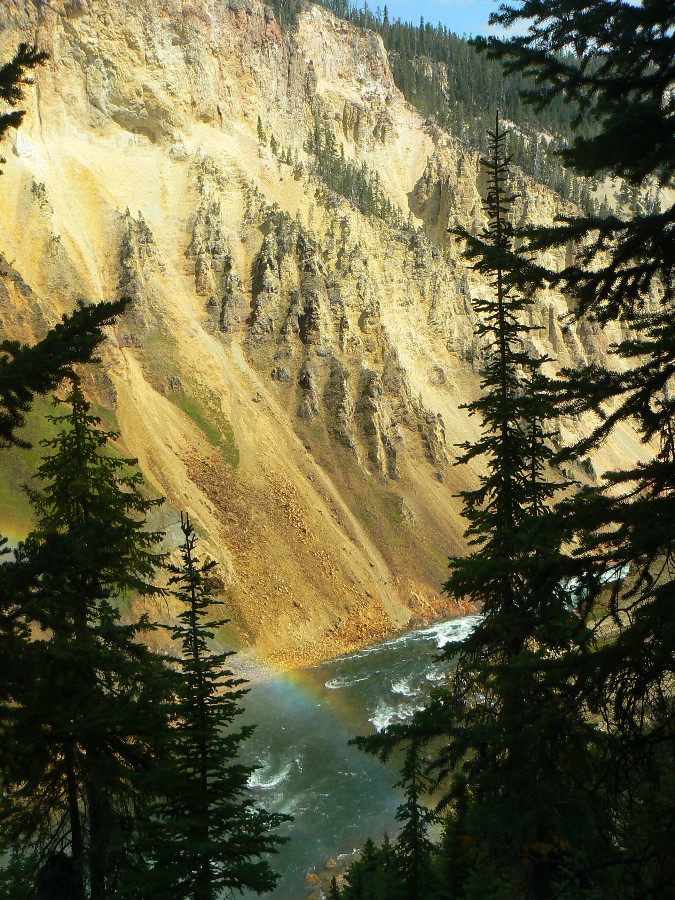
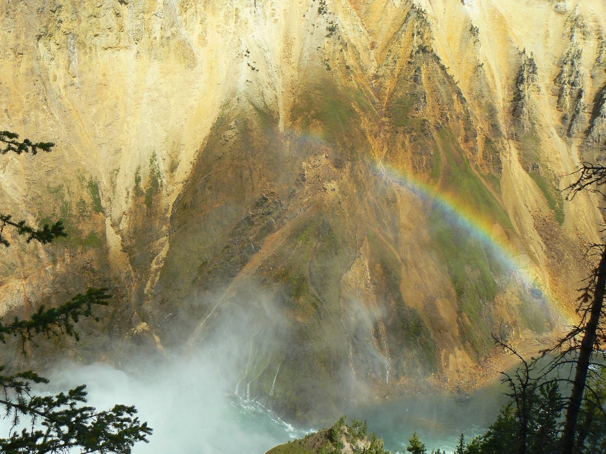
After admiring the buffys, and listening to their low register resonating guttural
grunts and buffy utterances, we continue to hike the Uncle Jim Trail to the overlook of Yellowstone Falls. As we
clomp down the long stairway into the Ggrand Canyon of the Yellowstone, a rainbow forms in the mist from the falls,
lending a kodachrome of colors to the yellow hues deposited along the canyon walls by eons of thermal activity.
It’s a tremendous view and an auditory delight.
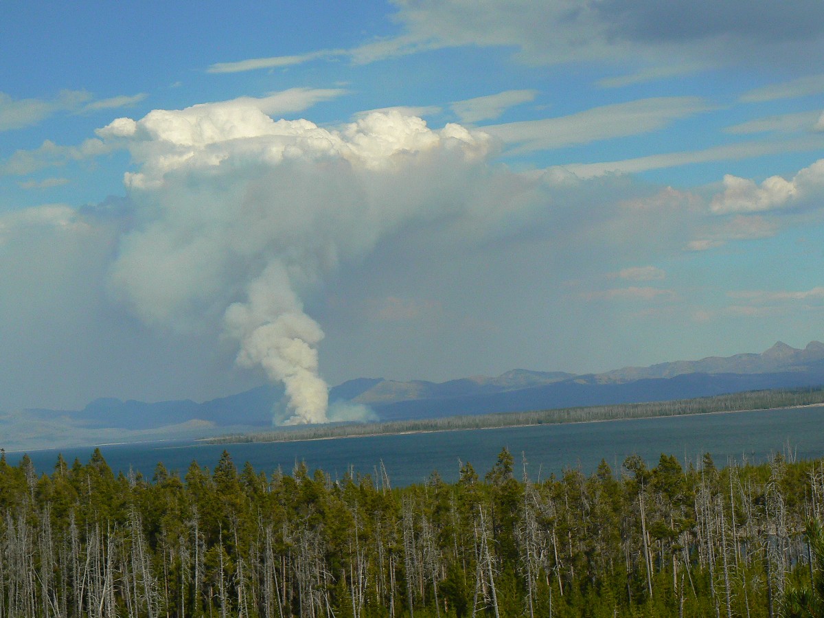
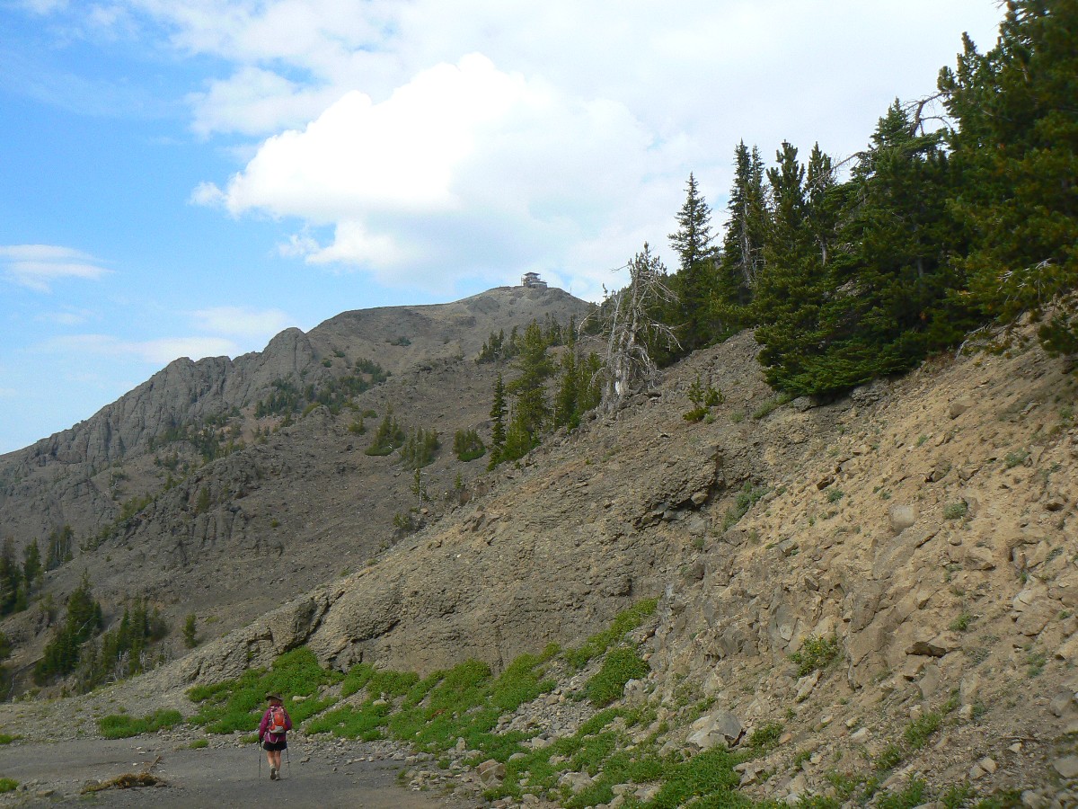
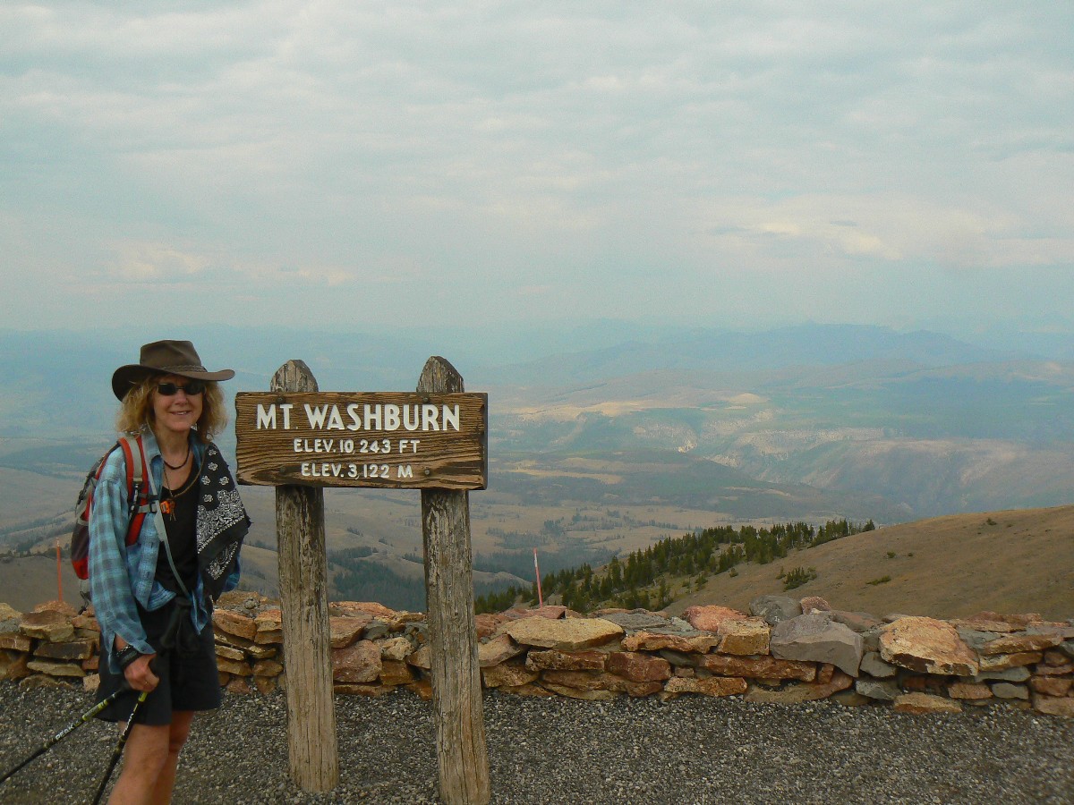
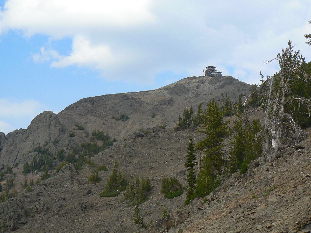
Continuing to Dun Raven Pass, we launch off toward Mt. Washburn (see map),
tracking our route one-way with the GPS (Global Positioning System) to the summit. Today, the fire lookout/communication
tower is open, and we lounge in the viewing room and wonder how wide our field of view might be if not for the smoke
from the fire burning across Yellowstone Lake. Yes, there’s a dreadfully smoky cast to the air from a throng of
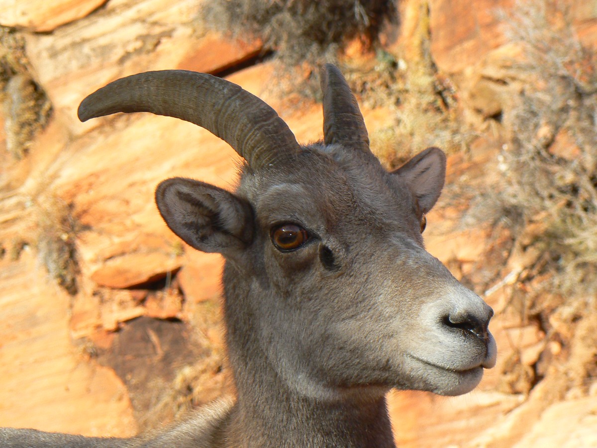
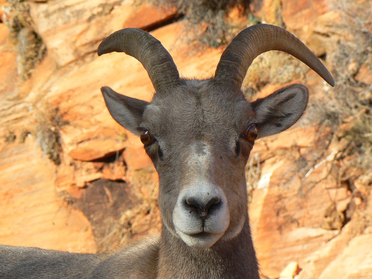
small natural fires. We keep watch for Bighorn Sheep, yet don’t see any today.
On the way back to camp, we again encounter buffy blockades and a harried Ranger
trying to keep the winnehogos from more seriously obstructing traffic. “Move along little (55 foot, sun obliterating,
climate changing) doggie!” The Ranger bellows over the jeep loudspeaker.
Baby buffys are on an island in the river with portions of the herd. A baby buffy
rests his head on a log as many tons of rolling dust bags swirl about and back and forth to the island. Serene.
On our return to camp, I am delighted to see that a new neighbor is apparently about.
What I see is a fine backpack tent made from cuben fiber, a rare creature. So, I assume there must be a backpacker
or bike tourist about. I light the fire, help a little with dinner and wine, and wait for the arrival of kindred spirits.
Ivan of the Canary Islands, his young son, and Francisca (the wife) later arrive. Kathleen and Ivan practice
their Spanish/English and I admire the tent.
Hike description: Drive to Dunraven Pass, which is 4.5 miles North of Canyon Junction in Yellowstone NP.
Hike the old road to the lookout and observation area.
Map - best viewed in topo mode.
Elevation data above are from one-way track, going up to the LO.
Round trip mileage is about 6.3 miles.
![]() Map -
A map of this GPS track/map to Mt. Washburn can be seen below. Change the map type (topo, terrain, etc.) and alter the scale
as you wish. Click "bigger map" text below map if you want a larger map.
Map -
A map of this GPS track/map to Mt. Washburn can be seen below. Change the map type (topo, terrain, etc.) and alter the scale
as you wish. Click "bigger map" text below map if you want a larger map.
| ||||
Yellowstone Day 3 - Photos by Rob
 |
 |
 |
 |
 |
 |
 |
 |
 |
 |
 |
 |
 |
 |
 |
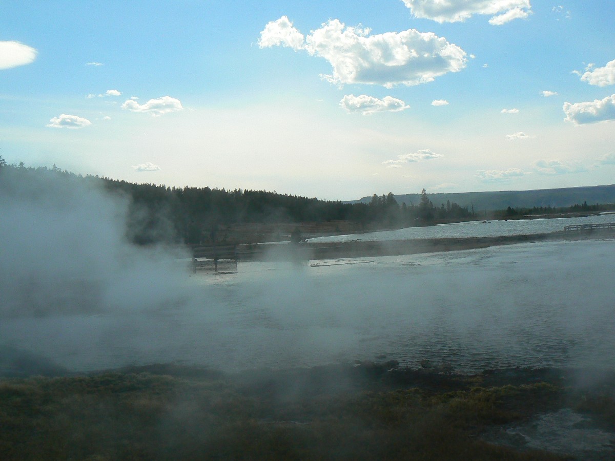
Yellowstone Day 4: Yellowstone NB:
We start off lounging in portable chairs upstream of Fishing Bridge, eating granola
and yogurt and watching small trout work the shallows along the river. It feels good to be out in the sun after a cool
evening.
It’s a light day of hiking to Yellowstone Natural Bridge and touring some boardwalks
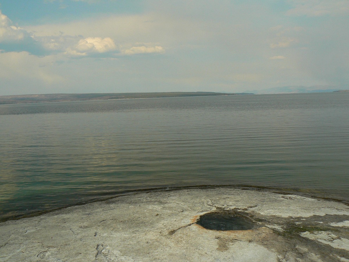
for geysers/springs today. Most think that Bridge Bay Campground and the bay are named after the bridge carrying
traffic across the neck of the bay, the bay off Yellowstone Lake. Not so. It’s the volcanic natural bridge which
spawned the Bridge Bay name. It’s a lovely lilting walk if one goes in via the campground TH (rather than the
biker/old road TH near the highway). The bay is off the northwestern shore of Yellowstone Lake and was named
in 1871 by the United States Geological Survey for the natural bridge over a tributary of Bridge Creek.
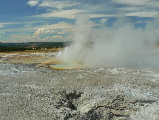
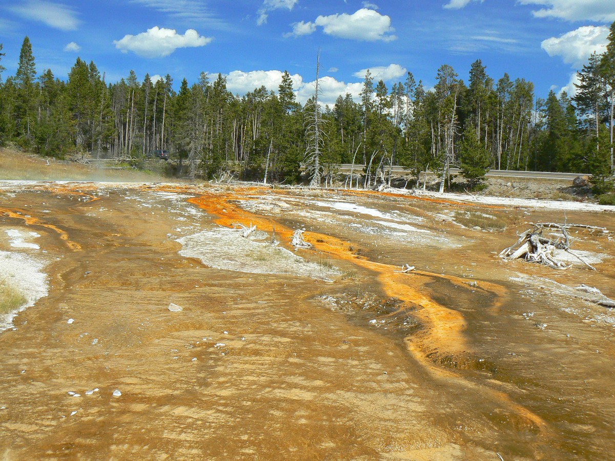
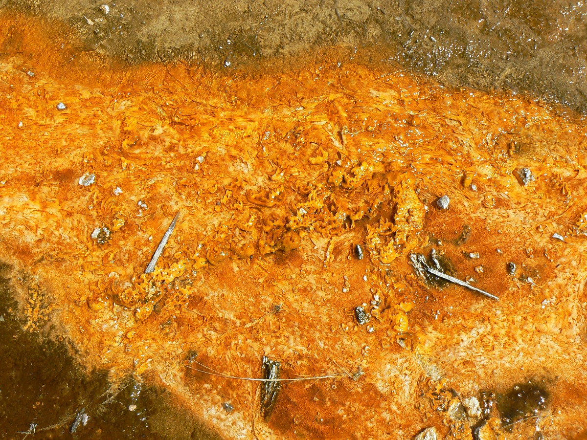
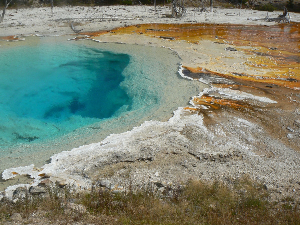
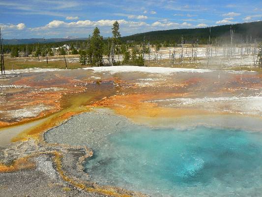
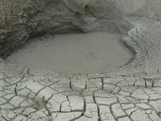
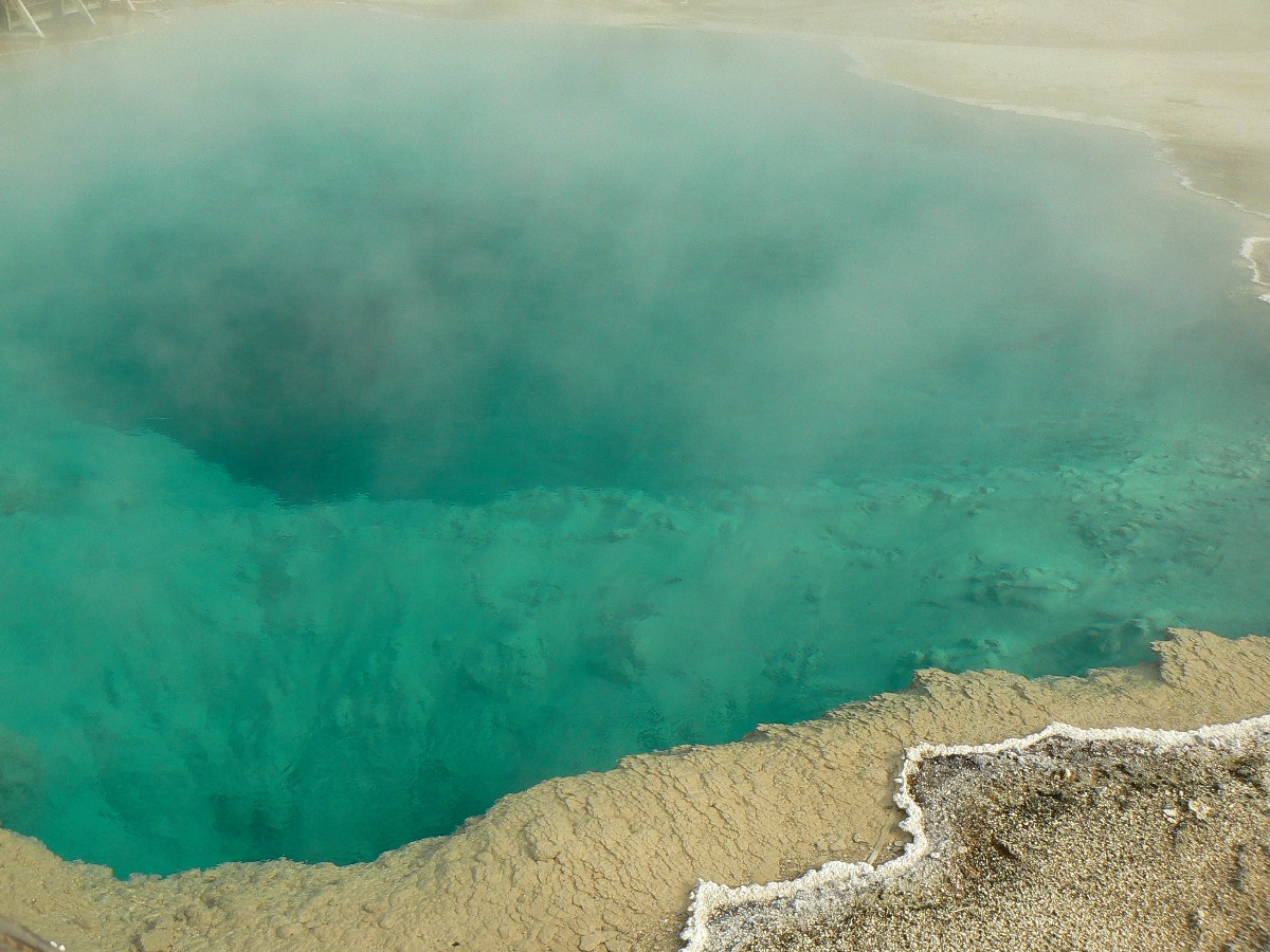
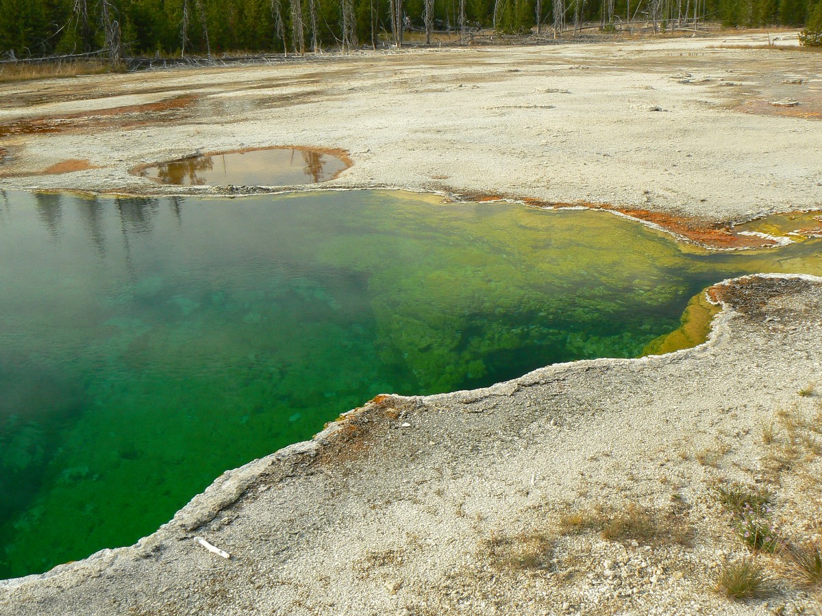
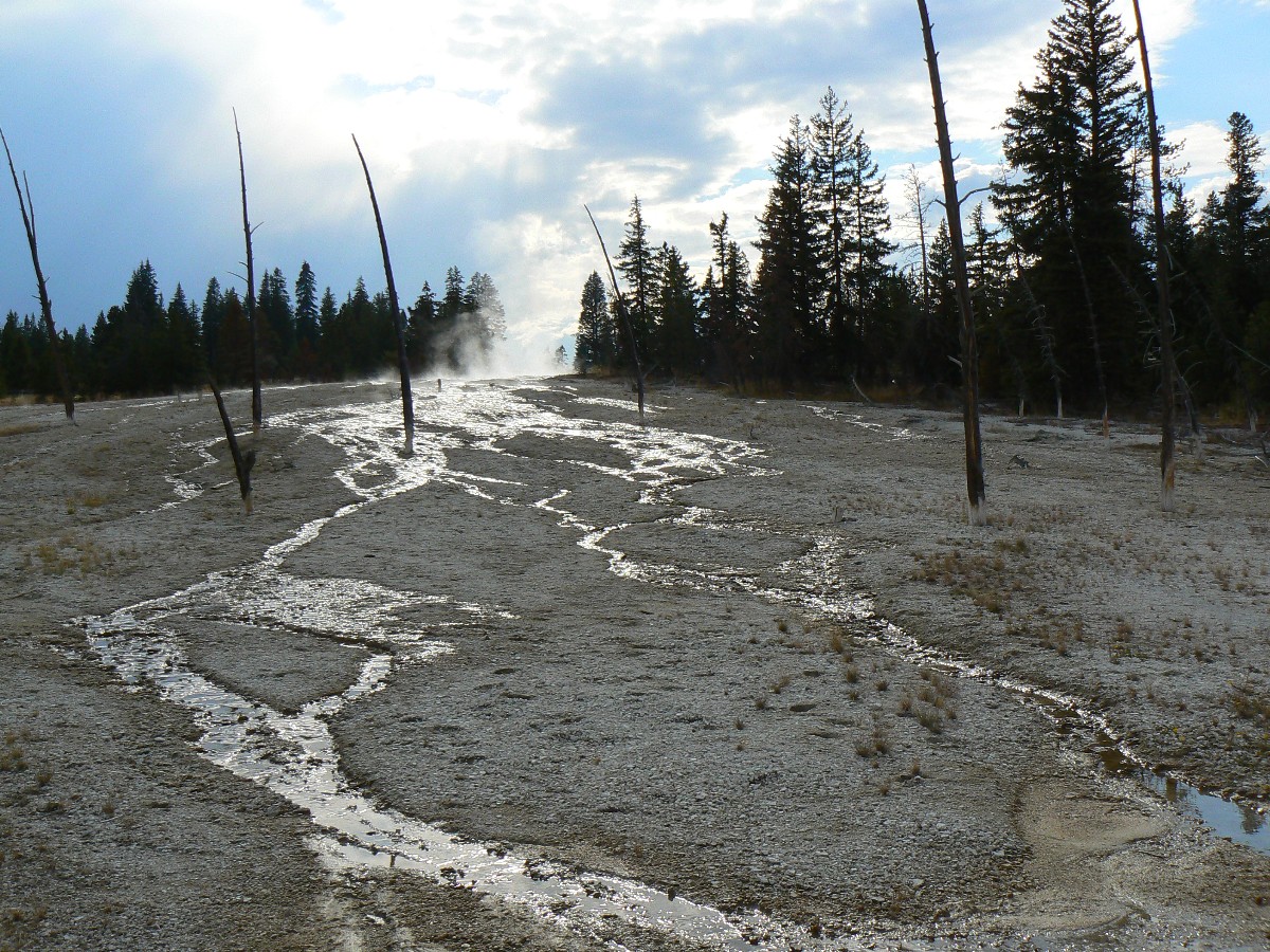
A walk of the West Thumb Geyser boardwalk takes us to now dormant geysers that
once (still occasionally do) spout from just under the frigid lake waters. Colorful hot pools and textured
sluiceways make me long for a dip in a natural hot springs.
The Greater Yellowstone. The Eaarth desperately needs areas to protect whole ecosystems, trans-continental
wildlife corridors, important big predators (e.g., wolves, grizzly bears), and buffer the national parks in
preserving some of what makes this country great. The Greater Yellowstone should be one of these areas.
Hike description: A 3-mile round trip hike to a natural bridge in Yellowstone National Park.
Easy hiking. Take the trail up to the bridge (the tail once went across the NB!),
and loop around to get the best views of the NB.
TO TRAILHEAD: Park in the long term trailer parking area at Bridge Bay Marina.
The Trail crosses the entry road and heads toward the camp ground, circling around to meet the old access road
(which starts from near the main road - for bikers).
![]() Map -
A map of this GPS track/map to Yellowstone NB can be seen below. Change the map type (topo, terrain, etc.) and alter the scale
as you wish. Click "bigger map" text below map if you want a larger map.
Map -
A map of this GPS track/map to Yellowstone NB can be seen below. Change the map type (topo, terrain, etc.) and alter the scale
as you wish. Click "bigger map" text below map if you want a larger map.
| ||||
Yellowstone Day 4 - Photos by Rob
 |
 |
 |
 |
 |
 |
 |
 |
 |
 |
 |
 |
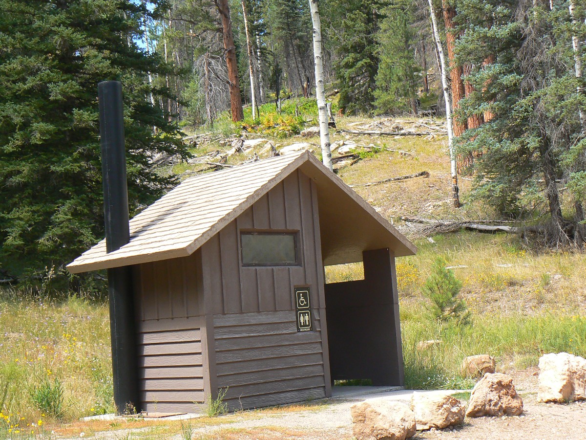
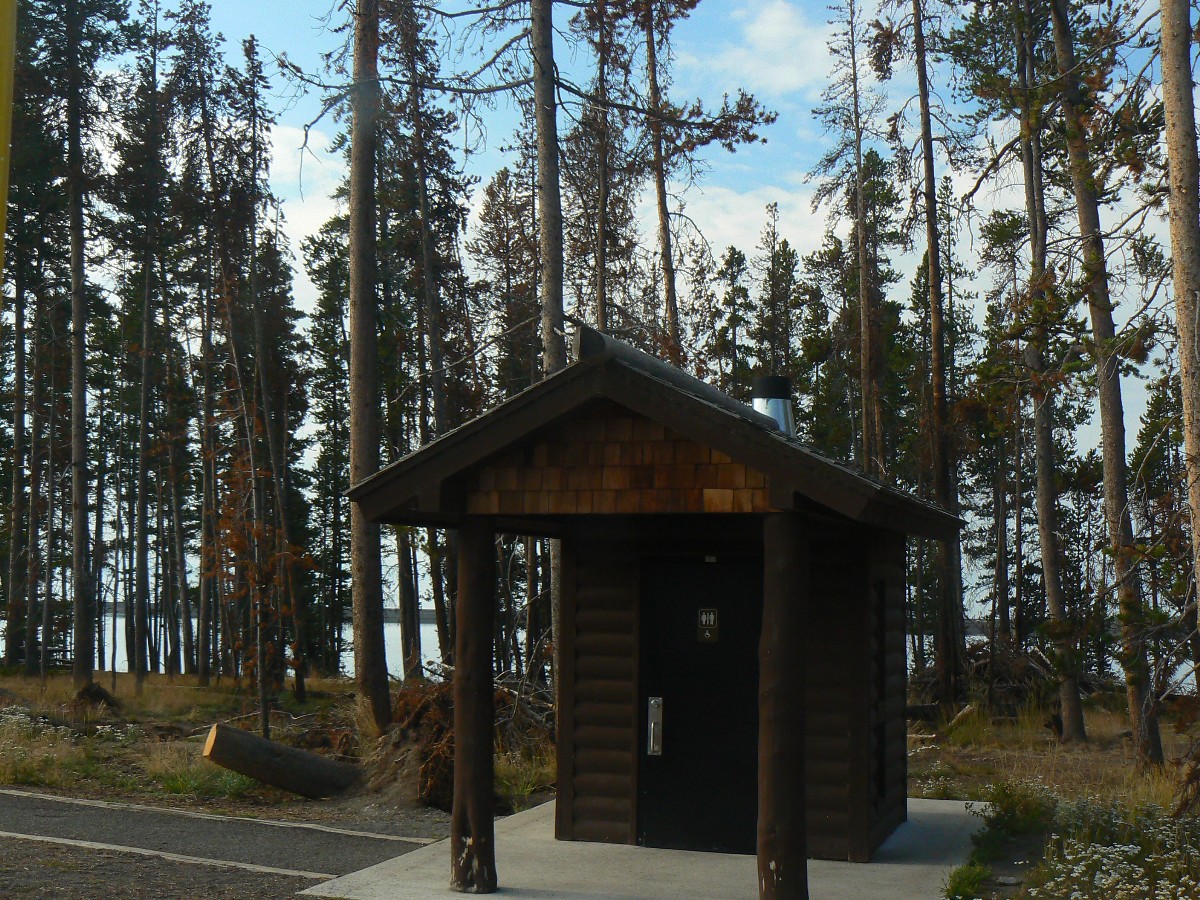
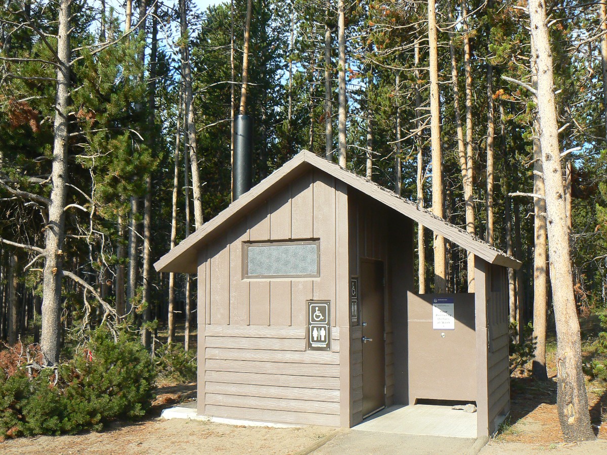
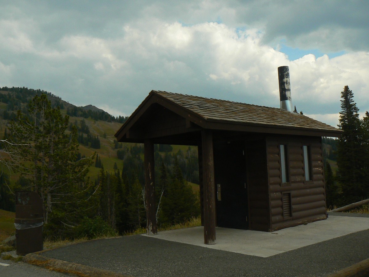
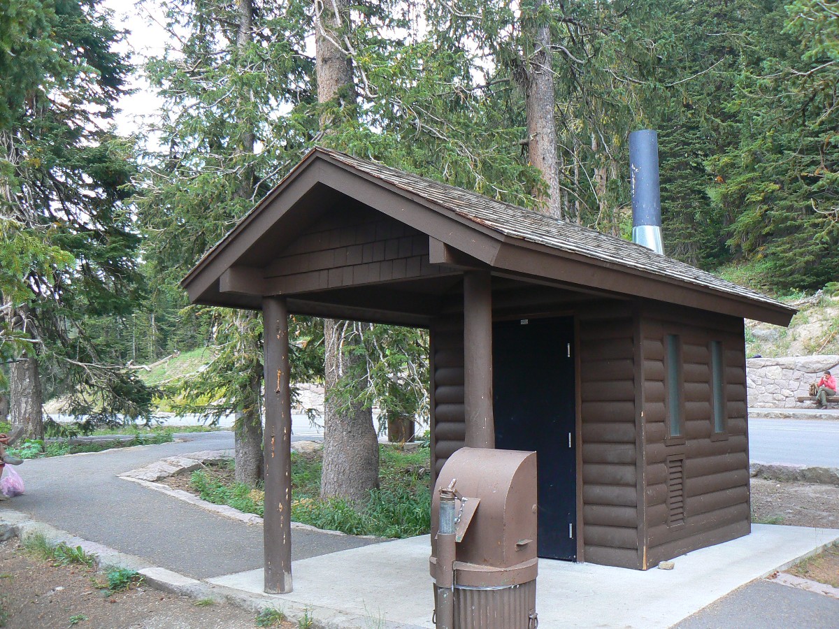
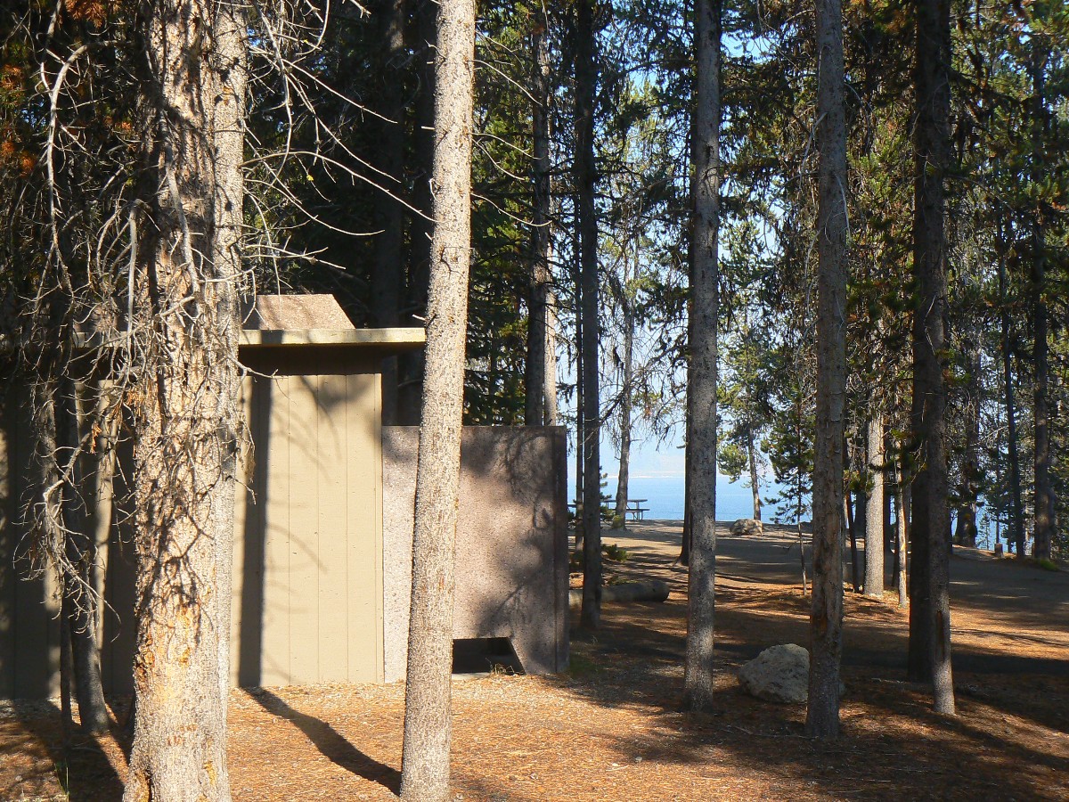
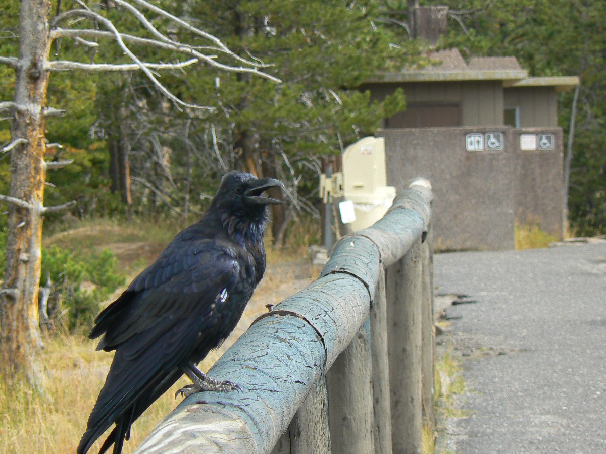
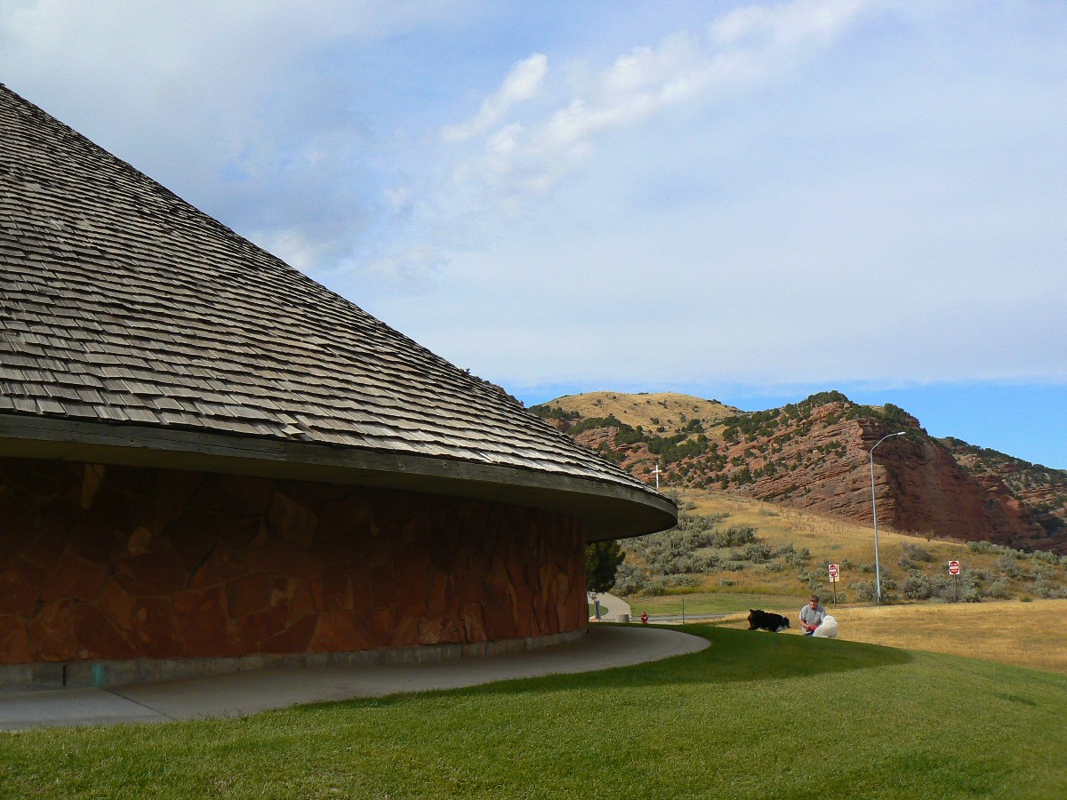
Scenic Toilets of Yellowstone
 |
 |
 |
 |
 |
 |
 |
 |
 |
 |
 |
 |
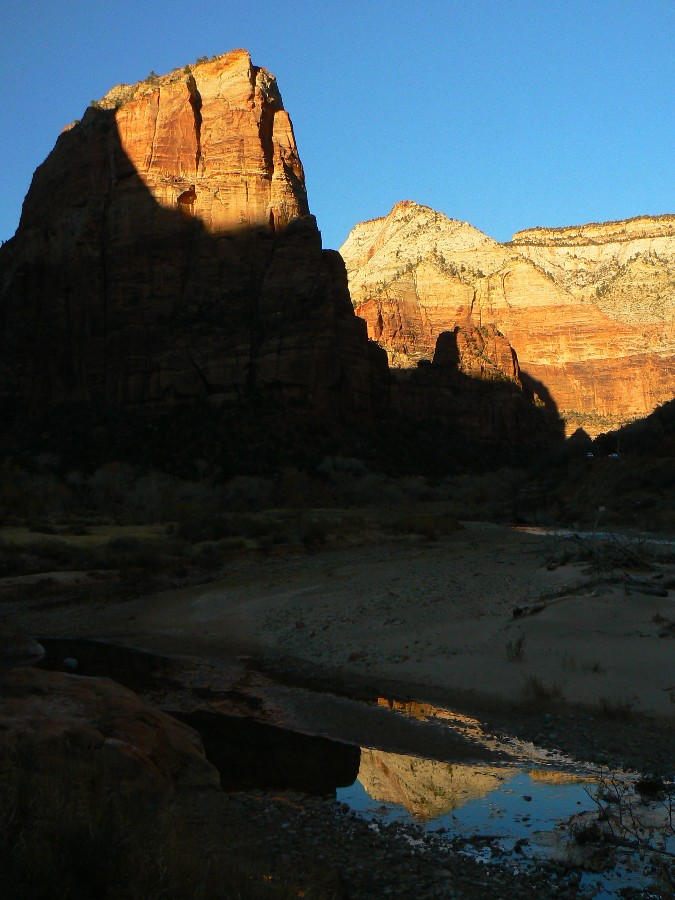
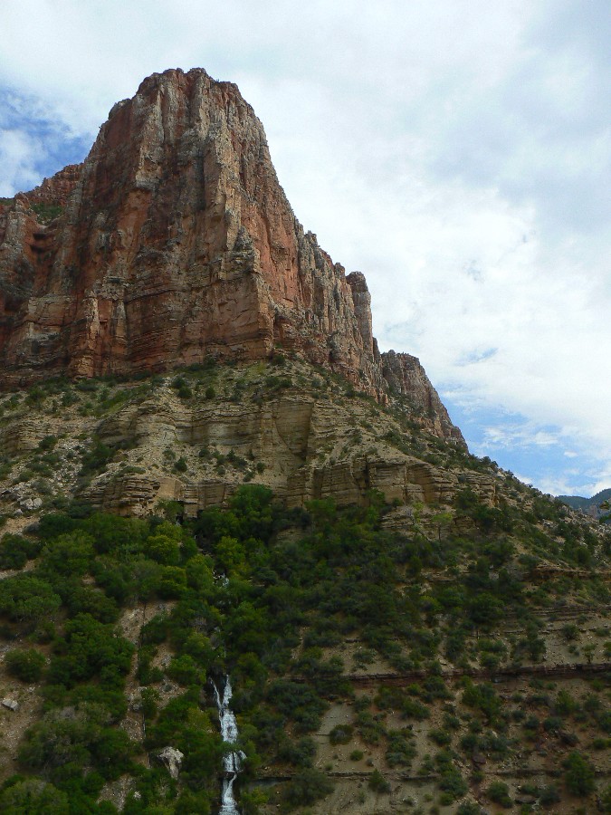
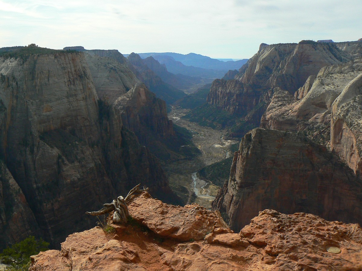
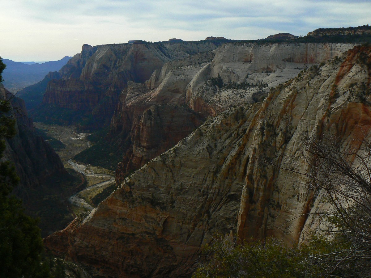
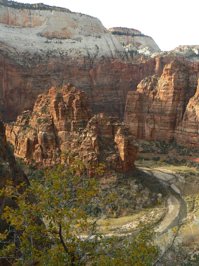
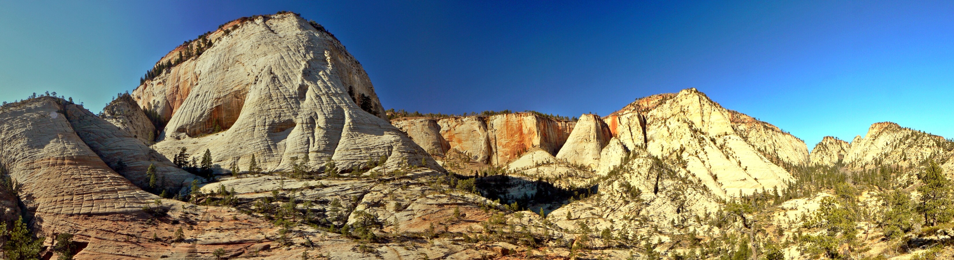
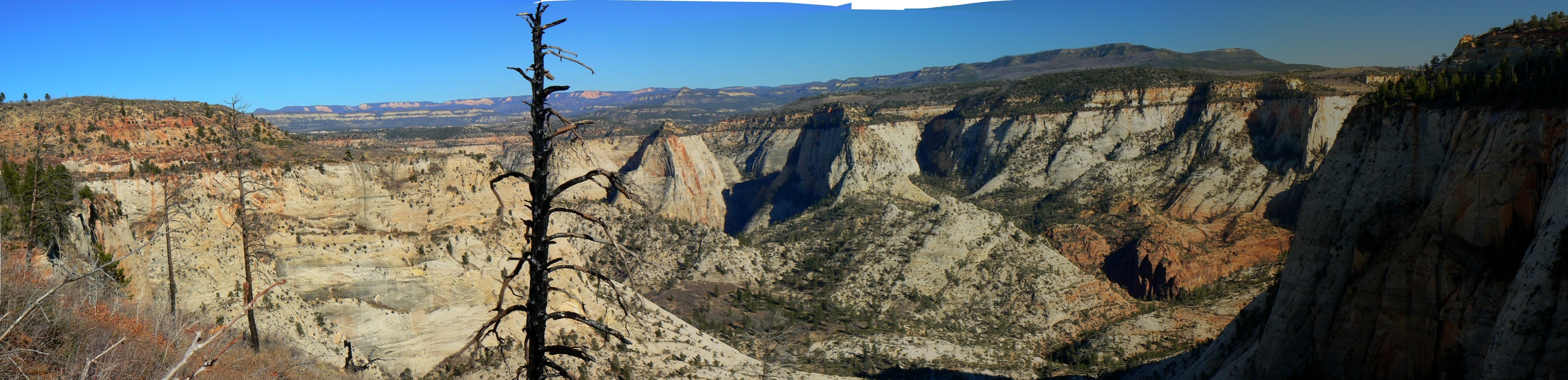
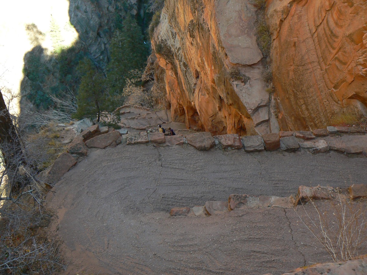
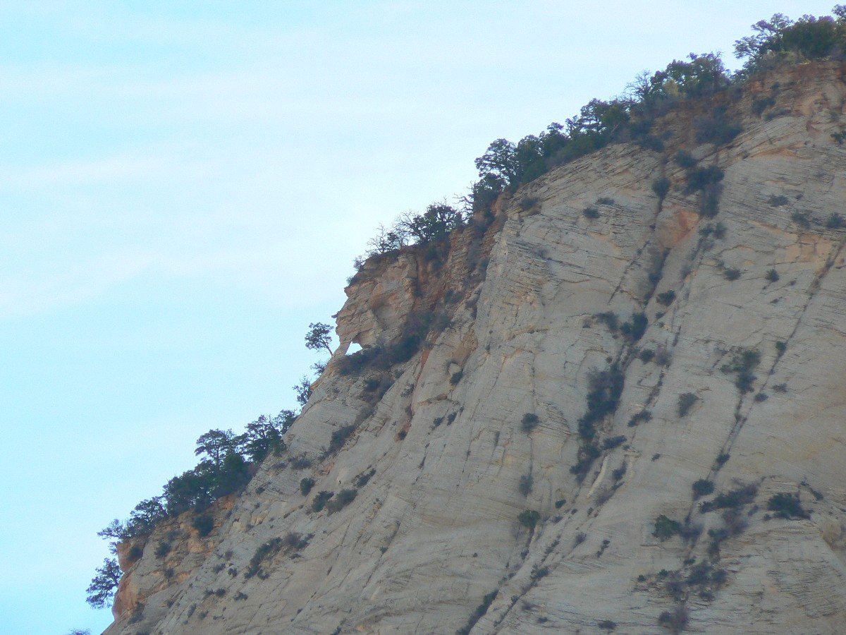
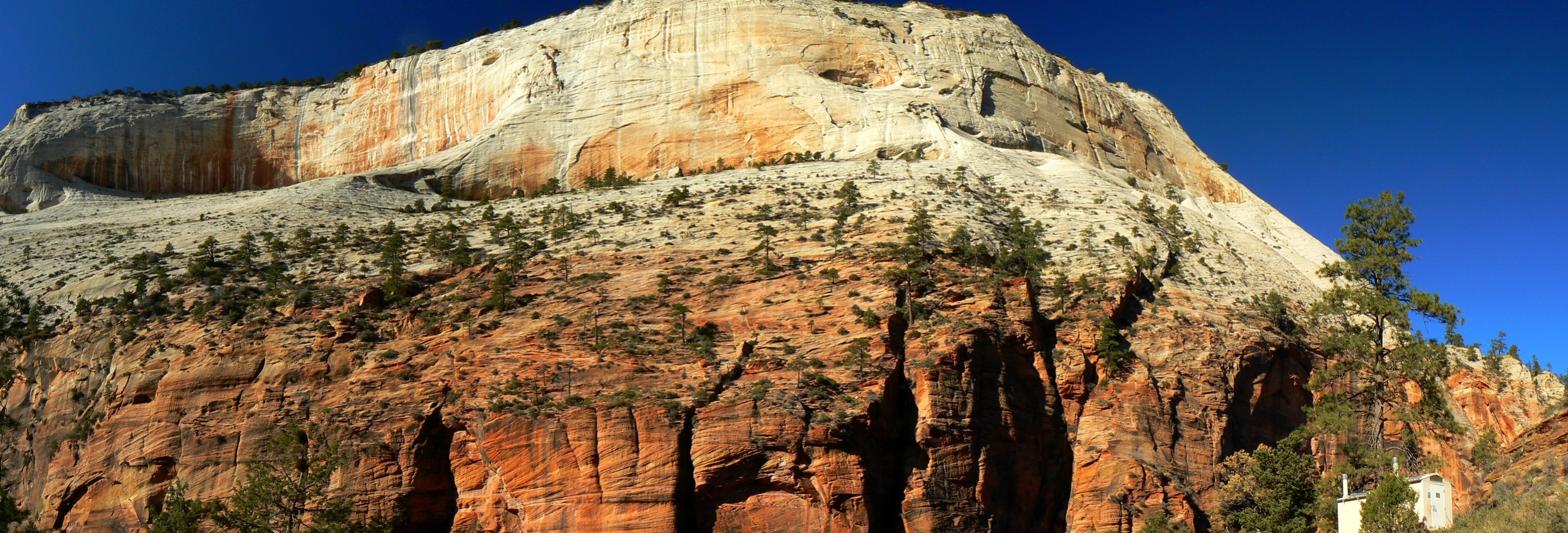
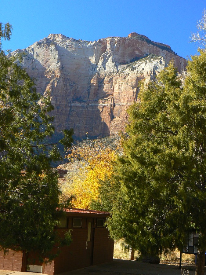
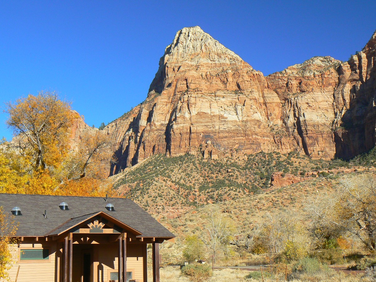
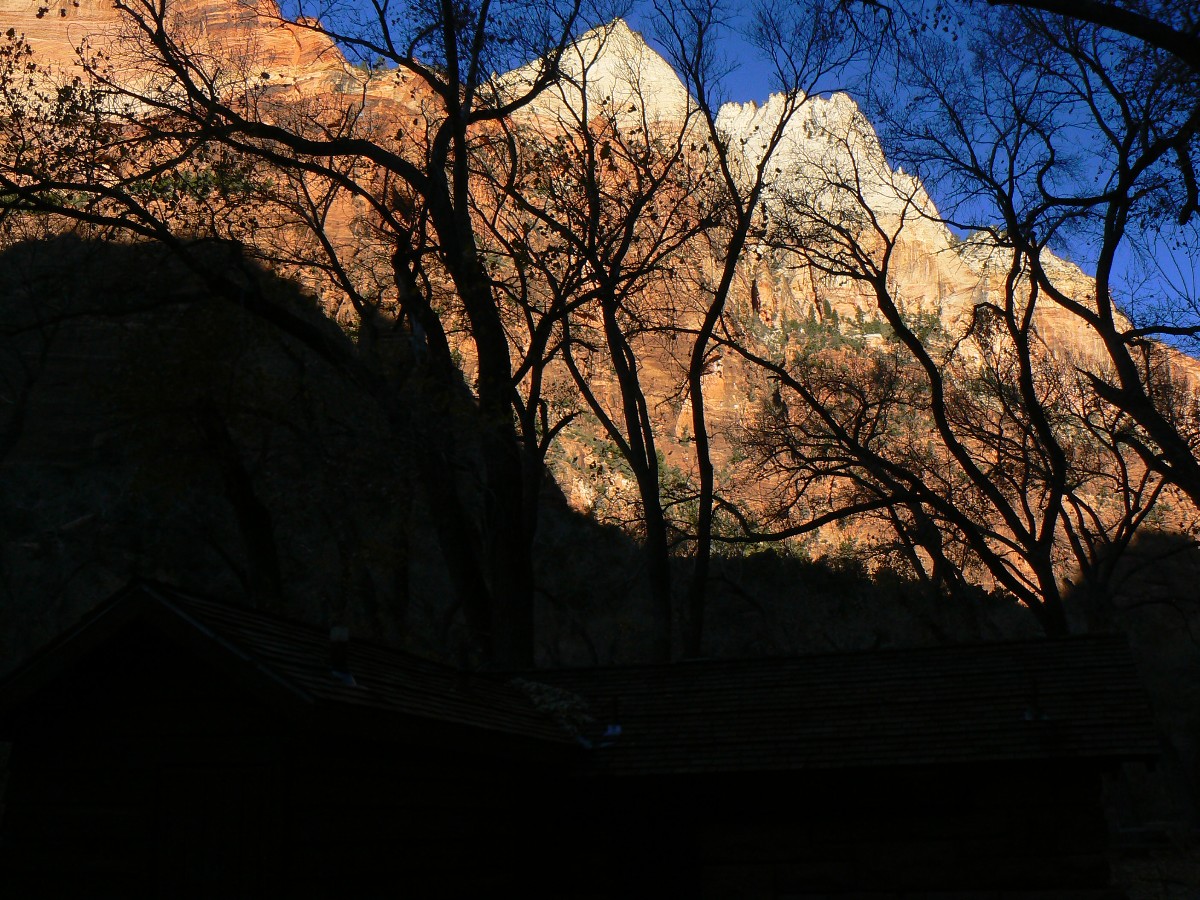
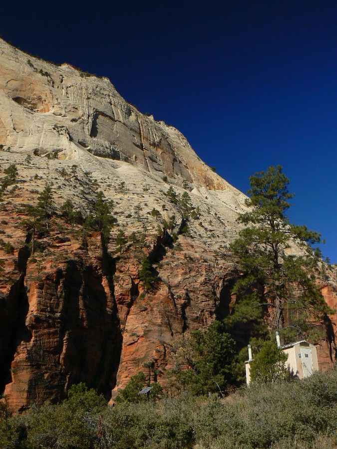
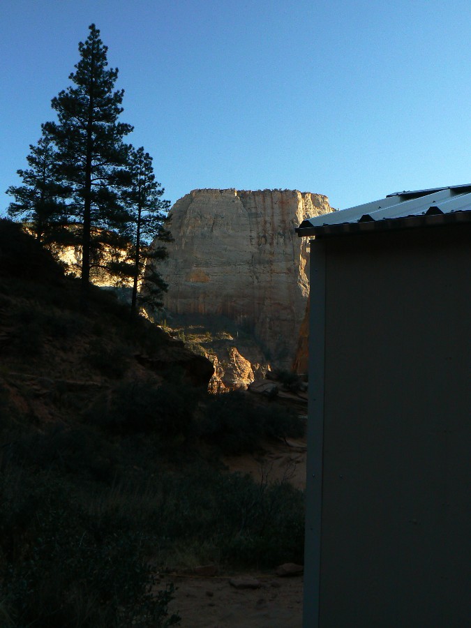
Zion Day 1; Part 1 of the rim-to-rim: The East Rim - Observation Point and Hidden Canyon, 10.6 miles,
gain (and lose) 2250', for an ERM (Energy Required Miles) of 19.6.
Kathleen and I drove down from a Thanksgiving visit with our good friends Bob
and Doris in Smog Lake and camped in the Watchman CG (campground) last night. We were in light clothes until sunset,
when it felt great to start a fire and stay warm. Sylvan.
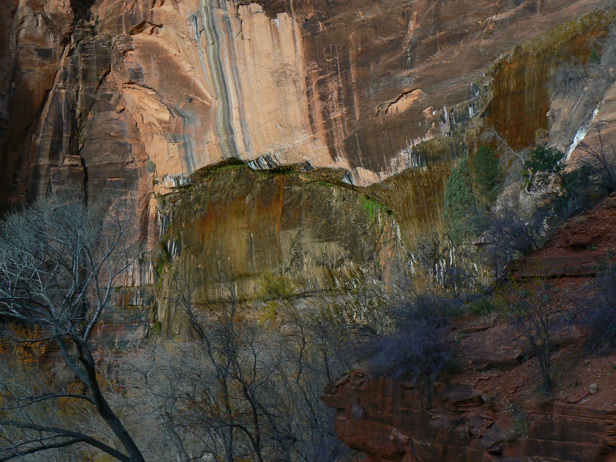
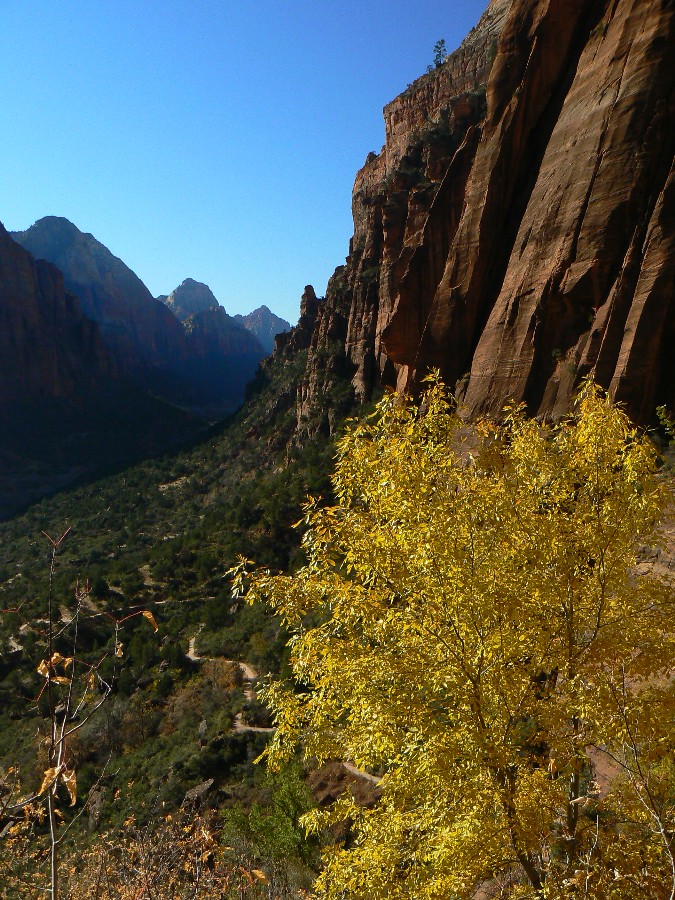
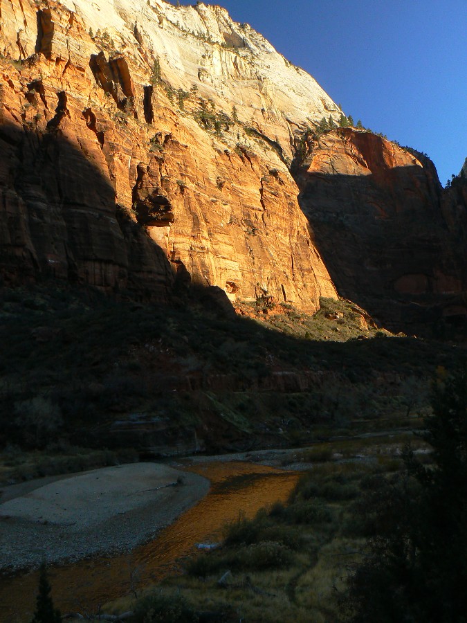
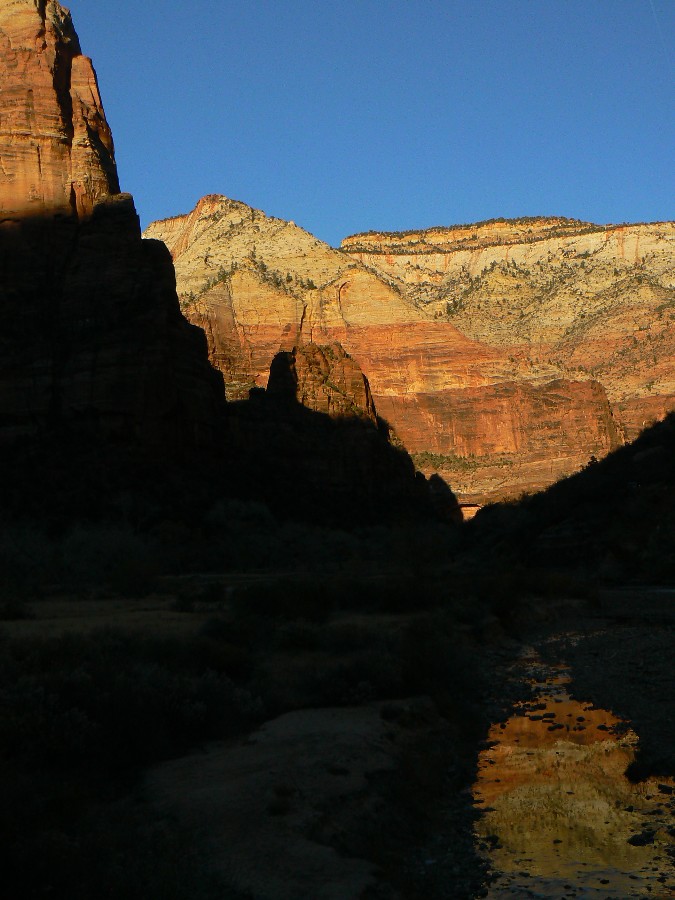
As we prepare to hike today, it's dark in the main canyon yet the sun glows on
sheer Navajo Sandstone above and across the canyon. Photographing the scenic toilet at the TH (trailhead) is a
balance of light and dark. It's a bit chilly starting out, and Kathleen and I shed gloves and top insulation
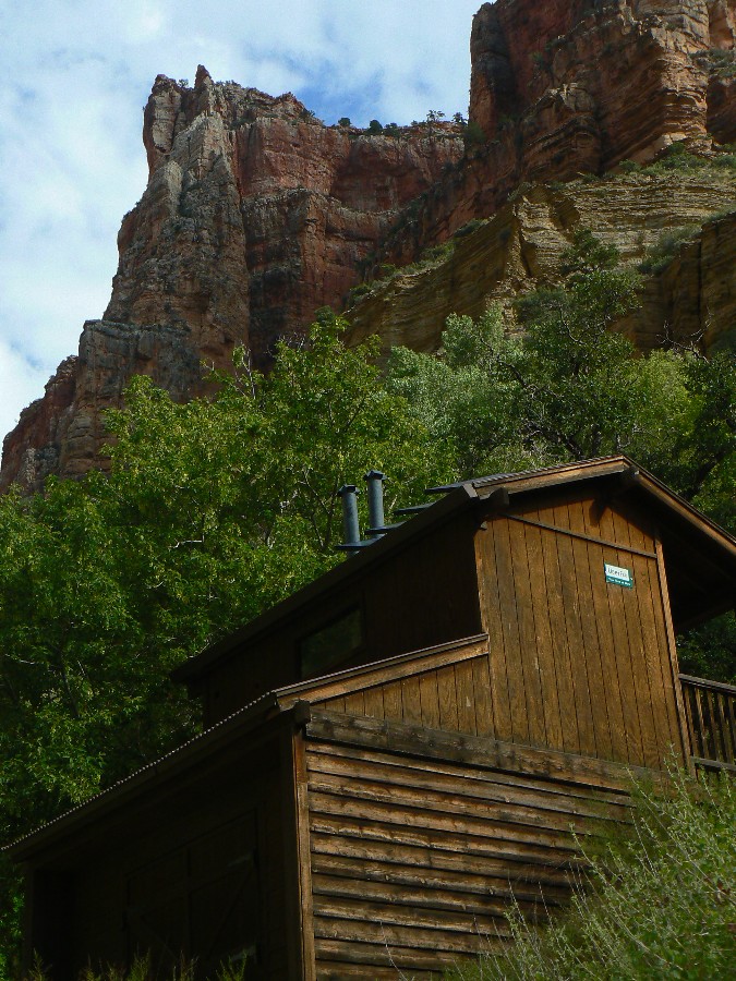
layers not long after passing the trail leading to Hidden Canyon. The light is not yet on Weeping Rock, so we'll
photograph it on the way down, provided there is sun.
Up and up, into narrows and on into opening canyons and the trail the CCC
(Civilian Conservation Corp - something we now need again) has carved into the sandstone, the trail clinging on
the edge of the checkerboard cones. Scenic.
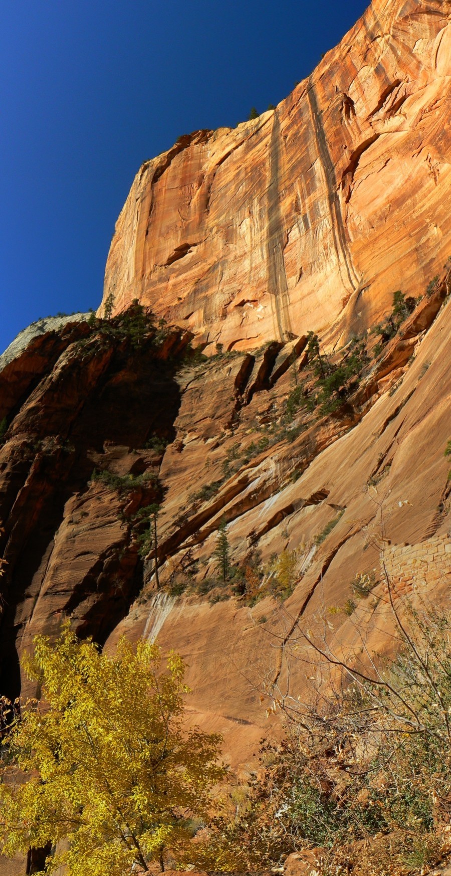
The trail is well graded and soon arrives at the end of the paved portion, then
it laterals over to Observation Point. This section is truly lovely as one gazes over part of the route up and
one can admire the creamy sandstone buttresses sloping into the canyon.
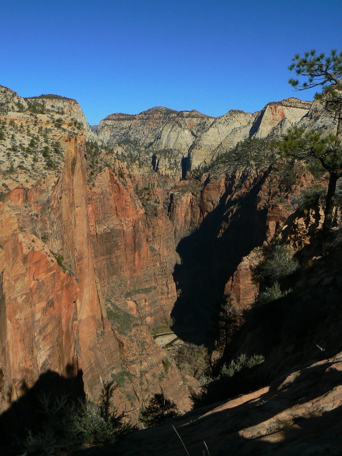
At the Point, we find the view a bit clogged with haze, yet the close views are
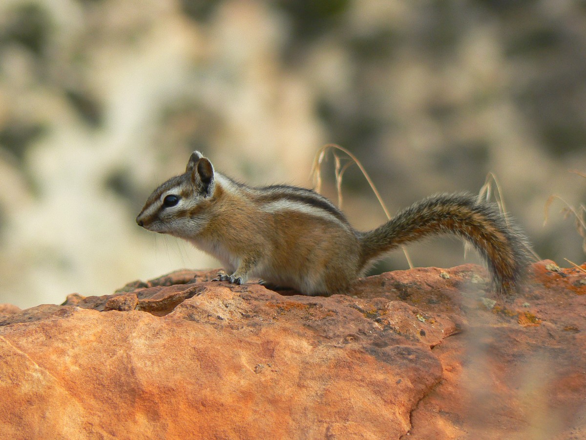
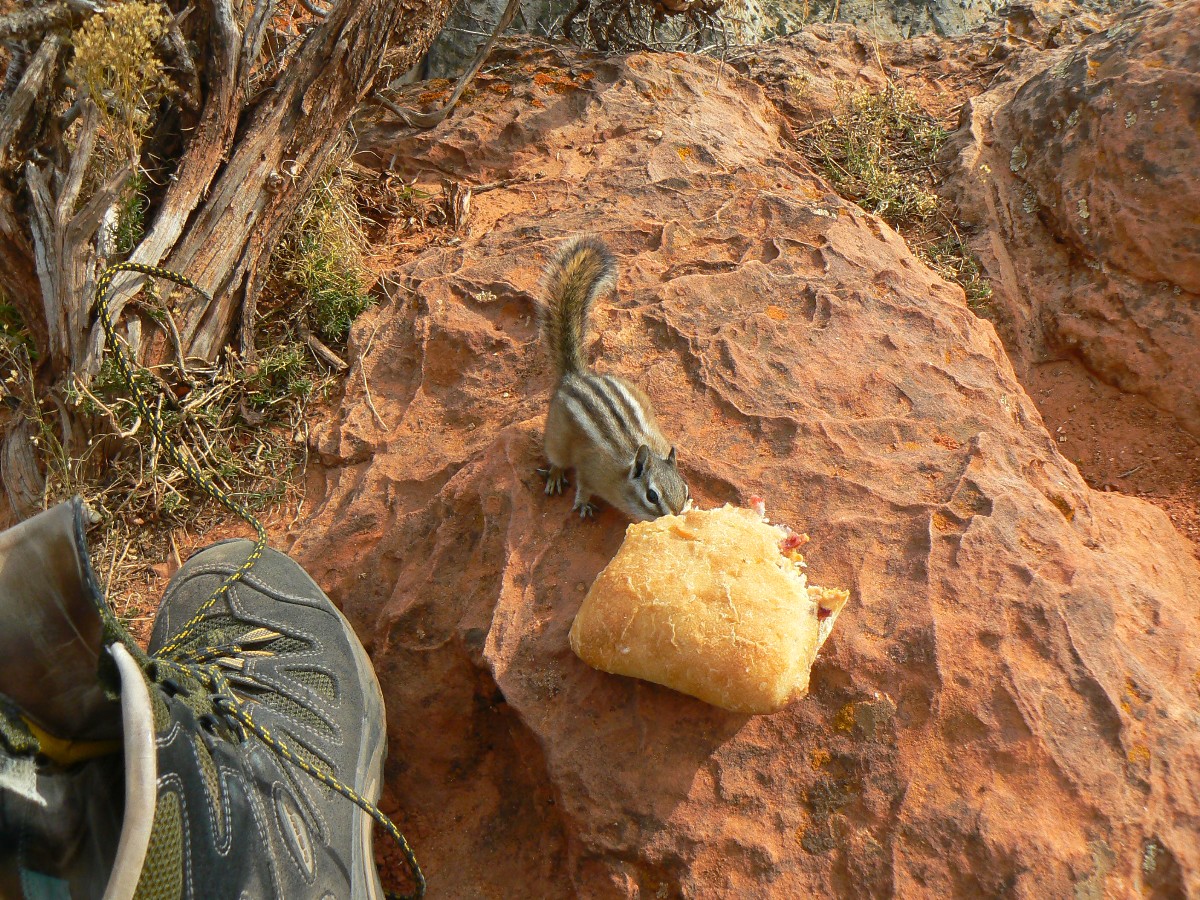
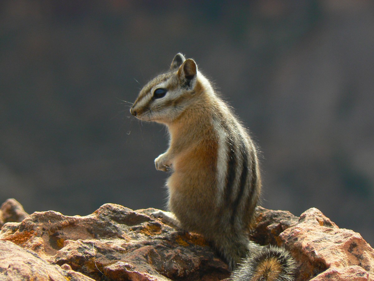
astounding. The view is down the canyon of the Virgin River as it slithers toward the burg of Springdale. I see
a curious chipmunk on its way up the rock to greet and glean crumbs from my sandwich, then realize there are three
chipmunks, and that one of them has snuck in for a nibble of bread while I am busy photographing a friend. Stealthy.
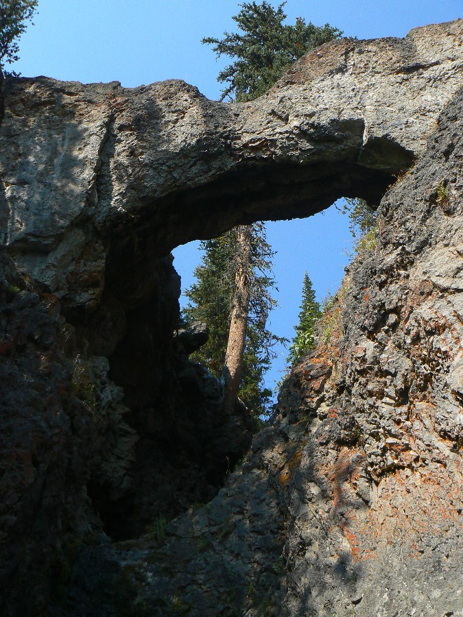
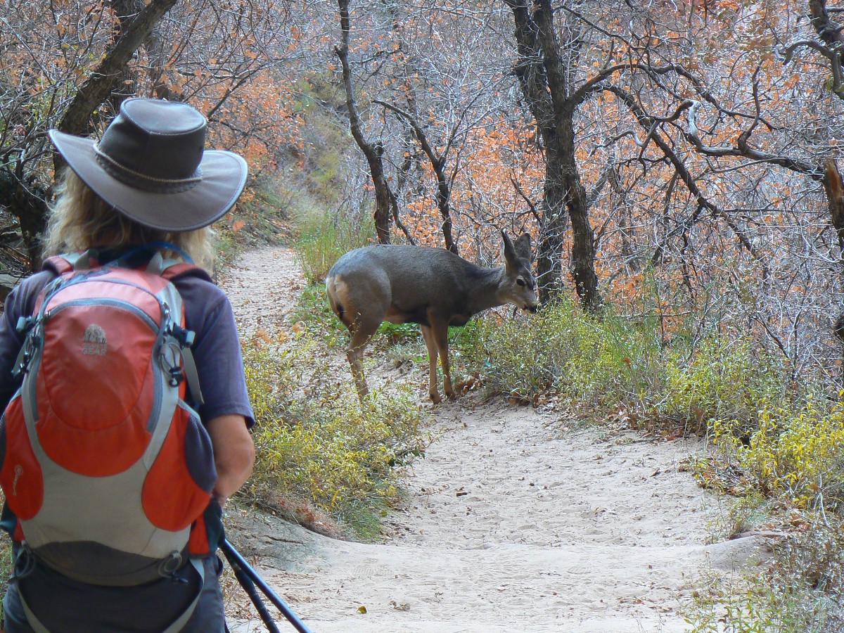
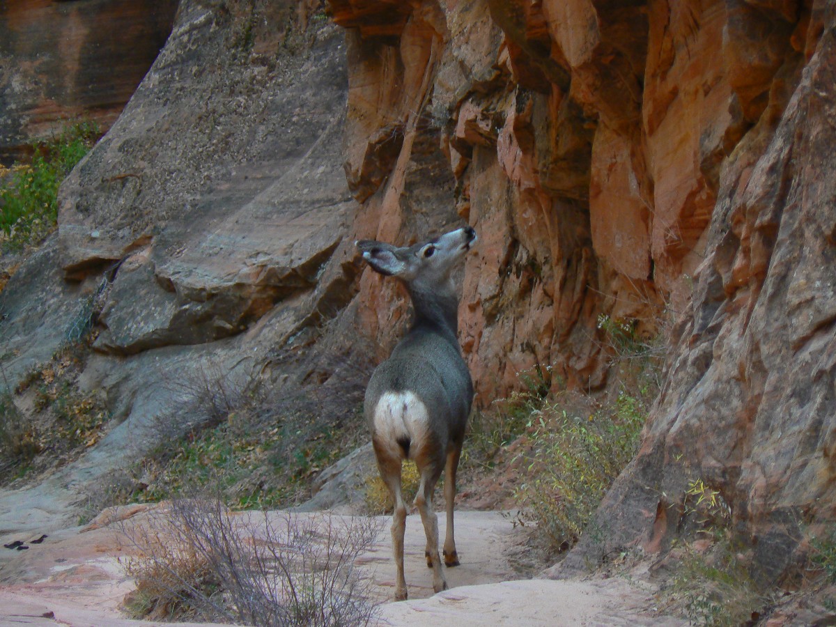
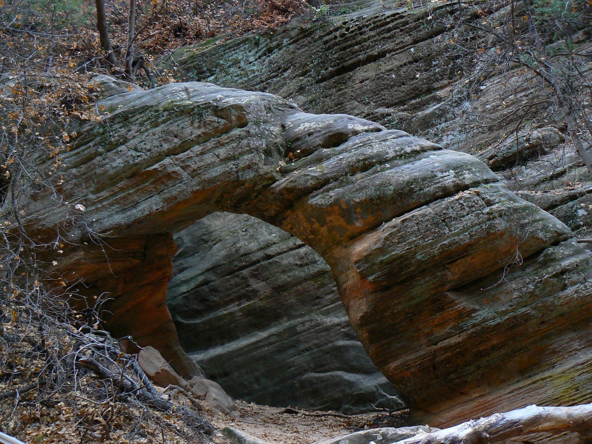
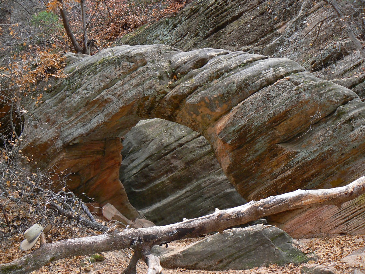
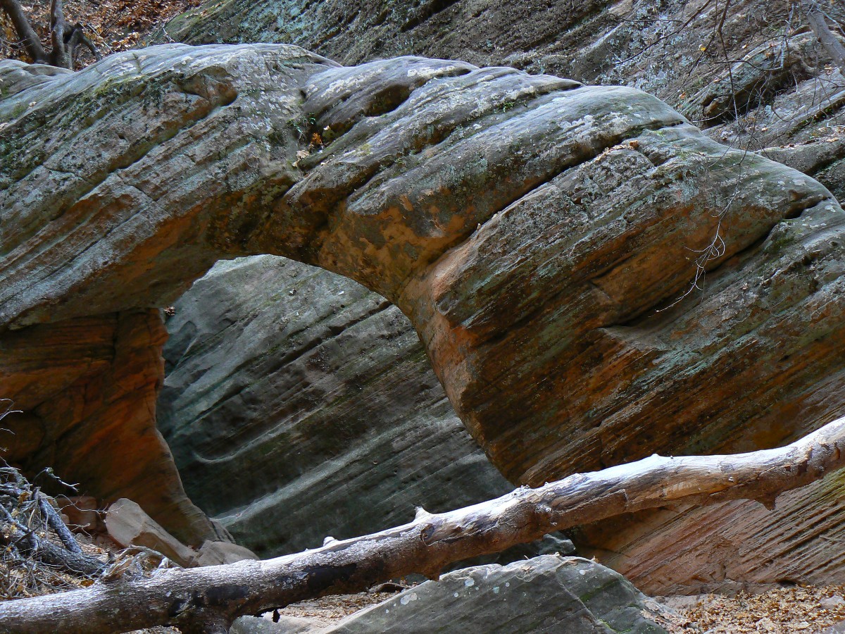
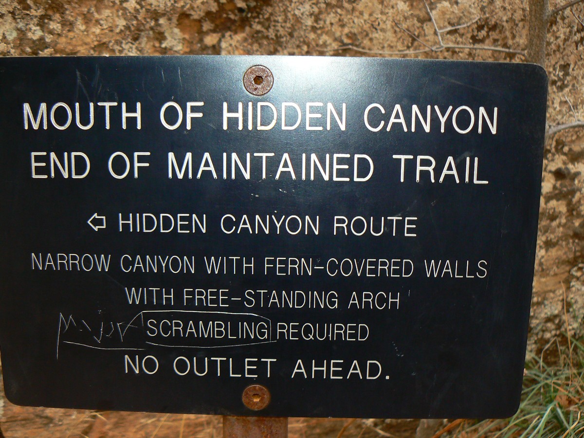
Cruising down from Observation Point, we decide to explore Hidden Canyon. Just
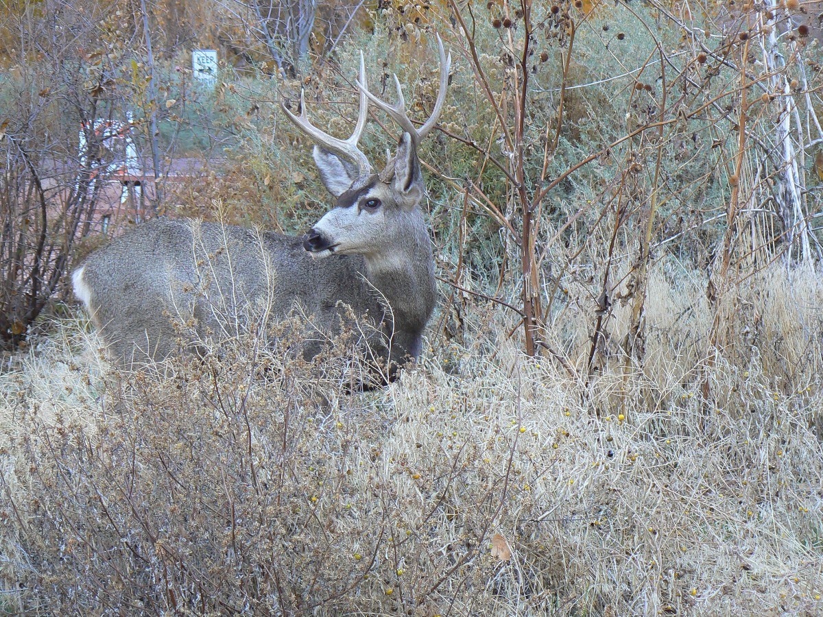
the name lures us on. Along the way down, we encounter a doe deer in a narrows section, and she shares the trail
with us for awhile, pretending to ignore us as she nibbles brush.
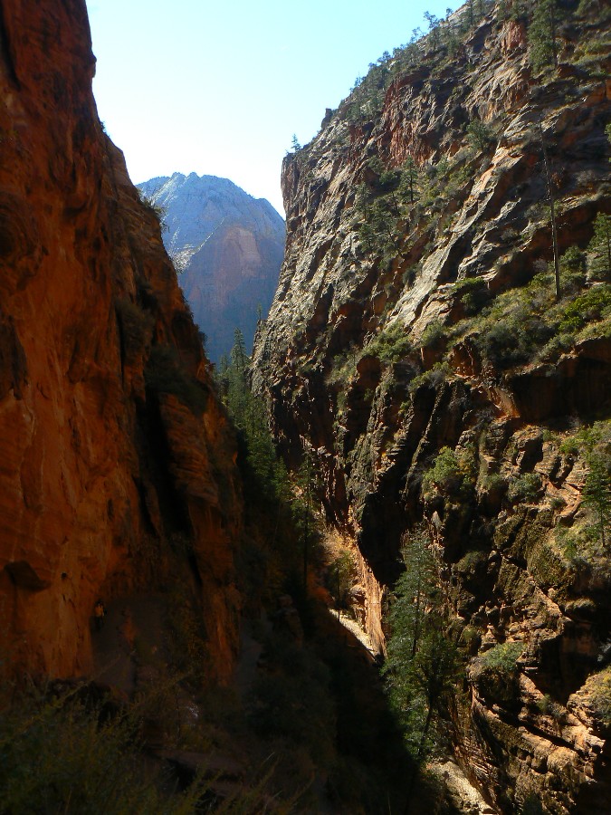
The trail to Hidden Canyon is somewhat tenuous at times and I'm glad there is no
ice on the trail. Cut into the side of cliffs in places, and at times following a natural rock shelf edged into the
cliff, it's no place for the acrophobic. The formal trail (such that it is) ends at the mouth of Hidden Canyon
(see the slot-like canyon on the below map, most visible when in topo mode). Kathleen opts to head down to look for
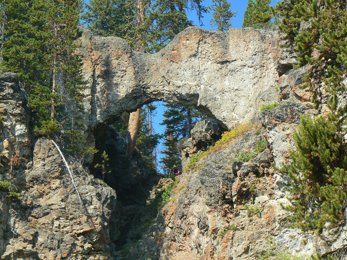
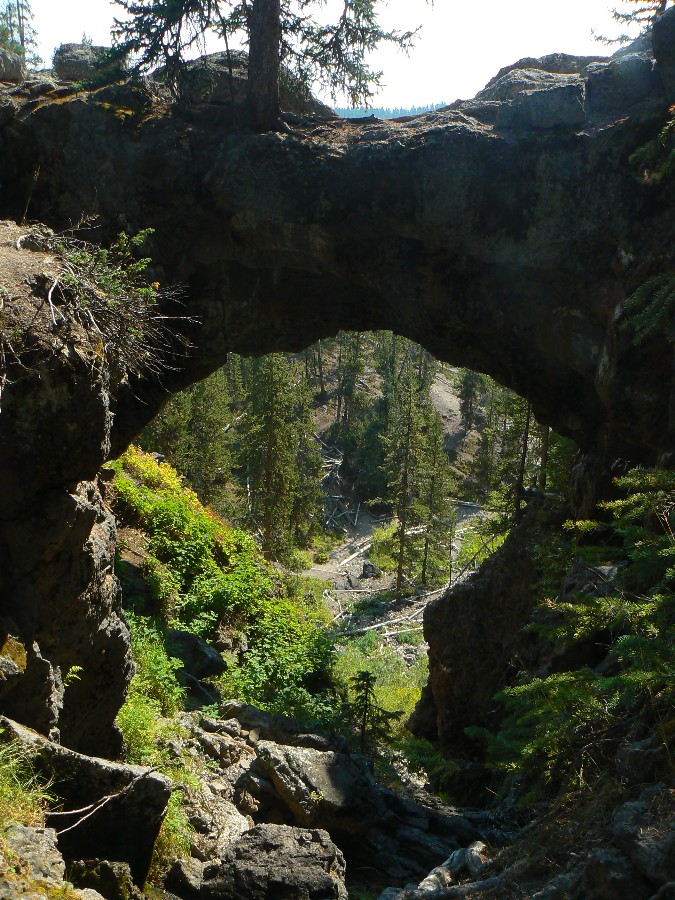
wild turkeys while I am intrigued by the notice of a "free standing arch" farther up the canyon. Yes, it's worth it.
Trail Summary: The trail climbs steadily from the trailhead, past good
views of Weeping Rock, to the junction with the Hidden Canyon Trail. This side trip is worth the effort, and it's
also worth the effort to continue into the slot to Hidden Canyon Arch, perhaps another 0.25 mile beyond the end
of the formal trail. Along the way, there is lots of exposure, yet handrails to cling to as well. From the Hidden
Canyon junction, the trail continues to climb, past another junction with the East Rim Trail, and finally tops out
on the rim. Gorgeous views await at Observation Point.
![]() Map -
A map of this GPS track/map to Observation Point can be seen below. Change the map type (topo, terrain, etc.)
and alter the scale as you wish. Click "bigger map" text below map if you want a larger map.
Map -
A map of this GPS track/map to Observation Point can be seen below. Change the map type (topo, terrain, etc.)
and alter the scale as you wish. Click "bigger map" text below map if you want a larger map.
Zion Day 1 - Observation Point


Zion Day 1 - Hidden Canyon
 |
 |
 |
 |
 |
 |
| ||||
| ||||
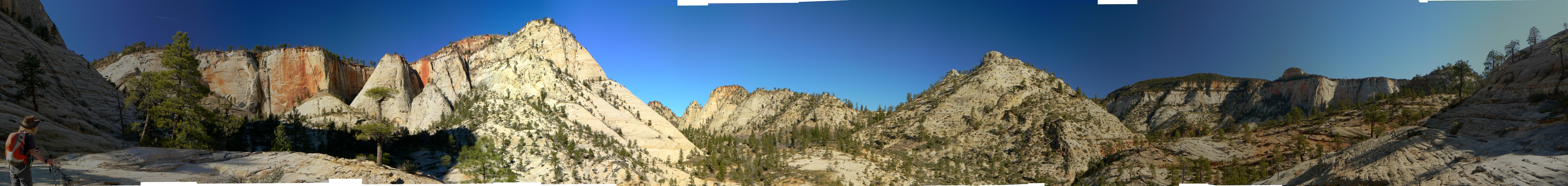
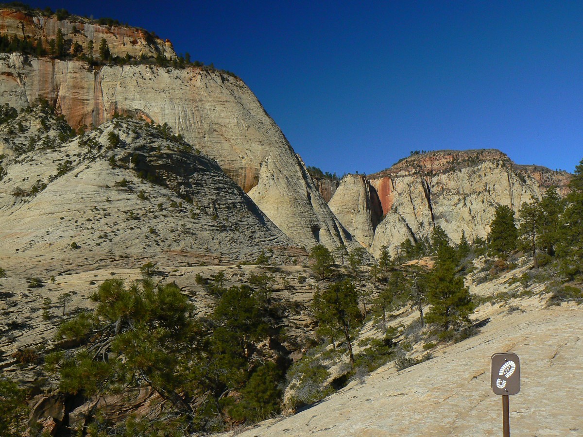
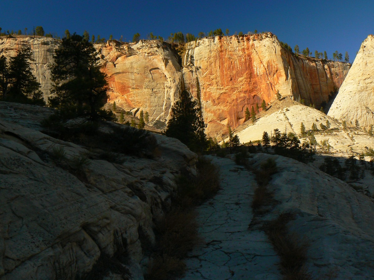
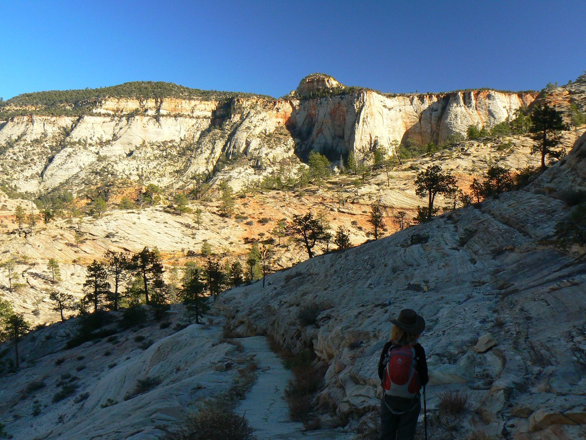
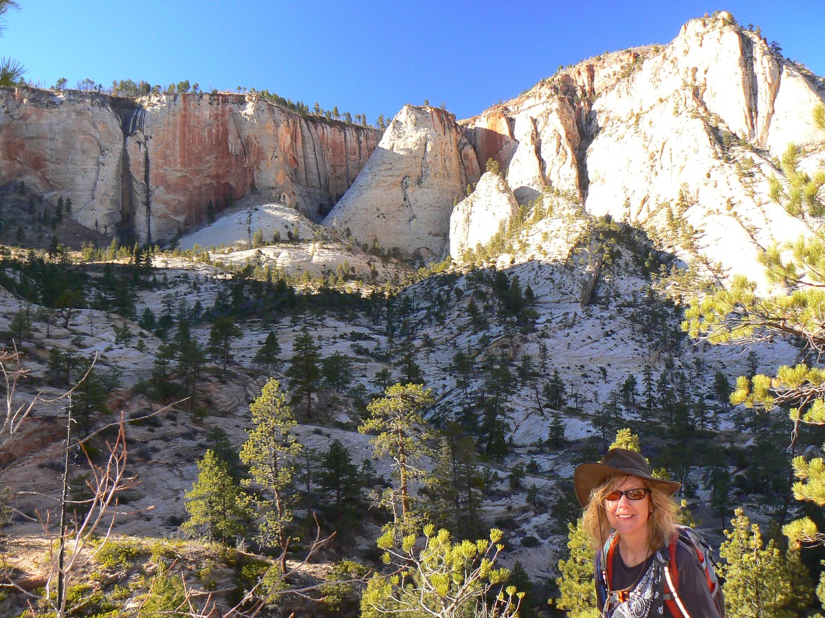
Zion Day 2; Part 2 of the rim-to-rim: The West Rim - Scout Lookout and West Rim, 9 miles,
gain (and lose) 2500', for an ERM (Energy Required Miles) of 19.
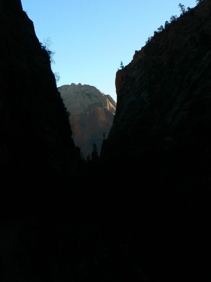
It's chilly (after warming on the hike up from The Grotto) in Refrigerator Canyon,
thoroughly earning its name. It's a dark slot and a bit of breeze would make it truly frigid. Yet, soon, we are
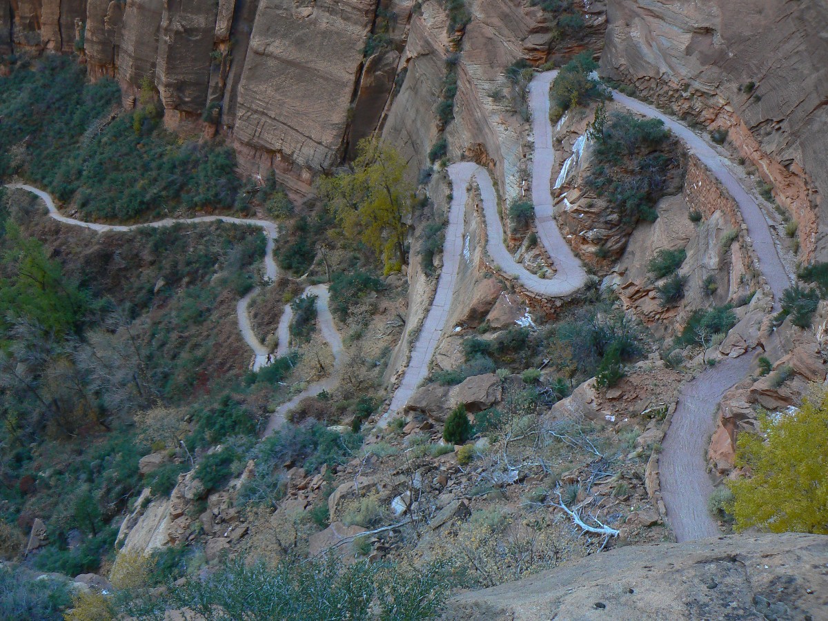
climbing the sinuous Walter's Wiggles (named for Walter Ruesch, a Zion Park building foreman), a slithering
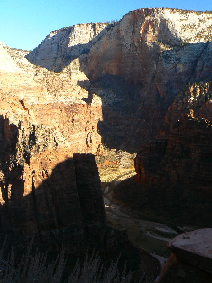
corkscrew of 21 tight switchbacks boosting the trail out of Refrigerator Canyon and up to the Scout Lookout/Angel's
Landing area. Scenic toilets await. Comforting.
Yet today we are on our way to the West Rim, and another exploration of the Landing
will wait for a future trip. We kid ourselves that we can visit it on the way back down from the West Rim. Right.
This is one amazing trail, contouring through slickrock swales and bobbing through canyons, yet always affording
tremendous panoramic views. Mostly it's up. Today, we are in the shade of the rim part of the hike and where the
tread is soil, it's often frozen as hard as the surfaced trail.
Finally, we're on the grade incised into sandstone climbing to the Rim. Up here,
surrounded by Ponderosa, there are bits of ice in the spring and lovely views across the basin.
After lunch, we march back to the TH, snapping photos of glowing reflections of Zion
monarchs along the way.
Trail Summary: From the Grotto TH, hike briefly along the river, then climb
steeply to Scout Lookout, via the dizzying Walter's Wiggles. At Scout Lookout, a side trail leads to Angel's
Landing - atop a narrow fin of sandstone. The West Rim Trail continues on an old CCC trail (paved!) which is blasted
into sheer Navajo Sandstone along part of the route to the rim.
![]() Map -
A map of this GPS track/map to the West Rim can be seen below. Change the map type (topo, terrain, etc.)
and alter the scale as you wish. Click "bigger map" text below map if you want a larger map.
Map -
A map of this GPS track/map to the West Rim can be seen below. Change the map type (topo, terrain, etc.)
and alter the scale as you wish. Click "bigger map" text below map if you want a larger map.
| ||||
Zion Day 2 - The West Rim
 |
 |
 |
 |
 |
 |
 |
 |
 |
 |
 |
 |
 |
 |
 |
 |
 |
 |
| ||||
| ||||
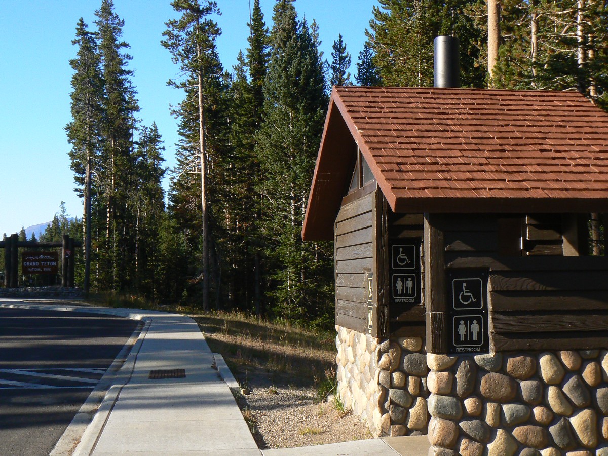
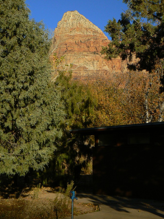
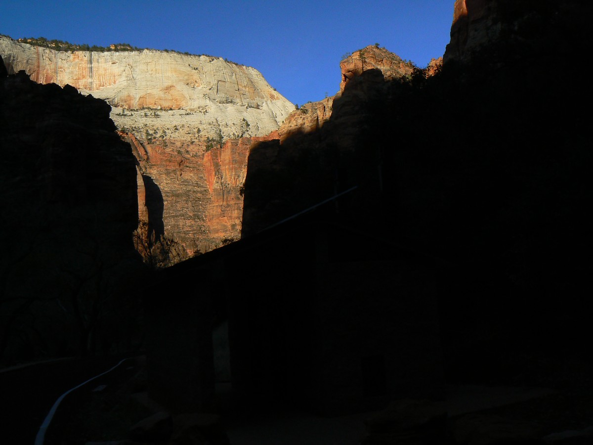
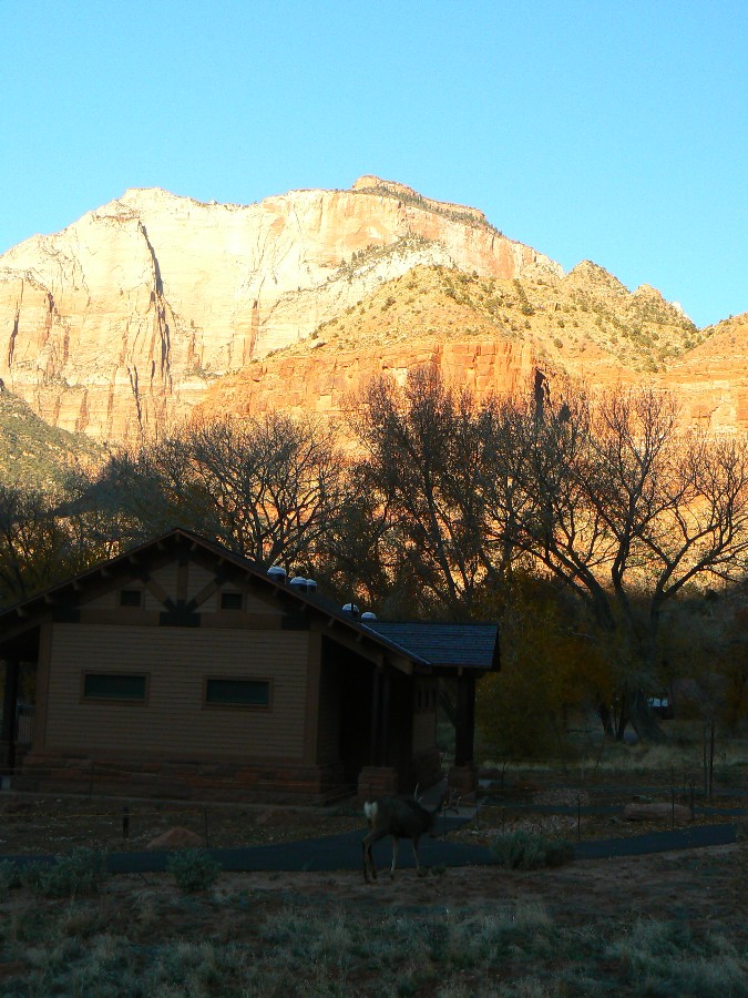
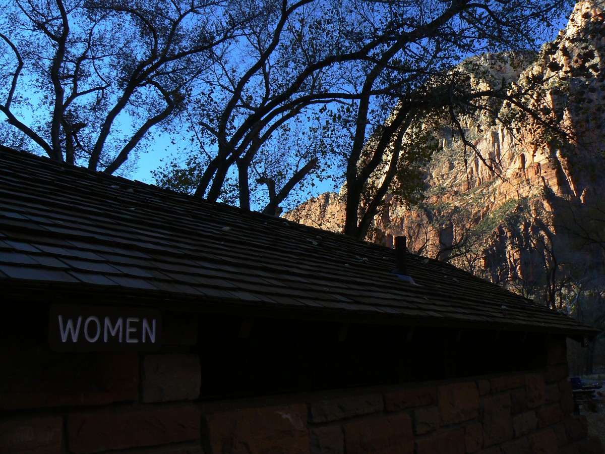
Scenic Toilets of Zion 2011
 |
 |
 |
 |
 |
 |
 |
 |
 |
| ||||

| ||||
| ||||

| ||||

| ||||

| ||||

| ||||

| ||||

| ||||
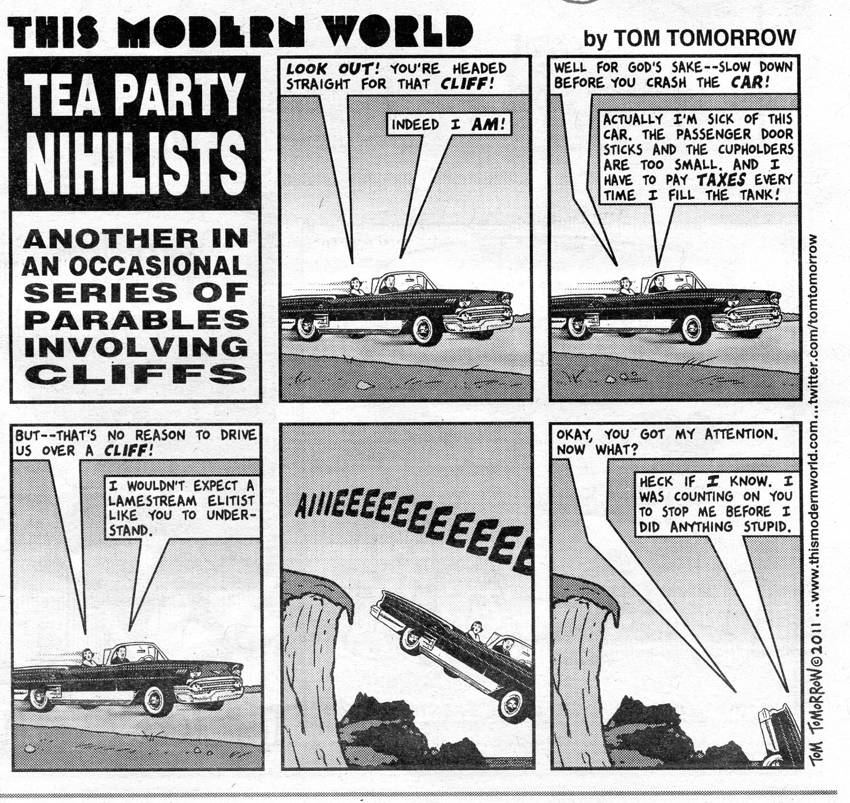
Definition of NIHILISM - 1: a: a viewpoint that traditional values and beliefs are unfounded and that existence
is senseless and useless b:a doctrine that denies any objective ground of truth and especially of moral truths
2: a doctrine or belief that conditions in the social organization are so bad as to make destruction
desirable for its own sake independent of any constructive program or possibility
| ||||
| ||||
A Wall Street banker, a Tea Partier and an Occupy Wall Street protester were sitting at a table. In the middle of the table was a plate with 12 cookies. The Banker quickly grabbed 11, turned to the Tea Partier and said, "You better watch out for that one, he wants a piece of your cookie!"
Going to church doesn't make you a Christian any more than standing in a garage makes you a car.
"Reality has a well-known liberal bias." - Stephen Colbert.
“If a free society cannot help the many who are poor, it cannot save the few who are rich.” - John F. Kennedy
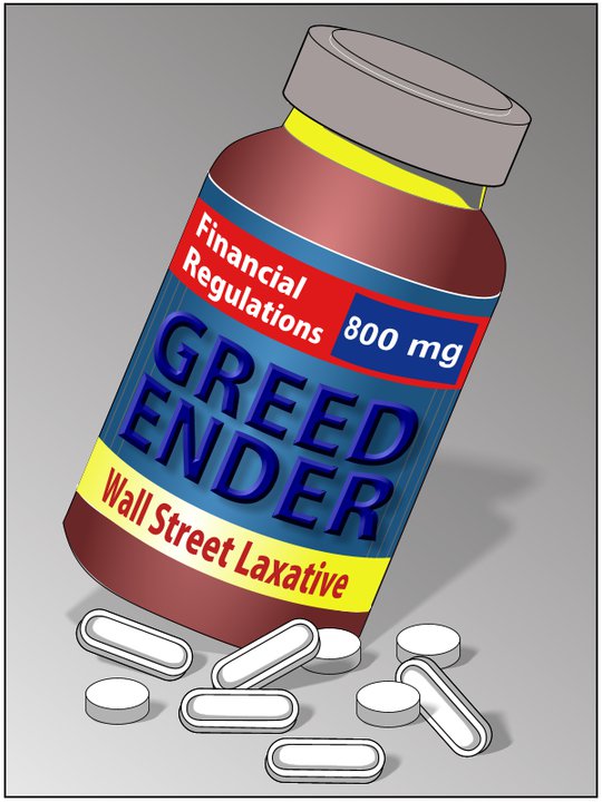
The Top 0.1% Of The Nation Earn Half Of All Capital Gains,
by Robert Lenzner, Forbes.com (11-20-2011)
Capital gains are the key ingredient of income disparity in the US-- and the
force behind the winner takes all mantra of our economic system. If you want even out earning power in the U.S,
you have to raise the 15% capital gains tax.
Income and wealth disparities become even more absurd if we look at the top 0.1%
of the nation's earners-- rather than the more common 1%. The top 0.1%-- about 315,000 individuals out of 315 million
-- are making about half of all capital gains on the sale of shares or property after 1 year; and these capital gains
make up 60% of the income made by the Forbes 400.
It's crystal clear that the Bush tax reduction on capital gains and dividend income
in 2003 was the cutting edge policy that has created the immense increase in net worth of corporate executives, Wall
St. professionals and other entrepreneurs.
The reduction in the tax from 20% to 15% continued the step-by-step tradition
of cutting this tax to create more wealth. It had first been reduced from 35% in 1978 at a time of stock market and
economic stagnation to 28% . Again 1981, at the start of the Reagan era, it was reduced again to 20%-- raised back
to 28% in 1987, on the eve of the October 19 232% crash in the market. In 1997 Clinton agreed to reduce it back to 20%,
which move was an inducement for the explosion of hedge funds and private equity firms-- the most "rapidly rising
cohort within the top 1 per cent."
Make no mistake; the battle that is to be fought over the coming attempt to reverse
this reduction in capital gains will be bloody and intense. The facts are clear according to the Congressional Budget
Office more than 80% of the increase in income inequality was the result of an increase in the share of household
income from capital gains. In fact, you can go so far as to claim that "Capital Gains income is the most unevenly
distributed-- and volatile-- source of household income," according to Laura D'Andrea Tyson, University of California
business professor and former chairwoman of the Council of Economic Advisers under President Clinton.
No wonder the super wealthy plutocrats obtained the largest share of national
income-- 25% of the nation's wealth- greater than any other industrial nation in the the period of 1979 to 2005.
Make no mistake; after unemployment-- this disparity between the 1%-- 3 million-- or the 0.1%-- the 300,000-- and
the other 312 million citizens of the U.S. has become the major theme of the Occupy Wall Street movement-- and an
important national debate.
I commend you to the late Justice Louis Brandeis warning to the nation that " We can
have democracy in this country, or we can have great wealth concentrated in the hands of a few, but we can't have
both." We have to make up our minds to restore a higher, fairer capital gains tax to the wealthiest investor class--
or ultimately face increased social unrest.
Sites:
Other WV reports about the Grand Canyon:
Thundering the North Rim (1999)
Jumping Up Into Kanab Creek Wilderness (2004)
Jumping Up into Thundering River (2005)
Eponymous Clear Creek of the Grand Canyon (2007)
Slog and Flog South Canyon (2007)
Precious Canyon Gems: Hermit to South Bass (2009)
Grapevine Galleria of the Grand Canyon: Bright Angel to Grandview on Tonto East (2009)
Torrid Tapeats - Fishtail Frolic: Thunder River-Colorado-Deer Cr. - North Rim (2009)
Chilly Cheyava Clear (NOT) Creek: Largest falls of the Grand Canyon, Cheyava Falls (2010)
Chocolate Nougat Nankoweap (2010)
Royal Arch Rhapsody:
Standard Loopo to Royal Arch - and back - via South Bass TH (2011)
Horsewhip Horsethief Trail
(Nankoweap-Kwagunt-Malgosa; 2011)
Other WV reports about Yellowstone:
Yellowstone Winterlike Llamalot: Llama-packing Ferris Fork & Bechler Meadow, 1999
Other WV reports about Zion:
Snow Angel: Dayhiking in Zion N.P., 1998
Cathedral of The Narrows, 2001
Zenith of Zion Zen, Zion Through-hike, 2004
Ode to Orderville! Touring Orderville Canyon and THE Subway of Zion, 2007
Related sites:
Click here to see The Archman's site on Utah and area arches.
Ben's Scenic USA - Picture of the Day.
Click here to see Steve's excellent photos - birds in flight, panoramas, etc.
MP3 sound recording of an elk bugeling
A well-regulated wilderness - why not cover the wilds with ORVs? (NY Times)
(mp3 file - sound recording) NPR - facing planetery enemy no 1 - agriculture 10-12-2011
7 billion and counting - will anyone survive?
World population clock - watch the number spin, geometrically, and be frightened, very frightened.
Arithmetic, population, and energy - the geometric function (youtube mini-lecture on math)
|
Wild Vagabond Main |
Trip Report Index  |
Caveat  |
|---|