Jumping Up Into Thundering River:
Kanab Creek Wilderness to Monument Point
via the Colorado River and Deer Creek
Grand Canyon Adventure 2005: Sowats Point to Kanab Creek ---
Then along the Colorado River to Deer Creek & Thunder River,
across the Esplanade and out the Bill Hall Trail
by Rob Jones
May 14 - 23, 2005
Text
and Photos © copyright by Rob
(Click on an image and read the caption below the image.
Full report below the photos.)
This trip and report are an extended follow-up to the Jumping Up into Kanab Creek trip
of 2004.
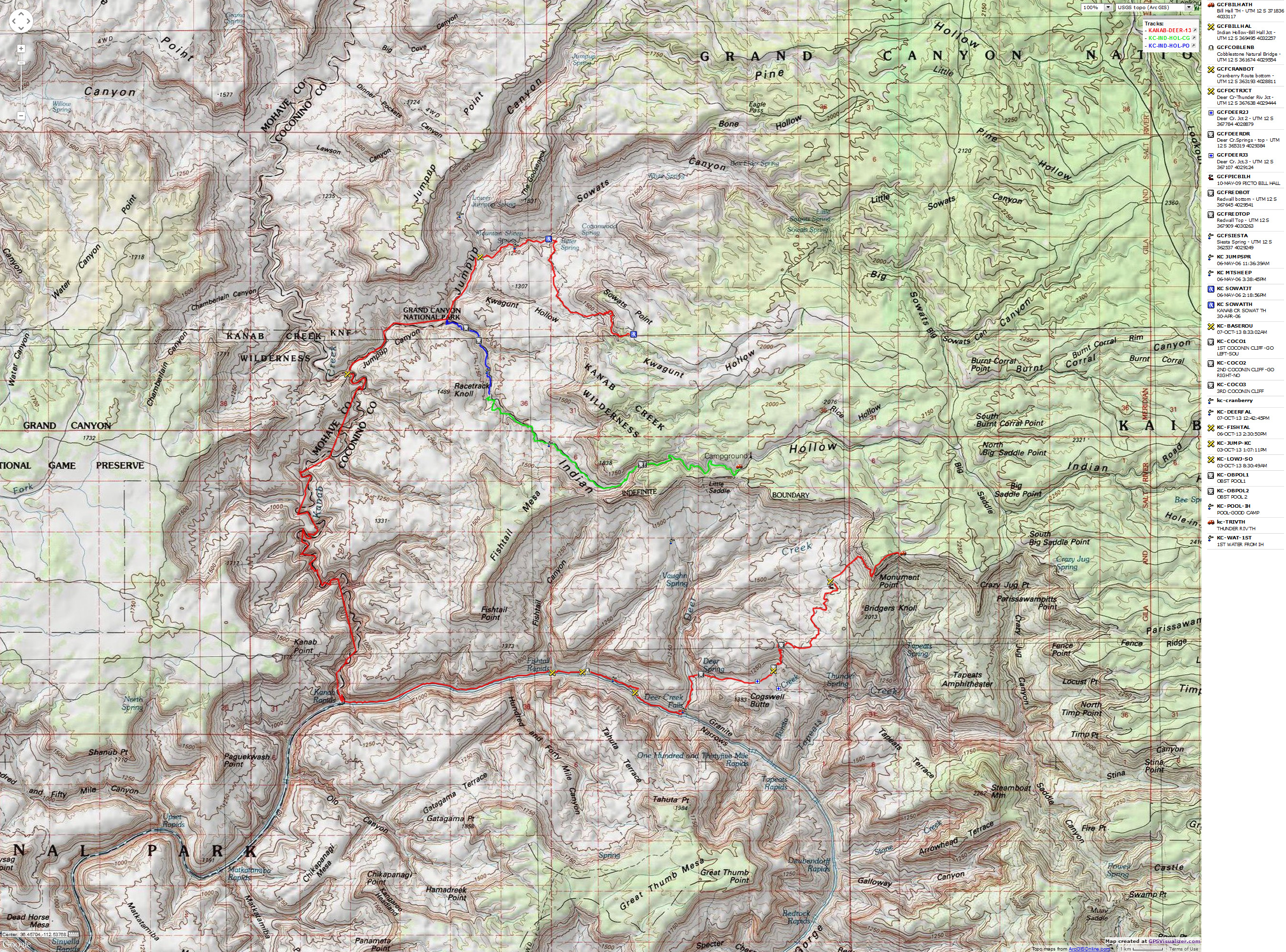
The map below is from a 2013 trip with a similar, yet not completely the same, route.
It will help orient you to most of the route and perhaps give you some trip ideas. Caution, it is not the exact route
from the trip described in this report. Yet, enjoy.


|
|---|
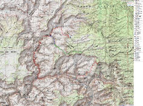
Map- kanab, 2013; sowats to monument pt; 45 mi (includes route from Indian Hollow,
which we did not hike)
(Click the image to see the map)
|
|---|
|
for a full-resolution map, click here. Caution - do not use this map or gps track for
navigating the route.
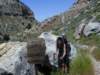
Day 1: Indian Hollow on the North Kaibab. Here we are,
Al & Mary H., Kathleen
and I, reclining in comfy chairs in Indian Hollow CG, at about 6200' and enjoying
the shade of Pinyon Pines after trailing through dusty miles of Ponderosa Pines
on this 14th of May, 2005. We started off from Smog Lake in the time of freshly-
baked bagels, and we were in Kanab for vegetarian lunch at the Rocking V on
Center Street. A dark beer and life is good. Breath the clearness of air, hear the
silence of wild country, feel and soak in old sol, see the jays harvesting pine nuts
in this pygmy forest, speak about tight, sinuous canyons.
Questions abound. Will we be able to negotiate the
expected high water in
Kanab Creek? The roads? So far they are fine, yet we hear tales about huge
snow banks. The permit was for 6, yet Zig and Craig dropped out, now we are
four.
K and I try sleeping under the two thin pile blankets
and freeze - out comes
the down comforter. We take the blankets into the canyons anyway, leaving the
down bag behind.
Day 2: Shuttle from Monument Point to Sowats (Jumpup/Nail)
to Mountain Sheep
Springs. It is cool in the hollow this morning. We start late, then drop off Al &
Marys Subaru at Monument Point (7200'), then drive about 15 miles to Sowats,
where we finally get hiking at noon. Then, down the steep pitch to Cottonwood
Spring, and from there out on the Esplanade, jumping down toward Jumpup, on to
Mountain Sheep Spring, which is flowing at three times that of last year.
Questions resurface - will we be able to hike Kanab, or will there be too much
water? Cactus are blooming, Century Plants too - where there were none last
year. Its a much wetter year. There was one car at the TH, and there is one tent
at the spring. After photographing pictos near the spring, we camp. Its a lovely
spot now that the sun has slipped behind the towering walls. Al is cooking
Alfredo and broccoli and all is well. We enjoy dinner perched on a sloping
slickrock boulder, discovering that an owl has also dinned here, leaving an owl
pellet packed with miniscule mice bones.
Revelation! Its not Jumpup. Nearing sunset in camp,
Craig and Elenor
stroll in (theyre camped under the ledge). Discussion ensues and wow, Craig
notes that we are currently at Mountain Sheep Spring, not Jumpup - which is in
the next canyon over and joins with Mountain Sheep about a half a mile down the
canyon. What we have called Mountain Sheep is actually Cottonwood. The trail
we thought was the Ranger Trail, joining in where we drop off the Esplanade, is
actually the route to Lower Jumpup Spring. One cannot approach Jumpup from
below because of a 60' pour-off, hence the Jumpup. So, things were not as they
seemed, the result of having part of the route on a poor-quality large scale map.
So, another place or three to explore - from Jumpup Point to some cabin to
Jumpup Spring. And a final note, Mountain Sheep Spring is apparently named
not for the sheep, but for the frogs who bleat like sheep, as we find out tonight.
Day 3: Flog to Showerbath Spring, with extra water
along the way: We start early
and quickly find ourselves crossing and recrossing the flow from Mountain Sheep
Spring until we are nearly to Indian Hollow, deep in the narrows of Jumpup
Canyon. We hike up Indian Hollow to an Eden pool and blocking chockstone,
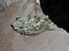
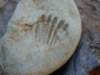
finding seashell fossils along the way. After a foot break, we continue the rocky
flog to the junction with Kanab Creek. Yikes, theres a good flow in Kanab Creek.
We had been pressing forward to reach Kanab, and collapse for a late lunch
before dropping into the sun and wind and wet boots of Kanab. We made it to
Showerbath ten (total) hours after leaving Mountain Sheep Spring. The spring is
running fresh, and we enjoy a rinse, put on evening wear to enjoy tofu enchiladas
and rice, supplemented by pita bread and hummus. Yum. A few drops of rain
send us scampering to store packs. K and I are getting down the procedure for
sleeping with two light pile blankets.
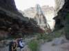
Day 4: Serpentine Swath to Whispering Falls,
The Slide of Susurrus, Ponces
Pond. Im leaning against a polished incline of gray limestone, looking up at
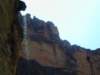
three types of cactus (pincushion, beavertail, barrel) and 600 or so feet of Kanab
Canyon verticality. Today has been a longish day of twisting through boulder
jams and rock-walking with some tramping along trails above stream level. We
had bagged important stuff inside the pack, in case we went submarine - but, not
to worry as we found routes around most obstacles. It is quite warm, yet the sun-
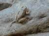
scraper walls shield us much of the day. We venture up Scottys Hollow, finding
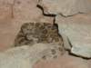
a lovely frog enjoying the cascading water. When routing around the difficult jam
below the Castle, we find an excellent elegant shell impression. Lounging
opposite the canyon entrance to the Slide we opt to camp, without the energy or
ambition to visit the Slide today.
Day 5: Colorado Rockies - Slide to the River:
We rise and visit the Slide. There is abundant water coursing through the
Slide slot. Champagne drops of water drip from the overhanging roof into the
azure pool as the water cruising down the slide whispers background melody.
Back at camp, Al finds a rattlesnake where he stashed his pack. Yikes.
Then, we walk the rock to the luxurious Mauv Limestone ledges where we nap
and read, not wanting to arrive at the river while the sun is blazing. This stretch is
much easier to negotiate - most of the difficult boulder jams are between
Showerbath and the Slide. As the carp play where the waters mingle, we enjoy
the percussion of Kanab Rapids and spaghetti with homemade sauce. The silky
white sand of the confluence of Kanab Creek and the Colorado toasts the
bottoms of my feet, but its local sunset here, and brisk breezes soon drift down
river.
Day 6: Hot rocks and cooked fish - to Fishtail
Rapids/Canyon with no route: We
try for an early start, but we are hiking at 7 a.m. It is hot in the full sun and there
is almost no shade as we slog over boulders and occasional sand. It takes eight
hours of grueling (Al says 10 hours) hiking and hiking, sometimes cowering in the
sparse shade of the rare tamarisk. My muscles ache from the up and down and
over the boulders and the heat exhaustion. But, what a backyard we enjoy as we
gaze up river across Fishtail Rapids, toward the buttes, temples, castles, and
ramparts glowing in the last rays of golden sun - glorious.
Now that local sunset has arrived, it is delightfully cool as we dip in the
frosty Colorado. Al retrieves the lost Tecate beer K and I had anchored to a stick
in the sand. Presumably because the selfish elitist glow of Las Vegas and LA
and Phoenix and Smog Lake, et al., that have no good reason to exist is provided
by increasing flow to the turbines from this overworked river, thus, our precious
beer (last of the four) procured from sympathetic river runners - floated away in
the rising waters, was caught by an eddy and returned to Al, just as he was
washing clothes. Amazing.
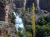
Day 7: Evaporative Thunder - Fishtail to Deer Creek
Falls and Camp: The
delicious wintry spray envelopes us as we pose for mandatory photos in front of
Deer Creek Falls as it leaps out of the banded Tapeats Sandstone and into a
swirl basin and quickly into the Colorado. Its evaporative thunder.
We have finally completed the river walk, and we have found the section
from Fishtail Canyon to Deer Creek to be an interstate highway compared to the
boulder flog of Kanab to Fishtail. The route goes up just to the East of Fishtail
and stays up about 300-400' above the cliffs on well-marked terrain to the
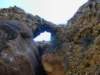
luscious Siesta Spring. Along the way, we pass what we call Cobblestone
Natural Bridge, eroded into a conglomerate layer revealed eons ago by more
numerous eons of canyon erosion. We lounge at the spring and replace the
dregs of Fishtail with water from the spring. Tadpoles and cattails and flowing
crystal water in a sandstone nook. From the spring, the trail drops down to a
broad beach - where we see no broads, and then skirts the last mile on sand and
rocks to Deer Creek. From the vantage of the cliff bands, we watch the
procession of populated baloney boats - folks on a Colorado Cruise, just a few
steps removed from what Al calls electronic cocaine (TV). We encounter a
group of 9 Canadians from the Rocky Mtn. Ramblers Club. They had attempted
and abandoned the Steck loop from Indian Hollow after earning many bruises and
cuts.
At the Falls, we are overwhelmed by a tsunami of river tourists clogging the
evaporative thunder. Lets hope they turn environmental with this touch encounter
with the Grand Canyon.
After procuring some precious fruit from Tour West, we hike the mile
through the Tapeats Sandstone gorge to camp. Blazing hot and glad to be in
camp, but sad that we dont see Fred the Turkey, local and historical icon.
Consecutive drenchings in the frigid Deer Creek help us survive until local sunset.
Day 8: Rest and recover - layover at Deer Creek Camp,
visit the Throne Room of
Deer Creek Spring: Again, the evaporative thunder of Deer Creek cools the air.
This time, its Deer Creek Spring and were reclining in the throne room, where
Queen Yucca (Kathleen) rules with an Agave frond, and delightfully so.
Frothy crisp water bursts from a moss-lined cleft in the salmon sandstone
and tumbles down the steep canyon wall, after a free fall of forty feet or more.
Superb. We lounge and soak in the coolness.
Back at camp, I catch up on gazing, pondering, and journaling.
We arose just in time to enjoy the last of the cool morning - watching
whiptail and spiny lizards patrol for bugs. I get a glimpse of a camp woodrat.
Then, we hang things in the shade of the big cottonwood tree and hike up the
canyon for perhaps a mile to the throne room and spring.
Yet, with trepidation, we sit around at dinner brainstorming options for the
searing soaring slog from our present 2200' to the 7200' of Monument Point.
Should we pause in Surprise Valley, drift down to Thunder River to eat and rest
and water up? Should we attempt a moonlight hike directly out? All options have
pros and cons. What to do?
Day 9: Refreshing Thunder - Surprise Valley,
Thunder Springs, Esplanade! We
are on the ebony trail climbing out of Deer Creek before the first glow. Flowers
galore bloom in the slanted light as the cool air settles from Surprise Valley,
rolling over us like a refreshing freshly-laundered sheet. As the sun peeks over
the distant walls, we cruise through Surprise Valley and stash packs. Taking two
packs with stove, filter, wine bladders, and food bags, we head into Thunder
River as the mid-morning heat begins to build. 2200' to 3400'.
Two rattlesnakes slither the trail in front of Al and Mary - lovers of the rim
rock. This time, I hear the drone of refreshing thunder long before reaching the
rim, as was the case the first time I experienced the incongruent roar of water in
this driest of deserts. Mist and spray from the huge flow envelopes us as we
cook a late breakfast near the springs.
We while away the mid-day, napping, talking with hikers and river runners
making a pilgrimage to the refreshing thunder. About 6 p.m., we finish filling the
bladders and eating dinner - and hike up and out and across Surprise Valley to
our stashed packs. The sun sets locally just as we finish reorganizing our packs.
We have decided to climb staircase #2 - to the Esplanade for the night. In two+
hours of steady hiking, we reach the rim as our 5-star hotel turns into a billion-star
abode.Hikers arrive to tell us there are one and a half gallons of water on the
Esplanade, with a note attached from Jeremy C (who we met yesterday at Deer
Creek) noting save this for the Wilderness Vagabond - and pack out the
empties. Lovely and kind.
We find the precious Jugs of Jeremy and set-up camp as the blazing full
moon leaps above the rim. Ahh, the Esplanade and sweet dreams. 3400' to
5200'.
Day 10: Bill Hall Grunt: Staircase #3: 5200' to 7200'. The stove has not been out
since we ate an early dinner at Thunder River - and it would stay in the pack until
we were home. Moving across the friendly Esplande, the flowers are everywhere
- what a delightful flower and water year! After a lilting two miles, we reach the
junction with the Bill Hall Trail (weve been on the Thunder River Trail since
Thunder River, and its better constructed than others in the area). A second brief
breakfast and up we go, seemingly endless switchbacks, and then a contour
around the South end of the point and into the sun before climbing the last 300 or
so feet. From 5200' on the Esplanade to 7200' on Monument Point. The
monument is to Bill Hall, who died in a 1979 car accident while working for the
park. A celebratory beer and we pile into Als Subaru and complete the shuttle,
then meet at Escobars for lunch. Good, but not great, and a bit disappointing
after this long wait. Al and Mary stay the night in Kanab as Kathleen and I return
to Smog Lake.
Sweet dreams echo of burbling, rushing, thundering, roiling waters of
Kanab, the Colorado, punctuated by deafening thunder of Deer Creek Falls, of
Thunder River rock me to sleep in this comfy bed with this luscious woman.
Click here or on the Looking Lizard to go to all WV reports about The Grand Canyon

|
|---|
Looking for All Wilderness Vagabond trip reports about the Grand Canyon?
Click the image to go to All WV reports about The Grand Canyon
|
|---|
|


