Grand Canyon Trip Report - Nankoweap #2 / Nankoweap Trail / Nankoweap Creek / Nankoweap Butte / Nankoweap Granaries / Marion-Seiber Route
(October 3 - 11, 2010)
Text © copyright by Rob; and Photos © copyright by Rob

|
Chocolate Nougat Nankoweap:
Grand Canyon Trip Report - Nankoweap #2 / Nankoweap Trail / Nankoweap Creek / Nankoweap Butte / Nankoweap Granaries / Marion-Seiber Route (October 3 - 11, 2010) Text © copyright by Rob; and Photos © copyright by Rob |
|
Co-Adventurers: Doug Nering, Mike Garvey, & Rob
| ||||

| ||||
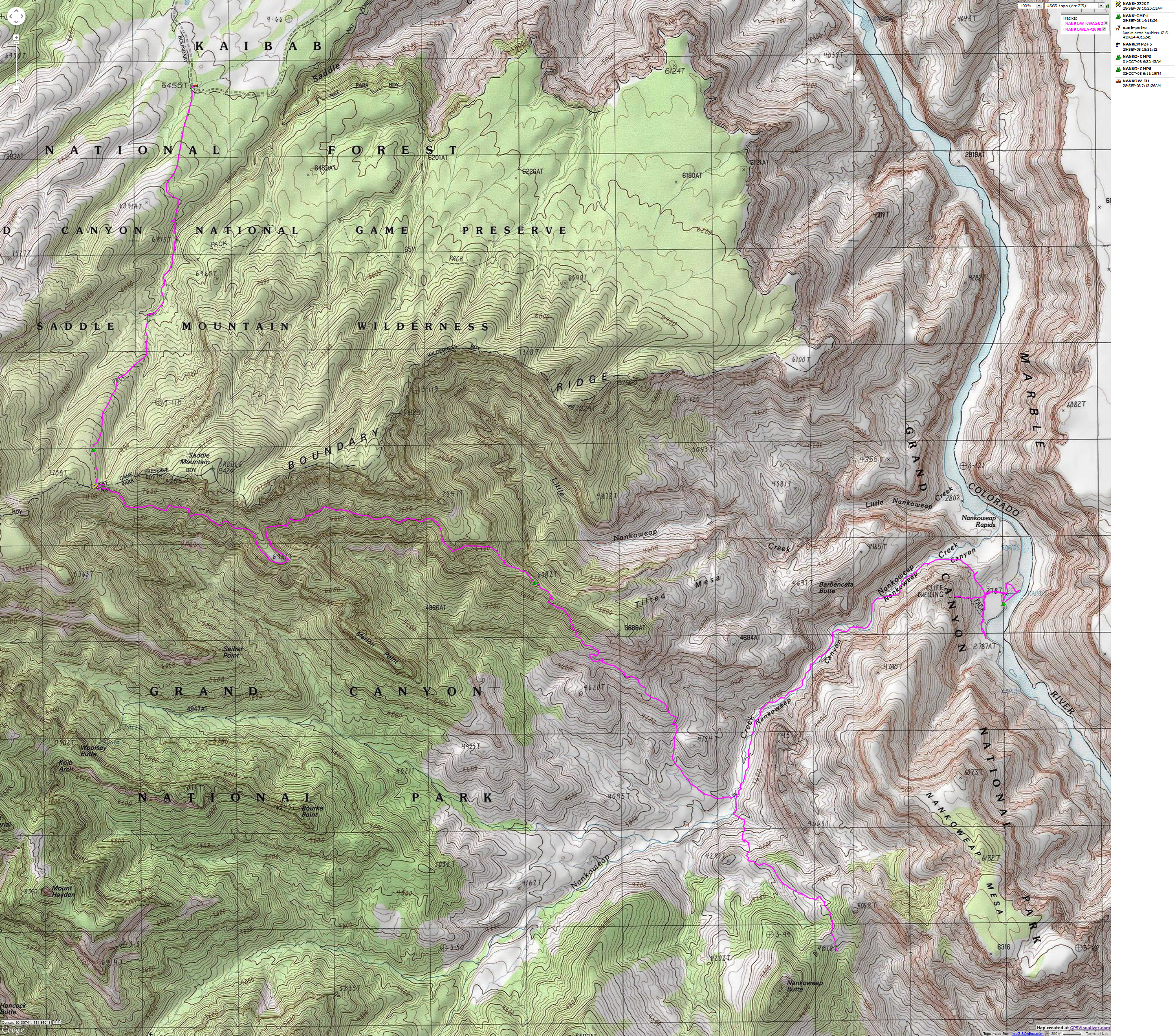
for a full-resolution map, click here. Caution - do not use this map or gps track for navigating the route.
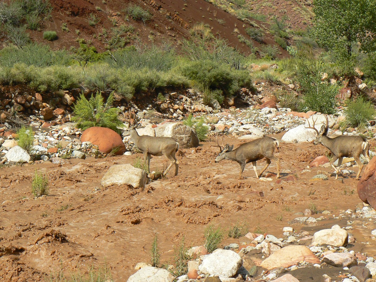
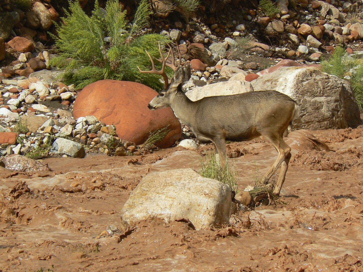
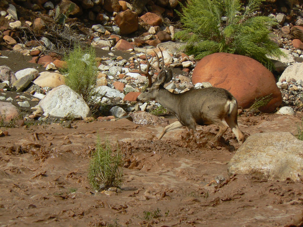
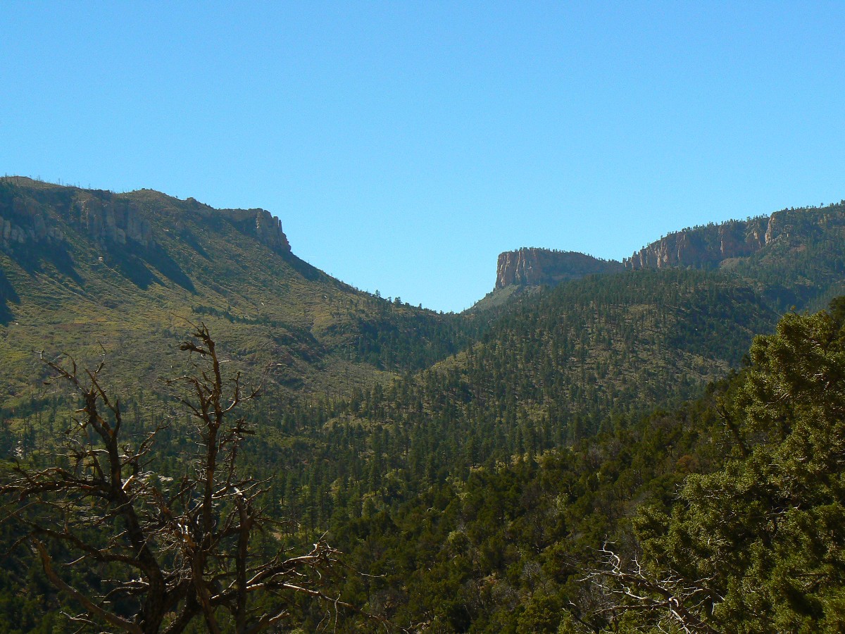
Summary: Doug Nering (of GCHBA fame), Mike Garvey (on-site in The GC) and I completed a 9-day mudfest adventure to The Nankoweap on October 11th. We experienced wondrous waterfalls off Nankoweap Mesa, a roaring, rock-rolling chocolate thunder flood in The Nankoweap drainage, a trio of gigantic bachelor bucks fording the flood, hikes to The Nankoweap Mesa (Doug) and The Nankoweap Butte (Rob), granary gazing at the Desert Façade (notably the steepest drop in the GC), a preliminary tour of Little Nankoweap, a delightful stroll along the Walcott route and up the Marion-Seiber (correct spelling per Doug) route, a stumble through several new (to us) surface ruin areas loaded with a variety of pot shards, and new (again, to us) petros and even some pictos not far from the Saddle Mtn. TH. Yowee and Yahoo!
This report contains: 45 photos, 4 panoramas, 4 movies, and 2 route descriptions.
 |
 |
 |
 |
 |
 |
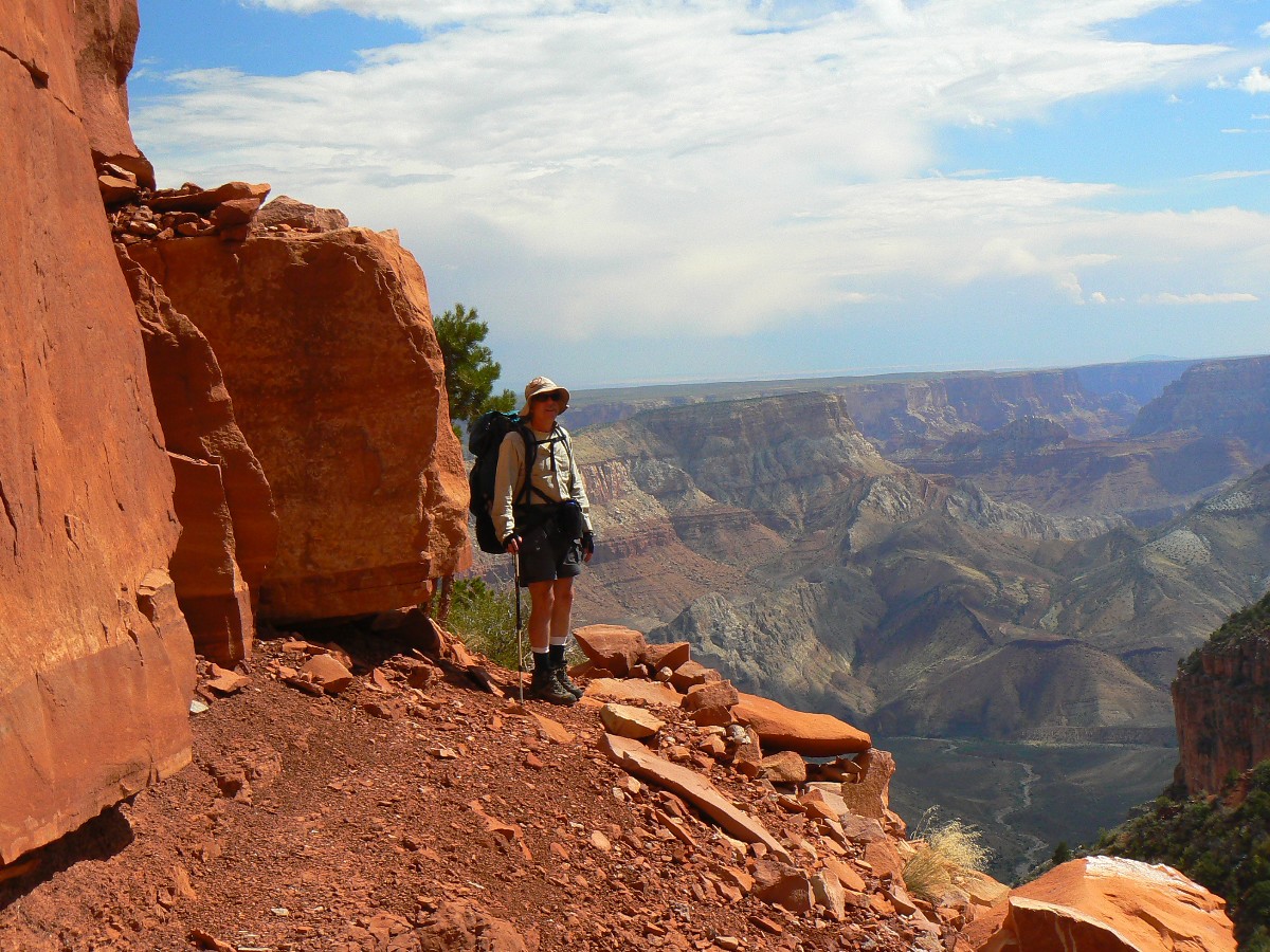
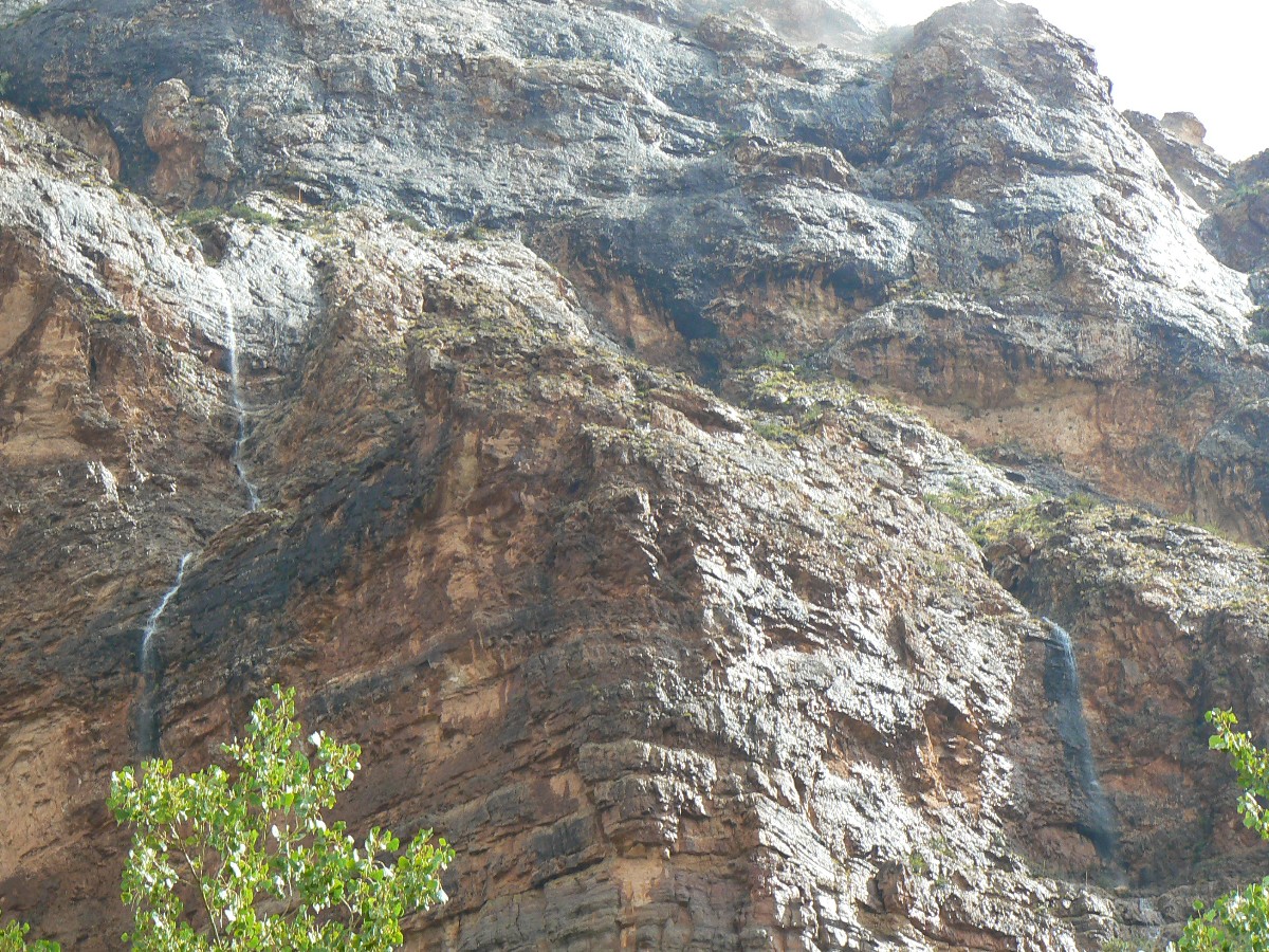
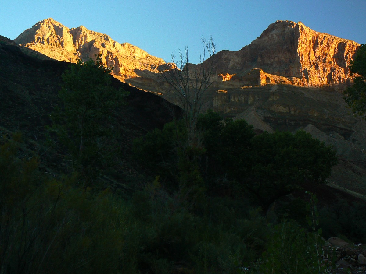
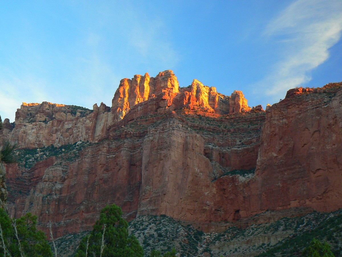
Day 1: Thunderous Arrival: to FS/NPS boundary, the remote TH, 3.5 miles.
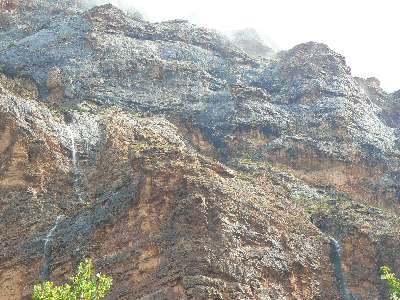
Thunder rolls through the swaying Ponderosa along with gusts of wind. Soon,
rain arrives as I sort equipment in the Henry Shires. Crack - pow - zot - lightning a bit too close, yikes.
Yet, we're a little below the crest leading to the Nankoweap (N) remote TH.
The pack weight is oppressive as we haul in the cache to this spot - perhaps 60
pounds, much of which will stay at the FS/NPS boundary cache. Then, there's the regular pack items too.
Day 2: Rain Arrival
- to N (Nankoweap) Creek, about 11 miles.
Mike and I are ensconced in a narrow overhang along the Esplanade traverse,
rain pelting the buttress and a thin stream pouring over the edge and making our tiny alcove progressively smaller.
A few alcove stops and we've used up more than what slack time we have and must suit up and hustle down the N trail
to N Creek. We meet up with Doug near Tilted Mesa. He has been enjoying the hoards of storm pulses rippling in from
the West rim. The good news is that the storm fronts have discouraged those horrid air tourons, with the exception of
a terribly intrusive helicopter buzzing us at low (and noisy!) altitude.
Bursts of rain punctuate the gathering darkness and we arrive at what was once the
Cottonwood-shaded camp to find it washed out. Across the drainage and down some Doug knows of a slightly better
(higher) camp. It rains and spits as we set up camp in the dark, then continues through the night. The situation
turns progressively more sodden and miserable as we set up and cook a quick dinner, rain water sluicing off our jacket
hoods and right into the soup. Lots of elevation loss today.
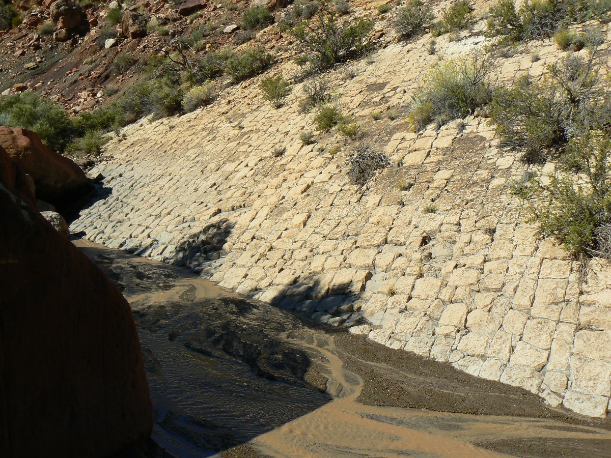
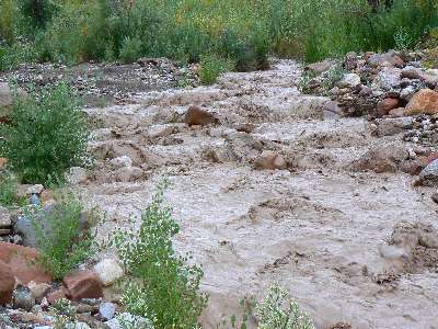
Day 3: Nankoweap Milkshake - Rain nearly all night.
And as dull and muted daylight creeps into N it's still raining and the creek
sounds much louder. How come? Apprehension. A slight pause in the pounding rain and a peek out of the tarp
tent - chocolate milkshake water has filled the regular stream bed and spilled over into the auxiliary beds,
billowing, pillowing over rocks. Rocks clatter and clink as they're rolled downstream by the torrent that more
resembles a debris flow than a stream. Rain. All day. With only a few breaks and only for a few minutes each.
Argh. Mikes tarp, a heptawing, saves the day.
| ||||
 |
 |
 |
 |
 |
 |
 |
 |
 |
Day 4: Bust out, more rain - Another camp day.
I awake to rain and so much condensation that when big raindrops hit the tent the
condensation pops into my eyes, onto my bag, all over. Easing out of the wet tent, I join the others in the rain
vigil under the tarp, watching the clouds roar over, unleashing pregnant permutations of rain. More rain.
Early afternoon and there's a break in the dysthymic day - sun! Yet, still rain
threatens and a few showers surprise us as we try to dry equipment, with little progress on the drying front.
| ||||
| ||||
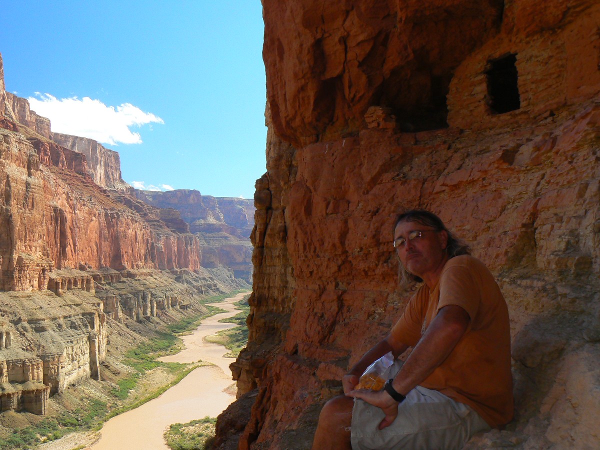
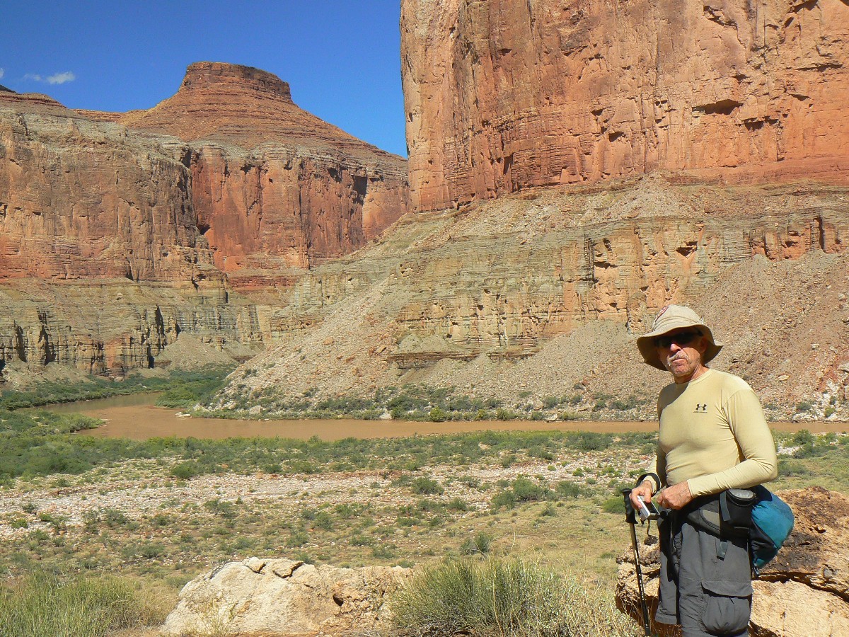
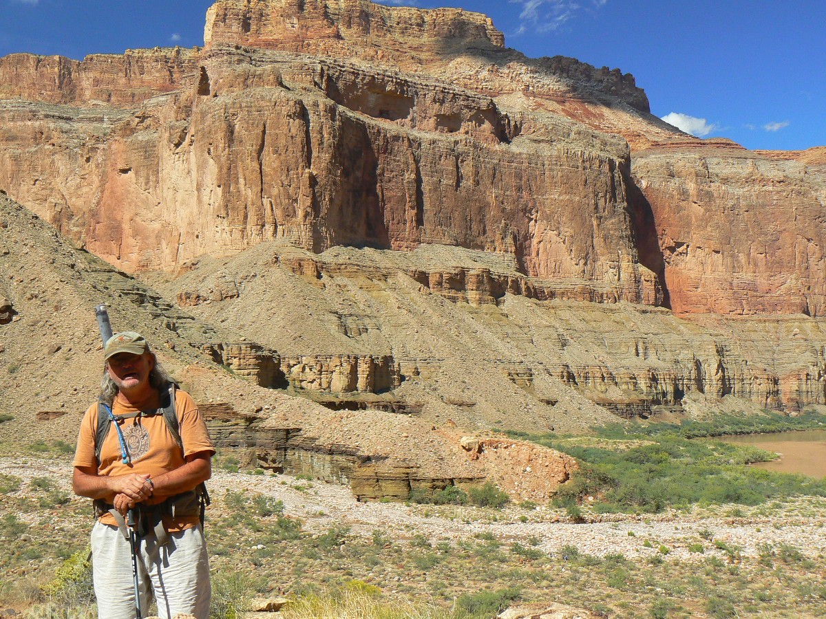
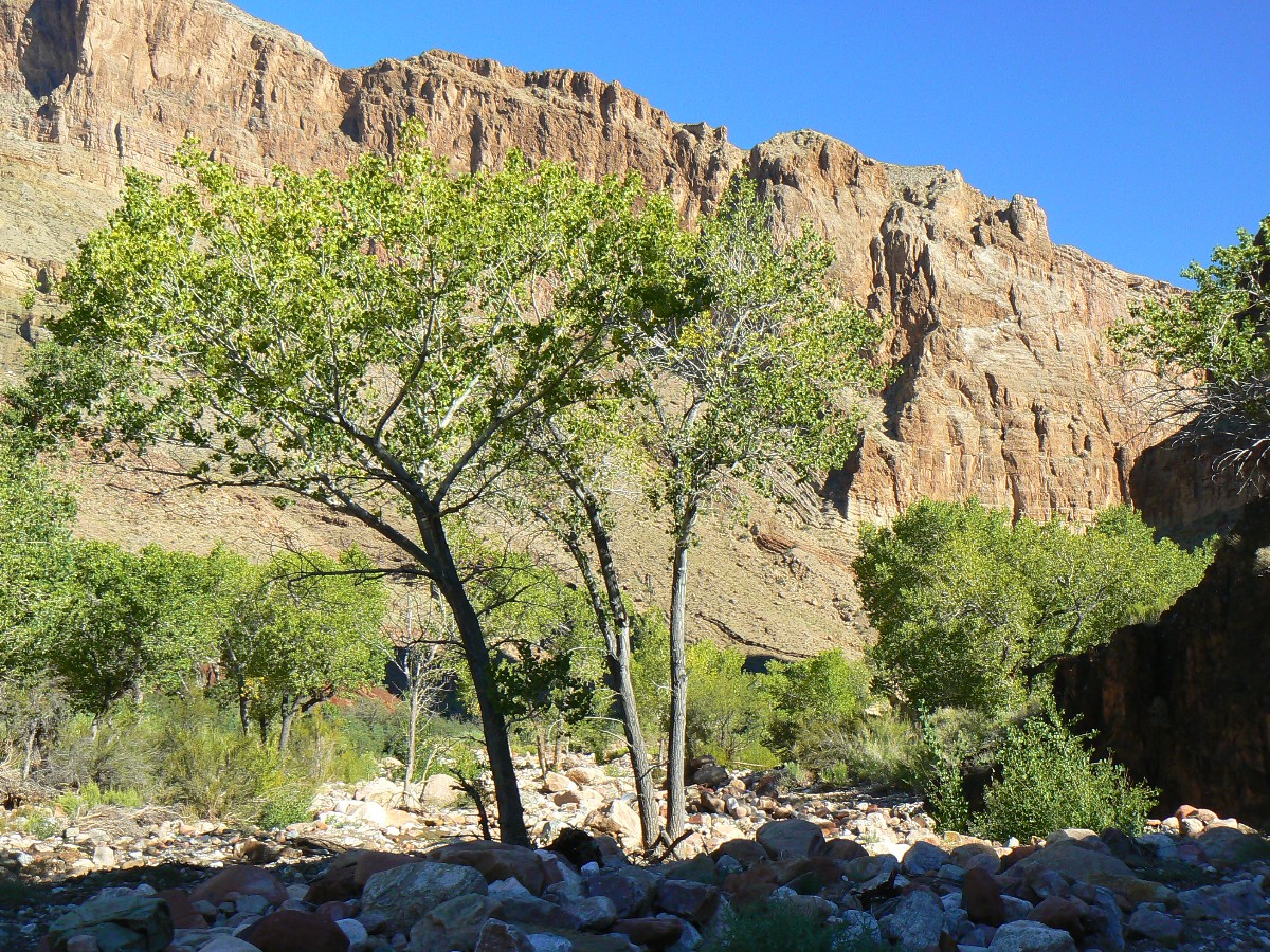
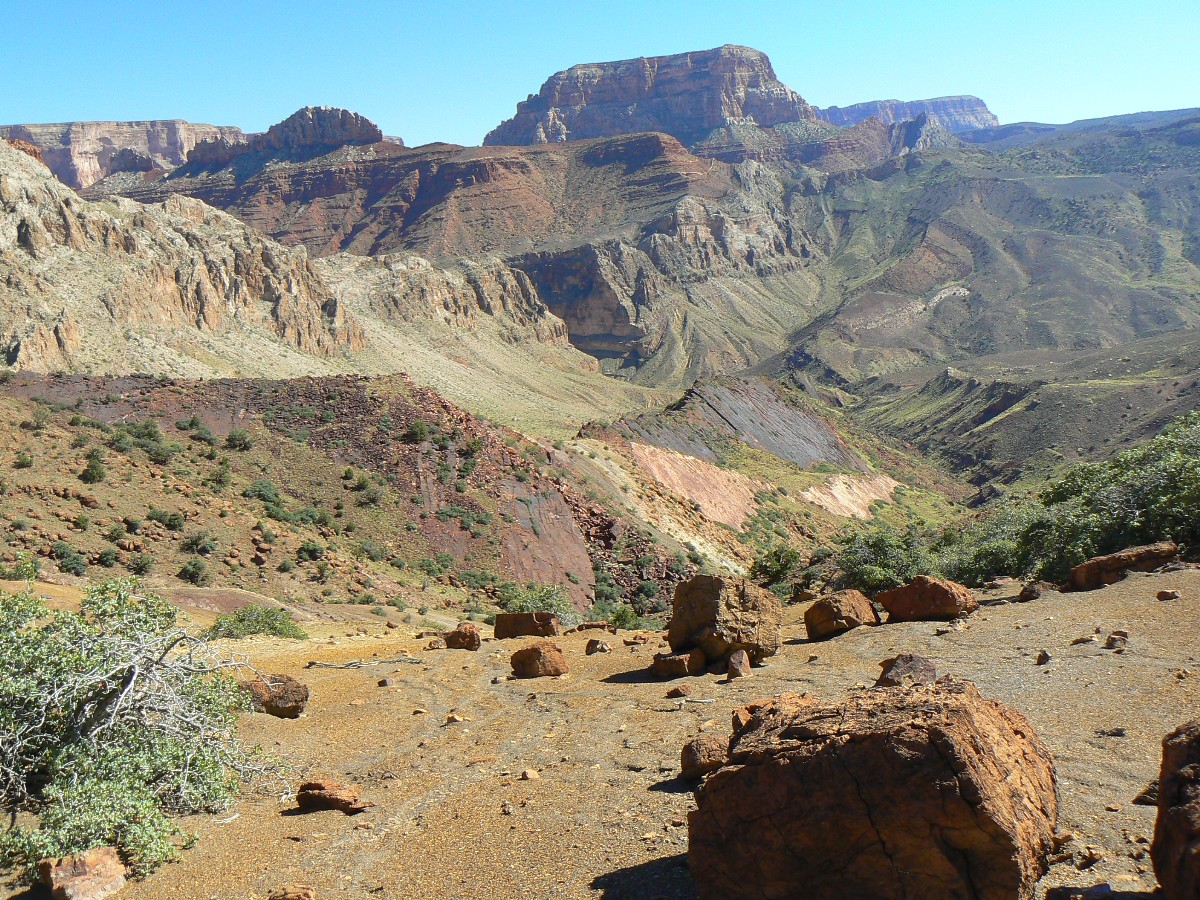
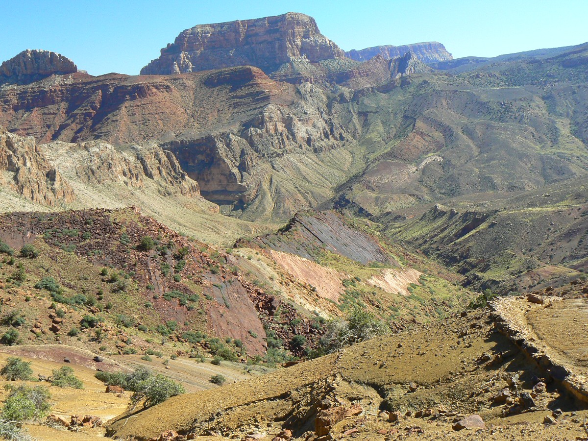
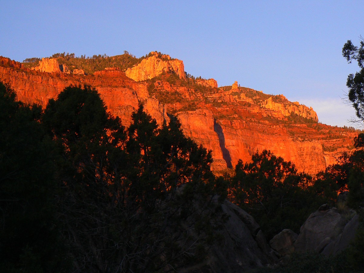
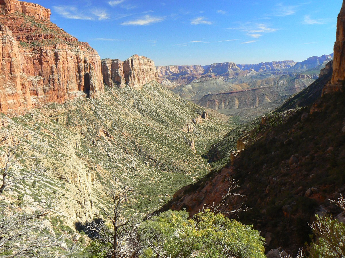
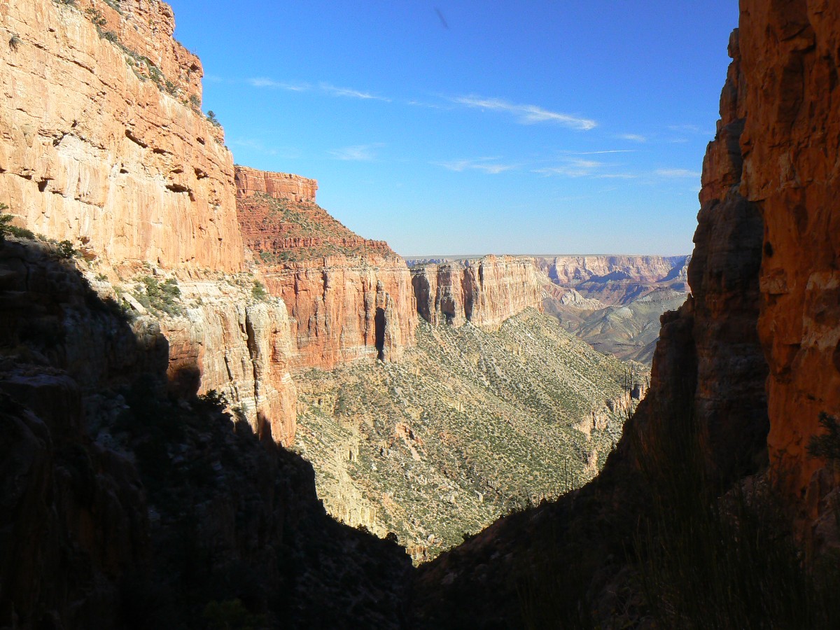
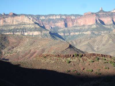
Day 5: Granary Gazing
- to the River and a visit to Little Nankoweap.
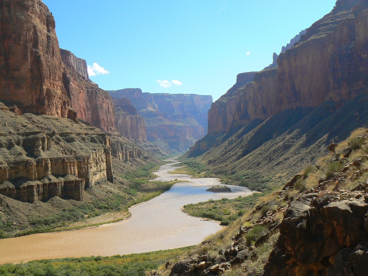
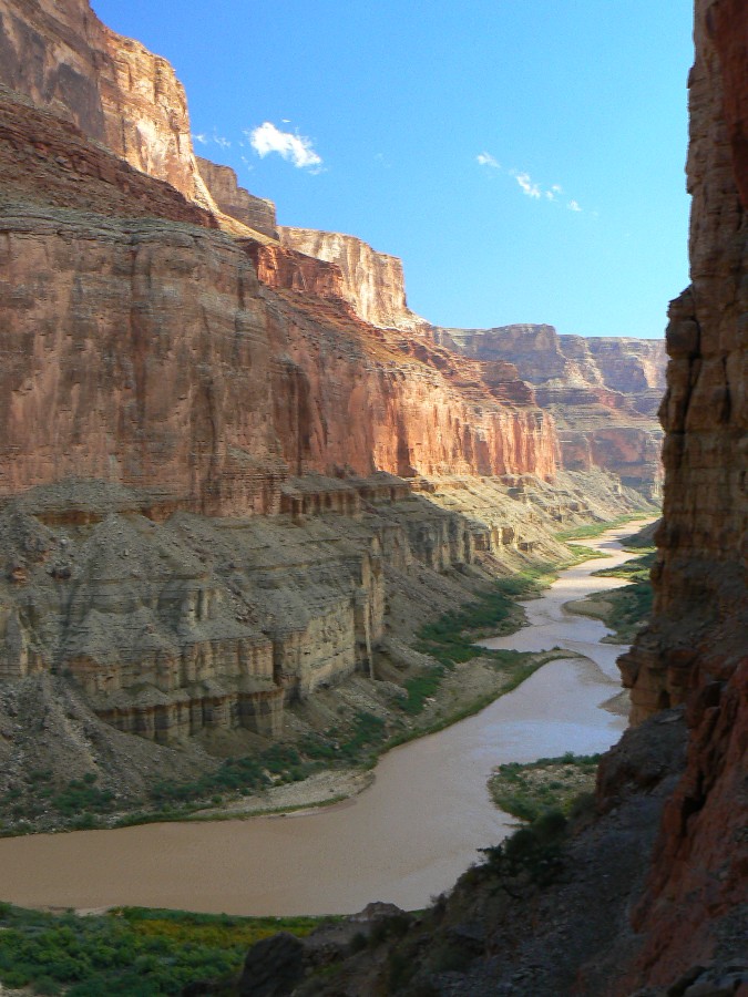
A day with clouds and sun. Nonproductive clouds, yahoo. We're walking the
high water-ravaged route to The River. The N Creek is still chocolate, but only a bit higher than seems typical.
We couldn't have done this hike yesterday, or the day before
Traps of quicksand bath our boots but present no major problems.
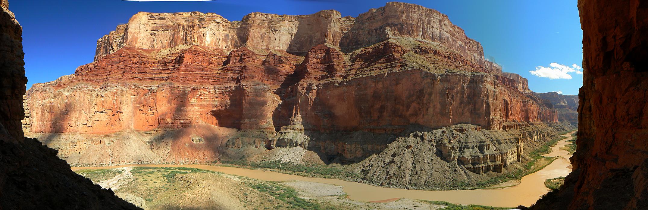
Gazing at the steepest section of canyon wall across The River from the N granaries,
we enjoy a lounging lunch and views of a chocolate river. Then, over to Little N, where we scramble up to where the
Little N forks before running out of hiking time. Doug reports that there is a (or are) petro boulder up the right
fork (looking up canyon) - Supai boulders on top of the Redwall - suggesting an ancient route to the rim (Boundary Ridge).
But not today because as it is, we hurry back to a dark camp - dark enough that Mike walks a good deal beyond camp
before correcting course.
A brisk wind clears the lenticular clouds and billions and billions of stars appear.
| ||||
 |
 |
 |
 |
 |
 |
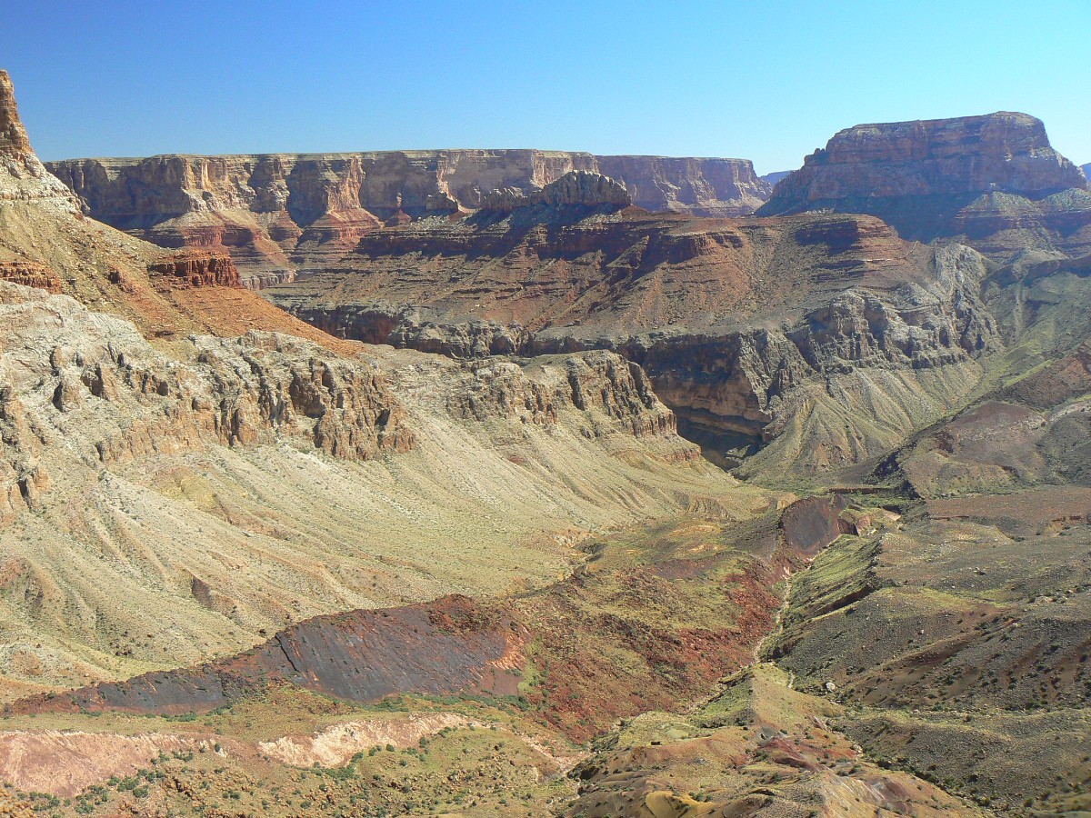
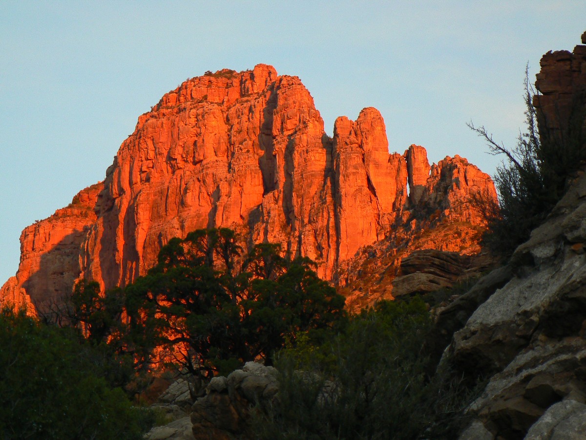
Day 6: Butte Bound - To Nankoweap Butte.
The sky dart cleaves the air with a "shhoooosh" and barrel rolls elegantly past my
head as I pensively sit on the summit block of Nankoweap Butte. A swift Swift. It's a brief yet welcome pause from
the cacophony created by terrorist-supporting, global climate change producing, health care cost increasing, destroyers
of natural quiet, and producers of visual pollution, greed-driven air tourons, and I can hear the knife edge wings of
Swifts cut past the butte.
I came up the West side of N Butte, starting up the drainage going East just before
the spring about a mile up from N Creek proper. While on top, I hear, then see a large group of rafters walking over
the saddle to the East and into Kwagunt, and I think "I could loop around and return to camp via this route" - which
I do, losing my way a few times and not finding much of the old route.
My knees creek as I relish in a bucket bath and the close of our first sunny day of
this trip.
| ||||
 |
 |
 |
 |
 |
 |
 |
 |
 |
 |
 |
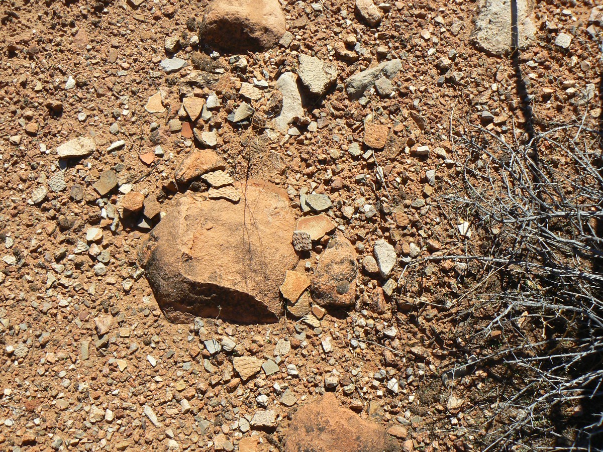 |
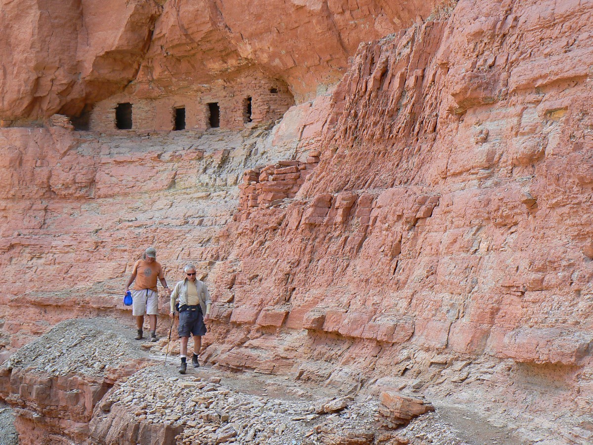
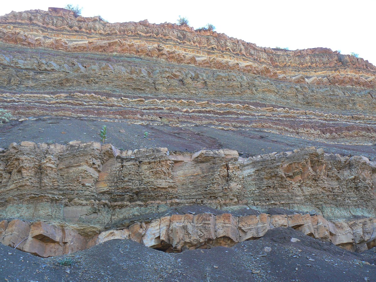
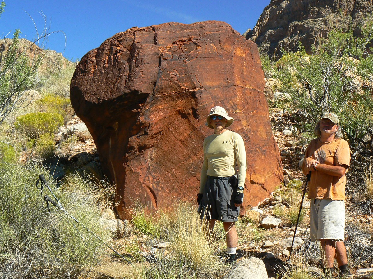
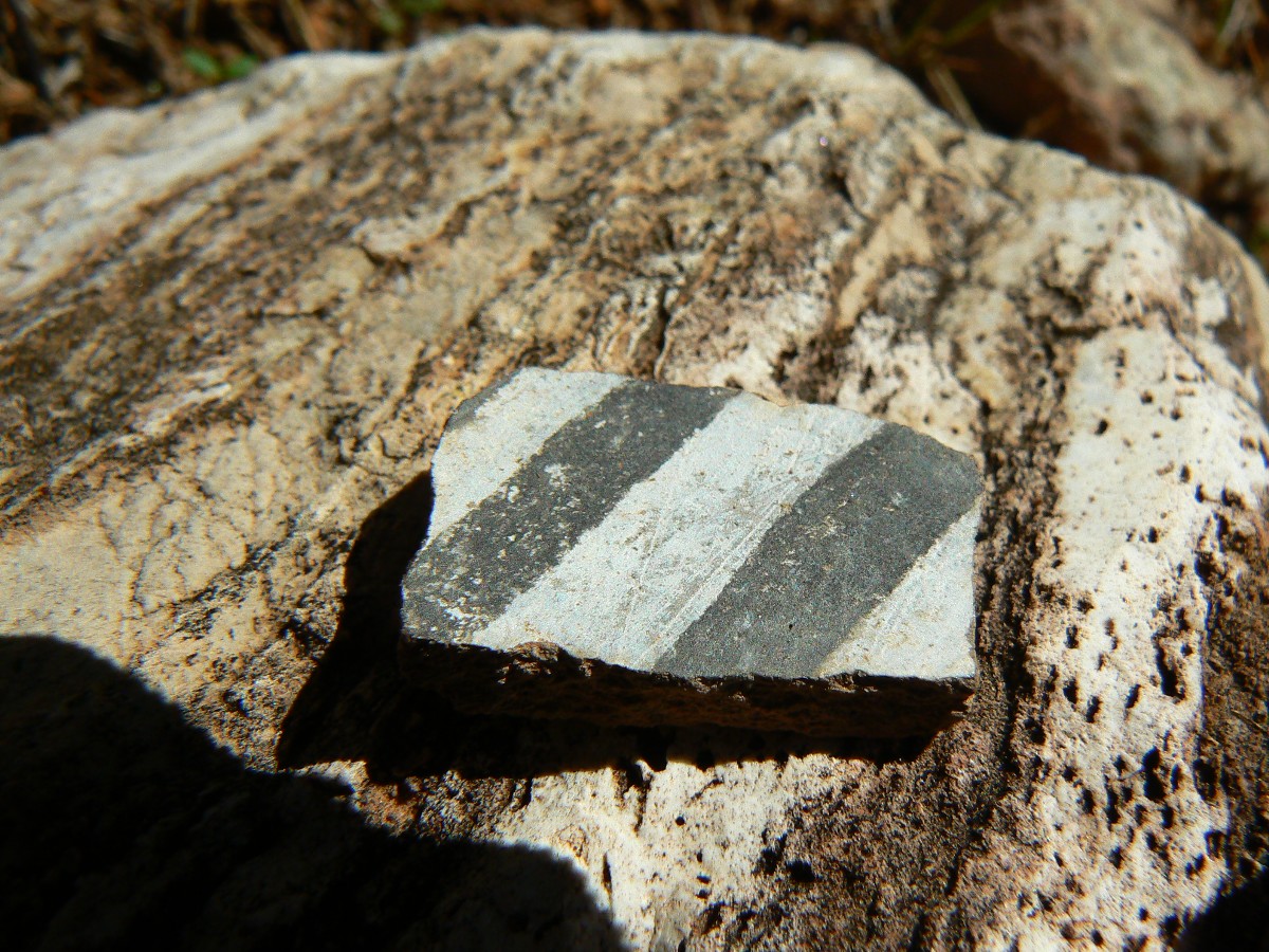
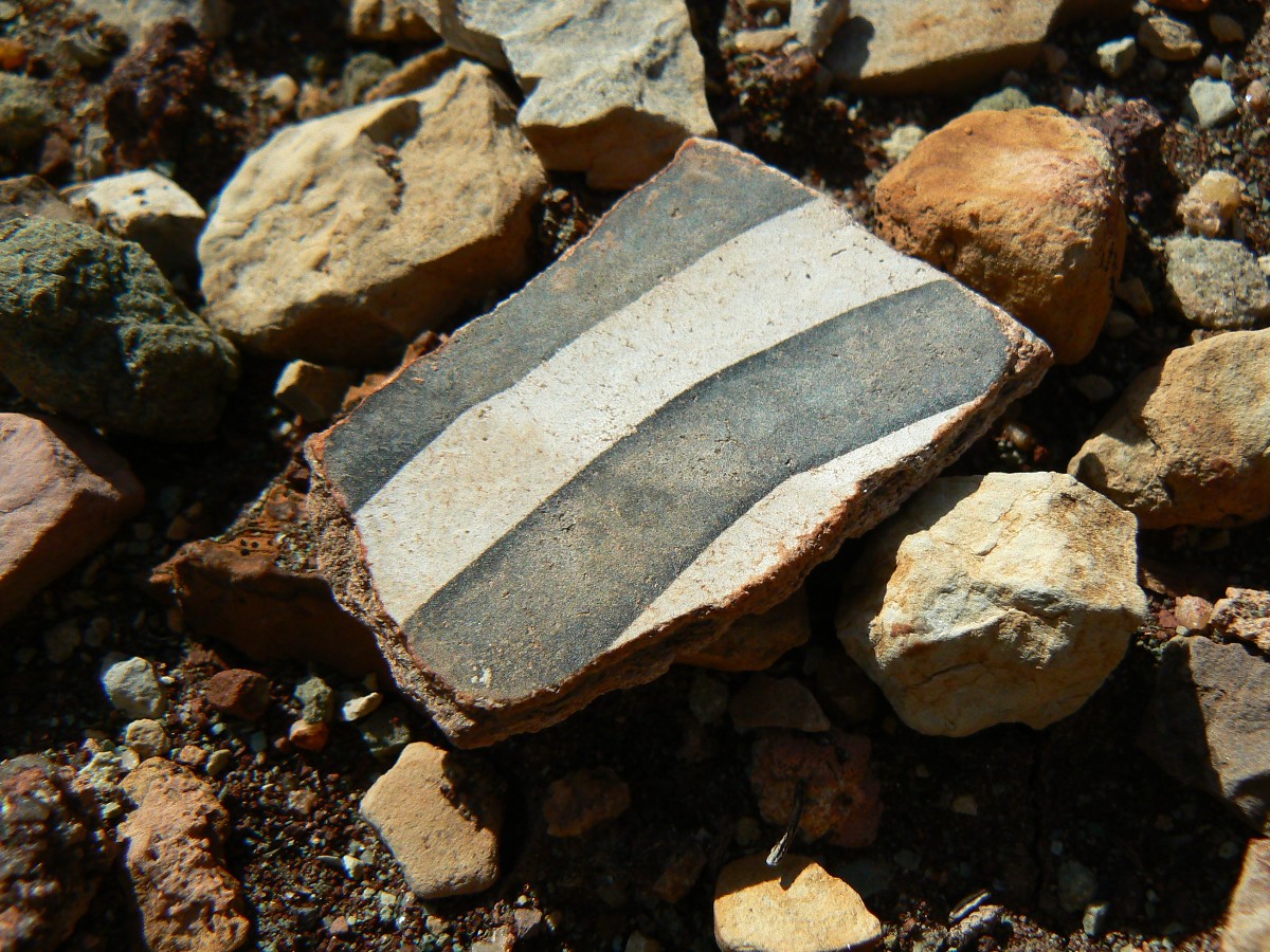
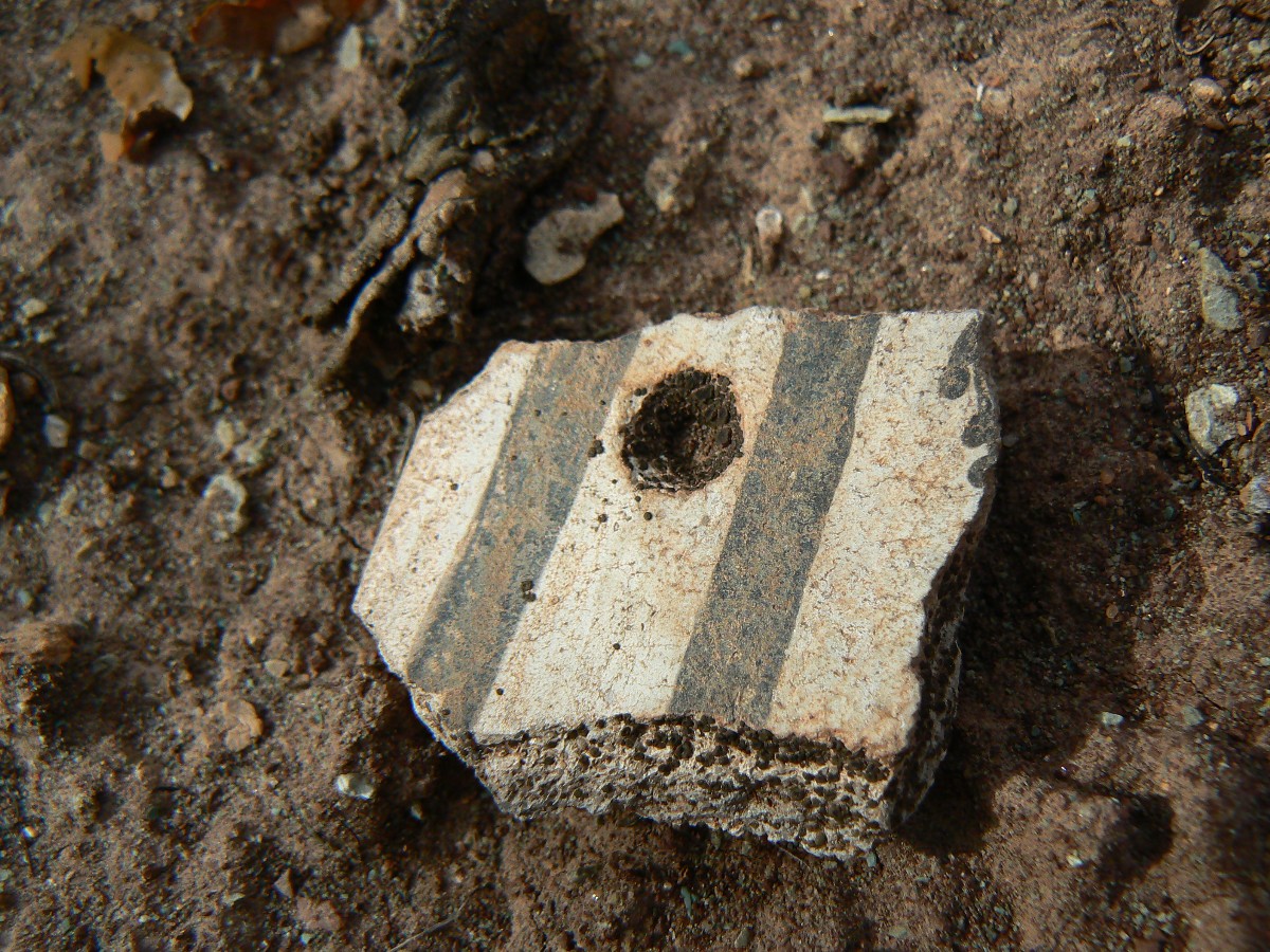
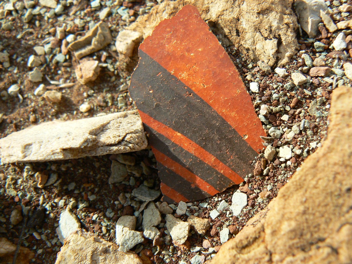
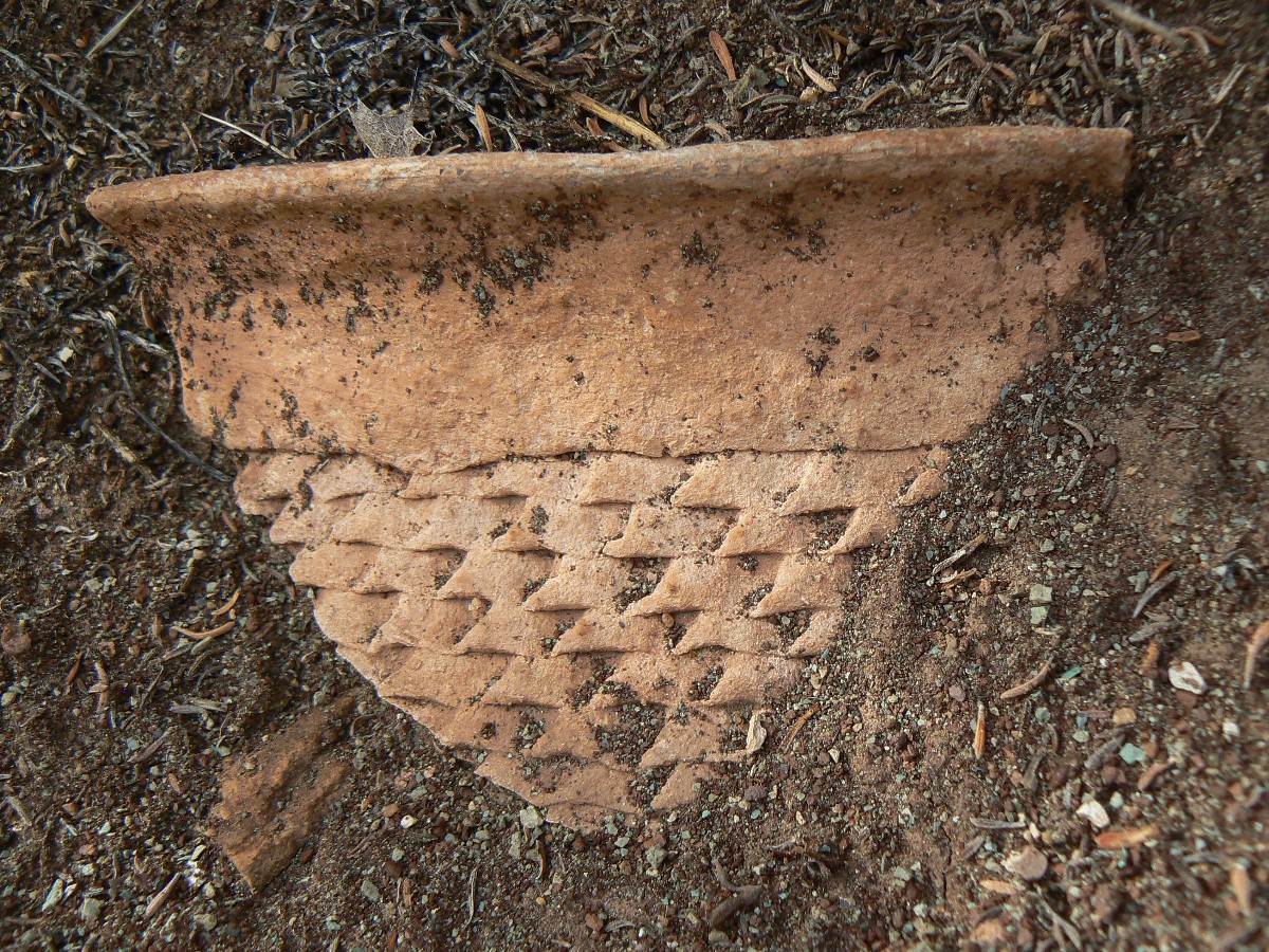
Day 7: Shards and Such
- to Marion/Seiber - Mystic Falls junction (historic Walcott camp and spring).
"A pot rim - a corrugated pottery shard with rim! Here's another! Wow, a black
on red with a hole for attaching a carrying strap." I exclaim over the bellicose high decibel clatter and drone of
the nearly continuous conveyor belt of fossil fools hastening the destruction of this, what's left of Eaarth
(spelling by Bill McKibben), our only Eaarth, and unambiguously decimating natural quiet in this supposedly
wilderness zone called Nankoweap.
We're somewhere above the spring in the arm leading to Marion/Seiber - Mystic
Falls junction and on a side hill scattered with square building blocks of the Hopi's ancestor's homes.
Earlier, in our search for a petro boulder near the main N channel, we stumble
across two sets of surface ruins - also decorated with pot shards of various construction. Probably, the variety
of pottery shards is a result of trading among native peoples. What else explains the diversity of pottery types
in a small area?
Pausing for lunch at the spring half way to camp, the 3800' spring, a Sharp-shinned
forest hawk swoops in, setting off alarm calls from a resident flicker.
We camp on the nose, near the point wall of the "y" between Marion and Majestic,
the end of Seiber Ridge, and about twenty feet above stream level, with good water trickling down the Mystic arm.
Cool, then cold air settles down the drainage as we dine on Chef Mike's soup. We're about 4 miles and 1000' up from
camp, at 4600'.
| ||||
 |
 |
 |
 |
 |
 |
 |
 |
 |
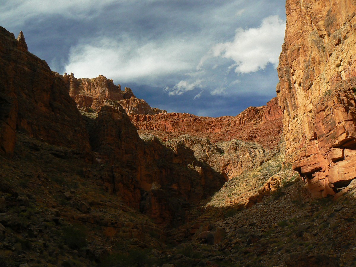
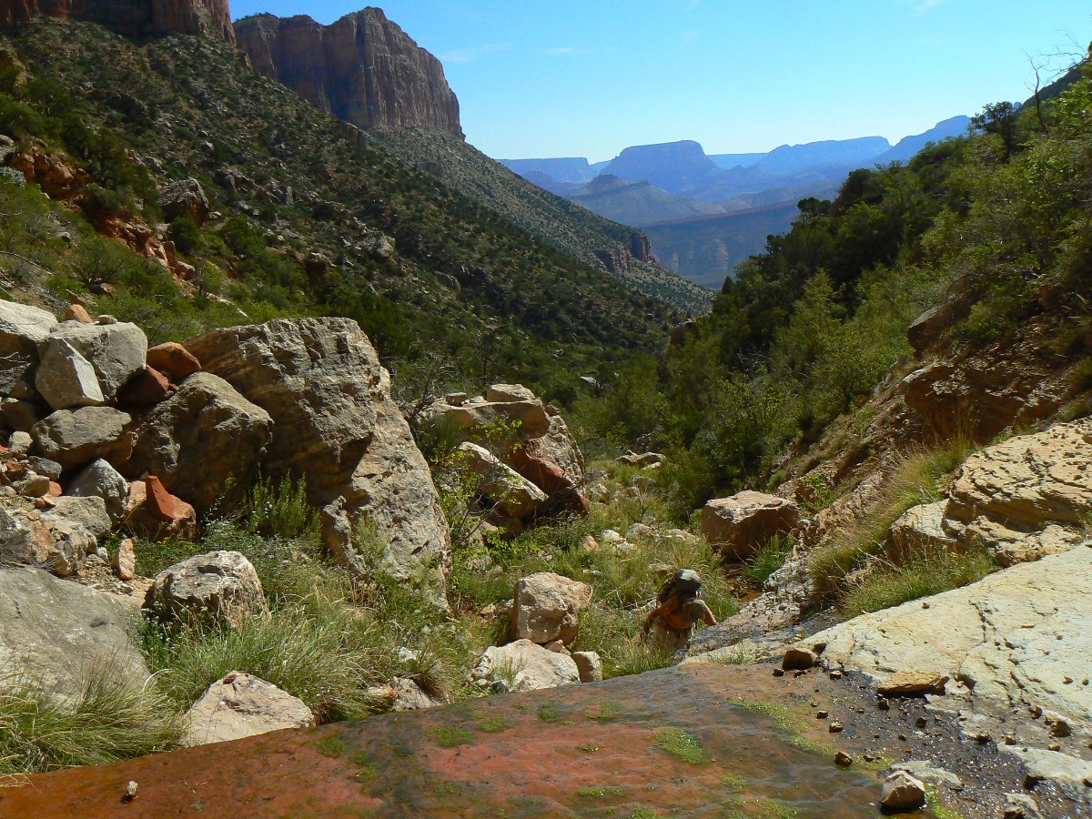
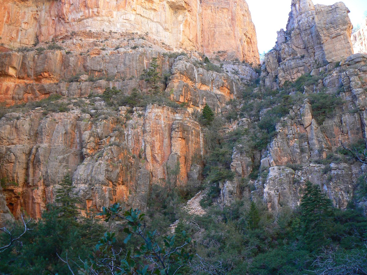
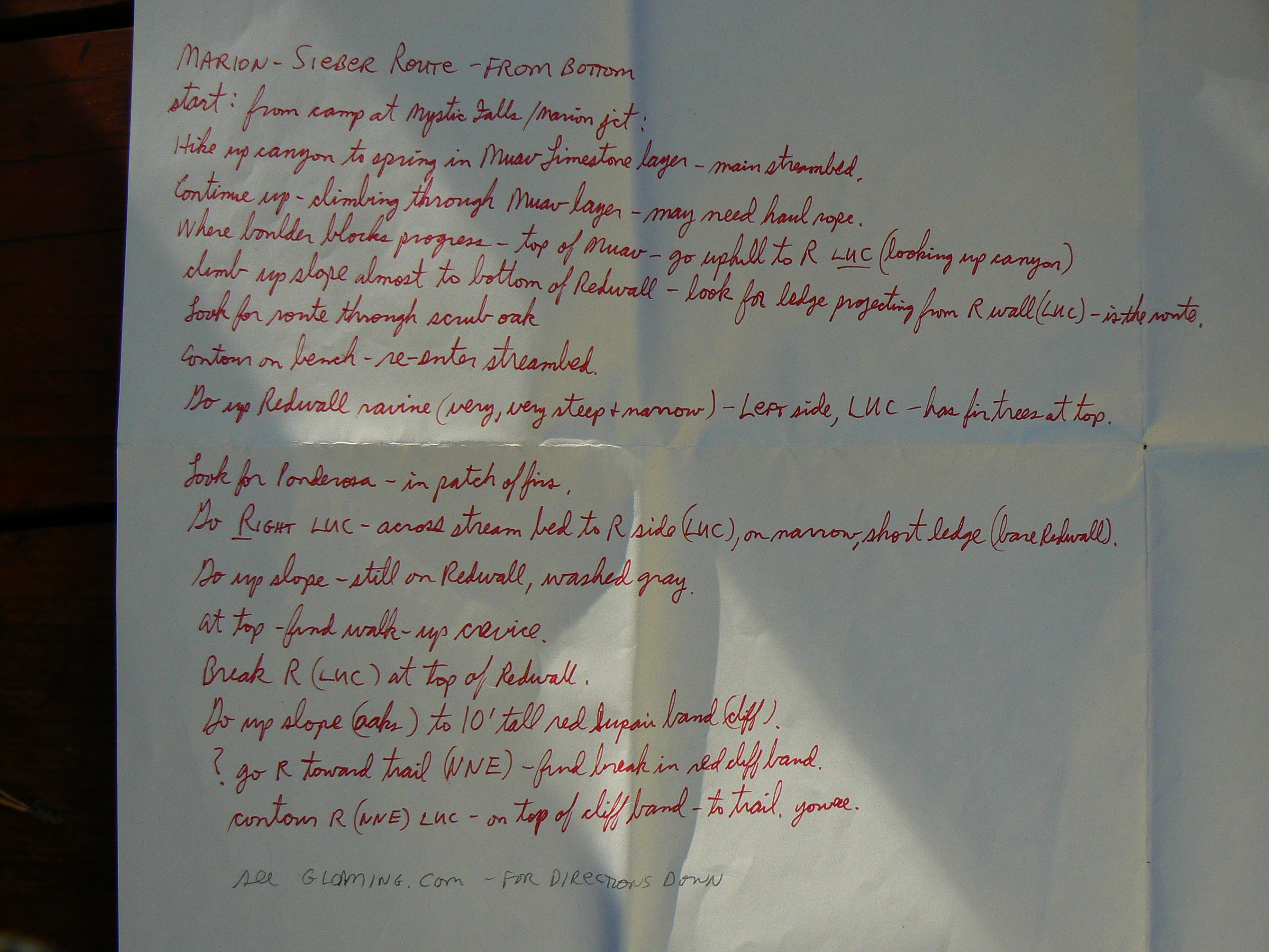
Day 8: Hello Marion - Up the Marion-Seiber Route.
The route goes up steeply and then even more steeply. Doug calls it very,
very steep and notes that many call it the "free-fall route." It is. Coming down, it would be like a stroll
into the Abyss, an abyss cluttered with leg-smashing oak and assorted other brush. Then, there are the climby
sections (bring a haul rope) through the Muav layer. Some sections feel like a prehensile tail would do. Others
are a bit confusing - this is not an organized or a developed route.
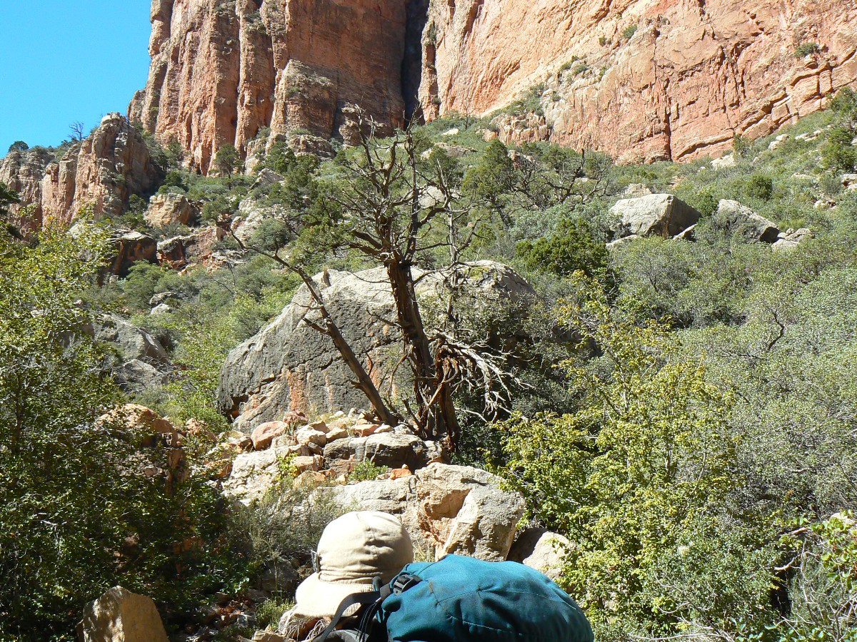
At the top of the Redwall, more uncertainty - as we claw through oak brush, a 15'
red rampart blocks the way. Searching left, Doug, and right, Mike - Mike finds a break, complemented with a climbing
dead tree and up we go. From here, it's a short lateral to the trail, which we acquire not far from the remote TH.
Dusk falls on us as we throw camp into place, retrieve the food, water, and fuel
cache and start a welcome fire as dark engulfs us and temps fall.
 |
 |
 |
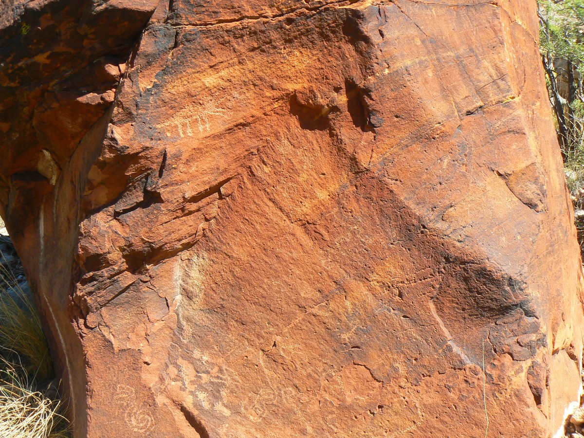
Day 9: Picto Surprise - return to Saddle Mtn. TH and home.
The ochre pictos dance under the minimal overhang, demanding ogling.
Wow - how did I miss them the last three times I walked beneath them? We're nearly out to the Saddle Mtn. TH,
where we snack on all foods left in Doug's vehicle, then head back to Flagstaff and from there our various homes,
thoughts of nougats of Nankoweap bouncing in our minds' eyes as we bump down the rain-damaged House Rock Valley Road.
| ||||
For a description of the so-called "Freefall" Route, that is, the Marion-Seiber Route - look at Doug's Nankoweap page.
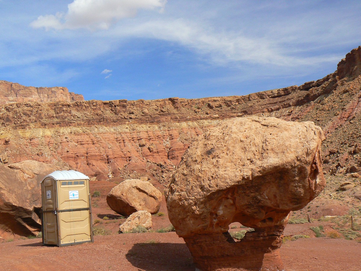
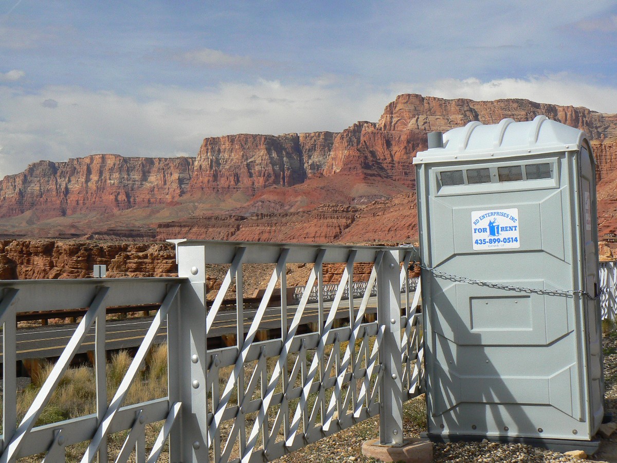
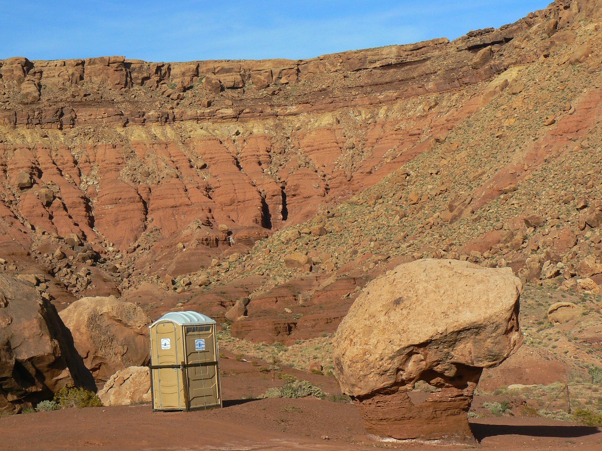
Scenic Toilets of The Chocolate Nougat Nankoweap
Maps:
| ||||
for a full-resolution map, click here. Caution - do not use this map or gps track for navigating the route.
Sites:
Click here to enjoy the first Nanko report: Gnarly Nankoweap (2008)
my attempt to describe the Marion-Seiber Route from the bottom
Powerpoint of tornado damage near Bellmont from the storm system.
Movies:
Click here to: see a Movie of Nankoweap Chocolate Nougat - 26 MB.
Movie of waterfalls off the Redwall - 6 MB.
link to a YouTube Nankoweap video by Mike.
link to another YouTube Nankoweap video by Mike.
link to a YouTube Nankoweap video by Rob - same as first movie in this series.
Movie by Doug from Nankoweap Mesa - 44 MB.
Panos:
pano of the Nankoweap granaries (2418 x 700 pixels, 336 kb)
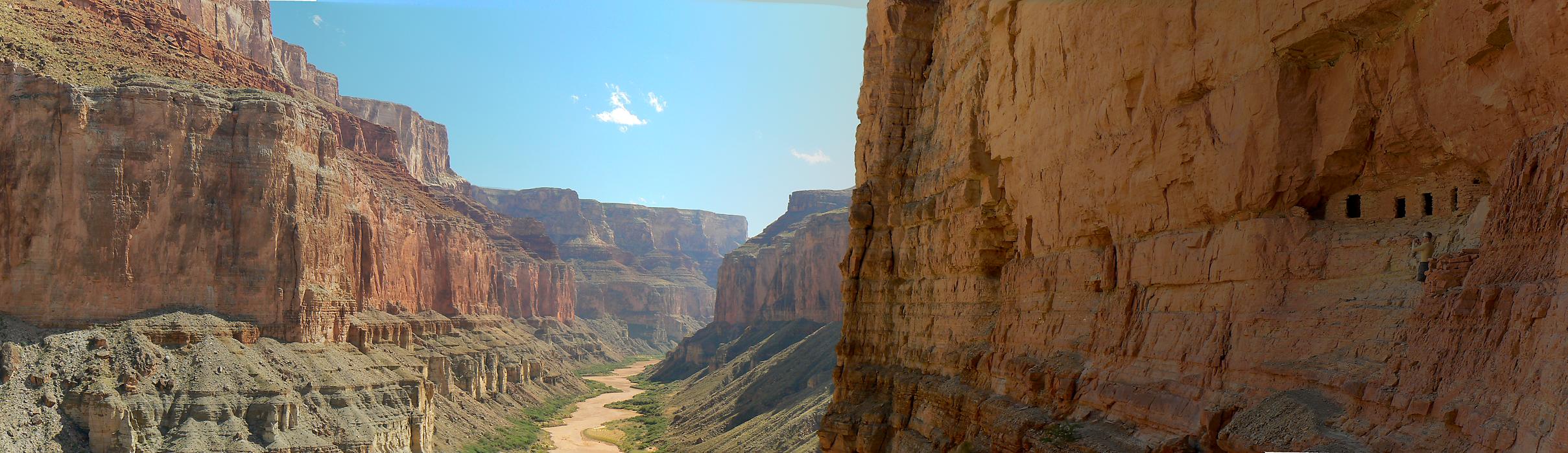
pano from the top of Nankoweap Butte (8036 x 700 pixels, 1.5 mb)
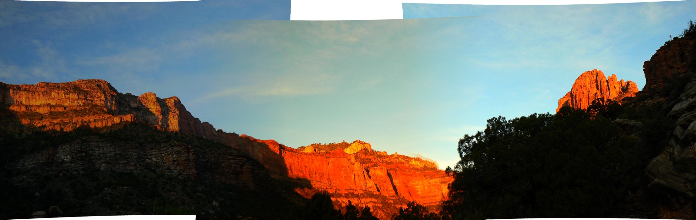
pano of Marion Point (2216 x 700 pixels, 148 kb)
Other WV reports about the Grand Canyon:
Click here or on the Looking Lizard to go to all WV reports about The Grand Canyon
| ||||
Related Links:
the geology of the Grand Canyon by the NPS
Nobel Prize Awarded To Man Who Helped Humans Have More F...ing Babies The Onion, October 7, 2010 | ISSUE 46•40
STOCKHOLM—The Nobel Prize in Medicine was awarded Monday to Robert Edwards, the British in vitro fertilization pioneer who made it possible for shitloads more babies to be born on top of the half million or so daily births already dangerously stressing the planet's dwindling resources. "The long-term impact of Edwards' work is absolutely staggering," read a statement from the Nobel Assembly describing the technology that allows infertile couples to not only give birth but choose the gender and eye color of their child instead of, say, adopting one of the thousands of tsunami-orphaned children in need of a home. "We congratulate him on finding a way for rich limpdicks to achieve what nearly a million poor couples do by complete f...ing accident every day." Nobel officials also awarded the Prize in Chemistry to the inventor of Pepcid antacids, which allow people to eat twice as much goddamn food as anybody needs, and the Prize in Literature to Twilight author Stephenie Meyer, "because f... it."
| ||||
| ||||
| ||||
| ||||
|
Wild Vagabond Main |
Trip Report Index  |
Caveat  |
|---|


