|
|---|
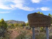
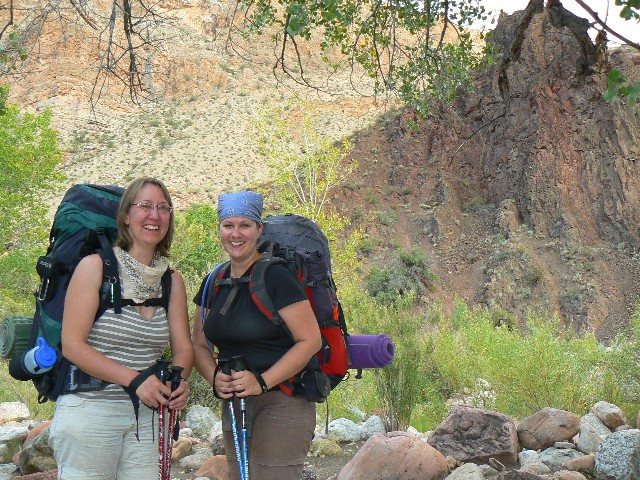
Day 1 at the TH
(Click the image for a full-size view)
|
|---|
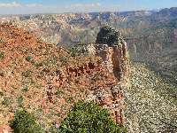
|
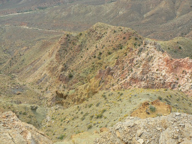
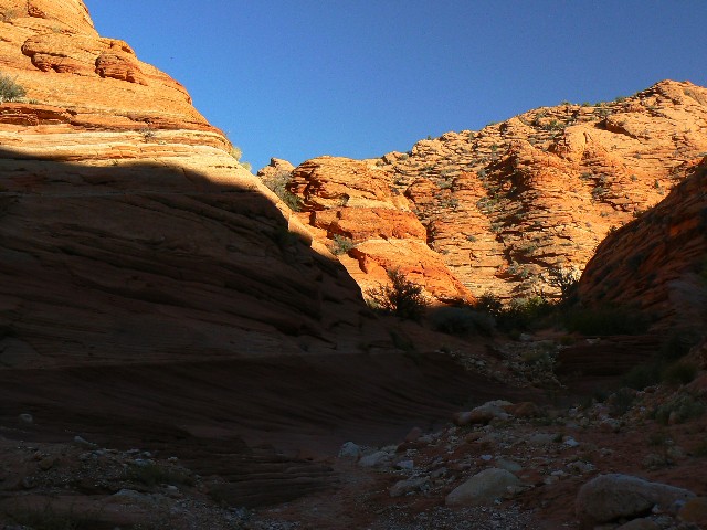
|---|
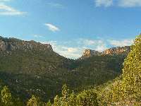
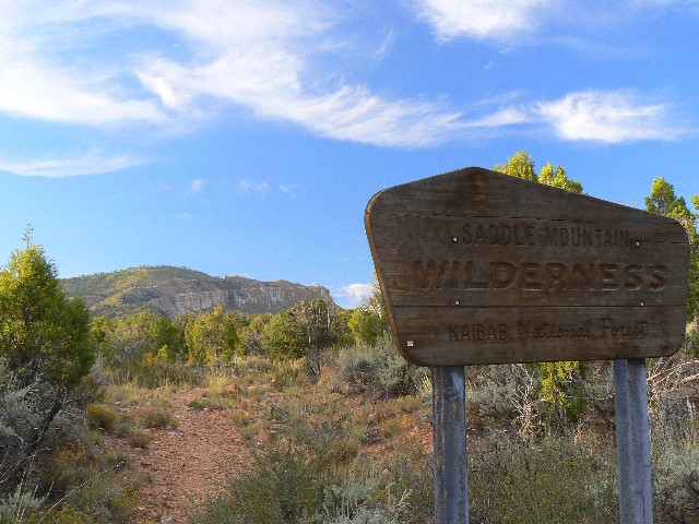
Saddle Mtn.
(Click the image for a full-size view)
|
|---|
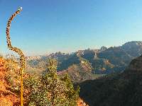
|
|
|---|
Pass at Saddle Mtn.
(Click the image for a full-size view)
|
|---|
|
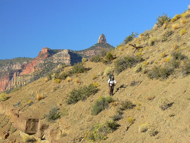
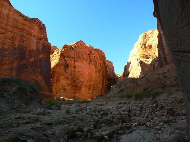
|
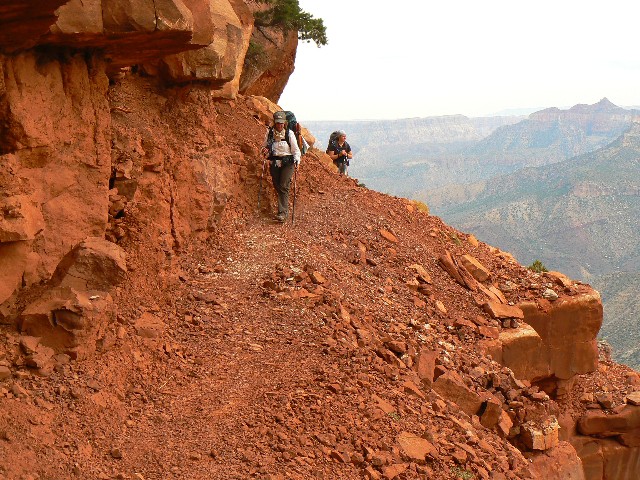
|---|
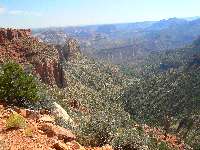
Starting down - into the park
(Click the image for a full-size view)
|
|---|
|
|
|---|
Marion Point
(Click the image for a full-size view)
|
|---|
|
|
|---|
Marion Pt. View
(Click the image for a full-size view)
|
|---|
|
(There are - More photos below the trip narrative.)
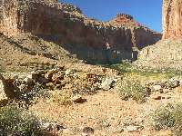
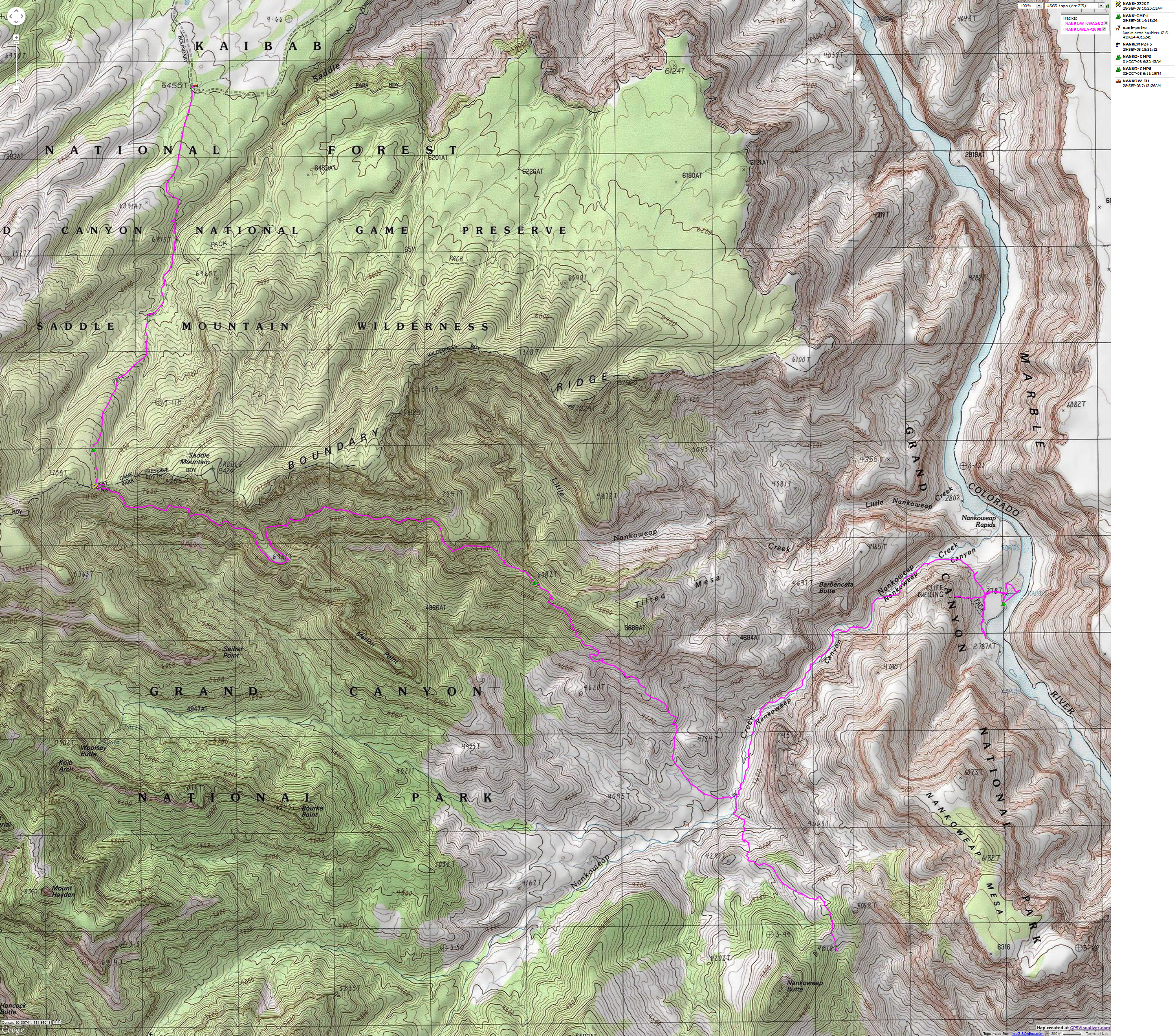
Day 1: Over the saddle: House Rock Valley
TH to Tilted Mesa; 8.1 miles, ERM of 15 (approx. 1900' ascent and 2300' descent
over 8.1 miles).
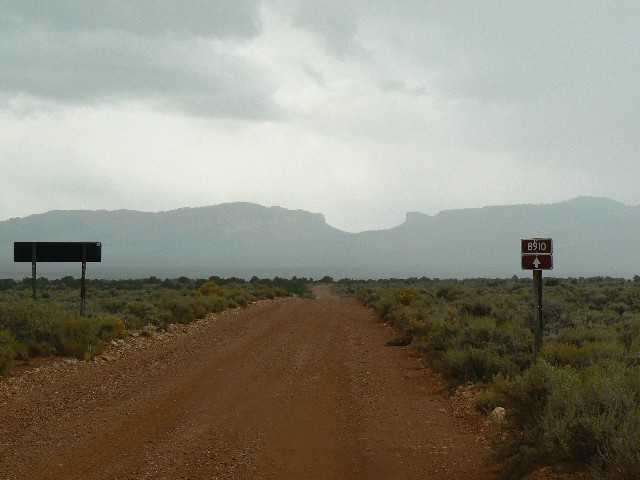
(Previous day) The drive into the Saddle Mountain TH,
via House Rock
Valley Road, is nearly 30 miles of good dirt and gravel. Good, but a lot of it. I meet
the lovelies Sonia and Marine at the TH and we gaze at the saddle while enjoying dinner.
Sonia is the permit-holder, and has graciously invited me along on this adventure.
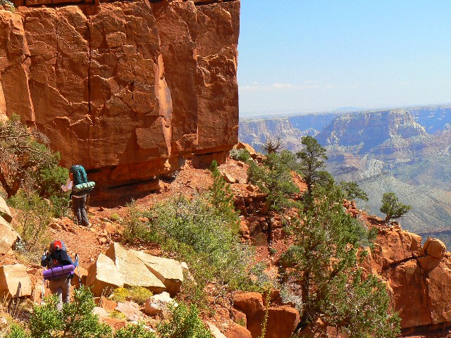
(Back to Day 1) The view of buttes and open space explodes
as we
reach the saddle, yoweee, 3.5 miles and 1200' up (and 400' elevation loss along the way).
Through the bits of P-Pines, juniper, Pinyon Pine - air tour conveyor belt noise
pollution assaults us as we pause for a snack at the junction of Trail 57 on the
Kaibab NF and the park boundary. It's a corner of Trail 57 where all the routes
converge at the saddle. Symmetry on the map. (Martine later counts over 30 helicopters
and several more airplanes in one day.)
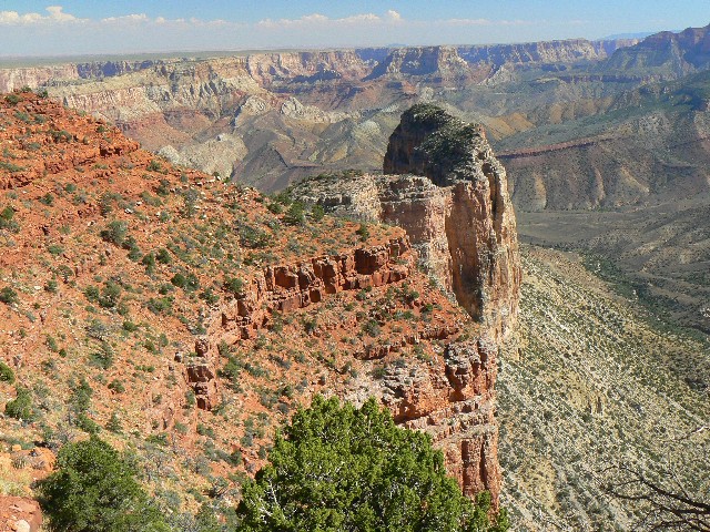
It's very slow going to Marion Point, where there
is an angled place for a camp. At least sort-of (I would not wish to camp here).
Sonia stashes her second water cache (the 1st was at the saddle) of 1.5 liters.
Everything is in liters to these French-Canadians from the land to the North.
Accurate. The trail is barely edged into the rock bands. We pass scary parts and
swing into a cove, where there is a pygmy forest, in the shade of the declining sun.
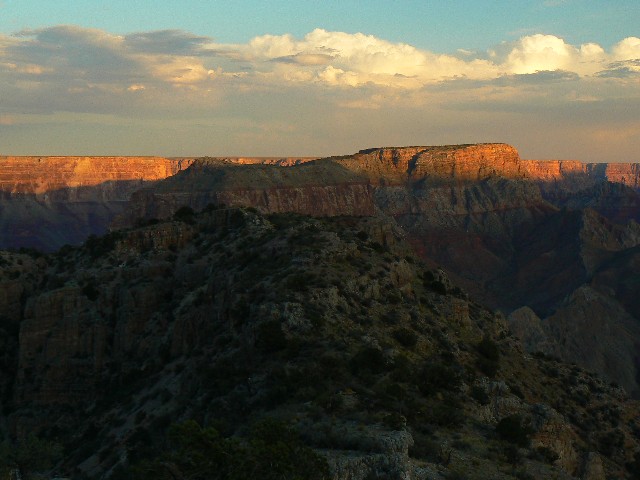
Undulating to Tilted Mesa, the day grows late as my
feet grow flat. Noting our slow progress, I go on ahead and find a camp, then continue
on and find another - looking for the best there is. I stopped as the Redwall takes
over and cache my extra gallon of water. The clouds begin to obscure the gathering stars.
Lightning showers down with two brief rain gusts.
We, the women and I, have camped separately because I went farther along toward Tilted
Mesa and they camped at the first decent camp with the engulfing darkness. We are
fortunate to be in the gnarly Nankoweap of the Grand Canyon. It's beyond the
crepuscular as the wind calms and the stars again fill the canopy.
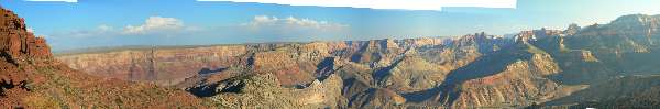
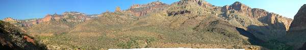
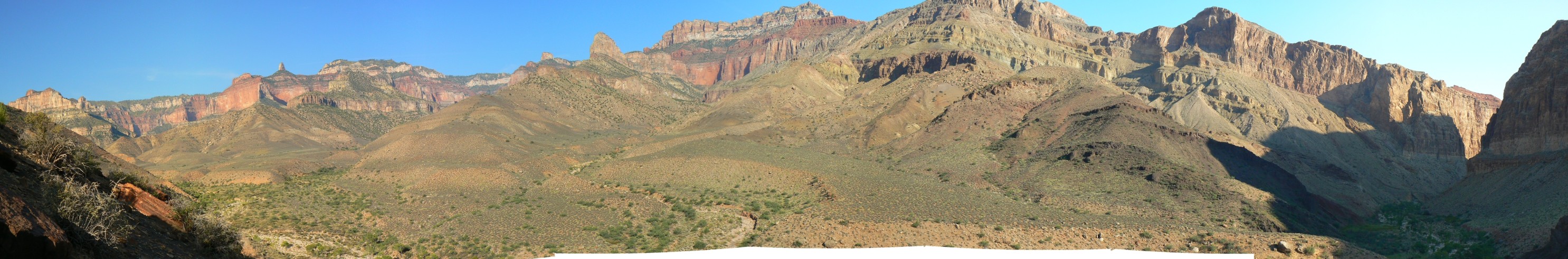
|
|---|
pano from trail, with Tilted Mesa low left center
(at base of red slope) - scroll
L-R to view it all (2966 pixels wide, 384kb)
(Click the image for the full-size image)
|
|---|
|
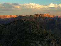
|
|---|
day 1 Tilted Mesa sunset
(Click the image for a full-size view)
|
|---|

|
|---|
Day 2- sliding off Tilted Mesa
(Click the image for a full-size view)
|
|---|
|
|
|---|
Day 2- Nankoweap Lounging
(Click the image for a full-size view)
|
|---|
|
(There are - More photos below the trip narrative.)
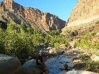
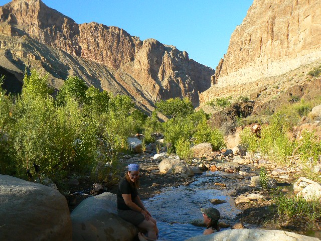
Day 2: Nankoweap Lounging
- to Nankoweap Creek and a field of springs. 3 miles, 7 ERM.
Gurgling, burbling, Nankoweap Creek courses
through the boulders and across the sand as I cook last night's dinner for lunch.
Cottonwoods and fresh water - deluxe.
The trials of the edge trail yesterday and the steep
slippery ball-bearing vigilance slide of today eases into nothingness in this garden
zen of the North Rim country. It's quite warm today, and when we arrived, I rolled
in a deep spot in the fresh waters of Nankoweap like a dog in horse manure.
Is the option of camping at the boundary
(TR 57 and NPS boundary) and then rambling to water (here) better than a dry camp
at Tilted Mesa or near Marion Point? A beckoning question. Yet for now all I
can say is - Nankoweap, delightful.

|
|---|
day 3 Hiking Nankoweap
(Click the image for a full-size view)
|
|---|

|
|---|
Day 3 - almost to the river
(Click the image for a full-size view)
|
|---|
|

|
|---|
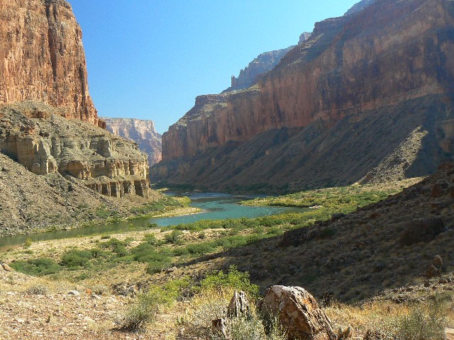
Day 3- looking down river
(Click the image for a full-size view)
|
|---|
|
(There are - More photos below the trip narrative.)
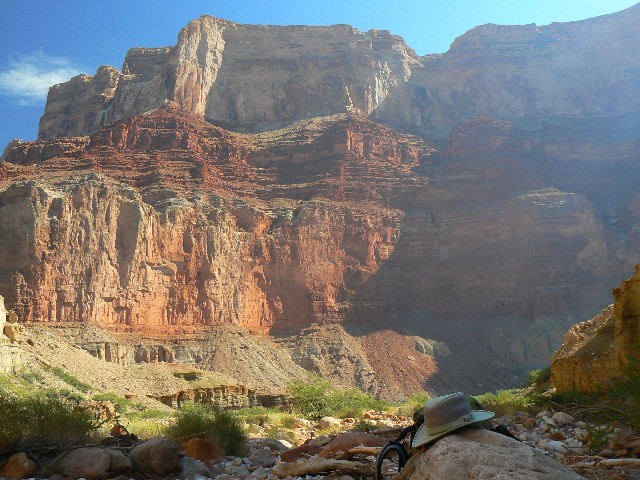
Day 3: The River, 3 miles, 5 ERM.
Non-social rafters fail to ruin the day.
Redwall glows as we enjoy dappled shade on a
Nankoweap/Colorado beach. The constant video of Spanish Armada rafterians entertain
Sonia, nearly as well as MTV does for teens. Beyond cold water cools the ambient air
and creatures, including us, who begin to pop out for dinner. Refreshing.
We started from the deluxe camp at the foot of
the trail in Nankoweap Creek and wandered through brush and river boulders,
suddenly encountering two stampedes of rafters heading up Nankoweap and across
to Kwagunt - to be retrieved by other rafters from the mouth of Kwagunt Canyon.
Silence returns. Ahh.
On we wander, eventually reaching the spill-out
past the ramparts. Hiding in the freckled shade, we slip out into the broasting
sun for a frigid bath and to find the surface ruins, and to attempt to talk with
taciturn boaters at the main beach - then retreat to the upper beach and are there
when the Maryland group rolls in with beer but no other offerings. And, we had
gregariously shared our private beach too. Oddly, this dour group had bragged to
us about how they had contracted a Flagstaff-based group to organize their equipment
and food, reporting that they had "So very much food they could not eat it all."
Like bushco, the wealth is only for the wealthy. Despicable.
The granaries watch like spectacles from afar
as crepuscular brown bats and their feathered compadres start play time. We're
near 2800' in elevation, way down from a high of 7300' in the saddle near Saddle
Mountain. Of course, much of this elevation is lost, regained, lost again, etc.
along this uneven trail and route. Undulational.
Despite strong hints, we are not offered food,
yet do acquire three cans of luscious beer. (No, I am not obsessing about food.
Not at all, despite dreaming of smothered burritos and cool melons, other melons).
The cool wafts of evening air compliment billions and billions of stars. And,
it's so lovely to sleep clean after the grimy night at Tilted Mesa. The
guide says it's 90 minutes from camp to river - while our time is twice that.
Sweet evening air drifts along the Colorado
corridor, engulfing us with a refreshing pneumatic ablution. Restorative.
|
|---|
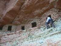
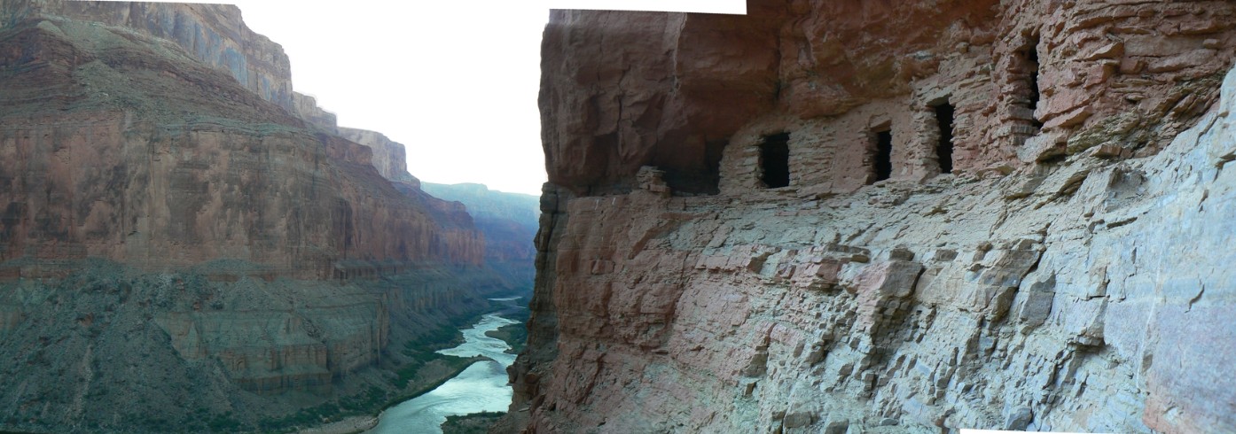
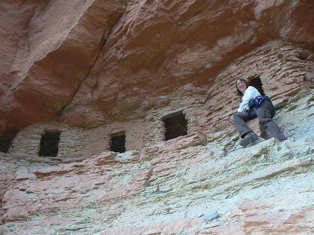
day 3 pueblo ruin
(Click the image for a full-size view)
|
|---|

|
|---|
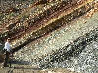
Day 3 why check your boots?
(Click the image for a full-size view)
|
|---|
|

|
|---|
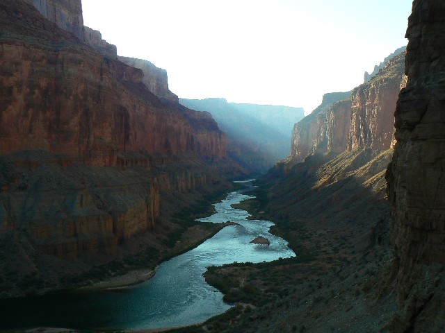
Day 4 - looking down river
(Click the image for a full-size view)
|
|---|
|
(There are - More photos below the trip narrative.)
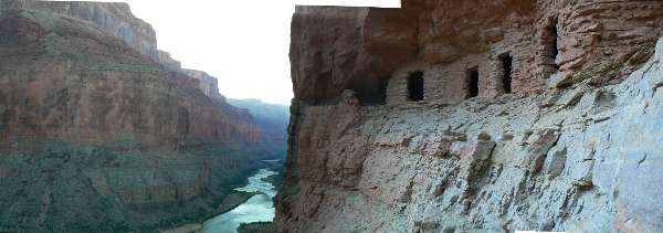
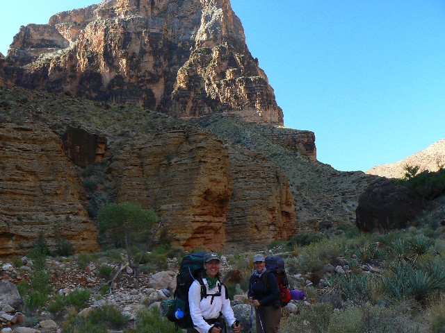
Day 4: Granary Gazing, return to Nankoweap,
3 miles, 5 ERM.
Ancient aura arises from pueblo-era granaries and
drifts over us as we watch the sun rays peek into the canyon of the Colorado. Canyon
vistas from high up, yet from the bottom of the soaring Redwall layer. Then, back to
pack and, with the intruding sun, begin the rock walk to Nankoweap camp. Shocks of
shade save the day. We meet Eric and Michelle from Wisconsin - hiking down the Nankoweap,
and planning to cross the river at the Little Colorado and hike the Beamer and then the
Tanner Trails. Yikes. And, this is their first GC hike? Lovely.
Female French voices murmur up from the glissading
Nankoweap Creek as I doze from too much lunch. Again, we're enjoying the deluxe delight
of Nankoweap Creek camp. A warbler warbles cheerily. A giant water boatman lazily
strokes the rapids of Nankoweap Creek. The sun glares as I shade beneath the craggy
Cottonwood beside the burbling spring of this fine camp.
My GPS track was saved at the granary above the
Colorado, stating:
16.0 miles, 2725' of ascending, 5200' of descending. And, this is roughly half the trip.
|
|---|
pano of river and granaries - scroll
L-R to view it all (1394 pixels wide, 204kb)
(Click the image for the full-size image)
|
|---|
|
|
|---|
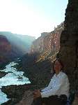
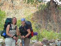
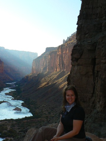
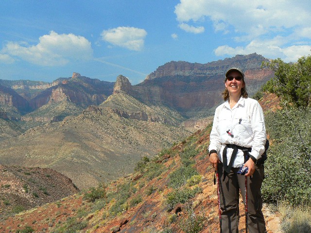
Martine, Day 4
(Click the image for a full-size view)
|
|---|
|
|---|
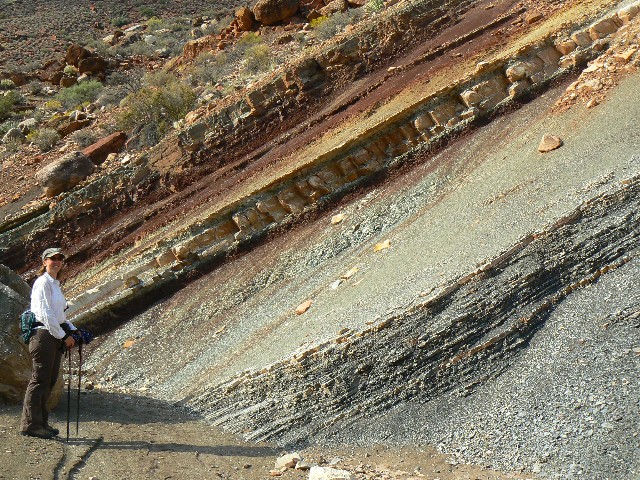
Day 4 - Sonia at ruins
(Click the image for a full-size view)
|
|---|
|
|
|---|
Day 4- Sonia
(Click the image for a full-size view)
|
|---|
|
(There are - More photos below the trip narrative.)
Day 5: Kwagunt Krunch,
5.7 miles, 11 ERM; + Geology Canyon. (Route is camp to pass above Kwagunt = 1000'
ascent over 1.75 miles.)
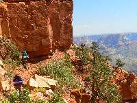
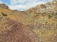
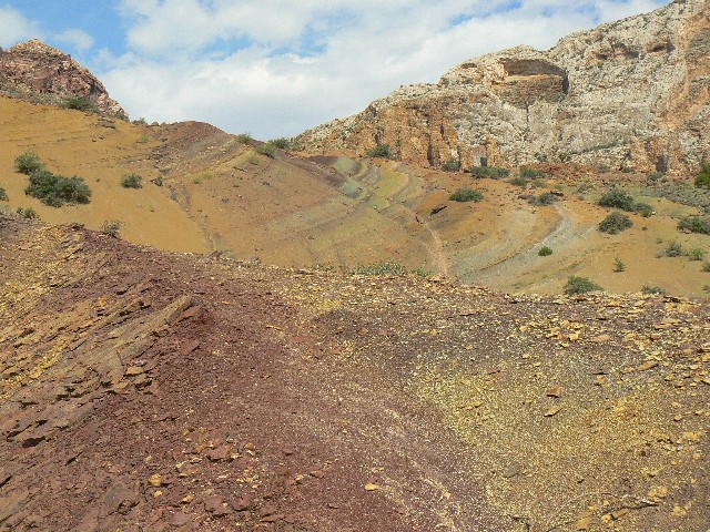
The tilted and tortured rock layers thrust skyward
like Stegosaurus plates, and Sonia and I walk the deteriorating shales and slates
from several eons past. Deluxe. We're exploring the route from Nankoweap to Kwagunt.
Despite the double gangs of river runners who hiked this way 2 days ago, the hard
ground (mostly fractured rock) holds few tracks. The geology is fascinating, and
the fault at the upstream side of Nankoweap Mesa has exposed a host of formations,
layers, and groups. I hiked to the pass near Nankoweap Butte, where the descent
begins into one of the Kwagunt arms, then return to our oasis camp of the Nankoweap.
Earlier today, Sonia and I explored up a ridge
(false start) and a side arm of Nankoweap farther up canyon, a canyon we dubbed
"Geology Canyon."
I'm back in camp enjoying a luxurious bath and an
early dinner - because Martine and Sonia are leaving to camp near the backbone
ridge - across the flats - at the foot of the route up the gnarly Tilted Mesa, and
Sonia has the stove.
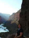
Jason (who just hiked in from the upper TH) and I
enjoy the quick local sunset of Nankoweap camp and the Carl Sagan star party. Wondrous.

|
|---|
day 5 - Sonia on spine, Kwagunt
(Click the image for a full-size view)
|
|---|
|
|---|
day 5 - Sonia in Geology Canyon
(Click the image for a full-size view)
|
|---|
|
|
|---|
day 5 pass into Kwagunt
(Click the image for a full-size view)
|
|---|
|
Day 6: Not in Nankoweap; 11 miles,
20 ERM. Camp in the Kaibab NF, just outside the park.
The pebble free-falls off the Esplanade Sandstone
ledge, 100 - 200 - 300 feet and out of sight. My, the trail is edged into space,
I note. Airy.
I started the day at Nankoweap Creek and ended here,
just outside the park, alongside Trail 57. Wonderful clouds accompanied us nearly
all day. Martine and Sonia got a head start on the climb by camping above the first
knoll last night. I stayed by the cool waters and finally met them near Marion Point.
Because of the poor camping (tilted) and the winds,
we decide to move on. So, I am dragging the 5 liters of water from my truck, to
Tilted Mesa, and back to this camp in the NF. It's windy and cold and a storm is felt
near. It's dark enough to cease the writing and go warm up in my snuggly bag.
The wind roared and shrieked and shrilled, like a
freight train on steroids - bending the tent fly poles between my feet. It was a
restless night.
|
|---|
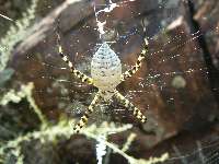
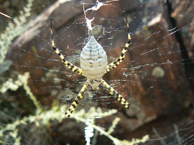
day 5 - spider along route
(Click the image for a full-size view)
|
|---|

|
|---|
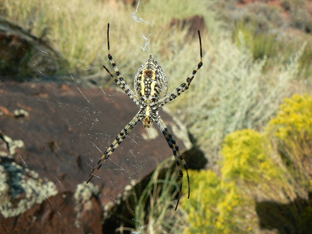
day 5 - spider along route 2
(Click the image for a full-size view)
|
|---|
|
|
|---|
day 6 - leaving Nankoweap
(Click the image for a full-size view)
|
|---|
|
Day 7: Damp in the Saddle, again,
3.5 miles, 6.5 ERM.
"Damp in the Saddle again (repeat)" goes the
country song from the mythical days of the cowboy. Only this time there is truth
there as the saddle of Saddle Mountain is obscured by a grey shroud, a wet saddle
blanket. Ahh, diversity.
Martine and Sonia are seemingly up with the
wind - making packing sounds between gusts of wind. Of course, the packing goes on,
yet is not heard during the howls. Soon, we're almost ready to go, and we combine
our extra water to fill my 3-quart orange juice container, which I hike back to
the park boundary/Trail 57 for future thirsty hikers. Perhaps for hikers as
unprepared as the 3 we saw yesterday - little water, no hiking poles, late in the
day and headed for Nankoweap Creek. And this from before Marion Point at 3:30 pm.
Not likely. The older man of the group was grumpy and controlling and behaved
like gw bushco - calling Sonia's lilting accent "horrendous" and bragging about
how he would hike fast downhill to Nankoweap Creek. Also, again, not likely.
Sliding down the course rubble of Redwall Limestone below Tilted Mesa in a hurry
seems as sentient as unprovoked "pre-emptive" war without cause. Cheese grater
comes to mind, followed by a wondrous free-fall and abrupt stop. Stunning.
Soon, we are in the 20 (now dry) crossings of
the creek bed, then climbing up to the old road bed (abandoned, hurrah). Real
rain ensues. Quick hugs and goodbyes at the TH. The long dust of road has settled.
More, I say to myself, for there is no female French accent reply. Terrific trip,
Sonia and Martine. Sonia, thanks for inviting me on this adventure. There will be
more, and they too will be deluxe.
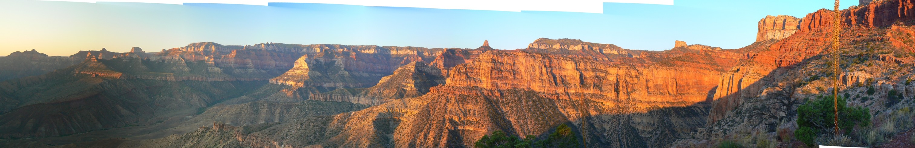
|
|---|
pano from Nankoweap Cr. (L & R), Tilted Mesa
in certer - scroll L-R to view it all (2971 pixels wide, 480kb)
(Click the image for the full-size image)
|
|---|
|
| | | | | | |


