A Wild Vagabond Trip Report
Snow Angel: Dayhiking in Zion N.P.
January 30 to February 1, 1998
by Rob Jones
(Text and Photos © copyright by Rob Jones)
(Click on the THUMBNAILS to see larger images)
|
|---|
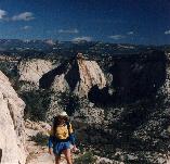
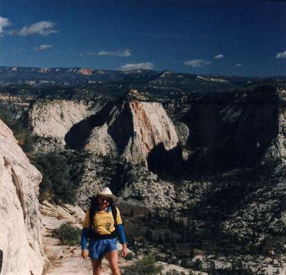
Rob and The West Rim
(Click the image for a full-size view (26k); Photo by Rob)
|
|---|
- During this short weekend trip, I hiked up to Angel's Landing and part of the
West Rim Trail. The Park Service's Zion website contains little information, but
here are the basics:
- Zion contains 229 square miles (593.1 km) of spectacular cliff-and-canyon
landscape and wilderness full of the unexpected,
including the world's largest arch - Kolob Arch - with a span that measures 310
feet (94.5 m). Yes, it's bigger than Landscape Arch in Arches N.P. Because it's far
up in the canyon wall, Kolob is not so awesome as Landscape.
- Wildlife such as mule deer, golden eagles and mountain lions also inhabit the Park. The Park was initially established and named Mukuntuweap National Monument in 1909; the name was changed to Zion National Monument in 1918; and established as a national park in 1919.
- There are two major accesses to the park, the Kolob Canyons Section, and the
Zion Canyon Section.
- MAILING ADDRESS:
Superintendent
Zion National Park
Springdale
UT 84767-1099
Telephone: 435-772-3256
- DIRECTIONS:
The Visitor Center at Kolob Canyons is accessible via Exit 40 from I-15. I-15 passes
west of the Park and connects with UT-9 and 17 to the Park. US-89 passes east and
connects with UT-9 to the Park. The Zion Canyon Visitor Center is a short distance
from the Park's South Entrance adjacent to Springdale. The closest airport is in St.
George, UT, 46 miles (74.1 km) from the park.
The park web address is: http://www.nps.gov/zion/
Night 1: Graveling in the pit: I left Friday night
and camped in a gravel pit above the Virgin River. Bucolic cow-songs woke me
to a cool and sunny day.
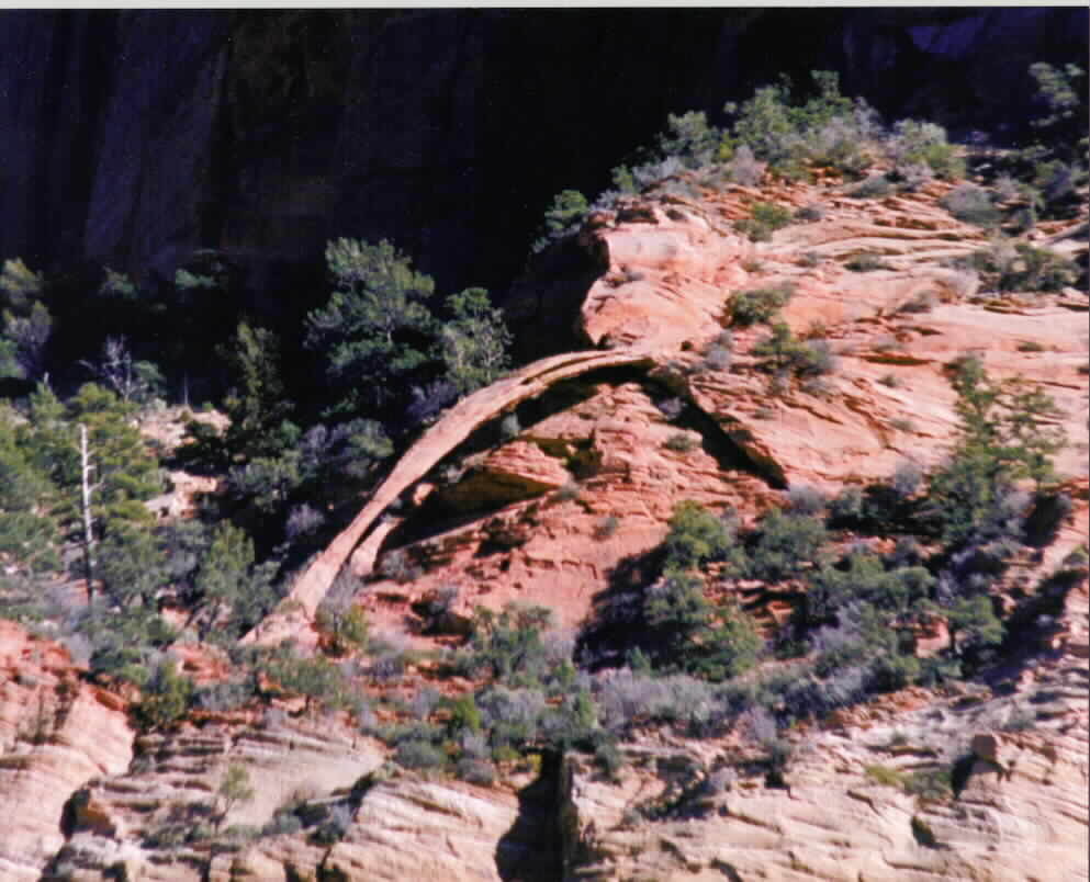
|
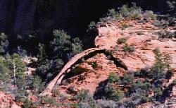
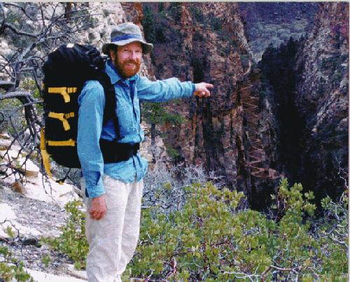
"...the distant Bridge Arch across the
canyon."
Photo by Bob Fagley taken from near the visitor
center with a 400 mm lens.
Click HERE for
Bob's full 993 X 804 image (78 kB)
|
|---|
Day 1: Squiggling the Wiggles: After passing a
plethora of new construction, mostly motels, and one of those gaudy Imax Theaters,
I entered the park and hiked Walter's Wiggles and Angel's Landing in the cool and
clear air. It was occasionally warm. First, I stopped at the Visitor Center. You can
see the distant Bridge Arch across the canyon if you look in the right place, and when
you use binoculars.
|
|---|
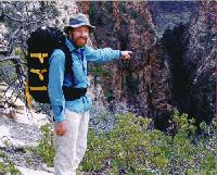
Rob pointing to Walter's Wiggles
(Click the image for a full-size view (59k); Photo by a tree limb)
|
|---|
The route to Scout Lookout and Angels Landing is about 2.5 miles long (one way).
The trail begins by crossing the Virgin River opposite the Grotto Picnic Area.
It's a well-developed trail that climbs a CCC (Civilian Conservation Corp)
engineered trail that is edged into the sheerness of sandstone cliffs. Then, the
trail slices through part of the cold box of Refrigerator Canyon before reaching
the 21 staircase squiggles of Walters Wiggles. At the top of the Wiggles, you
arrive at Scout Lookout and marvel, "how can the view be better than this!"
Keep going, up, to Angels Landing. Slip your boot into the man-made gouges
in the chocolate sandstone, grab a park service chain and haul your way to the
unrestrained capstone. There are pockets of snow and glazed ice on the Angel
this time of year, so watch out. Yow, you're rewarded with a 360 degree view of
open space and deceptively distant canyon walls. Now, you're about 1500' above
the Virgin River. Do you feel like reaching out and touching one of those "close"
walls? Not likely, unless you can float like the croaking Raven passing below. It's
a great place to see raptors drifting below or at eye-level. You may feel like you
are on the top of the world, but, you're still not on the West Rim, one more flight
up. Do you feel a bit queasy as you peek over the rim? Below, is the Virgin River
looping around the Landing. You may see ant-sized hikers walking along the river.
In the Summer, you will see herds of rampaging winnehogos hurrying to wait, then
turn around at the road's end near the Narrows.
After descending from Angel's Landing, I continued along
the West Rim Trail into snow. It was cool in the valley leading to the rim, and
the snow was packed and icy on the trail. I made it to where I could see the
top portions of the rim trail blasted into the sheer sandstone walls. The ranger
later told me that some hikers were attempting to get to the rim, but that this was
not recommended. When I returned to the Grotto Picnic area (the TH), I encountered
a flock of wild turkeys. They certainly are more aware and seem to have higher
IQ's than their distant domestic cousins.
I camped in South CG, which is next to the better known Watchman CG. It was
windy and the bluster easily pierced my double layer of pile jackets.
Day 2: Driving, Again: I was awakened by some sort
of police action in a neighboring camp. Smokeys from the park and county were
dismantling vehicles and standing guard over some youngsters huddled under blankets
and seated at a picnic table. What? Perhaps someone had been smoking the
Rabbit Brush. I never found out, but quiet returned to the CG before I went for a
hike up to the mouth of the Narrows (of the Virgin River). This is where hikers are
expelled from the famous and infamous Zion Narrows. It was warm in the sun and
crispy in the shade. It was not a day for wading, but it was a good day for examining
the lacey ferns dripping with ice and clinging to the walls of the Narrows.
 |
 |
|
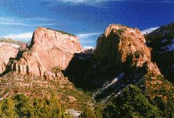
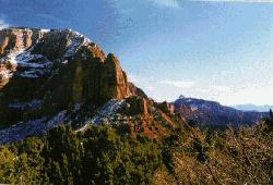
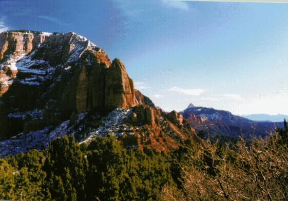
The Kolob Canyon Fingers (click for large view)
|
|---|
Heading back toward Smog Lake along I-15, I paused at the Kolob section of the park
and stayed long enough to add several pounds of red mud and mushy snow to my boots.
The cardinal fingers of the skyscraper plateaus are accentuated by iron oxide from
past eons. Canyons slice between the fingers, the Kolob Canyons. After enjoying
some sun and wind-burn...then, it was time for the long drive home from a short
weekend.


