|
|---|
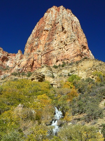
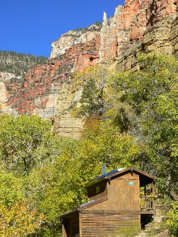
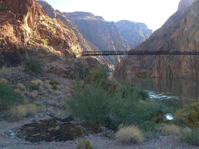
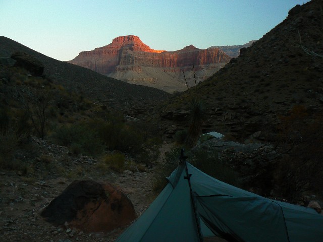
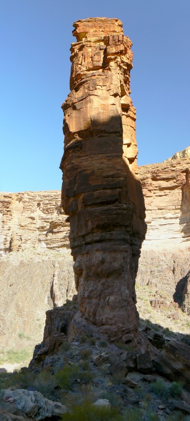
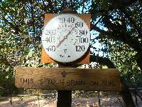
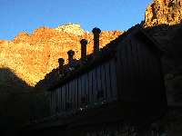
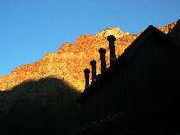
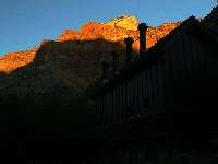
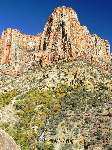
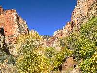
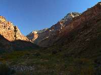
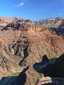
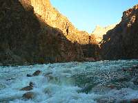
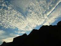
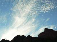
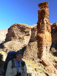
Day 1 - Hallowed Ditch
(Click the image for a full-size view)
|
|---|
|
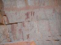
|---|
BA pictos
(Click the image for a full-size view)
|
|---|
|
|
|---|
At IG.
(Click the image for a full-size view)
|
|---|
|
|
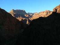
|---|
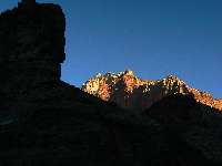
Redwall near dark
(Click the image for a full-size view)
|
|---|
|
|
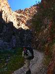
|---|
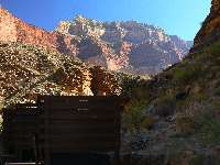
Dave on river trail
(Click the image for a full-size view)
|
|---|
|
|
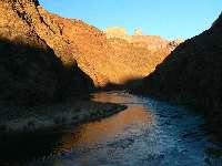
|---|
River glow
(Click the image for a full-size view)
|
|---|
|
(There are - More photos below the trip narrative.)
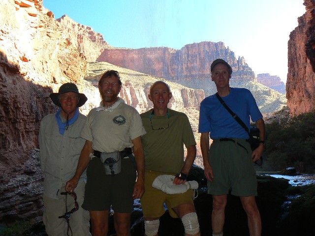
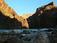
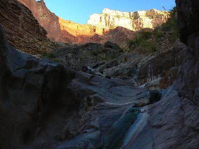
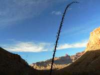
Day 1: Donkey Steps: Bright Angel (BA) TH to BA Camp, rendezvous with Craig M and Ward W. 9.6 miles.
Donkey steps, bombed out donkey steps to Indian Gardens (IG), where Dave and I consider caching part of our 9-day load. The situation does not seem good, so on we go, hauling everything. After all, we're running a bit late in this time of little sun. The IG ranger is not helpful with caching details.
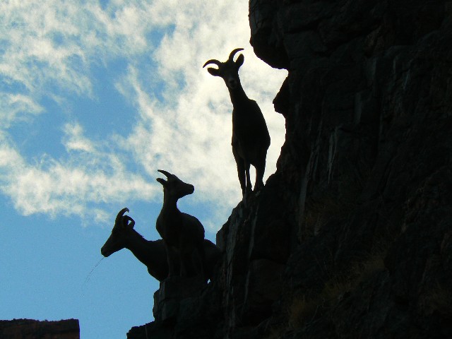
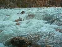
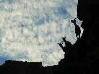
The decent load propels us, urges us, thrusts us down the spiraling corkscrew section through the basement rocks. Igneous and metamorphic, Zoroaster Granite and Vishnu Schist, sing a tale for my toes, thousands of steps into The Canyon. And, mysteriously, we don't see anyone through this section until we reach the beach area at Pipe Creek. Deluxe! A clatter of rocks announces a big Bighorn ram evading us in the rocks above. While trying for a better view than his whitish rump, I nearly step on a puny faded midget rattlesnake on the sandy riverside walk.
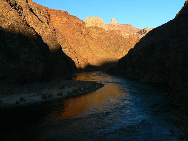
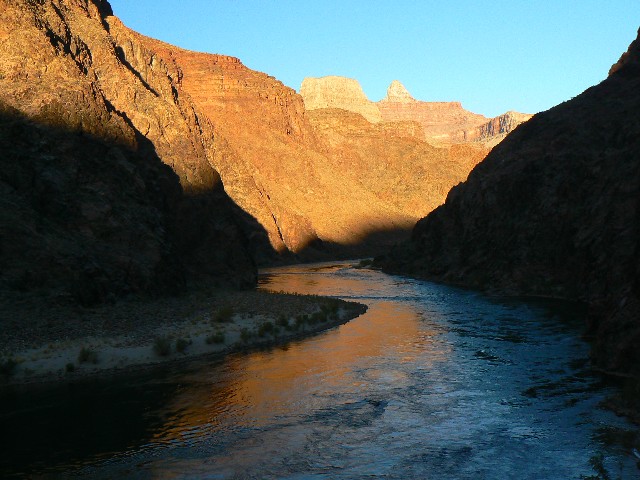
A golden sheen coats The River as the nearly full moon rises up river. We're late approaching BA, and the temperature tells us so. After all, we did leave the rim at noon, following a civilized start and a shuttle, and some gawking at the grandness of the Grand.
Craig and Ward are finishing dinner as we arrive at BA Camp. No time for dawdling now, we throw camp into place, enjoy dinner, then listen to the sounds of camp winding down for the night. It's cool but not cold. Certainly not as cold as Ward and Craig experienced, - 8F at the Kaibab Lodge on their way to the N. Rim. Dave and I drove into the park amidst 21F temps. - on our way to the shuttle. Now, we all bask in the upper 40Fs. Sunlight has been replaced by the cool unicolor of the moon. Cold-hearted orb that rules the night, removing colors from our sight (Moody Blues).
|
|---|
Movie - Ribbon Falls - 15 MB
(Click the image to see the short video - 15 MB)
|
|---|
|
Movie - Ribbon Falls - second version - 16 MB - Click here.
|
|---|
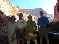
Day 2 - Group with Ribbon Falls
(Click the image for a full-size view)
|
|---|

|
|---|
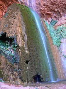
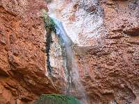
Ribbon Falls
(Click the image for a full-size view)
|
|---|
|
|
|---|
Ribbon Falls
(Click the image for a full-size view)
|
|---|
|
|
|---|
Ribbon Falls
(Click the image for a full-size view)
|
|---|
|
|
|---|
Scenic Toilet - Cottonwood
(Click the image for a full-size view)
|
|---|
|
|
|---|
Scenic Toilet - Cottonwood
(Click the image for a full-size view)
|
|---|
|
(There are - More photos below the trip narrative.)
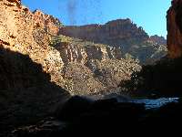
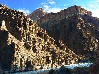
Day 2: Twisted Gneiss to Cottonwood: A bit over 7 miles. The Box.
Delightful twisted gneiss and granite in The Box. Crossing and re-crossing BA Creek, up the well-designed North Kaibab Trail past Phantom Creek and into shorts when we finally escape The Box and greet the sun, yahoo. There are too many rim-to-rim runners and strugglers clogging the trail. Is this akin to a republicans' version of "health care?" Lots of movement, yet no enjoyment, no lasting benefit?
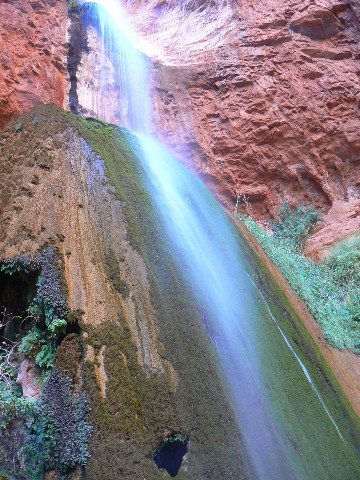
Along the way to Cottonwood, we stop at Ribbon Falls, relishing the spray from the calcium carbonate cone of ages, albeit a cool respite is not needed today. Tumbling water from the overhang showers the cone, slowly building over the eons.
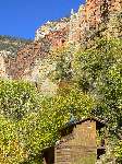
On into Cottonwood Camp, I spy a tiny natural bridge just South of the camp entrance, on the East side of the trail. Back later for a photo. The same for the scenic Cottonwood Camp toilet, photo later. For now, we grab the camp large enough for our 4 small tents and head for BA Creek for a bath in the very last rays of sun before the temperature begins to plummet.
Cold rushing crystal waters of BA Creek flow over my toes on a post local sunset drip bath. Cool settles quickly and the moon soon arrives.
This is hallowed ground, as today is Halloween. Treats and no tricks on this deluxe adventure. Hallowed, as in venerated; sacred.
|
|---|
Day 3 - Scenic Toilet Sunrise - Cottonwood
(Click the image for a full-size view)
|
|---|
|
|---|
Roaring Springs
(Click the image for a full-size view)
|
|---|
|
|
|---|
Roaring Springs.
(Click the image for a full-size view)
|
|---|
|
|
|---|
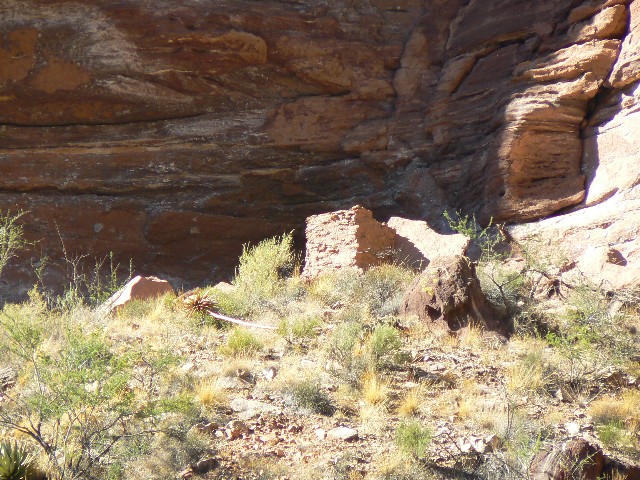
Ruin - Maybe?
(Click the image for a full-size view)
|
|---|
|
|
|---|
Cottonwood CG NB
(Click the image for a full-size view)
|
|---|
|
|
|---|
Cottonwood CG NB
(Click the image for a full-size view)
|
|---|
|
|
|---|
Scenic Toilet-Roaring Sp.
(Click the image for a full-size view)
|
|---|
|
|
|---|
Scenic Toilet-Roaring Sp.
(Click the image for a full-size view)
|
|---|
|
|
|---|
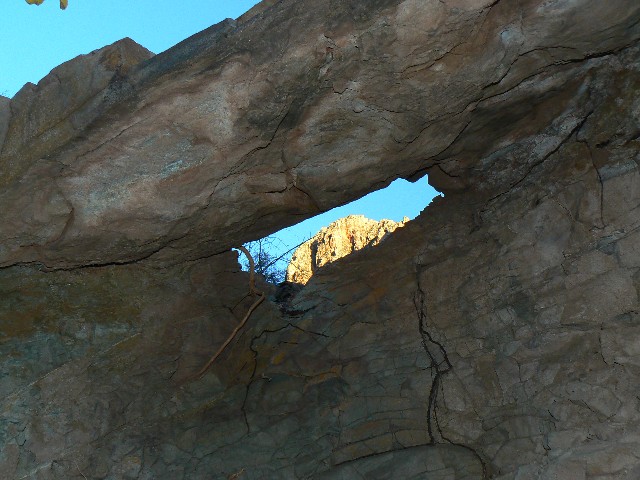
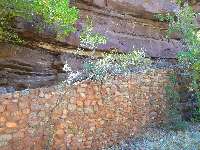
Rockwork N Kaibab
(Click the image for a full-size view)
|
|---|
|
(There are - More photos below the trip narrative.)
Day 3: The Roaring 6:
Roaring Springs Exploration, @ 6 miles.
We mull over the possibility of the squared pile of Tapeats SS being a ruin. It seems right and also wrong, Dave notes. Yes, it is quite square and seems to have individual stones. Then again, it seems too far out from any protection to have survived this long….? We ponder, wishing for binocs. Peering through the camera’s optical zoom doesn’t help. Weighing exploration against the angle of the sun and the prospect of a warmish bath?
Among the things I learn today is that there is a user trail leading to the Roaring Springs water treatment plant just before the junction with the Manzanita Canyon, and that there is a scenic toilet at the Roaring Springs trail spur and a lovely lunch spot amidst Box Elder trees. These tid bits we learn on a day hike while Craig and Ward are hiking to the North Rim, and then the long drive to Smog Lake.
Full sun, a day closed with a full bath. We see only four backpackers today, a relief from the rim-to-rim maggots. We also make note of the possible square ruin up canyon from the CG, on the West side of the trail under a Tapeats SS notch?
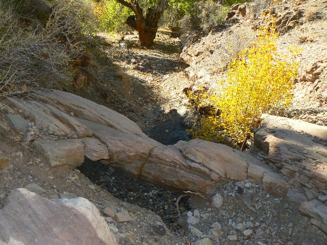
Cottonwood CG Natural Bridge
This midget NB is easily reached from the Cottonwood CG. Look up the shallow drainage to the East of the trail when you are about 200 feet from the Southern end of the Ranger Station at the Cottonwood CG on the North Kaibab Trail. Look for a large forked Cottonwood - like you see in the above photo of the NB. You can see the NB from the trail, although it may not be apparent in some light conditions. You are about 7.2 miles up the North Kaibab Trail from the Bright Angel CG.
|
|---|
Day 4 - North Kaibab Morning
(Click the image for a full-size view)
|
|---|
|
|---|
North Kaibab Morning
(Click the image for a full-size view)
|
|---|
|
|
|---|
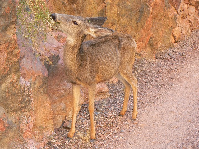
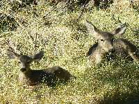
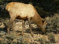
Deer on N Kaibab
(Click the image for a full-size view)
|
|---|
|
|
|---|
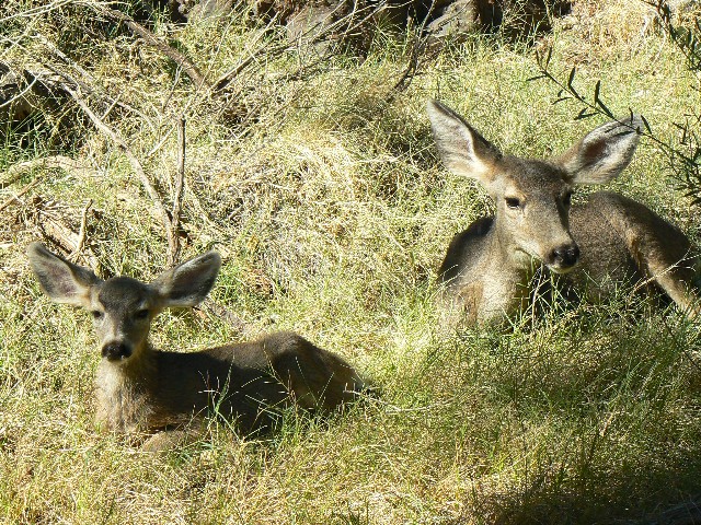
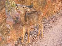
BA Deer
(Click the image for a full-size view)
|
|---|
|
|
|---|
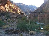
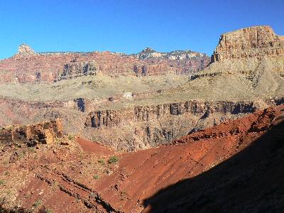
Day 5- Black Bridge and ruin
(Click the image for a full-size view)
|
|---|
|
|
|---|
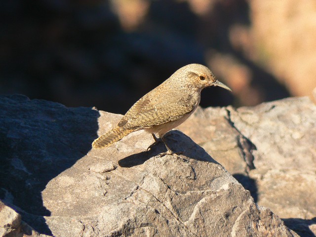
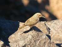
Rock Wren
(Click the image for a full-size view)
|
|---|
|
(There are - More photos below the trip narrative.)
Day 4: T-shirt Return to BA: @ 7.2 miles.
The scale’s needle rotates around, around some more. There, it stops at a reasonable 39 pounds. My pack contains two dinners for two, four lunches and breakfasts, some water, assorted gear and more gear, with semi-Winter clothing, it does feel reasonable. It would be too heavy for the Ranch duffle service, which has a 30 pound limit, 30 pounds at more than $2 per pound, yikes. Dave’s pack weighs in at a bit over 40 pounds. Good thing our friends are continuing on the Tonto toward Hermit with us.
We’ve lilted down the lovely North Kaibab from Cottonwood CG in a few hours, into the shorts and t-shirt heat of the BA camp area. Along the way, a deer crowds us for position on the narrow trail as we exit The Box. Good thing it’s a she (no antlers).
|
|---|
Movie - GC from The Tipoff - 27 MB
(Click the image to see the short video - 27 MB)
|
|---|
|
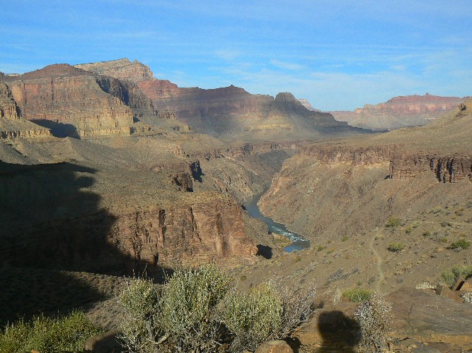
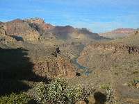
Day 5: Loafer to Indian Gardens, the long way. Or, Electronic Cocaine in the Canyon?
About 7 miles?
The natural quiet burble of The River far below is shattered by the nubile frenetically trying, with heightened voice, to get cell phone coverage. Horrid. The once solitary rapture of The Tipoff desecrated and defiled by this hypocrite high on electronic cocaine, yet currently undergoing withdrawal from constant connection, the cocaine IV drip.
Starting out, we enjoy relative solitude as we climb the nicely improved pygmy donkey steps of the South Kaibab. Ongoing renovation and no mule traffic. Delightful. A long early lunch at The Tipoff is enjoyed after the self-absorbed moaning of the electronic cocaine junkie fades down the trail. Natural quiet? Yes!
Next, we lilt across the Tonto between the South Kaibab and Indian Garden (IG), with an early local sunset stop at Pipe Spring. Lounging against the battleship gray Redwall Limestone boulders, slouched in the crunch of Cottonwood leaves, we ponder the old rock foundation. Was it a tent platform? Something more?
Local sunset accompanies us into IG, where we find nearly all the camps full. We are relegated to a decent camp with a seeping groundwater issue. Camping in swamp camp #7, priceless.
|
|---|
Leaving IG
(Click the image for a full-size view)
|
|---|

|
|---|
Plateau Point
(Click the image for a full-size view)
|
|---|
|
|
|---|
Tarp Tent at Salt Cr.
(Click the image for a full-size view)
|
|---|
|
(There are - More photos below the trip narrative.)
|
|---|
Movie taken from Plateau Point - 28 MB
(Click the image to see the short video - 28 MB)
|
|---|
|
Day 6: The Salt Mines or Salt Creek? Plateau Point and Tonto to Salt Canyon, 9+ miles.
The melodic dripping and dribbling of precious water in Salt Creek is disrupted by air tour terrorists droning as close to the flight path boundary as possible. Evil akin to dick cheney. Both are very bad for the future of life on Planet 1. Meanwhile, in the sacred (hallowed) canyon, Dave and I pause on the polished Precambrian igneous, the reddish Zoraster Granite in the Salt Creek narrows, admiring the impassable drop toward The River. Peace slowly returns to our auditory systems, yet only for a brief respite before the next wave of insult and climate-altering air and noise pollution craft.
We started out latish from IG, drop packs, and visit Plateau Point – good vistas and video. Then, on the foot-bruiser to Horn Creek for the first snack. Bruiser because we’re carrying 7 liters (@ about 14 pounds added to the @ 40). This, and I was prompted to carry even more because I was graced with an unexpected bounty of tuna, sweet and sour pork, red beans and rice, cereal, other goodies – leavings at the IG camp. Staying late brought us in contact with someone cleaning out the camp’s food storage rocket boxes. I guess I must be feeling hungry, so – well, you understand.
Genuine dark collapses around us as we begin to cook dinner. The crepuscular fliers, bats, ply the sky partly encircled by the colossal Redwall rampart.
|
|---|
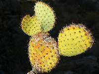
Mickey Cactus
(Click the image for a full-size view)
|
|---|
|
|---|
Scenic Toiley - Monument
(Click the image for a full-size view)
|
|---|
|
|
|---|
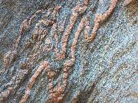
Twisted Zoroaster G
(Click the image for a full-size view)
|
|---|
|
|
|---|
Granite Rapids
(Click the image for a full-size view)
|
|---|
|
|
|---|
Granite Rapids
(Click the image for a full-size view)
|
|---|
|
|
|---|
Granite Rapids
(Click the image for a full-size view)
|
|---|
|
(There are - More photos below the trip narrative.)
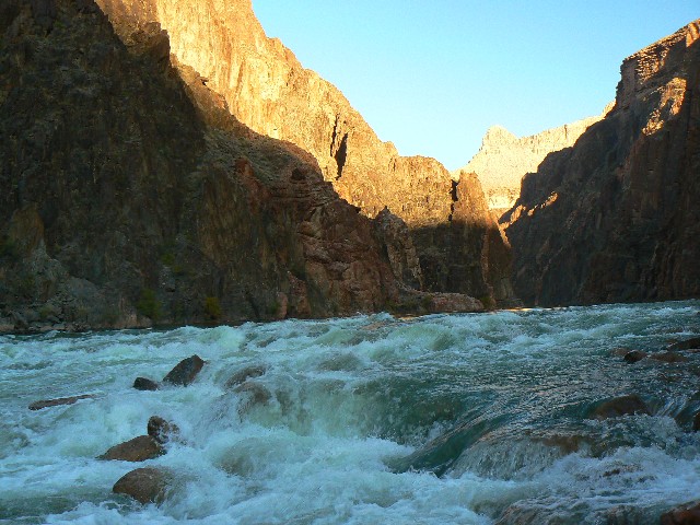
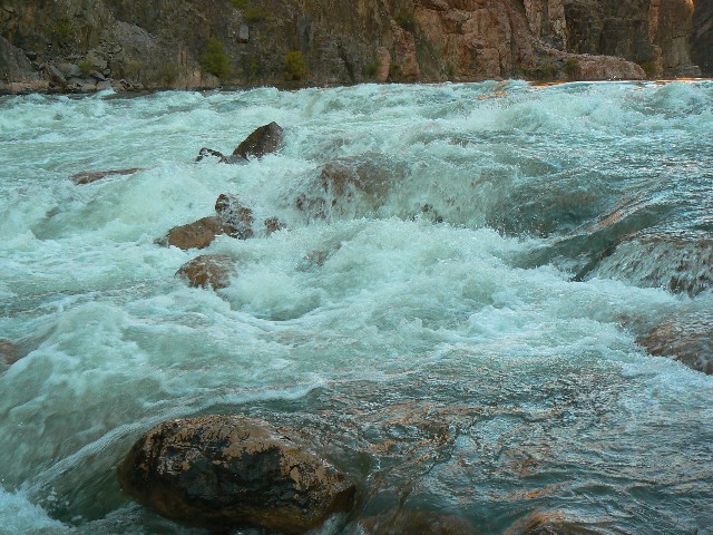
Day 7: Roaming to Rapids, to Granite Rapids:
The surface of the frigid Colorado River water is stretched a golden sheen as it drops into Granite Rapids. Slithering out from the gateway of polished Precambrian basement metamorphic and igneous, banded blacks and reds, The River heads toward Hermit and points beyond.
I’m bare-footing it through the sands of Granite Rapids camp area, alongside the trickling Monument Creek.
Again, we enjoy a late start, this time from Salt Creek (a trickle of water here), followed by a lunch at Cedar Spring (water here), and some camp exploring at Monument Creek prior to descending past the Monumental Monument and down the canyon to the rapids area. It’s warmer, and I’m still without socks after sunset. It appears that all the springs along this stretch of the Tonto have again started flowing, assisted by the lower evaporation rates.
The descending melody of the Canyon Wren is obliterated by the cacophony of mechanized asshole elitist air terrorists, money belts riding just to be riding so they can report to other money belts “been there, done that.” bushco.
The night is warm and the sounds of the rapids drown out all intrusive noise pollution from unnatural sources. Enveloped by deafening natural quiet! Priceless.
|
|---|
Movie - Monument Creek Narrows - 15 MB
(Click the image to see the short video - 15 MB)
|
|---|
|
|
|---|
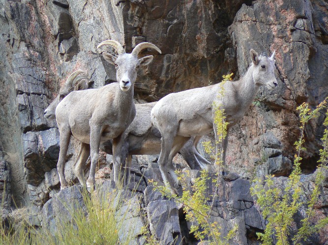
Day 8 - Desert Bighorn at Granite
(Click the image for a full-size view)
|
|---|
|
|---|
Desert Bighorn at Granite
(Click the image for a full-size view)
|
|---|
|
|
|---|
Desert Bighorn at Granite
(Click the image for a full-size view)
|
|---|
|
|
|---|
Desert Bighorn at Granite
(Click the image for a full-size view)
|
|---|
|
|
|---|
Sky track at Granite
(Click the image for a full-size view)
|
|---|
|
|
|---|
Sky track at Granite
(Click the image for a full-size view)
|
|---|
|
|
|---|
Morning at Granite Rapids
(Click the image for a full-size view)
|
|---|
|

|
|---|
Exploring Monument Cr.
(Click the image for a full-size view)
|
|---|
|
|
|---|
Exploring Monument Cr.
(Click the image for a full-size view)
|
|---|
|
Day 8: Monumental Monument + exploring:
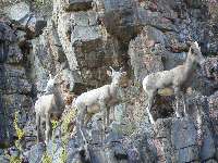
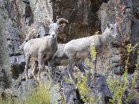
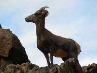
The near jagged skyline is broken by – what?! An ear twitch and soft pointed noses? Out of one snout sprouts a long solo stem of grass. Hay seed? Yes! Three ewe Desert Bighorns are peering over a ledge, apparently wondering “What in james watt are these creatures doing clogging our path to cool River water?”
A background of a cotton ball studded sky makes for an interesting and fine photo. Soon, we’re winding the return through the basement rocks to Monumental Monument camp. It’s already turned into a delightful t-short and shorts day, interrupted only by the air terrorist noise pollution.
First, an exploration up the canyon to the rampart of The Abyss, followed by a loop of the upper gulch, through the silky polished Precambrian basement rocks, and requiring a few low-grade scambly moves.
Again, dark collapses as we prepare dinner, the eighth and final dinner of this adventure, surrounded and overarched by grabby mesquite. Big-eared mice and assorted rodentia race across the bowed mesquite branches near our heads, hanging on and rattling the stainless steel mesh of the rat sacks, and providing comic relief to a wondrous day.
|
|---|
Monumental Monument - Panorama (500x1109- 148kb)
(Click the image to see the vertical pano - (500x1109- 148kb)
|
|---|
|
|
|---|
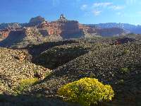
Day 9 - above the Tonto Platform
(Click the image for a full-size view)
|
|---|
|
|---|
Elk on rim
(Click the image for a full-size view)
|
|---|
|
|
|---|
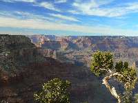
Long view from rim
(Click the image for a full-size view)
|
|---|
|
Day 9: Hermit Huff and Puff:
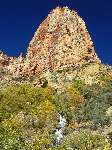
With some reluctance, we are rolling the last of this section of Tonto Trail to its junction with the trail to Hermit Rest. Here, the climbing ensues, and we stay warm with exertion as we climb into cooler zones. Vistas prevail, and as we contour toward Santa Maria Spring, I see the outline of the old cistern and pulley buttresses of the old Hermit tourist camp – far below. Lovely Hermit Creek snakes toward The River on the canvas below, embedded in a trench of Tapeats SS. Now this is the type of embedding to write about.
I’m still dragging extra food gleaned at IG, yet no extra lunch. Then, big bonus at Santa Maria resthouse, where we must appear emaciated to the resident day hikers, because they besiege us with a rain of food, muffins, gummy things, jerky, salami, and cookies! As is said on Sesame Street “C is for Cookie, it’s good enough for me!”
With heavy bellies, we slosh upwards into Coconino, Toroweap, then the topsider, Kaibab, layers, into the piercing breeze of the South Rim. Not a place for shorts, yet definitely The Place for a corridor stroll.
"Night and day the river flows. If time is the mind of space,
the River is the soul of the desert. Brave boatmen come, they go, they die, the voyage flows
on forever. We are all canyoneers. We are all passengers on this little mossy ship, this
delicate dory sailing round the sun that humans call the earth. Joy, shipmates, joy."
Edward Abbey, The Hidden Canyon -- A River Journey
Links:

Trail Distances:
Tonto Trail Distances - 2 pages in pdf format, Tanner Trail to South Bass....
Movies: Start downloading one, or four, while you read the above text....
Movie - Ribbon Falls - 15 MB
Movie - Ribbon Falls - second version - 16 MB
Movie - GC from The Tipoff - 27 MB
Movie taken from Plateau Point - 28 MB
Movie - Monument Creek Narrows - 15 MB
Other WV reports about the Grand Canyon:
Click here or on the Looking Lizard to go to all WV reports about The Grand Canyon

|
|---|
Looking for All Wilderness Vagabond trip reports about the Grand Canyon?
Click the image to go to All WV reports about The Grand Canyon
|
|---|
|
Related Links:
Scenic Toilets of Inner Earth
Click here to see the NOAA forecast for the Tonto near Monument.
| | | | | | | |