|
|---|
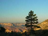
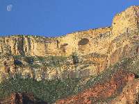
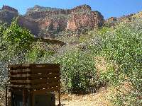
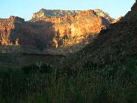
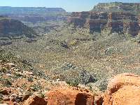
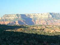
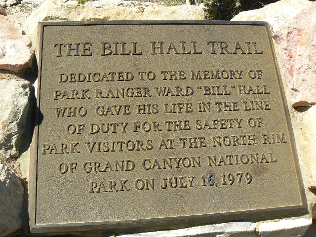
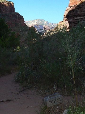
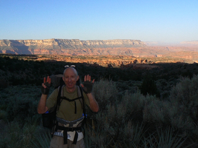
Bill Hall TH
(Click the image for a full-size view)
|
|---|
|
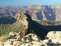
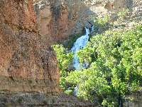
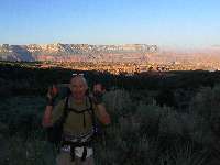
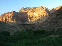
|---|
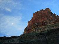
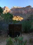
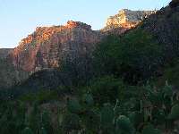
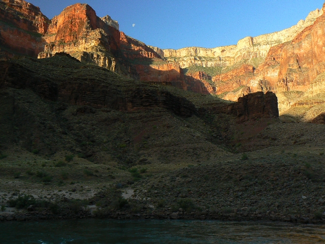
Bridgers Knoll
(Click the image for a full-size view)
|
|---|
|
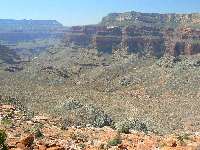
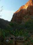
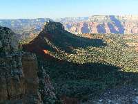
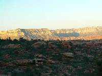
|
|---|
Surprise Valley
(Click the image for a full-size view)
|
|---|
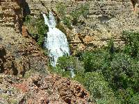
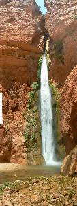
|
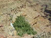
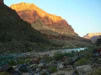
|
|---|
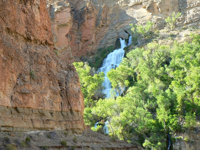
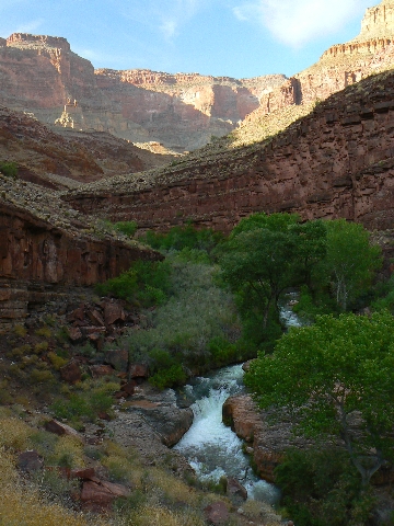
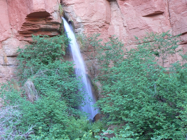
Thunder River
(Click the image for a full-size view)
|
|---|
|
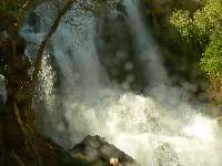
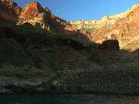
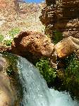
|
|---|
Thunder River
(Click the image for a full-size view)
|
|---|
|
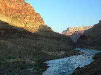
|
|---|
Thunder River
(Click the image for a full-size view)
|
|---|
|
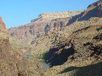
|
|---|
Thunder River
(Click the image for a full-size view)
|
|---|
|
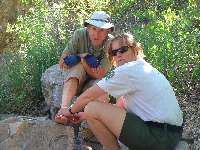
|
|---|
Della wraps ankle
(Click the image for a full-size view)
|
|---|
|
|
|---|
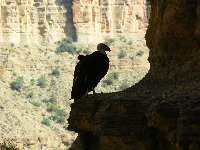
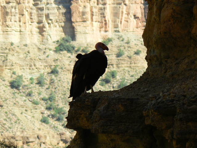
Condor!
(Click the image for a full-size view)
|
|---|
|
|
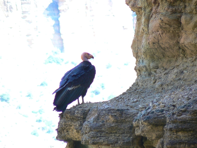
|---|
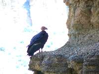
Condor!
(Click the image for a full-size view)
|
|---|
|
|
|---|
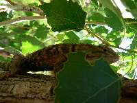
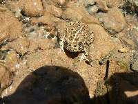
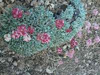
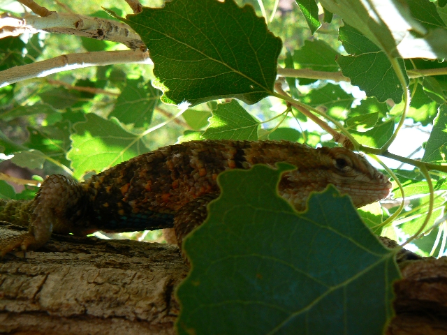
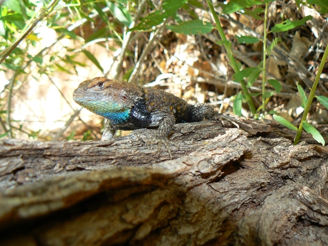
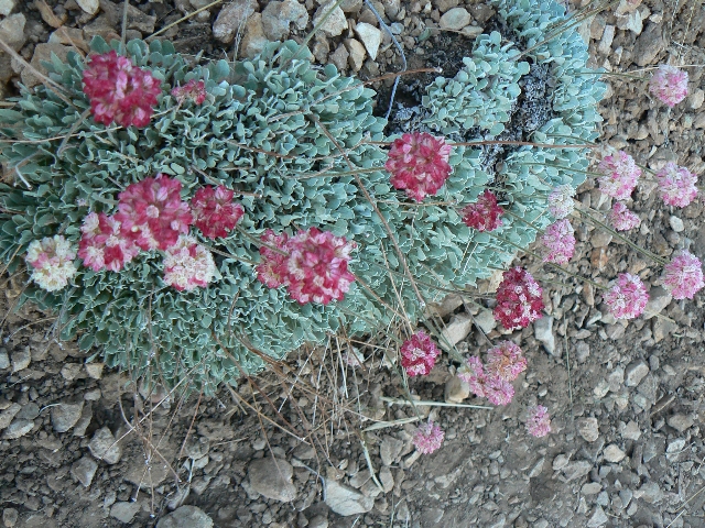
Day 1 Spiny
(Click the image for a full-size view)
|
|---|
|

|
|---|
Fat Boy
(Click the image for a full-size view)
|
|---|
|
(There are - More photos below the trip narrative.)
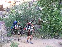
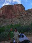
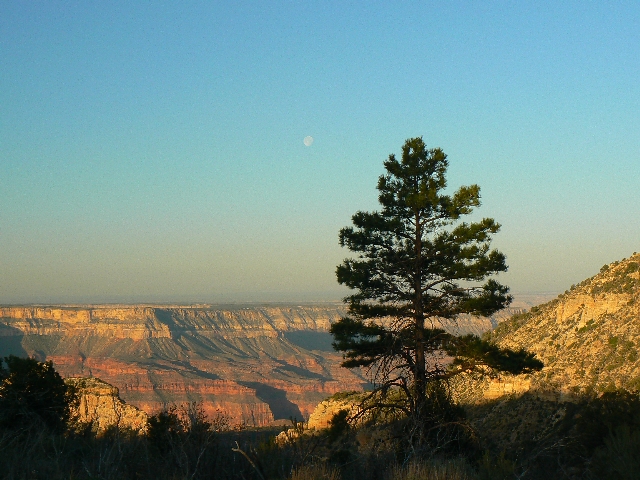
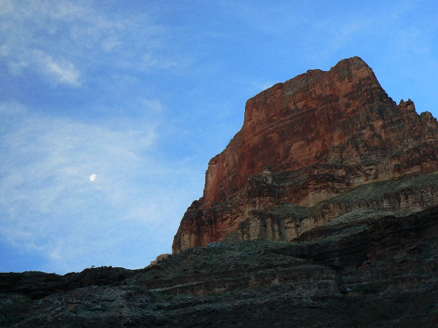
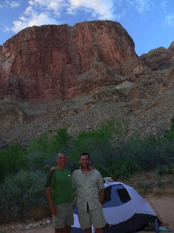
Pre hike, Day 1: Monument Point Drive:
Craig and I meet at Jacob Lake and from there drive FR 22 and other assorted dirt roads
to Monument Point. We find a lovely at-large camp overlooking part of The Canyon. An owl
keeps us company much of the nearly full moon night.
Pre hike, Day 2: Hot Cache: Monument Point
to Bill Hall-Thunder River Trail junction, and to a cache on the Esplanade. 7.5 miles,
descent of 2250' and ascent of 2250'. ERM = 16.5
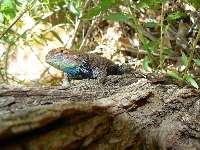
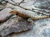
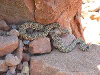
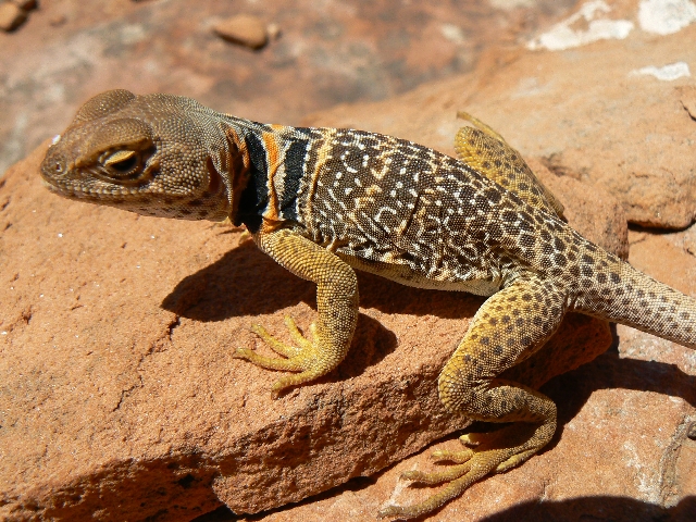
The Collared Lizard raises his toes off the hot rock and
poses for the camera. On the Esplanade, the heat is building like the public backlash to
corporate welfare and unconscionable excess of CEO "compensation" as we stash the cache,
plus. Plus because we've also hauled down all the dinners, lunches, and breakfasts for the
trip, along with 6 quarts of water and cans and fuel for the cache. Estimated weight is
about 25 pounds each, and our day packs are truly maxed out.
Two full rat sacks are left under the ledge and we return
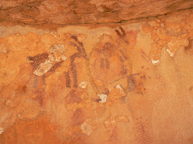
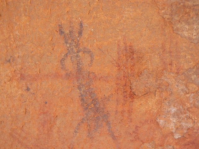
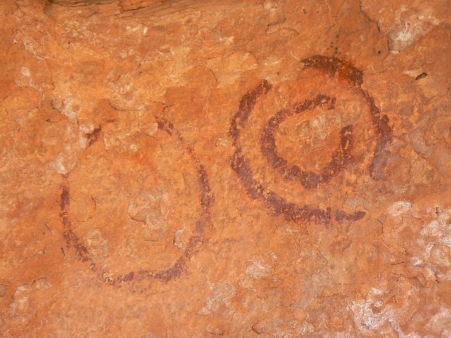
to near the Bill Hall-Thunder River Trails junction to inspect some pictos we earlier saw
from the rim of the canyon. Enchanting.
Back in the rim camp and showered and cooled, Craig says
"today was unexpectedly arduous, but we won't be toting as much tomorrow."
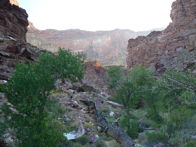
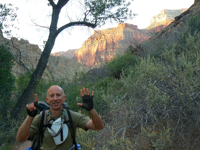
Day 1: De-Escalation and the Bald Bird: Bill
Hall TH to Upper Tapeats. 9.5 miles, 16 ERM.
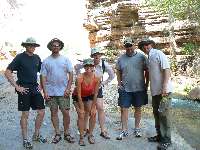
The mist gently settles in waves - nature's evaporative
cooling - as we chat with Della and Anne and two volunteers from the NPS. Looking up, I
pause, then the visual information is slowly processed by my well-baked brain.
Processing.... Big, plank-winged soaring buteo-like bird, white leading edges on the massive
wings. Pause, processing.... Condor! Condor alert! Exalting.
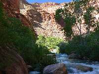
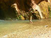
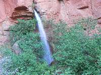
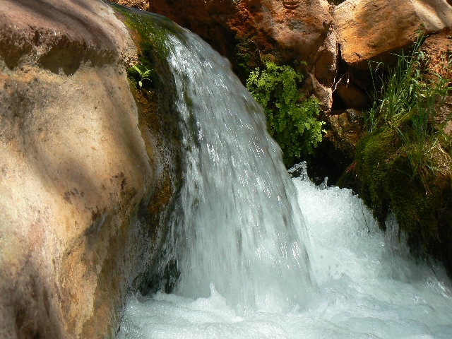
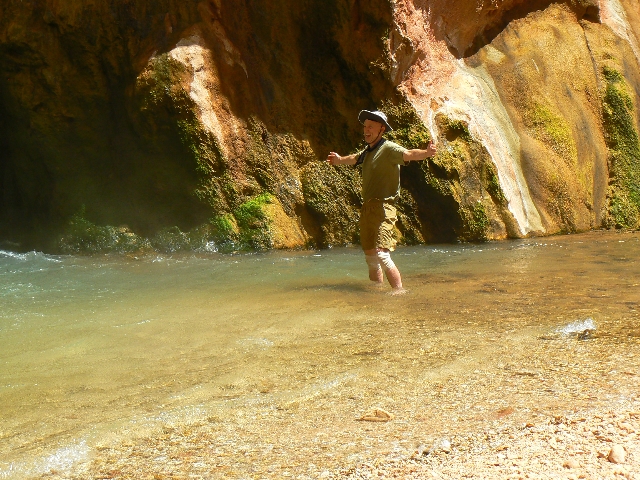
Bathed lightly in spray from the thundering Thunder River,
we chat and enjoy this hot time of day, having been rotisseried like turkeys on a spit
crossing Surprise Valley. Surprise! It's hotter than a TV evangelist's introduction to
the after-life.
We started the day, pre-dawn early, from our rim car camp
and were soon sliding and lurching down the Bill Hall Trail from Monument Point. Happy we
cached so much yesterday, we didn't pause until on the Esplanade and at the cache. Repacked
and now hefty, we drone along the Esplanade to where thyne Jugs of Jeremy were prophetically
offered and revealed. Revelation!
* thyne Jugs of Jeremy is a reference to the precious water
left on the Esplanade by Jeremy C. in 2005 - when we hiked the Kanab Creek Wilderness to The
River, along the river to Deer Creek Falls and Thunder River, and out the Bill Hall Trail.
See the 2005 Kanab Creek
Wilderness report for the complete story.
Now, back to our current report ---- I find myself humming
the Esplanade Terrain song as the route lilts through the lovely Esplanade Sandstone.
Link to
Esplanade Terrain song (by Rob) here:
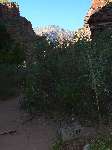
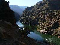
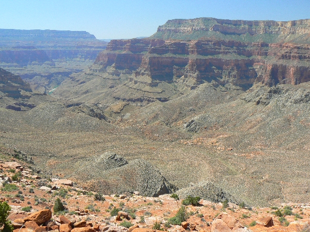
Continuing, we arrive at where the view of Surprise Valley
busts out into view like a stripper at the republican party convention. Yoweee! Revealing,
in the geological sense. The heat shimmers. Part 2 of de-escalation commences on the old
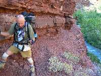
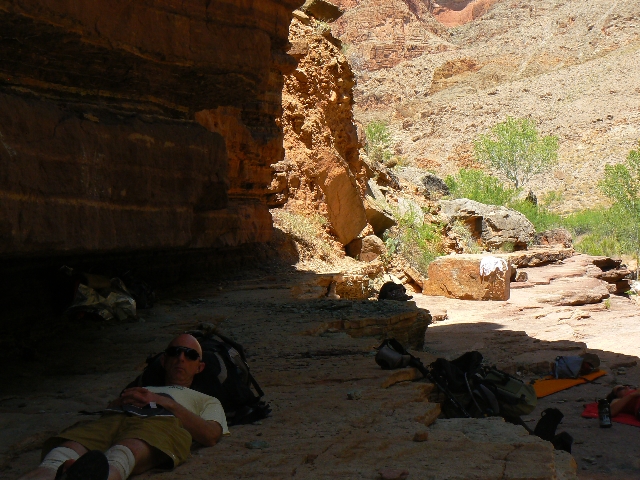
Thunder River horse trail through Esplanade SS then Redwall Limestone. Craig twists an ankle
rambling through the rock works and Della later wraps it at Thunder River. Doleful times.
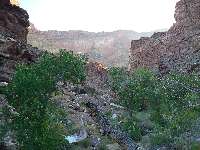
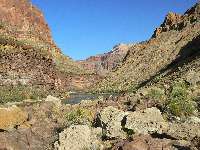
Easing out from the oasis of Thunder River springs, we
continue, with de-escalation #3, the drop from Surprise Valley into Tapeats Creek. Vulture
alert, again! The big guy is walking a ledge - apparently curious about what two Ravens
are doing. Later, we learn that the Ravens had unzipped a pack and pulled out lunch snacks.
Pilferage.
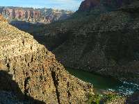
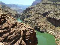
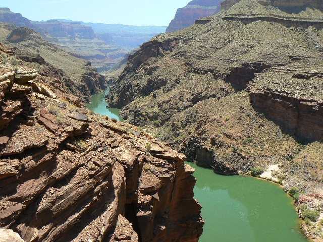
Down. The froth of thundering water races toward Tapeats
Creak, assuming the Tapeats name.
|
|---|
Della & Anne arrive for toilet duty
(Click the image for a full-size view)
|
|---|
|
|---|
Spiny awaits toilet time
(Click the image for a full-size view)
|
|---|
|
|
|---|
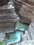
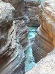
Tapeats Creek
(Click the image for a full-size view)
|
|---|
|
|
|---|
Tapeats Creek Sunrise
(Click the image for a full-size view)
|
|---|
|
|
|---|
Pointing the way - scenic toilet!
(Click the image for a full-size view)
|
|---|
|
|
|---|
Arrival - new scenic toilet
(Click the image for a full-size view)
|
|---|
|
|
|---|
Arrival - new scenic toilet
(Click the image for a full-size view)
|
|---|
|
|---|
Arrival - new scenic toilet
(Click the image for a full-size view)
|
|---|
|
|
|---|
Departure - not-so-scenic toilet
(Click the image for a full-size view)
|
|---|
|
|
|---|
New stuffing
(Click the image for a full-size view)
|
|---|
|
|
|---|
Trying the fit
(Click the image for a full-size view)
|
|---|
|
|
|---|
Tapeats scenic toilet
(Click the image for a full-size view)
|
|---|
|
(There are - More photos below the trip narrative.)
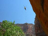
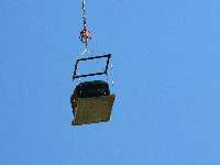
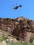
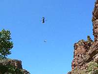
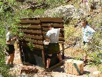
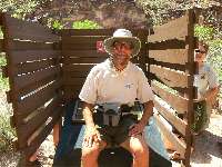
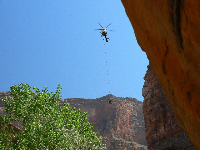
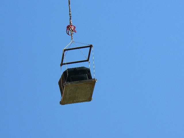
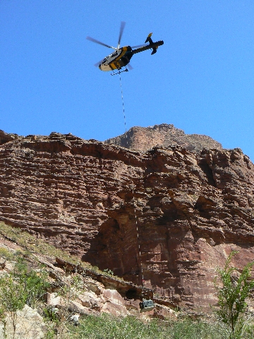
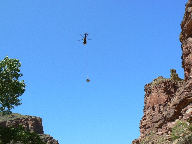
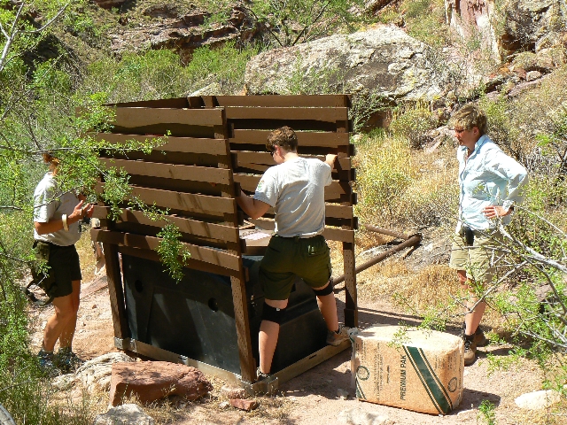
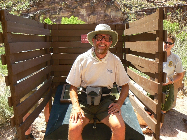
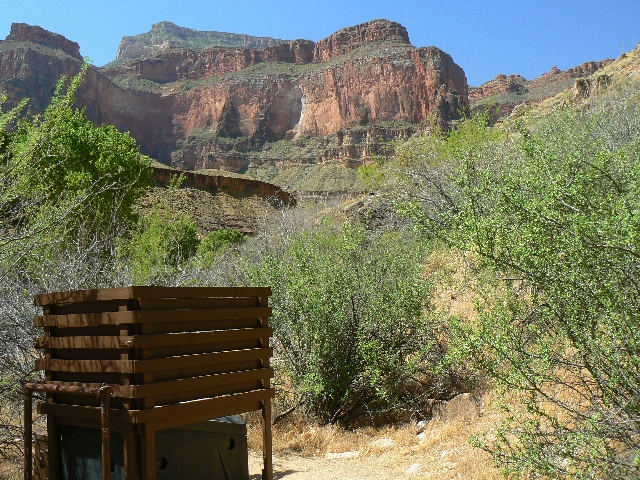
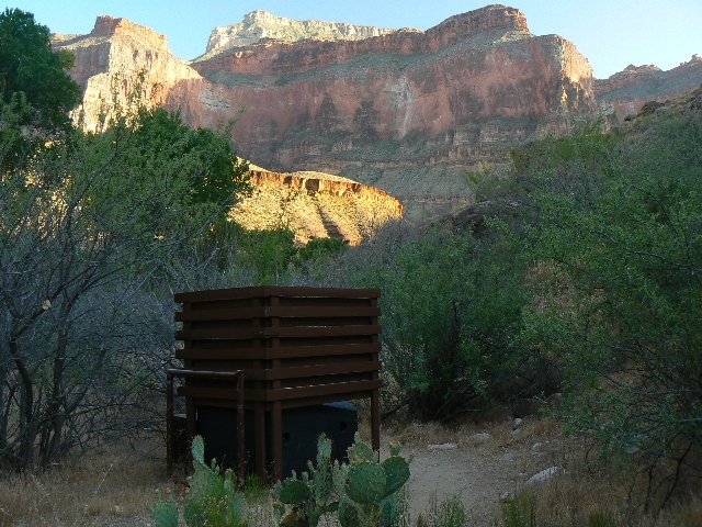
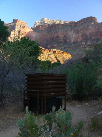
Day 2: Big Movement at the Scenic Toilet, or, Salutation Scenic Toilet. Lay-over
at Upper Tapeats camp.
The dehydrating scenic toilet hovers over the lower layers
of this deep canyon, suspended in the air. It sways and begins to descend towards its home
near Upper Tapeats Creek camp, coming to rest alongside its cousin, now a not-so-scenic,
totally full toilet, which then leaves the Canyon (as the war criminal bush cabal should be
doing - on their way to a black site in Afghanistan) rigged on a cable beneath the NPS
helicopter.
Della and Anne scramble around rigging the toilets.
Then, it's time for toilet inauguration, with several of the local camp women ready to do
so.
Link to Scenic Toilets of Inner Earth
Lounging by the tumbling froth, we while away the day
avoiding the incapacitating heat and blistering sun. Craig soaks his twisted ankle in the
cold water and we wet t-shirts for evaporative cooling.
|
|---|
Time to move - to Lower Tapeats
(Click the image for a full-size view)
|
|---|
|
|---|
Spiny Lizard
(Click the image for a full-size view)
|
|---|
|
|
|---|
Craig - what trail?
(Click the image for a full-size view)
|
|---|
|

|
|---|
Tapeats Canyon
(Click the image for a full-size view)
|
|---|
|
|
|---|
Tapeats meets Colorado
(Click the image for a full-size view)
|
|---|
|
|
|---|
Butte across The River
(Click the image for a full-size view)
|
|---|
|
(There are - More photos below the trip narrative.)
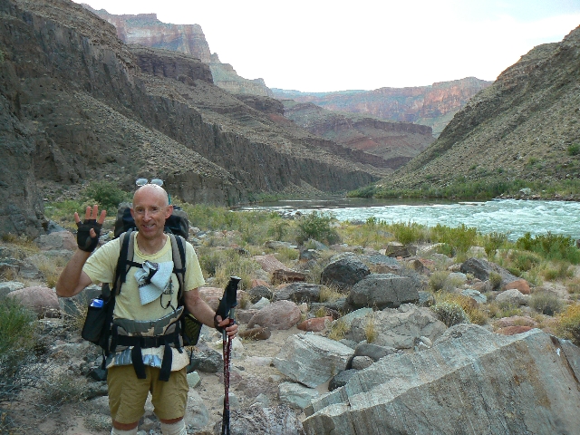
Day 3: Sweet Tapeaty: Upper to Lower Tapeats.
2.6 miles, 5.6 ERM.
There are those that come searching for something - perhaps
respite from the relentless intrusion of artificial noise, the glut of so many people?
Congestion!
Species extinction. Soon us. Others come because they have found something
- perhaps a connection with the real world?
What is needed is help from religions, not the mindless
hindrance and over-focusing on divisive issues like abortion - but true population reduction.
Man-dominated religion, or course, is a thoughtless,
self-fulfilling prophecy. We will
certainly get the predicted carnage and brimstone, and it will be directly caused by us,
overpopulating. Overpopulating some more. Because The Canyon is only 6,000 years old,
another can certainly be easily built by alien overseers cleaning up our mess.
As Pogo said "We have met the enemy
and he is us." Walt Kelly (from "Pogo")
"We have found the sources of hazardous
waste and they are us." US EPA, from "Everybody's Problem: Hazardous Waste"
"It isn't pollution that's harming the
environment. It's the impurities in our air and water that are doing it."
Dan Quayle, former US vice president
This morning Craig and I find we are alone in this
thundering, reverberating Tapeats drainage, surrounded by natural towering red sky-scrapers,
sky-seekers, and natural quiet so loud one must shout when near the stream.
We lounge until nearly 4 p.m., then go out as the shadows
grow in from The Canyon walls. The sweet smell of blooming Mesquite wafts by as we edge the
narrow boot-width trail far above Tapeats Creek. We endure lots of up and down because
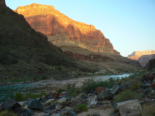
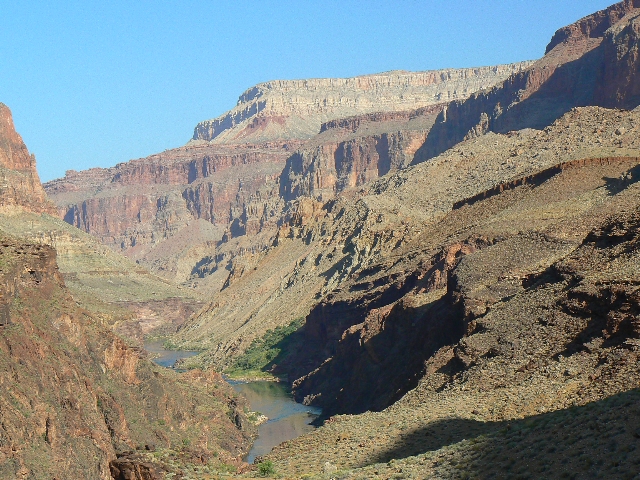
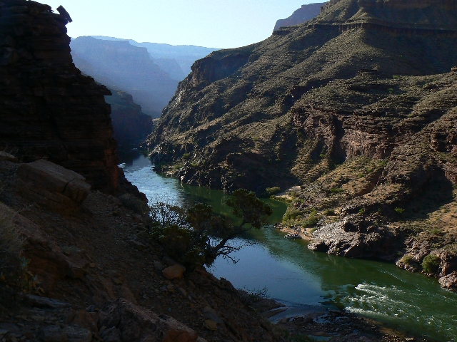
Tapeats Creek is too high to cross without a safety line. Eventually, we reach the nose
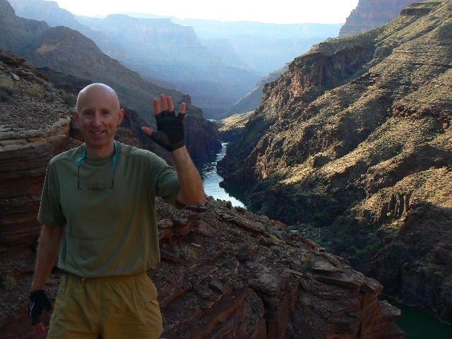
and look far down to where Tapeats Creek meets The Colorado. From here, the trail switches
severely down, to the open sandy, no shade campsite of lower Tapeats.
It's lovely now as sunset encroaches. Cool breezes refresh
as we enjoy a bath and late evening alpine spaghetti. Bats ply the calm sky.

|
|---|
Day 4 - Colorado Route
(Click the image for a full-size view)
|
|---|
|
|---|
Colorado Route
(Click the image for a full-size view)
|
|---|
|
|
|---|
Colorado Route
(Click the image for a full-size view)
|
|---|
|
|
|---|
Owl Eyes - Colorado Route
(Click the image for a full-size view)
|
|---|
|
|
|---|
Colorado Route
(Click the image for a full-size view)
|
|---|
|
|
|---|
Owl Eyes
(Click the image for a full-size view)
|
|---|
|
|
|---|
Deer Cr. Prints
(Click the image for a full-size view)
|
|---|
|
|---|
Patio - Deer Cr.
(Click the image for a full-size view)
|
|---|
|
|
|---|
Patio - Deer Cr.
(Click the image for a full-size view)
|
|---|
|
|
|---|
Patio - Deer Cr.
(Click the image for a full-size view)
|
|---|
|
|
|---|
Patio - Deer Cr.
(Click the image for a full-size view)
|
|---|
|
|
|---|
Utah Group
(Click the image for a full-size view)
|
|---|
|

|
|---|
Craig naps - Patio
(Click the image for a full-size view)
|
|---|
|
|
|---|
Deer Cr. Veranda
(Click the image for a full-size view)
|
|---|
|
|
|---|
Deer Cr. Scenic Toilet
(Click the image for a full-size view)
|
|---|
|
|
|---|
Deer Cr. Scenic Toilet
(Click the image for a full-size view)
|
|---|

|
|---|
Deer Cr. Scenic Toilet
(Click the image for a full-size view)
|
|---|
|
|
|---|
Deer Cr. Scenic Toilet
(Click the image for a full-size view)
|
|---|
|
(There are - More photos below the trip narrative.)
Day 4: Tapeats Traverse: Lower Tapeats camp to Deer
Creek. 4.1 hike + 1.2 explore = 5.3 miles. (17 total miles so far.) ERM = 7.
The cool water sluices and burbles over polished layers of
Tapeats SS in the patio area, entering a gorge that leads to the precipice that is Deer Creek
Falls. Pouring out the moss-fringed slot, the falling water creates a powerful swirling
mist. Invigorating.
The day started pre-dawn at Lower Tapeats camp. On the trail
before 6 a.m., Craig and I hobble over polished boulders - an amazing assortment of Grand
Canyon rock types, basalt, schist, Zoroaster Granite, Tapeats SS, Redwall Limestone, even
hints of Jasper in some rock - and through brush before climbing slightly above the river
and precipitously dropping back down at Bonita Creek - the precarious drop one reads about
in the NPS literature.
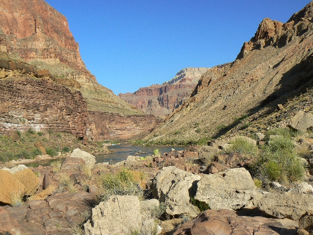
Soon, we are on the beach near 135-mile rapid, after which
the route shoots steeply up to the top of the Tapeats and begins a Tonto-like contour to
the saddle above Deer Creek. Glorious, long-ranging views up and down river are afforded
on the traverse. Inspiring.
Down to cross the fidgeting Deer Creek, we leave our
food-crammed rat sack at the Kurt camp (whom along with Jamie we had met at Upper Tapeats
camp), we wander down to the patio and the jacuzzi area of the Tapeats Narrows.
I continue to the falls while Craig lounges on the patio,
continuing to soak and nurse his ankle. While at the beach, I have a permit discussion
with Della and lunch with Diamond Outfitters. Delicious! Then, a return to the jacuzzi
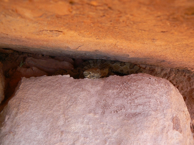
of the patio to avoid the heated afternoon. On the way to Deer Creek Camp, I nearly step
on a big rattler. I don't hear a thing, but Craig clearly hears the buzz worm.
|
|---|
Movie of Deer Creek Falls - 9 MB
(Click the image to see the short video - 9 MB)
|
|---|
|

|
|---|
Craig signals Day 5
(Click the image for a full-size view)
|
|---|
|
|---|
High route
(Click the image for a full-size view)
|
|---|
|
|
|---|
Colorado rock route
(Click the image for a full-size view)
|
|---|
|
|
|---|
vertical environment
(Click the image for a full-size view)
|
|---|
|
|
|---|
blooming barrel
(Click the image for a full-size view)
|
|---|
|
|
|---|
Palm at Siesta Spring
(Click the image for a full-size view)
|
|---|
|
|
|---|
Cobblestone NB
(Click the image for a full-size view)
|
|---|
|
|---|
Cobblestone NB
(Click the image for a full-size view)
|
|---|
|
|
|---|
Cobblestone NB
(Click the image for a full-size view)
|
|---|
|
|
|---|
Deer Cr. Falls Blast
(Click the image for a full-size view)
|
|---|
|
|
|---|
Froggie
(Click the image for a full-size view)
|
|---|
|
|
|---|
Nicholas and Carlos
(Click the image for a full-size view)
|
|---|
|
(There are - More photos below the trip narrative.)
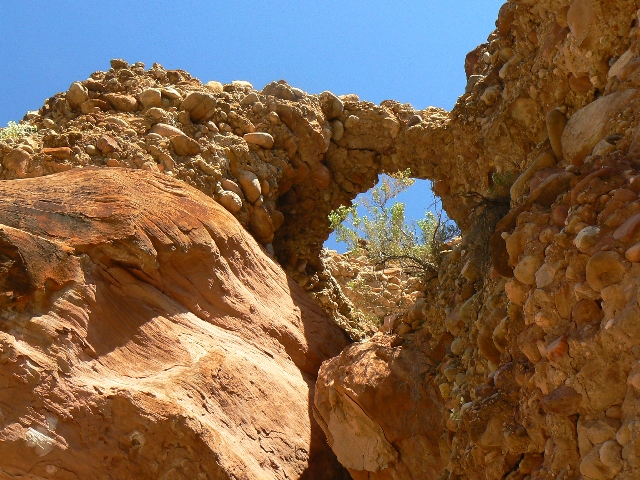
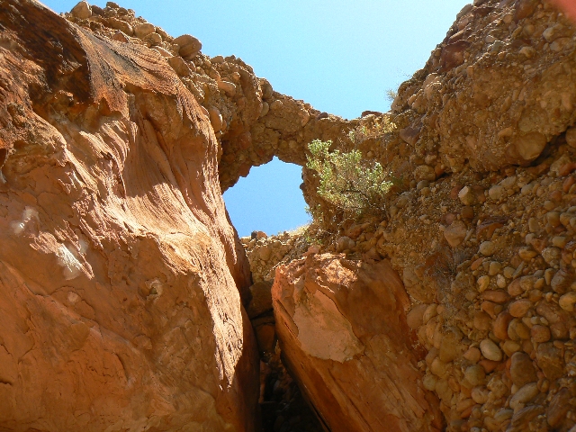
Day 5: Toasty Tapeats, Fishtail Frolic and Fry.
Deer Creek camp to Cobblestone Natural Bridge. 7 miles, ERM = 13.
My head swells with the heat as I seek the infamous
Cobblestone Natural Bridge (NB). Glorious. Lurching along the Tapeats SS layer between
Deer Creek and Cranberry Canyon, the views are mostly straight down into The River.
Shadeless. Rapture. Perhaps it's just heat exhaustion. The route rolls along, not really
a trail at all.
Craig remains at Siesta Spring which is back to the East
less than a mile. He's the smart one. It's been a long slog so far. Hot. There it is,
a cobblestone conglomerate layer, or at least a section of this stuff. Soon, the NB pops
into view. Devine. I capture photos
for the Archman!
Craig and I retreat to the falls, with its billowing,
surging, swirl of cool mist. Nirvana. We meet Carlos and Nicholas who are scheduled to
stay at Deer Creek camp tonight. Over the next two days, we enjoy discussions with Nicholas
and Carlos. Subjects range from the wild to the serious. Immersion in the waters of Deer
Creek prevents, just barely, heat stroke and exhaustion. Heavenly ablution, a sort of desert
baptism and purification. Ahh.

|
|---|
Craig signals Day 6
(Click the image for a full-size view)
|
|---|
|
|---|
Deer Cr. morning
(Click the image for a full-size view)
|
|---|
|
|
|---|
Deer Cr. morning
(Click the image for a full-size view)
|
|---|
|
|
|---|
Deer Cr. Spring
(Click the image for a full-size view)
|
|---|
|

|
|---|
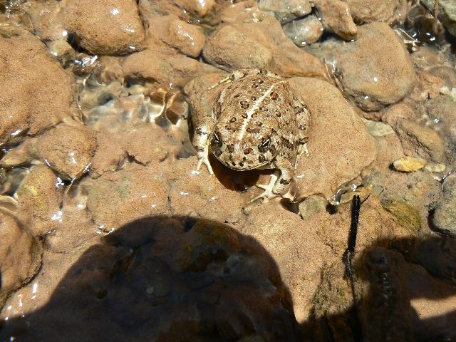
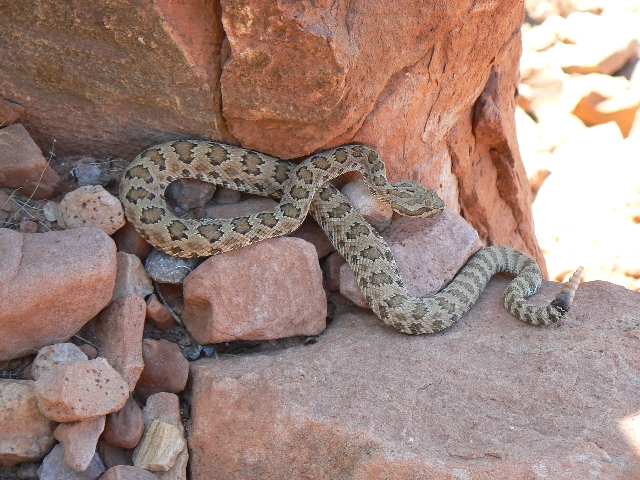
Sneaky Snake
(Click the image for a full-size view)
|
|---|
|
|
|---|
Irritated Rattler
(Click the image for a full-size view)
|
|---|
|
|
|---|
Rats in the sack
(Click the image for a full-size view)
|
|---|
|
|---|
Surprise Valley from Esplanade
(Click the image for a full-size view)
|
|---|
|
|
|---|
Early on Day 7
(Click the image for a full-size view)
|
|---|
|
|
|---|
Bridgers Knoll
(Click the image for a full-size view)
|
|---|
|
|
|---|
pom-pom fluffy
(Click the image for a full-size view)
|
|---|
|
|
|---|
Morning light - Esplanade
(Click the image for a full-size view)
|
|---|
|
|
|---|
Movie: From top of Deer Creek Springs; 31 MB
Click the image to see the video
|
|---|
|
|
|---|
Movie: Esplanade from Bill Hall Trail; 26 MB
Click the image to see the video
|
|---|
|
Day 6: Torrid, Torrid, Torrid! Deer Creek to the
Esplanade cache and camp. 6.9 miles, ERM = 13.
Ancient images gaze knowingly down on my dozing form,
cloistered from the mid-day sun under this wondrous mushroom rock. Esplanade. Ahh,
comfortable camp on the Esplanade after an early morning march from Deer Creek, past the
erotic spout of Deer Creek Spring, across the warming Surprise Valley, and a brisk climb
up the Redwall Limestone and Esplanade SS layers - seeing two unhappy, irritable rattlesnakes
along the way.
The canyons wilt in this continuing above average temperature
toaster. I would later learn that the area temperatures are 10-15F (or more) above average.
Torrid. Certainly, we can feel it now. Torrid Tappeats.
Our rat sack cache has been compromised. We suspect a
Ringtail worked on it over several days, eventually pulling out some of the stainless steel
mesh and bits of soup bag. Yet, little is lost. I guess this may teach us to hang the sack
out of sight of Ravens, yet where four-footers cannot get purchase on the fabric.
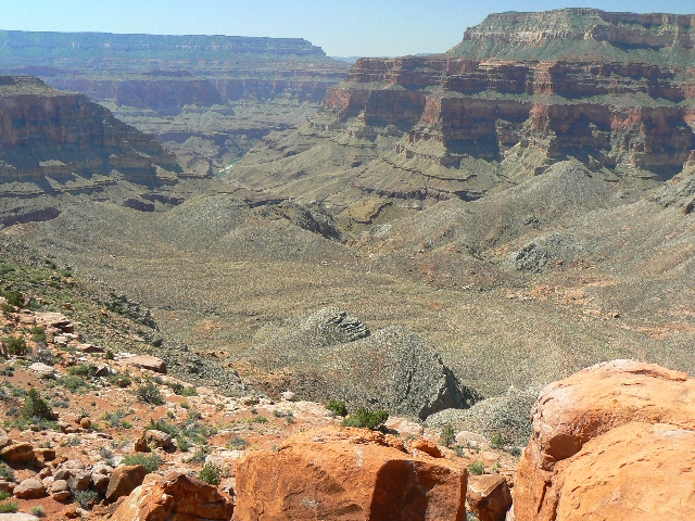
Views range across the middle and distant murky distance,
perhaps fouled by the Navajo Generating Plant (clean coal? Not!), local prescribed burns,
and/or the California fires? Still, it's a delightful view. Cool air slides in as the sun
slips below the horizon.
Day 7: Monumental Departure: Esplanade to Monument
Point and the Bill Hall TH. 2.9 miles, ERM = 7.
The blush of dawn thaws the relative chill of the Esplanade
- at least psychologically. Abruptly on the Bill Hall, a rise in elevation brings the
delicate drifting scent of blooming Cliffrose, which is just feeling Spring near 7,000'.
Up above, I hear the vigorous chatter of Carlos and Nicholas
as they creep toward Monument Point, debating the issues of the universe. It's a lovely
walk, with Monument Point casting a long, cool shadow over the Bill Hall Trail.
A bit over two hours of hiking and I am rinsing in cold
water from the solar shower bag, re-loading the truck, driving the FR 22 to Jacob Lake
(pond), loading Craig's car, and heading toward my Northern Arizona home. And, although
I will miss languishing in The Canyon, it will be cool
there.
"Night and day the river flows. If time is the mind of space,
the River is the soul of the desert. Brave boatmen come, they go, they die, the voyage flows
on forever. We are all canyoneers. We are all passengers on this little mossy ship, this
delicate dory sailing round the sun that humans call the earth. Joy, shipmates, joy."
Edward Abbey, The Hidden Canyon -- A River Journey
Links:

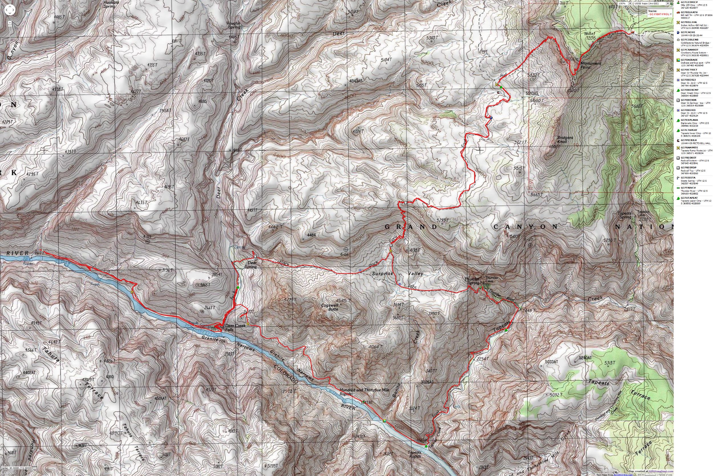
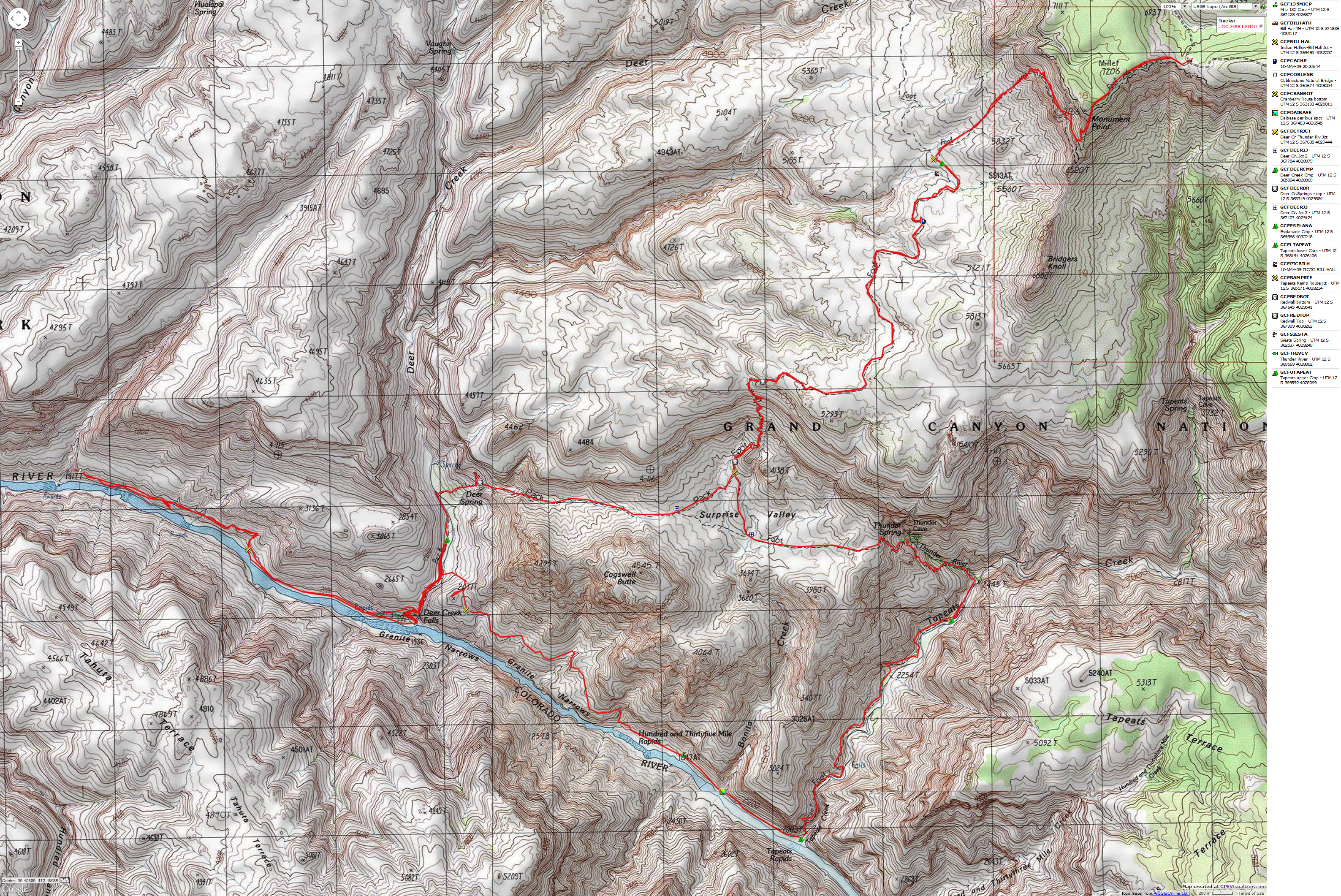
Map:


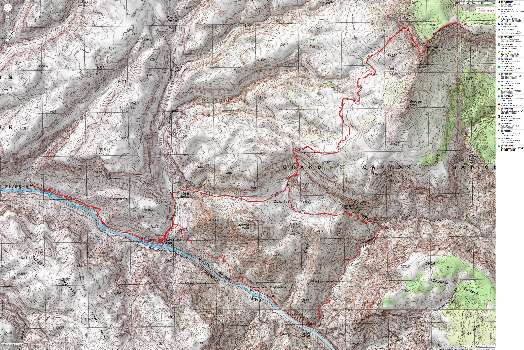
|
|---|
Map - GC: Thunder River & Deer Creek; 2009; 42 miles
(Click the image to see the map)
|
|---|
|
for a full-resolution map, click here. Caution - do not use this map or gps track for
navigating the route.
Movies: Start downloading one, or three, while you read the above text....
Deer Creek Falls, 9 MB
Deer Creek from Deer Cr. Spring, 31 MB
Esplanade from Bill Hall Trail, 27 MB
Other WV reports about the Grand Canyon:
Click here or on the Looking Lizard to go to all WV reports about The Grand Canyon

|
|---|
Looking for All Wilderness Vagabond trip reports about the Grand Canyon?
Click the image to go to All WV reports about The Grand Canyon
|
|---|
|
Related Links:
Scenic Toilets of Inner Earth
| | | | | | | | | | |


