|
|---|
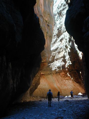
|
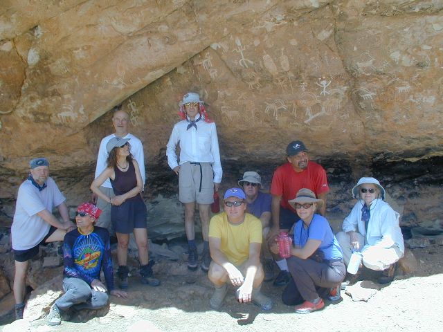
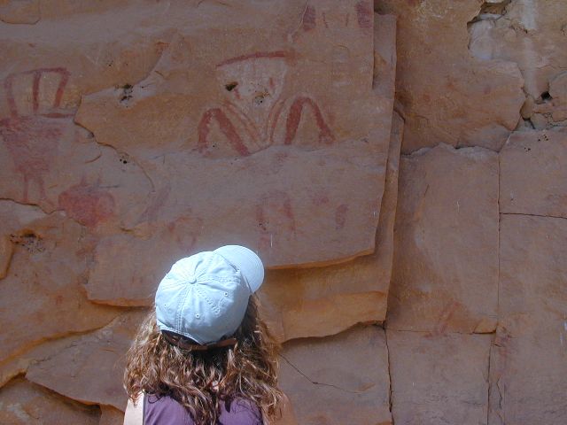
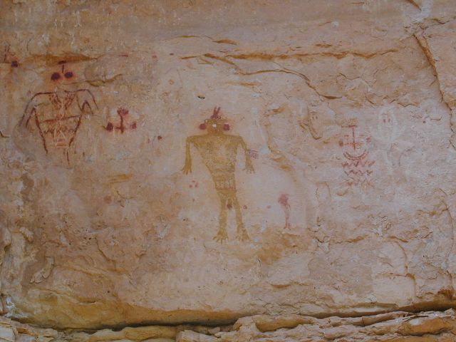
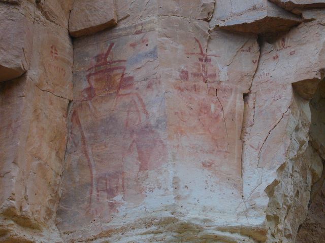
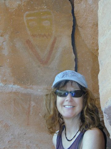
Group in Shelter
(Click the image for a full-size view) |
|
|---|
|
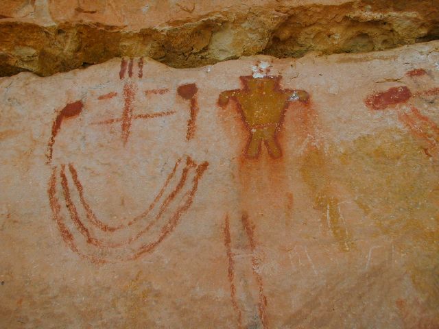
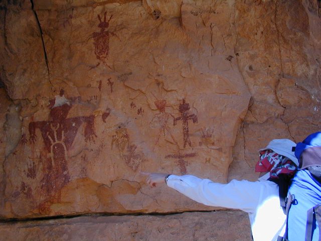
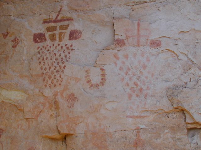
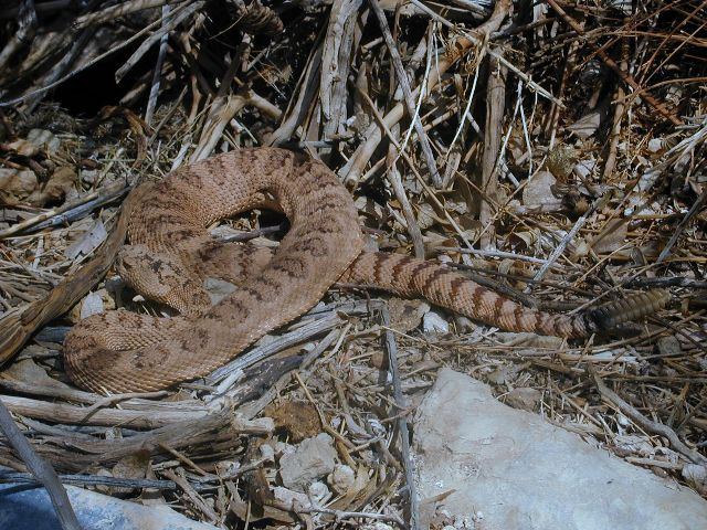
Picto in Snake
(Click the image for a full-size view) |
|
|---|
|
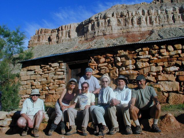
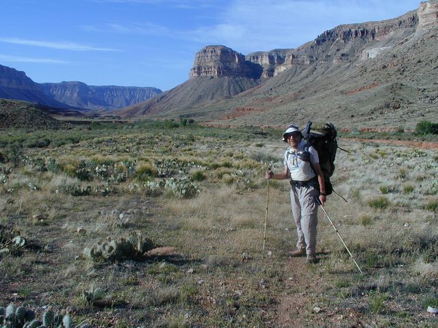
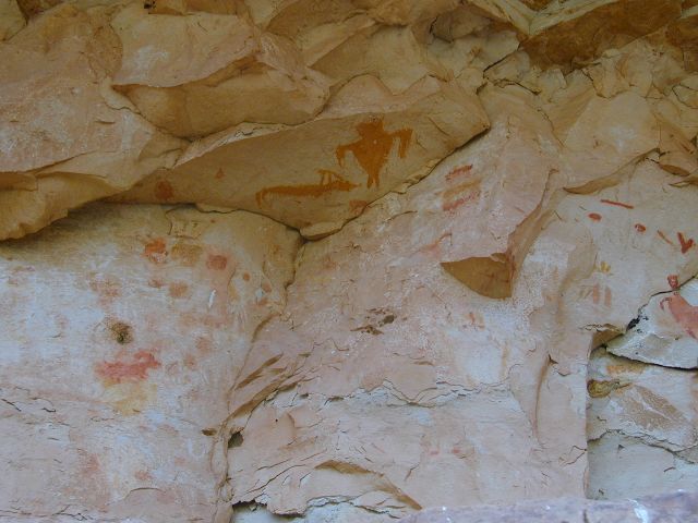
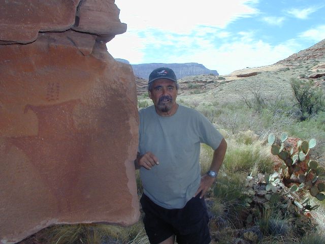
Seven at Ed Hatch
(Click the image for a full-size view) |
|
|---|
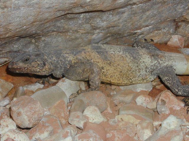
|
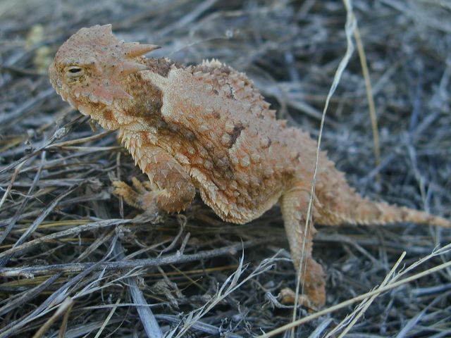
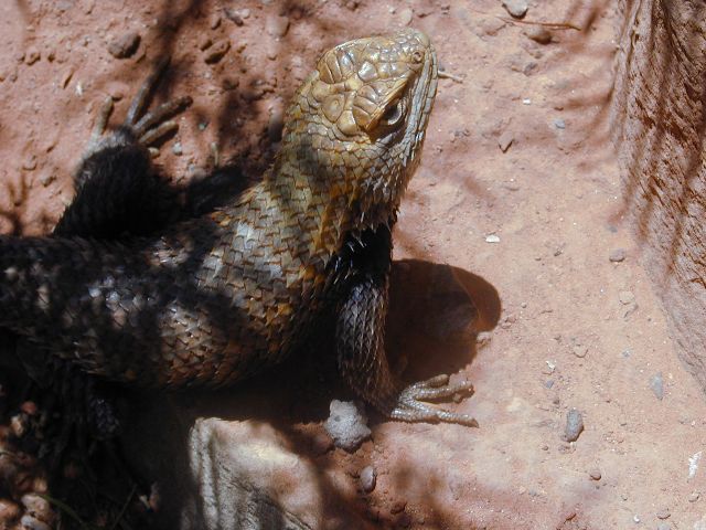
horned lizard
(Click the image for a full-size view) |
|
|---|
|
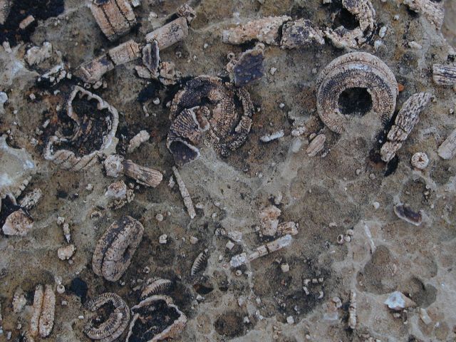
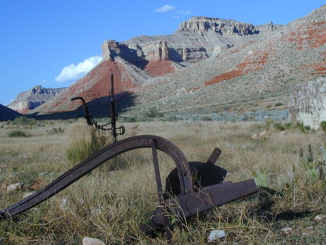
fossil rock
(Click the image for a full-size view) |
|
|---|
|
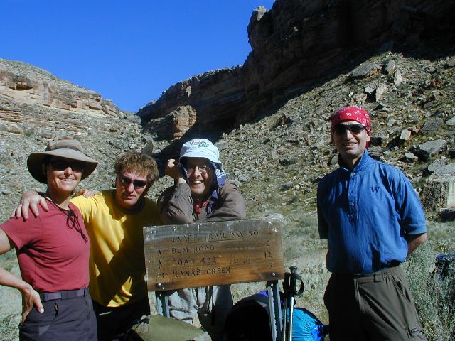
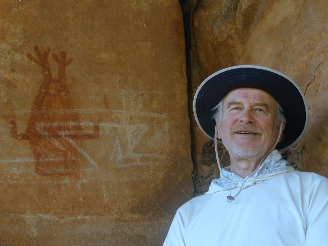
swapp group
(Click the image for a full-size view) |

| ||||
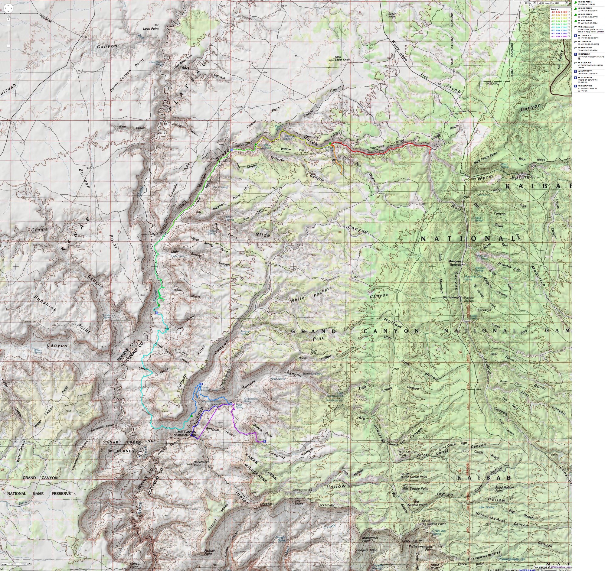
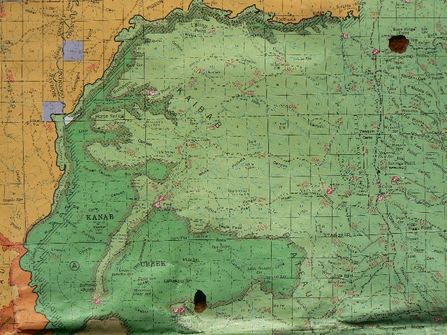
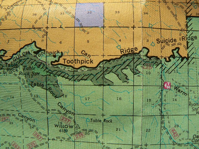
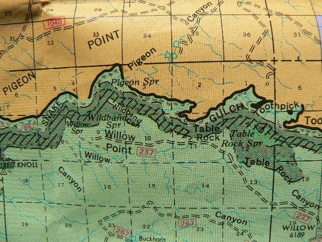
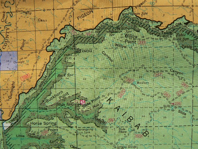
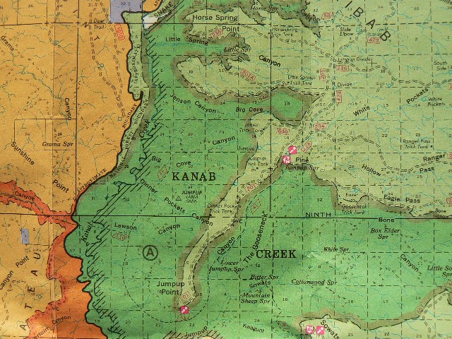
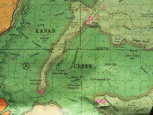
If you want to view a full-resolution map, click here. Caution - do not use this map or gps track for navigating the route.
Let's begin with a song: Esplanade Terrain
- Sung to the tune of "Acid Rain" by
the Austin Lounge Lizards: Highway Cafe of the Damned - 1988 (Sugar Hill Records;
SUG-CD 3901) Off we go, the intrepid eleven;
Because of monstrous pack weight, we are all in pain;
Esplanade, keep on rolling;
Seeing pictos in the shelters;
Some go out Swapp;
Now we are the Magnificent Seven;
Cow fondlers and tree huggers;
The Lost Ranger trail 41, where is it?
Esplanade, keep on rolling;
Walking around slickrock canyons, without a handrail;
When we came to Lawson - thought we were half-way;
After 13 on the Ranger and only 3/4 done;
So, thyne Jugs of Jeremy* did fall from the sky;
And, we did speak of the scrolls of Jeremy;
Well, the rain provided rescue;
Esplanade, keep on rolling;
First foreigners of the trip today;
Too soon we are climbing;
The "real" lyrics by the Lizards go like this: * thyne Jugs of Jeremy is a reference to the precious water left on the Esplanade
below the Bill Hall Trail by Jeremy C. last year - when we hiked the Kanab Creek Wilderness
to The River, along the river to Deer Creek Falls and Thunder River, and out the Bill
Hall Trail. See the 2005 Kanab Creek Wilderness report in the links section
for the complete story. Now,
back to our current report ---- Mark C. comments: Rob's report: Night 1: Yes, there are eleven of us. Al and I had envisioned a repeat trek into the land
of the Kaibab while the snow was flying, and co-organized it as a Sierra Club
cooperative trip. Al writes "fast forward 6.5 hours. Gather at Snake Gulch TH.
Exploration and camping on an irregular, rocky, cactus-covered desert. Reality is
pretty canyon, green grass, perfect temperature. Mellow group getting mellower by
the minute as the beers are consumed." Our plan is more complicated than initially envisioned: four would hike the
short, from Snake to Swapps TH (Ken E., Mark C., Rebecca W., and Robert J.) and
the remaining seven would continue to Sowats Point (Al & Mary H., Gordon L.,
Aaron J., Paul G., and Kathleen and I). Day 1: Picto Heaven - Snake Gulch to Table Rock Spring It's quite warm when we stumble to Table Rock Canyon and see no water or sign of water. Argh. Poking longingly into the canyon, we encounter a 4' diameter horse tank with glee. The luscious neon green water prompts us to continue up canyon where we soon reach a cement edifice filled with clear essence. Saved! The group spreads out to camp. An alcove above us contains bits of structure walls and some defaced pictos. Beauty surrounds us. We enjoy spicy black beans with rice and pita bread lathered with hummus. Yum.
A thunderstorm surprises us and sets the rocks to glisten and glow. Day 2: Rockin' to the Top: Table Rock - day hike
to top
As we grunt into Snake Gulch heaven.
While we keep on rolling, Without refrain;
Toward that Esplanade terrain.
Packing for 9 days; we do not hike in vain.
On and on we are hauling, toiling;
Thinking Esplanade terrain.
As we 11, we are strolling.
While here is great, we all exclaim;
Where's that Esplanade terrain?
And some petros, scattered helter-skelter.
This is just exactly what we came to do;
You cannot imagine doing this, can you?
To Fredonia it's a quick hop.
The rest remain;
heading to that Esplanade terrain.
In this country like heaven.
Marching down rock slabs;
Just South of Bigotville, Kanab.
Without Ed Hatch water, all would be strugglers.
And against the Zane Grey sky;
Neither has a reply.
Looking, scanning, we could have a fit.
No Esplanade on which to be roaming;
At the mouth, we are foaming.
As the rain, it is falling.
And with the sun, it's like a flame;
On this Esplanade terrain.
Inching, striding, promenading - mostly like a snail.
Esplanade, keep on rolling;
As the rain, it is falling.
Without the clouds & showers we would not have survived the day.
Esplanade, keep on rolling;
As the wind, it is blowing.
If not for rain-filled potholes, we'd be raisins drying in the sun.
Esplanade, keep on rolling;
As the sun, it is glowing.
We made camp on the slickrock, and did not fry.
Esplanade, keep on rolling;
As the shadows they are growing.
Up on this gentle layer, so much better than hegemony.
It's delightfully deluxe, we all acclaim;
This glorious Esplanade terrain.
While we enjoyed a panorama view.
Respite from the desiccated trudge;
Over all this world we judge.
As the sun, it is glowing.
Even with the sun, hot as a flame;
I love this Esplanade terrain.
We hope they do, then they go away.
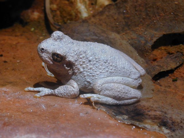
At the Mountain Sheep;
All those frogs go "bleat."
Out of the canyon, I am rhyming.
A report of our adventure, I sing the refrain;
About that wondrous Esplanade terrain.
Acid Rain, keep on falling;
while her name, I am calling.
I walk the shores, of Lake Champlain;
in the placid acid rain.
Walked together through the forest of dying trees;
tasted the sulfuric acid on the April breeze.
went canoeing on the lake, fish were floating by;
she read me her manifesto, I had no reply ...
Wandering the 'trail' up Table Rock Canyon, we find that the route has been used - probably by folks taking a short route to the panels of Snake Gulch. We hike up, take the right fork and climb out of the canyon to encounter a spider web of roads on their way to Willow Point. We return to a nice "bath" from the horse trough and pasta with fresh veggies prepared by Al and Mary. Now, we enjoy local sunset, as the light slips chiffon pink across the layer cake cliff bands.
|
|
|
|
|
Day 3: Wildband Roving - Table Rock to Willow Spring (6+ miles). My feet are regaining their previous shape for the fifth time today as the cool air settles into the canyon at the mouth of Willow Spring Canyon.We start out sometime after 9 a.m. and after one more picto and two small granaries, we don't see more prehistoric art or structures until we reach Kanab Creek. We stop in at Pigeon Spring and find a tiny flow, more of a hand-sized puddle filled with sulphurous slime. Disappointing. Ken plays tag with a canyon rattler, and I snap a quick photo before he slithers quickly into the brush. Continuing, we find water in a horse trough near Wildband Canyon, which holds an alcove suitable for lunch, after which we slog on in the heat to Willow Canyon. Ken is re-engineering the various drips and drops of Willow Spring after we locate in a half mile up the canyon. Soon, we have a flow sufficient to support two filters, filtering simultaneously. We gather water in what bottles we have and return later, after sunset, for more. We are camped on the coluvium opposite the canyon. Dinner is a stew of potatoes and lentils and peas. Deluxe. During the evening, the breeze flaps the tent, we hear owls hooting overhead, and toward morning Mourning Doves and coyotes. Day 4: The Magnificent Seven Go Seven + - Seven dust off to Ed Hatch Cabin and a Gusher! (8 or so miles). If the previous days were marked by pictos and petros, today is marked by expansive vistas, rising canyon walls, and a gusher of a spring confined to a pipe.Arising early, we head through the brush to the foot of Swapp Trail, where Mark, Ken, Rebecca, and Robert climb the short distance out of the canyon, and perhaps to Nedras or the Rocking-V. We remnant hikers encourage them to not support the bigots in Bigotville, Kanab who have recently endorsed a "natural family" resolution where every woman is cow to a "full quiver of children" and relegated to destroying the earth via dramatic overpopulation, and where diversity is denigrated in the name of 'religious' intolerance. I suppose "religious intolerance" is redundant, is it not? The resolution states "...We see our homes as open to a full quiver of children, the source of family continuity and social growth. We envision young women growing into wives, homemakers, and mothers; and we see young men growing into husbands, home-builders, and fathers." Then, there were seven. The character of the canyon changes, broader with taller walls and more dessert-like foliage. This translates into hotter with more dust. Now, while gazing at a Zane Grey sky - cerulean blue dotted with fluffy clouds pasted against the white and deep red rust of canyon walls - is this the Hermit Shale? Al reads from the Ed Hatch Cabin log, where folks whine and threaten cow fondlers and tree huggers, punctuated by notes about "Bigotville," referring to the propagation proponents in Kanab, shithead capitol of the West, although an astounding number of communities are vying for this distinctive title of elitism. We have showered and done light laundry and we regard the Ed Hatch Cabin as an oasis of yore. Water gushes from the spring wrapped in a pipe as we enjoy bean burritos garnished with fresh green peppers and avocados and tomatoes, luscious. The Magnificent Seven have arrived.
| |||||||||||||||||||||||||||||||||||||||||||||||||||||


