Grand Canyon Trip Report - Nankoweap #3 / Nankoweap to Horsethief Trail / Kwagunt / Malgosa overview
(September 30 - October 7, 2011)
Text © copyright by Rob; and Photos © copyright by Rob

|
Horsewhip Horsethief Trail:
Grand Canyon Trip Report - Nankoweap #3 / Nankoweap to Horsethief Trail / Kwagunt / Malgosa overview (September 30 - October 7, 2011) Text © copyright by Rob; and Photos © copyright by Rob |
|
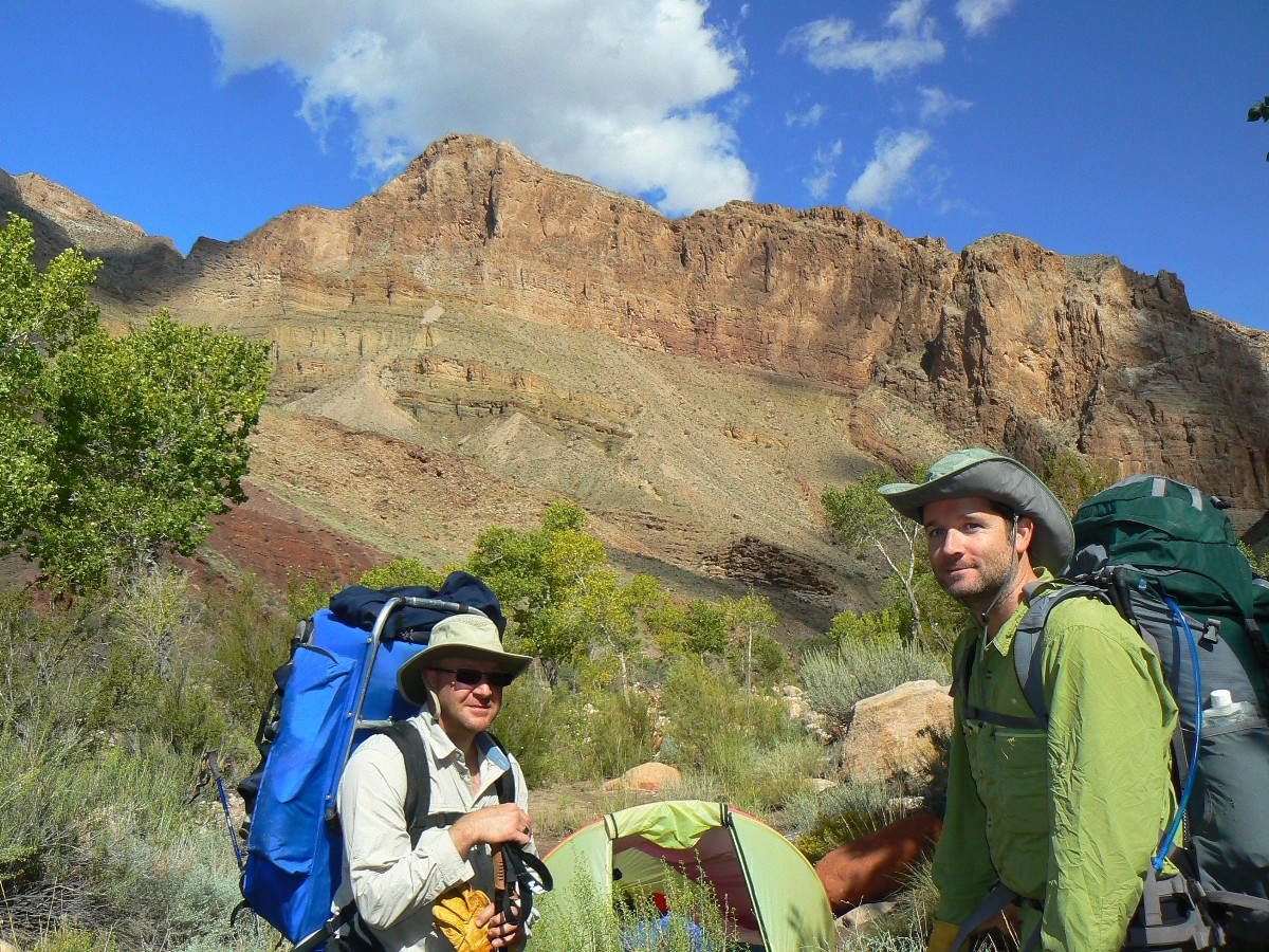
Co-Adventurers: Craig McCarthy & Rob
| ||||

| ||||
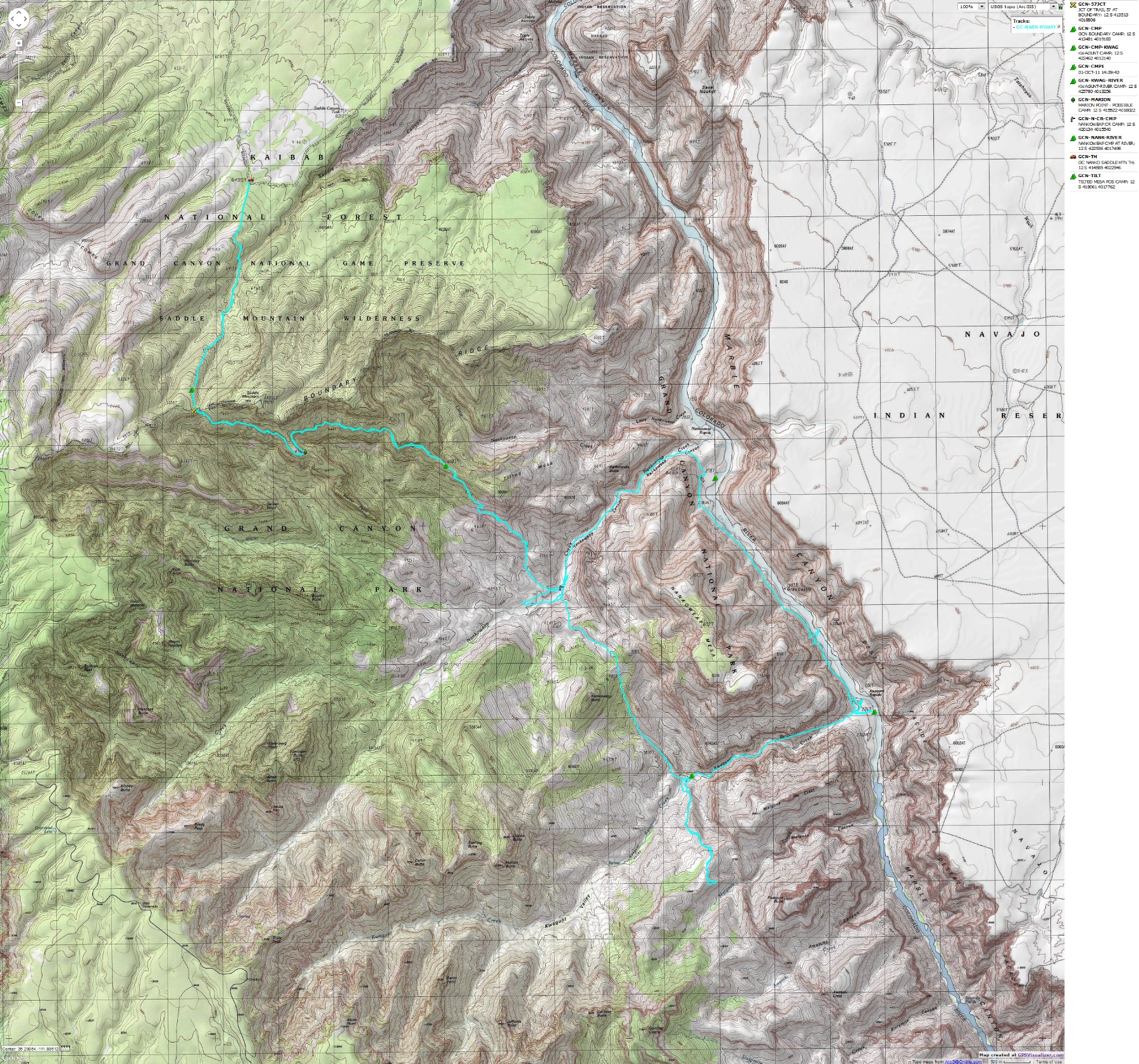
for a full-resolution map, click here. Caution - do not use this map or gps track for navigating the route.
Prelim:
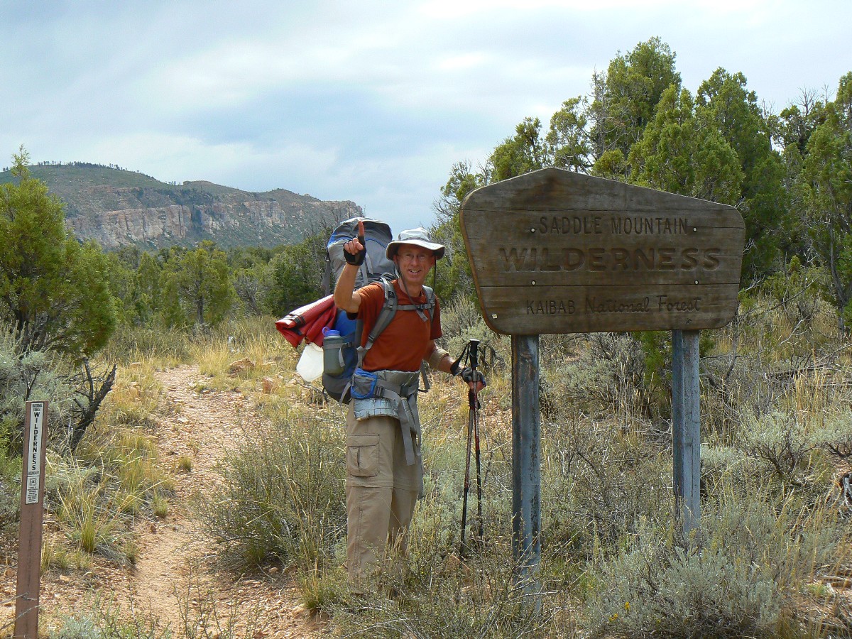
Sept. 29th finds Craig and me rendezvousing at the Hatch boat shed in Cliff Dwellers, along the stark and
voluptuous Vermillion Cliffs, then driving the teeth-rattling, prostate-pounding, washboard of the Buffalo Ranch
(South House Rock Valley) Road to the Saddle Mountain TH (trail head), arriving just after dark in a flurry of
Night Hawks fluttering on and off the road surface. Effusive. Life is good cradled in a collapsible chair eating
tuna casserole in the dark, surrounded by the pygmy forest of Pinyon Pine and Utah Juniper. Yum.
This report contains: 51 photos, 8 panoramas, and one dynamic map
| ||||
 |
 |
 |
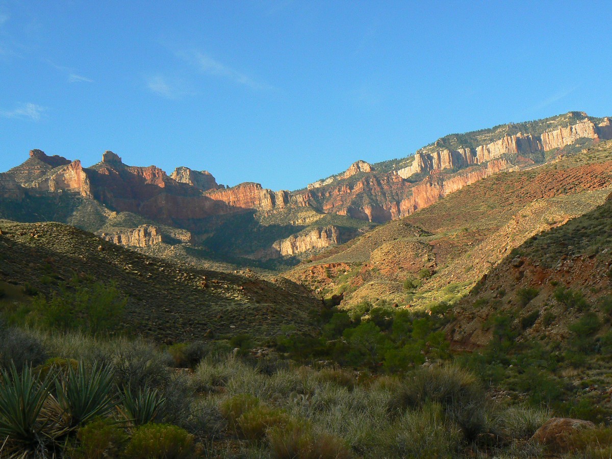
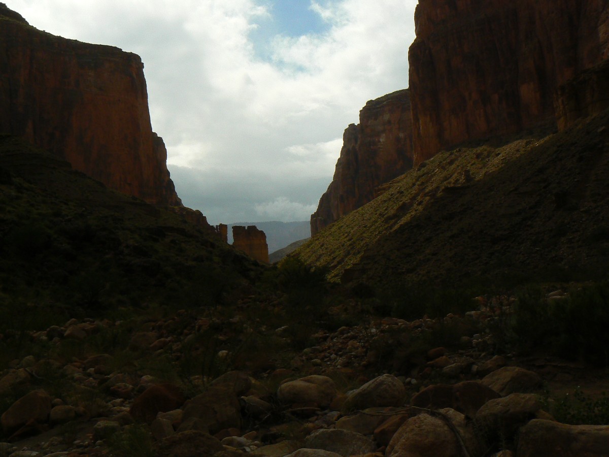
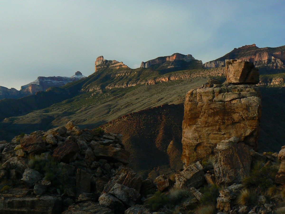
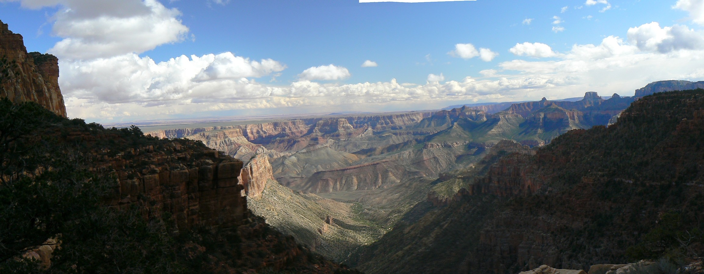
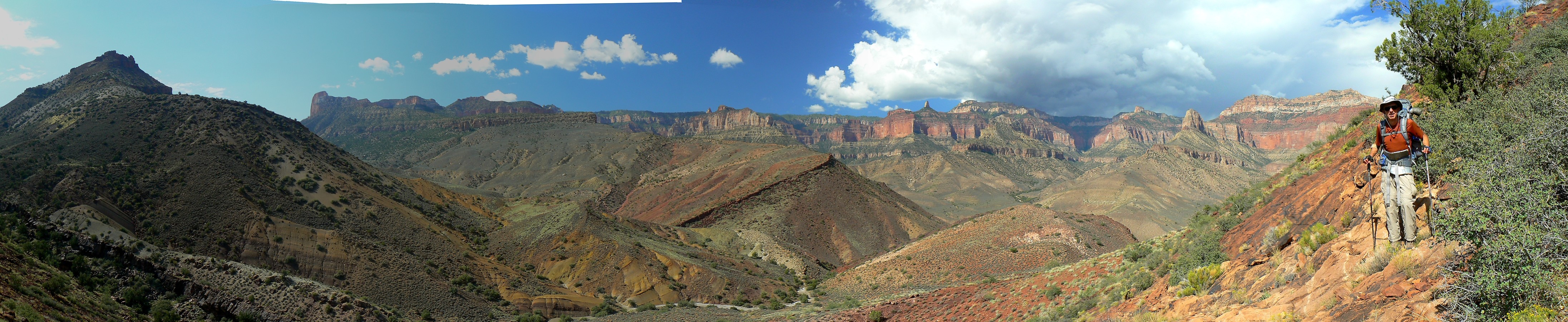
Day 1: Humping Water: to FS/NPS boundary, the remote TH, 3.5 miles.
Groan. Climbing to near 7600' and into the P-Pines (Ponderosa), the 20 pounds
of water and extra cache items makes gravity pronounced. Profound poundage. Not daring to put down the packs,
Craig and I rest with these bloated beasts propped on rocks, then continue. Enough water for camp today, the
long hike tomorrow, and for the return camp on the last day. 65 pounds? Heavy, anyway. Clouds have crept in,
perhaps the precursor to moisture from the new hurricane, pumping potential rain into the Colorado Plateau.
Over to the boundary (NPS/FS) we lilt - having dropped the behemoths in camp - to see the exploding view of
buttes, mesas, canyons yet to be explored.
| ||||
 |
 |
 |
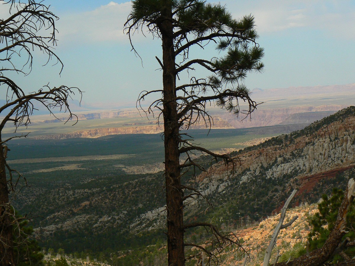
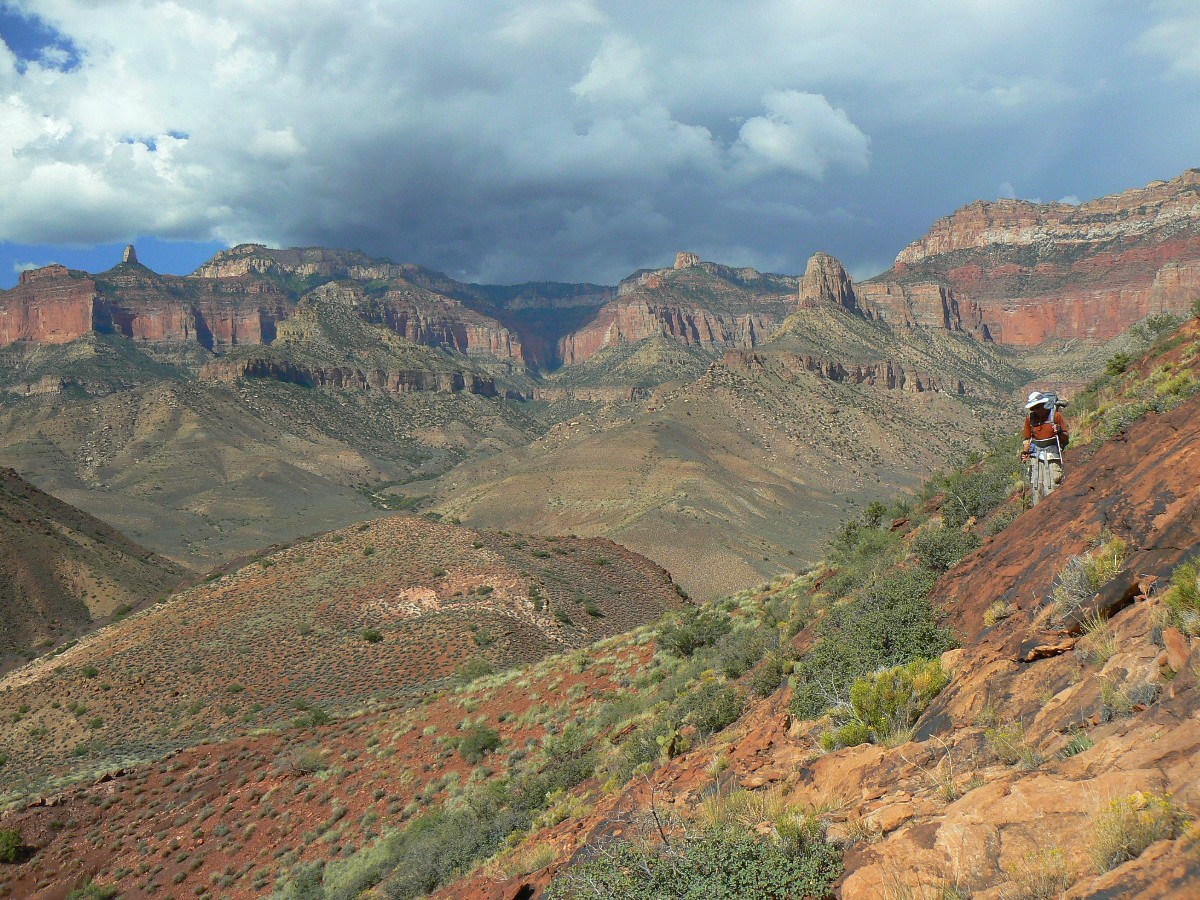
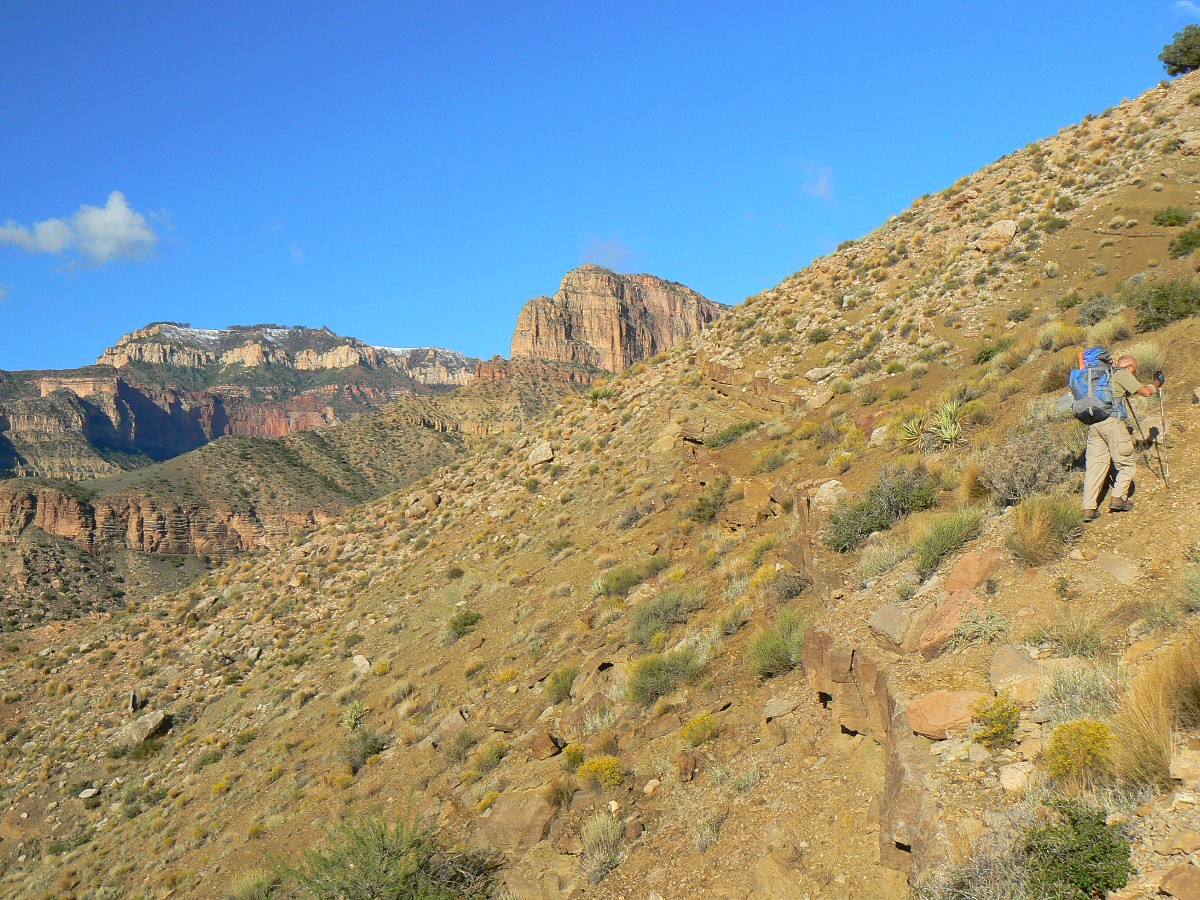
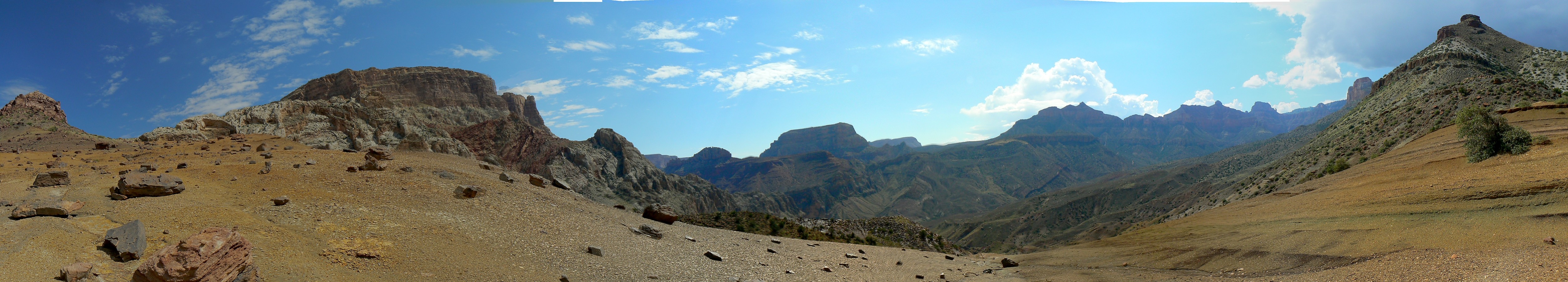
Day 2: Nankoweap Flog - 7.6 miles, up about 1760', down about 4620'; ERM* = 18. Camp at about 3440'.
*ERM = Energy Required Miles.
A mile is added for every 500' elevation gain or loss. ERM was initially used in Trails of
the Tetons (long out of print) by Paul Petzold, founder of NOLS. It's a wonderfully
useful concept and application. Add one mile for each 500' up AND down to distance = ERM.
I use ERMs to calculate what the actual day is like. It's a very serviceable method of
estimating energy required miles.
Using ERMs does not account for the 'texture' of the route or
trail - that is, rocky, boulders, no trail, slimy mud, etc., yet does help approximate the route.
Estimated mileage and ERM for this trip - GPS trip total of 41.1 total trip miles; up and down a total of about 22,250'; total ERM estimated at approx. 85.
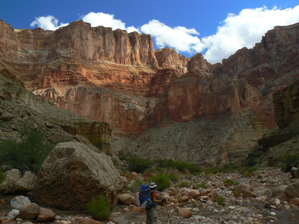
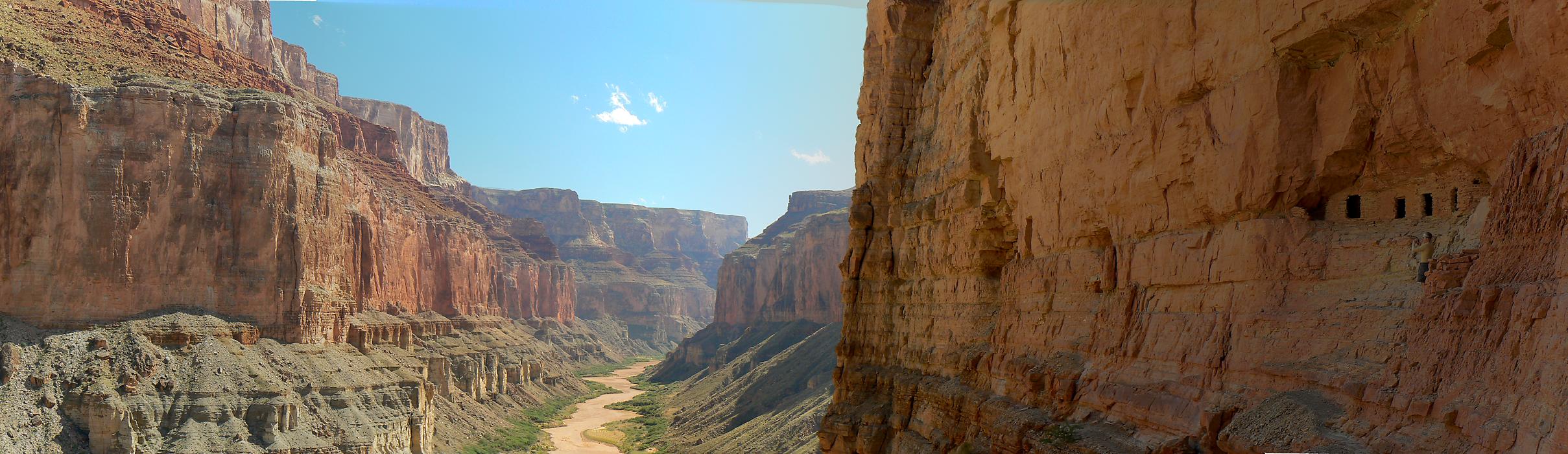
Finally, gurgling burbling waters of Nankoweap. Cool and refreshing, bordered by
luscious Cottonwood Trees, nestled in the deep cleft of The Canyon system. Today, it's a warm cleft. The trail
has eroded greatly in many sections making for poor footing. Temperamental tread. This requires much care and
slow going at times.
We start off with clear skies and begin the long Supai traverse beneath the
Esplanade Layer. Lots of sun, warming more. The air tour terrorists start their assault on natural quiet
promptly at 9a. Horrid. Wasteful. Terrorists. And, can you say "global warming?" Obliteration of a precious
natural resource. Soundscape.
First snack is in the juniper shade at Marion Point, then lunch at Tilted Mesa.
Clouds are roiling to the South and West and finally block the sun and provide needed shade. Entering the Nankoweap
drainage, we meet Jim and sons Jeremy and Steve from Albuquerque and Denver - who graciously offer to share the good
camp and supply batteries for my fading GPS. Lovely. A stream dip is beyond deluxe. It's a hot evening punctuated
by meager showers that dry nearly as quickly as they accumulate. Jim et al. duck into a tent during the showers,
then flop out in the open, yet still muggy air. Cloud cover reins.
| ||||
 |
 |
 |
 |
 |
 |
 |
 |
 |
| ||||
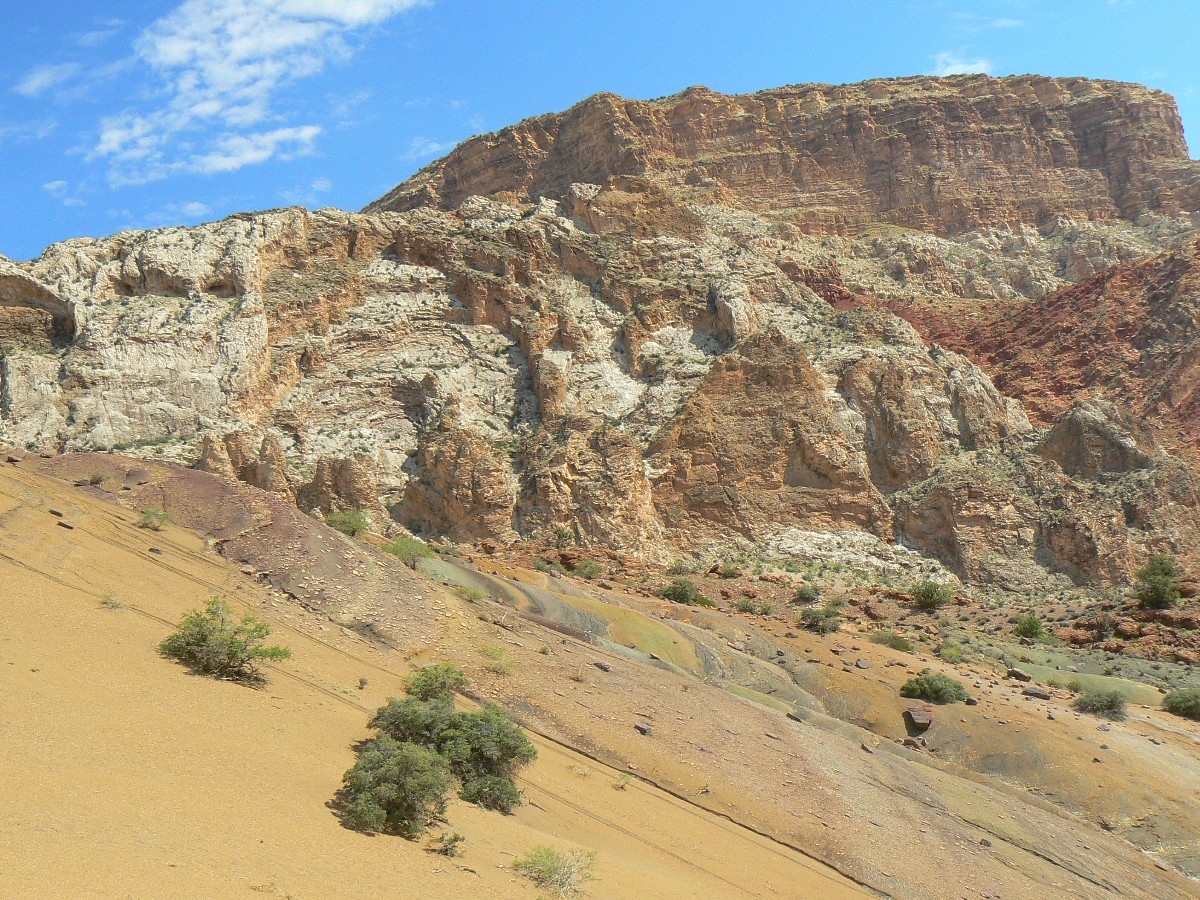
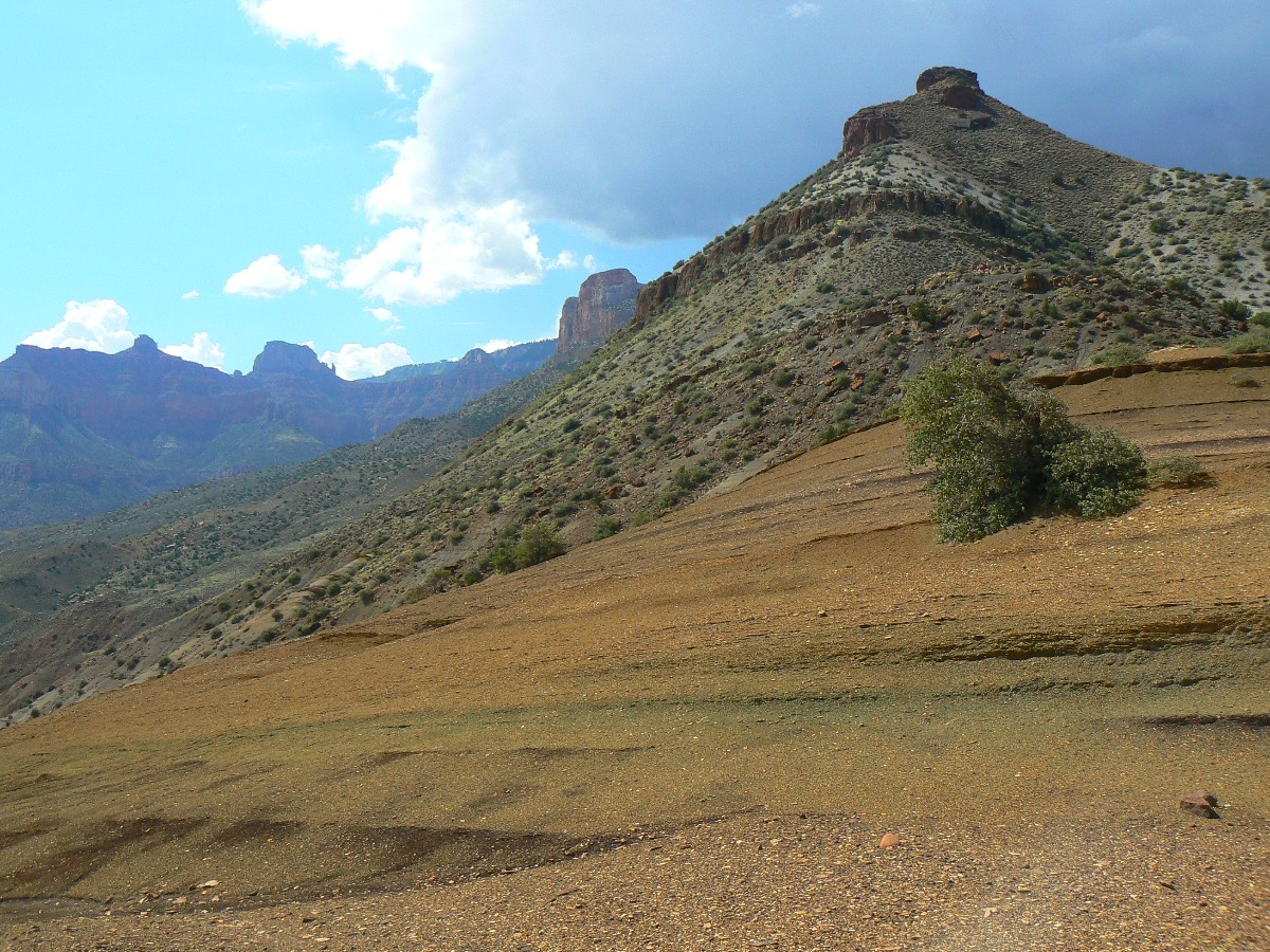
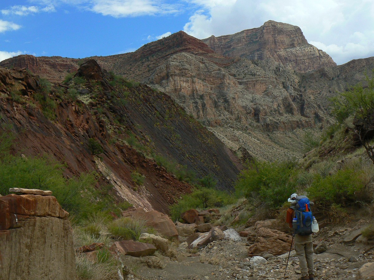
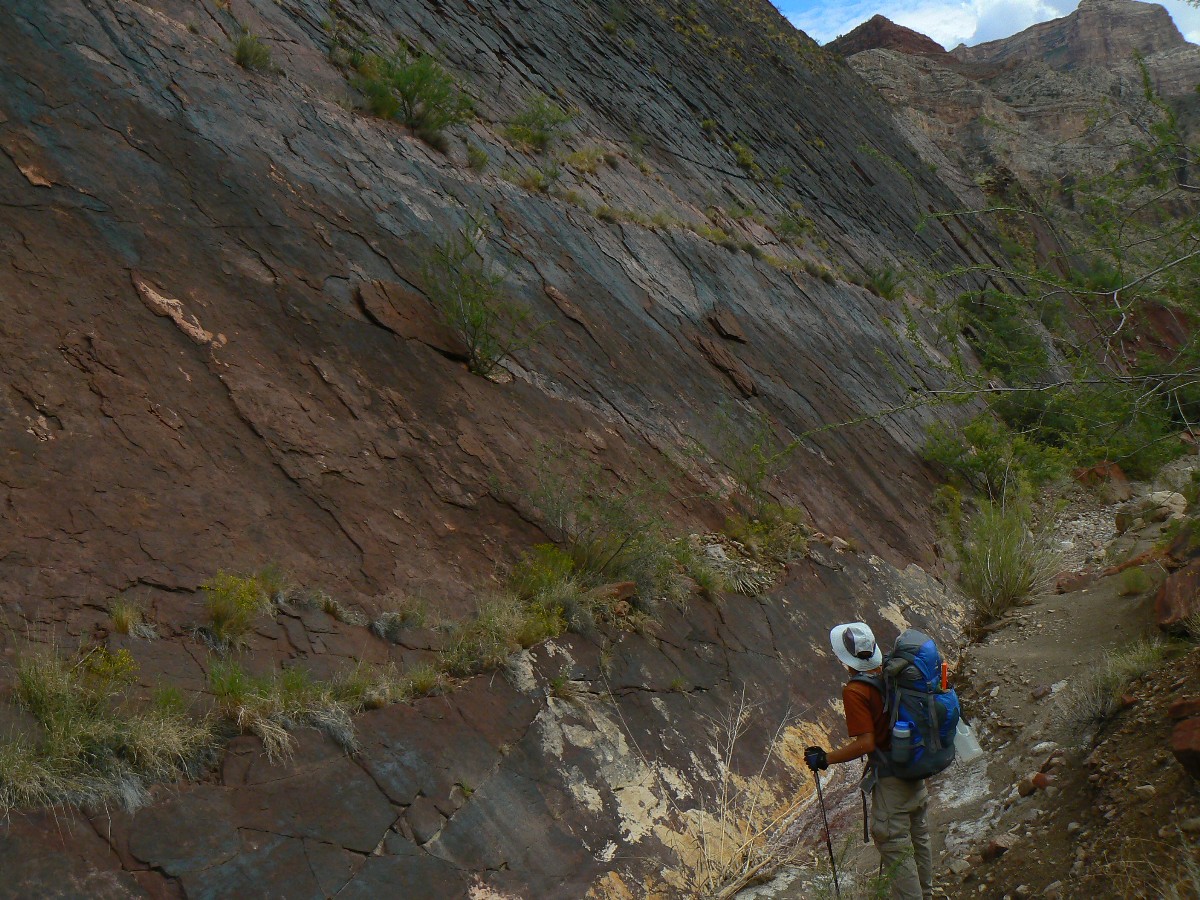
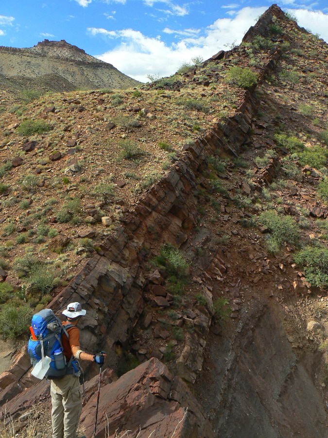
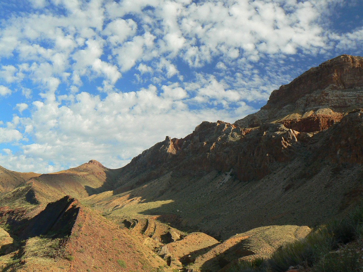
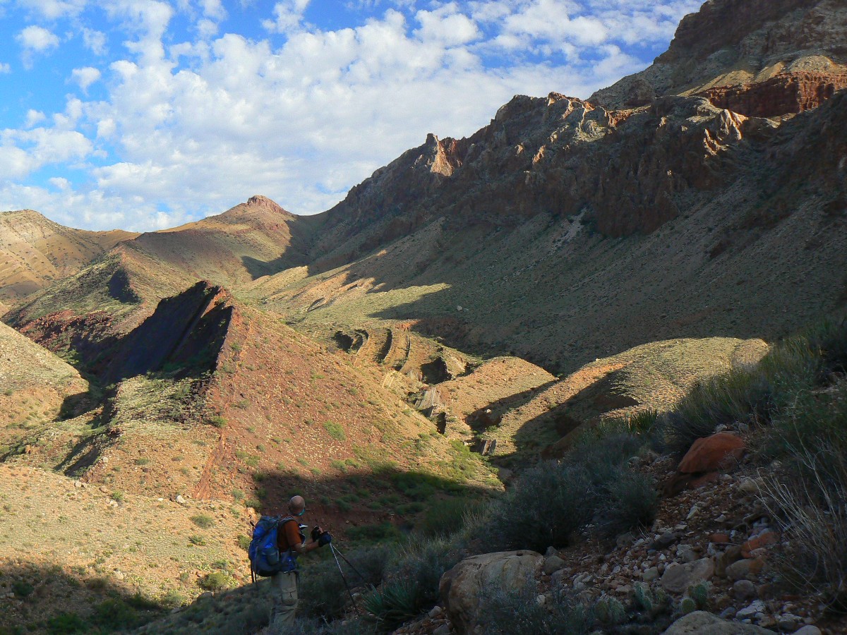
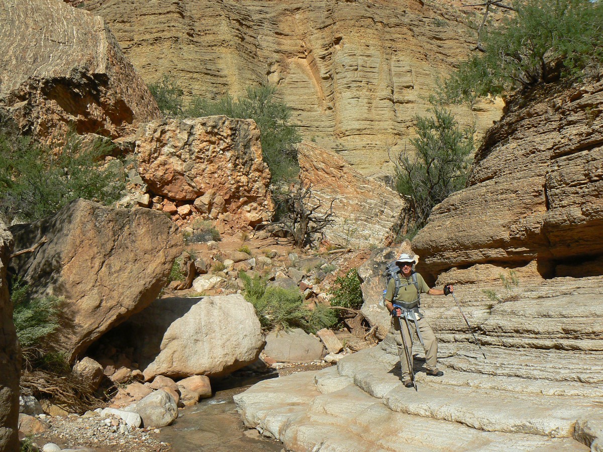
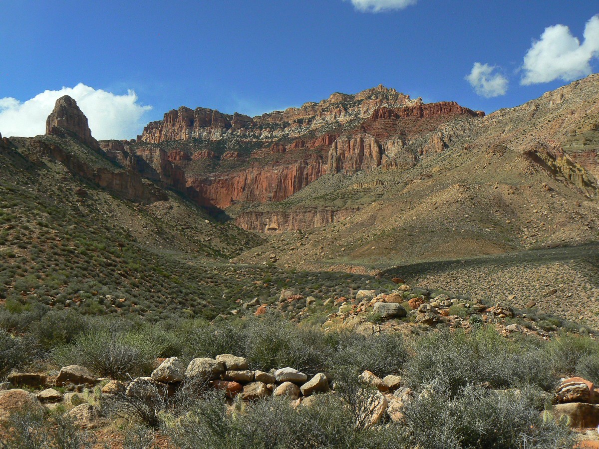
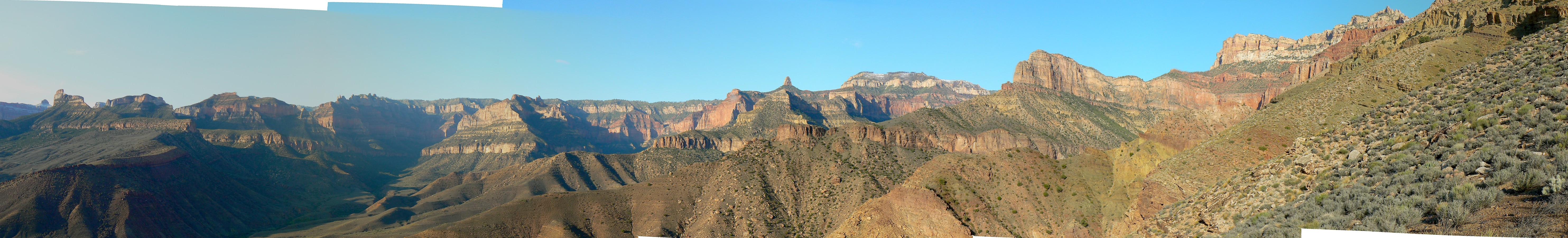
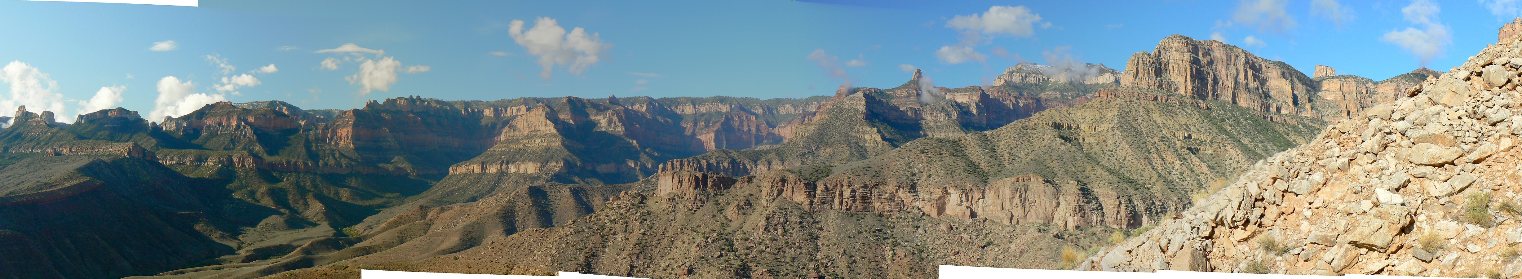
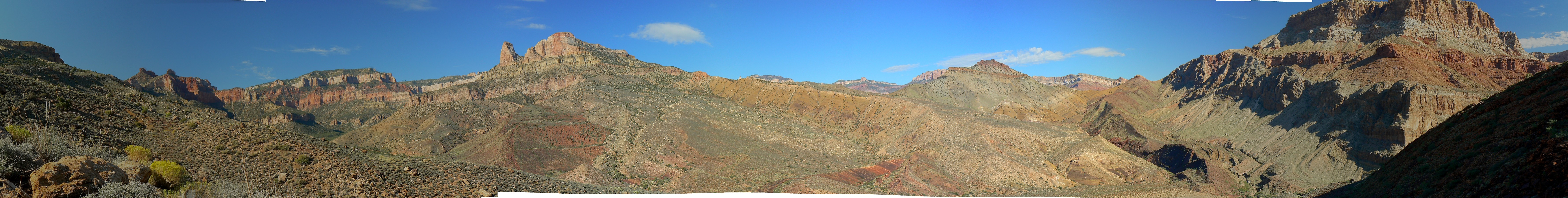
Day 3: Humping to Kwagunt, the Kwagunt Krunch - 4.1 miles;
via pass between Nankoweap Mesa and Butte; ERM = 9; camp at 3400'.
"Kwagunt!" cries Craig, as we roll off the rim above the serious pour-off, a portion
of the highly distressed, faulted rock garden sometimes called the Horsethief Route. Clear, flowing water from the
SW arm, and lots of it. Refreshing. We've made it to Kwagunt. An undiscovered country.
Not far today, yet somewhat challenging terrain.
We start out going up Nankoweap drainage a short distance, while Jim, Steve, and
Jeremy loaf on down Nankoweap to The River - a good recovery day after a thrash to Mystic Falls. Turning off the
main canyon, off-trail, Craig and I begin lumbering up to and through a break in the crest reef. Then, along a
polished uplifted slab of desert varnished Esplanade (?) and up a mound to enter the green shale slant to the
pass between Nankoweap Mesa and Nankoweap Butte.
Thunder and dark swirling hurricane-produced clouds curtail our admiration of
the Nankoweap and the Kwagunt basins and we roll off into Kwagunt, mostly in the bottom of the canyon. It's
slow going at times, and we skulk along another impressive faulted slab angling directly out of the stream
bed and reaching for the clouds. Roll right (LDC; looking down canyon) around the rim of one of these slabs
(you won't fail to notice the pour-off if you're in the stream bed) and into fabulous Kwagunt Creek. Yahoo.
A bath, irrigation by soup, bat gazing, a 1/4 moon, and enough solitude to
sooth the soul.
With creaking joints and tremulous quadriceps from the downhill dirge (mostly
from the Nankoweap section?), I feel like a well-flogged fricassee, and I am extremely happy to report this
to you from Kwagunt Creek camp.
| ||||
 |
 |
 |
 |
 |
 |
| ||||
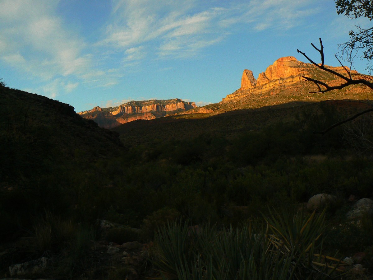
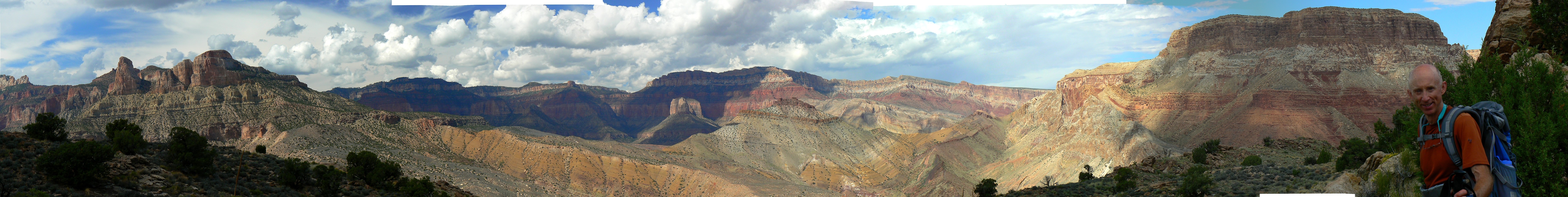
Day 4: Malgosa Malady - 3.7 miles to Kwagunt-Malgosa ridge
and exploration; ERM = about 10.5; camp at 3400'.
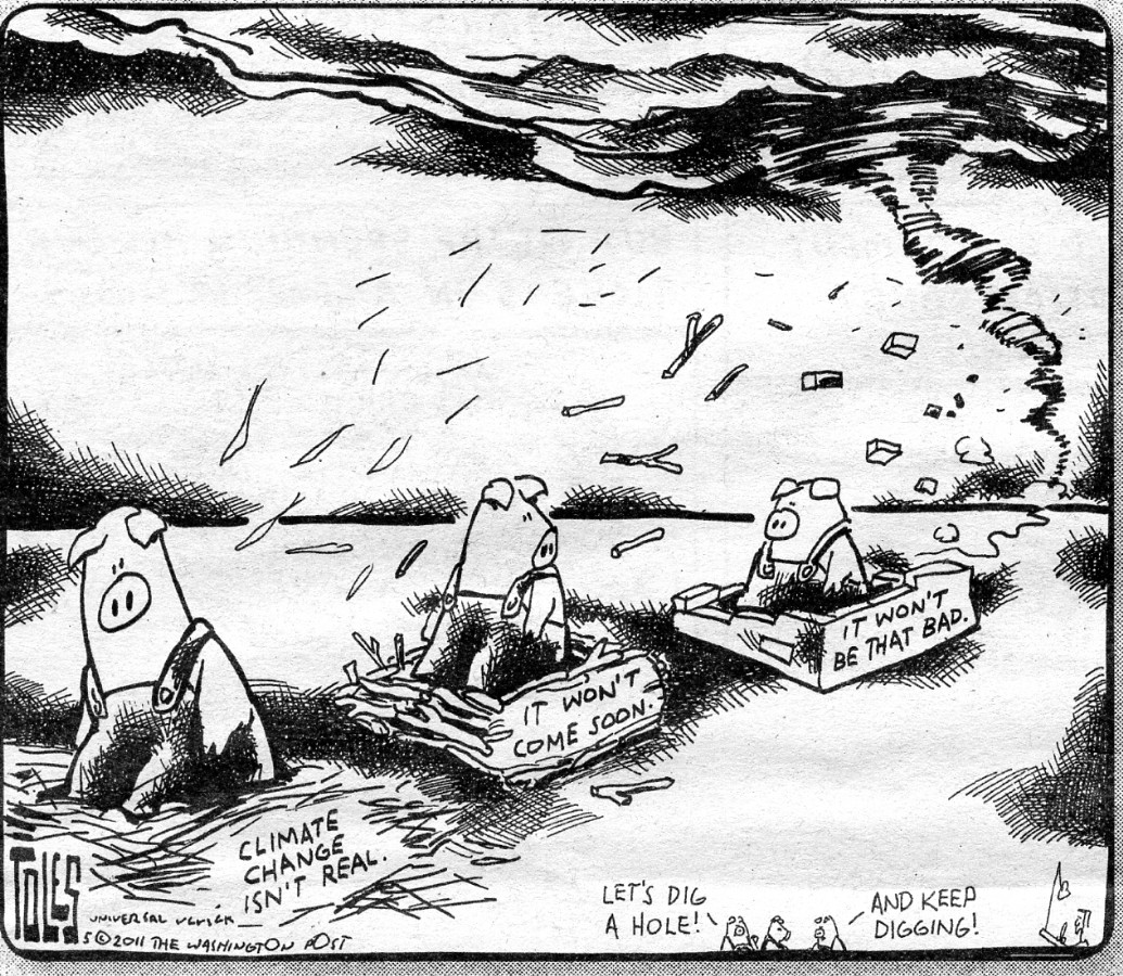
A veil of rain slides over the camp as another global climate change hurricane
hustles moisture from the Pacific. Winds buffet Craig and me on our way down from the Kwagunt-Malgosa divide.
It's a day of steep climbing and a bit of route finding. The rain drifts North and it's bath time, then dinner,
punctuated by a bit more insignificant rain speckling.
We got up early and packed lots of water for our day hike day, dumping out the
two rodents who jumped in, yet not out of the bucket. Craig gets fresh water for filtering, then reports that
these rodents won't be making it onto the roles of the Kwagunt Swim Team. These rodents exhibit bushco level competence.
Then, up the ridge we stumble, closely paralleling the great fault. Impressive.
Finally arriving at the Kwagunt-Malgosa pass, an immense undiscovered country is revealed. And, except for
the air tour terrorists making quiet conversation a yell, it's graced with natural quiet and solitude galore -
not having seen a track or a person since leaving Nankoweap. Now, that's a nifty feat, given the "human"
headlong suicidal dash of exponential population growth, 7 billion soon, another billion a few years later.
Hoards. Lemmings. The drop into Malgosa and regaining the next ridge is beyond us today. A Malgosa malady.
Now, after dark, no more air terrorists insult our ears and the gentle burble
of Kwagunt Creek soothes the fortunate.
 |
 |
 |
 |
 |
 |
 |
 |
 |
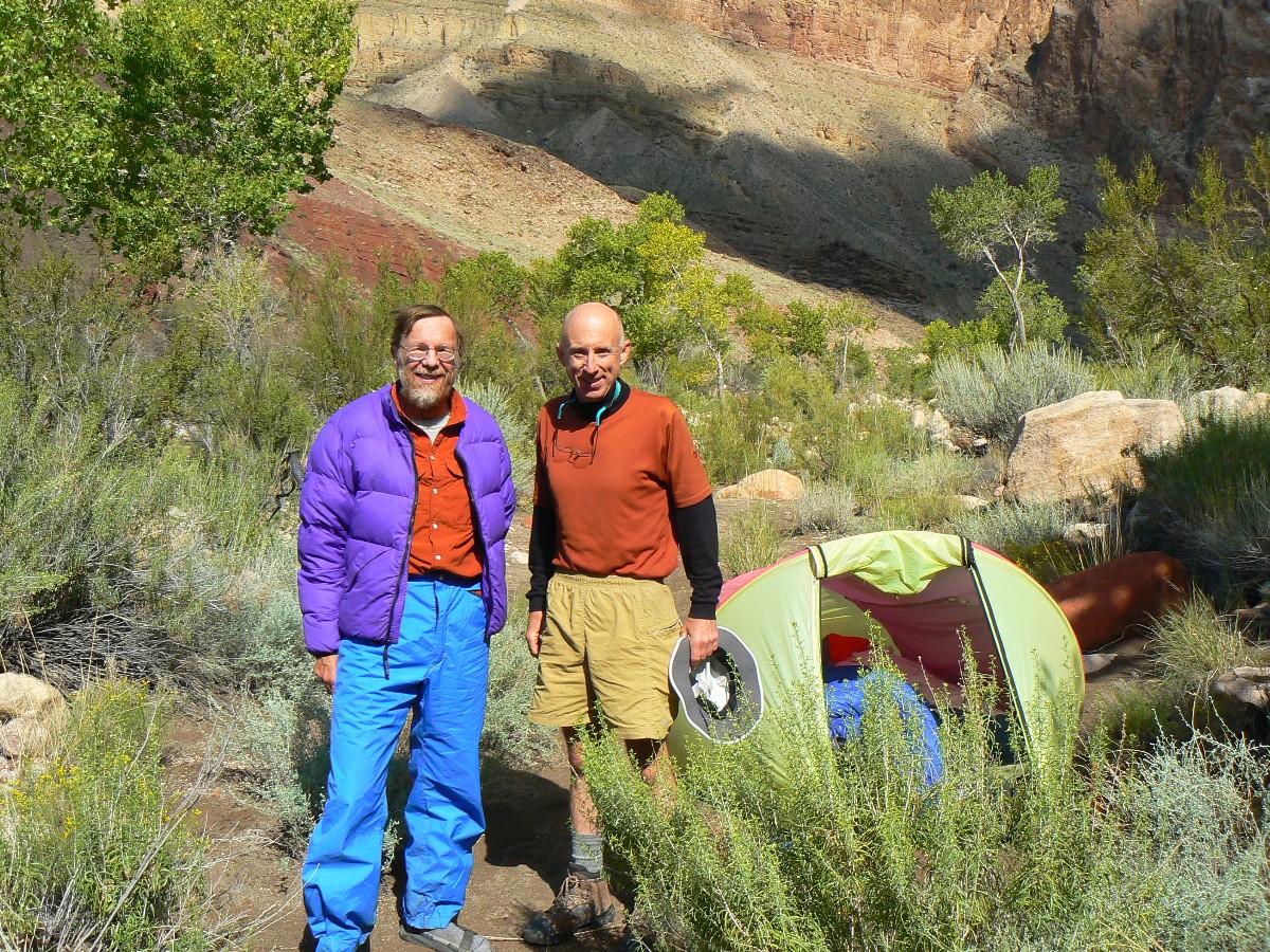
Day 5: Kwagunt Kruise
- to Kwagunt Beach/Rapids. 3.4 miles; ERM = 4.0; camp at 2780'.
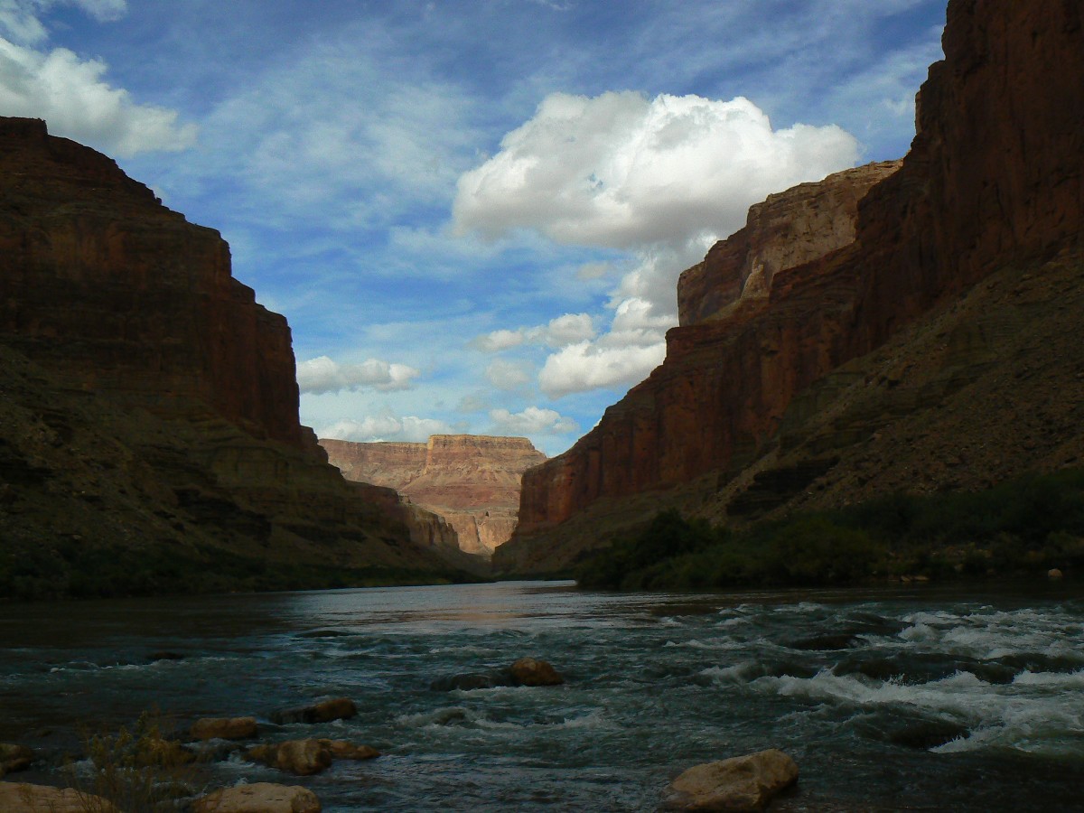
The mint-hued frigidity known as the modern day Colorado River roils and leaps,
rolling restlessly through Kwagunt Rapids, fidgeting as it frees itself from the reverse-engineering confines of
Lake Bowell, the Sewage Pond, otherwise known as Lake Foul. Reverse engineering? Yes, an engineering "solution"
that creates more problems than it solves and requires an infinity of engineering to work at all. Engineering comes
to many things, yet there are some places it should never come at all - as in the Colorado River.
We enjoy a lazy start to this short, beach lover day. The walk down Kwagunt to
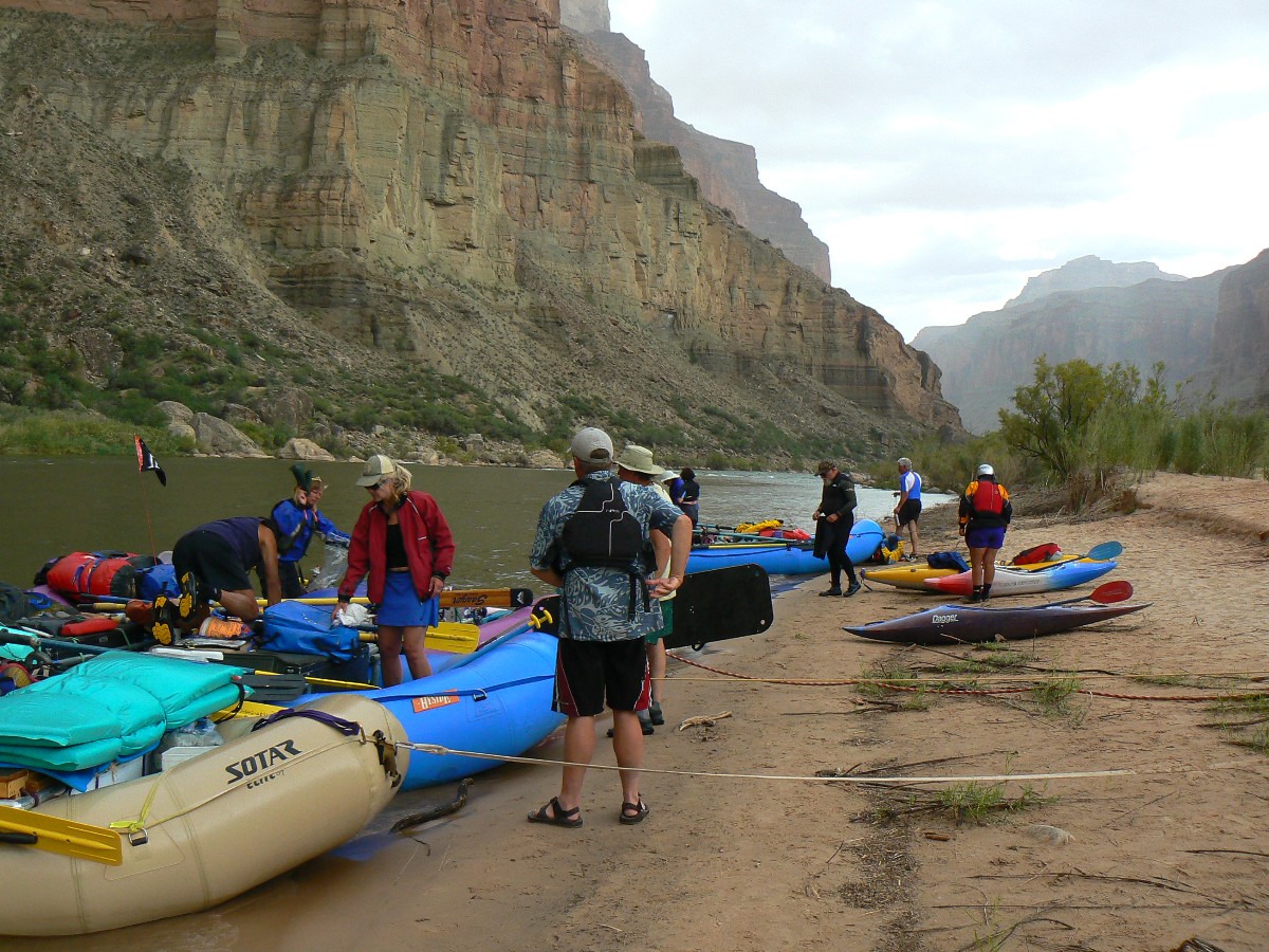
The River is in the stream bed and the going is fairly easy. At The River, we search upriver in vain for a camp.
Brush haven. Downriver is a marvelous camp. A rafting group arrives for lunch and we help them eat it - lovely
fare of PB and jelly, organic apples. Yum. Mort, Ed, et al., thanks.
Lounging in the shade of tamarisk, watching The River roll, is luxurious. Dark
clouds continue their harassment, as do the wealthy elite air terrorists - yet, the throb of The River diminishes
the latter's impact.
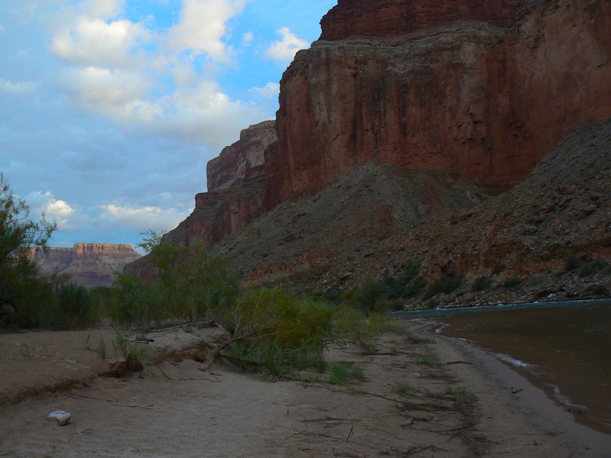
Almost sunset and a wind and rain storm blasts through, making a mess of camp and
sending sand into nearly everything.
| ||||
 |
 |
 |
Day 6: Kwagunt Knockout - twist and shout to Nankoweap
- 4.6 to mouth of Nankoweap, 3.1 back to Day 2 camp area. Total day to foot of the Nankoweap trail -
7.7; ERM = 12.4; camp at 3440'.
Rain thumps the tent as ebony clouds choke the Western buttes. We've set up
the mini-tarp, cooked a three-course meal (soup, salmon, Moroccan Couscous), dashed out in the beginning sputter
of this storm for a quick bath, topping off a tedious and difficult day, during which we hiked for approximately 8 hours.
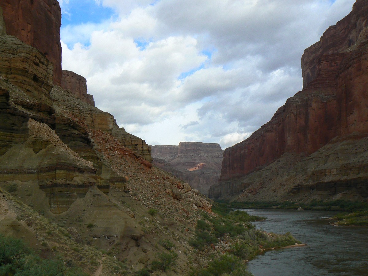
We start on the route between Kwagunt and Nankoweap, along The River, fairly early.
It's cloudy after a star-studded night, yet appears to be clearing. The route clings to storm-washed angled shale
beds on side slopes where nearly no track can be seen, dodges through many tiny drainages, and clambers over
melon-size rocks, staying above the skin-stripping mesquite and nasty tamarisk which border The River. Twisting
ankles, shouting over the din of air tour terrorists. Eventually, we cross the trail leading to the Nankoweap
granaries, and the walking is divine until we enter Nankoweap Canyon. It's a slog up the canyon, most certainly
only because of the tiring preliminary.
The good camp is occupied, and with the rapidly approaching storm - we opt for a
side pocket. Tinkling rain initiates as we set up the tent.
I am writing these journal notes as the rain intensifies. Now, well into headlamp
time, I hope our pocket camp stays flood free. It is holding dry, yet not without some trepidation. Rocks are
rolling, lightning is flashing, rain dribbles, then patters, then pours. Wind blows. Shades of last year in the
three-day deluge?
Very late night and it seems like we are sheltered sufficiently and suffer only
from condensation and mild anxiety. The rain, however, is inexorably more natural than when we shouted over
the high-decibel clatter of air tour terrorists, twisting ankles, shouting over the sounds of excess. It has
been a day of twist and shout to Nankoweap.
 |
 |
 |
 |
 |
 |
 |
 |
 |
 |
 |
 |
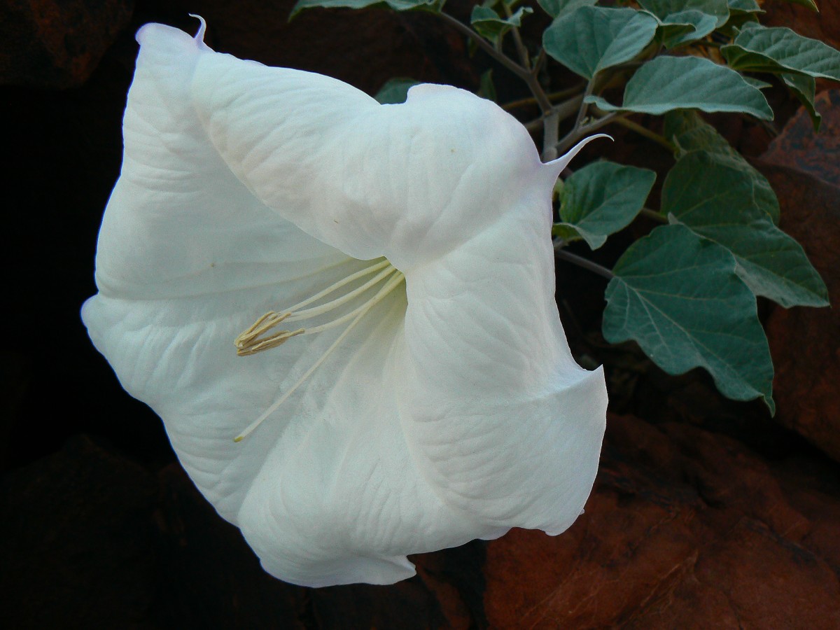
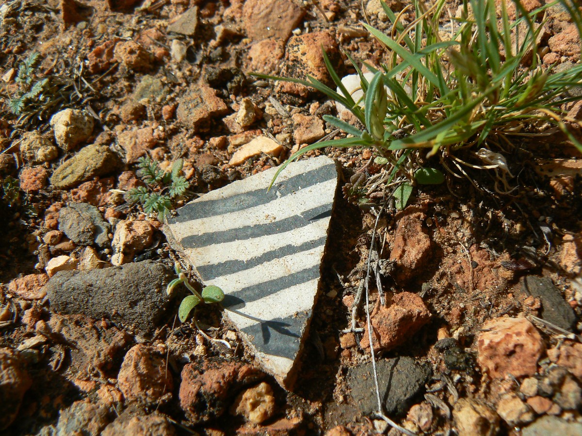
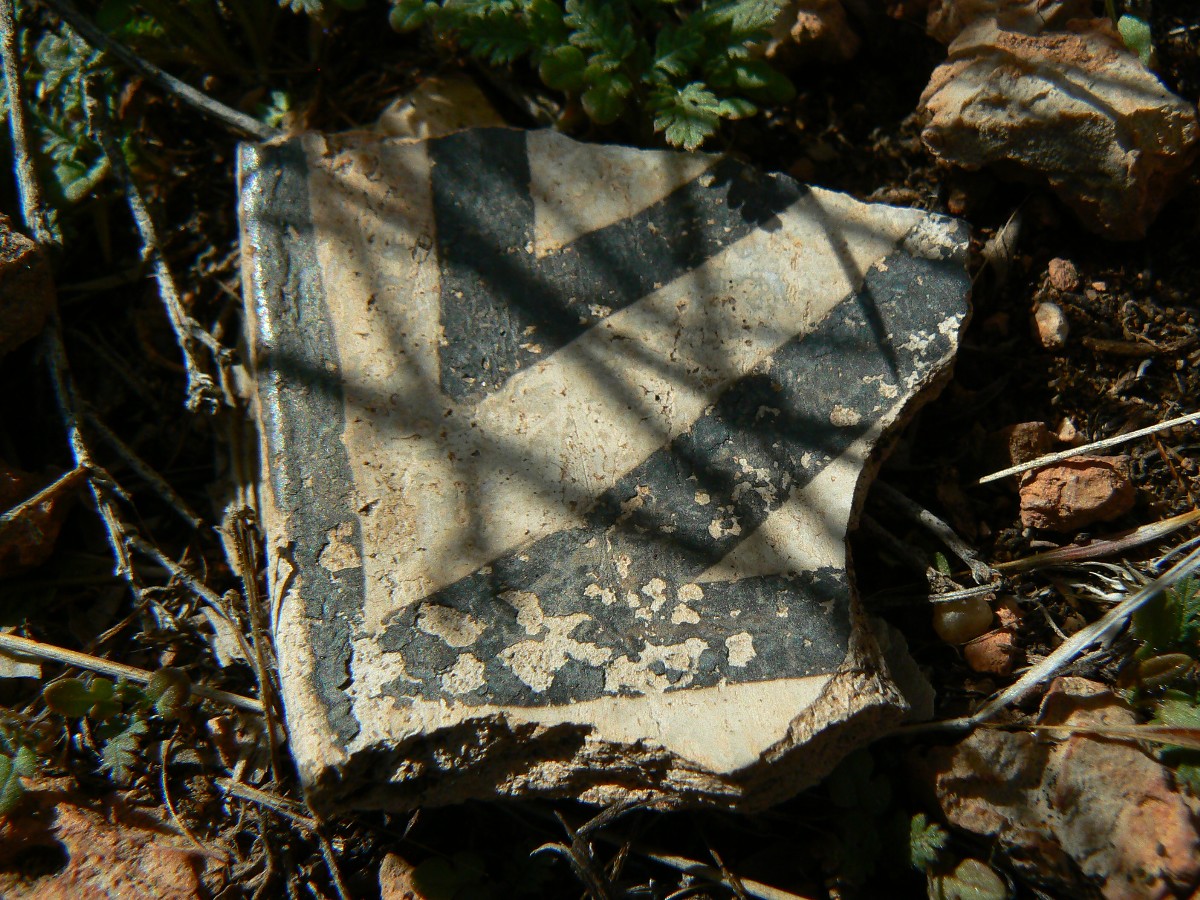
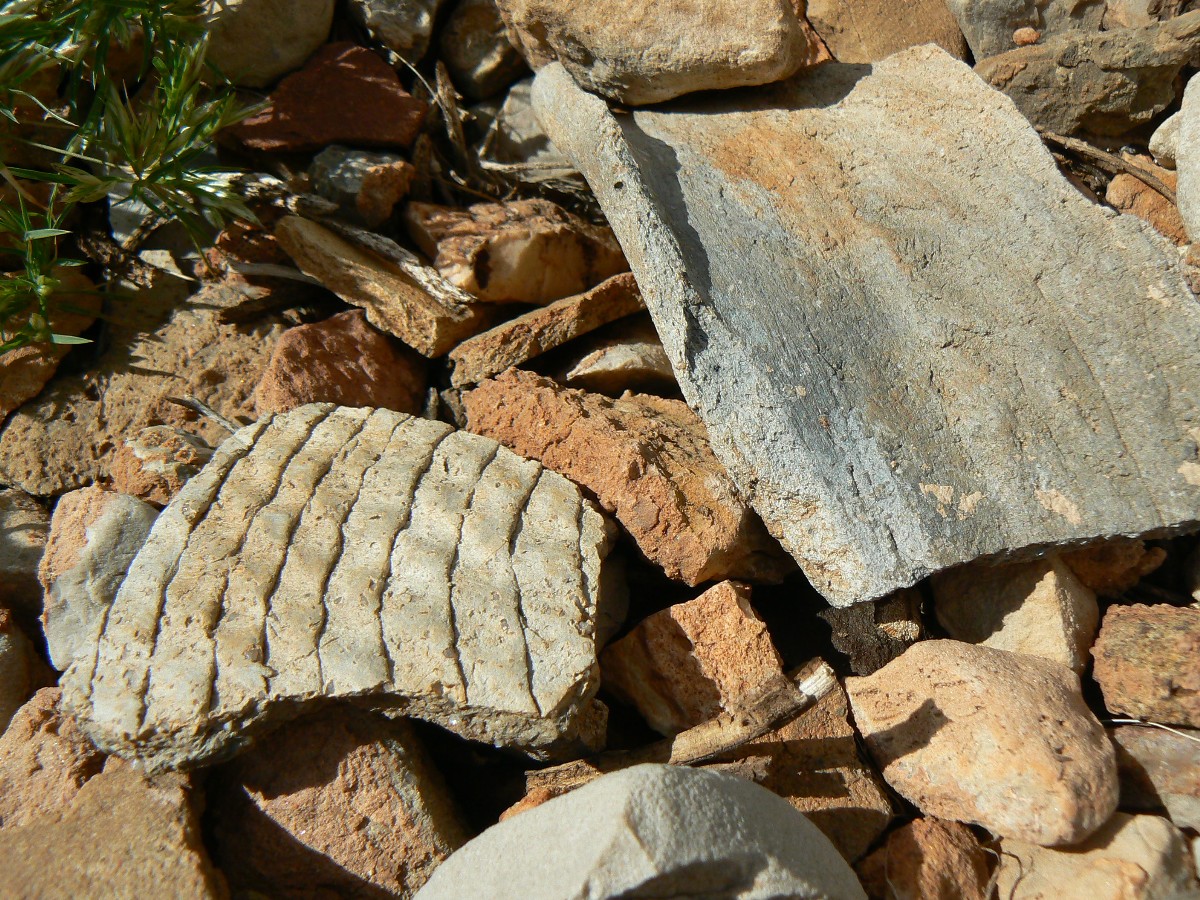
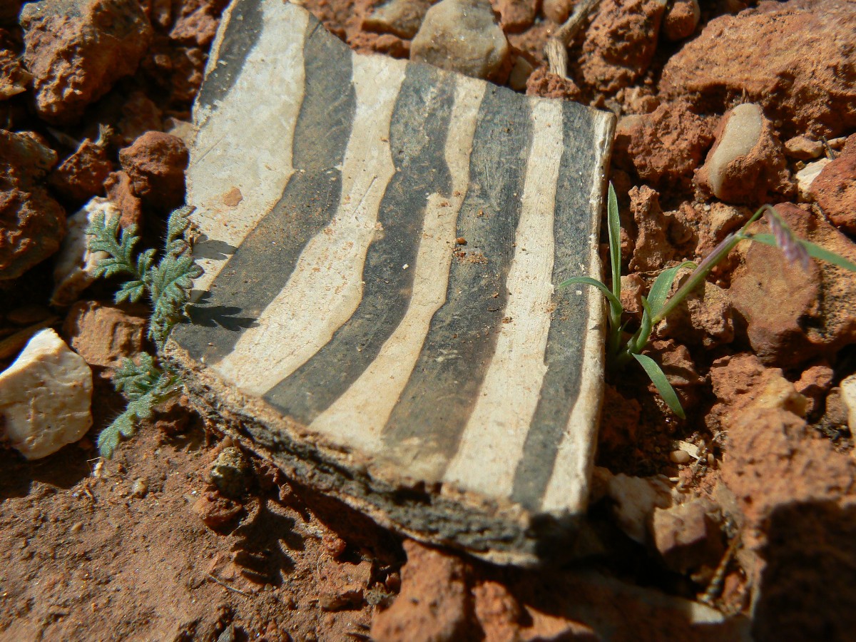
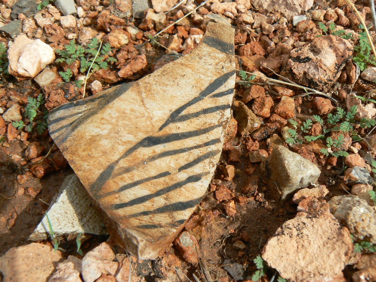
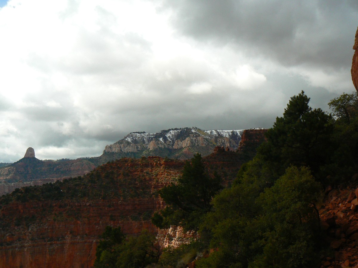
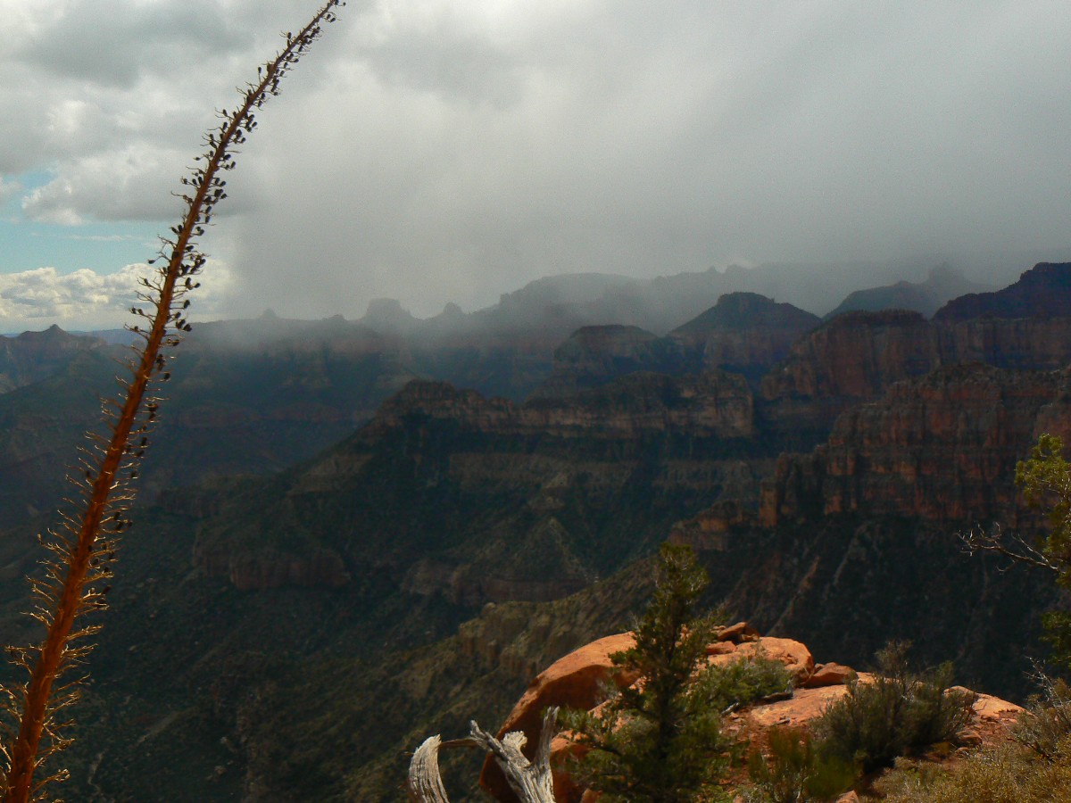
Day 7: Shards and Seasons
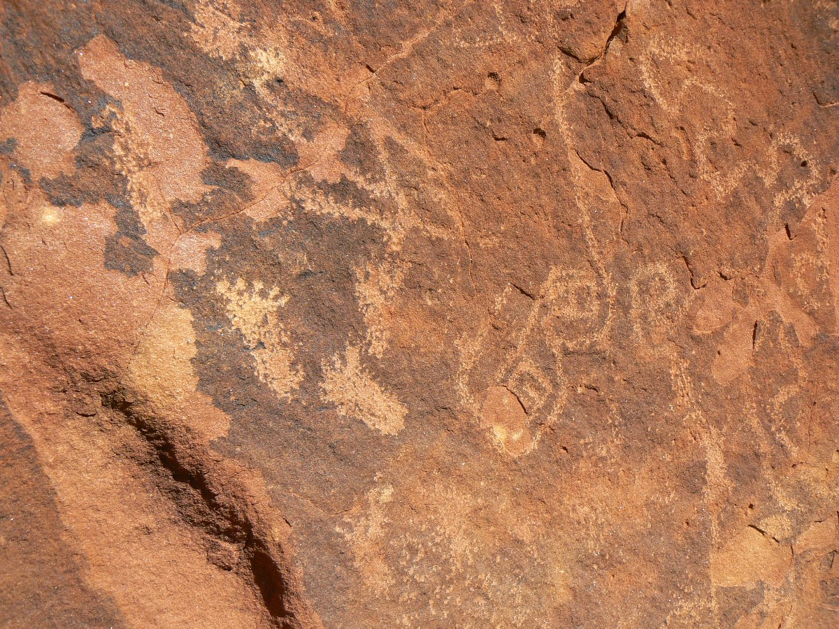
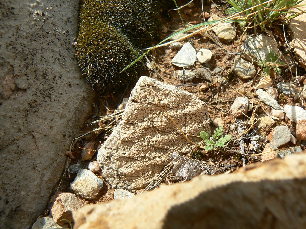
- Recovery day, looking for petros and pot shards.
The black on white pottery shard angles from the damp dirt, glinting in the new
season of the day. Pottery vessel lip. Dinnerware. Sun. A respite from cloud banks.
The rain stopped after sunrise and we started drying a few wet items. Checking in
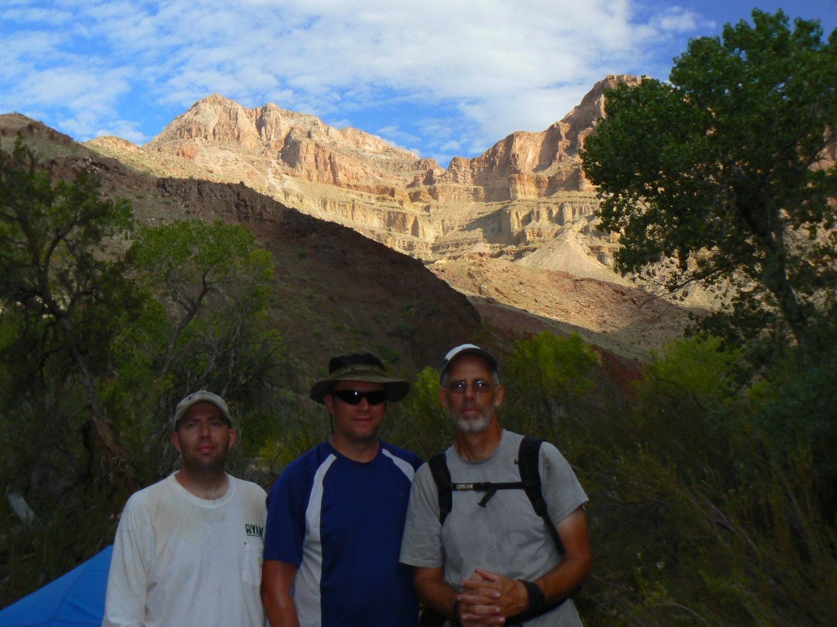
at the main camp, we talk with Jim and Scott from Michigan. They head down to The River, and we move into the "good"
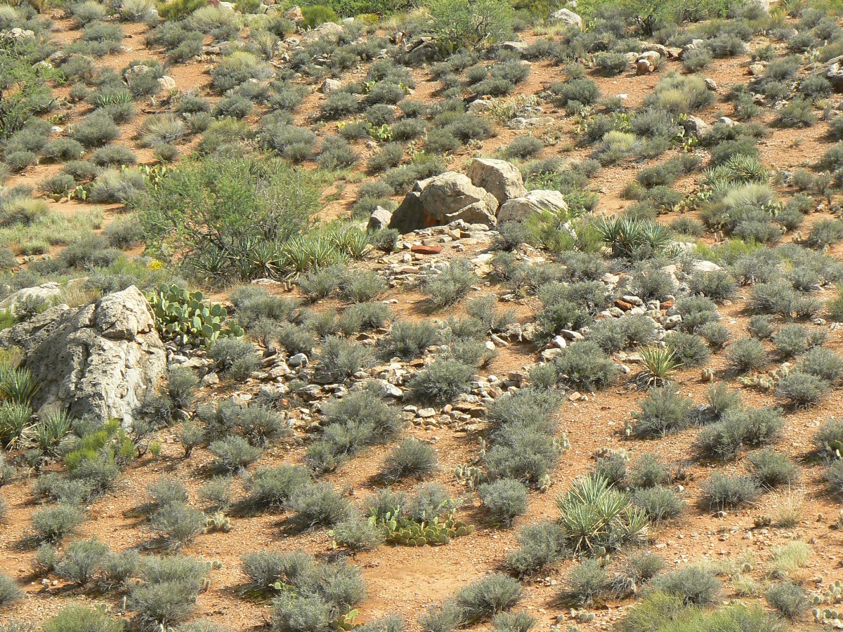
camp, then go exploring for the petro boulder and a couple of foundations sites, which appear to have been surface
dwellings. Several shards are seen. The creek still runs a dark milk chocolate color - so we visit the spring for
drinking and bath water and enjoy The Canyon on its own terms, without the excess global climate change promulgated
by the wealthy elite air tour terrorists. While we're in the sun, a few drops of rain blow over from the huge cloud
mass engulfing the North Rim, coating some high points with snow, and re-directing the terrorists elsewhere. Hooray.
Peace reigns much of the day, thanks to the effects of 7 billion people, many without clean drinking water. Jim
and Scott tell us that Tracy is entering Nankoweap via the Marion-Seiber route today. We've heard of Tracy on the
GCHBA yahoo site, yet have not met her. We are again alone in the basin - at least as far as we can tell.
Azure skies are punctuated by a 1/2 + moon, bordered by a gentle burbling Nankoweap
Creek, which helps produce just the right amount of solitude, sans the horrid destruction and obliteration of a valued
natural resource - the natural soundscape, the natural quiet. Burble. I can hear the soothing burble.
 |
 |
 |
 |
 |
 |
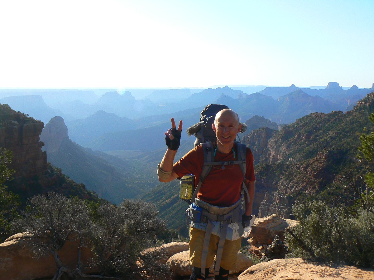
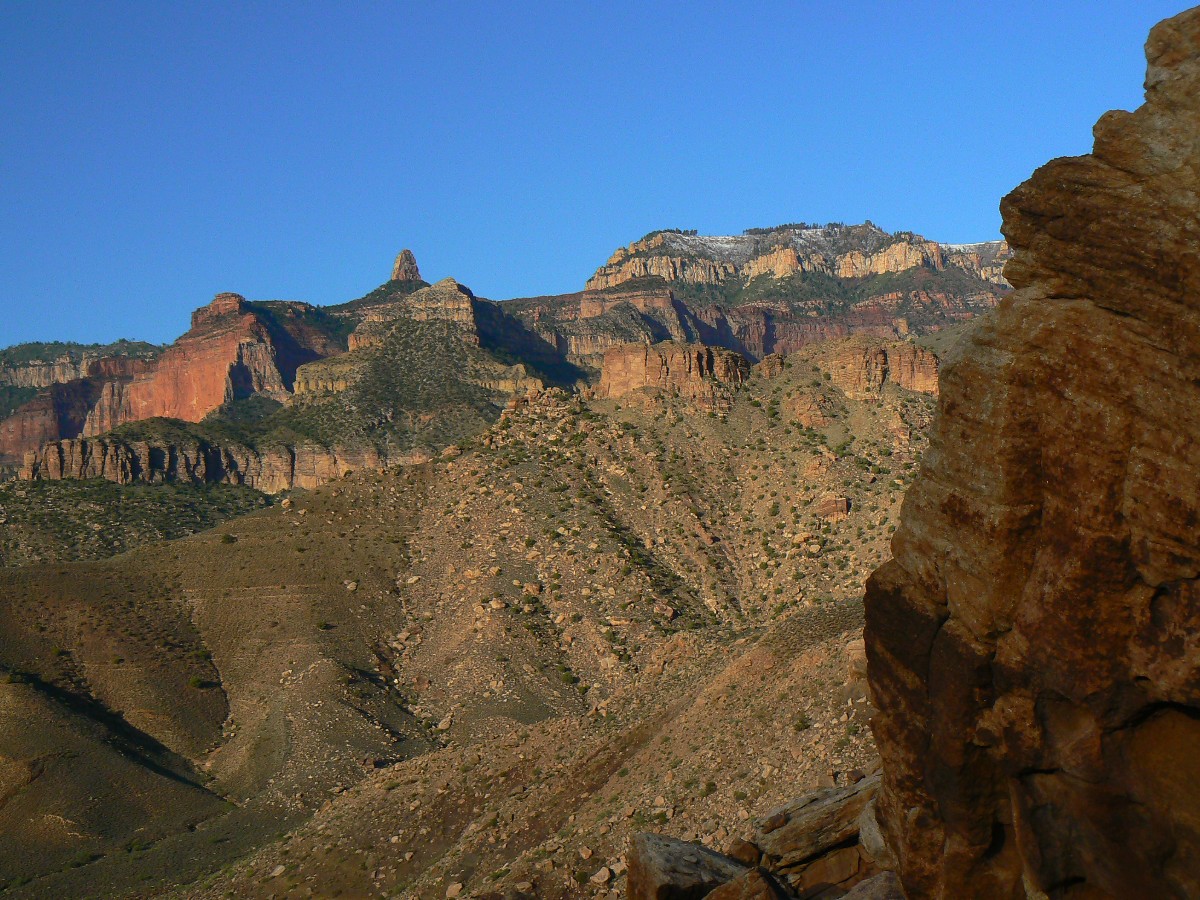
Day 8: Never-ending Nankoweap - Out to the boundary, then to
Saddle Mountain TH; 11.5 miles; ERM = 25.5; camp at 7000' with an adorable warm woman! (41.1 total
trip miles; up and down a total of about 22,250'; total ERM estimated at approx. 85.).
"Wild country, warm woman, cold beer, and this song," advises the song cut
from an old SUWA (Southern Utah Wilderness Alliance) benefit album. Yes! I'm living the dream of a never-ending
Nankoweap. Up, up, into grauple and gusting wind. Up, up, through layers of time, to the present, on and on
until I am lolling in flannel sheets with the adorable woman.
The day starts with Craig grunting about wool hats and the coming sun. It's
a bit after 4 a.m. and only the borderline crepuscular creatures are out. What does this say about us? A
small-sounding owl hoots softly from nearby Cottonwoods. We are on the trail, hiking up and up, not long after
we can see the trail. It's much easier going up this disintegrating trail. Our first snack break is at Tilted
Mesa, just in time for the first swarm of soundscape-obliterating wealthy elite air tour terrorists. As we
lumber along the extensive Esplanade traverse, grauple clangs off our hats, propelled by piercing winds. Winter
seems to be enveloping us as clouds race around us, clogging the approaching pass through Saddle Mountain.
More clothes. At the saddle, we retrieve our cache, dumping not quite frozen water and placing cache items
in well-carried packs.
Mostly down, the new red of Rocky Mountain Maples glow in florid contrast to
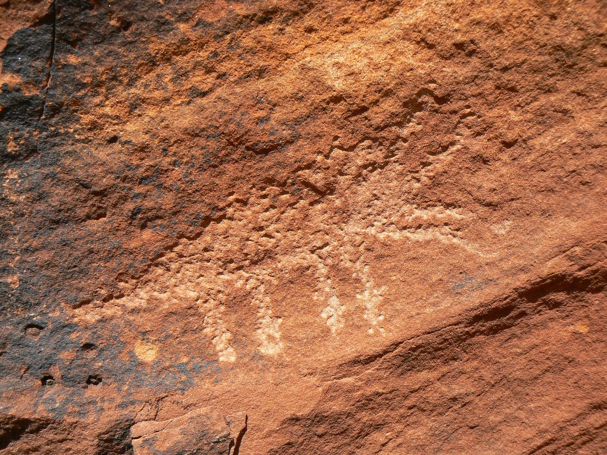
the verdant green of conifer and oak as we clamber through Saddle Canyon, then climb past the pictos to the TH.
A long bumpy road and we're out to the tarmac, then to retrieve Craig's car, then decision time - Zion or not?
Then, there's that song again, the one about the warm woman. Let's see, wet tent, cold drive to Zion, snow on
the hills, humm. "Wild country, warm woman, cold beer, and this song of Nankoweap."
| ||||
Sites:
Click here to enjoy the first Nanko report:
Gnarly Nankoweap (2008)
here is the 2010 Nankoweap report - Chocolate Nougat Nankoweap (2010)
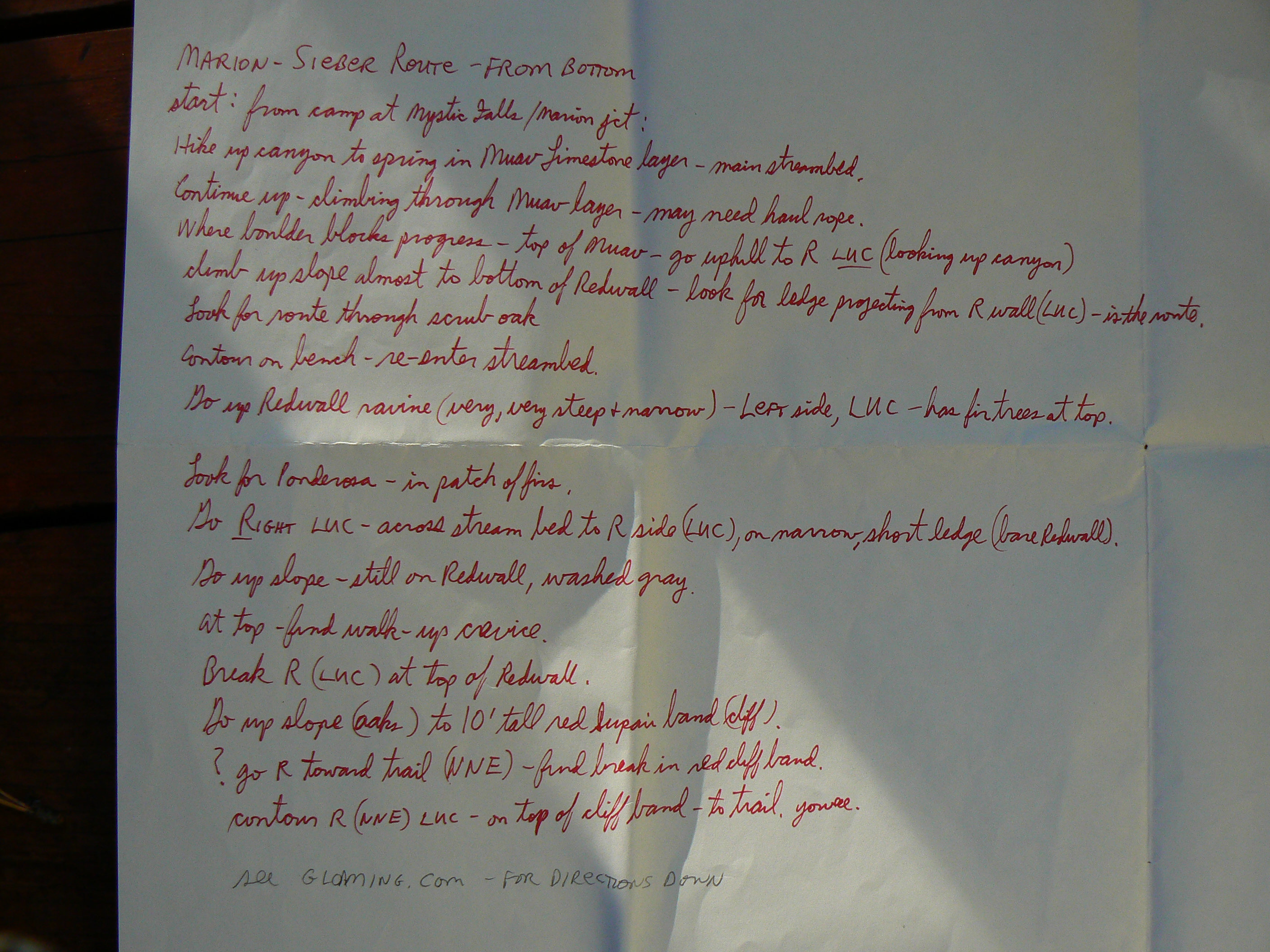
my attempt to describe the Marion-Seiber Route from the bottom
A well-regulated wilderness - why not cover the wilds with ORVs?
(NY Times)
(mp3 file - sound recording) NPR -
facing planetery enemy no 1 - agriculture 10-12-2011
7 billion and counting - will anyone
survive?
World population clock - watch the number spin, geometrically,
and be frightened, very frightened.
Arithmetic, population, and energy - the geometric
function (youtube mini-lecture on math)
Maps:
| ||||
for a full-resolution map, click here. Caution - do not use this map or gps track for navigating the route.
Other WV reports about the Grand Canyon:
Click here or on the Looking Lizard to go to all WV reports about The Grand Canyon
| ||||
Related Links:
Steve's
excellent photos -
birds in flight, panoramas, etc.
the geology of the Grand Canyon by the NPS
| ||||
| ||||
| ||||
| ||||
| ||||
| ||||
| ||||
|
Wild Vagabond Main |
Trip Report Index  |
Caveat  |
|---|


