|
|---|
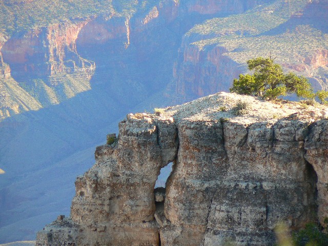
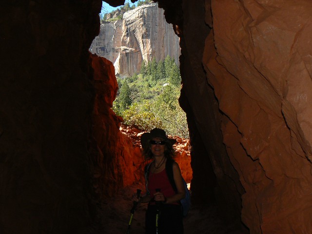
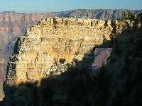
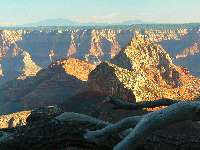
Angels Window
(Click the image for a full-size view)
|
|---|
|
|---|
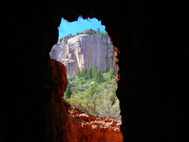
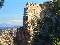
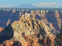
Angels Window
(Click the image for a full-size view)
|
|---|
|
|
|---|
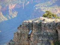
Sister of Angels Window
(Click the image for a full-size view)
|
|---|
|
|
|---|
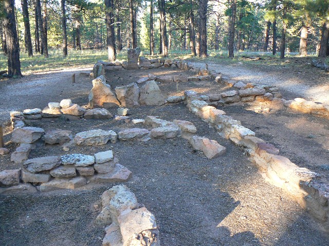
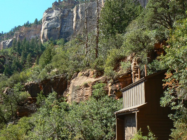
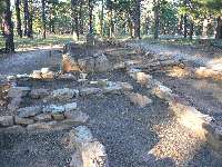
Walhalla ruins
(Click the image for a full-size view)
|
|---|
|
|
|---|
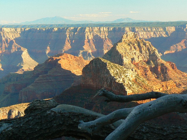
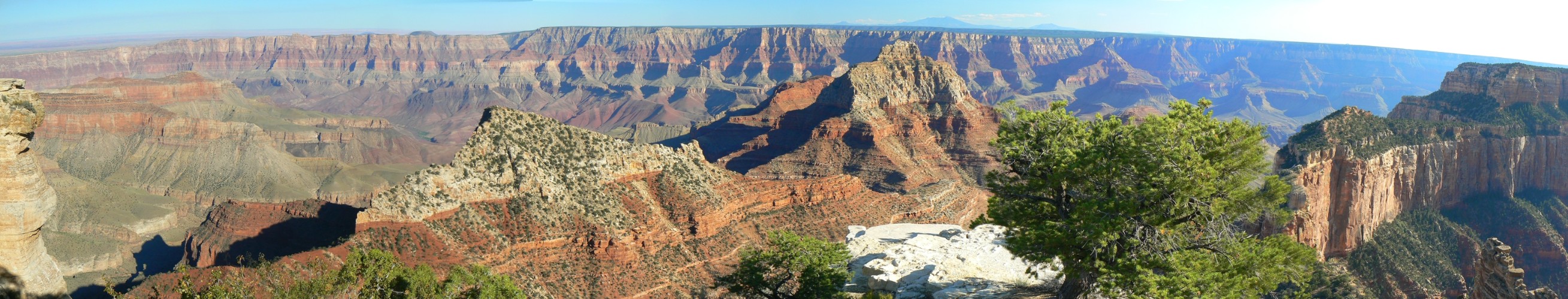
Vishnu & SF Peaks from Walhalla
(Click the image for a full-size view)
|
|---|
|
|
|---|
Vishnu & SF Peaks from Walhalla
(Click the image for a full-size view)
|
|---|
|
(There are - More photos below the trip narrative.)
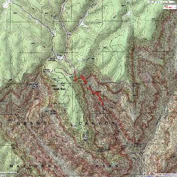
Day 1: Very Vishnu:
(drive, visit Cape Royal and Angel's Window, camp at DeMotte FS CG).
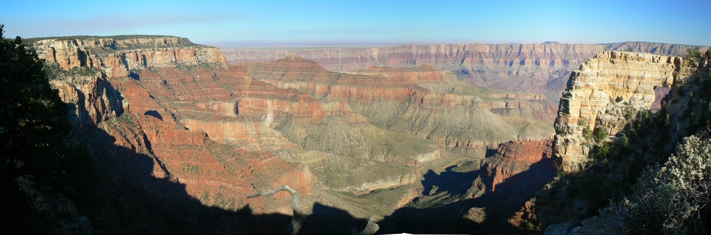
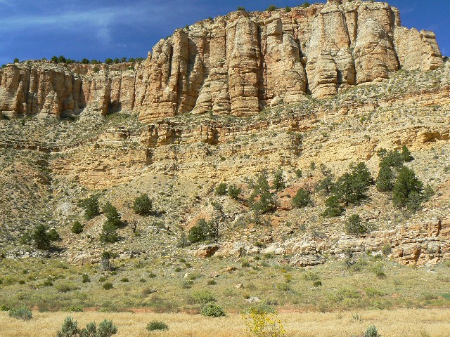
The distant canyon walls glow, and I'm seeing them
through the portal of Angel's Window at Cape Royal on the North Rim of THE Grand Canyon.
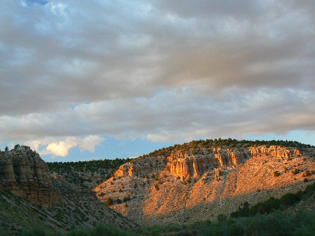
Evening is definitely the time to photograph this gem. Back along the serpentine road,
we stop at Walhalla Overlook and ruins - to see the Vishnu Temple and beyond it, in the
distance, the breast bump of the volcanic San Francisco Peaks, partly obscured by the
smoke from a controlled burn. Very Vishnu Vista. We return to a FS CG just after
sunset. The temperatures plummet into what we guess are the mid-30Fs.

|
|---|
pano from North Rim, with "Son of Angel's Window" on right,
Vishnu Temple center right - scroll L-R to view it
all (7051 pixels wide; 731kb)
(Click the image for the full-size image)
|
|---|
|
|
|---|
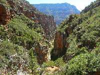
Transept from Widforss
(Click the image for a full-size view)
|
|---|
|
|---|
Coconino Overlook- N Kaibab
(Click the image for a full-size view)
|
|---|
|
|
|---|
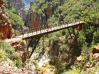
Redwall Bridge - N Kaibab
(Click the image for a full-size view)
|
|---|
|
(There are - More photos below the trip narrative.)
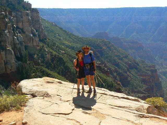
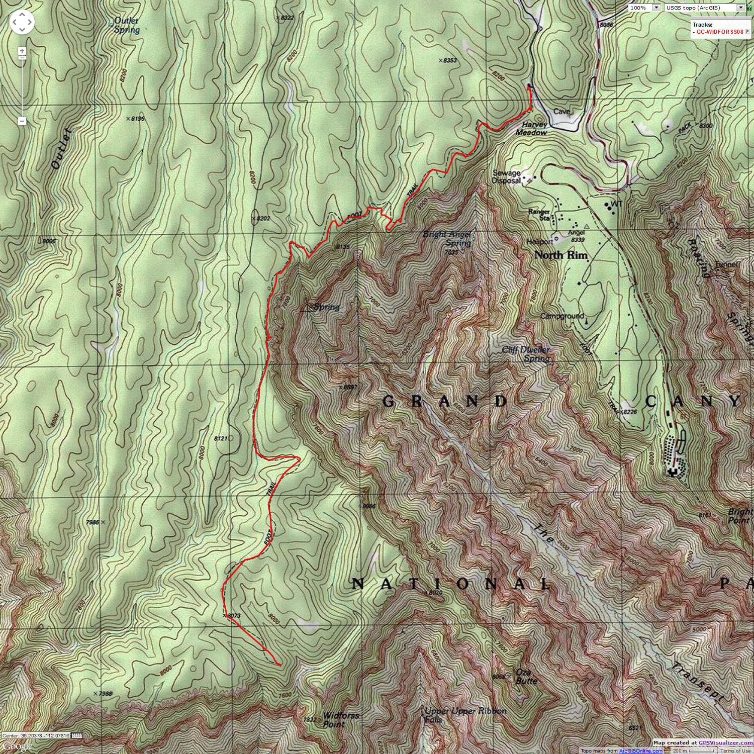
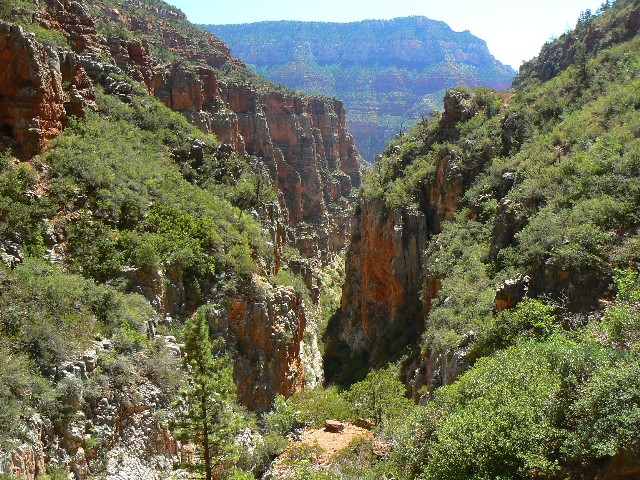
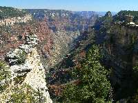
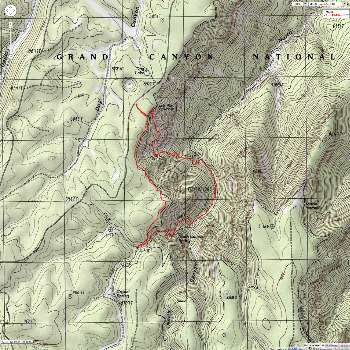
Day 2: Wild Widforss
- Transept Tour; 10 miles, 16 ERM.
The ice flakes off the fabric above my head, announcing
that it is morning. After drying off the flipster, we drive to the Widforss TH and begin
hiking. It's a fairly quiet and lovely trail, affording delightful views of the Transept,
a plunging cleavage that intersects with Bright Angel. A dull thudding comes from across
the canyon - it's the water treatment plant. Views evolve to include Vishnu, Angel's
Gate, and out near Widforss Point, vistas to the South Kaibab and aspects of the Tonto
Platform.
The trail bobs through vanilla-laced P-Pine freshened
air and also through old musty fire damage.
We return to the North Rim CG, where we had managed to get
an abandoned reservation for tonight. Ahh, a concession shower is enjoyed. A P-Pine fire
cuts the cooling air as a rotund moon climbs through the sentinel forest. Deluxe.


|
|---|
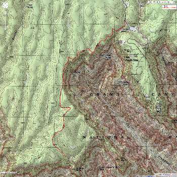
Map - GC: Widforss Trail; 10 miles
(Click the image to see the map)
|
|---|
|
|
|---|
Redwall Bridge - N Kaibab
(Click the image for a full-size view)
|
|---|

|
|---|
Supai Tunnel - N Kaibab
(Click the image for a full-size view)
|
|---|
|
|
|---|
Supai Tunnel - N Kaibab
(Click the image for a full-size view)
|
|---|
|
(There are - More photos below the trip narrative.)
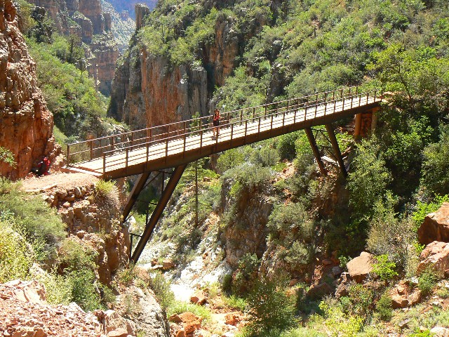
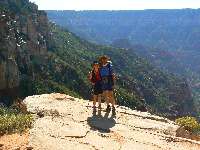
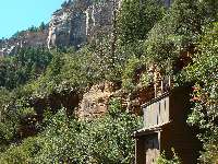
Day 3: Redwall Rumination: North
Kaibab to Redwall Bridge; 6 miles, 14 ERM.
The gulch drops away beneath the bridge, first
crossed by Brighty the donkey many years ago. The trail continues toward Eye of
the Needle, Roaring Springs, Cottonwood, Ribbon Falls, and on to THE River and
the fig trees of Phantom Ranch. But not today. The heat is gathering, so we
begin the slog back to the rim.
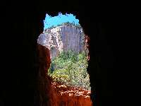
The narrow aperture through Supai Tunnel focuses
attention on the variegated Coconino SS walls, stained from layers above - perhaps
the Kaibab Limestone? A scenic toilet waits nearby. From here, the travel is pleasant,
even with the poofy powder of the trail ground to talc by the mules and many visitors.
Still, it's far quieter than the over-bustle of the South Rim.
There are no openings in the NPS CG, so back to a FS CG
we drive, where temperatures are cooler. A fire is needed, or at least enjoyed, to take
off the nip created by a clear sky.
|
|---|
Map - GC: N Kaibab to Redwall Bridge; 6 miles
(Click the image to see the map)
|
|---|
|
|
|---|
Scenic Toilet - Supai Tunnel
(Click the image for a full-size view)
|
|---|
|
|---|
Saddle Mtn Wild view
(Click the image for a full-size view)
|
|---|
|
|
|---|
Saddle Mtn Wild view
(Click the image for a full-size view)
|
|---|
|
(There are - More photos below the trip narrative.)
Day 4: North Canyon Thrasher ,
(Saddle Mountain Wilderness); 6 miles, 12 ERM. East Rim Viewpoint to Arizona
Trail to Trail 004-007 and back to the rim.
Suddenly - water! Delightful water appears in the
North Canyon streambed. It's wild and getting wilder.
We start out with a slight touch of frost on
the pumpkin, then warm quickly as we head nearly across the road from DeMotte CG and
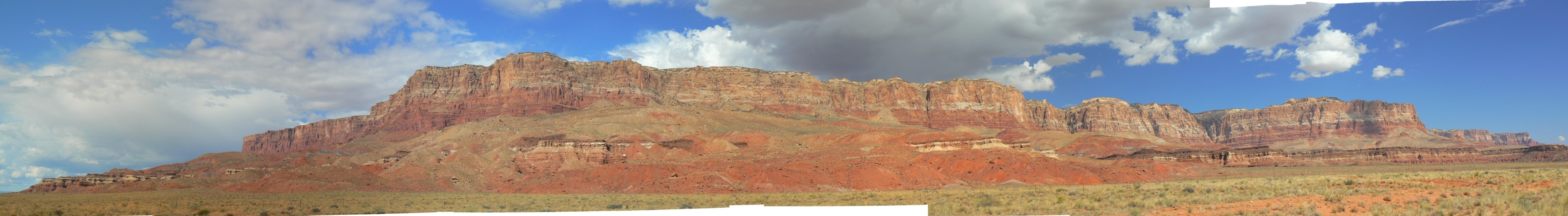
up to the E Rim Viewpoint. Views to South Canyon and Marble Canyon, a dark gash across
the flats below the Vermillion Cliffs.
A kettle of Turkey Vultures reel overhead as a
guided phalanx of mountain bikers stop for a view. We follow, hiking the Kaibab Plateau
section of the Arizona Trail. On to a trail junction where we encounter some simpering
Spruce Grouse strutting through the dry grass. Doubling back, we see the North Canyon
Trail going through an old log fence. After inspecting the map, we follow trail 004
into increasing wilder country. A grouse inspects us, clucking to K and doing a little
shuffle like the Plains Indians do, head down, tail up, strut.
The trail switches down toward Saddle Mountain
and the North Canyon Spring. Here's where the water joins in. Deep old growth forest,
a great contrast to the ravaged pines along the rim. Deeper. We're now 1000' below the
rim and lilting down more. After 4 miles, we reach the trail junction and eat lunch
by the burbling creek which reportedly hosts the rare Apache Trout. Then, up trail 007,
soon encountering fallen logs, then lots of brush. Steeply up, past nettles and such.
Once, this was an excellent trail, and the tread seems mostly OK. After fighting half
the way up, the vegetation changes - drier, and we walk to the top. A deluxe hike.
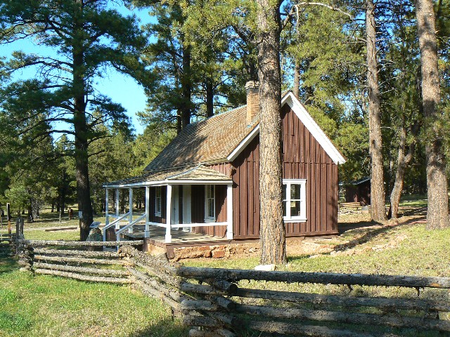
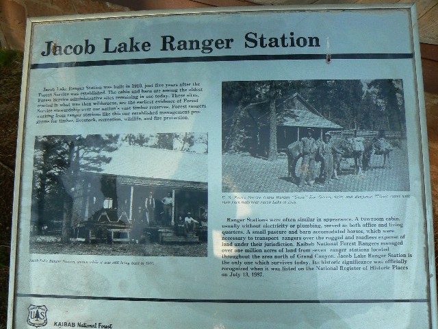
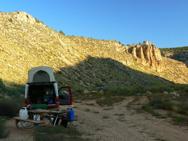
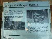
We have to return to Jacob Lake because we run
out of propane. We find showers at the RV park near Jacob pond and the historic Jacob
Lake Ranger Station. Then, continuing West on this road, we get to FR 22, the main drag
coming up from Fredonia, and then drive to the Snake Gulch TH. We are a few thousand
feet lower as we watch the thunderstorms build over the plateau we earlier departed.
It's very dark after sunset and warmer than up high. It's nice to have the place to
ourselves.
|
|---|
Map - Saddle Mountain Wild: North Canyon; 6 miles
(Click the image to see the map)
|
|---|
|

|
|---|
pano taken from Walhalla Overlook - scroll
L-R to view it all (2618 pixels wide, 484kb)
(Click the image for the full-size image)
|
|---|
|

|
|---|
Jacob Lk. Historic RS
(Click the image for a full-size view)
|
|---|
|
|---|
Jacob Lk. Historic RS
(Click the image for a full-size view)
|
|---|
|
|
|---|
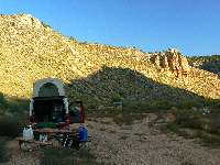
Snake Gulch TH
(Click the image for a full-size view)
|
|---|
|
(There are - More photos below the trip narrative.)
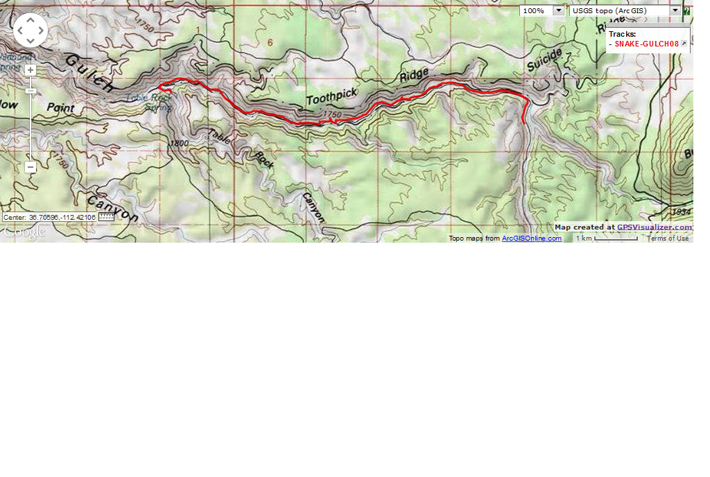
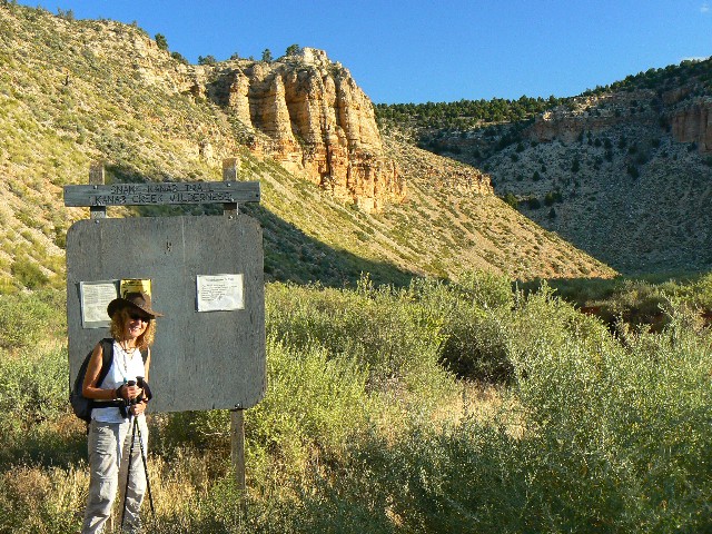
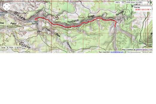
Day 5: Snaking Snake Gulch - Kanab Creek
Wilderness TH to Table Rock Spring; 14 miles, 18 ERM.
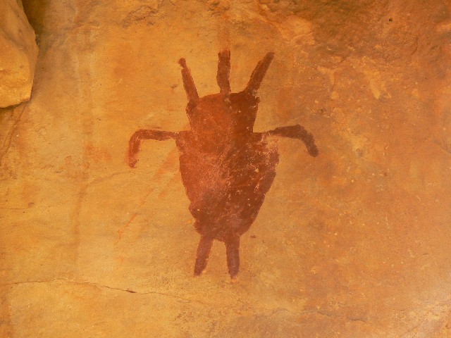
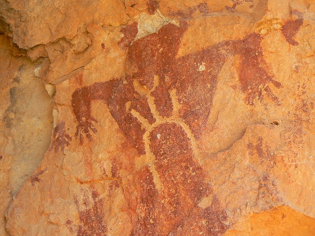
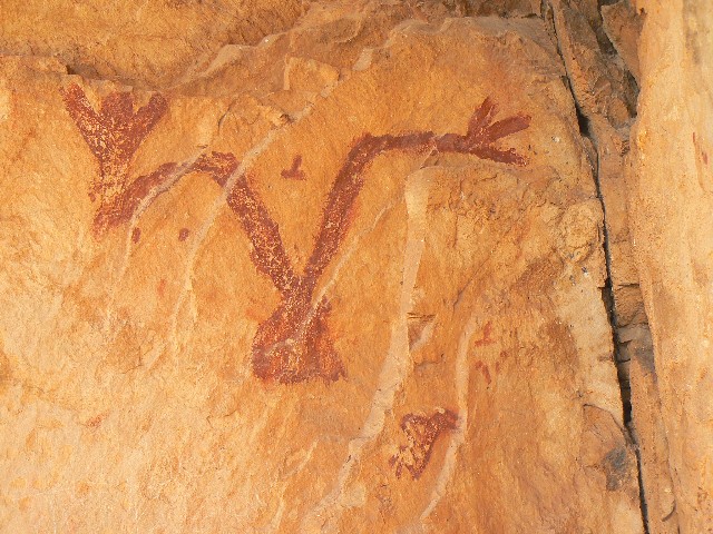
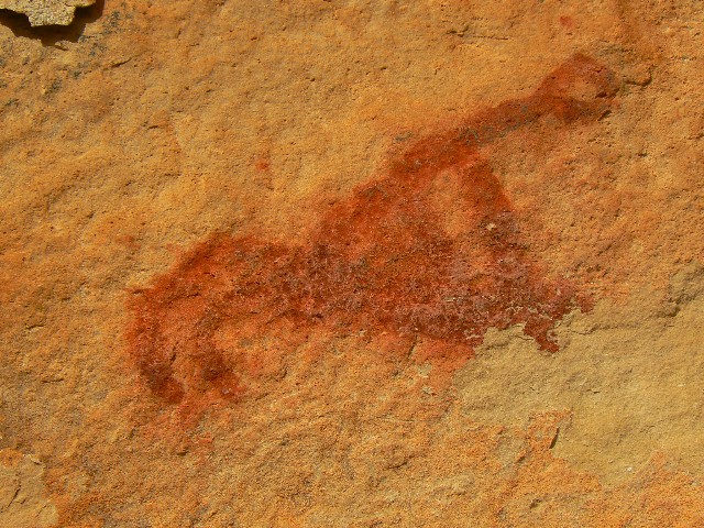
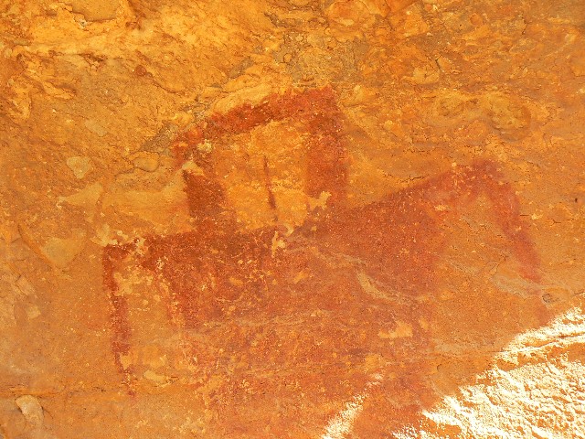
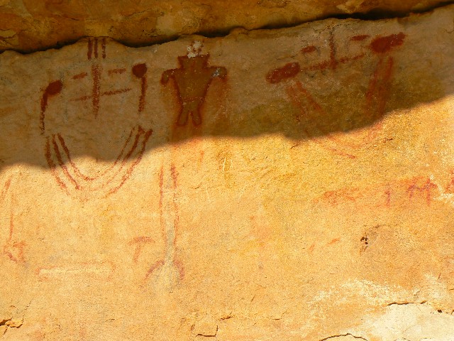
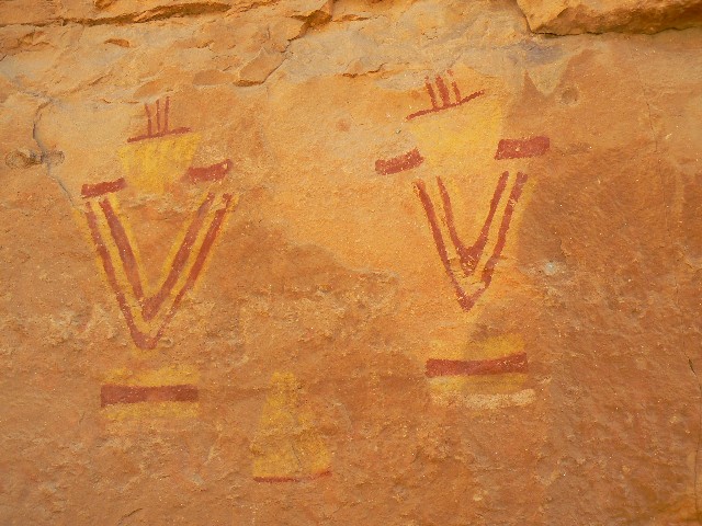
Ancient images beckon. Kokopeli, the Testicular Man,
a string of big heads (head dresses?) holding hands, faces with earrings. Lots of
features, mysterious, from the Basketmaker Era.
We're strolling down Snake Gulch, and like yesterday,
we don't see anyone else all day while hiking. Here, we don't see anyone for over 36
hours. Lots of Russian Thistles (?) to wade through and other signs of severe overgrazing.
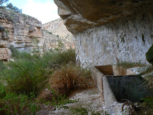
Cow burnt. Petros in the rock shelter, pictos scattered all along, with a higher
concentration as
we near the canyon sheltering the spring.
We eat lunch under a small overhang, it's ceiling
decorated with a few images and child hand prints. I check the spring and find one of
the tanks full with clear water. Water. A desert delight. Nearly 3,000' lower than
yesterday, it's warmer, hot in the full sun, but comfortable when we drag ourselves back
to the TH for a shower, drinks, salad, tapenade, and dinner. Scrumptious. Thick clouds
blanket and pile against the Kaibab Plateau.
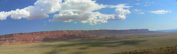
On the way back, we shoot some panos of the Vermillion
Cliffs.
|
|---|
Map - Kanab Cr Wild: Table Rock; 14 miles
(Click the image to see the map)
|
|---|
|
|
|---|
pano of Vermillion Cliffs from road to Jacob Lake - House
Rock Valley junction (buildings) can be seen in left bottom of open area
- scroll L-R to view it all (1638 pixels wide, 140kb)
(Click the image for the full-size image)
|
|---|
|
| | | | |