|
Grand Canyon Trip Report / Royal Arch Rhapsody :
Standard Loopo to Royal Arch - and back - via South Bass TH
South Bass / Esplanade/ Royal Arch / Royal Rappel! /
Toltec Beach / Garnet and Copper
Canyons / South Bass Tanks
/ South Bass Beach
April 22 -27, 2011
Text
© copyright by Rob; and Photos © copyright by Rob
|
 |
Co-Adventurers:
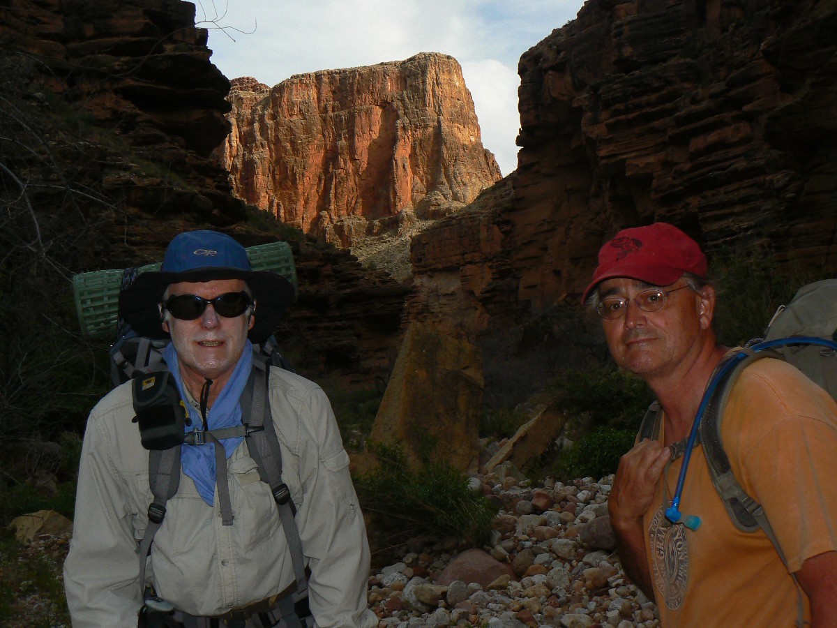
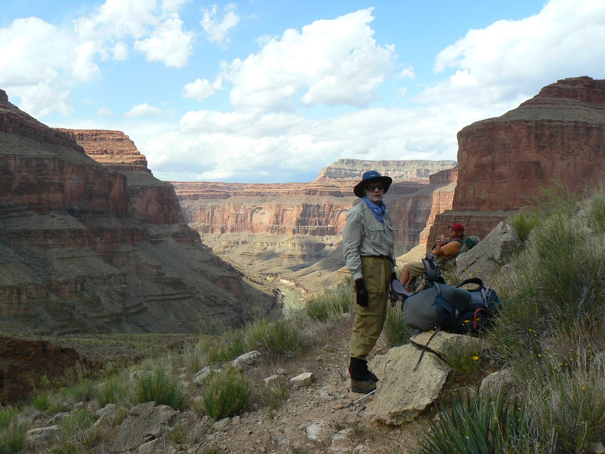
Dave Rumbellow, Mike Garvey, and Rob

|
|---|
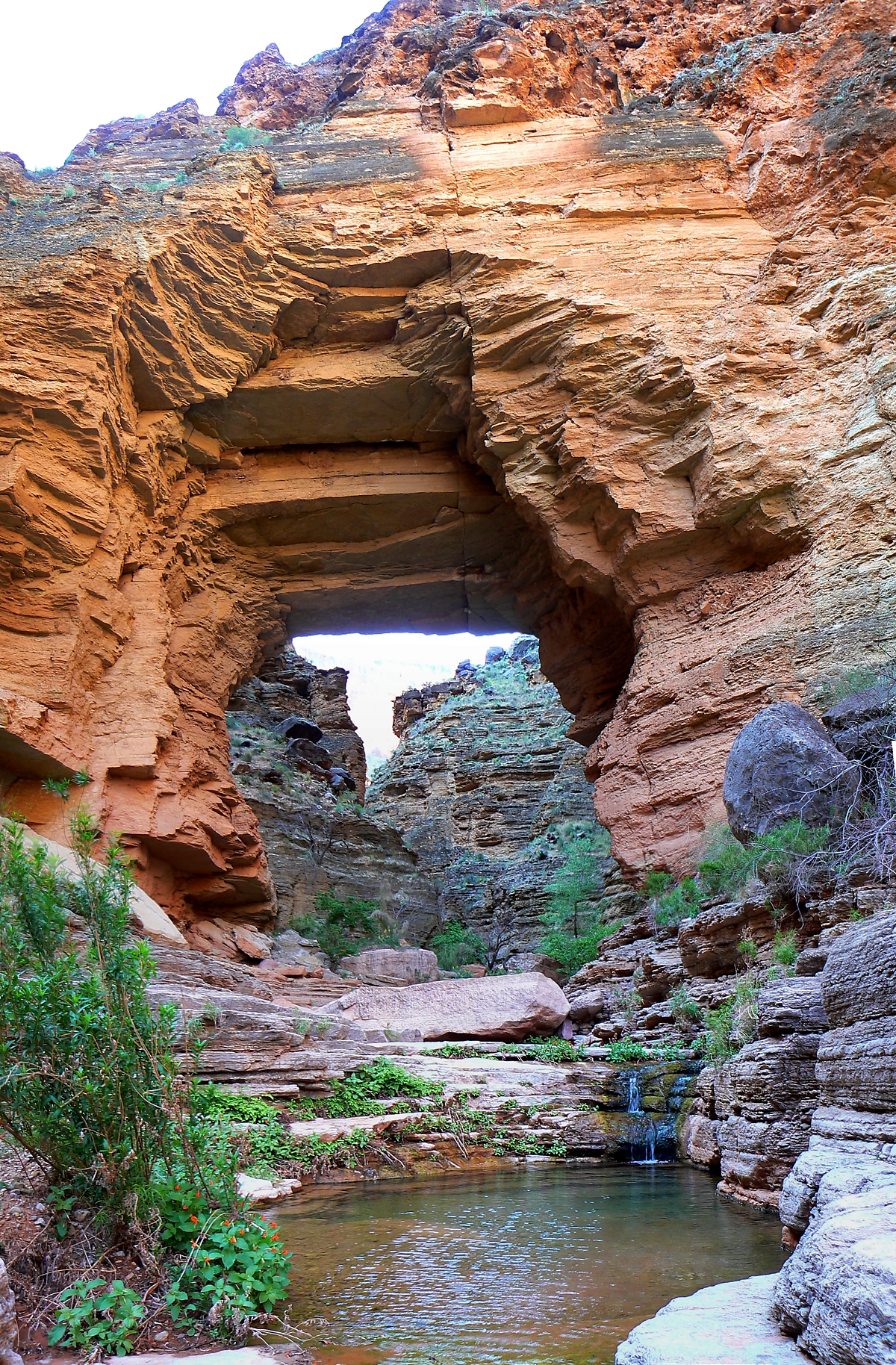
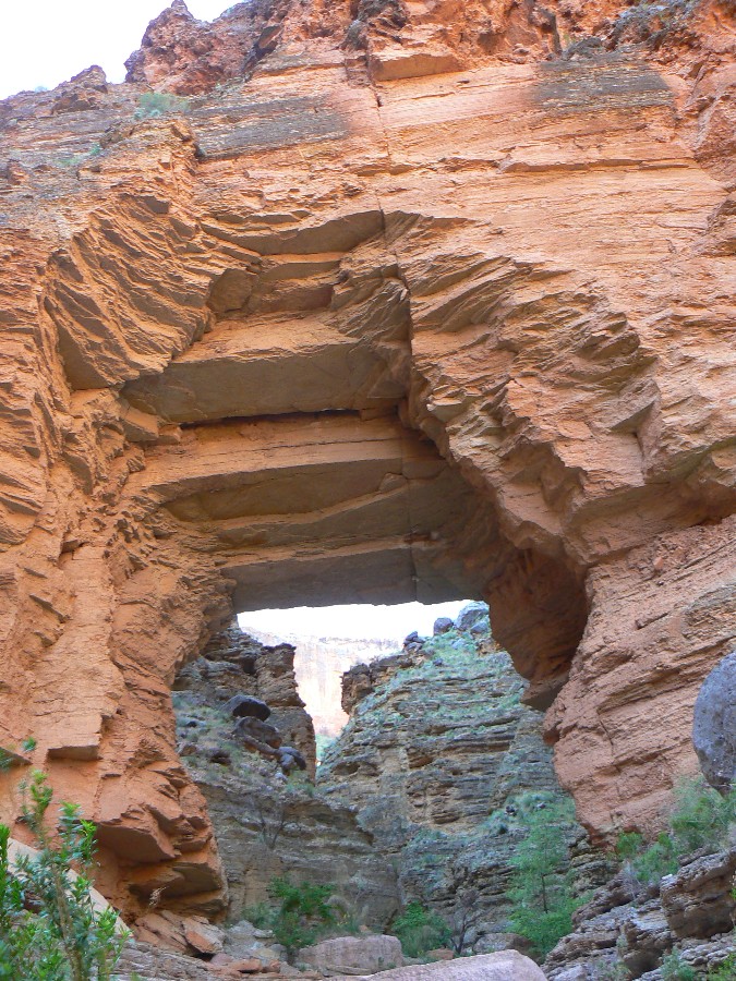
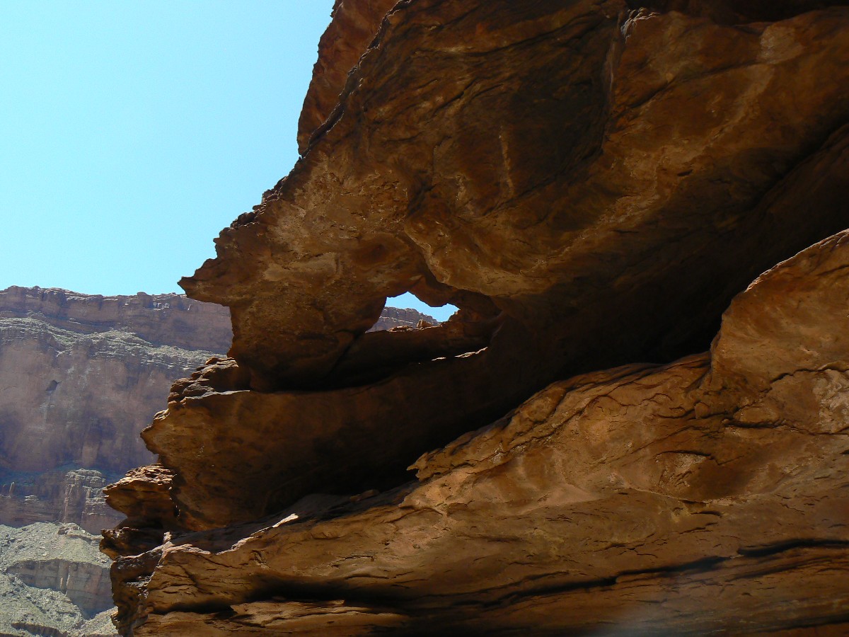
Vertical Panorama of Royal Arch (NB); 1200 X 1828; 3mb
(Click the image for the full-size image)
|
|---|
|
|
|---|
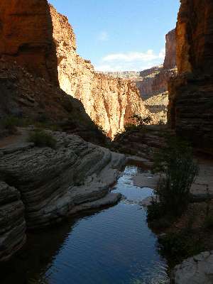
Looking N from beneath Royal Arch (NB), Day 3
(Click the image for the full-size image)
|
|---|
|
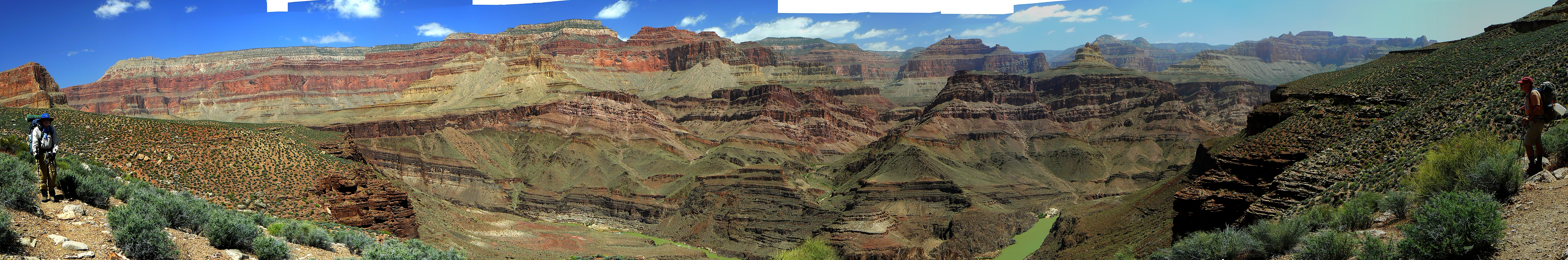
|
|---|
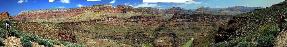
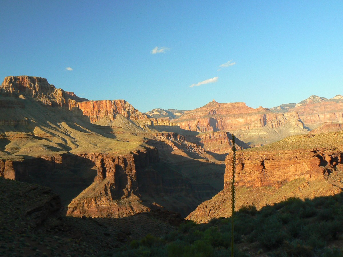
Panorama of North Bass area from the Tonto Trail; Dave left, Mike right
(Image is very wide and the file large - scroll to view it (5431 x 900; 6.4mb)
- Click the image for the full-size image)
|
|---|
|
"The rivers flow not past, but through us,
thrilling, tingling, vibrating every fiber and cell of our bodies, making them glide
and sing."
John Muir
“Stupidity got us into this mess - why can't it
get us out?”
Will Rogers
|
|---|
Movie of Royal Natural bridge - Day 3 - 19 MB; note Natural Quiet
(Click the image to see the short video - 19 MB)
|
|---|
|
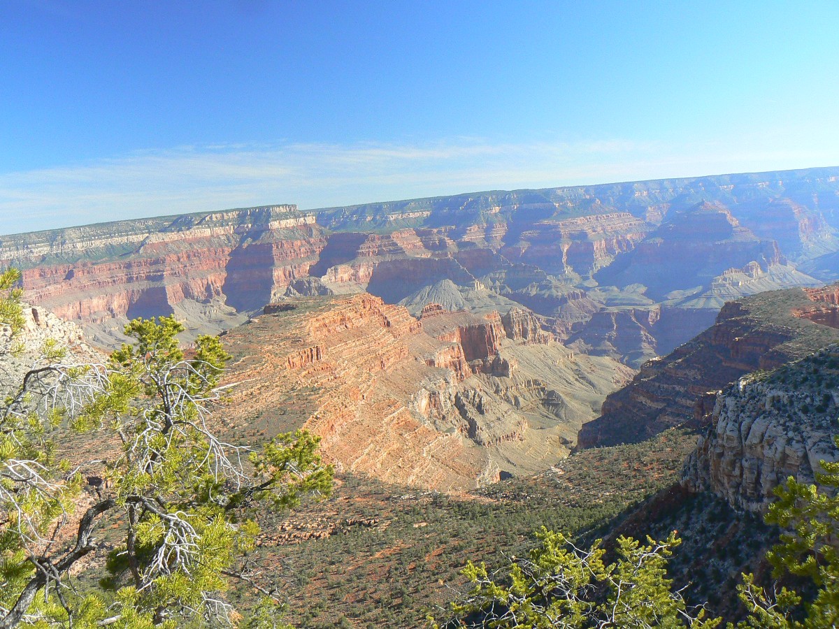
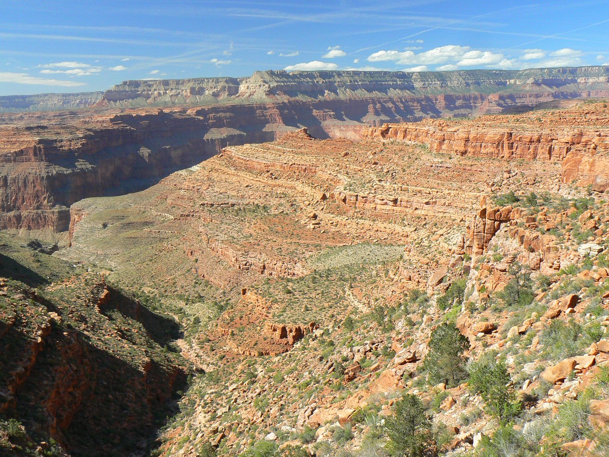
Overview: This is a report about backpacking the
Royal Arch loop, clockwise - which means a short rappel rather than a 20' free climb above Toltec Beach. We
found the going slower than predicted because of bouldering in Royal Arch Creek and trail texture (i.e., jumbles of rocks
in drainages, flesh-grater boulders). Plan more time the first time you go (5 days, minimum, are suggested).
Then, you will plan even more time for your second trip because you will want to explore all those canyons you skipped past.
Do not rely on previous hikers leaving a rope dangling for aid in free climbing (or descending) the wall above
Toltec Beach. Be
aware that any fixed ropes may be rotted or abraded. Backpacker Magazine has done a great diservice by suggesting this
loop can be hiked counterclockwise, in three days. Like the Michael Kelsey super-adventurer series ("the author"
hikes the Upper Muley Twist hike in 22 minutes and three seconds, a 9-mile hike), if you were not recently
a Navy Seal, be smart about your trip planing. Is it the journey in which you are interested or bragging rights, the
"been there, done that" mindset? Mindfulness vs. the g.w. bushco method?
76 photos
2 panoramas
2 videos
1 map
4 cartoons
Rhapsody = an instrumental composition irregular in form and suggestive
of improvisation.
an ecstatic expression of feeling or enthusiasm.
This hike contains amazing diversity - bouldering, a short rappel, route-finding challenges, exposure, and
delightful Tontour walking. Most amazing of all, you will not hear many air tour terrorists out here.
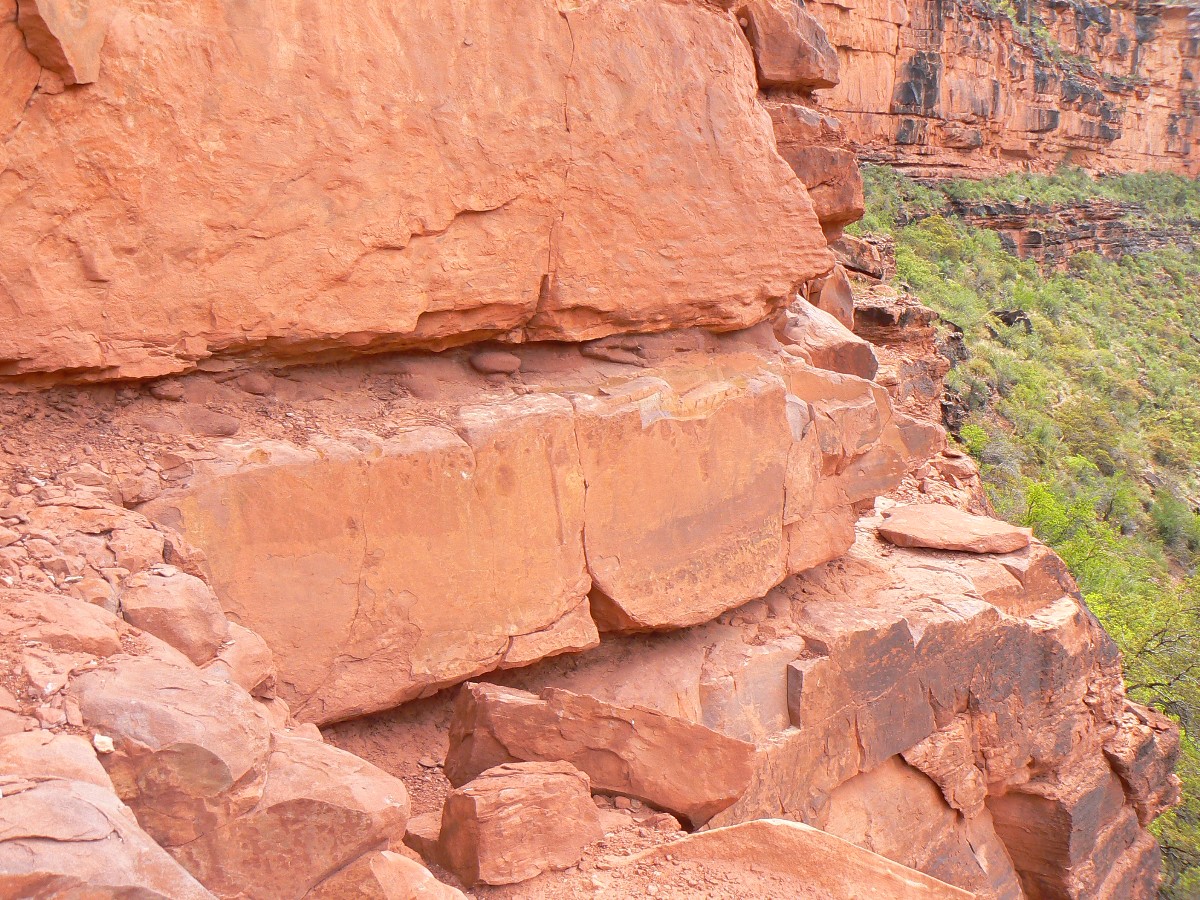
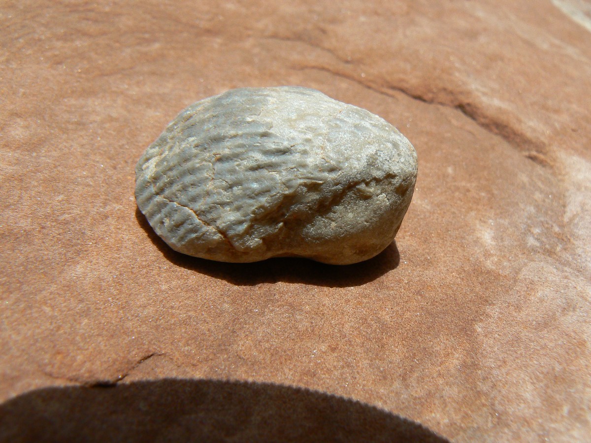
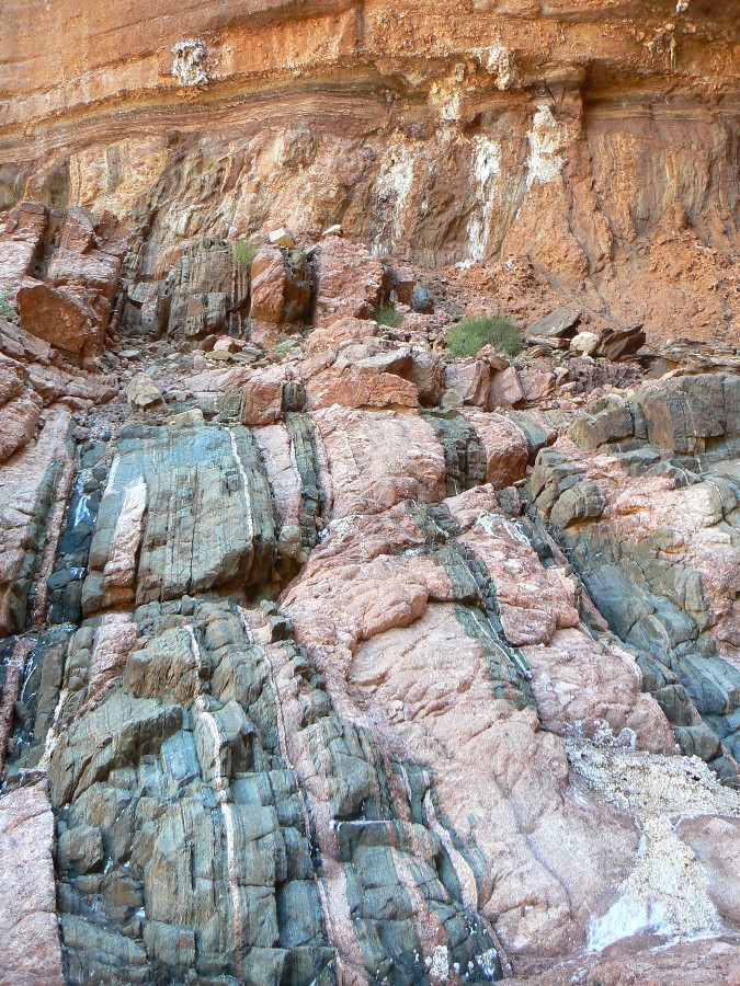
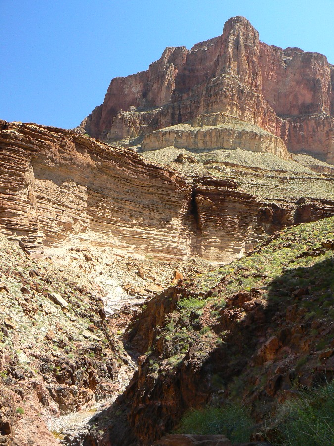
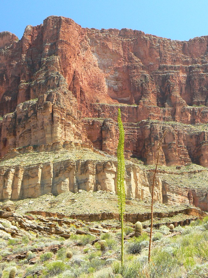
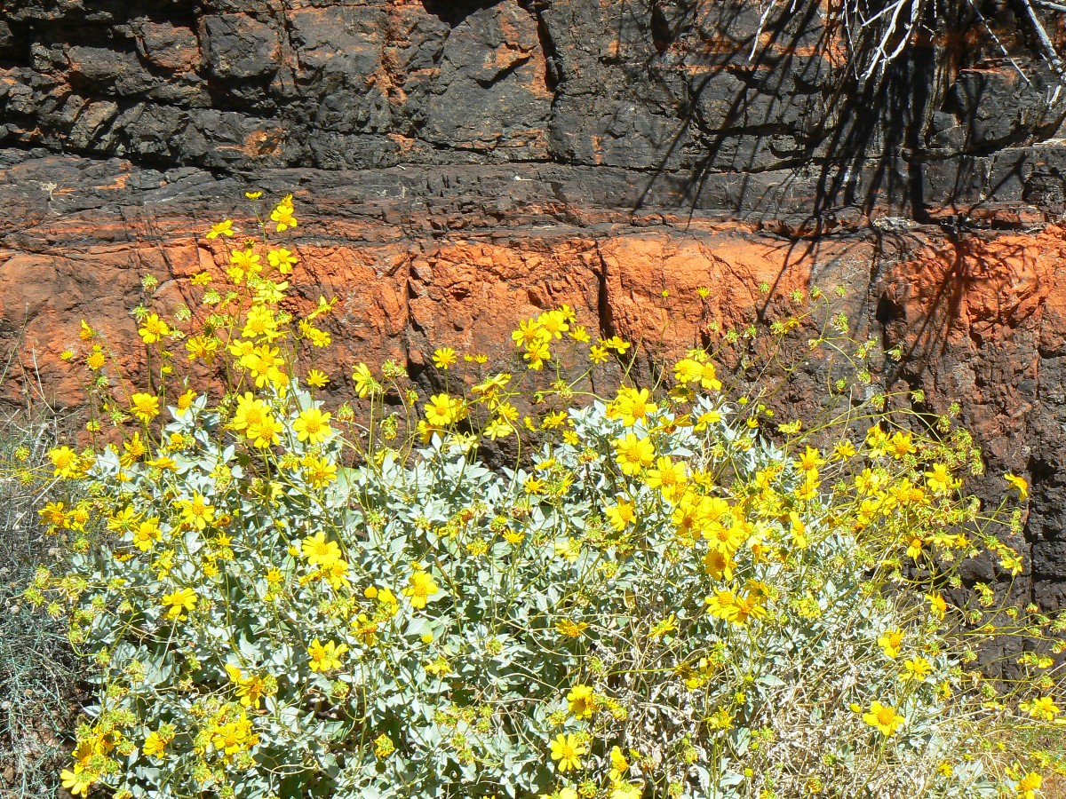
Tapeats Sandstone This layer averages about 545
million years old and is composed of medium-grained and coarse-grained sandstone.
Ripple marks formed by ocean waves of an early Cambrian sea are common in the upper layer.
The Tapeats is similar to the Redwall in that it forms a barrier between upper and lower
reaches of the Canyon that can only be traversed where a fault has caused its collapse. The
color of this layer is dark brown and it contains fossils of trilobites. brachiopods, and
trilobite trails.
ERM = Energy Required
Miles. A mile is added for
every 500' elevation gain or loss. It's a very serviceable method of estimating
energy required miles.
Map Note: Beware of the NPS and the Backpacker
Magazine (and other?) descriptions of the Royal Arch Route. 5 days are minimum, 7 is better, and clockwise is
best too. GPS may help, yet beware that in RA Creek, reception is poor or nonexistent. The trail shown on
the USGS 7.5 minute quad actually (on the ground) ends at the Royal Arch (RA) Creek branch below Montezuma Point.
The route down into RA Creek is not shown on the 7.5 min. quad, and it is rougly correct
(yet you may find confusing, or lacking in detail when you need it)
on the other (small scale - covering large areas in limited detail) maps.
A note about the mileages:
Distances are estimated rumsfeldian fashion, not accounting for known knowns or unknown
knowns or unknown unknowns, yet knowing that tall Canyon walls attenuate GPS accuracy
because few, if any, satellites can be "seen" by the receiver.


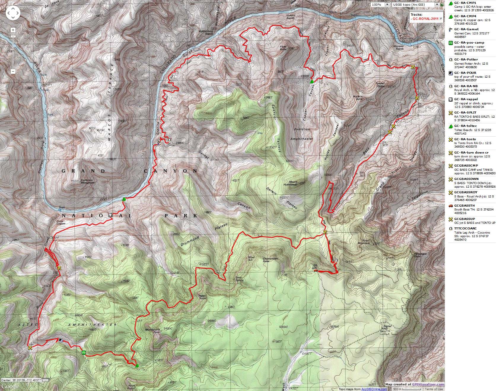
|
|---|
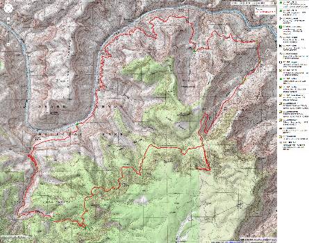
Map - GC: Royal Arch loop; 2011; 36 miles
(Click the image to see the map)
|
|---|
|
Enjoy, yet note that this track is deemed useful, not accurate. Do not
rely on it for route-finding.
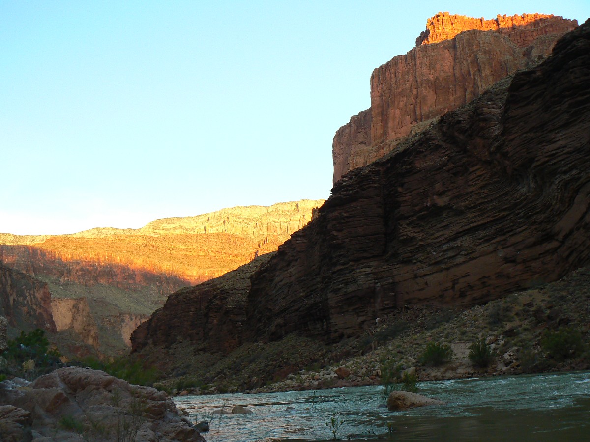
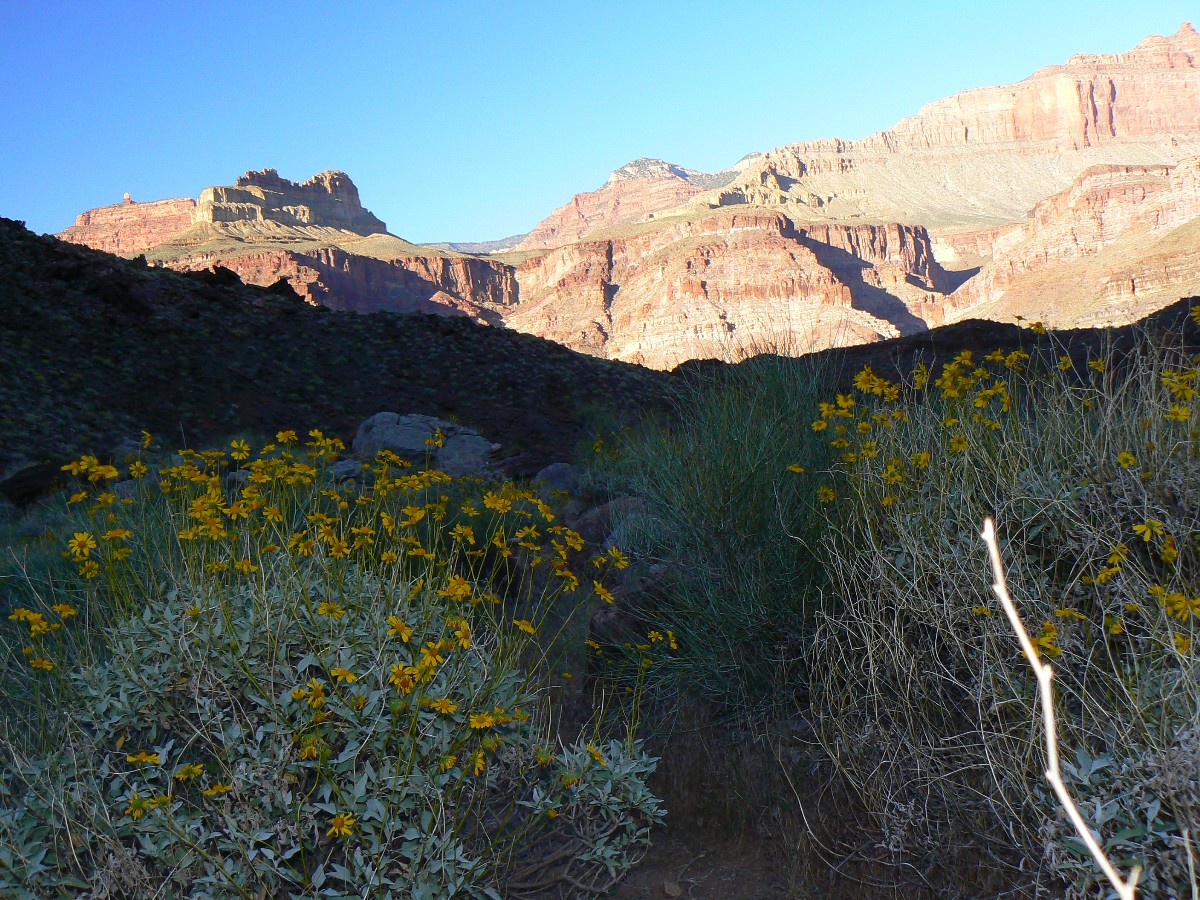
Day 1 photos - Royal Arch Rhapsody
(There are - More photos below the trip narrative.)
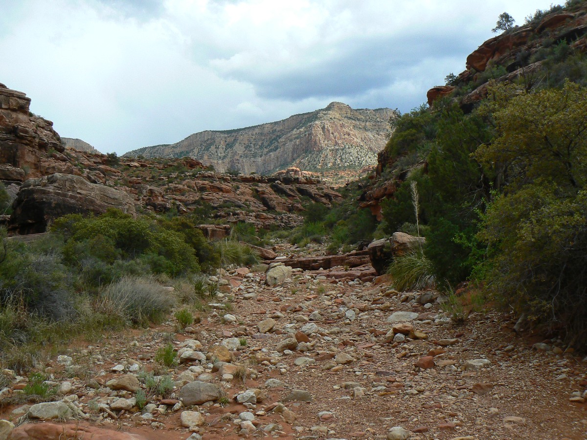
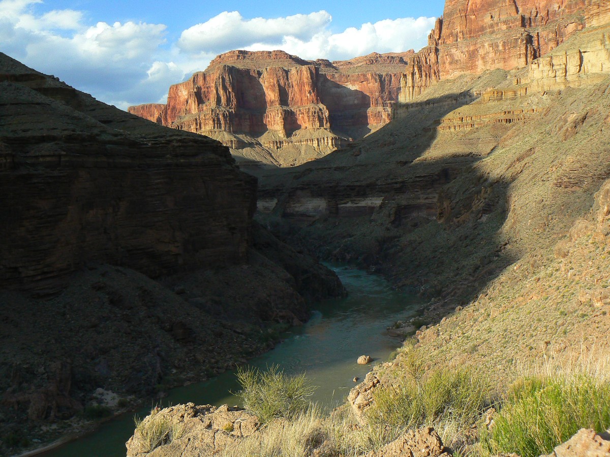
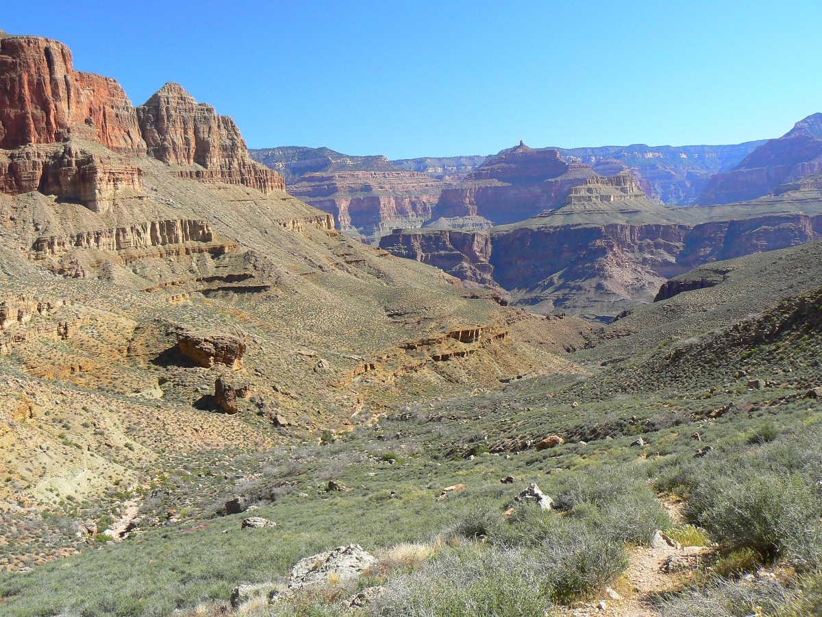
Day 1: Tedious Escalante:
To Royal Arch (RA) Creek; 8.3 miles; camp at 4900' (start at 6400').
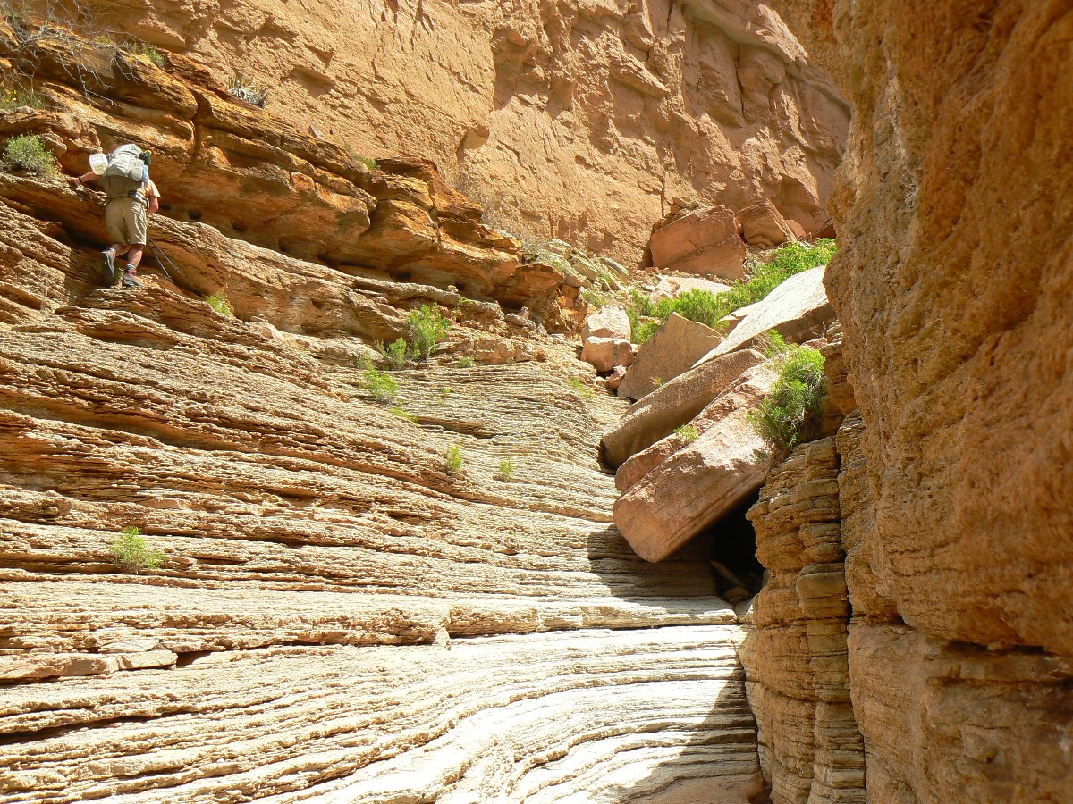
The Coconino SS (sandstone) cliff soars above as we walk the Esplanade highway,
interspersed with tedious picking through boulders in the drainages. Esplanade walking "should" be a waltz, this is not.
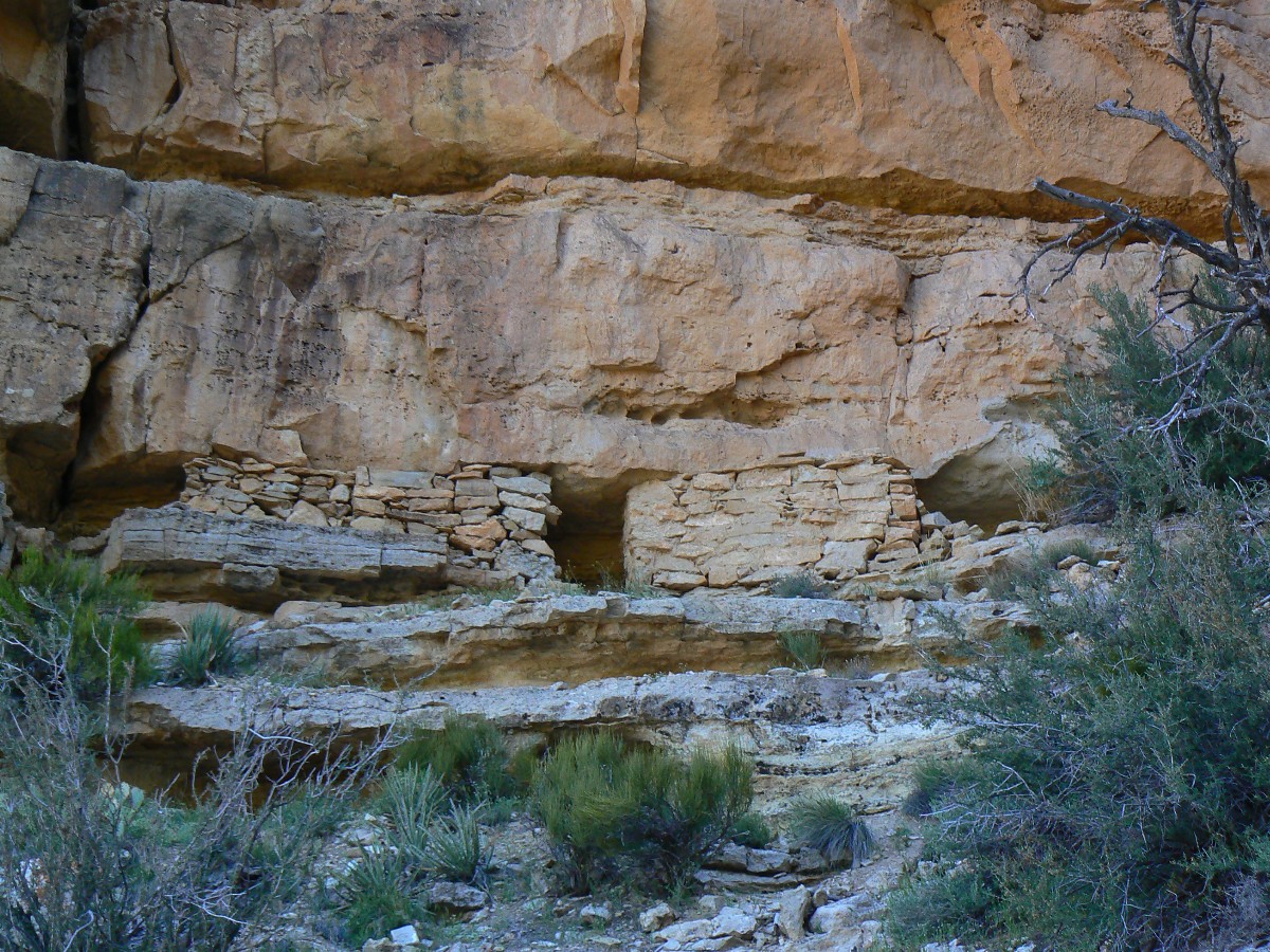
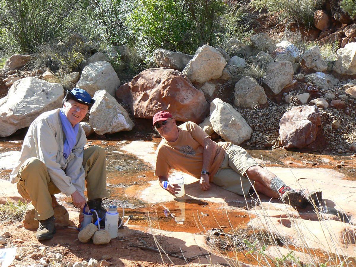
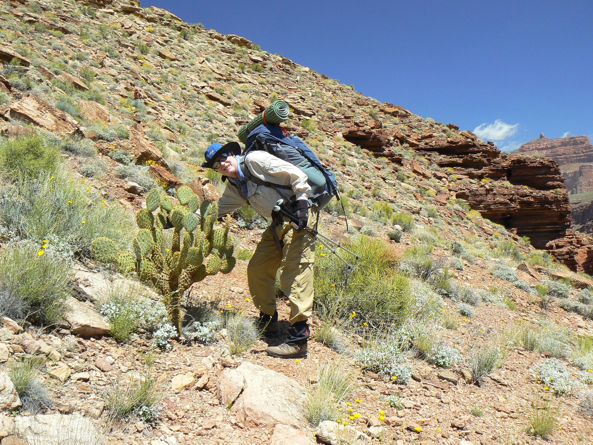
After driving the deeply-rutted road to the TH, we (Mike Garvey, Dave Rumbellow,
and I) investigated platforms and cisterns constructed by W. Bass and then eased off the rim carrying too much, 6
liters each, water. Mike stashes an additional gallon at the South Bass-Royal Arch junction for the way out, and
we hobble onto the Esplanade. Around points, in and out of drainages, some seeping water, until we get to the
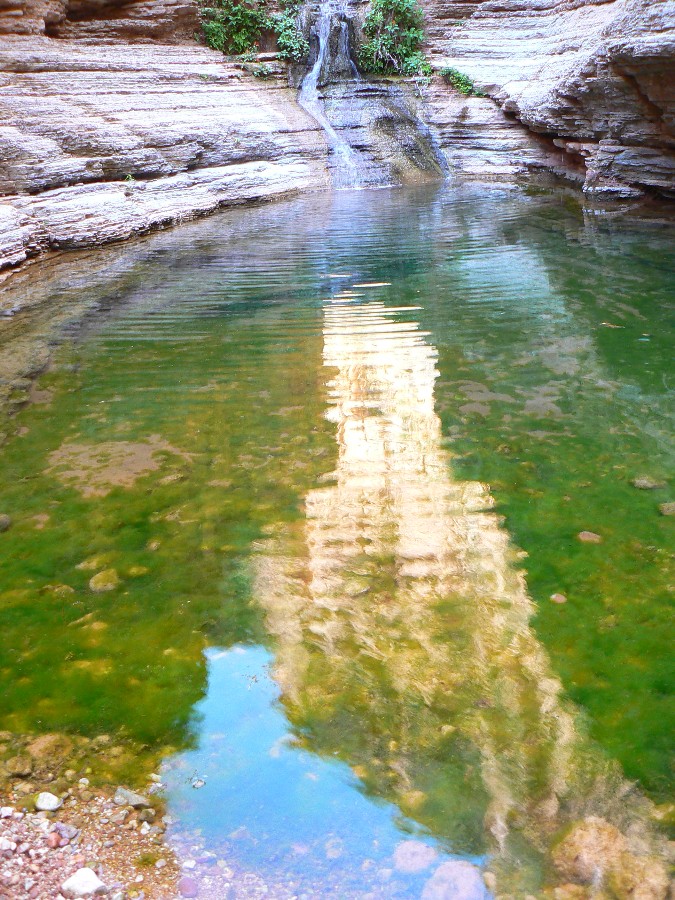
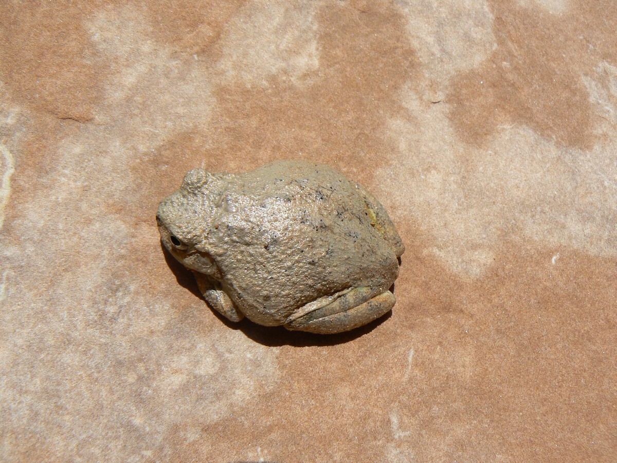
first arm of Royal Arch Canyon and this deluxe camp replete with water and a froggie serenade. Lovely.
Exhausted from the hospital visit to Phoenix (one of the infamous cities that
should not exist, destroying water resources, etc.), I'm way past ready for bed a I finish these notes by headlamp.
As my feet slowly regain a semblance of their natural shape, I sip the excellent
elixir of lime, lemon, and spirits (everclear) mixed by Mike and relish in the sweep of developing constellations
and the muted tinkle of the frog pond waters - ahh, natural quiet - no marauding air tour terrorists out here.
This is how the whole of the Park should sound - naturally quiet, all day and all night.
Click here to see the NPS trail distance estimates (two pages) for the Tontour, which ends at Garnet Canyon.
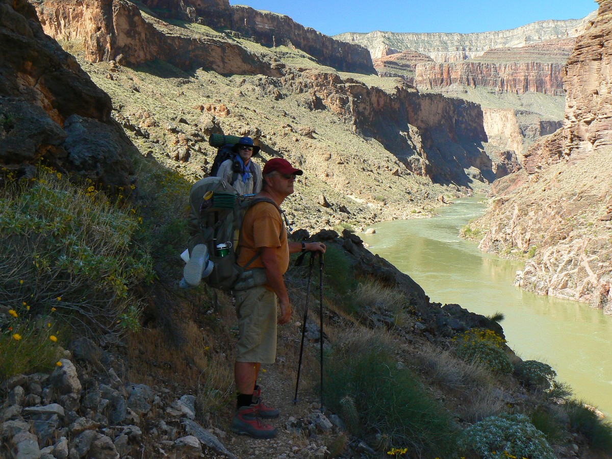
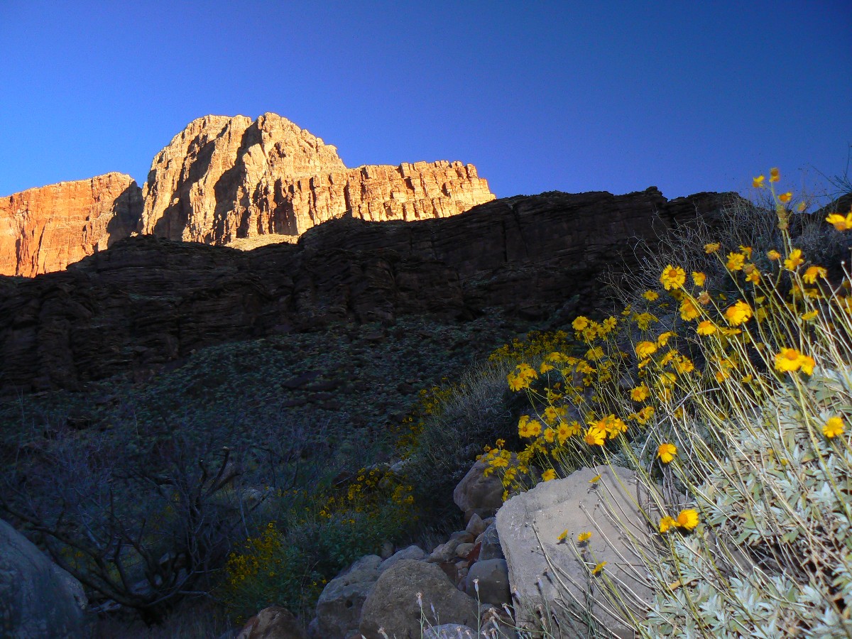
Day 2 photos - Royal Arch Rhapsody
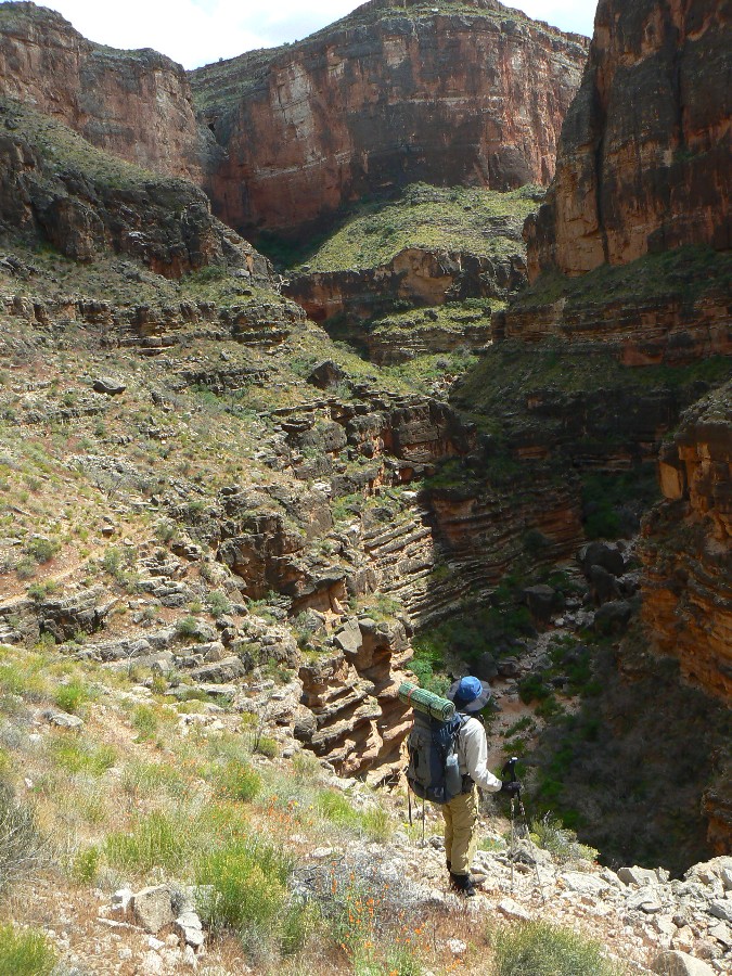
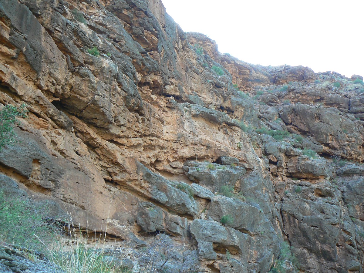
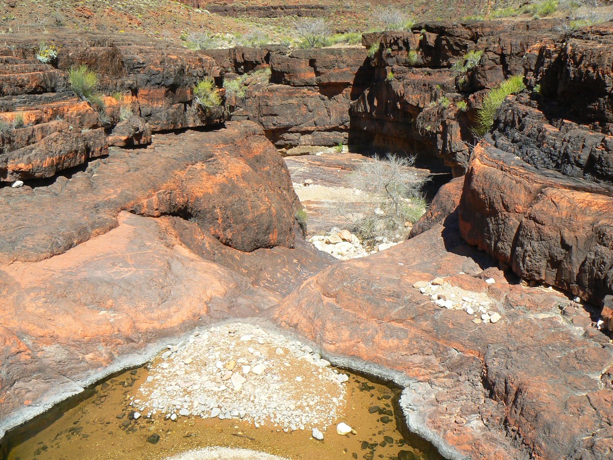
Day 2: Hassle Free Bouldering?
to near Tonto linkage; about 7 miles.
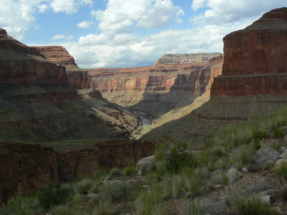
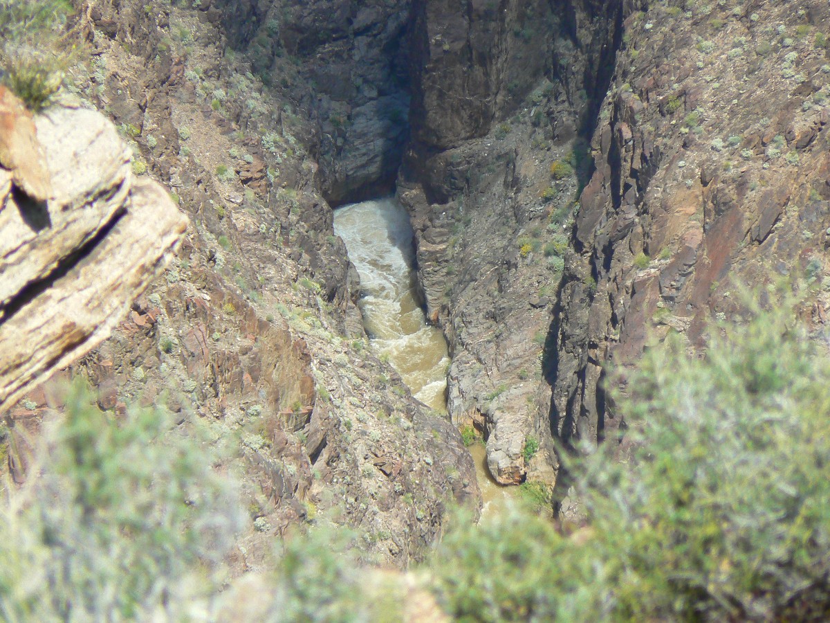
The brief rain has stopped and we continue down the side arm below Montezuma
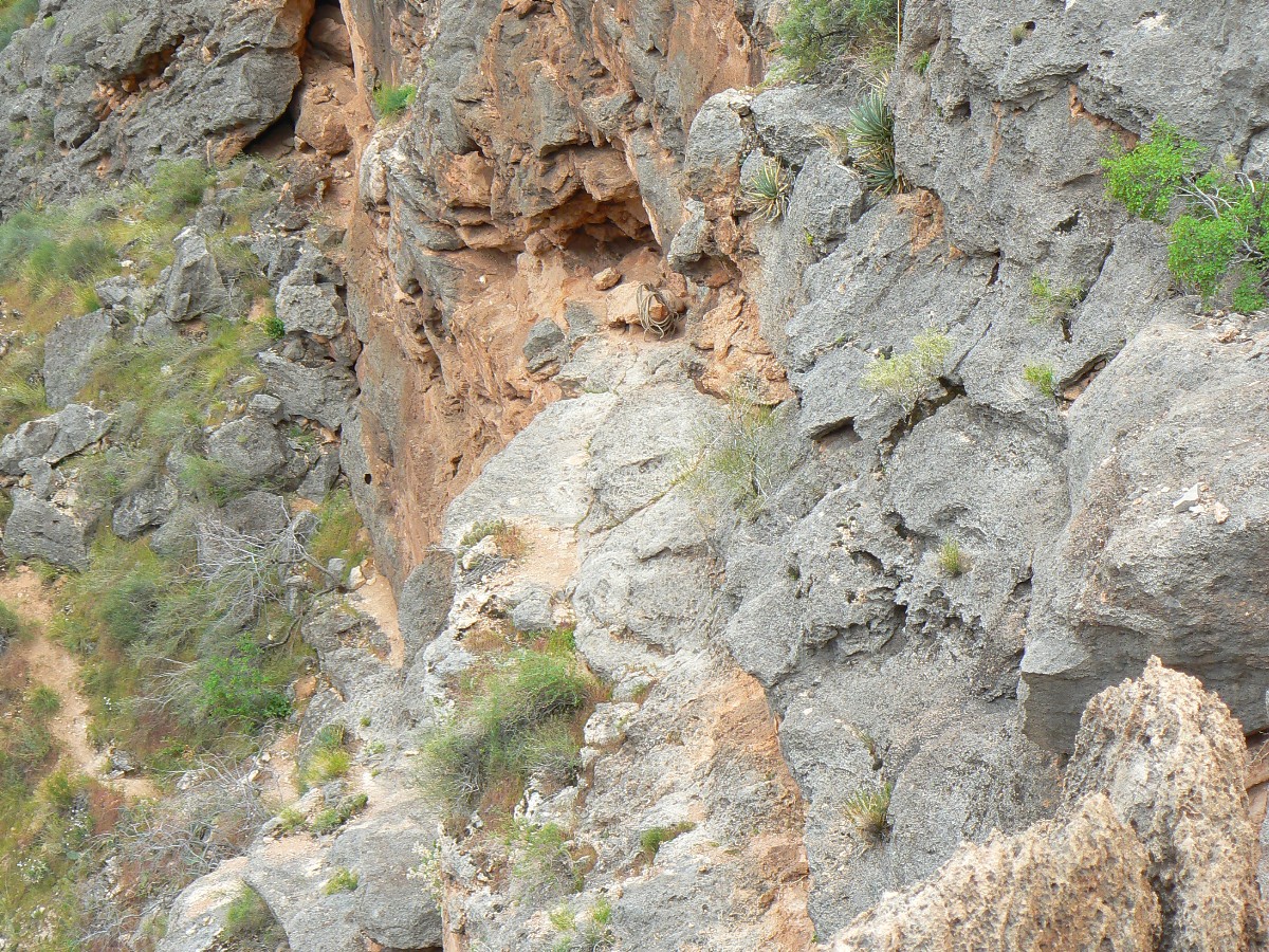
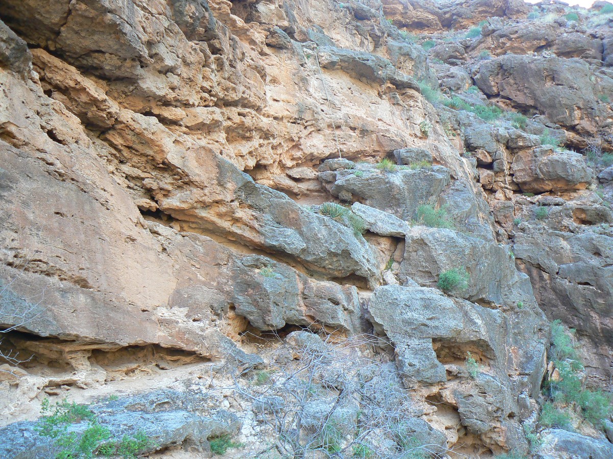
Point of Royal Arch (RA) Creek. Soon, a stunning drop-off. Yikes. Puzzling pour-off - isn't this supposed
to be in RA Creek proper? Perhaps it is.
Going left, the thin knife edge becomes a barrier to travel. Back above
the pour-off, we go right (LDC, looking down canyon) and creep along a wider ledge, then drop packs down,
and end up sliding down a talus pile to return to RA Cr. Then, argh, the hassle free (NPS description)
bouldering begins and we walk into the night, quitting when it's too dark for decent depth perception.
There are several pack-lowering, knuckle-skinning hassle frees to go through, slowing one's hiking speed
substantially. A dry camp and not enough water for dinner.
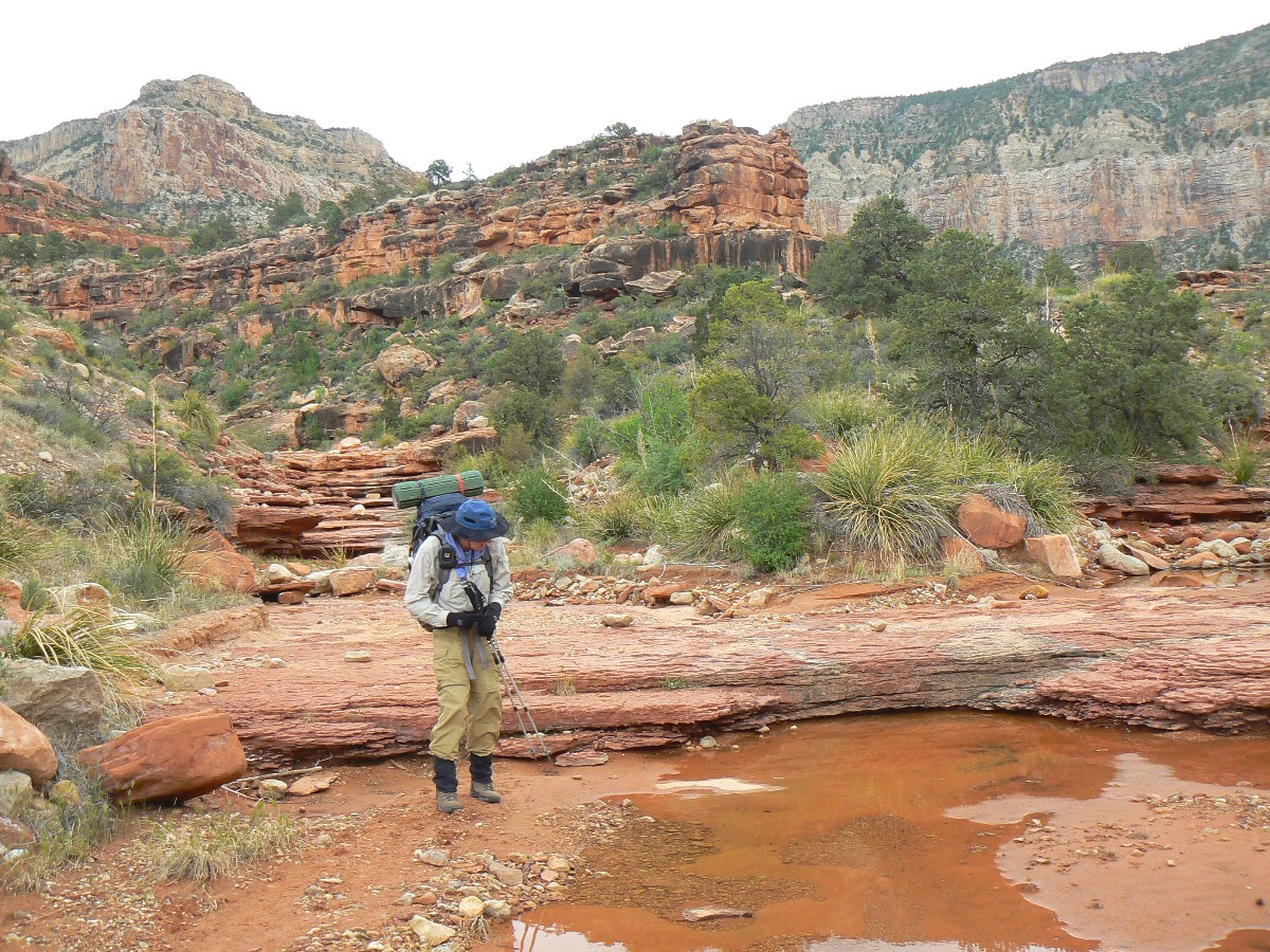
Early today, we set out from camp and begin to drop down rather than contour
per the topo map (trail shown on 7.5 minute quad). We had been cautioned by the BIC to 'not drop into RA Creek
too soon.' Backtracking, we eventually find the old trail, no signs of use for years. This time-waster causes
us to not explore the 0.4 miles to RA - because we ran out of light. Of course, we did not know our exact
location, so quit just before the sound of water at RA Spring. If we were more efficient today, the hike to
the arch (actually a NB, natural bridge) would have gone smoothly.
|
|---|
Movie of Monkey Flowers in RA spring - Day 3 - 6 MB; note Natural Quiet
(Click the image to see the short video - 6 MB)
|
|---|
|
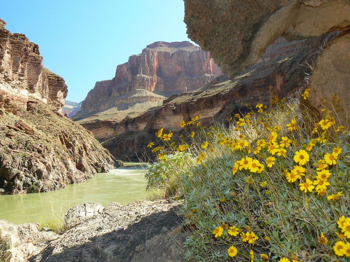
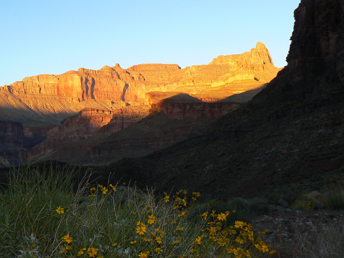
Day 3 photos - Royal Arch Rhapsody
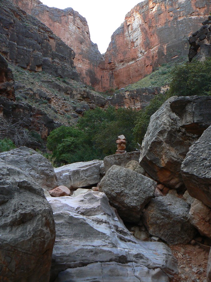
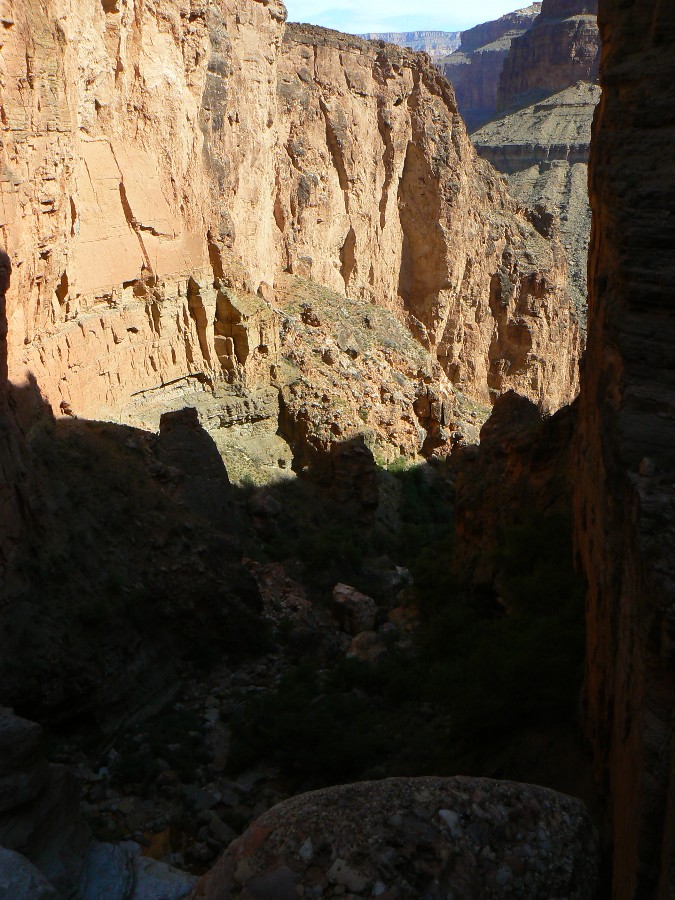
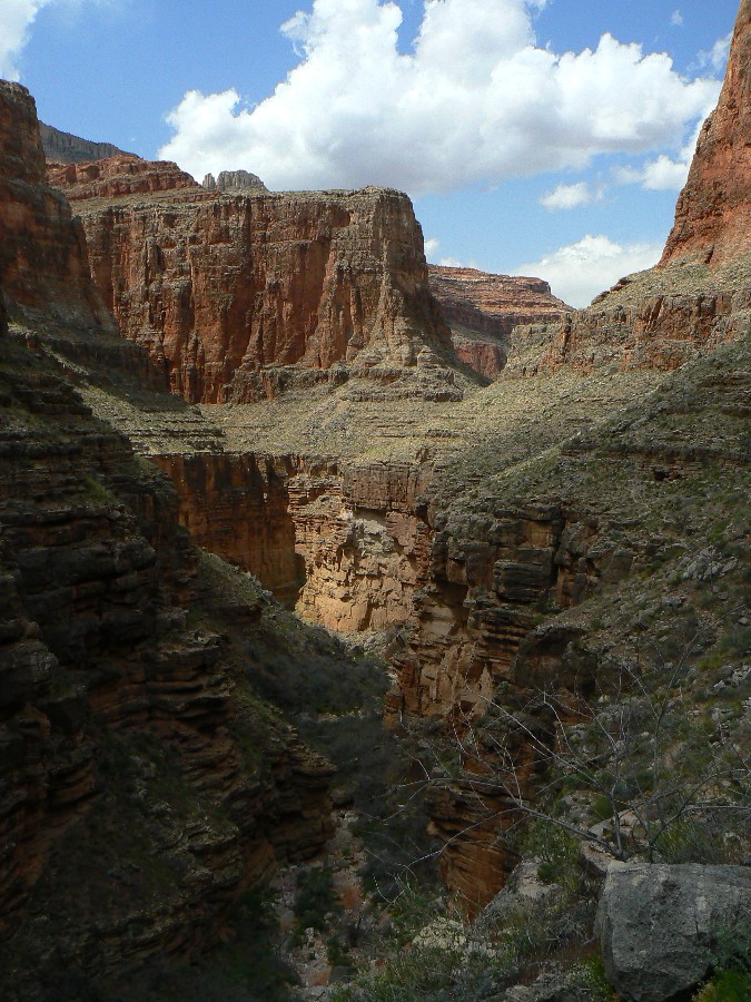
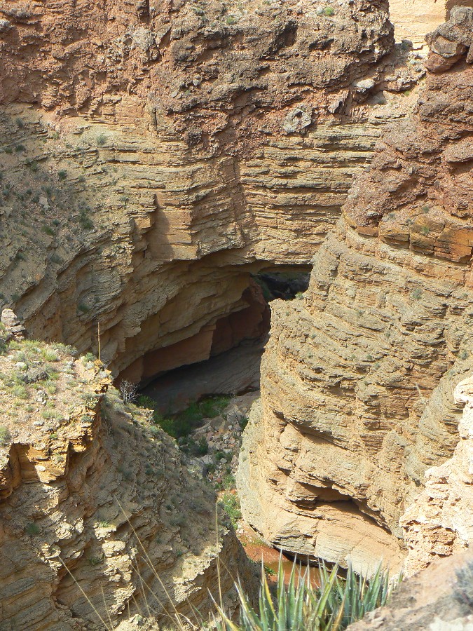
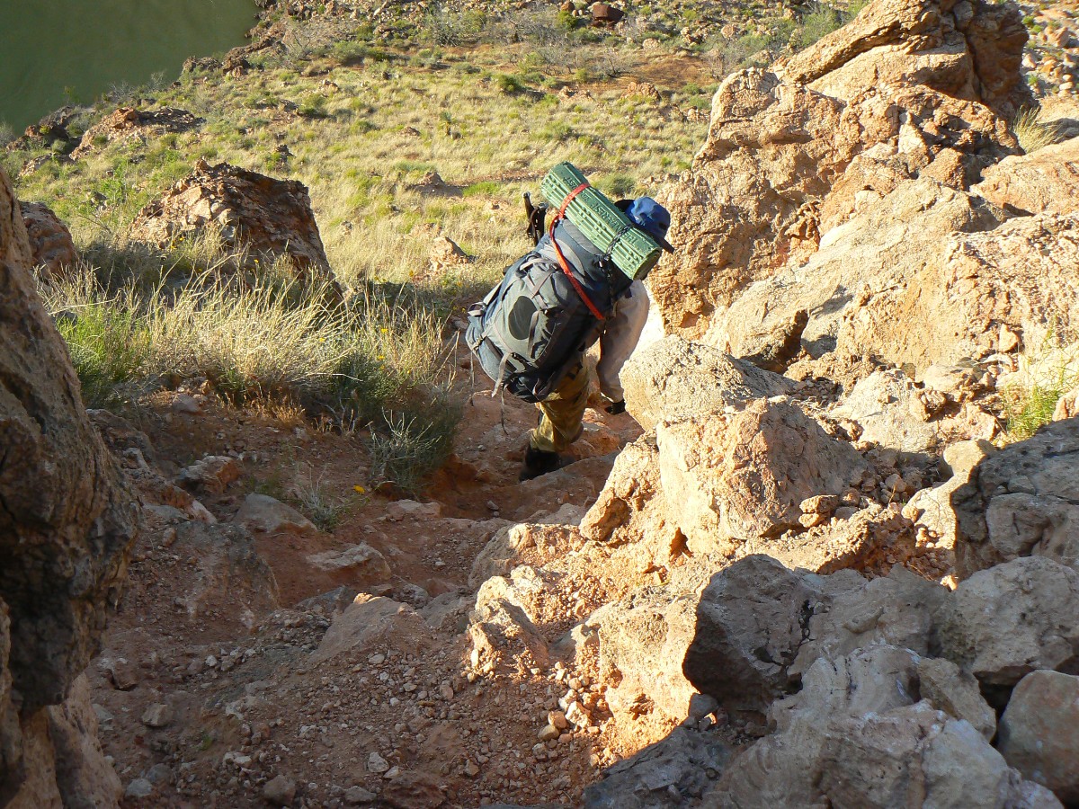
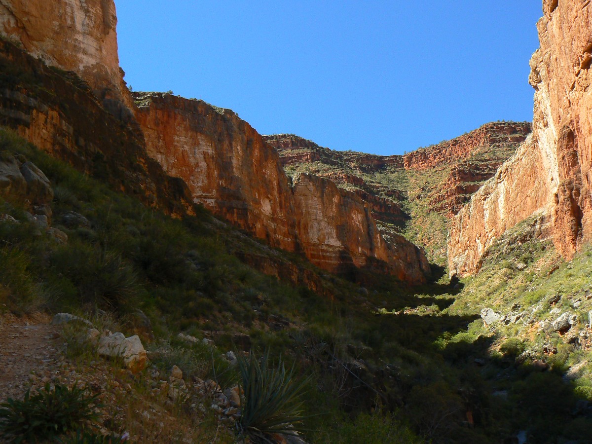
Day 3: Royal Rappel :
to Toltec Beach; 3+ miles.
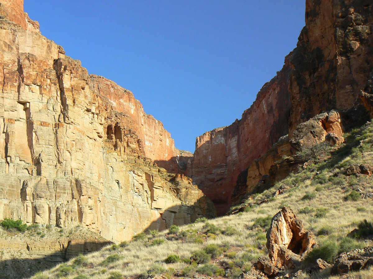
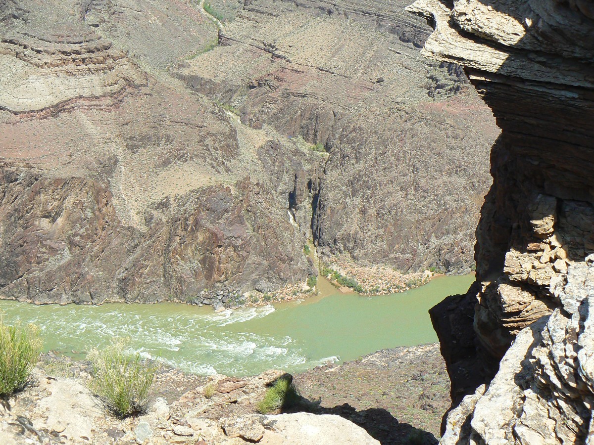
My large butt juts out above the distant Colorado, I ease tremulous over the edge.
Royal rappel? Splatorific? No, I walk the vertical wall to the landing. Whew. A relief of the 2nd order.
The 1st order is reserved for red-headed (and other colors) women with green eyes. Dave awaits at the landing,
and we deal with lowering packs and then Mike slides down the rappel.
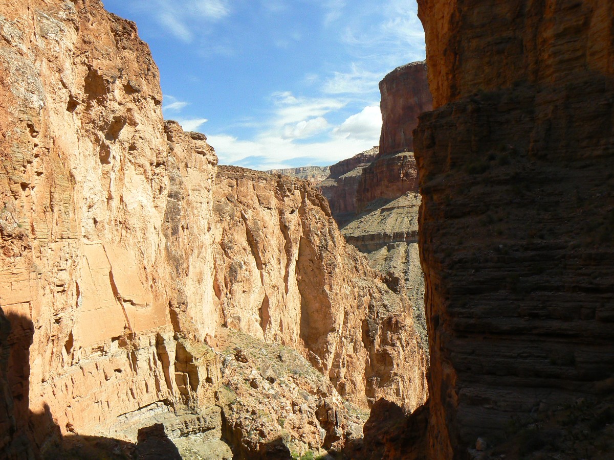
The short and direct route to Toltec Beach at the Colorado River is next, where
we relish in a River bath and sand camp. Clouds move in and blot out billions and billions of stars while Mike
serves a cocktail and soup and mac and cheese. Yummy. The River rolls raucous, fidgety, bound for impoundment
in the dead zone of Lake Mead, only recently and briefly freed from the sewage pond evaporative bathtub of Lake
Foul - it's so sad to commit these crimes upon a River of the West, any River, yet especially this River, deprived
of its essence, no sand, no warmth, only a river of profit with a cold heart - a republican river of low order.
Dismal. A republican crime against nature, and disrupting the natural cycle of things. Beware of those with
hearts of stock market tickers, with their conscious in a bank vault and their concept of a green belt that money
belt around their well-fed waste.
Earlier, we rose without breakfast and boulder-hopped down stream in RA Creek,
later learning that we were camped not far from the route to Toltec and hauling packs below was unnecessary.
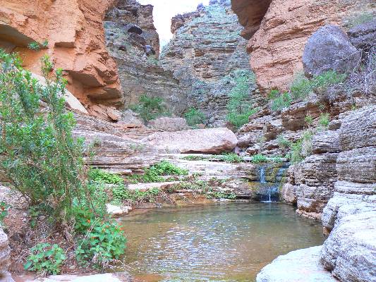
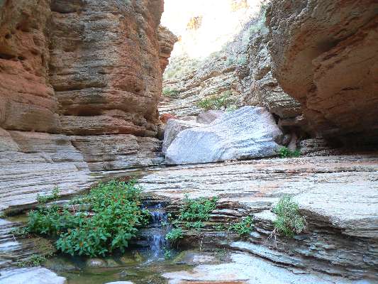
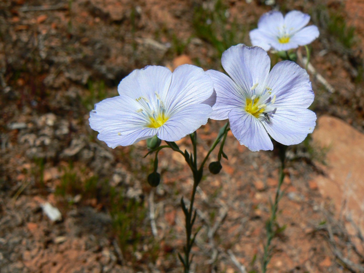
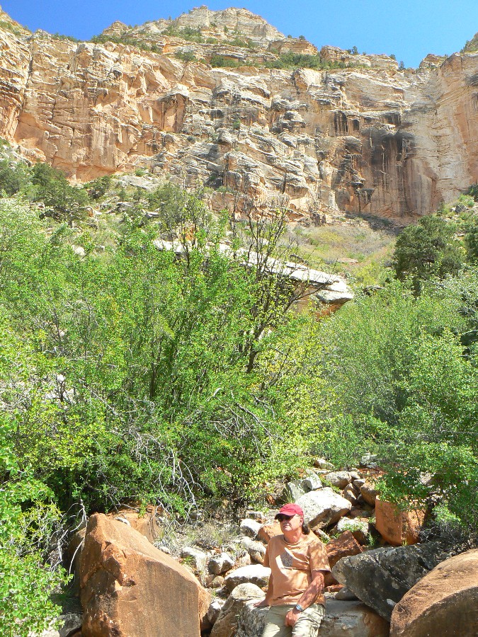
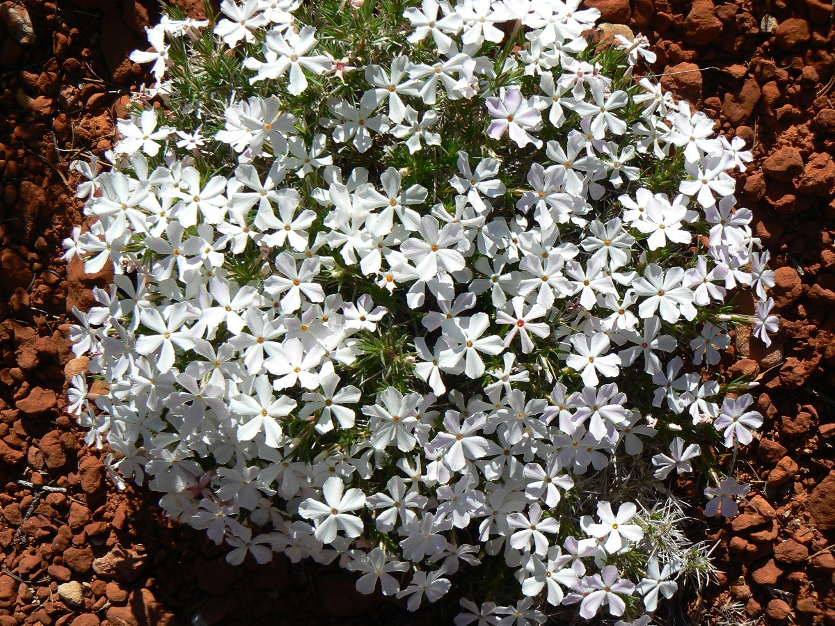
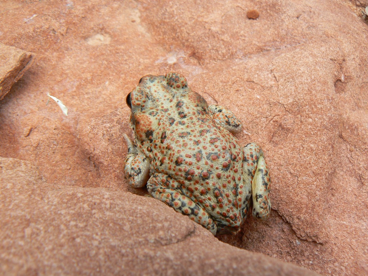
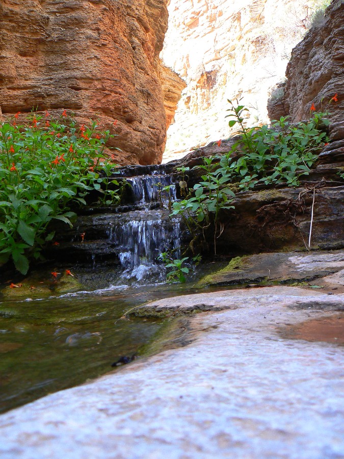
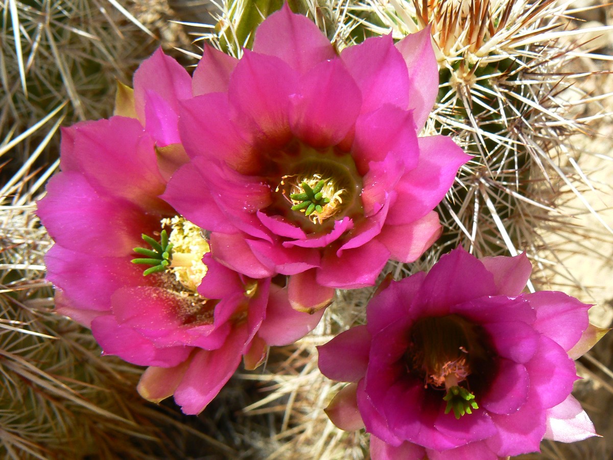
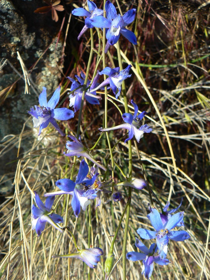
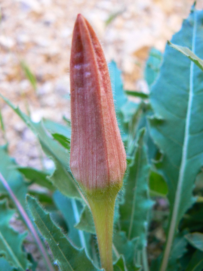
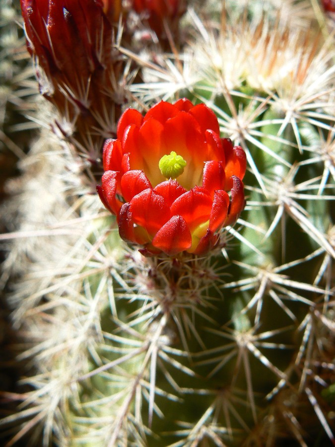
A jaunt to RA Natural Bridge, the spring and stream being the highlight -
populated with jumping froggies, sluicing water bordered by Monkey Flowers. Deluxe.
Then, the steep climb out of RA Cr. and over the shoulder to the rappel,
where this day's report started.
Day 4 photos - Royal Arch Rhapsody
(There are - More photos below the trip narrative.)
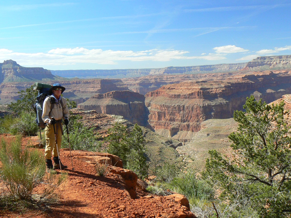
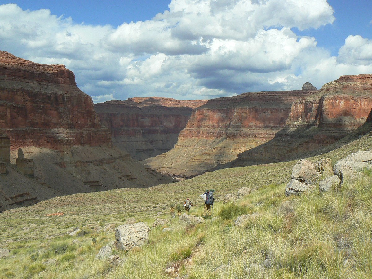
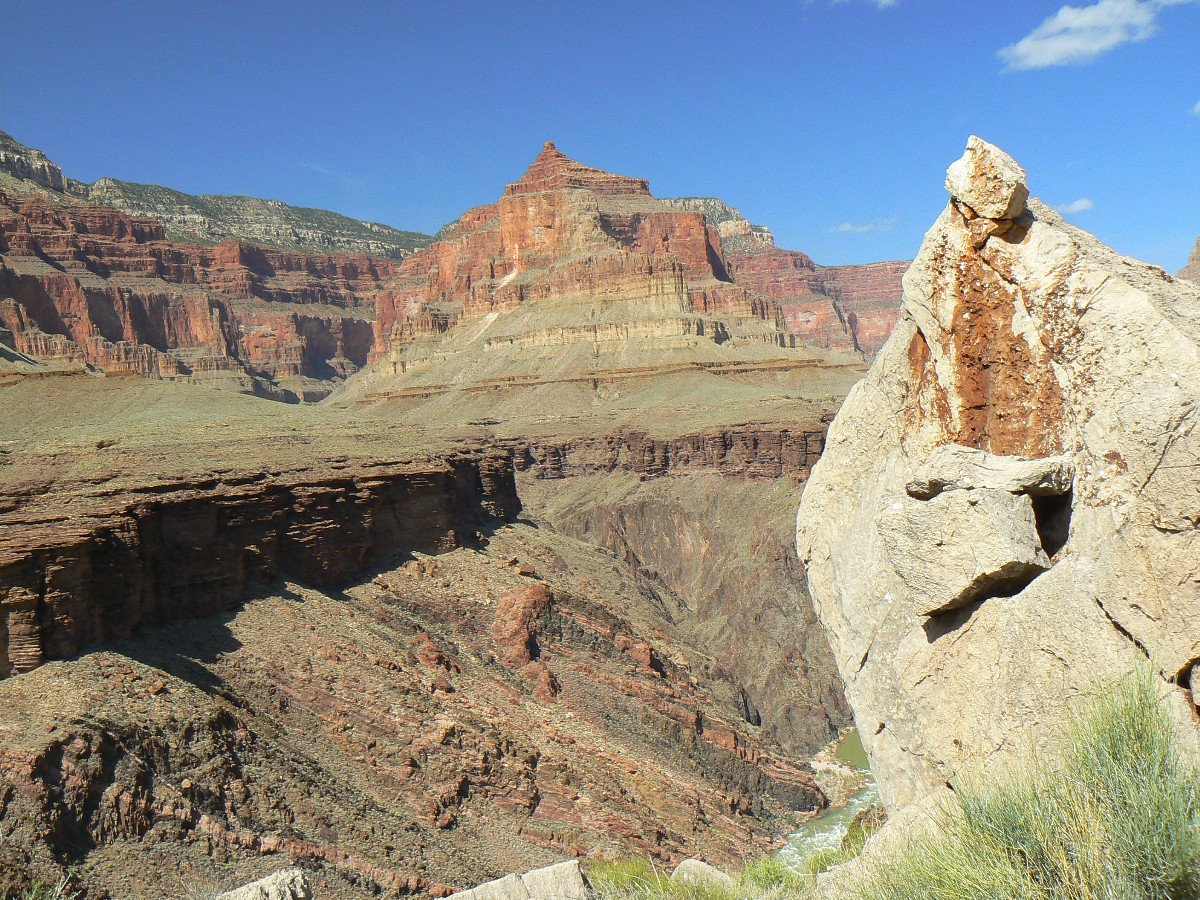
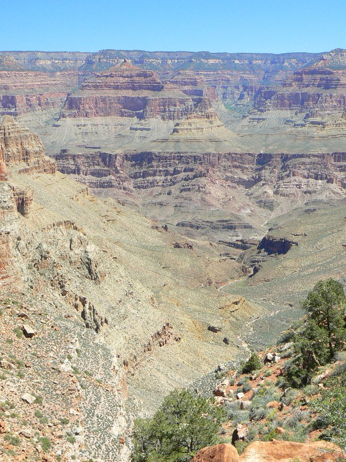
Day 4: Garnet Grind.
to Copper Canyon; 10 miles.
The basement rock amphitheater, decorated with the twisted and tortured
metamorphic and igneous of the Zoroaster Granite and Vishnu Schist and layered above by the stratified Tapeats
SS, reverberates with the throbbing base of The River, as it squirms through Granite Gorge - on its way to the
dead zone of Lake Mead, sacrificed to the gods of commerce and electrified gambling and banking. Horrid.
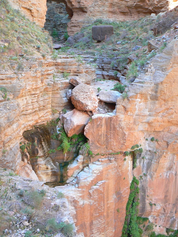
We've angled up from Toltec Beach, through the slow 1/2 mile of cheese- and
flesh-grater rocks to this alcove. Mineralized water has built small terraces. Continuing on, we reach Garnet
for lunch. Water here also, but it carries the strong rumor of digestive dirge. Leaving Garnet, the route climbs
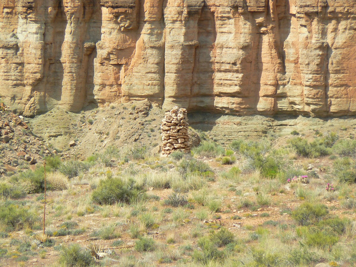
to the top of the Tapeats, passing Garnet Potter Arch, and begins a Tontour on the contour.
On the map included with this
report, the waypoint is GC-RA-Potter
Garnet Potter Arch; and Garnet Potter Arch is at approximately UTM 12 S 372447 4008650.
Grinding along beyond Garnet, the hike becomes a slog as we tour around several
drainages. Really, it's lovely Tontour hiking, perhaps the easiest of this route so far. To Copper just prior
to sunset - finding water up canyon. It's a late evening dealing with water, food, equipment, tired bodies. The
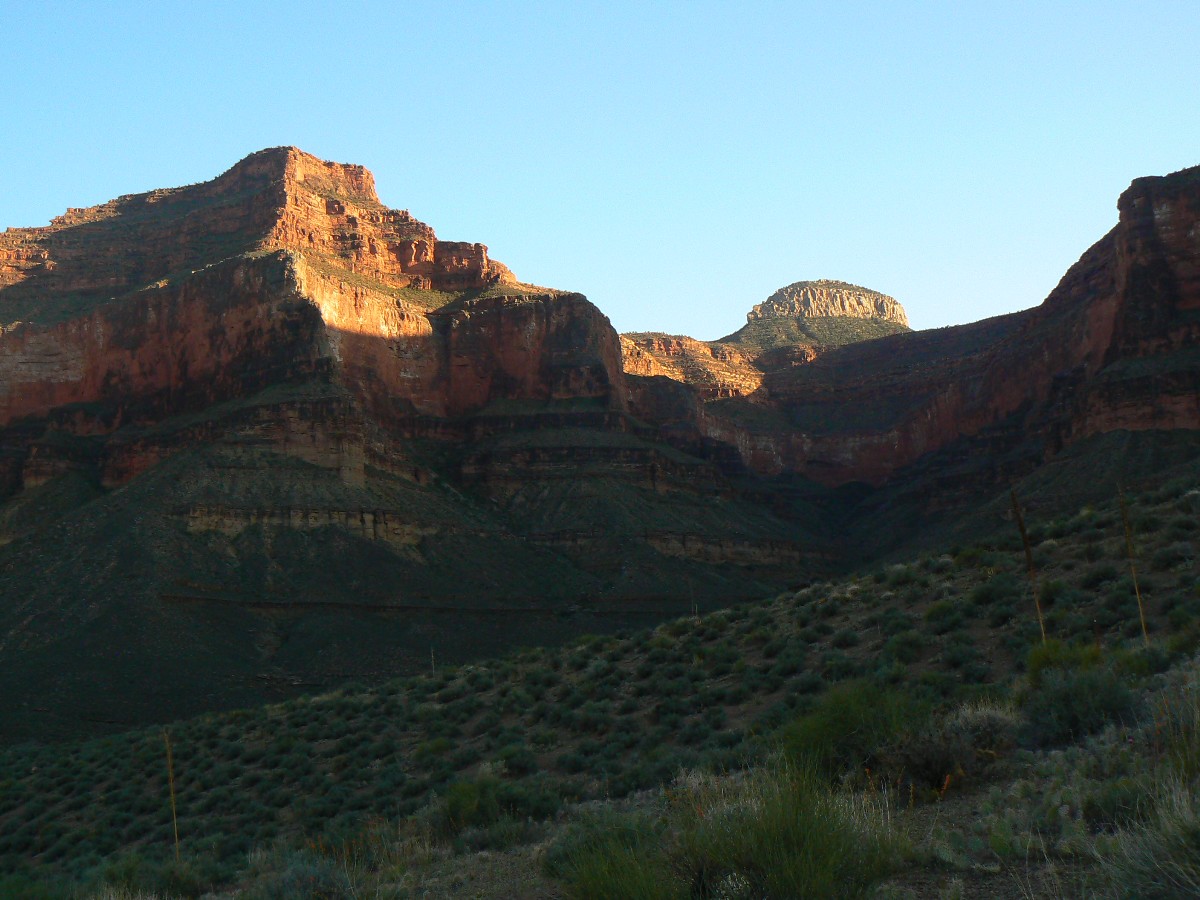
moon is on the wane, and we're treated to billions of stars and extensive natural quiet.
Thine Evolution Basin, topped by truth-tellers such as Spence, Huxley, The Darwin
Plateau, form the backdrop to camp. Foundations of The Truth. Now, if the creationists and hypocritical lack
of "intelligent designers" (what an astonishing, and revealing oxymoron!) were internally consistent - they would
not accept or participate in health care, which is based on science (and evolution) rather than make believe
stories. Thus, thine, and therefore, those who are certain, yet wrong, would earn the ultimate Darwin Award,
freeing us from horrid murderers and those swelling the ranks of the poor and unfed (i.e., modern republicans,
who have no social conscience) such as g.w. bushco, boner boehner, et. al., and a more rational species would evolve.
Day 5 photos - Royal Arch Rhapsody
(There are - More photos below the trip narrative.)
Day 5: Bassomatic, or, Tonto Triumph:
to South Bass Beach; camp at Bass Tanks at about 2800'. 3 miles or so + trip
to the beach and back to tanks.
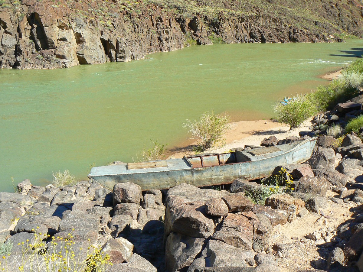
The polished ebony basement rocks lead down the end of the South Bass Trail
to The River. Like the proverbial fish out of water, the hand-riveted Wheeler boat rests mournfully far above
the corporate owned and operated high water mark. I've hiked to the South Bass Beach area from where we
dropped packs near the Bass Tanks. A lovely camping spot and coincidentally for me, the completion of walking
the entire Tonto Trail. A Tonto Triumph. It's been an easy day hiking from Copper Canyon to the S Bass. Hearing
only the occasional commercial jet? Nearly natural quiet. Of course, the FAA believes jets make no sound and
therefore should not be counted in the noise park analysis of the (only) Grand Canyon. I disagree. So do the
froggies, condors, ravens, rats, sheep; none of which matters to the FAA or the politicians or the wealthy elite.
It doesn't count if it has no direct commercial value.
I had heard that it was the Loper Boat at Bass Beach. Wrong.
Chris Forsyth wrote in with a correction about the boat out of water.
He notes that - it is the Ross Wheeler, which is the metal boat at Bass. The story there is that it was used
by a motion picture company (I think in the '20s) and then abandoned roughly where you see it now. For
whatever reason -- I have yet to figure out what is trash and what is history -- the park moved it
above the high water line and anchored it in place with the chain you see today. Loper's boat was wooden and
all that's left of it is a pretty rotted frame. It is far upriver.
Here's the report about the Trans-Tonto - Transcendental Trans-Tonto (TTT):
Tanner TH to South Bass – about 114 miles:
Transnavigation of the Tonto Trail and Escalante Route in The Grand Canyon (2010)
Returning to camp from Bass Beach, I enjoy a bath far from froggie water and yet
splendid with deluxe views of King Arthur's Castle.
At the close of today, I'm sitting on the glossy basement rocks contemplating
the extravaganza of stars. The black rock is still warm under my sleeping pad - something that feels lovely
on this cooler than typical night.
Tomorrow, Dave, Mike, and I will grind our way up through rocks made by time
- back through Tapeats SS, Bright Angel Shale, Mauv Limestone, Redwall Limestone, Supai Group (including the
Esplanade), Hermit Shale, Coconino SS, Toroweap Formation, and Kaibab Limestone to the South Bass TH and the
end of this Royal Arch Rhapsody.
Day 6 photos - Royal Arch Rhapsody
Day 6: Up and Out.
to South Bass TH. 36.4 miles total on my GPS. 8700' gained total, 8700' lost total.
For a wildly (a la runsfeldian Euclid math, where you know the known knowns, don't known the unknown known's
or the unknown unknowns, etc.) estimated (because of poor satellite reception in narrow canyons) ERM
(Energy Required Miles) of 71.
The mnemonic goes like this (read down, use first letter of starting word as
a reminder - from the rim, down):
Know - Kaibab Limestone
The - Toroweap Formation
Canyon's - Coconino SS
History - Hermit Shale
Study - Supai Group (including the Esplanade)
Rocks - Redwall Limestone
Made - Mauv Limestone
By - Bright Angel Shale
Time - Tapeats SS
Know The Canyon's History, Study Rocks Made By Time.

more Truth than joke
Postscript:
A Safe Operating Space for Humanity? Or
Death by Over Population?
Nature.com has weighed in on over population and the end of
nature. At the core of nearly every (all?) environmental and social problem is reducing
human population.
link to - blogs at nature.com
LIMITS TO GROWTH: NOW IT’S CALLED "PLANETARY
BOUNDARIES". It seemed to many of us that the culture police must have outlawed any
mention of Earth's ultimate problem. The word "population" is now rarely mentioned by the media.
This week in Nature, the population problem is given a new name. "A Safe Operating Space for
Humanity" is the Feature in today's issue. It’s an edited summary of a longer paper available
at the Stockholm Resilience Centre. The study was led by Johan Rockstrom. To facilitate debate
and discussion, Nature is simultaneously publishing a number of linked commentaries from independent
experts. It may be the most important project Nature has ever undertaken. Numerical boundaries
to human activity beyond which our planet would risk not recovering are: anthropogenic climate
change, ozone depletion, ocean acidification, biodiversity, freshwater, the global
nitrogen and phosphorus cycles, and change in land use. In the case of anthropogenic climate
change and human modification of the nitrogen cycle we may already have crossed the boundary.
It could be argued that the boundaries are simply surrogates for the overriding problem of
reducing human population.
POPULATION: WHERE IS MALTHUS WHEN WE NEED HIM?
Even as Nature featured the problem of "planetary boundaries” (WN 25 Sep 09), a special issue of
New Scientist asked, why isn't population control a key priority. Paul and Anne Ehrlich,
clearly thought it should be. They note, as Malthus did 200 years earlier, that we have a choice
between a falling birth rate and a rising death rate. Jesse Ausubel, however, argued that
technology will save us. Where has he been? We already have the technology to save us; the
pill has no side effects, is 100% effective, and is cheap as aspirin. Reiner Klingholz worried
that problems in Europe will grow as the European population shrinks. It's been shrinking for
years, and the last time I checked Europe was doing great. Fred Pearce blamed overconsumption.
The poor half of the world’s population, he says, is responsible for just 7% of the world's
emissions. Perhaps he's suggesting that we should make sure they remain poor lest they
exacerbate warming.
“The plural of "anecdote" is not
"data"." - unknown

|
|---|
a bankers 'progress' G Trudeau
Click the image for the full-size image)
|
|---|
|
Links:

Map and Mileage Table:
|
|
|---|
Map - GC: Royal Arch loop; 2011; 36 miles
(Click the image to see the map)
|
|---|
|
Enjoy, yet note that this track is deemed useful, not accurate. Do not
rely on it for route-finding.
 Click here to see the NPS trail distance estimates (two pages) for the Tontour.
Movies: Start downloading one, or two, while you read the above text....
Movie of Royal Natural bridge - Day 3 - 19 MB; note Natural Quiet
Movie of Monkey Flowers in RA spring - Day 3 - 6 MB; note Natural Quiet
Panoramas:
Panorama of North Bass area from the Tonto Trail; Dave left, Mike right
(Image is very wide and the file large - scroll to view it (5431 x 900; 6.4mb)
Vertical Panorama of Royal Arch (NB); 1200 X 1828; 3mb
Other WV reports about the Grand Canyon:
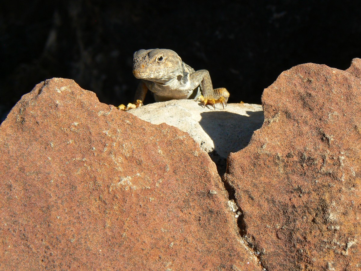
Click here or on the Looking Lizard to go to all WV reports about The Grand Canyon

|
|---|
Looking for All Wilderness Vagabond trip reports about the Grand Canyon?
Click the image to go to All WV reports about The Grand Canyon
|
|---|
|
Related Links:
Scenic Toilets of Inner Earth
Steve's
excellent photos -
birds in flight, panoramas, etc.
the NOAA forecast for the Tontour level.
the geology of the Grand Canyon by the NPS


