Cedar Mesa, Utah

|
| |||||


|
| |||||


|
| |||||


| ||||
| ||||
| ||||

Summary: I enjoyed a trek to The Citadel on Cedar Mesa. Also, day
hikes on Cedar Mesa and in Canyonlands National Park. First, the Citadel. What
a place! Who would build out here on this gooseneck of rock except for defensive purposes. "Fear!" chanted
gw bushco, and the re-election was his (along with the squandering of treasury, lives, billions in future
medical costs in a voluntary war, and nearly total destruction of the US economy). "Fear!" chants
the NRA and gun sales skyrocket. I suppose we have
learned very little since ancient times, yet our killing methods are more numerous and lethal.
I also hiked several day ventures in Canyonlands NP (National Park).
Co-adventurer: Solo trip
camera: Panasonic DMC-ZS19
"Reality has a well-known liberal bias." - Stephen Colbert
The Citadel :
I scramble up to the well-preserved ruins of The Citadel cloistered under
a protective Cedar Mesa Sandstone lid, far out on a rock isthmus and distant from water and the fields
cultivated by these early Pueblo people (about 800 years ago) on what is now called Cedar Mesa. It's
an eerie place. Getting their informs you about the defensive nature of The Citadel as one walks along
the rim of a canyon, and across the naked rock neck of the isthmus, hanging out in space above deep canyons
on three sides. It's impossible to see The Citadel as one drops off the canyon rim via angled slickrock,
then out toward the sandstone promontory. On the nape of the neck, you encounter low rock ruins, once
apparently guard shelters. I pause here in the expansive natural quiet and wonder if this could be the
way to The Citadel, it just looks like an impossible place to build. The 300 foot drop-offs on both
sides of the neck are spooky, yet the walking here on top is easy. At the distant end of the isthmus,
you finally see and can scurry up to the ruins.
The Citadel is a gorgeous set of masonry structures and I am
enveloped in the serenity and beauty of the place. Yet, the fear of attack is the only reasonable reason
to live or store food out here. Thinking about the effort involved in toting water and food to this
remote place, one is jolted from the present day sense of wonder to that of a society guarding its
existence. Anyone approaching across the neck, the only access to The Citadel, would be at the mercy
of guards behind the battlement walls. Scientists believe The Citadel was largely used as granaries,
although habitation may have occurred during times of attack. Archeologists report that this period,
now generally referred to as Pueblo III, was marked by soaring human population, food store raiding, and
habitat decline. These people were late in the cultural history of Cedar Mesa, which dates back over
6,000 years to the Paleoindian Period. Ancestral Puebloans left the mesa in the 1200s, apparently because
resource overutilization and overpopulation made habitation difficult. One might wonder what this says
about our current situation. The Puebloans moved South and Southeast, away from the four-corners area,
leaving us to wonder about their stone and art work.
It's prudent for the BLM to manage visitation to these precious
structures and sites, so I'll leave it to you to contact the BLM directly. Also, when visiting
cultural sites, please do not touch or enter structures and do not touch or mark rock art. Leave
all artifacts as you found them. So, no map graces this report. It's best explored on your own.
The name Cedar Mesa comes from the dense Pygmy Forest of cedars
(Junipers) and Pinyon Pines. The Mesa top ranges from about 5,500 to 7,000 feet.
An entire issue of Archaeology Southwest Magazine (2014, Vol. 28, No 3 & 4)
features the wonders of Greater Cedar Mesa culture and natural history. You can also see
their web site at: http://www.archaeologysouthwest.org/ Buy a copy at Kane Gulch RS, at
Natural Bridges NM, or on the above archaeology website.
The Citadel
 |
 |
 |
 |
 |
 |
Now, back to the start of this trip for a day-by-day report:
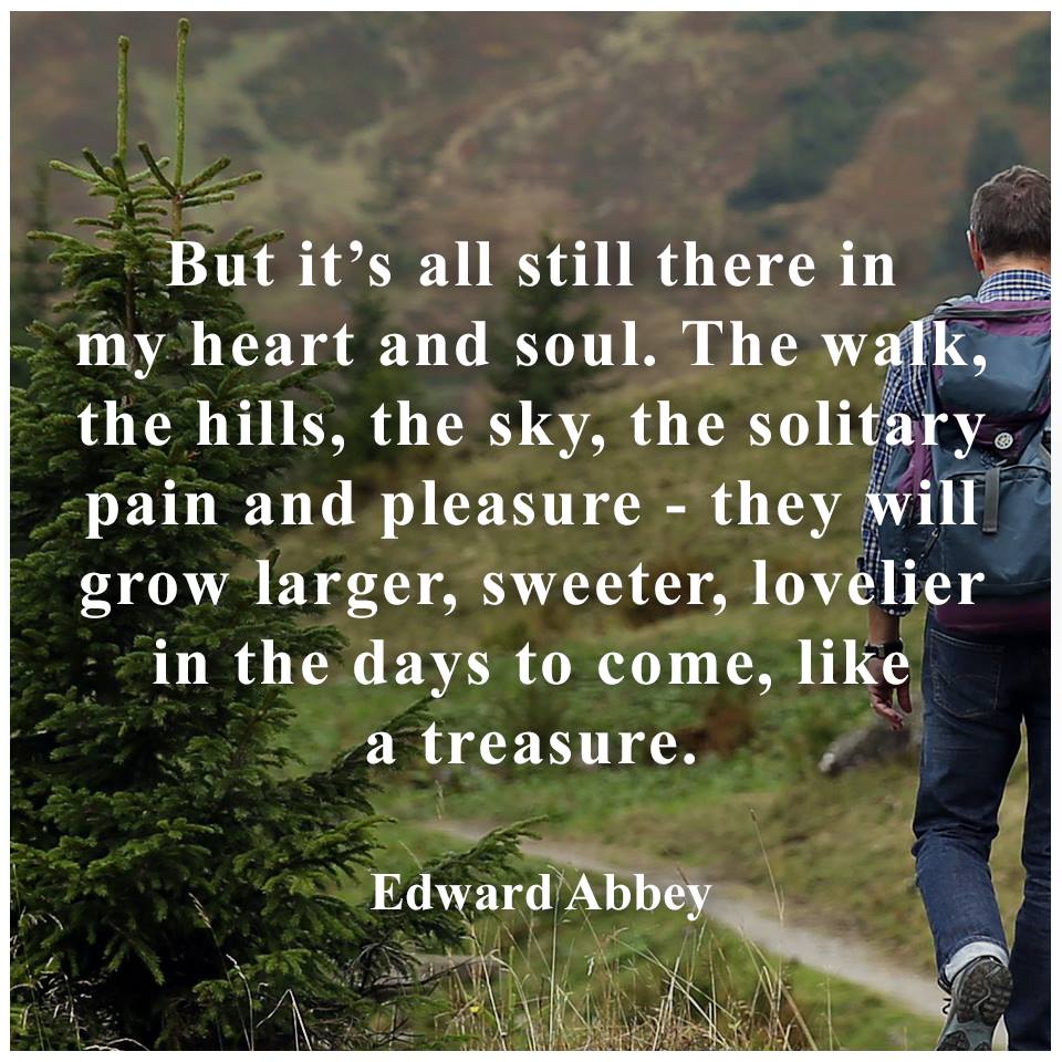
ōOnly we dumb locals may suffer physically from the power plants; but all Americans who enjoy ¢ actually or potentially ¢ the Grand Canyon, Lake Powell, Monument Valley, Shiprock, Canyon de Chelly, Zion, Bryce Canyon, Capitol Reef, Arches and Canyonlands national parks will be forced to accept the drastic degradation of the national heritage.ö Edward Abbey
Day 1: Pothole and Seep Trails, 3 miles:
Driver. .
Ken from Mesa and Chris from Boise and I share the handicapped campsites in
the Needles District. I hike the Pothole and Seep Trails, feeling alive on the slickrock.
Ahhh, back in the Needles again.
Day 1 Photos - Cedar Mesa & Needles 2016
 |
 |
 |
Day 2: Squaw - Big Spring Canyons, 9.2 miles: with a tag to the break into Elephant Canyon.
I move camp to loop A and add Steve from Atlanta, who is passing by
and looking for a campsite. Ken moves over too and we have a well-populated camp. Ken is going to
Natural Bridges tomorrow. I'm staying.
The view is of gorgeous neopolitan rocks, swirls of salmon, red,
white. Blooming cactus, pygmy Lupine, Larkspur, mormon tea, princes plume, Indian Paintbrush, other
stuff grace the flats.
I head out for hike of Big Spring Canyons. It's good to be back in
the Park, with all camp set-up tasks accomplished.
Day 2 Photos - Cedar Mesa & Needles 2016
 |
 |
 |
Day 3: Joint Trail loopo grande. 15.7 miles: From camp to Chesler, loop
around Chesler and through Joint Trail. Return via Elephant Canyon.
It's a long, ranging hike over and through grabens and open parks,
past colorful spires and eventually through the Joint Trail, a deep crack in the Cedar Mesa Sandstone.
Wonderful.
I drink two liters of water upon returning from the loopo grande.
Breakfast burritos for dinner. Hot sun shower, deluxe! Hard lemonade and Modelo beer. A superbly
lovely combination after this fairly hot and long distance day.
Bats now fly. The moon is obliterating the Milky Way in this dark
sky CG. An owl calls through the desert dark. All is as it should be.
Day 3 Photos - Cedar Mesa & Needles 2016
 |
 |
 |
 |
 |
 |
 |
 |
 |
 |
 |
 |
Day 4: Peek-a-boo to you, 10.3 miles:
Today, it's quite warm. Myrna of Kirkland, WA says that the
forecast is for 90F today. Early, it's good walking the side angle rocks to Peek-a-boo. There's
lots of gription and friction along this ankle bending, toe squishing route. The route drops
through the Cedar Mesa SS via a tilted ladder wedged in a sandstone crack. Now, down at Salt
Creek level, I head over to a scenic toilet and an arch passageway through a meander.
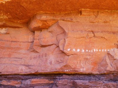
As I lounge eating lunch #1 and admiring the old, Ancestral
Puebloan - 1000 bp, before present, pictos on top of very very old, Archaic - 5000 bp, pictos,
a slender yet long racer snake slithers nearly to my elbow before abruptly changing course.
Pausing, he stares with glassy eyes and his tongue flicks out to test the air. It's a lovely
day in the neighborhood.
Day 4 Photos - Cedar Mesa & Needles 2016
 |
 |
 |
Day 5: Confluence Overlook, 10.2 miles:
A warm day and a decent hike. This is a hike that bumps
in and out of several side canyons on the way to an overlook of the confluence of the Green
and Colorado Rivers. It's very quiet today and I see only a few people. In fact, I don't
see anyone until I'm enjoying lunch #1 at the confluence overlook.
Where the Rivers meet, the color differential of their
respective waters remains for perhaps a mile downstream. The darker flow comes from the
Colorado while the silt-ladden lighter flow intersects from the Green. Like polarization
in politics, they flow side by side, yet are largely separate. Like the wish of many Americans,
they eventually blend into a single River of renown.
Day 5 Photos - Cedar Mesa & Needles 2016
 |
 |
 |
Day 6: Zero Daze: Rest day at the Needles
I go to the visitor center and chat with the Rangers,
learning that the Elk Ridge Rd, FR 88, still has some snow. "Probably not recommended,
yet" I hear. Drat. I've brought Elk Ridge but not the Cedar Mesa maps. So, I'll be hiking
lower and by memory.
I languish under a juniper and read more of the Monkey
Wrench Gang (by Ed Abbey, a classic) and a Lee Child book. The campground pace is that
of a meandering stream in the Fall, quiet, unhurried.
Day 7: Muling it, 7.3 miles: +1 to visitor center. Move to
Natural Bridges NM. House of Fire. South Mule Canyon.
First, I'm up before 5 a.m. and on the move to Natural
Bridges CG. The tent is packed wet because it rained in several bursts last night. I
find a rare spot at NB CG. Then, I drive to the Texass Flat Rd and hike South Mule Canyon.
This is a delightful canyon, sheltering several ruins, including House of Fire. While
I'm roving up canyon, rain spurts, bringing umbrella time. It's unsettled all day.
I slip a bit and the tires flip globs of deep red mud atop
the old truck on the way out to the tarmac. I'm back to camp in time for a hurried shower.
Then, extended rain forces me into the truck, and I dream of, stomach churning for, breakfast
burritos. Finally, the local showers present a chance to cook around 7 p.m. Feeling a bit
stiff from sitting in the truck and craving some movement, I stroll to the visitor center and
the photovoltaic area. The NM site reports that "Natural Bridges National Monument was chosen
as a demonstration site for the use of solar energy more than two decades ago (1980, now more
than three decades ago). Situated at an elevation of 6,500 feet in Utah's southeastern desert,
Natural Bridges' moderate, sunny climate makes it an ideal location for a solar energy system.
Prior to the installation of the PV system, the monument relied on diesel generators for all
its electricity needs. The generators operated continuously. The noise and pollution produced
by burning nonrenewable fossil fuel was incompatible with Natural Bridges' pristine desert
setting." I agree, the natural quiet available in the backlands of utah and other Western
states is increasingly rare. It seems every amoral corporation (that is, all of them) is
wrangling to destroy the last vestiges of natural quiet and nighttime dark sky, spurred on
by the utah state motto "Industrial propagation, Now!." Immoral and amoral, corporations
and the corporate welfare heaped upon them by repulsicans and corporate democrats are a threat
to democracy everywhere. Oligarchy anyone?
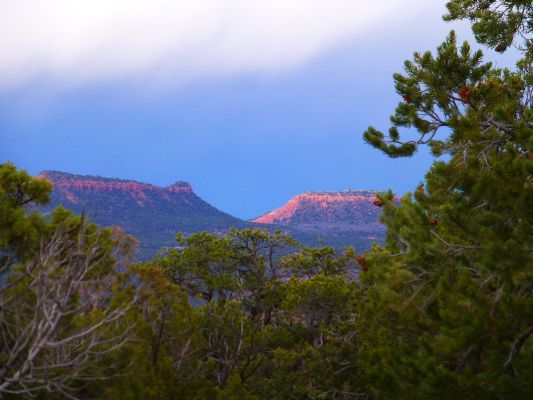
As I return from the visitor center, a gloomy glow blossoms
on the Bears Ears - the clouds are relenting and allowing a tinge of sunlight. It feels
like the preliminary to a chilly night as most of the clouds clear.
| ||||

Day 7 Photos - Cedar Mesa & Needles 2016
 |
 |
 |
 |
 |
 |
Day 8: Citadel and some Kivas, 7.6 miles:
Yes, this is the opening text and photos in this
report. I wrote the notes about the Citadel for submission to a newspaper, so that's
how come it's separated from the daily notes. So far, it is unpublished, perhaps a good thing
because there is enough pressure on these precious places. A caveat - I do not disclose
where the Citadel is in the article, or here either. Exploration is good for the soul.
It's a gorgeous venue, hiking to the Citadel. One
walks along the edge of a canyon to a peninsula of rock sporting a narrow neck, which
you cross to reach the Citadel. Amazing. You can feel the fear of people who would
build so defensively, far from water and far from land that might have been fields.
No one could sneak up on the Citadel, and a raid would be dangerous because raiders would
be exposed for quite a distance.
Returning to the TH, I immediately drop into the canyon
and sluice to the lush bottom, then start downstream for the Kivas site. It's an easy
jaunt and the Kivas, although broken down, are worthwhile.
Day 8 Photos - Cedar Mesa & Needles 2016
 |
 |
 |
 |
 |
 |
 |
 |
 |
 |
 |
 |
Day 9: To the Perfect Kiva and Jailhouse Ruin, 11 miles:
Again, rain patters on the truck, and I'm sitting
in camp waiting for time to shower and cook dinner. I've just returned from a Cedar
Mesa canyon. The carrots and hummus and corn chips I've been snacking on are nearly
gone, so I hope that the rain stops soon. The black cloud appears to be stuck over the
Bears Ears, yet I see some blue sky to the South.
It's a glorious and diverse hike to Perfect Kiva, down
slickrock bowls and across sandy benches and through brush. The Cedar Mesa Sandstone walls
rise higher as I slip down canyon. (Note, there are at least two kivas bearing the name
"Perfect Kiva." See the Slickhorn Gulch report for another.)
How did I miss Perfect Kiva the first time I traveled this
way? Now, it seems obvious. Of course I know where to look and generally for what.
Experience matters. It seems this is lost in the current election cycle, with lack of
knowledge, aggressive bullying, name-calling, and criminal acts against women and workers
being rewarded; all praise the orange psychopath - make America hate again. Let's elect the
least qualified person with the most irritable and impulsive disposition to solve very
complicated problems. This election has become a confrontation between truth and repulsican.
Sad, troubling.
It was gray and occasionally misting, yet there was no
rain during the hike, it seems that the Bears Ears are the current rain target.
The two blocks and one bag of ice cubes has lasted this
long, with the 6-day cooler covered by a comforter. Wonderful. Of course, it's been cool the
past several days. Just right, I muse, because I'm headed back to the Colorado Plateau tomorrow.
Day 9 Photos - Cedar Mesa & Needles 2016
 |
 |
 |
 |
 |
 |
 |
 |
 |
 |
 |
 |
 |
 |
 |
| ||||
. .
.
| ||||
Peter Francis Tassoni (2001) A Hiking Guide to Cedar Mesa: Southeast Utah, University of Utah Press.
Thrashorama in Upper Salt Creek: Backpacking Needles District of Canyonlands National Park , 2016
Grand Gulch Grandioso: Kane RS to Pour-off near San Juan River and out Collins Canyon TH, 2011
Bucolic Butler Wash: Ruins or ruination? Butler Wash ¢ Cedar Mesa area, Utah, 2009
Cedar Mesa Somewhere - Hiking the Trails of the Ancients, 2001
Click here to see Alum water treatment for backpackers
Scenic Toilets of Inner Earth: Scenic Scatology of the Wilderness Vagabond
Bill Mckibben - climate change and the flood this time. .
| ||||

| ||||

| ||||
| ||||

| ||||
| ||||

| ||||

| ||||

Link to below New Yorker article (click here).
MINNEAPOLIS (The Borowitz Report) Ś Scientists: Earth Endangered by
New Strain of Fact-Resistant Humans
By Andy Borowitz, May 12, 2015
Scientists have discovered a
powerful new strain of fact-resistant humans who are threatening the ability of Earth to sustain life,
a sobering new study reports.
The research, conducted by the University of Minnesota,
identifies a virulent strain of humans who are virtually immune to any form of verifiable knowledge,
leaving scientists at a loss as to how to combat them.
ōThese humans appear to have all the faculties necessary to receive
and process information,ö Davis Logsdon, one of the scientists who contributed to the study, said.
ōAnd yet, somehow, they have developed defenses that, for all intents and purposes, have rendered
those faculties totally inactive.ö
More worryingly, Logsdon said, ōAs facts have multiplied, their
defenses against those facts have only grown more powerful.ö
While scientists have no clear understanding of the mechanisms that
prevent the fact-resistant humans from absorbing data, they theorize that the strain may have developed
the ability to intercept and discard information en route from the auditory nerve to the brain.
ōThe normal functions of human consciousness have been completely nullified,ö Logsdon said.
While reaffirming the gloomy assessments of the study, Logsdon
held out hope that the threat of fact-resistant humans could be mitigated in the future. ōOur
research is very preliminary, but itÆs possible that they will become more receptive to facts
once they are in an environment without food, water, or oxygen,ö he said.
|
Wild Vagabond Main |
Trip Report Index  |
Caveat  |
|---|