|
|---|
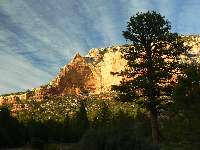
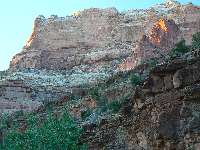
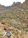
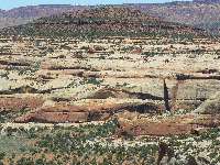
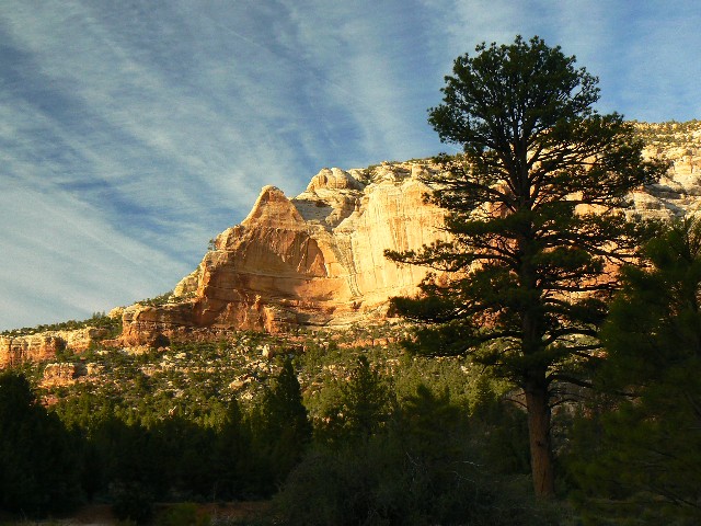
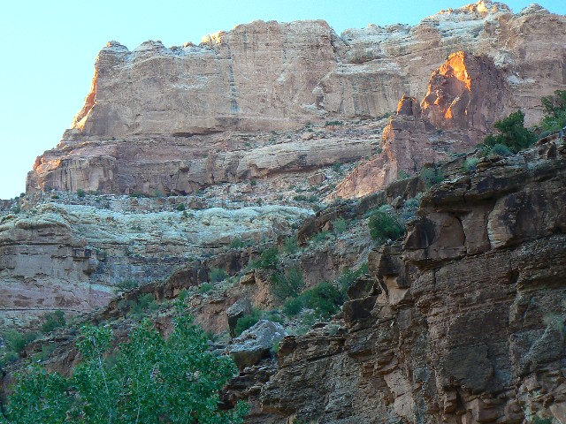
view from Rig
(Click the image for a full-size view)
|
|---|
|
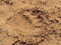
|---|
day2 bear front print
(Click the image for a full-size view)
|
|---|
|
|
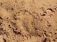
|---|
day2 bear rear print
(Click the image for a full-size view)
|
|---|
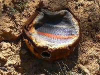
|
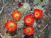
|
|---|
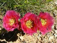
claret cup cactus
(Click the image for a full-size view)
|
|---|
|
|
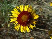
|---|
composite flower
(Click the image for a full-size view)
|
|---|
|
|
|---|
day2 dry times
(Click the image for a full-size view)
|
|---|
|
(Photos and the second part of the trip continue below.)
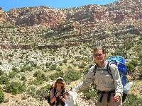
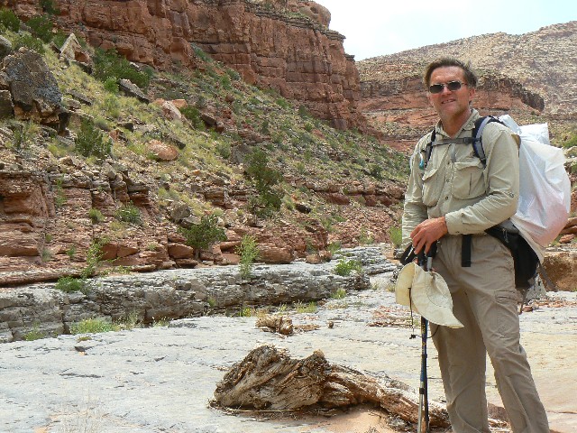
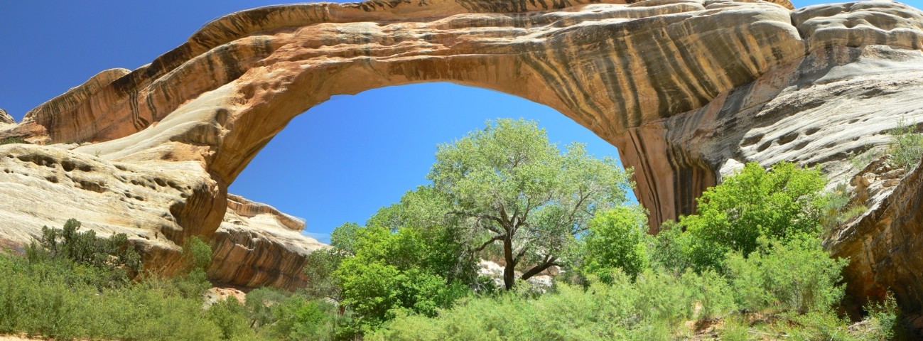
Day 1: Wriggling Along: Horse Pasture to Rig
Canyon; 8.3 miles, side hike of 3 miles in Rig Canyon; ERM = 12.5.
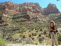
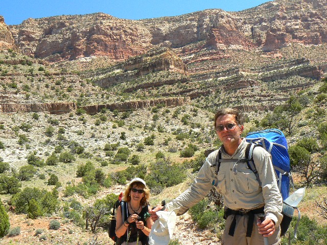
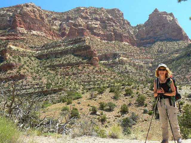
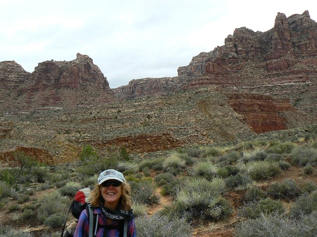
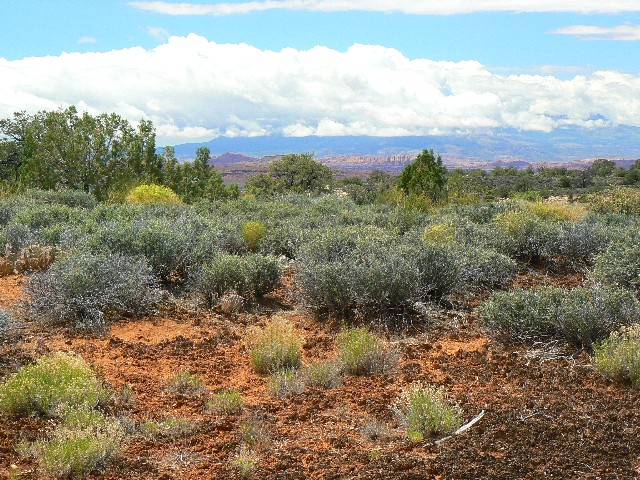
The expanse of wild-feeling Horse Pasture opens up as
we three (Bob Grant,
Kathleen, and I) loll through the sedges and grasses of the Pasture. (see the panorama)
Finally, after a lot of driving and dropping off Bob's
car at the Sundance
TH, we dare to say Dark Canyon. On the way out from the TH, we took a "shortcut,"
and found not a shorter way, but two new (to us) arches. Then, up to Horse Pasture
TH, where we camped for the evening at around 8600'.
Now, we start Day 1 of DC08. Down to the Pasture,
green and lovely. To Scorup
Cabin and Spring, where there is but a trickle of water from the spring, but lots of
water in the drainage from recent storms. After lunch at the cabin, we continue
down the terrorist (ORV) route to Peavine. Peace and natural quiet ensue, because no mechanized threats to national security pollute the air, water, and sound space.
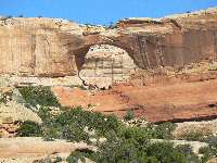
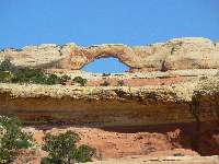
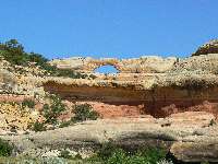
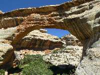
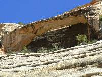
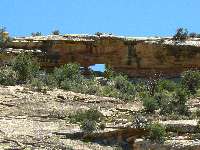
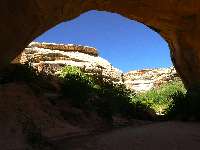
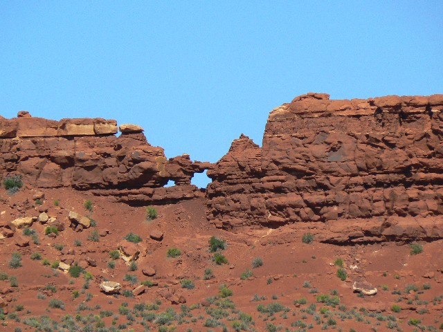
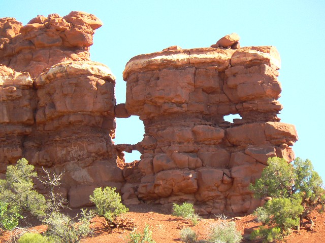
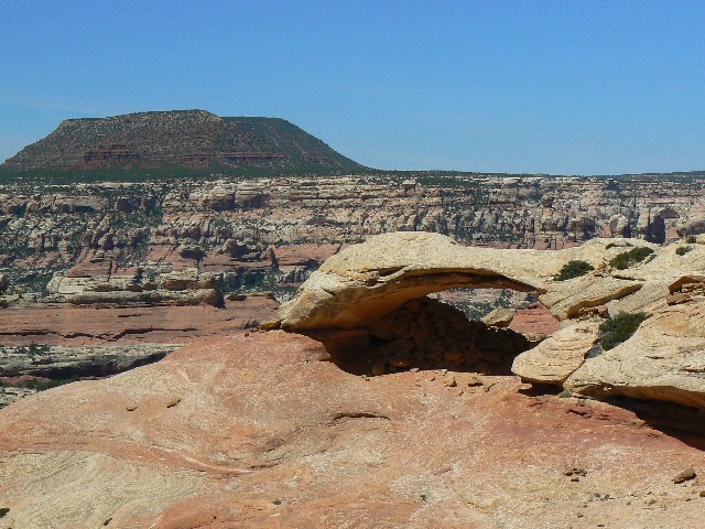
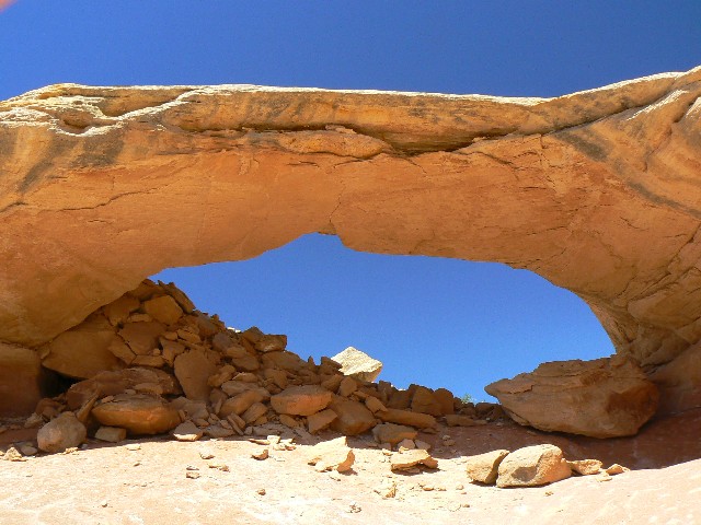
An arch! We call it Peavine Arch, wondering if it
has an official
name. It can be easily seen from where Peavine meets DC.
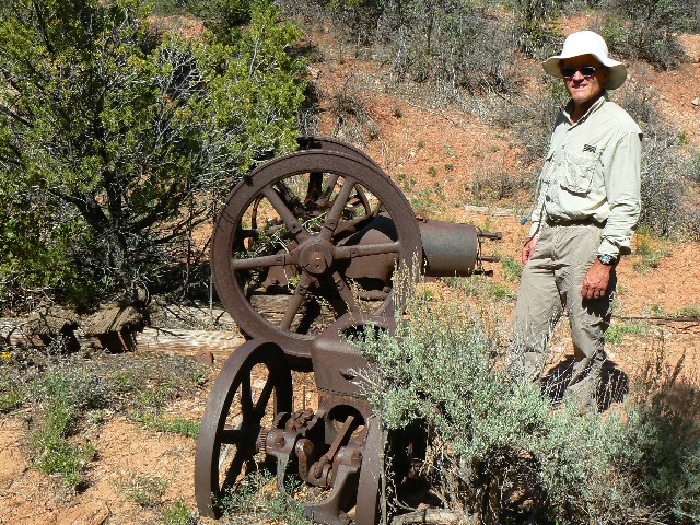
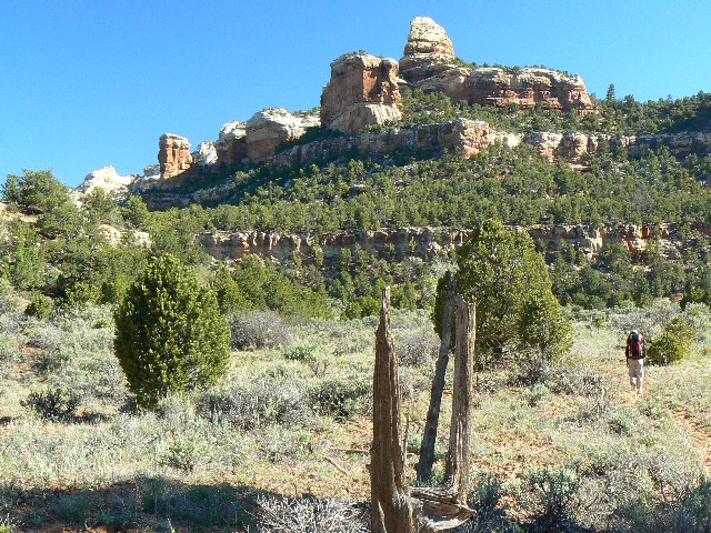
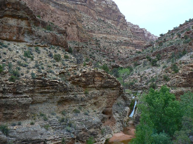
Bob and I day hike up Rig Canyon to an old well-head site.
We wonder what happened here, then return to camp where Rig meets DC and the
surface water is still trickling.
Today, we see no people and a few deer. Spaghetti with dried
tomatoes, sauce, and a dried hummus topping.

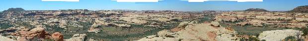
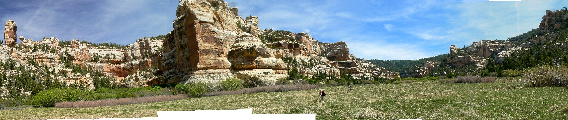
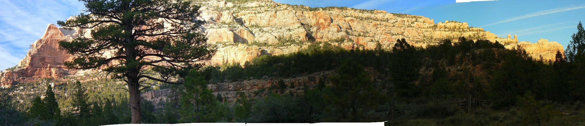
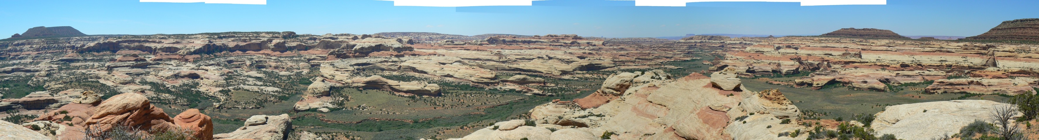
|
|---|
Rig Canyon view - panorama
(Image is very wide - scroll to view it (2212 x 480; 416kb) - Click
the image for the full-size image)
|
|---|
|
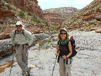
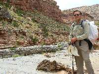
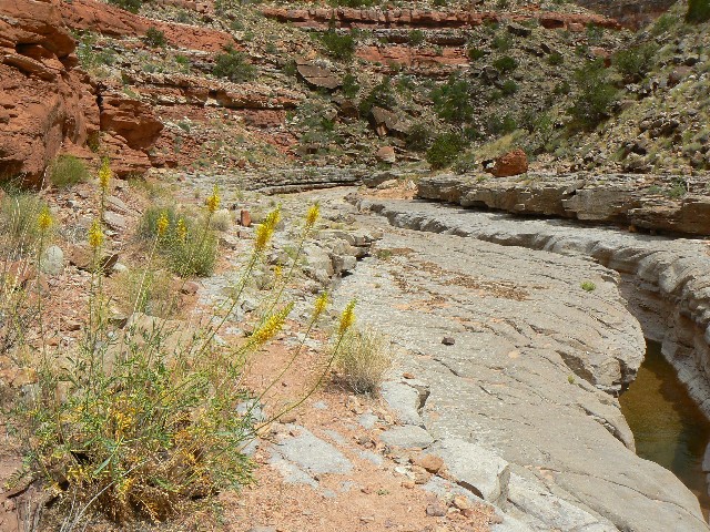
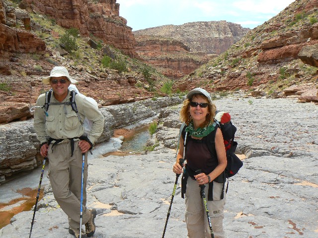
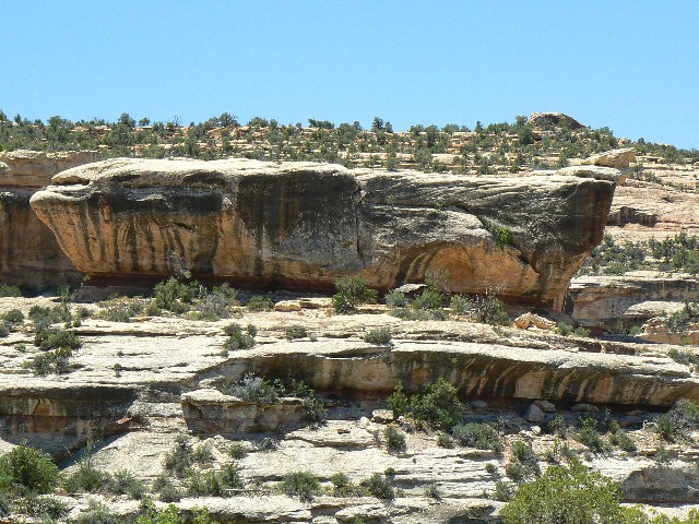
Day 2: Freeze and Fry: Rig to 3-Spring Canyon;
11.7 miles, ERM=16.
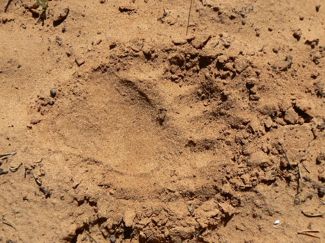
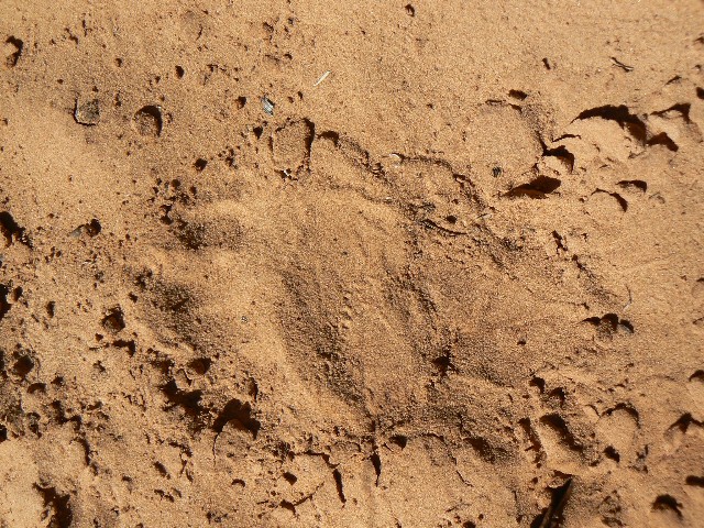
I slide to a stop and yell "Buffous ahead!" at the distinct
prints of Ursus Americanus, the Black Bear. We're in the long, dry stretch between
Rig and Trail Canyons - and we have not seen water since the mouth of Rig.
It was a very cold start to the day, wearing all the
clothes we carried. Six+ miles later, we hide from the sun on the blue highway chunk
across from Trail Canyon. Here there is good water, and we tank up - perhaps there is
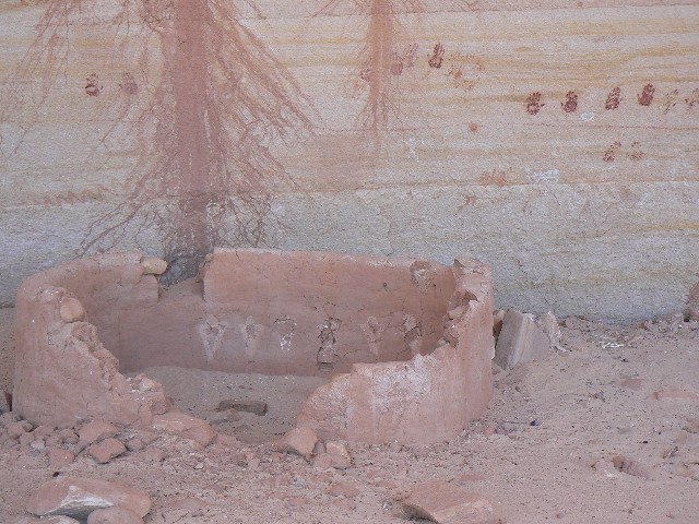
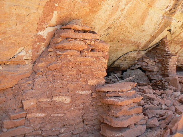
no water to the Hanging Garden spring up Woodenshoe Canyon, which is a mile or more up
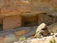
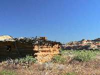
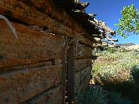
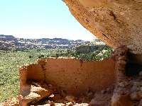
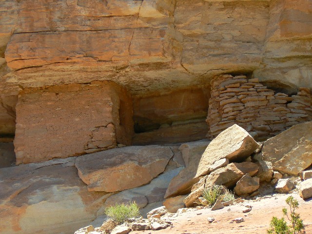
Woodenshoe canyon. We wander beneath the ruins down canyon from Trail/Warren, two
structures which seem to exhibit divergent construction techniques.
Now, I'm writing in the fading light near 3-Spring Canyon
camp, hiding from the no-see-ums and a few gnats and a rare mosquito. From Trail, we
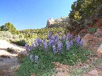
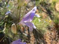
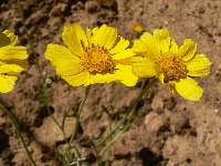
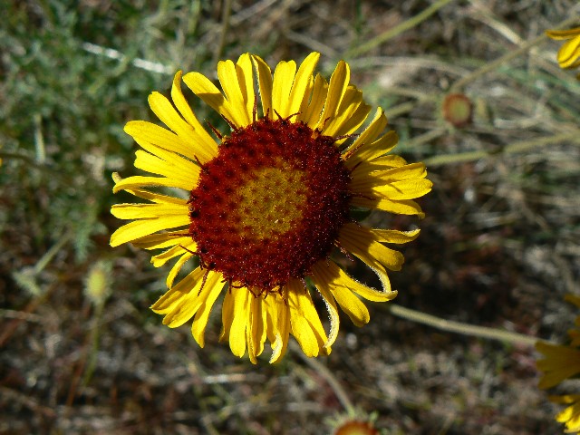
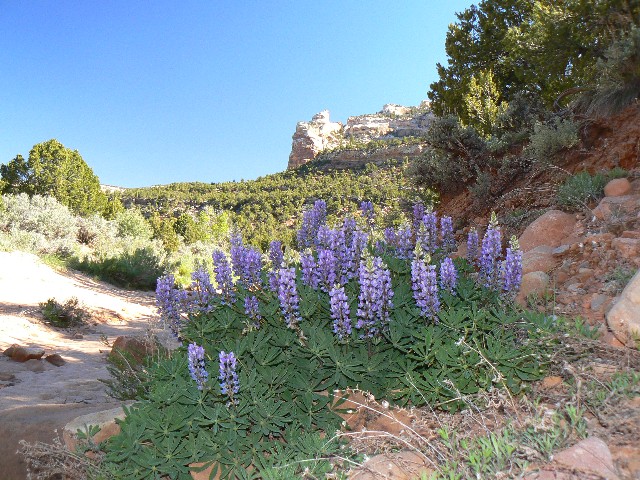
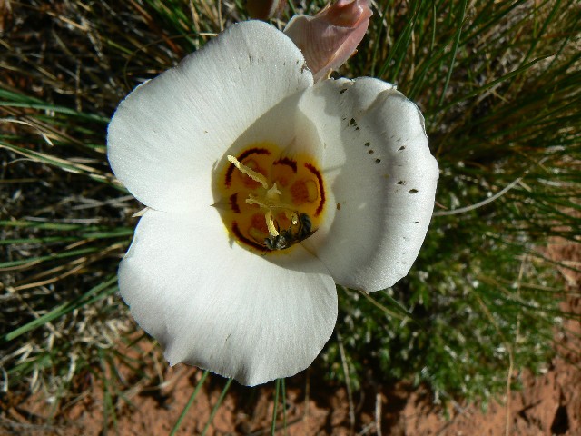
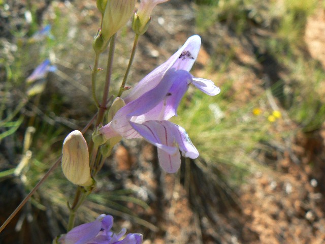
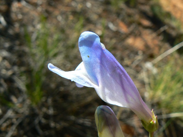
plodded into the gathering heat, happy for the occasional cooling gust of wind. Cactus,
penstemon, lupine, several yellow guys bloom along the trail. "Will we have to slog
all the way to Woodenshoe?" we ponder. No, we pause and find water near 3-Spring,
a delight. Tofu enchiladas and rice.

|
|---|
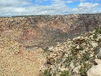
near Poison Can.
(Click the image for a full-size view)
|
|---|
|
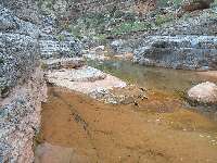
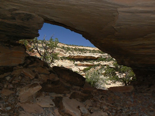
|---|
near Poison Can.
(Click the image for a full-size view)
|
|---|
|
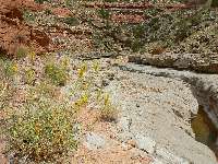
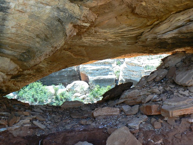
|
|---|
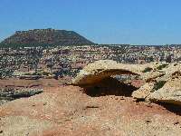
more- Rig Can.
(Click the image for a full-size view)
|
|---|
|
|
|---|
2 construction methods
(Click the image for a full-size view)
|
|---|
|

|
|---|
day2 - Sego
(Click the image for a full-size view)
|
|---|
|
|
|---|
day3 - cactus
(Click the image for a full-size view)
|
|---|
|
|
|---|
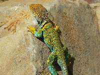
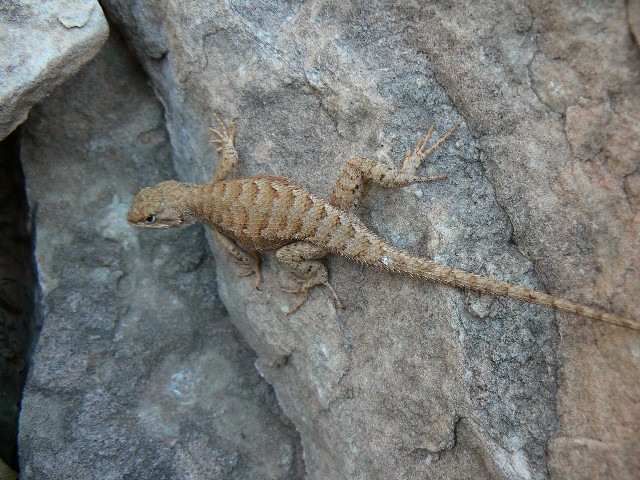
day 3 - Collarded Lizard
(Click the image for a full-size view)
|
|---|
|
|---|
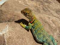
Collarded Lizard
(Click the image for a full-size view)
|
|---|
|
|
|---|
Collarded Lizard
(Click the image for a full-size view)
|
|---|
|
|
|---|
day3- near Woodenshoe
(Click the image for a full-size view)
|
|---|
|
|
|---|
day3- near Woodenshoe
(Click the image for a full-size view)
|
|---|
|
|
|---|
another flower
(Click the image for a full-size view)
|
|---|
|
(There are - More photos below the trip narrative.)
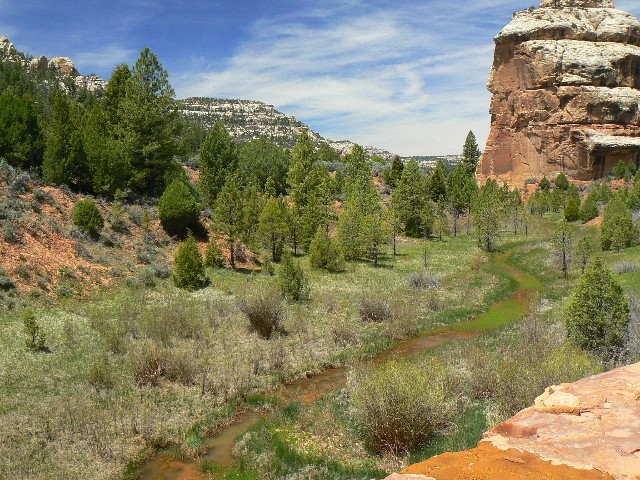
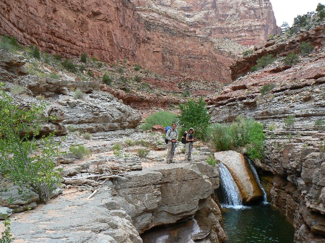
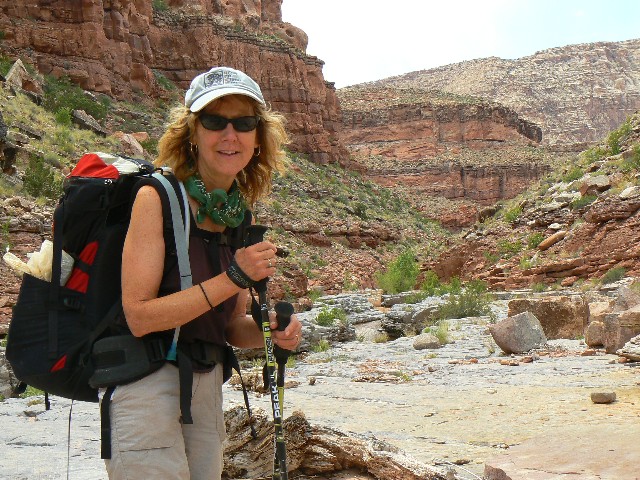
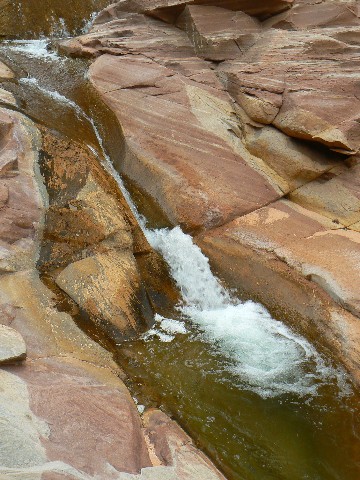
Day 3: Desiccated Desire: 3-Spring to DC Flow.
9.6 miles, ERM = 14.5.
The froggies chortle and trill as Bob's in-room jacuzzi
burbles a background of wondrous natural quiet. We're in the realm of permanent DC flow, after a long day without water and with lots of sun. Penetrating sun. Hooray for katabatic and anabatic winds.
A katabatic wind - from the Greek word katabatikos meaning
"going downhill", is the technical name for a drainage wind, a wind that carries
high density air from a higher elevation down a slope under the force of gravity.
Such winds are sometimes also called fall winds. Anabatic wind - A wind that is
created by air flowing uphill. Valley breezes, produced by local daytime heating,
are an example of these winds. The opposite of a katabatic wind.
Presently, it's an anabatic wind - gusting up from the
solar-heated sewage pond, from Lake Foul, from the shrinking puddle which won't,
cannot keep pace with the horrendous population surge, an unsustainable (but rarely
discussed) surge of nature-killing proportions.
We enjoyed a cool and calm late evening near 3-Spring
and awoke mostly refreshed. Setting out through the pygmy forest, we reach the
mouth of Woodenshoe for lunch. I considered a jaunt to Hanging Garden spring,
but thought it was too far given the uncertainty of terrain and water. Good thing,
the heat grew and the shade diminished.
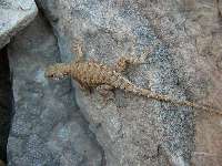
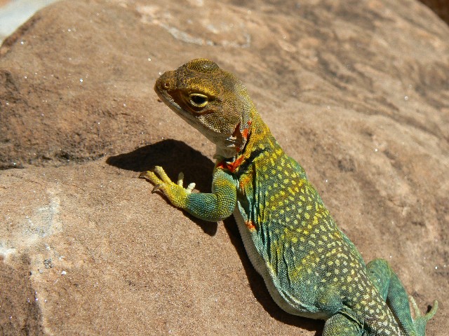
Lovely Collared Lizards in full breeding regalia bring
us to a stop on a few occasions. The canyon narrows and twists, and we climb over
meanders to stay out of the rock-strewn stream bed and perhaps cut the distance.
A large clog of tamarisk, willows, and young cottonwoods
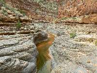
herald the first water hole. The DC flow starts another mile along. A permanent flow
from here to the pond. Moroccan Couscous and ham TVP.
|
|---|
another flower
(Click the image for a full-size view)
|
|---|
|
|---|
day3 Woodenshoe area
(Click the image for a full-size view)
|
|---|
|
|
|---|
day3 lizzy
(Click the image for a full-size view)
|
|---|
|

|
|---|
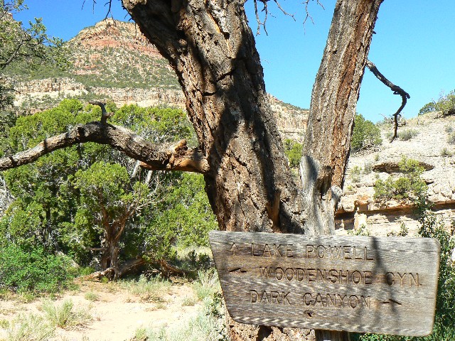
Woodenshoe junction
(Click the image for a full-size view)
|
|---|
|
|
|---|
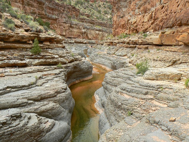
day4 blue highway
(Click the image for a full-size view)
|
|---|
|
|
|---|
blue highway
(Click the image for a full-size view)
|
|---|
|
|
|---|
blue highway
(Click the image for a full-size view)
|
|---|
|
|---|
blue highway
(Click the image for a full-size view)
|
|---|
|

|
|---|
blue highway
(Click the image for a full-size view)
|
|---|
|

|
|---|
blue highway
(Click the image for a full-size view)
|
|---|
|
|
|---|
blue highway
(Click the image for a full-size view)
|
|---|
|
|
|---|
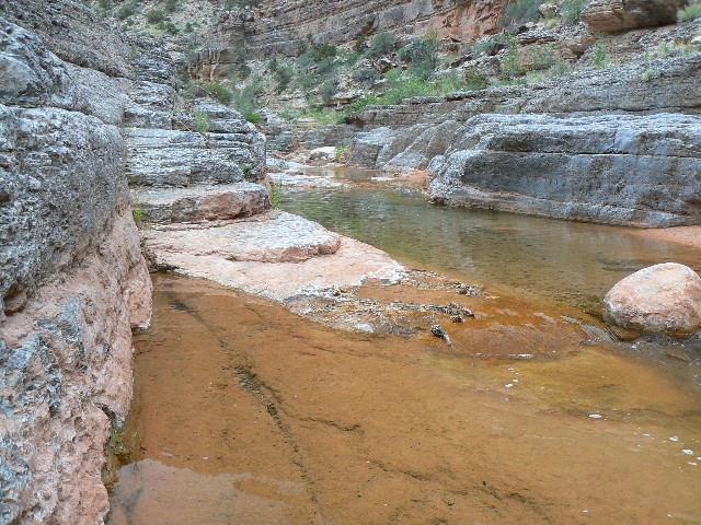
day4 burble
(Click the image for a full-size view)
|
|---|
|
(There are - More photos below the trip narrative.)
Day 4: Blue Highways: DC flow to mouth of Lost Canyon.
8.7 miles; ERM = 13 (unestimated terrain difficulty). Blue Highways:
A Journey into America by William Least Heat-Moon, about those seldom-traveled
backroads, marked in blue on the old highway maps. The steely-blue limestone
walkway stretches around the bend of the deep and narrow canyon, cut by ancestors
of the water currently swirling and burbling below, a channel of time, layer upon layer.
It's a gray day, and photo opportunities are not so
grand despite the subject matter. Blue highways, roll.
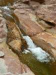
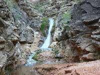
The day started slowly, with more vegetation-thrashing, which
improves after Youngs Canyon, which harbors a velvet falls apparently formed by
travertine. There's a decent place to camp there too. Plodding on, we're back
and forth across and above the drainage, staying foot dry. Rain bits sweep in
during the afternoon, only to return for dinner at the mouth of Lost Canyon, a good camp.
Currently, I'm writing from inside the tent - rain
tinkling and sometimes drumming. Out to finish cooking and eating dinner,
then forced back in by rising rain, a rain which continues nearly steadily throughout
the night. Spaghetti with pesto sauce, olive oil and parmesan cheese.

|
|---|
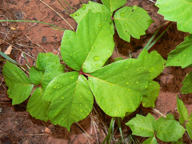
day4 poison ivy
(Click the image for a full-size view)
|
|---|
|
|---|
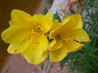
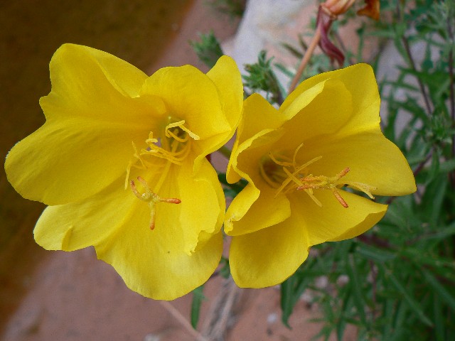
day4 primrose
(Click the image for a full-size view)
|
|---|
|
|
|---|
Youngs Can.
(Click the image for a full-size view)
|
|---|
|

|
|---|
Youngs Can.
(Click the image for a full-size view)
|
|---|
|
|
|---|
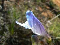
day5 flower
(Click the image for a full-size view)
|
|---|
|

|
|---|
day5 foot of Sundance
(Click the image for a full-size view)
|
|---|
|
|
|---|
day 5 Sundance Trail
(Click the image for a full-size view)
|
|---|
|
|---|
day5 top of Sundance
(Click the image for a full-size view)
|
|---|
|
|
|---|
day5 top of Sundance
(Click the image for a full-size view)
|
|---|
|
|
|---|
day5 top of Sundance
(Click the image for a full-size view)
|
|---|
|
|
|---|
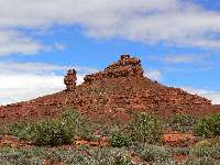
day5 Squaw and Papoose
(Click the image for a full-size view)
|
|---|
|
|
|---|
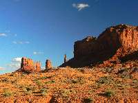
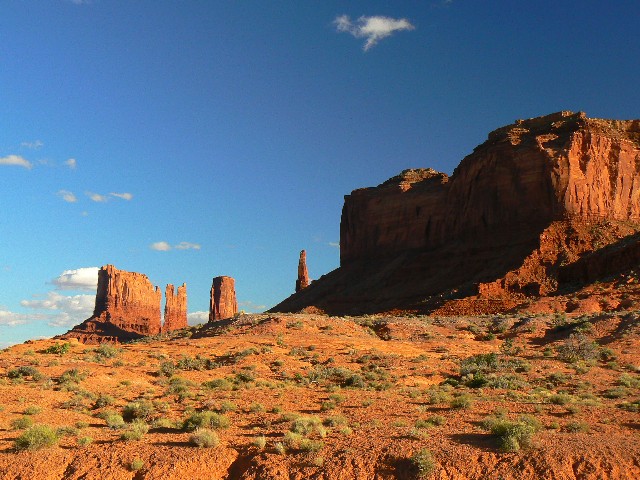
Way back - sun in Monument Val.
(Click the image for a full-size view)
|
|---|
|
(Photos and the second part of the trip continue below)
Day 5: Molding Mudder of Muck: Lost Canyon to
Sundance TH, and home. 5 miles; ERM = 8.
Puffing, gasping, the trail feels straight up at times,
and "trail" is a generous word in this instance. We're on the Sundance "Trail,"
and there appears to be a break in the gray/black sky after an evening of nearly
solid pattering and pounding drops on the tent. We stayed tent-bound until nearly
10 a.m., then packed and headed out.
Yikes, we see the first two people in three days, since Trail
Canyon. There are lovely views from the top of the scree ladder called Sundance,
then out and around the canyon. Finally, the TH, from which we head for home - with
little thought of attempting the Bears Ears Road. There are pockets of muck on
this low route, and sweeping stretches of clay on the Bears Ears venture.
It's three days later and I'm writing solo from the Salt
Creek TH near Cathedral Butte, off the North side of Elk Ridge. The road is rutted
but dry. It's quiet and cool and sunny. Today, Bob and I drove up carefully (June 8)
and after dropping me at the side road to Horse Pasture, Bob returned to tarmac the
same way we came in, and I continued over the ridge to here. No mud, but lots of
evidence of others sliding and gliding. It's off to sleep, dreaming of hunting,
hunting the Mastodon. Mastodon Arch.
|
|---|
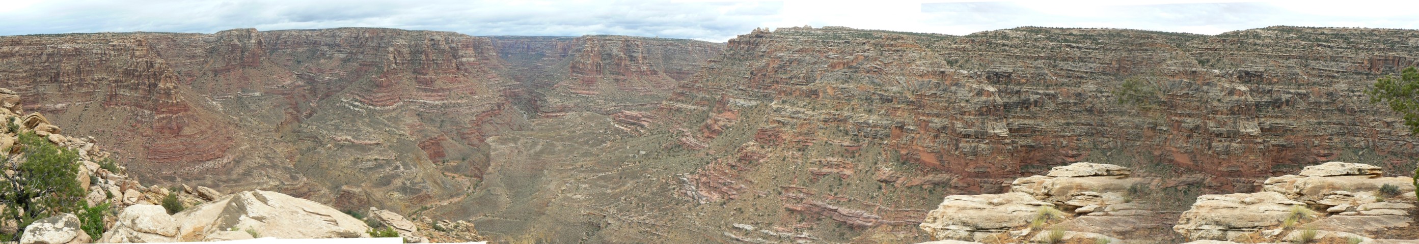
top of Sundance Pano
(Image is very wide - scroll to view it (2786 x 480; 512kb) - Click
the image for the full-size image)
|
|---|
|
Next, the
after-backpack excursions in the Cedar Mesa Area
DC Sequel: Upper Salt Creek and Natural Bridges NM
June 9 - 12, 2008
|
|---|
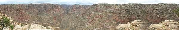
Looking into Salt Creek - Needles District
(Click the image for the full-size image)
|
|---|
|
|
|---|
View from ridge near Wedding Ring Arch - panorama
(Image is very wide - scroll left-right to view it (3552 x 480; 576kb) - Click
the image for the full-size image)
|
|---|
|


|
|---|
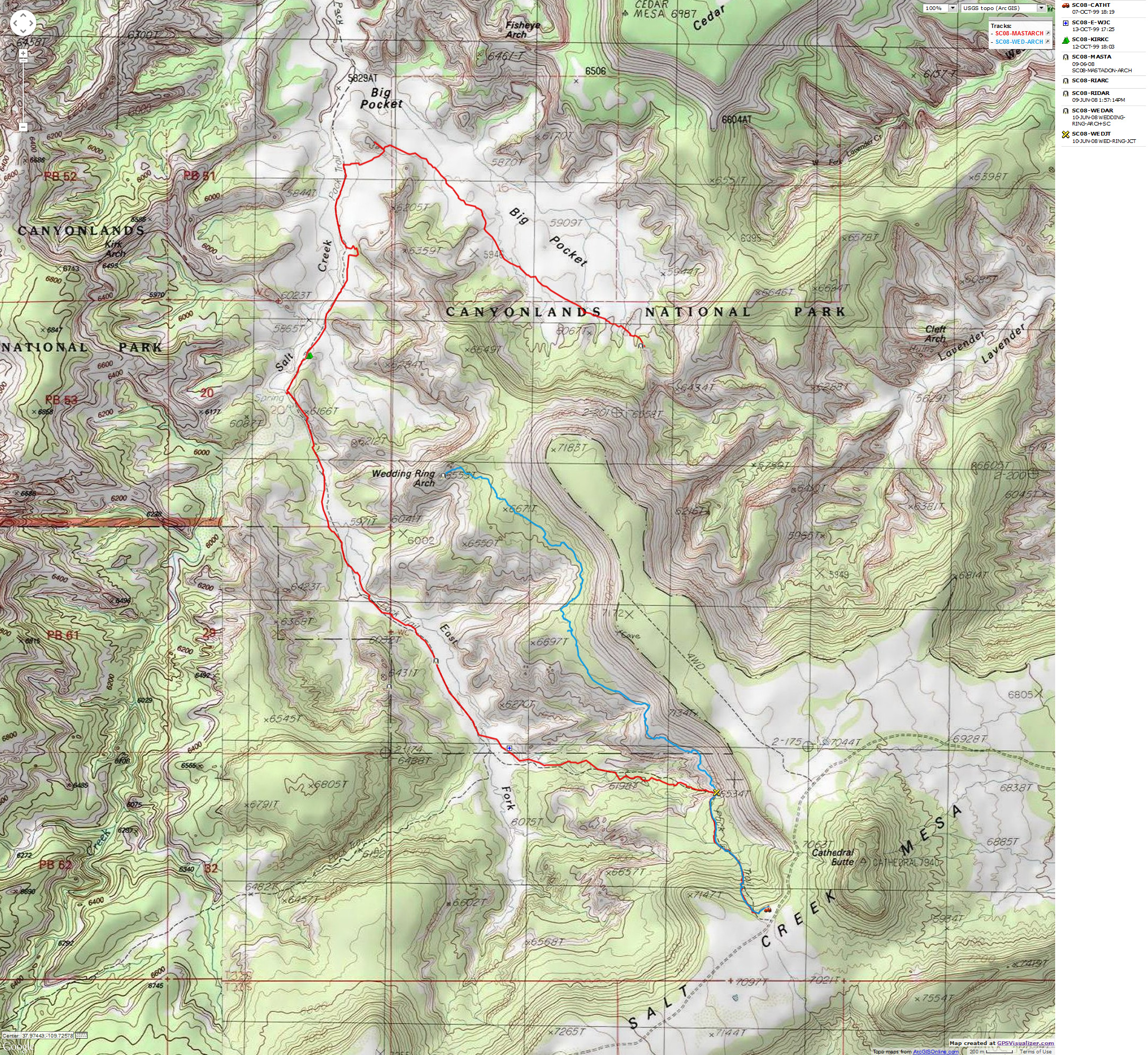
Map - Canyonlands: Mastadon & Wedding Ring Arches
(Click the image to see the map)
|
|---|
|
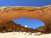
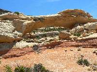
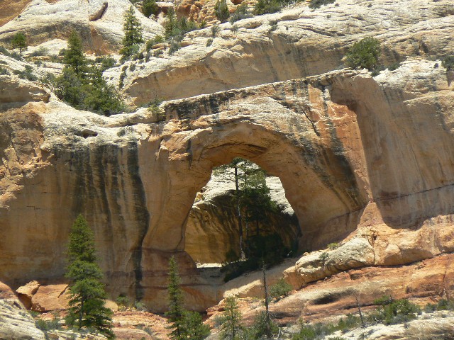
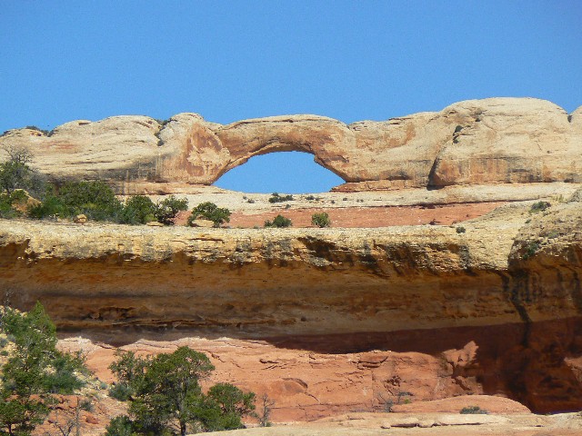
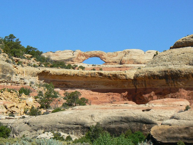
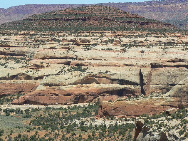
June 9, 2008: Mastodonia: Mastodon Double Arch,
Upper Salt Creek. 15 miles; ERM = 21.
Plodding up Big Pocket, I see light through a leg of
an arch. Right on course, I am pleased to see. I see the light of Masodonia.
The saga of Dark Canyon 08 finally closed yesterday,
after a 3-day wait for the roads to dry on Elk Ridge so Bob G. and I could complete
the shuttle. The shuttle went smoothly and Bob returned via the Bears Ears to Smog
Lake. I stayed up here - and today I got up early (very cool) and hiked down into Salt
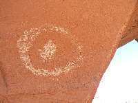
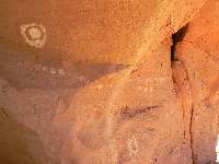
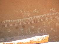
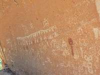
Creek in search of the arch. See the GPS track - link below. There are ancient symbols
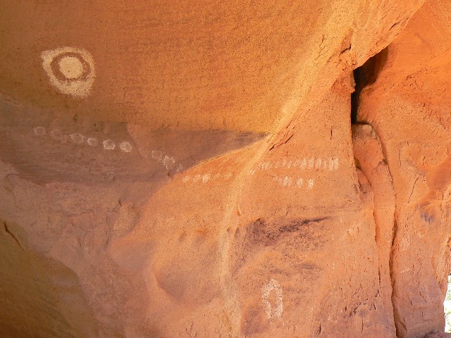
on both buttresses of the arch. Counting? Sun symbols? The route into Big Pocket
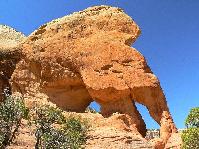
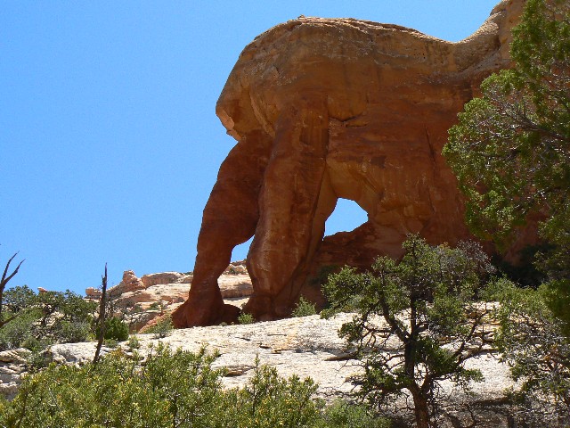
includes good views of Kirk and Elephant Trunk Arches. There's also an archlette I
call 'Kirk Ridge Archlette" S of Kirk's Cabin.
Very tired, I slouched into camp and enjoyed a sparse
shower. It's very quiet. I saw one group in the canyon.
Along the way, I took photos of Kirk and Elephant
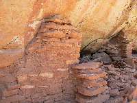
Trunk Arches, Kirk Cabin, some ruins that surprised me in the cut-off into Big Pocket,
and, of course, Mastodon Double Arch.
I also gathered a huge number of nasty, pointed weed
seeds all over my fabric gators. This provided the evening entertainment, accompanied
by a Western song: "picking socks in the sand." Just throw in a stanza about a train
and a dog and a horse, and a lover on a horse, or a lover who is a horse, and the song
is complete.
|
|---|
Kirk Arch
(Click the image for a full-size view)
|
|---|
|
|---|
Kirk Cabin
(Click the image for a full-size view)
|
|---|
|
|
|---|
Kirk Cabin
(Click the image for a full-size view)
|
|---|
|
|
|---|
Elephant Trunk Arch
(Click the image for a full-size view)
|
|---|
|
|
|---|
Elephant Trunk Arch
(Click the image for a full-size view)
|
|---|
|
|
|---|
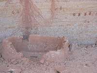
ruin - Big Pocket
(Click the image for a full-size view)
|
|---|
|
|
|---|
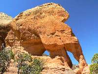
Mastodon Double Arch
(Click the image for a full-size view)
|
|---|
|
|---|
Mastodon Double Arch
(Click the image for a full-size view)
|
|---|
|
|
|---|
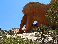
Mastodon Double Arch
(Click the image for a full-size view)
|
|---|
|
|
|---|
Mastodon Double Arch
(Click the image for a full-size view)
|
|---|
|
|
|---|
Mastodon Double Arch - from ridge
(Click the image for a full-size view)
|
|---|
|
|
|---|
picto near Kirk
(Click the image for a full-size view)
|
|---|
|
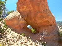
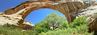
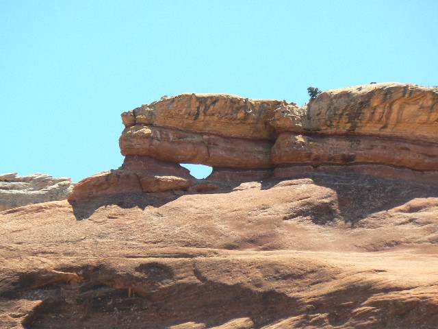
June 10: Wending to Wedding Ring Arch and no NB.
6 miles (10 total looking for the NB); ERM = 8.
Swinging, contouring around a dark dirt (Organ Rock Shale?)
knoll and there it is, Wedding Ring Arch - what a lovely symmetry it contributes to the
graceful sweep of Cedar Mesa muffins and cliff bands. Gorgeous.
It has been a haul out here because there is no trail
and one must sort through the rocks, trees, shrubbery, and well-developed cryptobiotic
soil - masses of it. After enjoying the arch as much as is allowed by the gathering gale,
I continue on for a frustrating natural bridge (NB) quest. Unsuccessful. Yet, I did find
myself on the ridge above Big Pocket, Kirks Cabin, a view of Kirks Arch, and an aerial-type
view of Mastodon Double Arch.

|
|---|
Kirk Ridge Archlette
(Click the image for a full-size view)
|
|---|
|
|---|
Wedding Ring Arch
(Click the image for a full-size view)
|
|---|
|
|
|---|
Wedding Ring Arch
(Click the image for a full-size view)
|
|---|
|
|
|---|
Wedding Ring Arch
(Click the image for a full-size view)
|
|---|
|
|
|---|
Wedding Ring Arch
(Click the image for a full-size view)
|
|---|
|
|
|---|
Son of Wedding Ring1
(Click the image for a full-size view)
|
|---|
|
|
|---|
Son of Wedding Ring2
(Click the image for a full-size view)
|
|---|
|
|---|
Sipapu NB
(Click the image for a full-size view)
|
|---|
|
|
|---|
Indian Foot NB
(Click the image for a full-size view)
|
|---|
|
|
|---|
Kachina Meander Archlette
(Click the image for a full-size view)
|
|---|
|
|
|---|
Kachina NB
(Click the image for a full-size view)
|
|---|
|
|
|---|
Kachina pictos
(Click the image for a full-size view)
|
|---|
|
|
|---|
Panorama of Sipapu NB
(Image is very wide - scroll left-right to view it (1300 x 480; 240kb) - Click
the image for the full-size image)
|
|---|
|
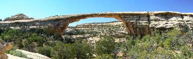
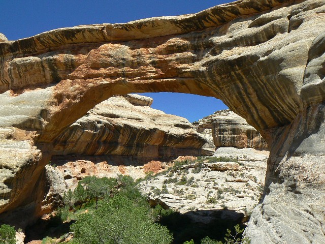
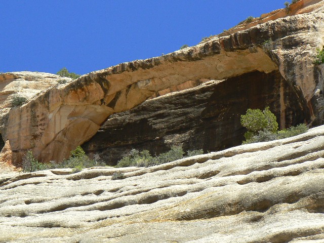
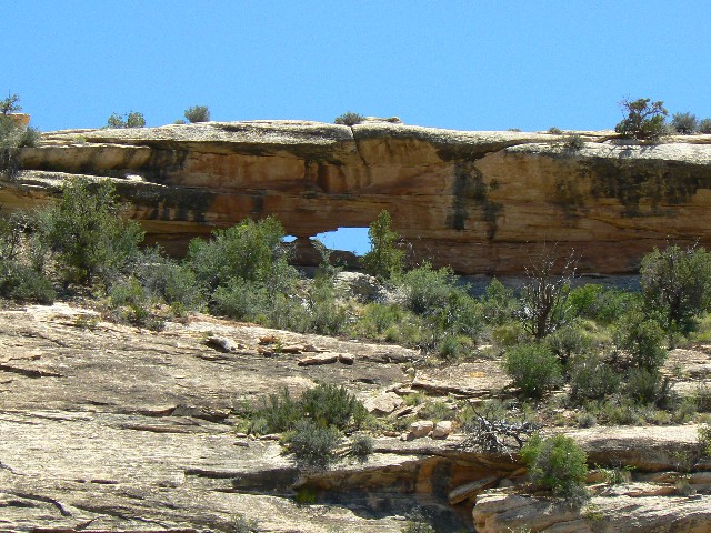
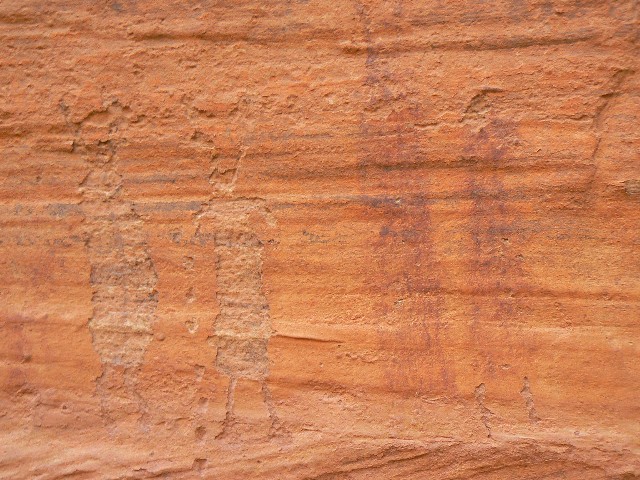
June 11: Loopy NB: Natural Bridges NM Loop 1.
Sipapu and Kachina NBs. 5.5 miles; ERM = 7.5.
The young NB arcs parabolic, gracefully framing the
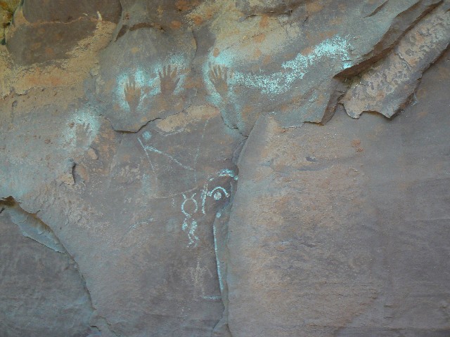
large Cottonwood. It's Kachina NB. I'm looking for petros when - there they are,
snakes and dancers, even a red hand print. There are figures on the other buttress
too, and along the wall, more images and some ruins. Delightful.
I'm hiking the Sipapu to Kachina loop in NB NM,
first federal park in backwards utah, land of ponderous and geometric population
explosion, a global climate change nightmare, so many footprints, so many large
carbon footprints stomping the life from the future, hastening the end of nature.
It was another extremely windy night, and I slept
in the truck bed rather than have the campermobile act as a sail. Then, I bumped the
nearly 50-miles of dirt to the NM and found only one site occupied. Not now anyway -
at sunset it would be full-up.
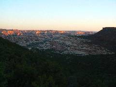
I'm gazing at the distant Bears Ears and fondly remembering
times on Elk Ridge and the Dark Canyon Plateau. Also, I'm considering the shower stall
I found in the pygmy forest behind camp - replete with tiled (flat rock) floor. Lovely.
I saw a 'Meander Archlette' in the abandoned meander just upstream of Kachina NB.
The sad thing is I will have to run for civilization soon
- low on gas after a couple of weeks of mostly hiking and some wandering. I found water
for the sun shower at Gooseberry GS (on Elk Ridge) and drinking water at the NM visitor
center, so I am set with the basics. At about 6500', it's cool (not cold), and not hot
today. As the Bear from the Bears Ears country said - this one is just right. The
report is that temperatures are cooler than usual, and that this will change soon.
|
|---|
Panorama of Owachomo NB
(Image is very wide - scroll left-right to view it (1300 x 480; 240kb) - Click
the image for the full-size image)
|
|---|
|
|
|---|
at Kachina NB
(Click the image for a full-size view)
|
|---|
|
|---|
Shoe Panel
(Click the image for a full-size view)
|
|---|
|
|
|---|
Shoe Panel
(Click the image for a full-size view)
|
|---|
|
|
|---|
Shoe Ruin
(Click the image for a full-size view)
|
|---|
|
|
|---|
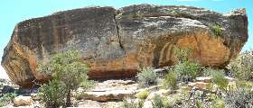
Shoe Arch
(Click the image for a full-size view)
|
|---|
|
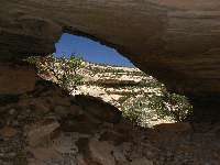
|
|---|
Shoe Arch
(Click the image for a full-size view)
|
|---|
|

|
|---|
under Shoe Arch
(Click the image for a full-size view)
|
|---|
|
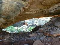
|
|---|
Shoe Arch
(Click the image for a full-size view)
|
|---|
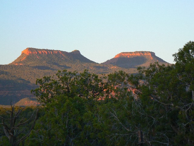
|

|
|---|
Sunset on the Bears Ears
(Click the image for a full-size view)
|
|---|
|
June 12: Loopy NB, Part 2: Owachomo NB and Shoe
Panel and Arch. 5.2 miles; ERM = 7.
The Cottonwood fluff floats like a March blizzard,
swirling up the wall and about the ledge where I'm enjoying lunch in the shade and
shadow of the ancients and their rock art. Deluxe! I've stumbled up a vortex zone,
the Shoe Panel and Ruin, so named for the remnant nose of an abandoned meander somewhere
above.
After a lounging lunch, I hike across the canyon and
scramble up the slickrock to look back across the canyon, above the panel, to see where
and what the "shoe" is - and what about that arch? Finally, I see it and the view tells
the tale - but not well enough. I return to near the panel and eventually scale the
wall to the arch and shoe. Remnants of coil pottery are scattered under the arch.
How did this get up here? Fires of yore have been built here too - as judged by
the blackened rock in the arch opening. Or, could the pottery have been brought here
by pack rats?
Earlier, I tried to get a panorama of Owachomo, and do
the same for the shoe. The temperature is rising, but it's still cool in the shade
when I return for another glorious sun shower in the tiled juniper stall.
Thoughts and dreams of home propel me that way, as
well as ruminations about all the work there is to do. For those who dare to say
'Dark Canyon!,' I salute you.
|
|---|
Panorama of Shoe Rock w. Arch
(Image is very wide - scroll left-right to view it (1122 x 480; 212kb) - Click
the image for the full-size image)
|
|---|
|
Links:

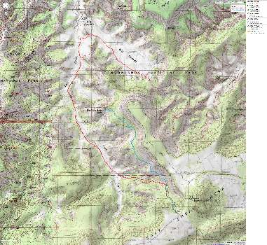
Maps:
|
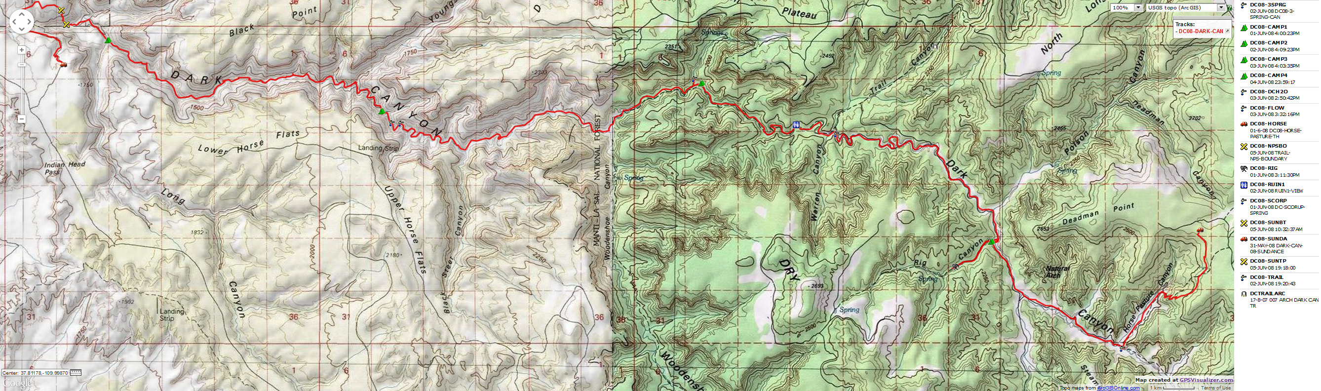
|---|
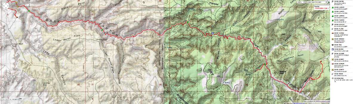
Map - Dark Canyon: Horse Pasture to Sundance Trail; 43 miles
(Click the image to see the map)
|
|---|
|
If you want to view a full-resolution map, click here. Caution - do not use this map or gps track for
navigating the route.
|
|
|---|
Map - Canyonlands: Mastadon & Wedding Ring Arches
(Click the image to see the map)
|
|---|
|
Click here to: Hear the froggies in Bob's jaccuzi. (MP3 file; 192kb)
Hear the sounds of Elk Ridge Residents from last Fall . (wav file; 140kb)
Videos of Dark Canyon by Bob Grant - Huge file size.
You may wish to set the download working on one of
these files while you view the remainder of the page.
Click here to: see Bob G.'s video of Horse Pasture. (HUGE AVI file; 27mb)
Click here to: see Bob G.'s video of the falls in the Blue Highways section
of Dark Canyon. (HUGE AVI file; 6mb)
Click here to: see Bob G.'s video of the burble at one of our lunch stops
in Dark Canyon. (HUGE AVI file; 21mb)
Click here to: see Bob G.'s video of the falls at the mouth of
Youngs Canyon. (HUGE AVI file; 23mb)
| | | | | | | | | | | |


