|
|---|
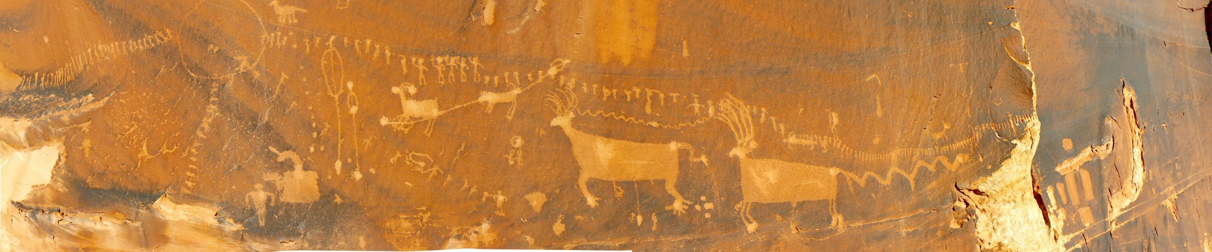
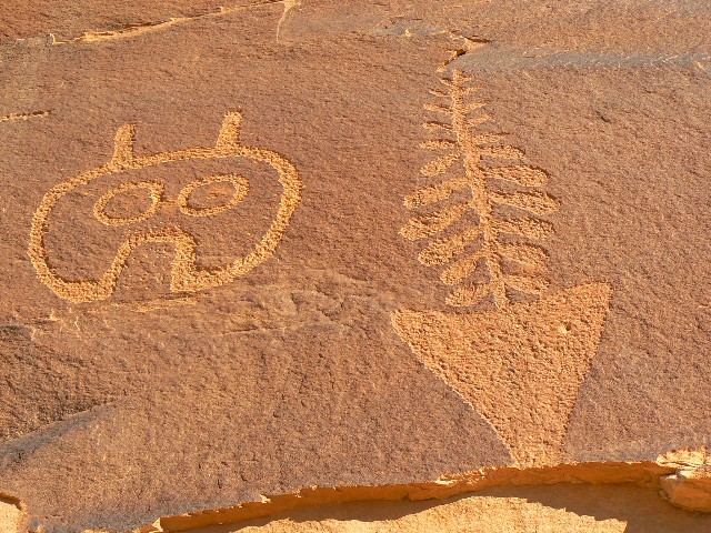
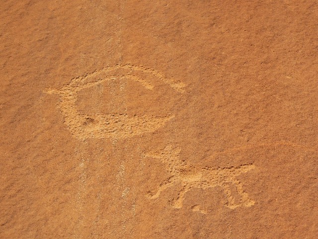
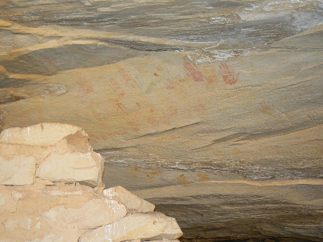
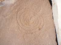
Coldspring picto
(Click the image for a full-size view)
|
|---|
|
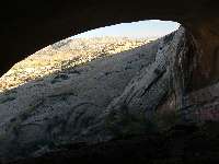
|---|
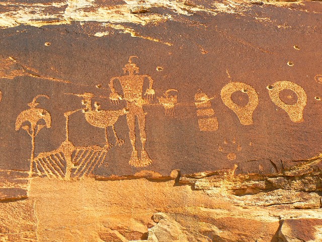
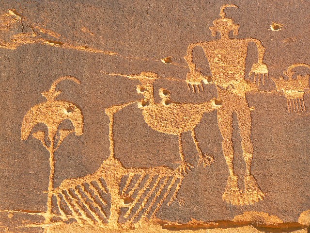
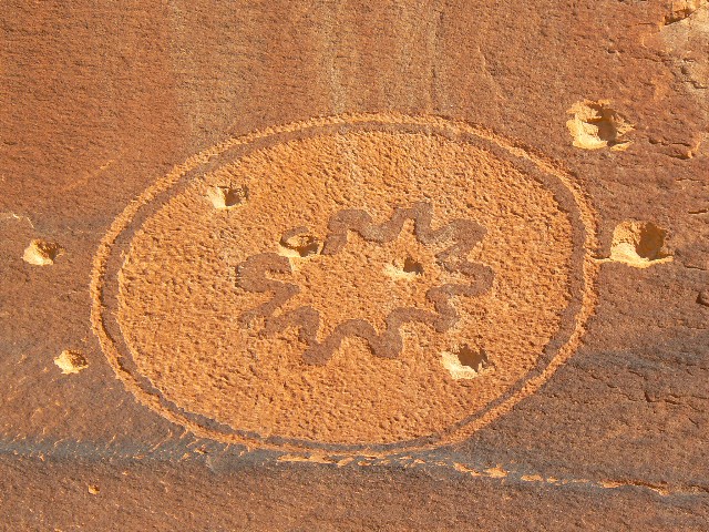
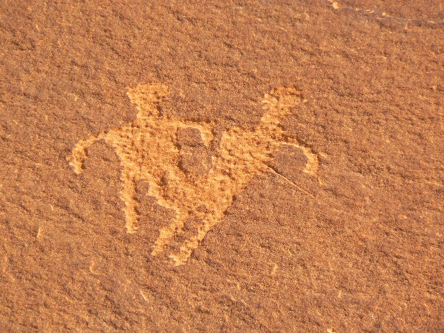
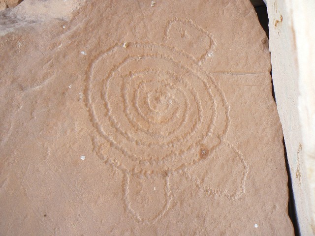
Coldspring petro
(Click the image for a full-size view)
|
|---|
|

|
|---|
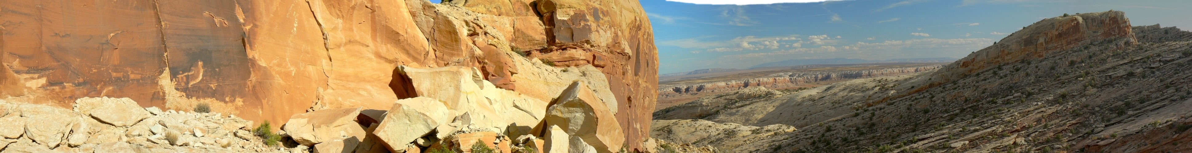
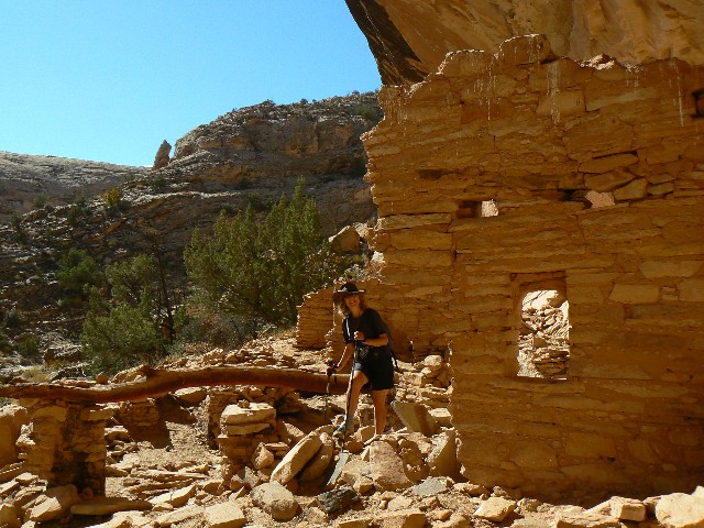
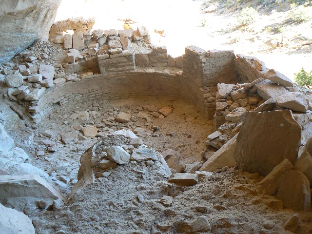
Coldspring Kiva
(Click the image for a full-size view)
|
|---|
|
(There are - More photos below the trip narrative.)
Day 3: Ruin Rambler: Off in search of the next monocline adventure along Butler Wash, we start a search for Monarch Cave. Seeing cairns, an elaborate series of cairns, we believe we are on the route paralleling the deepening gulch to the North. Climbing higher, I continue to assume that our route will drop us down into the gulch, avoiding some of the brush whacking. Not so, it appears to be a false route placed by lost and anxious Californians searching for Monarch Cave. The assumed anxiety caused the plethora of cairns. We double back and slip into the gulch – nearly back to the truck.
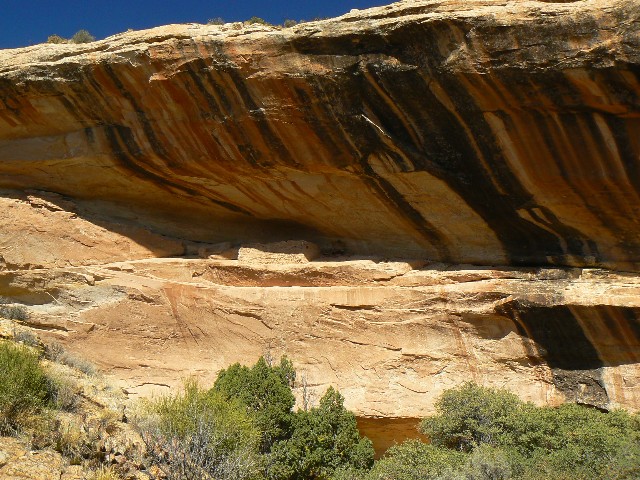
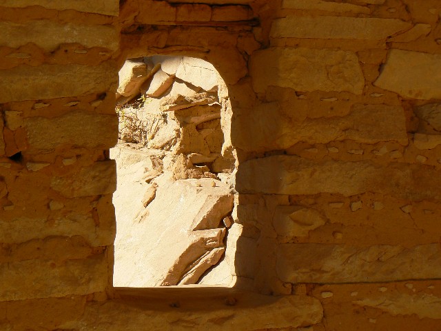
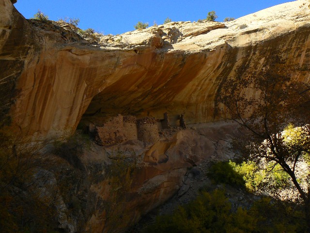
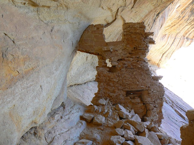
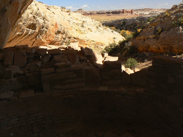
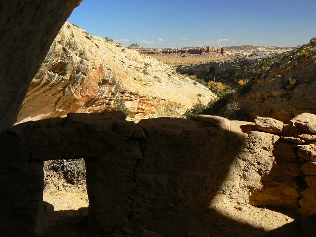
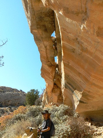
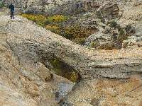
Monarch Cave – a grand place with some interesting pictos/petros. The main structures are perched on the edge of a pour-off, in dominion over a deep, dank plunge pool a rope pitch or more below. The 1892 exploration vandals (Illustrated American Exploring Expedition of 1892), and some current ones have left their dishonorable scribbling.
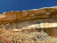
Cold Spring Cave is also scribed by the 1892 vandals and sits silently in a polished wash not far from Butler Wash. This pueblo area, like Monarch, has its own water source – hence the modern name. It’s a peaceful setting and we relish in this, then consider going up the other arm of the gulch to the tip of the Comb, and instead return to the truck to continue our ruin ramble.
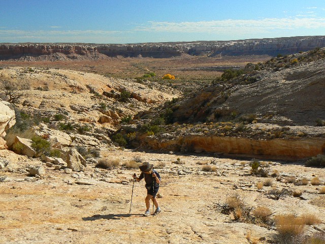
Fish Mouth Cave lords over the wash, big bass mouth gaping, frozen edges drooping in SS curves. The route in is littered with pieces of wall and other bits from prior habitation. This, I discover later, is really the best part of the exploration. The slickrock bowl below the cave mouth is interesting, and the scramble up into the mouth a bit arduous. In the cave, disappointment. The place has been looted by a series of pot hunters. What remains are bits of thatched roofs (floors?) and lots of recent graffiti by idiots of all ages and persuasions. Banners of Julio loves Carnita, Bowser loves Bonnie, and republicans for screaming "No!" to everything good deface the cave.
It’s windy and getting on toward sunset when we get back to the truck. So, we go directly across the Wash road and find a camp slightly protected by the SS walls. Again, a sun-warmed shower delights. The wind subsides somewhat.
|
|---|
Day 3 - from Fish Mouth Cave
(Click the image for a full-size view)
|
|---|
|
(There are - More photos below the trip narrative.)
Day 4: Rain rider:
We awake in the early morning to the preliminary patter of rain. I jump out and gather the drying towels and other things left out during the night. Then, it starts raining with purpose. Kathleen becomes concerned about the road – thinking: clay surface + water = disaster. I reluctantly agree and we speedily pack up and get rolling. Clumps of richly red mud spray if we go too fast, huge clumps clunk off the undercarriage and plop into car parts, permanently gluing themselves in situ. Yet mostly the Northern section of the Wash Rd. has more sand stretches than the South section.
We see the highway, and it takes another wandering two miles of clay to get there. Of course, the rain has quit by now, as we visit the Butler Wash ruin turn-out and sit behind the truck eating cereal ignored during our early escape. Then, we drive home, Kathleen having lost her quest for adventure. Along the way, I photograph a scenic toilet in Comb Wash. (link to scenic toilets)
We had anticipated an exploration of Butler Wash, followed by a return leg of exploration along Comb Wash, something that awaits the next questival.
|
|---|
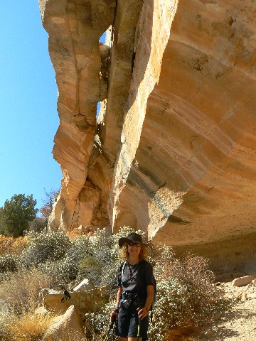
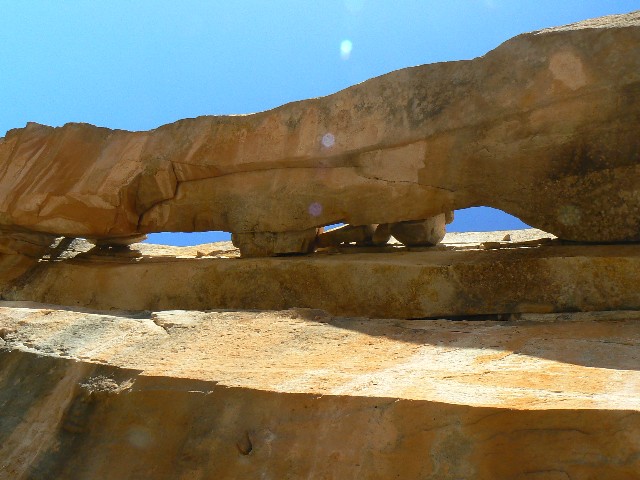
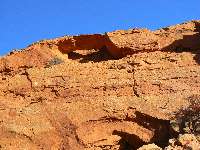
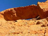
Day 1- Butler Wash Road Arch
(Click the image for a full-size view)
|
|---|
|
|
|---|
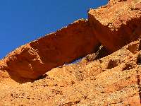
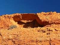
Butler Wash Road Arch
(Click the image for a full-size view)
|
|---|
|
|
|---|
Butler Wash Road Arch
(Click the image for a full-size view)
|
|---|
|
|
|---|
Butler Wash Road Arch
(Click the image for a full-size view)
|
|---|
|
|
|---|
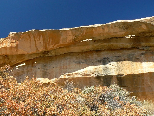
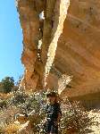
Day 2 - Double Stack Ruin Arch
(Click the image for a full-size view)
|
|---|
|
|
|---|
Double Stack Ruin Arch
(Click the image for a full-size view)
|
|---|
|
|
|---|
Double Stack Ruin Arch
(Click the image for a full-size view)
|
|---|

|
|---|
Double Stack Ruin Arch
(Click the image for a full-size view)
|
|---|
|
|
|---|
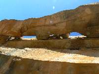
Day 4 - Butler Wash Ruin NB
(Click the image for a full-size view)
|
|---|
|
Butler Wash Road Arch:
Cedar Mesa Area, Utah
From Hwy 163 between Bluff and Mexican Hat, Utah, turn North onto San Juan Country Rd 262 at MP 40.5. This turn is about 5 miles West of Bluff. This is the Butler Wash Road.
Drive this dirt road North approximately 2.2 miles. Look in the top of the chocolate bluff to the East for Butler Wash Road Arch, which can be seen from the road, just above a spur road off the main road.
Coordinates for this arch are:
UTM 12 S 0621072E; 4127745N; WGS 84
Double Stack Arch
Butler Wash Road
Cedar Mesa Area, Utah
From Hwy 163 between Bluff and Mexican Hat, Utah, turn North onto San Juan Country Rd 262 at MP 40.5. This turn is about 5 miles West of Bluff. This is the Butler Wash Road.
Drive this dirt road North approximately 3.8 miles. At this mileage, turn West onto a dirt track and drive to the edge of Butler Wash. Park near the Wash, at approximately UTM 12 S 0621395E; 4130614N; WGS 84.
You are about 17.2 miles South of Hwy 95 (turn South onto Butler Wash at MP 112.3).
Look West for the alcove in the slanted white Navajo SandStone. Double Stack Arch is in the rim of this alcove. It's about a 20 minute hike to the arch. This arch is named for nearby Double Stack Ruin.
Coordinates for this arch are:
UTM 12 S 0620379E; 4130601N; WGS 84 at about 4860'
Butler Wash Ruin NB
Cedar Mesa area - Utah
Drive south from Moab on Rt. 191 to Blanding. Four miles south of Blanding, turn west onto the Bi-Centennial Highway (Rt. 95). About 10 miles west of the turnoff, a sign indicates "Butler Wash Ruins". The ruins are visible from an overlook at the end of a half mile hike from the parking area. One has to walk up-canyon along the fenced overlook beyond the end of the fencing to view the natural bridge.
Links:

Previous WV Reports about The Cedar Mesa area:
Dare to say Dark Canyon (2008) - Horse Pasture to Sundance Trail
- with after-backpack excursions to Upper Salt Creek and Natural Bridge
Cedar Mesa Somewhere (2001)
Related Sites:
Abbey's Web -- The man who is Desert Solitaire.
Even utahans ought to know - We Are Breeding Ourselves to Extinction (click here for full article)
SUWA - Dedicated to conserving the canyons of Southern Utah
The Utah Wilderness Coalition (UWC) seeks to protect wilderness values on public lands in Utah
A Hiking Guide to Cedar Mesa, Southeast Utah, by Peter Francis Tassoni (2001)
| |