Escape Into Winter (formerly Winter Escape)
Bicycling Badwater and toward Amargosa Divide
Day Hiking Echo, Telephone Arch, and Golden-Gower Canyons

|
| |||||
|
| |||||
|
| |||||
|
| |||||
Note: This is yet another WMC (Wasatch Mountain Club; 20th year)
escape from high altitudes and cold weather organized by Cheryl Soshnik of the WMC, Wasatch Mountain Club.
I went a bit early and stayed longer than the WMCers, extending what was billed as "Winter Escape."
However, at times this trip felt like "Escape Into Winter," although the temps were moderate by
alpine standards. The wind was another factor nevertheless. Thanks to Cheryl, Rob P., Greg, and
the Rovers (Minnesota Rovers Club) who helped make this excursion a good deal of fun.
“It’s a dangerous business, Frodo, going out your door. You step onto the
road, and if you don’t keep your feet, there’s no knowing where you might be swept off to.” Bilbo Baggins
Death Valley Dreaming, 2016
Winter Escape to DV Super Bloom, 2016
Death Valley Dreaming, 2017
Backpacking the Cottonwood-Marble Loop, 2017
Death Valley Dreaming, 2018
Hiking Telescope Peak (11,049') and Wildrose Peak (9,064'), 2018
.
Trip members included Cheryl Soshnik, Rob P,
Robert T, Dave and Susan R, Dave R and Michelle C, Angie and
Don V, Donna and Ron S, Steven and Lesli G, Jen H, Mike and Diane B,
Greg L, Randy B and Janet H, and Rob Jones.
Camera: Panasonic DMC-ZS19 (bike), ZS60 (hike)
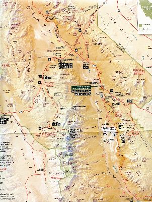
Maps: Please see the previous Death Valley Dreaming reports - maps for most of the hikes and rides can be found there. For general purpose, here is a scan of part of the NPS park map.
| ||||
Day 1.
Day 2: Golden-Gower . 7 miles. ERM of 11. Hike.
Travel from 10F to 62F, setup camp, talk with Rob P.
Rob has just returned from a ridge jaunt beyond the Keane Wonder Mine. Sounds keen.
Dark Triad: I brought along a newspaper and noticed how, once again,
trump is spinning lies and bullying others, calling them names while consorting with dictators
attempting to deceive you and undermine your vote. Then I wonder, 'is shame at being conned
the only reason trump supporters are still with him after all the harm he has done (such as
the give your tax money to the rich and corporations, while adding debt, to your tax bill),
the deception, the lies, dismantling your health/envioronment protections, undermining public
education, locking children in cages, selling out your government to the swamp masters, the
lack of decency. etc.?' That is, if you are not part of the miniscule 0.01% of the most
uber wealthy for whom trump legislates. That's the thing about con men, they con you and
you feel embarrassed about being fooled by these users and grifters. t-rump is a confidence
(con) man. He expertly (the only thing at which he is an expert) demonstrates the Dark Triad
(con man, grifter) of: 1. Narcissism (Yuge at this), 2. Psychopathology (psychopath), and 3.
Machiavellianism (manipulative, sees things in exchange value (e.g., win or lose, no
gradations or compromise) and dehumanizes and objectifies humans. Not sure t-rump
qualifies in any way as a "human." Relevant to Death Valley, I muse how trump would
like to further dismantle our public lands, selling them off to corporations and locking
out the public. Sad.
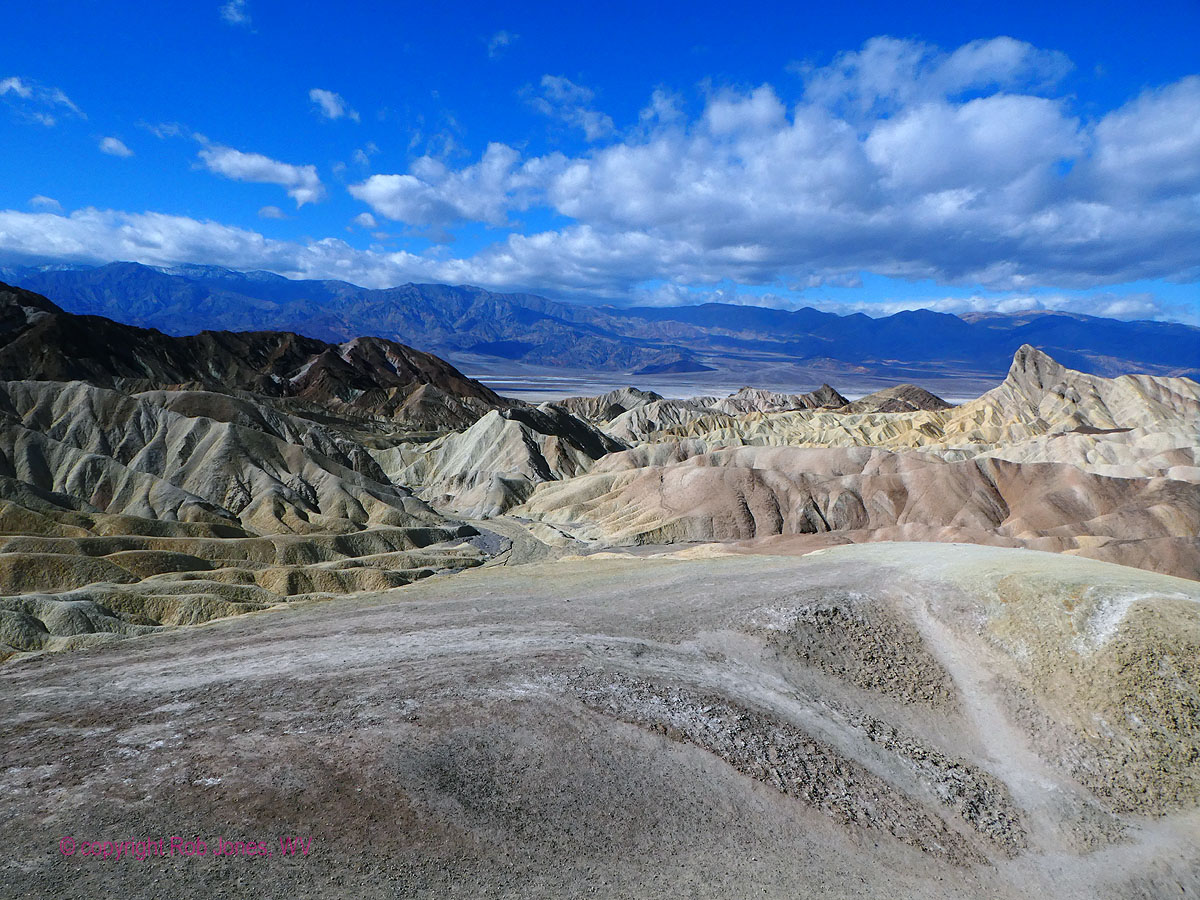
The crenulated chocolate brown meets the folded then
tilted blonde of rocks of Star Wars fame. Yes, sections of a Star Wars movie was shot in
this canyon. Greg, Jen, Rob P., and I are hiking the golden side of the Golden-Gower
loop as the wind builds. Even a strapped on Tilley Hat attempts to leave my head to
float up to Manly Beacon.
At Zabriskie Point, the wind builds to a gale and one
has to lean into the gusts to keep from being knocked over. A lithe wraith nubile,
wearing a flowing full white dress and black top attempts to pose for a glamour photo
at the point, long black hair and dress stretched out horizontal by the mini hurricane.
Lovely effect.
We retreat into Gower Gulch, where there are enough
curves to this sinuous canyon to provide respites from the wind. Even so, sand and
grit are occasionally propelled into the mouth and eyes.
We return early to camp and enjoy a happy hour during
a lull in the wind.
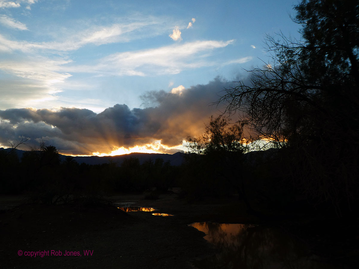
The wind cranks up to very uncomfortable levels as
sunset approaches, driving most campers into their tents.
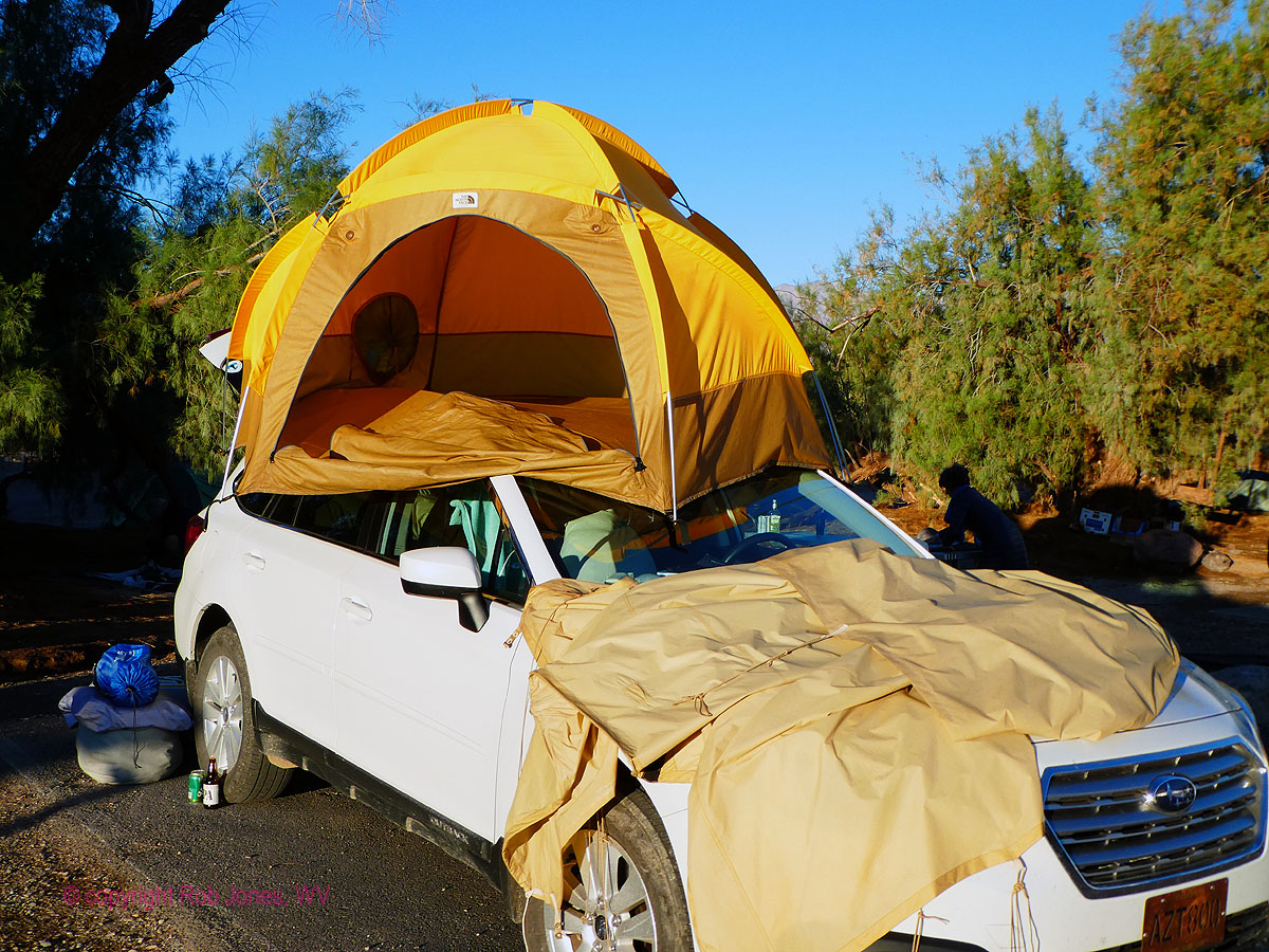
Me, I feel quite thankful for the venerable 40-year
old VE-24 North Face tent that has solid (no mesh) walls, otherwise, the wind would sift
the dirt and sand through the mesh into my face and over my equipment. Ahh. Patters of
rain, a mud storm, can intermittently be heard sullying the grand old mountain tent.
Death Valley 2019, Day 2 photos

![]()


![]()


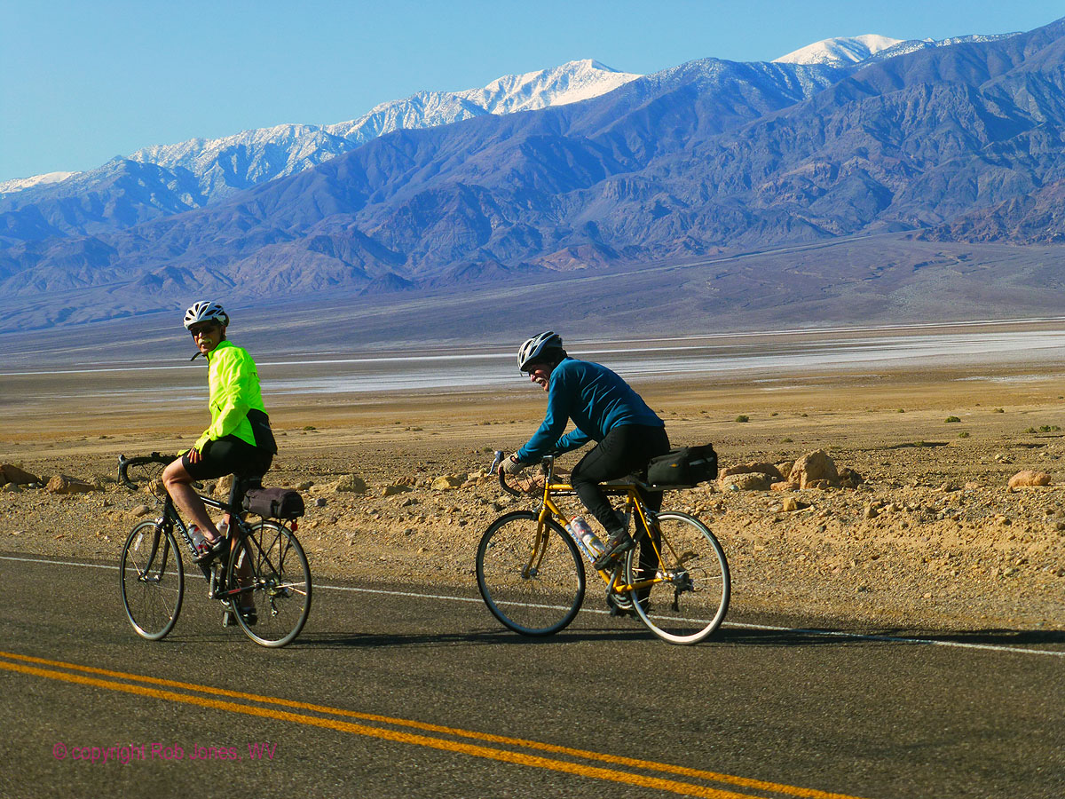
Day 3: Low Point. To Badwater and back, biking . 36.5 miles. Bicycle. biking to
the low spot in the continental US.
The edges of my ears feel a tingling crispness
and the fingers are frozen. Two layers top and bottom, and not enough. After a
cool evening accompanied by a yuge windstorm, the air is clear yet crisp. That is,
this is a cold weather ride to below sea level.
Far above, Telescope Peak ridge is cloaked in snow,
suggesting that this adventure would be too slow to be a practical destination. Lots
of snow work make for slow progress. (I hiked this high point last year,
as seen here, Day 6 (link)
The diminished group (few are biking today) reconvenes
at the low point of the trip, Badwater. It's a bit farther below sea level with each
trumpentine day; as global warming wreaks havoc on the glaciers and ice packs. Of course,
a mental midget like t-rump would exclaim that the recent yuge cold spell disproves the
issues of global warming. Yes, a certified mental midget, not understanding the difference
between weather and climate. ("I have a beautiful big a-brain." excellent oratory by t-rump.)
No wonder the repulsicans continue to believe the voodoo economics of how giving all the
(remaining) money to the rich will benefit everyone. Argh. It is a yuge benefit for the corporate
rich to destroy the Eaarth for their gain. This is corporate socialism, and you are paying for it.
Your children and grandchildren will pay, ultimately, the highest price. Sadly for all of us,
trump believes in
science fiction, not science. (Past time for a change.)
| ||||

| ||||

Amazing, there is no wind in our face on the return ride.
Most continue to camp while Barb and Greg creep up the Artist
Palette loop. Rob P., Dave R., and I pause among some black basalt boulders for a late lunch
before rolling back to camp. Sitting in warm black sand, propped up against a sun warmed ebony
boulder, ahh, an excellent lunch spot. To the West Telescope Peak scrapes the sky. Turning to
the East, we see the neopolitan squiggly layer-cake foothills of Artist Palette. Gorgeous.
I enjoy a heated water sun shower prior to helping Robert T.
prepare the Dutch ovens with chicken, potatoes, onions, carrots, garlic, yummy.
It's a cool evening awaiting the chicken bake, somewhat abated
by the campfire. Orion lights up as the intrusion of the sun wanes. Surround sound by a choral
of Song Dogs (Coyotes) pierces the calm night.
Death Valley 2019, Day 3 photos
 |
 |
 |
 |
 |
 |
 |
 |
 |
 |
 |
 |
Day 4: Brisky. Toward Amargosa Divide. 32 miles, up 2500'. Bicycle.
I am having difficulty moving my jaw as I peddle down the long
colluvium, drifting back toward sea level and a bit below. Brisky. Zabriskie Point? Da-brisky, I muse.
Another coats on day, layering layers on top of layers.
The day starts with the long, yet gradual climb up to the Dante
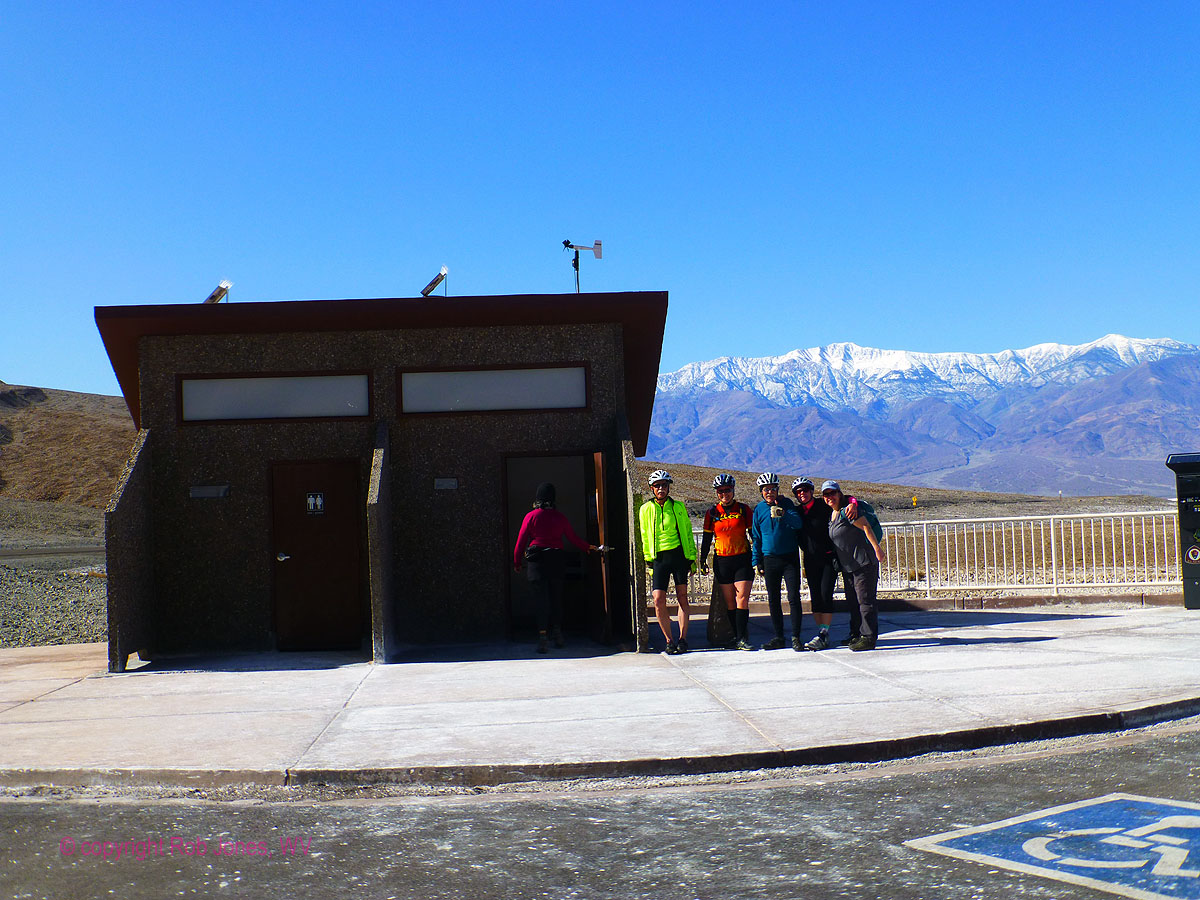
View junction for a snack. Rob P. and I continue to the scenic toilet entrance kiosk while Greg
and Diane roll toward Dante View, coolness increasing with the altitude and rising breeze. "It's
a dry cold," notes Rob P. Maybe so, and it's also a cold cold, I reflect.
The folded, striated mountains hem in the ribbon of road. Gorgeous.
I continue up toward Amargosa Divide, yet my enthusiasm wanes as
the temperature continues to decline and the slight tailwind switches to a headwind. Burr.
I peel off the road and, sheltered in a rock nook, enjoy lunch
before putting on what clothes I have and dropping to camp, slightly below sea level. Peddling is
often required because the second law of bicycling predominates; the wind is always in your face.
A heated solar shower and then a warm drink accompanied by a Feisty
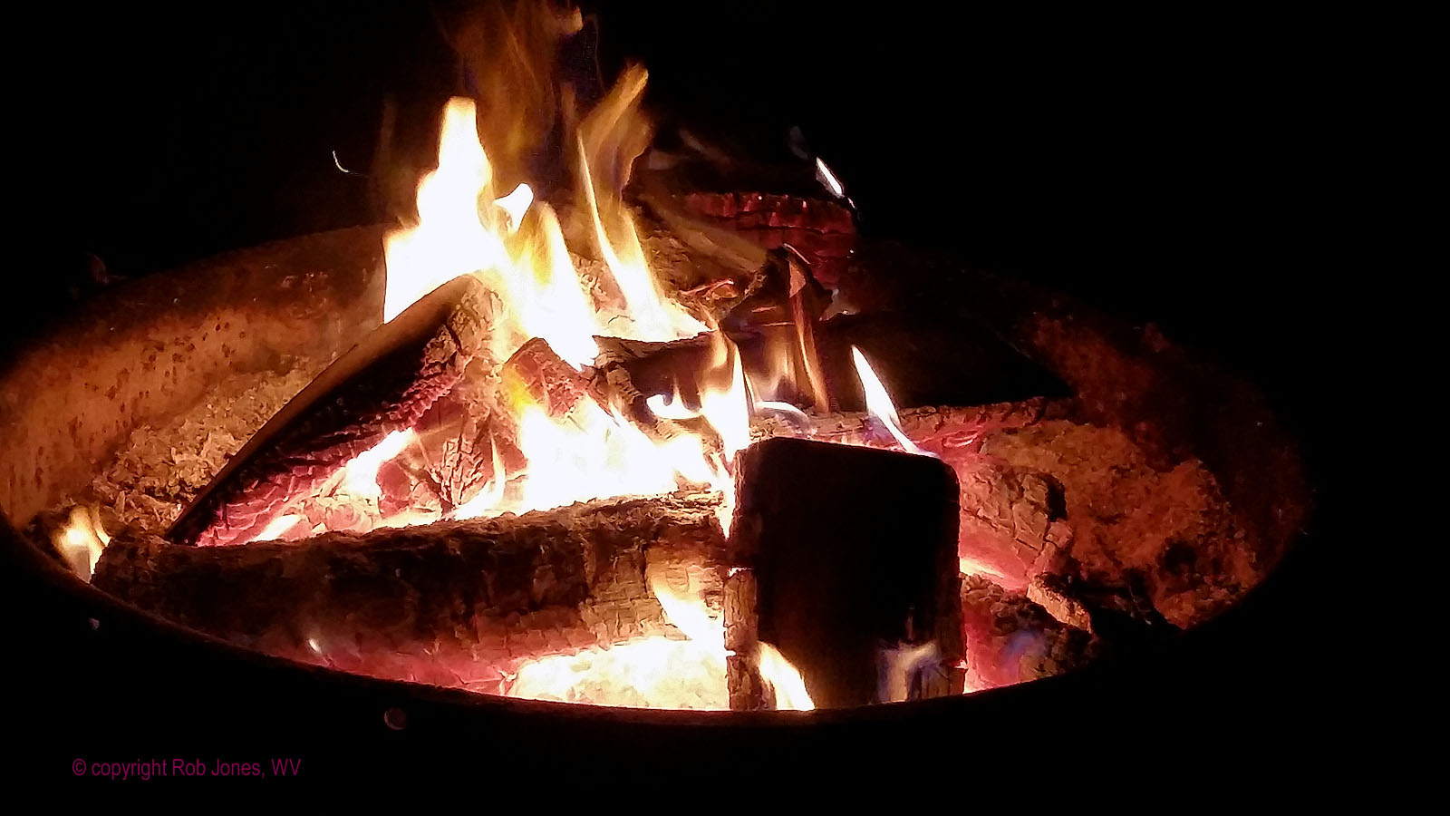
Chihuahua Mexican lager enjoyed by a fire while grazing the happy hour snacks and the day is complete.
Rain would seriously set in the next day, fouling moods, roads, and plans.
Colluvium vs. alluvium: Colluvianation is the process where sheet erosion, water erosion, downward creep, or a combination of all transport loose unconsolidated debris from hill tops to the base of the slope depositing different types of heterogeneous rocks and debris of varying sizes, and forming what is called a colluvium. Colluvium material consists of poorly sorted angular fragments of various sizes from silt to rock debris, and sometimes slabs of bedrock, facing up the slope as if indicating its original location. The formation of alluvium, on the other hand, is the process whereby river water transports and deposits clay, sand, silt, and such like material on the banks of valleys, deltas, or floodplains. These deposits are therefore known as alluvium. Alluvial materials are loose and may be reshaped during the whole transportation process. Distinguishing between colluvium and alluvium may not be easy, especially at valley edges where colluvial and alluvial materials may mix and become indistinguishable.
Death Valley 2019, Day 4 photos
 |
 |
 |
 |
 |
 |
Day 5: Telephone Home, ET. Telephone Canyon and Arch, Arrastre; Hole in the Rock Spring .
8.5 total miles, ERM of 13. Hike.
Rob P. and I employ the umbrellas as soon as we leave the vehicle,
starting the hike around the foot of the fanglomerate bluffs, heading to Telephone Canyon as it pierces
the Tucki Mountains of the Panamint Range in Death Valley National Park. Chilly.
We've stored the bicycles in the vehicles because there appears to be
little good weather ahead during our DV time. I remember to let out some of the pressure from my bike
tires to avert the issue from a tour a few years ago - increasing pressure from a climb of over 7,000'
can, and will, blow off the tire from the rim, taking the tube with it (large blast hole).
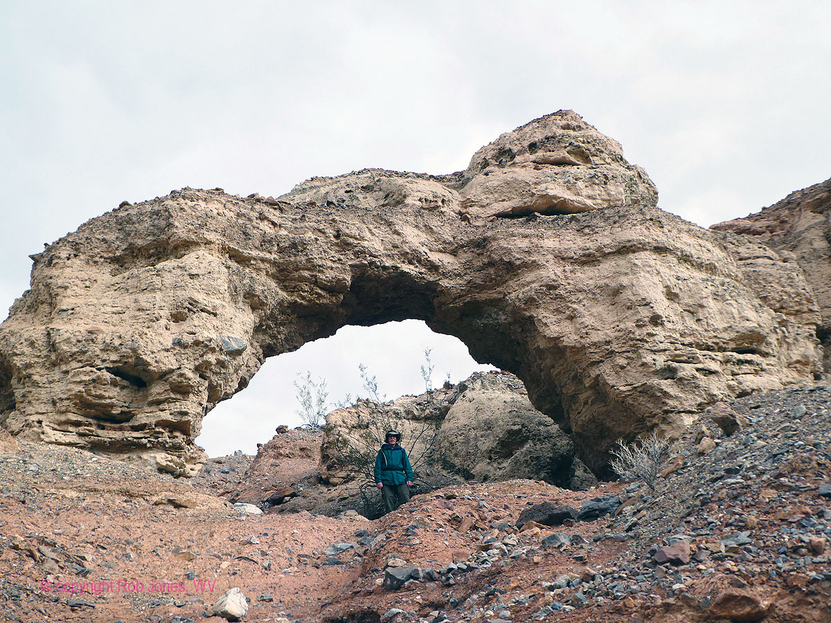
Telephone Arch, actually a natural bridge, is carved from a siltstone,
sitting on the Nova Formation fanglomerate, not far from the old ore processing area containing an arrastre,
replete with polished flat granite, marble, basalt, other hard rocks. Benches of fanglomerate apparently
housed cook shed and living quarters, probably wall tents. Telephone Spring was the reported reason for
the activity here, yet is now dry and we find no evidence of it. ET will not be phoning home from this Telephone.
After some exploring, we drift down canyon, looking for a nook out of the
brisk wind. Lunch enjoyed, we return to the car and over to the Daylight Pass Road and another, brief this
time, exploration to Hole in the Rock Spring, a trek of perhaps 0.75 miles. Water trickles, yet the pool
is merely damp.
Rob and I involve ourselves in happy hour snacks while driving back to Furnace
Creek Camp for the official happy hour, followed by a Cheryl S. tequila sauce over noodles dinner around a
warming fire.
An Arrastra (or Arastra, Arrastre) is a primitive mill for grinding and pulverizing (typically) gold or silver ore. The simplest form of the arrastra is two or more flat-bottomed drag stones placed in a circular pit paved with flat stones, and connected to a center post by a long arm. With a horse, mule or human providing power at the other end of the arm, the stones were dragged slowly around in a circle, crushing the ore. Some arrastras were powered by a water wheel; a few were powered by steam or gasoline engines, and even electricity.
Death Valley 2019, Day 5 photos
 |
 |
 |
 |
 |
 |
 |
 |
 |
 |
 |
 |
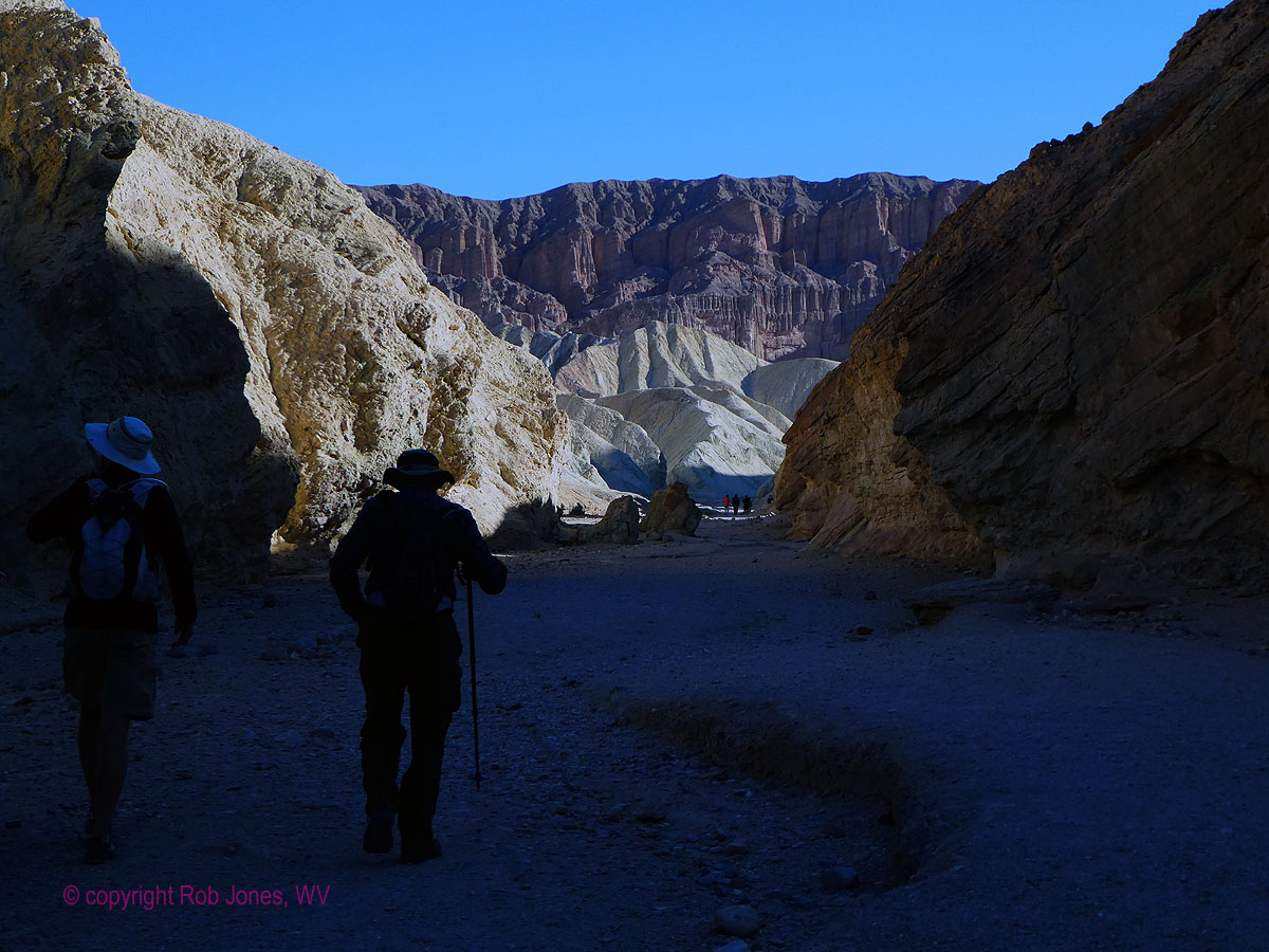
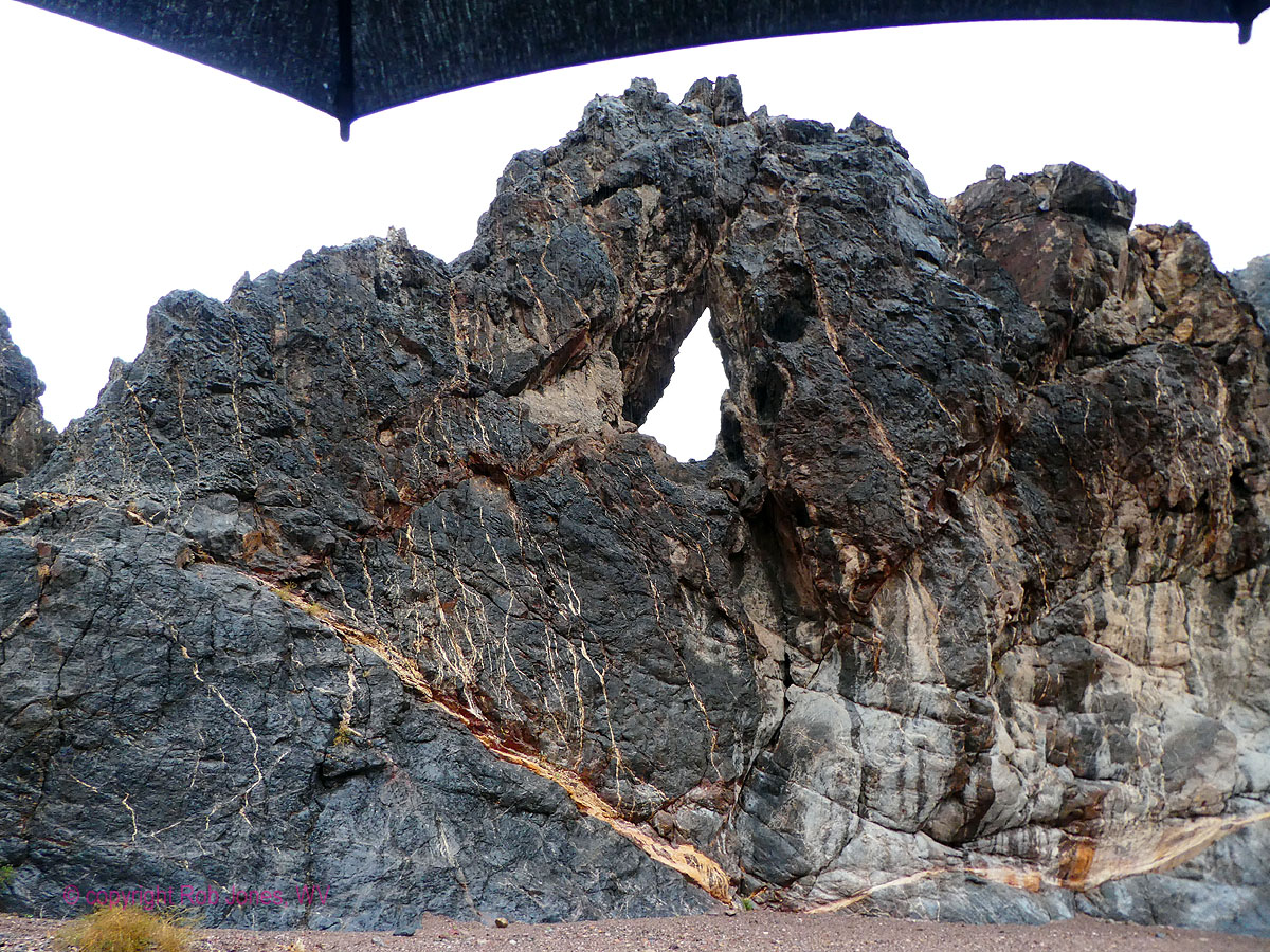
Day 6: Eye of the Needle; Umbrella Echo . 10.3 miles; ERM of 16. Hike.
I'm driving Echo Canyon, and the drizzle of the morning continues.
Rain starts some time before dawn, drips through breakfast, and joins me as I inch up Echo Canyon.
Every WMCer without an RV (but me) departs after breakfast if not before. The Minnesota Rovers are here,
partly because most fly out of Lost Wages on Saturday, two days from now.
It's instant umbrella as I get out of the Subie Subaru and hike the gravel
colluvium, accompanied by desert aroma which is at times pungent. This is one of the positive aspects of
hiking in the rain in desiccated lands, sweet aromatic odors.
Passing into the narrows of Echo Canyon, the Eye of the Needle hangs above
a bend in the drainage. Photo opportunities are limited today because of the dark skies, and, well, the rain.
An alcove appears up canyon from the arch, just before the canyon again widens.
I'm happy to be toting one of Cheryl's hand warmers (swag from the Sundance film festival, where Cheryl
volunteers) because although dry, the alcove is chilly and the wind has blown water on my legs, creating
heat-sapping wet pants. A dry, albeit not cozy, place for lunch. The handwarmer is the reusable type
containing a food-grade sodium acetate solution which is triggered by shocking it into action by bending a
metal disc (see below). Lovely.
Clouds rove, beginning to lose their punch as I leave the narrows on the
way back to the Subie. It's quiet and the storm seems to be winding down.
I return to a flooded campground with pools of water reflecting some excellent
low sun relief on the Funeral Mountains.
The Rovers invite me to dinner as a gusting gale builds for evening enjoyment.
Tacos. Flour tortillas sail like frisbees off the table and into the fire pit, followed by a ration of
spinach and chunks of onion. Fast food.
Pools and mud linger.
Reusable hand warmers start with the sodium acetate trihydrate solution
in the liquid state. (Food grade solution.) To get to the liquid state, the hand warmers were boiled to ensure
the solution was raised above its boiling point of 136.4 °F/58 °C (to 137.12 °F/58.4 °C). The solution must be
heated well above its melting point to become a supersaturated solution.
When cooling below the melting point, this supersaturated solution will not turn
to a solid form on its own, it needs help for that. That means that the stored “latent” heat can be saved to be
used whenever it’s needed. When the phase change from liquid to solid is initiated (usually by clicking a small
disc inside the reusable hand warmer), the latent heat is released and the hand warmer heats up to over 130 F.
This happens because tiny pieces of metal inside the activator create a nucleation
site for salt crystals to form when the metal (stainless steel; although nearly any metal will work) disc is
“clicked.” When in solid form, all you have to do to reset reusable hand warmers is boil them in water for
about five minutes.
The hand-warmer heats up when you bend the metal disk that’s inside the pouch.
Bending the disk causes the liquid inside the hand-warmer to solidify. This change results in an exothermic reaction,
meaning heat is released as the liquid solidifies. The heat released is the warmth you feel.
The key to the hand warmer is actually the solution itself, rather than the metal
disk. The solution is a mixture of sodium acetate and water. The sodium acetate solution is a supercooled liquid,
so it can stay liquid at temperatures below its freezing point (58°C). The supercooled liquid is metastable or
“sorta-stable”, so all it needs is a trigger for the spontaneous change from the liquid state to a solid state.
The metal disk just triggers the sodium acetate solution to solidify. It can be
any piece of metal as long as it is bendable. Stainless steel is often used for this job.
Death Valley 2019, Day 6 photos
 |
 |
 |
 |
 |
 |
 |
 |
 |
 |
 |
 |
 |
 |
 |
 |
 |
 |
Day 7: Mudfoot . 7 miles, ERM of 11. Hike.
The Emigrant Road is closed, as are other access points. Mudfoot
below, wind eggbeater hair above. Ick. I won't be hiking the route to Saddle Rock Mine, possibly
even to Skidoo, as I had planned for today because I cannot get to the trailhead.
After seemingly endless driving about, looking for a hiking venue,
I end up walking an alluvial fan near Hole in the Wall. Mostly, it's gravel and easy walking. I've
not started early enough to get to the good parts. It's a sunny day, delightful but for the pulsing
wind, and the mud, plenty of gooey mud left over from yesterday's rain event.
I return to camp and immediately heat water for a hot shower before
the reality of showering in the intermittent blips of cool air slipping through the tangle of
Australian Pines in the shower grove becomes predominant. The shower is a welcome one, followed by
a quick dodge into the tent for some warm lounging.
Cooking in the 40 MPH gusts is an adventure not so wondrous. Containers
sail off the table and the chair flies when I chase the containers. Etcetera. The stove is sheltered
in a nook of cook box and water jugs, and this works OK.
The wind howls like a jet airplane trying to lift off. Even the VE
shudders at times. Yikes.
Not waiting for hiker midnight, I stuff everything in the Subie or
the tent and retire to read and jot these notes. The sonorous sounds of Song Dogs is blown distorted
by the wicked wind.
Death Valley 2019, Day 7 photos
 |
 |
 |
.
Death Valley 2019, Scenic Toilets
 |
 |
 |
 |
 |
 |
| ||||
.
Bird and Hike site content page: Death Valley hiking
Death Valley Dreaming: Biking and Hiking Death Valley - 2011
Death Valley Dreaming: Biking and Hiking Death Valley - 2012
Backpacking and Biking Death Valley - 2013
Backpacking and Biking Death Valley - 2014
Death Valley Dreaming and Marbelous Marble Canyon Backpack, 2015
Death Valley Dreaming, 2016 Winter Escape to DV Super Bloom, 2016
Death Valley Dreaming, 2017 Backpacking the Cottonwood-Marble Loop, 2017
Death Valley Dreaming, 2018 Hiking Telescope Peak (11,049') and Wildrose Peak (9,064'), 2018
Scenic Toilets of Inner Earth.
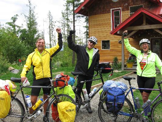
Click here or on the happy cyclists to go to all WV reports about Bicycle Touring
| ||||
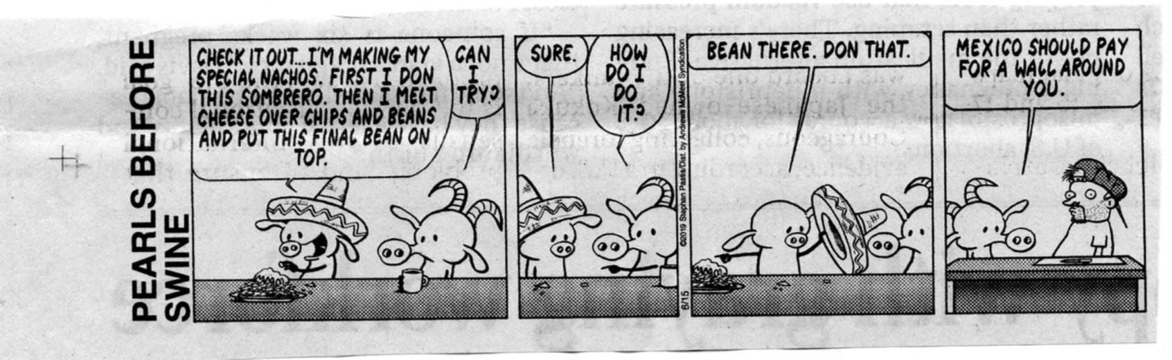
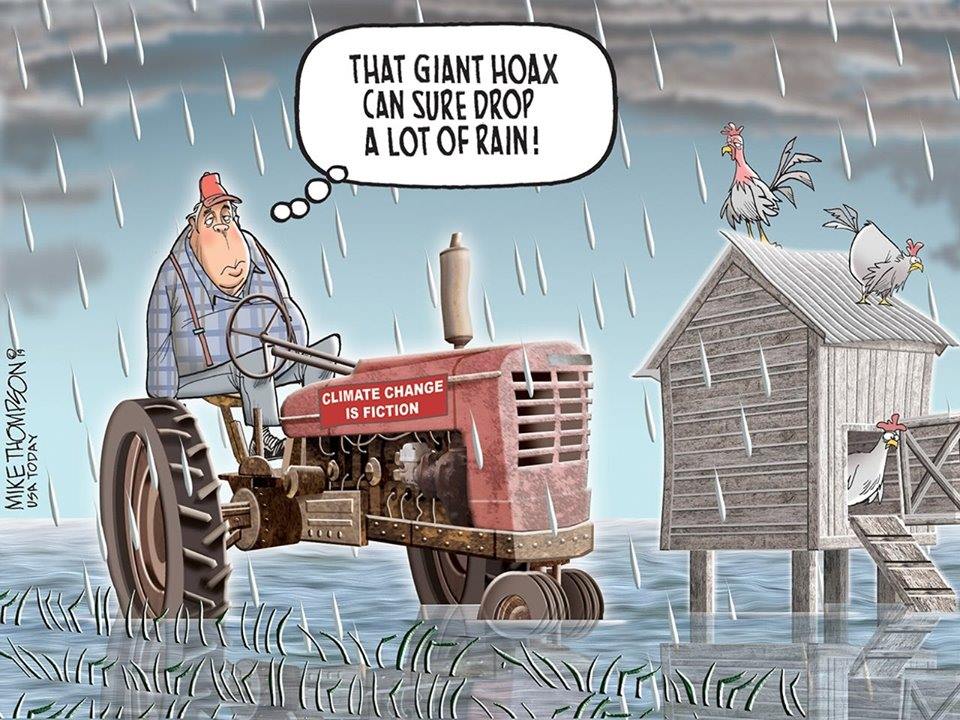
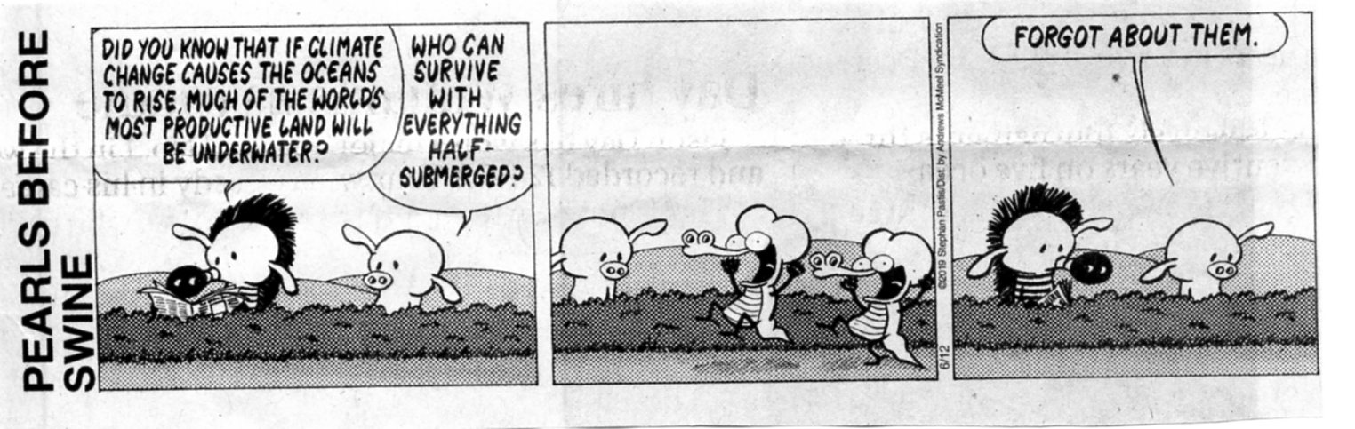
More Truth Than Joke:
Everyone is entitled to his own opinion, but not his own facts. Daniel Patrick Moynihan
| ||||

| ||||
| ||||
| ||||
| ||||

| ||||

| ||||
| ||||
| ||||

| ||||

| ||||
| ||||
|
Wild Vagabond Main |
Trip Report Index  |
Caveat  |
|---|