Backpacking and Bicycling Death Valley
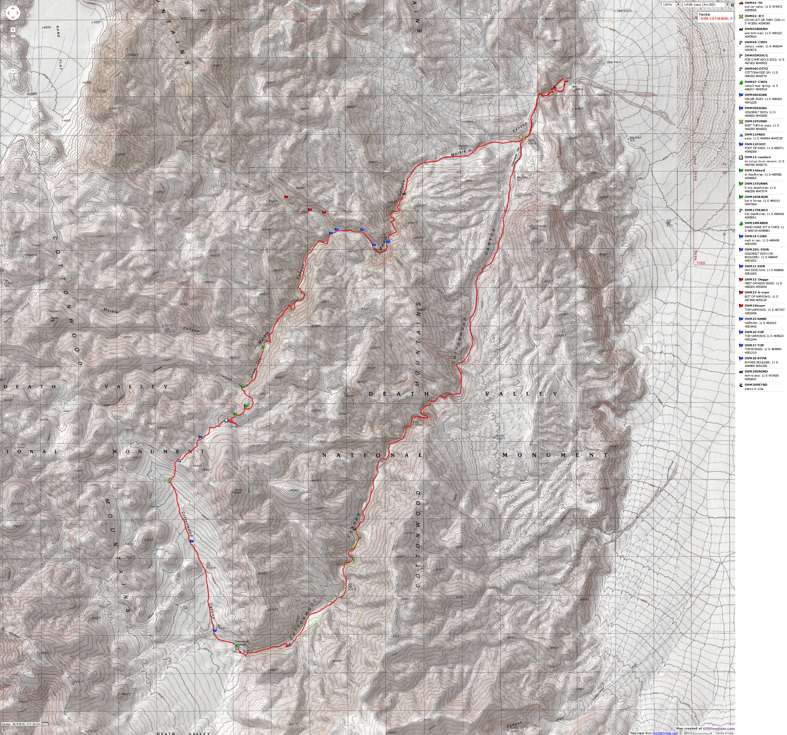
Cottonwood-Dead Horse-Marble Canyons Backpack Loop
Biking Bad Water and Artist Loop, toward Dante View, and Stove Pipe Wells
|
| |||||
|
| |||||

| ||||
| ||||
|
| |||||
|
| |||||
| ||||
| ||||
Photos are scattered throughout this report.
Keep scrolling.
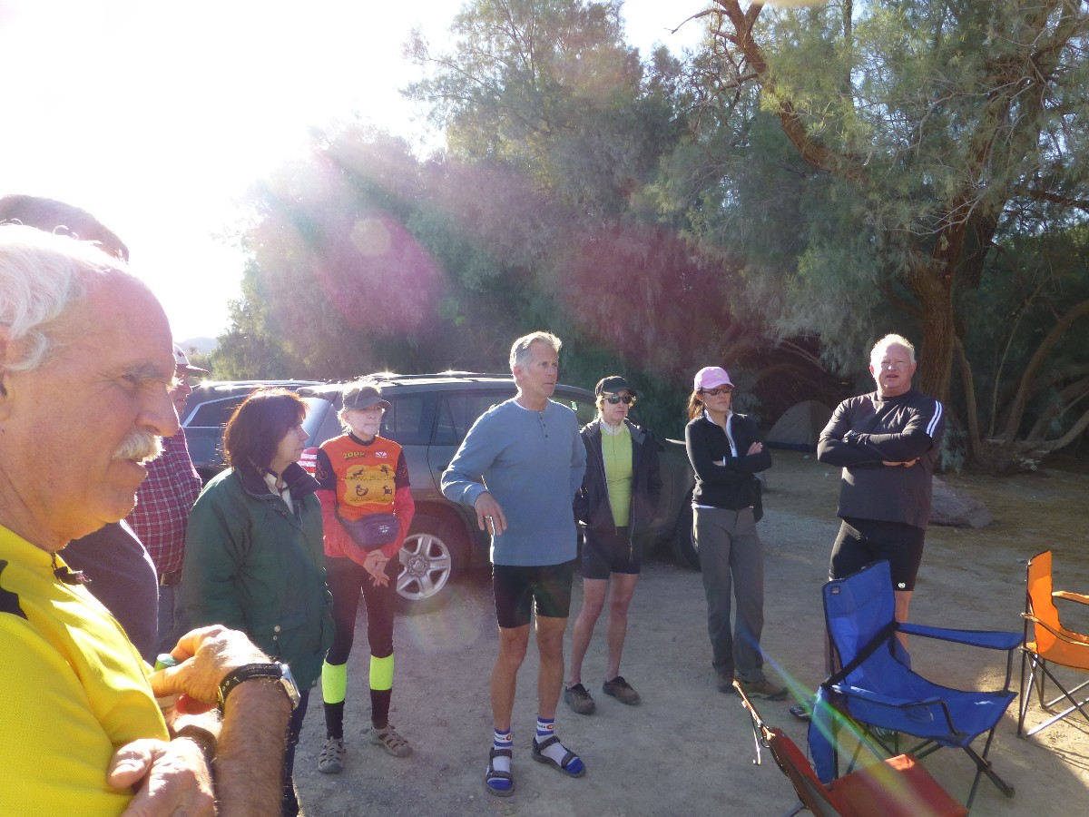
The bicycling adventures and Furnace Creek CG events were organized by Cheryl Soshnik and others of the Wasatch Mountain Club. The backpack was organized by The Wild Vagabond.
Preliminary: Initially, there was talk of a cooperative backpack in the DV area. As it turned out, I enjoyed the day bike rides, then a solo backpack. I posted the backpack report first (below), followed by the day bike rides.
Jump directly to the bicycling report which preceded the backpack (click here)
Summary: Cottonwood-Dead Horse-Marble Canyons Backpack Loop.
This 33-mile (51 ERM, Energy Required Miles) backpack loop is
said to be the "most popular" backpack in DV (Death Valley). Go slightly off-season and you
may encounter wondrous solitude. It's popular because it features wonderful limestone narrows
and has water near decent campsites. Just how popular is backpacking in DV? I suggest you
take topo maps (Harris Hill & Cottonwood Canyon 7.5 minute quads; USGS) and talk with the DV
Rangers about the route into Dead Horse from Cottonwood. Then, enjoy the trip, there's some
terrific stuff to see out there.
ERM - Energy Required Miles. A mile is added for every 500' elevation gain or loss. It's a very serviceable method of estimating energy required miles.
Total trip - (per my GPS) of 32.4 miles and total ERM = 51.

| ||||
for a full-resolution map, click here. Caution - do not use this map or gps track for navigating the route.
 |
 |
 |
 |
 |
 |
 |
 |
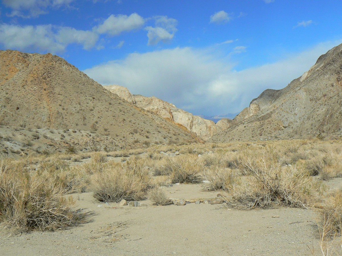 |
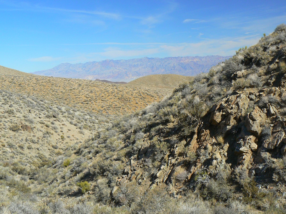
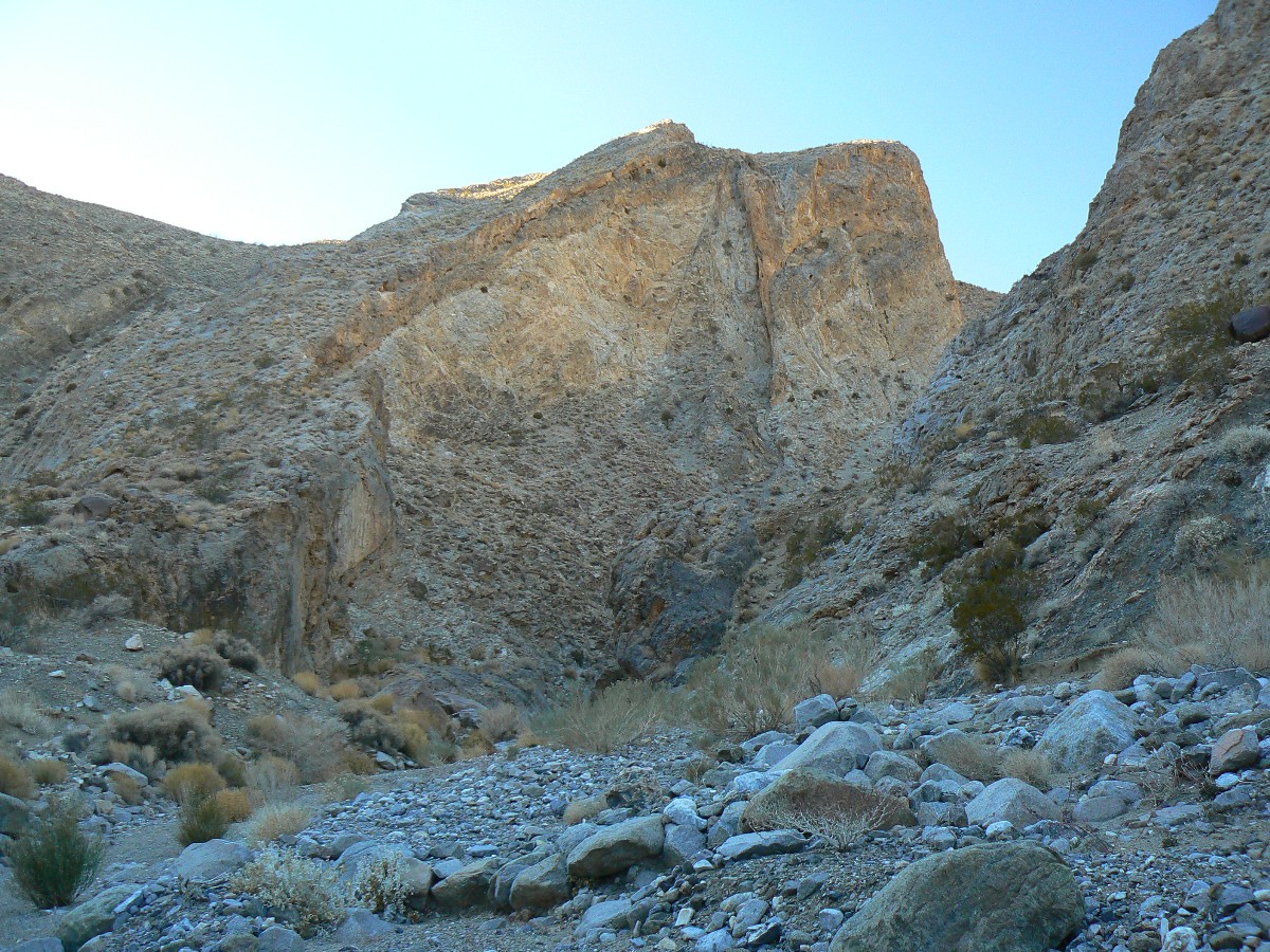
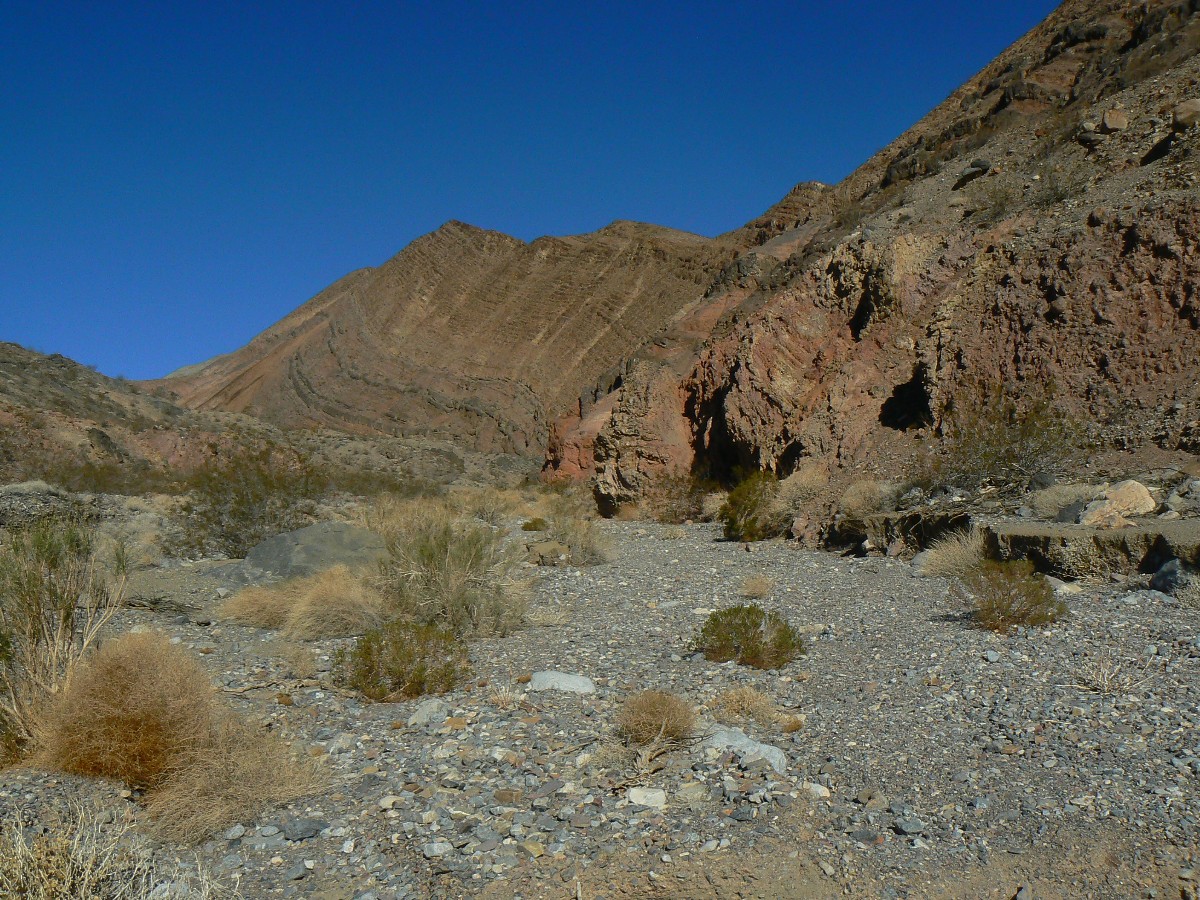
Day 1: Cottonwood Climb. TH to beyond end of road. 10.3 miles; ERM = 14.
I've been walking this old jeep road all day, or so it seems, when
a dead-looking tree appears in the near distance. A Cottonwood? A mirage? It's certainly not hot,
so I doubt the mirage idea. A few more turns and more trees and then, a trickle of desert water.
Terrific! I've been lugging 6 liters of water and now feel a bit silly, if not well-hydrated. Soon,
the end of the track appears and I continue on and soon find a selection of camp possibilities on the
quartz monazite, ground so fine tiny flakes appear attached to most things. The flakes even get lodged
in the velcro of my gators. Deluxe, yet cooling quickly.
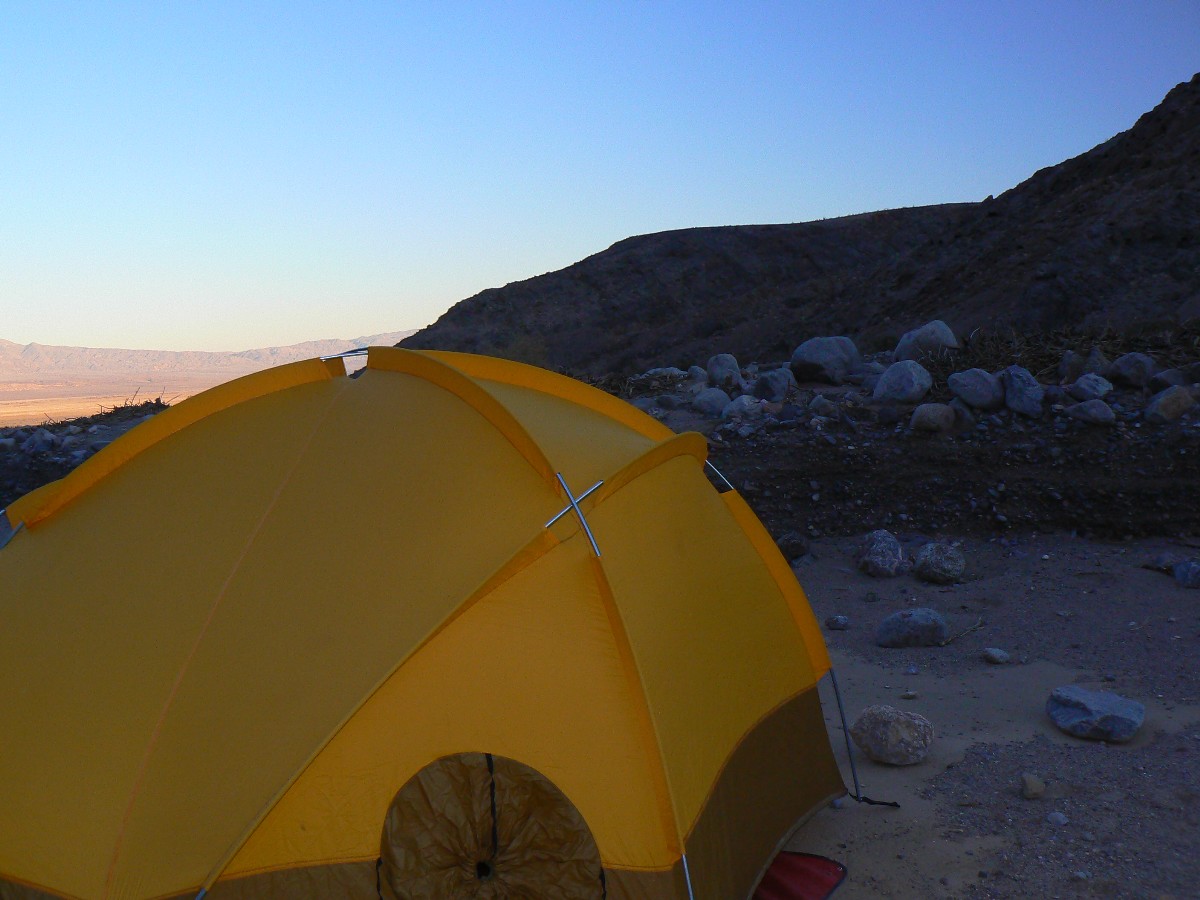
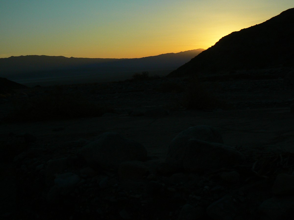
I start dinner, set-up the TarpTent and sort equipment as the temperature
and sun drop. Sunset finds me scurrying into the tent, with my legs in the fluffy Marmot (brought the
warm Marmot) and a down jacket and hat on the top.
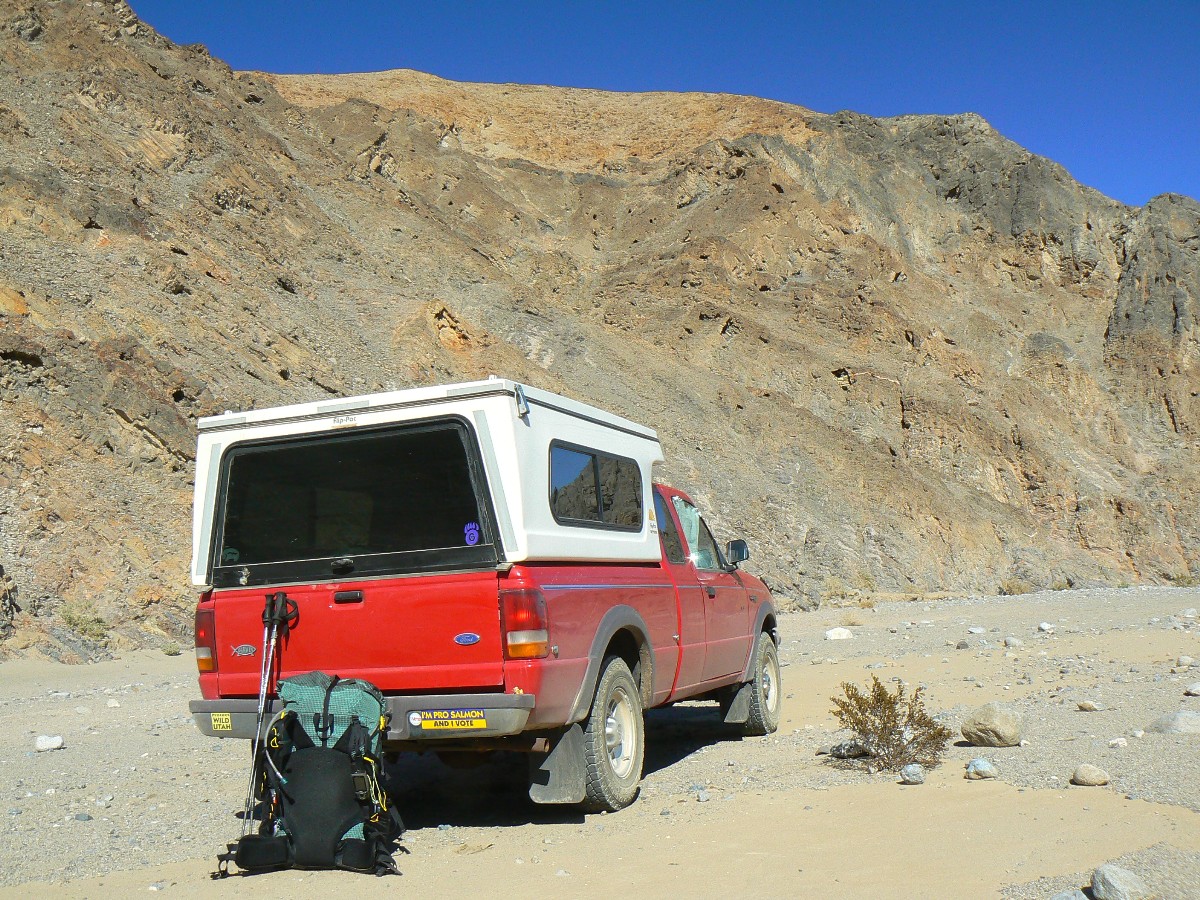
I start the day packing up at Furnace Creek CG and saying farewell
for now to Dave, Cheryl, Rod, Rob, Chris and others of the WMC (Wasatch Mountain Club) and drive over
to Stovepipe Wells and the 8+ miles to where the road turns rough(er), and then another 1/2 mile to a
good flat spot to camp on when I return. Then, I try to fit everything and extra water and bear can
(just trying it in the pack; thinking fondly of PCT time this Summer) in the new Catalyst. I could
drive to the junction of the Cottonwood-Marble loop, I find after walking the easy 1.5 miles.
The wind is gusting and clouds have arrived and no one is nearby.
I saw two jeeps earlier.
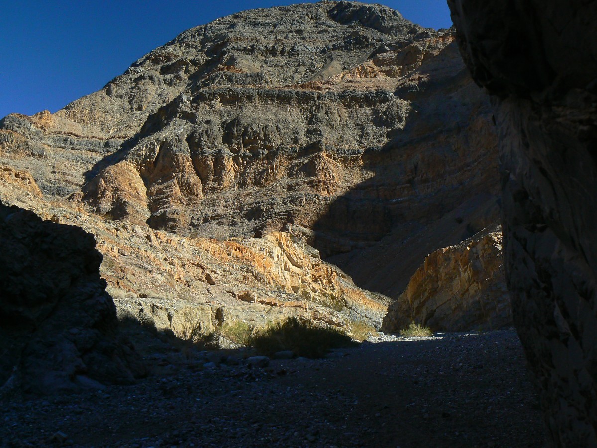
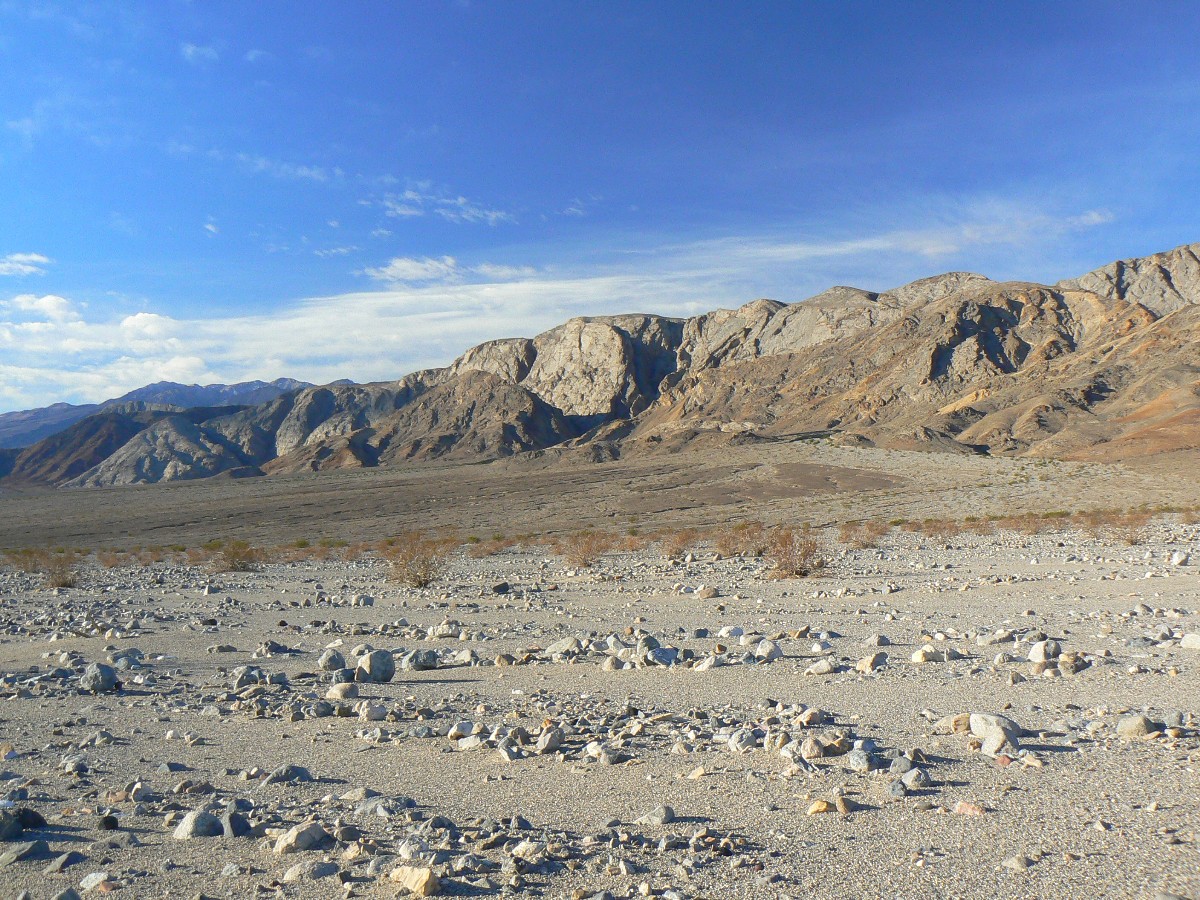
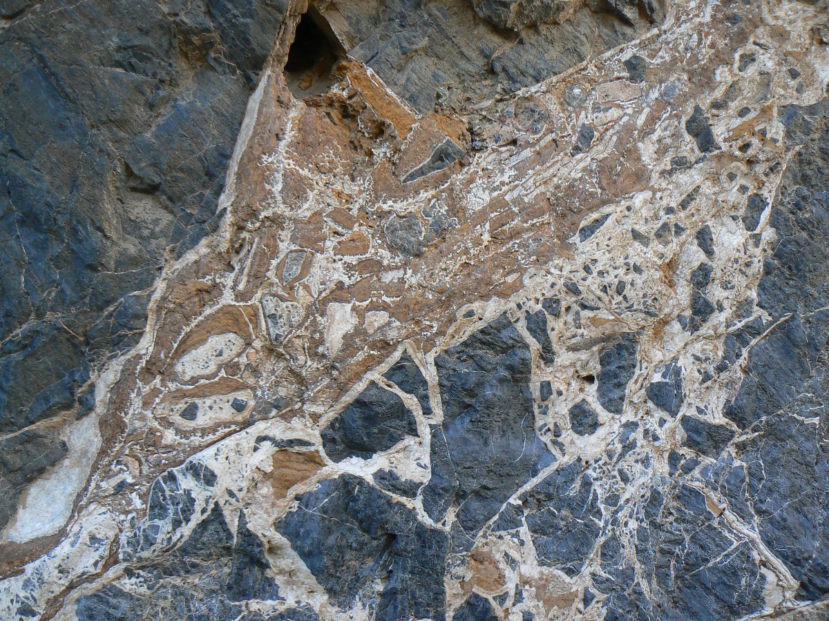
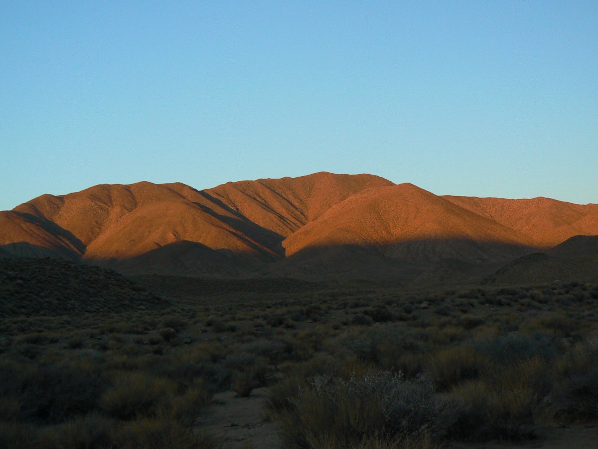
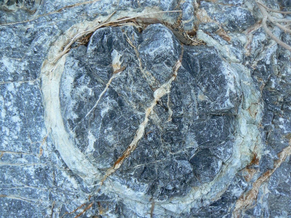
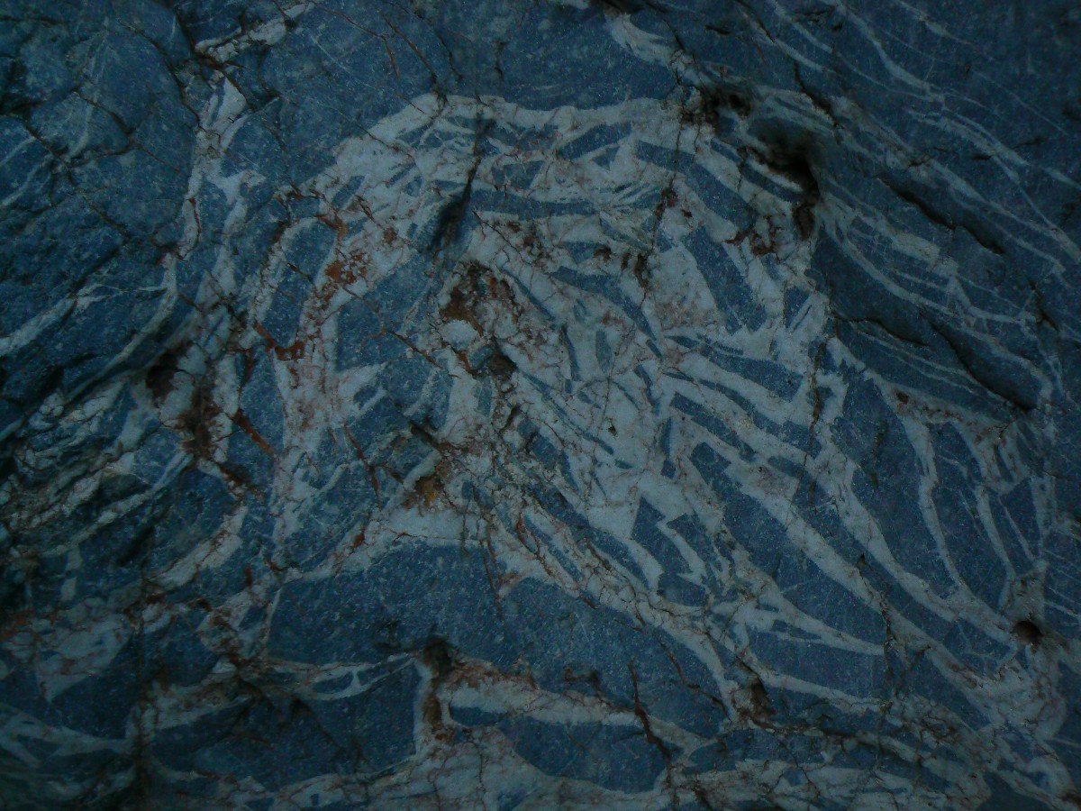
Today, the corrugated, striated hillsides look volcanic, then a
limestone-looking polished gray rock, and with touches of color perhaps due to ancient thermal action?
Road note - the sandy clog on the road to the TH is near the end
of the airport, just out of Stovepipe Wells. Roving dunes are shown on the map. So, if you make it
through the first 1/2 mile beyond the pavement, you'll probably have better conditions all the way
to the TH.
 |
 |
 |
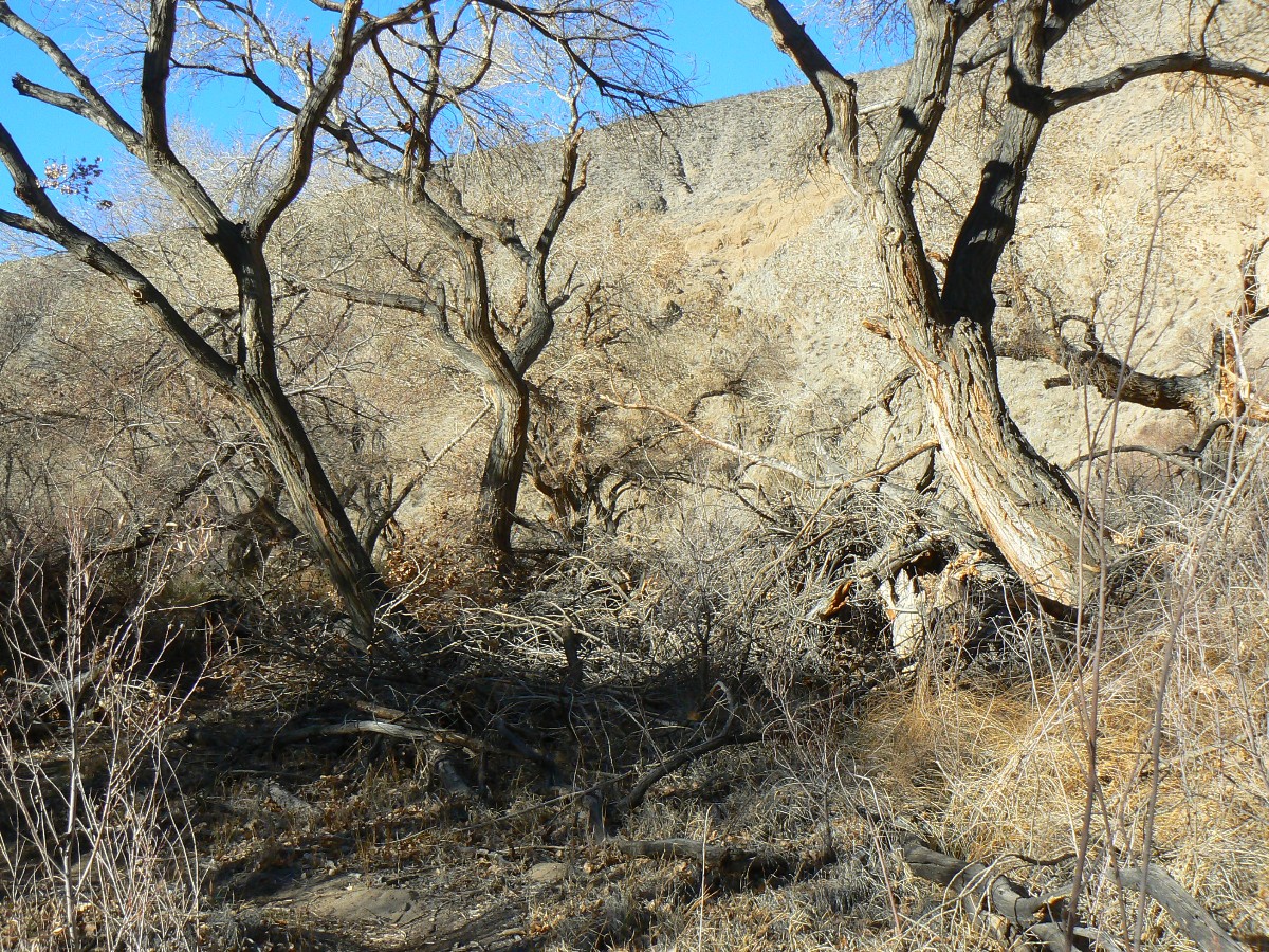
Day 2: Cold Cottonwood. To Cottonwood Spring. 4.2 miles; (14.5 miles total); ERM = 6.0. Camp at 3650'.
I've taken a wrong path and now backtrack to near the possible camp
and then back on the North side of the flow. The flow has created this thicket of Cottonwoods and
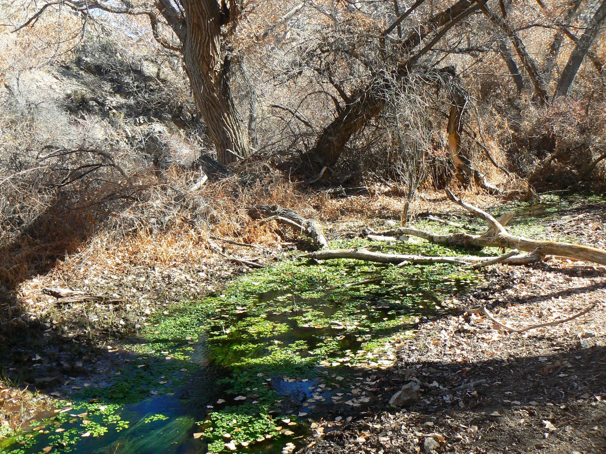
brush and a bit of a bog. Desert water! Bog in the desert?
From the possible camp to where water flows from Cottonwood Spring,
the route is on a dry bench, then crosses and finishes on the South side. A maze of routes tracked by
unshod ponies threads the brush above and into the spring. Icky. The piercing wind is still howling
and the next water is a long, indeterminate distance, so I opt to find a camp. Above the spring, there
are several possibilities with some protection from the wind and also promise of warming morning sun.
Earlier today -- I'm up and on the trail wearing two shirts and a wind
breaker and an ear band and gloves - and wear all - all day. After perhaps 3/4 mile, I leave the Cottonwoods
behind and hike the scrubby open until the possible camp, seeing no one. From the possible camp, there's
water intermittently to Cottonwood Springs, which feeds this lush oasis.
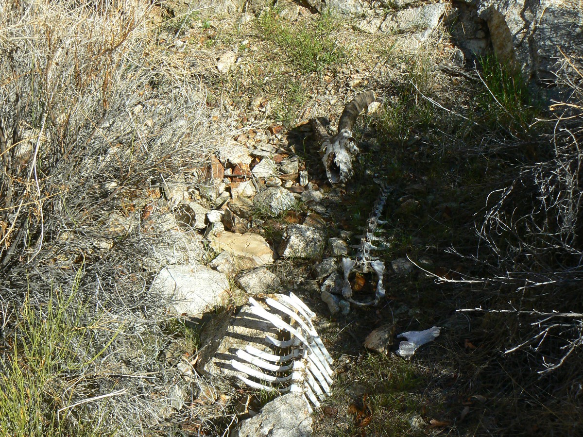
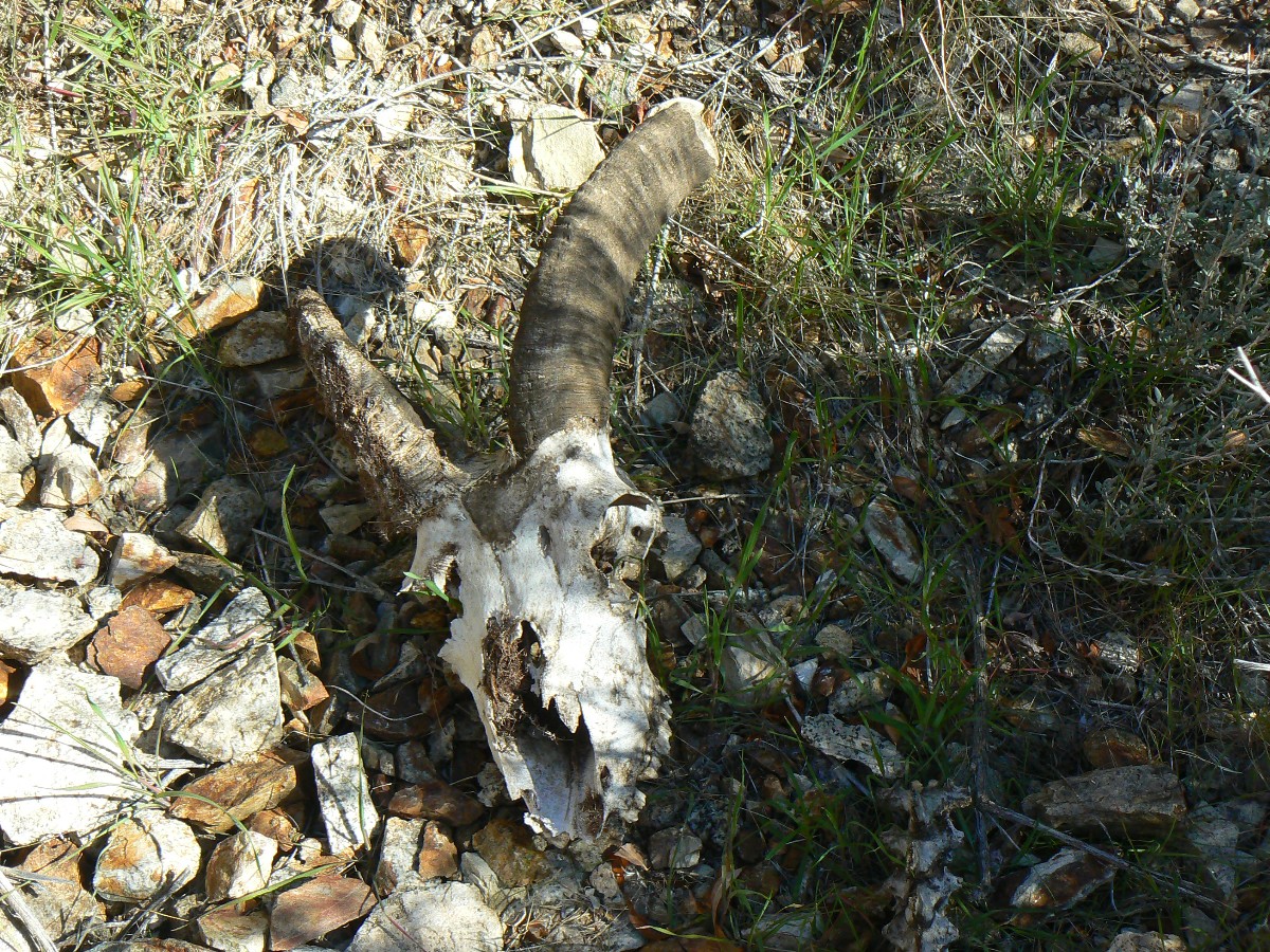
It's difficult to find a spring access not trampled by the wild horses
and burros. I find a good location where water burbles out of the ground - although I'm not naive enough
to think it is 'crystal pure spring water.' Time for a BBQ?
 |
 |
 |
 |
 |
 |
 |
 |
 |
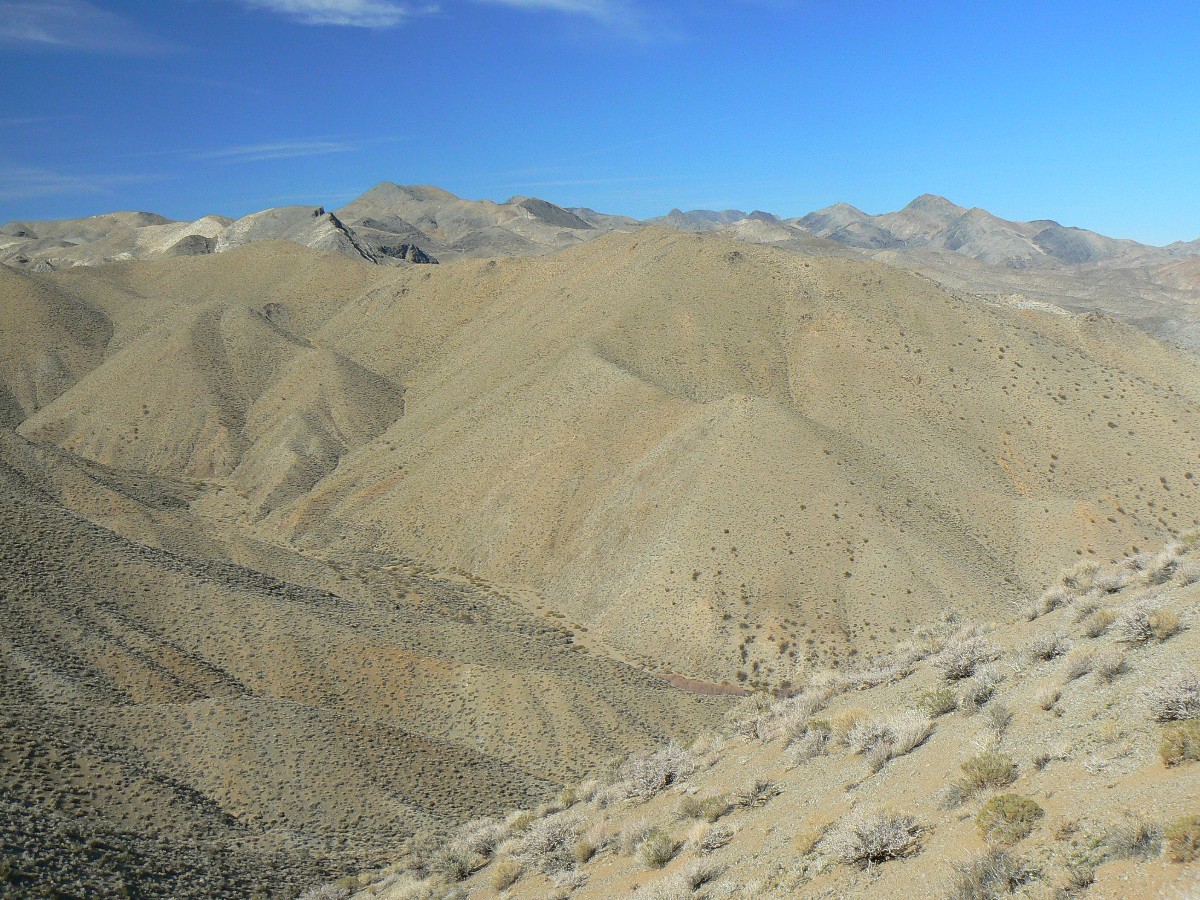
Day 3: Not Quite Dead Horse. To Dead Horse/Marble Junction. 7.9 miles (22.4 total miles);
ERM = 15; camp at 3170'.
Coyotes and owls sound the crepuscular alarm at camp 2. Good morning, frosty friends.
Plodding up to the low ridge from the dry spring across the divide
from the Cottonwood side, I muse about how easily I nearly took the "dangerous, warning" dry falls
route into the wrong drainage. That's where the footprints go, and it's easy to cruise along, deeper,
deeper. Wait? I backtrack and eat lunch and re-evaluate, orienting the topo and entering a waypoint
at the approximate coordinates to enter Dead Horse. "Ahh!" I mutter, the less than obvious route.
I gain the ridge and lilt along it to a view of Dead Horse Canyon, a
good 600' below, then drop off to the right, entering a more gentle drainage than that I was looking
into, and curving around the last bump on the ridge and back left into Dead Horse. Success. I search
for water in the brush and cattails - but don't find water until nearly a half mile down the canyon.
I get enough for the evening and tomorrow and continue down canyon.
When I reach what I believe to be the Dead Horse/Marble Canyon junction,
I consider going a bit farther, then decide to peek up Marble and the decision is made, this is camp 3.
This turns out to be the best camp in the area, considering water access (a third of a mile or so up canyon)
and good tent sites.
I start the day, at Cottonwood Spring, with a sol dance - attempting to
warm feet and fingers. One water bottle is frozen and I forgot to blow out the water in the hydration tube
last night - and it's frozen too. I snake the tube in my morning hot water batch, and soon all is well.
My hot water bottle, the one I enjoyed in my sleeping bag, however, is ready to go. Yesterday, I had
carefully looked for a camp area with some wind protection and an Easterly exposure. Yes! Sol.
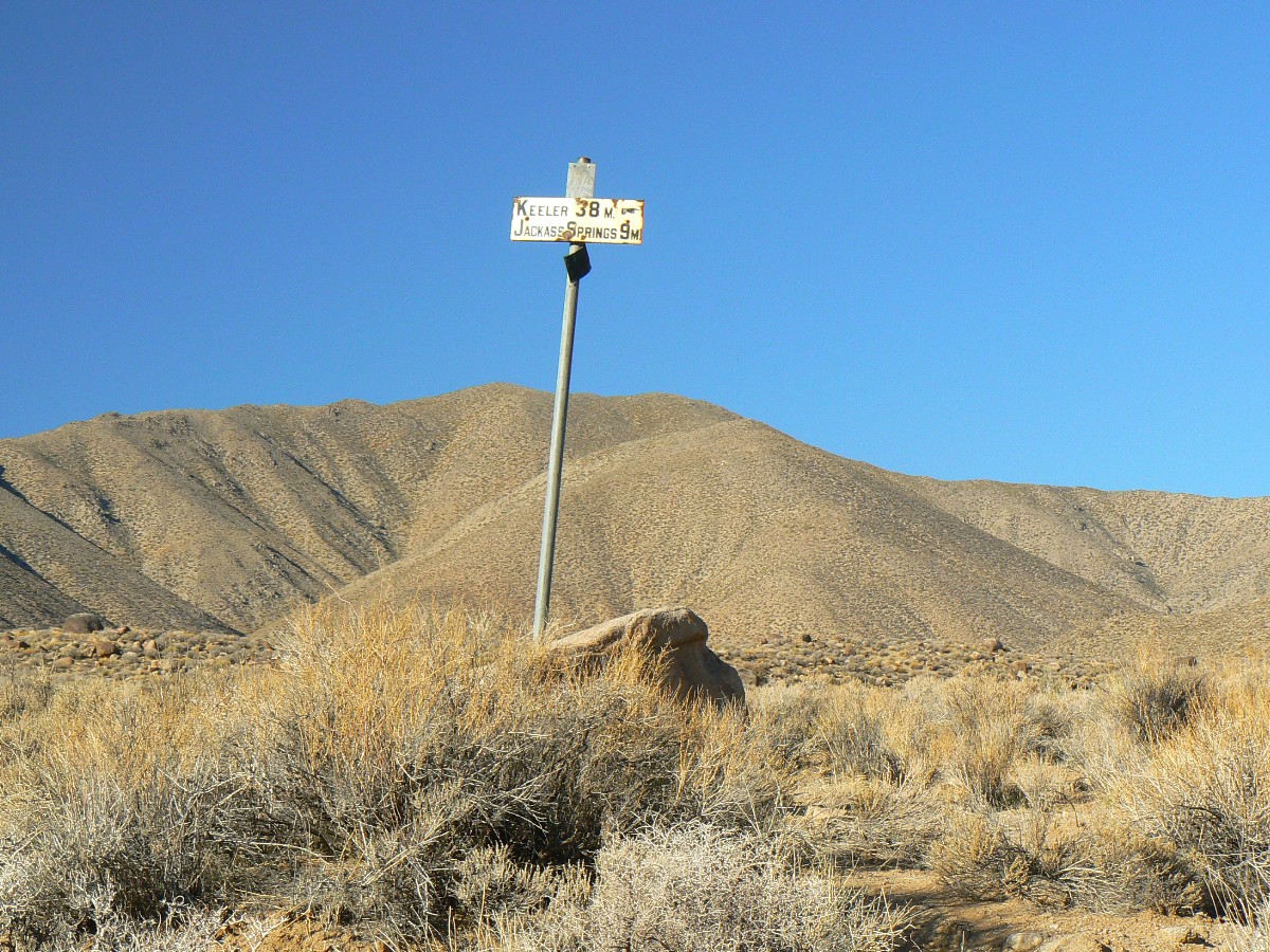
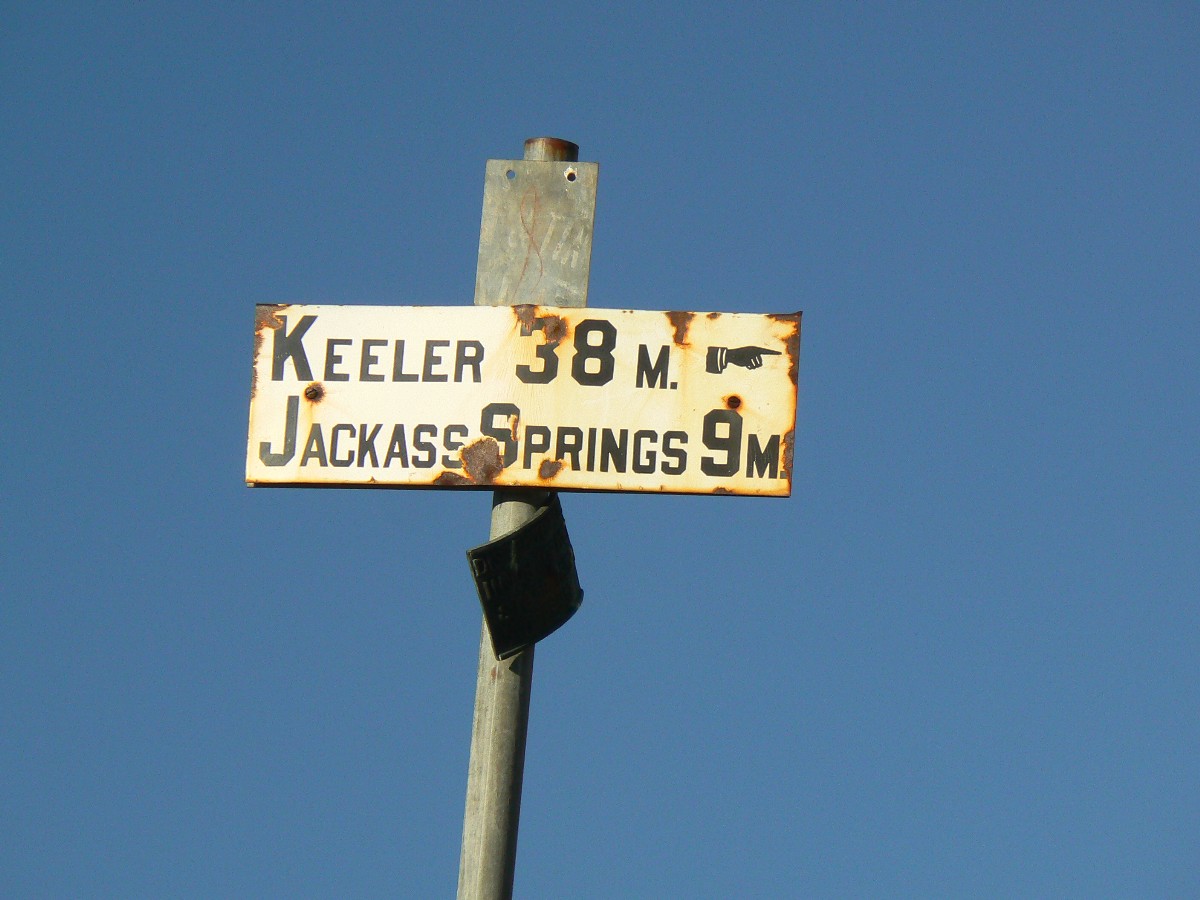
On the route up Cottonwood, I slog up the drainage, passing two curiously
out of place signs - Goldbelt? Keller? Farther along, I note a cairn, one of a very few and check the
route - Right turn (NE) to the pass (easy to miss), followed by a quick down hike from the pass to where
today's story began - near the dry spring.
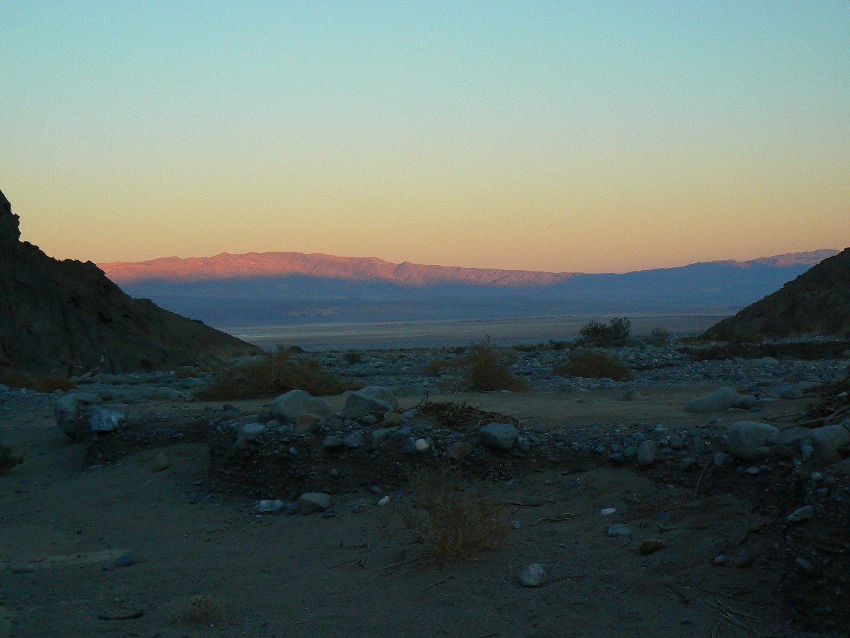
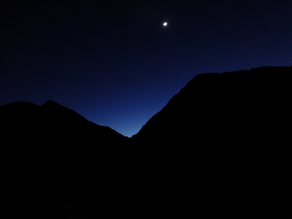
Now, it's past sunset and the glow is gone from the rocks. Tonight,
I've made two hot water bottles, yet it is much more pleasant than last night - no wind and a little
warmer. After finishing this entry, I'll listen to the podder for awhile. No people seen since part-way
up the Cottonwood entrance road.
 |
 |
 |
 |
 |
 |
 |
 |
 |
 |
 |
 |
 |
 |
 |
 |
 |
 |
 |
 |
 |
 |
 |
 |
Day 4: Narrowly Closing the Loop. Return to the TH. 10.3 miles (32.4 total miles);
ERM = 16; (ERM total = 51). Camp around 700'.
Wow, what a contrast! I'm sitting in shorts at the truck, warmed
through by old sol and enjoying peanuts and beer. Deluxe. I've basked in a sun shower and tinkered
with equipment and talked with Joe C. - the first person I've seen in 3 days. Joe is biking the track
to see if he will brave driving it with the Sprinter Van. Later, on the way out of the area, I spend
an enjoyable two hours chatting trips and such with Joe C. and Janet O., from the Corvalis, OR area.
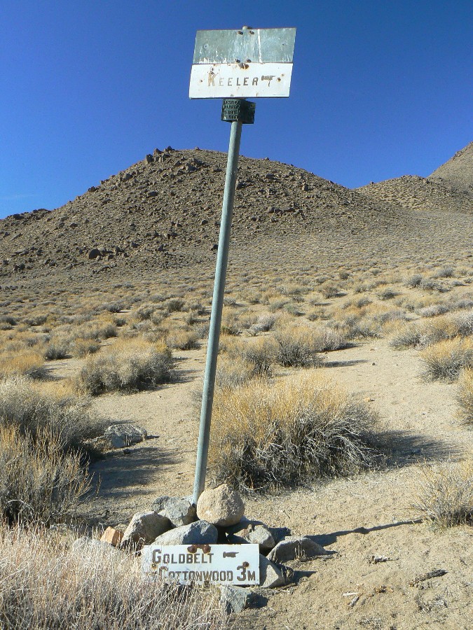
The day starts chilly at the Marble/Dead Horse junction. Crunching
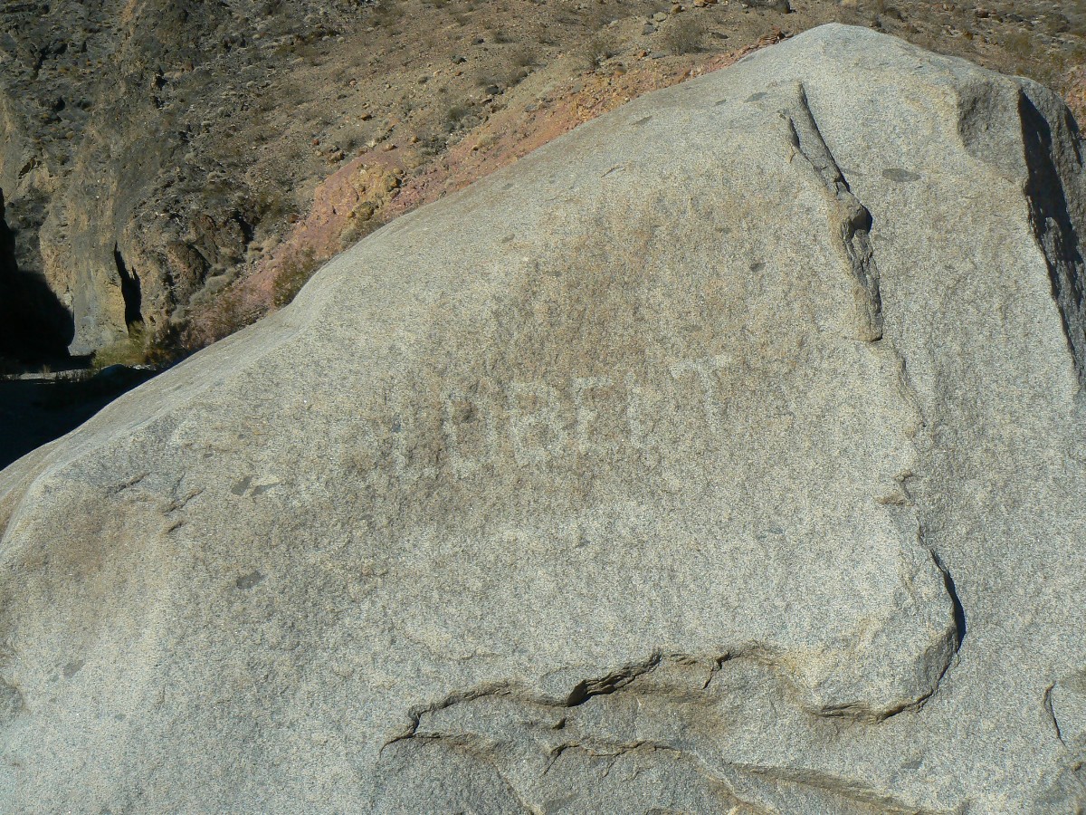
down canyon, I arrive at the Goldbelt sign (on a boulder) and consider looking up the side canyon for
the fabled nest of dragon's eggs (chert clumps?) and think about getting back to the truck in time to
enjoy the sun and say "maybe next time."
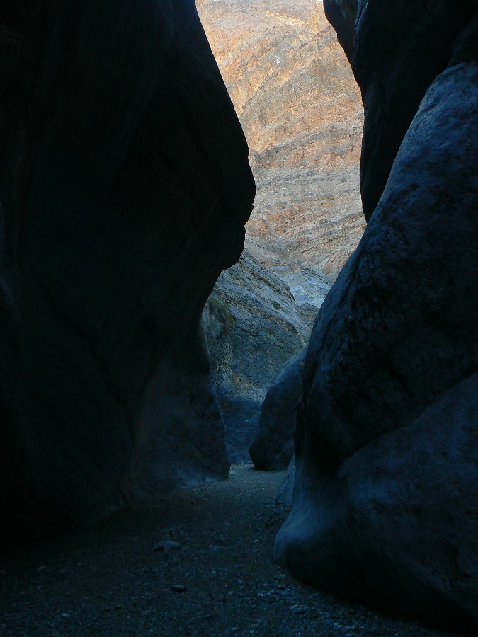
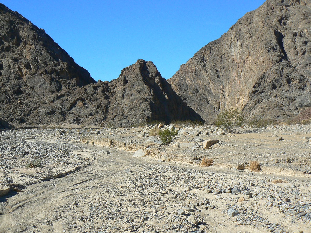
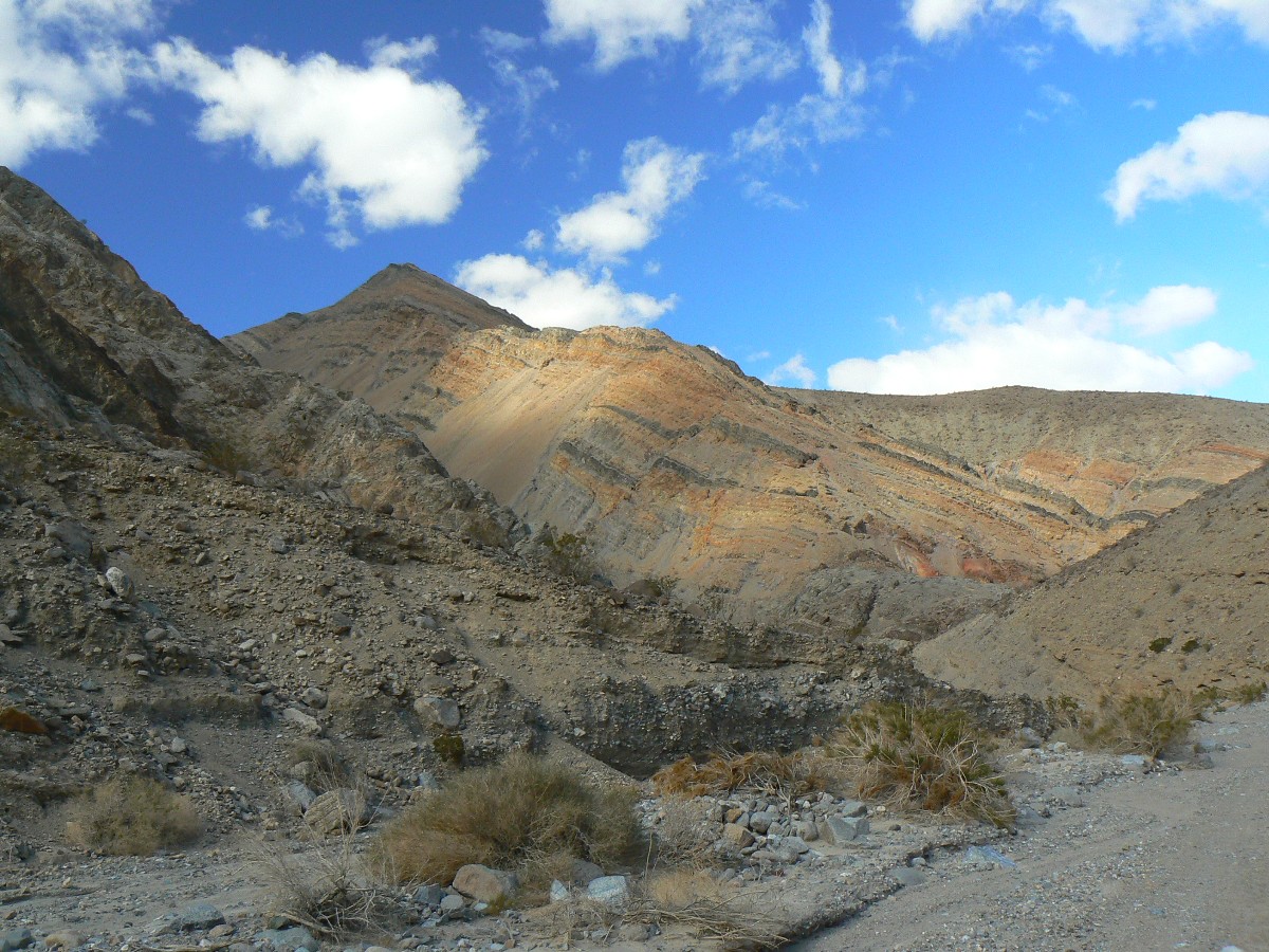
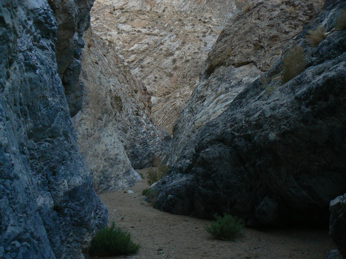
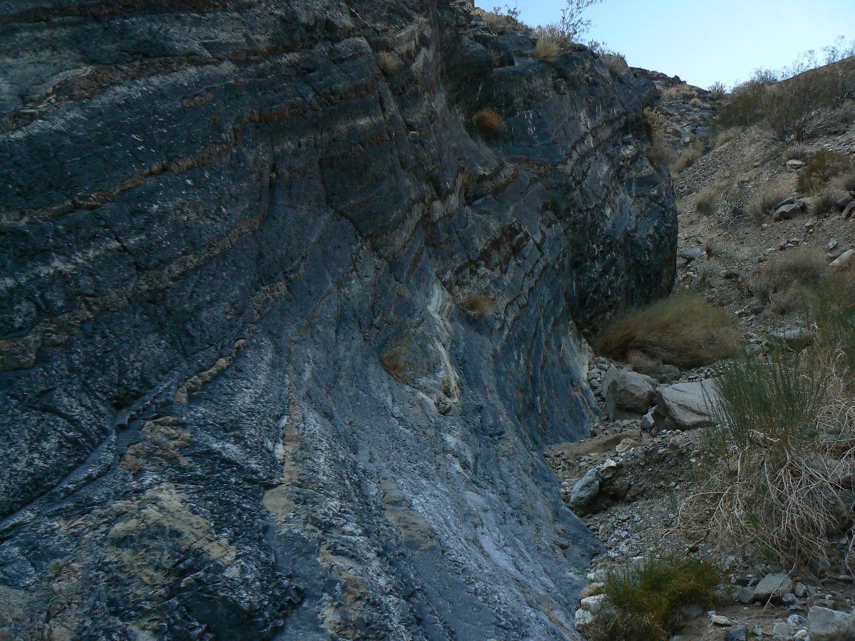
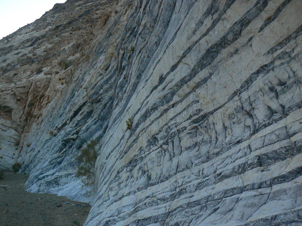
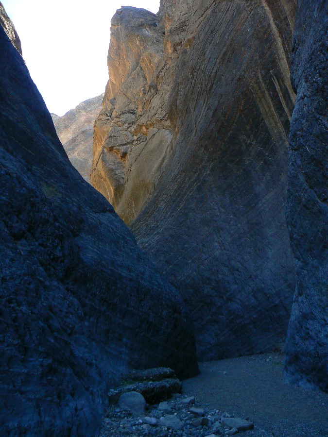
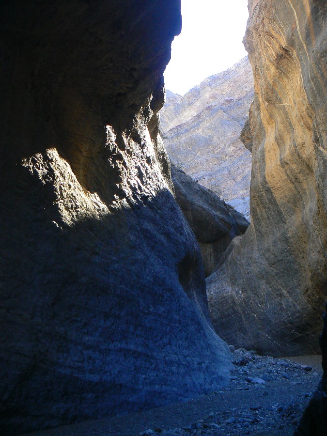
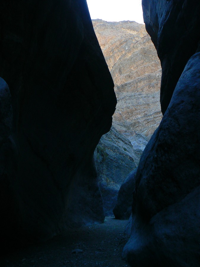
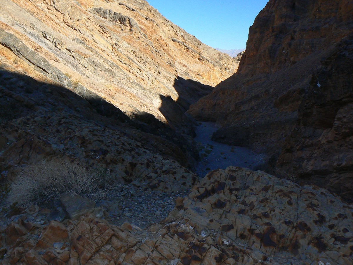
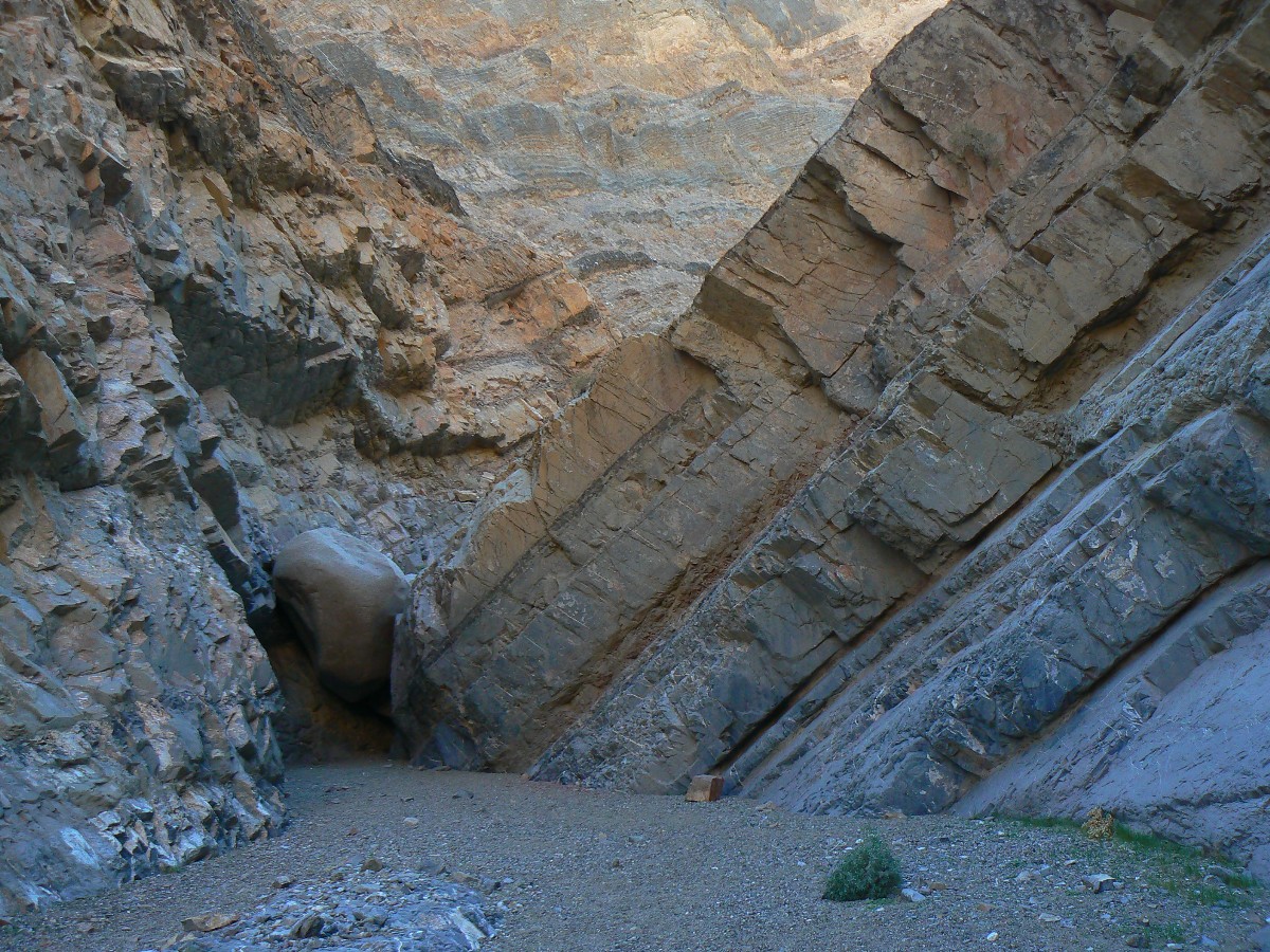
Lilting on down canyon, I'm sliding serpentine through polished
limestone narrows, convoluted wiggles through eons of rock. Narrowly. Next, some dramatically
corrugated country. Faulting abounds. Crunch, crunch. Then, the end of the jeep road, yet not,
of course, the walking. Quieter than the Grand Canyon, with its air tour terrorists, most of the
noise is crunching over colluvium, interspersed with jet noise. Natural quiet, and when you stop,
wondrous quiet. (I didn't encounter more than two jeepers on the access roads - these intrusive
quiet- and soil-busters can certainly change the aura of the land.)
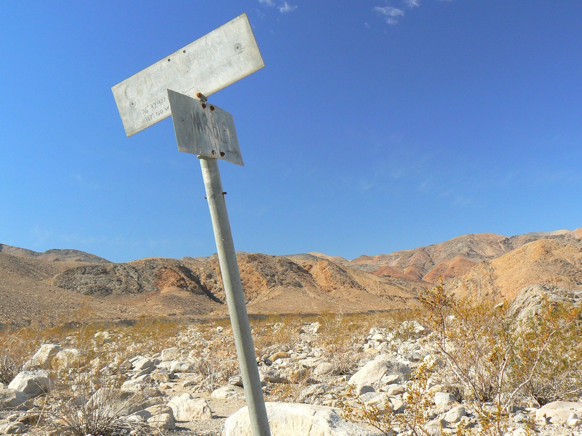
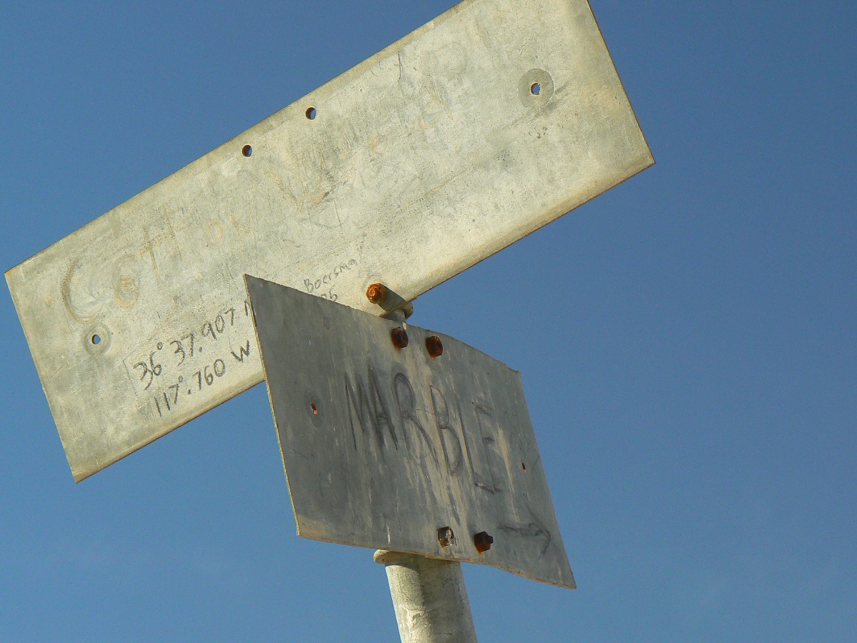
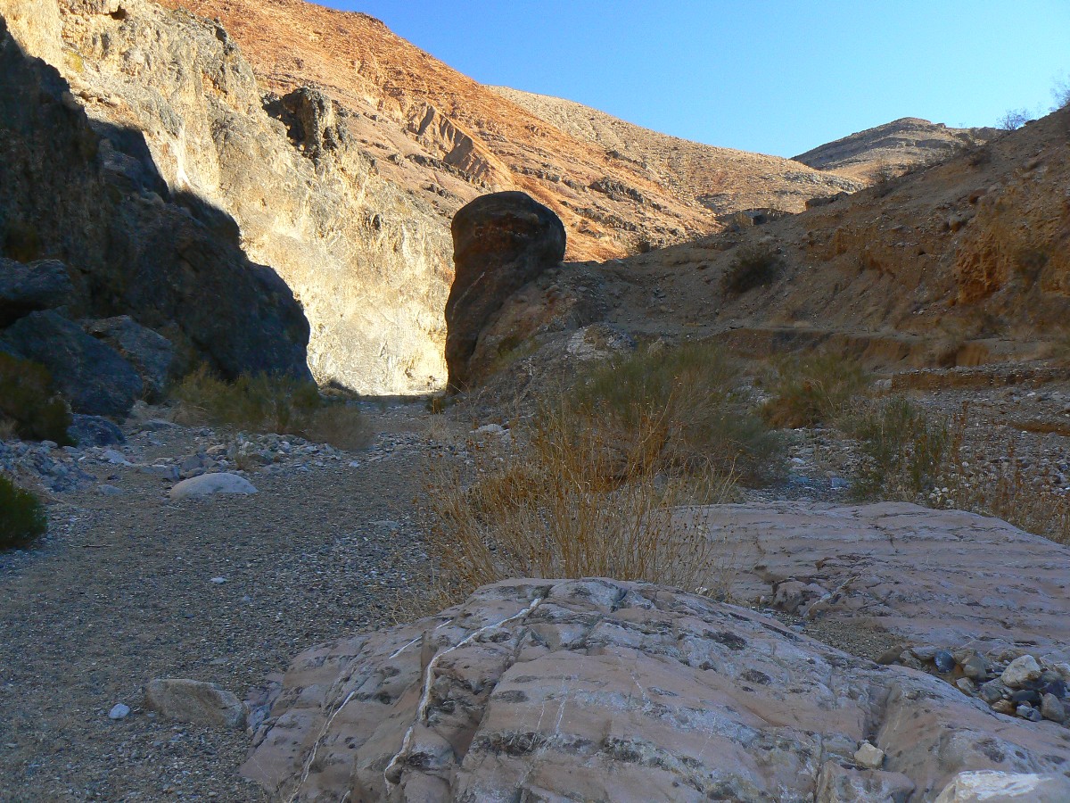
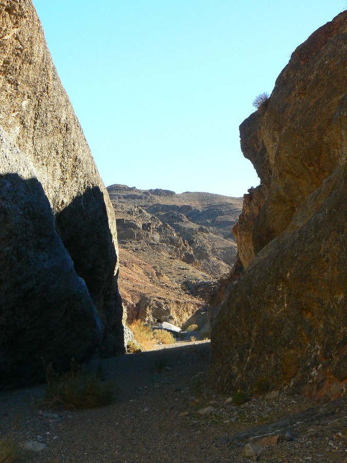
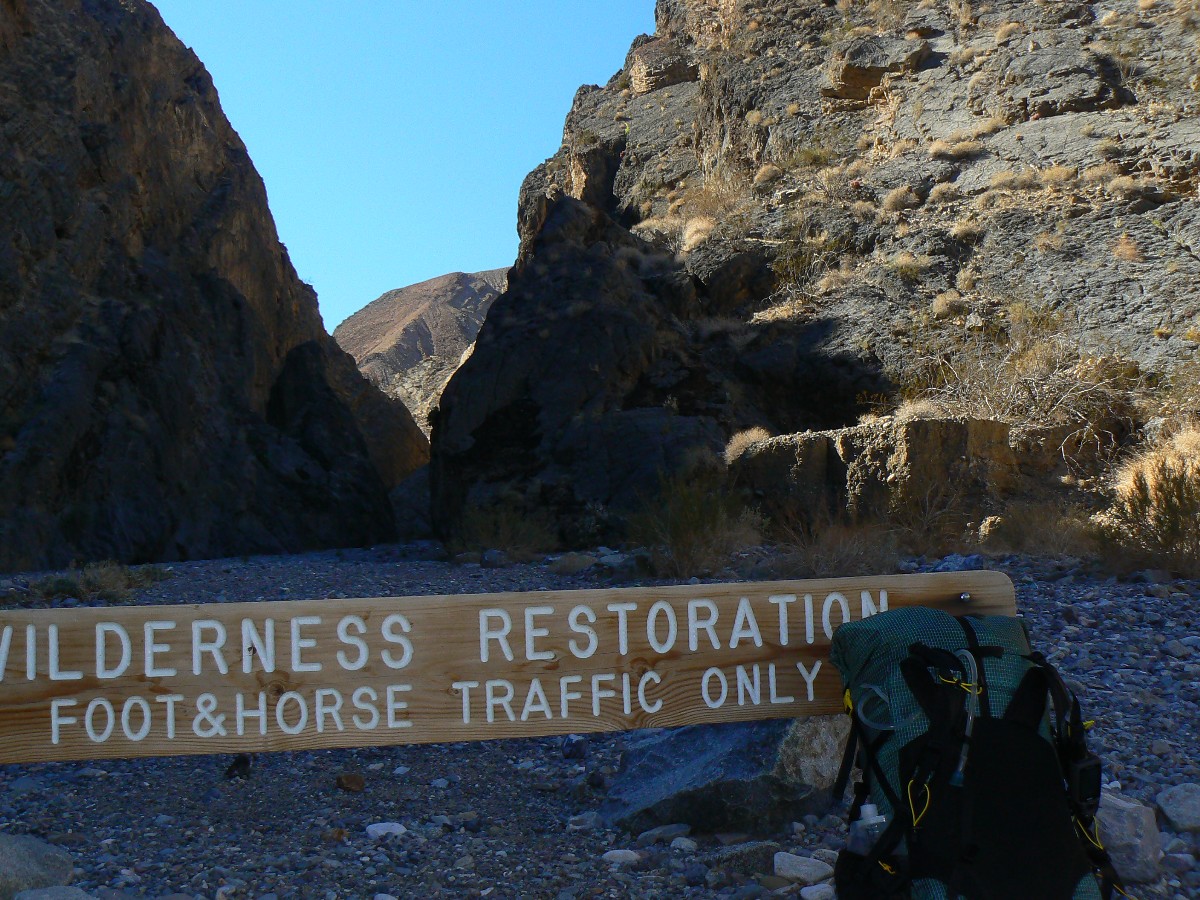
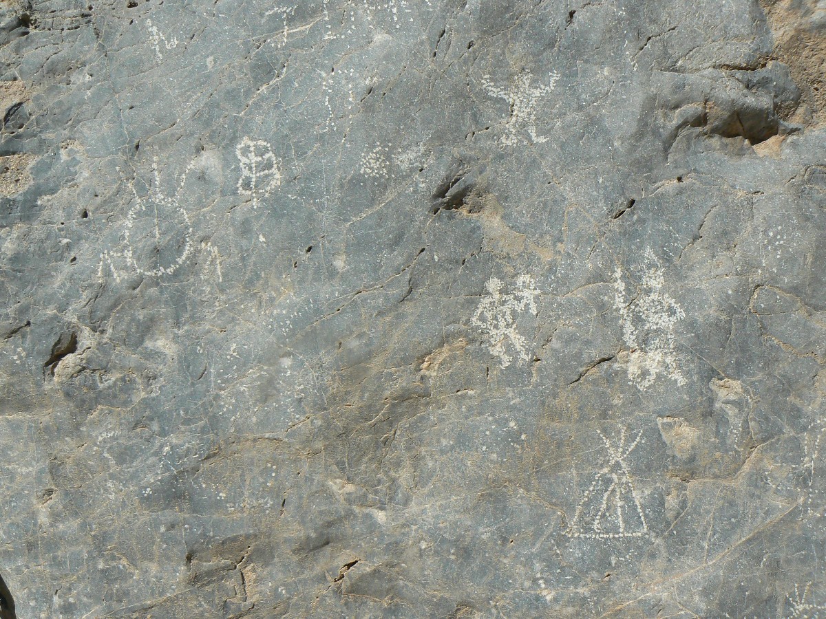
In another 2.5 miles, I close the loop at the strangely out of place
street sign and move into the first notch from the good road (last notch on return hike) and find
some petroglyphs there. Soon, the truck and a minutia of chores, dinner, and gazing as the light
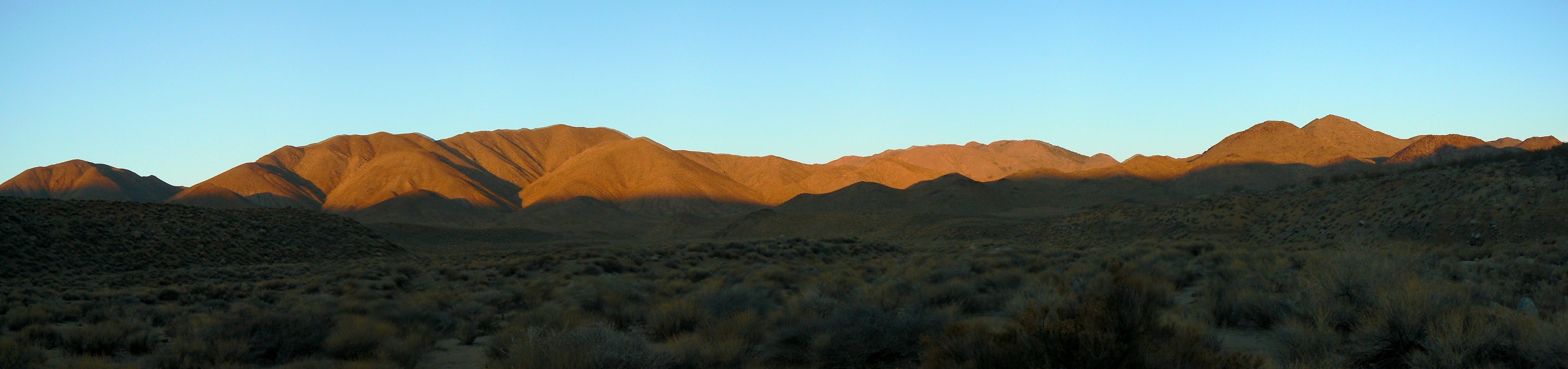
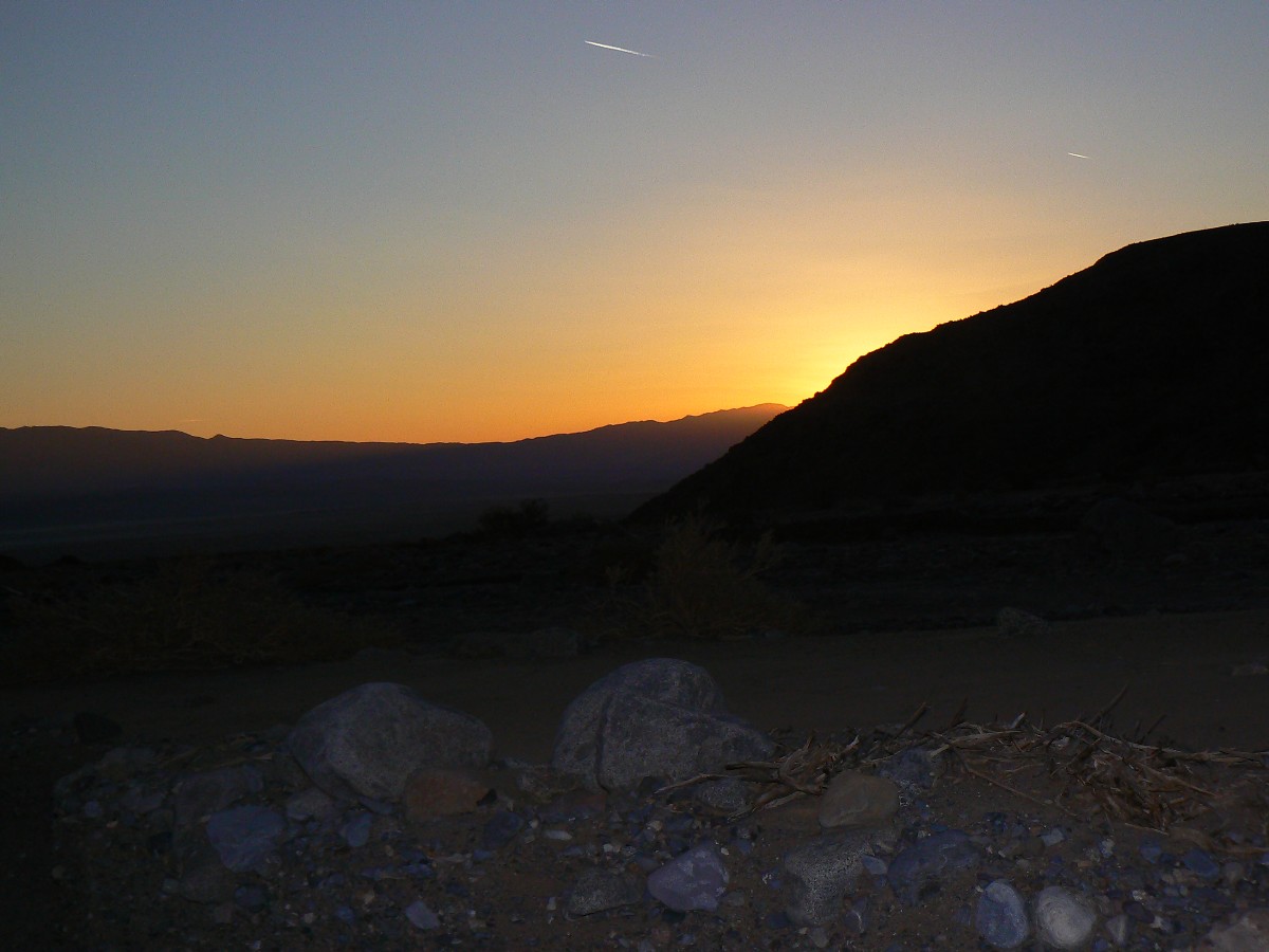
fades from the Amargosa Range across the flats below sea level.
| ||||
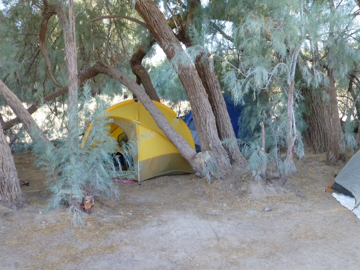
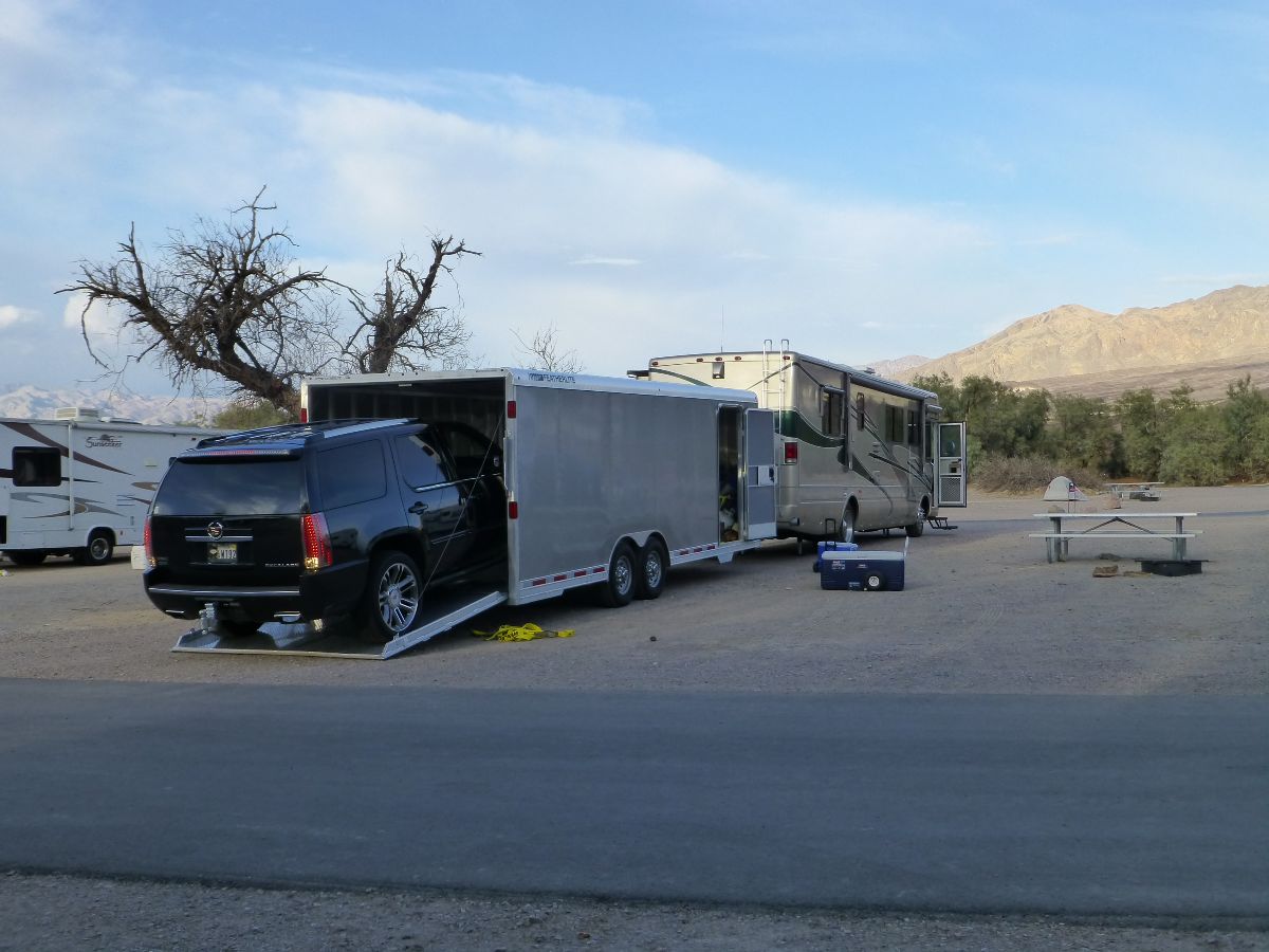
Prelim: From four layers of clothing to one, into shorts (briefly), I arrive at Death Valley (DV) and set-up the 30-year old VE-24 tent amidst the gnarled tamarisk trunks. Ahh. DV dreaming. It's good to see old friends, Dave, Rob, Cheryl, Kirk, Robert, others - and meet some new riders too.
 |
 |
 |
 |
 |
 |
 |
 |
 |
 |
 |
 |
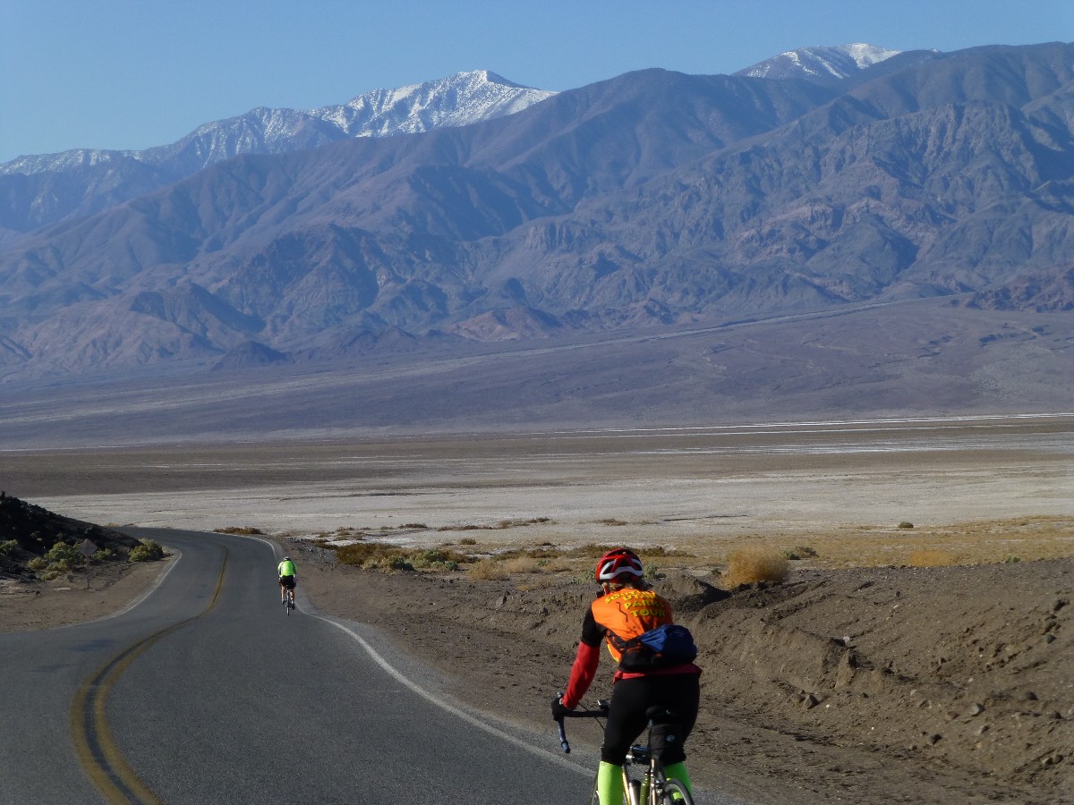
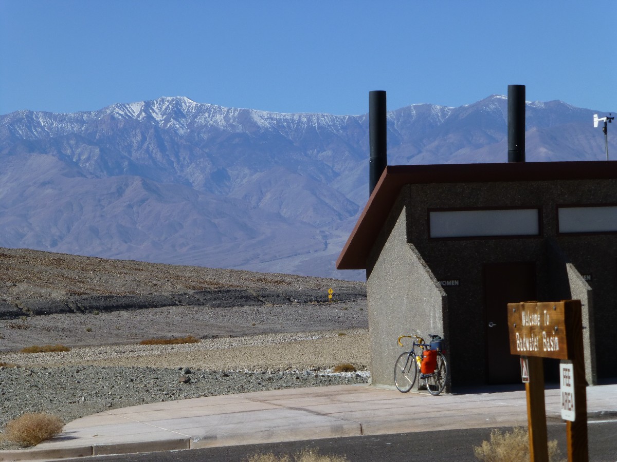
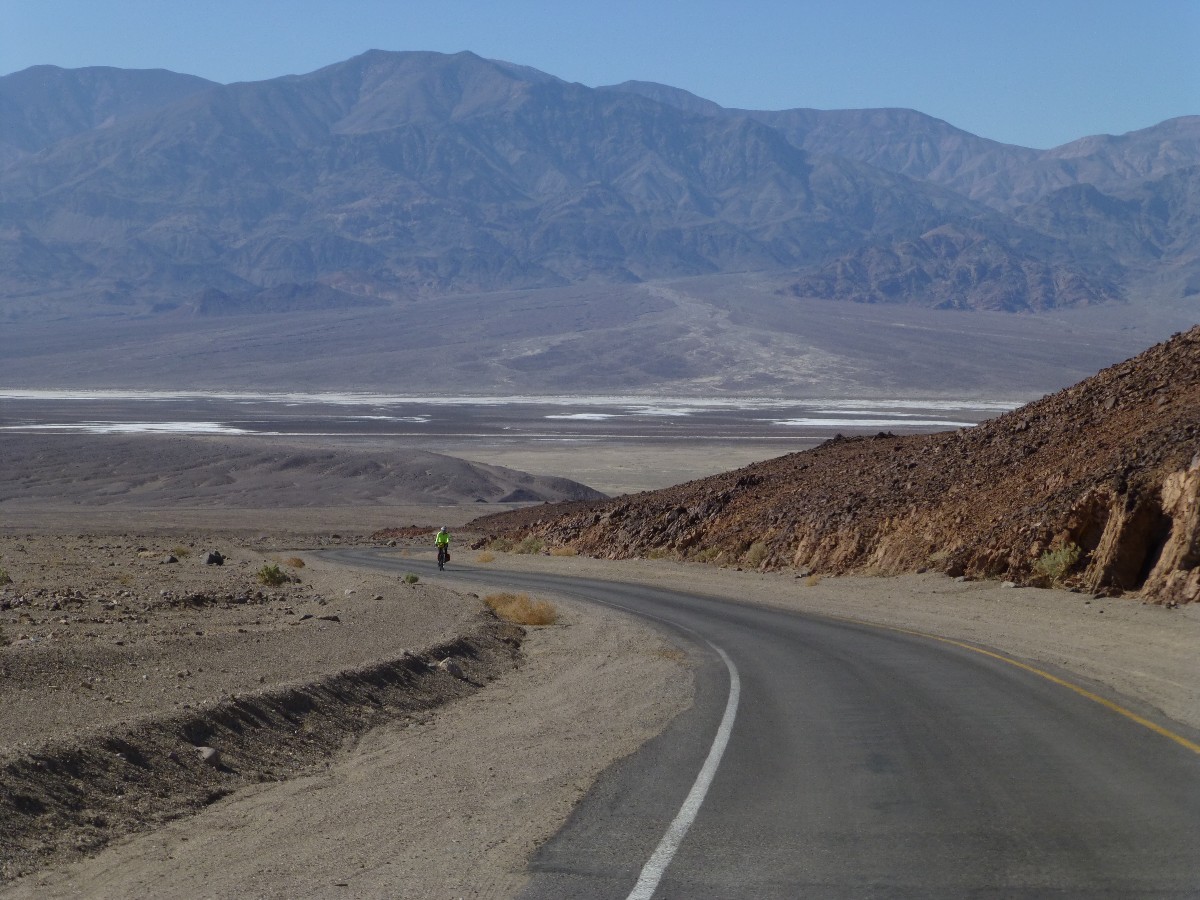
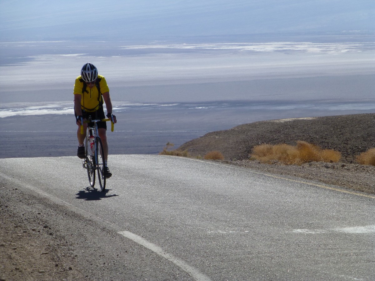
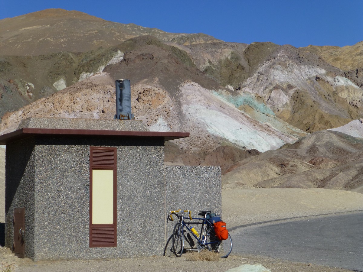
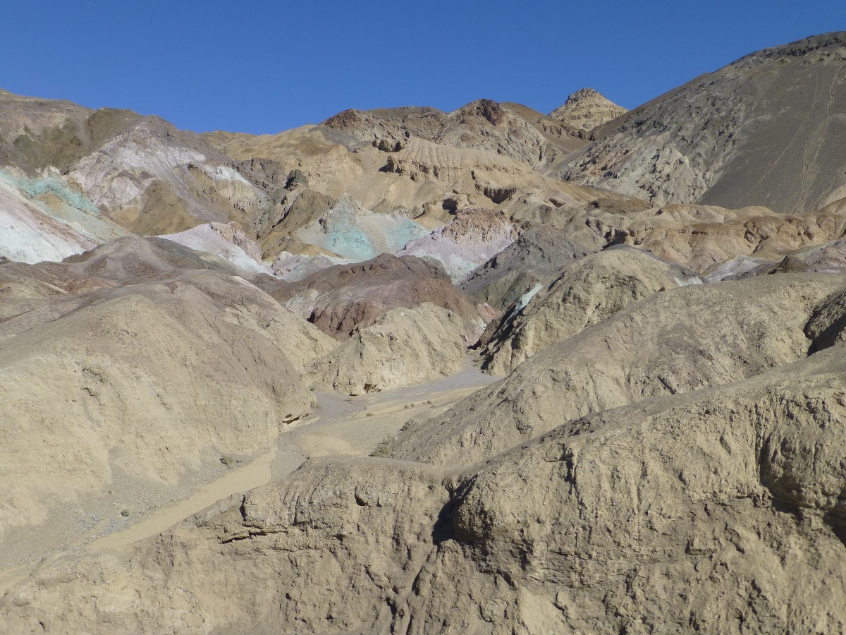
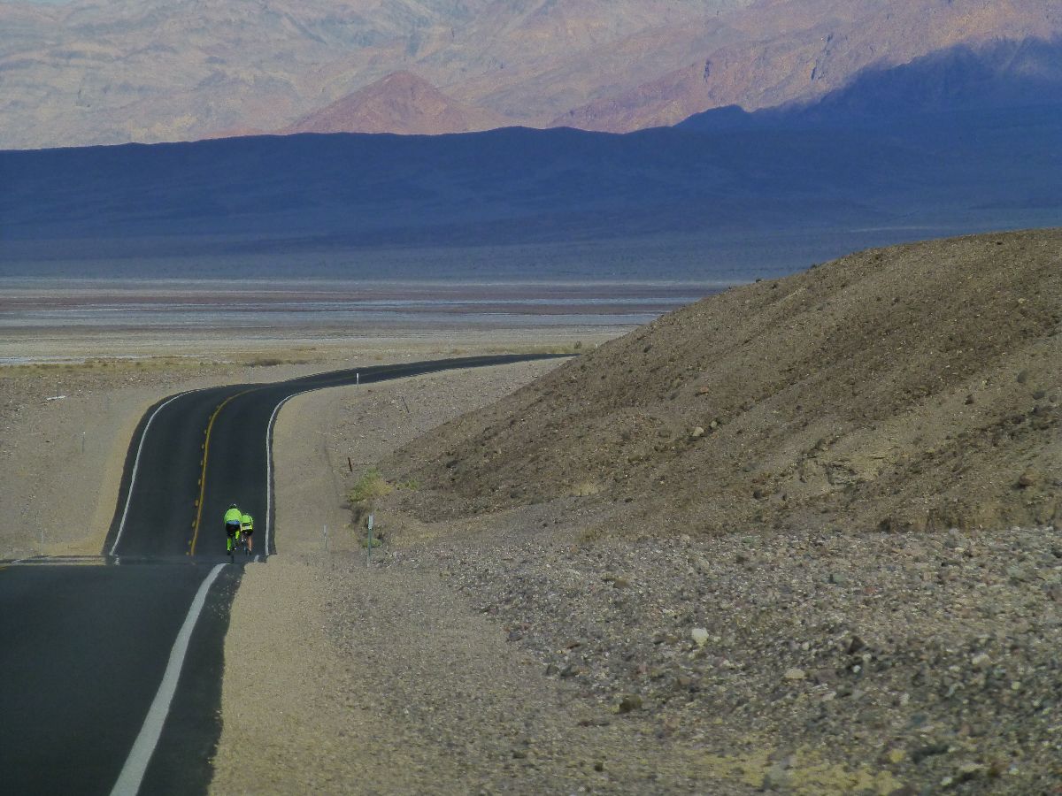
Day 1, Bike: Bad Water Coyotes. Bad Water and Artist Loop; 42 miles.
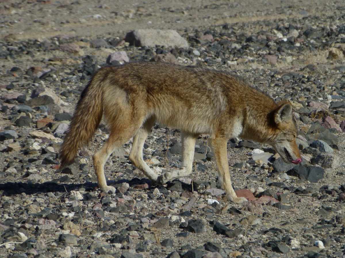
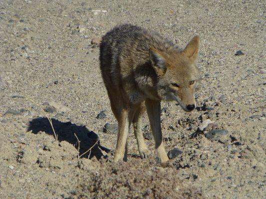
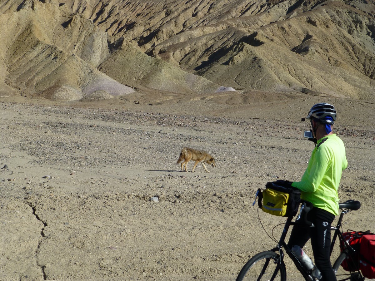
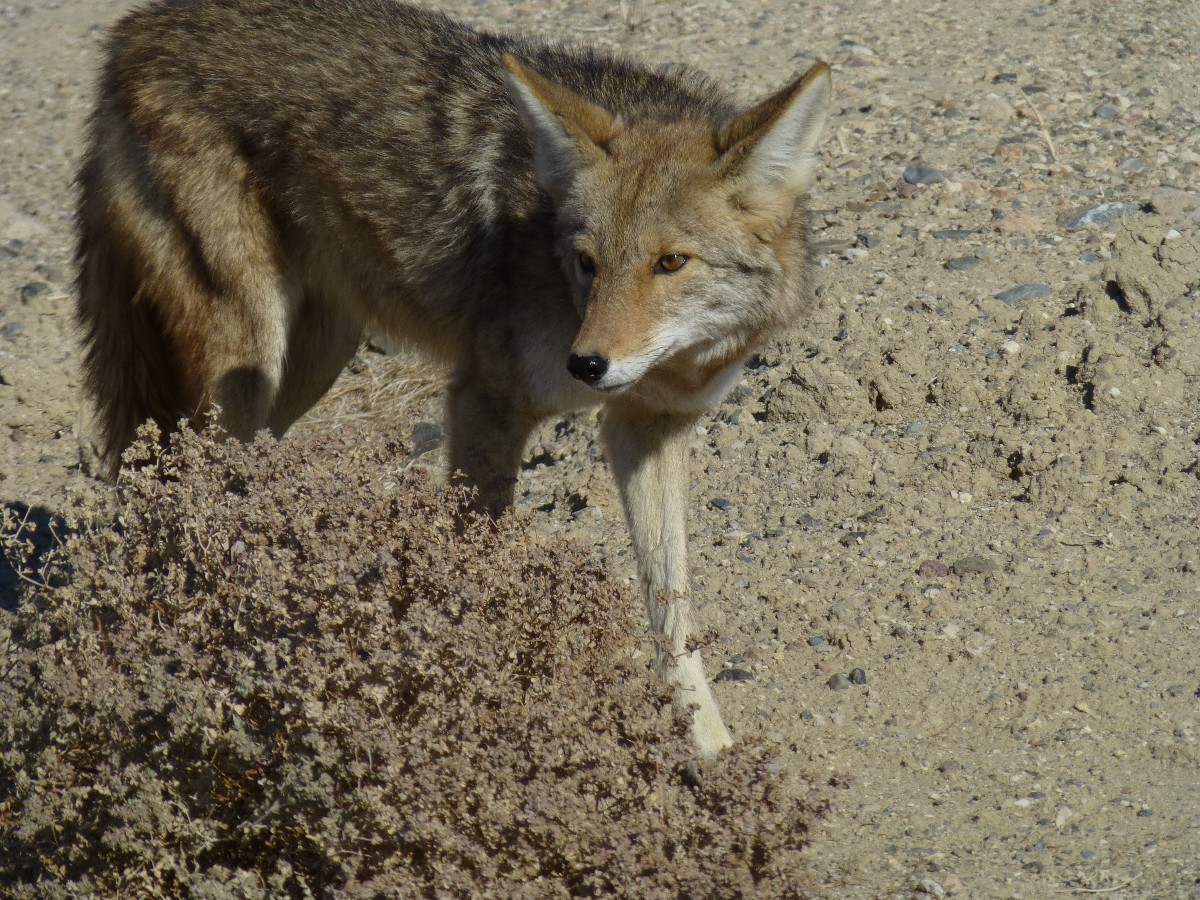
The Coyote duo skulks along the colluvial fan near Golden Canyon, their
tawny fur seems to glow in the low-angle light. They look a bit mangy too. Life in the desert is rough.
Today, we start off from the Furnace Creek CG (campground), riding
the rollers to well below sea level at Bad Water - about 18 miles out. Then, some of us branch off
to the grunt up to Artist Loop, where Rob P., Dave R., and I enjoy a leisurely lunch gazing at the
neoplolitan rock folds; followed by a dramatic drop back to the Bad Water Road and a sun shower in
camp, followed by Cheryl's chili, yum. A lovely day, about 75F.
![]() See the map of today's Bad Water and Artist Loop
ride at: (click here)
See the map of today's Bad Water and Artist Loop
ride at: (click here)
 |
 |
 |
 |
 |
 |
Day 2, Bike: Dante View of Rain. Furnace Creek CG toward Dante View; 40 miles.
The aroma of desert rain wafts past as Dave, Rod, and I pass the 20-mule
team entrance road. Grind, grinding up the steady slope laid on the vast colluvial drainage from the Armagosa
Divide to Furnace Creek. A patter of rain is soon with us, and cloud sheets roam the peaks surrounding DV,
appearing to deposit snow up high. It's quite cool as Dave and I rally in the lee of the breeze behind the
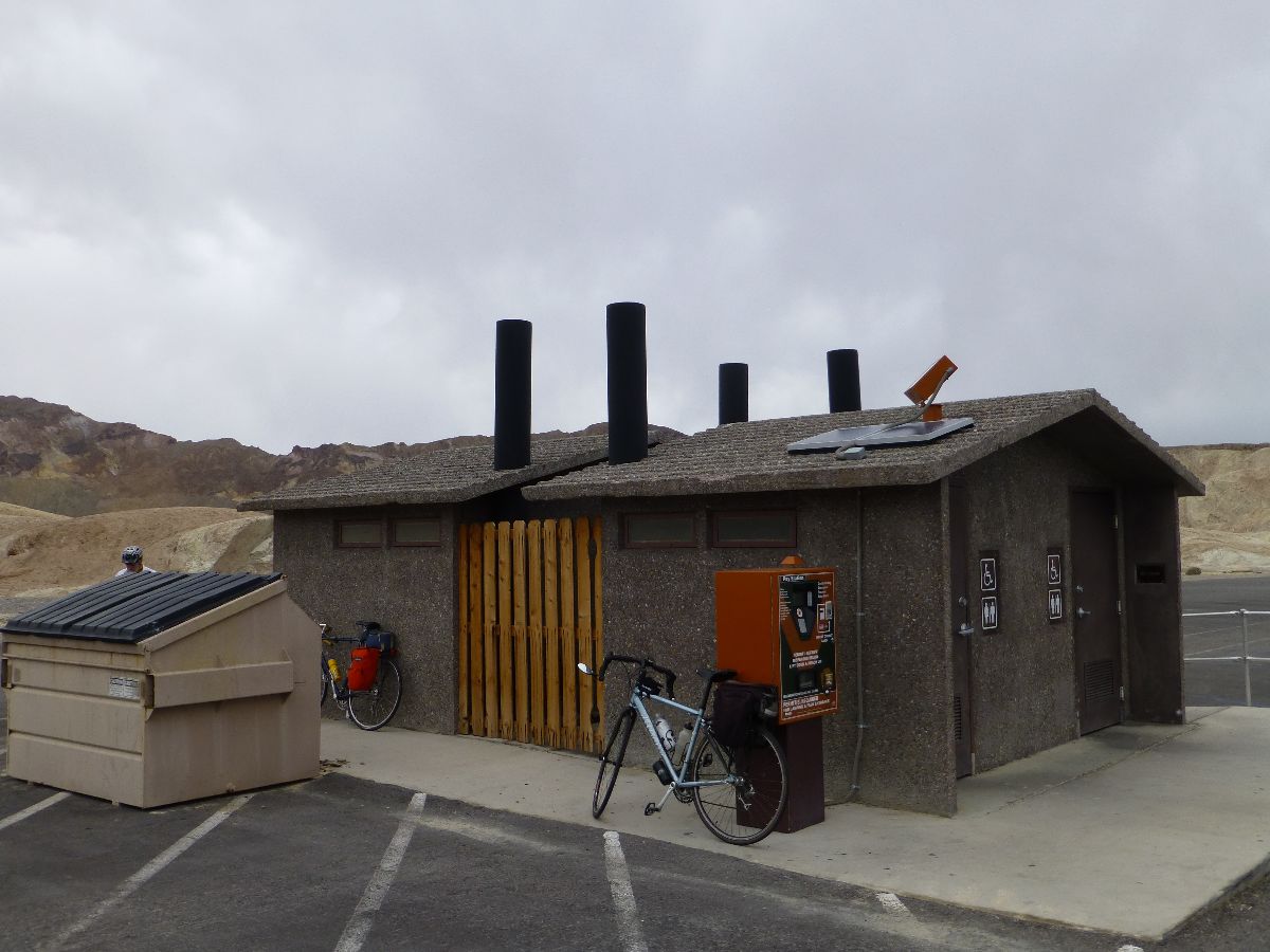
scenic toilet at the park boundary, after which we climb toward Dante's View to warm up.
Hypothermia averted, I turn around at the Green Water Valley area (about
mile 7.5 on the Dante Rd.) and zip back, pedaling into the cold breeze to the junction, where my face thaws
as the 30 MPH drop back to Furnace Creek soon delivers me below 1000', to sea level, and bit below sea level.
After a hasty shower and some snacks and soup, Dave has still not returned
and it's almost sunset. Rob P. and I drive to see where is Dave? All the way to Dante View. No Dave.
Dark now, we return to camp to discover we missed Dave as he cut through the village or the visitor center.
We're late, yet Cheryl has saved a good portion of Robert T.'s dutch oven chicken and potatoes, carrots,
and onions. Yum. A cool night slides in and we're thankful Dave is OK. A contrast of owls hooting and
RVs (gigantic carbon footprints) bellowing punctuates the night.
![]() Map -
A map of this GPS track/map of bicycling the Amargosa Crest can be seen below. Change the map type (topo, terrain, etc.) and alter the scale
as you wish. Click "bigger map" text below map if you want a larger map.
Map -
A map of this GPS track/map of bicycling the Amargosa Crest can be seen below. Change the map type (topo, terrain, etc.) and alter the scale
as you wish. Click "bigger map" text below map if you want a larger map.
Bicycling to Stovepipe Wells, Day 3 photos
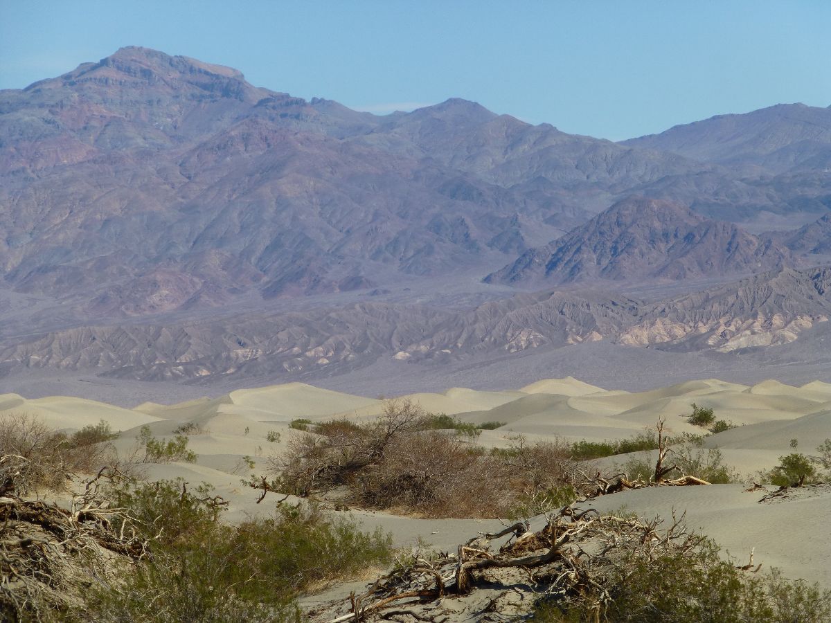
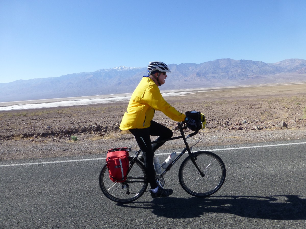
Day 3, Bike: Stove Top Stuffing. To Stovepipe Wells; 50 miles (132 miles total bicycling).
The cool breeze warms some as the scenic sand dunes toilet comes into view.
Through the Devil's Cornfield, beneath the corrugated mountains circling the DV bowl. With resurfaced road
from Furnace Creek almost to the Beatty junction, it's a lilt of a ride. Although not very warm, unless one
is stopped. Wind chill.
Back to the CG in time for a sun shower, repacking the backpack, and a quick
review of the new visitor center before dinner.
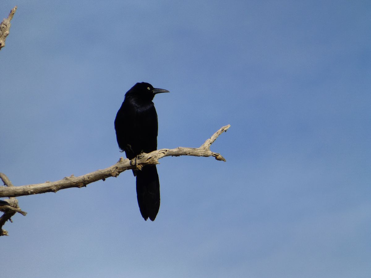
Ravens fluff and Grackles point bills at Jupiter, it's breeding time for
avians below sea level. And, it's time for switching from wheels to boots because, for me, tomorrow the
Cottonwood-Dead Horse-Marble backpack loop begins.
![]() See the map of today's Stove Pipe Well ride at: (click here)
See the map of today's Stove Pipe Well ride at: (click here)
| ||||
for a full-resolution map, click here. Caution - do not use this map or gps track for navigating the route.
![]() See the map of the Bad Water and Artist Loop
ride at: (click here)
See the map of the Bad Water and Artist Loop
ride at: (click here)
![]() See the map of the Armagosa Crest ride at: (click here)
See the map of the Armagosa Crest ride at: (click here)
![]() See the map of the Stove Pipe Well ride at: (click here)
See the map of the Stove Pipe Well ride at: (click here)
NPS description of the Cottwood-Marble Loop
Without Baggage map and description of Cottonwood-Marble Loop
Bird and Hike site description of Lower Marble Canyon and Side Canyon
Death Valley Dreaming: Biking and Hiking Death Valley - 2011
Death Valley Dreaming: Biking and Hiking Death Valley - 2012
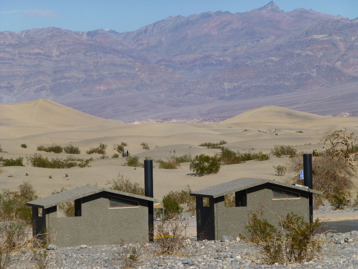
Scenic Toilets of Inner Earth.
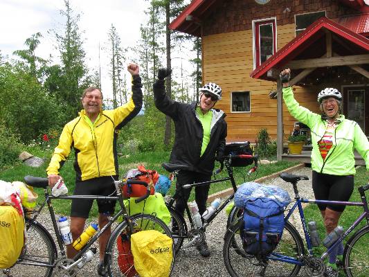
Click here or on the happy cyclists to go to all WV reports about Bicycle Touring
| ||||
More Truth Than Joke:
| ||||
| ||||
| ||||
| ||||
| ||||
 |
 |
 |
 |
 |
 |
 |
 |
 |
Link to below Onion article (click here).
Scientists: 'Look, One-Third Of The Human Race Has To Die For Civilization To Be Sustainable, So How Do We Want
To Do This?'
26 Jan. 2012 | ISSUE 48•04
Scientists say at least 2 billion dead bodies will be burned and converted into fossil
fuels.
WASHINGTON—Saying there's no way around it at this point, a coalition of scientists
announced Thursday that one-third of the world population must die to prevent wide-scale depletion of the planet's
resources—and that humankind needs to figure out immediately how it wants to go about killing off more than 2 billion
members of its species.
Representing multiple fields of study, including ecology, agriculture, biology,
and economics, the researchers told reporters that facts are facts: Humanity has far exceeded its sustainable
population size, so either one in three humans can choose how they want to die themselves, or there can be some
sort of government-mandated liquidation program—but either way, people have to start dying.
And soon, the scientists confirmed.
"I'm just going to level with you—the earth's carrying capacity will no longer
be able to keep up with population growth, and civilization will end unless large swaths of human beings are killed,
so the question is: How do we want to do this?" Cambridge University ecologist Dr. Edwin Peters said. "Do we want to
give everyone a number and implement a death lottery system? Incinerate the nation's children? Kill off an entire
race of people? Give everyone a shotgun and let them sort it out themselves?"
"Completely up to you," he added, explaining he and his colleagues were "open to
whatever." "Unfortunately, we are well past the point of controlling overpopulation through education, birth control,
and the empowerment of women. In fact, we should probably kill 300 million women right off the bat."
Because the world's population may double by the end of the century, an outcome
that would lead to a considerable decrease in the availability of food, land, and water, researchers said that,
bottom line, it would be helpful if a lot of people chose to die willingly, the advantage being that these volunteers
could decide for themselves whether they wished to die slowly, quickly, painfully, or peacefully.
Additionally, the scientists noted that in order to stop the destruction of global
environmental systems in heavily populated regions, there's no avoiding the reality that half the world's progeny will
have to be sterilized.
"The longer we wait, the higher the number of people who will have to die, so we
might as well just get it over with," said Dr. Chelsea Klepper, head of agricultural studies at Purdue University,
and the leading proponent of a worldwide death day in which 2.3 billion people would kill themselves en masse at the
exact same time. "At this point, it's merely a question of coordination. If we can get the populations of New York
City, Los Angeles, Beijing, India, Europe, and Latin America to voluntarily off themselves at 6 p.m. EST on June 1,
we can kill the people that need to be killed and the planet can finally start renewing its resources."
Thus far, humanity has been presented with a great variety of death options,
among them, poisoning the world's water supply with cadmium, picking one person per household to be killed in the
privacy of his or her home, mass beheadings, and gathering 2.3 billion people all in one place and obliterating
them with a single hydrogen bomb.
Sources confirmed that if a death solution is not in place by Mar. 31, the U.N.,
in the interest of preserving the human race, will mobilize its peacekeeping forces and gun down as many people as
necessary.
"I don't care how it happens, but a ton of Africans have to go, because by 2025,
there's no way that continent will be able to feed itself," said Dr. Henry Craig of the Population Research Institute.
"And by my estimation, three babies have to die for every septuagenarian, because their longer life expectancy means
babies have the potential to release far more greenhouse gases going forward."
While the majority of the world's populace reportedly understands this is the only
option left to save civilization, not all members of the human race are eager to die.
"I personally would rather live, but taking the long view, I can see how ensuring
the survival of humanity is best," said Norwich, CT resident and father of three Jason Atkins. "I guess if we were to
do it over again, it would make sense to do a better job conserving the earth's finite resources."
"Hopefully, the people who remain on the planet will use the mass slaughter of their
friends and loved ones as an incentive to be more responsible going forward," he added.
|
Wild Vagabond Main |
Trip Report Index  |
Caveat  |
|---|


