|
|---|
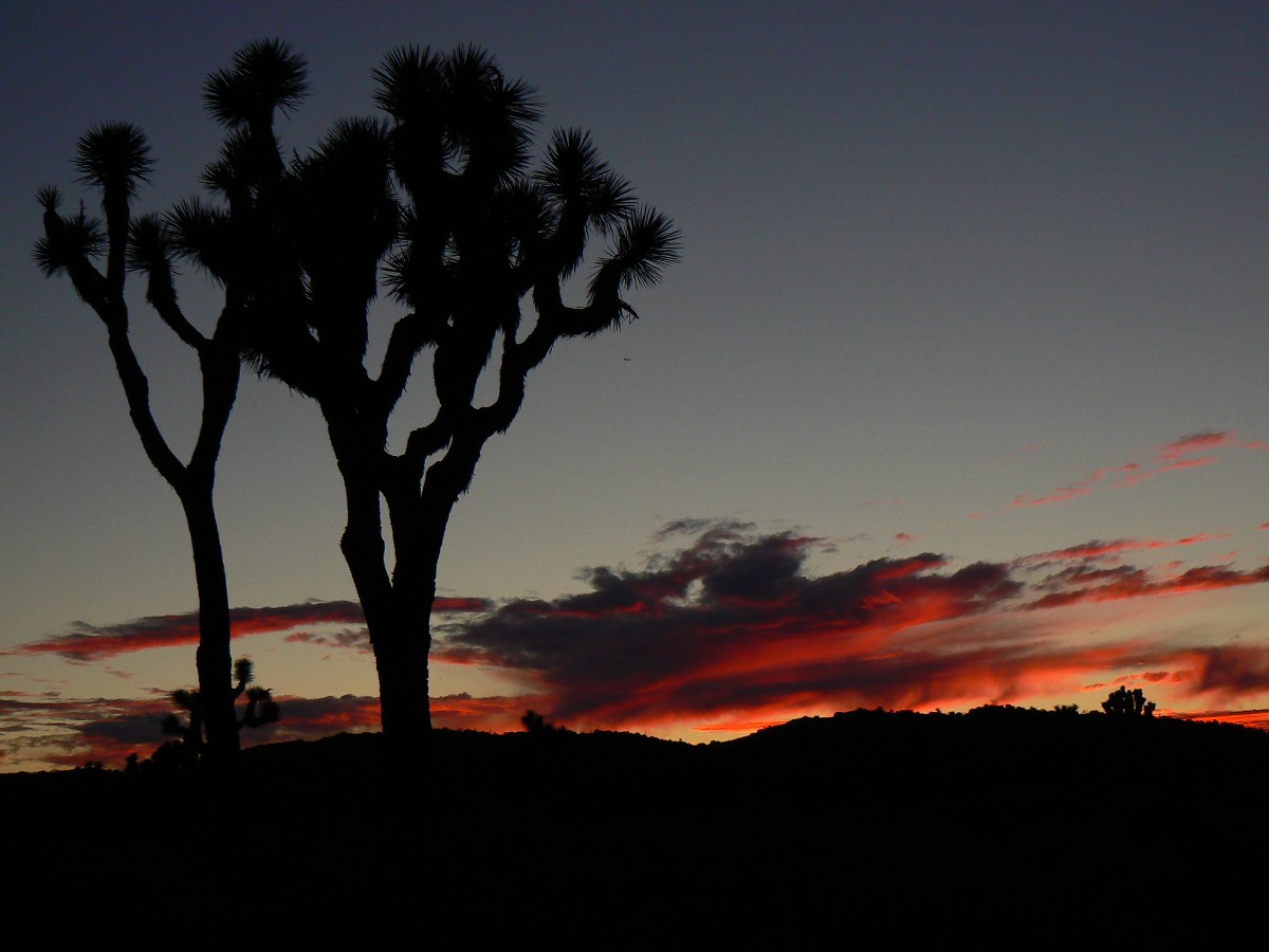
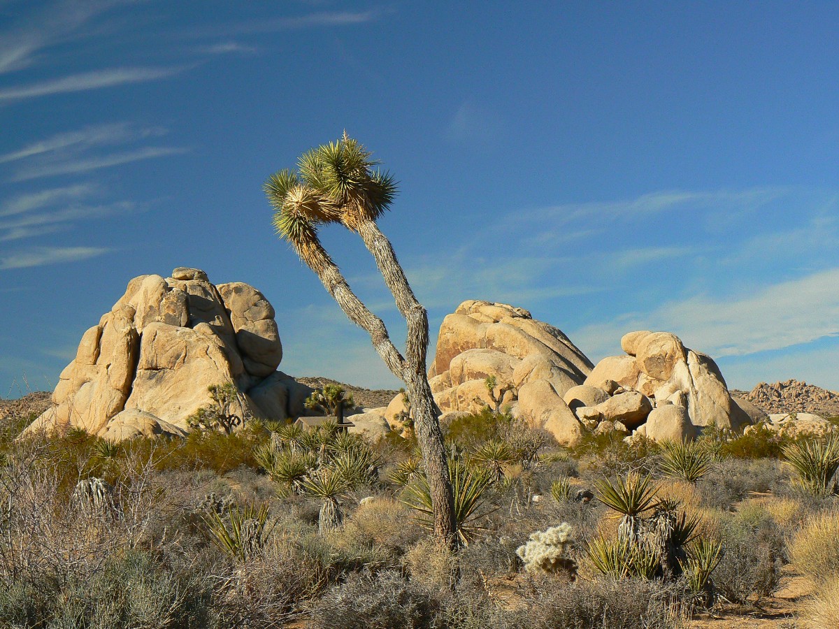
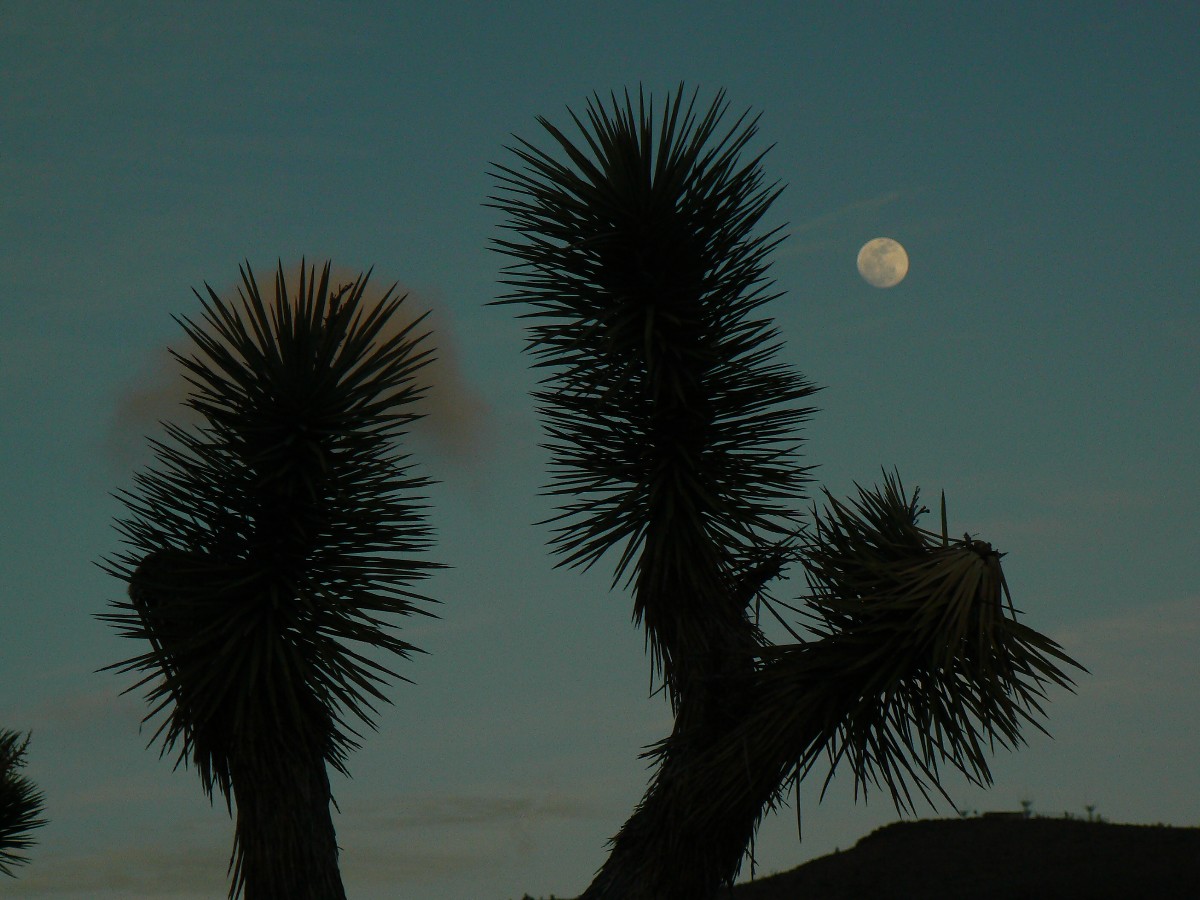
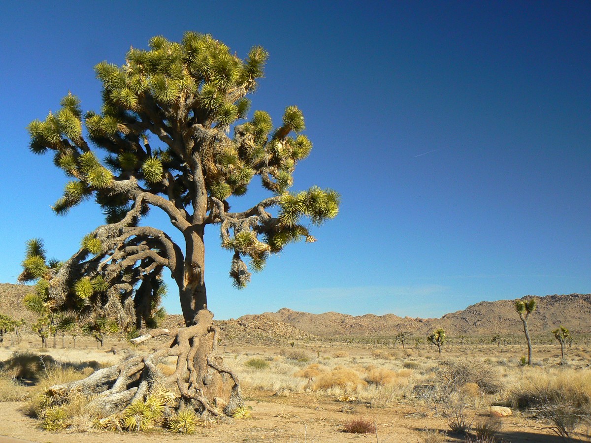
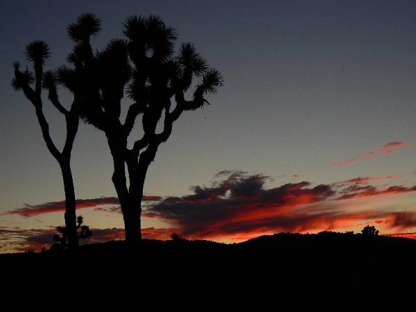
JT Sunset
(Click the image for a full-size view)
|
|---|
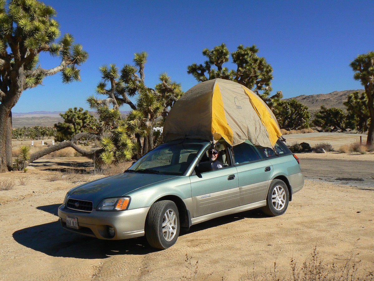
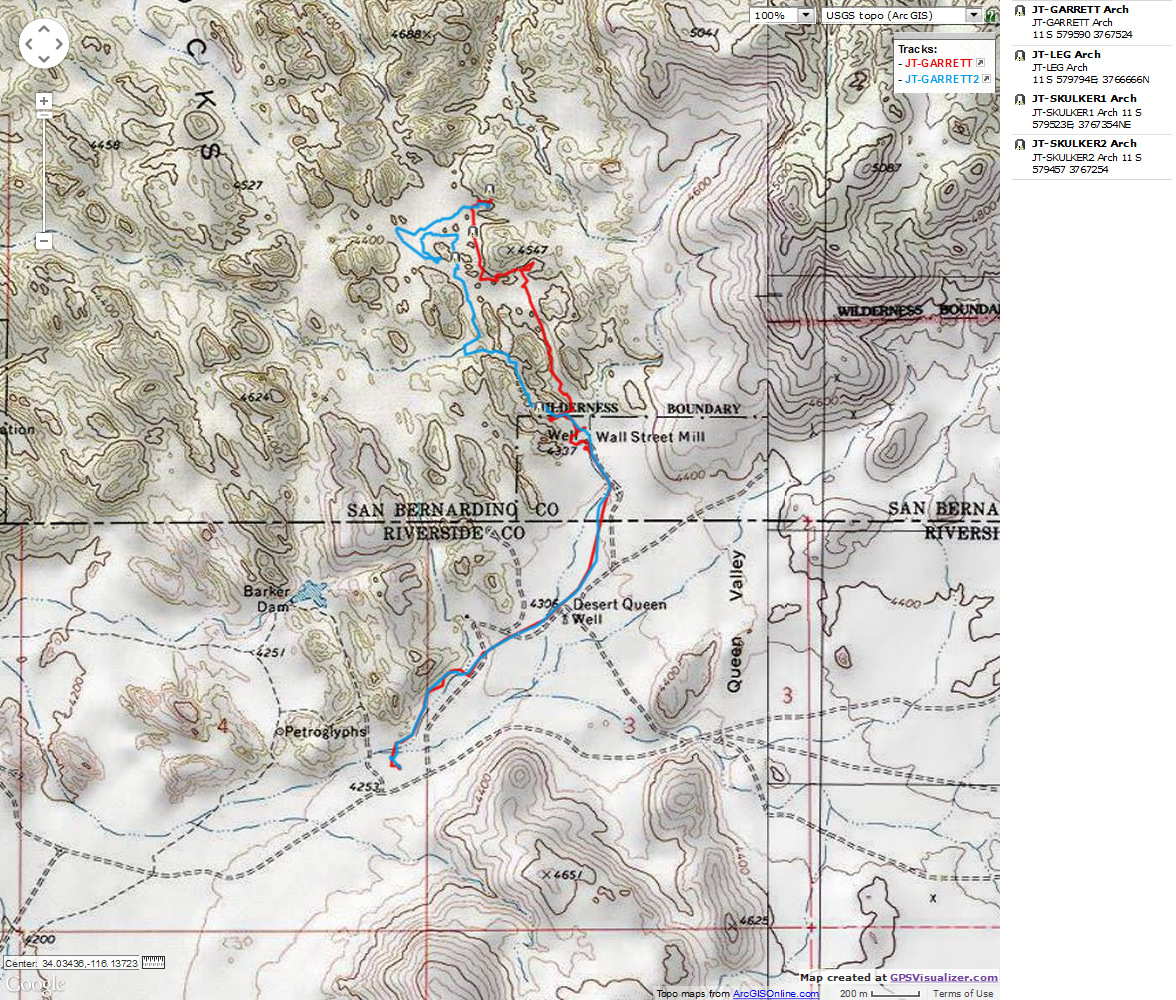
Joshua Tree Backpack - Day 1
Photos are scattered throughout this report.
Keep scrolling.
"Adventure is not a cable channel." Zig Sondelski
Zig and I backpacked the California Riding and Hiking Trail in Joshua Tree National Park.
This was a continuation of the trip to Death Valley (see that report). So, the driving loop was:
AZ - DV - JT - AZ, a bit over 1000 miles.
ERM = Energy Required Miles. A mile is added for
every 500' elevation gain or
loss. It's a very serviceable method of estimating energy required miles. ERM was initially used in Trails
of the Tetons (long out of print) by Paul Petzold, founder of NOLS. It's a wonderfully useful concept and
application. Add one mile for each 500' up AND down to distance = ERM. I use ERMs to calculate what the actual
day is like. It's a very serviceable method of estimating energy required miles. Remember, however, that the
ERMs are estimates because they depend on GPS satellite coverage and math functions.


|
|---|
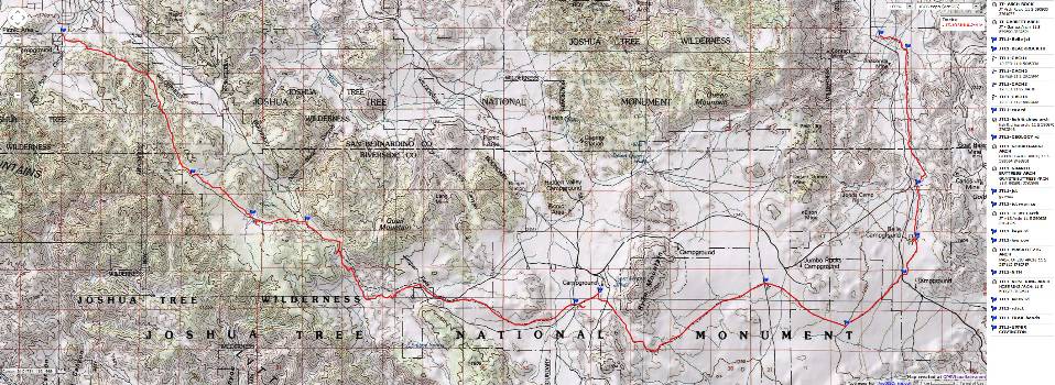
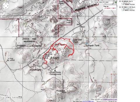
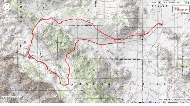
Map - CA: Joshua Tree - Riding and Hiking Trail; 2011; 41 miles
(Click the image to see the map)
|
|---|
|
Click here to see A different version of the JT Junket
map - can be downloaded as a GPX file.
Preliminary - Day 1: No to Natural Quiet. Drive from Death Valley.
330+ miles to Blackrock Canyon CG.
The Great Horned Owl hoots his hootage - directly above my tent in a frantically
flailing and waving Joshua Tree (JT), the first natural sound most of the night. Getting almost no sleep, thanks
to the bellowing of noise-addict youngsters and RV furnaces, giggling girls and macho boys - horrible. Repeated
requests for quiet, then new arrivals, all night, take over to provide surround too much unnatural noise. Argh.
The day started with a final pack-up at Death Valley and a trip South along the Bad
Water Rd, where I see too morning Coyotes and several scenic toilets along the way to Baker, Barstow, eventually Yucca
Valley, and into Blackrock Canyon CG at the edge of town. Warm, then sunset brings plunging temperatures. Zig arrives
with the cold air sumping down canyon. And, the cacophony ensues.
Preliminary - Day 2: Caching the Future - 4 caches for 4 nights.
The sun warms us quickly and I'm in shorts before we request, then move camp away
from the noise addicts. Would they recognize natural quiet if it's ever experienced? Or, would they run for
headphones, turn up the volume of their electronic cocaine to blot it out? Is there much doubt about the answer
to this question!
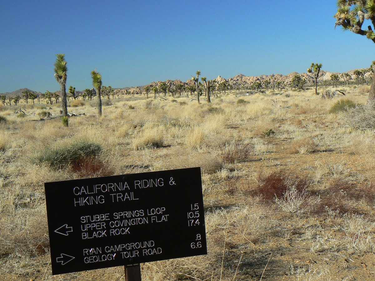
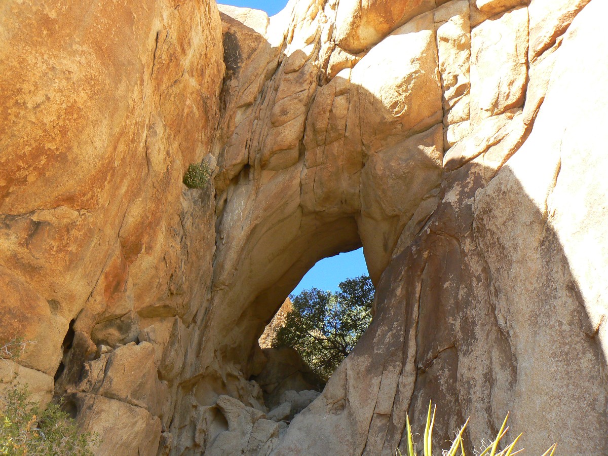
After moving camp, we begin placing water caches - at Covington Flats, Keys View,
Geology Tour, and near Belle CG, a process that consumes the remainder of the day - so, no sun shower today. I spy
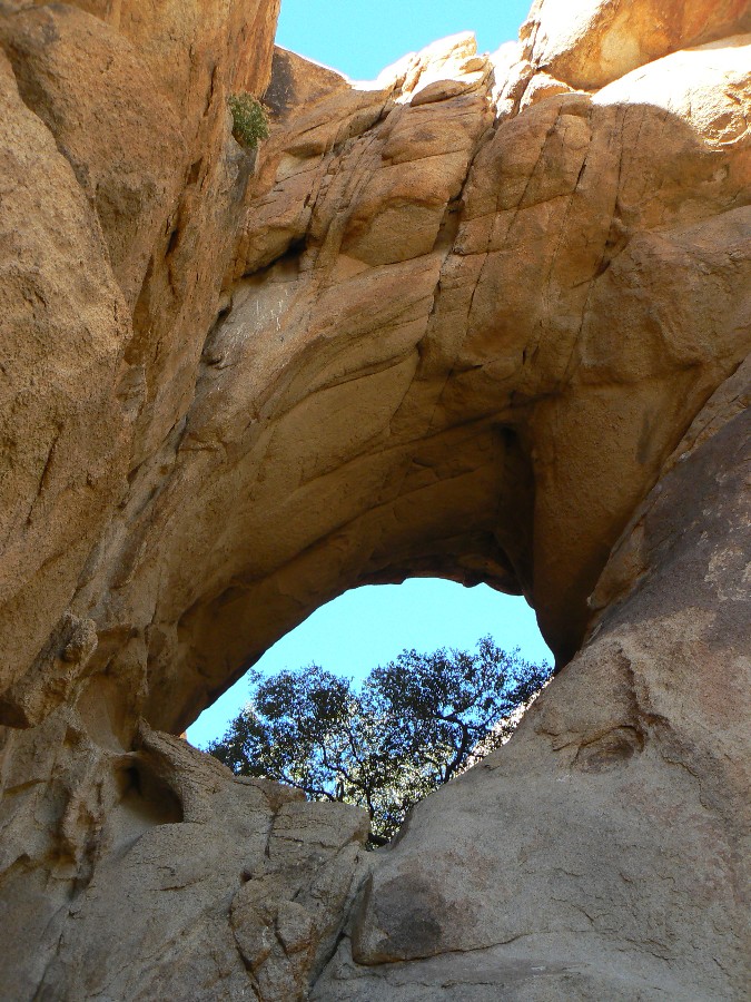
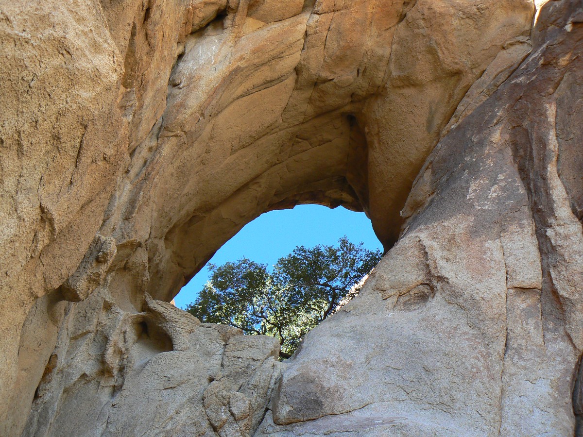
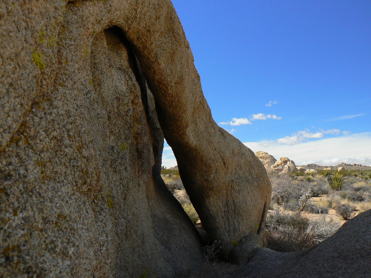
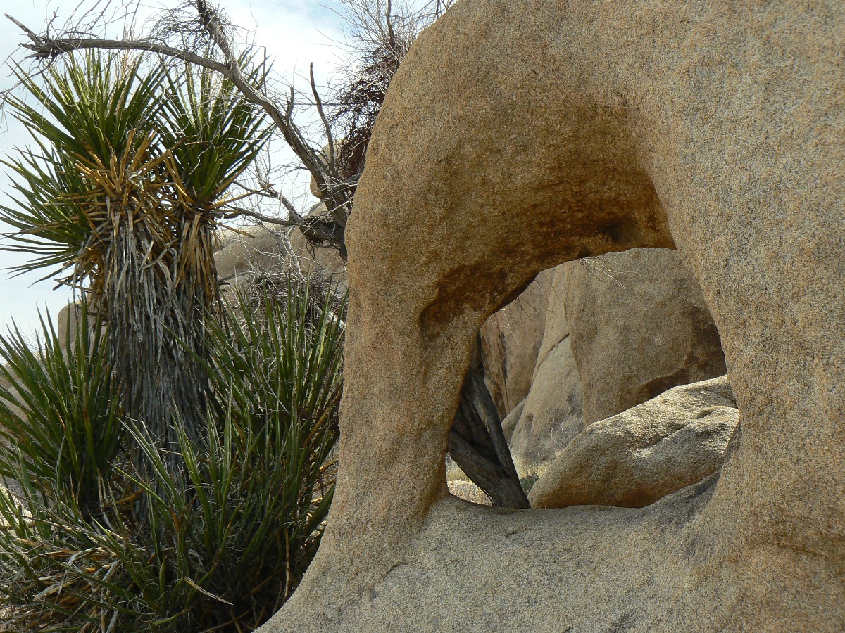
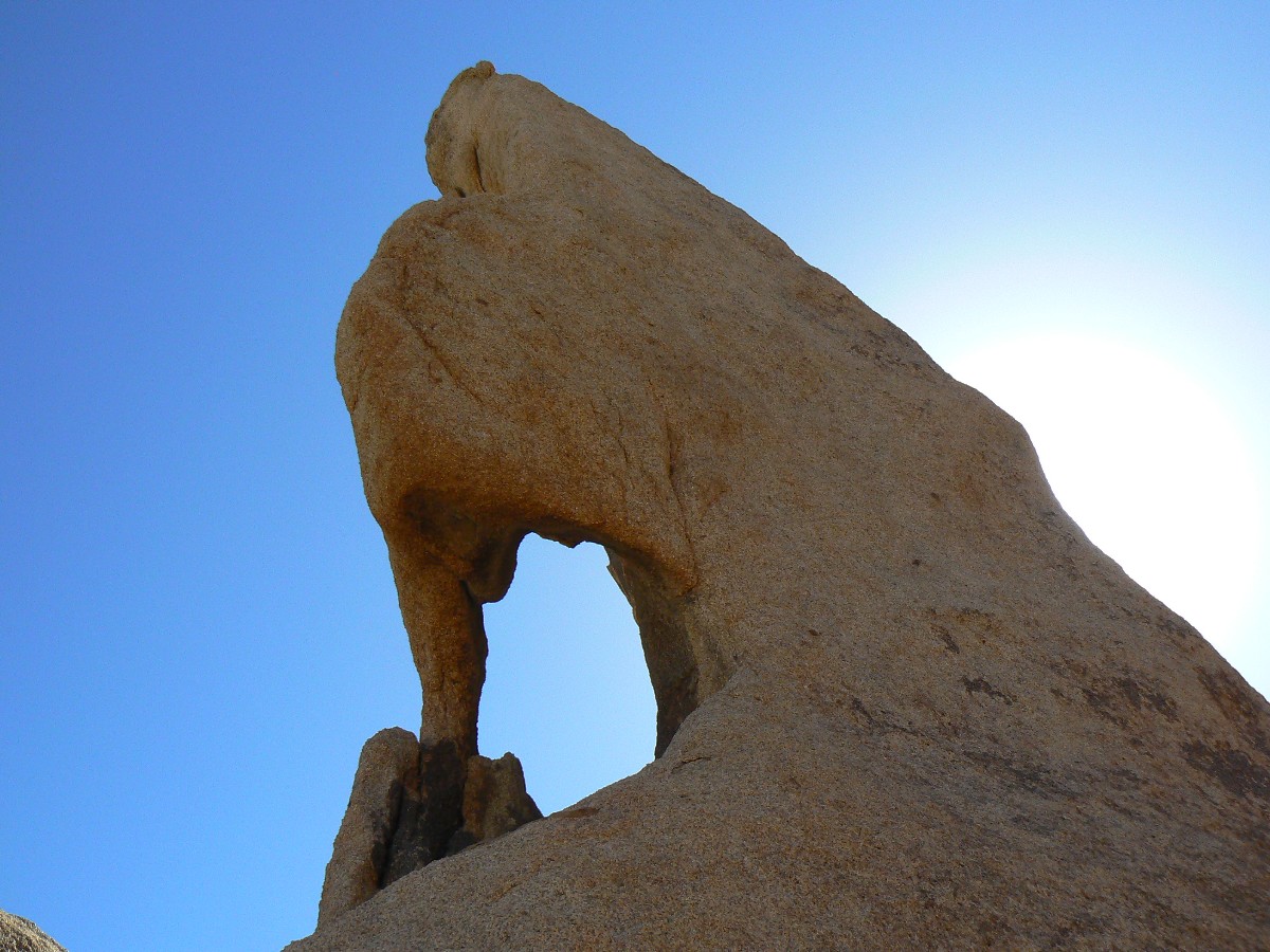
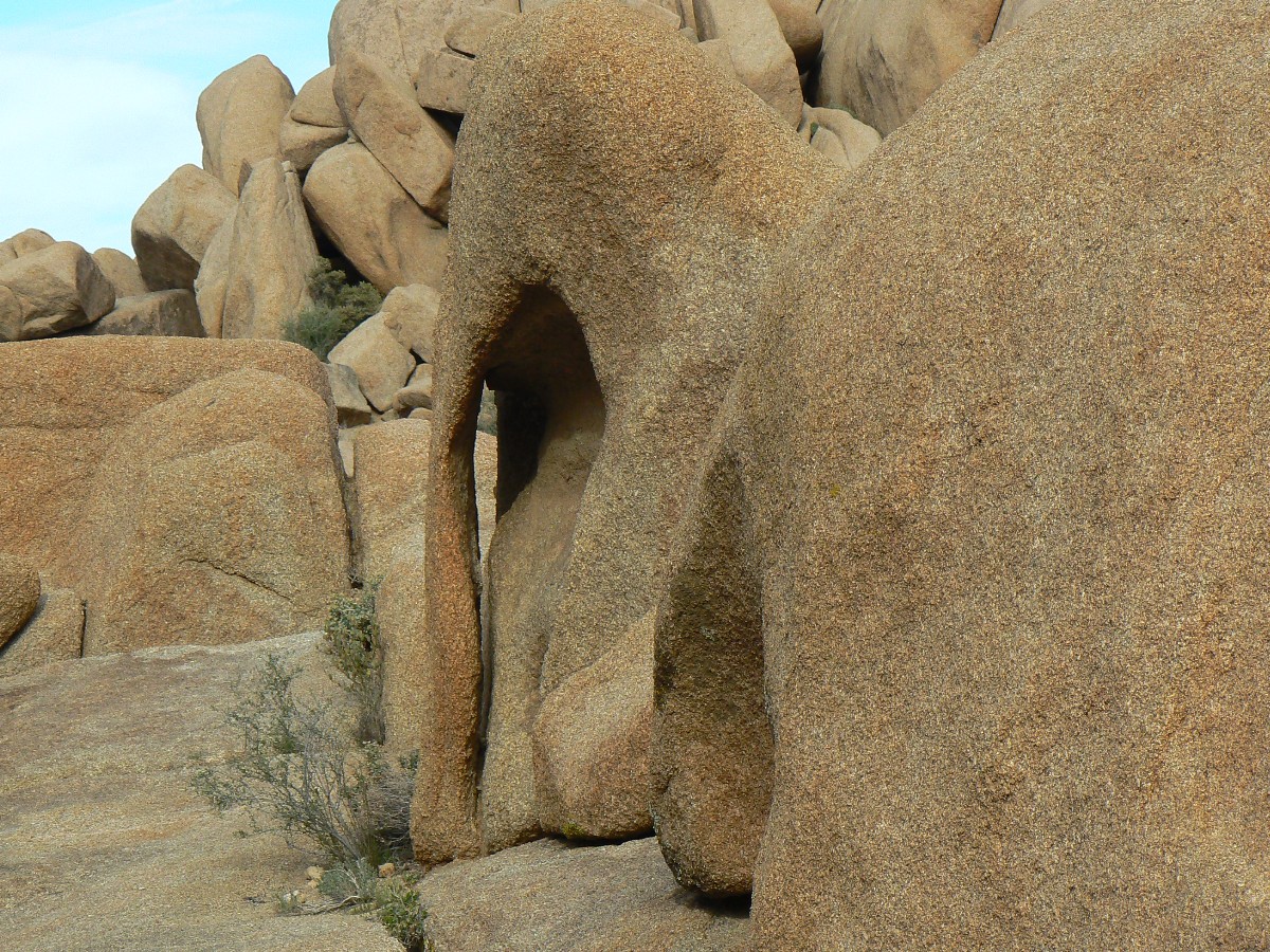
a small arch in the Belle CG rocks.
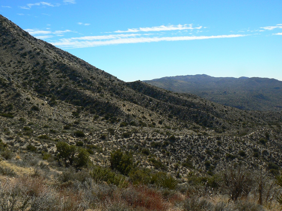
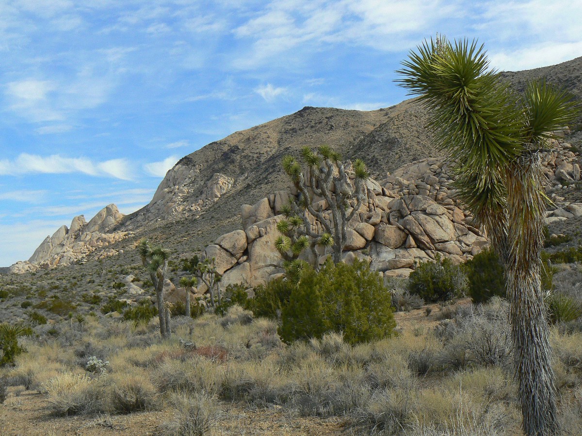
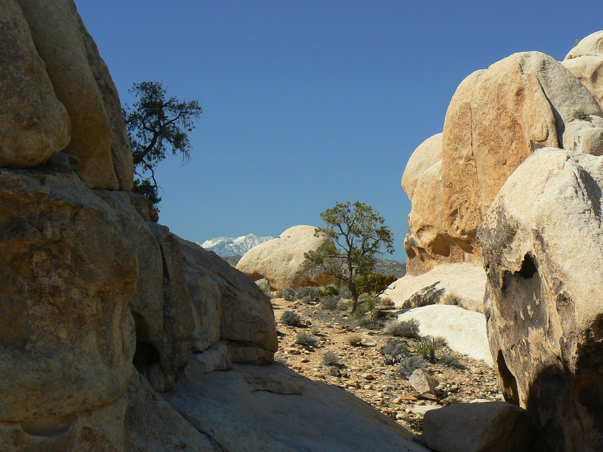
Day 1: Oh, Joshua! Blackrock Canyon TH to Mile 8, East of Upper Covington Flat (GPS mile 8.1, up 911',
down 433'); ERM = 11.
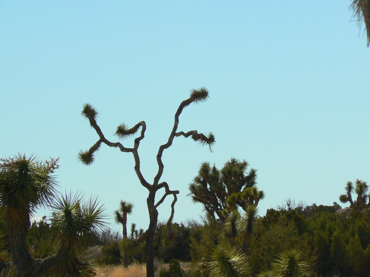
The fronds of JTs seem to flail the sky, pointing the way in all directions,
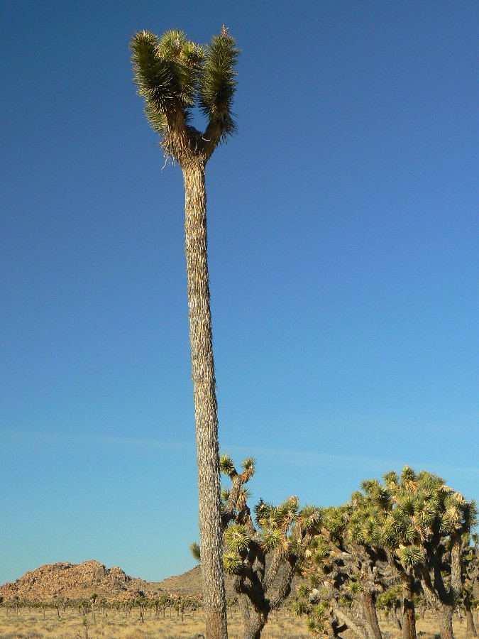
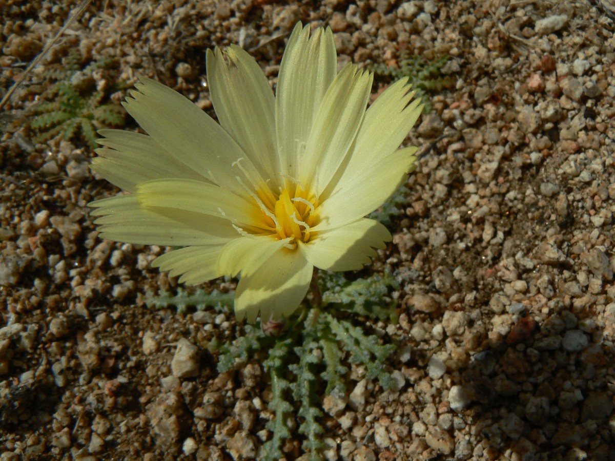
akin to faiths with contradictory answers, internally contradictory edicts. Delightful yuccas!
This, from the JT NP site: Known as the park namesake, the Joshua tree, Yucca
brevifolia, is a member of the Agave family. (Until recently, it was considered a giant member of the Lily family,
but DNA studies led to the division of that formerly huge family into 40 distinct plant families.) Like the California
fan palm, Washingtonia filifera, the Joshua tree is a monocot, in the subgroup of flowering plants that also includes
grasses and orchids. Don’t confuse the Joshua tree with the Mojave yucca, Yucca schidigera. This close relative can be
distinguished by its longer, wider leaves and fibrous threads curling along leaf margins. Both types of yuccas can be
seen growing together in the park. The Joshua tree provides a good indicator that you are in the Mojave Desert, but you
may also find it growing next to a saguaro cactus in the Sonoran Desert in western Arizona or mixed with pines in the
San Bernardino Mountains.
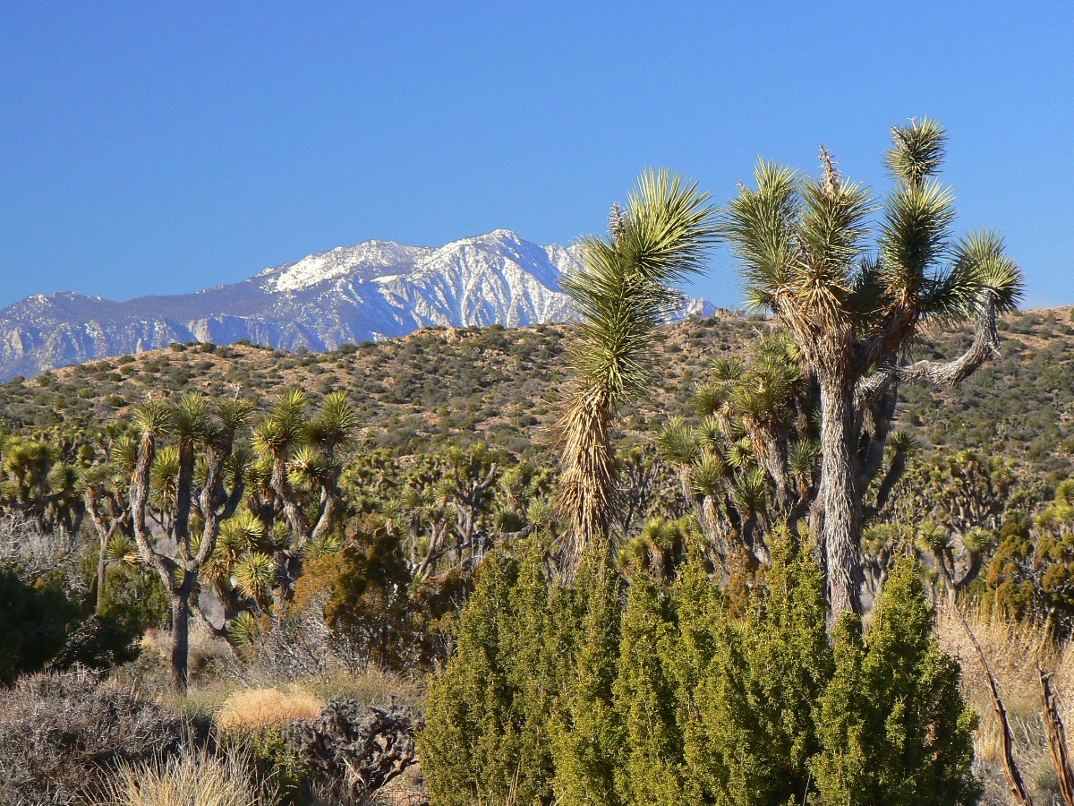
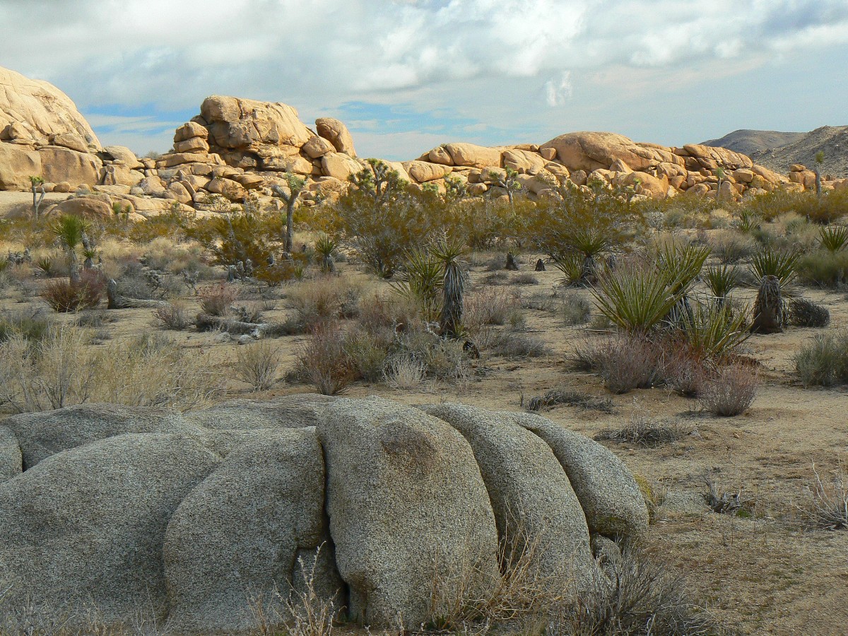
Yes, delightful yuccas, the JTs represent sentinels of this Mojave Desert, watching
over granitic muffins and an occasional Pinyon Pine.
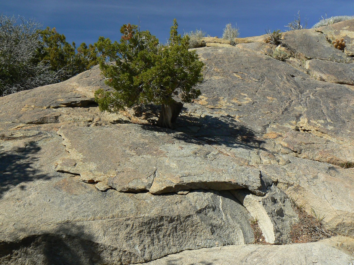
Again, from the park site: Geologists believe the face of our modern landscape was
born more than 100 million years ago. Molten liquid, heated by the continuous movement of Earth’s crust, oozed upward
and cooled while still below the surface. These plutonic intrusions are a granitic rock called monzogranite.
Global climate change, courtesy of all these people, more people, and far more people
than this, our only Earth, can sustainably support, is hastening the departure and demise of the Pinyon Pine. It won't
be migrating upslope - it will just be gone, replaced by more and more people. So, the prophecy of the JT is - stop
having babies - give other species a chance to continue - or else enjoy a self-fulfilling prophecy, the end of days a al
palin-style.
Zig and I start out from the TH in warm direct sun, following a cool evening once again
shattered by too many people making too much noise too late into the early morning.
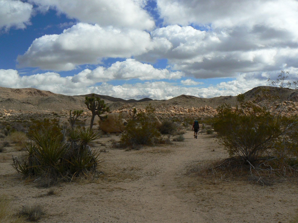
Much of the first half of today is slogging up the granitic sands of a wash. The
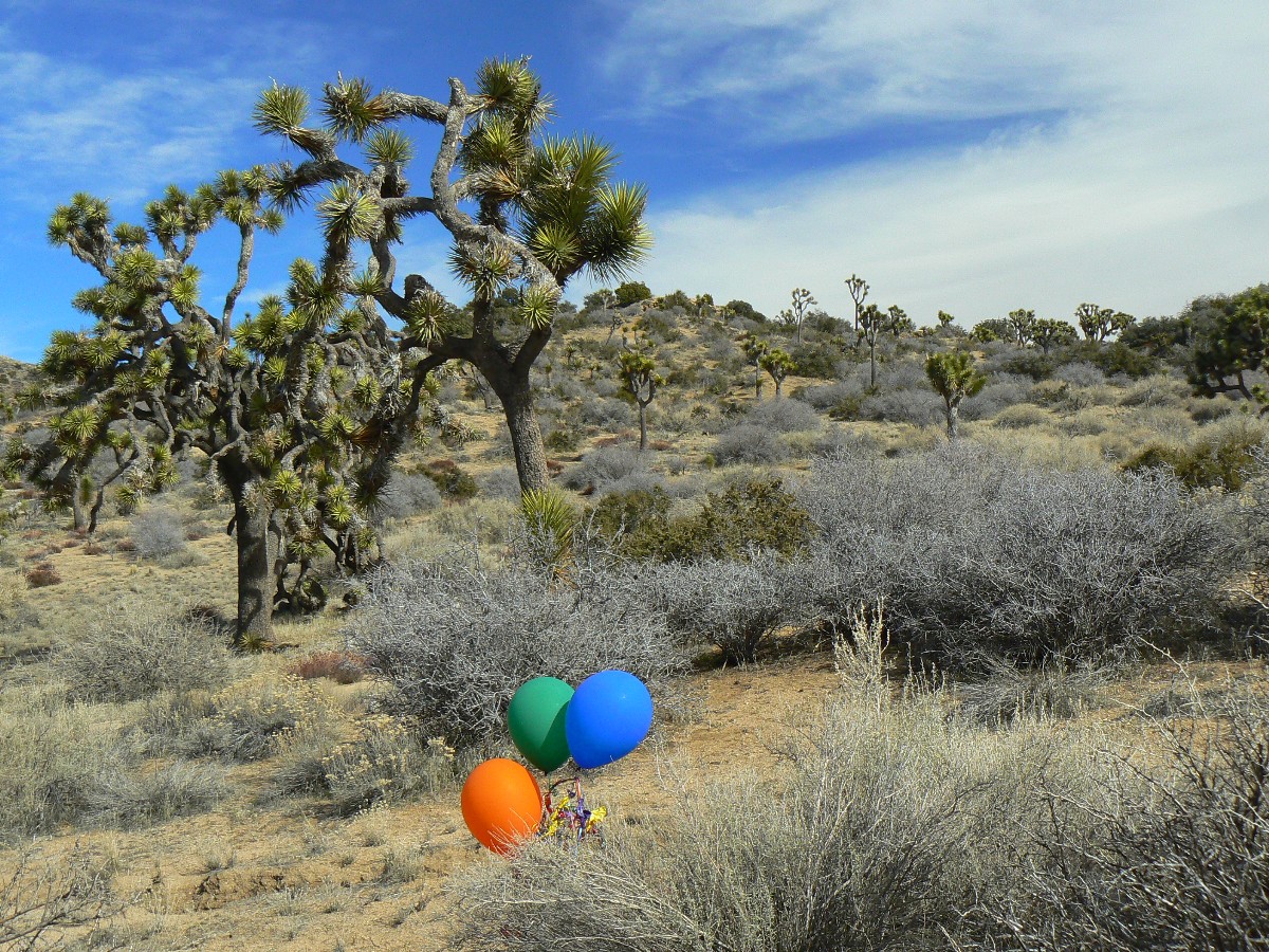
hiking and vistas dramatically improve as we top out the nearly 1000' climb before crossing the Covington Flat dirt road.
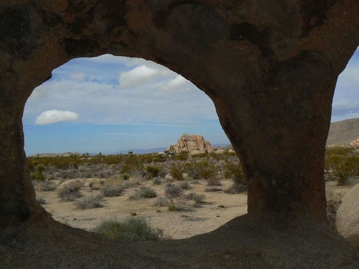
Near here we see balloons in primary colors cluttering the backcountry. The mix of rock muffins and JTs becomes even
more enchanting. Lovely. We reach Covington Flat backcountry board and soon find our first water cache. Deluxe.
Quiet, peaceful, ahh - wilderness (albeit fractured by road crossings).
Pink beach ripple clouds are punctuated by JTs at sunset.
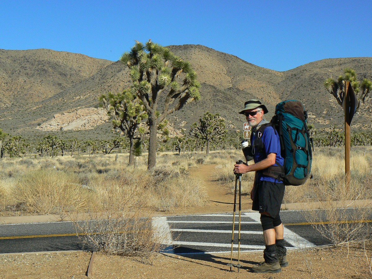
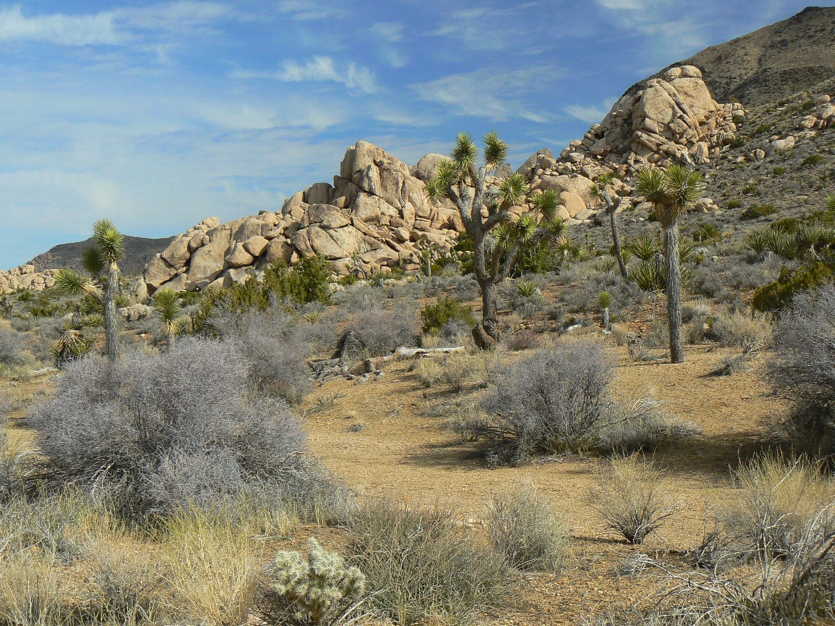
Day 2: Diversity Tour: Covington to Keys View. 11.7 miles. (GPS mile 19.8, up 1315, down 1773); ERM = 18.
Camp at 4300'.
After about 3 miles of hiking, Zig and I drop off the ridge and into the diversity tour,
a narrow wash dotted with JT, Pinyon Pine,
oak, fat yucca, beavertail and hedgehog cactus, a sage-smelling shrub, junipers, and other unnamed beings - all
packed into this zone of edge. This entire stretch is enjoyable, partly because it's a lovely day, following a windy
and chilly morning. Also, it's probably the most isolated section of the trail, with the most wilderness characteristics.
The trail rolls along, gathering a good deal more elevation change than yesterday. Stately JTs and granitic muffins
line the way, beckoning us on, on to the wilds. Quiet. Nice. We see no one until the distant vehicle at Keys View
Rd - and chuckle at the hiker crosswalk across the dangerous tarmac. Yikes. Then, to cache #2, where Zig has wisely
stowed tins of delectables and where there is clear water (chilled to the ambient temperature, of course), extra fuel,
and a way to tonight's camp. With sunset, temps plummet as if falling off a cliff and we scurry for our fluffy bags -
to dreams of beckoning JTs and long-haired girls.
Joshua Tree Backpack - Day 2
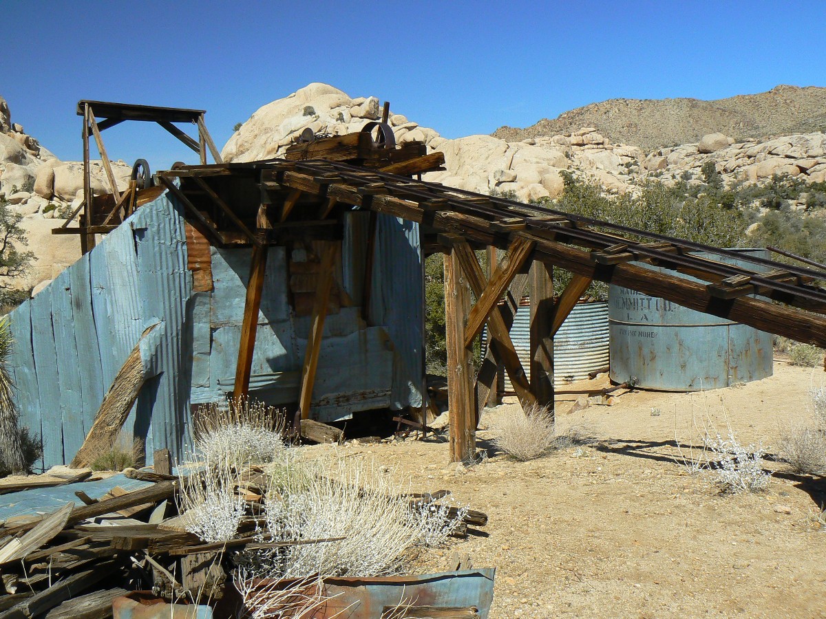
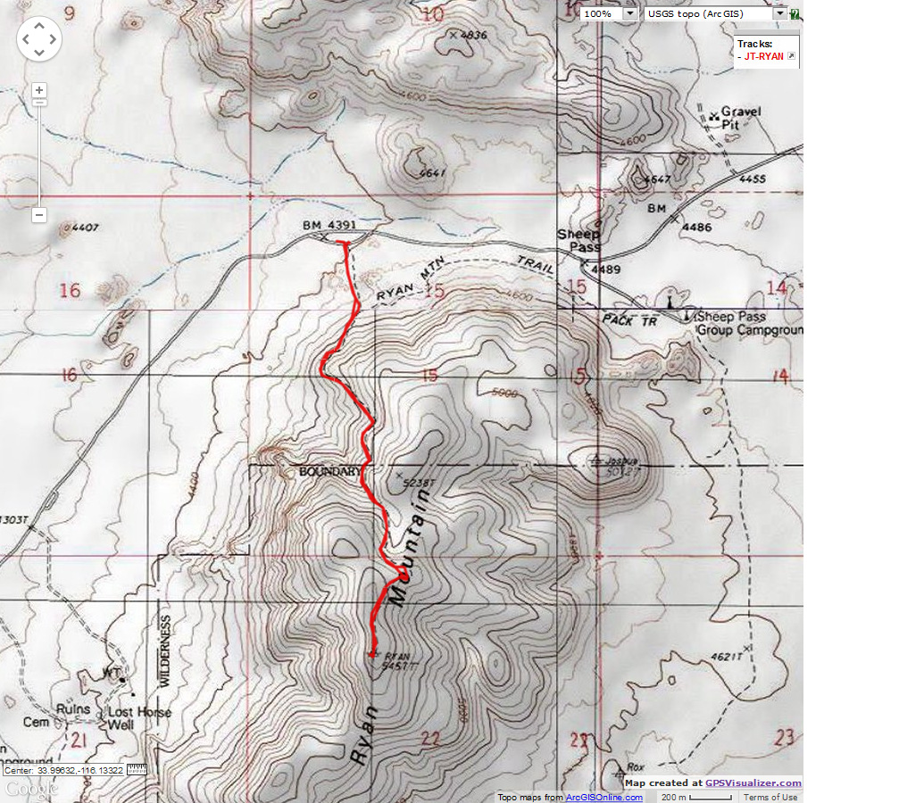
Day 3: Ryan Ramble: Keys View Road to Geology Tour Road, 7 miles, 460 up, 450 down; camp at 4460'.
ERM = 9. (GPS mile 27.0).
The granite monzonite, a buffy path and plain of granulated granite of old is bordered
by an outcrop of ebony metamorphics, quartz, and gold-flaked feldspar, or something like this. Two grated mine shafts
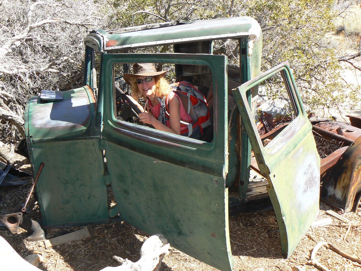
and a tailings pile droops into the wash. Zig and I walk the remnants of old Ryan Mine where we see foundation outlines,
lots of relic tin can trash, a few disintegrated tires, and boards with round nails. Yes, now a treasure, formerly a
junk and trash pile. With the coming abrupt close of the fossil fool era, there will no doubt be countless internal
combustion (infernal combustion) vehicle trash piles for alien architects to ponder. How could an extinct race, that
called themselves humans and thinkers, believe in the fossil fool gods, oil, "clean" (ha!) coal, etc.? Blinded by
greed and god channelers, they sealed their end of days by unsustainable overpopulation and resource abuse.
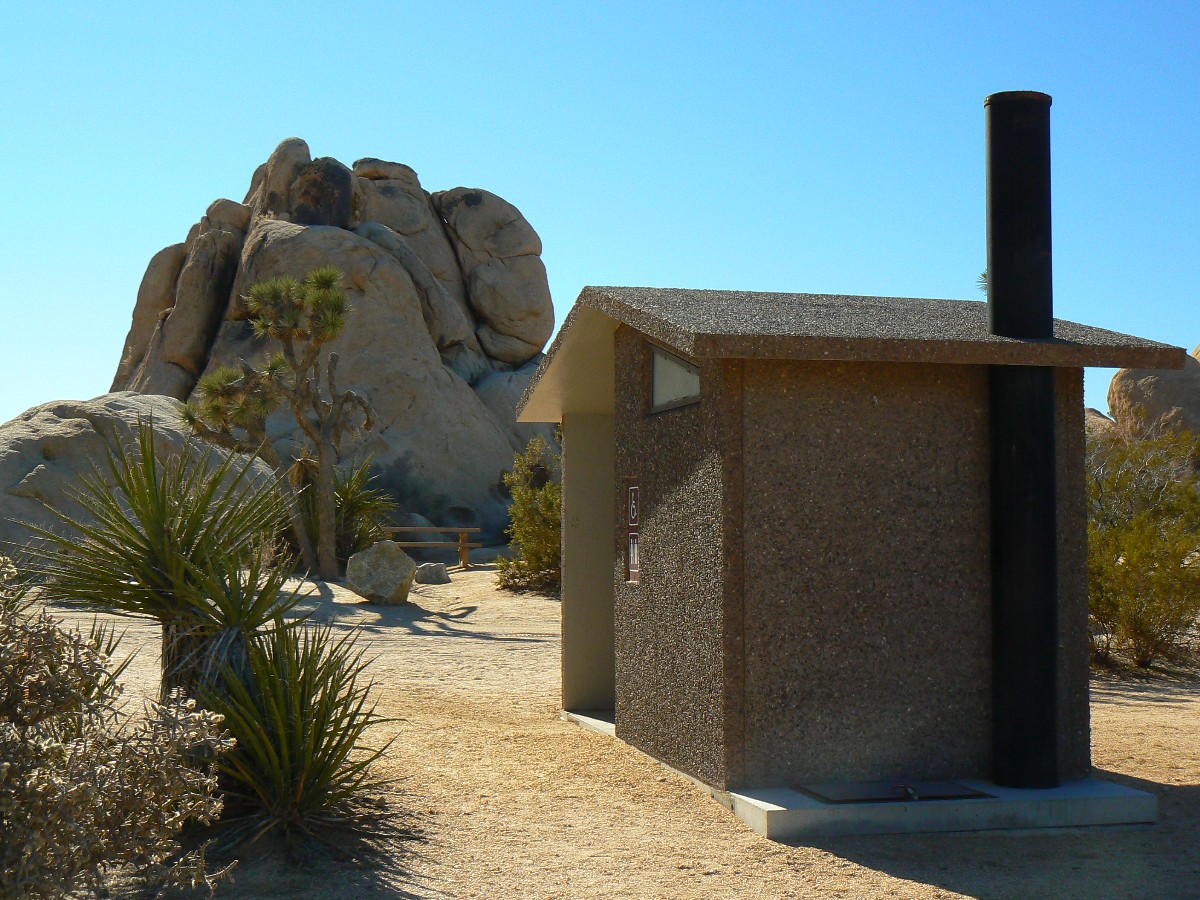
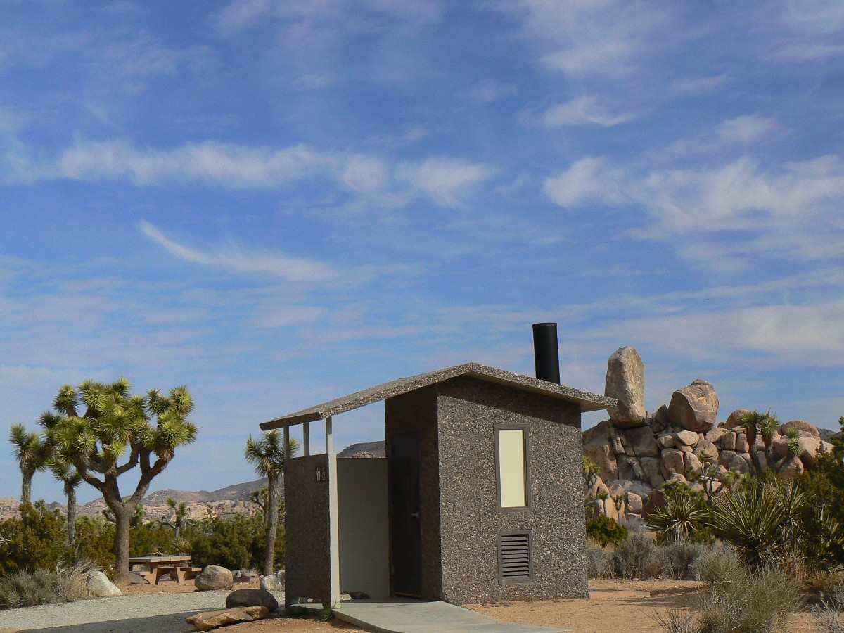
Again, we see no other hikers as we stroll past Ryan CG, with its very scenic toilet,
and out over the very low pass South of Ryan Mountain, past the mine trash - miners always leave their mess and toxic
brew for someone else to deal with - and out into Queen Valley, where we again enjoy open views of granite muffin mounds
dotted with stately JTs.
It's another day of all clothes on morning, shorts hiking, and all clothes on dinner.
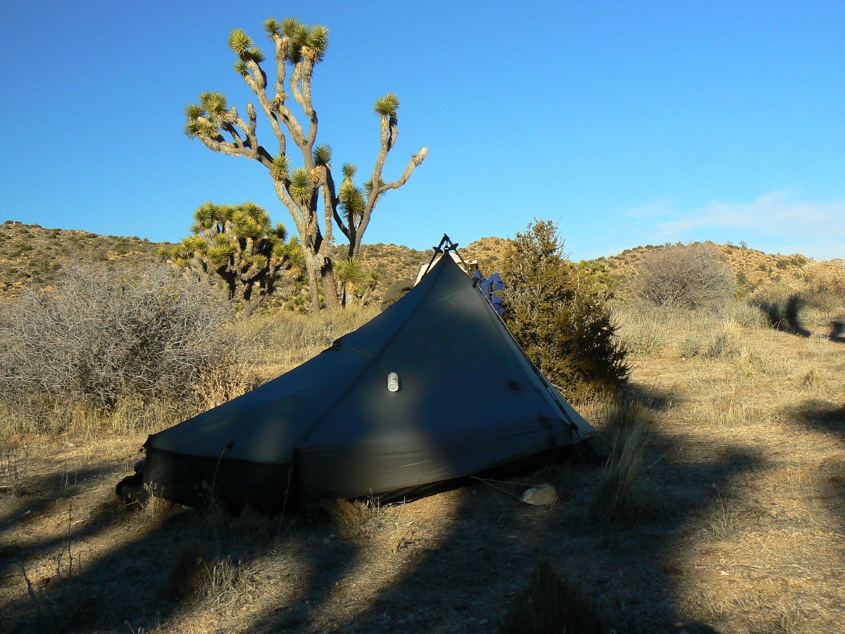
A layer of frost coats the inside of my TarpTent and there's a rim of ice in the water bottle this morning. When I
pour water into the pan, a flurry of ice crystals form, then start building around the edge. Burr.
We cross Geology Tour Road, retrieve water cache #3, and camp behind a buffy boulder
that helps shear the gathering wind. Tents flap a bit tonight.
Joshua Tree Backpack - Day 3
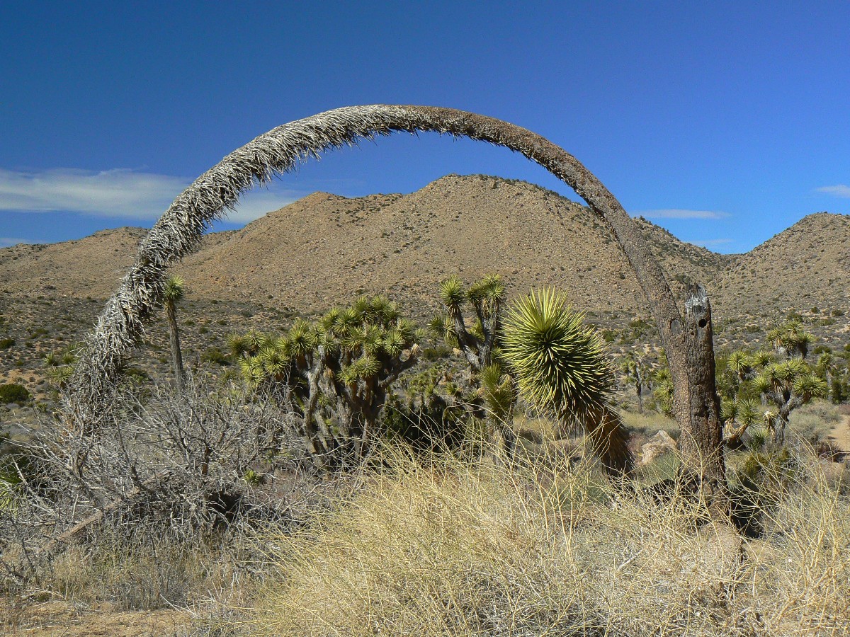
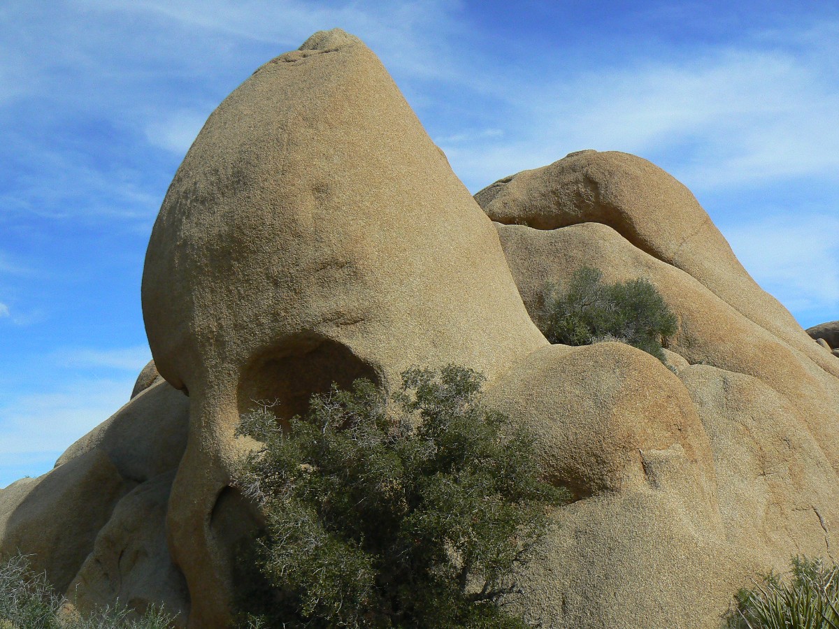
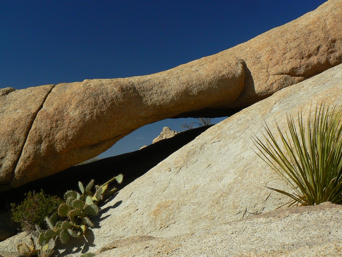
Day 4: Desert Border Bop: Geology Tour Road to near Belle CG. 6.2 miles + 2+ exploring for arches.
up 360' and down 710'; ERM = 8. Camp at 3850'. (GPS 33.2 miles, before exploration).
I awake to the smell of impending rain - clouds encompass the edge of our world,
while it's clear above. Impending most of the day, yet the clouds disintegrate as they quickly roll over us.
Definitely, there's a weather change in progress.
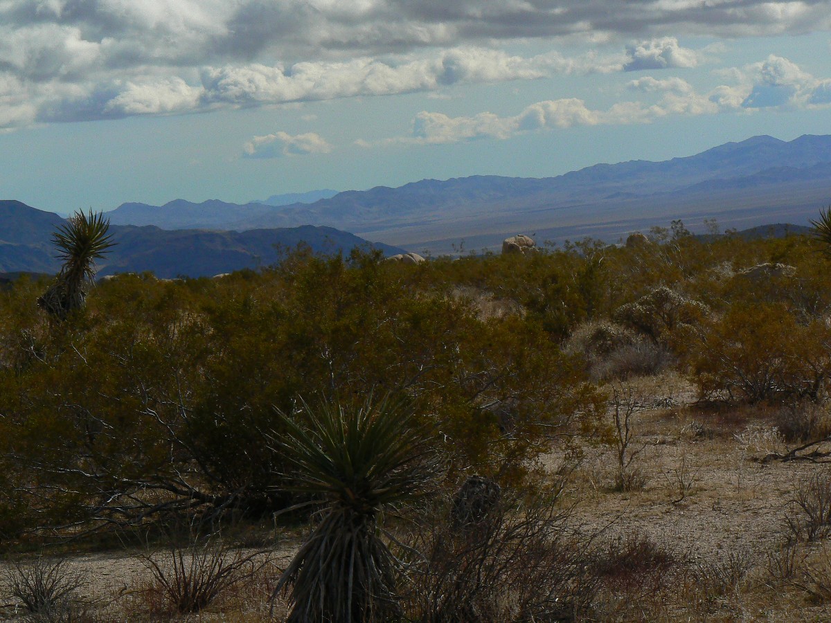
As we lilt SE and then trend NE, we migrate out of the Mojave and into the Colorado
Deserts and the JTs fade in number, replaced by another, less stately, yucca, and there are many more creosote bushes.
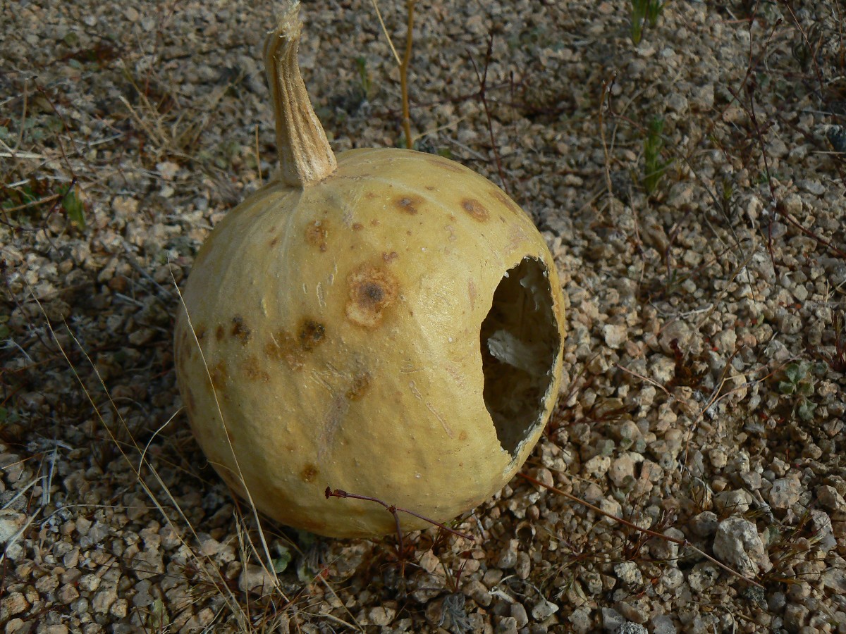
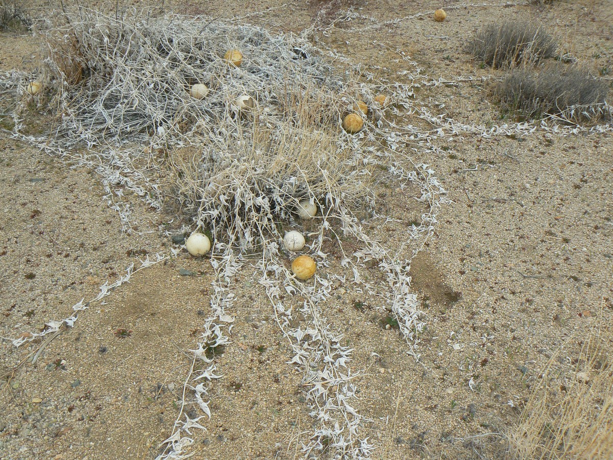
Along the way, I begin to encounter tennis ball-sized squash or gourd shells. Zig calls them desert gourds. Curious.
Then, I see a group of them and their expired vines - interesting. A bit farther and I see several scratch and sniff
territorial markers - perhaps from a big pussy cat - with lots of scratching and dirt-tossing and some scat too.
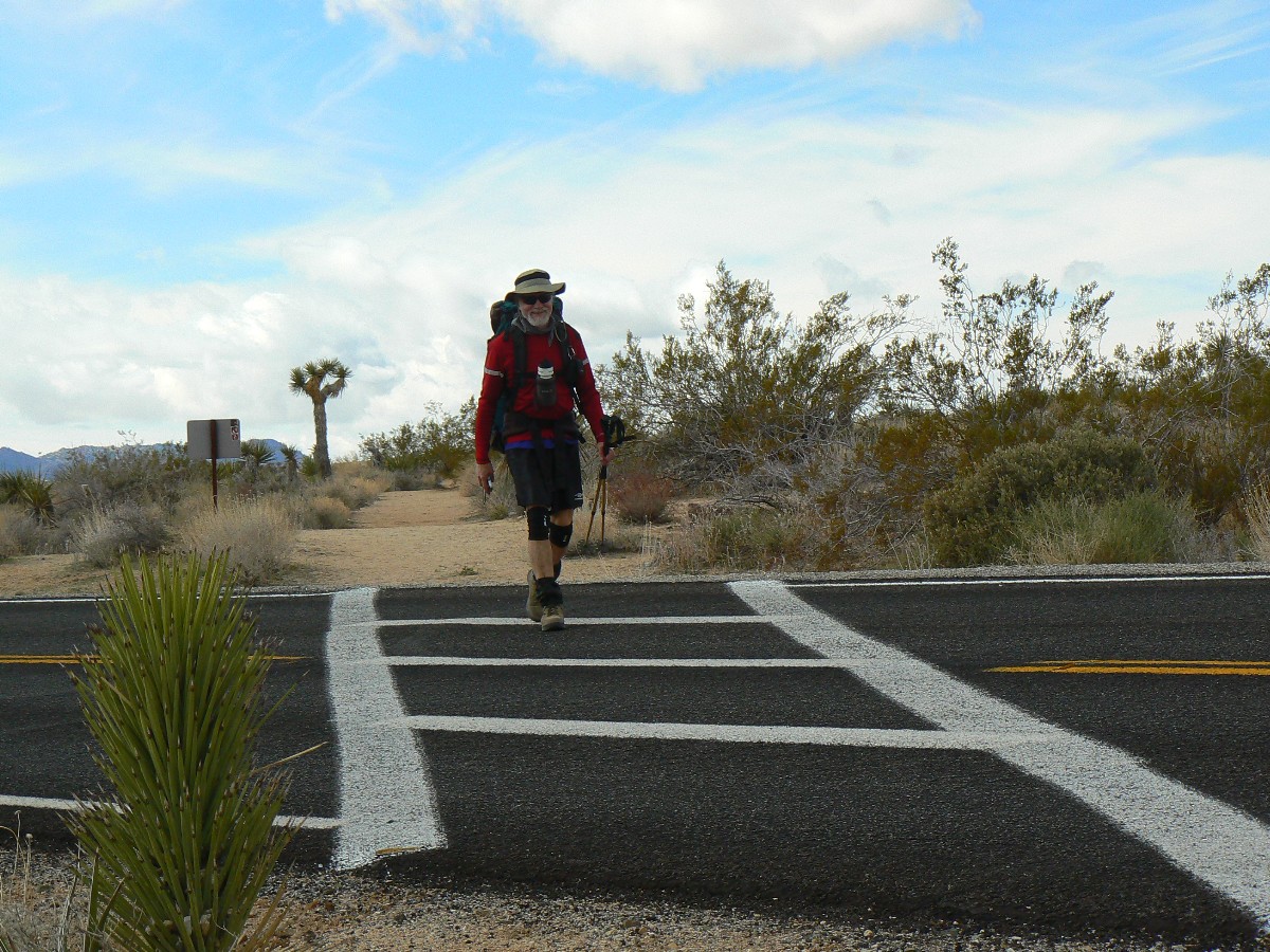
Angling every so slightly up, we cross the Pinto Basin Road, and we have to wait for
the OK from the crossing guard at the painted crosswalk (just kidding). The granitic muffins return, as do the JTs as
we approach our last water cache, #4, this one near Belle CG. The wind has given us chills all day and we spend a good
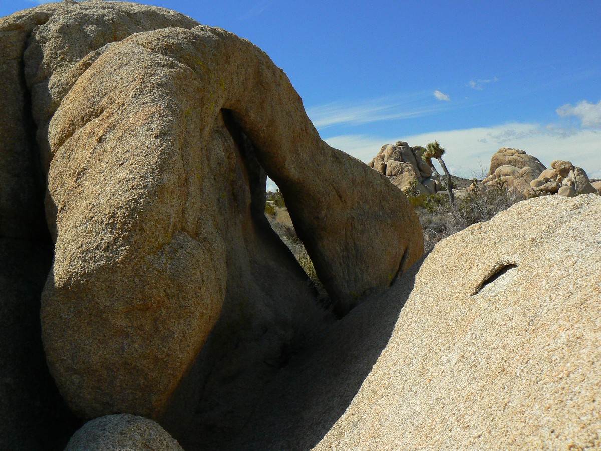
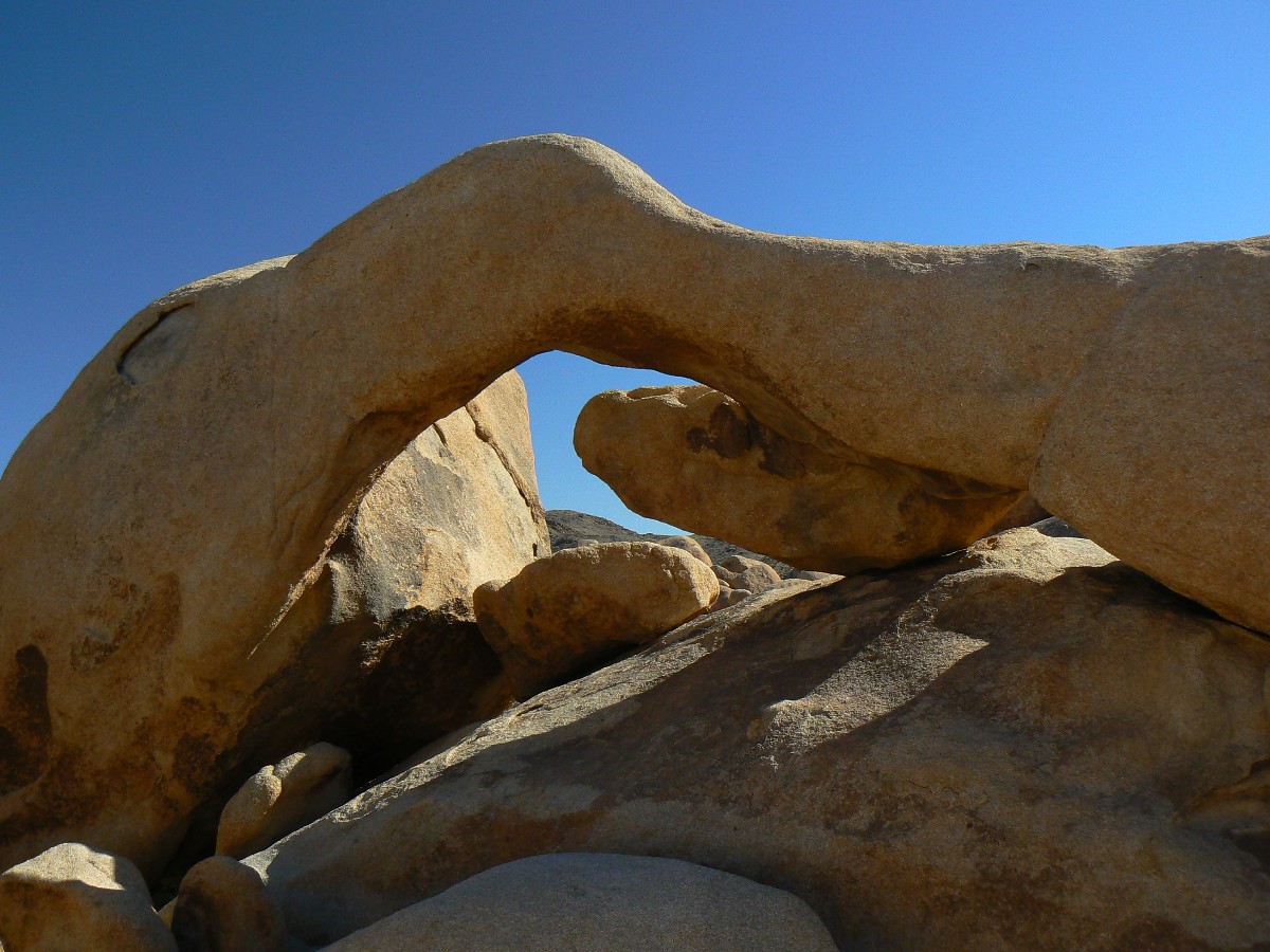
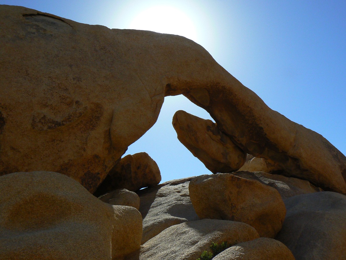
deal of time trying to locate a sheltered camp spot. Along the way, we literally climb on a wall buttress arch - a
ribbon of granite, arching.
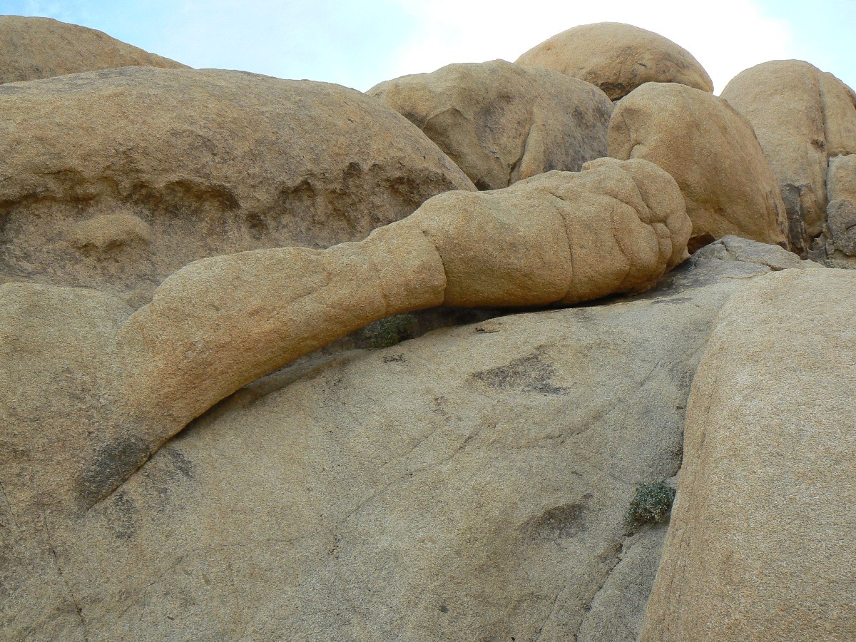
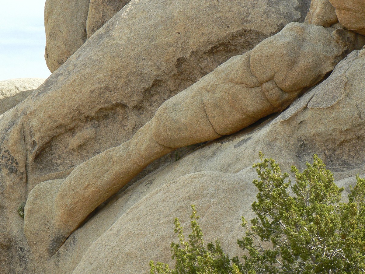
After establishing camp, I explore around the Belle CG rocks in search of more arches,
finding 3 others, one right in a camp site.
Zig has wisely cached food in cans and a cookie tin along with the water and we gorge
on potatoes and veggies with salmon and chocolate pudding topped with brandy. Yum.
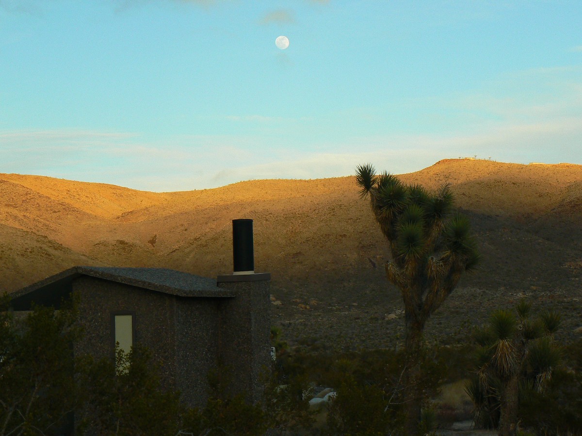
The thick clouds seem to be stalled out over the Little San Bernardino Mountains, yet
the wind continues. I go strolling for a full moon and JT photo - pushing the shutter priority for effect.
Joshua Tree Backpack - Day 4
Day 5: Granite Arches: Near Belle CG to North TH. 6 miles. 450' up and 1125' down; ERM = 9.
End at 2890'. (GPS = 41.7 miles, total elevation gain is 3500', total elevation lost is 4485'.)
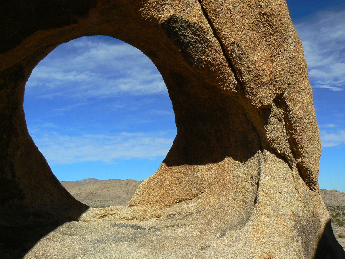
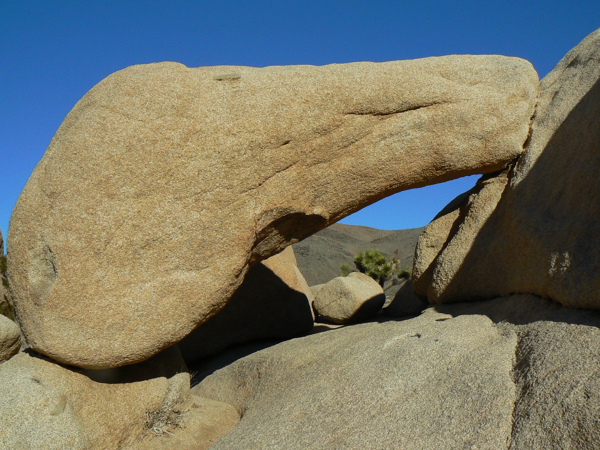
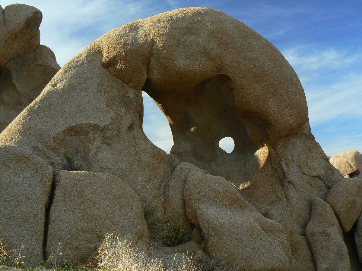
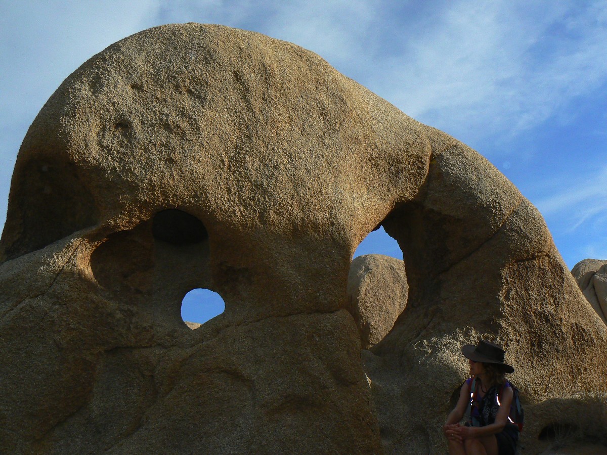
Another unnamed arch appears, adding to a decent assortment of granite arches
found near Belle. Fish and Chips Arch, Nosering, JT#13 (because it's in site 13), Granite Buttress - the first
we accidentally found while looking for a camp area yesterday, and now Gourd Gauge - found N of Belle while looking
for another arch (which we have not yet found). Gourd Gauge because of the plethora of Desert Gourds we find in this
last section of the CRHT. As we stride along, I recall the frigid morning, with a bit of ice inside and outside my
tent's surface and some in my toes when I first get out of the snuggly bag. I recall that despite the numerous road
crossings - we see only one hiker, and this a short distance day hiker girl. Dropping toward the N TH, the JTs are
few, then none can be seen. Colorado Desert - fine and diverse, yet I like the stately and undisciplined JTs of
the Mojave Desert.
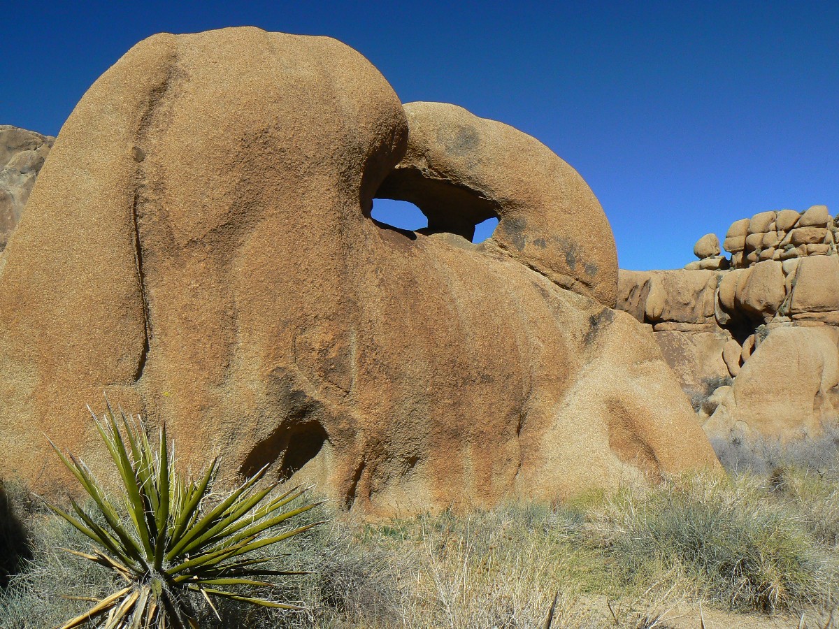
Zig and I retrieve the materials from the 3 caches (we did not leave anything at
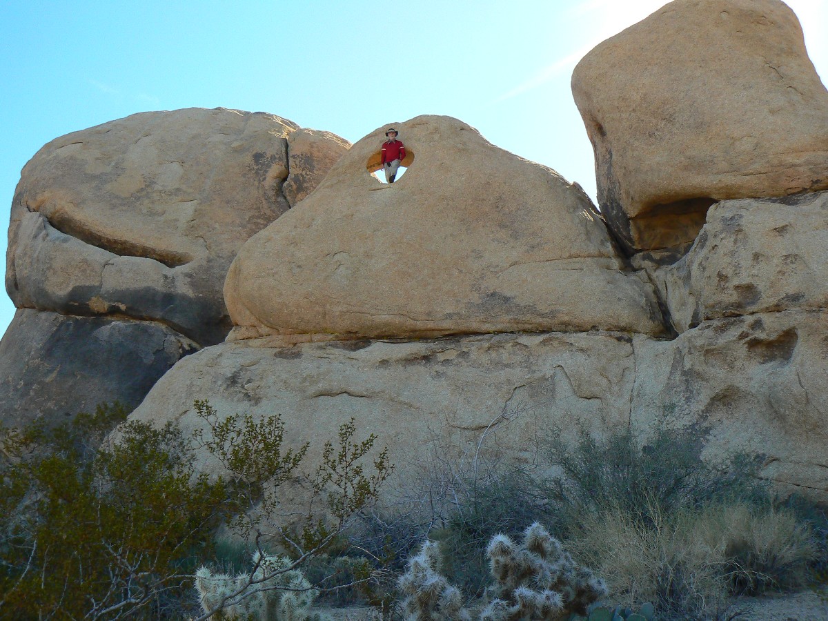
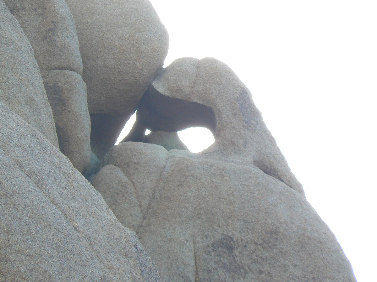
cache #1), and Zig spies another arch, which I call the Mask of Zig - because of its shape and double opening.
Retrieving the Ranger from Blackrock TH, Zig goes briefly into town while I work
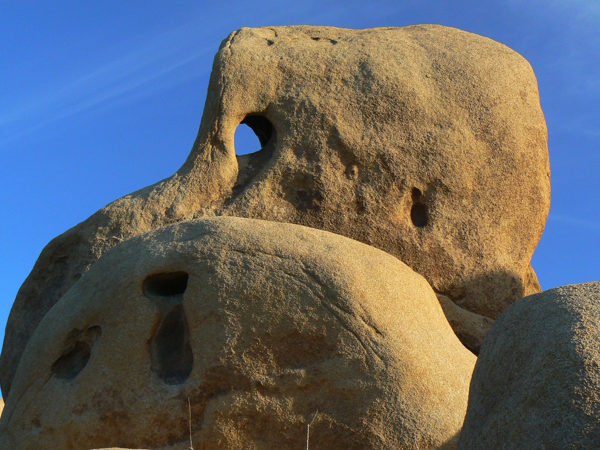
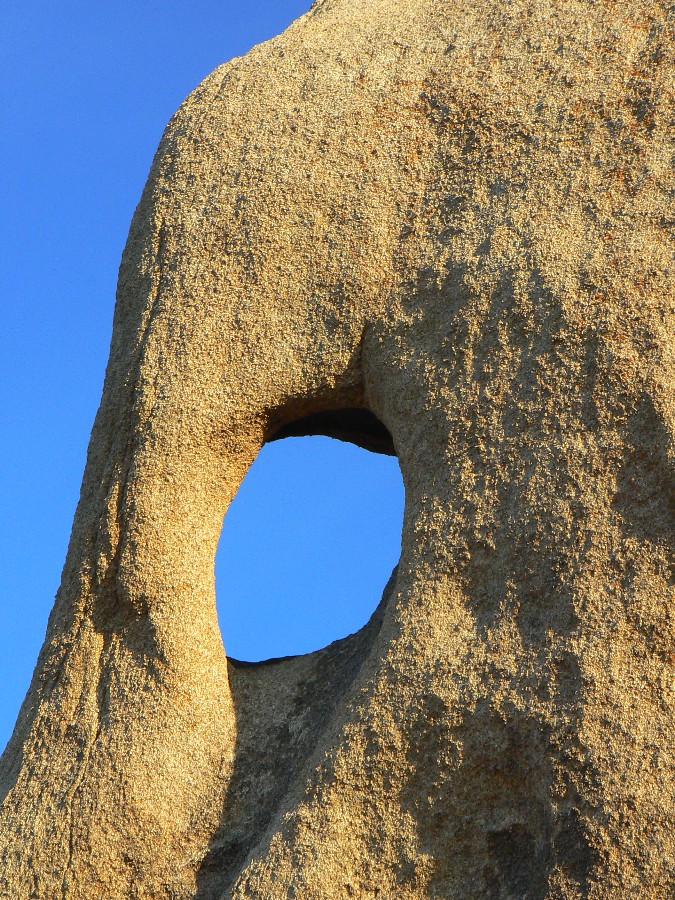
my way back to Belle CG, stopping for a few scenic toilet photos and a brief (cool, fading light) and fruitless search
for Skull Cap Arch. I do see a mini skull arch in the low light, and because it vaguely resembles it, Tear Duct Arch.
Back at Belle, I use the last light to set up the VE-24 tent - planning for a warmer
night. Coyotes, the song dogs, and owls hoot and howl me to sleep, ending a deluxe JT junket.
Joshua Tree Backpack - Day 5
Second Joshua NP Trip (Day Hikes,
with Kathleen Jones):
March 10-14, 2011
Night 1 (6 by total Joshua count) Driver To Cottonwood.
Seasick rollers - roll down, g-force, roll up, not quite weightless on Hwy 95,
plummeting and then climbing through countless arroyos. Last gas at Chiriaco Summit and soon into JT and camp at
Cottonwood Camp. Cool night. Coyotes and owls (not the grumble of RVs, yahoo) rule the night. Melodic.
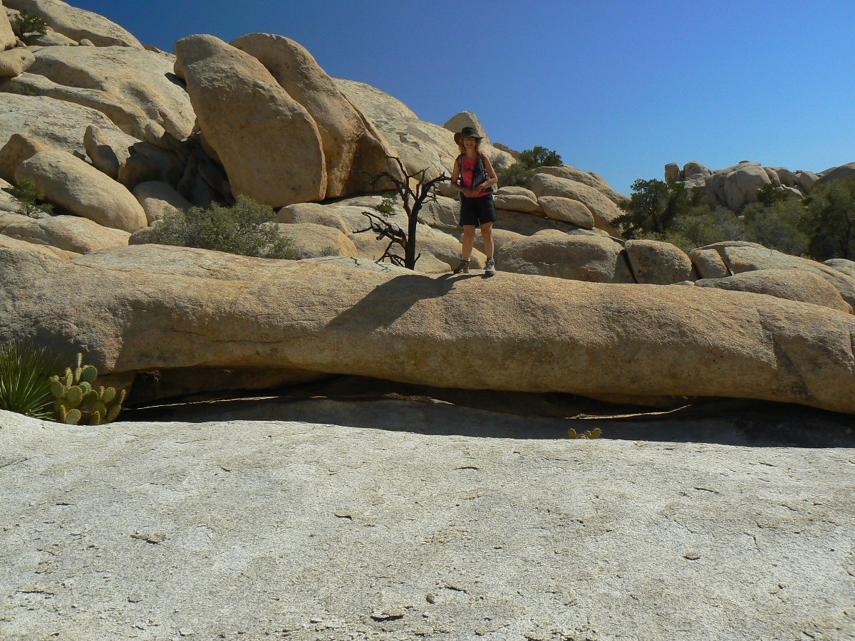
Day 1 (7) Garrett Grinder Garrett Grinder - to Garrett Arch,
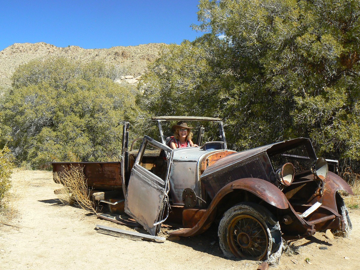
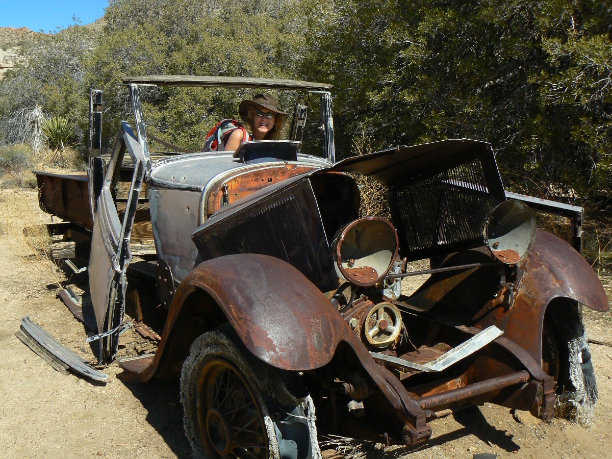
6 miles, 8 ERM.
(We move up to Jumbo Rocks, then set out for Garrett Arch.)
Finally, there it is - Garrett Arch, about 100' above us and not looking all
that spectacular. Kathleen and I have hiked out from Wall Street Mill, into the Wonderland of Rocks - finding the
way anything but obvious and concluding that the dam site might provide easier access. The granite monzonite is
rough on the skin as we scramble rock pillows, staying away from the intermittent drainage where it is clogged by brush
that tear off ones hide. Abrading, slashing.
We happen upon two low arches and call them Skulkers. Clinging Klingon fashion over
and under undercut
boulders, we slowly make our way out of the Wonderland.
|
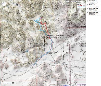
|---|
Map - CA: Joshua Tree - Garrett Arch day hike; 2011; 6 miles
(Click the image to see the map)
|
|---|
|
Joshua Tree Dayhikes Day 1 (day 7 of index)
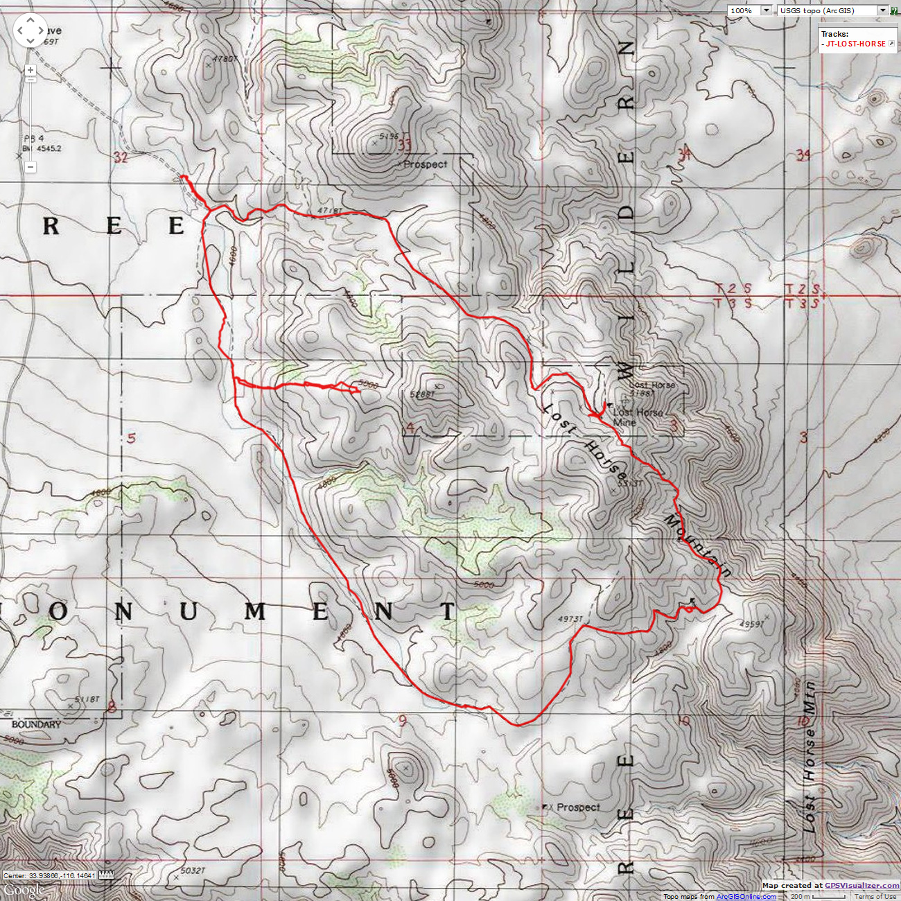
Day 2 (8): A Horse with no name Lost Horse Loop - Lost Horse Mine, 8.5 miles, 1300' change, 13 ERM.
At dawn, the winnehogo generators begin to bellow, drowning out quail, coyote, owl.
The tin can disgorges a walker, an RV walker going round and round the CG for exercise. Ignoring the fine Skull Rock
trail which starts right in camp. Puzzling.
I'm plodding up a brushy ridge, hunting two arches seen from below. Argh, the first
arch is formed by a JT and rock overhang while the second is a rock fallen between two spires - no new arches today.
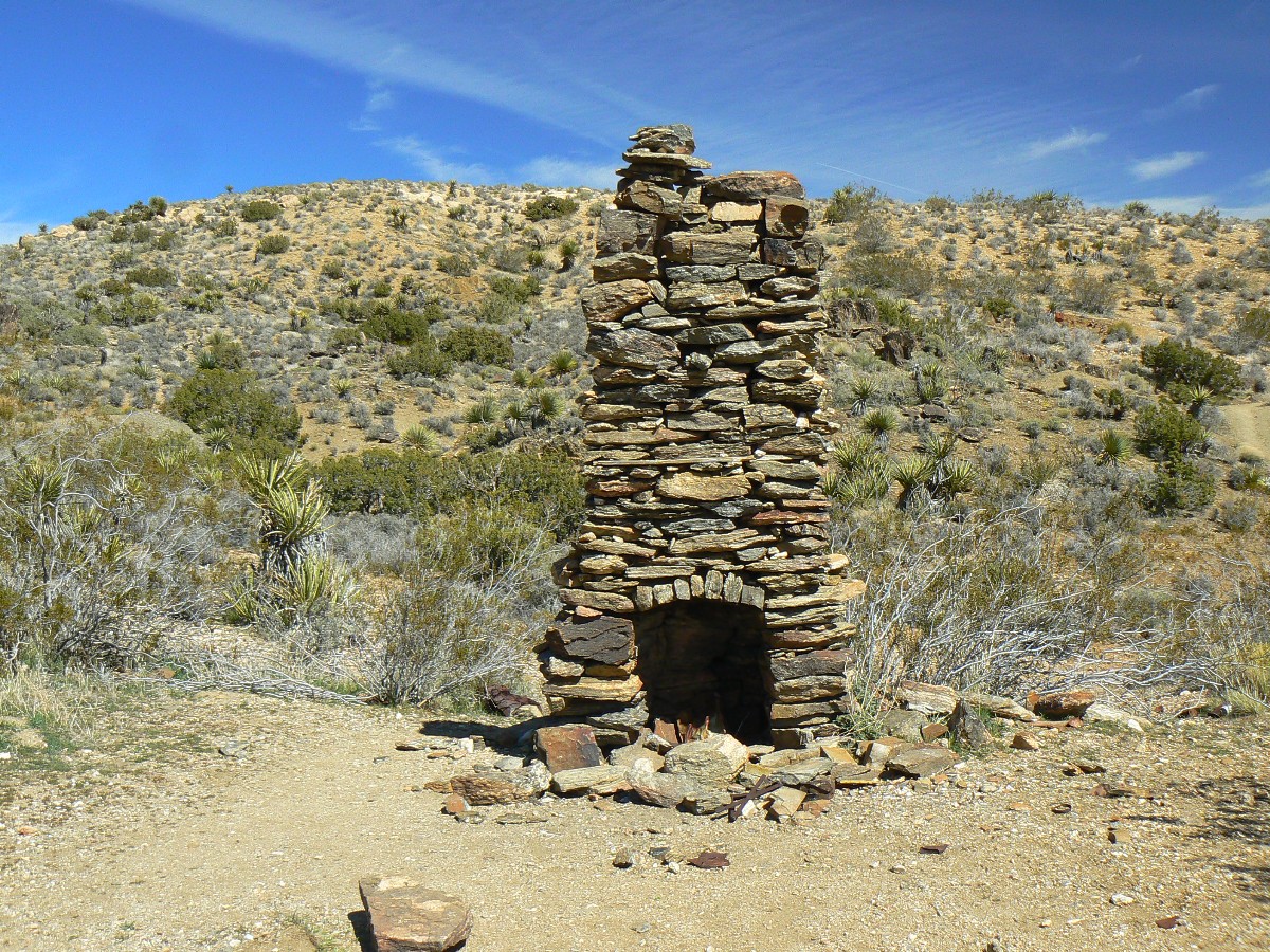
Continuing on, we stroll up Quail Wash and over a low pass to find a solitary chimney
- no hint of a dwelling anywhere. The geology changes, and we see old explorations and tailing piles. Miners, always
leaving the mess for someone else. I suppose all miners are republicans? At least the owners are - privatize gain
(ore extraction) and socialize loss (clean up of poisoned drinking water, toxins spread across land, air, water).
Tea-bagging to riches for the wealthy elite. Have those ignorant flag-wavers carry water for the rich elite, an
unconscionable welfare for the rich, while waving religious symbols and flags, while of course republicans cut the
programs that might improve the lives of the workers.
All the injuries related to all these roads where they should not be. Erosion,
habitat destruction, eye sore. Wondrous destruction, and so republican. We've our money in the bank, you clean up
our mess.
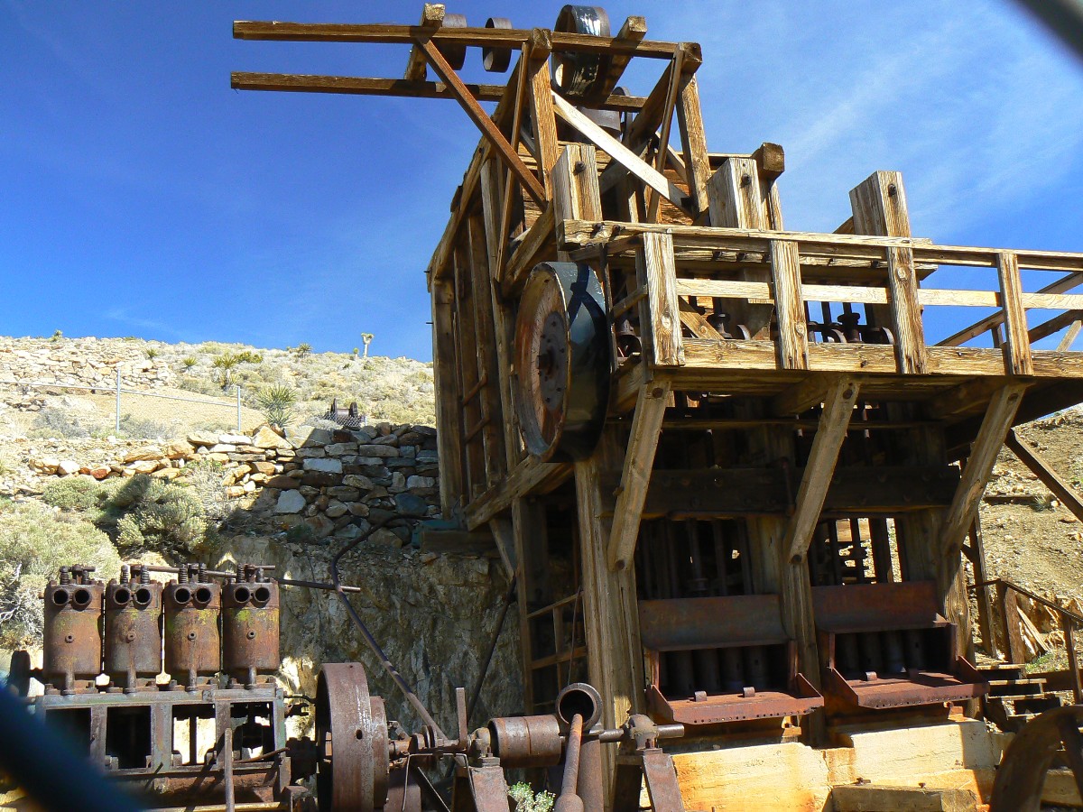
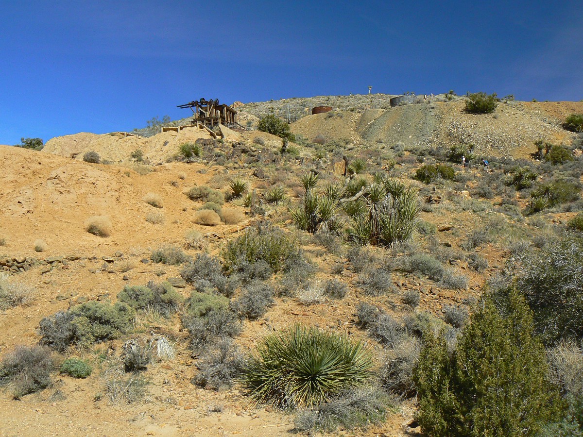
Through another pass and the main eyesore of the loop, a rambling eyesore that is
the Lost Horse Mine. Artifacts or junk? Junk. Still, one might wish to admire all the hard work.
A fire has raced through the area, cooking JTs and other yuccas and generally
blackening the area. Again with the old roads.
Completing the loop, my feet need a rest. What I find is a delightful scenic
toilet.
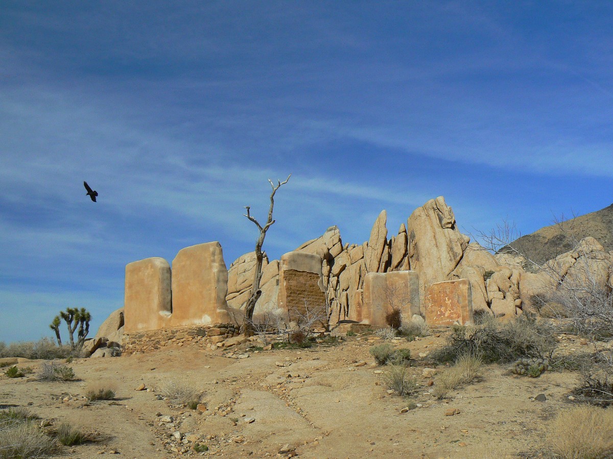
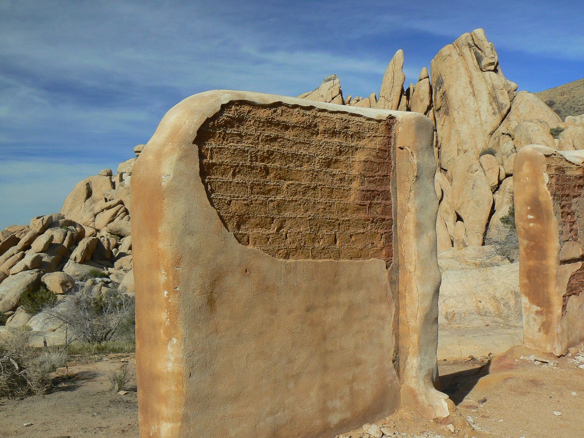
We stop at Ryan CG and walk out to admire the thick adobe walls of Ryan Ranch -
apparently a support base for the mine. Yet, it's the walls that catch my attention - conserving energy - and a
heat-moderating and retaining technology largely ignored today. Ignored in favor of producing more and more, more
square footage for more children - going over 7 billion this year. Shame on you religionists, right-wing "conservatives,"
preventing survival of other species and hastening a monoculture of not so humans. Conserving only the welfare for the
rich and corporations so republican in nature, while calling it something else - reframing the language associated with
inequality, is enough for tea baggers, not for thinkers.
|
|---|
Map - CA: Joshua Tree - Lost Horse Mine day hike; 2011; 8.5 miles
(Click the image to see the map)
|
|---|
|
Joshua Tree Dayhikes Day 2 (day 8 of index)
Day 3 (9) : Skullduggery Hike Ryan Mountain 3 miles, +1000'; Hunt for Skull Cap
and unnamed arches, 3 miles, 600'; 6 total miles, 12 ERM.
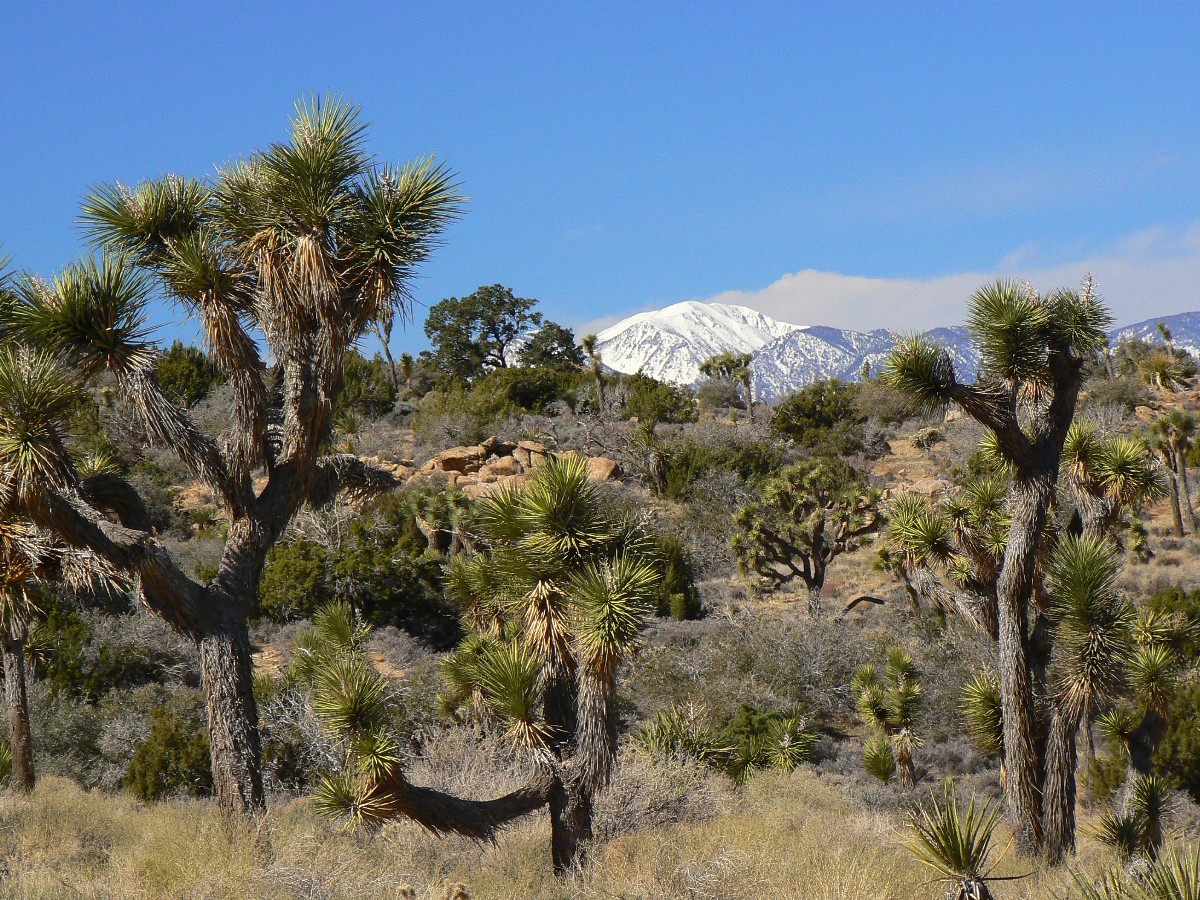
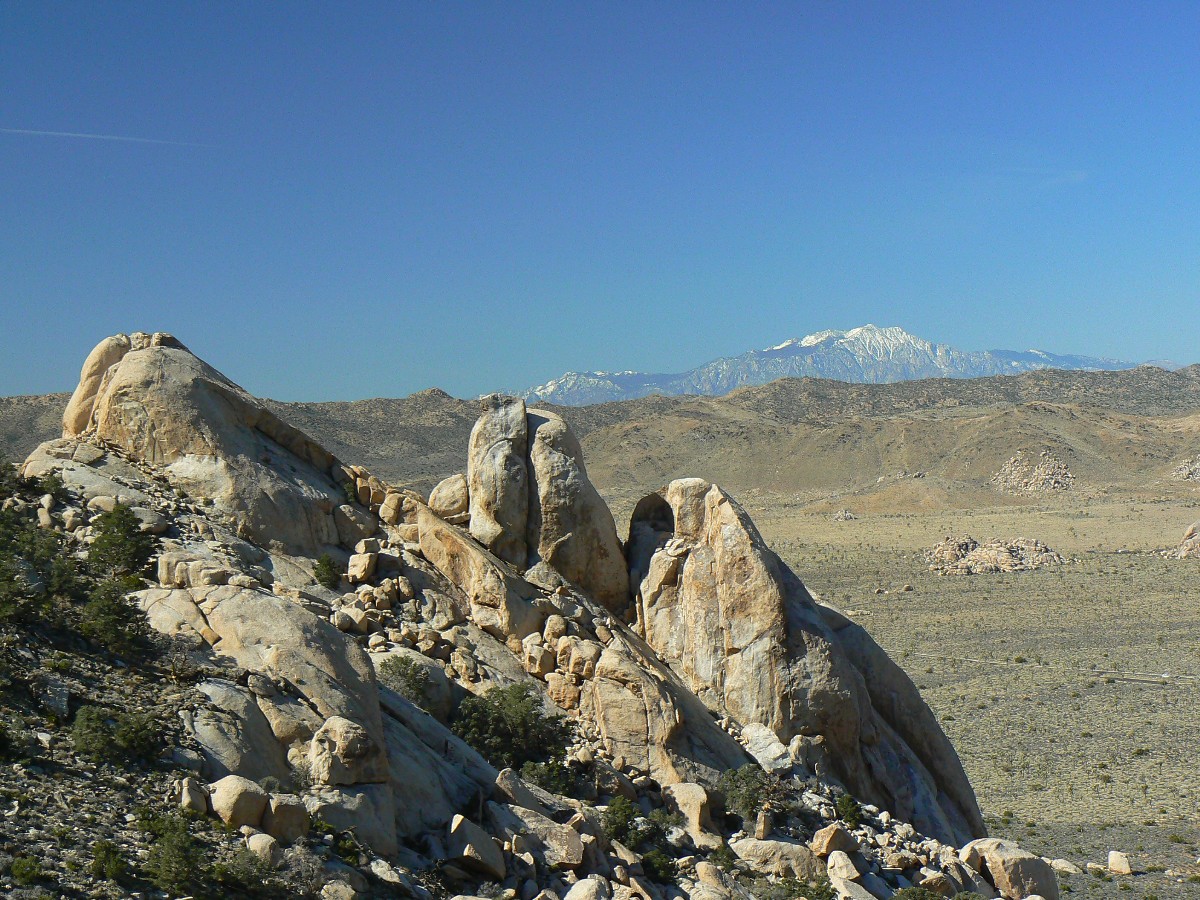
Mt. Jacinto blooms white-capped far behind the rounded white muffins of the Oyster
Bar. The foreground is speckled with worn outcrops of granitemonzonite and the Dr. Seuss-like JTs, not appearing to
have decided which way to grow. The undecided yucca, flaunting order and predictably unpredictable.
The trail is good and we zoom to the top of Ryan, 5400' something and back down and
return to camp before lunch. After some leisurely discussion with Edward and Pat from Frisco, CO, also escaping a
snowville, we set out from camp at Jumbo Rocks and hike to Skull Rock and beyond, looking for unnamed arches. Failing
in our first arch quest, we return to Skull Rock and find Skull Cap Arch and two companions.
Being Saturday, we are besieged by extra generators and far too many children who
cannot or will not stay on the trail, making showering less pleasant.
A lovely Ponderosa Pine fire drives away the desert cool after a slightly saffron
sunset.
|
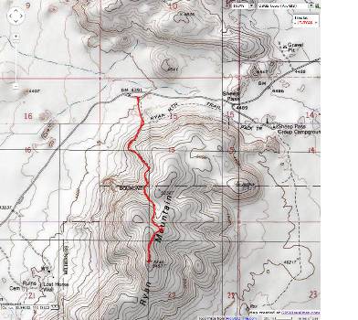
|---|
Map - CA: Joshua Tree - Ryan Mountain day hike; 2011; 3 miles
(Click the image to see the map)
|
|---|
|
|
|---|
Map - CA: Joshua Tree - Skull Cap Arch day hike; 2011; 3 miles
(Click the image to see the map)
|
|---|
|
Joshua Tree Dayhikes Day 3 (day 9 of index)
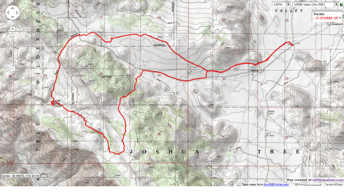
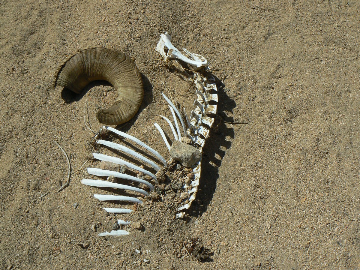
Day 4 (10): Stubbe or not Stubbe Stubbe Spring Loop, 13.6 miles, up and down 1150'; 18 ERM.
The Bighorn ram horn lies askew near its bleached and desiccated backbone and rib
cage. And in the drainage near the spring too. I don't see flowing water, just rushes and other plants not of the
desert - so, maybe the sheep found no water?
I wandered over to explore the spring after our lovely lunch in the thin grass beneath
a Pinyon Pine. The loop has featured more diversity than many JT hikes, with varying geology and plants, igneous and
metamorphic, JTs yucca cholla pinyon oak. Open country and canyon hiking too. Of course, the mileage is off, a common
feature of the JT area, it seems. Clockwise seems the best way to hike this loop - going down the soft monzonite more
often this direction.
The day started early - early with republican RVers starting up generators before
natural quiet hours have been enjoyed.
The loop ends as a bruised feet slog - partly because the mileage was more than
anticipated. Getting back to Jumbo Rocks, we enjoy a sun shower, a soda, an early fire because it seems cooler
than previously - or maybe we're just out of energy? The late sunlight angles in, adding a glow to the area yuccas
and the delightful pillowed rock muffins of granite monzonite.
|
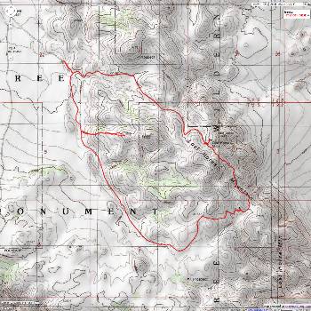
|---|
Map - CA: Joshua Tree - Stubbe Spring loop day hike; 2011; 13.6 miles
(Click the image to see the map)
|
|---|
|
Click here for -- fossil fools.
Joshua Tree Dayhikes Day 4 (day 10 of index)
Arches of the Joshua Tree Junket
The arches from the JT Junkets
include:
JT Arch
This curious arch can be found East of Covington Flats.
JT #13 Arch
This arch is in Belle CG, and abuts campsite #13. The GPS coordinates
for JT #13 Arch are:
UTM 11 S 590658E; 3762825N; WGS84
Granite Buttress Arch
A flying buttress arch of granite, this arch can be found just East of the
California Riding and Hiking Trail (CRHT), and just North of where the access trail from Belle CG joins the CRHT.
It's low in the fins of monzogranite. The GPS coordinates for Granite Buttress Arch are:
UTM 11 S 590851E; 3762899N; WGS84
Fish and Chips Arch
Look in the group of rocks South of Belle CG for this and Nose Ring Arch. You
will likely see Nose Ring easily. Look for Fish and Chips Arch on the wall to your left (facing Nose Ring from
the CG. The GPS coordinates are approximate because the rocks prevented good satellite reception. The GPS
coordinates for Fish and Chips Arch are:
UTM 11 S 590670E; 3762548N; WGS84
Nose Ring Arch (40-CA-193 in WAD)
Look in the group of rocks South of Belle CG for this and Fish and Chips Arch.
Nose Ring is nearly at ground level. The GPS coordinates are approximate because the rocks prevented good satellite
reception. The GPS coordinates for Nose Ring Arch are:
UTM 11 S 590627E; 3762571N; WGS84
Gourd Gauge Arch
Hike about 0.7 miles North of Belle CG on the California Riding and Hiking Trail
(CRHT). Look East and at the North face of a cluster of buffy-colored monzogranite muffins for this round arch.
With a bit of scrambling, one can access this arch from the South side. While strolling the CRHT, look for desert
gourds, which frequent this area. The GPS coordinates for Gourd Gauge Arch are:
UTM 11 S 591014E; 3763851N; WGS84
Mask of Zig Arch
Drive 0.3 miles East of the Skull Rock parking area, to a turn-out on the North
side of the road for "The Intruder" exhibit. Walk to the North, into the park behind the first group of rocks to
find the Mask of Zig Arch at approximately:
UTM 11 S 587115E; 3762787N; WGS84
Nasal Arch (near Skull Rock)
From the Skull Rock parking area, walk South to Skull Rock and look to your right
and up for Nasal Arch. You may be able to see this small arch from the road.
The approximate GPS coordinates for Nasal Arch are:
UTM 11 S 586886E; 3762256N; WGS84
Skull Cap Arch (S of Skull Rock)
From the Skull Rock parking area, walk SW 200 feet along the trail in the wash
parallel to the road. Turn SE and walk through a narrow ravine, out the other side and to the 0.2 mile point
beyond the wash near the road to GPS point:
UTM 11 S 586972E; 3762053N; WGS84
There are two companion mini-arches you might find on the way to Skull Cap.
Arch Rock (3 V21-35 on WAD; AKA White Tank Arch)
Drive into the White Tanks CG, and continue to the Arch Rock nature trail. The
trail starts from the distant end of the CG. Walk the trail over the first bump, and look to your right for Arch
Rock at:
UTM 11 S 590930E; 3761077N; WGS84
Arch Rock Sidekick
Is SE of Arch Rock about 50 feet.
Garrett Arch
Hike toward the Wall Street Mill from the Wall Street/Parker Dam TH. From the
mill, continue off trail, scrambling though and around boulders in the Wonderland of Rocks, toward GPS point:
UTM 11 S 579590E; 3767524N; WGS84
JT Skulker 1 and Skulker 2
From Garrett Arch, scramble and frictioneer the Wonderland of Rocks back to the
Wall Street Mill, passing the Skulker Arches along the way (follow the GPS route)"
Skulker 1: UTM 11 S 579523E; 3767354N; WGS84
Skulker 2: UTM 11 S 579457E; 3767254N; WGS84
JT-LEG Arch
Nearly back to Wall Street Mill from the Skulker Arches, look in a low min-alcove
for JT Leg Arch at:
UTM 11 S 579794E; 3766666 N; WGS84
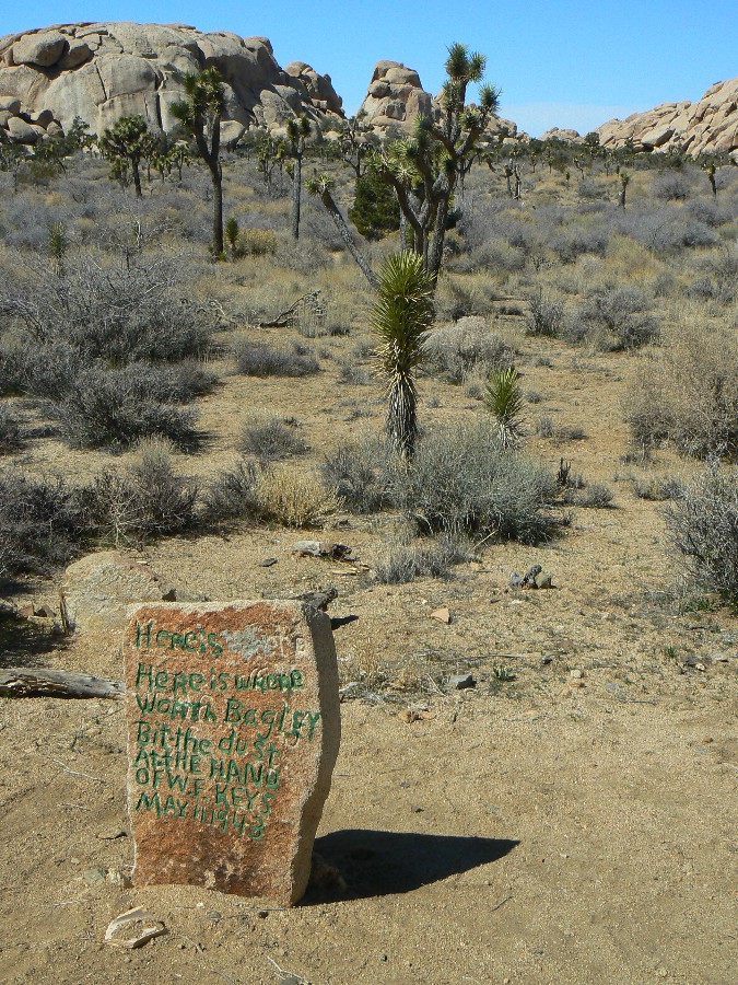
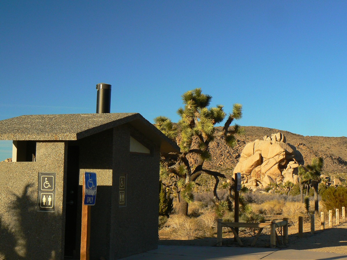
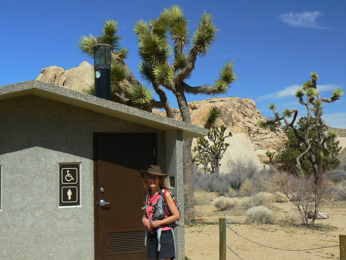
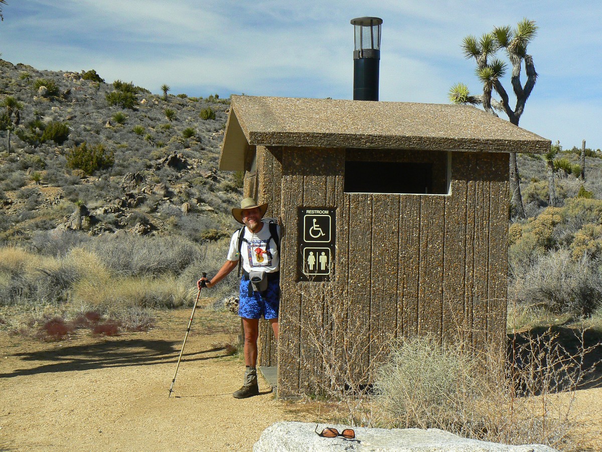
Scenic Toilets of Joshua Tree
U.S. seniors hardly rich
by Susan Jacoby
AZ Daily Sun, 3/16/2011
As the debate over the federal deficit heats up, Americans are going to hear a great deal about "greedy geezers" who are supposedly bankrupting the nation with Social Security and Medicare. Politicians will no doubt be more circumspect than former Wyoming Sen. Alan Simpson, who, as the Republican co-chairman of the federal deficit commission, described Social Security as a "milk cow with 310 million tits."
The myth underlying these attacks (including Simpson's misogynist bovine metaphor) is that most old people don't need their entitlements -- that they are affluent pickpockets fleecing younger Americans.
This image of prosperous geezers and crones is just not accurate. The notion of an aging population well prepared to take care of itself -- not only in its relatively healthy 60s and 70s, classified by sociologists as the "young old," but throughout the "old old" 80s and 90s -- is a delusion that threatens to undo 75 years of social progress that began when President Franklin D. Roosevelt signed the Social Security Act in 1935.
No generation stands to lose more from this fantasy than baby boomers, whose oldest members turn 65 this year. Because of financial losses in what will surely be known to history as the Crash of 2008, many boomers -- especially older ones with less time to recover -- may enter retirement in a worse financial position than their parents. According to a report by the Center for Economic and Policy Research, a liberal Washington think tank, households headed by boomers between the ages of 55 and 65 lost about half of their wealth between 2004 and 2009 as a result of the real estate collapse and the shrinkage of 401(k) retirement accounts. Americans at the lower end of the socioeconomic scale were the hardest hit, because for most lower- and middle-income families, their homes were their only assets. Furthermore, only half of working Americans -- the wealthier half with employers that match contributions -- even have tax-sheltered retirement accounts. The average value of these accounts, by the way, was only about $45,500 before the crash -- hardly a lavish retirement nest egg for boomers expected to live beyond 85 in unprecedented numbers. In just 20 years, the over-85 population is expected to number more than 8.5 million.
The archetype of the greedy geezer is based partly on a misconception about today's oldest Americans: the World War II generation. The frequently repeated statistic that 75 percent of all assets are owned by people over 65 is utterly misleading, because those assets are held in a minority of very rich hands. Nearly half of older Americans receive no income -- none -- from assets such as stocks and savings accounts. Of those who do, half receive less than $2,000 a year.
Three-fourths of those over 65, according to a report by the nonpartisan Congressional Research Service, have annual incomes, including Social Security, of less than $34,000. Furthermore, household income drops precipitously with every decade, and most of the poor in their 80s and 90s are women, who -- unless their husbands possessed vast wealth -- are very likely to become poorer when they are widowed. It has long been assumed that boomer women will be in a better economic position than their mothers, because more of them held paying jobs. But that assumption may be a fallacy, given the disappearance of traditional fixed pensions during the last three decades and the interrupted job history of many working mothers, which reduces Social Security income.
One major obstacle to realistic government and individual planning is incessant propaganda, much of it dispensed by boomers themselves, claiming that we are on the threshold of a "new old age" radically different from old age in previous generations. This spirit was embodied by a panel on aging, titled "90 Is the New 50," at the 2008 World Science Festival held in New York City.
In the "forever young" fantasy, boomers will be immune to the worst vicissitudes of old age thanks to medical breakthroughs and their own clean-living habits. The truth: Half of Americans who live beyond 85 will suffer from dementia, of which Alzheimer's is the leading cause, and half will spend time in a nursing home before they die. One can always hope, as I do, for medical breakthroughs to treat the worst scourges of old age -- especially Alzheimer's -- but they are more likely to arrive in time for the children or grandchildren of the boomers than for adults already in their 50s and 60s.
Furthermore, hope is not a plan of action. The saving of Social Security and Medicare for the boomer generation -- and generations to follow -- will require nothing less than a reworking of the intergenerational contract on which these programs were based. We now have a system (regardless of the ultimate fate of the decidedly modest health care reform law in the courts) in which people under 65 spend ever-increasing sums on private health insurance and only the old enjoy government-financed care. At the height of the debate in 2009, a national poll showed that two-thirds of Americans over 65 opposed universal healthcare -- except for themselves. This does sound like greedy geezers talking, but I suspect that it was fear speaking -- the fear that better health care for younger Americans would mean worse care for the old. What's wrong is not that the old have too much access to healthcare but that the young have too little.
The post-1935 intergenerational social contract, which depends on the willingness of young workers to pay for the dependent old, may crumble in the next 20 years unless the health care needs of young Americans are also addressed. Reworking the contract, and the programs that depend on it, will require aging boomers to recognize the financial stresses of younger workers, and the young to tell mean-spirited public figures like Simpson that Social Security is not a luxury but a permanent responsibility for all Americans of all generations.
Finally, a decent old age requires more than health care. Both higher taxes and more personal saving will be needed to support longer lives, however unacceptable that dual reality may be to political purveyors of unreason. If we are not going to kill Granny, we must support many more boomer Grannies. Or we can numb our brains with the delusion that 90 really will become the new 50 and that boomers will be able to work (and shop) till they drop.
Then we can just do nothing until time runs out and the reduction of poverty among the old -- one of the great accomplishments of America's 20th century -- is undone by our feckless fantasies.
Susan Jacoby is the author of "Never Say Die: The Myth and Marketing of the New Old Age." She wrote this for the Los Angeles Times.
Comic Connection - More Truth than
Joke
|