Winter Escape to DV Super Bloom
Bicycling Artist Loop, Dante View, Stovepipe Wells (136.5 miles).
Hiking Golden-Gower, Thimble Peak, The Room Canyon, and Mormon Point Canyon (19.8 miles)

|
| |||||
|
| |||||
|
| |||||
| ||||
The bicycling adventures and Furnace Creek CG events were organized by Cheryl
Soshnik and others of the Wasatch Mountain Club. After the bicyling adventures, the WMC returned to Smog Lake,
and a group of 5 stayed in DV for day hiking.
.
Camera: Panasonic DMC-ZS19
Maps: Maps were made by loading my GPS tracks into GPSvisualizer.com and taking a screengrab of each map.
Day 1: Summit to Sea, to DV.
I'm riding the old Trek bicycle (circa 1983) to Texas Springs CG,
warm wind blowing through my unhelmeted hair, swirling about my loosely sandaled feet. Ahh, the tarmac
test ride of the bike prior to the trio of road rides (where I wear helmet, cycling shoes, etc.).
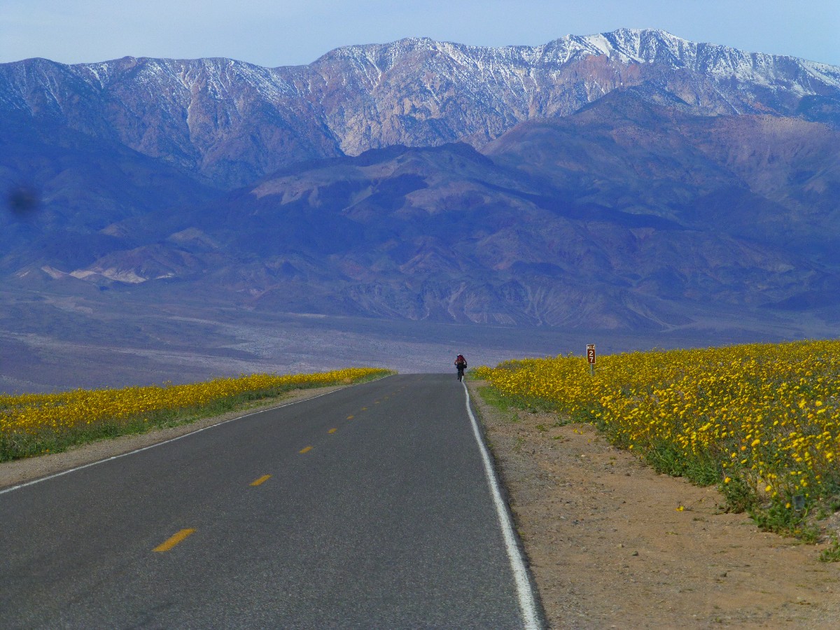
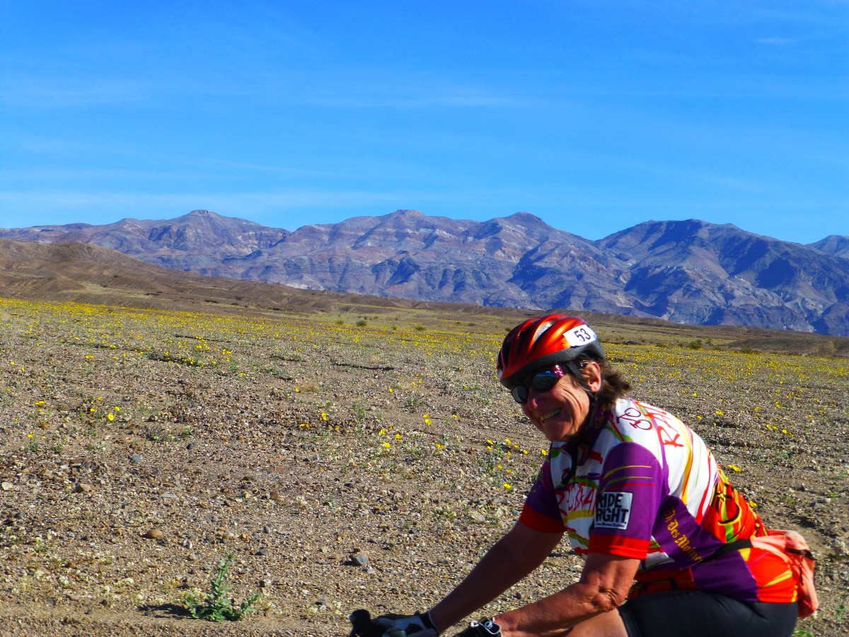
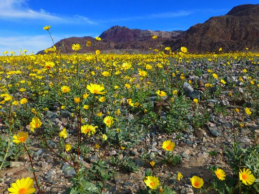
Yellow flowers of the desert dot the colluviums gradually slumping
toward the basin floor, with a backdrop of the crenulated Funeral Mountains. Gorgeous. And, it's warm,
hence the moniker "Winter Escape."
It's been an uneventful trek from the chilly heights of the Colorado
Plateau to this rain shadow desert drain. A desert sea? Summit to sea.
A generous dosing of Mango Tango (mango mix and spiced rum), and I zonk
out reading an ebook. Yelping Coyotes wake me, still holding the phone. Hold the phone, I'm home.
It's another visitation of the Death Valley Winter Escape organized by
Cheryl Soshnik of the Wasatch Mountain Club (WMC). At least the biking part of this adventure, after which
I extend the campground reservation for hiking.
I stopped in Lost Wages and obtained a baker's dozen potato bagels, which
now reside in my 6-day cooler along with assorted fixings for breakfast burritos, humus, lasagna, chili verde,
and, of course, beer. The cooler is swaddled in my small yard sale duvet. Note - the two blocks of ice
last the entire 8 days of this adventure in this set-up. The over-arching Australian Pines (they look like
Tamarisk, but are not) in camp and the top-insulated shell on the truck help in this ice conservation.
A botanical site notes that "The Australian pine, also known as “ironwood”,
“horsetail tree”, “she oak”, “beefwood”, “Australian oak”, or “whistling pine”, has a pine-like appearance but
is not a pine (Pinus), an evergreen, or a conifer. Rather, it is a deciduous tree whose branchlets of scale-like
leaves are mistaken for needles, and whose round brown fruits resemble acorns." Another source reports that
"Australian pine now occurs throughout South and Central Florida, the West Indies, Mexico, and elsewhere in
tropical regions outside its native range. Because of its aggressive growth rate, never plant Australian
pine trees. There are native trees that provide shade and do not harm the environment. Possession of Australian
pine with the intent to sell or plant is illegal in Florida without a special permit." Are we talking about
invasive plants or republicans and the one-percenters (of both parties)? Is there really a difference? Both
are selfish and take all the resources available, refusing to share with others, including those who have helped
in their establishment.
Death Valley 2016, Photos - Day 2
 |
 |
 |
 |
 |
 |

| ||||
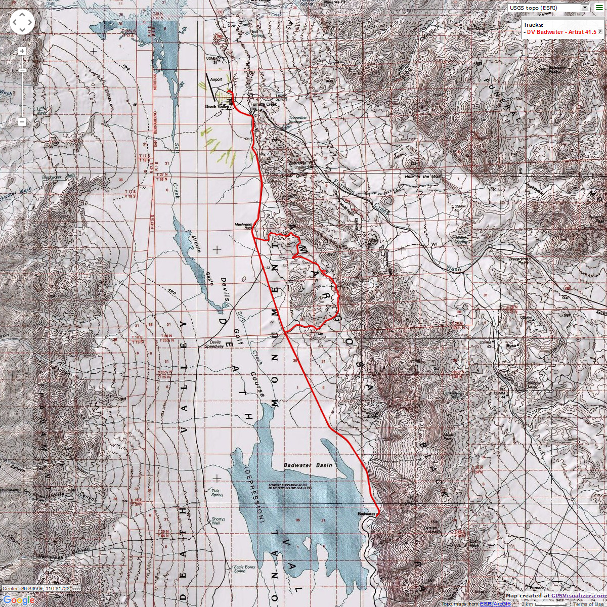
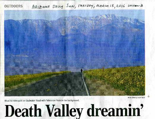
Day 2: Artistic Adventure. (bicycle), 41.5 miles from Furnace Creek to Badwater
and back via the Artist Loop.
The Artist Loop grade feels like more than the 12% or 14% it is.
A puffer. Inching up the incline, the angle lessens and, wait, there's Mark S. stretching the tube
from his overturned bike. Blowout. Riding too fast? After the repair, we continue to Artist Pallet
for lunch. It's warm, almost too warm, but just right for the plunge back to the main road. The heat
of old sol is gratefully accepted.
Lunch at the Palette is followed by a deep dive, thundering the
curving tarmac, then, yikes, back uphill to the real highpoint before twisting downhill, back to
the main road and the return leg to Furnace Creek.
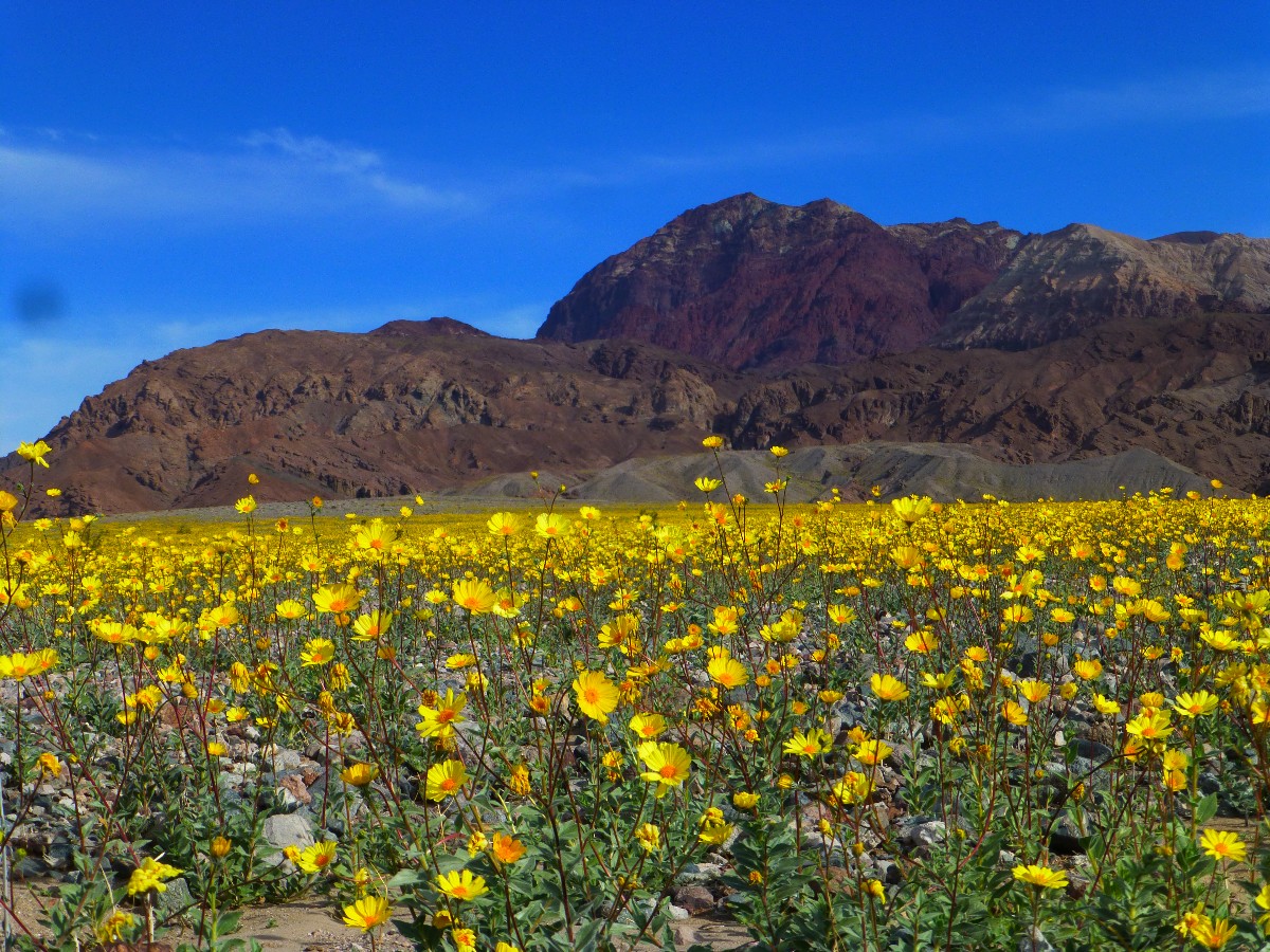
Flowers of purple, white, mostly yellow grace today's ride.
A deluxe warm sunshower eases off the road grime and helps transport
me into a lasagna dinner before observations of the new moon sky, in this official Dark Sky Park.
Brilliant, and it would be stunning if not for the intrusive light emanating from winnehogos.
Death Valley 2016, Photos - Day 3
 |
 |
 |
| ||||
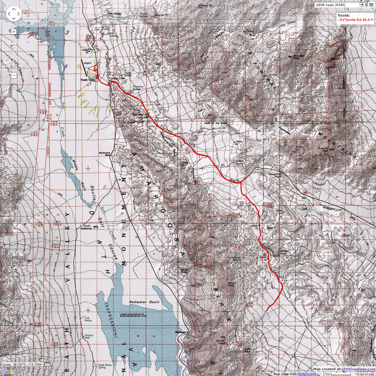
Day 3: Daunting Dante. (bicycle). 44.4 miles and 4,000' elevation gain on the road to Dante View.
The grade grinds without heel. And, it's getting steeper as we approach
Dante View. The last portion of the 13-mile Dante View Road is a 15% grade. A lactic acid wonder.
I start today's ride with Rick and Mark, then Rick continues toward the
divide and Mark and I take the road toward Dante View. It's another lovely day, with a mild breeze, lots
of sun, and rising temperatures. We ride past the devastation of republican miners, who have done the
corporate welfare thing, privatize the gain and socialize the loss - take the money and run, leave toxic
and other waste for the public to deal with.
Creosote Bush dominates the colluviums, the alluviums, replete with
poisonous roots to keep other plants distant. Does this sound like the model of the one percent, "I've
mine, you're on your own, stay away," despite the great extent the one percenters were helped by public
infrastructure (schools, roads, nonregulation of wallstreet, tax dodges for corporations and the rich, etc.).
It's a selfish repulsican model, adored by our current crop of repulsican candidates - get your private gain
and socialize the loss, leave others behind while chanting a religionist mantra (without substance) to cover
your carnage, then blame problems on the socially responsible who are attempting to make things better for all.
Up above the trailer parking area (too steep ahead for vehicles with trailers)
near the Greenwater Road, grind. The grade continues. I conk out and float back to the trailer turn around
for a lounging lunch, where Mark joins me after grinding a bit farther, nearing Dante View. I've totted extra
water and a full lunch for this epicurean episode.
After lunch, there's nearly total downhill back to camp and a luxurious sun
shower. Of course, the 2nd law of bicycling interrupts - "The wind is always in your face!" - and we have to
peddle some on the way downhill.
Death Valley 2016, Photos - Day 4


| ||||
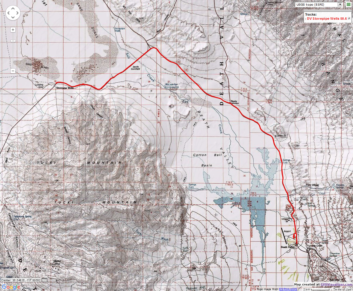
Day 4: Stovepipe Stuffing. (bicycle). Stovepipe Wells, 50.6 miles.
The bright yellow composites (Desert Gold) range up the alluvial fan
toward the corrugated mountains. Cheryl the flower girl rides along this smorgasbord of color, bound
for Stovepipe Wells.
It's a glorious day, a bit cool at the start of the ride, then warming
with calm winds. The course today is more mellow than the previous two days.
Temps warm, yet it's not hot. The riding is a cruise, an enjoyable one.
Rolling from below sea level, to sea level, down, up, roll. Past the Devil's Corn Field and the Mesquite
Sand Dunes to Stovepipe Wells. Lunch is enjoyed in the shade of the general store patio.
It's tough to ride a continuous cruise on the return to Furnace Creek.
How come? Well, it's because the festival of flowers interrupts me. "Wait, have I seen that flower before?"
I ask myself. "I better take a photo of this show, it may not happen again when I am here." I ride
to the Furnace Creek general store to trip the odometer over to 50 miles, then return to camp for a hot
shower, journaling, post-ride snacks with a savored cerveza, and dinner, followed by an NPS program about
Coyote voices and then some star gazing with Bob G.'s telescope before the tent calls.
.
Death Valley 2016, Photos - Day 5
 |
 |
|
 |
 |
 |
| ||||

Day 5: Golden (Hiking). Golden - Gower Gulch loop, 6.8 miles.
Hiking. It was biking and now it's hiking, which feels a bit oddly unusual.
The knees protest some, and creak along. Today, Mark S. and I are hiking to Zabriskie Point via Golden Canyon,
then returning to the TH via Gower Gulch. The day begins late, after waiting for WMC folks to vacate my
individually-reserved camp so that remaining hikers could relocate. The WMC throng is returning to Smog Lake,
and five of us are staying
on at my previously-reserved site for day hikes, including Donn Seeley, Mark Shipman, Jerry Hatch, Bob Grant,
and me.
Golden Canyon is of Star Wars fame, one can imagine R2D2 rolling along the mud
plain. Today, the hiking is smooth and picturesque as Mark and I climb out of Golden and around the buttress
base of Manly Beacon, and to Zabriskie Point. A place crowded with visitors from around the globe. It's the
hazardous part of the trip, weaving through an overpopulation of selfie-stick waving tin can tourists intent
on clogging the near view. Well, it's good to see they have ventured out of their tin can contraptions to
meet the world, see some rock, grind some silt into their jelly shoes, breath the low humidity desert air.
After some gazing at layers of talc overlaid with ebony basalts and reddish
basalts and the breccia of Red Canyon, we drift down Gower to a luxurious lunch in the shade of tilted mudstones
and what appears to be talc. Tasting a quartz-like rock, it tastes not soapy (borax) or salty (alkali or sodium),
so it's probably a quartz.
Then, along the front of the Badwater Basin, past some assorted flowers, and
back to the TH to close the loop.
Death Valley 2016, Photos - Day 6
 |
 |
 |
 |
 |
 |
 |
 |
 |
 |
 |
 |
 |
 |
 |
 |
 |
 |
| ||||

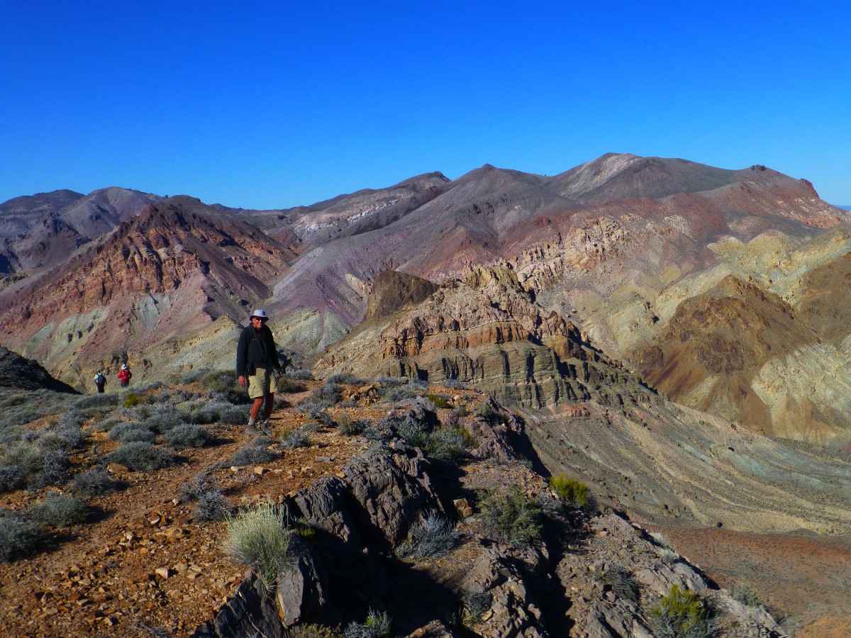
Day 6: Titans of Thimble (Hiking). Thimble Peak (6,381'), 4 miles,
up 2000', drive Titus Canyon, visit Rhyolite Ghost Town.
The sheep scat pellet sweeps and bounces across the knobby gray cheese grater
limestone slab, propelled by the vicious and surprisingly cold wind.
Donn Seeley (WMC Hikemaster), Mark Shipman, Jerry Hatch, Bob Grant, and I are
nearly to the top of Thimble Peak (6,381'). The vista evolves into a 360 degree view of stark desert peaks,
many sporting multi-colored layers, many also faulted and folded. We're on the surprising summit of Thimble.
Surprising because I thought we had a few hundred more feet of cheese grater scrambling to reach the top,
yet we pop out of a short cleft and here we are, panorama time.
We're off to Nevada and Rhyolite (a fine-grained
igneous rock rich in silica: the volcanic equivalent of granite; and the name of this once populous place),
now a ghost town, was once a thriving welfare mining burg. Yes, invade public lands, rip out the commercially
available gold and such, and leave the clean up to the public, "Make America Great Again!" says trump.
We visit Rhyolite, with its false facade fronts, Tom Kelly's bottle house, and train depot transformed into a
hotel then a Rhyolite Ghost Casino, and now a haven for scorpions and rats (actual rats, not repulsicans).
From 1905 to 1911, this town was populated by up to 8,000 people.
On to Titus Canyon, where we drive to Red Pass, park, and hike the steep
ridge to Thimble.
Returning from Thimble, we continue to drive down and down Titus, past
petro boulders and talus piles of mine waste, and into glorious limestone narrows, occasionally striped
with seams of marble. Nearing the lower opening, the sun glows gold on the tortured rock. Today, I could
have driven a Subie down Titus, yet realize that this is not always the case. Thanks to Donn for a most
excellent tour.
Death Valley 2016, Photos - Day 7
 |
 |
 |
 |
 |
 |
 |
 |
 |
 |
 |
 |
 |
 |
 |
| ||||
| ||||
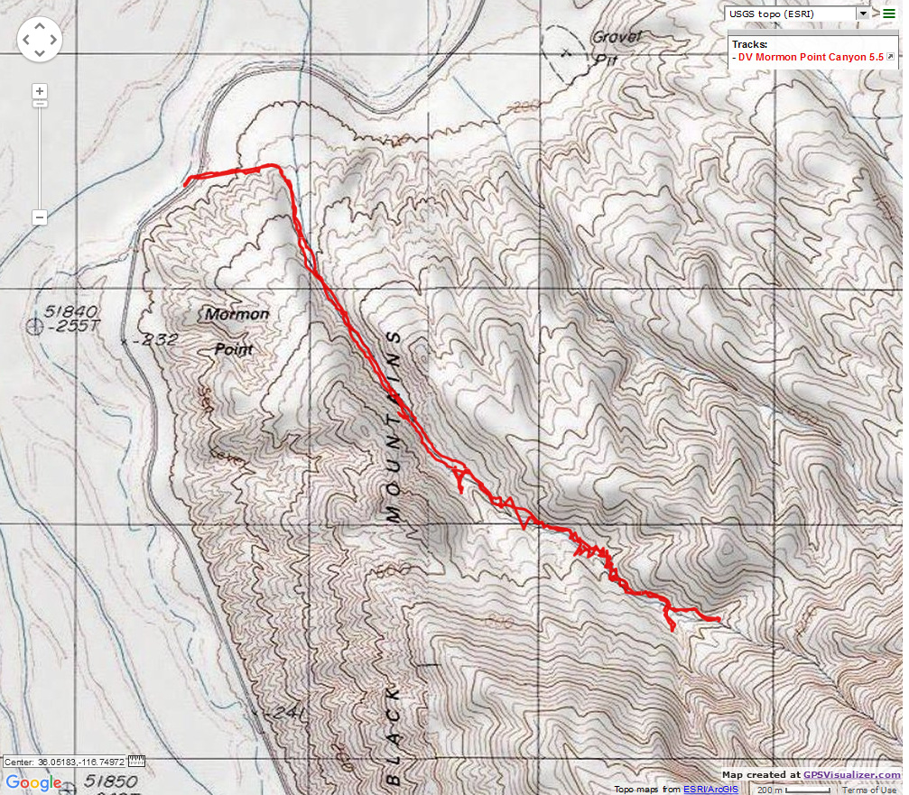
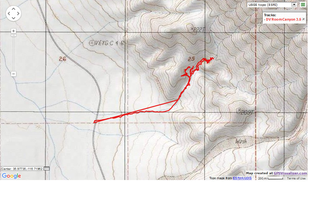
Day 7: Slipping the Slots (Hiking). The Room Canyon and Mormon Point Canyon. 9.0 miles.
Donn hears a hummingbird in the creosote bush, and I peep in to see a
tiny nest cradling two alabaster eggs. It's a flower flurry to the extreme, and I trust the hummer is easily
finding plenty of nectar and tiny bugs. Emphasizing this, Golden pollen coats the boots and occasionally
puffs into the air.
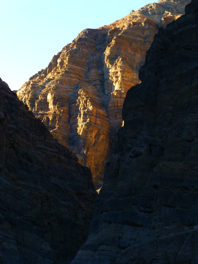
After ranging up the slanting slope of the colluvium/alluvium incline,
we reach the Fanglomerate Conglomerate columns and serpentine narrows of Room Canyon. You'll notice that
most (all?) Death Valley slots are preceded by a ranging hike up a slopping colluvium/alluvium wedge.
We weave a near loop in Room Canyon, slipping up one narrows, crawling through a notch to enter the slot,
to look into a parallel slot abutting the narrow separating ridge.
Continuing in the main drainage, we pop out into the Room, and soon after
our walk terminates at a dry fall that nearly reaches to the low plateau above. Back into the narrows for a
quick lunch; quick because Donn has visions of Mormon Point Canyon. Soon, we all do.
Again the wedge walking to where the evolving walls, steadily rising out
of the incline, narrow into a gnarly sinuous fanglomerate slot. Lovely. This time, it's Mormon Point Canyon.
And, the narrows curve farther than slots we have hiked on this escape. Again, we're greeted by a dry fall.
This one we could surmount, yet it appears that the canyon opens above and is therefore of less interest.
Besides, the shadows lengthen and our stomachs yearn for breakfast burritos, beer, humus with crackers, cheetos,
celery, carrots, yumm.
Now, we're flying back to camp, and I'm shooting a bouncing video of Desert
Gold ranging the colluvium/alluviums to the base of the Black Mountains. It's a swirl of the real gold of
this desert. Glorious.
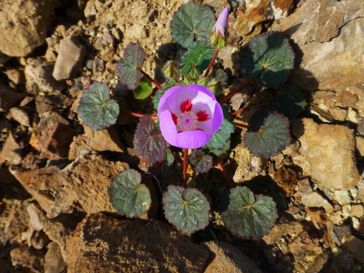
Desert Gold, Brown-eyed Evening Primrose, Notch - leaf Phacelia, Lesser
Mojavea, Desert Five-spot, Gravel Ghost, Lupine, others unnamed. Lots of flowers, in kind and in number.
Wind is kicking up dust, obscuring the mountains during our drive back to
camp. It blows intermittently hot and cool during the evening, making sleep conditions poor.
Day 8: Sea to Summit.
It's time to either head for the backcountry or home. So, I weigh
the choices and travel from below sea level to about 7,000' on the Colorado Plateau, enjoying the trip
from sea to summit, mentally rehearsing the Desert Gold in them there hills.
| ||||

.
| ||||
.
Seeley's Travels, Death Valley 2016
Bird and Hike site content page: Death Valley hiking
Death Valley Dreaming: Biking and Hiking Death Valley - 2011
Death Valley Dreaming: Biking and Hiking Death Valley - 2012
Backpacking and Biking Death Valley - 2013
Backpacking and Biking Death Valley - 2014
Death Valley Dreaming and Marbelous Marble Canyon Backpack, 2015
Scenic Toilets of Inner Earth.
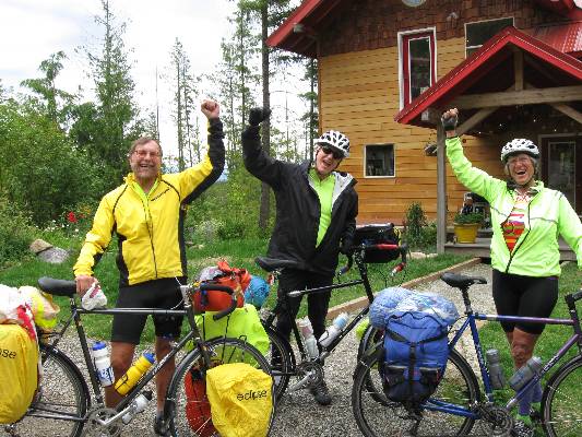
Click here or on the happy cyclists to go to all WV reports about Bicycle Touring
| ||||
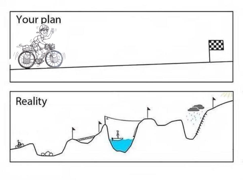
More Truth Than Joke:
| ||||

| ||||

| ||||

| ||||

| ||||

| ||||

| ||||
|
Wild Vagabond Main |
Trip Report Index  |
Caveat  |
|---|