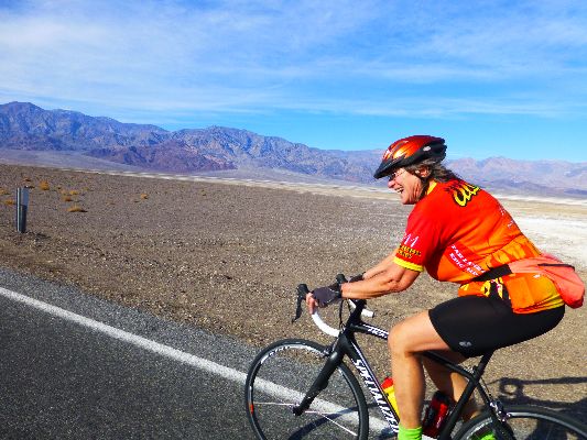
Bicycling Artist Loop, Dante View, Mesquite Sand Dunes (128 miles).
Backpacking Marble Canyon - visiting Gold Belt, Dead Horse Divide, and thar Dragons' Eggs (30 miles)
Followed in March with Dreamer Day Hikes (24.6 miles)

|
| |||||
|
| |||||
|
| |||||
| ||||
The bicycling adventures and Furnace Creek CG events were organized by Cheryl
Soshnik and others of the Wasatch Mountain Club. The backpack was organized by The Wild Vagabond.
| ||||
Preliminary: The full moon is so bright I am prompted
to deploy the sun visor as I roll off the Ponderosa-infested plateau toward desert dwelling, watching for Elk
in the ebony pre-dawn on the Colorado Plateau. It's a descent through several ecological zones, from nearly
8,000' in elevation to a minus (below sea level) reading. Summit to sea? Yes, in a way that's correct.
.
Having stripped from pile to shorts, I set up the 30+ years old VE-24
under an ancient invasive tamarisk, which shields the precious mountain tent from sun and some of the wind.
Dave and Michelle arrive, Matt appears. Cheryl and Tye (her new knee), organizer of the bike tour event,
return from their daily cavorting. Deluxe.
The second part of this Dreamer tale is about backpacking Marble Canyon.
Kathleen and I returned to DV in March to continue Dreaming, this time
enjoying day hikes.
Day 1, Bike. Mauve Meander. CG (Furnace Creek Campground) to Bad Water and Artist Loop. 42 miles.
Crenulated, crinkled mauve terrain. Shades of mauve as we inch up the
Artist Drive, toward the Artist Pallet. Yet, what texture to the terrain, like the ridges of Einstein's brain,
only jagged.
The day starts with Rick K., the Ride Leader, detailing the ride and the
possible consequences of poor planning. Then, the rolling flat to Bad Water, over 200' below a rising sea
level. (Currently -282' at Bad Water.) Approaching this low spot, I see the reflected twinkle of windshields
in the parking lot and cheer "to Oz, we're going to make it to Oz!" Too much sun on the head? Reading too
many accounts about superstition taking over faux news and the repulsican party? Nahhh, just some
electrolyte imbalance, I insist, positioning myself as a reality-denier.
A decent snack below sea level and we ride on to the Artist Loop.
It's a steep climb. Arriving at the first high point, a group of us clown with the "Dip" sign and rejoice.
Down, refreshingly down, and then briefly up to the Pallet for lunch. Ahh. Again, a thundering down
to an abrupt "U" turn and then, again up. Argh. Closing the loop is a serpentine plummet to return
to the Bad Water Road. Tired now, it's a bit of a grind back to Furnace Creek CG, a luxurious sun shower,
followed by appetizers and a gluttony of salad, Dutch oven chicken, potatoes, carrots, onions by chef
Robert T., and a nightcap of brownies. Yummy. Juvenile Coyotes wail their high-pitched howl as background
sound - before the drone of winnehogo heaters and monoculture equipment (golf course) intrude.
Day 1 Bike
 |
 |
 |
 |
 |
 |
 |
 |
 |
Day 2, Bike. Fire Wind of Dante? To Greenwater Rd, Dante View Rd. 40.3 miles.
I'm sheltered in the (last of its kind?) U.S. made 30+ year-old
VE-24 North Face tent, hiding from the 50 MPH South wind, blowing like the fire wind of Dante. Yes,
it's a warm wind. Thanks to the full fabric mountain tent, where sand and dust don't sift onto your
face and other body parts, sifting through the mesh like flour through a flour sifter. Argh, yet not today.
The day starts calm, with the steady grind up from below sea level
to near 2,000' and the Dante junction. Turning up canyon toward Dante View, the wind blossoms and
builds. Low gears and more elevation (3,000'?) to Greenwater Rd. and the trailer drop-off lot, all
the Dante stretch with the strong wind in my teeth. It's too steep ahead for long or heavy vehicles,
winnehogos, hence the trailer drop-off lot. I've dropped off today. I wrap my yet unused wind jacket
around a wheel and it and clumps of creosote bush break the wind for lunch.
Downhill with a tail wind, yahoo. Approaching speeds of 45 MPH, yet
cross-gusts prompt reduction to a lower rate. Then, a repeat on Hwy 190, near 45 MPH at times, with
most of the way seeing speeds of 25-30. Down. Shower. Help with dinner and then over to see an NPS
presentation on the night sky. The Dippers and Orion brightly beacon and beckon.
Day 2 Bike
 |
 |
 |
Day 3, Bike. Concluding the Rolling 40s. To Mesquite Dunes. 46 miles.
The Devil woman slithers from the Prius, her ruby red body sultry
suit shimmering like a Las Vegas Strip sign. Strip? OK, I'm waiting. Floating in her wake is a
caped white-washed apparition posing for unearned gratuitous attention. Maybe now I've arrived in Oz?
Perhaps they've missed the Las Vegas bus stop? It's gaudy foreground to the naturally scenic dunes.
I'm resting in the shade of the scenic outhouse and enjoying the view.
It's been a breezy ride to the dunes, a lovely respite from yesterday's gale.
The ride back to Furnace Creek CG is superb and feels like it enjoys a
tailwind boost. In truth, the air is calm. And, scattered clouds ease the predicted 86F heat wave, which
feels good on the lizard hide.
Back at camp, Cheryl is organizing hors-d'oeuvres and Matt is cooking
quesadillas topped with guacamole. Will there be stomach room for dinner? As the time of the crepuscular
approaches, a sharp contrast, light to dark, appears in the sparkling relief of the Funeral Mountains.
Day 3 Bike
 |
 |
 |
.
Summary: Cottonwood-Dead Horse-Marble Canyons Backpack Loop.
This 35-mile backpack, with side trips, is
said to be the "most popular" backpack in DV (Death Valley). Go slightly off-season and you
may encounter wondrous solitude. It's popular because it features wonderful limestone narrows
and has water near decent campsites. Just how popular is backpacking in DV? I suggest you
take topo maps (Harris Hill & Cottonwood Canyon 7.5 minute quads; USGS) and talk with the DV
Rangers about the route into Dead Horse from Cottonwood.
We backpacked into a base camp in Marble Canyon, then enjoyed some
day hike adventures from there, visiting Gold Belt, the Dead Horse-Marble loop, and thar Dragons' Eggs. Yargh.
Co-adventurers: Dave Rumbellow, Michelle Couderc, Rob
Camera: Panasonic DMC-ZS19
ERM - Energy Required Miles. A mile is added for every 500' elevation gain or loss. It's a very serviceable method of estimating energy required miles.
Total trip - (per my GPS) of 30 miles and total ERM = 56. (Includes side trips.)
| ||||
Day 1, Pack. Debris or Not Debris? To Marble-Dead Horse Junction. 6 miles' ERM of 12; camp at 3100'.
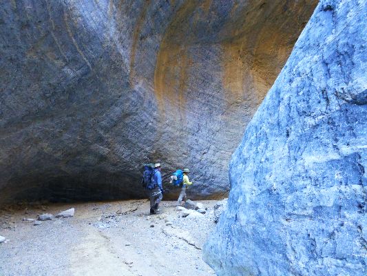
Michelle C., Dave R., and I are hiking the flat hard surface of a massive
debris flow and we have yet to find the head of it. Traveling with force, it surmounted and coated the Goldbelt
boulder at the mouth of the Dragons' Eggs canyon with a hard adobe. A small flow of water later cut a narrow
channel in the mudstone. Flowing like Pahoehoe Lava, the flow billowed and pillowed around obstacles. Tracks
of a slithering snake cross the flow and are now petrified - at least until the next good rain.
Petros pop near the entrance to a narrows. Do they direct one to the land of
spirit karma or the next fast food joint?
Reaching the junction of Marble and Dead Horse, we observe mudstone issuing
from both canyons, while the majority seems to have coursed down Dead Horse. The flow of water from the spring
is more vigorous than I have previously seen. The wind is cool and the Milky Way dense and profound.
Day 1 Backpack
 |
 |
 |
 |
 |
 |
 |
 |
 |
 |
 |
 |

| ||||
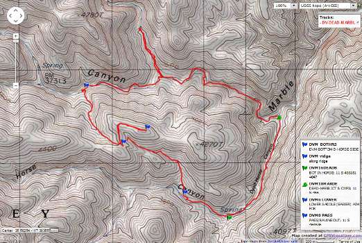
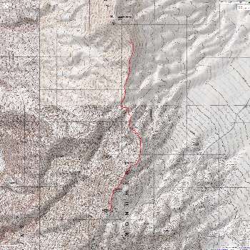
for a full-resolution map, click here. Caution - do not use this map or gps track for navigating the route. It can be a tricky place
Day 2, Pack. Smooth as Marble. To Gold Belt Springs. 12.5 miles; ERM of 20. Same camp.
The polished white rock is marbled into limestone, the white intertwined
with the gray. A commentary on blending of communities? Marbelous.
We're winding up the narrows of Marble Canyon, heading to Gold Belt Springs.
The sign pecked into the desert varnished boulder near camp predicts "4 miles, Gold Belt," yet we're not
inclined to believe this, something noted by a republican miner.
Past some shattered Cottonwoods - killed by the consequences of over-population
and corporate greed-driven climate change. Past the ravine that leads to the Dead Horse Divide, still walking
more of the debris flow pavement. This gunk came from the arm with the flowing spring (side canyon to Marble),
yet the spring still functions. On up canyon, no debris pavement here. Two more dry springs. Finally, the road,
collapsed structures, an overturned Lincoln rusting with a beer can halo, an abandoned WWII military surplus Dodge
Power Wagon deteriorating in the unrelenting sun. Typical of miners and all corporations - privatize the gain
(extract, ruin the land) and socialize the loss (leave trash and toxins and debt and clean-up for the public).
The repulsican way.
A quick look around and it's time to go quickly back, arriving at camp in time
for a cool water bucket bath as dark settles. Then, the crepusculars pop-out. Bats, Long-eared Owls, Orion,
the Milky Way skylight, the cup of the Big Dipper, and much later, a goodnight moon. And calm wind, in great
contrast to last night's tent-flapper. Goodnight moon.
Day 2 Backpack
 |
 |
 |
 |
 |
 |

| ||||
Day 3, Pack. The Horse is Dead. Dead Horse Divide-Marble Loop. 6 miles; ERM of 12.
A moon-scape greets us after clambering up the short pour-off in Dead Horse
Canyon. The thickets of willows and tamarisks and other brush we fought through last year have been ripped
out or paved over by the debris flow. Easy walking today. Locating the unmarked ravine entrance, we climb
to the divide between Dead Horse and Marble for a snack, which we enjoy by peeling off the ridge far enough
to get out of the gale sweeping over the divide. Exploring along the ridge a bit, we can see the spring
canyon in Marble far below, where some of the debris originated, and farther up Dead Horse too.
A phalanx of struggling Joshua Trees stand limply off the divide. We exit
the ravine route near the decrepit Cottonwoods to enjoy lunch. After lunch, we walk a side canyon to where a
granite intrusion creates a barrier which we partially scale.
Again, we enjoy the lilt through the narrows of Marble above camp. Glowing.
Another brisk evening develops and yet we have seen no others since the TH.
Deluxe. Saffron clouds blend to pink and then seem to dissolve into the black blue of twilight.
Day 3 Backpack
 |
 |
 |
 |
 |
 |
 |
 |
 |
Day 4, Pack. Thar be Dragons' Eggs. Return to TH. 6 miles; ERM of 12.
Strolling the adobe pavement, we're early on our exit from the Dead
Horse - Marble confluence. Down, pausing briefly to seek Dragon Eggs. Down more. Slithering through
the circuitous limestone narrows and around the chock stone (where the pavement fades, then ends).
Soon, we're at the road end and loading up before thundering down the
alluvial fan to the junction of the Marble - Cottonwood drainage, where Dave and Michelle have left their
vehicle. Thundering, trundling, bumping as fast as 8 MPH. Continuing on, we find a suitable campsite
not far from the 2WD road and enjoy a hot shower and a late dinner on a bench overlooking Mesquite Flat
and the Grapevine Mountains.
We're all looking forward to an early morning trip in search of breakfast
buffet for a proper gorging before the long drive home.
Day 4 Backpack
 |
 |
 |
 |
 |
 |
 |
 |
 |
| ||||
.
Day 1 Day Hikes
 |
 |
 |
3-5-2015. Dropping to Death Valley Borax works, 3 miles.
Kathleen and I have returned to Death Valley (DV) for another round of
day hikes. It's now early March.
We are at furnace creek campground, having dropped out of the fields of
snow at 7,000' to below sea level. The full moon is glaring on the crenulated mountains, the Funeral
Mountains as we enjoy the end of the day. Today, we drove to Death Valley from the land of snow and ice
and 20F degree temperatures to below sea level and 80F degree temperatures. Contrast is good.
We walked from the campground to the borax works and back, a distance of
about 3 miles. In camp we saw a grackle and a ring neck Eurasian Dove and an overabundance of winnehogos,
replete with natural quiet shattering generators and furnaces.
Now about 7:30 p.m. we are lounging in bed with the fly off and the full
moon glaring through the mesh, awaiting the howl of the juvenile coyotes. They do not disappoint.
Day 2 Day Hikes
 |
 |
 |
3-6-2015. Golden-Gowan Canyons loop. 7 miles. Golden Canyon to Zabriskie Point, out Gowan Gulch.
Climbing up toward Manley Beacon we look back to the valley below sea
level and across the valley to the snow-capped Telescope Peak. On we climb to Zabriskie Point to join with
the crowds overlooking the big geology of Death Valley national park.
Then, down Gowan Canyon and across the front of the apron of alluvium to
the Golden Canyon trailhead, making this into a good loop hike.
Then we return to camp to enjoy a hot sun shower hung in the invasive
tamarisk (or Australian Pine?). Today, we relocated to texas Spring Campground. Quieter, yet less shelter
from the sun afforded by trees in parts of Furnace Creek Camp.
Day 3 Day Hikes
 |
 |
 |
3-7-2015. Fall Canyon. 6 miles.
Here we are 3 miles in and the below the smooth drop of the dry fall in Fall Canyon.
An early morning start allows us to stay in the shade of the big walls almost all
of the way to the dry fall. Polished limestone and assorted faulted volcanics and possibly metamorphics grace the hike.
We are alone on the hike in, yet a throng is marching in as we leave. College students on a field trip.
Loafing in the shade of the truck at the TH, we sip water and consider what to do next.
We go to Stove Pipe Wells, eat some lunch, and realize that it's hot,
and this cancels our Mosaic Canyon plans.
So we return to camp and talk with Eric, who is bicycling a loop out of
Las Vegas, one of those cities that should not exist (no credible water source).
We muse about the Australian Pine, supposedly, these trees are not Tamarisk.
| ||||
Day 4 Day Hikes
 |
 |
 |
 |
 |
 |
3-8-2015. Mt Perry from Dante View. 8.6 miles, ERM of 17. Rolling on the rollers.
Again with the rolling rollers over the small bumps between Dante Peak and
Mount Perry. The steep sections are hard to navigate because of all the slippery rolling roller rocks between
Dante and Perry.
First, we spot a Black-throated Sparrow singing from a stickery bush at Dante
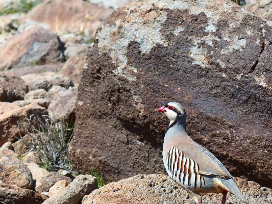
View. Later, part-way into the hike, Chukars pop out from the creosote bush and chortle their partridge curses
for being disturbed. Cute guys, yet I wonder if they are native or invasive like so many inhabitants of Death
Valley NP. Certainly, being natives of Afghanistan, they were introduced to DV.
On the flank of Mt. Perry, the quartzite-type rock is jagged and the going
more arduous. We continue to the South summit, and call it good enough for today. Up over 5,000', there are
a few Paintbrush flowers in bloom. Otherwise, the terrain is as stark as is the norm in DV.
Back in camp, we enjoy a delightful sun shower under an Australian Pine,
then appetizers of hummus, celery, carrots, crackers and beer. As soon as the sun sets, the temperature drops
from short and t-shirt hot to long-sleeved, long pants coolness. Long tendrils of pink lilt across the skyline
of the Panamint Range, signaling the arrival of the time for headlamps and an extra shirt. Soon, a sweater joins
the ensemble.
Then, out pops the glowing Milky Way, surrounded by billions and billions of stars. Wondrous.
The propagationists have erected a giant walk-in glow tent, and I can see
them conjuring their own planets in there. Propagationists, they are successfully going to kill us all because
any efforts to deal with the increasingly faster spin and positive (only in direction, not valence of
attractiveness) feedback cycle of global warming will be overcome by geometric overpopulation. We passed
sustainability at 2 billion. Now, we are rushing past 7 billion, on our way, quickly now, to 13 billion.
Back to gazing at the Milky Way, so wonderfully enhanced by the dark sky
of Death Valley Dreaming.

| ||||
.
NPS description of the Cottwood-Marble Loop
Without Baggage map and description of Cottonwood-Marble Loop
Bird and Hike site description of Lower Marble Canyon and Side Canyon
Death Valley Dreaming: Biking and Hiking Death Valley - 2011
Death Valley Dreaming: Biking and Hiking Death Valley - 2012
Backpacking and Biking Death Valley - 2013
Backpacking and Biking Death Valley - 2014
Scenic Toilets of Inner Earth.
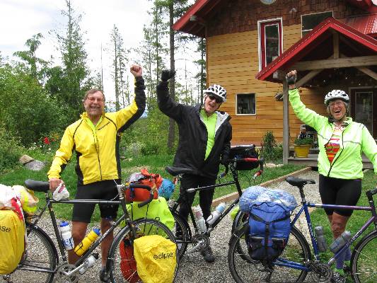
Click here or on the happy cyclists to go to all WV reports about Bicycle Touring
| ||||
More Truth Than Joke:
| ||||
| ||||
| ||||
| ||||
| ||||
| ||||
| ||||
*ERM: Energy Required Miles, are there data to support this
mileage adjustment?
Journal of Outdoor Recreation, Education and Leadership
Petzoldt first proposed his theory in his 1976 book “Teton Trails” to
help backpackers plan trips and calculate their energy needs on mountain trails. “Petzoldt defined one
energy mile as the energy required to walk one mile on the flat. He recommended adding two energy miles
for every 1,000 feet of elevation gain, so a person hiking one mile and 1,000 feet upward would use the
equivalent of three energy miles,” Phipps said.
Petzoldt’s energy mile theory was just a reflection of the mountaineer’s
“gut feeling,” Phipps said. The theory had never been tested in a laboratory before the study began in WCU’s
Exercise Physiology Laboratory in the spring of 2010, Phipps said.
To determine the validity of the theory, the study measured the energy cost
and perceived exertion for walking on flat ground, with and without a 44.5-pound backpack, and up an elevation
gain of 1,000 feet, with and without the backpack, through the collection of metabolic data, Phipps said.
Twenty-four student, faculty and staff volunteers, including 12 males and 12
females, went through four testing sessions as the research continued into fall semester of 2010. The study
results showed that the additional energy cost for ascending 1,000 feet ranged from 1.34 to 2.02 energy mile
equivalents, for an average of about 1.6 miles, compared to Petzoldt’s use of two energy miles for each 1,000
feet. The range revealed by the study was due to the “hikers” personal weight differences, Phipps said.
“It is remarkable that Petzoldt’s energy mile theory is so close to the actual energy cost measured during our
study,” Phipps said. “In the field of outdoor education, it’s important for leaders to include an estimation
of energy requirements during the planning of hiking trips.”
Phipps said the energy required for hiking up steep mountain trails would vary
for individuals and groups, and the variables of the trail would also factor in, but he recommends that
backpackers stick with Petzoldt’s idea of adding two energy miles for every 1,000 feet of elevation gain when
planning trips.
The Validity of Petzoldt's Energy Mile Theory, 2010
Authors: Maridy McNeff Troy, Maurice L. Phipps
Publication: Journal of Outdoor Recreation, Education, and Leadership
|
Wild Vagabond Main |
Trip Report Index  |
Caveat  |
|---|


