Bicycling Badwater, Amargosa Divide, Stovepipe Wells
Hiking Telescope Peak (11,049') and Wildrose Peak (9,064')

|
| |||||
|
| |||||
|
| |||||
Overview: I enjoyed 130 miles bicycling in Death Valley
National Park with the WMC (Wasatch Mountain Club) to Badwater Basin, Amargosa Divide, and Stovepipe Wells.
Rob Paull and I explored the Keane Wonder Mine on Day 5. Hiking solo, I climbed
Telescope Peak (11,049'), walked the Golden-Gower loop, and climbed Wildrose Peak (9,064').
Part 6: Death Valley Dreaming, 2016
Winter Escape to DV Super Bloom, 2016
.
Cameras: Panasonic DMC-ZS19 (bike photos); DMC-ZS60 (while hiking)
Co-adventurers: Days 1 to 4 with the Wasatch Mountain Club (WMC); Day 5 with Rob Paull; remaining days solo.
Maps: Please see the previous Death Valley Dreaming reports - maps for most of the hikes and
rides can be found there.
Day 1: Driving below sea level. To Death Valley.
The drive from the rare air heights of the Colorado Plateau to below sea level
goes smoothly. Into the land of shorts and t-shirt. The Subie Subaru, crammed with equipment for biking, day
hiking, backpacking, and camping purrs along at 35 MPG. Excellent.
Long Ear Owls hoot in the dropping temperature of Furnace Creek Camp.
Photos Day 2, Death Valley 2018


Day 2: Bike. Badwater. (bicycle) 40 miles. Hot air kisses.
The corrugated artists' hue of rumpled mountains dominates the Eastern view
as a throng of WMC bikers rolls to Badwater Basin. A low point of the trip, 282 feet below sea level - below
a steadily rising sea level. A geographic low point, yet certainly not an emotional low point. When will
the exponential growth of the human population, coupled with the idiocy of corporate welfare repulsicans
(climate change deniers), slaves to the amoral immoral corporations, add tens of feet to the Badwater
distance below sea level? Will those lackeys toting legislation for extractive industries establish
an historical sea level so it appears nothing has changed? Will corporate democrats and all repulsicans
do something significant about the rampage of global warming? Nah, they will dig in and improve the
blame game or polish denial slogans in place of helpful policies. Clearly, we now live on Eaarth, not
Earth, because our ecosystems have been so altered that we live on a different and dying planet.
(See author Bill McKibben for the book "Eaarth.")
Yet today, muscle powered recreation rules on the lilting lounge to
Badwater Basin. Coming back is another matter. As soon as the group turns at Badwater and starts back
to camp, the hot kisses of a building breeze begin. I rediscovered the First Law of Bicycling, the
wind is always in your face.
The allure of the steep Artist Pallet Loop fades with the building breeze. So lunch becomes appealing,
in the rocks at about mile 5, counted from the start of the Badwater Road, near the palatial Inn, where
high rollers lounge in luxury.
I grind North from the campground to accumulate a 40 mile ride.
Tonight the WMC group feasts on Dutch oven chicken, potatoes, carrots, and onions. Delightful.
Photos Day 3, Death Valley 2018
 |
 |
 |
Day 3: Bike. Bighorn Surprise. (bicycle). To Amargosa Divide. 40 miles.
Drifting down from 3200' at Amargosa Divide, toward a bit below sea
level at Furnace Creek, I see Matt swerve and point to the North. "What?" I wonder. Coming to a stop,
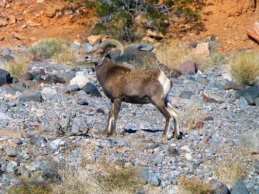
I see a Bighorn Sheep pair skittering away from the road. Wow. Then they stop and browse on the
desiccated brush, seemingly nonplussed. I haul out the camera and snap a few photos of these gorgeous
ungulates. Later I chat with Bill Sloan, a Sheep researcher for the NPS, and he tells me exactly
where this pair is feeding. Love those science people.
We've enjoyed an eventful day bicycling up the colluvium ramp from
below sea level to about 3200' over 20 miles. Matt has duct taped an extra liter water bottle to his
bike frame and it comes in handy when we stop for lunch at the top of the climb. There are some RVs
parked on the old cement slabs - apparently once a housing location for mill workers, later perhaps an
RV park. Howard from one of the RVs comes over to check on us, wondering if we are OK. Apparently,
he believes that we need to be revived, and invites us over for an ice cold beer. Yummy.
Then, down we roll, against a slight breeze. Along the way, we stop
to visit with anthropologists surveying the benches above the highway and a pair using a film plate
view camera to make panoramic views of the landscape.
Arriving back at Furnace Creek, the temperature is displayed at the
visitor center as 89F. Certainly, it seems cooler than yesterday. Matt encounters the three fast
riders we met up at the divide and they apologize to Matt for making fun of his taped-on extra liter
bottle of water, reporting that they had run out of water on their way back to Furnace Creek. Not fun.
Somehow the remaining afternoon disappears in showering and
organizing the bike. Now Orion is hovering overhead, surrounded by billions and billions of stars.
Lovely. Young Coyotes try their singing voices during the night, squeaking out yips and yowls, with
an occasional howl.
Photos Day 4, Death Valley 2018
 |
 |
 |
 |
 |
 |
Day 4: Bike. Cool Blonde Girl in the Middle of the Road. (bicycle). To Stovepipe Wells. 50 miles.
The Frenchman pulls his rental vehicle to the side of the road, comes over
to Matt and me and asks about taking our photo. He reports that his biking friends will not believe that
people bicycle in Death Valley. "Sure," we reply, sitting on a hummock of gravel, ensconced behind a barely
flowering creosote bush at the junction of the Lone Pine and Beatty roads.
The Frenchman offers a Leffe Blonde Belgian beer. Gorgeous. We sip and relish
the blonde girl with the remainder of our lunch, then attempt various photos of the blonde girl in the middle of the road.
It's been an active day, starting with moving camp (throwing things in and on top
of the car and moving it to the new campsite, a true RV). I move the mobile home, carrying the tent by the ridge
pole to its new home.
Then, off to Stovepipe Wells, which is a lovely cruise. As Matt and I eat a quick
snack we watch the flag on the Ranger Station start to ripple, then fly. Oh no. Of course the First Law is solid
and we're chugging up to the road junction with the strong breeze in the face.
After lunch and blonde girl photos, the breeze moderates some and refreshingly
carries coolish air, making the jaunt to Furnace Creek go well.
As I'm wrapping up after a luxurious shower, Alexi and Anysia of Switzerland roll
up on a German built tandem. Recumbent in the front and standard seating in the rear. They've been on the road
an amazing two years. I invite them to share camp, and they eagerly accept.
.
Photos Day 5, Death Valley 2018
 |
 |
 |
 |
 |
 |
Day 5: Hike. Wondering About Keane? To Keane Wonder Mine. 5 miles, ERM of 12.
The towers still hold the stout cables and a few oar buckets hang far
above the flash flooded drainage distantly below. The trail is steep, as Rob Paull and I inch up through
glittering schist, mica, quartzite, assorted metamorphics. We are the only remaining members of this year's
Wasatch Mountain Club Winter Escape, albeit there is little Winter from which to escape. Can you say "global
warming?" And today we're hiking rather than biking. Up, up more, around a rock neck to a scenic toilet
in the middle of a narrow trail etched into folded rock. We have to dip through a side canyon to regain
the main path, then up more, happy that the basement rock is exposed for good gription.
The upper ore loading station is reached about lunch and after wondering
about how this equipment functioned, we eat lunch in the shade of the oar reservoir while gazing through
the gaps in the huge timbers underneath this box toward the Mesquite Sand Dunes and Stovepipe Wells far below.
Back in camp, I again enjoy a solar shower and later a beer with Rob
before trying to prepare for a drive to the charcoal kilns and a long hike to Telescope Peak, 11,049',
climbing around 3,000' over 8.5 miles, one-way. We'll see, because it's forecast to be quite windy and
much of this trail is along the ridge.
Photos Day 6, Death Valley 2018
 |
 |
 |
 |
 |
 |
Day 6: Hike. Trampled by Telescope. (Hiking). To Telescope Peak, 11,049'. 17 miles.
ERM of 34. Elevation gain of 4300'.
Abbey, Lucas, and John are well into lunch atop Telescope Peak when
I drag up, gasping and enervated. What a climb.
The gate near the Charcoal Kilns is locked, adding 1.5 miles and 1300'
to an already substantial climb, one way. That's how come today's hike is much farther and more elevation
gain than predicted.
The day starts in the dark, and I'm driving up to the kilns. Then
onto an extraordinary steep (closed) road walk to the Mahogany Flat Campground and the actual trailhead.
The trail starts out well positioned and climbing fast to a so-called meadow area and a somewhat level
rounder of Bennett Peak, dotted with a few icy stretches. Along the way I meet the adorable Abbey, who
is visiting all the national parks while working as a visiting occupational therapist. Then the fun
along the approaching and summit ridge begins with sun-crusted ice and decreasing oxygen. Grand monarch
limber pines and a few bristlecones dot the snow-covered trail. The better route is on the windy ridge.
Post holing is the theme on the trail, where snow has blown into the tread notch. The Kahtoola microspikes
flail into action as I inch up to what I believe is the summit. Arriving at the top, I see the youngsters
lounging on a slightly higher peak a few tenths of a mile away. Argh.
I'm about spent, yet continue. Telescope Peak! Summit!
The views are telescopic, far ranging to the Sierra; maybe that's
Mt Whitney - capped with snow. All cloths on because it's beyond brisk.
Down, down on the icy crust and then the long trail back to the closed
road and finally the drop to the kilns parking area.
While slanting down around Rogers Peak, the valley has disappeared,
behind what looks like a yuge dust storm. Oh oh. Maybe a haboob? I smile at the connotations of this
descriptive word. (An haboob is a penetrating sandstorm.)
It's growing dark as I bump down the dirt road.
I put up the mountain tent, the venerable 40 year old VE-24, in the
dark because the vicious wind has filled the more ventilated REI tent with dirt. It's like flying a
box kite, dealing with the tents, and in the dark too. Argh.
The VE has no mesh through which to strain the dirt, depositing the
fine grit on your face. The wind howls and the VE-24 barely shudders, providing a restful night in this
dark sky park. As I drift off to sleep, I fondly recall quickly putting up the VE-24 on a flank below
Buck Mountain in the Teton Range (Grand Teton National Park) forty years ago with the Great Sinclair
(Jim Sinclair) as a horizontal snow squall sweeps in on raging winds.
Photos Day 7, Death Valley 2018
 |
 |
 |
Day 7: Hike. Hiking is Golden. (Hiking). Golden-Gower loop. 7 miles. ERM of 11.
Telescope Peak lords over the rumpled terrain below Manly Beacon.
Today I find myself repeatedly looking for Telescope Peak on the skyline. It's the highest point in
the Park and in the Panamint Range. And, I find it amazing that I was walking that snowy ridge this
time yesterday. Wow.
Yet, back to the moment, where red flutes jut into the canyon used
in the filming of Star Wars. It is otherworldly.
The hiking goes smoothly, a contrast to the bodily thrashing yesterday.
As Rob P noted, uphill is cardiovascular and muscular, downhill is skeletal, joints. Yes indeed. I
am almost to the mouth of Gower when I pause for an early lunch prior to going out in the breeze because
it's in the 70F range today.
Returning early to camp, I work to fit the bike in the Subie, do some
laundry, and shake out the sand from the REI tent, putting it away. I'll use the VE-24 for the remaining
time here.
Sunset is early and the stars pop into the dark void. Billions and
billions of lovely stars.
Photos Day 8, Death Valley 2018
 |
 |
 |
 |
 |
 |
Day 8: Wild Wildrose. (Hiking). Wildrose Peak (9,064'). 8.5 miles. ERM of 18.
Snow? Yes, flakes of light snow deter me from eating lunch at one
of the overlooks of the valley far below. That and it's just chilly. When I started this morning,
the car thermometer read 31F at the charcoal kiln parking area at about 6700'. And there was a bit
of wind, making for less than optimal hiking. It stays cool and the trail straggles into the sun
for some pleasant solar load. The pygmy forest is thick enough at times to provide some protection
from the wind.
Many of the trees appear to be the same or similar age, probably
because the Pinyon Pines were cut for the charcoal operation that fed a distant smelter about 100
years ago.
Up, steeply after the first peek toward the Badwater basin, with
solid high angle after rounding the 8,000' bump. The vistas improve too, with far-ranging looks at
the valley over 8,000 feet below. Mesquite Sand Dunes appear like a rumpled carpet, bounded by miles
of flat plains. Arriving at the summit, I hurry to the second of the twin peaks, which must be a
little higher because it sports the USGS monument and the summit log stashed in an ammunition box.
I sign in, arrange a timed photo, then start back without taking off the pack, looking for warmer
climes for a snack. I end up eating lunch in the car about 1 p.m., finally warm.
The wind and threat of rain prompt me to put on the fly for the VE-24.
It needs a good airing out anyway.
So, it's after dark and I'm ensconced in the US-made North Face tent,
which barely whispers in the 25 MPH wind. An excellent place to write journal notes and stay warm.
It's easily 20 degrees cooler than two days ago, the slight coolness accentuated by the driving wind.
Dinner was an experience in patience tonight.
.
Bird and Hike site content page: Death Valley hiking
Death Valley Dreaming: Biking and Hiking Death Valley - 2011
Death Valley Dreaming: Biking and Hiking Death Valley - 2012
Backpacking and Biking Death Valley - 2013
Backpacking and Biking Death Valley - 2014
Death Valley Dreaming and Marbelous Marble Canyon Backpack, 2015
Death Valley Dreaming, 2016 Winter Escape to DV Super Bloom, 2016
Death Valley Dreaming, 2017 and another Cottonwood-Marble Loop backpack, 2017
Scenic Toilets of Inner Earth.
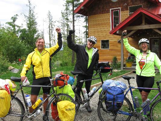
Click here or on the happy cyclists to go to all WV reports about Bicycle Touring
| ||||
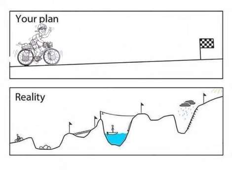
More Truth Than Joke:
| ||||
| ||||
| ||||
| ||||
| ||||
| ||||
| ||||
|
Wild Vagabond Main |
Trip Report Index  |
Caveat  |
|---|


