|
|---|
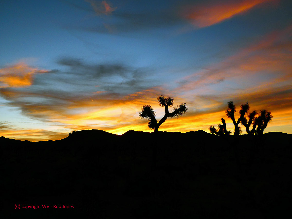
JT Sunset
(Click the image for a full-size view)
|
|---|
Camera: Panasonic ZS-60
Photos are scattered throughout this report.
Keep scrolling.
"Adventure is not a cable channel." Zig Sondelski
Holly, Annette, and I backpacked the California Riding and Hiking Trail
in Joshua Tree National Park.
This was a continuation of the 2018 trip to Death Valley (see that report).
(This trip continued as Day 9 following the Death Valley 2018 adventure.)
How come " Tourińo?" Well, it sounds like a word describing a small tour, a Tourińo. OK, I made up this word, and I'm sticking with it.
ERM = Energy Required Miles. A mile is added for
every 500' elevation gain or
loss. It's a very serviceable method of estimating energy required miles. ERM was initially used in Trails
of the Tetons (long out of print) by Paul Petzold, founder of NOLS. It's a wonderfully useful concept and
application. Add one mile for each 500' up AND down to distance = ERM. I use ERMs to calculate what the actual
day is like. It's a very serviceable method of estimating energy required miles. Remember, however, that the
ERMs are estimates because they depend on GPS satellite coverage and math functions.


|
|---|
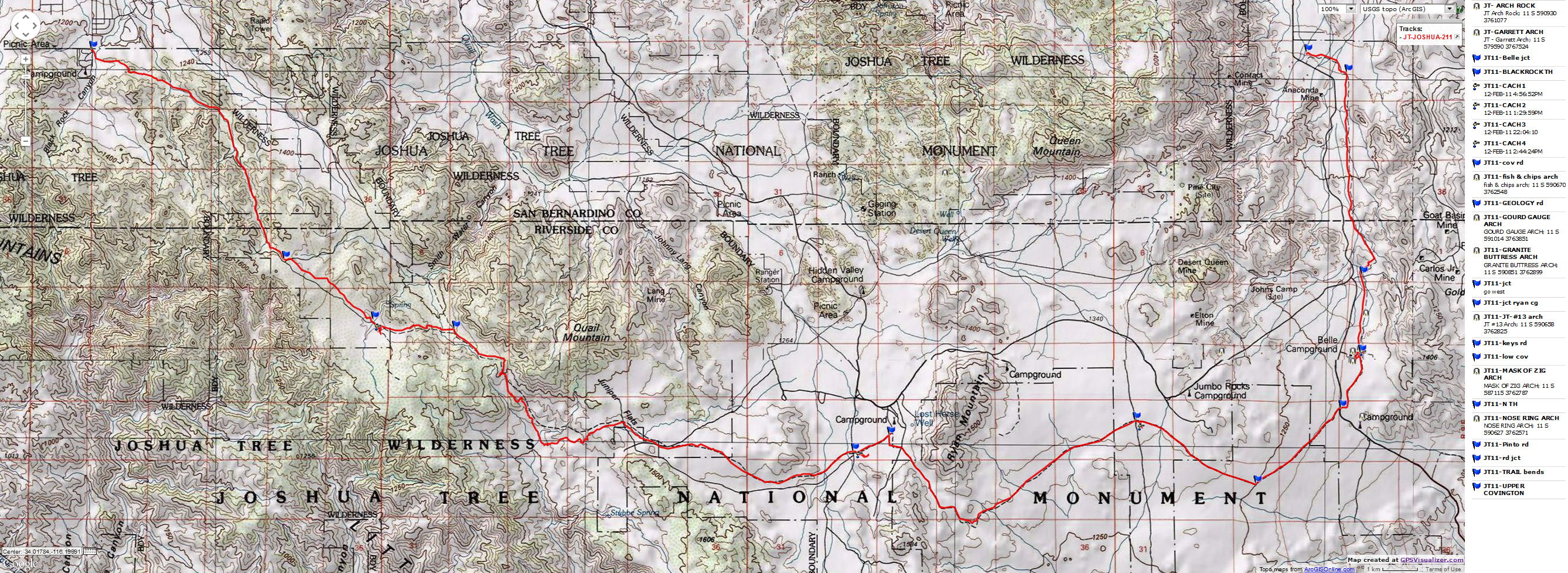
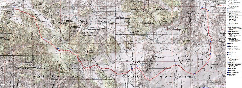
http://wildernessvagabond.com/joshua-tree-2011/Map - CA: Joshua Tree - Riding and Hiking Trail; 2011; 41 miles
(Click the image to see the map)
|
|---|
|
Day 9: car. Joshua Bound. Drive from Death Valley to Indian Cove CG. Walk 2 miles.
It's a longish day, given the slow Bad Water Road and the road construction.
I arrive in Joshua Tree National Park to find that I have reserved a
very decent campsite amidst granite boulders. Granite monzonite, with a large crystal composition.
Monzogranite. Yes, I spent a long time on the web and with maps trying to figure out which campsite
might be level and provide some cover from sun and wind. Success (mostly).
Windy and quite cool, I am setting up the VE-24 behind a garage size
boulder when Holly and Annette arrive. We invest some walking time in exploring the area, then eating
a delightful chili made by Holly before dark-thirty descends.
Preliminary Photos - Joshua Tree Tourińo
Day 10: Hike. Cache-a-rama. Caching water, fuel, and food for the Joshua Tree Tourińo.
Backpack. 4 miles.
The wind is cold, discouraging, dampening slightly the enthusiasm
for the Joshua Tree Junket backpacking adventure as Annette, Holly, and I hike in caches at Covington
Flat, Keys View, Geology Tour, and Belle Campground access to the California Riding and Hiking Trail.
Several scenic toilets are photographed, surrounded by the stately, elegant Joshua Trees, sometimes
found with the checkered joints and cheese grater surface of the granitic monzonite (monzogranite)
boulders and outcrops in the background.
The caching takes nearly the entire day and we return to the Indian
Cove Camp as the sun sets. And, the cold breeze joins us for dinner, prompting an early bedtime. I
am extremely happy to have set up the VE-24 tent because it provides super protection from the frigid
breeze. A hot water bottle is pleasantly enjoyed tonight.
From the NPS page: Monzogranite: Geologists believe
the face of the modern Joshua Tree landscape was born more than 100 million years ago. Molten liquid,
heated by the continuous movement of Earth’s crust, oozed upward and cooled while still below the
surface. These plutonic intrusions are a granitic rock called monzogranite. The monzogranite developed a
system of rectangular joints. One set, oriented roughly horizontally, resulted from the removal—by
erosion—of the miles of overlying rock, called gneiss (pronounced “nice”). Another set of joints
is oriented vertically, roughly paralleling the contact of the monzogranite with its surrounding rocks.
The third set is also vertical but cuts the second set at high angles. The resulting system of
joints tended to develop rectangular blocks. Good examples of the joint system may be seen at Jumbo
Rocks, Wonderland of Rocks, and Split Rock.
About the Joshua Tree:
From Desert USA.com: The Joshua tree, the largest of the yuccas, grows only
in the Mojave Desert. Natural stands of this picturesque, spike-leafed evergreen grow nowhere else in the world.
Its height varies from 15-40 feet with a diameter of 1-3 feet. They grow 2 to 3 inches a year, takes 50 to 60 years
to mature and they can live 150 years.
Joshua trees (and most other yuccas) rely on the female pronuba Moth
(Tegeticula) for pollination. No other animal visiting the blooms transfers the pollen from one flower
to another. In fact, the female yucca moth has evolved special organs to collect and distribute the
pollen onto the surface of the flower. She lays her eggs in the flowers' ovaries, and when the larvae
hatch, they feed on the yucca seeds.
Without the moth's pollination, the Joshua tree could not reproduce, nor could
the moth, whose larvae would have no seeds to eat. Although old Joshua trees can sprout new plants from their
roots, only the seeds produced in pollinated flowers can scatter far enough to establish a new stand.
Joshua trees, Yucca brevifolia, grow in the Mojave Desert of southwest
California, Nevada, Utah and Arizona, at elevations from 2,000 to 6,000 feet.
Day 11: Hike. 4 miles: ERM of 5.5. 49 Palms.
The charred ancient palms have yuge tan skirts of dead palm fans.
Yes, some mental midget started on fire the palms at this oasis, formed when the Eaarth fractured via
fault line. Water, rare desert water bubbles to the surface here and feeds the palms, Desert Bighorns,
an assortment of birds and other wildlife. We've hiked over a low ridge to visit this oasis.
Later, we spend time in one of the Joshua Tree visitor centers and
enjoy an excellent Mexican lunch. Back at camp, it's time for a hot shower and more equipment sorting.
The light intrusion from Los Angeles ruins the night sky to the West,
yet the Eastern view is decent tonight.
Tourińo Day 1: Backpack. Elephant Foot: Blackrock Canyon TH to Mile 8.1, East of
Upper Covington Flat (up 911', down 433'). 8.1 miles. ERM of 11. Camp @ 5100'.
How come " Tourińo?" Well, it sounds like a word describing a small
tour, a Tourińo. OK, I made up this word, and I'm sticking with it.
Packs on, we're cruising the long grade of gravel to the lip of the
fault above Covington Flat, the big elephant foot Joshuas begin to appear. Glorious. Looking West, a
snow-capped peak is framed by Joshuas and the hills bordering the drainage we are walking. The milepost
reads 7 when we cross the Covington Road and lilt and undulate along the remaining mile plus to our
first water cache.
I believe that the snow-capped mountain is San Gorgonio Mountain,
also known locally as Mount San Gorgonio, or Old Greyback, is the highest peak in Southern California
and the Transverse Ranges at 11,503'.
We're finally up above where the majority of people rove, day hikers
venturing out of Blackrock TH (trailhead).
Camp is thrown quickly into place as the sun disappears and the temperature
drops. After dinner, the hot water bottles are put into action, warding off the evening chill. Still, my
feet are frozen and it takes an hour of hot water bottle treatment in the sleeping bag before nodding off
for the first time.
The day begins with a 64 mile car shuttle to the North Entrance Trailhead
and back to Blackrock to begin the hike. This after final futzing with the packs and breaking camp.
Holly, Annette, and I make it to all of 7:30 p.m. before retiring to the
warmth of the snuggly bags.
Day 1 Photos - Joshua Tree Tourińo
Day 2: Technicolor Trees. To beyond Keys View Road: 11.2 miles. (up 1315, down 1773).
ERM of 17. Camp @ 4125'.
The gallon jugs rattle with chunks of ice. Indeed, it's been a
cold night. At first it's difficult to warm up the fingers and toes, yet the calm day is joined by
an increasingly hearty sun. Lovely. Joshua Trees dot the skyline, veritable Dr. Seuss Trees.
It warms to single layer shirt conditions as we roll out of Covington
and onto a broad colluvium plain cleared by fire not long ago. At the top, we can see the outline of
the distant Salton Sea in the LA haze. We find 4 mylar balloons over the course of today, released
by petroleum dolts; released to strangle wildlife and clog the guts of ungulates and other unfortunate
creatures of the wilderness. Down briefly, then up and up before lilting into the Juniper Flat area
and as the feet tire, across the Key View Road to the second water cache, this one accompanied by a
bear can filled with goodies. More food, fuel, water. Resupply splendor.
Sunset delivers a superb technicolor of Joshua Trees. Yowee.
Day 2 Photos - Joshua Tree Tourińo
Day 3: Windy Refuge, Rock Harbor: To near Jumbo Rocks. 8 miles. ERM of 9.
Camp @ 4360' in sheltering rocks.
"Ahh," says Holly, "this is so much better than crouching in the drainage
or hiding in the swirling wind behind the mushroom rock where we initially cached the food and water."
It's late afternoon and we're cornered, sequestered among the monzogranite boulders south of Jumbo Rocks
and about 1000' North of the trail. We toted the bear can and all the cached water nearly a mile beyond
the initial cache location to this harbor from the vicious wind. Now we are farther from the Geology Tour
backcountry board and will need to problem solve about getting the bear can and empty water jugs out of
the wilderness for later collection.
This morning, splendid colors light the morning crispness. It's a
good reason to get out into the chilly dawn.
The day starts out windy and sunny and quite interesting, as the
geology changes, from granite to what looks like basalt, past mining debris and past hoodoos and across
a windswept plain to the Geology Tour backcountry board. Along the way we enjoy lunch #1 amidst and in
the lee of blonde boulders. Already it's a joy to be free of the assaulting wind. Fortunately, the
maelstrom is from behind or quartering.
We search for shelter near the mushroom rock cache, but give up and
continue toward the squiggles of topo lines on the map indicating taller features ahead along the trail.
The wind draws our attention to more vagrant mylar balloons, a total of 9 collected so far. Some
creature has again chomped on two of our water jugs, reminiscent of the handle chomping at the last
cache, so the jugs are carefully carried. Annette reflects on the possibility that the holes were
made by Ravens. Most likely, she is correct although I was initially blaming the roving Coyotes.
We leave the trail and search for solace from the wind. Others
have the same idea and it takes time to find a port ensconced in the rocks.
You've heard of a three dog night? Well tonight is feeling like
a two hot water babies night. Heated to boiling, the water is poured into Platypus and Nalgene
containers, then wrapped in spare clothing and cuddled on the insulating sleeping pad These babies
will heat us through the night, then provide warmish water for the morning beverage. Ahhh. The wind
continues in the open areas, and occasionally buffets the tent far after sunset and along into a clear
night. And here we are, in a safe harbor of rock friends, with friends.
Day 3 Photos - Joshua Tree Tourińo
Day 4: Cold Completion. To North Entrance & gather caches: 11.9
miles. ERM of 18. Total miles = 39.2. Total ERM = 55.
Sun starkly lights the granite plates as my hands are wrapped around a
tub of hot chocolate, with couscous, raisins and mandarin oranges rehydrating on the stove. It's necessary
to keep the couscous bowl on the stove because it's very chilly. The wind is back with increased vigor and
the temperature is dropping.
Sweeping out my tent, I have issues getting out all the white grains of
grit; then realize that graupel is falling. And, it's bouncing into the tent while I try to sweep out the
grains. Yikes.
Hurrying to finish packing the pack, we're on the trail in plummeting
temps and wind strong enough to steer the packs where it wishes. At times it's difficult to stay on the
trail, avoiding puncture by all the pointy things in this Colorado Ecosystem Zone Desert. Raw conditions.
Horrible. Soon, our mylar balloon count is up to 10.
We cross the Abbey Road crosswalk of the entrance road and make our way
toward Belle CG, dropping off the empty water jugs and bear can at the road crossing to collect later (cache
pick-up solved). Soon we're at Belle and search and search for a decently calm place to camp. No success,
so we continue along the trail, leaving the Belle cache in place to collect if we find something suitable.
Around the next grouping of boulders we tour. Nothing. The wind swirls and screams and shrieks while
buffeting us and abrading our faces and exposed skin. The temperature is low (40F?) and the wind chill
is stunning (20sF?), so we continue and soon decide to hike to the end of the trail and find a warmer
place for tonight. The Joshua Trees become more widely separated. The walking is easy and soon we're
jamming packs into Annette's Subie and backtracking by car to collect the caches. Holly drops off
Annette and me and we retrieve the Belle cache while she gets the cache dropped near the entrance road.
Then, it's over to Ryan CG, where Annette and Holly run the trail to get the Keys View cache. Done,
and it's still daylight. So, we collect my Subie Subaru at Blackrock and find a decent motel, where we
finally warm up, looking out on the stately Joshua Trees as the light fades, providing a fitting end to a
Joshua Tree Tourińo.
Day 4 Photos - Joshua Tree Tourińo
.
Links
Click for a previous report about hiking
Joshua Tree National Park.
.
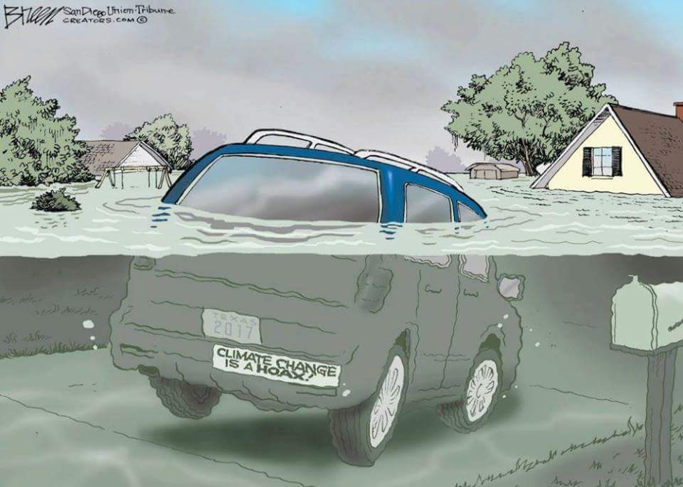
More Truth Than Joke

|
|---|
screw the people
(Click the image for the full-size image)
|
|---|
|

|
|---|
continuous religious war
(Click the image for the full-size image)
|
|---|
|

|
|---|
glug for the GOP
(Click the image for the full-size image)
|
|---|
|

|
|---|
more gun hypocrisy
(Click the image for the full-size image)
|
|---|
|

|
|---|
insanity
(Click the image for the full-size image)
|
|---|
|

|
|---|
Intelligent Life?
(Click the image for the full-size image)
|
|---|
|
|