|
|---|
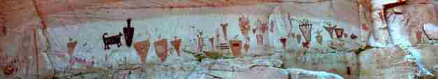
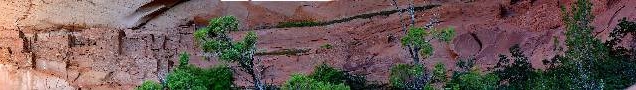
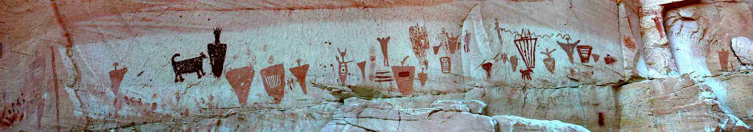
One of the Barrier Canyon panels
This image is 2446 pixels wide -
it may be about 4 screen widths
scroll LATERALLY, L & R to see all
(Click the image for a full-size view; 95 K)
|
|---|
|
|---|
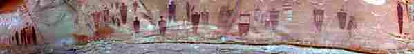
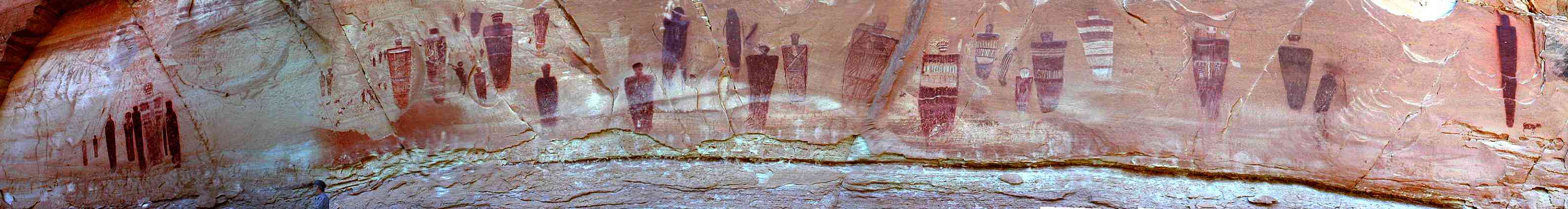
Panorama of the Great Gallery
This image is 3177 pixels wide -
it may be about 5 screen widths
scroll LATERALLY, L & R to see all of it
(Click the image for a full-size view; 158 K)
|
|---|
|
|
|
|---|
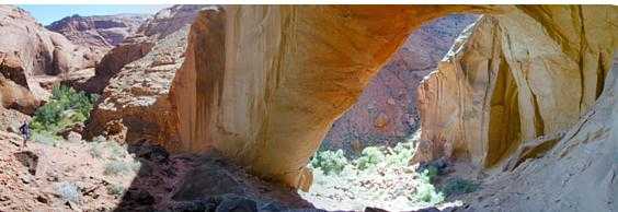
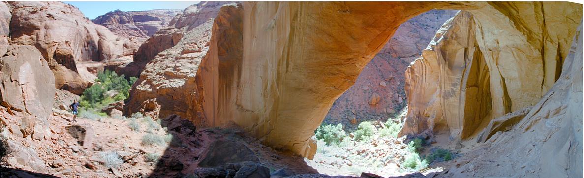
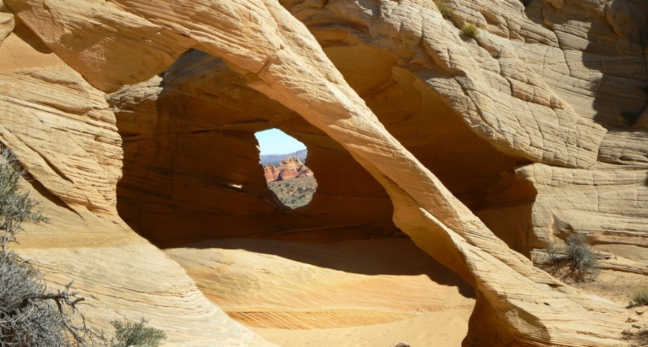
Wrather Arch, 6th largest span in the world (90k; full-size panorama is 1187 pixels wide;
look for Bret off the left buttress for scale)
(Click the image for the full-size panorama)
|
|---|
Click here for the full report about Passion for Paria!
Backpacking Paria Canyon With Day-dabbling in Buckskin Gulch
|
|
|
|---|
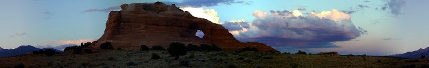
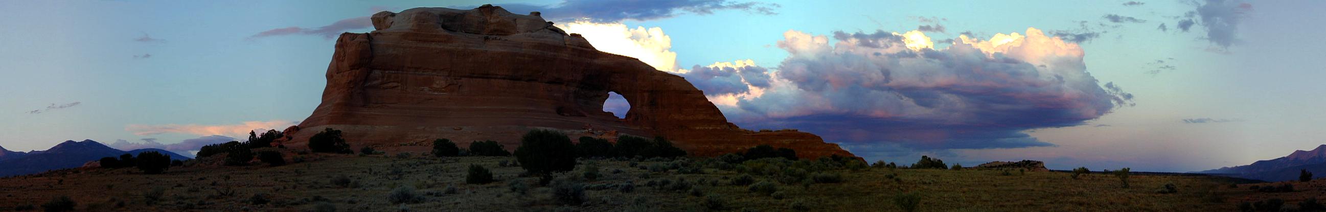
Looking Glass Arch South Of Moab, Utah (100k; full-size panorama is 2594 pixels wide;
Abajo Left; LaSal Mtns right)
(Click the image for the full-size panorama)
|
|---|
|
|

|
|---|
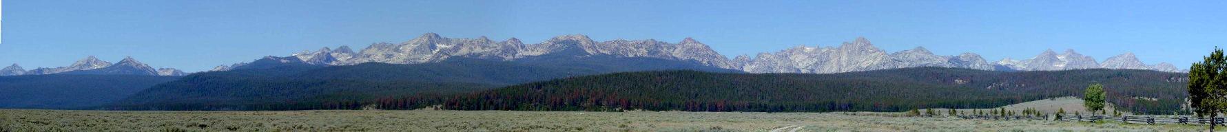
panorama of The Sawtooth Mountains of Central Idaho
(Click the image for a full-size view, SCROLL HORIZONTAL)
|
|---|
|
|
|---|
180 degree panorama of a petro panel, featuring 97 linked petros, continuing around to Butler Wash, and a view of Comb Ridge.
This image is 3852 pixels wide - it may be about 5 screen widths scroll LATERALLY, L & R to see all of it (Click the image for a full-size view; 91 K)
|
|---|
|
|
|---|
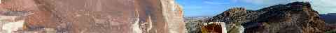
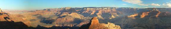
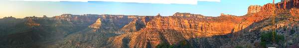
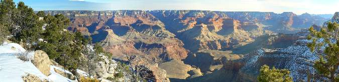
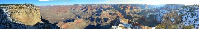
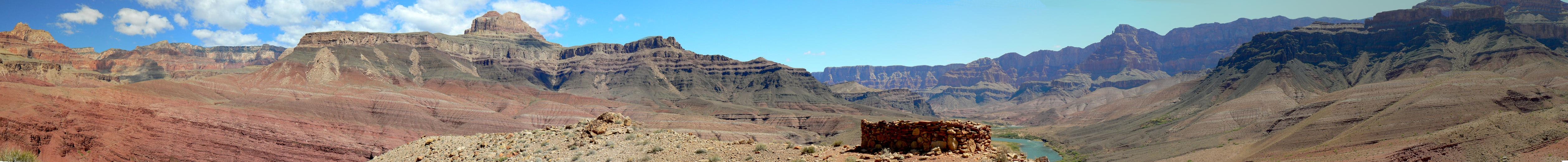
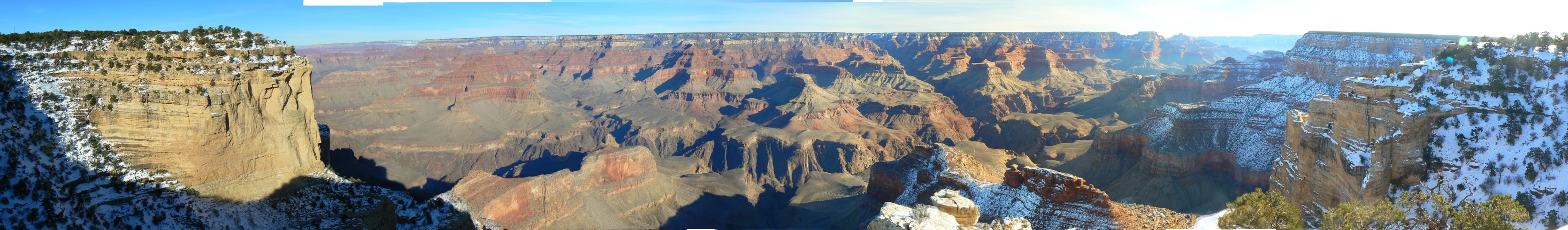
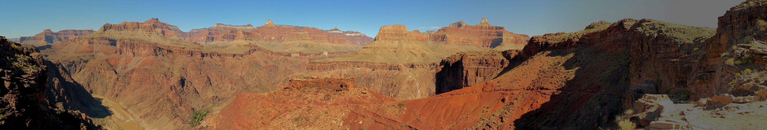
Grand Canyon Panorama - from The Tipoff
(Image is very wide - scroll to view it (4427 x 753 pixels; 1.8mb) - Click
the image for the full-size image)
|
|---|
|
| |
Above is a very wide panorama of the Grand Canyon (4427 x 753 pixels; 1.8mb).
It was made from a series of 9 overlapping
photos, which were then stitched together to form this pano. In your windows viewer
(perhaps others) you may have to click on the "actual size" button (bottom, left side)
to get the whole image to appear, then scroll left-right (perhaps top to bottom) to see
from buttress to buttress. The photos were taken from The Tipoff along the South Kaibab Trail.
On the left is the Tapeats Sandstone that bolsters the
Tonto Platform (famous for the
Tonto Trail), then, continuing to the right, is the Colorado River, then a slice of
the Phantom Ranch/Bright Angel Creek greenery, to the view point on the South Kaibab,
and around to where the trail heads down toward the river from The Tipoff on the right
buttress. Yoweeeee! A most glorious lunch spot! Click the image above for the full-strength
view.
For those wanting a smaller file (252kb), yet a nearly
full-size image, click here:
Grand Canyon Panorama - from The Tipoff - compressed
|
|---|
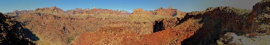
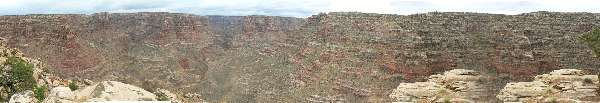
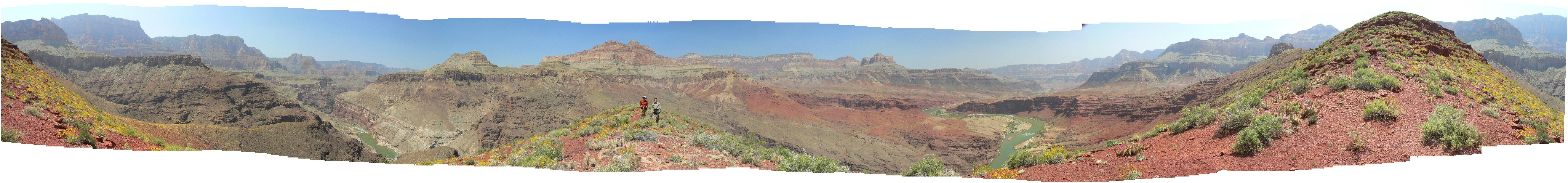
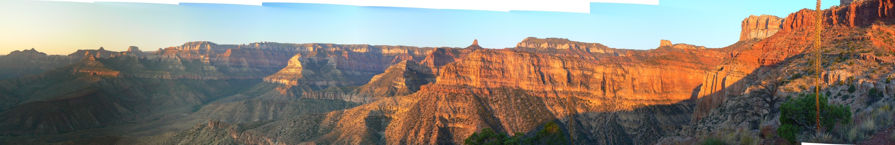
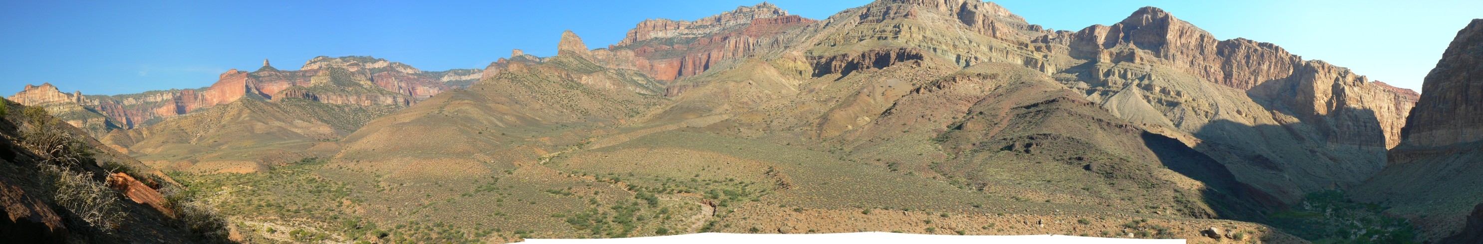
Grand Canyon Panorama - Escalante Route
(Image is very wide - scroll to view it (5034 x 522; 1.4mb) - Click
the image for the full-size image)
|
|---|
|
|
Click here to see the report about: Bodacious Beamer,
Or – Beam me up Scotty: Tanner Trail to the Little Colorado River (2007)
|
|---|
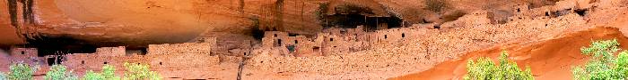
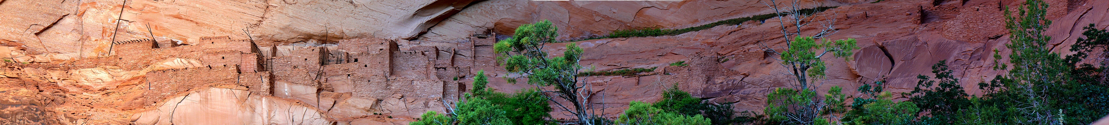
Keet Seel (Kawestima) Panorama
(Image is very wide - scroll to view it (3227 x 415; 500kb) - Click
the image for the full-size image)
|
|---|
|
|
|---|
Batatakin (Talastima) Panorama
(Image is very wide - scroll to view it (3600 x 406; 1.8mb) - Click
the image for the full-size image)
|
|---|
|
Click here for the full report about Kawestima/Keet Seel;
Talastima/Betatakin; & arch hunting ventures
|
|
|
|---|
Bears Ears to Abajo Mountains - Elk Ridge (373k; full-size panorama is 2619 pixels wide;
Bears Ears left, Abajo Mtns right)
(Click the image for the full-size panorama)
|
|---|
|
|

|
|---|
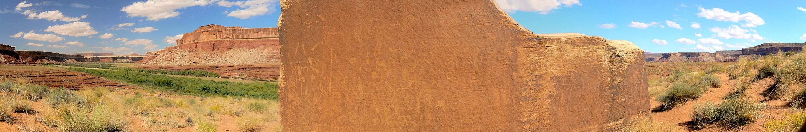
Peteroglyph Boulder along Stillwater Canyon, Green River
(429kb; full-size panorama is 2736 pixels wide).
(Click the image for the full-size panorama)
|
|---|
See the full report about canoeing the Green River (2007)
|
|
|
|---|
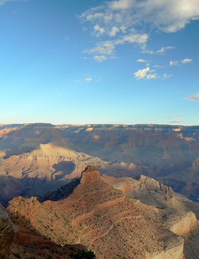
Panorama - O'Neil Butte - vertical pano (145kb); full-size panorama is 840 pixels tall;
(North Rim at top)
(Click the image for the full-size panorama)
|
|---|
|
|
|
|---|
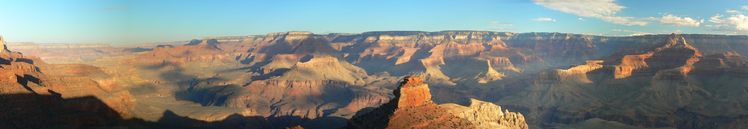
Panorama - GC from S. Kaibab (217kb); full-size panorama is 2517 pixels wide;
(O'Neil Butte in lower center)
(Click the image for the full-size panorama)
|
|---|
| |
|
|
|
|---|
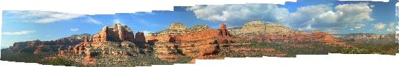
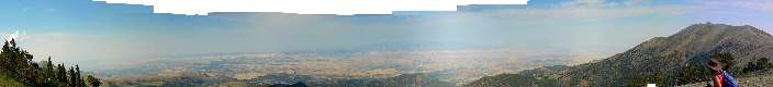
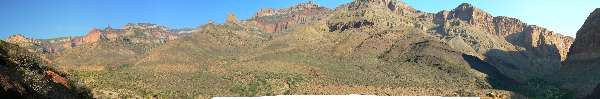
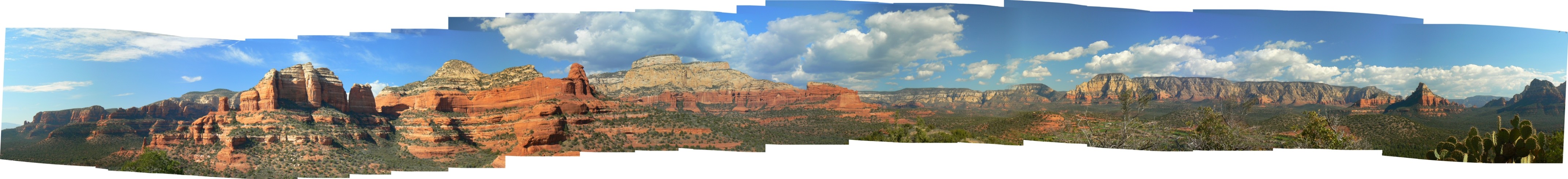
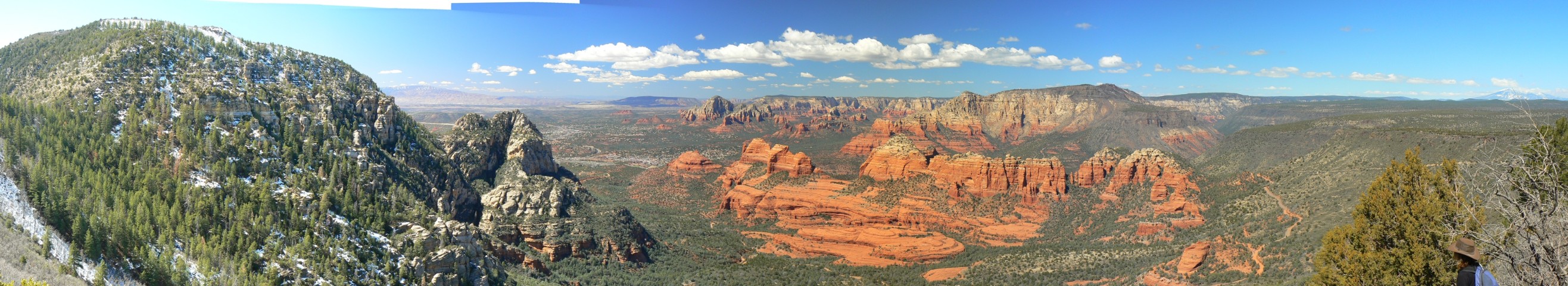
Panorama - from Mescal Mtn. - about 330 degrees of Secret Mountain Wilderness
(448kb); full-size panorama is 4288 pixels wide
(Click the image for the full-size panorama)
|
|---|
|
Left-to-right, the above pano shows Bear Mountain
to the Boynton Canyon spires, to Maroon Mtn. and the features near Sedona. Lost Wilson Mtn.
is on the right of the pano.
Note that you will have to scroll left-right to see
the whole image, which is 4288 pixels wide.
See the other reports about day hiking Northern Arizona (2007)
|
|
|
|---|
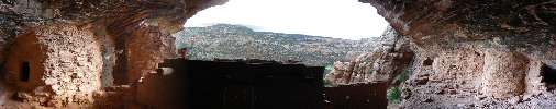
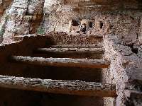
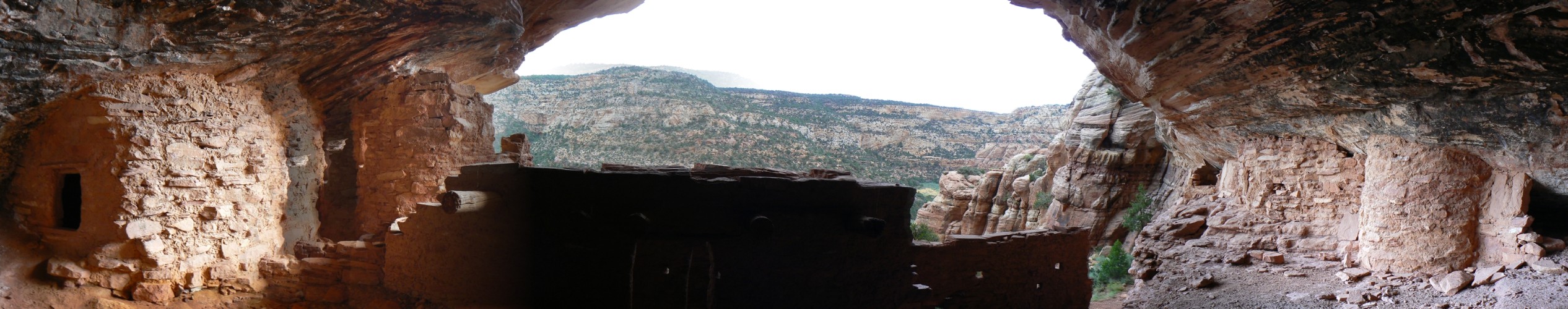
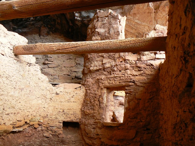
Panorama - from inside a pueblo ruin somewhere off the Dark Canyon Plateau
(380kb);
full-size panorama is 2532 pixels wide
(Click the image for the full-size panorama)
|
|---|
|
Here (below) are some images of what is in the dark
center portion of the above pano. Lovely T-shaped doorways to what may have been a
ceremonial kiva.
|
|---|
A look inside
(Click the image)
|
|---|
|
|
|---|
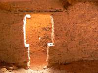
T-door glowing
(Click the image for a full-size view)
|
|---|
|
|
|---|
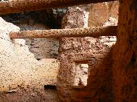
View along the wall
(Click the image for a full-size view)
|
|---|
|
|
|
|
|---|
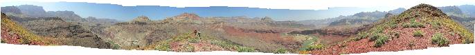
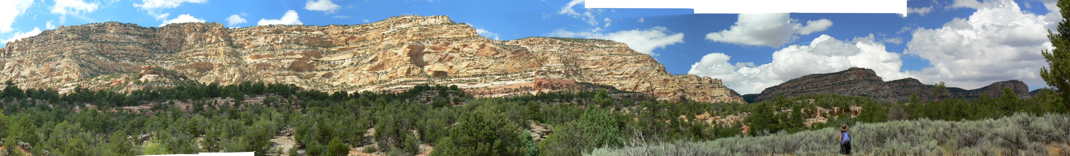
Panorama - looking up Trail Canyon toward the Dark Canyon Plateau
(612kb);
full-size panorama is 3421 pixels wide
(Click the image for the full-size panorama)
|
|---|
| |
|
|
|
|---|
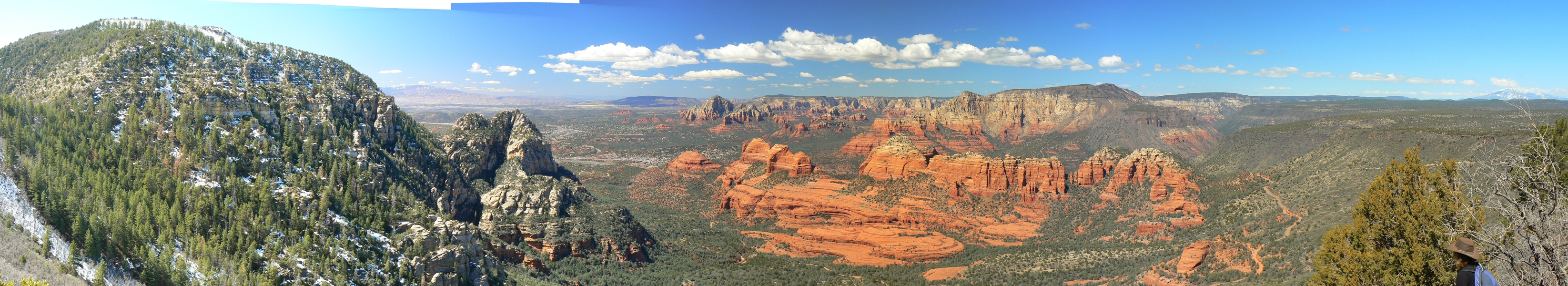
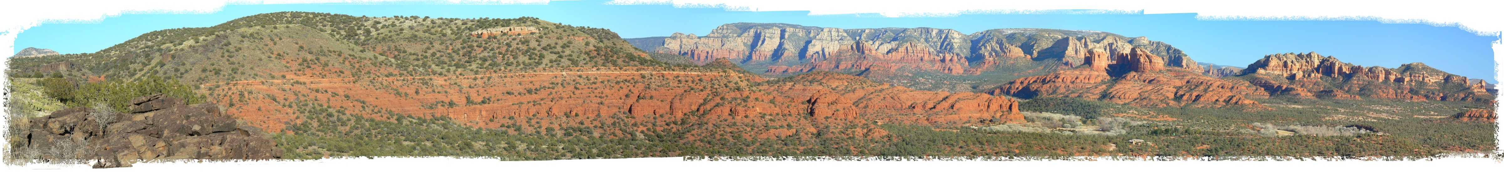
View from Scheurman Mountain - Sedona (968k; full-size panorama is 4802 pixels wide, 565 tall
(Click the image for the full-size panorama)
|
|---|
|
|
Click the image above for the full-strength view.
For those wanting a smaller file (324kb), albeit not as
lustrous an image, click here:
Sedona AZ area: Scheurman Mountain (Scheurman Mtn. is left to Sedona spires on the right - compressed
|
|
|
|---|
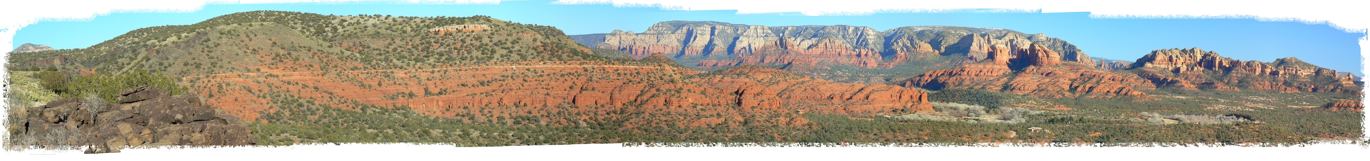
View from Schnebly Hill - Sedona (2.1mb; full-size panorama is 3291 pixels wide, 600 tall
(Click the image for the FULL-size panorama)
|
|---|
|
|
Click the image above for the full-strength view.
For those wanting a smaller file (480kb), albeit not as
lustrous an image, click here:
Sedona AZ area: Munds Mountain is left to Mitten Ridge and Cow Pies (center) to Schnebly Hill on the right - compressed
|
|
|
|---|
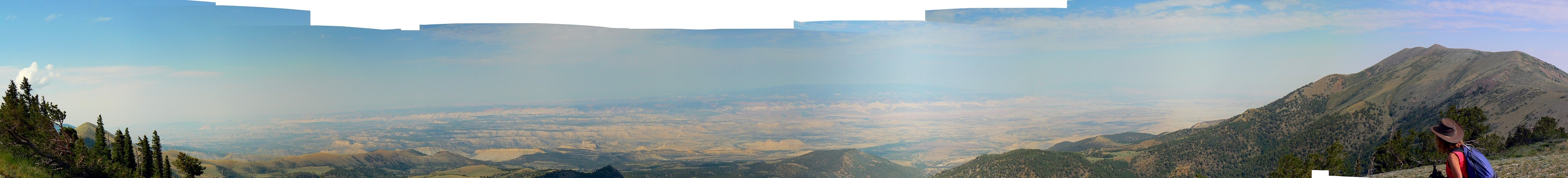
View of S. Ellen (left) to Water Pocket Fold, to N. Ellen, Henry Mountains, Utah
(full-size image is 4389 pixels wide, 500 tall)
(Click the image for the full-size panorama)
|
|---|
|
|
|
|---|
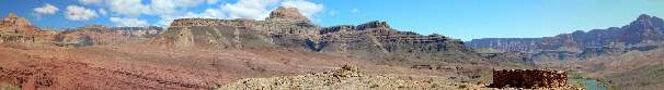
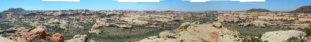
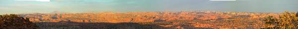
360 degree pano from the Escalante Escalade Route,
South side of the Grand Canyon - scroll L-R to view it all (4116 pixels wide)
(Click the image for the full-size image)
|
|---|
|

|
|---|
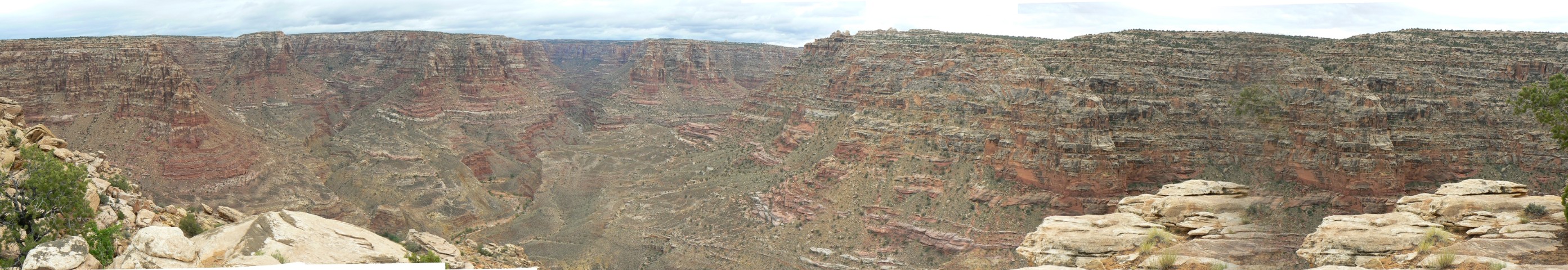
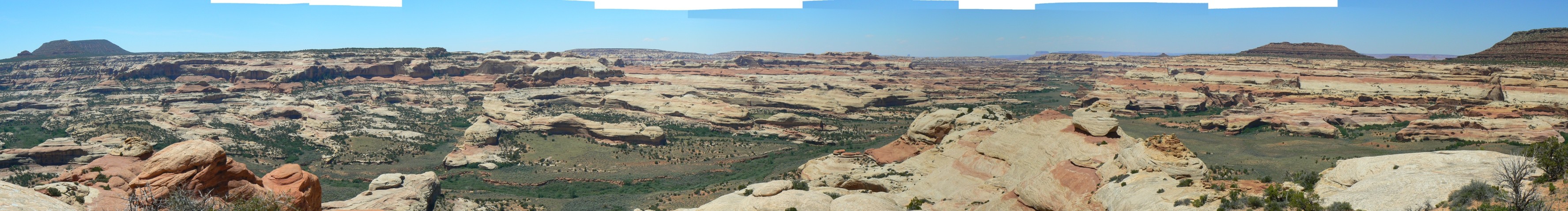
Horse Pasture Pano - Dark Canyon Wilderness, Utah
(Image is very wide - scroll to view it (2260 x 480; 484kb) - Click
the image for the full-size image)
|
|---|
|
|
|---|
top of Sundance Pano - Dark Canyon Wilderness, Utah
(Image is very wide - scroll to view it (2786 x 480; 512kb) - Click
the image for the full-size image)
|
|---|
|
|
|---|
View from ridge near Wedding Ring Arch - panorama
(Image is very wide - scroll left-right to view it (3552 x 480; 576kb) - Click
the image for the full-size image)
|
|---|
|
|
|---|
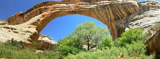
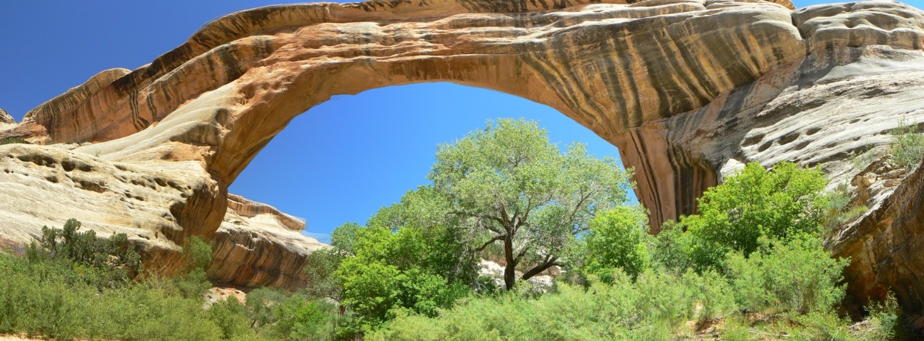
Panorama of Sipapu NB, Natural Bridges NM, Utah
(Image is very wide - scroll left-right to view it (1300 x 480; 240kb) - Click
the image for the full-size image)
|
|---|
|
|
|---|
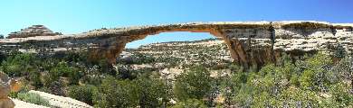
Panorama of Owachomo NB, Natural Bridges NM, Utah
(Image is very wide - scroll left-right to view it (1300 x 480; 240kb) - Click
the image for the full-size image)
|
|---|
|
|
|---|
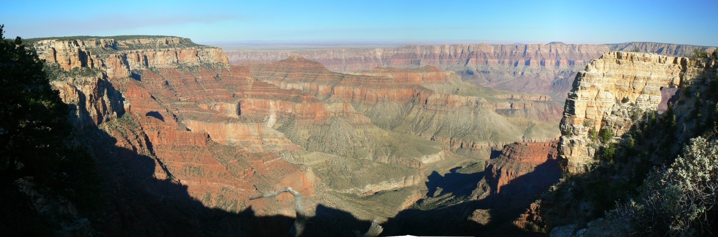
pano from the North Rim of the Grand Canyon -
Angel's Window (Right side) - scroll
L-R to view it all (1452 pixels wide, 202kb)
(Click the image for the full-size image)
|
|---|
|

|
|---|
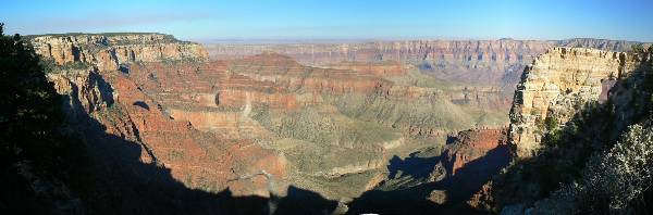
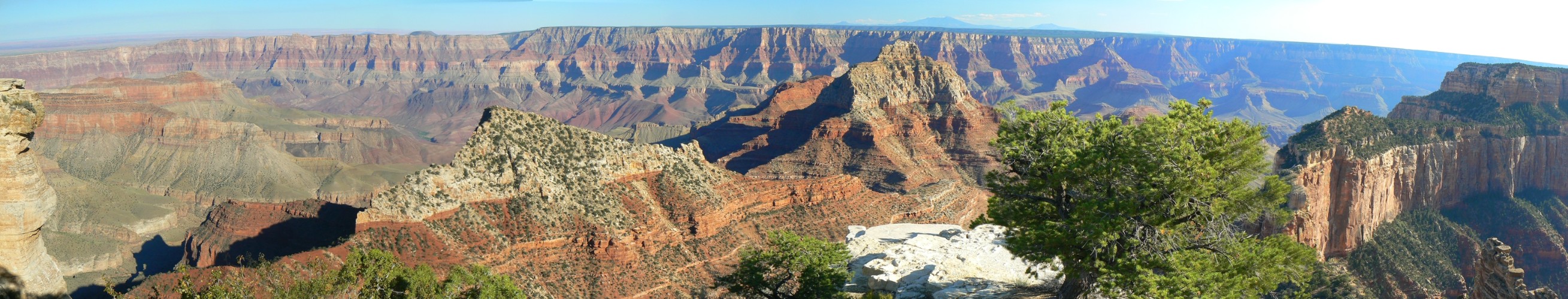
pano taken from Walhalla Overlook - North Rim of the
Grand Canyon - scroll
L-R to view it all (2618 pixels wide, 484kb)
(Click the image for the full-size image)
|
|---|
|
|
|---|
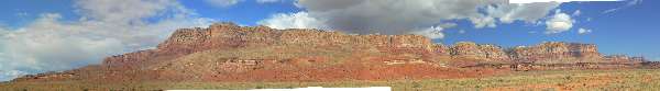
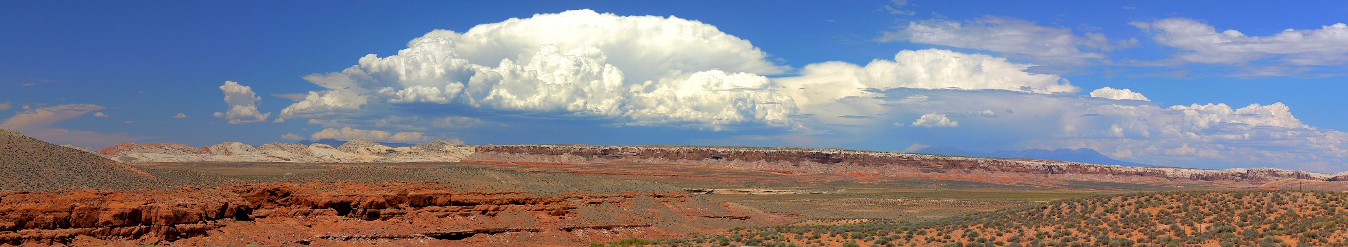
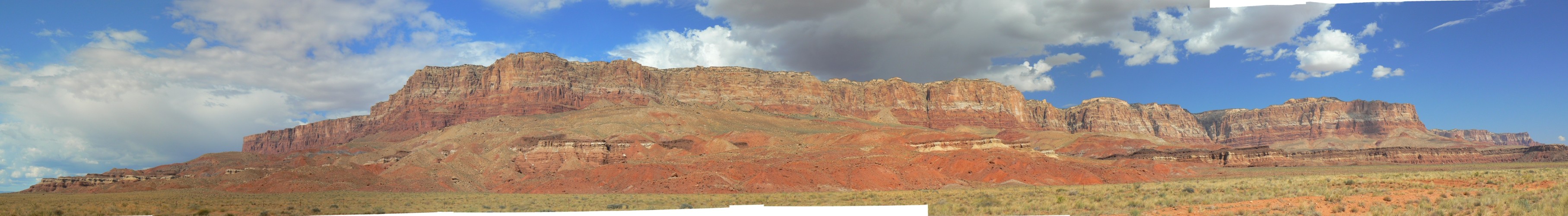
Vermillion Cliffs Pano
(Image is wide - scroll left-right to view it (3630 x 500; 435kb) - Click
the image for the full-size image)
|
|---|
|
|
|---|
pano from Nankoweap drainage, North Rim, Grand Canyon -
the top of Tilted Mesa (Right) - scroll
L-R to view it all (3024 pixels wide, 404kb)
(Click the image for the full-size image)
|
|---|
|
|
|---|
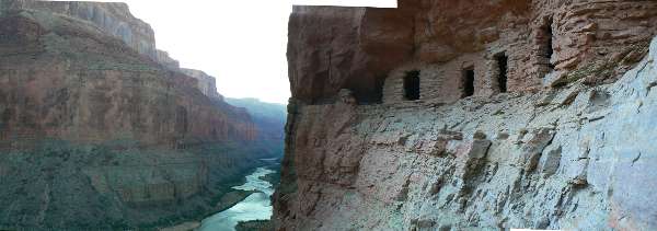
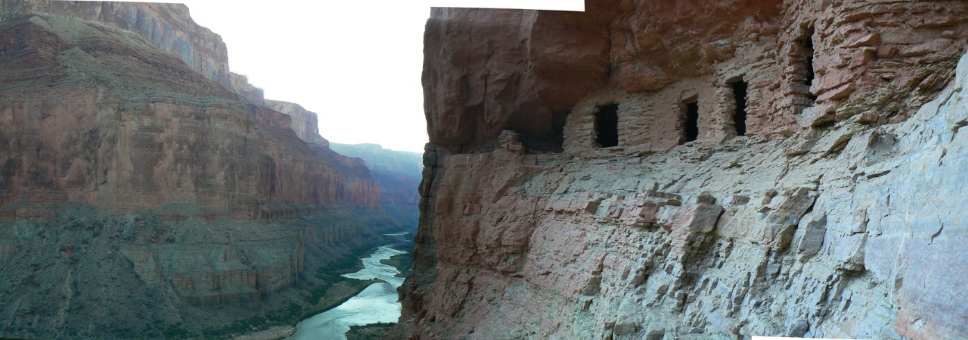
pano of river and granaries - Nankoweap, North Rim of
the Grand Canyon - scroll
L-R to view it all (1394 pixels wide, 204kb)
(Click the image for the full-size image)
|
|---|
|
|
|---|
pano from Nankoweap Cr. - North Rim, Grand Canyon
(L & R), Tilted Mesa
in certer - scroll L-R to view it all (2971 pixels wide, 480kb)
(Click the image for the full-size image)
|
|---|
|

|
|---|
Melody (Vreeland 12-2) Arches view 1 - panorama
Vermillion Cliffs Area-
(Image is wide - scroll left-right to view it (916 x 490; 144kb) - Click
the image for the full-size image)
|
|---|
|
|
|---|
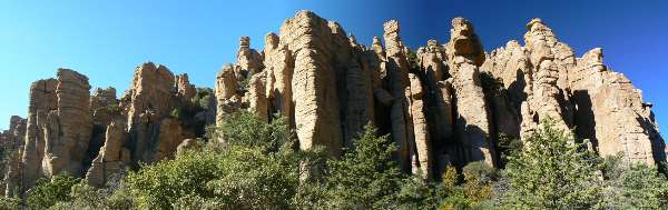
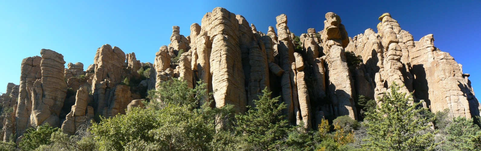
Organ Pipe Pano - Chiricahua NM
(Image is very wide - scroll to view it (1591 x 500; 280kb) - Click
the image for the full-size image)
|
|---|
|
|
|---|
Egypt Pano (Fence Canyon of the Escalante-Grand Staircase
National Monument in Utah)
(Image is very wide - scroll to view it (4862 x 485; 556kb) - Click
the image for the full-size image)
|
|---|
|
|
|---|
Organ Pipe Cactus NM - Panorama Estes Park
(Image is very wide - scroll left-right to view it (2519 x 490; 480kb) - Click
the image for the full-size image)
|
|---|
|
|
|---|
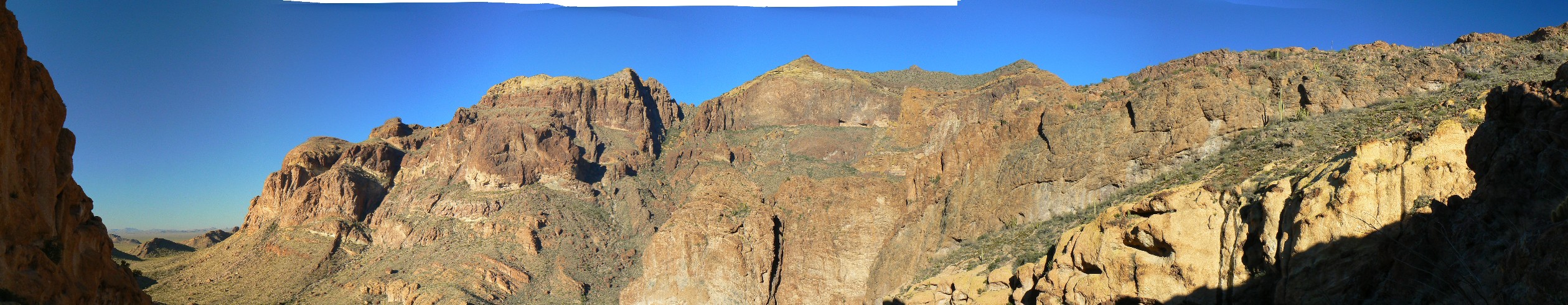
Organ Pipe Cactus NM - Pano- Bull Pasture and Ajo
Mountain Arch (R side)
(Image is very wide - scroll to view it all (2516 x 485; 428kb) - Click
the image for the full-size image)
|
|---|
|
|
|---|
Panorama of the GC from Hermit Drive, taken 1-1-2009;
you can see Plateau Point below (trail).
Taken while getting the next GC permit.
(Image is very wide - scroll left-right to view it (2008 x 490; 380kb) - Click
the image for the full-size image)
|
|---|
|
|
|---|
Panorama of the GC from Maricopa Point, taken 1-1-2009,
while getting a GC permit;
closing out the end of the bushco error for 2008.
(Image is very wide - scroll left-right to view it (3341 x 490; 560kb) - Click
the image for the full-size image)
|
|---|
|
Tune in again to
see additions to this panorama panoply.
| | | | | | | | | | | | | | |


