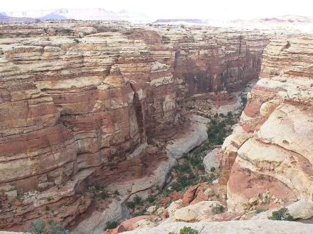
|
|---|
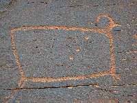
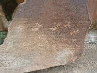
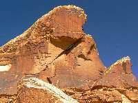
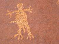
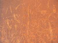
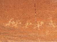
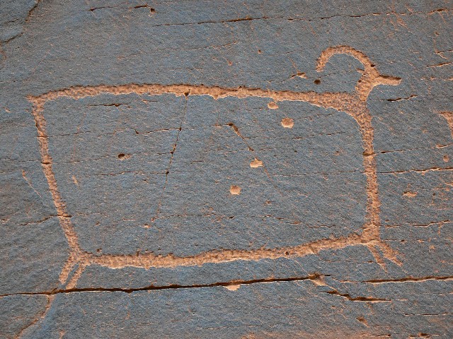
Ancient sheep on the way into Mineral Bottom
(Click the image for a full-size view)
|
|---|
|
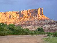
|---|
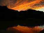
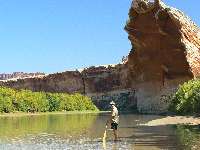
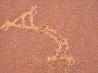
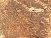
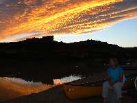
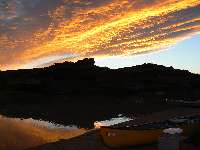
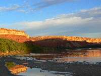
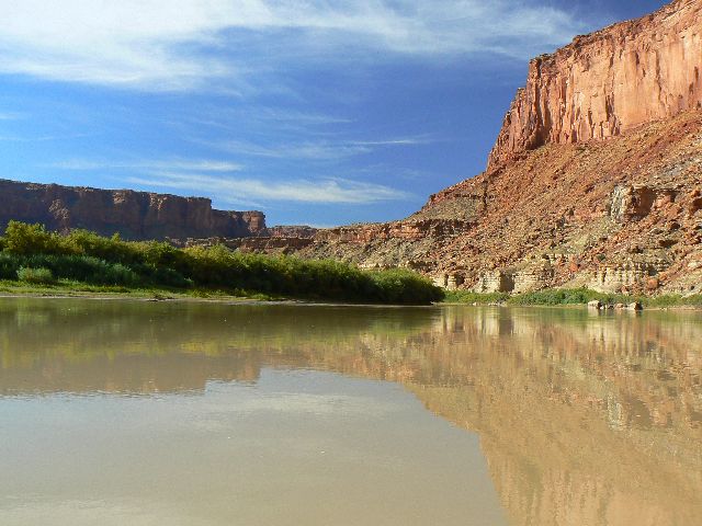
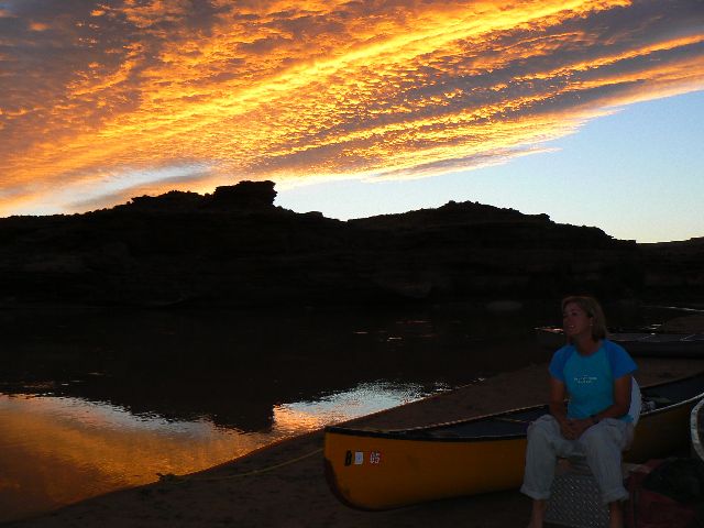
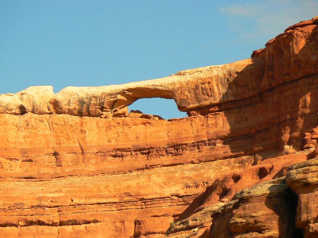
It's a Tuxedo Sunrise - Day 5
(Click the image for a full-size view)
|
|---|
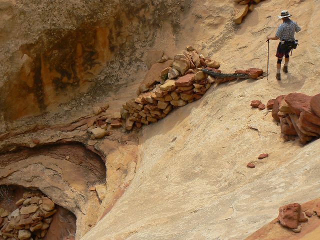
|
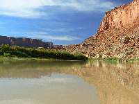
|
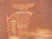
|---|
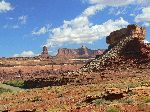
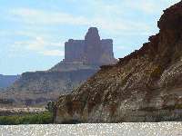
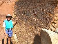
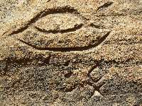
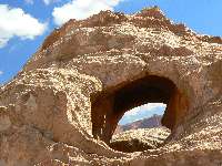
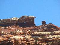
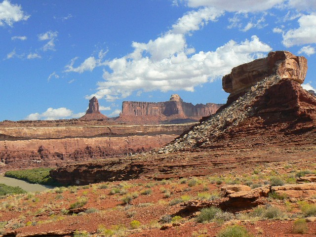
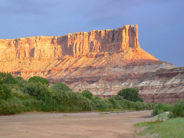
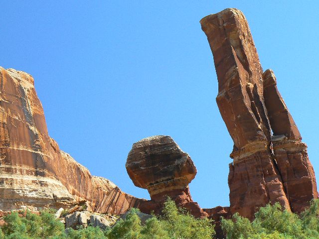
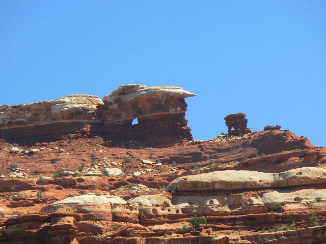
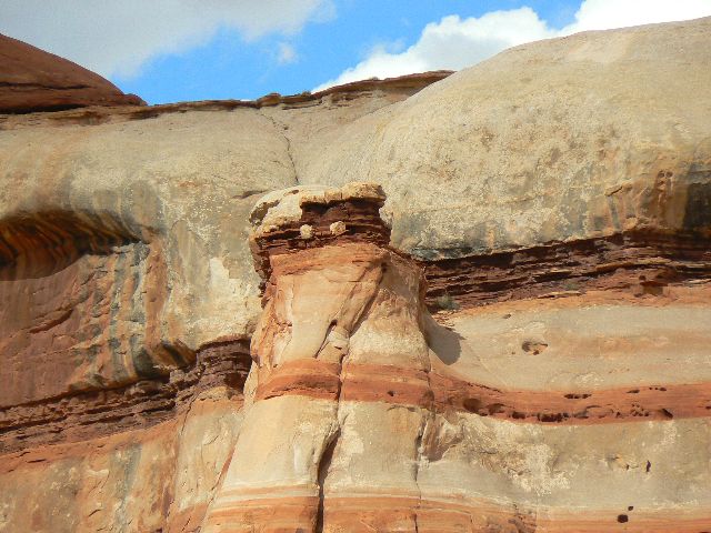
Candlestick and Turk's Head - Day 4
(Click the image for a full-size view)
|
|---|
|
(There are - More photos below each day of the trip narrative.
Total photos = 67.)
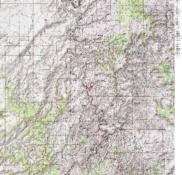
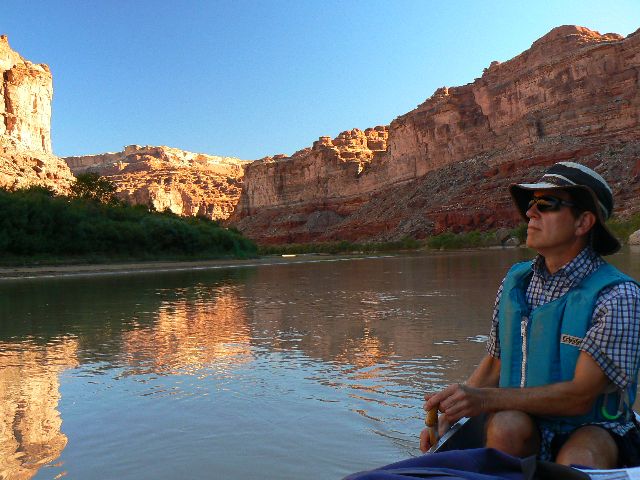
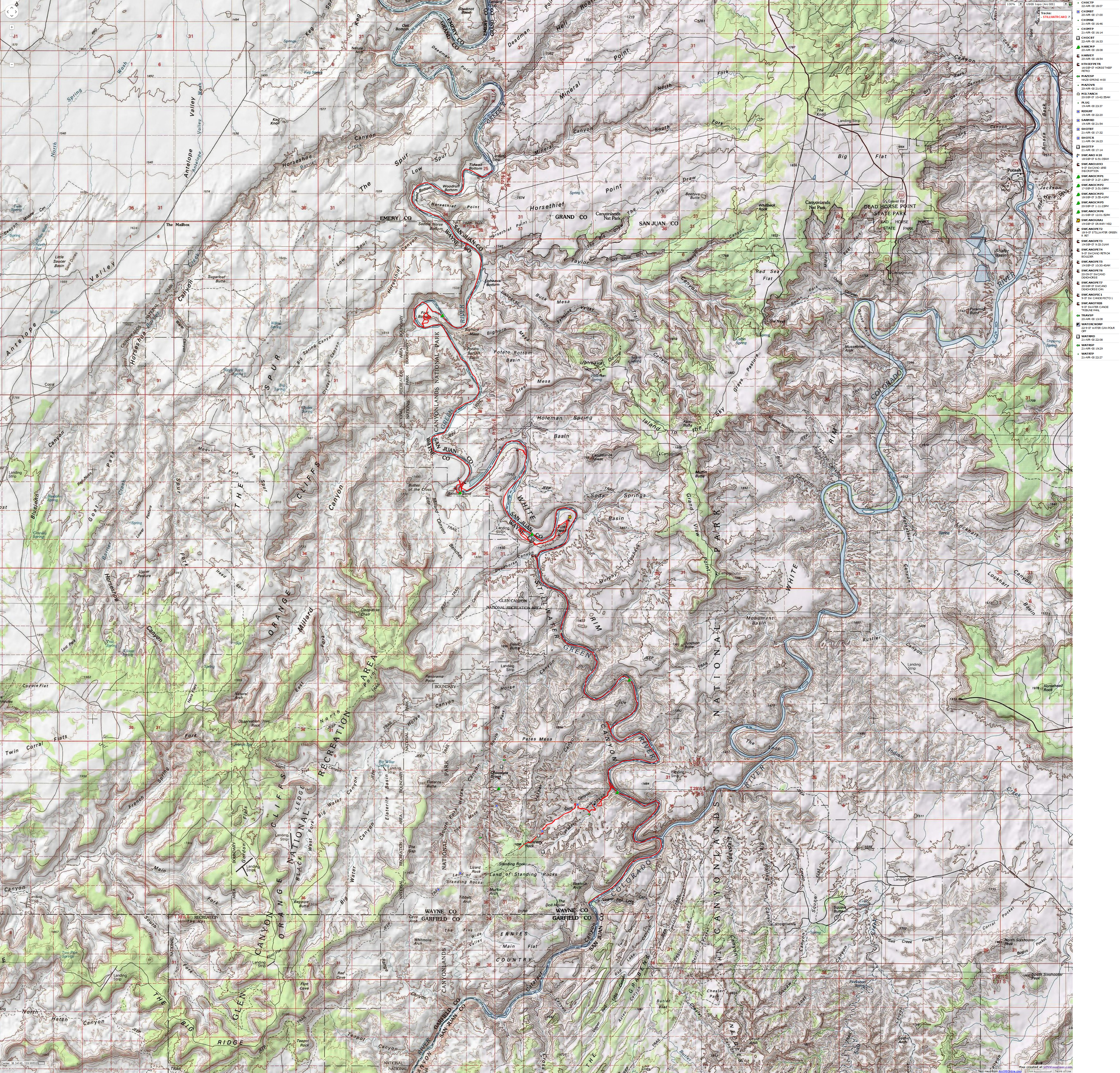
Summary:This is a report about canoeing
the Stillwater section of the Green River through Canyonlands NP. We paddled from
River Mile (RM) 53 to 0, then for a few miles on the Colorado River below the
confluence. The below GPS track was logged at 92 miles on water and land:


|
|---|
Map - Green River: Mineral Bottom to Spanish Bottom: 2007
(Click the image to see the map)
|
|---|
|
If you want to view a full-resolution map, click here. Caution - do not use this map or gps track for
navigating the route.
|
|
|
|---|
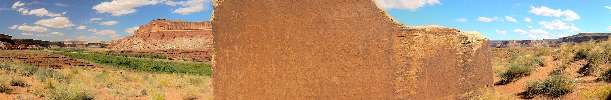
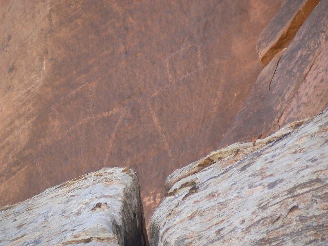
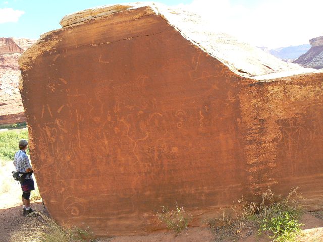
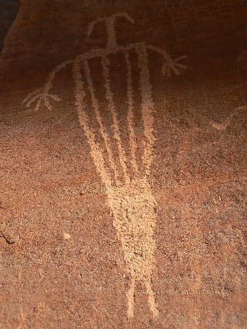
Peteroglyph Boulder along Stillwater Canyon, Green River
(429kb; full-size panorama is 2736 pixels wide.
(Click the image for the full-size panorama)
|
|---|
| |
|
|---|
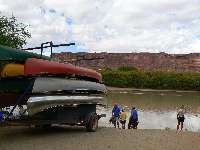
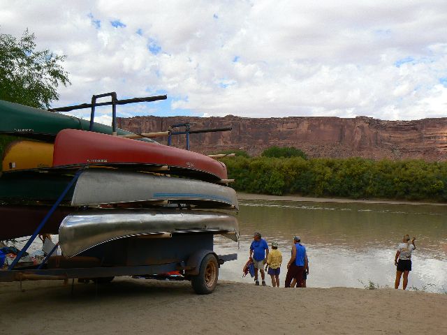
day 1 load out at Mineral Bottom
(Click the image for a full-size view)
|
|---|
|
|---|
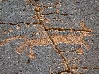
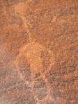
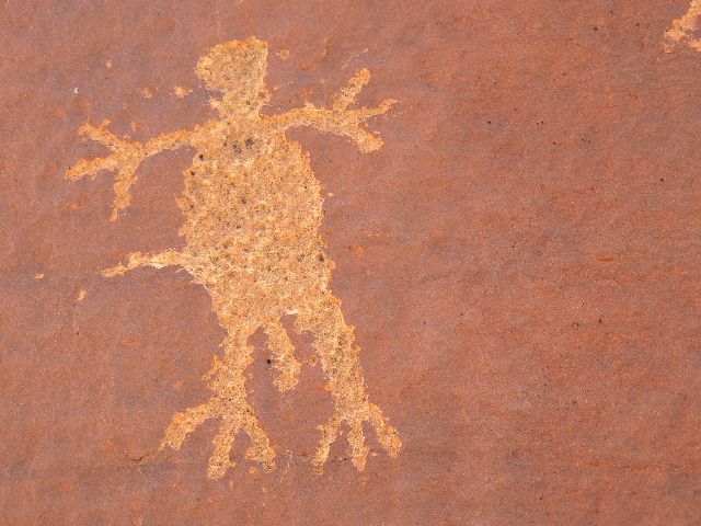
day 1 petro
(Click the image for a full-size view)
|
|---|
|
|
|---|
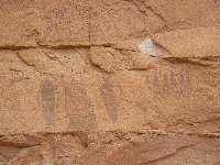
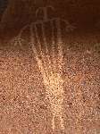
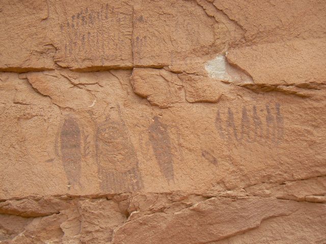
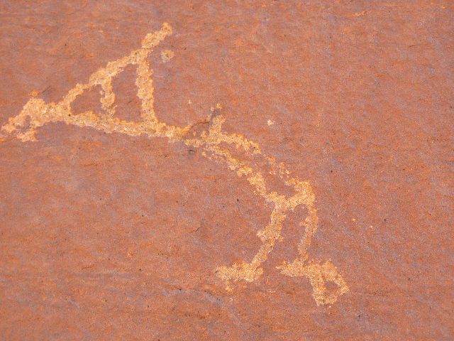
day 1 picto
(Click the image for a full-size view)
|
|---|
|

|
|---|
day 1 Zig lounges
(Click the image for a full-size view)
|
|---|
|
|
|---|
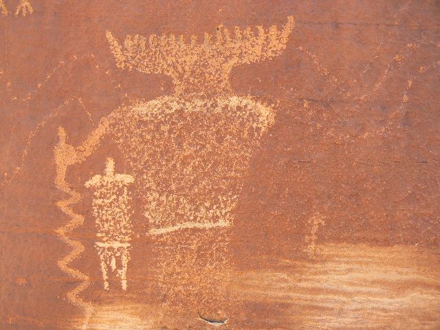
day 1 petro 4 horsethief
(Click the image for a full-size view)
|
|---|
|
|
|---|
day 1 view from camp
(Click the image for a full-size view)
|
|---|
|
(There are - More photos below each day of the trip narrative.
Total photos = 67.)
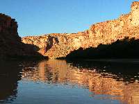
Day 1. Back to Moab. It's a long 330+ miles from
Flag to the whirling cacophony of Moab. Passing the turn-off to The Needles District,
I feel a twinge of home. I meet my friend Zig at a Moab motel. This is a WMC
(Wasatch Mountain Club) trip, and I was invited by Zig because he has a canoe,
and has room in it. Everyone else is traveling from the North, most from near
the center of the earth. There will be 13 people and 7 canoes.
River Day 1:
(River Mile, RM 53 to 41.5; Mineral Bottom to almost Fort Bottom).
Zig and I are ensconced in the tent as it rains lightly. This bout ends
and we creep out for hors d'oeuvre and then dinner before the next round rolls
in on a percussion of thunder. The cliff-forming Windgate Sandstone (SS) spires
poke into the mist and slithering clouds.
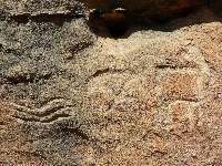
We had met the shuttle at 7:30 a.m. to load canoes
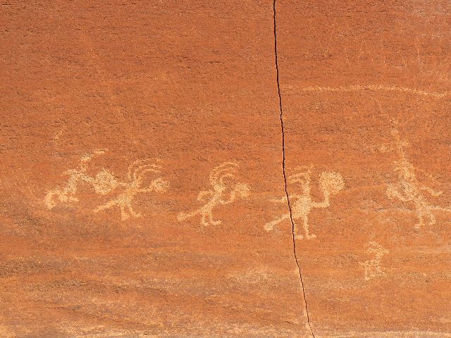
and gear and ride down the precipitous Horsethief trail after stopping to view
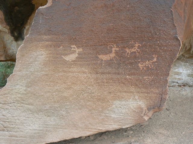
petros along the road to Island In The Sky - nice square sheep, perhaps Fremont
artistry? Are these sheep bred for toasting in those fast food ovens? Is this
the land of Organ Rock arches or golden arches? The petro sheep are just the
right shape to fit a sandwich iron.
The water is low and the put-in crowded and
constricted (because of the low water level). After dumping items and more
items into Zig's canoe and 6 others, we float across the river to repack before
continuing down river. Deep icky muck tries to suck off our sandals and river
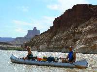
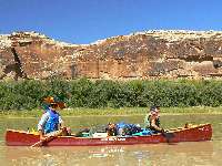
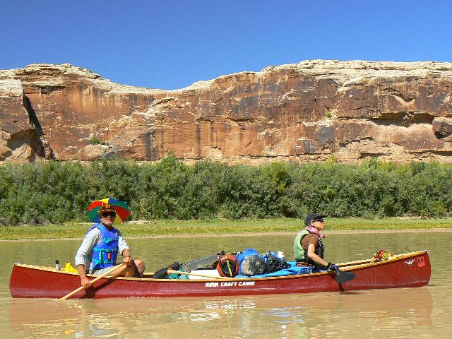
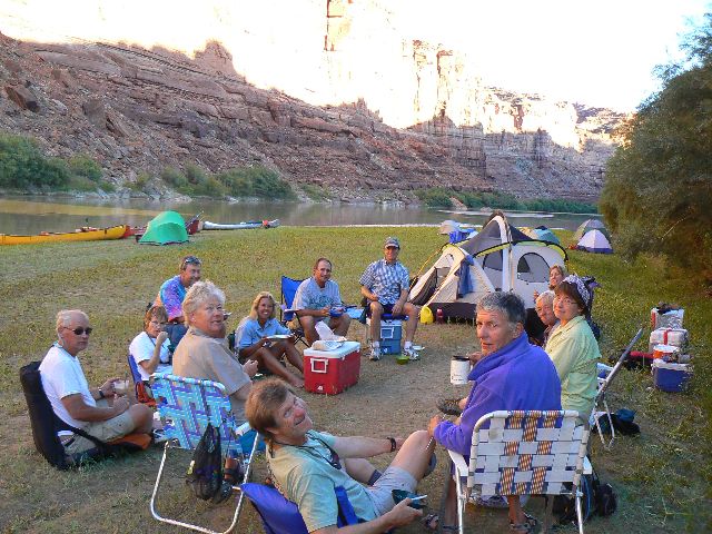
shoes. There are 13 of us in these 7 canoes. The trip was initiated by Rina
of the WMC (Wasatch Mountain Club). The canoeists include: Rina and Ken, Steve
and Mary Ann, Carol and Chris, Charles and Kay, Sharon and Paul, Sue in a solo,
and Zig and I.
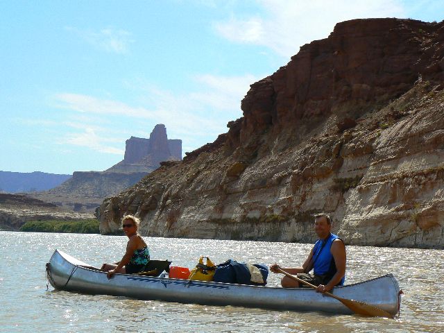
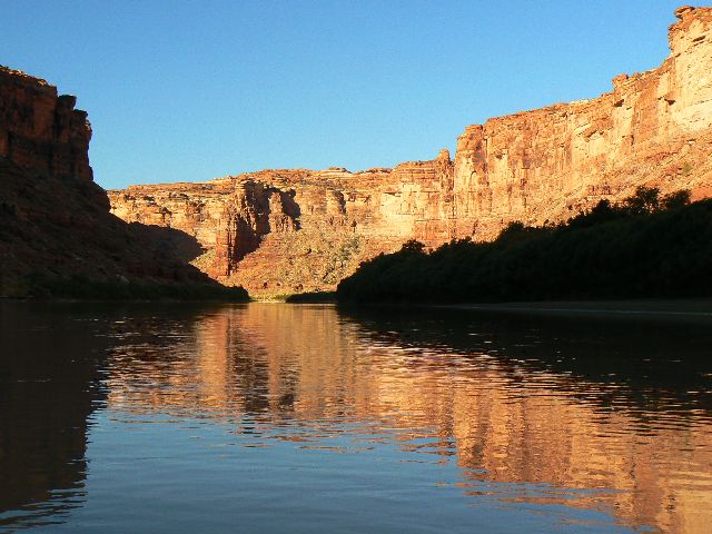
Delightfully deluxe cruising on the Green into
Stillwater Canyon. We pause at Horsethief Canyon and walk a few hundred yards
up canyon to view sheep petros. Lovely.
We camp before Fort Bottom. Between storm swirls,
we enjoy the tremendous views and pulled BBQ pork and pasta salad by Paul and
Sharon. Yummy.
|
|---|
day 2 Fort Bottom
(Click the image for a full-size view)
|
|---|
|
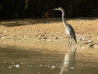
|---|
day 2 Great Blue Heron
(Click the image for a full-size view)
|
|---|
|
|
|---|
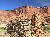
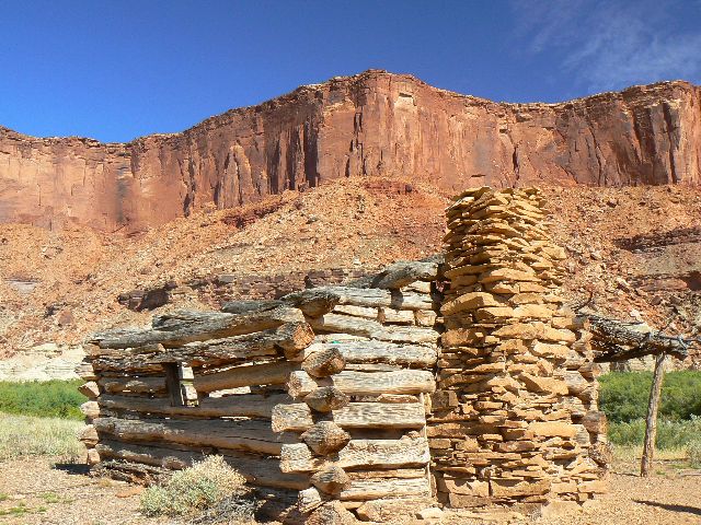
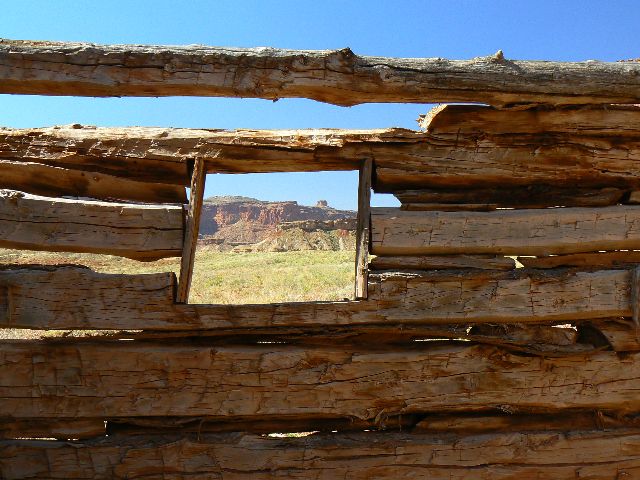
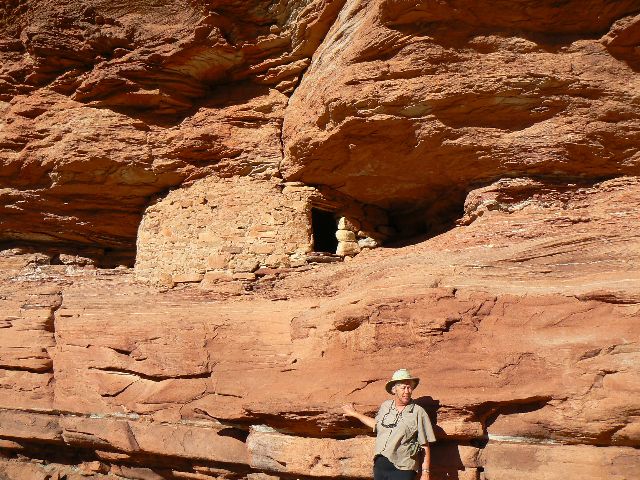
day 2 Outlaw Cabin
(Click the image for a full-size view)
|
|---|
|
|
|---|
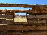
day 2 Outlaw Cabin view
(Click the image for a full-size view)
|
|---|
|
|
|---|
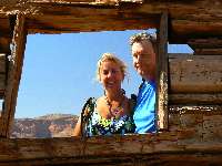
day 2 Sharon & Paul at Outlaw
(Click the image for a full-size view)
|
|---|
|
|
|---|
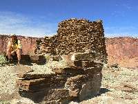
day 2 Fort Bottom Ruin
(Click the image for a full-size view)
|
|---|
|
(There are - More photos below each day of the trip narrative.
Total photos = 67.)
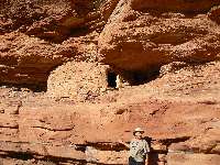
River Day 2:
(River Mile, RM 41.5 to 31; to Anderson Bottom, hike Fort Bottom Ruin, 5 mile hike.).
Bouncing off an unseen rock in the dirty brown river, Zig yells "we'll run it backward!"
as we begin the sluice into Millard "rapid," which we do without much difficulty,
peeling around as the fast flow pillows against the rock wall. Stilt-like Great
Blue Herons stand statuesque, eyeing us as we drift along.
Earlier today, and not far from camp, we pull
off and through the ineffaceable tamarisks and hike a circuitous route to the old
outlaw cabin and then up the low mesa to Fort Bottom Ruin.
After the hike, we continue down the river to
where the White Rim Sandstone pops up from below river level and begins climbing
to its lofty position. Yes, this is the SS of
fabled mountain bike riding,
riding the White Rim (click for link to Rim report). Zig recently finished
this adventure, and Chris
is planning to go next week. We camp just below the exit of an abandoned meander,
a rincon, and the sharp turn of Bonita Bend. (Refer to the map in the links
section to see all these goodies and our route.)
Carol and Chris cook Thai curried chicken &
vegetable stir fry over rice, with a mystery dessert.

|
|---|
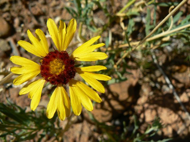
day 2 flower
(Click the image for a full-size view)
|
|---|
|
|---|
day 2 Buttes of the Cross
(Click the image for a full-size view)
|
|---|
|
|
|---|
day 2 Buttes of the Cross
(Click the image for a full-size view)
|
|---|
|
|
|---|
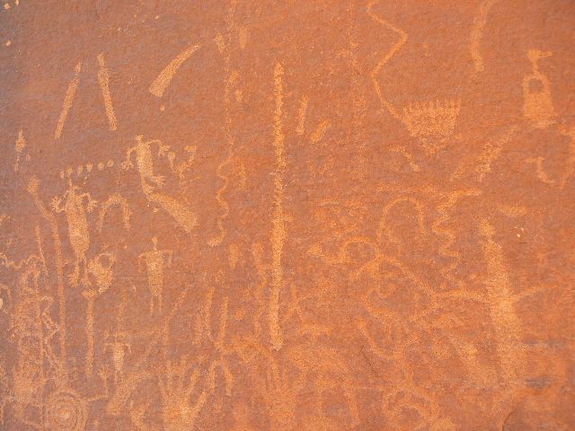
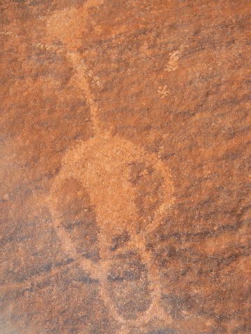
day 3 petros (canopet2)
(Click the image for a full-size view)
|
|---|
|

|
|---|
day 3 petros (canopet2)
(Click the image for a full-size view)
|
|---|
|
|
|---|
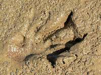
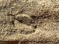
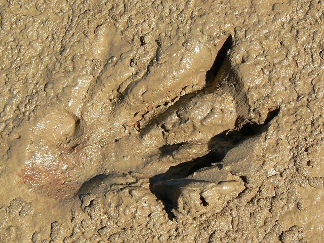
day 3 beaver track in mud
(Click the image for a full-size view)
|
|---|
|
(There are - More photos below each day of the trip narrative.
Total photos = 67.)
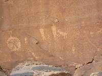
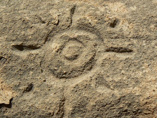
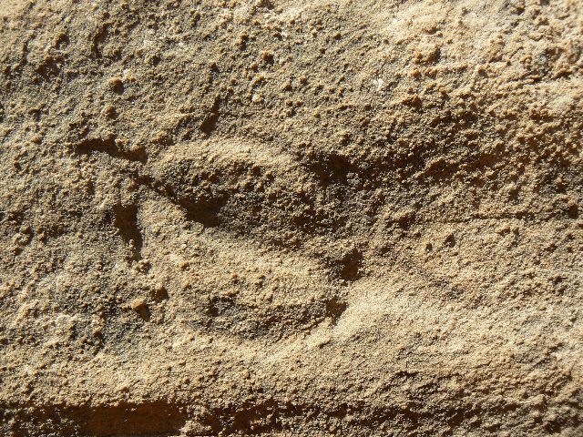
River Day 3:
(RM 31 to 23.5; Tuxedo Bottom.) Behind The Frog, and high up on the flank
is a running shield petro accompanied by bear tracks and lots of other stuff.
Yowee. I'm on a petro hike from camp to 'The Frog,' where this panel hides
on the North side. Then, we paddle over to where we can easily fetch water
from the rock cistern. Nearby, we find an excavated cavern where lore suggests
that potties were stored to support the lack of friendship cruise - more motors
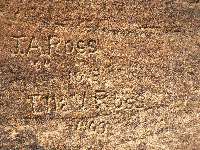
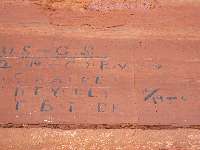
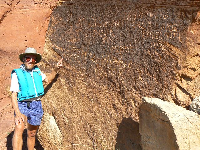
than the river or earth can tolerate. Zig and I also pull the canoe up the river
to find the SL Tribune inscriptions on a varnished boulder.
Then, final packing and on down the river we float,
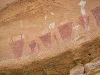
not far to Valentine Bottom, where we try to slash and crash through the dreaded
tamarisk wall - unsuccessfully. Back in the canoes, and down river, we find a
pathway and walk to see the picto panel far above the flats. A duo of granaries
compliments the view. An abandoned row boat is rumored to be nearby, but we did
not search for it.
On we go, into the wind to Tuxedo Bottom, where
we drift too far and have to line the boats back up. There, on a broad bar, we
camp, yet good small camps can be found above the bottom and provide access to
the hike for tomorrow around Turk's Head. We crowd against the wall of tammies,
which provide welcome shade.
Zig and I cook Shepherds pie and cake in the dutch ovens.
|
|---|
day 3 The Frog at Bonito Bend (behind it is canopet2 on map)
(Click the image for a full-size view)
|
|---|
|
|---|
day 3 Zig up the river with a paddle but no boat
(Click the image for a full-size view)
|
|---|
|
|
|---|
day 3 Salt Lake Tribune rock
(Click the image for a full-size view)
|
|---|
|
|
|---|
day 3 The Sphinx
(Click the image for a full-size view)
|
|---|
|
|
|---|
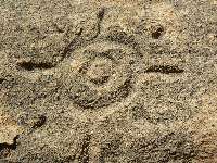
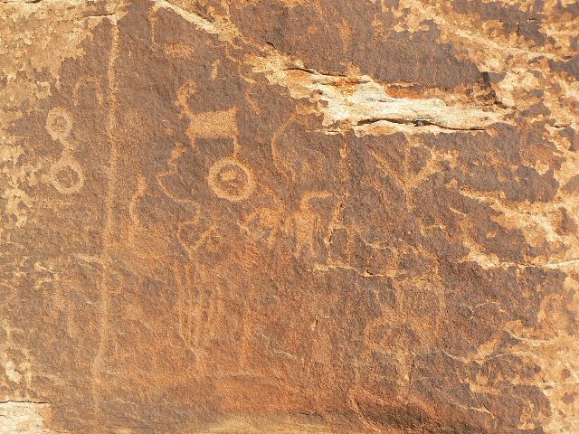
day 4 petro (canpet3 on map)
(Click the image for a full-size view)
|
|---|
|
|
|---|
day 4 petro (canpet3 on map)
(Click the image for a full-size view)
|
|---|
|
(There are - More photos below each day of the trip narrative.
Total photos = 67.)
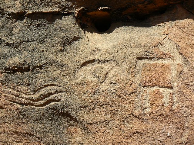
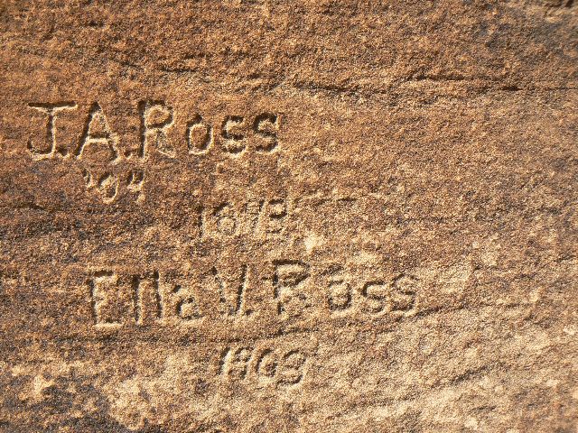
River Day 4:
(Turk's Head Transnavigation, layover day; hike 7 miles.) Massive
quantities of petros adorn the desert varnished boulder glistening in the
sun. We're up near the low pass between Tuxedo Bottom and Deadhorse
Canyon, rolling along toward Turk's Head. The reputed petros in Deadhorse
will wait until tomorrow. For now, we've discovered two more petro
boulders as we round the South side of Turk's. The day started with
an upstream canoe to a parting of the tamarisk line.
A halo of chert shards surrounds one
of these boulders. Mounds and fields of jasper, shot, chert grace our
walk. It's a lithic bonanza from yore. Imagine all the folks
working the jasper corns into scrapers and points, gazing out
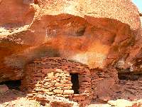
toward the river, toward Turk's Head. Dropping down a bit, we
encounter several granaries and an inscription from 1893, perhaps
from early river runners?
We return to the dust and grit-swept
beach to learn that Chris' tent has blown into the river and would
have been lost but for Sue rescuing it and other items. Sue had
stayed behind to read, but did little because of wind-produced
problems. A thin coating of grit envelopes all as we endure
intermittent gales hurling sand down the fine bottom. Some of us
think fondly of Queen Ann's Bottom and other fine bottoms.
|
|---|
day 4 petro (canpet3 on map)
(Click the image for a full-size view)
|
|---|
|
|---|
day 4 petro (canpet4 on map)
(Click the image for a full-size view)
|
|---|
|
|
|---|
day 4 petro (canpet4 on map)
(Click the image for a full-size view)
|
|---|
|
|
|---|
day 4 petro (canpet4 on map)
(Click the image for a full-size view)
|
|---|
|
|
|---|
day 4 petro (canpet5 on map)
(Click the image for a full-size view)
|
|---|
|
|
|---|
day 4 petro (canpet5 on map)
(Click the image for a full-size view)
|
|---|
|
(There are - More photos below each day of the trip narrative.
Total photos = 67.)
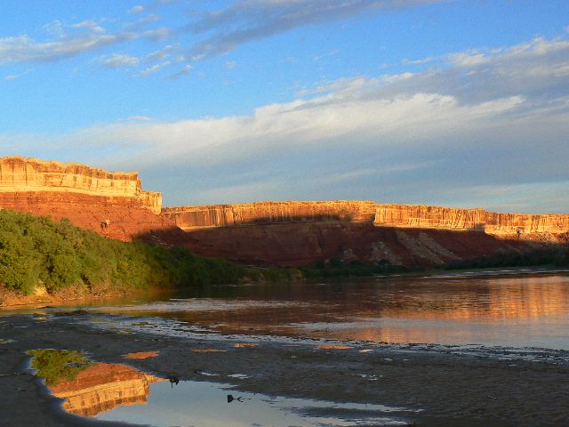
River Day 5:
(Tuxedo Sunrise, or Scenic Groover Deluxe; RM 23.5 to 12.) Nature girl
poses primly on the scenic groover as the soft glow of early morning lights
the saffron clouds and gently blushes the White Rim SS across the now blue Green
River. Actually, the river is a murky shade of brown, yet this morning light
enhances all with chromatic grace, including this silt-laden sloth of a river.
The contrast with a real Western river is vast.
One a clear,
restless, roiling, raucous river fidgeting and bucking toward the
sea, (click here for link to this river) the other a full-suspension sluggard listlessly
lilting toward a series of rapids before entombment in a sewage pond. Ahh, yet
both rivers traverse incredible and generally wild terrain. Deluxe and delightful.
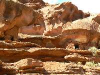
Our stop of the day is Deadhorse Canyon, where
we walk briefly to two lovely petro panels. The canyon walls grow taller, more
complex, more interesting as Cedar Mesa SS rises from the depths to join the White
Rim SS, the Organ Rock Shale, at least in our limited inner canyon experience.
We see two arches, one at RM 17 on river left and the
other, actually a duo, perched far above on river right near RM 13.3 or so.
Now it's early evening, and we're lounging in the
luscious shade amidst calm and cooling air, nibbling on salsa and hummus, peacefully
awaiting clam chowder and apple crisp while filtering alum-settled river water and
watching the shade creep up the milk chocolate walls while the moon blossoms beyond half.
|
|---|
day 4 petro (canpet5 on map)
(Click the image for a full-size view)
|
|---|
|
|---|
day 4 petro (canpet5 on map)
(Click the image for a full-size view)
|
|---|
|
|
|---|
day 4 1893 inscription
(Click the image for a full-size view)
|
|---|
|
|
|---|
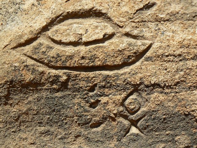
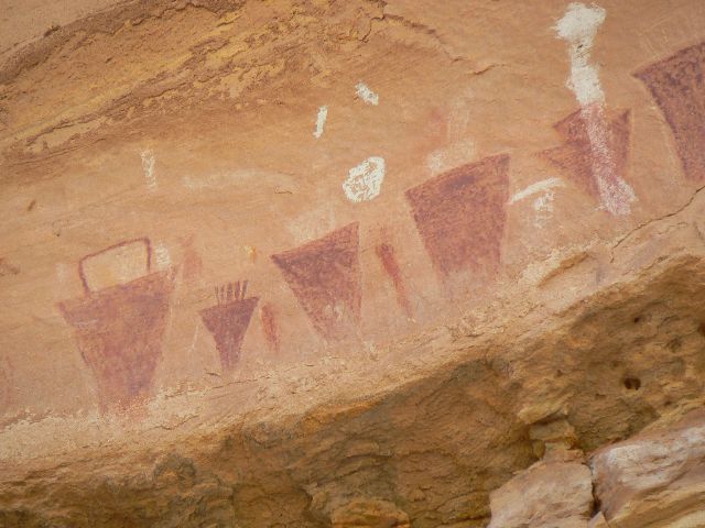
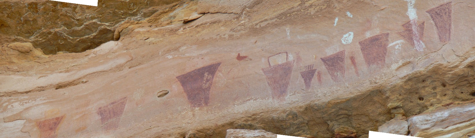
day 4 pictos
(Click the image for a full-size view)
|
|---|
|
|
|---|
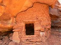
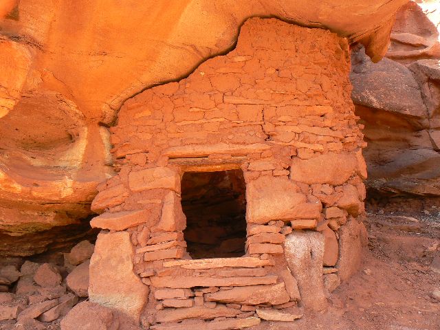
day 4 storage unit
(Click the image for a full-size view)
|
|---|
|
|
|---|
day 4 storage unit
(Click the image for a full-size view)
|
|---|
|
|
|
|
|---|
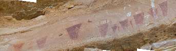
A Panoramo of the picto panel
(236kb; full-size panorama
is 1645 pixels wide.
(Click the image for the full-size panorama)
|
|---|
| |
(There are - More photos below each day of the trip narrative.
Total photos = 67.)
River Day 6:
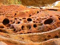
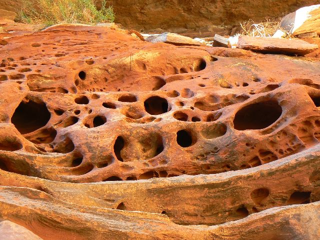
Water-oooh. (RM 12 to 4, mouth of Water Canyon.) The overhang soars as we admire
the pock-marked surface of short Jasper Canyon, just a quarter of a mile or so up
from the river. Well, Jasper is short from the river, yet long from above. Jasper
is one of the few canyons anywhere in the SW to be spared the disastrous and
habitat-altering visitation of bovines and sheep. Now closed to hiking because
of how poorly funded the park service and other public agencies are in this era
of the arrogant bushco, where the only conservation includes: conservation of
tax cuts for the rich, conservation of extreme spending on war and prisons,
conservation of your great-great grandchildren's obligation to pay for the obscene
illegal war spending, conservation of exporting jobs, conservation of money for the
rich and conservation of strangulation of funding for public lands, health care,
education, and infrastructure..... one of the results being that there is insufficient
funding for archeological surveys and resource protection. We visit ruin M85, near
the mouth of Jasper before continuing down this delightfully calm section of the river,
and, no wind.
Stopping just down stream of the mouth of Water Canyon,
we set up camp close to the willows to enjoy the first shade of the evening. Zig and
I hike up Water Canyon and filter the good water in the shade of a boulder, then later
climb up to the pour-off leading into Shot Canyon. Clearly, this is the stopping
place for hikers traveling up or down Shot Canyon. After a river bath and a delicious
dinner, a wondrous evening ensues.
|
|---|
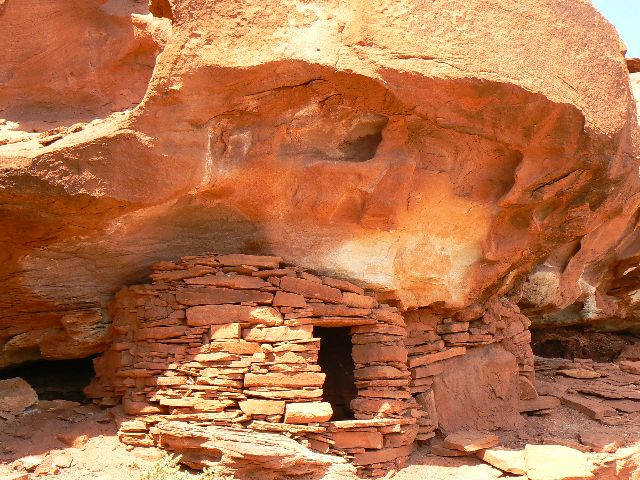
day 4 storage unit
(Click the image for a full-size view)
|
|---|
|
|---|
day 4 Turks Head Portal
(Click the image for a full-size view)
|
|---|
|
|
|---|
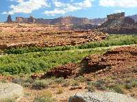
day 4 tuxedo Bottom view
(Click the image for a full-size view)
|
|---|
|
|
|---|
day 4 Oregon Traveler
(Click the image for a full-size view)
|
|---|
|

|
|---|
day 5 box canyon?
(Click the image for a full-size view)
|
|---|
|
|
|---|
day5 nature girl
(Click the image for a full-size view)
|
|---|
|
(There are - More photos below each day of the trip narrative.
Total photos = 67.)
River Day 7:
Swirling Dervish in Shot Canyon. (day hike to Chimney Rock; hike 14 miles.)
An early call for breakfast signals a
long day of hiking into The Maze District.
A swirling dervish of rock steps stacked around
the slickrock bowl leads to the last series of muffin mounds and then - a complete
view of Chimney Rock. Paul, Zig, and I reach the Chimney and there are no dramatic
views. Disappointment. We hike a bit more and then the 360 degree panorama
explodes - and we see the Land of Standing Rocks, the buttes named Elaterite and
Ekker, Six-shooter Peak in The Needles District, the La Sal Mountains, The Blue
Mountains, and on around. It's a seven mile one-way jaunt from the river, but so
worth it. Most of the group hike nearly to Chimney Rock, then head back because
of threatening skies and the approach of evening.
To get here, we hiked up and around the Water Canyon
pour-off, going higher than the regular route - which afforded a wonderful view of what
we call CW Arch, in honor of Chris who first sees it. On can also see this arch from
the cross-over ridge between Water and Shot Canyons. This is where we hiked, up Water
Canyon, across the ridge into Shot, then up Shot to Chimney Rock.
It's a long drag. Just as I was reaching camp on the
return hike, a rain event cuts lose and soaks me. Now, we're sitting around a Solstice
fire and reminiscing about a wondrous adventure. It's approaching 8 p.m. and pumpkin hour.
|
|---|
day5 scenic groover
(Click the image for a full-size view)
|
|---|
|
|---|
day 5 RM 13.3 arch
(Click the image for a full-size view)
|
|---|
|
|
|---|
day 5 petros in Deadhorse
(Click the image for a full-size view)
|
|---|
|
|
|---|
day 5 petros in Deadhorse
(Click the image for a full-size view)
|
|---|
|
|
|---|
day 5 petros in Deadhorse
(Click the image for a full-size view)
|
|---|
|
|
|---|
day 5 tuxedo sunrise
(Click the image for a full-size view)
|
|---|
|
(There are - More photos below each day of the trip narrative.
Total photos = 67.)
River Day 8:
Growler. (RM 4 to 0 to Colorado RM 213 and Spanish Bottom; total of 7 RM.)
The growling low roar echoes down the canyon as rain patters intermittently on the tent
fly. It's a very dark and stormy night. Anxiously, I think "an airplane?" No, the
sound is lasting too long. "Perhaps a flash flood?" I venture. It must be water
flowing, falling off the big drop in Water Canyon, we surmise. Zig gets out into the
rain to see if the river is rising. It doesn't look any different in the dark with full
cloud cover and the incessant rain. Sleep comes and goes.
It's still raining in the morning, and we go to
investigate the flow from Water Canyon, finding a good muddy flow, but not huge.
The Germans camped on the bar near the mouth are still there, having not been washed away.
The river is higher, and, if possible more turbid. We load up and head into the cool air
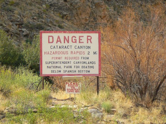
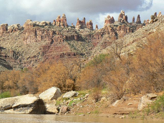
toward the Confluence. It stops raining. The Colorado comes in as a swirl of milk chocolate. A few sucking eddies beckon. We pass the sign warning of the rapids in Cataract Canyon.
On to Spanish Bottom. Unload. Lunch. I save the track
from my GPS, which has been running on water and land - logging 92 miles of travel. The
jet boats are here - no time to hike to the Doll House today. Load out. It's a long,
noisy jet boat ride to Potash. The blood red tide entering from Indian Creek tells tales
of the storm last night. Then, the drive into Moab. Fond and sad goodbyes and more
unloading and loading.
Then, into the night, the very long night, driving
the sinuous route across Southern Utah and the vast Navajo Reservation, replete with
open range black cows in the ebony dark. It's next morning before I'm snuggling in my
bed, dreaming about Stillwater Solstice.
|
|---|
day5 USGS inscription: 21 to colorado
(Click the image for a full-size view)
|
|---|
|
|---|
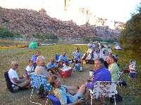
day5 the group at dinner
(Click the image for a full-size view)
|
|---|
|
|
|---|
day6 green morning
(Click the image for a full-size view)
|
|---|
|
|
|---|
day 6 Carol and Jasper ruin m85
(Click the image for a full-size view)
|
|---|
|
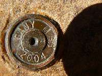
|
|---|
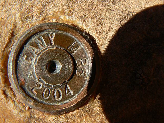
day 6 m85 marker - NPS survey marker
(Click the image for a full-size view)
|
|---|
|
|
|---|
day 6 Grillwork-end of Jasper Canyon
(Click the image for a full-size view)
|
|---|
|
(There are - More photos below.
Total photos = 67.)
After we loaded out from Spanish Bottom, we started thinking
about all that shit contained in the now not-so-scenic groovers. Then,
we started thinking about
all that shit created by king george's unconstitutional seizing of power!
Frightened yet? Are we a nation of laws or kings
and queens? Impeachment is the cure for the current constitutional crisis.
Impeachment of Cheney and Bush are critical because, in the
words of Bruce Fein (former associate deputy attorney general under former President
Ronald Reagan - that is, he is no liberal):
"... because he is seeking more
institutionally to cripple checks and balances and the authority of Congress and the
judiciary to superintend his assertions of power. He has claimed the authority to tell
Congress they don't have any right to know what he's doing with relation to spying on
American citizens, using that information in any way that he wants in contradiction to
a federal statute called the Foreign Intelligence Surveillance Act. He's claimed
authority to say he can kidnap people, throw them into dungeons abroad, dump them
out into Siberia without any political or legal accountability. These are standards
that are totally anathema to a democratic society devoted to the rule of law."
"... Take, for instance, the assertion that he's made
that when he is out to collect foreign intelligence, no other branch can tell him what
to do. That means he can intercept your e-mails, your phone calls, open your regular mail,
he can break and enter your home. He can even kidnap you, claiming I am seeking foreign
intelligence and there's no other branch Congress can't say it's illegal--judges can't
say this is illegal. I can do anything I want. That is overreaching. When he says that
all of the world, all of the United States is a military battlefield because Osama bin
Laden says he wants to kill us there, and I can then use the military to go into your
homes and kill anyone there who I think is al-Qaeda or drop a rocket, that is
overreaching. That is a claim even King George III didn't make--"
See the rest of the
interview with Fein and the case for impeachment of bush and cheney.
Yet, for this moment, I am thinking about
floating through Stillwater with wonderful folks and terrific weather.
| | | | | | | | | | | |


