Needles Knocked About

Misadventure in Upper Salt Creek and your PLB

A Rocky Time in The Needles District
Canyonlands National Park, Utah
PLB is Personal Locator Beacon

September 20 -25, 2014

by Rob Jones

(Text © copyright by Rob Jones; Photos © copyright by Rob Jones
All American Man - Day 1
(Click the image for the full-size image)
Four Faces - Day 1
Four Faces - Day 1
(Click the image for the full-size image)

a wall arch - Day 1
a wall arch - Day 1
(Click the image for the full-size image)
Shaman - Day 2
Shaman - Day 2
(Click the image for the full-size image)

Issues and Concerns - Day 3
(Click the image for the full-size image)
view from SC3 - Day 4
(Click the image for the full-size image)

Topo map using my GPS track
(Click the image for the full-size image)

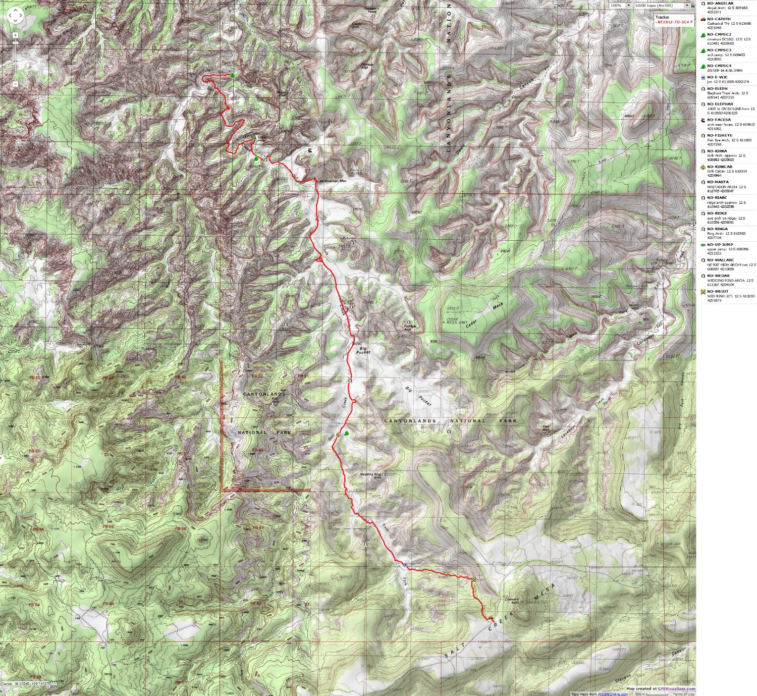
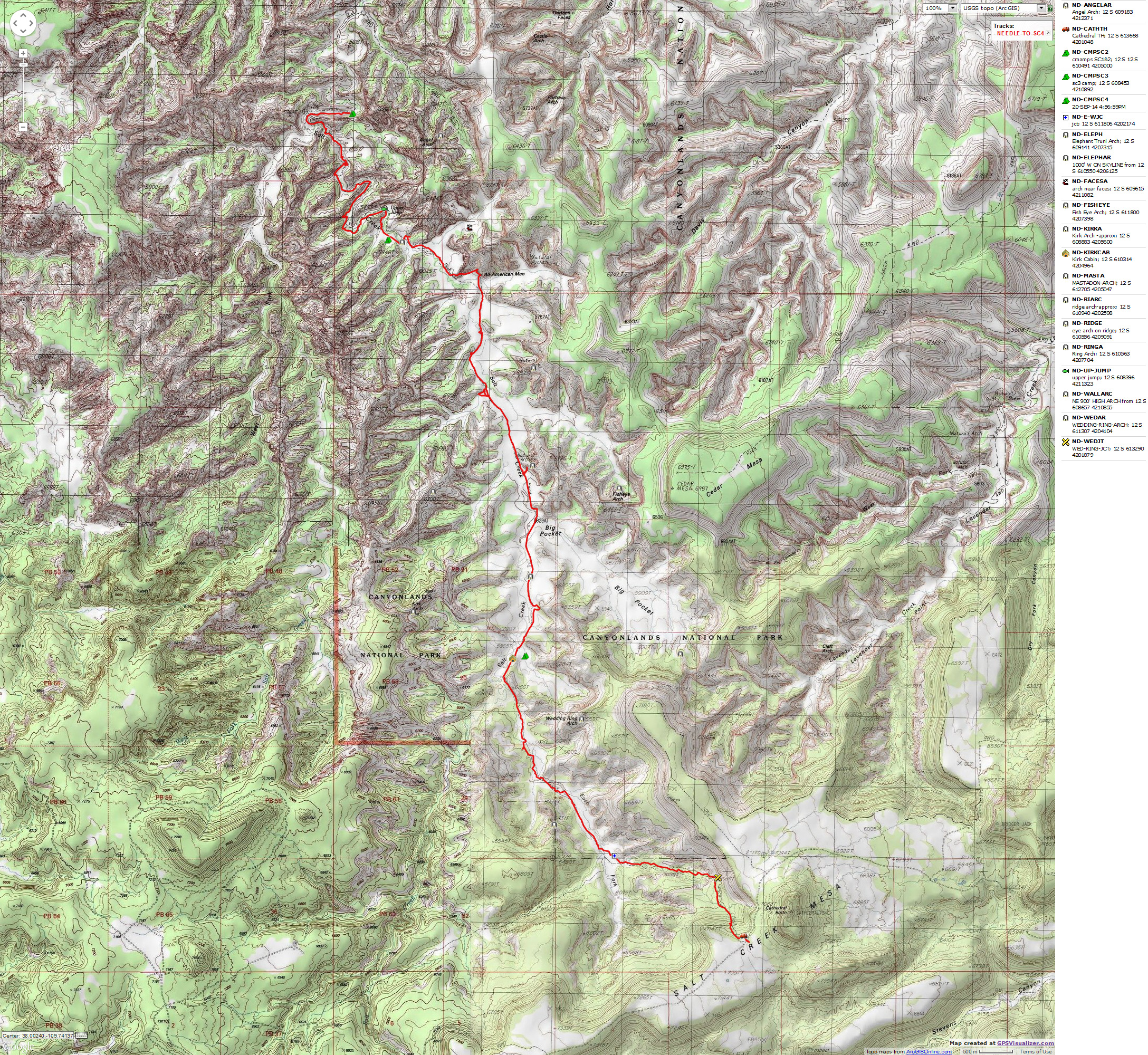
for a full-resolution map, click here. Caution - do not use this map or gps track for navigating the route.

Topo map drawn by hand - waypoints and route approximate (3 mb)
Topo map with route drawn by hand - waypoints and route approximate (3 mb)
(Click the image for the full-size image)

pdf of Canyonlands NP backcountry camps
pdf of Canyonlands NP backcountry camps (PDF file; 336 kb)
(Click the image for the full-size image)

Movie #1 of Ruination in the rain,  Day 2 - 11.0 mb
Movie #1 of Ruination in the rain, Day 2 - 11.0 mb
(Click the image to see the short video - 11mb)

medicare for all
medicare for all
(Click the image for the full-size image)

      Summary: Summary: This report may serve as an example of what happens when things go wrong. What was the error? Hiking solo? I had notified the NPS of my plans and had a valid backcountry permit which specified where I would be on what night. I had left a detailed plan with Kathleen. I had excellent USGS maps and good background information. No, I did not get lost, not ever. Yes, I fell off a rock and (I later learned) broke my ankle on both sides. No, I did not carry a PLB (Personal Locator Beacon) and, again, I was hiking solo.
      You will not see waypoints for any of the archeological features (e.g., ruins, pictos, petros) in the report maps. You will see references to camps and arches.
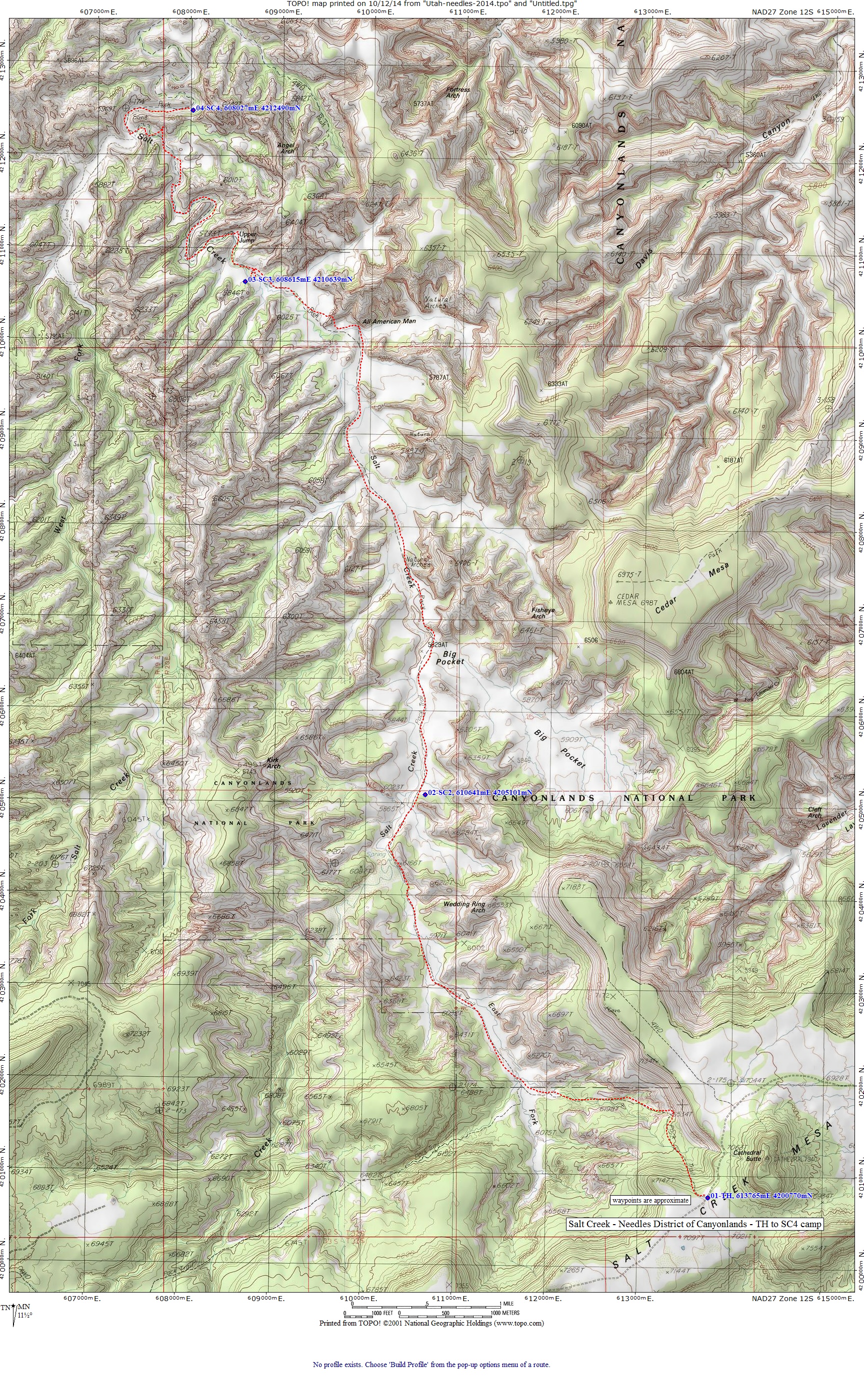
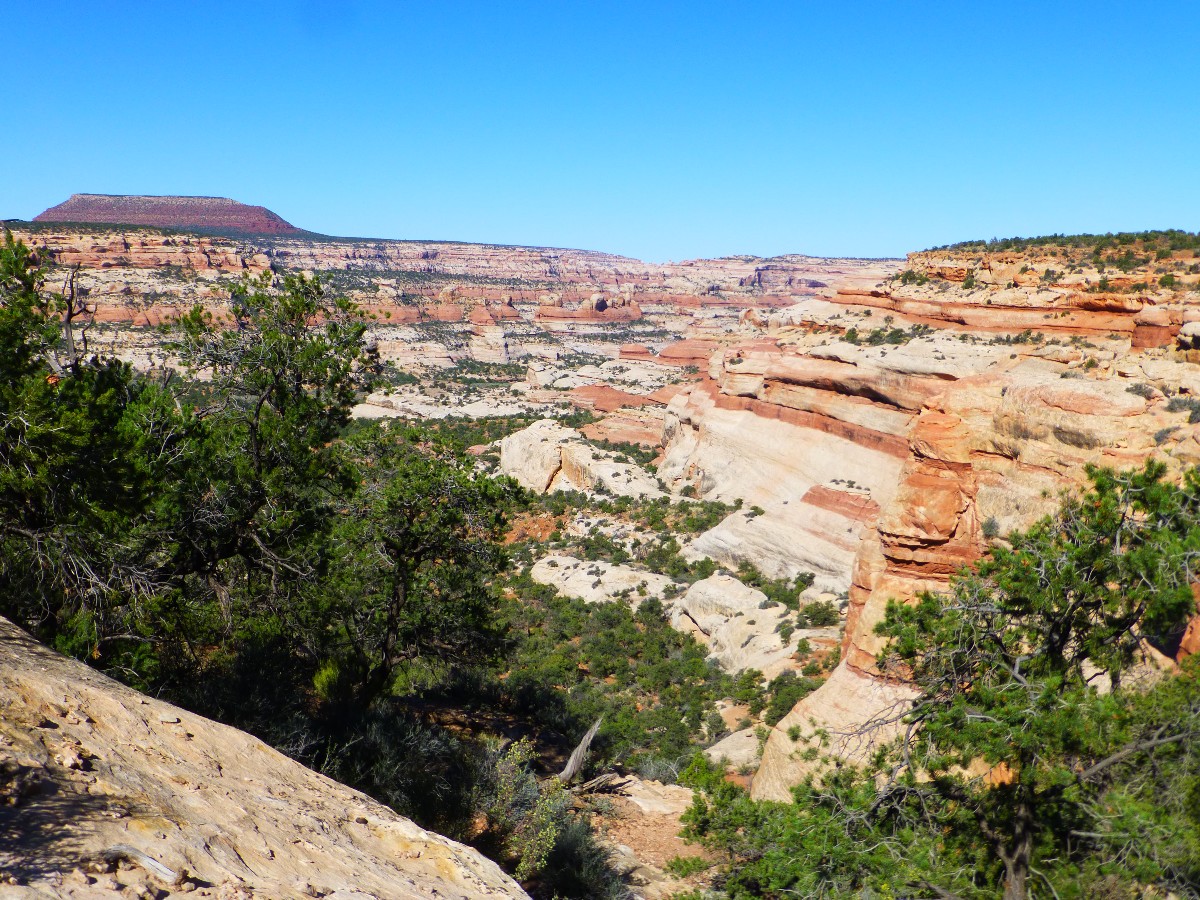
      The first hiking day of this excursion, I hiked from the Cathedral Butte TH to Salt Creek 4 (SC4) camp, a long day in the monsoon jungle. The next day I went exploring and fell and broke my ankle. Argh. I spent the next day in SC4, then hiked slowly out of Salt Creek over the following three days. I actually stayed on my permit. The slow pace out was designed to allow exploration of ruins and pictos, and ended up working well for just getting out.

      Co-adventurers: 0 (solo trip)

      camera: Panasonic DMC-ZS19

      Prelim: Yesterday, I left Bob Bordasch's and Donna Karr's Hobbit House hospitality and drove from San Cristobal, NM to the Cathedral Butte TH, the last 18 miles on OK dirt. Thanks Bob and Donna! It was terrific and necessary to have a free day to wash things and dry the tent, etc. following the Sensuous Sin in the Precious Pecos Wilderness Adventure (see report - click here). Along the way, I cross the deep shadow notch of the Rio Grande, then pass the Eaarthship colony outside Taos. Some innovative designs. Sure, even Eaarthships are impacted by the dramatic change we have forced on Eaarth (Eaarth; this spelling indicates that our present planet no longer resembles Earth) via global climate change and overpopulation. Sure, people are starting to publically state that climate change promises a much greater absolute risk than terrorism, yet have you noticed that population growth (i.e., explosion) is rarely mentioned as a huge aspect of the problem? Terrorism, inflicted by corporations or religionists or climate change, is spawn of population growth of course. And so it goes.

"Reality has a well-known liberal bias." - Stephen Colbert

Prelim Photos - Needles 2014

Click thumbnail to see full size image
wneedles-salt-2014-day0-1  Hobbit House.jpg (322927 bytes)

wneedles-salt-2014-day0-1 Hobbit House.jpg

wneedles-salt-2014-day0-2   Jane in Hobbit House.jpg (163729 bytes)

wneedles-salt-2014-day0-2 Jane in Hobbit House.jpg

wneedles-salt-2014-day0-3   Hobbit House.jpg (186105 bytes)

wneedles-salt-2014-day0-3 Hobbit House.jpg

wneedles-salt-2014-day0-4  Hobbit House.jpg (229233 bytes)

wneedles-salt-2014-day0-4 Hobbit House.jpg

wneedles-salt-2014-day0-5  Eaarthship.jpg (300060 bytes)

wneedles-salt-2014-day0-5 Eaarthship.jpg

wneedles-salt-2014-day0-6  Eaarthship bottlehouse.jpg (331200 bytes)

wneedles-salt-2014-day0-6 Eaarthship bottlehouse.jpg

wneedles-salt-2014-day0-7  Eaarthship construction.jpg (198424 bytes)

wneedles-salt-2014-day0-7 Eaarthship construction.jpg

wneedles-salt-2014-day0-8  Eaarthship bottlehouse.jpg (303491 bytes)

wneedles-salt-2014-day0-8 Eaarthship bottlehouse.jpg

wneedles-salt-2014-day0-9  Eaarthship.jpg (185749 bytes)

wneedles-salt-2014-day0-9 Eaarthship.jpg

wneedles-salt-2014-day0-10  Church Rock.jpg (248352 bytes)

wneedles-salt-2014-day0-10 Church Rock.jpg

wneedles-salt-2014-day0-11  Dugout area.jpg (250592 bytes)

wneedles-salt-2014-day0-11 Dugout area.jpg

wneedles-salt-2014-day0-12  Six-Shooter Peaks.jpg (194764 bytes)

wneedles-salt-2014-day0-12 Six-Shooter Peaks.jpg

      Day 1: Brush Beating :   Cathedral Butte TH (Trail Head; about 7,000') to SC4 (Salt Creek Camp #4; NPS, National Park Service, designation). 14.0 miles; ERM = 20; camp @ 5450'.
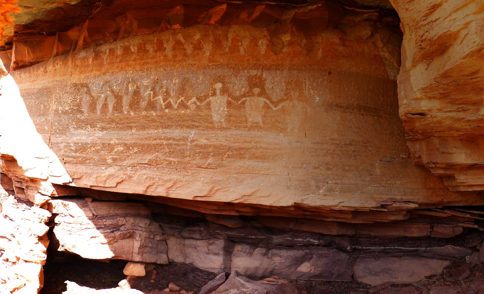
      The tricolor All American Man appears to grin down at me from his protective alcove as I lounge on slickrock and eat lunch #2 beneath a juniper. He can smile because he's above the brush beating inflicted by the vegetation-choked "trail." It's often difficult to see the trail, wading through sage, grass, rabbit brush, willows, tamarisk, and lots of grabby sharp and pokey things. Perhaps one-half of the "trail" today is obscured and brush covered. Argh! Yes, it feels like more than half. Much is waist- head-high or taller. I'm a bit tired, yet there are another 4 or so miles to slog to SC4 camp. I see ruins, arches, pictos - all delightful and making the beating worthwhile. To verify this, I soon see the Four Faces smile above wall remnants.
      I get off-track and thrash around in close-rank sage for awhile. The trail fades repeatedly as I approach SC4 and I nearly miss the camp, which is marked by an 18" post sporting a camp triangle. It's a camp for hot weather - having a large Cottonwood and high fairly narrow canyon walls to protect one from too much sun at least part of the day. A consequence of this is that the views are narrow, lacking the far-ranging quality of some camps. It's about 1500' to good water, which I set about gathering.
      Now, after 8 p.m., I sit on my bear can and watch the stars through my narrow vantage points. Yes, bear canisters are now required in some areas of The Needles because the bears come off the Abajo Mountains and Elk Ridge in search of berries, cactus apples, etc. I attempt to choke down some food but my tired body rebels. I did enjoy a quick bucket bath and tried to rinse the yellow pollen, green leaf/stalk smears, and purple spots made by some sort of soft-bodied beetle (at first, I thought these were spots of my blood from the brush beating), and a pound of salt from my shirt and pants. Not a "trail" for shorts today. This area has experienced a very generous monsoon rain season, and the brush has vigorously responded. Humm, I muse, perhaps I'll eat some of this dinner for breakfast, as I slide the pot into my bear can.
      I'm guessing the temperatures today were in the 80Fs. The cool air courses down the Salt Creek drainage and I notice the tail of the Big Dipper glowing through the trees and obstacles to the generous sky.

Panorama from Day 2
Panorama from Day 2
(Click the image for the full-size image)

Day 1 Photos - Needles 2014

Click thumbnail to see full size image
wneedles-salt-2014-day1-1  into  Salt Cr.jpg (281812 bytes)

wneedles-salt-2014-day1-1 into Salt Cr.jpg

wneedles-salt-2014-day1-2  Cedar Mesa SS.jpg (279234 bytes)

wneedles-salt-2014-day1-2 Cedar Mesa SS.jpg

wneedles-salt-2014-day1-3  flowering.jpg (257511 bytes)

wneedles-salt-2014-day1-3 flowering.jpg

wneedles-salt-2014-day1-4  cattail.jpg (402814 bytes)

wneedles-salt-2014-day1-4 cattail.jpg

wneedles-salt-2014-day1-5  first picto.jpg (397552 bytes)

wneedles-salt-2014-day1-5 first picto.jpg

wneedles-salt-2014-day1-6  Kirk Cabin.jpg (444253 bytes)

wneedles-salt-2014-day1-6 Kirk Cabin.jpg

wneedles-salt-2014-day1-7  Kirk Arch.jpg (372832 bytes)

wneedles-salt-2014-day1-7 Kirk Arch.jpg

wneedles-salt-2014-day1-8  Mantis.jpg (642926 bytes)

wneedles-salt-2014-day1-8 Mantis.jpg

wneedles-salt-2014-day1-9  Elephant Trunk.jpg (287889 bytes)

wneedles-salt-2014-day1-9 Elephant Trunk.jpg

wneedles-salt-2014-day1-10  Ring Arch.jpg (314579 bytes)

wneedles-salt-2014-day1-10 Ring Arch.jpg

wneedles-salt-2014-day1-11  Ruination.jpg (357600 bytes)

wneedles-salt-2014-day1-11 Ruination.jpg

wneedles-salt-2014-day1-12  Picto of time.jpg (250900 bytes)

wneedles-salt-2014-day1-12 Picto of time.jpg

wneedles-salt-2014-day1-13  storage chambers.jpg (360231 bytes)

wneedles-salt-2014-day1-13 storage chambers.jpg

wneedles-salt-2014-day1-14  Needles.jpg (365586 bytes)

wneedles-salt-2014-day1-14 Needles.jpg

wneedles-salt-2014-day1-15  High Ruination.jpg (329716 bytes)

wneedles-salt-2014-day1-15 High Ruination.jpg

wneedles-salt-2014-day1-16  AA  Man.jpg (290790 bytes)

wneedles-salt-2014-day1-16 AA Man.jpg

wneedles-salt-2014-day1-17  park view.jpg (329845 bytes)

wneedles-salt-2014-day1-17 park view.jpg

wneedles-salt-2014-day1-18  park.jpg (440485 bytes)

wneedles-salt-2014-day1-18 park.jpg

wneedles-salt-2014-day1-19  Four Faces.jpg (398451 bytes)

wneedles-salt-2014-day1-19 Four Faces.jpg

wneedles-salt-2014-day1-20  Faces and ruin.jpg (401674 bytes)

wneedles-salt-2014-day1-20 Faces and ruin.jpg

wneedles-salt-2014-day1-21  low ruins.jpg (412914 bytes)

wneedles-salt-2014-day1-21 low ruins.jpg

      Day 2: Picto Pause and West Fork Catastrophe :   4 miles exploring and limping.
      I turn to check my path and I'm shocked by the eerie, skeletal red anthropomorphic shaman/ghost figure staring out of hollow eyes. Yikes. Wondrous. I'm headed to explore the West Fork and detour to inspect the ruins and pictos on the nose of the main canyon. It's narrow going at times on the Cedar Mesa Sandstone (SS), where these apparent storage granaries and picto billboards are crafted into a thin ledge. One structure is hidden in a cave and I can see the fingerprints of ancient craftswomen in the centuries-old mortar. Fascinating. Clouds are building, so I find a way onto the bench of West Fork and sit through a storm under an overhang. I shoot some videos of ruins as seen through the rain.
      Then, catastrophe. With mud on my boots, I step on a slanted rock and -- boom, down with a sprained or broken left ankle. Of course, all thoughts of exploration evaporate with the searing pain. Taking off the boot, I note that my foot is already swelling. Easing the foot back in the boot and securing it, I jerk and limp through the next rainstorm and the wet jungle to camp. If I had an emergency beacon (PLB; Personal Locator Beacon), would I now trigger it? Tempting. My injury is not life-threatening, yet, still. Anyway, I don't have a PLB.

Movie #2 of Ruination in the rain,  Day 2 - 7.2 mb
Movie #2 of Ruination in the rain, Day 2 - 7.2 mb
(Click the image to see the short video - 7mb)

Day2 Photos - Needles 2014

Click thumbnail to see full size image
wneedles-salt-2014-day2-1  Shaman.jpg (376821 bytes)

wneedles-salt-2014-day2-1 Shaman.jpg

wneedles-salt-2014-day2-2  Petro.jpg (336798 bytes)

wneedles-salt-2014-day2-2 Petro.jpg

wneedles-salt-2014-day2-3  ruin.jpg (242998 bytes)

wneedles-salt-2014-day2-3 ruin.jpg

wneedles-salt-2014-day2-4  inap posing.jpg (463834 bytes)

wneedles-salt-2014-day2-4 inap posing.jpg

wneedles-salt-2014-day2-5  finger prints.jpg (383010 bytes)

wneedles-salt-2014-day2-5 finger prints.jpg

wneedles-salt-2014-day2-6  recessed.jpg (320285 bytes)

wneedles-salt-2014-day2-6 recessed.jpg

wneedles-salt-2014-day2-7  ruin.jpg (368653 bytes)

wneedles-salt-2014-day2-7 ruin.jpg

wneedles-salt-2014-day2-8  ledge work.jpg (409719 bytes)

wneedles-salt-2014-day2-8 ledge work.jpg

wneedles-salt-2014-day2-9  ruin.jpg (378709 bytes)

wneedles-salt-2014-day2-9 ruin.jpg

wneedles-salt-2014-day2-10  billboard.jpg (360635 bytes)

wneedles-salt-2014-day2-10 billboard.jpg

wneedles-salt-2014-day2-11  billboard.jpg (429391 bytes)

wneedles-salt-2014-day2-11 billboard.jpg

wneedles-salt-2014-day2-12  ledge work.jpg (380311 bytes)

wneedles-salt-2014-day2-12 ledge work.jpg

wneedles-salt-2014-day2-13  no context.jpg (489648 bytes)

wneedles-salt-2014-day2-13 no context.jpg

wneedles-salt-2014-day2-14  SC4 sunset.jpg (292303 bytes)

wneedles-salt-2014-day2-14 SC4 sunset.jpg

wneedles-salt-2014-day2-15  SC4 rainbow.jpg (297583 bytes)

wneedles-salt-2014-day2-15 SC4 rainbow.jpg

Movie of Ruination after the rain,  Day 2 - 19.5 mb
Movie of Ruination after the rain, Day 2 - 19.5 mb
(Click the image to see the short video - 19.5 mb)

      Day 3: RICE :   0 miles. Still at SC4.
      Something about RICE (Rest, Ice, Compression, Elevation) comes to mind. I lie in the tent and prop the left ankle up on my bear can, next to or on top of a cool water bottle. No compression. Then, I count the ibuprofen - certainly more than recommended - yet this is something special. I watch the clouds, woodpeckers, chipping chipmunk, inquisitive scrub jay, ground squirrel, bees, whatever I can see from the open tent doors. I'm finally cooked out of the tent in the afternoon by direct sun, the time before this being a feature of SC4. Will I make it out over the next three days? To SC3, then SC2, then the TH? Because I've seen no one today, it's a plan. And, it's the way I designed the permit, although not for self-extraction, for exploring all the tempting rock coves and alcoves as I work my way back up canyon. Humm. Black and blue and bloated like a Summer sausage, my foot skin is taught as a drum. And, it hurts too.

Day 3 Photos - Needles 2014

Click thumbnail to see full size image
wneedles-salt-2014-day3-1  issues.jpg (319757 bytes)

wneedles-salt-2014-day3-1 issues.jpg

wneedles-salt-2014-day3-2  concerns.jpg (285220 bytes)

wneedles-salt-2014-day3-2 concerns.jpg

wneedles-salt-2014-day3-3  and problems.jpg (319965 bytes)

wneedles-salt-2014-day3-3 and problems.jpg

      Day 4: Hobble to SC3 :   3.6 miles; ERM = 5; camp @ 5700'.
      Caught in the waist-high jungle again, my left foot twists, and there flows the pain. Arghh! It's sort-of OK on level, open space, when pressure can be straight down. Yet, twisting any direction off-plumb is agonizing, so I go slowly. Perhaps reaching 1 MPH on the good stretches of trail, I hobble along. Thankfully, it's a short day and about all I can handle.
      After getting water from up the trail toward the Four Faces, I'm sitting under a scrub oak at SC3 with my foot in (for now) a cool bucket of water. Ahh.
      I was planning a ranging exploration from SC3, yet today I'm exploring the meager, yet delightful, shade while gazing at the Neapolitan Cedar Mesa SS littering the view. My leg is warming the water in the bucket - like one of those coil heaters once used in coffee cups. Soon, it will be bath water. My overall speed today was a bit less than 1 MPH, and good enough to get here. The special features of SC3 become more apparent as sunset approaches. Delightful scrub oak cast a deepening and extending shadow. Billions and billions of stars pop out, Orion blares on the Southern horizon.

Day 4 Photos - Needles 2014

Click thumbnail to see full size image
wneedles-salt-2014-day4-1  sausage.jpg (380986 bytes)

wneedles-salt-2014-day4-1 sausage.jpg

wneedles-salt-2014-day4-2  bucket.jpg (353128 bytes)

wneedles-salt-2014-day4-2 bucket.jpg

wneedles-salt-2014-day4-3  foot view.jpg (338383 bytes)

wneedles-salt-2014-day4-3 foot view.jpg

wneedles-salt-2014-day4-4  SC3 view.jpg (298969 bytes)

wneedles-salt-2014-day4-4 SC3 view.jpg

wneedles-salt-2014-day4-5  SC3 view.jpg (259302 bytes)

wneedles-salt-2014-day4-5 SC3 view.jpg

wneedles-salt-2014-day4-6  SC3 view.jpg (293089 bytes)

wneedles-salt-2014-day4-6 SC3 view.jpg

      Day 5: Wobble to SC2 :   6 miles; ERM = 8; camp @ 5900'.
      After wobbling a bit over a mile, the All American Man again seems to smile at me. Is he smiling with me or at me? It's slow going where the trail sneaks through a gap between tall rock pillars near the AA Man. There are lots of angled steps and slickrock work, fun on a regular day. Today is not a regular day and I carefully ease through the notch. After communing with the AA Man, I trundle on in the full sun, finding that I can almost walk on level trail using short steps. Good. I meet Jim and crew, who are headed for SC4, and I tell them about the jungle warfare, and most importantly, the water near this camp. After a discussion of ankle taping, we continue our separate ways.
      Wobbling past ruins yet unexplored, I find my plan (i.e., campsite reservations) good yet my condition folly. Eyebrow, Elephant Trunk, Ring, then Kirk Arch roll into view. Near Kirk Cabin, I find the camp, leave most equipment, and mosey the 0.3 miles to the outflow from the East Fork Spring, where I gather and treat water, enjoy lunch, and soak my foot in the surprisingly cool water. I see a Belted Kingfisher perching on a willow snag, watching the large pool below the cascade of spring water. I meet two USGS folks, who are hiking to Big Pocket to monitor a vegetation tract. They suggest I put a note on the camp post if I need help, and they will stop in on their way out of the canyon later today.
      Lee Kirk built the local cabin and corrals in the late 1800's, yet did not stay much longer than to have the large Kirk Arch named after him. Even so, the cabin was used as a line shack by ranchers until Canyonlands National Park was designated, in the 1960s. It's good foreground for a photo today.
      Now, it's mid-afternoon and I'm enjoying the music of tumbling water as it cascades down rock steps, and the enchanting background of intricate layers of Cedar Mesa SS. Thoughts 
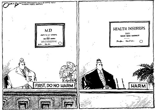
about medical care keep creeping into the nirvana of The Needles. I recall, with great disgust, how all the repulsicans and many wimpy democrats maintained the death panel control of insurance carriers rather than support a decent universal healthcare system. Just getting the profit and insurance company control out of health care would drop health care costs by what - 20%, 30%, more? Corporate welfare should never come to health care. Medicare for all.
      The sun drives me back to the camp area and I await shade in camp a short distance away, under an overhang. Looking up from my bed of slickrock, I see a Bighorn Sheep picto in red and some tiny white handprints. Satisfying, I enjoy a mini-exploration today after all.

medicare for all, less expensive, more humane
medicare for all, less expensive, superior, more humane
(Click the image for the full-size image)

medicare for all = no harm from corporate welfare artists
(Click the image for the full-size image)

"Life is like riding a bicycle. To keep your balance you must keep moving." - Albert Einstein

Movie of part of the jungle trail,  Day 5 - 9.7 mb
Movie of part of the jungle trail, Day 5 - 9.7 mb
(Click the image to see the short video - 9.7 mb)

Day 5 Photos - Needles 2014

Click thumbnail to see full size image
wneedles-salt-2014-day5-1  Four Faces.jpg (324607 bytes)

wneedles-salt-2014-day5-1 Four Faces.jpg

wneedles-salt-2014-day5-2  Four Faces.jpg (401412 bytes)

wneedles-salt-2014-day5-2 Four Faces.jpg

wneedles-salt-2014-day5-3  Picto.jpg (319783 bytes)

wneedles-salt-2014-day5-3 Picto.jpg

wneedles-salt-2014-day5-4  AA Man.jpg (331504 bytes)

wneedles-salt-2014-day5-4 AA Man.jpg

wneedles-salt-2014-day5-5  arch.jpg (334741 bytes)

wneedles-salt-2014-day5-5 arch.jpg

wneedles-salt-2014-day5-6  Kirk Arch.jpg (306833 bytes)

wneedles-salt-2014-day5-6 Kirk Arch.jpg

wneedles-salt-2014-day5-7  hand prints.jpg (278071 bytes)

wneedles-salt-2014-day5-7 hand prints.jpg

wneedles-salt-2014-day5-8  sheep.jpg (373092 bytes)

wneedles-salt-2014-day5-8 sheep.jpg

wneedles-salt-2014-day5-9  Kirk Arch.jpg (196446 bytes)

wneedles-salt-2014-day5-9 Kirk Arch.jpg

      Day 6: Stumbling Cathedral :   SC2 to TH and home. 4.6 miles; ERM = 7.5.
      Orion beams brightly in the Southern sky, foretelling Fall, and soon. Then Winter, argh. I have this sinking, frustrated feeling that it might be Winter before I can smoothly enjoy the wildness.
      It's cool enough this morning that the tent fly has running condensation. I'm up early so I can stumble up and out of Salt Creek to the TH near Cathedral Butte and drive home. Lacing the boots carefully and tightly, my lopsided ambulation is going more smoothly today as I weave and push through the monsoon-generated jungle. Up a thousand feet and more, up through the Cedar Mesa SS and a few layers above, I knock out of the Needles.

Day 6 Photos - Needles 2014

Click thumbnail to see full size image
wneedles-salt-2014-day6-1  Kirk Cabin.jpg (424760 bytes)

wneedles-salt-2014-day6-1 Kirk Cabin.jpg

wneedles-salt-2014-day6-2  Kirk Cabin.jpg (282206 bytes)

wneedles-salt-2014-day6-2 Kirk Cabin.jpg

wneedles-salt-2014-day6-3  Kirk Cabin.jpg (374407 bytes)

wneedles-salt-2014-day6-3 Kirk Cabin.jpg

wneedles-salt-2014-day6-4  Kirk Cabin.jpg (209007 bytes)

wneedles-salt-2014-day6-4 Kirk Cabin.jpg

wneedles-salt-2014-day6-5  E Fk Spring.jpg (276449 bytes)

wneedles-salt-2014-day6-5 E Fk Spring.jpg

wneedles-salt-2014-day6-6 Out of Salt.jpg (440820 bytes)

wneedles-salt-2014-day6-6 Out of Salt.jpg

Epilog : A broken ankle, in two places. Perhaps thanks to my high-top Lowa boots, the bones somehow remained stable and so far I have not had surgery. Nevertheless, the recovery process has been slow and little fun and I've had to cancel two Grand Canyon backcountry trips (one a volunteer service project I have been organizing for many months) and lots of local hiking and biking. Argh. Cabin fever has arrived already.

Movie of the East Fk Spring and pond,  Day 6 - 15.7 mb
Movie of the East Fk Spring and pond, Day 6 - 15.7 mb
(Click the image to see the short video - 15.7 mb)

.

.

      An Analysis of PLBs (Personal Locator Beacons):

      Yes, cell phones sometimes work in the backcountry. It's amazing how many cell phone calls are received by the SAR (Search And Rescue) people/agencies. Of course, cell phones don't always work, and in some of the most delightful places never work, and often don't transmit gps (global positioning system; your position on a map) coordinates with a call. Cell phones communicate via towers while PLBs use satellites. If it's truly an emergency, a cell phone is insufficient and may create a false sense of security. A heavy in weight, subscription-heavy satellite phone is a good alternative for some and allows two-way communication, making it the "standard" for river trips and other large group activities in the backcountry. If you are going in a small group or solo, you probably won't carry a satellite phone. So, if phones are a poor choice for the independent outdoors person, what's the alternative?
      Ideally, one wants a device that absolutely works during an emergency, transmits gps coordinates with the emergency signal (so SAR people can find you), is light in weight, has a good battery life, and does not require subscription fees. By absolutely works - one wants a PLB with lots of power so it can send the signal through trees, out of narrow canyons, etc.; and uses a proficient satellite system (not cell phone towers). A true PLB (such as a 5-watt ResQLink) - sends a signal directly to SAR while a satellite messenger (e.g. Spot, broadcasts at 0.4 watts; DeLorme InReach, 1.6 watts) signals a private company and at lower power.
      Cost is another factor, with the 3-year cost of a ResQLink currently estimated at about $350, a Spot about $550, and an InReach about $1000 - see article.
      Light in weight suggests a unit weighing less than 5 ounces so it isn't perceived as a bother to take it along. A good battery life means that you can just go with your PLB for 5 years or so without worrying about battery life. And, then there are subscription fees, which make satellite phones and satellite messenger devices (e.g., Spot) less attractive. If you haven't paid your subscription fees, your device will not work (as opposed to cell phones, with which you can still call emergency if other services do not work).
      My analysis of the reviews of PLBs and satellite messengers reduces down to: carry a PLB (not a messenger) like the ACR ResQLink because one does not have to worry about changing the batteries for five years or paying a subscription. And when you're really in trouble, it's the device that has proven to work best (has 5 watts of power, while the Spot has a meager 0.4 watts). If you like the messenger aspect, I suggest you carry a capable device, such as the DeLorme InReach Satellite Messenger, yet it will cost and weigh more than a PLB. Use your PLB responsibly, that is only in life-threatening situations, the outdoor annals are filled with annoyance from SAR and others when outdoor people use an emergency signal in casual situations (e.g., such as the infamous story about Grand Canyon hikers who triggered their Spot because they thought the water was salty).
      A final note: Be sure to register your PLB on the NOAA online beacon database. This way, SAR knows which unit (that is, registered to you and having contact and background info about you) triggered the emergency signal.

An excellent review of PLBs can be found here: (click here). .

.

I came home to see that the Arizona Daily Sun has published one of my hiking articles, this one about the Sycamore Rim Trail.

Click here for a jpg file of the article (1.2 mb) - the article can be viewed below in pdf format (click on the lily pad image)

Arizona Daily Sun article about hiking the Sycamore Rim, 9-27-2014; 1.4 mb
Click the image to go to the article (pdf - see above link for jpg file)

.

Links:
.

.

An excellent review of PLBs can be found here: (click here).

An overview of 406 PLBs (such as the ACR) vs. the Spot can be found here: (click here).

Part 1 - Why a 406 PLB (such as the ACR) vs. a cell phone or satellite messenger (e.g., Spot)? (click here).

Part 2 - Why a 406 PLB (such as the ACR) vs. a cell phone or satellite messenger (e.g., Spot)? (click here).

Chomsky: Are We Approaching the End of Human History (article, 2.3 mb)

Bob's Grand Canyon Journals

Scenic Toilets of Inner Earth

Previous WV Reports about Canyonlands NP:

Maze 2013: Marauding the A-Mazing Marvelous Maze, 9-day backpack, 2013

Triple Flushing The Magnificent Maze: Exploring The South Fork area of THE Maze, 2010

A-Mazing Maze, a Desert Solitaire: Exploring The Fins Area of Canyonlands NP, 2009

Snowfest attempt in THE Maze, 2009

Water-Ooooh in THE Maze, 2000

Disraeli Gears, Part 2: (The Undiscovered Country) Bicycling The White Rim of Canyonlands N. P., 2000

Disraeli Gears: Bicycling The White Rim of Canyonlands N. P., 1999

Upward Angel & Angle in the Needles District Backpacking Upper Salt Creek: In The Needles District of Canyonlands N.P. , 1999

Chocolates for Easter, 1998

Jointly To The Needles: Dayhiking in The Needles District of Canyonlands N.P., 1998

More Truth Than Joke:
in science we trust - get religion out of government and health care
(Click the image for the full-size image)

corporate health care = bankruptcy
(Click the image for the full-size image)

costs lower without corporate health
costs lower without corporate health "care"
(Click the image for the full-size image)

corporate welfare artists
(Click the image for the full-size image)

the system is wasteful
(Click the image for the full-size image)

going for broke
going for broke
(Click the image for the full-size image)

fear more important than healthcare for all
(Click the image for the full-size image)

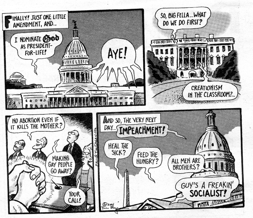
More - More truth than joke - part 1

Click thumbnail to see full size image
wbushco the reason for deficit.jpg (226353 bytes)

wbushco the reason for deficit.jpg

wJesus is a socialist.jpg (167334 bytes)

wJesus is a socialist.jpg

wno money for health care.jpg (111143 bytes)

wno money for health care.jpg

More- More truth than joke - part 2

Click thumbnail to see full size image
wGod is a Socialist.jpg (297295 bytes)

wGod is a Socialist.jpg

wgop and women.jpg (55753 bytes)

wgop and women.jpg

wgovernment oversight and tea baggers.jpg (189052 bytes)

wgovernment oversight and tea baggers.jpg

More truth than joke - part 3

Click thumbnail to see full size image
wgreed makes you believe.jpg (348633 bytes)

wgreed makes you believe.jpg

wguns to protect your home.jpg (234261 bytes)

wguns to protect your home.jpg

wmagic answers are OK.jpg (401449 bytes)

wmagic answers are OK.jpg

Link to below Onion article (click here).

Scientists: 'Look, One-Third Of The Human Race Has To Die For Civilization To Be Sustainable, So How Do We Want To Do This?'
      26 Jan. 2012 | ISSUE 48•04

      Scientists say at least 2 billion dead bodies will be burned and converted into fossil fuels.
      WASHINGTON—Saying there's no way around it at this point, a coalition of scientists announced Thursday that one-third of the world population must die to prevent wide-scale depletion of the planet's resources—and that humankind needs to figure out immediately how it wants to go about killing off more than 2 billion members of its species.
      Representing multiple fields of study, including ecology, agriculture, biology, and economics, the researchers told reporters that facts are facts: Humanity has far exceeded its sustainable population size, so either one in three humans can choose how they want to die themselves, or there can be some sort of government-mandated liquidation program—but either way, people have to start dying.
      And soon, the scientists confirmed.
      "I'm just going to level with you—the earth's carrying capacity will no longer be able to keep up with population growth, and civilization will end unless large swaths of human beings are killed, so the question is: How do we want to do this?" Cambridge University ecologist Dr. Edwin Peters said. "Do we want to give everyone a number and implement a death lottery system? Incinerate the nation's children? Kill off an entire race of people? Give everyone a shotgun and let them sort it out themselves?"
      "Completely up to you," he added, explaining he and his colleagues were "open to whatever." "Unfortunately, we are well past the point of controlling overpopulation through education, birth control, and the empowerment of women. In fact, we should probably kill 300 million women right off the bat."
      Because the world's population may double by the end of the century, an outcome that would lead to a considerable decrease in the availability of food, land, and water, researchers said that, bottom line, it would be helpful if a lot of people chose to die willingly, the advantage being that these volunteers could decide for themselves whether they wished to die slowly, quickly, painfully, or peacefully.
      Additionally, the scientists noted that in order to stop the destruction of global environmental systems in heavily populated regions, there's no avoiding the reality that half the world's progeny will have to be sterilized.
      "The longer we wait, the higher the number of people who will have to die, so we might as well just get it over with," said Dr. Chelsea Klepper, head of agricultural studies at Purdue Univer­sity, and the leading proponent of a worldwide death day in which 2.3 billion people would kill themselves en masse at the exact same time. "At this point, it's merely a question of coordination. If we can get the populations of New York City, Los Angeles, Beijing, India, Europe, and Latin America to voluntarily off themselves at 6 p.m. EST on June 1, we can kill the people that need to be killed and the planet can finally start renewing its resources."
      Thus far, humanity has been presented with a great variety of death options, among them, poisoning the world's water supply with cadmium, picking one person per household to be killed in the privacy of his or her home, mass beheadings, and gathering 2.3 billion people all in one place and obliterating them with a single hydrogen bomb.
      Sources confirmed that if a death solution is not in place by Mar. 31, the U.N., in the interest of preserving the human race, will mobilize its peacekeeping forces and gun down as many people as necessary.
      "I don't care how it happens, but a ton of Africans have to go, because by 2025, there's no way that continent will be able to feed itself," said Dr. Henry Craig of the Population Research Institute. "And by my estimation, three babies have to die for every septuagenarian, because their longer life expectancy means babies have the potential to release far more greenhouse gases going forward."
      While the majority of the world's populace reportedly understands this is the only option left to save civilization, not all members of the human race are eager to die.
      "I personally would rather live, but taking the long view, I can see how ensuring the survival of humanity is best," said Norwich, CT resident and father of three Jason Atkins. "I guess if we were to do it over again, it would make sense to do a better job conserving the earth's finite resources."
      "Hopefully, the people who remain on the planet will use the mass slaughter of their friends and loved ones as an incentive to be more responsible going forward," he added.


Wild Vagabond Main   Trip Report Index   Caveat