Sangre de Cristo Mountains - along part of the Skyline/Divide Trail
Text and photos © copyright by Rob Jones and Bob Bordasch

Co-adventurer: Bob Bordasch
Camera: Panasonic DMC-ZS19
|
| |||||

|
| |||||

|
| |||||


| ||||
| ||||
|
| |||||
|
| |||||
|
| |||||
| ||||
| ||||
ERM* = Energy Required Miles.
A mile is added for every 500' elevation gain or loss. It's a very serviceable method of
estimating energy required miles. And, see a study about the validity of using ERMs below.
Summary: Roving the tundra above 11,000' for days of hiking in
New Mexico? "What!" one might exclaim, "not in New Mexico, there's nothing this high in that desert state."
Well, one can rove for many miles above tree line in the Pecos Wilderness, which is what Bob Bordasch and I
did on this 38-mile backpack along part of the Skyline/Divide Trail. Leaving the pygmy forest (Pinon-juniper),
Ponderosas, and Aspens behind, we hiked in the realm of Bristlecone Pine and Blue Spruce and areas where even
the krumholtz clings. From Serpent Lake to Borrego Mesa, we hiked on and off the divide in this precious bit
of alpine sky island terrain.
A note about the title: Peco is a Spanish word related to sin,
something about placing temptation in front of someone. Is this where the Pecos Wilderness got its name, a
sinfully tempting place? Certainly, it temps wilderness aficionados.
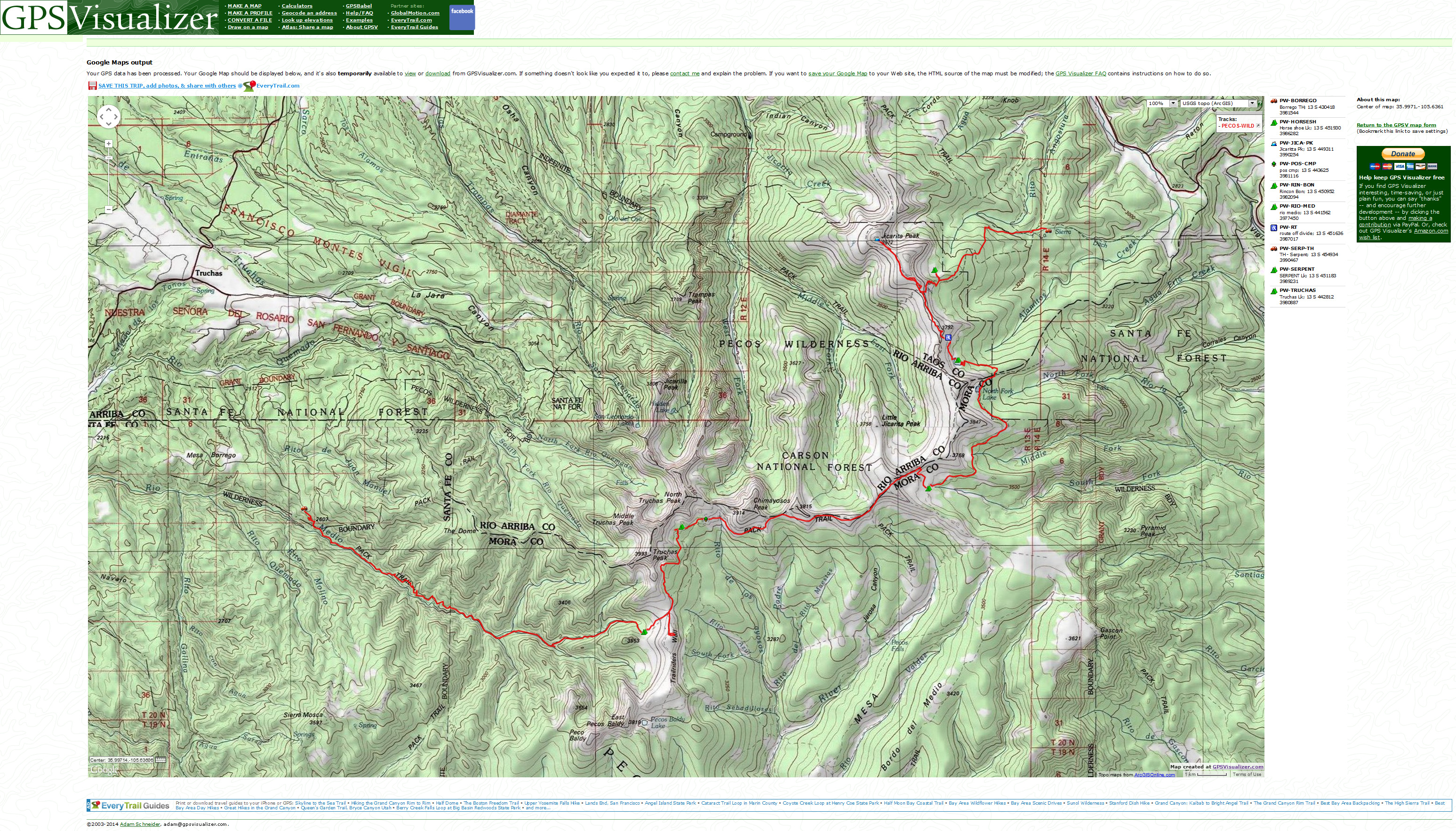
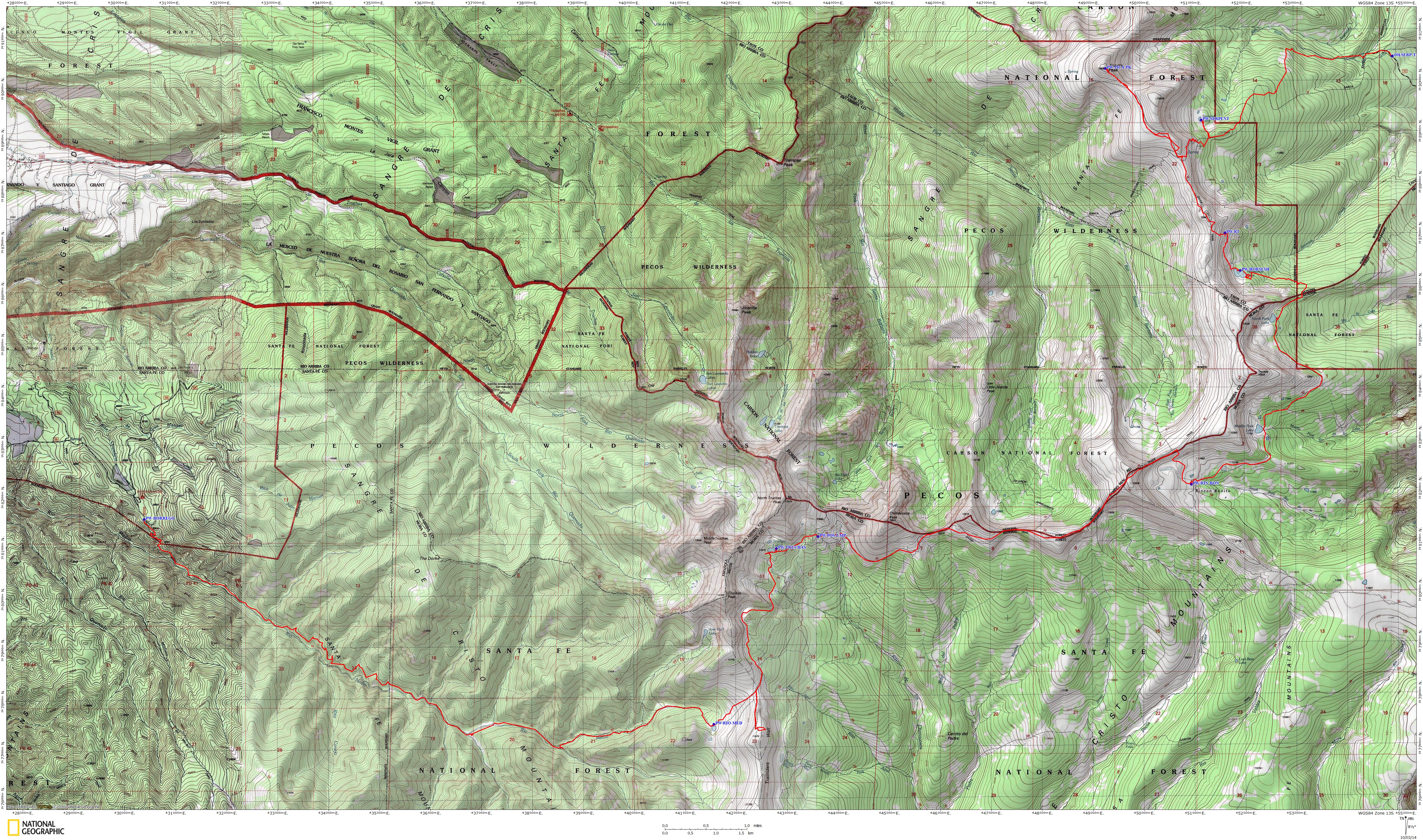
Overview Maps: This first set of maps are in large files and are
overview maps. All maps but the pdf of the USFS map show the track and waypoints from my GPS. Each day report
contains a smaller topo map, also showing our route (GPS track) and waypoints.

| ||||
| ||||
| ||||
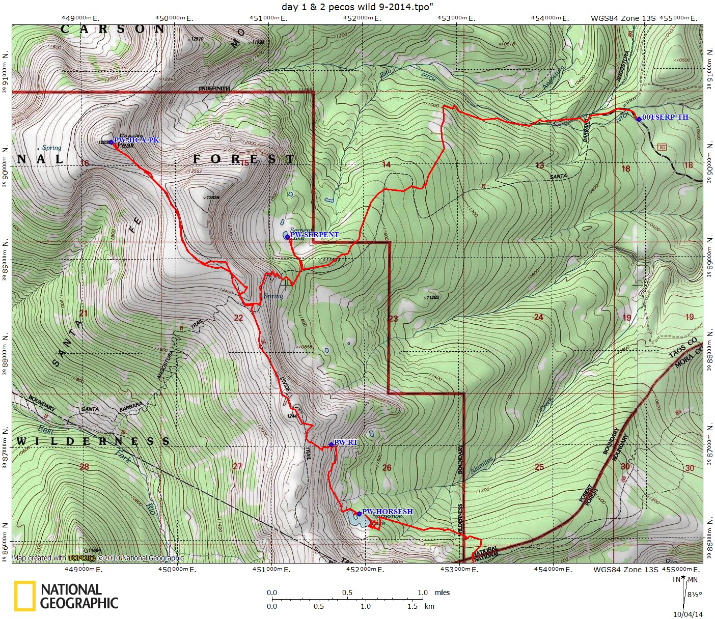
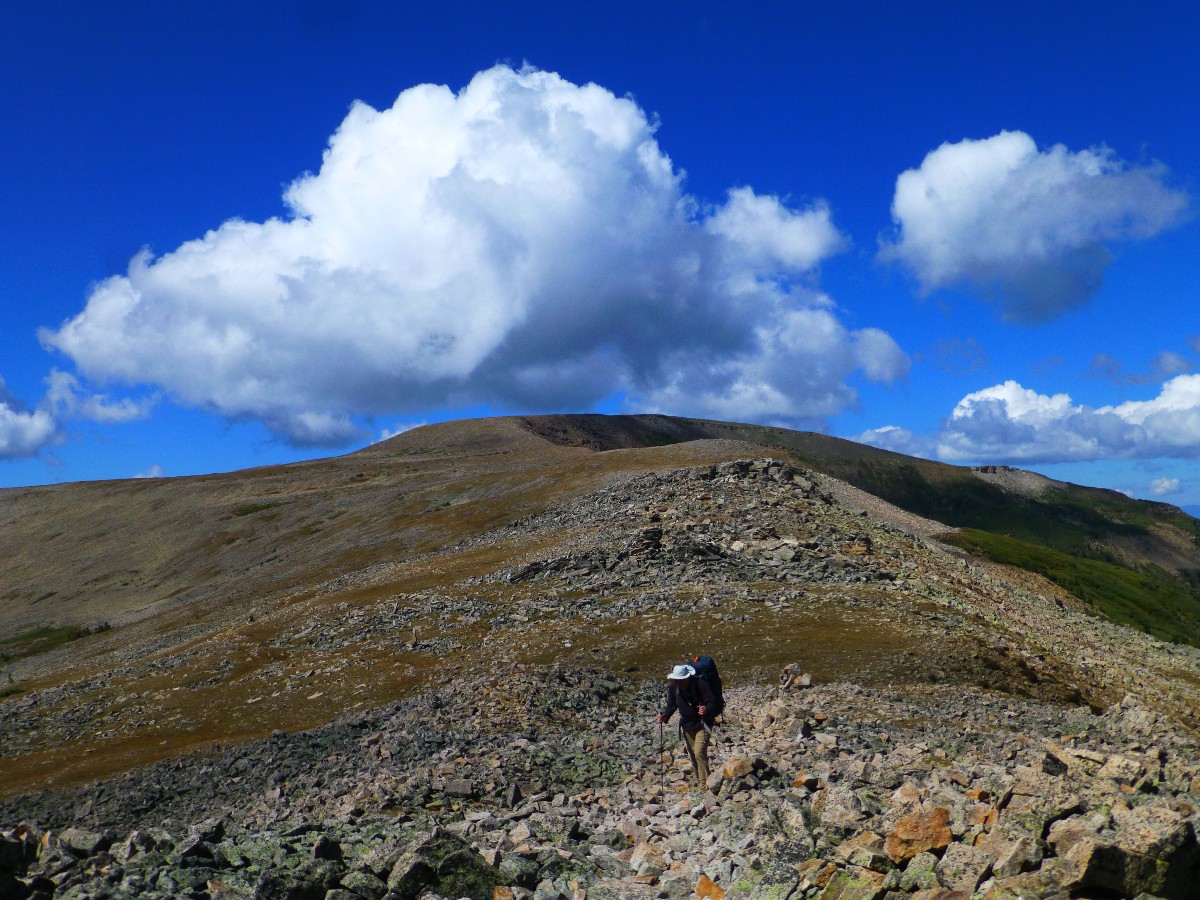
Day 1: Scurry to Serpent Lake:
3.4 miles; ERM = 7; camp @ 11,700'.
The wind pierces my pile jacket, wrapped inside a down jacket as I walk
the tawny tundra-type grasses dotted with purple gentians of Serpent Pond. Burr. It's very cool today at
11,700' and Serpent Lake/Pond. Bob Bordasch and I are in the Pecos Wilderness, along the Sangre de Cristo
Mountains and hiking solo since we've left a quad of hunters prior to dropping into the lake bowl.
Donna K. drops us off at the Alamitos Creek TH and immediately we start
climbing through firs, spruce, cork-bark fir and an occasional aspen. Glorious. It's warm enough for
t-shirts until we stop at the pond of Serpent Lake. Then, the warm clothes come out, quickly, from the
depths of the packs. Just after sunset a bull elk practices his haunting harem call while Bob and I
head for the warmth of the fluffy bags.
"Reality has a well-known liberal bias." - Stephen Colbert
Bob Bordasch's photos - Pecos Wilderness 2014


 |
 |
 |
 |
 |
 |
Day 2: Jicarita Junket:
To Jicarita Peak (12,834'), and the Divide/Skyline Trail, and off-route to Horse Shoe Lake.
7.1 miles; ERM = 16; camp @ 11,740'.
The wind rips across the alpine tundra as we clatter on the plates of
quartzite on our way to Jicarita Peak (12,834'). An easy and accessible peak that affords views of the
Pecos Skyline/Divide Trail as it sweeps South then West toward the Truchas Peaks.
We climb from Serpent Lake and drop packs when we intersect the Skyline/Divide
Trail and head off North to Jicarita Peak. Along the climb to the Divide Trail - we see what looks like
Bristlecone Pines. Returning to our packs, Bob notes that a marmot has stolen 2 bagels and 2 bars from
his pack. We contemplate a broasting to replace the calories.
Following a quick lunch, we gasp and ramble South on the Divide Trail and
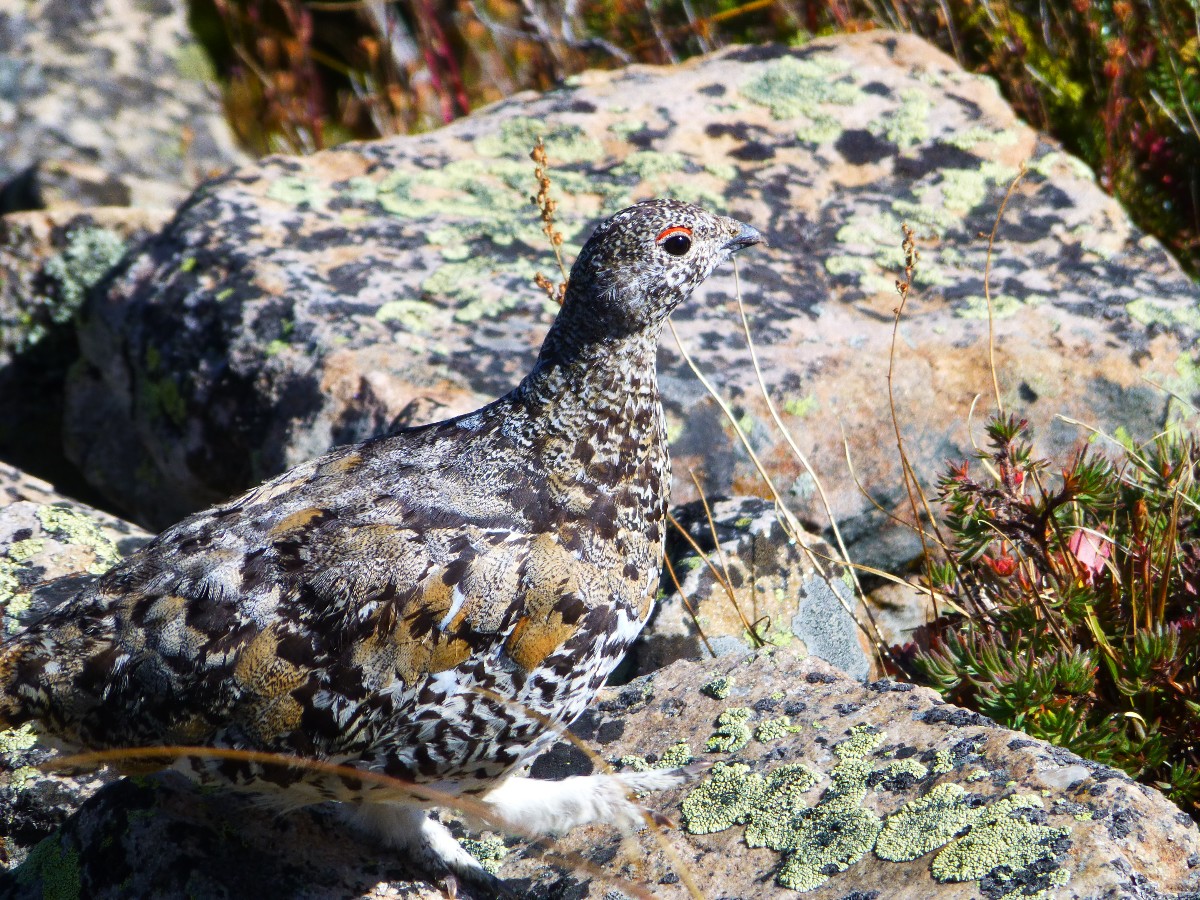
drop off it, off route, toward Horse Shoe Lake. Watching for an elk way, I see the rocks move, rolling
across the hill, not down the hill, then - the rocks bob. Yikes. High altitude hypoxia? No, Ptarmigans,
specifically, Rock Ptarmigans. They look like fluffy rocks with feather-encrusted feet. Incredible
camouflage feathering. Wondrous. Encountering a well-designed elk way, we slide to Horse Shoe Lake
for a late afternoon camp. It's approaching 8 p.m. as I finish these notes in the TarpTent, my legs
straddling a gloriously hot water bottle.
| ||||
 |
 |
 |
 |
 |
 |
 |
 |
 |
 |
 |
 |
 |
 |
 |
 |
 |
 |
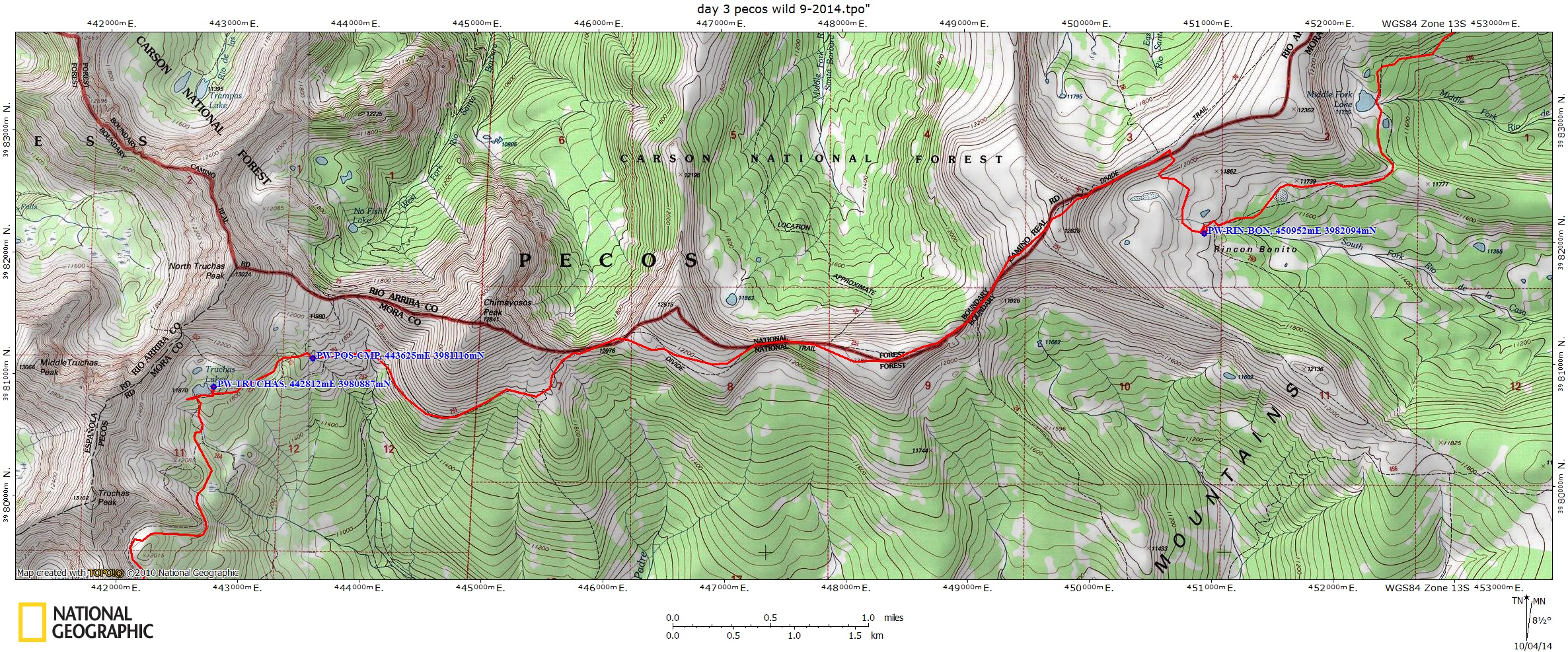
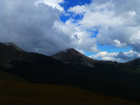
Day 3: Roving the Rincon: To Rincon Bonito.
5.8 miles; ERM = 10; camp @ 11,830'.
"Gloriosa! Bob, there's a saw-cut ahead, yahoo!" I exclaim. Lovely.
We're literally out of the woods. After over an hour walking elk trails and native forest, we've
connected with the North Fork Lakes Trail. Before long, we're at the lake for lunch, the lake bordered
by a wall of nearly vertical rock. Then, on the contour to Middle Fork Lake, where rain spits on us
from building clouds. Rain covers, rain jacket, briefly as we rove toward Rincon Bonito. And, bonito it is.
A delightful curve of beauty backed by the glacially-sculpted bevel leading to the Divide Trail - up
there somewhere where the low clouds/mist flies through a notch.
Tawny meadows consisting of frost-killed mules ears and California corn
lilies and grass/forbs remind us that the equinox is approaching. Bonito. Bristlecone Pines - this time
I'm fairly certain that these cones with the hooked bristles are just that, Bristlers. I later read that
there are three sub-species of Bristlers, and that the New Mexico variety is not the fabled long-lived
Bristler, which has the name longevity, Pinus longaeva - the Great Basin Bristlecone Pine. The local
Bristlers are Rocky Mountain Bristlecone Pine - Pinus aristata. Still, they are a welcome sight, lending
even more diversity to the highland connifers.
A storm seems to be sweeping in, so we quickly set-up camp near where a
tributary leaves the mostly dry lake/pond bed. No storm for awhile, so we enjoy a leisurely dinner and
good conversation. I'm enjoying my conversations with Bob. Today, we distilled the difference between
republicans and democrats to its essence - democrats care about others (including other species) and are
willing to share so everyone does well and they realize there are few simple answers, while republicans
are all about "me" and, while often espousing religious-type rhetoric, are OK with corporations getting a
tax break if it means the poor go without and would rather have the Rove-and faux-news types tell them what
to think (even if it is incorrect and means voting against their own best interests).
Coyotes chortle in the bonito basin.
| ||||
 |
 |
 |
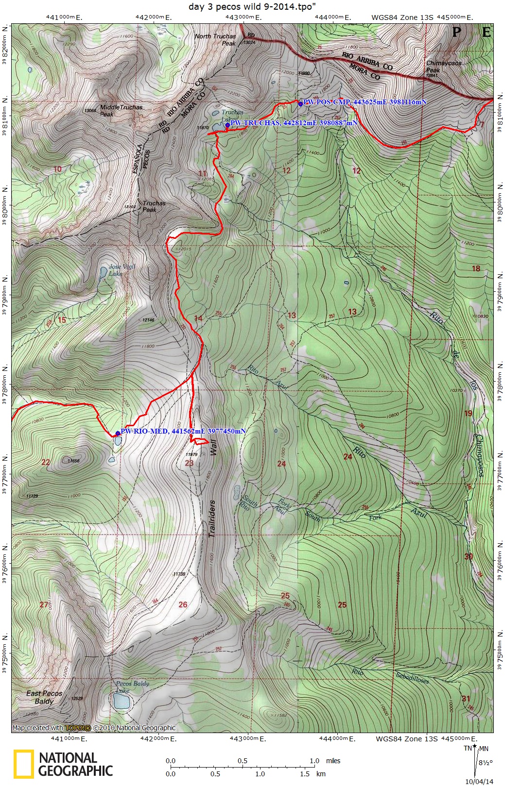
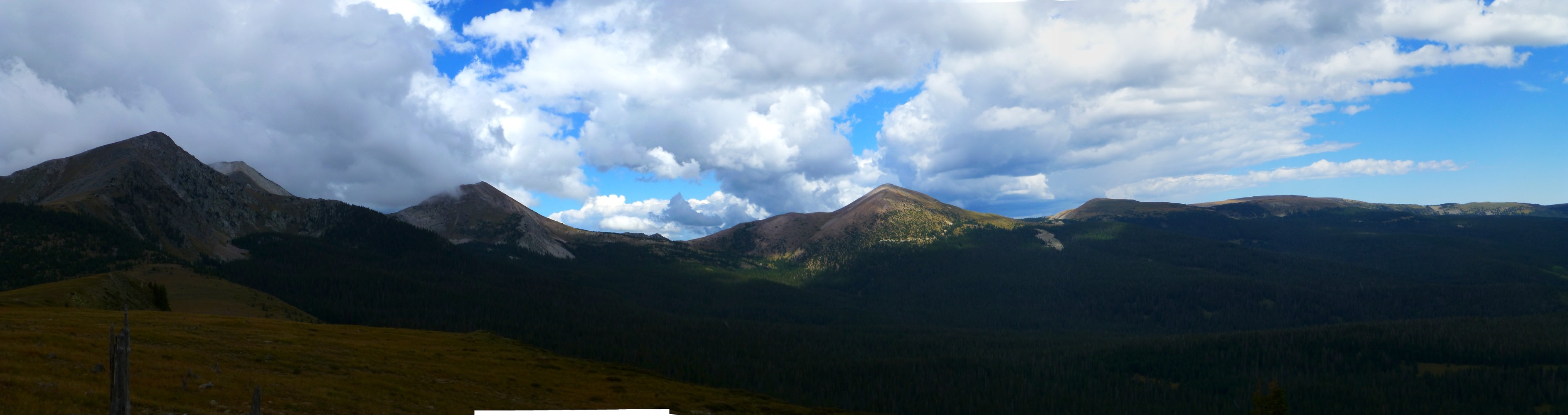
Day 4: Tundra Trek:
To Truchas Lake. 7 miles; ERM = 13.5; camp @ 11,800'.
The sun shines and the wind is mild as Bob and I trek across the tundra
carpet above 12,000' on the Skyline/Divide Trail, here a narrow isthmus of highly elevated quartzite.
A falcon curves in on delta wings, then magically stops and hovers without an apparent ripple of the wing
feathers. On the Northern skyline pokes Jicarita Peak and in front thrusts the main Truchas group.
Glorious! Bobbing along the divide, the views are far-reaching and grand. Towering thunderclouds begin
to build above the peaks and we muse about how exposed we are on this sky trek, with little but an
occasional krumholtz above waist level. The distant Trailriders Wall is in the dark below a gray cloud.
Slipping off the tundra, we contour around Barbara Peak, then drop into
a Bristlecone mini-forest below Chimayosos Peak. A light rain backed by thunder and a dash of lightning
roll above as we head for Truchas (trout) Lake. The spitting rain stops as we search out a camp near Truchas
Lake. Evening brings a white-pebbled sky reflected in the calm lake waters.
| ||||
 |
 |
 |
 |
 |
 |
 |
 |
 |
 |
 |
 |
 |
 |
 |
 |
 |
 |
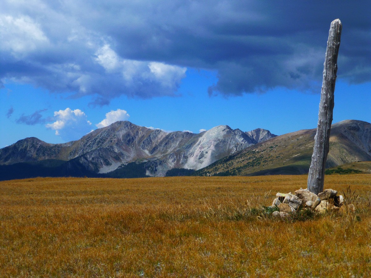
Day 5: Hail Trailrider:
To Rio Medio lakes area. 4.6 miles; ERM = 9; camp @ 11,200'.
The hail sweeps across Trailriders Wall, popping and hissing coldly
off our jackets and hats and discouraging further travel up the wall. What seemed like a fun exploratory
is turning into an exposed march. So, back to the packs and downhill toward some pond lakes in the top
of the Rio Medio drainage. Darn - we had just begun exploring the limestone cliffs, replete with all
sorts of fossils.
Some rain, then heavy hail, piling an inch deep as we look for a place
to camp and wondering where the trail goes down this tributary. Wet, icky conditions and the storm continues,
so we opt to set-up tents. Inevitably, lots of equipment gets wet.
The day starts delightful at Truchas Lake, with sunlight glinting off the
mica and quartz in the quartzite. Off we hike through thick forests and across tails of moraines. We see
a Pika carrying forbs for his haystack, and he pauses long enough to "eek!" at us. We've entered his territory
without permission. Bob sees a weasel, lilting like a ghost through openings in the blocks of quartzite.
He's still wearing his Summer brown, with just a bib of white foretelling the coming Winter.
It's feeling somewhat like Winter as I write these notes amidst a jam of
equipment in the TarpTent. Some sodden, much clutter. And, I'm pitched on a toboggan slope beneath a Blue
Spruce. Time for a nap?
No nap, the drumming of drops on the tent is now from the trees - it has
stopped raining and hailing. I put on rain pants - the hiking pants are soaked - and try to find a way to
the ponds for water. Then, Bob helps me move the tent to a more level location. With the clearing of the
sky, we can see a thin strip of Trailriders Wall above our thick forest engulfing the ponds.
| ||||
| ||||
 |
 |
 |
 |
 |
 |
 |
 |
 |
 |
 |
 |
 |
 |
 |
 |
 |
 |
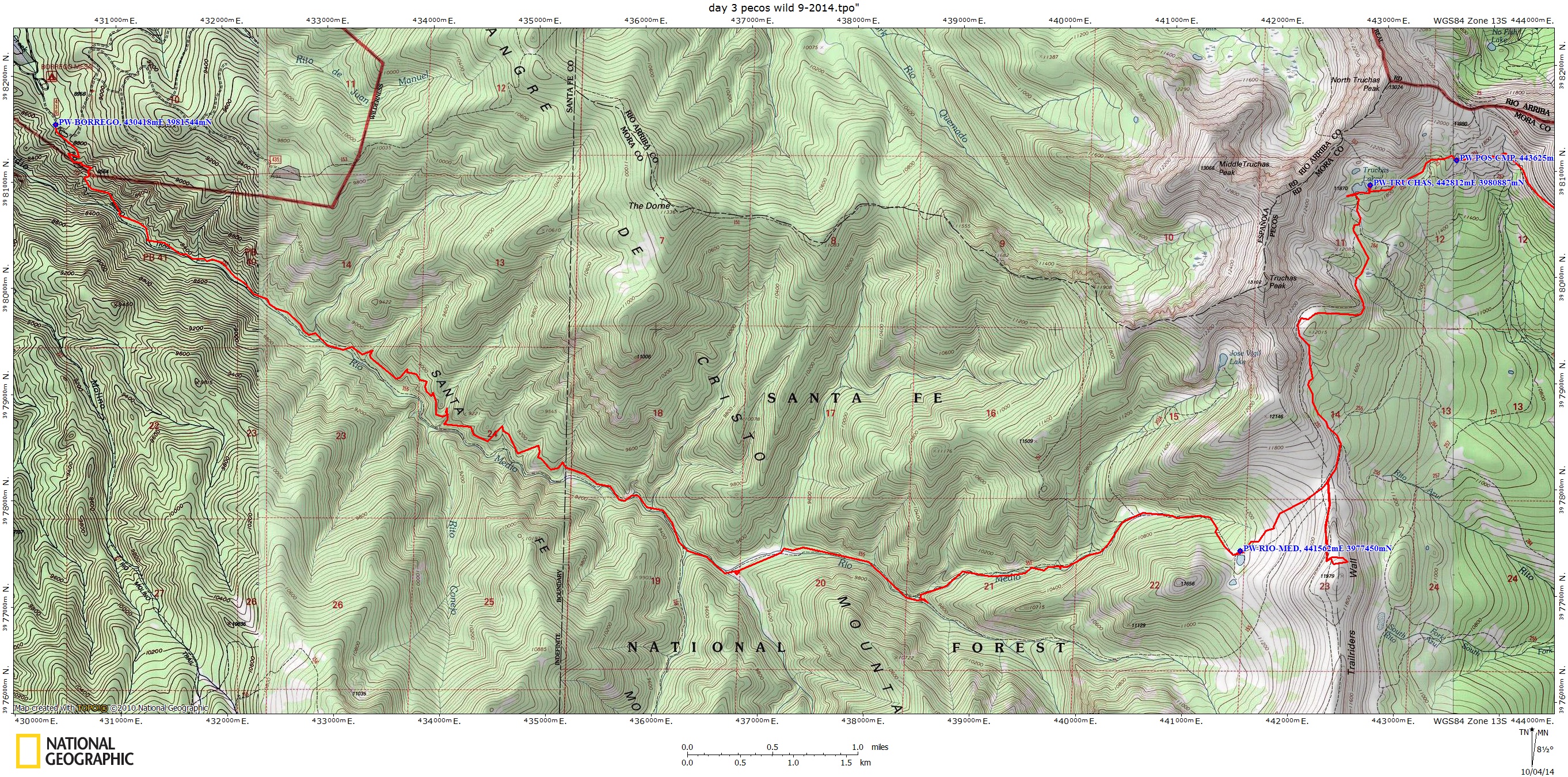
Day 6: Dark Forest Dribbles:
To Borrego CG and TH (about 8800'). 10.8 miles; ERM = 20; camp @ 7500' in the San Cristobal Hobbit House.
(Total trip mileage = 38.7 miles; ERM = 75.5)
The strands of moss sway in the breeze as another cloud dips from the heights
and dribbles on Bob and me as we walk the thick dark forest along Rio Medio, stepping over, detouring around,
climbing through yet another of the 200+ down trees blocking the trail. It's a bit more difficult than we
envisioned, the map suggests a gradual decline from somewhat over 11,000' to about 8800' at the TH, while the
texture of the terrain, predominantly the down trees, complicates this suggestion.
The day starts dark and cool, sporting total cloud cover and abundant condensation.
Packed wet, we set off through thick spruce and soon join Rio Medio as it tumbles down canyon. Gorgeous,
early Fall colors in the waist-high Fireweed, sticky geraniums, etc. Rain pants are required as we plow through
the soggy forbs and flowers. Past the historic site of Brazos Cabin, we cross the muds and silts clogging and
burying the trail, product of erosion from a recent fire up slope.
Dropping into the Aspen zone, some darts of Fall color. Climbing out of the
riparian area, the trail dramatically improves, rain pants come off - at least for awhile - and Ponderosa Pines
appear. The trail occasionally dips to near the stream, yet is now in much better condition. After a final
climb, we meet Donna and Jane (doggy) at Borrego TH and head for the hospitality of the Hobbit House, leaving,
for now, the precious Pecos Wilderness, sinfully tempting for a wilderness jaunt.
| ||||
| ||||
 |
 |
 |
 |
 |
 |
 |
 |
 |
 |
 |
 |
 |
 |
 |
 |
 |
 |
*ERM: Energy Required Miles, are there data to support this
mileage adjustment?
Journal of Outdoor Recreation, Education and Leadership
Petzoldt first proposed his theory in his 1976 book “Teton Trails” to
help backpackers plan trips and calculate their energy needs on mountain trails. “Petzoldt defined one
energy mile as the energy required to walk one mile on the flat. He recommended adding two energy miles
for every 1,000 feet of elevation gain, so a person hiking one mile and 1,000 feet upward would use the
equivalent of three energy miles,” Phipps said.
Petzoldt’s energy mile theory was just a reflection of the mountaineer’s
“gut feeling,” Phipps said. The theory had never been tested in a laboratory before the study began in WCU’s
Exercise Physiology Laboratory in the spring of 2010, Phipps said.
To determine the validity of the theory, the study measured the energy cost
and perceived exertion for walking on flat ground, with and without a 44.5-pound backpack, and up an elevation
gain of 1,000 feet, with and without the backpack, through the collection of metabolic data, Phipps said.
Twenty-four student, faculty and staff volunteers, including 12 males and 12
females, went through four testing sessions as the research continued into fall semester of 2010. The study
results showed that the additional energy cost for ascending 1,000 feet ranged from 1.34 to 2.02 energy mile
equivalents, for an average of about 1.6 miles, compared to Petzoldt’s use of two energy miles for each 1,000
feet. The range revealed by the study was due to the “hikers” personal weight differences, Phipps said.
“It is remarkable that Petzoldt’s energy mile theory is so close to the actual energy cost measured during our
study,” Phipps said. “In the field of outdoor education, it’s important for leaders to include an estimation
of energy requirements during the planning of hiking trips.”
Phipps said the energy required for hiking up steep mountain trails would vary
for individuals and groups, and the variables of the trail would also factor in, but he recommends that
backpackers stick with Petzoldt’s idea of adding two energy miles for every 1,000 feet of elevation gain when
planning trips.
The Validity of Petzoldt's Energy Mile Theory, 2010
Authors: Maridy McNeff Troy, Maurice L. Phipps
Publication: Journal of Outdoor Recreation, Education, and Leadership
Books:
Eaarth : making a life on a tough new planet, McKibben, Bill,
Time Books, 2010.
Maybe one : an environmental and personal argument for single-child families, McKibben, Bill, Simon & Schuster,
1998.
The end of nature, McKibben, Bill, Random House, 1989.
Important Links:
| |||||
| |||||
| |||||
| |||||
| |||||
|
Wild Vagabond Main |
Trip Report Index  |
Caveat  |
|---|