(Click the image for a full-size view (23k); Photo by Bob Fagley)

|
|---|
|
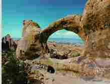
Double O Arch in Arches N.P.
(Click the image for a full-size view (23k); Photo by Bob Fagley) |
Links to other trip reports about Canyonlands N.P. on the Wild Vagabond site:
Chocolates for Easter: Backpacking THE Maze (1998)
Disraeli Gears Under Island In The Sky (1999)
Upward Angel: Backpacking Upper Salt Creek (1999)
The Canyonlands N.P. home page
is:
http://www.nps.gov/cany/
SUWA has something to say about
Lockhart Basin and the active neglect it is receiving from the Bureau of
Leasing and Mining (BLM). See SUWA at:
http://www.suwa.org
And, one of the articles about
Lockhart Basin at:
http://www.suwa.org:80/newsletters/1998/spring/lockhart.html
|
Wild Vagabond Main |
Trip Report Index  |
Caveat  |
|---|
The Trip:
Night 1:
Tremuloides:
After working late Thursday evening, I drove out of
Smog Lake about 9:30 p.m. I would drive all the way to
the Indian Creek/Lockhart Basin Road just outside The Needles District
of Canyonlands N.P., to rendezvous with Adam, and a friend, Angie. I was
experiencing the eyeball tremuloides by the time I Q-beamed the youngsters'
camp on a faint track off the Lockhart Basin Road at 4:30 a.m. Stepping into the
colorblind glare
of the full moon and the sweet early spring desert air, things fell back
into normalcy. Ahhh, home again.

|
|---|
|
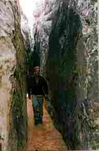
Adam tours the Joint Trail
(Click the image for a full-size view (15k); Photo by Rob) |
Day 1: Jointly to Chestler: In the morning, we enjoyed breakfast on a warming red rock, then relocated camp to Squaw Flat in the Needles. After lounging on the billowing Cedar Mesa Sandstone behind camp, we organized for a hike to Chestler Park. It's amazing how restful sandstone can be, after excellent sleep deprivation.
Hiking through spires and slots, we climbed in and out of Elephant Canyon before reaching Chestler. We Contoured around Chestler, an open park surrounded by the red/white-striped spires fencing of Chestler, before slithering through the long crack of the Joint Trail. Jointly, to and through the Joint Trail. Popping out from the Joint, we crossed Chestler Canyon and continued our loop into the rising dark, arriving back at the TH a little before moon rise (about 11 miles of hiking). And, it was a gorgeous orange goose-egg moon that rose over the open park in front of our camp. Lizard-lounging, replete, in the Needles District.

|
|---|
|
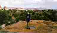
Slickrock Haven
(Click the image for a full-size view (16k); Photo by Rob) |
Day 2: Slickrock Striding: Yodeling coyotes reverberated into the early bird symphony as the sky turned pink. It was a good day to stride the slickrock. Adam and Angie hiked to Druid Arch, and I explored the mud-infested route into Salt Creek Canyon, explored out a-ways toward Lockhart Basin, toured Cave Spring, and hiked the Slickrock Trail, then with the lure of the warm afternoon sun, I inadvertently napped in the truck, missing my other intended hike of the day. I'm still recovering from the tremuloides, I guess.
Back at camp, Angie was experiencing the desert chills because she had bailed into a pool on the way to the massive Druid Arch, so we enjoyed a delightful fire as the moon rose.
Day 3: Archdom: Arches N.P. can be found arching along the Entrada Sandstone of the Colorado Plateau. I drove out of The Needles, to Arches N.P., and I hiked the trail to Double-O Arch on the Devil's Garden Trail (about 4 miles round trip). Sure, it's a contrast to the relative quiet of Needles, but Arches is a good way to ease back into civilization, such as it is.........
Please read, then act upon the concerns registered in the Caveat to this trip report. Thanks.
|
Wild Vagabond Main |
Trip Report Index  |
Caveat  |
|---|