Maze Musings, 2021
Wandering THE Maze, and musings about our cow burnt lands

El Loopo Grande: A 9-day backpack in The Maze District of Canyonlands NP:

Visiting South Fork Maze, Harvest Scene, Chimney Rock, Shot Canyon, Water Canyon,
Doll House, Spanish Bottom, and West Ernie's Spring (Lou's Spring).

April 27th to May 6th, 2021

Text and photos © copyright by Rob Jones

Co-adventurers: Zig Sondelski and Rob

Total miles = 68 miles; Total trip *ERM = 105

Sir Rambunctious, Day 1
(Click the image to see the full image)

Panorama of the Harvest Scene
Panorama of the Harvest Scene, scroll to see it all, 4756x1200, 1.2mb
(Click the image to see the full image)

Beehive Arch, Day 1
Beehive Arch, Day 1
(Click the image for the full-size image)
 Needles view, Day 1
Needles view, Day 1
(Click the image for the full-size image)

Maze Morning, Day 2
Maze Morning, Day 2
(Click the image for the full-size image)
Water Reflection, Day 3
(Click the image for the full-size image)

Chocolate Drops, Day 4
(Click the image for the full-size image)
The Maze, Day 4
The Maze, Day 4
(Click the image for the full-size image)

Footnote to The Maze, Day 4
(Click the image for the full-size image)
Shaman, Day 4
Shaman, Day 4
(Click the image for the full-size image)

Claret Cup Cactus, Day 4
(Click the image for the full-size image)
Pictos, Day 8
Pictos, Day 8
(Click the image for the full-size image)

Camp in Ernie's Country, Day 9
(Click the image for the full-size image)
Picto, Day 9
Picto, Day 9
(Click the image for the full-size image)

Movie 1: Spanish Bottom, Day 9, 15mb
(Click the image to see the video)

What's in this report?
     Preliminary and background information: ERM, map, cowburnt lands, geology, tamarisk, cryptobiotic soil, etc.
     Trip report: narrative and assorted photos and videos
     Terra Incognita, Into The Maze (by Ed Abbey)
     Some research validating the use of ERM (expanded definition too)
     Links section
     More truth than joke (cartoons and sage advice)

     Total trip miles hiked = 68; ERM = 105.

     ERM = Energy Required Miles. A mile is added for every 500' elevation gain or loss. ERM was initially used in Trails of the Tetons (long out of print) by Paul Petzold, founder of NOLS. It's a wonderfully useful concept and application. Add one mile for each 500' up AND down to distance = ERM. I use ERMs to calculate what the actual day is like. It's a very serviceable method of estimating energy required miles.
     See a more complete definition and research validating the use of ERMs below the Ed Abbey article about The Maze.

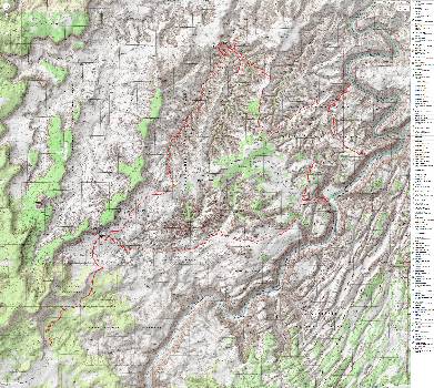
Map - THE Maze
Map - THE Maze area. This is not the track of the current hike, yet it's useful to see the area we visit.
(Click the image to see the map)

for a full-resolution map, click here. Caution - do not use this map for navigating the route.

Movie of wailing pictos at the Harvest Scene
Movie of wailing pictos at the Harvest Scene (from 2013) - 4.3 MB
(Click the image to see the short video - 4.3 MB)
(Photos and the report of the trip continue below.)

     Prelim 1 - Our cowburnt lands:
     A few years before cattle were removed in the Hart Mountain National Antelope Refuge in southeastern Oregon study area, Edward Abbey wrote in Cowburnt, which was published in Harper’s Magazine:

"The rancher (with a few honorable exceptions) is a man who strings barbed wire all over the range; drills wells and bulldozes stock ponds; drives off elk and antelope and bighorn sheep; poisons coyotes and prairie dogs; shoots eagles, bears, and cougars on sight; supplants the native grasses with tumbleweed, snakeweed, povertyweed, cowshit, anthills, mud, dust, and flies. And then leans back and grins at the TV cameras and talks about how much he loves the American West." - Ed Abbey

     What can you do to support your public lands, clean water, public animals, diversity, sustainability? First, stop eating beef. Just stop it. There are plenty of more environmentally friendly and more healthy alternatives. Cattle especially are unbelievably harmful to the Eaarth. Tune in to the links and files in this report and see how drastic and disgusting raising cattle is for you, for the Eaarth. I write "Eaarth" because we have altered our planet to where it is no longer recognizable as "Earth."
     It's been obvious to me since I ranged the hills and valleys of Idaho many decades ago that livestock grazing (almost always overgrazing) has tragically altered the flora and fauna and watersheds of the West, destroying fisheries, pushing out native wildlife, cowburning the land into a monoculture of non-native (e.g., cheetgrass) or native (e.g., sagebrush, which was once studded among a diversity of grasses) plants. Trampling stream banks and riparian areas, compacting the soils, overgrazing is bad enough, yet another aspect of land abuse includes our paying huge amounts to poison (e.g., for coyotes, gophers) and shoot/trap our public predators (ask yourself how come wolves or wild horses or cougars or badgers or most public wildlife cannot be tolerated by welfare ranchers). You know, those predators and other "competition" for livestock that made an ecosystem whole and sustainable. These public animals (and plants) cannot be tolerated by welfare ranchers, and we the public must pay to eliminate them, thus further destroying the health of our public lands.
     "Welfare ranchers?" you ask. Yes! Grazing fees on public lands are far less than one tenth of the free market cost of grazing. Welfare ranching is harmful to our treasury in addition to destroying our lands (our, not exclusively theirs). Welfare ranching is one of the examples of the worst kind of socialism, where we pay ranchers to destroy our lands and eliminate animals that would keep the system whole. And again, we are paying to extirpate our public animals so private ranchers can profit. There's a government program to shoot predators that ranchers don't like. It doesn't matter if these animals are keystone animals to the environment, they cannot be tolerated on what ranchers consider their own piece of private public land. Is it important to have an economic benefit for an animal to live? If this were the case, all public lands grazing would be terminated immediately. Ranchers would be paying the public for the harm they have done to the land, watersheds, animals, plants, and treasury, after removing all livestock from public lands. Of course, there are the adverse health effects of eating beef, the dramatic negative impacts livestock have to the spiraling global warming, yet these are just other aspects of how horrible cattle are for you or the Eaarth.
     Here is a sample, there's more info in the links section.

Costs and Consequences: The Real Price of Livestock Grazing on America's Public Lands (pdf file).

Assessing the Full Cost of the Federal Grazing Program (pdf file).

     Prelim 2 - Trail names:
     My trail name is Wild Vagabond. Many years ago, I "earned" this trail name in The Grand Canyon, and brought it with me to subsequent hikes. The website name "wildernessvagabond.com" evolved from the trail name. Zig's trail name is Zigs, it's a play on zig-zag.

     Prelim 3 - Background Information:

Geology: Primarily, we wander in the Cedar Mesa Sandstone during this jaunt.

Canyonlands Geology. The NPS - Canyonlands NP - developed this handy guide to the area geology Click here to see the pdf (pdf file).

Bear Safety: The NPS - Canyonlands NP - used my bear track photo from 2013 in its Bear Safety publication. It's an honor to help the guardians and stewards of our precious public lands. We looked for Bear sign, yet didn't see any this trip. Click here to see the pdf (pdf file).

Tamarisk, (Tamarix spp.) commonly known as salt cedar: is an exotic (non-native) shrub or tree that grows in dense stands along rivers and streams in the West. Tamarisk, introduced to the U.S. in the 19th century as an erosion control agent, spread through the West and caused major changes to natural environments. Tamarisk reached the Grand Canyon area during the late 1920s and early 1930s, becoming a dominant riparian zone species along the Colorado River in 1963 (following completion of Glen Canyon Dam).
     The impacts caused by tamarisk in the Southwest are well documented. These prolific non-native shrubs displace native vegetation and animals, alter soil salinity, and increase fire frequency. Salt cedar is an aggressive competitor, often developing monoculture stands and lowering water tables, which can negatively affect wildlife and native vegetative communities. In many areas, it occupies previously open spaces and is adapted to a wide range of environmental conditions. Once established in an area, it typically spreads and persists. (from the NPS Grand Canyon page)

Cryptobiotic soil (once called crypto-gamic soil): a crust of cryptobiotic soil provides a living ground cover in the high deserts of the Southwest. The soil, consisting of cyanobacteria, lichens, and mosses, forms crusts that are resistant to wind and water erosion and provide nutrients to plant life.
     Cryptobiotic soil crusts are an important part of arid and semi-arid ecosystems throughout the world, including those in Glen Canyon National Recreation Area, Grand Canyon National Park, Canyonlands, etc. Crypto means hidden, while biota means life. Hence these crusts are composed primarily of very small organisms that cannot be seen with the naked eye. Well-developed cryptobiotic soil crust is often much darker than the soil it is on top of, and has a sponge-like look and texture. The extent of crust development depends on soil structure, texture, and chemistry as well as elevation and microclimate.
     Cryptobiotic soil crusts are created by living organisms such as algae, cyanobacteria, and fungi. The bacteria within the soil release a gelatinous material that binds soil particles together in a dense matrix. The result is a hardened surface layer made up of both living organisms and inorganic soil matter. This crust is an important means by which arid soils resist erosion by wind and water. Many cryptobiotic soil crusts are able to absorb water more quickly than regular soils and as a result reduce runoff and also impede evaporation. In addition, the cyanobacteria in the crust, as well as some of the surface lichens, are nitrogen fixers, meaning that they can chemically convert atmospheric nitrogen into a form usable by other plants. Lichens and mosses often grow on the stabilized surfaces of the crust, and can often cover the crusts. Many unusual and unique organisms occur in association with crusts, including many rare and undescribed algal species as well as rare lichens. It is becoming increasingly clear that the older and better developed crusts support important levels of cryptogamic plant biodiversity. (from the NPS Grand Canyon and USGS sites)

Day 1 photos - Maze Musings, 2021

Click thumbnail to see full size image
maze-2021-day1-1  To the Jet Boat  w.jpg (374218 bytes)

maze-2021-day1-1 To the Jet Boat w.jpg

maze-2021-day1-2  Spanish Bot landing  w.jpg (410876 bytes)

maze-2021-day1-2 Spanish Bot landing w.jpg

maze-2021-day1-3  Spanish Bottom  w.jpg (562513 bytes)

maze-2021-day1-3 Spanish Bottom w.jpg

maze-2021-day1-4  Up from Spanish  w.jpg (460794 bytes)

maze-2021-day1-4 Up from Spanish w.jpg

maze-2021-day1-5  Sir Rambuncious  w.jpg (363378 bytes)

maze-2021-day1-5 Sir Rambuncious w.jpg

maze-2021-day1-6  Coy Rambunctious  w.jpg (326918 bytes)

maze-2021-day1-6 Coy Rambunctious w.jpg

maze-2021-day1-7  Rambunctious  w.jpg (410794 bytes)

maze-2021-day1-7 Rambunctious w.jpg

maze-2021-day1-8  Paintbrush  w.jpg (702331 bytes)

maze-2021-day1-8 Paintbrush w.jpg

maze-2021-day1-9  Dolls House  w.jpg (438492 bytes)

maze-2021-day1-9 Dolls House w.jpg

maze-2021-day1-10  storm in Needles  w.jpg (302752 bytes)

maze-2021-day1-10 storm in Needles w.jpg

maze-2021-day1-11  waterpockets  w.jpg (390365 bytes)

maze-2021-day1-11 waterpockets w.jpg

maze-2021-day1-12  La Sal Mtns  w.jpg (331559 bytes)

maze-2021-day1-12 La Sal Mtns w.jpg

     Day 1: Rain Whip and Sir Rambunctious. To near Confluence Trail: 6 miles. ERM of 11.
     Zig and I are up early for breakfast. Sadly, the MAGAvirus is preventing a real breakfast, yet we and the motel staff do our best to work around the atrocious yet necessary restrictions caused by the lack of interest or effort by the repulsican administration. We're cozy in a motel, yet wind and rain are whipping around the shrubbery outside. Good, this means a little water across the desiccated plateau, maybe some water for the drainages and waterpockets of The Maze.
     Zig and I are co-adventurers. What? This means we share the planning and organization of the adventure. I've previously hiked The Maze, and know something about the springs and routes, so I take the lead on roughing out a hike route, then pass it over to Zig to evaluate. We adjust plans after discussion. Seeing what is needed, Zig works on the cache and in-town reservations while I work on the backcountry reservations. It all works out and our trip goes well because of it. We ended up reversing our planned route because of water issues, and the planning allowed this to easily happen.
     After an early breakfast, we're off to Tex's Riverway to check in for the jet boat ride to Spanish Bottom, which is just below the confluence of the Green and Colorado Rivers. Yahoo, getting ready to start!
     Skies are gray as we board the old school bus to the put-in near the portal area, passing corporate welfare cleanup of the radioactive tailings from the defunct Atlas Mill. Typical. Mining companies take ore from public lands, pay basically nothing for it, extract the profits, declare bankruptcy (this is a common practice), then leave toxic brew for the public to clean up. Yes indeed, corporations are good, good for nothing. Cleaning up after these corporate welfare "good citizens" has taken many years and cost many millions of your/our dollars. Extractive (mining, logging, public lands grazing, etc.) corporations are job creators, for sure, they create jobs the public has to fund. Never mind the devastation wrought on our public lands.
     We board the jet boat wearing all the clothing we have, topped with rain top and pants. The captain swings the big jet boat into the current. The engines burble, then roar. Cold rain and wind assaults Zig and me, so we huddle behind seat cushions held up like shields to break the wind and shed the rain. Burr. It's a full frontal assault of drenching rain.
     This continues for nearly two hours as we fly down the Colorado River, diminishing lifeblood of the SouthWest.

"In rivers, the water that you touch is the last of what has passed and the first of that which comes; so with present time." - Leonardo da Vinci

     Docking at Lower Spanish Bottom, it's pleasurable to get on land and defrost, which happens quickly once off the boat.
     Stashing the cache of water, Bear canister, and tin of food for our last night, we pack away almost all our clothes and start the climb up to the Doll House.
     A huge Bighorn Sheep ram (Sir Rambunctious) knocks some rocks across the trail in front of us, then peers at us around boulders and trees, posing, then ignoring us while perched on a side hill. Wow! Yes Sir.
     Rain surges roll over the land as we make our way to Beehive Arch and the rain top is on, off, on, finally off as we work through several small drainages, getting glimpses of The Needles, the LaSal Mountains. We're drying out and wondering whether to camp or try for Water Canyon Spring.
     Zig likes the views of The Needles near some freshly topped off potholes. I like that there's an alcove yet wonder about fierce winds.
     Rain starts up, then tapers with dinner and the breeze fades with sunset. Superb.

Day 2 photos - Maze Musings, 2021

Click thumbnail to see full size image
maze-2021-day2-1  misty morn  w.jpg (136535 bytes)

maze-2021-day2-1 misty morn w.jpg

maze-2021-day2-2  crypto path  w.jpg (502269 bytes)

maze-2021-day2-2 crypto path w.jpg

maze-2021-day2-3  parkland  w.jpg (446710 bytes)

maze-2021-day2-3 parkland w.jpg

maze-2021-day2-4  Chimney Rock  w.jpg (376146 bytes)

maze-2021-day2-4 Chimney Rock w.jpg

maze-2021-day2-5  Cedar Mesa SS  w.jpg (488660 bytes)

maze-2021-day2-5 Cedar Mesa SS w.jpg

maze-2021-day2-6  big walls  w.jpg (283301 bytes)

maze-2021-day2-6 big walls w.jpg

     Day 2: Water World. To Water Canyon: 9 miles (includes day hike). ERM of 15.
     The orange rays of first sun appear to emanate from the spires and hoodoos in the near distance. Old Sol decorates the needles of The Maze with gold and umber. It's a partially sunny start to Day 2.
     It had rained a few times last night, and the dreaded wind had cooperated by being mostly absent. I slept through much of this activity.
     The tents have mostly dried by the time breakfast is served, and soon we're off winding through cracks in the spires and into the park where we meet the junction to the Colorado overlook.
     The biological soil is deep and dark, looking like brain gyri , convoluted crenulations. Fabulous. The Neapolitan swirls of white, pink chocolate are gorgeous. Apparently, some of the color layers indicate unconformities. An unconformity is a surface in the rock record representing a time from which no rocks are preserved. It could represent a time when no rocks were formed, or a time when rocks were formed but then eroded away.
     Over a low hump we hike, then drift down Water Canyon to a glorious spring supporting reeds and Cottonwood and willows, oh my.
     At the spring, Zig and I snack while sitting on clean polished shale slickrock, gazing at the variegated sandstone walls. Roving down canyon, we get partway to the Green River before turning back and locating the jump through the wall and into Shot Canyon, our way out of these canyons tomorrow.
     Setting up camp on the slickrock upstream of the spring, we discover that it's time for lunch #2.
     The remainder of the hike of the day is upcanyon to the head of Water. A delightfully wild canyon, probably because the route out of it is thin. In fact, we use binoculars and still cannot discern a decent route. Not recommended.
     Few wildflowers are displaying this desiccated year, yet we do see penstemon, mormon tea, asters trying to make a living out here.
     My bath water has warmed in the penetrating sun, and soon I'm clean and ready for dinner, which has been soaking during bath time.
     The salmon tinge of sunset creeps up the walls, signaling the end of Day 2.

Day 3 photos - Maze Musings, 2021

Click thumbnail to see full size image
maze-2021-day3-1  Water Canyon  w.jpg (451126 bytes)

maze-2021-day3-1 Water Canyon w.jpg

maze-2021-day3-2  passage  w.jpg (457111 bytes)

maze-2021-day3-2 passage w.jpg

maze-2021-day3-3  cattle route  w.jpg (340958 bytes)

maze-2021-day3-3 cattle route w.jpg

maze-2021-day3-4  into Shot  w.jpg (638509 bytes)

maze-2021-day3-4 into Shot w.jpg

maze-2021-day3-5  water in Shot  w.jpg (352121 bytes)

maze-2021-day3-5 water in Shot w.jpg

maze-2021-day3-6  ruin  w.jpg (377151 bytes)

maze-2021-day3-6 ruin w.jpg

maze-2021-day3-7  Shot steps  w.jpg (646730 bytes)

maze-2021-day3-7 Shot steps w.jpg

maze-2021-day3-8  Shot steps  w.jpg (486994 bytes)

maze-2021-day3-8 Shot steps w.jpg

maze-2021-day3-9  La Sal Mtns  w.jpg (470998 bytes)

maze-2021-day3-9 La Sal Mtns w.jpg

maze-2021-day3-10  footnote to on top  w.jpg (413226 bytes)

maze-2021-day3-10 footnote to on top w.jpg

maze-2021-day3-11  Chocolate Drops  w.jpg (600547 bytes)

maze-2021-day3-11 Chocolate Drops w.jpg

maze-2021-day3-12  Into The Maze  w.jpg (663201 bytes)

maze-2021-day3-12 Into The Maze w.jpg

Movie 2: Shot Canyon day 3, 27mb
Movie 2: Shot Canyon (note arch on skyline near end) day 3, 27mb
(Click the image to see the video)

     Day 3: Sure as Shot. Water to Shot to Chimney Rock to Horse below The Maze Overlook: 9 miles. ERM of 16.
     The footnote to The Districts of Canyonlands is delightfully deluxe, Supremó. We're lounging against a helpful rock near the top of the route out of Shot Canyon admiring the panoramic vista: from Elaterite Butte to Ecker Butte to Junction Butte of Island In the Sky District, to the LaSal Mountains, to Six Shooter Peak and Molly's Nipple of The Needles District, and around to the Abajó/Blue Mountains and Dark Canyon Plateau. Yowee. It's a ranging overview of Canyonlands.
     We've popped over from Water to Shot (where Shot, Jasper, Chalcedony (differing names for the same rock) is lying in heaps on the upper rock layers) and hiked up Shot around pour-offs and up slickrock bowls where large rock steps and rails are positioned to make a pathway for cattle to overgraze and decimate the canyon ecosystem. Unbelievable, both the continuing abuse of our public lands by welfare queen ranchers and the tortuous route built to steal resources from the public.
     Public lands cattle constitute about 2% of our national beef supply. Yes, that's it, about 2%. Just the economics make subsidizing livestock on public lands a hideous crime. When you add in the climate change-related harm caused by cows, the desertification of the West, the health and economic costs to Americans of eating beef, the destruction of riparian areas and water sources, the chaining of native vegetation and killing of native animals (predators, anything that competes with livestock), etc. well, it's ghastly, tragically ghastly. (See the more coherent analysis in the link below.)

"Overgrazing is much too weak a term. Most of the public lands in the West, and especially in the Southwest, are what you might call 'cowburnt.' Along every flowing stream, around every seep and spring and water hole and well, you'll find acres and acres of what range-management specialists call 'sacrifice areas.' Our public lands have been overgrazed for a century...and overgrazing means eventual ruin, just like strip-mining or clear-cutting or the damming of rivers." - Ed Abbey

     Topping out, we're at the panoramic splendor where today's summary began. We see Zach of New York heading into Shot. Otherwise, it's quiet in our canyons.
     At Chimney Rock, we continue North along the ridge above Jasper Canyon almost to Pete's Mesa before turning down into a side arm that winds around and leads to the spring at the base of what is often called Pictograph Fork (AKA Chimney Rock Fork). We start to see precious water and reeds, then look for a nook out of sight of The Maze Overlook, which we find, and set about collecting drinking and bathing water, then setting up camp, which we finish as bats fly, the temperature lowers, and dark collapses.

Costs and Consequences: The Real Price of Livestock Grazing on America's Public Lands (pdf file).

Assessing the Full Cost of the Federal Grazing Program (pdf file).

Movie 3:  pano from the top of Shot Canyon, day3, 33mb
Movie 3: pano from the top of Shot Canyon, day 3, 33mb
(Click the image to see the video)

Day 4 photos - Maze Musings, 2021

Click thumbnail to see full size image
maze-2021-day4-1  Chocolate Drops  w.jpg (288398 bytes)

maze-2021-day4-1 Chocolate Drops w.jpg

maze-2021-day4-2  Chocolate Drops  w.jpg (517040 bytes)

maze-2021-day4-2 Chocolate Drops w.jpg

maze-2021-day4-3  Harvest Scene  w.jpg (407987 bytes)

maze-2021-day4-3 Harvest Scene w.jpg

maze-2021-day4-4  Harvest Scene  w.jpg (322709 bytes)

maze-2021-day4-4 Harvest Scene w.jpg

maze-2021-day4-5  Harvest Scene  w.jpg (325705 bytes)

maze-2021-day4-5 Harvest Scene w.jpg

maze-2021-day4-6  Harvest Scene  w.jpg (371572 bytes)

maze-2021-day4-6 Harvest Scene w.jpg

maze-2021-day4-7  Harvest Scene  w.jpg (444026 bytes)

maze-2021-day4-7 Harvest Scene w.jpg

maze-2021-day4-8  Harvest Scene  w.jpg (383789 bytes)

maze-2021-day4-8 Harvest Scene w.jpg

maze-2021-day4-9  Harvest Scene  w.jpg (579484 bytes)

maze-2021-day4-9 Harvest Scene w.jpg

maze-2021-day4-10  Petros  w.jpg (436254 bytes)

maze-2021-day4-10 Petros w.jpg

maze-2021-day4-11  pothole arch  w.jpg (558818 bytes)

maze-2021-day4-11 pothole arch w.jpg

maze-2021-day4-12  sand flower  w.jpg (411319 bytes)

maze-2021-day4-12 sand flower w.jpg

Movie 4:  The Harvest Scene, day4, 24mb
Movie 4: The Harvest Scene, day 4, 24mb
(Click the image to see the video)

     Day 4: Haven It's Not. To Haven Spring, Harvest Scene, and Back: 8.5 miles, ERM of 10.5. Plus a sand slog factor.
     The sun glints from the Chocolate Drops while the encroaching moon languishes in the Southern sky. Good morning to Day 4 of Maze Musings.
     We're up and going in the calm coolness of a desert morning, bound for the Harvest Scene Pictograph Panel and possibly the Haven Spring up the right fork of this longish canyon, passing beneath the Chocolate Drops and some unnamed arches. Hurrah!
     Ravens coo and chortle, expressing their desire to inspect camp for goodies as soon as we leave. Wedge tails flare and mark their exploration around the edge of camp. Otherwise, the natural quiet of the desert is complete. Even the sporadic obnoxious air tourists in flying tin cans are thankfully absent.
     The heat reverberates and echoes, magnified by the glowing canyon walls. Sand slogging up canyon is excellent preparation for wearing those high heeled shoes.
     Fragrance of Barberry wafts through the heated air. A strong aroma with a pleasant undertone. Splendid aromatic experience.
     The Harvest Scene rambles across the expansive sandstone canvas, depicting the harvesting of rice grass and a plethora of mystical shaman-like figures and messages. Totally amazing. This is Barrier Canyon Style rock art. The limited information I found places the pictography between 2,000 and 4,000 years old. Yowee.
     Pecked petroglyphs surprise us as we round yet another confusing turn of this canyon called The Maze. Are these guiding travelers? Communicating a story? Expressive art? Early graffiti? Something else?
     Arriving at the location of the Haven Spring, we see a pool of runoff water yet no flow from the spring. Oh oh, more signs of the desertification of the Eaarth. As climate change engulfs us, some areas like the Intermountain and SW will become dryer while the East may become wetter, with all areas experiencing wild, dramatic swings in weather. The climate has been on a hotter, drier trend, while weather has become more erratic. Climate change.
     It's hot, so we hike partway back and have lunch #1 on a bench above the drainage; soon the revolving Eaarth allows the sun to toast us out of our nook. More down canyon hiking, beyond the fork to Chimney Rock and another foot and food break for lunch #2 in the deep shade of canyon walls so deep you can see the stars at noon. It's cool in the shade because much of the heat we feel is from solar load. The air temperature is moderate.
     Zach comes by after hiking a loop to Water Canyon and he's the only other hiker we see today.
     Back to camp, unEaarthly quiet surrounds. So quiet that my eardrums go in search of some vibration to call sound. Delightful. Rare. UnEaarthly.
     The water in the bucket is gloriously warm, the Lightsaver (solar panel) fully charged, and everything out in the sun melted or warped or very hot.
     A deluxe bucket bath ensues, followed by full shade and more natural quiet. It's local sunset at camp #4.

Day 5 photos - Maze Musings, 2021

Click thumbnail to see full size image
maze-2021-day5-1  Abbey Triple Flush  w.jpg (472116 bytes)

maze-2021-day5-1 Abbey Triple Flush w.jpg

maze-2021-day5-2  Abbeys Triple Flush  w.jpg (251499 bytes)

maze-2021-day5-2 Abbeys Triple Flush w.jpg

maze-2021-day5-3  Horses Ass  w.jpg (539343 bytes)

maze-2021-day5-3 Horses Ass w.jpg

maze-2021-day5-4  Butt Cleavage  w.jpg (432369 bytes)

maze-2021-day5-4 Butt Cleavage w.jpg

maze-2021-day5-5  Infinity  w.jpg (507140 bytes)

maze-2021-day5-5 Infinity w.jpg

maze-2021-day5-6  vague petro  w.jpg (434277 bytes)

maze-2021-day5-6 vague petro w.jpg

maze-2021-day5-7  unused canvas  w.jpg (448932 bytes)

maze-2021-day5-7 unused canvas w.jpg

maze-2021-day5-8  Pothole  w.jpg (474132 bytes)

maze-2021-day5-8 Pothole w.jpg

maze-2021-day5-9  arch sign  w.jpg (711388 bytes)

maze-2021-day5-9 arch sign w.jpg

Movie 5: Abbey Triple Flush Arch, day 5, 10mb
(Click the image to see the video)

     Day 5: Horse or Horse's Ass? Exploring Horse Canyon: 8 miles. ERM of 11.
     "Peter Monnet, Price, UT, 1915" is a horse's ass for defacing this splendid rock canvas. This, horse's ass, is what my Dad called selfish assholes, a horse's ass. In this case a typical cowman, mistreating public lands everywhere. It's way past time to get these entitled welfare ranchers off our public lands and give the native plants, riparian areas, and animals a turn. Vandalizing this sandstone canvas embodies cowboy ethics.
     We're exploring down Horse Canyon, finding undocumented arches along the way. A multitude of alcoves grace one sweep of the canyon and one is a pothole arch. It's the Infinity Oval Arch, Zig announces. Dwarf Lupine dot the gravelly soil, yet few other flowers are seen. There's none of the fragrant Barberry in sight or smell.
     Second breakfast is enjoyed in the deep shade of a receptive canyon wall, where two little brown bats still ply the coolness for insects as their second lunch.
     Butt Cleavage Arch (a wall arch) appears near what seems to be a frequent spring - judging from the presence of cattails and sedges. Across the canyon lurks Incisor Arch, a pothole arch.
     Down at the confluence of Horse and South Fork Horse we search for reported petro panels without finding much but dust in our teeth. A song ensues: Sand in the eyes. Can't even see the sky. Dust in our teeth. All we have is dust in our teeth (continue the song verses here...). See the song "Dust in the wind" by Kansas to get the notes, you supply the remainder of the verse.
     So, a low ledge provides shade for 1st lunch. Then, we're back out looking for petroglyphs. Exploring up and down the main arm of Horse yields nothing but dry skin as a schizophrenic gusting weather pattern sets in. Calm, then 30 MPH wind, back to calm. Ick.
     Stopping in at spectacular Abbey's Triple Flush arches (actually Natural Bridges or pothole arches) finishes our daily tour. It's so much more elegant and spectacular than trump towers. trump towers? you ask. You know, those dilapidated outhouses full of shit, that's a trump tower.
     The wind has filled the tents with fine sand and dirt, sifting it through the tent mesh. It calms, and an overcast sky is like putting a lid on the heated saucepan. Where's the breeze now?

Day 6 photos - Maze Musings, 2021

Click thumbnail to see full size image
maze-2021-day6-1  Maze camp  w.jpg (351757 bytes)

maze-2021-day6-1 Maze camp w.jpg

maze-2021-day6-2  Snake petro  w.jpg (609541 bytes)

maze-2021-day6-2 Snake petro w.jpg

maze-2021-day6-3  Jasper-Shot-Chert  w.jpg (603773 bytes)

maze-2021-day6-3 Jasper-Shot-Chert w.jpg

maze-2021-day6-4  Jaspercorn  w.jpg (563178 bytes)

maze-2021-day6-4 Jaspercorn w.jpg

maze-2021-day6-5  FPT2  w.jpg (340986 bytes)

maze-2021-day6-5 FPT2 w.jpg

maze-2021-day6-6  SFPT1  w.jpg (355536 bytes)

maze-2021-day6-6 SFPT1 w.jpg

     Day 6: South Fork Maze. To the South Fork Spring: 7.5 miles. ERM of 11.
     The chertarama stretches for nearly 100 feet, Jasper, shot, chalcedony galore, an interesting vein of huge Jasper corns.
     Zig and I are winding the serpent slithers of the convoluted South Fork Maze (Horse), which has more walking rubble and less sand slogging than Horse or the Picto Fork. Clouds alternate with brain-boiling sun. Tall walls reflect the heat, in addition to looking gorgeous.
     Earlier today, we rounded the canyon nose and entered the South Fork, passing a snake petro along the way. Tracks of Maze Overlook hikers trample everywhere, yet soon we're into another day of seeing no one. Tracks diminish, natural quiet prevails, visual splendor reigns.
     A splendid clean and polished bench in deep shade serves as the table for 2nd breakfast. A delightful and sweeping vista adds ambiancé to the best 2nd breakfast of the day.
     Later, a more sedate venue in a welcome overhang serves as lunch #1.
     Two pothole arches are photographed and marked along today's route, both high in the Cedar Mesa Sandstone.
     The Canyon walls appear higher today than they did in Horse.
     The spring is running well and supports a host of water loving plants, including willows, cottonwood, reeds, and cattails. Most excellent.
     A sporadic nasty wind sets in, lasting until sunset. This decreases the enjoyment factor and makes finding a good camp nearly impossible. Zig hides out behind a fallen tree above the spring and I go 5 minutes up canyon to a low bench populated by a single cottonwood, which has graciously littered the ground with last year's leaves, covering the sand and preventing mud-eye syndrome. Hurrah. Still, the wind blows at angles somehow, and I have to add rock anchors to the tent. Local sunset creeps in early, and concomitantly it's an early bedtime for bonzo.

Day 7 photos - Maze Musings, 2021

Click thumbnail to see full size image
maze-2021-day7-1  rain cover  w.jpg (491815 bytes)

maze-2021-day7-1 rain cover w.jpg

maze-2021-day7-2  we lichen  w.jpg (717678 bytes)

maze-2021-day7-2 we lichen w.jpg

maze-2021-day7-3  ledges out  w.jpg (525526 bytes)

maze-2021-day7-3 ledges out w.jpg

maze-2021-day7-4  crypto-biotic  w.jpg (752956 bytes)

maze-2021-day7-4 crypto-biotic w.jpg

maze-2021-day7-5  slickrock  w.jpg (533239 bytes)

maze-2021-day7-5 slickrock w.jpg

maze-2021-day7-6  NB near road  w.jpg (221385 bytes)

maze-2021-day7-6 NB near road w.jpg

maze-2021-day7-7  on top  w.jpg (479985 bytes)

maze-2021-day7-7 on top w.jpg

maze-2021-day7-8  Lou Spring  w.jpg (675847 bytes)

maze-2021-day7-8 Lou Spring w.jpg

maze-2021-day7-9  pictos  w.jpg (413755 bytes)

maze-2021-day7-9 pictos w.jpg

     Day 7: Earnest for Ernie's. To Lou's Spring + explore: 8 miles. ERM of 12.
     Wind has an innate urgency, yet dark pendulous mammatus storm clouds contain more cosmic emphasis. Thus opens Day 7 of Maze Musings, dark, with a foreboding calm of impending something. I'm feeling good about camping on the low bench. It grows colder and darker. Burr. Time to hike.
     Up the top part of the South Fork Horse to the scrambly parts and the tucked in the drainage natural bridge, to the roadwalk and the Mother and Child (Genie and the Robot, trump and jeff sessions, supplicant to the trump cult) landmark, and into the Western reach of Ernie's County. A landscape of and for natural creatures, plants, and features.
     It starts raining not long after the start of the hike. Stopping in an overhang and waiting some helps.
     Soon we're on the climb out of the South Fork, which contours into a drainage, climbs, contours back, climbs, finally climbs out to a small natural bridge before reaching the jeep path. The rain sputters to a stop. The path isn't worthy of calling it a road.
     Now, it's the jeep path walk to the Mother and Child before dropping toward Ernie's Country. And Lou's (West Ernie's) Spring.
     Finding a decent previously used camp out of the drainage and the nasty wind takes way too long.
     After setting up camp Zig and I discuss plans for tomorrow, explore nearby and go long for Spanish Bottom the following day, or divide the long day into two, which involves carrying water for a dry camp.
     We explore to the Range Canyon picto panel, fabulous red anthropomorphs. Hollow eyes vacantly gazing into space, and then fetch lots of water from nearby Lou's Spring.
     It's nearly dark as we finish dinner, and now to enjoy a calm cool evening.

Day 8 photos - Maze Musings, 2021

Click thumbnail to see full size image
maze-2021-day8-1  cedar bark ruin  w.jpg (609107 bytes)

maze-2021-day8-1 cedar bark ruin w.jpg

maze-2021-day8-2  cactus  w.jpg (531999 bytes)

maze-2021-day8-2 cactus w.jpg

maze-2021-day8-3  The Fins  w.jpg (459827 bytes)

maze-2021-day8-3 The Fins w.jpg

     Day 8: Heavy Water. To Wide Valley of Ernie's Country: 5 miles. ERM of 8.
     The strips of bark from a Juniper on the roof of the structure look newly thatched at Cedar Bark Granary. A little exploring precedes the totting of heavy water. No, not the radioactive type of water associated with the end of nature, just more than we typically tote. Heavy. Because we're envisioning a dry camp tonight. Zig and I are each carrying 7 liters of heavy water. That's about 14 pounds, each. Argh.
     Clell's Spring is desiccated as the Department of Agriculture/Interior "thought" about public lands grazing and looks like it's been dry for a few years. (Actually, I acknowledge that this is more of a political problem than an agency problem.) It's in a side canyon in the narrow notch that opens to Ernie's Country and Wide Valley. There remains a fringe of Maiden Hair Ferns where a hint of seepage remains, suggesting that this spring could again flow, maybe.
     Opens is correct. As we move upstream, sand slogging, in the East Fork of Wide Valley, most trees are absent, leaving a wide open view of a distant beanie rock and a sweep of desert lands. Was this once a grassland prior to obliteration by livestockers? Almost certainly. Is there any hope of rehabilitation given the screaming advance of climate change? Did the Department of Agriculture or Interior once again sell out the native anything to host range maggots, who promptly decimate the nature, the natural? Of course they did. Continuing today, we public unwillingly pay huge subsidies to the livestock industry to decimate our public lands, riparian areas, our fellow creatures. Except the ants, the ants seem to benefit from extensive land abuse. And, we pay to eradicate the natural predators that once kept nature in balance. Sad, deplorable, and despicable. Of course, you know that less than 2% of US beef comes from public lands, yet a huge percentage of damage to public lands resources comes from livestock. An asymmetrical relationship, and an expensive one too. At least this carnage has stopped in Canyonlands National Park. Yet far to late to allow natural regeneration.
     Now we're ensconced under the lone Juniper for a kilometer or so, just out of sight of the radiator cooling plates of The Fins, and treasuring the natural quiet of this wondrous place. Although a wide valley, the low scrubbery is bounded by the variegated muffins, walls, and spires of the featured Cedar Mesa Sandstone. Terrific.
     Around the beanie rock we hike, finding abandoned jars and cut wood from what we think is a pre-park era cowboy camp. Ancestral people may also have camped in the area, as judged by lithic fields, yet what remains are petrified cow dung in what might have been an ancient structure. Sigh.
     The vista of The Needles and the River cut, topped by the Abajo/Blue Mountains is spectacular, marred only by the restless, fidgeting wind, which alternates with nasty midges. Still, we've seen no people for days and relish in the solitude and beauty that is The Maze.

Day 9 photos - Maze Musings, 2021

Click thumbnail to see full size image
maze-2021-day9-1  Morn in Ernies  w.jpg (433471 bytes)

maze-2021-day9-1 Morn in Ernies w.jpg

maze-2021-day9-2  picto  w.jpg (625385 bytes)

maze-2021-day9-2 picto w.jpg

maze-2021-day9-3  picto  w.jpg (462823 bytes)

maze-2021-day9-3 picto w.jpg

maze-2021-day9-4  picto  w.jpg (665335 bytes)

maze-2021-day9-4 picto w.jpg

maze-2021-day9-5  picto  w.jpg (642267 bytes)

maze-2021-day9-5 picto w.jpg

maze-2021-day9-6  Surprise Valley  w.jpg (493518 bytes)

maze-2021-day9-6 Surprise Valley w.jpg

maze-2021-day9-7  Surprise Valley  w.jpg (482062 bytes)

maze-2021-day9-7 Surprise Valley w.jpg

maze-2021-day9-8  LaSal & River  w.jpg (606073 bytes)

maze-2021-day9-8 LaSal & River w.jpg

maze-2021-day9-9  Granary  w.jpg (478649 bytes)

maze-2021-day9-9 Granary w.jpg

maze-2021-day9-10  folding  w.jpg (535237 bytes)

maze-2021-day9-10 folding w.jpg

maze-2021-day9-11  Steamer Powell  w.jpg (724166 bytes)

maze-2021-day9-11 Steamer Powell w.jpg

maze-2021-day9-12  The River  w.jpg (222100 bytes)

maze-2021-day9-12 The River w.jpg

Movie 6: The Doll House, day 9, 20 mb
Movie 6: The Doll House, day 9, 20mb
(Click the image to see the video)

     Day 9: Spanish Bottoming Out. To Spanish Bottom, exploring along the way: 7 miles. ERM of 11.
     A terrific camp. The sun blooms early and orange. Eaarthly quiet. Calm. I believe that I can hear the Ravens waking up in The Needles District, on the other side of The River. Glorious.
     Starting out, it's a view of the top of the Colorado River cut. Across the way sprout The spires and hoodoos of The Needles. The Needles District of Canyonlands. Off to the NE blossom the snow dappled LaSal Mountains. The Abajo/Blue are SE, along with what looks like Cathedral Butte on the South end of Salt Creek. It's Abbey's Country, to the max.
     Lilting into the day, we search for pictos, then pause in the delicious shade of a Juniper, with a sitting ledge and a credenza of sandstone, for an early snack, second breakfast.
     We hike into the Doll House, replete with its mystical protrusions of many shapes.
     Lunch is near a dramatic needle of the Doll House geography. We're able to stay in the deep shade for this long languishing lounging first lunch. Delightful.
     Out on the loop to the granary and Surprise Valley overlook we hike, where the trail squeezes through a narrow cleft in the slickrock. Narrow enough that the packs fit only sideways. Surprise Valley is indeed surprising, and appears to be a graben, a big one. A bit farther is the alcove sheltering two granaries, both in decent condition. A speeding Terrestrial Gartersnake shoots away when I go to sit on a sandstone perch. Yikes.

     Graben: A graben is a collapsed or down-dropped block of rock that is bordered on its long sides by faults. Grabens are normally associated with horsts, which are the up-thrown blocks of rock in between. (Both words are of German origin: graben meaning ditch or grave and horst meaning aerie, referring to the high nesting sites of predatory birds.) (from the NPS website)

     Lunch #2 is enjoyed near this overlook, and under the shade of a magnanimous public Pińon Pine, a temperature controlled environment of the best type.
     Vague distant glimpses are had of The Colorado far below.
     Zig and I muse about what was once stored in these granaries. Rice Grass and other stuff, plants that the livestockers obliterated? Not sure.
     Out of food, nearly out of water, it's time to bottom out to the cache near The River.
     The drop to The River is infinitely easier with our light as air packs compared to the climb up, loaded, on Day 1. We spot what we think is the contour route into Surprise Valley and mark it on the map for future reference.
     The sun is still in the "bake" setting when we arrive in Spanish Bottom, so we stroll to the Steamer Powell inscription, then eat snacks and drink beer from the Bear canister cache in the shade of the new willows near The River. The tamarisk beetles appear to have done a good job of eating the tammies in this section, and willows have again taken limited hold. Overall, of course, the invasive tamarisk dominate the riparian landscape and have drastically changed the riparian area of the Colorado River and many tributaries. Dinner is from cans in the cache.
     The golden reflections of tall walls in The River signal the close of a very diverse day of Maze Musings.

     Day 10: Hell Hole; recreational brothel. Jetting home:
     Light from the billions and billions of stars fades as Day 10 arrives. We lazily pack, keeping all the warm clothes on the top layer of the pack, and move to the bank where we were dropped off well over a week ago. The sun is hot and it seems we'll never use the warm gear. Hah!
     The River shuttle folks have to pickup several canoe parties and lots of their gear. So, it's getting hot and late when we're finally bound for the hell hole of Moab. The water level remains low, and extra maneuvering is required. The days of peak water in the Colorado River Basin are far in the rear view mirror. The features of this gorgeous place go screaming past as we jet upstream. It's cool, but not frigid during today's River shuttle. The takeout goes well and passage through the corporate enclave of business-only repulsicans (big box motels) that now mostly constitute Moab is not overly hampered by the endless construction. Helping unload the boat hastens our departure, hurahh.
     Zig and I share goodbyes and I'm out of this recreational brothel and don't stop until Monticello. Sigh of relief. Moab was once part of the serene experience, now it's a major irritant and representative of overpopulation of our only Eaarth. Sad. Yet recreation is better than the uranium miners causing billions and billions of expenses in cleanup of the radioactive Atlas Mill, or the destruction of entire ecosystems and its native inhabitants by livestockers.
     Plying my way across the Big Rez (Hopi and Navajo Nations) is restful. Gazing at the Bears Ears and the promise of an administration focused on people and The Eaarth/Land, including The Dine and Hopi People, incite hopeful musings.

""There are some good things to be said about walking. Not many, but some. Walking takes longer, for example, than any other known form of locomotion except crawling. Thus it stretches time and prolongs life. Life is already too short to waste on speed. I have a friend who's always in a hurry; he never gets anywhere. Walking makes the world much bigger and thus more interesting. You have time to observe the details. The utopian technologists foresee a future for us in which distance is annihilated. … To be everywhere at once is to be nowhere forever, if you ask me." - Ed Abbey

We are Spirits of the Colorado Plateau and approve this trip report!
(Click the image for the full-size image)
A footnote to The Maze, Huraah!
(Click the image for the full-size image)

.

.

Terra Incognita, Into The Maze

by Edward Abbey (1927-1989)

     From the Arid Lands Newsletter (Spring/Summer 1994, Issue No. 35; ISSN: 1092-5481):

     http://ag.arizona.edu/OALS/ALN/aln35/TOC35.html

     "This is the most beautiful place on earth," Abbey declared on page one of Desert Solitaire. The place he meant was the slickrock desert of southeastern Utah, the "red dust and the burnt cliffs and the lonely sky - all that which lies beyond the ends of the roads."

     Desert Solitaire, drawn largely from the pages of a multi-volume journal the author began in 1956 and kept over several seasons as a ranger in Arches National Monument (now a national park), was published "on a dark night in the dead of winter" in 1968. The book later moved the novelist Larry McMurtry to declare Abbey "the Thoreau of the American West," but it was greeted at first with little acclaim and slow sales. Since then, readers have supported the book through a long history of printings that led to what the author declared to be the "new and revised and absolutely terminal edition" brought out by The University of Arizona Press in 1988. It is that twentieth anniversary edition from which our excerpt, from the chapter titled "Terra Incognita: Into the Maze," is taken:

     We camp the first night in the Green River Desert, just a few miles off the Hanksville road, rise early and head east, into the dawn, through the desert toward the hidden river. Behind us the pale fangs of the San Rafael Reef gleam in the early sunlight; above them stands Temple Mountain - uranium country, poison springs country, headwaters of the Dirty Devil. Around us the Green River Desert rolls away to the north, south and east, an absolutely treeless plain, not even a juniper in sight, nothing but sand, blackbrush, prickly pear, a few sunflowers. Directly eastward we can see the blue and hazy La Sal Mountains, only sixty miles away by line of sight but twice that far by road, with nothing whatever to suggest the fantastic, complex and impassable gulf that falls between here and there. The Colorado River and its tributary the Green, with their vast canyons and labyrinth of drainages, lie below the level of the plateau on which we are approaching them, "under the ledge," as they say in Moab.

     The scenery improves as we bounce onward over the winding, dusty road: reddish sand dunes appear, dense growths of sunflowers cradled in their leeward crescents. More and more sunflowers, whole fields of them, acres and acres of gold - perhaps we should call this the Sunflower Desert. We see a few baldface cows, pass a corral and windmill, meet a rancher coming out in his pickup truck. Nobody lives in this area but it is utilized nevertheless; the rancher we saw probably has his home in Hanksville or the little town of Green River.

     Halfway to the river and the land begins to rise, gradually, much like the approach to Grand Canyon from the south. What we are going to see is comparable, in fact, to the Grand Canyon - I write this with reluctance - in scale and grandeur, though not so clearly stratified or brilliantly colored. As the land rises the vegetation becomes richer, for the desert almost luxuriant: junipers appear, first as isolated individuals and then in stands, pinyon pines loaded with cones and vivid colonies of sunflowers, chamisa, golden beeweed, scarlet penstemon, skyrocket gilia (as we near 7000 feet), purple asters and a kind of yellow flax. Many of the junipers - the females - are covered with showers of light-blue berries, that hard bitter fruit with the flavor of gin. Between the flowered patches and the clumps of trees are meadows thick with gramagrass and shining Indian ricegrass_and not a cow, horse, deer or buffalo anywhere. For God 's sake, Bob, I'm thinking, let 's stop this machine, get out there and eat some grass! But he grinds on in singleminded second gear, bound for Land's End, and glory.

     Flocks of pinyon jays fly off, sparrows dart before us, a redtailed hawk soars overhead. We climb higher, the land begins to break away: we head a fork of Happy Canyon, pass close to the box head of Millard Canyon. A fork in the road, with one branch old, rocky and seldom used, the other freshly bulldozed through the woods. No signs. We stop, consult our maps, and take the older road; the new one has probably been made by some oil exploration outfit.

     Again the road brings us close to the brink of Millard Canyon and here we see something like a little shrine mounted on a post. We stop. The wooden box contains a register book for visitors, brand-new, with less than a dozen entries, put here by the BLM--Bureau of Land Management. "Keep the tourists out," some tourist from Salt Lake City has written. As fellow tourists we heartily agree.

     On to French Spring, where we find two steel granaries and the old cabin, open and empty. On the wall inside is a large water-stained photograph in color of a naked woman. The cowboy's agony. We can't find the spring but don't look very hard, since all of our water cans are still full.

     We drive south down a neck of the plateau between canyons dropping away, vertically, on either side. Through openings in the dwarf forest of pinyon and juniper we catch glimpses of hazy depths, spires, buttes, orange cliffs. A second fork presents itself in the road and again we take the one to the left, the older one less traveled by, and come all at once to the big jump and the head of the Flint Trail. We stop, get out to reconnoiter.

     The Flint Trail is actually a jeep track, switchbacking down a talus slope, the only break in the sheer wall of the plateau for a hundred sinuous miles. Originally a horse trail, it was enlarged to jeep size by the uranium hunters, who found nothing down below worth bringing up in trucks, and abandoned it. Now, after the recent rains, which were also responsible for the amazing growth of grass and flowers we have seen, we find the trail marvelously eroded, stripped of all vestiges of soil, trenched and gullied down to bare rock, in places more like a stairway than a road. Even if we can get the Land Rover down this thing, how can we ever get it back up again?

     But it doesn't occur to either of us to back away from the attempt. We are determined to get into The Maze. Waterman has great confidence in his machine; and furthermore, as with anything seductively attractive, we are obsessed only with getting in; we can worry later about getting out.

     Munching pinyon nuts fresh from the trees nearby, we fill the fuel tank and cache the empty jerrycan, also a full one, in the bushes. Pine nuts are delicious, sweeter than hazelnuts but difficult to eat; you have to crack the shells in your teeth and then, because they are smaller than peanut kernels, you have to separate the meat from the shell with your tongue. If one had to spend a winter in Frenchy's cabin, let us say, with nothing to eat but pinyon nuts, it is an interesting question whether or not you could eat them fast enough to keep from starving to death. Have to ask the Indians about this.

     Glad to get out of the Land Rover and away from the gasoline fumes, I lead the way on foot down the Flint Trail, moving what rocks I can out of the path. Waterman follows with the vehicle in first gear, low range and four-wheel drive, creeping and lurching downward from rock to rock, in and out of the gutters, at a speed too slow to register on the speedometer. The descent is four miles long, in vertical distance about two thousand feet. In places the trail is so narrow that he has to scrape against the inside wall to get through. The curves are banked the wrong way, sliding toward the outer edge, and the turns at the end of each switchback are so tight that we must jockey the Land Rover back and forth to get it through them. But all goes well and in an hour we arrive at the bottom.

     Here we pause for a while to rest and to inspect the fragments of low-grade, blackish petrified wood scattered about the base of a butte. To the northeast we can see a little of The Maze, a vermiculate area of pink and white rock beyond and below the ledge we are now on, and on this side of it a number of standing monoliths - Candlestick Spire, Lizard Rock and others unnamed.

     Close to the river now, down in the true desert again, the heat begins to come through; we peel off our shirts before going on. Thirteen miles more to the end of the road. We proceed, following the dim tracks through a barren region of slab and sand thinly populated with scattered junipers and the usual scrubby growth of prickly pear, yucca and the alive but lifeless-looking blackbrush. The trail leads up and down hills, in and out of washes and along the spines of ridges, requiring fourwheel drive most of the way.

     After what seems like another hour we see ahead the welcome sight of cottonwoods, leaves of green and gold shimmering down in a draw. We take a side track toward them and discover the remains of an ancient corral, old firepits, and a dozen tiny rivulets of water issuing from a thicket of tamarisk and willow on the canyon wall. This should be Big Water Spring. Although we still have plenty of water in the Land Rover we are mighty glad to see it.

     In the shade of the big trees, whose leaves tinkle musically, like gold foil, above our heads, we eat lunch and fill our bellies with the cool sweet water, and lie on our backs and sleep and dream. A few flies, the fluttering leaves, the trickle of water give a fine edge and scoring to the deep background of - silence? No - of stillness, peace.

     I think of music, and of a musical analogy to what seems to me the unique spirit of desert places. Suppose for example that we can find a certain resemblance between the music of Bach and the sea; the music of Debussy and a forest glade; the music of Beethoven and (of course) great mountains; then who has written of the desert?

     Mozart? Hardly the outdoor type, that fellow - much too elegant, symmetrical, formally perfect. Vivaldi, Corelli, Monteverdi? - cathedral interiors only - fluid architecture. Jazz? The best of jazz for all its virtues cannot escape the limitations of its origin: it is indoor music, city music, distilled from the melancholy nightclubs and the marijuana smoke of dim, sad, nighttime rooms: a joyless sound, for all its nervous energy.

     In the desert I am reminded of something quite different - the bleak, thin-textured work of men like Berg, Schoenberg, Ernst Krenek, Webern and the American, Elliot Carter. Quite by accident, no doubt, although both Schoenberg and Krenek lived part of their lives in the Southwest, their music comes closer than any other I know to representing the apartness, the otherness, the strangeness of the desert. Like certain aspects of this music, the desert is also a-tonal, cruel, clear, inhuman, neither romantic nor classical, motionless and emotionless, at one and the same time - another paradox - both agonized and deeply still.

     Like death? Perhaps. And perhaps that is why life nowhere appears so brave, so bright, so full of oracle and miracle as in the desert.

     Waterman has another problem. As with Newcomb down in Glen Canyon - what is this thing with beards? - he doesn't want to go back. Or says he doesn't. Doesn't want to go back to Aspen. Where the draft board waits for him, Robert Waterman. It seems that the U.S. Government - what country is that? - has got another war going somewhere, I forget exactly where, on another continent as usual, and they want Waterman to go over there and fight for them. For IT, I mean - when did a government ever consist of human beings? And Waterman doesn't want to go, he might get killed. And for what?

     As any true patriot would, I urge him to hide down here under the ledge. Even offer to bring him supplies at regular times, and the news, and anything else he might need. He is tempted - but then remembers his girl. There's a girl back in Denver. I'll bring her too, I tell him. He decides to think it over.

     In the meantime we refill the water bag, get back in the Land Rover and drive on. Seven more miles rough as a cob around the crumbling base of Elaterite Butte, some hesitation and backtracking among alternate jeep trails, all of them dead ends, and we finally come out near sundown on the brink of things, nothing beyond but nothingness - a veil, blue with remoteness - and below the edge the northerly portion of The Maze.

     We can see deep narrow canyons down in there branching out in all directions, and sandy floors with clumps of trees--oaks? cottonwoods? Dividing one canyon from the next are high thin partitions of nude sandstone, smoothly sculptured and elaborately serpentine, colored in horizontal bands of gray, buff, rose and maroon. The melted ice-cream effect again - Neapolitan ice cream. On top of one of the walls stand four gigantic monoliths, dark red, angular and square-cornered, capped with remnants of the same hard white rock on which we have brought the Land Rover to a stop. Below these monuments and beyond them the innumerable canyons extend into the base of Elaterite Mesa (which underlies Elaterite Butte) and into the south and southeast for as far as we can see. It is like a labyrinth indeed - a labyrinth with the roof removed.

     Very interesting. But first things first. Food. We build a little juniper fire and cook our supper. High wind blowing now - drives the sparks from our fire over the rim, into the velvet abyss. We smoke good cheap cigars and watch the colors slowly change and fade upon the canyon walls, the four great monuments, the spires and buttes and mesas beyond.

     What shall we name those four unnamed formations standing erect above this end of The Maze? From our vantage point they are the most striking landmarks in the middle ground of the scene before us. We discuss the matter. In a far-fetched way they resemble tombstones, or altars, or chimney stacks, or stone tablets set on end. The waning moon rises in the east, lagging far behind the vanished sun. Altars of the Moon? That sounds grand and dramatic - but then why not Tablets of the Sun, equally so? How about Tombs of Ishtar? Gilgamesh? Vishnu? Shiva the Destroyer?

     Why call them anything at all? asks Waterman; why not let them alone? And to that suggestion I instantly agree; of course - why name them? Vanity, vanity, nothing but vanity: the itch for naming things is almost as bad as the itch for possessing things. Let them and leave them alone - they'll survive for a few more thousand years, more or less, without any glorification from us.

     But at once another disturbing thought comes to mind: if we don't name them somebody else surely will. Then, says Waterman in effect, let the shame be on their heads. True, I agree, and yet - and yet Rilke said that things don't truly exist until the poet gives them names. Who was Rilke? he asks. Rainer Maria Rilke, I explain, was a German poet who lived off countesses. I thought so, he says; that explains it. Yes, I agree once more, maybe it does; still - we might properly consider the question strictly on its merits. If any, says Waterman. It has some, I insist.

     Through naming comes knowing; we grasp an object, mentally, by giving it a name - hension, prehension, apprehension. And thus through language create a whole world, corresponding to the other world out there. Or we trust that it corresponds. Or perhaps, like a German poet, we cease to care, becoming more concerned with the naming than with the things named; the former becomes more real than the latter. And so in the end the world is lost again. No, the world remains - those unique, particular, incorrigibly individual junipers and sandstone monoliths - and it is we who are lost. Again. Round and round, through the endless labyrinth of thought - the maze. .

.

     *ERM: Energy Required Miles, are there data to support this mileage adjustment?
     Journal of Outdoor Recreation, Education and Leadership
     Petzoldt first proposed his theory in his 1976 book “Teton Trails” to help backpackers plan trips and calculate their energy needs on mountain trails. “Petzoldt defined one energy mile as the energy required to walk one mile on the flat. He recommended adding two energy miles for every 1,000 feet of elevation gain, so a person hiking one mile and 1,000 feet upward would use the equivalent of three energy miles,” Phipps said.
     Petzoldt’s energy mile theory was just a reflection of the mountaineer’s “gut feeling,” Phipps said. The theory had never been tested in a laboratory before the study began in WCU’s Exercise Physiology Laboratory in the spring of 2010, Phipps said.
     To determine the validity of the theory, the study measured the energy cost and perceived exertion for walking on flat ground, with and without a 44.5-pound backpack, and up an elevation gain of 1,000 feet, with and without the backpack, through the collection of metabolic data, Phipps said.
     Twenty-four student, faculty and staff volunteers, including 12 males and 12 females, went through four testing sessions as the research continued into fall semester of 2010. The study results showed that the additional energy cost for ascending 1,000 feet ranged from 1.34 to 2.02 energy mile equivalents, for an average of about 1.6 miles, compared to Petzoldt’s use of two energy miles for each 1,000 feet. The range revealed by the study was due to the “hikers” personal weight differences, Phipps said. “It is remarkable that Petzoldt’s energy mile theory is so close to the actual energy cost measured during our study,” Phipps said. “In the field of outdoor education, it’s important for leaders to include an estimation of energy requirements during the planning of hiking trips.”
     Phipps said the energy required for hiking up steep mountain trails would vary for individuals and groups, and the variables of the trail would also factor in, but he recommends that backpackers stick with Petzoldt’s idea of adding two energy miles for every 1,000 feet of elevation gain when planning trips.
     The Validity of Petzoldt's Energy Mile Theory, 2010
Authors: Maridy McNeff Troy, Maurice L. Phipps
Publication: Journal of Outdoor Recreation, Education, and Leadership

.

.
Links:

Map:

Map - THE Maze
Map - THE Maze area. This is not the track of the current hike, yet it's useful to see the area we visit.
(Click the image to see the map)

for a full-resolution map, click here. Caution - do not use this map for navigating the route.

Costs and Consequences: The Real Price of Livestock Grazing on America's Public Lands (pdf file).

Part 1 of a 4 Part Series: The Media Adores Ranchers. Here’s Why They Shouldn’t.

Part 2 of 4: Sustainable Cowboys or Welfare Ranchers of the American West?

Part 3 of 4: Bad Ranchers, Bad Cows

Part 4 of 4: Forbes Billionaires Top US Welfare Ranchers List.

NPS tamarisk management -pdf

Canyon Tree Frog (hear them here, mp3, 112kb)

The NPS - Canyonlands NP - used my bear track photo in its Bear Safety publication. It's an honor to help the guardians and stewards of our precious public lands. Click here to see the pdf (pdf file).

Learning to use a map and compass - instructional page (Ron Watters)

Here is the document about alum treatment of River water.

Previous WV Reports about The Maze:

Marauding the A-Mazing Marvelous Maze, 2013

Triple Flushing The Magnificent Maze: Exploring The South Fork area of THE Maze, 2010

A-Mazing Maze, a Desert Solitaire: Exploring The Fins Area of Canyonlands NP, 2009

Snowfest attempt in THE Maze, 2009

Water-Ooooh in THE Maze, 2000

Chocolates for Easter, 1998

Related Sites:

Scenic Toilets of Inner Eaarth

Falter - Has the Human Game Begun to Play Itself Out on this Eaarth? by Bill McKibben

Click here to see - Hoerling: Past Peak Water - beware propagators. (pdf file)

Click here to see - species loss accelerated by human overpopulation (pdf file)

Abbey's Web -- The man who is Desert Solitaire.

We Are Breeding Ourselves to Extinction (click here for full article)

More Truth Than Joke:

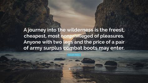
journey
journey
(Click the image for the full-size image)

GOP is dangerous
competence has been unusual during the last 4 years
(Click the image for the full-size image)

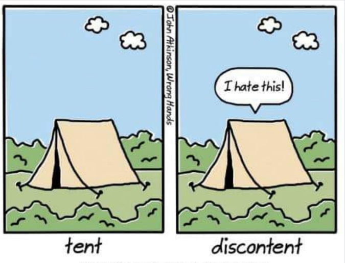
discontent
discontent
(Click the image for the full-size image)

10 Best
10 Best
(Click the image for the full-size image)

anti-fa
anti-fa
(Click the image for the full-size image)

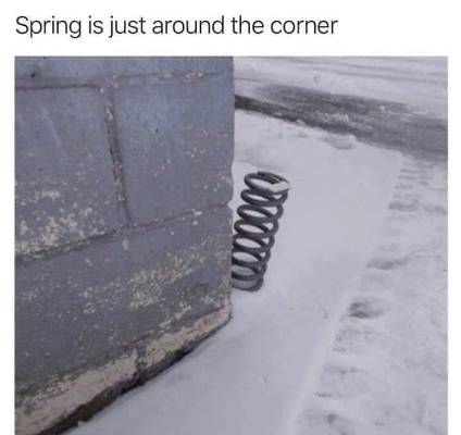
spring is just around the corner
(Click the image for the full-size image)

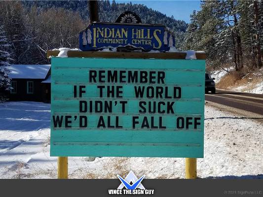
if the world didn't suck
(Click the image for the full-size image)

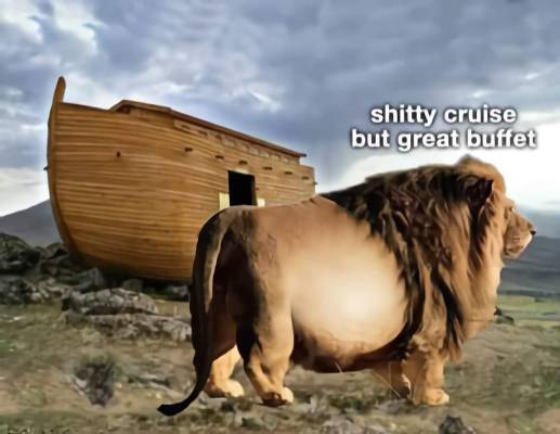
buffet
buffet
(Click the image for the full-size image)

coming for our cars
coming for our cars
(Click the image for the full-size image)

incentive needed?
incentive needed?
(Click the image for the full-size image)

a good wall
a good wall
(Click the image for the full-size image)

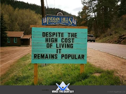
still popular
still popular
(Click the image for the full-size image)

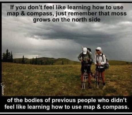
map and compass skills or death
(Click the image for the full-size image)

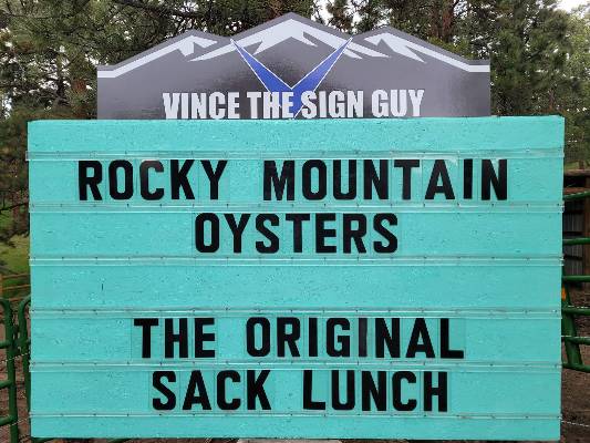
sack lunch
sack lunch
(Click the image for the full-size image)

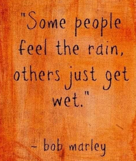
get wet
get wet
(Click the image for the full-size image)

finite Eaarth
finite Eaarth
(Click the image for the full-size image)


Wild Vagabond Main   Trip Report Index   Caveat