Exploring Aravaipa Canyon Wilderness from the West entrance to Horse Camp Canyon
with Kathleen Jones
Camera: Panasonic zs19

|
| |||||
|
| |||||
| ||||
|
| |||||
|
| |||||
| ||||
Photos are scattered throughout this report.
Summary: This is a report about an exploratory backpack into Aravaipa Canyon Wilderness. We hiked
as far as Horse Camp Canyon, leaving the rest of the Canyon for another exploration.
ERM - Energy Required Miles. A mile is added for every 500' elevation gain or loss.
It's a very serviceable method of estimating energy required miles. Total trip - (per my GPS) of 12.5 miles, ERM of about 15
Keep scrolling.

| ||||
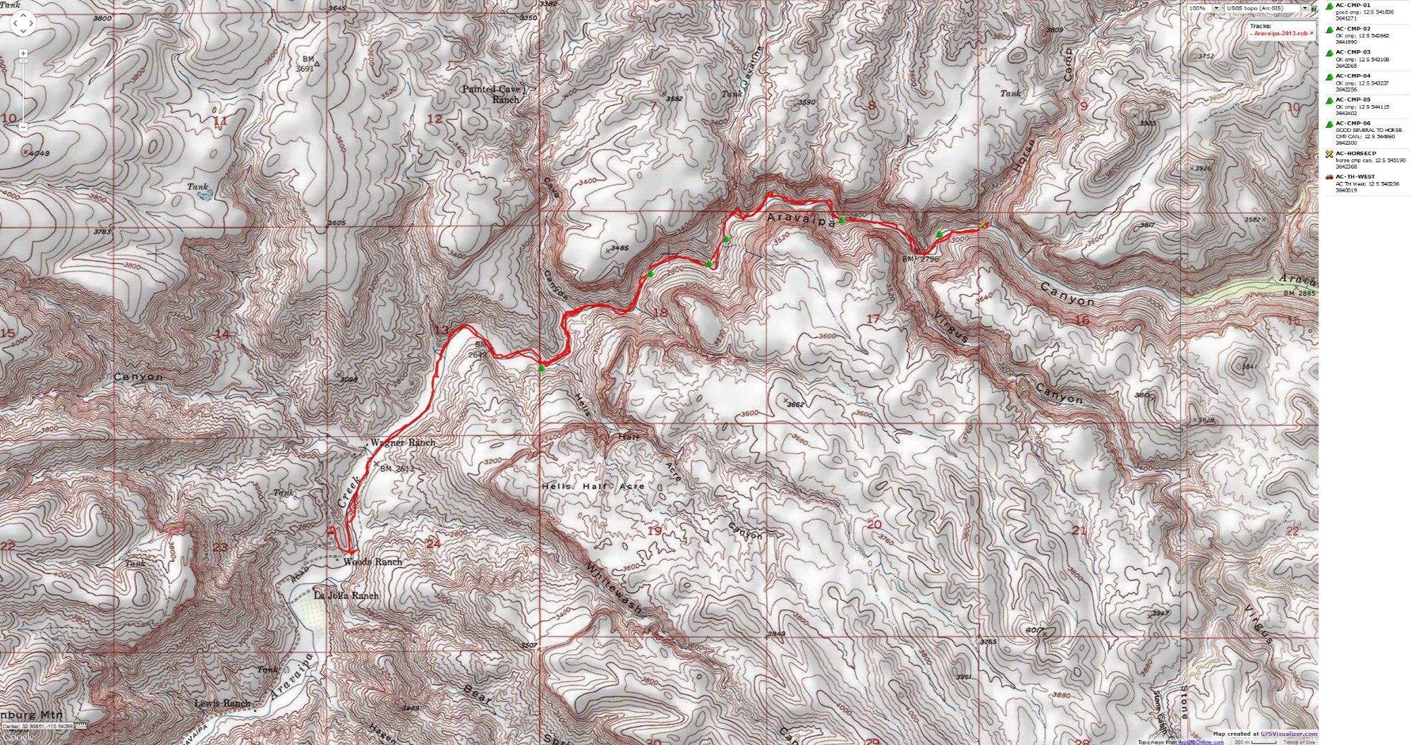
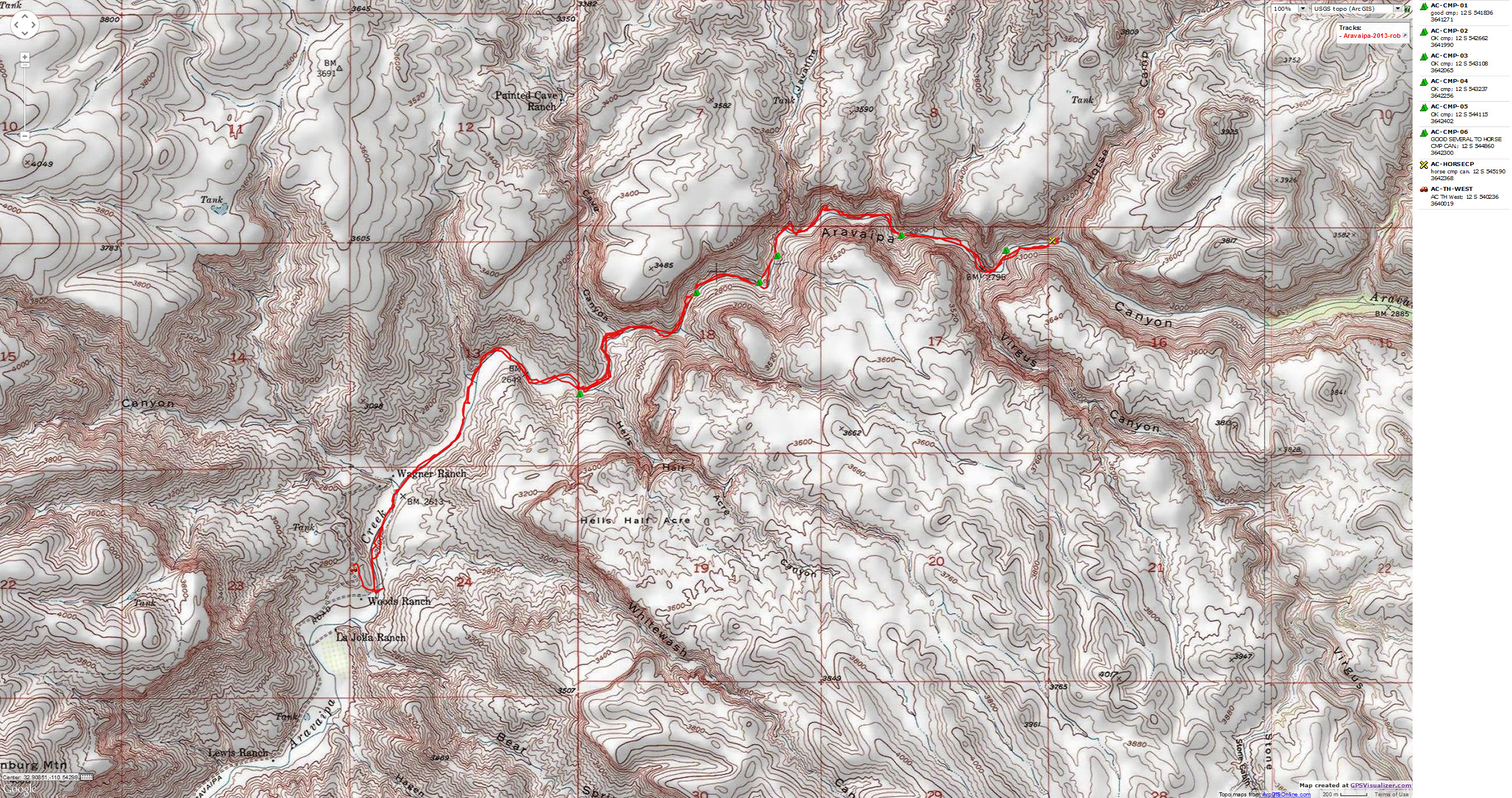
for a full-resolution map, click here. Caution - do not use this map or gps track for navigating the route.
Prelim: Brandenburg Dribble. To the West entrance of Aravaipa Canyon.
Again with the mosquitoes and blown-in sky dribble. Kathleen and I are in
our full moon camp near the Brandenburg Ranger Station, 3 miles from the West TH to Aravaipa Canyon BLM
Wilderness. We're camping without a tent and with a pile blanket rather than a sleeping bag, and I don't
get much sleep because of the bugs and the heat and the dribble. It was a hot drive down from the plateau,
taking much longer than predicted - partly because of road construction.
BLM Wilderness? One might ask, is this an oxymoron? Sort of like a tea-party
patriot? The tea-terrorists are, of course, famous for transporting all the wealth to the wealthy elite and for
saying "no!" to helping others. Like all terrorists, they take innocents hostage to force what they cannot get
via election. Very patriotic. A rump faction of the gop? The BLM is sometimes called the "Bureau of Leasing
and Mining," and one has difficulty associating the BLM with wilderness. Yet, the BLM administers a good amount
of our public land that should be instant wilderness. In Utah, wilderness volunteers have identified nearly 9
million acres of BLM land deserving of instant wilderness designation. Arizona has a bunch too. Well, the
chances of preserving the wild character of these lands is remote. As is the chance that tea-terrorists will
actually do something patriotic, like fairly tax the rich and do some nation building in the USA.
We've wondered about hiking the Aravaipa since reading something Ed Abbey, a
Ranger at Aravaipa in the '70s and famed writer of Desert Solitaire said “It is among the few places in Arizona
with a permanent stream of water and in popular estimation one of the most beautiful. I am giving away no
secrets here: Aravaipa Canyon has long been well known to hikers, campers, horsemen, and hunters from the
nearby cities.’’
 |
 |
 |
 |
 |
 |
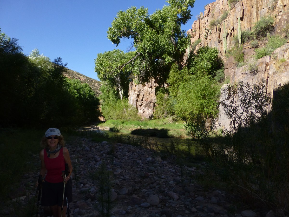
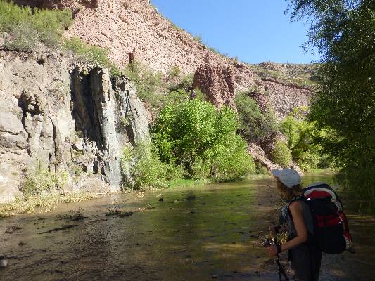
Day 1: Alluvial Aravaipa Ambling. To near Painted Cave Canyon. 3.2 miles (after a retreat
from the gorge). Camp at 2670'
Cool rain water courses off my hat and down the back of my neck, continuing
down to my neoprene socks. Kathleen and I are pressed against one of the towering volcanic walls of a narrow
gorge, yet find little shelter from the surprise morning storm. Argh. Our early morning march up Aravaipa is
cut short by a 9 a.m. thunderstorm. Wow, it's really raining, hard. We're not enchanted with the prospect of
another flood - we're already slogging through stream-side mud and milk chocolate water from a Friday flood
(2 days ago). Alluvial (made up of or found in the materials that are left by the water of rivers, floods,
etc.). Noting how the flood rearranged the flotsam and bent the willows and horsetails, we consider going
farther into the narrow gorge we just entered when the T-storm pounced.
So, we retreat to a camp we saw below and think about options. We get
comfortable and set-up camp, then nap through two storms, then while away the afternoon in Canyon time,
beneath much appreciated and stately Cottonwood trees. It's a comfy camp, on a bench above the stream,
with a ledge of bedrock just the right height for sitting and lounging, and arched over by sheltering trees.
Lovely.
We're also practicing our alum treatment of the muddy, turbid water.
We take the simple approach and start with 4/5 teaspoon of alum in our 10-liter collapsible bucket, which
is carefully hung from a stout tree root, which protrudes from a fallen tree. Stir madly for a minute or two,
then let sit for an hour. The particles of mud and silt begin to flocculate (clump together), and the swirl
at first looks like a cross section of our galaxy before the particles drop out of suspension, too heavy to
keep orbiting. Then, we line-up containers and carefully fill them in a continuous pour, so that the
flocculated materials are not disturbed until we've extracted much of the water.
See this link for a more
thorough explanation of alum treatment of turbid water - pdf file.
It's peaceful, and Canyon time stretches a bit longer. We had planned
to camp near Horse Camp Canyon, but believe we made the right decision to change plans given the erratic
weather. I'm imagining that ambling Aravaipa will be easier tomorrow.
| ||||
 |
 |
 |
 |
 |
 |
 |
 |
 |
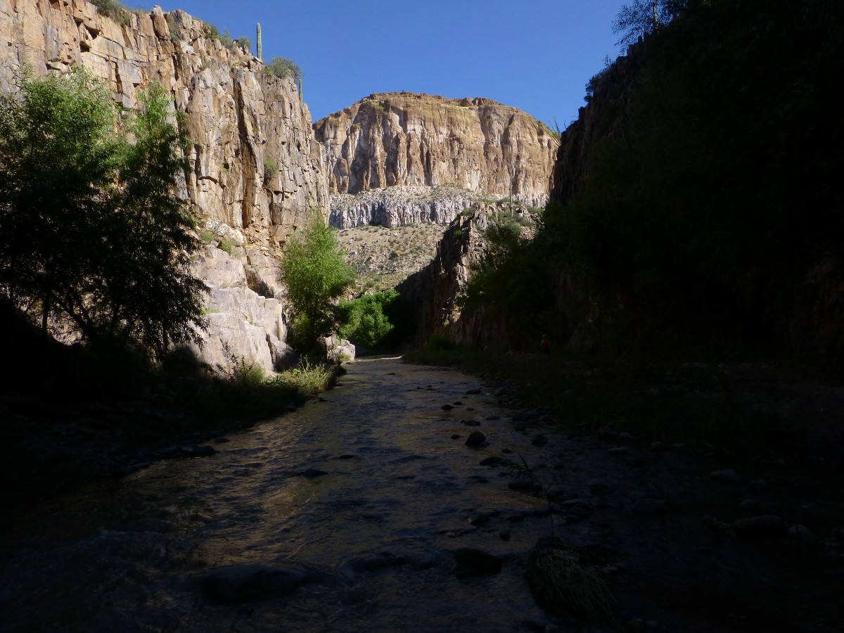
Day 2: Galloping Horse. To Horse Camp Canyon and back. 7.1 miles, ERM = 9.0. Camp at 2670'
It's a relative gallop along the broad flood-formed sand and river rock bench
near Horse Camp Canyon. We've found a few of these overland routes along the way, yet the remainder of the trek
is a bit tedious wade and occasional thrash. Stark contrasts abound. Above, buffy volcanic cliffs - like the
tuft (?) holding Ojo de Cabello (arch) in the Superstition Mountains - dotted with Saguaro and other prickly
desert plants, while we wade cool water beneath Desert Willow, Cottonwoods, and Sycamore. Glorious.
It's quite hot above, yet cooler in the riparian zone, especially in the
shade of towering walls or big trees. The stream level is lower than yesterday and the water quality is
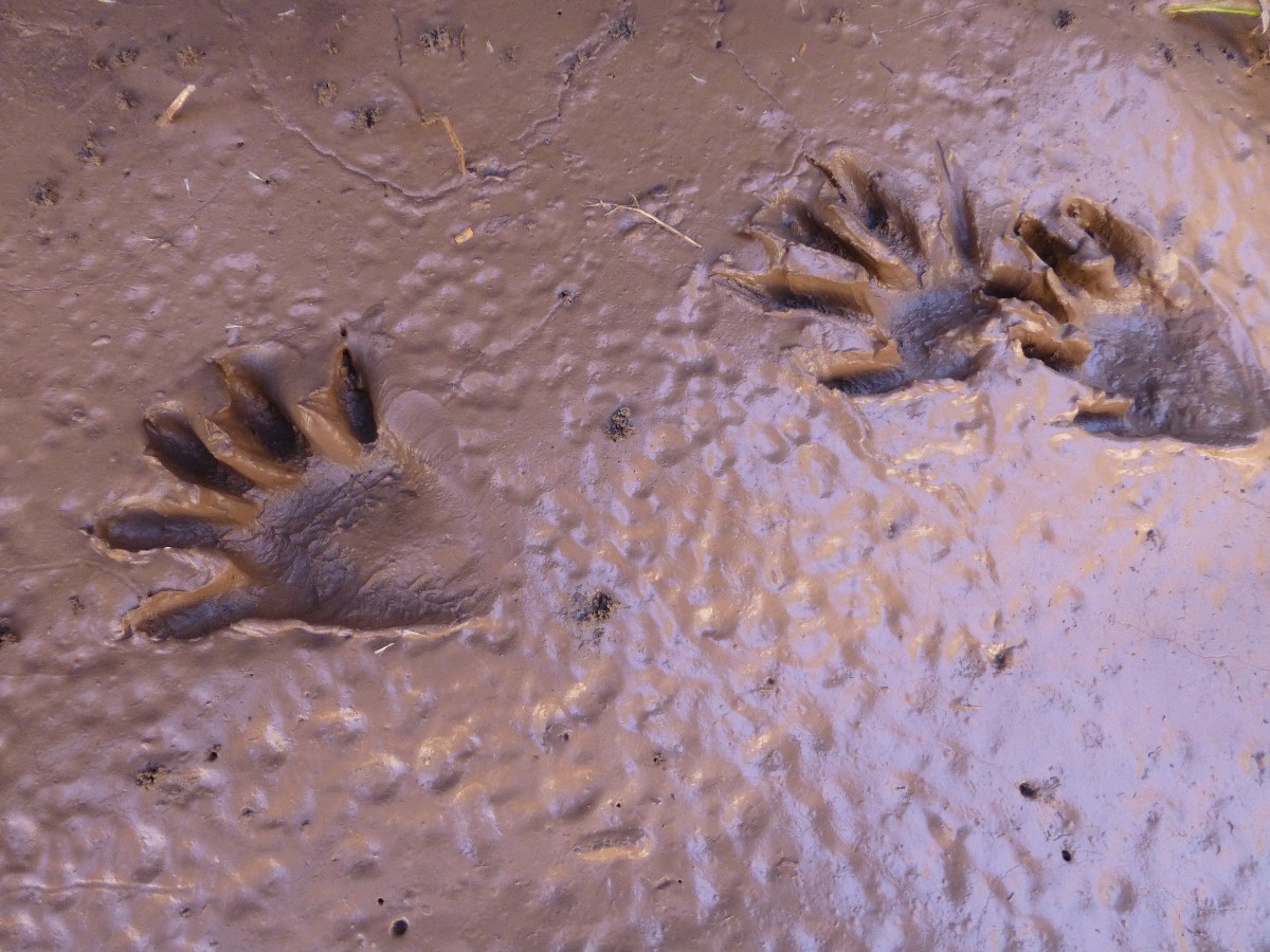
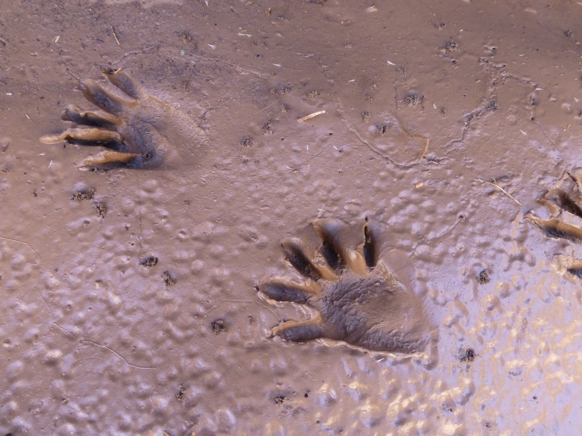
improving to murky turbid from milk chocolate shake consistency. A flock of Blue-wing Teal, a Great Blue
Heron, a White-tail Deer, a Cottontail Rabbit, and a few frogs is what we see today. And, a 6-person ACE
(American Conservation Experience, founded in Flagstaff) crew from Tucson - here to get the invasive perch
out of Horse Camp Canyon Spring.
It's five hours of hiking and two good breaks and we're back in comfy
camp to bathe on warmed polished rock before dinner and another cool night. The alum treatment has
worked well, and we have clear water for dinner and drinks.
 |
 |
 |
 |
 |
 |
 |
 |
 |
 |
 |
 |
 |
 |
 |
 |
 |
 |
 |
 |
 |
Day 3: Torrid Temps. Through the land born of fire, Phoenix. 2.2 miles (12.5 total trip
miles, ERM of about 15).
Another cerulean sky and a JND (just noticeable difference) more clarity
to Aravaipa Creek greets us this morning. Quartz intrusions sparkle in the early angle sunlight. As quiet
as an evangelical in a whore house, yet certainly of higher value to the Eaarth (Bill McKibben spelling),
an Eared Owl rows silently past as we eat our oatmeal. A few minutes later, a group of scouts clamber upstream,
as silently as a republican getting the next energy legislation written by big oil, loudly proclaiming climate
change is a myth while denying aid to starving children and storm-wrecked lower and middle income people, except
where there is all religion and no government, as in Haiti. It's insanit-tea.
We enjoy the walk out in a clearing Aravaipa Creek, beneath big shade trees.
Even with the plentiful shade, it's growing hot as we approach the West TH, now on land managed by the Nature
Conservancy. The Nature Conservancy’s 9,000-acre Aravaipa Canyon Preserve includes lands at both the East and
West ends of the canyon as well as preserve lands, mixed in with public land, on the canyon’s south rim.
As we dump cool water stored in the car over our heads, change clothes, and head
for home, we recall that Abbey said it well: “We have earned enough memories, stored enough mental-emotional
images in our heads, from one brief day in Aravaipa Canyon, to enrich the urban days to come.’’
We experience torrid temperatures as we escape from the land of congestion
and haboob, Phoenix, born of fire, and feeling like it today, and journey back to the land of P-Pines and cool
nights. It's over 100F as we pass through Phoenix.
| ||||
 |
 |
 |
 |
 |
 |
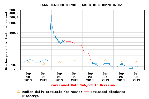
Suggestions: Of course, wear wading shoes. Shoes that give decent support (you don't want a sprained ankle in the Aravaipa). Check the USGS stream gauge prior to leaving home - flows of 10 cfs (cubic feet a second) or less present good hiking. Search for "usgs streamflow aravaipa" if the below link does not work. The USGS, another example of how tea-terrorists are right, government does nothing for us (not). Take and use two hiking poles - they provide stability and allow you to probe for possible deep holes when the water is murky. Take alum and a collapsible bucket and know how to use them (see text). You will also want a way to purify water. If using a water filter, I suggest attaching a pre-filter with replaceable filter elements. Take a good camera and a decent map. You need a permit for day hiking or camping (maximum is two nights), which you obtain from the BLM. It's best to use the BLM on-line advance permit system to reserve your spot.
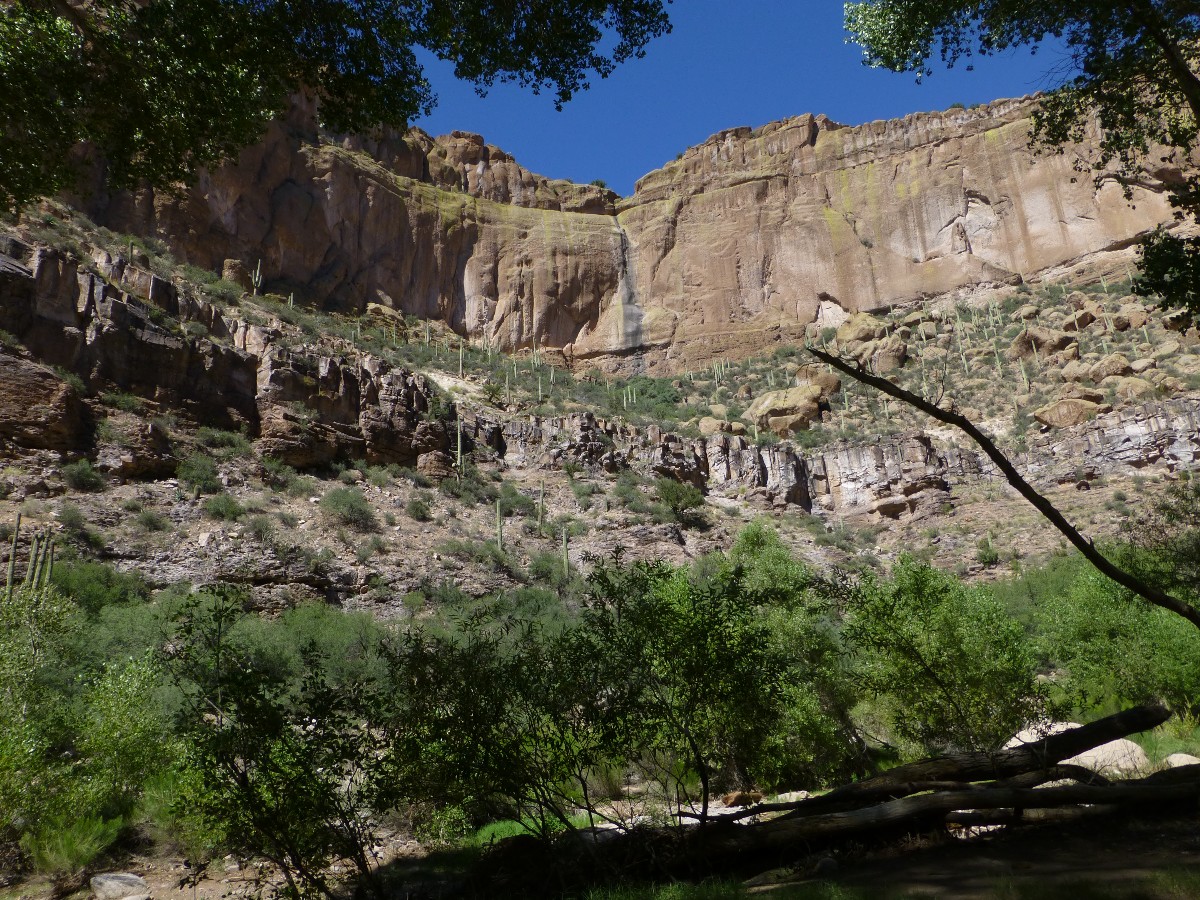
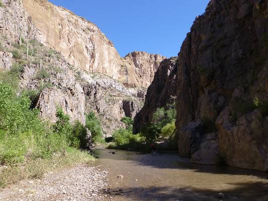
Geology (BLM): On the West end of the canyon, between Virgus and Hell's Half Acre canyons, the
creek cuts through a dark red porphyry (rock containing crystal structures). This rock is considered part
of the Pinal Schist group which originated in the Precambrian Era. It is older and harder that the other
formations and may be why the stream has cut a narrower channel in this area.
The cavernous, buff-and-brown colored walls you see as you walk through
the canyon from the east are composed of Hell Hole Conglomerate, which extends to Parson's Canyon on the
south wall and Hell Hole Canyon on the north wall. From here and continuing west, the Galiuro Volcanics
begin and shape Paisano Canyon, and from Booger to Horse Camp Canyon. This mid-portion of the canyon
displays impressive red, orange, and gray walls with columns towering over 1,000 feet.
 |
 |
 |
| ||||
for a full-resolution map, click here. Caution - do not use this map or gps track for navigating the route.
BLM site about Aravaipa Canyon Wilderness - includes how to reserve a hike.
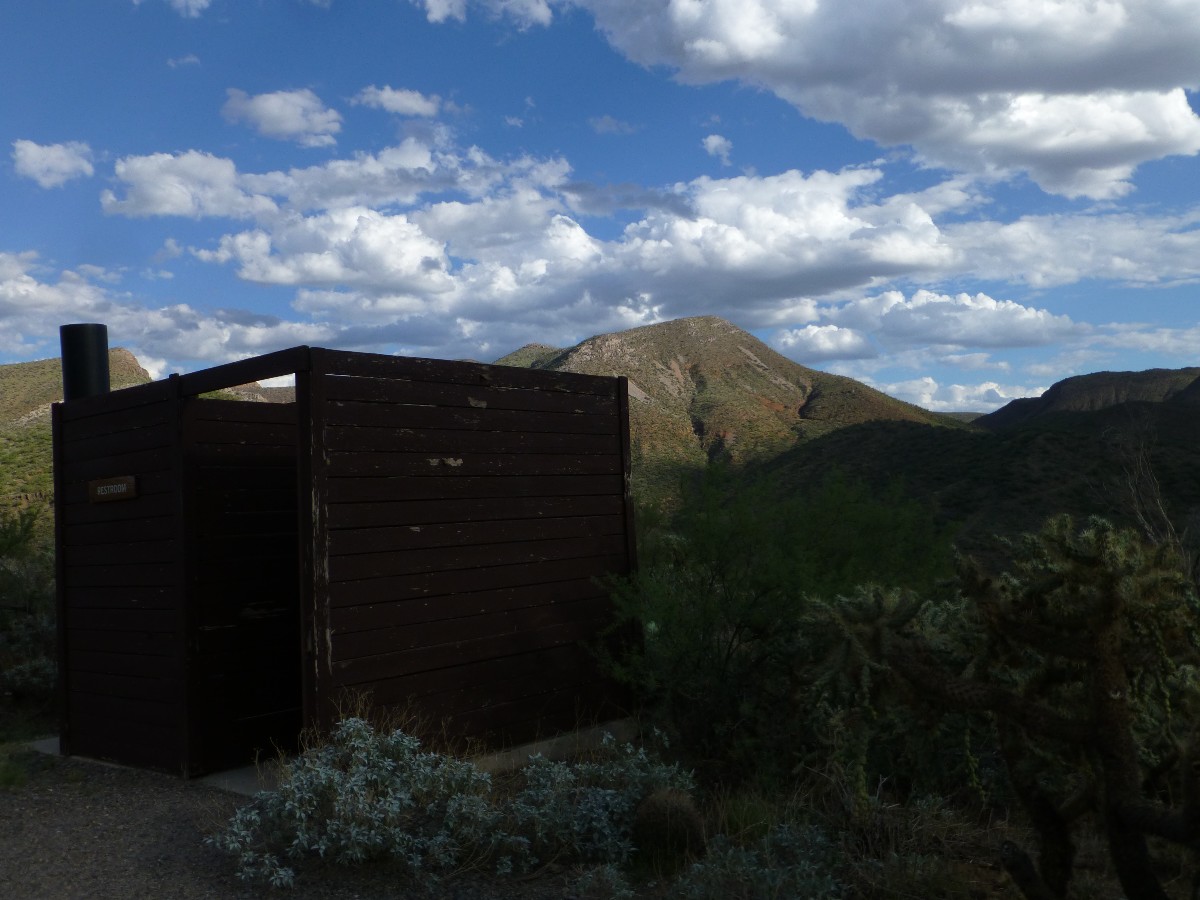
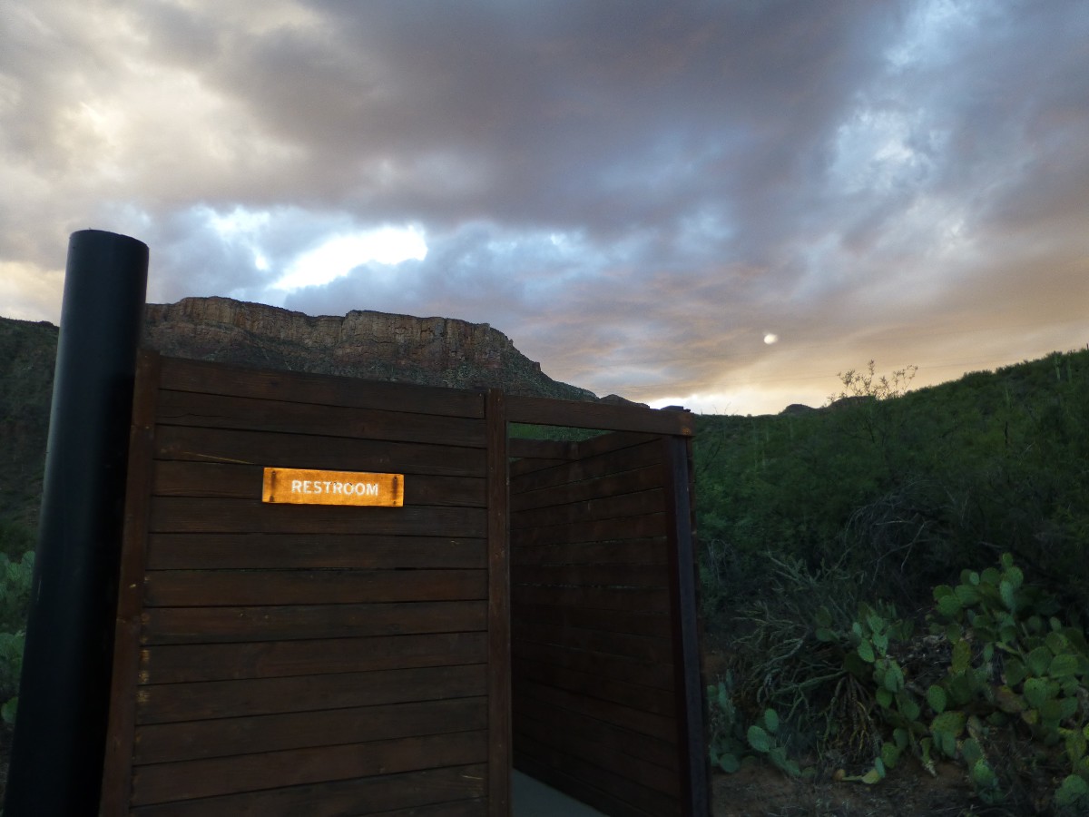
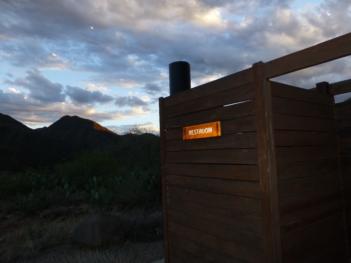
Scenic Toilets of Inner Earth.
Wealth inequality in America, thanks to tea-terrorists for making this more and more unequal
Superstition Wilderness Backpack: "T" is for Tortoise (2010)
Organ Pipe Cactus NM, you Ajo: A Sonoran Solstice Saturnalia, 2008
More Truth Than Joke:
| ||||
| ||||
Face it, church and state are no longer separated. Religion can’t be off limits anymore. It’s not just time
to expose the crazy in the GOP, it’s time to expose the fact that personal belief isn’t sacrosanct. Evangelical
Christianity is a curse to America. It’s time to say so. It's a shameful thing to be crazy on purpose. The
government lockout/shutdown (October 1 - 13, 2013) is the naked face of nutty religion exposed. Certainly,
like all gop activities, this hurt the middle class and poor a lot more than the wealthy elite. How come
airports were open while veterans went without? $$$$ + crazy
Believers have been folded into one deadly destructive, economy-threatening
entity by the Republicans. It’s time to stop being any less forcefully truth-telling about religion than we
are about politics. They are one and the same. The shutdown is a slow motion religious extremist attack on
America being carried out by those living in the netherworld of apocalyptic fantasy.
| ||||
| ||||
| ||||
| ||||
| ||||
 |
 |
 |
 |
 |
 |
 |
 |
 |
Link to below Onion article (click here).
Scientists: 'Look, One-Third Of The Human Race Has To Die For Civilization To Be Sustainable, So How Do We Want
To Do This?'
26 Jan. 2012 | ISSUE 48•04
Scientists say at least 2 billion dead bodies will be burned and converted into fossil
fuels.
WASHINGTON—Saying there's no way around it at this point, a coalition of scientists
announced Thursday that one-third of the world population must die to prevent wide-scale depletion of the planet's
resources—and that humankind needs to figure out immediately how it wants to go about killing off more than 2 billion
members of its species.
Representing multiple fields of study, including ecology, agriculture, biology,
and economics, the researchers told reporters that facts are facts: Humanity has far exceeded its sustainable
population size, so either one in three humans can choose how they want to die themselves, or there can be some
sort of government-mandated liquidation program—but either way, people have to start dying.
And soon, the scientists confirmed.
"I'm just going to level with you—the earth's carrying capacity will no longer
be able to keep up with population growth, and civilization will end unless large swaths of human beings are killed,
so the question is: How do we want to do this?" Cambridge University ecologist Dr. Edwin Peters said. "Do we want to
give everyone a number and implement a death lottery system? Incinerate the nation's children? Kill off an entire
race of people? Give everyone a shotgun and let them sort it out themselves?"
"Completely up to you," he added, explaining he and his colleagues were "open to
whatever." "Unfortunately, we are well past the point of controlling overpopulation through education, birth control,
and the empowerment of women. In fact, we should probably kill 300 million women right off the bat."
Because the world's population may double by the end of the century, an outcome
that would lead to a considerable decrease in the availability of food, land, and water, researchers said that,
bottom line, it would be helpful if a lot of people chose to die willingly, the advantage being that these volunteers
could decide for themselves whether they wished to die slowly, quickly, painfully, or peacefully.
Additionally, the scientists noted that in order to stop the destruction of global
environmental systems in heavily populated regions, there's no avoiding the reality that half the world's progeny will
have to be sterilized.
"The longer we wait, the higher the number of people who will have to die, so we
might as well just get it over with," said Dr. Chelsea Klepper, head of agricultural studies at Purdue University,
and the leading proponent of a worldwide death day in which 2.3 billion people would kill themselves en masse at the
exact same time. "At this point, it's merely a question of coordination. If we can get the populations of New York
City, Los Angeles, Beijing, India, Europe, and Latin America to voluntarily off themselves at 6 p.m. EST on June 1,
we can kill the people that need to be killed and the planet can finally start renewing its resources."
Thus far, humanity has been presented with a great variety of death options,
among them, poisoning the world's water supply with cadmium, picking one person per household to be killed in the
privacy of his or her home, mass beheadings, and gathering 2.3 billion people all in one place and obliterating
them with a single hydrogen bomb.
Sources confirmed that if a death solution is not in place by Mar. 31, the U.N.,
in the interest of preserving the human race, will mobilize its peacekeeping forces and gun down as many people as
necessary.
"I don't care how it happens, but a ton of Africans have to go, because by 2025,
there's no way that continent will be able to feed itself," said Dr. Henry Craig of the Population Research Institute.
"And by my estimation, three babies have to die for every septuagenarian, because their longer life expectancy means
babies have the potential to release far more greenhouse gases going forward."
While the majority of the world's populace reportedly understands this is the only
option left to save civilization, not all members of the human race are eager to die.
"I personally would rather live, but taking the long view, I can see how ensuring
the survival of humanity is best," said Norwich, CT resident and father of three Jason Atkins. "I guess if we were to
do it over again, it would make sense to do a better job conserving the earth's finite resources."
"Hopefully, the people who remain on the planet will use the mass slaughter of their
friends and loved ones as an incentive to be more responsible going forward," he added.
|
Wild Vagabond Main |
Trip Report Index  |
Caveat  |
|---|


