|
|---|
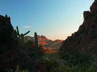
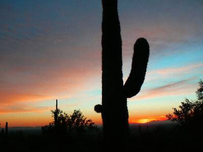
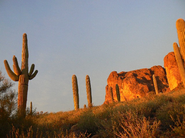
Peralta Canyon sunset
(Click the image)
|
|---|
|
|---|
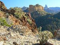
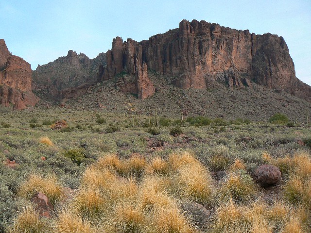
Battleship Mtn. from North
(Click the image for a full-size view)
|
|---|
|
|
|---|
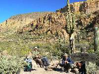
Gavin and Mason at Boulder Creek
(Click the image)
|
|---|
|
Every walk of life falls under the sway of the Testicular Imperative: Either you have the world by them, or it has you. Colin Fletcher, The Complete Walker IV
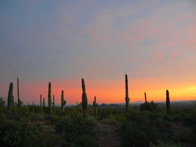
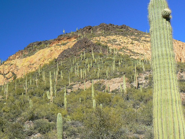
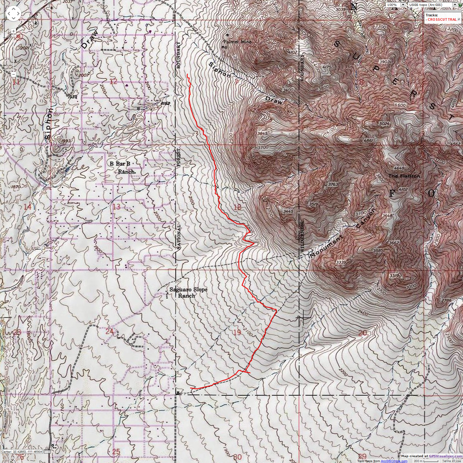
Day 1: Crosscut Trail. (8 miles; 9 ERM - Energy Required Miles; East Broadway to near Dutchman State Park, Trail 58). After driving down from the 19F of the Mogollon Rim, to the 50F of Happy Valley, we drive to the end of East Broadway in Apache Junction and begin hiking the rocks of Crosscut Trail. That awful Bruce Grubbs book said it was 4.1 miles to Dutchman's State Park, but after more than 4 miles, no park is in sight, not even a junction. A vivid burnt orange tinge paints the flanks of the Superstition Mountains as we roll far beneath Flatiron.
The tequila sunset purples and reds bloom delightful as we finish rock crunching in the dark. It's very dark out here nearing new moon surrounded by black basalt. Walking the skree and sand skirts of the bajada, we roll through the dusk and into dark thirty. A bajada ("ba-HA-da") is a single apron of sediment, made by alluvial fans, that covers the foot of the whole range.
Day 2: Weaver's Roundabout and beatout:
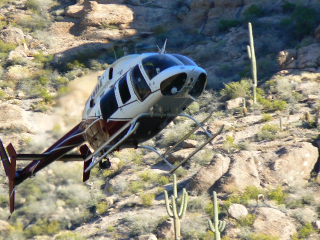
(13.5 miles; 23 ERM: 2750' elevation gain; Bluff Spring 235 -Terrapin 234 - Dutchman 104 - Peralta 102). The annoying helicopter is within 100' of us as we hike up the narrow polished-base water haven below Bluff Spring. What is this representative of bushco doing, hovering so low, tearing the spirit of this wilderness asunder. Finally, this giant mosquito rotors away. Helicopter harassment. A report to the FAA? To this same group who has for four decades emptily promised to limit fuel-wasting, natural quiet destroying overflights of that grandest of canyons? Right, and bushco is helping to repair the wealth disparity in America. And, I can see a purple pig flying supersonic over Weaver's Needle too.
It's a good year to be backpacking - with water flowing in many of the drainages. Last year at this time, nearly all the drainages were dry.
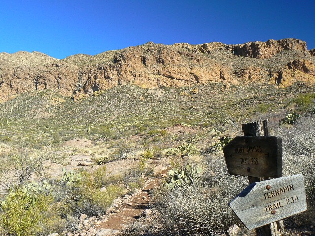
Up over Bluff Saddle and Terrapin Pass we roll, through most complex country. Delightful, quiet. Natural quiet surrounds us. The trail deteriorates and the klingon brush bloom as we descend toward the junction with the Dutchman Trail. During lunch, we see a group of backpackers who rave about the 'water works' just around the corner.
Realizing that the Bruce Grubbs' estimate is totally unrealistic, we cut short our leisurely lunch and head over the low bump below Blacktop Mesa (site of Spanish hieroglyphs) and to the junction with the Peralta Trail 102.
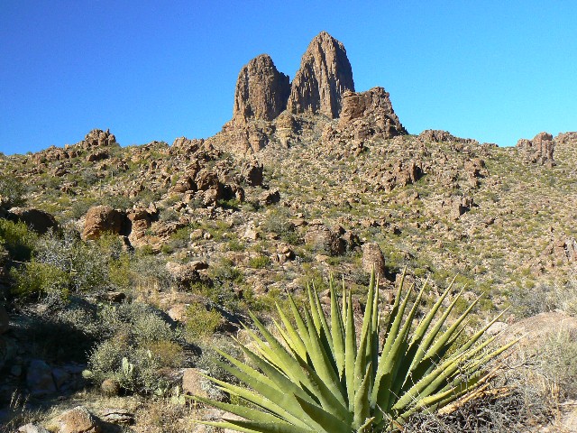
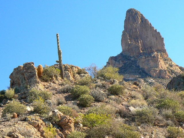
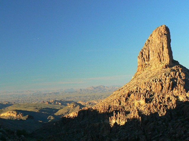
Beginning the lovely hike up Boulder Canyon, the views of Weaver's Needle evolve. We are hiking completely around the Needle. Continuing quiet, we see a threesome of youngsters hiking Black Top Mesa, with plans to climb the Needle tomorrow. Their wide grins match the wide open toothyness of this stark country. Passing Pinon Camp - apparently named for a few remaining Pinon Pine (many have died of drought) - the air cools dramatically and the warmth of ol' sol is obscured by that elongated spiny ridge. However, the group has warned of "standing in line to hike" in Peralta Canyon, clogged with tourists.
And so, it came to pass. When we reached Fremont Pass, separating Boulder from Peralta Canyons, the people density exploded.
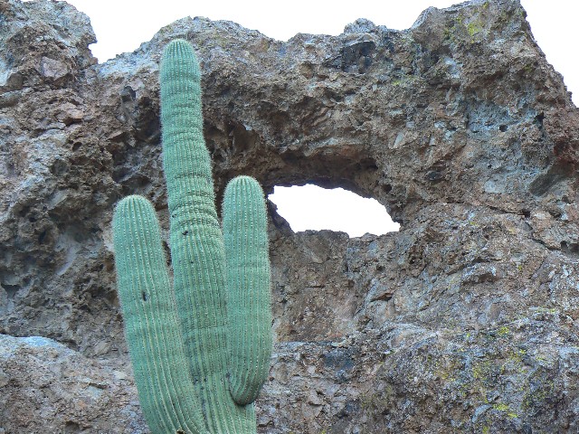
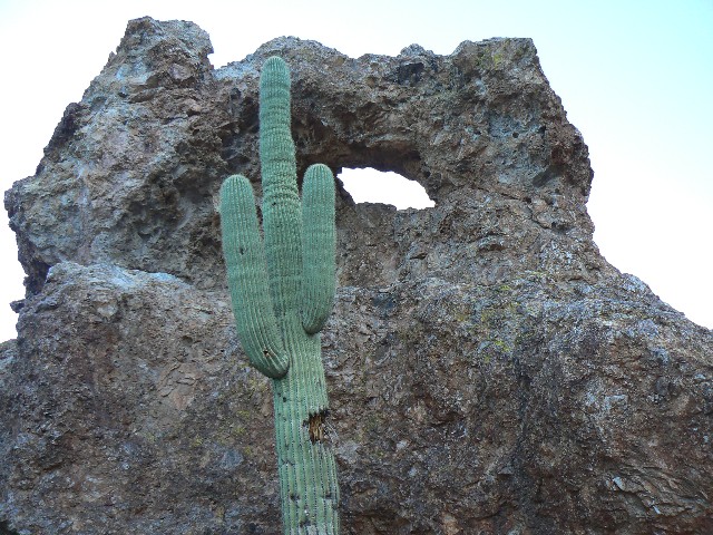
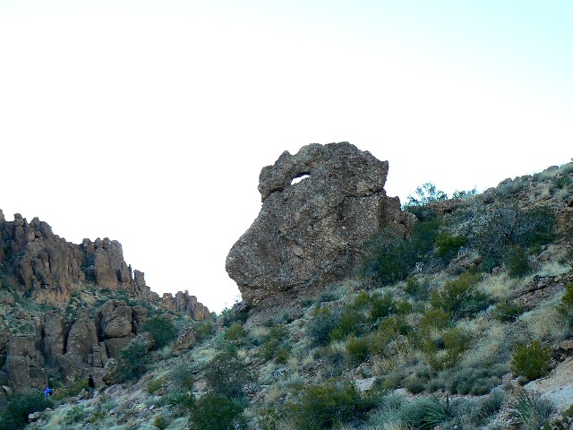
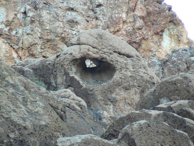
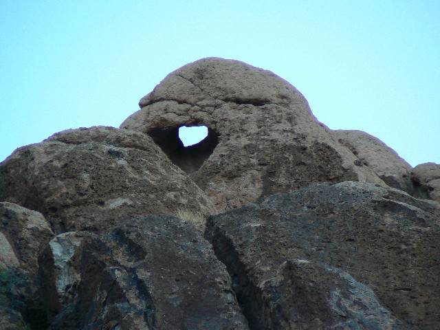
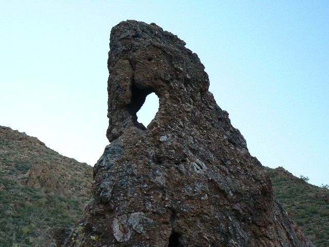
Just over the pass, I spot Peralta Popup Arch (my name). A delightful archlet in a stand-alone boulder. Kathleen heads down Peralta because of waning light - I can tell she does not want to repeat dark-thirty hiking. Yet, I see three more archlets, and have only enough light to get poor photos of two of them. See the photo set.
It's after sunset when we reach the TH. Damn that Bruce Grubbs and his wildly inaccurate estimates of distance and elevation. I later found FS data to (nearly exactly) corroborate my tracked distance and elevation change data - with the grubby data being the outlier. I suggest you not purchase or use "Hiking Arizona's Superstition & Mazatzal Country" (A Falcon Guide) by Grubbs.
Day 3: Boulder 103 North, La Barge to Boulder Creek:
(9 miles; 15 ERM: 1750' elevation gain; from Canyon Lake on the Boulder 103 to La Barge then Boulder Creeks). Kathleen and I are hovering near the trail junction (103 - 236) contemplating what to do next, when we see the big puppy with two hikers and two additional hikers trailing a bit behind. They hop boulders across well-named Boulder Creek to the junction. It's lovely Lacona (a rescue puppy with his servants) who are headed for First Water TH, over the 236. Next, Mason and Gavin roll in for a lunch snack and we strike up a conversation. Gavin has sprained his ankle on the boulder hop and needs some drugs from Kathleen. They've also left their car keys for the shuttle car in the Peralta (starting TH) car. I comment "you mean that tan Honda with the four flat tires?" (We had parked next to this car at the Canyon dry-dock.) "Yes - and what!?" questioned Gavin. I continue "Well, we did park next to your car and I could tell it had been there all night from the early dew running off the trim." Yikes - and this is when we found out about the keys. No, the tires were OK.
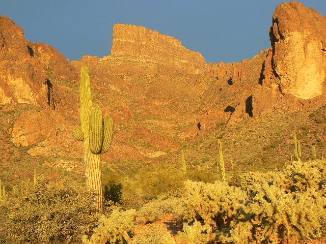
We started the day from the nearly dry-docked Canyon "Lake," which serves as a reminder of how come we need population reduction, now, to survive. We climb into increasing winds to views of La Barge Creek and Battleship Mountain. Lovely country awaits, we see. Blondish Battleship is reminiscent of Palomino Mtn., lair of the Ojo de Caballo Arch. See the 2006 Superstition Wilderness exploratory report. After rolling down to where the trail crosses La Barge, we lounge on solar heated rocks and enjoy the gentle tinkling of fresh water while eating lunch.
We hike briefly along La Barge, then over a low saddle (replete with an abandoned mine) and to Boulder Creek, also flowing gently. Here is where the story for today started.
We accompany Gavin and Mason back to the TH and give them a ride to Peralta TH. Dedicated educators, it's a delight to talk with them. It's sunset and with everyone rushing home from Peralta, I wonder if the air cleaner is choking in dust.
Day 4: Second Water 236 to Boulder 103:
(7 miles; 12 ERM: 1200' elevation gain; First Water TH to the Boulder 103). Reclining on a sofa or polished rock, I orient the smooth side of the apple into the wind to delay imbedding of sand. We're again at the Boulder Creek Trail junction with the 236, where we were yesterday, yet this time arriving from the 236. I hoped the back of the sofa would block the wind, but it shifted as soon as I got off my boots.
From First Water, the trail winds smoothly past the junction with the trail to Black Mesa, then between the cleavage of two low mounds of dark basalt, where it borders the ephemeral trickle from Second Water Spring down to Boulder Creek.
As you can see from the tracks on the map, we've linked together some of the Superstition bits. Rolling easily across the playa-like flats back to the TH, I enjoy the sun and relish in introspections about sublime superstitious traveling in the Superstitions.
Colin Fletcher provided the quotes for this report. Colin
died this year (2007), after sparking the desire and providing the tools to just go hike. Here's to you Colin.
GPS tracks and maps
Because this area is so widely known, I am providing
GPS tracks and maps:
Wait for the topo maps to form under the route.
You can change the scale (left side of map)
and relocate the center of the map (use the "hand") as you wish. Use the drop-down
box in the upper right to select other maps (e.g., aerial). Enjoy.


|
|---|
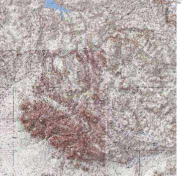
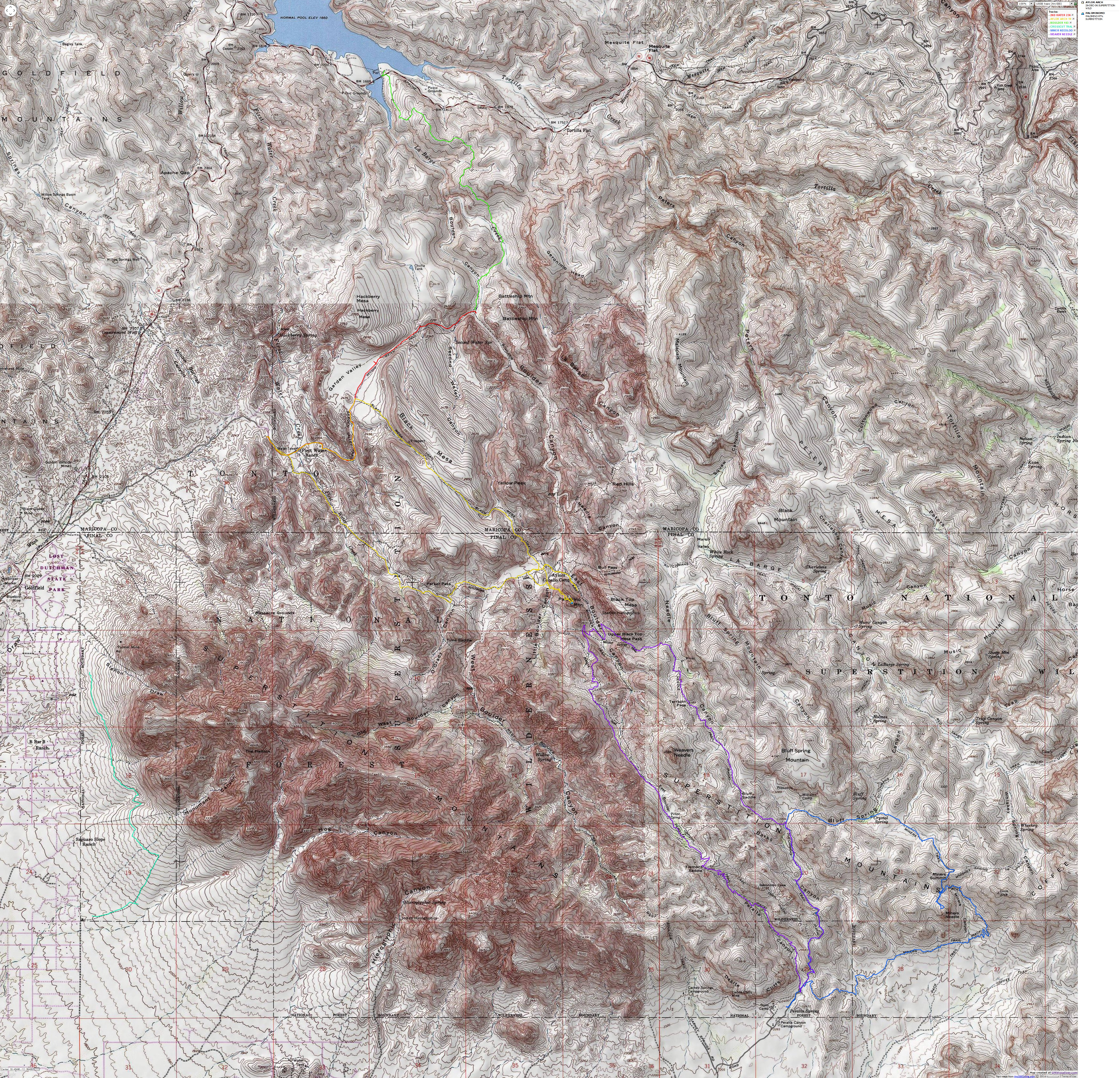
Map - Superstition Wilderness: All Hikes 2007
(Click the image to see the map)
|
|---|
|
If you want to view a full-resolution map, click here. Caution - do not use this map or gps track for
navigating the route.
And - here is each track individually. Some "extra" area hikes
can be seen in some of these maps. Enjoy.
|
|---|
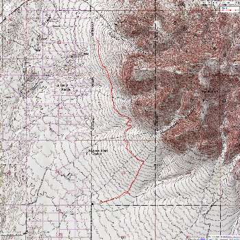
Map - Superstition Wilderness: Crosscut; 8 miles
(Click the image to see the map)
|
|---|
|
|
|---|
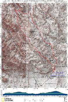
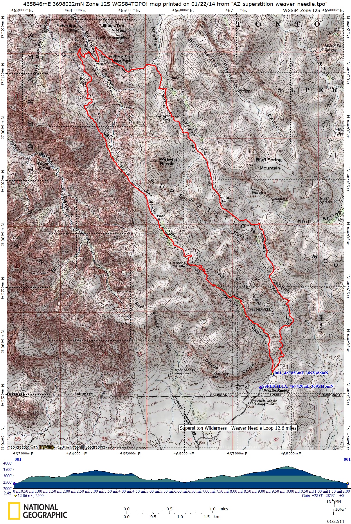
Map - superstition: weaver needle loop; 12.5 miles
(Click the image to see the map)
|
|---|
|
|
|---|
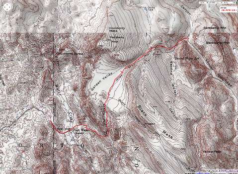
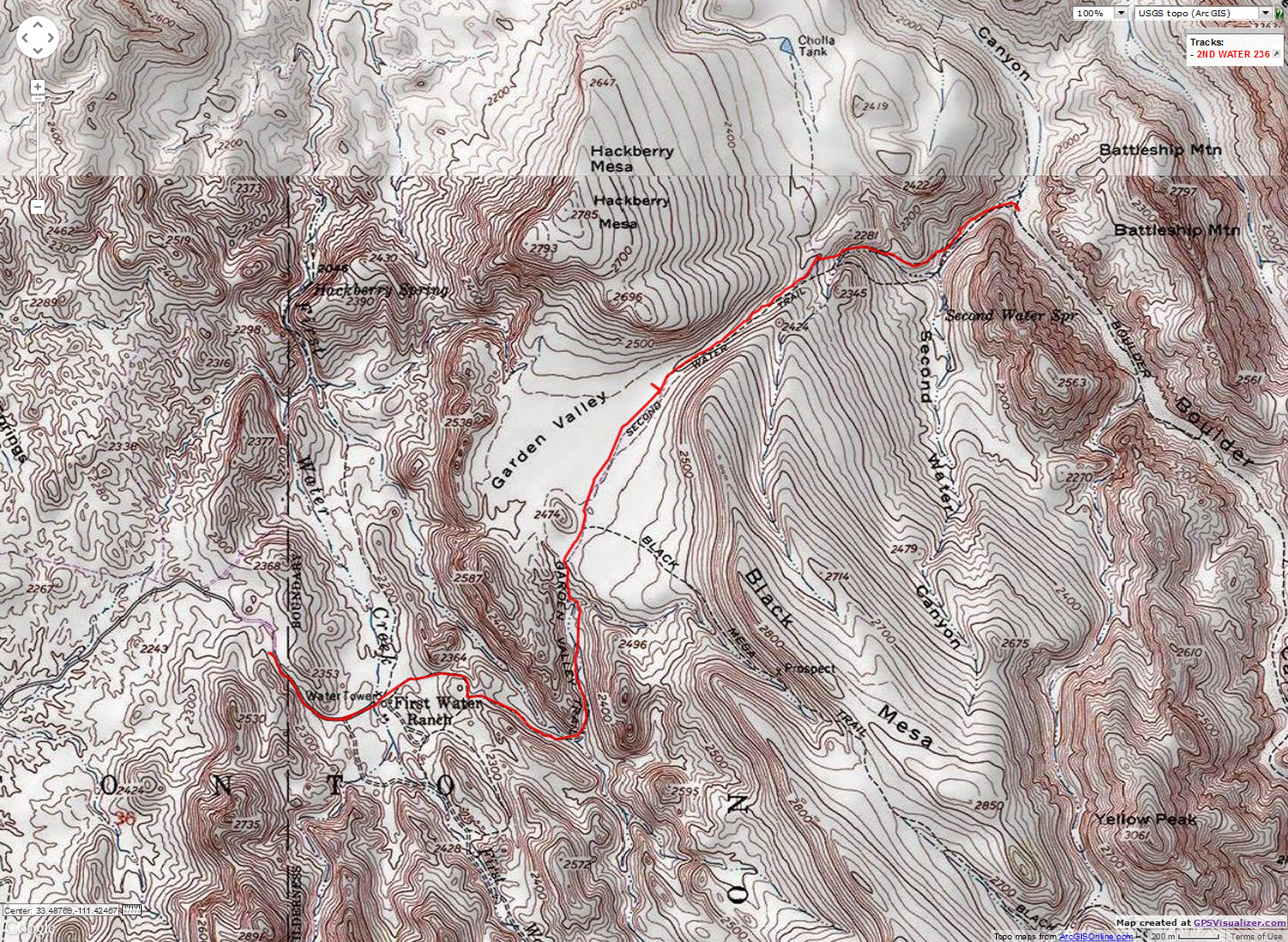
Map - Superstition Wilderness: Second Water 236 to Boulder 103; 7 miles
(Click the image to see the map)
|
|---|
|
-Arch-13mi.jpg)
|
|---|
Map - Superstition Wilderness: Eye of the Horse (Ojo de Caballo) Arch; 13 miles
(Click the image to see the map)
|
|---|
|
|
|---|
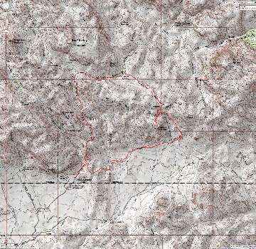
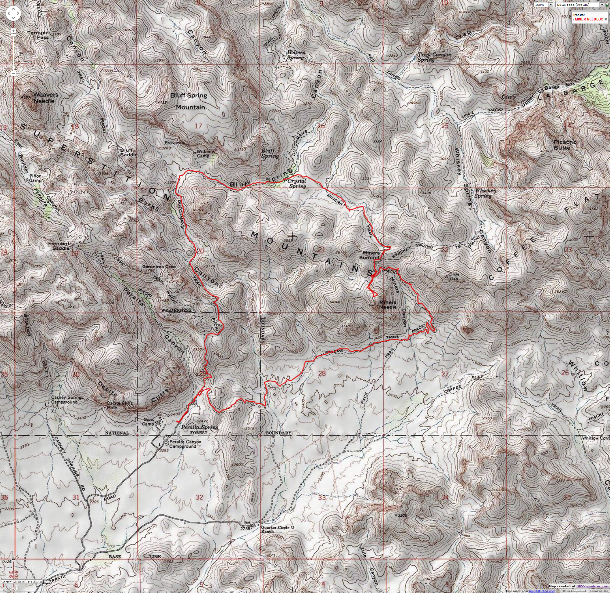
Map - Superstition Wilderness: Miners Needle Loop from Paralta TH; 10 miles
(Click the image to see the map)
|
|---|
|
Previous Report
The 2006
Super Superstition Wilderness adventure.
|
|
|
|---|
Waving "so long" from the Super Superstition Wilderness
(Click the image to see a full-size version.)
|
|---|
|
|


-Arch-13mi.jpg)

