|
|---|
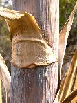
Purple Agave
(Click the image)
|
|---|
|
|---|
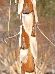
Baby with a blanket
(Click the image for a full-size view)
|
|---|
|
|
|---|
Agave parchment
(Click the image)
|
|---|
|
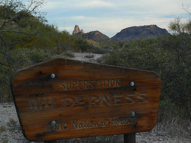
The wilderness once offered men a plausible
way of life, now it functions as a psychiatric refuge. Soon there will be no
wilderness. Soon there will be no place to go. Then the madness becomes universal.
And the universe goes mad. Doc Sarvis in The Monkey Wrench Gang
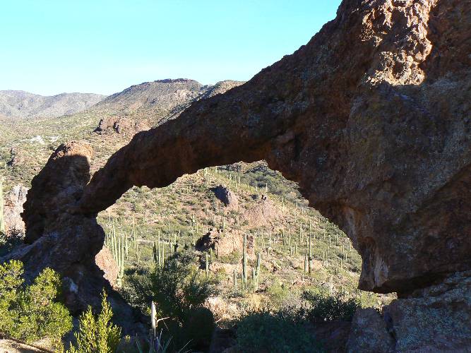
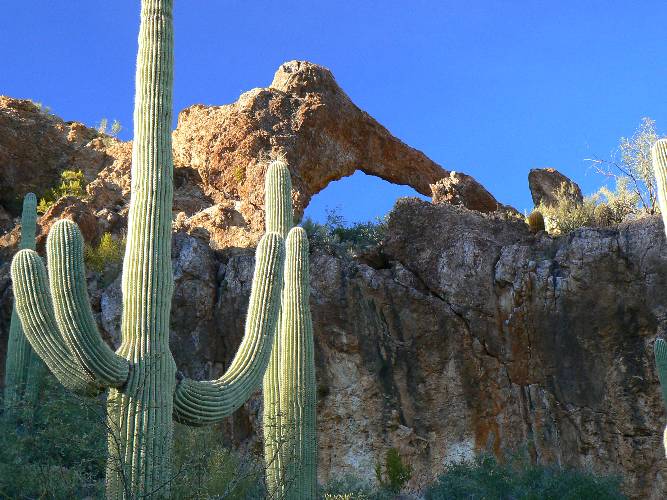
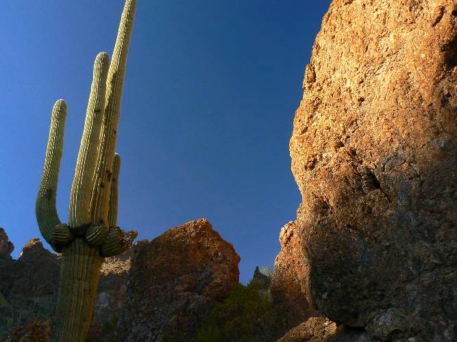
Day 1: Elephantine Crosscut. (Drive, Hewitt Canyon Elephant Arch, Crosscut Trail for sunset celebration).
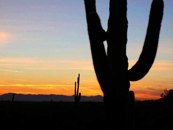
We left Northern Arizona, leaving temperatures in the 20's and 30's for the 50's and 60's
of the happy valley lowlands. After checking in at the Apache Trails Motel in Apache Junction,
we went in search of Hewitt Arch. We found and photographed it, then went looking for First
Water TH, from which we hope to start our quest for the Eye of the Horse (Ojo de Caballo;
Aylors) Arch, supposedly in a tall fin of Palomino Mountain. We found the road to the TH,
then pulled in at Crosscut TH rather than bump the washboards out to First Water.
Good choice, because a brief hike in the sunset among the Saguaros, Ocotillos, Chollas,
Palo Verde (green stick), and other desert dwellers allowed us to soak in the sunset.
Wandering the volcanics, we were accompanied by howling coyotes and chittering quail -
delightful.
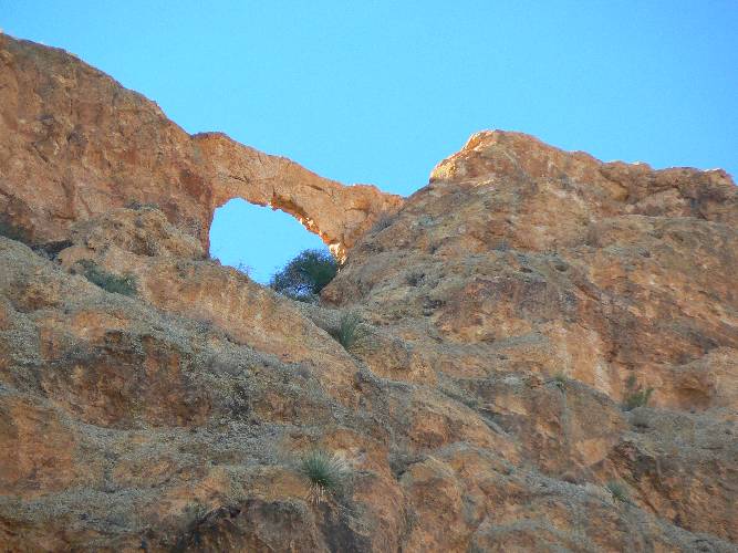
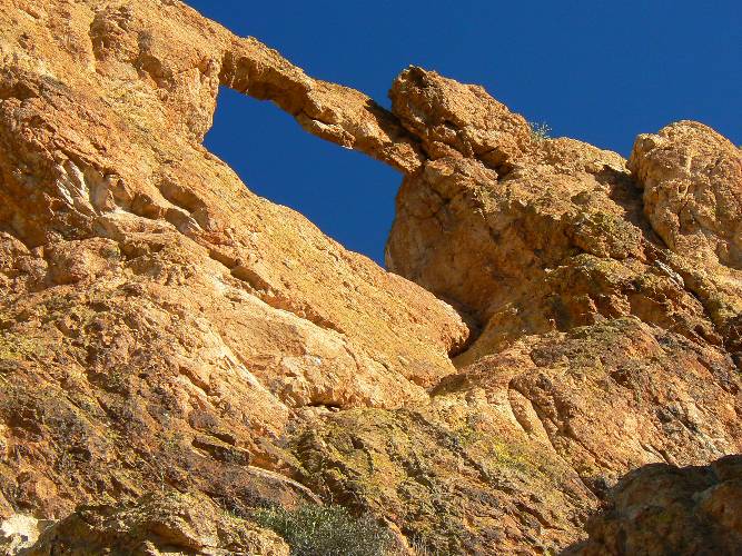
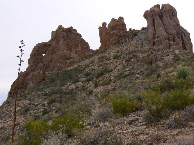
Day 2: Eye of the Horse (Ojo de Caballo) Arch + gription:
(Dutchman Trail #104 and Black Mesa Trail #241; climb Palomino Mtn.; 13 miles).
The arch is also called Aylor's Arch, after some prospectors who placed illegal camps
in the wilderness near what is called Aylor's Caballo Camp and a cabin, also in the
wilderness, at another location. Because of this, I prefer the name Eye of the Horse Arch.
We start off on the Dutchmans Trail (#104) and hike the
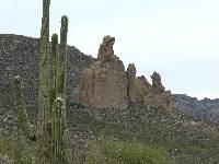
diversity of igneous rocks to the junction with the Black Mesa Trail. Looking at Palomino
Mountain, which consists of blonde volcanic fins, we see no clue as to the location of the
arch. So, we walk past Boulder Trail and curve around to the East, then South, to the old
site of Aylor's Caballo Camp, now a flat spot in the trail. A little farther on the trail
we see the arch, looking like the Eye of the Horse and several hundred feet up a nearly
sheer wall. Wow, how does one approach this spectacle, we asked. Returning to just East
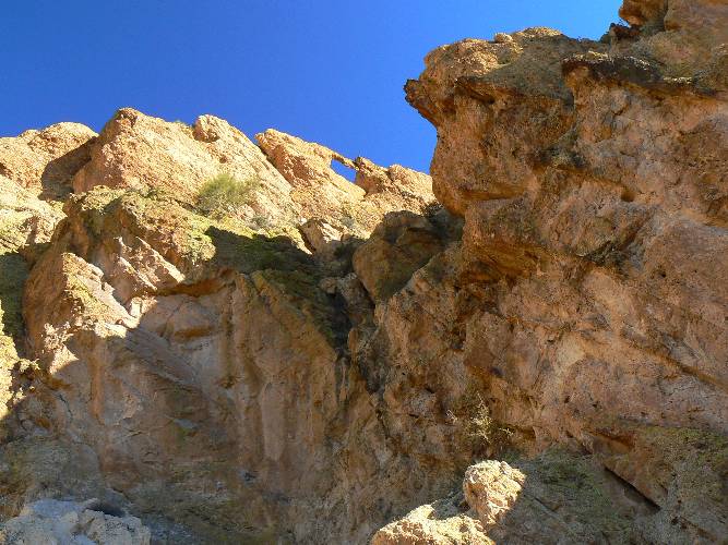
of the Black Mesa Trail junction, we started toward Palomino Mountain, over a very low
saddle, through aptly-named Boulder Creek, and up a ravine between two (middle and West)
of the massive fins comprising Palomino. Good gription is rare on sections of pulverized
basaltic ball bearings. Along the way, the Eye of the Horse looks down on us as we scramble
past old prospects at the base of the horse's jaw. At times it's a bit of a grunt with
some nasty, clingy, thorny brush. Proceeding toward the East fin, which houses the arch,
one must gription walk along the top edge of a fin for about twenty feet, something not
for those challenged by grand exposure. (I do not recommend you do this.) Then,
you arrive at the base of the East fin, and scamper down a bit to a point below the arch.
Good photos and a slide down the ravine and back down to the trail.
Then, we are off to the long foot-numbing return via
Black Mesa and Second Water Trails. Lovely Saguaros, cholla, spectacular views of
Weavers Needle to the SE accompany us into twilight. The trail is often, very often
rock-strewn, making for tedious travel. Our GPS trail mileage is radically longer
than stated in the Bruce Gubbs (Falcon Guide) guidebook, and of course much more
accurate. The Elvira Special at Elvira's Restaurant (!muy exelante'!) was well-deserved
- oh the chili con carne, the enchilada, the beans, the tostada, the taco, the salsa,
oh my. And, it's an easy sleep with visions of Ojo de Caballo dancing in my head.
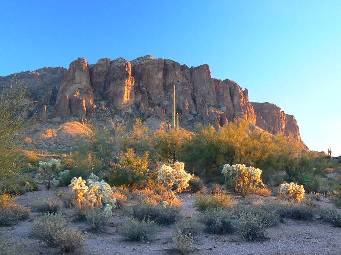
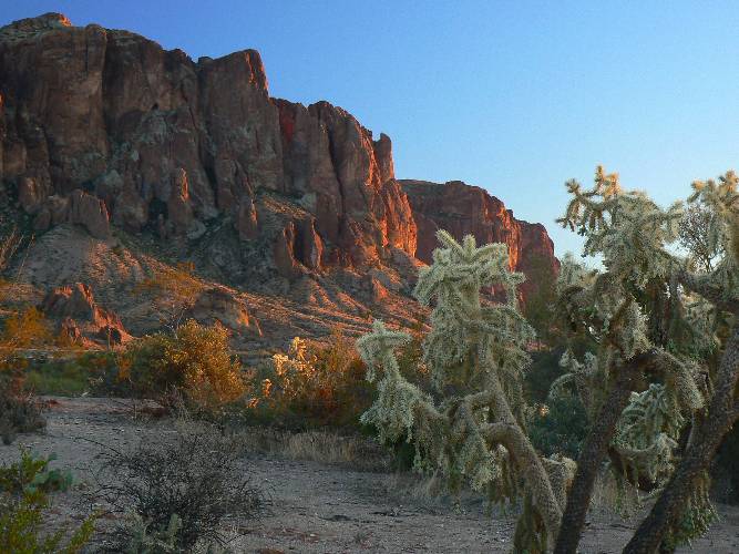
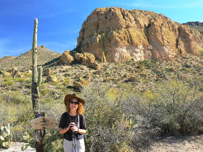
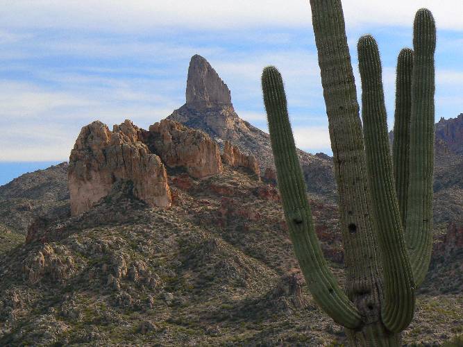
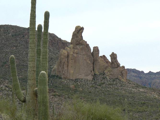
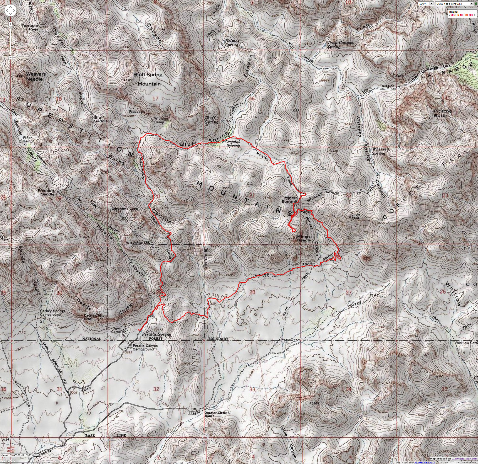
Day 3: Miners Needle Loop - from Paralta TH.:
Eight miles of tarmac East of Apache Junction (Hwy 60), then another eight on dirt North
to the Paralta TH, passing through another of thousands of cookie-cutter over-developments
of happy valley. Industrial propagation on crack cocaine? The size of the local ward houses
add exclamation marks to water scarcity, aquifer collapse, air pollution, congestion,
sprawl, poor education funding, global warming, the end of nature.
Growth for the sake of growth is the ideology of the
cancer cell. Edward Abbey, "Money, Et Cetera" in A Voice Crying in the Wilderness.
Like at First Water TH, there are layers to the TH,
overflow and overflow - what does this mean? It's cloudy yet soon shirt-sleeve weather
as we wander the Dutchman Trail (yes, again on the #104) into the delightful upper regions
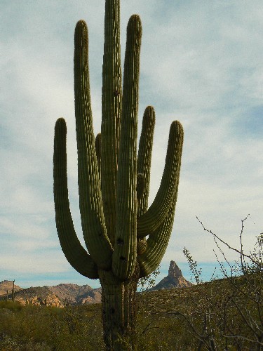
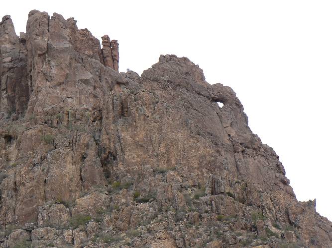
of Coffee Flat. After about 2.5 miles, we enjoy our first view of the arch in the South
fin of Miners Needle. Along the way, look for the "baby holding a blanket" formation near
the Coffee Flat trail junction. Continuing up to Miners Pass at about 4.5 miles, one can
go out on the low ridge to below the Needle - launch for this short trip from the 'obvious'
switchback below the pass.
Over Miners Pass we encounter Junipers, amazing. In
the drainage near the location of the phantom Crystal Spring (no water to be seen on
the whole loop), we see a Cottonwood, looking quite out of place in this deep desert.
Left at the Bluff Spring Trail and again at the Terrapin Trail, looping back to the TH,
we muse at distant views of the Needle, Weavers Needle too. The day is gray and
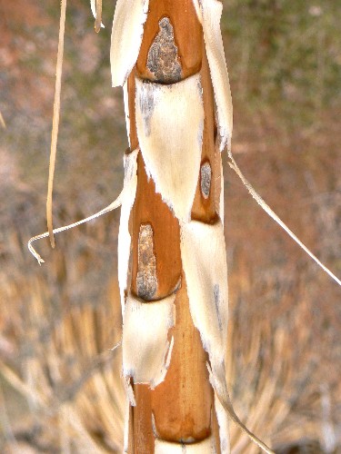
photographic offerings are not encouraging. Yet, I greatly enjoy the purple stalks
of dilapidated Century Plants with their contrasting beige scales.
Again, the Bruce Michael Kelsey-type Grubbs guidebook is way off in mileage and elevation.
Certainly, one expects some variation - but 100% error? 40% error? The mileage for
this loop was listed as 6.9 and turned out to be 10.2, conservatively. Elevation
change was listed as 850' and in fact was 1800'. I do not suggest you purchase
"Hiking Arizona's Superstition & Mazatzal Country" (A Falcon Guide) by Grubbs.
Our return to the North was complicated by a rolling snow
storm. Big rigs were stuck on the interstate and we waited over an hour while snow
accumulated but the road was cleared. Now, to reminisce about the Super Superstition
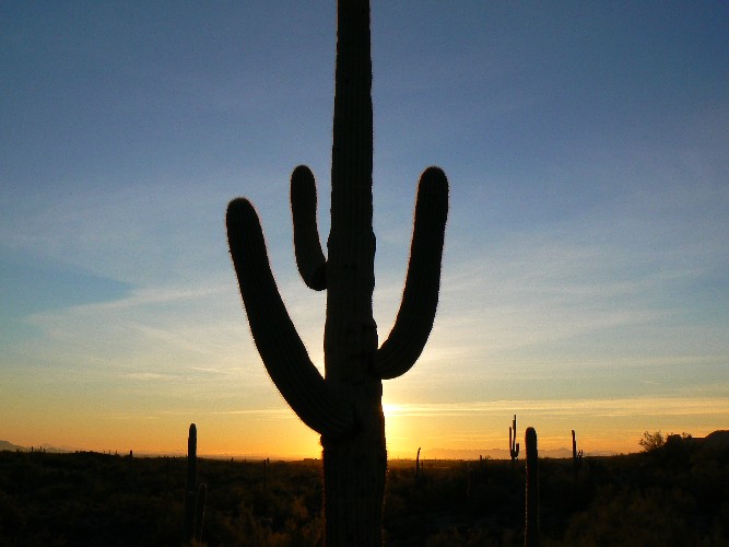
Wilderness by gazing at the photos, and thinking about that Spring adventure.
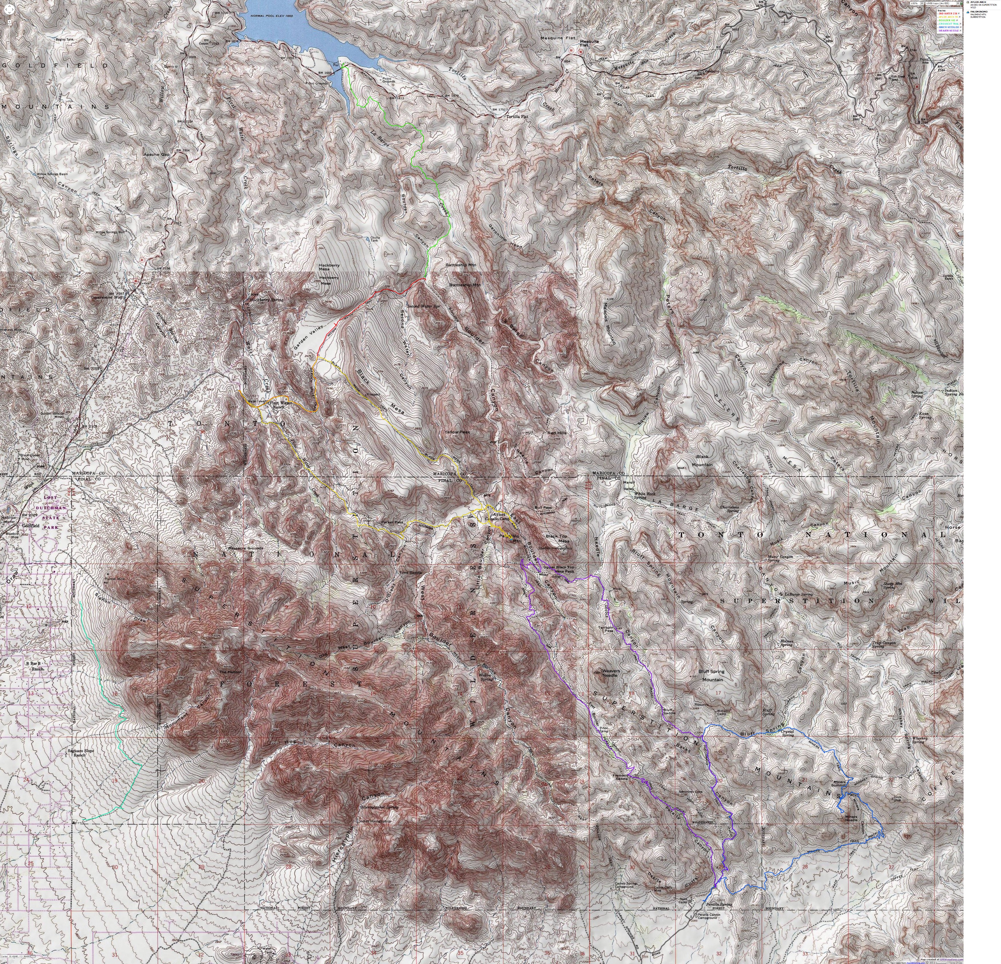
Because this area is so widely known, I am providing
maps:


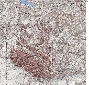
|
|---|
Map - Superstition Wilderness: All Hikes 2007
(Click the image to see the map)
|
|---|
|
If you want to view a full-resolution map, click here. Caution - do not use this map or gps track for
navigating the route.
-Arch-13mi.jpg)
|
|---|
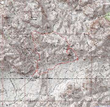
Map - Superstition Wilderness: Eye of the Horse (Ojo de Caballo) Arch; 13 miles
(Click the image to see the map)
|
|---|
|
|
|---|
Map - Superstition Wilderness: Miners Needle Loop from Paralta TH; 10 miles
(Click the image to see the map)
|
|---|
|
Approximate UTM coordinates include (WGS 84):
Eye of the Horse (Ojo de Caballo) Arch:
First Water TH: 12 S 458807 E; 3704637 N
Caballo Camp Arch View: 12 S 463960E; 3702032N
Route over low saddle - start: 12 S 463157E; 3702305N
Eye of the Horse Arch: 12 S 463825E; 3701934N
Miners Needle Arch Loop:
Peralta TH: 12 S 467463 E; 3695114 N
Miners Needle Arch: 12 S 470106 E; 3696701 N
|


-Arch-13mi.jpg)

