|
|---|
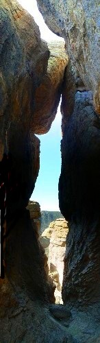
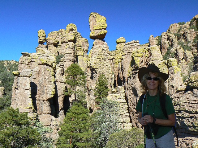
spires of Echo Park
(Click the image for a full-size view)
|
|---|
|
|---|
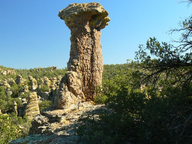
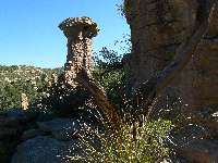
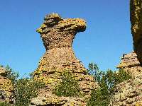
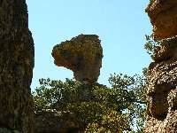
Thor's Hammer
(Click the image for a full-size view)
|
|---|
|
|
|---|
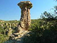
Thor's Hammer
(Click the image for a full-size view)
|
|---|
|
|
|---|
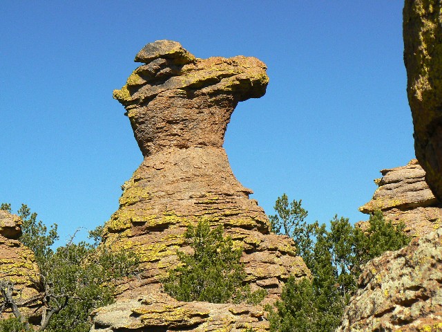
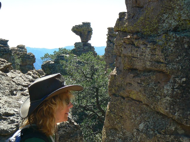
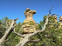
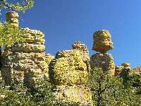
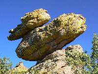
Camel Head
(Click the image for a full-size view)
|
|---|
|
|
|---|
Camel Head
(Click the image for a full-size view)
|
|---|
|
|
|---|
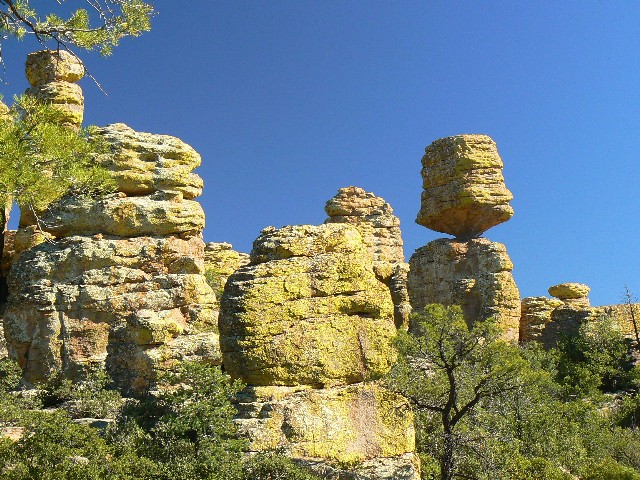
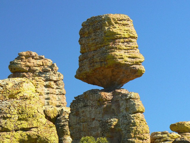
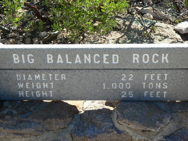
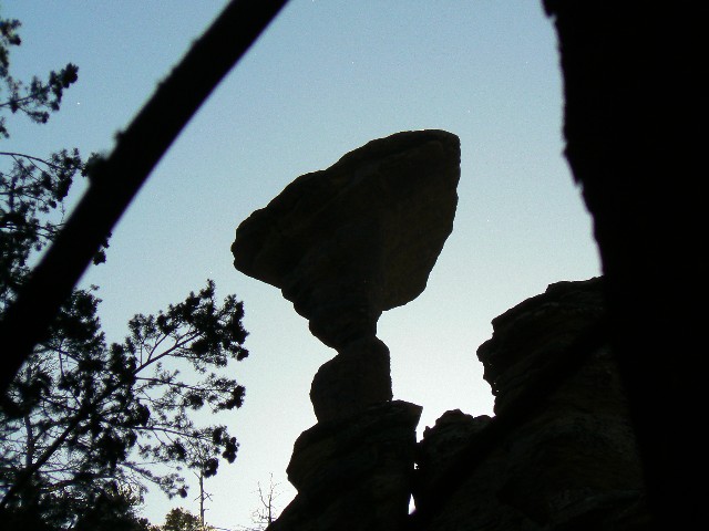
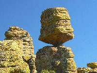
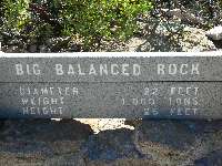
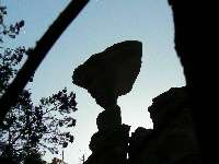
Big Balanced Rock
(Click the image for a full-size view)
|
|---|
|
10-23-2008: Driver: Driving to the NM, by way of
Payson and other "back" roads. Arrived at the NM about 4:30p after 350 miles or so of
traveling. (This was the 22nd), now back to the real Day 1:
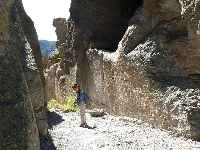
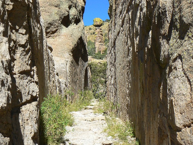
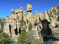
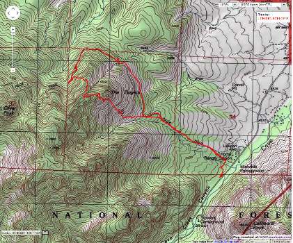
Day 1: Hoodoo Hurrah. Chiricahua Big Loop, :
9 miles; 16 ERM.
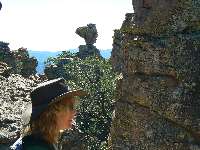
From under two blankets and a down comforter, I'm
writing these notes. It's been a long exploration day in the gorgeous hoodoos created
by many layers of cemented volcanic ash - The Turkey Eruption - then, the layers were
eroded into the spires, mushrooms, balanced rocks, and other features of the NM.
Delightful. We began at Echo Canyon TH, near 7,000', and wandered the grotto and wall
street on our way to diversely treed Echo Park. A cavalcade. Then, Rhyolite Canyon,
leading to Deming and the Heart of the Rocks loop. All along the way we hike lovely
grades constructed by the CCC (Civilian Conservation Corp, the "Tree Army" of the last
great depression) - thanks due to the CCC.
Soon, I imagine we will have another CCC. Now, we
await the
rendition of bushco, to work as 'go-fors' for the next version of the CCC, initiated with
the present great depression, thrust upon us by the regulation-gutting, asleep at the switch,
elitist wealthy of the uber wealthiest-enhancing g.w. bushco and his minions, to be followed
by their rendition to Iraq for truth-telling after many years of public service. This
service will be a tiny portion of repayment for all the harm done to our society, the
constitution, the people, our national identity, our standing in the word, the global and
local environments, harm galore. Lift that rock dick head, tote that bucket rummy, cut
that brush bushco, clean that outhouse condie, keep working, there's work until dark,
working, working hard - even on Saturday and Sunday. Placement of these war criminals and
global gluttons in no way diminishes the fine work of trail crews, because bushco serve as
the lowliest of servants to the crews in imperfect atonement and redress of sins too
numerous to catalogue. Of course, their health care coverage and wealth will be
transferred to someone deserving, they will be under constant surveillance, they will
have no constitutional rights, and they will listen (at high decibels) to evangelical
christians reciting the names of all those killed and maimed in the optional Iraq war,
and the names of the many millions of Americans they transported (trickle down) out of
the middle class and into some shade of poverty. Live video streaming of all bushco
activities will be provided by the repulsican national committee on the faux news channel.


|
|---|
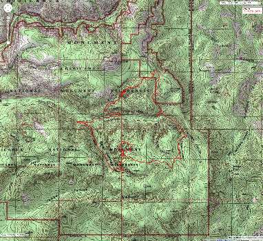
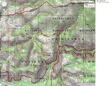
Map - Chiricahua: Big Loop; 9 miles
(Click the image to see the map)
|
|---|
|
|
|---|
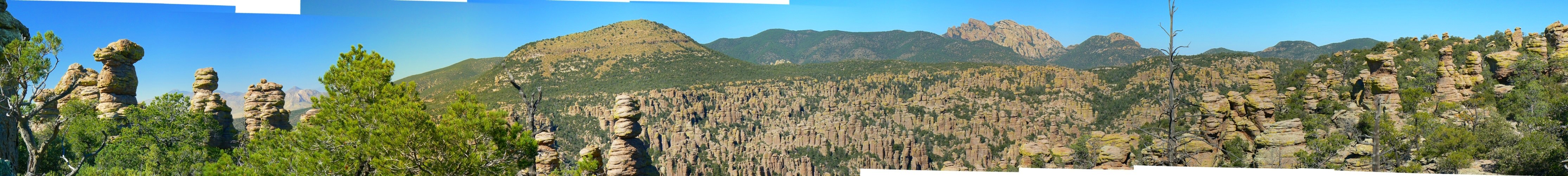
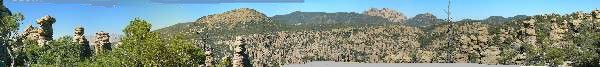
Heart of the Rocks Pano - L-R: Dos Cabezas to Sugar
Loaf to Cochise Head
(Image is very wide - scroll to view it all (4459 x 500; 872kb) - Click
the image for the full-size image)
|
|---|
|
|
|---|
Big Balanced Rock
(Click the image for a full-size view)
|
|---|
|
|---|
Big Balanced Rock
(Click the image)
|
|---|
|
|
|---|
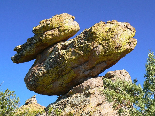
Duck on a rock
(Click the image for a full-size view)
|
|---|
|
|
|---|
Old Maid
(Click the image)
|
|---|
|
|
|---|
Old Maid, Young Maid
(Click the image for a full-size view)
|
|---|
|
|
|---|
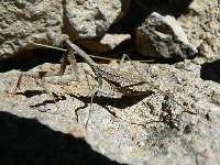
rock-color mantis
(Click the image for a full-size view)
|
|---|
|
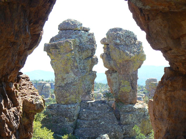
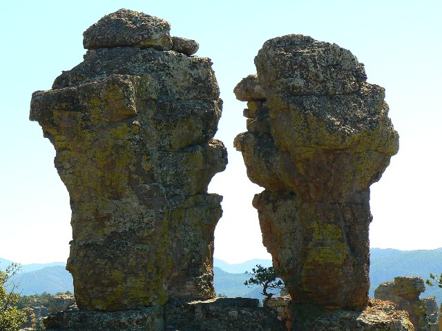
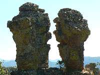
Camel Head, Thor's Hammer, Kissing Rocks,
Duck on a Rock, Punch and Judy, et al. - nicely crafted and decorated with neon lichens.
Exquisite. Back from the Heart of the Rocks loop, I see the giant Balanced Rock from
the junction. Impossible. An incomparable variety and assortment of shapes and vegetation
exist on this sky island. Unique combinations seen nowhere else. Amazing. A pano from
(Dos Cabezas?) to Sugar Loaf to Cochise Head, and hoodoos among and between. Now, we are
hiking from Balanced Rock to Mushroom Rock, another feature high on the ridge, unbelievably
perched. The Ed Riggs Trail leads us finally back to the car park. A glorious hike,
definitely worth a future repeat. (See the map.) We enjoy a sun shower and dark collapses.
We wear shorts during the day and fleece at night. Happily, the CG is generally safe
from RVs. Hoorah!

|
|---|
Punch and Judy
(Click the image)
|
|---|
|
|---|
Punch and Judy
(Click the image for a full-size view)
|
|---|
|
|
|---|
Mushroom Rock
(Click the image)
|
|---|
|
There are - More photos below narrative.
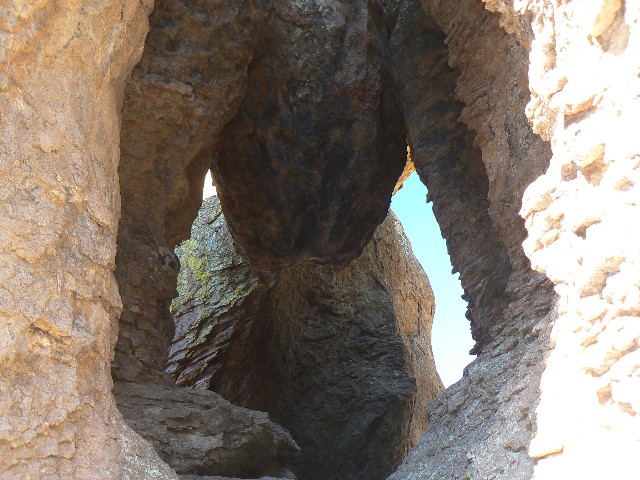
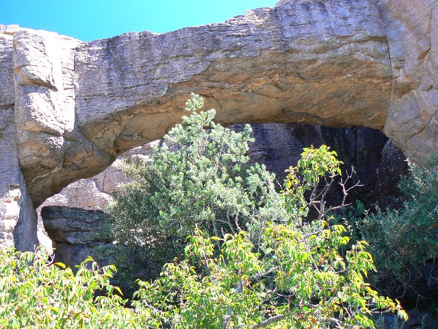
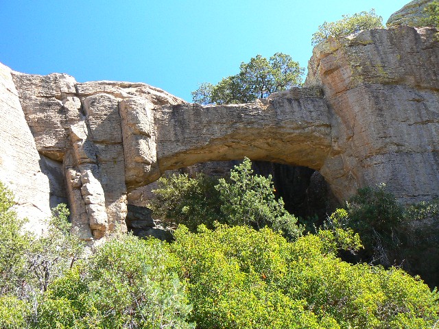
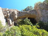
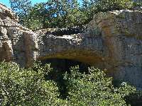
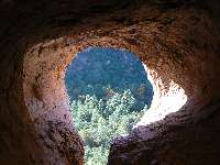
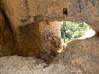
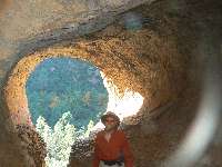
Day 2: Cheerio! Chiricahua Natural Bridge. :
5 miles; 7 ERM.
We've toured up North Bonito Canyon, over a bump,
and down into Picket Canyon and now gaze at the diverse assortment of trees and terrain,
when, pop, there's the bulky NB just across the narrow canyon. It's possible to contour
around to the NB because we're nearly at the head of the canyon - albeit not much is gained
in photographic potential because the NB is crowded by pines and other foliage. It's a
delightful hike with or without the NB. We're back early for a shower and to finally check
in at the visitor center. It has been warm today - shorts all day until 4:30p.
|
|---|
Map - Chiricahua: Chiricahua Natural Bridge; 5 miles
(Click the image to see the map)
|
|---|
|

|
|---|
Chiricahua NB
(Click the image for a full-size view)
|
|---|
|
|---|
Chiricahua NB
(Click the image)
|
|---|
|
|
|---|
Chiricahua NB
(Click the image for a full-size view)
|
|---|
|

|
|---|
Chiricahua NB
(Click the image)
|
|---|
|
|
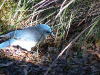
|---|
Mexican Jay
(Click the image for a full-size view)
|
|---|
|
|
|---|
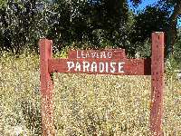
Paradise Not
(Click the image for a full-size view)
|
|---|
|
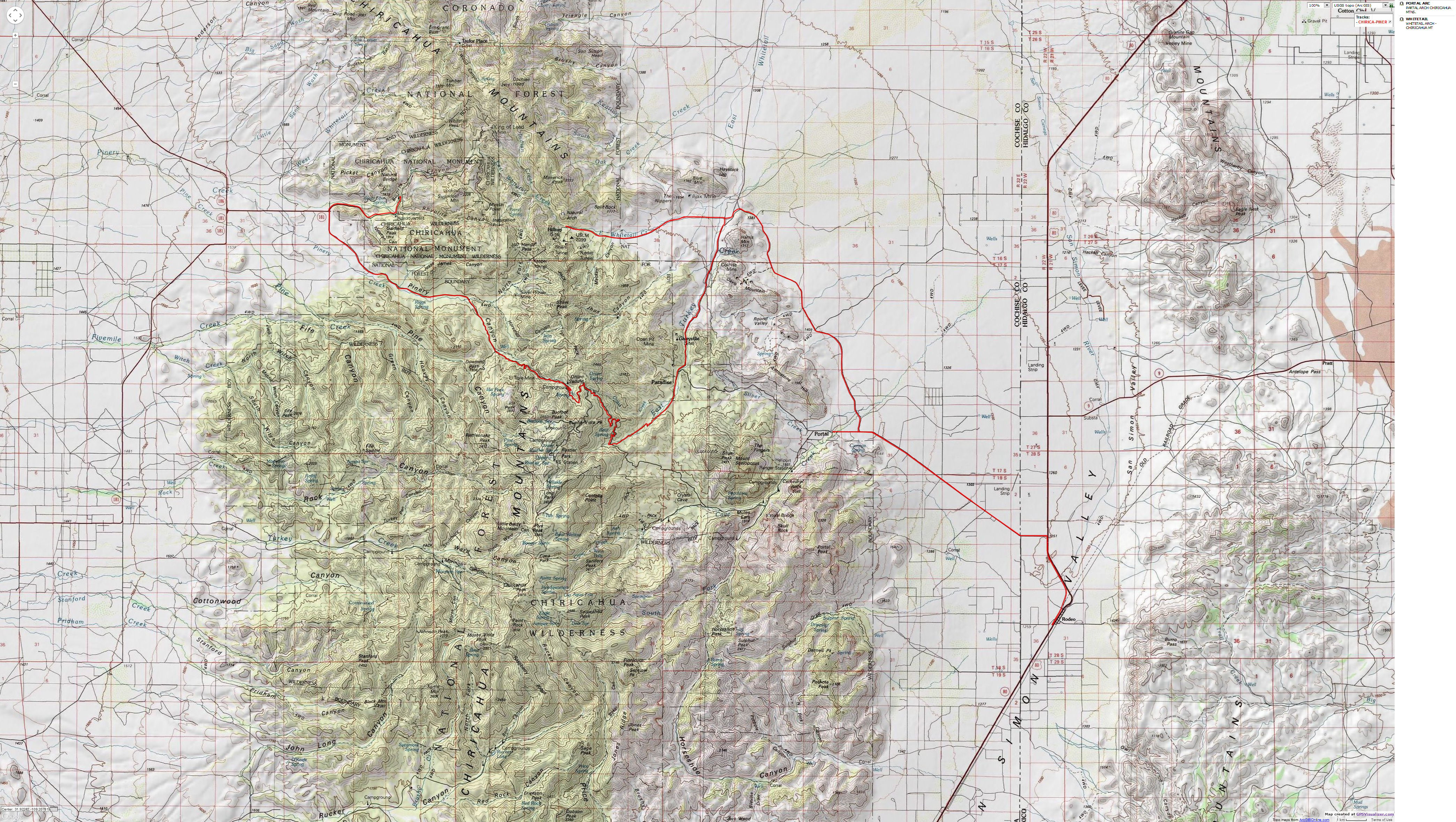
Day 3: Big Piney prowling to Portal.
Chiricahua - NM to NM (National Monument to New Mexico). Today, we did a lot of
driving and then looked for Whitetail and later the Portal Arches, finding one Portal
and a distant Whitetail. 2 miles; 4 ERM.
Reluctantly packed up, we drive the sinuous Big
Piney dirt road (could camp along here if NM CG is full) over Onion Saddle and beyond.
Branching off to Paradise (not), we search for East Whitetail Canyon Arch - clogged with
private land blocking access. A distant photo, then we move on. On to Portal, then to
Rodeo, NM and back to Portal. It's our fourth try, (first, on the phone and later in
person) trying to get a few basic questions answered by people at the Portal Lodge with
zero success. We finally yield. People are much more congenial in Los Angeles. I would
not recommend Portal Lodge. Instead, go camp in one of the nearby FS camps, where the
ambience is so much better anyway.
|
|---|
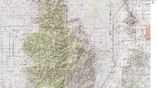
Map - Chiricahua: driving - Portal - NM overview
(Click the image to see the map)
|
|---|
|
|
|---|
The Nippers
(Click the image for a full-size view)
|
|---|
|
|---|
Whitetail Arch
(Click the image)
|
|---|
|
|
|---|
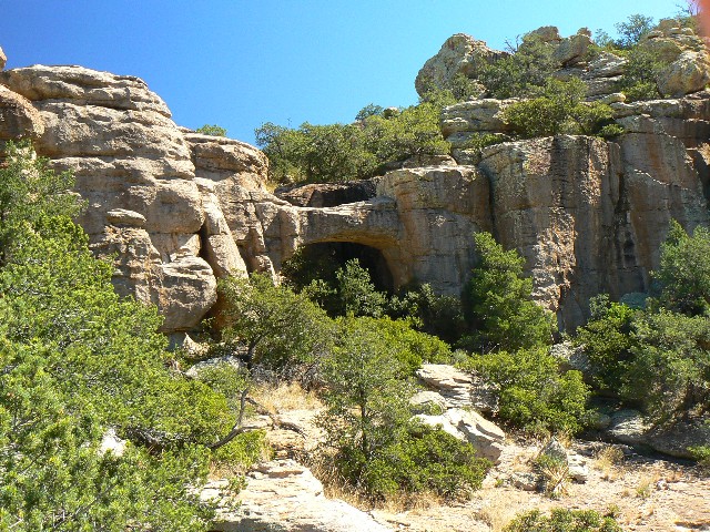
S. Cave Cr. Portal
(Click the image for a full-size view)
|
|---|
|
|
|---|
S. Cave Cr. Portal
(Click the image)
|
|---|
|
|
|---|
S. Cave Cr. Portal
(Click the image for a full-size view)
|
|---|
|
|
|---|
Sycamore Sunset
(Click the image for a full-size view)
|
|---|
|
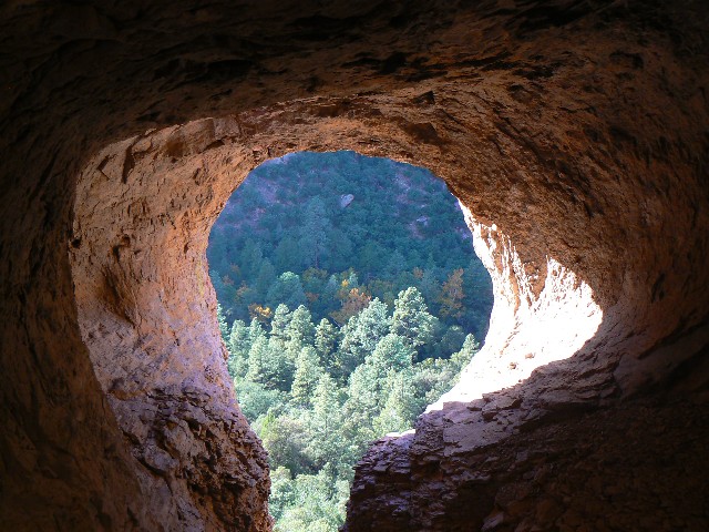
Now, back to our story - 0.25 miles up from the
mouth of South Fork Cave Creek, I begin searching for the Portal Arches. Up the untrailed
scree, it's a slippery business. I find what may be Little Portal Arch, but run out of
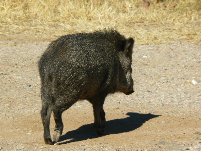
daylight before locating Big Portal. Sadly, we stay in the Portal Lodge. Javelina are seen
near the lodge trying to harvest what appear to be pomegranate.
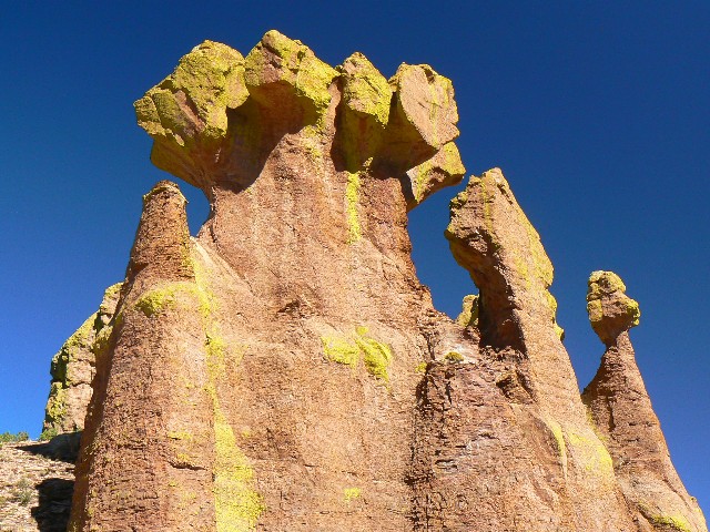
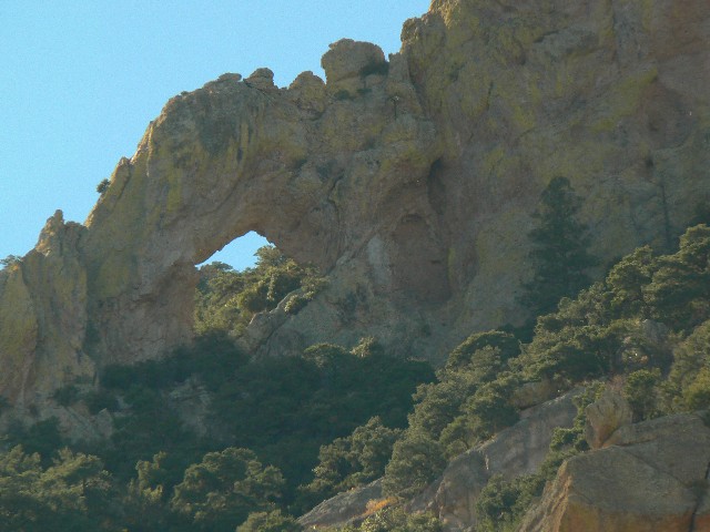
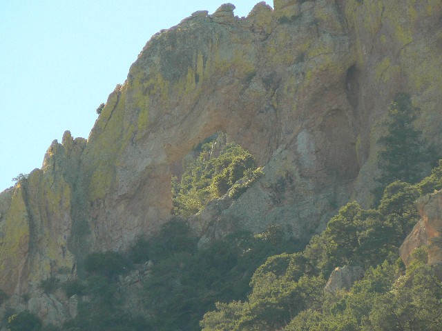
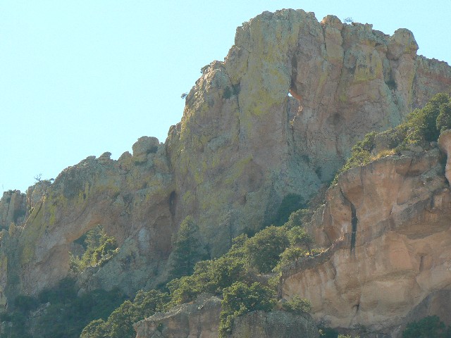
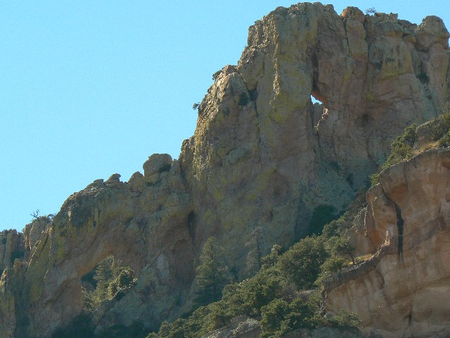
Day 4: Chiricahua times: Silver Peak Trail in quest of the Sceloporus
(my name) Arch - which turn out to be two arches. 5.5 miles; 15 ERM.
This unnamed arch, we dubbed Sceloporus Arches
(because there are two arches there), and Sceloporus because that's the name of a
nearby peak.
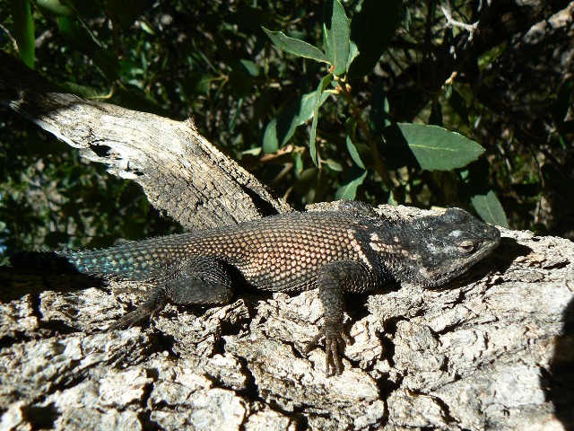
Sceloporus is biology speak for Spiny Lizard,
and we believe we have been seeing the Sceloporus Jarrovii, or Yarrow's Spiny Lizard.
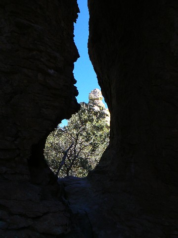
We start up the Silver Peak Trail - a good trail. Unwisely, I went up the back side of
the ridge containing the arch and assorted hoodoos, hoping the gain in elevation was to
my advantage. Instead, I would have enjoyed the day more if I had continued on the Silver
Peak Trail to its summit. (One can see the arch from near the trailhead - in the
formation that looks like a coffee pot.) Steep up, then ridged out, I drop down to the
first set of hoodoos, and, peering around the edge of a dramatic drop, finally see the
still-distant arch, and snap some distant photos. Not wanting to retrace the route, I
start down from the hoodoos, an awful descent filled with klingon sticky weed seeds.
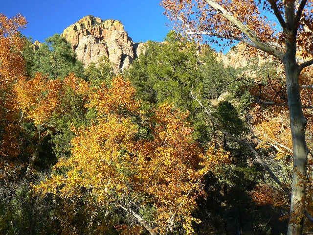
Happy to be down, we explore to Sunny Flat CG and then over to the end of S. Fk. Cave
Creek for dinner, followed by a walk in the ablaze Arizona Sycamore. Delightful.
|
|---|
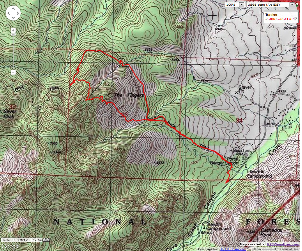
Map - Chiricahua: Silver Peak Trail to near Sceloporus; 5.5 miles
(Click the image to see the map)
|
|---|
|
| | | | |