The AZT 2018, Part 1
Saguaro Sortie: Hyponatremia to Hypothermia on the AZT
Arizona Trail 2018 (Part 1 for 2018)
Las Colinas to Oracle; Passages 6 through 12 = 111.4 miles
Rincon Mountain Wilderness, Saguaro National Park and Wilderness,
Pusch Ridge Wilderness, Santa Catalina Mountains, and so much more.
April 8th to April 18th, 2018
Text and photos
© copyright by Rob Jones
 |
Co-participants: Solo hike by Rob (Wild Vagabond)
camera: Panasonic DMC-ZS60

|
|---|
Gila Deluxe, Day 4
(Click the image for the full-size image)
|
|---|
|

|
|---|
Viper Way, Day 2
(Click the image for the full-size image)
|
|---|
|
.jpg)
|
|---|
Collared Lizardo (male) on Day 4
(Click the image for the full-size image)
|
|---|
|
.jpg)
|
|---|
Collared Lizarda (female), Day 4
(Click the image for the full-size image)
|
|---|
|

|
|---|
Ocotillo, Day 2
(Click the image for the full-size image)
|
|---|
|

|
|---|
Completion, Day 11
(Click the image for the full-size image)
|
|---|
|

|
|---|
Movie: Gila Deluxe races through the grass, 27mb, Day 1
(Click the image to see the short video)
|
|---|
|
"Between every two pines is a doorway to a
new world". - John Muir
Overview: I backpacked from the start of Passage 6 (86 trail miles
North of the Mexico border) to Oracle during this jaunt. Previously, I hiked the AZT from Oracle to
the North Rim of the Grand Canyon.
So, as of this report, I've hiked from AZT mile 86.8 to 712.4 (North Kaibab TH of The Grand Canyon),
a continuous distance of 625.6 miles, or 78% of the 800 miles from the Mexico to the Utah border.
See all the sections I have hiked on the AZT by clicking on this link to
all WV trip reports about hiking the Arizona Trail.
Preliminary: With a sense of adventure and completion rolled together, I sit outside the Oracle
Chalet Village Motel, unwinding from the lengthy drive with the aid of a beer. Ahh.
The journey from and back to the Chalet started two years ago with the
AZT 200 (link to the 200). Now I'm back to hike
the section South of here, starting at the beginning of Passage 6, AZT, Arizona Trail, mile 86.8, and ending
in Oracle at AZT 198.2.
I meet with Marney of the Chalet and talk about trail conditions and what
the unorganized, disorganized?, bike race (350 and 750 miles) will do to existing water caches.
Amazingly, I see 3G, whom I met last year in Etna on the PCT. Wow.
PCT 2017 (link to the PCT report).
I've been struggling to get ready for this adventure, cleaning up after
the
volunteer service project in the Grand Canyon (link to this report),
organizing a plan (thanks Wendy L. for the help), prepping food, all the logistical minutia preceding a
jaunt on a long (or a short) trail.
Prelim - water caching: It's been a trumpentinian dry year (global warming and elections have
consequences; in this case they are linked) and AZT (Arizona Trail) water sources are drying quickly. It, and the rising
temperatures, are the reasons I'm not starting at the border. Too hot, drying water sources. So, I'm
out today placing water caches and a resupply bucket.
The first cache goes OK, although the stop and stop and some go through
the overpopulation sprawl of Tucson is beyond annoying on the way to Gabe Zimmerman TH (trailhead).
Then back a ways and on the Redington Road, which turns out to be a 10
mph or slower rock shelf-studded slog which takes an hour to bounce 12 miles. Argh. Very dry out in
this scrubland, so perhaps the pain is worth it? If I had known more about the road condition, I might
have endeavored to adjust the hike plan.
The young woman gropes the pavement about her car at the Molino Basin CG
(campground) day use area, appearing blind. She wobbles unstable toward the toilet, comes to the curb,
wobbles and falls on her butt. I'm watching from the shade, a delectable potato bagel and cheese in my
hand and leaning against a polished granite riser. I get up and go over to the woman to see if she
wants/needs help. She can tell me only her first name as I walk her to the shade. She collapses against
an oak, then rolls over and appears to experience a seizure. About this time a Canadian comes to help
and we try to arouse the woman, then try for a cell signal - no coverage. I collect her three driver's
licenses from the tarmac and the Canadian takes what appears to be the most recent license and drives
down the road to call the paramedics. I stand watch over the woman, making sure her airway is open and
that she is breathing OK. After awhile the paramedics, fire truck, and sheriff show up and cart away
the woman, who is still disoriented and unresponsive. It's a traumatic experience for this young woman.
It appears that the woman had overdosed on some drug. My Subie Subaru
is blocked by the fire truck, so I am delayed before the tedious drive through the edge of sprawl city
Tucson, back to Oracle. I leave some water under the CG host's picnic table at Molino Basin CG and toil
back to Oracle. A trio of song dogs (Coyotes) entertain me as I drift off to sleep in a rustic A-frame
at the Oracle Chalet Village.
Day 1: Gila Deluxe. To Twin Tanks:
AZT mile 86.8 to 99.9 + hike in a water cache and hike in from the closed gate = 14.5 miles. ERM of 20.
The chalet at the Oracle Chalet Village Motel comes with a purrific cat. The
gray guy saunters in and out because he owns the place. He is a good conversationalist and has a pleasant
demeanor. Then, he climbs into the Subie as I'm sorting equipment and seems content to stay there. Purrific.
This cat requires individualized attention and door valet to get him out of the Subie.
Steve C., who is an AZT Trail Steward and who previously hiked the AZT, gives
me a ride to the starting point and helps hike in the last water cache near AZT mile 99. Thanks Steve!
The orange and black Gila Deluxe moves surprisingly quickly through the grass.
"Hold still Ms. Gila" I mutter as my hat goes flying and I'm sidestepping the two step around cactus clumps
attempting to keep up sun of the wiggling, sprinting Gila. I try for a brief video and snap some photos
before leaving alone this denizen of the desert. She is too deluxe to be called a "Monster," so I call her
a Gila Deluxe.
Earlier, as I struggle with the wind over possession of my umbrella, I look
at the trail just in time to see "Snake!" It also registers that this guy has a rounded, not a diamond-shaped
head as he lunges across the trail between my left leg and the hiking pole. Yowee! Gopher Snake. They're
know for their aggressive nature, so the lunging is not unusual. The adrenaline pump is working fine I notice
as I'm propelled over the rest of yet another dip and dive: rolling endlessly through drainages then over a
low ridge, and again. It's exhausting.
I'm wondering if I am the last hiker on this section because I see no one all
day. All the bike racers are North too, it appears. This doesn't mean I don't hear people because I hear a
cacophony of pistol, rifle, machine gun noise as people contribute lead poisoning to the hillside.
Now it's 8 p.m. and I'm eating dinner in the dark up slope from Twin Tanks.
The clean water I'm using is the water Steve and I cached earlier today. I also found bath water in the upper
dirt tank - very nice because I'm coated with grit, mostly salt grit. I move up the drainage to get away from
the tank so wildlife can use it and also get back in the zone of allowance because this is state land and
there's a use corridor unless you have a special permit.
I find it difficult to keep eating because I'm very tired after the late,
11:15, start and a more challenging than anticipated hike. Also it is quite warm despite the cooling breeze.
The good news is that I'm clean, camp is set, it's calm, and the stars are popping. It's after hiker
midnight, 9 p.m., when I finally drag into the TarpTent.
Photos Day 1 - AZT 2018 part 1
Day 2: Eaten by a Rattler. To near Gabe Zimmerman TH:
AZT 112.6. 12.7 miles. ERM of 14.5.
I'm enjoying the shade and coolness of the North end of the tunnel
under I-10, which is painted to look like a viper mouth. Very nice artwork. I lounge into the early
afternoon, post lunch. I'm not relishing walking out into the baker. After I retrieve my water cache
near the TH, I'll camp in this area to avoid the Cienega riparian area. And to avoid the all night
train noise of the tracks over Cienega Creek. Then again, there's the I-10 noise.
I started out from Twin Tanks in delightful morning coolness; yet soon
after starting I deployed the mobile shade, an umbrella, which would be in action most of the day.
Stopping at the TH at the Green Valley/Sahuarita Road, I strap the
umbrella to a hiking pole to provide some shade while enjoying some lovely water left there by Steve C.
Thanks Steve!
Hiking today is through scrubby terrain, which provides poor shade.
The bonus is an occasional arch of flowering Ocotillo. Some of the cactus are blooming too.
I enjoy another long break in the ramada (no camping) at the Gabe
Zimmerman TH, which is the end of Passage 7. A Black-Throated Sparrow keeps me company dodging about
the brush near the ramada. I doze a bit to let the heat roll past.
The local sheriff is here, waiting for a call about a lost hiker or
rider. No one specific, he's just playing the probabilities.
The doves cry their warbling love song as the temperature drops with
the sun.
My shirt is stiff enough to stand by itself. I'm looking forward to
a camp with water access.
Photos Day 2 - AZT 2018 part 1
Day 3: Heat Curve. To Rincon Creek:
AZT mile 126.3. 13.7 miles. ERM = 17.
The Cienega natural area hosts a juxtaposition of Cottonwoods and
Saguaro. Amazing. Saguaro stand just up slope of Cottonwood trees.
I start off in the sunrise coolness. By La Selvilla picnic and camp
area I'll be experiencing los rincon caliente, the curve of the heat. Argh.
The trail walks easily and I take the detour into the La Posta Quemada
Ranch section of the Colossal Cave mountain park. I find good water, and there's shade behind the
toilet. Holiday bulb Cardinals flit through the trees.
Too soon, I'm back on the trail to the covered ramada at La Selvilla,
where I find another glorious working spigot and shade. I'm the only one here after the park maintenance
guy leaves. It's better camping about 2.5 miles back, which is served by the same spring as here at La
Selvilla. If I had another day of food, I might stay here, I muse as I stretch out in the shade of the
covered stone ramada. The park guy reports that it will cool by the end of the week, although today is predicted to be the hottest day so far this year. Argh. Definitely, it's umbrella time.
Taylor and I chat as the ramada roof creaks with the wilting heat. Taylor
is the first hiker I see so far this trip, although I've seen 5 day bikers. Soaking the shirt helps relieve
the heat, yet we are reluctant to venture into the scorch of the trail. So, we lounge until 3 p.m. and
only then leave because I estimate it will take until almost sunset to hike to Rincon Creek.
The gambit works because the heat declines part-way into the afternoon
hike and I arrive at Rincon with barely enough time to throw camp in place, start dinner and water
treating, and partake of a cool bucket bath as dark descends. The water flows clear, filtered by
sandy gravel. Although very tired, with bruised feet, I enjoy the lonesome hollow hoots of doves
downstream and chortling froggies upstream and the heat curves down decently.
Photos Day 3 - AZT 2018 part 1
Day 4: Hotel Saguaro. Grass Shack Escalator. To Grass Shack CG:
AZT 135.3. 9.0 miles. ERM = 15.
The Gila Woodpecker titers from atop Hotel Saguaro. Gorgeous.
The early morning light is fabulous and I'm frequently detained by photographic possibilities. As
I enter Saguaro National Park the diversity of plants and animals noticeably increases. Who needs Parks
anyway? Let's trumpetize all our public lands by giving them to corporations (just another form of
corporate welfare that has made American and Eaarth less inhabitable; it's time for MEGA, Make Eaarth
Great Again?).
After this delightful stroll through the blooming Ocotillo and cactus,
I arrive at the Saguaro Wilderness boundary spring area. The flow has stopped yet there are, for now,
pools amidst the lovely granite niches. Booboo Bear (Taylor) has been good enough to post notes about this
and upcoming water. Thanks Taylor!
As I'm guzzling water I see movement, and yowee there's a Gila Deluxe, a
Gila Halloweena, edging down to the water. Now he's getting a drink, wow. The Gila hears the camera click
and wedges himself under a poolside rock. Amazing encounter.
Now it's up, up the Grass Shack Escalator (nonmotorized). A turquoise
Collared Lizard and spouse pose for their portraits along the way.
A solo oak, a shade-throwing oak, appears and it looks like foot break time.
What a welcome respite.
Continuing on, I don't see another oak until about 2 miles from Grass Shack;
and there is surprise water. I wet the shirt, get water, and find oak shade for lunch and to watch the
Turkey Vultures dip the drainage on dihedral wings.
Arriving at Grass Shack Campground, I call in a water report to the Park.
A yuge three-site CG, it's adorned with a toilet, two bear boxes and glorious oaks, a few Alligator Junipers,
and a dead Ponderosa Pine. At 5300' it's a contrast of relative coolness. There's time for some laundry,
a bucket bath, and some lounging before dinner. I suspect that I won't see anyone today. It's truly
natural quiet for the first time this adventure. The other camps have suffered train, auto, truck, and
aircraft noise although Rincon Creek was mostly quiet.
There's a gentle tinkling sound from the nearby drainage, and all is well.
Best camp this trip..
Photos Day 4 - AZT 2018 part 1
Day 5: Ridge Wiggle. Moving to Manning:
AZT 139.9. 4.6 miles. ERM of 11. Camp at 7980'.
The flakes of mica pop out in the trail. There are plates of
igneous and metamorphic rock forming this wiggly ridge, perched above Chimenea Canyon. It looks
glaciated, polished slabs in the high desert? I'm walking among trees and there is frequently
shade. It's up, from 5300' at Grass Shack CG to 7940' at Manning Camp. Pinyon Pine and later
Ponderosa Pine appear and when I stop at the Devil's Bathtub junction, the smell of vanilla from
the P-pines is enjoyed. Anabatic winds (upslope, driven by heating) start up, driven by the torrid
conditions below and I'm wishing that I had not buried my wind jacket so deep in the pack when I stop
for a break at the bathtub junction even though I'm out of the major wind in the pines. My feet
actually enjoy being in the full sun.
My heat-throttled appetite has definitely returned.
Manning Camp is in the P-Pines. It's named after Manning who built
the now NPS cabin in 1905 to escape the Tucson heat. Imagine that?
Today I'm the only one here. I explore the area, tote water to camp,
and indulge in a short nap. The wind is increasing, and I wonder if there's a front coming, perhaps
this is not only heat induced wind?
Sunset is accompanied by a gale. What? I'm happy that I am mostly
protected from this cold wind, yet occasionally swirls come roving. Again, I don't see other hikers today.
Photos Day 5 - AZT 2018 part 1
Day 6: Down Drop. Leave Saguaro NP and wilderness, cross Rincon Wilderness, to Redington Road:
AZT mile 151.1. 11.2 miles. ERM = 21. High of 8600' low of 3990' today.
Ice is forming in my water bottles during breakfast at Manning Camp. I
have all my clothes on and it's not enough. Hurrying, the filter goes in my pocket (it will be ruined if it
freezes, and there is no way to test it) and I head up, yes more up (to about 8600') and Mica Mountain. The
wind is cranking in even colder air. Burr.
Nearly hypothermia. All my parts warm up by the Park boundary, 4 miles later.
Distant views reveal what I'm guessing is the Catalina Canyon, which
hosts Molino Basin CG, the destination tomorrow.
The terrain calls for a pause approaching Tangue Verde (green tank or
reservoir) water source; and from a vantage point I enjoy the huge hummocks of granite. Another pause at
Tangue Verde Canyon for water and a snack. There's a sycamore in this canyon, suggesting frequent water
availability. It's still cool enough for a jacket at 5,000' indicating an area-wide cold front.
Another stop near Italian Trap remote TH (Passage 10 starts here) then
the lilt to the cache and Redington Road. I work to locate a decent campsite, one with some protection
from the still growling wind and somewhat level too. I use my empty pack under the sleeping pad to level
the terrain.
Sardines and beer and repacking for the next jaunt are a deluxe distraction
from the fact that it's still bordering on cold.
Looking back, Mica Mountain is a yuge high hulk encompassing the Southern
skyline. Wow, and I was just up there. Yowee, down through the eco zones.
Photos Day 6 - AZT 2018 part 1
Day 7: Pushing Toward Pusch Ridge. To Molino Basin CG:
To AZT 161.6. 10.5 miles. ERM of 17.
Rolling through the rock swales, the trail is punctuated with weathered
old blonde granite knobs adorned with screaming yellow and greenish lichen. Colorful, more colorful
than anticipated. Quite interesting, especially in the early morning light.
Pause at The Lake, an expiring mud tank, then the Agua Caliente (hot
water) drainage where I enjoy a long break and filter a liter of water, which is not caliente but cool
and crisp today. I see that the trail climbs a thousand feet getting to the ridge overlooking Molino
Basin, so I opt to save the rest of lunch for the other side of this pass.
Topping the pass, it's goodbye to the Mica Mountain lump. Below, on
the Catalina side, the glitter of car windows can be seen in the Molino Basin CG. And the noise of
frenetic motorheads dominates the acoustic atmosphere. Time to find a hillside shade tree for the
remainder of lunch.
Now I'm lounging in the spectacular shade of a scrubby oak in Site
13 of Molino Basin CG with my feet hanging out, watching a flood of "civilization" rush and thunder
past, roaring up and down the Catalina Highway. After nearly four days of not seeing anyone, this
mass of tin can tourists is a jarring contrast to public lands solitude. The campground host sends
me to #13, which he apparently saves for AZT hikers. I find it curious that nearly all the sites
are vacant. People know of the building heat (today is hospitably decent), few RV sites, most sites
are walk-in, too close to a noisy road? As the air cools near sunset, it's delightful. And soon
it's sunset with a tinge of chill. Happily, I have the campsite to myself.
Photos Day 7 - AZT 2018 part 1
Day 8: Pushing Pusch. Into Pusch Ridge Wilderness, to Sabino Creek:
AZT mile 169.6. 8.0 miles. ERM of 15.
I'm in the Pusch Ridge Wilderness, looking and listening for water sounds
from Sycamore Creek, when all of a sudden there are scouts, a gaggle or storm of smartly organized and
excited scouts. They tell tales of Hutch's Pool, rabid skunks, and trails enjoyed. Scoutmaster Reed
notes that no electronics are allowed on scout trips. Wonderful. Perhaps these young men won't end up
as part of the "no child left outside" group?
Yet I don't find water in Sycamore Creek; it seems that the water is
disappearing by the day. There were notes in the trail app about water being here three days ago.
So, I'm drinking the last of my carried water from Molino when Kadeen
(U of AZ, public policy) comes by and after we discuss the probabilities that democracy will exist in
the US post-trump world (authoritarian debacle in progress), we discuss water in Sabino Canyon.
There's a ground tram just over the ridge to the South, Kadeen reports, and a five mile walk to Hutch's
Pool from the tram. Too close, an infringement on the wild. This validates my plan to camp in Sabino
rather than get involved in a crowded pool party. There just wouldn't be a place to camp.
I'm adding pinches of salt to some of my drinks to help avoid
hyponatremia, yet titration is unknown (at least to me).
At Sabino, searching is involved, and I end up camping amidst oaks
just on the North side of trickling mossy water off the Box Camp Trail, not far from the Sabino
Canyon junction. The heat has torridly returned and it's good to stop a bit early.
After setting camp, sluggishly gathering water, a bath, and
ejecting scores of biting midges from the tent, I write notes and doze waiting for the heat to drop.
Photos Day 8 - AZT 2018 part 1
Day 9: Catalina Climb. To Lemmon Creek:
AZT 179.2. 9.6 miles. ERM of 20. Climb from 3700' at Sabino Creek to 7400' near the Wilderness of
Rocks junction. Camp at @ 7100'.
I can hear and see water gurgling through Hutch's Pools below the
switchback of the trail. The pools look delightful and busy, hosting at least one camper in a confined space.
Continuing on, it's up, up, through oaks, occasional Arizona Cyprus,
and far-spaced P-Pines by the elevation of the Cathedral Rock Trail junction at 5300'. Already a
strong climb, the journey continues, up.
At the Cathedral Rock junction, I meet Tamar (Gila Monster) and we
hike together to Romero Pass, still going up, of course.
At the pass the trail heads directly up the ridgeline, progressing
(actually inching along) to 7400'. Time for a foot and lunch break. Gorgeous rock, large crystal
granites, some quartzite, probable metamorphic rocks, a mix of geology.
Finally fabulous Lemmon Creek. Clear water, flowing through granite
and gravel depressions.
I'm extremely tired and it's a chore to organize camp and treat
water. Tamar strolls in and joins me in camp. Not feeling hungry, it takes some food priming to
eat dinner. The stately P-Pines help screen out the wind as a full overcast fills the sky. Will
this cloud blanket make it a warmer night?
Photos Day 9 - AZT 2018 part 1
Day 10: Marshaling up to Summerhaven. To Dan Saddle:
AZT 187.1. 7.9 miles. ERM of 15.
Tom's Sawyers crew are out on the trail patrolling for deadfall in
this Wilderness of Rocks. Thanks for your stewardship of our trails Sawyers.
The name fits. Wilderness of Rocks. Hummocks, fingers, muffins,
plates of gorgeous granite, much covered in a kaleidoscope of lichen.
Soon, I'm out of the Pusch Ridge Wilderness and at the Marshall Gulch
TH and picnic area, where a length of road walking begins to Summerhaven. Yipes. The temperature is
dropping and the wind building. How come the cold weather arrives when I am high on the trail, and
the hot weather arrives when low on the trail?
The road walking leads to a cafe. And, I eat too much.
Back on the trail loaded with water for a dry camp, I re-evaluate
the options when reaching Dan's Saddle on Oracle Ridge. Finding a narrow nook out of the sun and
wind, I opt to use the water here and walk to Oracle tomorrow. The trail has circled around to
the other, East, side of Mt. Lemmon, which is sadly festooned with a forest of radio and microwave
masts, and one lonely FS Lookout. So, I have no difficulty texting Marney at the Oracle Chalet
Village for a reservation for tomorrow night.
Photos Day 10 - AZT 2018 part 1
Day 11. And The Oracle Sayeth. To Oracle via Oracle Ridge:
American Flag TH, AZT mile 198.2. 11.1 miles. ERM of 19.
Trip total = 111.4 AZT miles (more counting caches, etc.).
Total ERM = 184.5.
And The Oracle sayeth, "get thee to the Casa Rivera, for behold there be
sustenance for thee of weak mind and body yet with a satchel of soiled cash." And so beith. Burrito bonanza.
I've completed this section of the AZT, linking the trail hiked from AZT
mile 86.8 to 712.4 (North Kaibab TH of The Grand Canyon), a continuous distance of 625.6 miles. Yahoo.
I'm planning to hike the section from The Park (Grand Canyon) to Utah in
May, leaving only the extreme Southern section to complete.
Marney of the Oracle Chalet Village Motel collects me from the American
Flag TH and delivers me to the Chalet for a thorough cleaning before an early dinner. Yes, Casa Rivera.
Earlier today.... The Roadrunner sashays around the corner of the trail,
successfully avoiding a photo. The third Roadrunner of the trip to elude being photographed. Darn.
The rolly rocks proliferate on the numerous downhills today, making for
slow going. It's a day of losing altitude, that hard-gained altitude out of Sabino Creek. Conditions
vastly improve near High Jinks Ranch (sadly, closed today) with the reappearance of the quartz monzonite
boulders and terrific tread surface.
I enjoy the last trail lunch under an Alligator Juniper above the High
Jinks Ranch.
An Acorn Woodpecker is celebrating with me as I log the last mile to
American Flag TH to connect with the previous sections. His is a laughing chortle that could be considered
mocking or congratulatory. This mimics the tenor of this adventure, notable for its contrasts.
78% of the AZT hiked with Day 11!
Author's note: This report officially ends with counting this
segment of the AZT to the North Kaibab TH. AZT mile 86.8 to AZT 712.4. That's about 78% of the AZT hiked
through today. I'm planning more AZT hiking in May (stay tuned).
Parenthetically, at the end of 2018, I
have hiked about 91% of the AZT, following finishing the sections from Las Colinas to the Utah border.
I'm planning to report 100% of the AZT hiked by this time next year. Yahoo.
See all the sections I have hiked on the AZT by clicking on this link to
all WV trip reports about hiking the Arizona Trail.
Photos Day 11 - AZT 2018 part 1
.

Scenic Toilets - AZT 2018 part 1
.

|
|---|
Looking for All Wilderness Vagabond trip reports about hiking the Arizona Trail?
Click the image to go to All WV reports about The AZT, Arizona Trail
|
|---|
|
Links and books:
Arizona Trail Association - trail and water conditions; maps of some of this hike
Link to all WV reports about hiking the AZT (same link as obtained by clicking on the above image)
How to use alum to clarify water prior to treating it.
Bill McKibben – suggested books include: Maybe One, Eaarth, The End of Nature
Related Sites:
Scenic Toilets of Inner Earth:
Scenic Scatology of the Wilderness Vagabond
We Are Breeding Ourselves to Extinction (click here for full article, pdf)
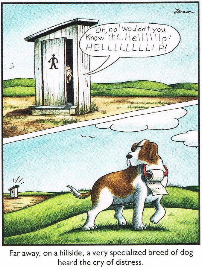
More Truth Than Joke:
|
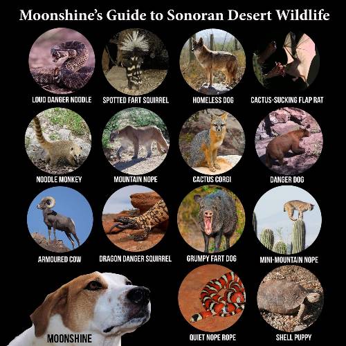
|---|
guide to Sonoran Wildlife
(Click the image for the full-size image)
|
|---|
|

|
|---|
MEGA - Make Eaarth Great Again
(Click the image for the full-size image)
|
|---|
|

|
|---|
warning, t-rump
(Click the image for the full-size image)
|
|---|
|
"What luck for the rulers that
men do not think". - Adolph Hitler

|
|---|
Big banks
(Click the image for the answer)
|
|---|
|

|
|---|
hypocrisy, once again
(Click the image for the full-size image)
|
|---|
|

|
|---|
may the Forest be with you
(Click the image for the full-size image)
|
|---|
|


.jpg)
.jpg)