The AZT 200
Arizona Trail 2016
Oracle to Mt. Peeley TH
Total AZT miles = 200.8 to 404.2 = 203.4; ERM = 341.6
April 6 to 27, 2016
Text and photos
© copyright by Rob Jones
 |
Co-participants: Susan Nauman (Salty Sue) & Rob (Wild Vagabond)
Total Trail Miles –> 203.4.
Total ERM = 341.6.
camera: Panasonic DMC-ZS19

|
|---|
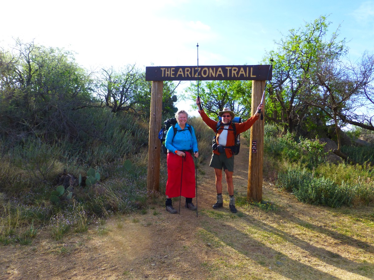
Day 1 Starting out
(Click the image for the full-size image)
|
|---|
|

|
|---|
Day 3 Black Hills Sunrise
(Click the image for the full-size image)
|
|---|
|

|
|---|
Day 3 Rainbow near Beehive Well
(Click the image for the full-size image)
|
|---|
|

|
|---|
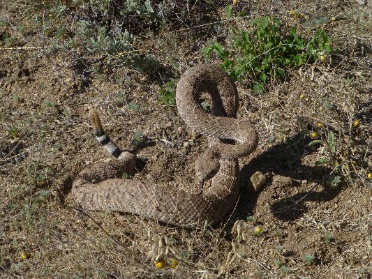
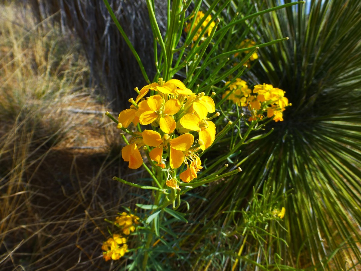
Day 4 Buzzworm near Freeman Resupply Box
(Click the image for the full-size image)
|
|---|
|

|
|---|
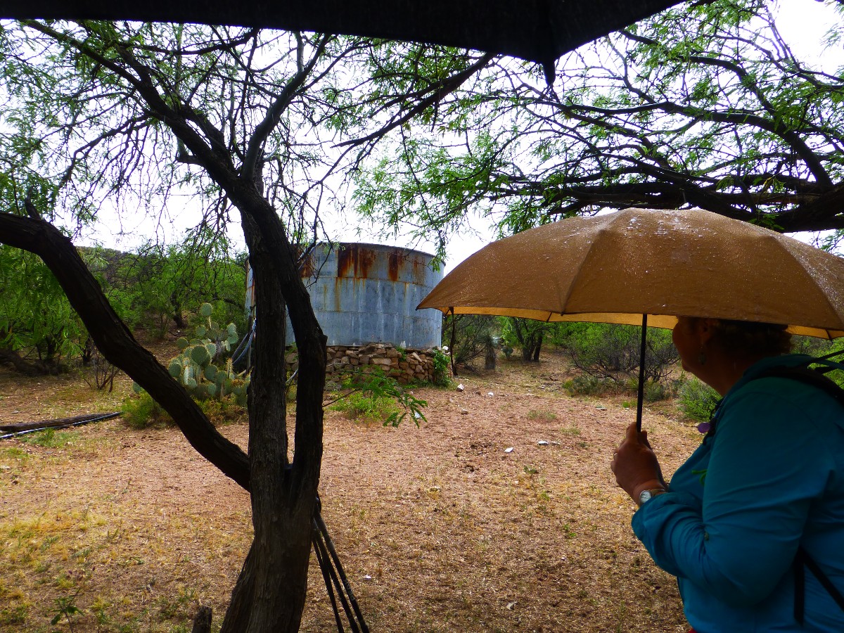
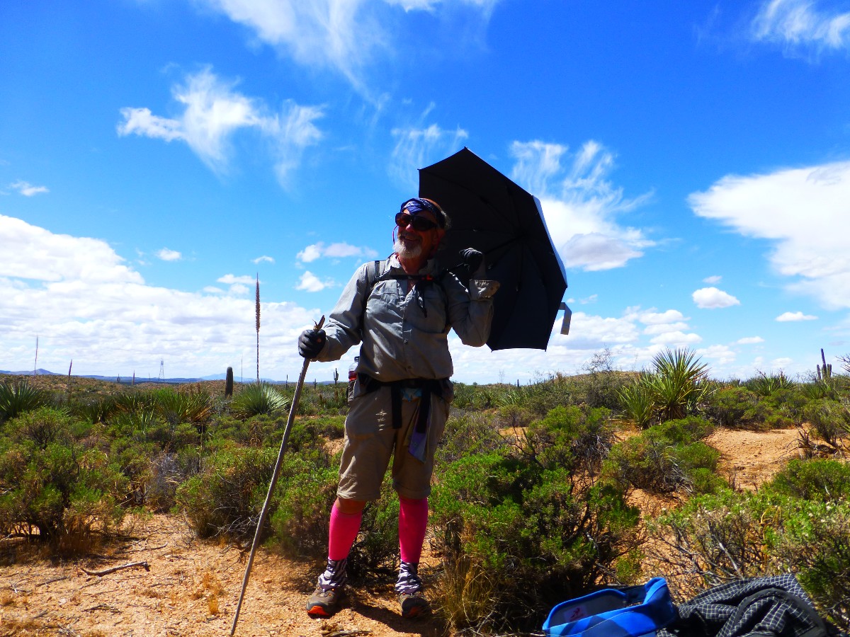
Day 7 Susan in Tortilla Mountains
(Click the image for the full-size image)
|
|---|
|

|
|---|
Day 21 End of the Trail, for now
(Click the image for the full-size image)
|
|---|
|
|
|---|
Movie - Day 4 Buzzworm, 3 mb
(Click the image to see the short video)
|
|---|
|
"Between every two (cacti) is a doorway to a
new world". - John Muir
Prelim:
Traversing the (unintelligible passages system) AZT Passages #13-22:
Oracle, Black Hills, Tortilla Mountains, Gila River Canyons, Alamo Canyon, Reavis Canyon, Superstition
Wilderness, Four Peaks, Pine Mountain, and Saddle Mountain.
The highest point hiked on this segment of the AZT was just over 6000'
near AZT mile 374 in the Pine Mountain Passage, and the low point was about 1600' near the Gila River.
Preliminary: planning, packing, planning, packing meals, fussing with
maps and the incomprehensible passages system that throws confusion into all phases of the process.
The AZT app works on continuous mileage, 0 to 800. Zero at the Mexico
border and 800 at the AZ/UT border. The book and the website are on the insane and disjointed passages
system, while the topo maps are on almost the same mileage system as the app (not quite, yet close), yet
with references to the points from the data book, the infernal passages again. Argh! And one has to
wonder how come people worked so hard to make an incomprehensible and disjointed system when there are
fine examples of how to keep it simple and elegant (everything based on a continuous trail mileage system),
such as the superb Halfmile maps, tracks, waypoints of the PCT, Pacific Crest Trail? !
So, now Salty Sue (Susan Nauman) and I are lounging peacefully in the
Chalet Motel in Oracle, having placed water caches at the Gila River (also a food bucket here), Tiger
Mine TH, and deep along the Freeman Rd. to make total desiccation less likely. We'll place the Northern
caches after a break from the trail in Superior.
We enjoyed a spirited lunch meal at Jilbertos in Miami, while waiting for
the road to Superior to open after blasting.
It didn't open, so we had to drive the long way around to Winkleman and had to skip the Superior water cache.
Is this blasting secret preparation for the yet to be approved huge copper mine? Only corporations get
to know. Certainly, only corporations get their say in public land decisions.
Yet, now we're here and ready to hike the AZT. But first, we eat our lunch
for dinner, then fall asleep to the hootage of owls outside the chalet.
ERM = Energy Required Miles. A mile is added for
every 500' elevation gain or
loss. It's a very serviceable method of estimating energy required miles. ERM was initially used in Trails
of the Tetons (long out of print) by Paul Petzold, founder of NOLS. It's a wonderfully useful concept and
application. Add one mile for each 500' up AND down to distance = ERM. I use ERMs to calculate what the actual
day is like. It's a very serviceable method of estimating energy required miles. Remember, however, that the
ERMs are estimates because they depend on GPS satellite coverage and math functions.
Using ERMs does not account for the 'texture' of the route or trail - that
is, rocky, boulders, no trail, slimy mud, etc., yet does help approximate the route.
See more information about ERMs at the end of this report.


|
|---|
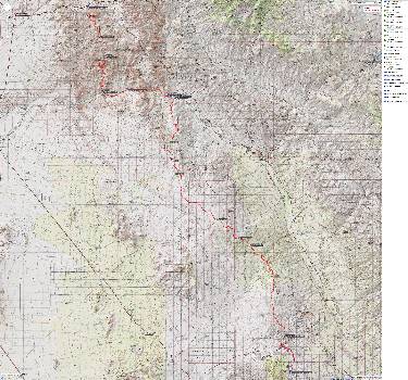
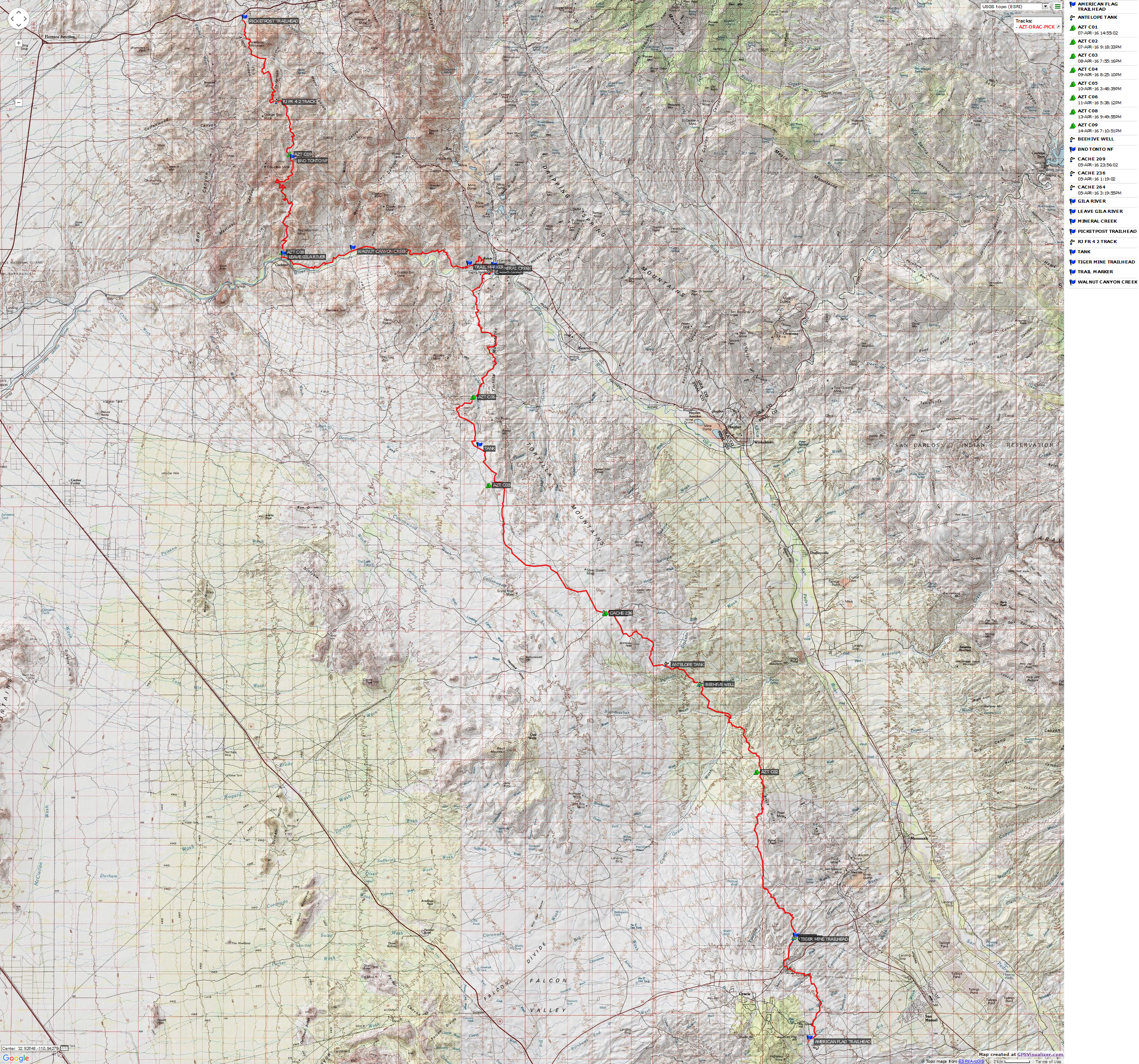
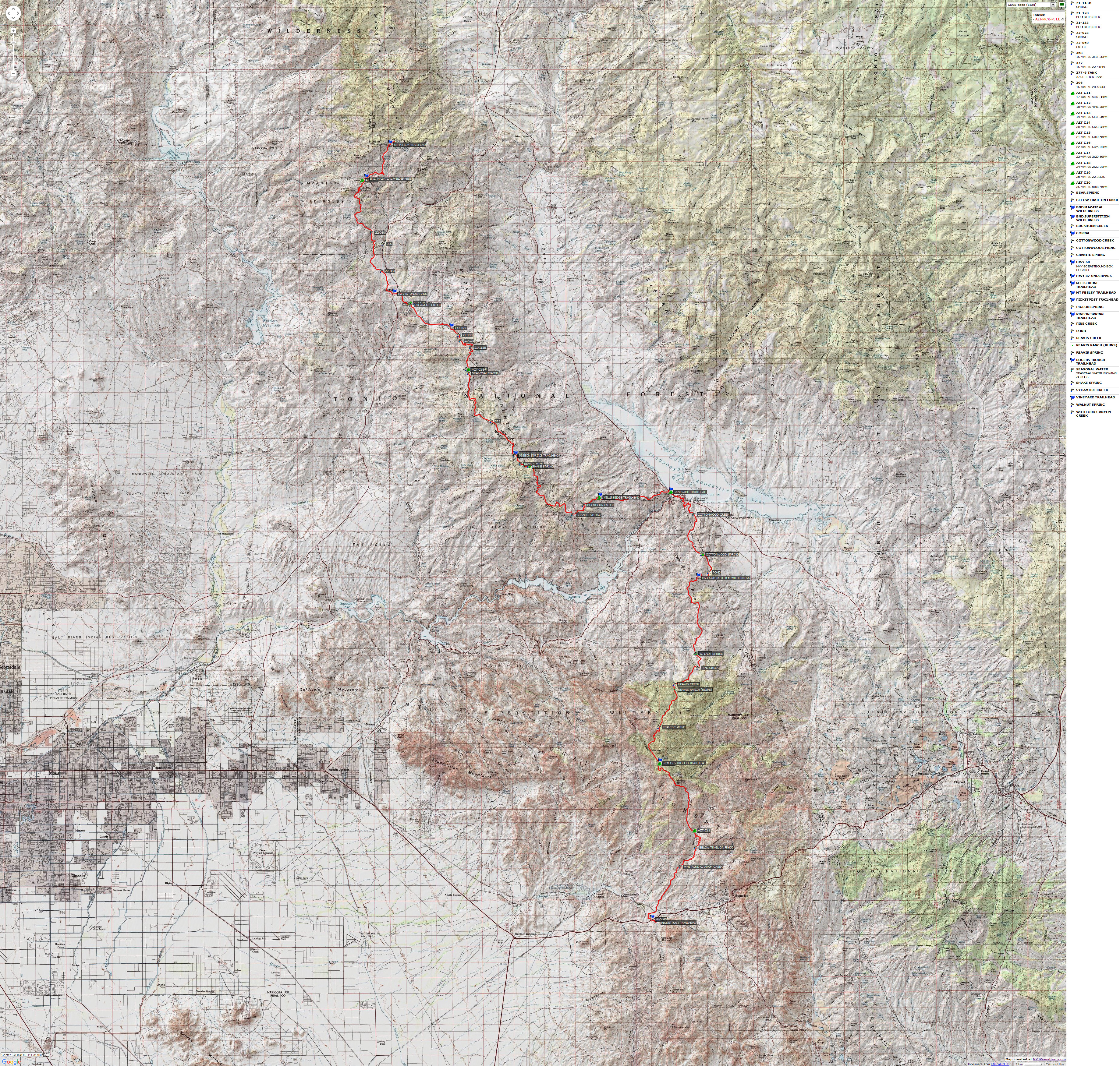
Map - AZT mile 200.8 to 301.6; passages 13 (Oracle) to 17 (Picketpost), from my garmin, 4.3 mb
(Click the image to see the map)
|
|---|
|
Right
Click (then save this file: "save link as..." in most browsers) on this Download link to get the GPX file from
my GPS - you can then open it in your mapping software. Note - that's a Right Click on this link.
You will get the track for your software shown in the map above.
|
|---|
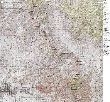
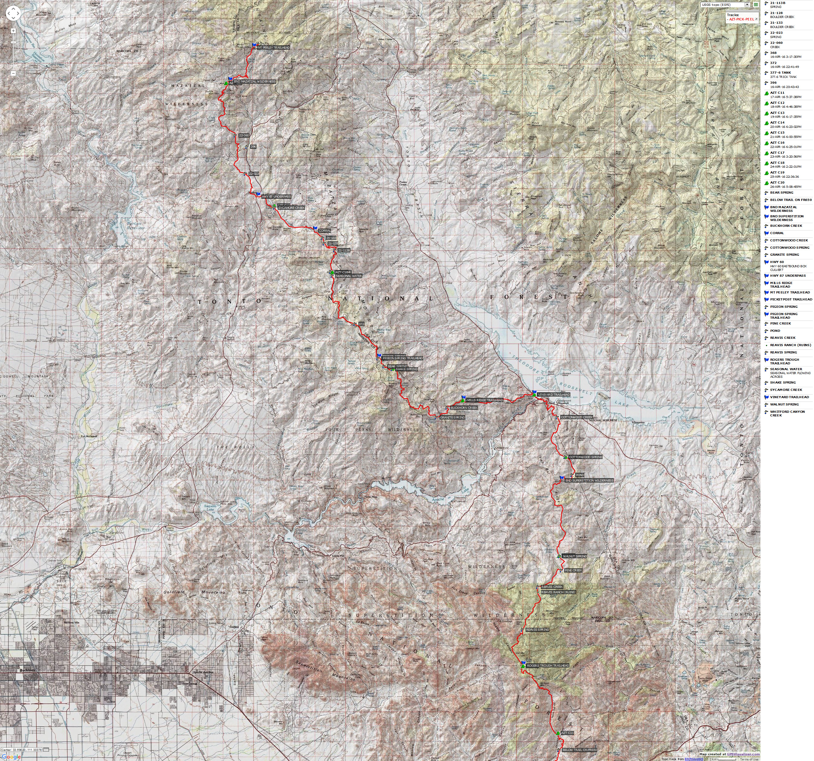
Map - AZT mile 301.6 to 404.2; Picketpost to Mt. Peeley TH,
from my garmin, 4.6 mb
(Click the image to see the map)
|
|---|
|
for a full-resolution map of this second section, click here. 8.6 mb Caution - do not use this map or gps track for
navigating the route.
Right
Click (then save this file: "save link as..." in most browsers) on this Download link to get the GPX file from
my GPS - you can then open it in your mapping software. Note - that's a Right Click on this link.
You will get the track for your software shown in the map above.
Day 1 on the AZT
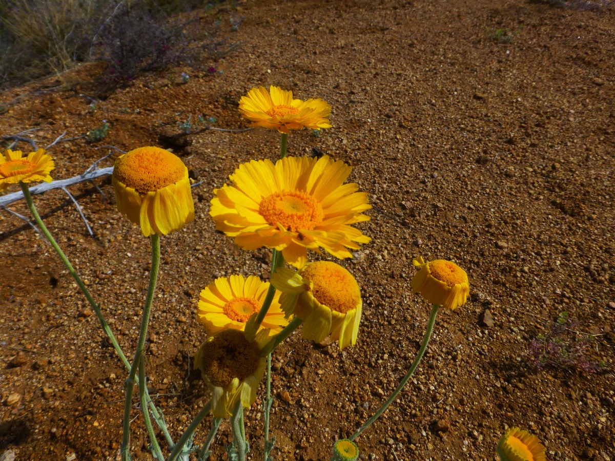
Day 1: Rattling through Passage 13, Oracle, flower splendor:
To Tiger Mine TH. AZT 200.8 to 209.1. 8.3 miles. GPS = 8.7 to camp. ERM = 12.5. Camp @ 4050'.
The incensed buzzworm is levitating on sinuous loops of reptilian terror.
"Yikes!" says Salty Sue, "get back!"
Not hearing the frequency of rattlesnakes, I am too close. And, nearly step on the rattlesnake.
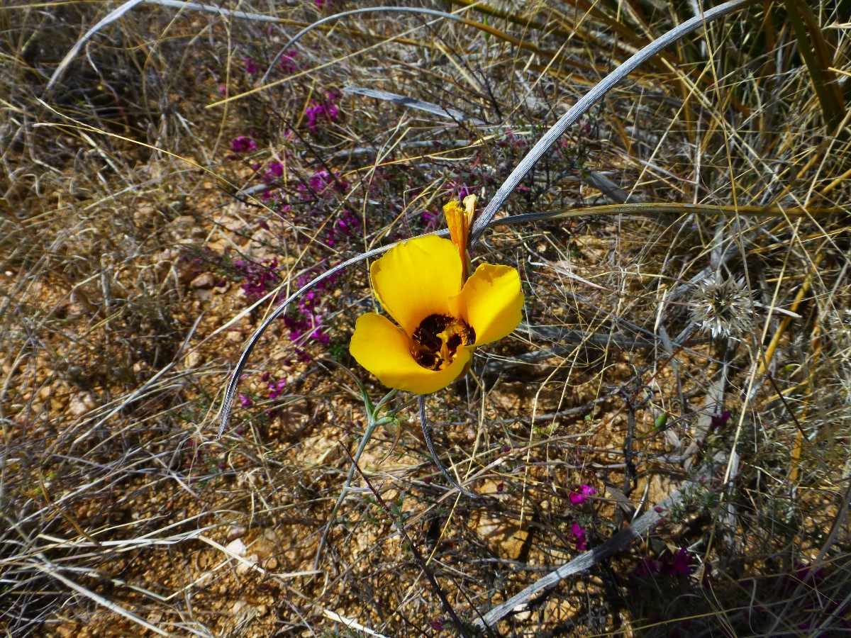
A few photos and it's back to observing the splendid diversity of wildflowers,
including Four o'clock, lilies, daisies, asters, sacred datura, wallflower, hummingbird plant, phlox, fairy
duster, penstemon, hedgehog and beavertail cactus flowers, larkspur, gravel ghost?, globe mallow, and quite
an assortment unnamed.
We pause in the underpass of Highway 77 and have a lounging lunch in the deep
shade. Waiting for 2 hours because we have another 2 miles of umbrella time to go to the Tiger Mine Trailhead
(TH) where we have cached water. It's a good thing we cached water because the Kannely windmill site is dry
dry dry and there are no other water source on this passage.
The morning starts from the Chalet Motel in Oracle. We get up and have the
rest of our lunch for breakfast before Marney takes us to the American flag trailhead to start our AZT experience.
At the close of the day we are camped on a low ridge amidst stunted mesquite
trees, not far from the Tiger Mine Trailhead. Clouds have moved in and it has become refreshingly cool.
We do not see other hikers today.
Day 2 on the AZT
Day 2: Green Slime X 2. Ocotillo Picket Fence. To Mountain
View Tank: AZT 209.1 to 221.1. Black Hills Passage. 12 miles. ERM = 19. GPS = 21.8. Camp @ 3650'.
Corner tank is a slimy green depression of stinking viscous water, a swirl
of cattle goo. Yuck. We're thirsty, yet. .. It's well past it's time for drinkability. So, we shrug on
the packs and continue the bobbing in and out of drainages, in and out of cooling cloud cover, past ridges
with a picket fence of Ocotillo. On to Mountain View Tank, shuffling in to the tank area out of water and
thankfully greeted by a large steel tank full of minnows prowling the green, yet not viscous water. A
beyond acceptable approximation of a desert oasis, yet without the luscious shade of big trees.
We start treating water and looking for a camp zone a respectable distance
from the tank as the last of the gray sky turns dark.
A bucket bath in the dark revives and cooking with the green water goes
well, until light rain arrives. The wet desert earthy aroma is our reward for finishing housekeeping in the tents.
We see two bikepackers early this morning. Our other company for today
is a small kettle of Turkey Vultures, a smattering of quail, and an assortment of unidentified birds in the bush.
Day 3 on the AZT
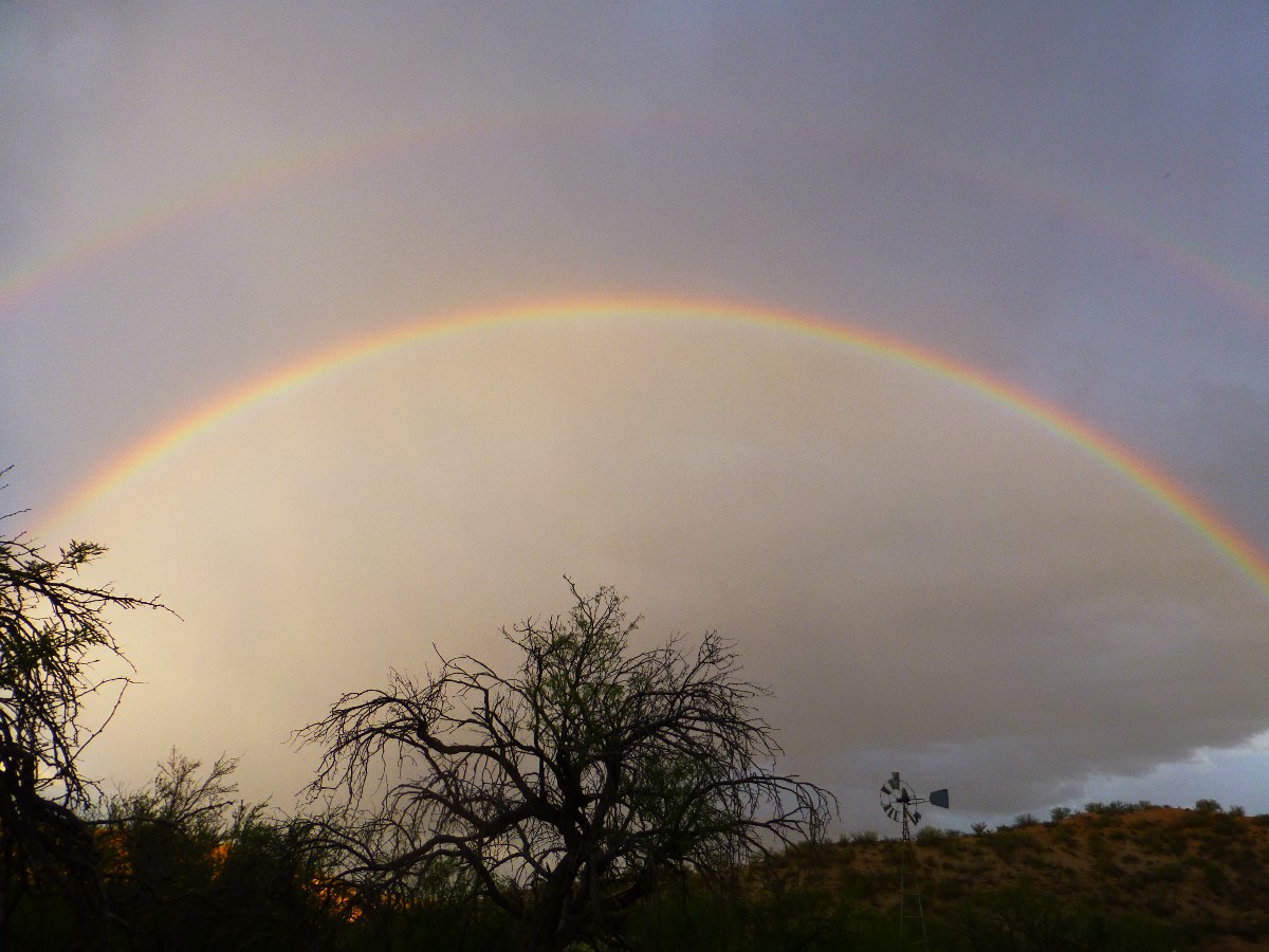
Day 3: Chasing Rainbow. To Beehive Well:
AZT 228.6 7.5 miles. ERM = 11.5. GPS 30.3. Continue in Black Hills Passage. Camp @ 3040'
The Twin psychedelic rainbows arc over Beehive Well and the sunlit
Saguaro on the ridge. Yoweee! With them comes another wave of rain. It's a scramble because we've
just started cooking, and equipment is scattered about.
Into the tents we scurry to hide out while things cool and my laundry
gets a second rinse. Argh, no dry laundry for tomorrow.
The day starts cool and with lovely hiking weather from Mountain View
Tank. Rolling into the Cowhead Tank area, we get our first rain event of the day. This huge tank is
full, yet climbing an old steel ladder to the top yields just enough space between inlet trickle and the
surface of the water to fill a liter at a time with which to replace the green slime water from Mountain
View. Wonderful. After a long lunch to allow the water to be treated we're on the way to Beehive Well.
A few more squalls accompany Salty Sue and me to Beehive.
Beehive is true to its name because the surface of the water is nearly
coated with dead bees. Many more drone across the water. We strain this otherwise good water through
a handkerchief, treat, and enjoy. Then, a bath and some laundry before the rain returns.
It's after 8 p.m. and again! it is raining as I draft these notes.
No one on the trail today but some deer, Cottontail and Jack Rabbits,
and a continuation of the wildflower show, with Ocotillo and Pencil Cholla predominating. The rain
patters into the night at Beehive Well.
Day 4 on the AZT
Day 4: Freestyle to Freeman. to Freeman Road at AZT 236.5:
7.9 miles. ERM = 11.9. GPS = 39.0. End of the Black Hills Passage. Camp @ 4010'.
This time, the infuriated buzzworm is coiled, head levitated, rattles
shaking, reptilian hide tremoring, under the shade of a Beavertail Cactus pad, crowding into the trail,
and subsequently into our path. Yikes! Again. Well-hidden, this fangster licks the air and swivels
with our every move, pits vipering for body heat. Buzzby doesn't track the proffered poles, and instead
seeks meat. Hikers' meat. It's a good thing both of us were not ogling the Banana Yucca.
The day starts slowly, with drying bags and such from last night's rain
event. Then, it's off on another day of rolling gently through drainages, past Ocotillo, cactus flowers,
lots of blooming plants, including creosote bush and Palo Verde.
Road Runners, Antelope Ground Squirrel, deer, Cardinal, perhaps two sheep.
Another quiet day on the AZT, and again no hikers or bikers are seen.
Upon reaching the resupply box at Freeman Rd, we sign the trail register
and retrieve our water cache. Two vehicles rumble past in the near distance as we eat dinner and await a
finally clear night sky contaminated only by the light of a fingernail of a moon.
Day 5 on the AZT
Day 5: Freezing from Freeman. To Ripsey Ranch:
AZT 247.3 + .06; 11.4 miles. ERM = 15.4. GPS = 50.3 Start Tortilla Mountains Passage. Camp @ 3420'.
Antelope Peak, from the last passage, slips behind a veil of rain amid
darkening skies and wind gusts strong enough to require double loops on the hat. This and an ear band
because the wind is cold. Yes, the weather has changed dramatically, and so has the area. There are lots
more plants in number, and the type has changed some too, a few juniper and oak, dried carpets of grass
and forbs, yet the elevation has changed little. There are also occasional boulders of what looks like
quartz monazite. The trail walks easily and we arrive at the ruins of Ripsey Ranch with slightly bruised
feet and extra water - just enough to survive if the proffered water in the old ranch trough doesn't exist.
It, the water, does exist. The historic windmill doesn't work, so a modern cowboy has rigged a pump to
the old well and there's decent water in the old cement stock tank.
We go down wash to setup camp, and high winds tie the tents in knots, making
life difficult. It rains hard as my tent is almost up and I dive in, dragging in the pack too. Some
journal notes and I peek out to see a gorgeous full rainbow over Susan's tent.
Eventually, the rain stops and we retrieve water from the tank. More rain.
Out into the drizzle for a quick bucket bath, rain continues.
Some sun arrives in this fourth driest state in the union and Susan and I
hustle out to cook dinner, then are again, surprise, chased back to the tents by more showers. That's the
molding report from Day 5 on the AZT.
Day 6 on the AZT
Day 6: Tortilla Monday; a Crowded AZT. To AZT 254.1:
6.8 miles. ERM = 8.3. GPS = 57.9. Continue Tortilla Mountains Passage. Camp @ 3009'.
Susan and I are lounging for lunch in the sparse shade of a Palo Verde
humming with bees when along strides DB Wren, who is hiking the Grand Enchantment Trail, which partly
overlaps the AZT. Yikes, the AZT is getting crowded. DB is the first person I've seen on the AZT since
the two bikers at Tiger Mine TH.
The land is mostly devoid of trees much of today. There are more
Saguaro and less flowers. Hydrocarbons are squandered in the pursuit of military readiness as unseen
planes thunder incessantly from too close Luke Field, as the US military outspends the next 22 countries
combined and 20% of US children are in poverty and failing nutritionally, educationally, and have
difficulty contributing to support the well-fed military except as conscripts. Sad, yet representative
of republican values (as long as a good measure of corporate welfare is involved). War, repulsicans' jobs plan.
We pass and briefly explore what appears to be the footings for a stamp
mill of the old Ripsey Mine, then continue around the hill to greet a Gopher Snake sunning in the trail.
An aggressive devil, he pretends to be a rattler.
At AZT 254.1, we locate what is rumored to be the last good water before
the Gila River, and decide to stop early and enjoy the desert ambiance.
The food bags are like air, and that's mostly what's in them. Already I'm
dreaming of a chili Verde burrito wrapped up in a big slice of pizza. Yummy.
As I am gathering drinking and bath water, several horned black moo cows
shoulder us out of the way and contend with the swarm of bees to slurp a few gallons of water. We willingly
share the tub of fine desert water.

|
|---|
Movie - Day 6 Gopher Guy, 3.5 mb
(Click the image to see the short video)
|
|---|
|
Day 7 on the AZT
Day 7: Tortilla Mountains Mutilation. To Gila River, end of
the Tortilla Mountains Passage, AZT 264.9:
10.8 miles. ERM = 19. GPS = 69.2. Camp @ 1740'.
The mountains of toxic mine tailings waste are stacked in tiers,
obliterating what was once a few mountains of public lands, now topped with a poisonous lake most
likely leaking republican brew into the ground and surface water. Corporate welfare at its best,
privatize the gain and socialize the loss, including eyesore and superfund site for future generations.
A bonus is polluted ground water. Corporations bullying local workers and bribing chambers of commerces,
extorting from taxpayers local and nationwide. This is the view that is most of the middle distance, a
sad exclamation about the state of greed and sell-out. The far and near vistas are more pleasing, with
the sea of Superstitions afar and the dry Tortillas up close and under boot.
The day starts with a climb up The Big Hill, bordered by cardinal red
fringed flowering Ocotillo. The wind screams. Rounding the Big Hill, we roll along the dry Tortillas,
then plunge toward the Gila River, sporting umbrellas. I try for photos of the first Saguaro flowers,
yet they seem to bloom only on steep hillsides and in precarious places. Gorgeous.
Along the way, I sign an offer to sell the family house in Idaho, which
will end an era, if the sale goes. Oh, the distractions unrelated to the trail.
Reaching the Gila, we seek cell coverage, walking up from the River to
do so, then order a large pizza, with assorted side delicacies from the Old Time Pizza place in Kearny,
asking them to deliver to the Florence-Kelvin Bridge, where we are right next to the USGS stream gage
signal system. The Old Timer says he knows exactly where we are. Setting about discovering tent spots,
the pizza soon arrives and we happily stretch our stomachs, and still save two pieces and breadsticks
for breakfast. Yummy!
Retrieving the resupply bucket and four gallons of water we cached a
week ago, we organize food bags for the stretch to Picketpost TH and Superior. A quick bucket bath,
some organizing and journal writing, and it's finally to bed with the whispering of the fast-moving
muddy Gila as background noise. That and the occasional train hauling tailings and such. To bed to
dream of pizza.
No hikers seen on the AZT today.
Day 8 on the AZT
Day 8: Saguaro Sautee. To Red Mountain Spring:
AZT 280.8 + 0.5 to Red Mountain Spring = 16.2 miles. ERM = 24. GPS = 86.5. Camp @ 1690'.
The Saguaro are blooming and it's warm. Their delicate trumpet
flowers face mostly South for some reason. Rings of soon to burst forth buds circle some of the trumpets.
One can imagine heat waves rippling off our trusty umbrellas, although it's not hot by Summer standards.
Nevertheless, it feels like a Saguaro sautee.
We start today eating the last of the delightful pizza and a few breadsticks.
Still yummy.
The AZT climbs away from and returns to the Gila several times over
the next 15 miles, although there is River access in only a few areas. Mostly, the trail contours a
hundred feet or more above the currently racing brown sludge. The trail tread is good, it's just a
ways to go.
Because of water uncertainty tomorrow and then the following day, we
drone on to where the AZT turns away from the Gila to camp. It's a long day, brightened by the Saguaro,
barrel cactus, and other bloomers, and by the developing views of cliffs and mountains akin to the volcanics
seen in the Superstitions.
Now, to find the Red Mountain Spring, gather and treat water, set up camp,
cook, clean off some of the day's salt grit, jot journal notes, and say goodnight moon.
Day 9 on the AZT
Day 9: High Saddle Hiatus. To AZT 290.2:
9.4 miles. ERM = 16.5. GPS = 96.8. End of the Gila River Canyons Passage, 16, and start
of Passage 17, Alamo Canyon, which will take us to Picketpost TH. Camp @ 3690'.
Susan and I are resting in the deep shade of volcanic cliffs of yore,
allowing the body temperature to decline some. This is the first decent shade we've encountered since
that in a long ago wash. From the High Saddle we can see the AZT contouring around the basin, staying
somewhat high rather than plunging into the craggy steepness below. Good.
The wind has picked up, making continued umbrella use a struggle.
We've climbed about 1,800' from the Gila to this lofty view, and have not seen an AZT hiker since we
encountered DB Wren, although several had signed in at the Florence-Kelvin Rd TH. Along the way, we
hike in the gaze of what is unofficially called Dale's Butte, a pinnacle representative of the vision
and efforts of Dale Shewalter, considered the Father of the AZT. The AZT is a young trail. Dale
started fantasizing about an AZT in the 1970s, and reportedly first hiked the distance in 1985, at
which time there were many sections without trails. Lots of planning, work, more planning, negotiation,
work and the trail was officially completed in 2011. I invite you to join the AZT Association and to
support the trail through trail work, donations, your other good works. Thanks.
It's a long drag up from the Gila River to the Tonto National Forest
boundary and then the resupply box at AZT 290.1 and FR (Forest Road) 4. Susan is feeling the effects
of the long day yesterday and today's heat. So, we find the first passable camp after retrieving some
water from the resupply box and do our camp business (thanks Wendy and the other AZT Trail Angels! for
the water cache).
Tomorrow, we'll hike the 12 miles to where the AZT crosses Hwy 60, and
go to Superior for a zero day, during which we will collect the Gila River cache bucket and place the
water and food caches for the next 100 miles on the AZT.
Day 10 on the AZT
Day 10: Glittery Cow Foot Walk. End Passage 17, Alamo Canyon.
To Picketpost TH and AZT 301.6:
10.4 miles. ERM = 17. GPS = 109.
The first AZT century is accomplished, 100 miles on the AZT. Yahoo.
Along the way past Seep Spring, I encounter Jim and Amy, through hikers
from the San Francisco Bay area. We would meet up with them at several shade breaks, and finally at the
mini-laundry in Superior, just before Jim and Amy hitched back to Picketpost TH to continue their quest of
hiking the entire AZT. It's sad to part company so soon, yet perhaps I'll see them when they roll through
Flagstaff? (Note - we do meet up for more discussion and dinner in Flagstaff, after I'm off the AZT, as
these long distance birders quickly stroll the AZT. Wonderful times.) Jim and Amy completed the AZT in early
May.
Waiting in the lee of the wind and precious shade of the scenic toilet at
Picketpost, we're soon on our way to the Copper Mountain Motel.
John picks us up from Picketpost TH and we all go to Superior for a zero
day, tomorrow. Of course, we'll be retrieving the vehicle in Oracle and the cache bucket near the Florence-Kelvin
Bridge, and also placing caches for the next two stretches, another 100 miles on the AZT.
Today, sections of the Arizona Trail are sparkly with mica from schist and
other rocks, and coat marauding cow feet, making them glitter.
It's a day of mostly down, which is made more enjoyable by chatting with Jim
and Amy about birds, bushco, birds in the bush.
After encountering the third buzzworm of the trip, we stroll into a ground
swell of bees, bees buzzing all about. Yikes. There are hundreds of bees, and there seems to be a hive underground.
John, Susan, and I enjoy dinner at Porters Cafe in Superior. Our zero day
continues with the next breakfast at The Patio in Oracle. I enjoy a delightful frittata. Then, dinner is at
Los Hermanos in Superior, all good.
We drive to Oracle for breakfast and to get the car, pick up the Gila bucket,
and relocate the car to the Mt Peeley TH, and place water caches at Mormon Grove, Pigeon, on the road to Circle
M, and food and water at Mills Ridge TH. There's not much zero on this zero day.
Day 11 on the AZT
Day 11: Roaring to Reavis. To Reavis Trail Canyon. AZT 312.3:
10.7 miles. ERM = 17. GPS = 120. Camp North of corral in creek bottom. Camp @ 3,000'.
The bright orange pygmy leviathan rises buoyantly from the depths of the
TU-DS Ranch cement cistern like a miniature submarine blowing ballast. The working windmill churns above,
and water, precious water, flows from windmill pump to cistern to trough, elegantly. Goldfish swim the cistern.
As we walk the first low ridge, the view back to Picketpost Mountain is one
of a dark hulking hump this morning. Jutting from the Northern view are the Superstitions, including the
spire of Weavers Needle.
It's a day of rolling through canyons and up to the foot of what promises
to be a good climb up Montana Mountain, passing through surprisingly wet Whitford creek before coming to the
luscious windmill pumped water at about AZT 310. Continuing on the AZT, we locate the refreshing Reavis water.
Just prior to camping, we walk through an historic stone corral only slightly
cleaner than the Copper Mountain Motel where this day began.
Water trickles down Reavis Trail Canyon and Wood Camp Canyon, joining for a
Happy Camp Canyon, which it is, graced by a few Cottonwood Trees, willows, and the omnipresent tamarisk.
It's early to bed because we are planning an early go at Montana Mountain.
Day 12 on the AZT
Day 12: Rogers Roundup. To Rogers Trough TH.
End of Reavis Canyon Passage. AZT 320.2:
7.9 miles. ERM = 14. GPS = 128.
Camp @ 4800'.
The Redtail duo lofts down the ridge above the Montana Mountain pass,
effortlessly working the thermals chimneying up from the heat below to 5400' in the pass. It's good to be
lounging in the shade of an Alligator Juniper and an oak. It's relative high country.
We're up early and on the trail climbing Reavis Trail Canyon in the shade.
Delightful.
The sun is upon us as we start the switchbacks on Montana Mountain.
Along the way, we encounter veterans David and Jordan, Warrior Hikers on the AZT, walking off the war.
We wish them well. Following the pass, it's road walking to Rogers TH, where we find decent water.
We could continue, yet an early day sounds good, and a passable campsite
is located.
Doug returns from a hike to the ruins, and shares water and grapefruit.
Yummy.
As I collect bath water, Vesper (Mike of NY) arrives and we chat about
Ed Abbey and the Monkey Wrench Gang. Vesper is lilting long miles, striving to get near Pine before
temporarily leaving the AZT to situate his daughter in college.
It is busy on the AZT today, as we also encounter the two Warrior Hikers,
a couple from the UK, and Kathy of Tucson.
Day 13 on the AZT
Day 13: Not So Bad. To Walnut Spring. AZT 331.2. :
11 miles. ERM = 18. GPS = 140. Camp @ 4570'.
Perky Primrose protrude above the tawny grass as we descend into the
cold air sink below Rogers Trough TH. For the first time this trip, I put on the pile gloves.
We're off on day 13 of this AZT jaunt.
After climbing over the relatively short Reavis Saddle, we enter a pleasant
zone where a delightful vanilla scent wafts through the P-Pines and cosmically radiated Sycamore trees
line the old orchards at Reavis Ranch. The Ranch area is the most relaxing and sylvan to date on the AZT.
Then, the harsh volcanic walking up and down to Pine Creek for more water
before tracing near Reavis Gap, and on to surprisingly cold Walnut Spring.
Earlier today, as we inspect a monarch Alligator Juniper, Not So Bad
(Kyle) lopes up, and we ask him if he has a cable to replace our defunct solar panel cable, which stopped
working after Picketpost. Amazingly, Not So Bad does, and sells us a cable. I give him a little more and
suggest he get a good meal from MaryAnn at the LF Ranch near the crossing of the Verde River.
At the close of Day 13, I believe I see the sun set behind The Four Peaks
Wilderness. A lovely sight. Not So Bad.
Day 14 on the AZT
Day 14: Billy Goat Gruff. To Cottonwood Spring. AZT 341.2:
10 miles. ERM = 20.5. GPS = 151. Camp @ 3400'.
Again, the rolly rocks trail heads directly down the fall line. Then,
straight up the fall line. It's obvious that this "trail" was designed by allowing a goat to range across
the steep slopes, then putting in the route by goat wandering. The North side of this part of the
Superstition Wilderness has received little care and maintenance. The going is slow and arduous at times.
The route bobs up, down, up, down, finally contouring around Pinon Mountain,
where there are only junipers, to drop dramatically toward Cottonwood Creek. Finally, some dirt walking,
having stumbled across rolling steep rocks most of the way.
After a slog of ten miles, we escape the penetrating sun, hiking into the
tiny idyllic oasis of Cottonwood Spring. Ahhh. Cool water and passable camping. Big Sycamore, Cottonwood,
and Arizona Walnut shade the narrow canyon, enhancing the oasis effect. Even the nearly full moon has
difficulty blaring through the tree cover. What moonlight does filter through the greenery casts a pleasant
dappled pattern on camp.
Day 15 on the AZT
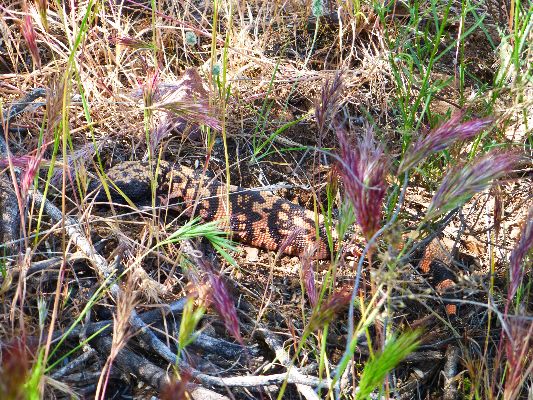
Day 15: Gila Surprise. To Vineyard TH, Theodore Roosevelt
Evaporation Pond. AZT 348.9:
7.7 miles. ERM = 14. GPS = 159.
Camp @ 2230'. End of Superstition Wilderness Passage, Passage 19.
There is reptilian movement in the dry grass. Snake! ? No, it's a Gila
(Monster) surprise, and off he goes, attempting to evade being photographed. An enjoyable sighting, nevertheless.
It's a hot day of mostly down hill, which begins with a riparian walk
through the dark forest of Cottonwood Creek. Big trees form an archway for this rare desert event, running water.
Reaching the area above the evaporation pond (Theodore Roosevelt Reservoir),
the trail initiates a seemingly endless slithering around sun baked side hills until reaching the dam.
We find shade under the bridge, where Susan prepares to pull off the AZT
because of shoulder issues. I will miss her company.
It's hot. It finally cools after local sunset.
Susan and John have headed back home and I'm camped 30' above pond level,
off the aptly named Hotel Point. Occasionally, a sizeable trout plunks the water jumping for insects.
Earlier, when I go down to the pond for bath water, a Dutch oven of trout greet me as they patrol the
shallows looking for insects who have fallen in the pond. "Would one of you like to come for dinner?" I
ask. I am given the fish eye.
|
|---|
Movie - Day 15 Gila Surprise, 2.5 mb
(Click the image to see the short video)
|
|---|
|
Day 16 on the AZT
Day 16: Mills Ridge Ramble. To Mills Ridge resupply. AZT 355.1:
6.2 miles. ERM = 11. Camp @ 3600'. Start of the Four Peaks Passage, Passage 20.
It's a wind resembling a blast furnace that sweeps the scant vegetation
(and shade!) near Mills Ridge TH. I'm hiding from ol sol in the dappled shade of a small Holly Oak, enhanced
by my umbrella perched atop the shrubbery. Utah Zuke (Kathy of Tucson), Compass Bearing (Dinny Pocock of the
UK), and Sileur (which means catfish; Gary Halliwell, also of the UK) have continued up and up the AZT. I
enjoyed the pleasure of hiking with these three through hikers from near the evaporation pond to Mills Ridge
TH, where I had previously cached a resupply bucket and extra water.
Now, I'm trying to stay in the shade after refilling and sorting food bags,
fuel, water treatment, and tp, etc. Treats were in the bucket (thanks Susan!), it's warm, and my eyelids droop.
It's a short day, made somewhat uncomfortable and tedious by the hot wind and the glaring sun.
Now far below, I see the surface of the evaporation pond buffeted by the wind,
guessing that it's not a great boating day.
I started early today, having been thoroughly roasted yesterday afternoon.
Still, the sun is hot upon us as we walk the ramps toward the high country of the Four Peaks.
The wind continues, so I find a lee of the wind spot in the TH area and
cower behind a Palo Verde. Crenulated mountains form the view from where the AZT has lead, to here.
Day 17 on the AZT
Day 17: Shakin Around the Peaks. To Shake Spring. AZT 366.4:
11.3 miles. ERM = 24. GPS = 176. Camp @ 5400'.
The clear water courses, wriggling, off the granite boulders and into a pool.
There's even a tiny waterfall. Welcome to gorgeous Shake Spring, after a grueling day working our way partly
around The Four Peaks. Some segments are overgrown to the point where one fights their way through the brush,
trusting your feet to feel the trail tread.
I'm out of camp early, and encounter Kathy, Dinny, and Gary on their first break
of the day. We hike together throughout the many climbs as we enter the Four Peaks Wilderness and sweep around
the Four on the East and North sides, climbing to 5900' in the process, and the reason the ERM is high today.
The wind continues its howling tempo, forecasting a cold night.
The elevation change brings along some Ponderosa and the return of Alligator
Juniper and moderate size oaks. It's a relief to be in more moderate temperatures, yet the wind chill later in
camp is basically cold.
I was planning to stop at Pigeon Spring, yet decide to take the campsite on
the hill above Shake because I guessed that four would not fit well in the Pigeon area.
While I am setting up the tent, Arrowhead (Nick) comes along and we chat
awhile (photo of Nick).
The wind continues to howl, literally screaming at times, making sitting
around waiting for dinner difficult. So, I do some math concerning the next days of the AZT 200 because of
changing water reports. Amy is posting excellent reports as she and Jim lope along the AZT.
I have the TarpTent nestled in a thicket of blooming Manzanita, which shreds
the shredder wind.
Goodnight from the Shake Spring area, and have a pleasant tomorrow.
Day 18 on the AZT
Day 18: 422 For You. To Little Pine Flat. AZT 377.6:
11.2 miles. ERM = 18. Camp @ 5500'. GPS = 188. Mostly in the Pine Mountain Passage #21.
It's road walking with hummingbirds. I'm hiking FR 422 for most
of today, after hiking from the Shake Spring area, past Bear Spring and Pigeon Spring, leaving the
Four Peaks Wilderness. At Pigeon Spring TH, Passage 20, Four Peaks, ends and Pine Mountain, Passage 21,
begins. There are abundant hummers, sampling the Manzanita and other flowers.
During the first road segment, the ATVs spew their fumes of partially
burned gasoline and create clouds of dust, making breathing difficult and spoiling the ambience of the
trail. Sure, ATVs become the single use when in an area, making it difficult, if not impossible, for
other users to enjoy. What does this say aout the multiple use concept? The traffic calms once on FR
422, and I walk it to where water is actually dribbling across the road. Along the way I put out the jugs
we cached earlier, marking them for public use by AZT hikers. Good, I'm at Little Pine Flat. I continue
for a few minutes and there is a camp and a few pools of water. Yeah.
I locate a tent site out of the again building wind, enjoy a bucket bath,
and explore a bit, finding two trick tanks and a fiberglass tub about 400' down the drainage to the West.
It's very quiet, although I'm along the road, and I see only three vehicles on the 422, and no AZT hikers.
Day 19 on the AZT
Day 19: Skipping to Sycamore. To Sycamore Creek, AZT 386.4:
8.8 miles. ERM = 17. GPS = 197. Camp @ 3350'.
The hummers zip high, swing in an arc, flying high then low enough to
disappear behind the shrubbery. A spectacular display of flying skill and strength, especially considering
that the wind gusts are fast enough to sail my laced-on hat off my head and 100' distant. I believe that
the hummers are displaying, a courtship dance. Lovely.
Today is a day of losing elevation, over 3000' per my GPS (which counts total
up and down for today).
The road walking ends as the AZT turns onto a trail and drops into the Boulder
Creek drainage. However, there's no water until the clear bonanza of Sycamore Creek. This is one of the many
Boulder Creeks, a name that can be widely applied along the AZT. I'm wondering how few miles of the AZT
involves hiking on dirt? I'd like to hike more miles, yet the next reliably reported water is over 7 miles
ahead. And besides, the chilly wind prompts me to consider a lower elevation camp for tonight. I find myself
humming "let it snow," and that seals the decision to stop at Sycamore Creek.
It's a struggle finding a sheltered spot for the tent, which I eventually
do, sort of, up canyon and along the stream. Even so, the wind swirls and pops the tent stakes out of the
ground and nearly blows out the groundsheet from under the full with equipment tent. Yikes.
No people are seen today.
The Pine Mountain Passage soon ends, near Hwy 87, and the Saddle Mountain
Passage, number 22, begins and will include the AZT as I hike to the Mt Peeley TH.
When I awake during the night, I hear the sound of burbling water in the
rivulet of Sycamore Creek. Wonderful, the wind has paused for much of the night.
Day 20 on the AZT
Day 20: Magnificent McFarland. To McFarland Canyon Trail. AZT 400.4:
14.0 miles. Camp @ 4900'. ERM = 24. GPS = 212.
The huge Golden Eagle is drinking from the pool down below as I come over the
rise 40 feet away. Whooshing sounds prevail as she goes airborne and down the canyon before I can get out the
camera. Wow.
I'm hiking up into the Mazatzal country, and the hiking has been pleasant these
first 6 miles because there is actually dirt on the trail. Later, another section of old abandoned forest road
contours through good tread-making shale to where the trail drops into McFarland.
Distant views are hazy, because of all the dust created by the high winds, or
because of smog from the overpopulated Phoenix area? Phoenix, another city that should not exist, as J. W.
Powell cautioned cities should be founded on a watershed basis not according to the directives of the selfish
chamber of commerce. Through a gap in the Mazatzal hills, I get a glimpse of the Four Peaks.
I've kept at the hiking today, not knowing what type of terrain I might encounter.
Yes, lots of up and down and decent elevation gain too, yet overall not overly strenuous.
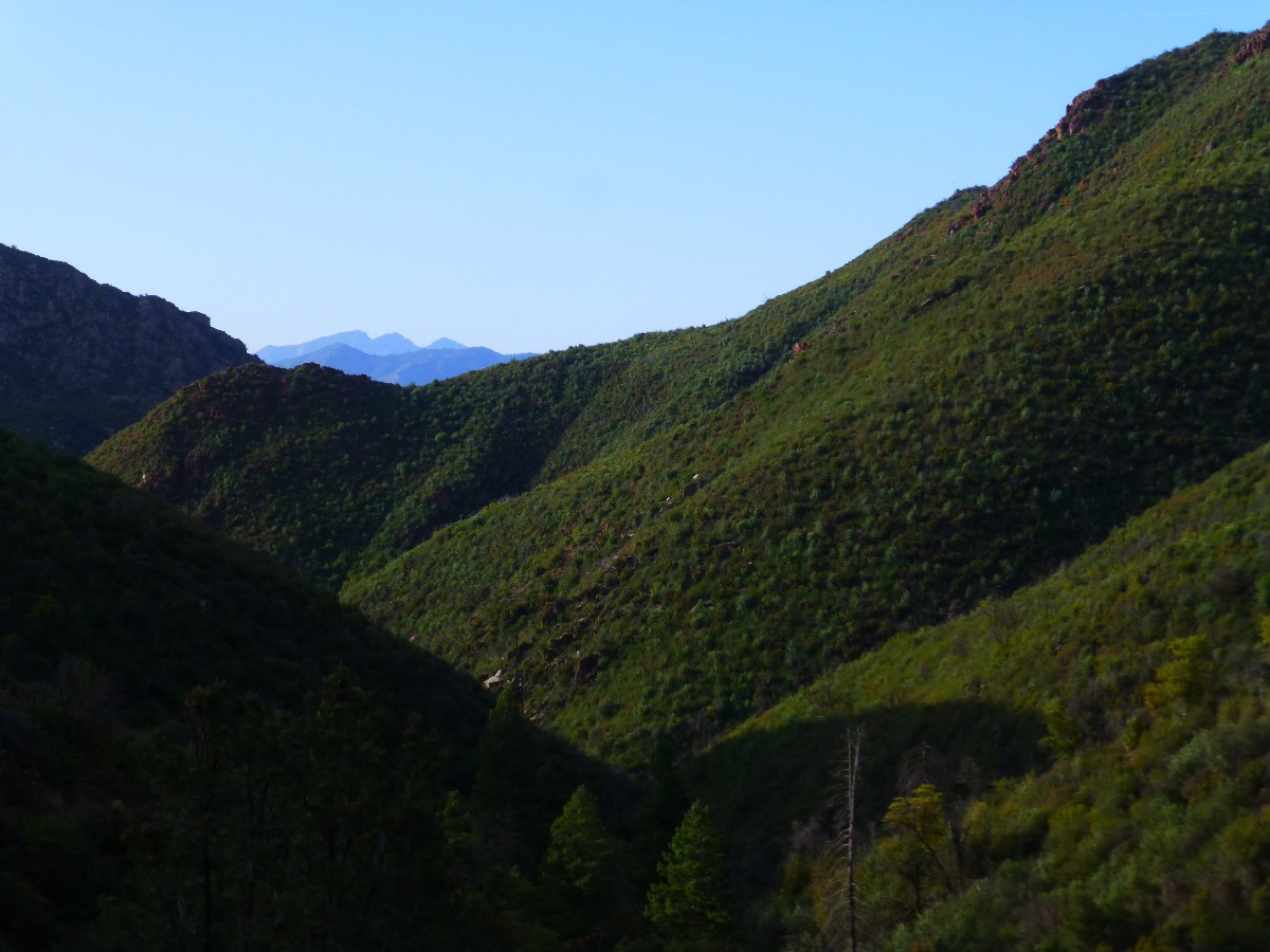
McFarland is magnificent because it's one of the tiny niches of big Ponderosa and
Fir that the fires mostly missed. The area was scorched by the Willow Fire in 2004 and the Sunflower Fire in
2012, considerably downgrading the beauty of this section. Some of the big P-Pines at McFarland are scorched,
yet seem OK. Apparently a ground fire swept through this area. And, there's water here today as a super bonus,
with good camping too. As a bonus bonus, the howling harpy wind has difficulty penetrating this narrow cleft of
greenery. The downside is that this cleft acts as a cold air sink, and this on top of it already being cool
today.
I see no one on the AZT today. The only people I see are a wrecking crew
removing a vehicle, as I slip through the underpass of Highway 87.
Even the admonitions of the harpy hurricane die away, and I'm left with what
tin can tourists fear, quiet, a nothingness of noise. Then, an evening hummer stops by, and that's natural quiet.
Day 21 on the AZT
Day 21: Peeley Pull Out. To Mount Peeley TH and home:
AZT 404.2 + .05 = 4.3 miles. ERM = 9. Total AZT miles = 200.8 to 404.2 = 203.4.
At 5782' at 9:35 a.m., I leave the AZT at the Mazatzal Divide Trail and hike
to the Mount Peeley TH, ending my quest for the Arizona Trail 200. A paisley swirl of emotions encompass me
as I lilt the last bit to the TH.
I'll have to return later to retrieve the resupply bucket from Mills Ridge TH,
and to say "aloha!" (goodbye and hello) to the AZT.

|
|---|
Wishing you Rainbows from the AZT, Aloha! (Day 5)
(Click the image for the full-size image)
|
|---|
|

*ERM: Energy Required Miles, are there data to support this
mileage adjustment?
Journal of Outdoor Recreation, Education and Leadership
Petzoldt first proposed his theory in his 1976 book “Teton Trails” to
help backpackers plan trips and calculate their energy needs on mountain trails. “Petzoldt defined one
energy mile as the energy required to walk one mile on the flat. He recommended adding two energy miles
for every 1,000 feet of elevation gain, so a person hiking one mile and 1,000 feet upward would use the
equivalent of three energy miles,” Phipps said.
Petzoldt’s energy mile theory was just a reflection of the mountaineer’s
“gut feeling,” Phipps said. The theory had never been tested in a laboratory before the study began in WCU’s
Exercise Physiology Laboratory in the spring of 2010, Phipps said.
To determine the validity of the theory, the study measured the energy cost
and perceived exertion for walking on flat ground, with and without a 44.5-pound backpack, and up an elevation
gain of 1,000 feet, with and without the backpack, through the collection of metabolic data, Phipps said.
Twenty-four student, faculty and staff volunteers, including 12 males and 12
females, went through four testing sessions as the research continued into fall semester of 2010. The study
results showed that the additional energy cost for ascending 1,000 feet ranged from 1.34 to 2.02 energy mile
equivalents, for an average of about 1.6 miles, compared to Petzoldt’s use of two energy miles for each 1,000
feet. The range revealed by the study was due to the “hikers” personal weight differences, Phipps said.
“It is remarkable that Petzoldt’s energy mile theory is so close to the actual energy cost measured during our
study,” Phipps said. “In the field of outdoor education, it’s important for leaders to include an estimation
of energy requirements during the planning of hiking trips.”
Phipps said the energy required for hiking up steep mountain trails would vary
for individuals and groups, and the variables of the trail would also factor in, but he recommends that
backpackers stick with Petzoldt’s idea of adding two energy miles for every 1,000 feet of elevation gain when
planning trips.
The Validity of Petzoldt's Energy Mile Theory, 2010
Authors: Maridy McNeff Troy, Maurice L. Phipps
Publication: Journal of Outdoor Recreation, Education, and Leadership
Links and books:
Arizona Trail Association - trail and water conditions; maps of some of this hike
How to use alum to clarify water prior to treating it.
Bill McKibben – suggested books include: Maybe One, Eaarth, The End of Nature

|
|---|
Looking for All Wilderness Vagabond trip reports about hiking the Arizona Trail?
Click the image to go to All WV reports about The AZT, Arizona Trail
|
|---|
|
Maps:
|
|
|---|
Map - AZT mile 200.8 to 301.6; passages 13 (Oracle) to 17 (Picketpost), from my garmin, 4.3 mb
(Click the image to see the map)
|
|---|
|
Right
Click (then save this file: "save link as..." in most browsers) on this Download link to get the GPX file from
my GPS - you can then open it in your mapping software. Note - that's a Right Click on this link.
You will get the track for your software shown in the map above.
|
|
|---|
Map - AZT mile 301.6 to 404.2; Picketpost to Mt. Peeley TH,
from my garmin, 4.6 mb
(Click the image to see the map)
|
|---|
|
for a full-resolution map of this second section, click here. 8.6 mb Caution - do not use this map or gps track for
navigating the route.
Right
Click (then save this file: "save link as..." in most browsers) on this Download link to get the GPX file from
my GPS - you can then open it in your mapping software. Note - that's a Right Click on this link.
You will get the track for your software shown in the map above.
Reports about bits of the Arizona Trail:
Mazatzal Meandering:
Baby Doll TH to The East Verde River (2014)
Mazatzal Divide - Arizona Trail Passages 23 & 24:
Mount Peeley TH to Doll Baby TH (2015)
San Francisco Circum-ambulation:
Circumnavigation of the San Francisco Peaks
and Musings about the Life Zones of C. Hart Merriam
(2015)
Related Sites:
Scenic Toilets of Inner Earth:
Scenic Scatology of the Wilderness Vagabond
We Are Breeding Ourselves to Extinction (click here for full article, pdf)
More Truth Than Joke:

|
|---|
in science we trust
(Click the image for the full-size image)
|
|---|
|

|
|---|
reality has a liberal bias
(Click the image for the full-size image)
|
|---|
|

|
|---|
Oh oh
(Click the image for the full-size image)
|
|---|
|

|
|---|
big money is government
(Click the image for the answer)
|
|---|
|

|
|---|
bombs not food
(Click the image for the full-size image)
|
|---|
|

|
|---|
beware - evil forces
(Click the image for the full-size image)
|
|---|
|
"What luck for the rulers that
men do not think". - Adolph Hitler

|
|---|
more precious than money
(Click the image for the full-size image)
|
|---|
|


