Burney Falls State Park (PCT 1415.9) to Seiad Valley (PCT 1653.4)
PCT miles = 237.5 miles
ERM (Energy Required Miles) = 409
Text and photos © copyright by Rob Jones

| ||||
|
| |||||
|
| |||||
|
| |||||
|
| |||||
|
| |||||
.
“There are some good things to be said about walking. Not many, but some. Walking takes longer,
for example, than any other known form of locomotion except crawling. Thus it stretches time
and prolongs life. Life is already too short to waste on speed. I have a friend who's always
in a hurry; he never gets anywhere. Walking makes the world much bigger and thus more interesting.
You have time to observe the details. The utopian technologists foresee a future for us in which
distance is annihilated.To be everywhere at once is to be nowhere forever, if you ask me.”
"Estranged from Beauty –
Solo Hike
Camera - Panasonic DMC-ZS60 (I'm still learning about this camera, so some photos are, well, not so great.)
none can be –
For Beauty is Infinity –
And power to be finite ceased
Before Identity was leased."
Background: My trail name is Wild Vagabond. Many years ago, I "earned"
this trail name in The Grand Canyon, and brought it with me to The PCT. The website name
"wildernessvagabond.com" evolved from the trail name.
Prior to this trip,
I hiked from PCT mile 702 at South Kennedy Meadows to Burney Falls (PCT mile 1416.5).
With the present excursion to PCT mile 1653.4, the total will climb to 951.5 miles (about 36%) of the PCT (2650 miles in length),
making it
a Pygmy PCT Promenade. 951 gorgeous miles rambling on our precious public lands, along the Pacific Crest Trail.
I got into hiking the PCT, in segments, following the Jaunty Juggernaut
hike of the John Muir Trail - See the various PCT and JMT reports here --->
All Wilderness Vagabond trip
reports about the PCT, JMT, Sierra hikes I used some of the quotes from the JMT report - because
they seem quite relevant to this current hike.
I kept notes of distance and elevation gained and lost each day, using the
exquisite Halfmile app, and the most excellent Halfmile PCT maps (see links). I used the Halfmile point-to-point
data to estimate the ERM,
Energy Required Miles. Full credit is due Halfmile and his www.pctmap.net site for maps and tracks used to
design this trip. The Halfmile app is available free, and it will calculate the data for determining ERMs as well as
tell you where you are on The Trail.
Maps: I color copied the Halfmile maps and sent sections with the
resupply boxes. These paper maps are what I used most of the hiking day. I also used the Halfmile app and
found it worked well. I occasionally used the Guthook Atlas Guides PCT app yet it took a very loooooong
time to load on my phone and it reloaded far too often (it appears to be optimized for the iphone).
You'll see extensive references to the Halfmile PCT mileages in this report. Thanks to Lon Cooper,
Halfmile, for his incredible public service to the hiking community.
I have to confess that I have started writing journal notes in the dumb-ass phone because the text is easy to export
once I get home. And, I can email sections of writing home so that I don't lose any journal notes.
Here are my journal notes, some photos, and the daily data and trip map,
and links to the outstanding Halfmile maps, tracks, and waypoints.
ERM = Energy Required Miles. A mile is added for
every 500' elevation gain or
loss. It's a very serviceable method of estimating energy required miles. ERM was initially used in Trails
of the Tetons (long out of print) by Paul Petzold, founder of NOLS. It's a wonderfully useful concept and
application. Add one mile for each 500' up AND down to distance = ERM. I use ERMs to calculate what the actual
day is like. It's a very serviceable method of estimating energy required miles.
Using ERMs does not account for the 'texture' of the route or trail - that
is, rocky, boulders, no trail, slimy mud, etc., yet does help approximate the route.
There is additional information about the valididy of using ERMS at the end of this report.
“PCT miles” reference the mileage from the Southern US border of the PCT, as specified in Halfmile's maps, a trail bible. Also note that the trail (PCT miles) has been reconfigured following a re-measurement of the trail by Halfmile and crew. This and re-alignment of the trail means mileage numbers in this report do not necessarily match mileages in old guide books, maps, or reports. See the links section at the bottom of this report for references.

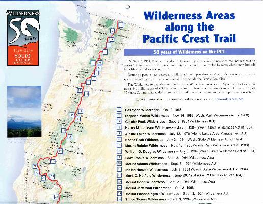
![]() Maps for Days 1 - 7: for the wonderful Halfmile maps for section O, California, 82.2 miles: Start - Burney
Falls State Park, mile 1416.5
End - Hwy 5 [near Castle Crag], mile 1498.7, these maps cover days 1 to 7 of this hike, click here. Fairly large
pdf file. Twelve pages of maps and elevation profiles.
Visit pctmap.net for waypoints, tracks,
more maps -- for the entire PCT. A super resource. Each of these three pdf files is approximately 20 mb (well worth
the digital dithering).
Maps for Days 1 - 7: for the wonderful Halfmile maps for section O, California, 82.2 miles: Start - Burney
Falls State Park, mile 1416.5
End - Hwy 5 [near Castle Crag], mile 1498.7, these maps cover days 1 to 7 of this hike, click here. Fairly large
pdf file. Twelve pages of maps and elevation profiles.
Visit pctmap.net for waypoints, tracks,
more maps -- for the entire PCT. A super resource. Each of these three pdf files is approximately 20 mb (well worth
the digital dithering).
| ||||
Preliminary - driver:
Finally, I'm lounging in the Desert Rose Inn in Reno, body jigging
like a treadle sewing machine, coming down from near caffeine psychosis and settling in for a short night
before the final leg to Burney, CA tomorrow. Whew. A Carl Hiaason audio book helped me get here today (Chomp).
It always amazes me how time intensive and laborious it is to sort and
arrange logistics for a stroll on the PCT, Pacific Crest Trail. How to get on and off the trail, where
to resupply, where might one find water, where does one stay on the trip to and from the trailheads, how
many meals to prepare for each segment, and lots of the typical backpack preparations. Once done, I
often wonder what took so long, yet of course the solutions are clear and effortless from a hindsight position.
I feel wrung out from the drive and also from the tedious plodding
arranging things to get here. Soon, I'll be on The Trail and the minutia will fall away to reveal the
joy and wonder of being, being on The Trail, absorbing and melding into the country. Ahh.
And, I'm free of the corporate selfishness of the airline corporate
welfare artists. Never again will I support these takers (without service) if I can find another way
to travel. How come? You'll just have to read the "Dancing Donner, PCT 2016" report to find out.
The next morning I'm up early and on the road to Burney, where I mail
two resupply boxes (one to Castella - Castle Crags, and one to Etna), meet 2 PCT hikers while I'm in
the post office and take them back to the trail before returning to Burney and parking at the Green
Gables (a wonderful place to begin and end a section hike) and finishing last minute packing before
Dave of Burney taxi takes me back to where I left off last year on the PCT.
 |
 |
 |
| ||||
| ||||
Day 1: Ouzeling Along. To Jake Spring: PCT mile 1415.9 to 1425.3.
9.4 miles. ERM = 15. Camp @ 4170'. 2,000' cumulative feet of elevation change today, and over 700 of this is down.
The nondescript bird bounces on a wet boulder in the frothy flow of Rock Creek,
then pops into the water and flies underwater and upstream. Totally amazing; Dipper or Water Ouzel. (See the first
video in this report for a Water Ouzel dipping in Rock Creek.)
Out in the full sun, the heat hits me like a brick tossed from an eight story
tenement building. Wham.
To start the day, I drive the rest of the way, from Reno to Burney.
Leaving the car with Nancy of Green Gables, I ride the Burney Taxi with Dave
Marks to near the Burney Falls Campground, where I departed the PCT last year.
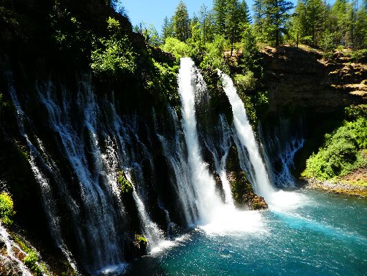
I meet the first PCT hiker, Griffin, at Burney Falls State Park, photo.
Getting on the trail in the oppressive heat is difficult (it's 1 p.m.), and
I'm happy to briefly swirl the trail in the cool draft from the falls before slipping into the dappled scorching sun.
A respite at Rock Creek, tired. Yet there is the joy of watching the Water Ouzel.
Finally at Jake Spring, it's tedious gathering water dribbling from the spring
pipe, assaulted by mosquitoes.
Here I meet the Ed troop; Ed, Carl, Ann, and Bryan.
Happy to have lugged the TarpTent, I am sleeping on top of the bag, just out
of proboscis reach by mosquitoes as Day 1 closes.
Beans and potatoes with chicken, peppers, green beans, onions; pad thai soup.
 |
 |
 |
 |
 |
 |
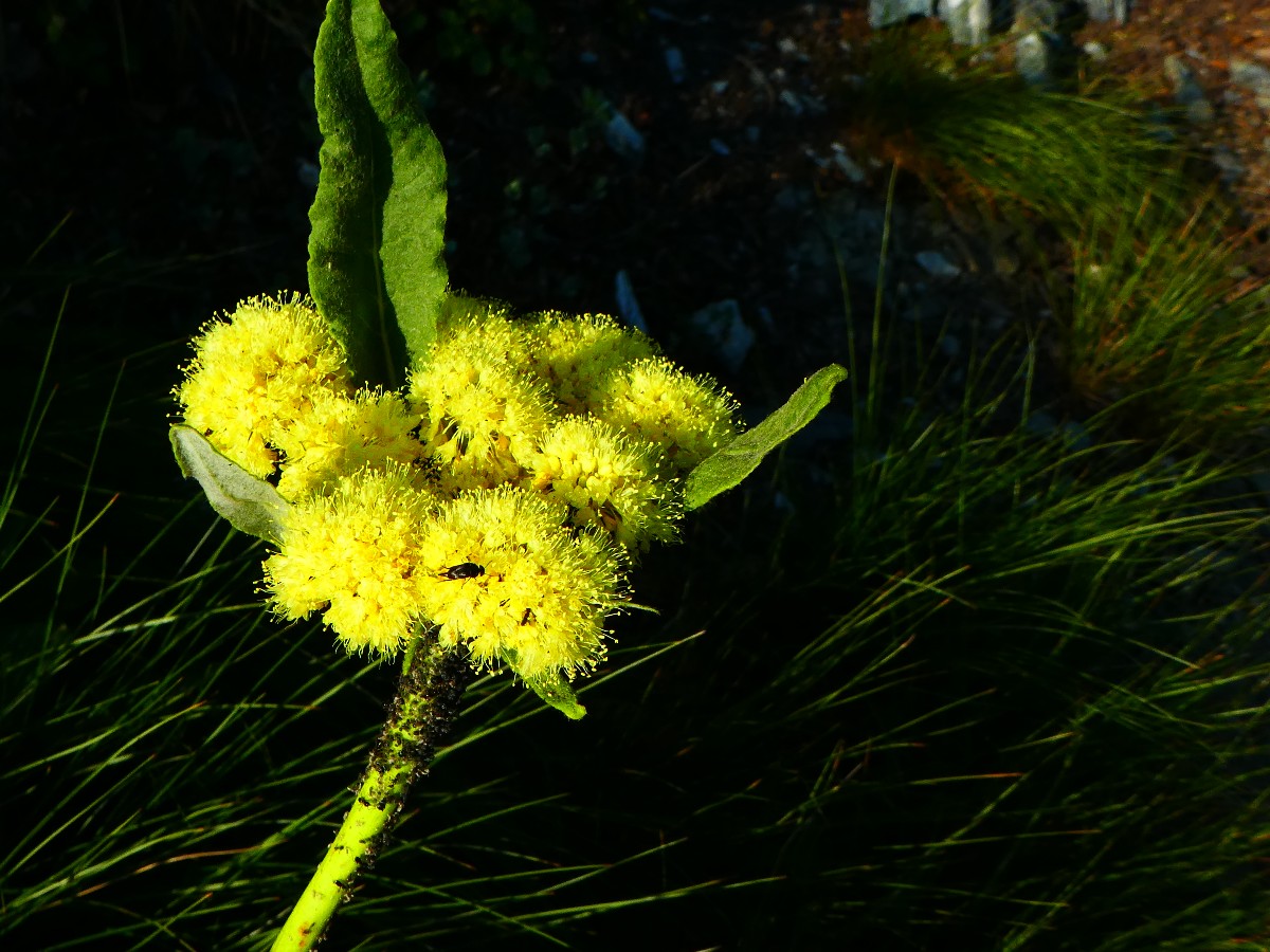
Day 2: Washington Lily. To Kosk Spring:
PCT 1437.9. 12.6 miles. ERM = 19. Camp @ 5120'
More lilies poke brilliantly through the vegetation. The long stems
of the Washington Lily makes this possible. There are also Tiger Lilies, red columbine, paintbrush,
Larkspur, Lupine, more. A grand view of Mt Shasta appears as we gain elevation. I'm hiking with Bryan,
Ann, Ed, and Carl and we're all headed for Kosk Spring. I've loosely joined this group, which is hiking
from Burney to Ashland.
Cold water greets us at Kosk, making for a delightful bucket bath. And
some clothes rinsing.
It's a fine day except for a troubling sour stomach. What? Giardia?
Heat effects? Unpleasant. I nearly throw up a few times, and fear I will use all my toilet paper before
the end of Day 2. I feel sad and disgusted about the possibility of aborting the trip, yet mostly I feel sick today.
Wiling away the afternoon, all too soon it's time for dinner. Another
good thing, no mosquitoes. A pleasant evening creeps over the Kosk Spring camp.
Alpine spaghetti with miso soup.
 |
 |
 |
Day 3: Moosehead Musings. To near Alder Creek:
PCT 1452.6. 14.7 miles. Plus 1 mile round trip to the creek. ERM = 20. Camp @ 5410'.
Hiking up from Bartle Gap, enjoying the aroma of the Washington Lilies,
rounding the low bump and expecting another ranging view of Mt Shasta, I hear the resplendent rushing
roiling and refreshing Moosehead Creek. Now, it feels like a mile to get to this frosty water rest stop,
where the group is sprawled in the shade enjoying the PCT. Lovely. Upper Moosehead appears through a
veil of moss with a footing of Yellow Monkey Flowers.
Then it's more up and down, sometimes with shade and sometimes not as
the heat grows into the afternoon. I encounter the first snowbank of this quest and put a clump of snow
under my hat. Refreshing.
Eventually, the junction of the trail to Alder Creek appears.
There are basically adequate camps near this junction, and 0.5 miles out
some gorgeous water (and better camps, but I'm already set up). Good water results and a cool evening.
Cheddar broccoli pasta with chicken, corn, mushrooms, green onions; miso
soup with tofu bits.
 |
 |
 |
 |
 |
 |
| ||||
Day 4: Bearly One and Done. To the McCloud River, Ash Camp Campground:
PCT mile 1468.4. 15.8 miles. ERM = 32. Over a mile of elevation loss today. Camp @ 2420'.
The bear tracks are partially obscured by the early hikers. Bufus
has strolled the narrow ledge contouring the steep hillside, the trail notched into the bedrock. You
have one step and you're done; one and done. Bufus Bear knows that the trail provides the easiest passage;
and, he doesn't want to be one and done, so he uses it, probably at night.
It's a cool morning near Alder Creek, and Ed claims that he has a reading
of 45F. Not long after it's light enough to see the trail, hikers start for the McCloud, a destination about
15 miles distant. The others of this group that I've loosely joined eat bars for breakfast and hit the trail.
Me, I cook couscous and enjoy the slowly lighting camp in the big conifers. Deluxe.
I stop at Gold Creek for water, having brought little from Alder Creek.
It's a very quiet trail this morning, and I encounter a doe and twin fawns
feeding along the PCT. The doe seems only curious yet the fawns jump around and run back and forth, to mom,
into the brush, as I advance. Then, the doe utters a mewing noise and joins the fawns.
Speak Up comes into view. He has flipped North to Ashland and is now hiking
back toward the snow infested Sierra, where Winter snow levels were 200% of normal or more. Creeks and rivers
in the Sierra are raging; snowfields clog the passes and beyond. It's an interesting year to hike the JMT,
John Muir Trail, section.
Down, down more.
I pause at Deer Creek for a foot break and a quick snack, then trundle on
toward Butcherknife Creek, which is about 4 miles short of McCloud. Along the way, I meet cute Convict, who
has also flipped North and is now hiking South. PCT hikers are flipping in an astounding variety of ways,
their quest disrupted by the difficult conditions in the Sierra.
Thanks to the trees for the shade, I mutter as I creep into the Butcherknife
oasis, moss, elephant-ear water plants (locally called parasol or umbrella plants), delicious cold water. Past
time for lunch.
Back out in the intermittent sun, which drills holes in my hide, the poison oak
begins to line the trail. Argh.
Finally, Ash Camp Campground, hot and not much. A mostly operational toilet
and a few fire rings and lots of hot ground. Yet there is small McCloudy McCloud River and a good place for
a swim in the tributary (Hickock?). Yahoo. The McCloud River appears to be carrying silt or something
producing a McCloudy glacier stream opaque blue.
Mac and cheese with chicken, green beans; hot cocoa.
 |
 |
 |
 |
 |
 |
Day 5: Pig to the Trough. To West Trough Creek:
PCT mile 1479.4. 11.0 miles. ERM = 22. Camp @ 3170'. 5500' elevation change to West Trough Creek from Ash Camp.
The alarm goes off and is almost ignored given the lulling background of
Hickock Creek. Cool air has been flowing down drainage, allowing wondrous sleep and dreams. And it's time
to get hiking before the true heat envelops the PCT. Ed and crew blast out of camp at first light and I wave
farewell and thanks for the camaraderie. It's a civilized pleasure to enjoy a sit-down toilet this morning,
rather than searching for good loamy dirt in which to dig a hole and then pack out toilet paper. A gift from
the Romans, who were all about engineering toilet systems.
I encounter Snakebite, Rise, and Shine with Copper the dog, sisters on the PCT.
They're cooking breakfast on a rock outcrop after being chased there by the generous mosquitoes of Fitzhugh
Creek, last water until Trough Creek.
Because of feeling ill earlier this trip I have extra lunch and pause three
times, pigs to the trough, on the way to Trough Creek to catch up, culminating with a third lunch leaning
against a monarch Douglas Fir a few feet from the burbling Trough Creek, enveloped in luscious shade as the
battery in the solar charger, which is out in full sun, requires shade from a scrap of bark because of the
vicious heat and sun. (The American-made Lightsaver (PowerFilm) charger is a mere 4.9 ounces and contains a
rechargeable battery. This battery will overheat if on the hot Eaarth and in full hot sun, thus the shade from
the scrap of bark.)
I filter extra water and decide to stay in the Trough Creek camp because of
uncertainty about whether there is camping at Squaw Creek, last water for another 10 miles. That, and I
discover that my left foot pain from the toes being crowded to the side of the boot by the highly angled
trail tread (almost always angled left) is a serious looking blister where the little toe has been pinched.
I drain and wrap it after a soothing bucket bath.
Orzo and beef with peas; wakami soup with a little extra salt.
 |
 |
 |
 |
 |
 |
Day 6: Shasta Views:
To PCT 1493.9. 14.5 miles. ERM = 31. Camp @ 3750'. Cumulative elevation change of 8600' today.
The trail climbs steadily, a decent grade with dirt on the tread (dirt on
the tread, a rarity on the AZT, Arizona Trail), a lovely early walk through the trees to 4600', where I stop
for a long break to revive feet and metabolism (snack). I find an excellent view of Mt Shasta and surprisingly
good cell coverage. So, I send out a draft of these notes and attempt to call Kathleen. For the first time
this trip I feel slightly chilled.
Very early today, nearing large Squaw Creek, I meet Ed and Flame who are heading
South and hope to camp at Ash Camp tonight. We talk of camps and water sources and then of creatures seen on
the trail. The topic of Water Ouzels naturally dips into the conversation.
From Squaw Valley Creek at 2600', it's a steady long uphill to this rest stop,
at 4600'.
An Oregon Junco comes to visit and to pose for a photo. Cute guy.
Ofir from Israel joins me at the dirt road crossing.
Hiking along the contour, following Ofir, with grand vistas of the Trinity Alps,
Castle Crags, and Mt Shasta. It's the sort of ranging vista not found on the Appalachian Trail.
Beta joins me at the spring near Fall Creek. He started early to take advantage
of the snow bridges over creeks in the Sierra and to avoid the sloppy snow.
Loading up with water, I continue to the dry camp which has a spectacular view
of Mt Shasta. Now, Dan of the UK and I are sitting in camp enjoying the view and a good
discussion too. We talk of the Grand Canyon and, of course, the PCT.
The hulking Mt Shasta watches over us as strength lags and dusk descends.
Scrambled eggs with orzo, sausage TVP, mushrooms, green and red bell pepper;
asparagus soup.
 |
 |
|
 |
 |
 |
 |
 |
 |
 |
 |
 |
Day 7: Amaratti Breakfast Burrito. To Castle Crags State Park. Resupply:
PCT 1500.7. 6.8 miles. ERM = 13. Camp @ 2600'.
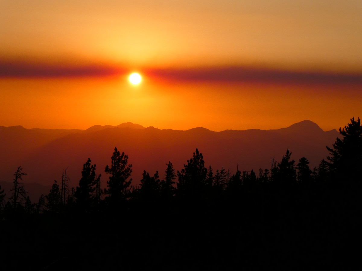
Morning dawns a golden yellow, light slowly defining Mt Shasta. Train horns bellow
in the dark valley below. It's morning of Day 7. Dan of the UK and I drift down easily to the Sacramento River
and the nearby frontage road, through a dark and quiet mature forest. I start walking to Castella and Dan makes
a sign and tries to hitch a ride to Shasta on I-5. I walk to Castella and to a breakfast burrito at the Amaratti
Market in Castella, yummy.
Then it's time to fetch the heavy resupply box and sort things into and out of
the pack. The result is a very heavy pack, especially when contrasted with the lightweight just off the last
section. I mail home a few things and walk to the park (Castle Crags State Park) to flush the filter with
vinegar, set up in the PCT Hiker camp, and eventually enjoy a hot shower. Luxurious.
Totes, Erica, Dan the Mayor, Loree round out the PCT groupo at the hiker camp in Castle Crags State Park.
Another sandwich from Amaratti's, ramen, salmon pouch, cocoa, extra Snickers bars.
 |
 |
 |
 |
 |
 |
 |
 |
 |
Day 8: Disappearing Water. To near Disappearing Spring
Camp at 1508.7. 8 miles + 2 for access from Crags Park. 8 miles on the PCT (10 total). ERM = 17. Camp @ 3550'.
Rounding the corner in the trail below the granite Crags, I lurch to a stop
because - Bufus Bear has passed and left dusty footprints. Wow. And, on top of footprints from today's early
hikers. It's a maze of trails exiting Castle Crags State Park and returning to the PCT. Then, into glorious
granite country, the granite instrumental in holding streams of crystal water. Views of the Crags are occluded
by a haze of smog or fire smoke. Yet, they are still delightful. Uphill, with a 2,000' climb to come.
Again encountering Erica and Dan at the Disappearing Spring, we share a ranging discussion of republican
voters continuously voting against their own best interests, to the hypocrisy and compound lies of trumpentine,
to the fallacy of upward mobility for all and how it's more diagnosis by zip code, to data driven vs.
political/administrative decision making, to, of course, the PCT. Wonderful people, exhibiting compassion
and concern for others - they've already served in the Peace Corp, and are now seeking public health advanced
degrees. They continue on and I contemplate my schedule. You see, I am anchored or limited by the Stage
Transit that serves Seiad Valley because it operates only twice a week. So, I might as well stay on course
and not hike long (for me) miles, because if I do, I'll be waiting in Seiad Valley, in the heat and among the
Jefferson secessionists. So the climb to 5600', to 6700' can wait for the coolness of tomorrow morning.
Hatch, whom I met in the Castella post office, comes charging back down the
trail from up at the pass, 12 miles ahead. He's hiking back to Castella and then on to Dunsmuir to catch
public transportation because he received a text while at the pass that his dog is ill. Yikes, what a long
ramble. Still, Hatch pauses and we talk about life and times in the Owyhee country. We agree about the
mystical worthiness of official wilderness status of the Owyhee Canyon country, a totally amazing place. It
seems that we were both born in the same hospital, which has since been torn down. Strange coincidence.
So, I camp among the live oaks and conifer, hanging my massive food bag high
from an oak tree branch with the aid of my trusty parachute cord. A tribe of mosquitoes sings me to sleep.
Alpine spaghetti with olive oil, parmesan cheese, parsley, and garlic; miso
with tofu bits soup.
 |
 |
 |
 |
 |
 |
 |
 |
 |
Day 9: Braden's Spring. To spring off PCT 1519.3:
10.6 miles. ERM = 19. Camp @ 6500'.
I round the corner into the springs area and there they are, jade green
carnivores glowing in the morning sun. Wow. Pitcher Plants, possibly some orchids too. I've come
up to 5800' in the shade of the Crags, enjoying the early coolness during the climb. Filtering some water
(I've climbed with a basic amount), I continue along the trail and find a place for an early snack, which
is surprisingly difficult to do because of the sidehill and thick manzanita.
It's now lunch and I'm at about PCT 1416, where there are exposed camps,
and one tree, out on the end of a ridge. It's a stunning panoramic view of Mt Shasta to the Castle Crag
ridgeline. At about 6300' and cool in the bug clearing wind, even wearing a long sleeve shirt I feel
chilled at times. Fluffy clouds are pushing over the nearby ridge and swirling about Mt Shasta, causing
me to wonder if there might be a weather change coming. And, it's very quiet on the trail now, with
only a Stellar Jay squawking at me. I saw a flurry of 5 hikers this morning, and nothing since. More
shallow climbing.
Then, I meet Dennis, Daniel, and Christopher, the FS
Trail Crew for the Trinity-Shasta NF. They are fixing a section of the PCT, and wondering where the
Soapstone trail sign has again gone. They suspect someone is stealing the FS signs, attempting to keep
the trail a secret. Of course, they note, these are some of the same folks complaining about gov'mnt waste.
We discuss the two Salmon Rivers, one nearby and one sheltered in the Frank Church River of No Return
Wilderness in Idaho,
click here for the link to a report about the real Salmon River, floating the Middle Fork Salmon
which brings
us to talking about hot springs and how many miles of trail could be cleared if one less bomb were built.
More gradual uphill brings me to the ridge where it dips below the high
points in small saddles. I see Echo Lake suspended in what looks like a hanging cirque across the canyon
to the South, then reach the junction to Braden's Spring and walk 0.3 miles off the North side of the ridge
and find a crisp and clear flow perched on the fairly flat edge of a very steep hill. The view of
cloud-ringed Shasta is outstanding.
For dinner, the down Jacket comes out for the first time (other than
as use for a pillow) on this trip. It's high and cool in this camp.
Potatoes and pinto bean flakes with green peas, sausage TVP, and green
onions; generic miso soup.
 |
 |
 |
 |
 |
 |
 |
 |
 |
Day 10: Porcine Porker to Porcupine. To Porcupine Lake:
To PCT 1528.8. 9.5 miles. ERM = 13.5. Camp @ 7240'.
The pink-laced light streams through the gap near Mt Shasta, leaving a
horizontal defining line between golden and dark. It's a gorgeous view from the Braden Spring camp. On
the trail, the Seven Lakes roll into view as the trail works its way up to the pass amidst granite outcrops.
From here, the PCT stays mostly on the ridge to the next road crossing, providing ranging views across the
Mumbo Lakes to a snow-studded mountain range that must be the Trinity Alps.
At the dirt road crossing and route to Picayune Spring, I meet Long Legs
(Cheryl), a botanist for the FS who is clearly in love with The Frank. That's the Frank Church River of
No Return Wilderness, where she's again going, this time to near the Flying B. Glorious! We chat
extensively about places and people along the Middle Fork Salmon, including Kathleen and my time volunteering for
two months in The Frank.
click here for the link to the Salmon Sojourn trip report
I drop down to Picayune Spring for a liter of cold water and find a lush
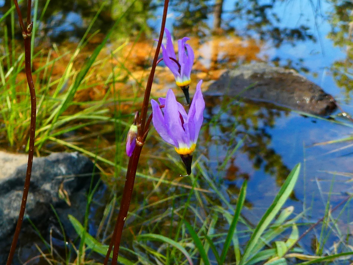
pygmy garden teeming with Monkshood, wild rose, columbine, paintbrush, other stuff.
And back on the PCT to just beyond Whiteridge Spring where a cleft North
of Whiteridge affords a sweeping vista of Mt. Shasta for lunch #2. The PCT is more and more West than South
of Shasta. Two healthy lunches today, a porker traveling to Porcupine Lake?
I'm early to Porcupine, and enjoy some camp time; a bit of laundry, a bucket
bath. Life is good.
Porcupine is a lovely little lake with clear and not frigid water; and it's
too close to the trailhead, from the Toad Lake CG (campground) to the North or from the last forest road to
the South. The squirrels are brazen, expecting hand outs like the rich, corporations, and big banks and
there have been too many fires sullying the soil. So, I camp carefully and hang the food and the pack.
Of course, short distance hikers stroll in before sunset making this the busiest camp on the trail so far.
Lasagna and orzo; egg flower soup.
Day 10 Photos - PCT 2017


Day 11: Drop Dead Deadfall. To PCT 1543.4. Chilcoot Creek:
14.6 miles. ERM = 20. Camp @ 6660'.
This morning it's a greenish glowing sunrise across Porcupine Lake. Lovely.
The well engineered trail rises through the pass above Toad Lake and continues
through a brief snowfield into a flowerfest among the bare naked rufous bedrock, somehow maintaining its
lilting trajectory through the next notch, where the PCT meets the Sisson Calahan Trail.
About the Sisson Calahan Trail, from "go-California:" "Cattlemen, prospectors
and trappers who came into the Upper Trinity Area from Scott Valley first established the trail in the mid-1800's.
The trail was constructed around 1911 shortly after the creation of the Shasta National Forest. The trail
linked the Callahan Ranger Station with the Forest Headquarters which was in Sisson (Mt. Shasta) at the time.
The trail provided a much shorter route for Forest officers traveling between the two stations than the wagon
road From Sisson to Gazelle and then up Willow Creek to Callahan. A telephone line was also maintained along
the trail between the two stations. The trail also served as access to a Forest Service lookout on Mt. Eddy.
The lookout was abandoned in 1931. The original Forest Service trail blazes may still be seen along the trail.
Beginning at 3,500 feet near Lake Siskiyou, the Sisson-Callahan Trail climbs
to the 8,020 foot Deadfall Summit, the drops to 7,200 feet to tie in with the Pacific Crest Trail (PCT)."
Continuing along in the early coolness, where the trail is for now in the
shade, I arrive at Deadfall Lake just in time for a luxurious footbreak before continuing to the road crossing
at the Parks Creek TH. It's drop dead gorgeous near the springs beyond Deadfall, where a garden of Monkshood,
monkey flowers, orchids, paintbrush, cow parsnip, et al., glorify the place. Along the way I encounter dozens
of day hikers, some on the way to Mt Eddy, @ 9,000', and a smattering of backpackers. The trailhead is crowded
with vehicles. And to think that I had seen no one from Porcupine to Deadfall. Nary a day hiker goes North
on the PCT.
North of Parks Creek TH, the trail loops around the drainage in the baking sun,
"baking" being a relative term in contrast to the scorcher down below. Triple-S from Germany comes along as
I'm enjoying a liter at North High Camp Creek. On to Chilcoot Creek where camping is sketchy and there is
water. Mountain Goat comes along the trail, hiking South, with a list of names of people he saw on the trail
today and I'm surprised that the Ed crew and the three sisters are less than a day ahead of me. The total
camp count tonight is 9. Erin strolls in from the North as I'm starting into:
Cheddar broccoli with chicken, mushrooms and corn; red miso soup.
 |
 |
 |
 |
 |
 |
 |
 |
 |
 |
 |
 |
 |
 |
 |
 |
 |
 |
Day 12: Pitcher Up. To PCT 1553.3:
9.9 miles. ERM = 13. Camp @ 6150'.
It's a red morning (sailors take warning; good thing we're not sailing?)
at the Chilcoot dormitory. Goat is up early, and I hear soft snoring and mild groaning from the young women's
tents on the hill.
Fidget comes down for morning water.
The trail climbs limply around Bull Lake and through a low pass, again encountering
the Sisson Calahan Trail which appears to receive little use.
Bulbous Bear Grass emanate an inner harmony from a cleft in the red patina granite
boulders.
Forest and Harry come by during my first reconnoiter/foot break and we talk about
water use in the West. photo
Crossing a side hill meadow, a wildflower aroma aura envelops me, and exuberant
Cane Toad and Chef too. From Arizona, we have much to talk about; have you hiked this, explored this cave?
Arriving at the water at 1547, Harry, Forest, Cane Toad, and Chef are busy with
water or breakfast; and I start in then notice a phalanx of Pitcher Plants. Appearing like glowing alien beings,
these plants have ramps that entice insects to the entrance and around the bend to their doom. Exciting stuff.
Time to attempt more photography.
Burger Time arrives as I'm leaving the spring, and he gives me a rundown on
eateries in Etna. Thinking, sometimes dreaming, more often of food, it sounds like everything is good in Etna.
Perhaps they have a chili Verde burrito wrapped in half a pizza, I muse.
Mare's tail clouds fly across the sky and I wonder if this predicts a weather
change?
I'm boosting the monster pack up when the small boulder on which I've propped
my leg rolls off the side hill and gouges out a strip of my shin skin. Ouch.
Pocahontas and Captain Cowboy come by as I'm washing my leg at the next water
and we chat about the camping options in Etna. I slothfully roll into the camp and spring area at PCT 1553 and
set up camp. Bovine intellects, the cattle not the republican congress, have visited the area and left their
calling cards and are now nowhere to be seen. Of course, the bovine are kinder to public lands than republicans
(their bullshit can be beneficial in small quantities), who believe their mission is to privatize or give all our
lands to corporations, to the detriment of all citizens. Selecting a shady spot without cow influence, I'm happy
to be home.
Beef stew with orzo, corn, and peas; Chinese style seafood soup with an egg
(no seafood).
 |
 |
 |
 |
 |
 |
 |
 |
 |
 |
 |
 |
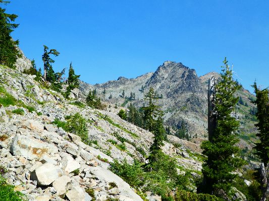
Day 13: Trinity Alps. To PCT 1562.4:
9.1 miles. ERM = 14. Camp @ 6420'.
It's a pleasant morning in camp 1553, with the distant murmur of a
roiling creek far down canyon and a saffron hue to the local foothill. This morning, it's couscous and
raisins with milk and protein powder. Yummy, and a few more ounces off the back.
Pimp Daddy, Poppercorn, and Vapor, camp mates for the evening, hit the trail early.
Nearing Scott Summit, 5407' at the crossing of Hwy 3, I look and look for
Hayden Cabin, which is depicted on the map. I see it vaguely in the trees below and work down slope for a
photo. Not much and the scenic toilet is long gone.
From the summit, the trail heads back up over 6500' and into the Trinity
Alps Wilderness. Ahh, wilderness! I arrive at one of my possible camps for the day and call it good enough.
There are Pitcher Plants, froggies, and other interesting stuff in the nearby wet meadow, enough to keep me
occupied for awhile. In addition, I want to rinse some clothing, and also get it dry.
Tarahumara joins me in the camp. Spanish is her native language.
Tarahumara is the name of the Natives from Chihuahua.
At dusk, Polar Bear, from Finland joins us in the meadow camp. Polar
reports that he got his trail name because the frigid stream crossings in the Sierra did not bother him.
Yikes. It's feeling like a cool, perhaps chilly night. Big thunderheads rove the sky to the East and
I wonder if they might visit?
Sweet and sour pork with rice and tuna; miso soup with a touch of salt.
And a slice of avocado from Tarahumara. Yummy.
 |
 |
 |
 |
 |
 |
 |
 |
 |
 |
 |
 |
 |
 |
 |
Day 14: Alp Walking. To PCT 1575.6:
13.2 miles. ERM = 21. Camp @ 6250'.
Mike from Alaska catches me on the climb to over 7400' and Scott Mountain
Summit. The views are deluxe and contain Alps and cirques and tarns and showy flowers. Heather blooms
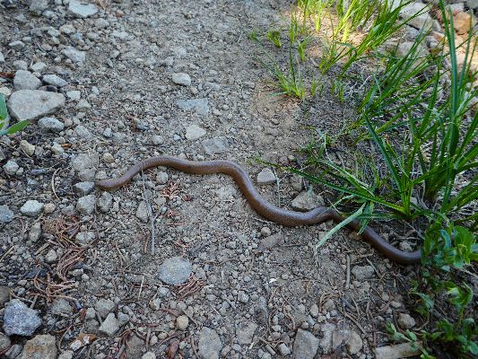
among the granitic boulders. A striped racer snake slithers across a meadow, nearly eluding photography.
A distant mountain range is adorned with snow, and we struggle to identify it. Is it 30 miles away? Talking
with Mike helps the miles go by, and then I stop at 1573 for water and lunch, while Mike hikes closer to Etna,
where he is rendezvousing with his wife. Mike is a mechanical engineer from Alaska, and after more hiking,
he's considering becoming a teacher. Public Schools need solid liberal (i.e., able to think critically) citizens
like Mike.
While eating lunch, thunderstorms brew above and there is the distant sound of
thunder. Yikes. This time, it's a false alarm.
Dropping off the ridge, the trail loses a bunch of the hard-earned altitude.
I'm happy to see the sparse campsite nestled among big trees for shade (and
perhaps wind protection?) near the clear and cold stream at 1576.5, fed by a spring just up the local bowl.
My feet cheer and the creek burbles.
Orzo and beef with green peas; wakami soup.
 |
 |
 |
 |
 |
 |
 |
 |
 |
Day 15: See-saw to Statue. To the Statue Lake Outlet:
PCT mile 1588.3. 12.7 miles. ERM = 24. Camp @ 6900'.
Again, the trail dips dramatically down, then immediately goes back up,
repeatedly losing and gaining the same elevation. The long grades of the last few days are not in evidence
today. See-saw. Reaching a high point of about 7300' above Jackson Lake, the trail starts down toward the
Russian Wilderness. I left the Trinity Alps Wild a few miles back when I crossed Carter Meadows Summit,
near Hwy 93. It's brisk up here and there's a snowfield languishing among the granite boulders exposed
along the rim of the Jackson Lake cirque. North facing. Continuing into the Russian, the PCT works along
the white granite flank of the Salmon Mountains, far above South Russian Creek, a Klamath Wild and Scenic
River (Hurrah!). The final see-saw of today is a steady climb up over 7,000' over a side ridge just off the
mountain range spine. Happily, there are clouds for this climb; sadly, rain sets in about the time I'm
finishing a quick bucket bath. I'm fairly wet, then notice I'm getting wetter and the breeze is colder -
and, hey! it's raining on me. And, a recent fire has swept through this basin, making locating a decent
camp a tedious process. Burned trees and ash are all about. If you have the time and energy, consider
continuing out of the burned areas to Payne Lake.
The dribbling rain goes on for nearly an hour, disrupting my dinner plans.
I'm happy to be somewhat clean and snuggled in the Marmot bag because it's quite cool in the downdraft of
the thunderstorm.
Emboldened or energized by the storm, mosquitoes and gnats assault me
when I come out of the TarpTent to cook dinner. A shaft of direct sunlight certainly feels good right
now, as the mosquitoes struggle with my permetherin-infused long pants and shirt. Haw!
The food bags are almost empty, my clothes are grungy, my stomach has
shrunk, it must be time for a town visit.
Scrambled eggs with orzo, green peppers, mushrooms and TVP sausage;
cream of asparagus soup (German, Maggi brand, very good).
 |
 |
 |
 |
 |
 |
 |
 |
 |
 |
 |
 |
Day 16: Etna! To PCT mile 1597.2. R & R Bunkhouse; resupply:
8.9 miles. ERM = 15. Camp @ 2950'.
The early morning light slants through the ghost trees of the Russian Wilderness;
it's a quiet morning walking the burn through lovely igneous granite. The PCT is back in living trees by the
time it loops near Payne Lake. Here I see Shaggy from Alaska tanking up on water because he's skipping Etna
and walking through to Seiad Valley, and the next water is 10 miles beyond Etna and we're still 5 miles from Etna
Summit. Shaggy tells of three weeks in the Sierra with wet feet and occasional peeling skin off his feet.
A preliminary to trench foot? He's hoping to get a good short job after the PCT to fund his next hike, maybe
the Hayduke or Arizona Trail. If the trumpites give his health care to the rich, he may be forced to change
plans. Right now, he gets coverage through his parents' plan, one of the many benefits of the Affordable Health
Care law to those not on Obamacare, including no caps on coverage and no denial of care because of preexisting
conditions. The selfish repulsican congress wants to give away these benefits to please their corporate
masters, hurting all humans (they are not) in the process. Of course, if members of congress had the same
health insurance (not coverage) as the poorest among us, things would change for the better. Somewhere,
there's a religionist teaching about this - ignored by fake christians everywhere. If there were more actual
humans in congress we would have universal health care, now.
The trail climbs a thousand feet or so to reveal a smoky sea of ridges above
Etna, with an occluded view to Shasta. I meet two young women from Etna who report several new fires started
by yesterday's thunderstorms. Ick.
A bit of snowfield to traverse and I'm heading down to Etna Summit, where I
find several other hikers waiting for a ride to Etna, and there's no cell coverage.
Along comes a local woman driving an old pickup and we all pile in, then head
downhill on the serpentine narrow road to Etna, population about 700, elevation 2900'. After getting my resupply
package from the Hiker Hut ($10 fee! for leaving it outside on a hot sunny porch (send yours to the cool,
secure post office in Etna)), I walk to the R & R Bunkhouse to meet Trail Angel Cate, enjoy a shower and do
much needed laundry.
After some lounging, I walk over to the drive-in and get a SW burrito. When I
return to the R & R, I find that I am the only remaining hiker and enjoy the facilities by myself.
 |
 |
 |
 |
 |
 |
 |
 |
 |
Double Zero Days; 00. Two days off The Trail in Etna:
The R & R (Rough & Ready) work for stay bunkhouse is spartan and yet deluxe;
with sleeping in a converted garage and access to a shower and kitchen and covered lounging deck. Hiker
advisory rating - deluxe! Close to all the essentials (grocery, post office, beer, restaurants, library),
the R & R is delightful - if you are willing to do just a tiny bit of work.
As noted above, I'm ahead of schedule and needed to adjust my schedule -
and a 00 in Etna was superb - so I could meet the Stake Transit in Seiad Valley, which operates only two days a week.
I worked on these journal notes, sorted photos, and lounged in addition to
enjoying Etna and discussions with Cate and crew.
I won't report the next two zero days separately, yet I stained a portion
of Cate's new fence and enjoyed many excellent conversations with her, Dad Mitch, and sister Kris. It's a
restful respite at the R & R. Thanks Cate!
click here for the link to the R & R (Rough & Ready) work for stay bunkhouse
 |
 |
 |
Day 17: Marbelacious! Into the Marble Mountain Wilderness.
To Shelly Lake outlet camp:
To PCT 1607.9. 10.7 miles. ERM = 18. Camp @ 6240'.
With lungs wheezing slightly, I climb the ridgecrest into the Marble
Mountain Wilderness. Yes, it's the Pacific Crest Trail, on the crest. At the wilderness boundary.
I meet Optimistic Turtle and we exchange picture taking. There's a hint of smoke in the air and the
skyline is murky. And, it's a gorgeous skyline when not obscured by haze, with dark and white naked
summit bumps protruding along the craggy crest.
Somewhere along the yo-yoing ridge trail near Cub Bear Spring I pass
the 900 PCT miles mark; I've hiked 900 miles of the PCT from Kennedy Meadows, South, to right here, that is.
The day starts in the delicious coolness of the R & R Bunkhouse, with
final pack preparations, a bit of breakfast, writing a thank you note to Cate, and a short walk to Main
Street in Etna to hitch a ride back to Etna Summit, which takes about 20 minutes.
The trail rolls through shallow passes on its way to Shelly Lake meadow,
over big gravel tread that walks like a talus slope at times. I'm setting up camp after gathering water
and searching the knoll, without result, for the Wilson Cabin shown on the map when Rick (Dr Jones), an
archeologist, joins in for camping and dinner discussion. Simpatico. Rick worked for the forest service
in Washington state. Before hitting the trail, Rick was busy writing letters to the trump antichrist
wealthy and nonrepresentative elite cabinet against proposals to eliminate or shrink our wondrous
national monuments such as the Bears Ears. This is special public land and deserves expansion, not
be subject to corporate welfare and commodity mayhem. A newt, froggies, tadpoles, and dragonflies ply
the shallows in the meadow. A sudden increase in the mosquito population signals bedtime.
Lasagna & Orzo; Vietnamese porridge fish flavour - as a soup.
 |
 |
 |
 |
 |
 |
 |
 |
 |
 |
 |
 |
 |
 |
 |
Day 18: Undulating Marble Mountain Ridge. To Marble Valley Cabin:
PCT mile 1621.2. 13.3 miles. ERM = 24.5. Camp @ 5750'. 5,800' of elevation change today.
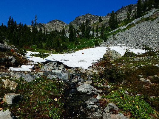
The crystal water emerges from a snow cave amidst a foreground of showy
flowers and a backdrop of the Marble Mountain crest. Deluxe. It's time to tank up for the climb over the ridge.
Torpedo, from Germany, strolls up and poses for a snow and flower photo.
The uphill feels long as Torpedo, from Germany, and I hike above Man Eater Lake.
We encounter Zed from Scotland hiking South and he tells us it's downhill soon. Wrong. The trail continues up,
finally dropping down to the Summit Lake junction at mile 1616. This is a good place and time for lunch.
Several burned areas make some of the hiking exposed and hot, yet the local fires are not smelled. Still, the
distant views are smoke cluttered.
3-G strolls along, pausing for a brief conversation. She is named for the
three gallons of water she carried in the desert. I met 3-G at the R & R in Etna.
Marshall Dunham, Old Bee-keeper, is lounging in the conifer shade on the next
climb, and I take advantage of the opportunity for another break. He's the first person I meet during this
trip that is near my advanced age.
The trail continues to undulate along and off the Marble Mountains ridgeline.
My left little toe is complaining louder and louder. It's been a long stretch without water sources, the trail
is too high on the ridge to access water in the springs and cirques below.
All day I've been hiking toward the massive white plate of rock comprising Marble
Mountain, with a hulking top knot of black rock sitting high to the North. Now, as the PCT drops steadily into
Marble Valley, the trail skirts the foot of the massive monolithic Marble Mountain during the final approach
to the Forest Service Marble Valley Patrol Cabin. The rock appears to be something rather than marble - something
to investigate. Apparently, the light colored rock is a limestone and the dark knob is metamorphic.
Arriving, finally, at the stream and cabin, I'm disappointed to discover that
there is no scenic toilet associated with the patrol cabin. Disheartening.
It's been a long day, and camp chores and a much needed bucket bath occupy the
time until sunset. There's an orange cast to the near hills from low angle light through smoke. Argh. Not bad,
however, I cannot smell smoke and my breathing is fine.
At dusk, two helicopters trailing water buckets on cables briefly interrupt
three bachelor bucks browsing nearby. The newly half moon is chasing the sun to bed.
Cheddar broccoli pasta with chicken, mushrooms, and corn; Aka (red) miso soup
with extra salt.
| ||||
 |
 |
 |
 |
 |
 |
 |
 |
 |
 |
 |
 |
 |
 |
 |
 |
 |
 |
 |
 |
 |
| ||||
Day 19: Buckhorn Bound. To Buckhorn Spring:
PCT 1632.1. 10.9 miles. ERM = 19. Camp @ 6510'.
The snowfield feeds directly into a sinkhole below Black Marble Mountain,
also watering a slope of diverse wildflowers. Gorgeous.
At times, wildflowers are higher than my head and it's difficult to see the trail or my feet. Arriving at
Paradise Lake, I see a scenic setting but a mucky lake with little to offer. King's Castle oversees this
part of paradise. It's a good place for a footbreak, especially because the trail has been so quiet today
- I've seen one hiker to 10 a.m. As I write this, along breezes Catalyst and I get her photo with King's
Castle as a background. Catalyst's big hike was delayed as she graduated in environmental science, studying
the canopies of old growth forests. Hurrah for scientists!
As I gain elevation above the Turk Lake junction, PCT 1628, I notice a
smoke plume from what might be the Island Fire. As I cruise along the contouring Crest Trail (finally,
a contour), I see plumes from at least 3 small fires across the valley. The lowlands are filling with
smoke, yet for now, at 6700', the air is clear and cool albeit the sun is hot.
I'm reclining in the shade of a twin-trunk pine as helicopters freight
water buckets back and forth across the Crest. It's a sylvan rest stop but for these aerial barges. A
snorkeler also passes low over the ridge.
Nonstop arrives at Buckhorn Spring for a rest.
Not wishing to drop into the smoke or heat zone, or out of the wilderness,
I opt to stay near Buckhorn Spring where the water is crisp although somewhat tedious to gather, and the
shade from the three-trunk pine delightful.
Scorch rolls in for dinner before continuing closer to the burg of Seiad Valley.
An orange fireball sunset closes out Day 19 of this pygmy PCT.
Sweet and sour pork with rice; pink salmon pouch; miso soup with extra salt;
wasabi roasted seaweed.
 |
 |
 |
 |
 |
 |
 |
 |
 |
 |
 |
 |
 |
 |
 |
 |
 |
 |
Day 20: Major Downer To Hell. To Grider Creek 4th crossing/campground:
PCT mile 1646.9. 14.8 miles. ERM = 31. Camp @ 1700'. 6500' of downhill today, and 1600' up.
The trail slips down, down through the early morning and a smattering of
blackberries and thimble berries, ranging switchbacks looping down, down more. The morning is already very
warm as I hike from 6500' to 3200' at Cold Spring Creek, where I take my first break of the day alongside
this chilly evaporative cooler.
I meet Pocket Rocket (Romana from Switzerland) and we chat down the trail
to the third crossing of Grider Creek. She crossed through the Sierra with Polar Bear and others. Sections
of trees and bridges have burned and I'm happy that the two top burned bridges have been replaced.
I stop at the third Grider crossing (2300') for lunch as Pocket Rocket
surges toward Seiad. I'm tired and wet, although the hiking has been quite enjoyable overall. I'll be
soaking the shirt and hat in the creek before again setting out for an area somewhere near the first crossing.
Thomas, from France, stops for a rest. He's trying to get into Seiad to
get a package but not roast while doing so. Timing is difficult because of post office and store and cafe hours.
I'm wilting. When I drop through a swale, humidity as in a pressure cooker
engulfs me. Argh. Smoke builds. Heat builds. It's republican hell. We are living in republican hell.
The false christian republicans (basically all those in Congress) blame others for being poor, so they
steal from the poor and middle class and give to the money changers, the very rich (who deserve it because
they are, well, rich), and corporations (who have money that is speech, more money (i.e., speech) than
actual voters). The bible admonishes those who have much to care for the less fortunate about 700 times;
not a casual directive. Yet republicans conveniently turn around this directive into take from the poor
to garnish the rich - and republican voters fall for this totally disproven voodoo economic "plan" over
and over and over. It never works as advertised.
In a miasma of ennui, I reach the final crossing of Grider Creek, now near
1700', and the partly operational campground.
Express, a lovely young woman, rolls in after 26 miles and she heads for
the pool in Grider Creek. Most of the hikers stacking up in this area head for a pool in Grider Creek.
A soak in the creek partly revives me from the visit to hell.
Rick of Oregon joins me in the campsite and delivers some electrolyte. Wonderful!
Mosquitoes mob us and I am forced to put on long pants and shirt,
necessitating another dip about sunset.
Sometime after midnight it's cool enough to slip the feet into the bag.
The burbling melody of Grider Creek soothes.
Flash photos of Lego and cute Sassafras.
It's fun being around this group of youngsters, Thomas, Sasfrass,
Express, Rick, Lego.
Potato and beans with chicken and peas; hot chocolate.
 |
 |
 |
 |
 |
 |
 |
 |
 |
Day 21: Seiad Sad. To XX land of Jefferson; oppressive heat; secessionists: To PCT mile 1653.4, Seiad Valley. 6.5 miles. ERM = 8. Camp @ 1370'. 35.7 trail miles from the California-Oregon border.
(Total PCT miles = 237.5; Total ERM, Energy Required Miles = 409).
Fifteen mosquitoes sit on the pan lid as I wait for the couscous to fluff
up. It must be morning at Grider Creek camp.
The road walk of The PCT commences, perhaps the only road walk on The PCT.
It's a 6 mile road walk to sad Seiad. As I graze the blackberries, the hard road surface begins to bruise the feet.
Eventually, the Klamath River Bridge appears after walking the highway for
awhile. Then, it's almost a mile to Seiad, bathed in noise from unmuffled vehicles and under a pall of
forest fires smoke and oppressive heat.
Here I see Thomas, Lego, Jennifer (just dropping down from the North), and Dopey (going to join friends in
Ashland soon).
After checking in at the RV campground next door to the double-X combo of
restaurant, store, and post office, I enjoy a shower before lunch with Jennifer and Thomas.
Thomas (from France), Jennifer, and I then while away the afternoon under
the camp shade trees.
I would need a second shower before bedtime near the noisy highway. This is not Etna.
Ash falls on the TarpTent, heat rustles through the oaks, high decibel
vehicles ply the tarmac, double-Xers rove our common public lands. No, not Etna.
I try to sleep while reliving the tappity-tap of my poles across the Klamath
River Bridge at the close of the pygmy PCT 2017.
 |
 |
 |
 |
 |
 |
 |
 |
 |
Epilog - The long and winding road:
So, the exit disintegrates at the start. The Stage Transit decides
to cancel the Seiad to Yreka route today, Friday. Ugh. I only learned about this cancellation because
I call Stage early in the morning to find out what time to have Dave of Burney meet me in Weed.
Jennifer and I easily catch a ride with David and grandson Lance, to
Yreka, where the plan gets back on track. The Stage is running from Yreka to Weed. It is no doubt
because Jennifer is a redhead that the ride comes so quickly. David drops us off at the Yreka Stage
Transit hub, hurrah.
I meet Dave of Burney Taxi at the Greyhound shack (really, just a shack)
in Weed and off we go, back to the Green Gables where I had left the trusty Subie Subaru. A fine meal
at LaFogata in Burney tops off the day before I collapse in the well-appointed Gables. It's luxuriously
deluxe. As I drift off to sleep I wonder where are all the fine people I met on The PCT? Out there on
the long trail, hiking the good hike. The majority youngsters, I hope they help guide our rise and
recovery from the tyranny of repulsicans and corporate democrats. The future may be brighter than I fear.
The next day I continue to Tonopah, Nevada, breaking up the drive into
manageable parts. A long phone discussion with my friend Stan helps the miles pass. The following day,
I'm back on the Colorado Plateau, marveling at the cool air and the ocean of Ponderosa Pine. And, I'm
wondering what to do with a whole day not hiking, just dolefully staring at this small mound of equipment
and wondering...... what next?
I'll be reliving and remembering the Northern California Cruise on this
edition of the Pygmy PCT through the photos, the memories, the contouring through the wild forests and
grasslands and along the ridges of Northern California.
Epilog Photos - PCT 2017


| ||||
 |
 |
 |
| ||||
| ||||
.
*ERM: Energy Required Miles, are there data to support this
mileage adjustment?
Journal of Outdoor Recreation, Education and Leadership
Petzoldt first proposed his theory in his 1976 book “Teton Trails” to
help backpackers plan trips and calculate their energy needs on mountain trails. “Petzoldt defined one
energy mile as the energy required to walk one mile on the flat. He recommended adding two energy miles
for every 1,000 feet of elevation gain, so a person hiking one mile and 1,000 feet upward would use the
equivalent of three energy miles,” Phipps said.
Petzoldt’s energy mile theory was just a reflection of the mountaineer’s
“gut feeling,” Phipps said. The theory had never been tested in a laboratory before the study began in WCU’s
Exercise Physiology Laboratory in the spring of 2010, Phipps said.
To determine the validity of the theory, the study measured the energy cost
and perceived exertion for walking on flat ground, with and without a 44.5-pound backpack, and up an elevation
gain of 1,000 feet, with and without the backpack, through the collection of metabolic data, Phipps said.
Twenty-four student, faculty and staff volunteers, including 12 males and 12
females, went through four testing sessions as the research continued into fall semester of 2010. The study
results showed that the additional energy cost for ascending 1,000 feet ranged from 1.34 to 2.02 energy mile
equivalents, for an average of about 1.6 miles, compared to Petzoldt’s use of two energy miles for each 1,000
feet. The range revealed by the study was due to the “hikers” personal weight differences, Phipps said.
“It is remarkable that Petzoldt’s energy mile theory is so close to the actual energy cost measured during our
study,” Phipps said. “In the field of outdoor education, it’s important for leaders to include an estimation
of energy requirements during the planning of hiking trips.”
Phipps said the energy required for hiking up steep mountain trails would vary
for individuals and groups, and the variables of the trail would also factor in, but he recommends that
backpackers stick with Petzoldt’s idea of adding two energy miles for every 1,000 feet of elevation gain when
planning trips.
The Validity of Petzoldt's Energy Mile Theory, 2010
Authors: Maridy McNeff Troy, Maurice L. Phipps
Publication: Journal of Outdoor Recreation, Education, and Leadership
.
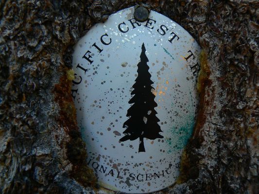
Click here or on the PCT trail marker to go to all WV reports about The PCT, JMT, Sierra hikes
| ||||
Half-mile site: Pacific Crest Trail Maps and GPS Information - a terrific resource
Pacific Crest Trail Association
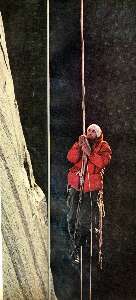
Click here to: see the First ascent of El Capitan, Argosy Magazine, 1959 (10 pages) 22 MB.
Marc Reisner (1993) Cadillac Desert: The American West and Its Disappearing Water, Revised Edition, Penguin Books
Bill McKibben – suggested books include: Maybe One, Eaarth, The End of Nature
The waypoints with numbers indicate PCT mileage from the Southern US border.
![]() Maps for Days 1 - 7: for the wonderful Halfmile maps for section O, California, 82.2 miles: Start - Burney
Falls State Park, mile 1416.5
End - Hwy 5 [near Castle Crag], mile 1498.7, these maps cover days 1 to 7 of this hike, click here. Fairly large
pdf file. Twelve pages of maps and elevation profiles.
Visit pctmap.net for waypoints, tracks,
more maps -- for the entire PCT. A super resource. Each of these three pdf files is approximately 20 mb (well worth
the digital dithering).
Maps for Days 1 - 7: for the wonderful Halfmile maps for section O, California, 82.2 miles: Start - Burney
Falls State Park, mile 1416.5
End - Hwy 5 [near Castle Crag], mile 1498.7, these maps cover days 1 to 7 of this hike, click here. Fairly large
pdf file. Twelve pages of maps and elevation profiles.
Visit pctmap.net for waypoints, tracks,
more maps -- for the entire PCT. A super resource. Each of these three pdf files is approximately 20 mb (well worth
the digital dithering).
Scenic Toilets of Inner Earth: Scenic Scatology of the Wilderness Vagabond
We Are Breeding Ourselves to Extinction (click here for full article) or at:
Breeding ourselves to extinction? .
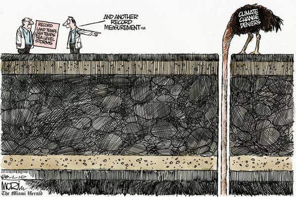
Author's note: As I finish posting this Pygmy PCT report, Hurricane Harvey is literally
drowning texas. Some say it couldn't happen to a more deserving bunch of secessionists who vote
republican, voting for Senators who deny aid to others (e.g., Hurricane Sandy) unless they cut
their budget somewhere. Wonderful fake christians indeed. Of course, now these same phony christians demand that
others pile on the help for texas - they'll get around to cutting Medicare, Social Security, and child feeding
programs later, and then get back to giving our public lands to corporate welfare artists (effectively locking out the
public from their lands, then leaving a toxic and erroded mess for the public to fix).
The lack of good government in texas has resulted in lax zoning and building codes,
giving rise to developments everywhere, paving over estuaries, wetlands, altering water courses, and lots more concrete
and more concrete, effectively producing the situation for easy and extreme flooding. A civilized society does better
(as measured by health and survival and quality of life) than an all religion, no government group. In addition,
these texas repulsicans are climate change deniers - not helpful and their reversal of good science (e.g., restrictions
on coal-fired plant emissions) will leave a sad nothingness for future generations. Increasing ocean temperatures
are like high octane fuel for hurricanes (hint - a good deal of the temperature increase of global warming has
gone into the oceans).
I say we are all in this together and will benefit from more compassion, more
education, and voting for people of integrity; more humane people. Here's a bit of additional information. And,
see the "More truth than joke" section below:
From the Yale Climate Connections site:
Yes, global warming systemically caused Hurricane Sandy – and the Midwest droughts and the fires in Colorado and Texas, as well as other extreme weather disasters around the world. Let’s say it out loud, it was causation, systemic causation.
Systemic causation is familiar. Smoking is a systemic cause of lung cancer. HIV is a systemic cause of AIDS. Working in coal mines is a systemic cause of black lung disease. Driving while drunk is a systemic cause of auto accidents. Sex without contraception is a systemic cause of unwanted pregnancies.
Climate scientists are sure to study Harvey closely for many years to come. But climate scientist Michael Mann at Penn State University has already offered an initial assessment in The Guardian: “We cannot say climate change ’caused’ Hurricane Harvey (that is an ill-posed question), we can say is that it exacerbated several characteristics of the storm in a way that greatly increased the risk of damage and loss of life,” he wrote. “Climate change worsened the impact of Hurricane Harvey.” .
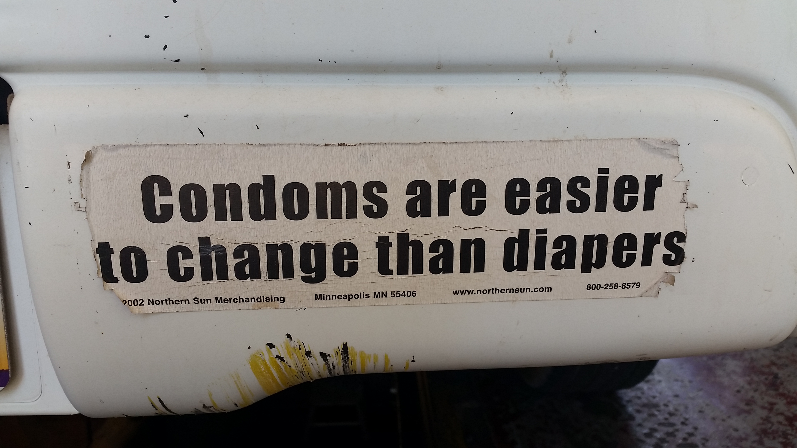
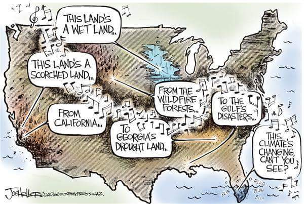
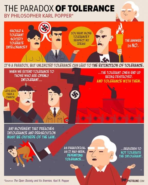
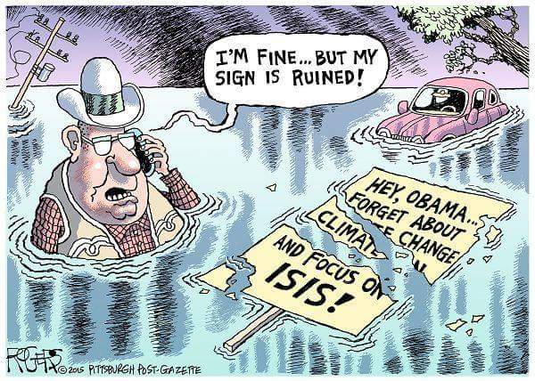
More Truth Than Joke:
| ||||
| ||||
| ||||
| ||||
| ||||
.
| ||||
| ||||
| ||||
| ||||
| ||||
| ||||
| ||||
|
Wild Vagabond Main |
Trip Report Index  |
Caveat  |
|---|


