|
|---|
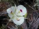
MF Sego Lily
(Click the image)
|
|---|
|
|---|
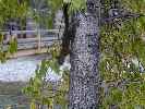
Scooterbee Tree Squirrel
(Click the image)
|
|---|
|

|
|---|
MF Hippies: Josh, Colby, Taylor
(Click the image)
|
|---|
|
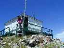
|
|---|
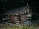
Sater Cabin
(Click the image)
|
|---|
|
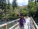
|
|---|
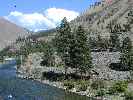
Sater View
(Click the image)
|
|---|
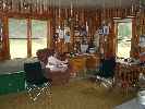
|

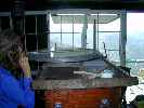
|
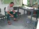
|---|
Inside Little Cr GS
(Photo by Bruce P.)
|
|---|
|
6/25/2005 Laundry day.
We heated water and tried the hand-powered laundry agitator - finding that it works OK once you get the amounts of items mostly correct. It is much quieter today, no massive air assault from MF Lodge, and the river seems fairly quiet too. Currently, the MF electric company is crackling and announcing a storm. It's very dark, with local cool winds and sinking temperatures. It's time for a weather forecast - oops, it appears to be lightning dotted with rain.
River level, according to a private group I met across the river - is at 3.14. My river gauge rock is almost out of the water, having been well under water when we arrived here at river mile 35, then forming a small hydraulic, and now this - soon it will be a river obstacle.
Big rain drops are falling, and that sweet scent of ozone air wafts by, it's too dark to see my notes, and it's time for spaghetti dinner with wine, yum.
6/26/2005 Drizzling post holing.
The gander peeks at me from around the huge Ponderosa Pine. "Urooonk?" he asks. Not getting the goosian password, he slips back down the steep bank. I tip toe to the edge and look over to see four adult Canada Geese and seven goslings, all fluffy down and a ways from being able to fly. Across the choppy waters of the MF Salmon they ferry, the tight knot of goslings surrounded by the four adults.
We had planned to hike today, but the poor weather encouraged us to dig more post holes. More rock work indeed.
We place our first order for air delivery of food - we hope Arnold Aviation picks it up in the morning. Will it end up like the materials sent by Tommy - somewhere at the lodge?
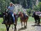
High of 77 and a low of about 70, punctuated by intermittent rain.
6/27/2005 Horse whispering.
The hay-burners are training us, it's becoming clear. When called in the morning, they do not come. Instead, they arrive after all possibility of working this day has expired. Today, they show their Roman noses and bulbous feet after we have come in for dinner. So, being well trained, I went out to whisper bushisms (e.g., you're with us, mule-face, or you're against us; no religious tolerance for you or anyone else - except those with money) to them and admit them to the pasture and feed them rolled alfalfa treats. How come? Well, I am planning to keep them in the pasture tomorrow night because the next day Tommy G.and Taylor will be arriving to take them to Indian Creek, starting the next leg of weed patrol. It will be both good and sad to see them head upriver.
The river is at 3.12' and the clouds are low, slithering through the low passes in the adjacent hills, at perhaps the 5500' level. It drizzles intermittently, and it's cool enough (low 50's) that we lounge around a warming fire in the small wood stove for part of the morning. Then, it's out to dig two more post holes and remove some old fence, along with pounding stakes to support the revamping of the steps to the outhouse.
We walk over to Thomas Air Field, and encounter Scott F., who is organizing outgoing baggage for the last of the long weekend of visitors. He informs us that, contrary to what Carol Arnold, of Arnold Aviation, told us - mail/food deliveries occur only on Thursday. So, the request we had hiked to the field last night will be sitting there for several more days. Argh. It's a good thing Kathleen did an excellent job of organizing the food for this venture.
High of 77 (for a few minutes), low of 53 (most of the morning). As noted, river level of 3.12 feet. The water has a greenish yellow tinge to it, lacking its common crystal clarity.
6/28/2005 Marble Day.
The view down river past Ski Jump Rapid is blurred a bit by the pounding hail. No, not marble-size hail, but to be avoided just the same. We cower in the cover of a Ponderosa Pine and enjoy the view. We consider dashing on to the narrow rock shelter with the Native Peoples' pictographs, but decide here is just fine. Where we would genuinely like to be is lounging in the steaming pools of Sunflower Flat HS, yahoo. Yet, when we drift past the HS, which are on the other side of the river, we see they are jammed with scouts. Oh well.
We hiked up the river trail to Marble Creek and the associated river camp, where we saw Bruce from the Canyons company unloading a big sweep boat. After helping him haul some 24 river bags up the bank and into the forest, we eat lunch then head up Marble Creek to see what this country is like. It gets wild quickly. Wishing to go farther, we reluctantly turn back because a storm is brewing in the West.
The weather clears and we enjoy the remainder of our 9-mile day hike, our first decent hike since ramping up to Mahoney LO.
Upon our return to the cabin, we find our long-nosed friends waiting for their daily treats. We keep them in the pasture tonight because Tommy and Taylor are due to return to weed crew moving duty tomorrow morning - and these hay burners know better than to show up for treats in the morning.
River lever is back up to 3.21'. Temperature range today was 50-67, humidity range was 52-78%. And, all is well in this cell phone-free zone of the Frank Church, still wild and free despite the deliberate multiple abuse and corporate logging, ranching and mining welfare so dearly paid for by the public, garnered by the welfare artists' lobbyists.
6/29/2005 Quiet river.
The pink chiffon clouds float across the wine sky. There is no one at the nearby camps and no aircraft on Thomas Field. No hikers, and the horses and mules have retired to somewhere on Jackass Flat. A deer appears to be herding a dozen Canada Geese across the river. She flips her head erratically and kicks, bucks, and jumps. The geese are not in a panic, but not calm either, as they head for the river to escape this whirligig deer. The doe must be plagued by horse flies? Deer flies, more likely.
Tommy and the week crew did not arrive today, so we turned lose the stock and worked a bit on replacing broken fence rails.
River level is 3.01 feet. Temperature range was 51-72. Humidity 43-85%. Pressure fairly
constant at 873mb.
|
|---|
Genuine Idaho, Joe
(Click the image)
|
|---|
|
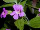
|---|
Purple Fringe
(Click the image)
|
|---|
|
|
|---|
LO Fire Finder
(Click the image)
|
|---|
|
|
|---|
GS View
(Click the image)
|
|---|
|
|
|---|
Ski Ramp Pictos
(Click the image)
|
|---|
|
|
|---|
Little Soldier Lookout
(Click the image)
|
|---|
|
6/30/2005; Day 14 Goodbye June.
It's the end of June and the end of two weeks at Little Cr. GS. It's a busy day at the GS. First, Kevin and Travis arrive to work on the remote weather station on the bluff above the GS (readings are available on a remote weather station site - see links below). We went up to Thomas Field to meet a flight that Tommy had sent - with equipment for us. We replaced the post on the mailbox mid-way down the field. No morning flight as scheduled yet today. So, we went back down to meet Jeremy and David from the FS inventory analysis, who are here to check some of the timber/forb sites scattered every 3 miles across the U.S. They took off to climb to a site on the ridge above W. Fk Thomas Cr.
Sometime after lunch, and after four false trips to the field, the 9 a.m. flight arrived, and we started attaching rails to the recent set of fence posts. Steve from MF Aviation had brought in 12 lbs. of 7.5 inch nails, a huge coffee pot, weed whips (actually, you get whipped, not the weeds), and other stuff.
Joe B. , wilderness ranger, arrived about 6 p.m. with a horse and four huge red mules, each weighing an estimated 1500 pounds, with draft horse hoofs the size of dinner plates. We enjoyed our discussions with Joe, who a few weeks ago saw a big Cougar walking the trail, then the bridge near the GS. He also told about a bear who awoke him while sleeping in the GS late last Fall, peering in the window at him.
It was after dark when Jeremy and David returned, exhausted from the route to the ridge. I helped them find their way to the Sater Cabin, where they and Joe are spending the night.
River level 2.92 feet, 1900 CFS. The temperature range today was 48-83 F.
"Sometimes, if you stand on the bottom rail of a bridge and lean over to watch the river slipping slowly away beneath you, you will suddenly know everything there is to be known." A.A. Milne (Winnie the Pooh)
July 1, 2005 Weed whipped.
The copper-hued wood tick creeps along my leg, our first encounter with these blood-sucking fiends this adventure. I squish him with the edge of my tea cup and proceed to gaze across about 125' of rolling MF Salmon.
The day began early for us. We were up at 5:30 to fix breakfast for Joe and the inventory crew. When I tried to start the stove, I learned that the propane cylinder was empty - so this is how the day actually started. Joe and the inventory crew packed up and headed up Marble Creek to examine more sites.
We whipped, and were whipped by weeds around the GS. Then, we moved the slash from the fence project and the whipped grass down to the lower end of the pasture. The cabin water pressure has dropped, so I went up to clean the filter screen in the tiny cistern - that's not it, and continued up stream to the diversion, where the intake was not under enough water - and rearranged the rocks blocking the stream so a portion of it slides down the intake. This worked for awhile but alas, more needs to be done tomorrow.
Joe, Jeremy, and David are back (two days earlier than expected). A huge down P-pine blocked their path, and the creek is too high to ford. So, once again we have the big mules whipping the grass. It's a national shame the way bushco devotes so much of your money to corporate timber sales, and starves the trails maintenance and other public resources. There is talk about eliminating these remaining GSs too, so more $ is available for corporate welfare of all types. Down with bushco up with Spring, Terra Primum!
High of 89, low of 43 F. A good day for a sun shower, which heated nicely to a temperature of 120 F on the planks above the propane tanks.
"In the end, our society will be defined not only by what we create but by what we refuse to destroy." John Sawhill, The Nature Conservancy
7/2/2005 PR Day.
The private permit boaters head back across the pack bridge and we get back to our door scraping project. "This door is a mess, flaking varnish hangs in tatters" notes Kathleen. After years of neglect, it most certainly is.
Today we said goodbye for now to Joe B., the research group, and hello and goodbye to one of the river patrol crews, Paul S. and Eric L., who were accompanied by Clay C. and Amanda R. - permit checkers stationed at Boundary Cr. Clay and Amanda are on the river learning a bit about the area they are permitting, and Paul and Eric are on yet another delightful river patrol, cleaning camps and helping to ensure the safety of all these boaters.
"All this PR stuff seems like a "post rectal" experience to me," notes one of today's visitors. After a good laugh, I agree, and add "Yet what a delightfully deluxe venue for a PR experience."
The river level has sunk to 2.82. Temperature range was 54-85 F.
"The earth does not belong to any man; Man belongs to the earth. This we know.
All things are connected like the blood, which unites one family. All things are connected.
Whatever befalls the earth befalls the sons of the earth. Man did not weave the web of life. He is merely a strand in it. What he does to the web, he does to himself. This we know." Chief Sealth, 1854
7/3/2005 Soldiering ON.
The dense Spring snow falls away from my boot treads, and, there they are - Purple Fringe, those gorgeous bottle-brushes of the high country.
We're slogging our way to Little Soldier Lookout (LO), and there is precious little snow, even up here at 8813'. It's been a delightful hike through deep fir forests. Over the nearly 9 miles from the GS to the LO, we've seen a Pileated Woodpecker (a rare sighting for me), Mountain Bluebirds, lots of flowers, and another drumming, strumming Blue Grouse using the trail as a lek. My GPS says that the total elevation gained from GS to LO is 4869'. Wow, this coupled with the 18 miles makes the ERM for today equal to approximately 26 miles. No wonder my feet are tender.
The stove and the compass sighting instrument (fire finder) are intact in the LO, and the views of distant and close peaks is inspiring. Not staffed for nearly two decades, this near-relic is a mostly unseen symbol of what has happened to the FS - benign neglect, then, it's not used, so get rid of it. Very sad indeed.
River level at about 2.62'. Temperature range of 49-82 F at the GS. We did encounter one hiker, Karl from LaPlata, NM (near Durango) - the first hiker we have encountered during our hikes over the past 2 + weeks. Karl came in from Blue Lake, and we are the first folk he has seen over the past four days. Lovely country it is.
7/4/2005 Happy Independence!
I meet Nick of OARS at Thomas Field just as the two-engine plane is taking off with two clients from his river trip. A female client developed an unusual rash, headache, exhaustion, and diarrhea over the course of yesterday, and a physician on the trip recommended evacuation.
The story actually began last night after we had cleaned up from the Little Soldier LO hike. John of OARS came by, seeking help because their satellite phone was not working. We tried ours, and it also did not work. We called Josh over at Indian Creek and he tried the sat. phone he had, also without success. John continued over to MF Lodge.
We did not learn the outcome of John's efforts until the plane came in early this morning.
After talking with Nick while his crew caught up with him - he's a Pilate's instructor in Smog Lake when he's not rowing rivers - we finished scraping, sanding, and varnishing the outside surfaces of the screen and entry doors. Our tired puppy feet relished the relative break.
High of 89 and a low of 48 F. We did not hear the river level for today, but the water appears to have dropped a bit more since yesterday's reading of 2.62'.
7/5/2005 Diversion Day
The river rolls on at 2.56 feet on the gauge, clear and cold. So does our Little Creek ditch after extensive remodeling today. We also rebuilt the diversion for the tiny cistern that supplies the house water, because the water pressure was down to a trickle, not enough to trigger the instant water heater in the cabin to turn on. I also discovered that more water flows through the water heater if the temperature is set a bit lower - I guess the heater restricts the flow when it is set to "hot." Also, on this fairly hot day, we dug five post holes, finding dirt, real dirt!
When the sun arrived in our work area, we ate lunch and retired to the hammock. Ahh.
The water is flooding the West side of the pasture, which is getting baked and is beginning to look like a desert.
I will call Bruce P. when I finish this note, to see if he and Judy are still planning to fly in this next weekend, and also to give him a wish list of extra goodies.
As noted, the water level is at 2.56'. Temperature range of 48 to 92 F. Delightful weather for a sun shower.
7/6/2005 Mending Fences.
The pink chiffon clouds float across the wine blue Idaho sky, in the cell phone-free zone of the Frank Church as the restless Middle Fork Salmon gurgles past our observation post near the Little Creek Guard Station. It's sunset on a working day here at the GS.
Today we tore out a section of dilapidated fence and installed rails on a 50-foot section we started work on yesterday. Drilling pilot holes with a hand brace, pounding the 7.5 inch nails, sawing the post tops off straight - it was a day of mending fences.
We are anticipating the arrival of our friends Judy and Bruce in two days. It will be great to see them, and relish in the delightfully deluxe veggies and fruitage they bring.
We did not hear the river level today. Temperature range was 55-93 F. The mosquitoes are becoming a minor problem as I write these notes and the light fades on a blissful scene of solitude.
"I am beginning to understand that the stream the scientists are studying is not just a little creek. It's a river of energy that moves across regions in great geographic cycles. Here, life and death are only different points on a continuum. The stream flows in a circle through time and space, turning death into life across coastal ecosystems, as it has for more than a million years. But such streams no longer flow in the places where most of us live." Kathleen Dean Moore and Jonathan W. Moore, The Gift of Salmon, Discover Magazine, May 2003
7/7/2005; Day 21 Mana from heaven.
The red-streaked single-engine plane dips smoothly onto the dirt strip, gliding in without a buck or bounce. "Yippee!" exclaims Kathleen, "it looks like we're going to be eating good stuff again." It is Ray Arnold of Arnold Aviation, Cascade, Idaho, combining mail service with 'scenic flights' with food delivery. What we care about today is the food. Twenty-seven pounds of manna for manana and several days afterwards. Romaine hearts, yogurt, cookies, eggs, and sundries, the essential luxuries of GS living, as Martha Stewart would say.
We went up to Thomas Field about 9:45 a.m., noting that last week, Ray had arrived about ten. We thought we were clever to bring folding chairs and books to read. They were beyond helpful, because we sat in the shade of Scott and Shelda's plane wings and read for two hours as the heat built and a few practice fliers, wasting our energy reserves, flew in and out, feet never touching the ground, noses never sniffing the MF air, other senses never experiencing their exhaust and dust plume as they immediately took off upon landing. Very republican.
We happily totted our groceries along the field and back to the GS, then began the afternoon chores of laundry (done in that curious hand agitator), irrigating the pasture, and reading good books.
As I walked out to change the water flow, I noticed movement in the high grass. Out popped a well-mottled head, then three smaller heads - a mother and young grouseletes on patrol for bugs and a few feet from the GS door. Imagine that.
River level at 2.47' (1390 CFS). High of 94 and a refreshing low of 56 F.
|
|---|
Cameron Cr Pictos
(Click the image)
|
|---|
|
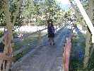
|---|
GS Bridge View
(Click the image)
|
|---|
|

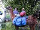
|
|---|
Judy & Bruce in Sunflower
(Click the image)
|
|---|
|
|
|---|
Lewis Monkeyflower
(Click the image)
|
|---|
|
|
|---|
John and Renee
(Click the image)
|
|---|
|
|
|---|
Judy lounges in the GS
(Photo by Bruce P.)
|
|---|
|
7/8/2005 Going Dutch (start of fourth week at Little Cr. GS).
Bruce lifts the lid from the Dutch Oven and a tantalizing brew of garlic, sage, roasted onions, and other aromas drift out upon the finally cooling Idaho air. We're sitting around Tommy G.'s fire pan and cooking Dutch Oven lasagna, and gently baking garlic bread on the grill slung above the oven. It's pork factor 5, Scotty (an old Star Trek misquote) in the Frank Church. The conversation and wine flow as freely as does the MF Salmon.
Bruce and Judy flew in from Pocatello for a brief stay, and we're making the most of enjoying it.
Earlier today, while we talked in the shade along the MF, Renee and John rolled across the bridge carrying packs and leading two big llamas, Bert Reynolds and High Noon. Delightful folks, they are traveling the Frank Church, on a 30-day flexible "non-itinerary." This is their honeymoon, and they are enjoying the world. We talk for a few hours, learning that almost all our paths crossed in Pocatello. Amazing that the world seems so small. It makes one ponder the interconnections that are being destroyed by greedy corporate welfare (timber welfare, mining welfare, grazing welfare, airline welfare, just any old corporate welfare), what the effects will be of allowing corporations to re-write our environmental regulations to increase their short-term profits, how this is all linked to political and corporate deception and greed. Yikes. As Gee Whiz bush says "what global warming?, there's no such thing, Kenny-Boy Lay and Enron told me so."
The river level is 2.43' (1350 CFS). Temperature range of 56-96 F.
7/9/2005 Sunflower Lounging.
The hot water gurgles, encompassing my head, while down below, some 20 feet or more below, the MF Salmon burbles, eddying out in the deep jade pool adjacent to Sunflower Flat hot springs (HS). We've relished the HS, sans boaters, for nearly two hours - and we love this rare time without activity on the MF. At times, this wondrous river is like an industrial tourist conveyor belt. I'm in the lowest (and coolest, "this one is just right!", said poppa bear) pool of the upper level of pools. On the downstream end of the lowest pool, the water slips down a log chute and cascades into the riverside pool that entices some folks to call this "showerbath," although that name is taken by another lovely HS in the Frank Church. It's a relatively cool and cloudy day, making HS lounging especially enjoyable.
After a satisfying breakfast of pancakes, eggs, and cantaloupe, we hiked to the MF Lodge bridge, across it and on the route to Sunflower Flat. One has to wonder if the cartographers switched the names for Sunflower HS (which really is on a broad coluvial delta populated with sunflowers) and Sunflower Flat (which has a minor number of sunflowers and is set against a steep slope, not a flat). As I wonder about this, a series of four voluminous sweep boats drift past, signaling that the tourist conveyor belt has again started. So, back to the GS we hike - for another scrumptious meal. This time it's bbq chicken, left-over lasagna, salad, corn on the cob, watermelon, and ice cream, yummy.
River level unknown today, but it appears to have dropped a bit more. Temperature range of 57-76, is 20 degrees cooler than yesterday. A drizzle sets in after we returned to the GS, and lasts into early evening.
7/10/2005 Cloudy Layover.
Yesterday's rain is continuing today, drip, drizzle, drip. Bruce and Judy had planned to fly out this morning, but the airfield is strangely quiet. Peaceful. Bruce and I see Scott from MF Lodge fly in and walk over to check conditions. Scott has been to Loon Creek and back, and notes that things above are socked in. We wait. On the way back to the GS, we note the FS horses and mules outside the high fence on the Thomas Creek West side of the MF Lodge property. So, that's where the hay-burners disappeared.
It's late afternoon, and two dozen Canada Geese stroll into the pasture, signaling that the weather is improving. Judy and Bruce fly out for Pocatello, after a terrific visit and re-supply. Two twin-engine Islander planes fly in with Iraq soldiers on respite from the war. Some have been seriously injured. Talking with Scott, we learn that the MF Lodge owner has sponsored this group of about 18, moderating our views some about this operation.
The river level is 2.41'. Temperature range was 51-64 F.
7/11/2005 Clearing out.
The low clouds that have obscured the mountain tops over the past two days are clearing out.
It's a day of work and more work. Digging post holes in the rocks, trimming brush to make way for the fence, dismantling and removing the old remnants of fence.
From across the river comes the yodeling, bad singing, and hollering of another Spanish Armada of humanoids with their abundant gear. Luckily, we enjoyed a quiet morning because planes were grounded elsewhere and the Armada had yet to arrive. Happily, I recall that this camp near the bridge is rarely used.
The river level is at 2.49' (1420 CFS) bolstered briefly by the rains. The temperature range was 52-87 F. The second tank of propane is empty - my, it seemed to go quickly, especially considering we have been mostly using the sun shower courtesy of 'ol sol rather than one of the fossil fuels.
7/12/2005 Just another fencing day.
Nothing much to report about today. We worked nailing rails to the next section of fence, napped, enjoyed a good lunch and black bean burritos for dinner. A commercial group is camped across the way, just above the bridge, but spilling over into our direct view across the river. I surmise that State Land Left must be unusable due to the lower water level (maybe they cannot land at the beach)?
The river level is 2.38' (1300 CFS). The temperature range was 55-97 F. I guess irrigating the pasture will return to the fore.
7/13/2005 Singing Sol.
It is hot enough that the air seems to be singing as we examine the Native American (Sheapeater band of Shoshone) pictographs on a low bench near Cameron Creek (9-mile round trip hike from the GS). There's a picto of ol' Sol, what appears to be a hunting scene, possibly an atlatal, and a line of naked people strolling across the boulder.
"Ancient rock paintings remind us that there are no unclaimed lands, that people have always lived here. They are wayposts along the river journey to the interior of the mind and heart." Lynn Noel, Voyages: Canada's Heritage Rivers
"Another outstanding feature of Middle Fork archaeology is the nature of the rock art sites. The remains are pictographs where design elements have been applied directly to a rock facing through the use of red ocher (hematite) paints... The rock art sites offer an incredible array of motifs and coloration (blue, white, black or red) although a detailed study of the art is lacking. The majority of the panels are associated with rock shelters and caves." (Max Pavesic, from Sheila Reddy, 1996 FS document.) Pictographs are paintings of pictures. Colored mineral oxides and/or plant dyes mixed with animal fats, and/or blood applied to protective rock overhangs can exist for hundreds of years. To the Shoshone, Paiute, Bannock, and Nez Perce people, pictographs have symbolic and spiritual meanings. Pictographs found in the Salmon River Mountains are approximately 800 to 1000 years old." (Heritage Program, Payette NF, McCall, Idaho.)
We ease back down the trail to the old Cameron boater camp (no longer in use because of the pictos and perhaps some structure impressions, maybe pit houses once dwelled here?) and into the shade of a welcoming P-pine. "Delightful," Kathleen muses "It's a skull-baking day!" Recently, the low for the day (near 60 last night) matched the high just three days ago. Sitting in the hot springs was delightful then, chilling in the river sounds better today.
A group from Western Rivers Conservancy arrived just in time for lunch. Jeff A. and the boatmen from Echo graciously invited us to enjoy taco salad, made with lots of fresh! stuff. We enjoyed talk of volunteering for the FS with Josh of Western Rivers. Josh volunteered for several years near Mt. St Hellens. There's even a wedding planned for the next night. Luckily, or per plan I suppose, Captain Jeff is also a minister, so this couple will be doubly married (by the captain, by the minister).
After we return to the GS, two FS fisheries men come by asking about the temperature and whether we had heard if "X" aviation was flying in for them at 8 p.m. We all wondered - because it was so hot - it's still 84 F a bit after 9 p.m., and many pilots will not fly until the air is cool, denser.
The river level is 2.30' (1230 CFS). The temperature range was a balmy 62 to a skull-baking 98 F.
7/14/2005; Day 28 That Otter Do It.
The MF gurgles and rumbles below the veranda at Little Creek Guard Station. It's local sunset and cool air is slipping down stream, a welcome respite to a 94 degree day. The local animal excitement has passed for the day, a trio of River Otters, slithering sinuously, effortlessly through the water, playfully rolling downstream and negotiating the riffles as if they were calm water, which to them I suppose they are. It's so easy to personify otters, doing what they ought to. They seem to smile, play, enjoy the day, so zen-like in their travels. And why not? In this rare clean and wild river, there are lots of mercury-free fish and freshwater mussels to rake in and enjoy. Certainly, there are few rivers of this quality left in the world. Most have been privatized and serve only the corporate, not the public, good.
"All things are connected, like the blood that runs in your family . . . The water's murmur is the voice of my father's father." Suquamish Chief Sealth, 1854
Today was food! day again. Kathleen and I lounged around sipping tea and reading until we guessed it was time to hike up to Thomas Field and meet Ray Arnold as he swoops gracefully out of the warming sky and plops down food! We waited and read until noon, wondering if it was too hot to fly. Ray appeared, this time in a green plane (he usually flies his characteristic red-wrapped plane). Lovely.
Then, laundry and some maintenance stuff like adjusting the gate, rolling two 50-gallon empty propane cylinders across the bridge and carting them up to the field, wire brushing and painting the propane cart. Watching the geese and the mergansers enjoying the Little Creek rafter camp without rafters. Then, a delightful sun shower and a bit more reading and journal writing before bedtime.
Currently, I am reading "Never Turn Back - the life of whitewater pioneer Walt Blackadar," Great Rift Press (1994) by my friend Ron Watters, himself an excellent kayak wrangler. Sure, I had read bits of it over the years, but now I am taking the time to read the whole story about this Salmon, Idaho physician and how he helped pioneer white water kayaking in Idaho. Ron has also written about trails and tales of the long snowshoe (crosscountry skiing in Idaho), a whitewater river guide, a ski camping guide, and, more recently, a smooth-water guide (canoeing) for Idaho.
Unknown river level, but my river gauge rock, which created a tiny hole when we arrived, is now a river obstacle, sticking up about a foot. Temperature range was 58-94 F.
7/15/2005 Working stiff.
"Clunk, grind, punck!", we're digging more post holes, the last stretch on the East side of the pasture. "This Idaho topsoil is 90% rocks and 10% dirt," I comment. Kathleen mutters something unprintable as she is locked in a battle with a Hackberry, and the Hackberry's inch and a half thorns are inflicting considerable damage to her creamy soft skin. Five more post holes, carry the heavy posts and plant them, remove a section of old fence, wired together in true Western improvisational manner, trim and saw Hackberrys and wild rose and other nasty stuff. When we finish this section, we will have built about 260 feet of post and rail fence in one of Idaho's fascinating coluvial fans (the pasture). We find ourselves aching with repetitive motion and arthritis-like symptoms when we stop for a late lunch and a well-deserved nap. It's just too hot to work in the afternoon, now that we are in the exposed section of the pasture, unprotected from the morning and afternoon sun. To add itch to ache, mosquitoes ambush us from the tall grass in the shady sections.
Uncle Sam wants you to volunteer, because the republicans see no reason to properly steward this presently public land. Perhaps this abusive neglect is designed to privatize it and sell it off to their connected friends? It's just another form of corporate welfare.
And us? Besides the benefits of knowing we are helping-out our public lands, we're just hoping for a 'rain check' to float the MF with the river patrol next June. ;-)
The river level is 2.2' (1150 CFS). The temperature range was a delightful 55 to a broasting, wind-driven blast furnace 98 F.
7/16/2005 Railing for the FS.
The ground squirrel looks out of his element. Stretched full-length along the thin gooseberry branch, he's trying to reach the sour fruit. This plumpkin is decidedly unstable. Toes curled around the branch, he noses into a tasty tidbit and pauses to nibble. Then, he suddenly falls off, splatting on the ground, albeit cushioned by his bloated belly.
We're eating another late lunch after pre-drilling holes for the ring shank 8" spikes we're using to attach the rails to the posts we installed yesterday. Using a brace and bit, it's tedious work, but more enjoyable than digging post holes. Then, we pound in the spikes with a two pound hammer. What fun. Finally, Kathleen wanders the pasture correcting the irrigation while I saw off the tops of the posts. Everything is done by hand this side of the bridge. It's quite a contrast, because wheeled vehicles of all sorts are allowed on the state land chunk that harbors Thomas Creek Field. No motors, no wheels, certainly no power tools over here.
We stopped our work in time to meet Steve from Middle Fork Aviation, who was delivering two full 50-gallon propane cylinders and taking out two empty ones. While waiting for the plane, I clean up some of the airplane camps. Nope, no fire pans required on this land, and the fire pits are filled with aluminum foil, partially burned cans and bottles, and other junk that fits with the State of Idaho view of wild lands.
Now, we enjoy sitting by the MF, with the strong breeze blowing in the cool post-local sunset air and a whiff of Bob's and Art's campfire at Little Creek Camp. Just past lovely.
River level 2.19'. The temperature range was 66-94 F.
7/17/2005 Toasted Vanilla.
Hike to Mitchell Ranch (Marble Creek), 13 miles round-trip.The light sweet aroma of toasted vanilla wafts by as I find myself shoulder deep in wild rose and brush, my unseen toes feeling the way along the obscured trail. Toasted? Yes, a fire swept through this stretch of Marble Creek, toasting swaths of trees. Some large P-pines endure, and their trademark vanilla odor seems a bit toasted - perhaps because of the fire, or just the heat of the day. It's a better-than-average MF trail, because one can tell where it goes.
We reach the ranch and find a broad bench with remnants of wheat, a couple of iron-spoked wheels, a single-bottom plow, and what little remains of the cabin and a circular corral.
We continue on to near the trail junction, and, consulting the map, realize we are only a couple of miles from Mahoney LO. Of course there's the matter of 3500' of elevation gain within those two miles. We're too close to the hills to see Mahoney, but looking back across the ranch, we can see Little Soldier Mountain and LO about 10 miles away.
The hike back is a bit too warm, and the salty sweat irritates all the scratches on my arms and legs.
Dreaming along the trail, I wonder if there really is a Norton Ridge LO? Each time I see a trail sign for Norton, I am reminded of a Twilight Zone-type nightmare I once had after driving across Nebraska. It goes like this - each time you see a road sign, it's 373 miles to the Nebraska border. If you try to pull off the freeway, you are directed right back on, and the next sign says "373 miles to the border," try to jump out of the car, all the doors are locked tight, and you see a sign - it's 373 miles to the Nebraska border.... you understand how it goes. Well, each time I see a trail sign for Norton Ridge LO, it's about 18 miles away. Does it exist?
Currently, it's a bit after 7 p.m., and Kathleen and I are sitting out on the veranda overlooking the MF Salmon, and marveling at how the water level has dropped since we arrived. We are quite tired and anticipate an early bedtime, listening to the burble and gurgle of the diverted Little Creek, with background harmonics provided by the restless, fidgeting MF Salmon.
"I sat there and forgot and forgot, until what remained was the river that went by and I who watched. On the river the heat mirages danced with each other and then they danced through each other and then they joined hands and danced around each other. Eventually the water joined the river, and there was only one of us. I believe it was the river." Norman Maclean, A River Runs Through It
River level of 2.15'. Temperature range of 52-90 F.
7/18/2005 Frankly My Deer.
"Well, look at you, just look at you, Deary" fawns Kathleen to the doe deer browsing about 40 feet away. "Have you come to see us, the salt lick, and get some fine brush?" Kathleen continues, the deer chewing and examining her with a tiny modicum of concern. I suppose it's the big hammer I am holding, or the pruning loppers Kathleen has that brings this camp deer to pause. Otherwise, she'd be closer still. Despite all the thrashing and bashing we have been doing in tearing out old fence and attempting to install the new, our camp deer remains for several more minutes, then wanders off to find a shady spot, unlike us, who labor on until it becomes too hot to do so.
The river level is 2.12' (1070 CFS). Temperature range was 54-95 F.
7/19/2005 The North 100, and Native Wild Life!
Today, we worked on the 100 remaining feet of fence we are attempting to build. Thrash and be thrashed and trashed by the Hackberries and wild rose, hammer rails and cut wire and pry apart the old fence, dig post holes in the infamous Idaho topsoil, drag rails and posts across the now lengthy reaches of the pasture..... on it goes.
The river level is 2.10' (1040 CFS). The day's temperature range was 56-96 F. There is a fire in the Pahsimeroi Valley and several engines and a helicopter have responded, or so we learn from the chatter on the FS radio. All is clear and calm in our corner of the MF Salmon, albeit smelling of incinerated fish skins - the odor coming from a commercial dory group just across the river and above the bridge. Well, most of the group and the fire are above the bridge. Directly across are three monoculture green tents and a shadow of a groover (toilet). Above the bridge are seven more, just like the sameness, the institutional repetitiveness of mormon subdivisions. It's nearing 9 p.m., and I can see the reflected glow of the fire under the beams of the bridge. It's local sunset in these parts, and has been for about an hour. The sun shower has been enjoyed. The lounging afternoon nap has been napped. I find there is just not enough time like this in these days. It has been nearly five weeks without the blare of TV, the primeval electronic cocaine, without the intrusive clatter and silly tunes followed by too-loud chatter of cellular phones, without the constant hum of vehicles in cities all across this once-great land. Once, we held some type of "moral high ground" because of our "clean" reputation as to war. This facade was shattered by bushco's rush to unwarranted, vindictive war, carefully designed, intelligent design, to cover his full-scale corporate welfare and ruination of nearly all (all?) public programs and regulations (such as health - air quality, etc.). Sad, and with the blind support of those addicted to electronic cocaine.
Wow, dear reader, you are saved from this drivel by the arrival of three comely boaters who have chosen this moment to walk out to the middle of the bridge and flash those in camp. The young man practicing his fly fishing cast in the river below the babes, misses an entire cast, and his line curls up on the current. As I burst into supportive laughter, they giggle and return to their display, certainly as showy as that of the Blue Grouse. Ahh, what lovely encounters with nature (or natural?) wildlife can be experienced in the Frank Church Wilderness!
"You could not step twice into the same river; for other waters are ever flowing on to you." Heraclitus (540 BC - 480 BC), On the Universe
7/20/2005 Turning the corner.
The air has cooled, the blast-furnace wind has calmed, and we are enjoying the delights of an early evening in the Frank Church. With no neighbors in the sometimes camp across the river, and no plane traffic to speak of today, it's a satisfying return to the semi-wild of this portion of the Frank Church Wilderness.
The river level is 2.08' (1020 CFS). The temperature range was 57-97 F., but now, on our river-front veranda, it is local sunset and a mellow 80 degrees. Lovely.
Today, we turned the corner on the monotonous, marathon fence project. We also turned our attention to leaving this lovely place. Without the break we had hoped for in the way of a working river trip, it has just been too much of the same. A "rain check" for a working float with the river patrol next June would be very nice indeed.
"Rivers know this: there is no hurry, we shall get there some day." A. A. Milne (Winnie the Pooh)
7/21/2005; Day 35 Ending chapter 5; Where is the Hospital Bar?
There is little to report today. We did laundry, retrieved our last air delivery from Arnold Aviation, and talked briefly with Scott while the Life Flight crew from McCall strapped in a guest who had developed kidney difficulties. Other than that, we note that today is the end of week 5 at Little Creek GS.
Scott told a local story while observing Life Flight personnel go through their checklists. It went something like this: A couple of years ago, Scott noticed a Life Flight helicopter buzzing up and down the canyon. Soon, the copter landed in a pasture near the MF Lodge and he went out to talk with the pilot. "Where is Hospital Bar?" the pilot asked. "We've been up and down the canyon and this is the only place that looks like it could be a bar." Scott laughed and noted that Hospital Bar is now a river camp/hotsprings at about river mile 53 (the MF Lodge is at RM 33), and is a low bench where the army had a field hospital during the so-called Sheapeater War. It doesn't have a parking lot or a flashing "Bar!" sign. The pilot reportedly noted "I wonder if that's where all those people were waving at us?" Interestingly, it was a member of the party currently staying at the MF Lodge that had called for a helicopter, after a woman broke her leg.
The river level is 2.02' (991 CFS). The temperature range today was 56-95 F. For the first time in several days, there are clouds in the sky, although nothing looks threatening. High lenticular clouds are braced by cotton-ball fluffies in the azure sea of the sky.
7/22/2005 Starting Week 6!
The large black bird cackles and caws and scurries about in the tall P-Pine at the NE edge of the pasture. "He's making a lot of noise, what is it?" I question. Kathleen replies "He's jumping all around in that tree and acting like a crow." Then, with an undulating swoop he bullets toward the Aspens, the low-angle early morning light illuminating his crest, lighting it like fire. Stunning. "I think he's a Pileated Woodpecker," I say loudly. "Wow, just look at him!" He really is a sight - a huge crow-sized black-backed woodpecker with a scarlet crest and white and black lines contouring about his wedge head clinging to a white Aspen and peeking around to display his long light-colored bill, and of course that brilliant red head crest. There is something in his call reminiscent of Woody Woodpecker, and I wonder if it is an encounter like this that spawned the idea for the famous cartoon character. And all this because we are out early bashing holes for posts in the Northern extreme of the pasture. Delightful.
The other highlight of the day is the late evening visit by Jen and Chuck, the other river patrol duo. What a delightful and laid-back team they are! We talk and talk about the Frank Church, the state of politics in the U.S., and what everyone does with the rest of their lives. Jen ski patrols in Park City, utah and Chuck has a consulting business for avalanche forecasting in McCall, Idaho. Jen and Chuck are enthusiastic about taking us down the MF Salmon, and we wonder how come this did not happen?
We see a variety of the 'public' as well today. Airplane campers and short-range boaters who had picked up part of a permit on a last-minute cancellation. The boaters are packing up their gear and lugging it up to Thomas Field. In the morning, they fly back to Stanley.
The river level is 2.04' (982 CFS). The temperature range was 67-96 F, with the high low temperature a result of the nearly complete cloud cover. The clouds are gone before noon.
7/23/2005 Happy Birthday, FCRONRW!; Let the fun begin!
Pounding the nail in the angle brace for the pasture gate, I exclaim "That's it, we've completed 37 sections, about 370 feet of this miserable xxxxxxx fence! We've done it." Kathleen puts down the big sledge hammer she has been using to absorb the shock from bashing 8 inch ring shank spikes through predrilled (with a brace and bit!) rails and into untreated posts, and exhorts "Finally, we can get up a little later, except when we're hiking that is - and we can add some variety into our stay here."
True, we have been working 6-7 days each week trying to finish what for us old people is a huge project. It's quite an accomplishment, one that we hope is a benefit to the FS, its employees, and the public lands in general. "It does look a lot nicer than that old wired-together falling-down pile of junk we replaced," notes Kathleen. "Yet, it would have been very nice to enjoy some diversity - via a working float with the river patrol," I inject.
Twenty-five years ago today, what would later be re-named the FCRONRW (Frank Church River of No Return Wilderness) was signed into official existence as the 'Central Idaho Wilderness Act' by Jimmy Carter. There in support were Senator Frank Church (Idaho), Interior Secretary Cecil Andrus (former Idaho Governor), and current Idaho Governor John Evans. It was and is a wonderful thing, Happy Birthday FCRONRW! Since this time, Idaho and the nation are still looking for a group with the type of long-range stewardship goals represented by this group. Instead, we are saddled with mostly slogan-slinging corporate welfare guardians and artists, giving us slogans and fear rather than proper stewardship of people, jobs, health, social security, education, and public lands. So sad.
The river level today is 2.02'. The temperature range was 63-95 F. Currently, I'm in the secondary veranda, scooting my chair to follow the deep shade from the trunk of a P-Pine as we approach local sunset. A rare event, cooking of dead meat, is in progress. I'm BBQing the second chicken from the Judy and Bruce visit, enjoying the aroma as the breeze twirls the smoke around the compound. I'm a six-day a week vegetarian, and an omnivore the other day. Yet, since I have been here, this is the second non-vegetarian meal I will eat. I do miss those chili verde burritos at La Hacienda, however. We are eating quite well, thanks to the resupply by Judy and Bruce, the manna from heaven of Ray Arnold and Arnold Aviation, and most importantly, Kathleen's careful planning in arranging the food we brought in during our first flight.
|
|---|
Tommy G.
(Click the image)
|
|---|
|
|---|
Salmon NB
(Click the image)
|
|---|
|
|
|---|
Ranger Rick
(Click the image)
|
|---|
|
|
|---|
Rick, Clay, Chastity, Vincent
(Click the image)
|
|---|
|
|
|---|
fence project
(Click the image)
|
|---|
|
|
|---|
pigeon handout
(Click the image)
|
|---|
|
7/24/2005 Indian Creek Marathon (21 miles, 24 ERM); Geometric Progression Day (how sad).
"I was still sleeping when I heard the panic bleat of a deer, that sound they make when they are in trouble. I looked out the window from the loft and saw a fawn, one of the three from the two does who live behind the station. It was running around confused and making that panic sound. Then, I saw the wolf, a big black one, he went toward the fawn and it ran into the other two wolves who were eating the twin fawns from the second doe. That morning those wolves ate up all three fawns. When I stepped outside, the exhausted doe came to within 30 feet of me with a haggard expression, sort of like "what should I do, this is terrible."" Reported Ranger Rick of Indian Creek RS while we were touring the facilities. Rick continued "Well, you think of it in the abstract and it all makes perfect sense, the balance of nature and all; but I'm here to say it's a bit different when it comes that close to home."
This is just one of the fascinating reports we hear from Ranger Rick P. today. We started off early on our reconnaissance tour to Indian Creek RS. Along the way, we nearly bumped into twin fawns, who apparently were headed down the trail and met us at a rise in the trail. First, the one in front stopped, causing the fawn behind to bump into it, then they sprang up and ran into each other - each trying to get off the trail.
"What do you have when the last bear is gone? And the last wolf?"
"I don't know," the young man said. "What?"
"Why you have safety; it is safe then to have more farms too poor to support people and more people who cannot live on the farms, and finally you have the tourists who are disappointed because they really came to see the bears." Dion Henderson, The Ninety-ninth Bear
The river trail is delightful, yet long, this morning, with the low light glowing from the water surface and the just-past full moon perched above the jagged Idaho mountains.
Along the way, we pass what appears to be a hunting blind made from a wall of rocks aside the trail near Little Soldier rafter camp, and several depressions that might have once been pit houses just West of Pungo Creek. When we get to the station, we ask Vincent, who is one of the Native American interpreters, if that's what they are - and, he replied "Yes, you see so much more when you are walking, walking is good for the soul."
Kathleen and I walk down by the river to eat lunch while Rick and Vincent catch up on paperwork. Two-engine and single-engine planes roar in and out of the long Indian Field, carrying huge bundles of rafts and rows of coolers and equipment boxes. Some of the outfitters are flying everything into Indian Creek. The water level has dropped below 2.0 feet (today it is 1.99').
When we return to the RS from the river, Rick is talking about a Rock Dove (domestic pigeon) who arrived with two bands on each leg and promptly adopted the office as his home. He waits by the door for Rick to open it, then walks inside to be fed carefully rolled balls of white bread. Rick notes that the pigeon won't eat the bread if not rolled just so. Another worker at the RS got on the internet when out from their 'hitch,' and found the bird is registered in British Columbia. We wonder if this long-distance flyer will return to BC, be shipped home, or attempt to Winter in the Frank Church? If he doesn't return to BC, kindly Rick will see if a local pigeon keeper in Challis will keep him for the Winter.
Ah, and today we are happy to be far away from the antics of 'Geometric Progression Day," locally called "Pioneer Day" or "Days of '47," when the dangerous multi-parity of the Mormons became firmly entrenched in the Intermountain West. Overwhelming the wild areas, open space, farmland, and every other place seems to be the primary mission of these latter day populators. As individuals, they are often wonderful people, yet this corporate 'religion' is truly dangerous from a survival of the planet perspective. It's just difficult to understand. And, the A church is decidedly pro-birth but little pro-life, as they argue for and receive huge (or near total) tax exemptions for overpopulating the globe and for 'tithing' to the A church, refusing to support education, open space, and other good things. It's so lovely to be far away from this display of geometric progression, numbers exploding in a manner which would make a hutch of rabbits feel shame. In a properly balanced ecology, wolves step in when deer populations are too large for their range. What about extreme propagator humans?
"We have been God-like in our planned breeding of our domesticated plants and animals, but we have been rabbit-like in our unplanned breeding of ourselves." Arnold Joseph Toynbee
"The hungry world cannot be fed until and unless the growth of its resources and the growth of its population come into balance. Each man and woman -and each nation - must make decisions of conscience and policy in the face of this great problem." Lyndon B. Johnson
"We have met the enemy and he is us." Walt Kelly (from "Pogo")
"We have found the sources of hazardous waste and they are us." US EPA, from "Everybody's Problem: Hazardous Waste"
"It isn't pollution that's harming the environment. It's the impurities in our air and water that are doing it." Dan Quayle, former US vice president
After several wonderful hours chatting with Rick and Vincent, enjoying their hospitality at Indian Creek, we realize it's time to head back to the GS if we wish to arrive before dark, even given these long Summer evenings. So, with somewhat bruised feet, we slog home, pausing at Teapot Creek for refreshing cool water, and to marvel at the Monkeyflowers growing in this narrow riparian marvel. We arrive at the GS a bit after 9 p.m., thankful for a fully enjoyable day and the remaining warmth in the sun shower.
As noted, the river level is 1.99 feet. The temperature range today was 55-94 F.
7/25/2005 Cabin Fever
There is not much to report about today. Dan came in to go to Little Soldier LO for a deferred maintenance evaluation. I can vouch that maintenance has been deferred at the LO.
We cleaned the cabin and napped, recovering from the Indian Cr. RS marathon.
Dan returned with bruises and such from falling from the horse on the steep LO trail - telling a story about a lose cinch. Happily, he doesn't seem to be hurt too badly.
The river level is 1.98'. Temperature range was a mild 57-83 F.
7/26/2005 Passing the Border Bop?
We're sitting in the shade after enjoying the restful waters of Sunflower HS. A mother and three baby grouse realize the boisterous rafters have departed and cluck and strut down the old log and within five feet of us. Lovely.
Today is significant in that Kathleen tells me we have been away for 40 days straight. This surpasses the time Marv and I were away riding the Border Bop, a self-contained bicycle tour from Mexico to Canada, then back to Idaho (see the separate report about our travels over 38 days). Amazing, 40 days (and counting!) without the electronic cocaine of TV, the obnoxious blare of others' cell phones, the constant background hum of motorized travel, etc.
We're cleaning up and preparing to fly out early tomorrow, taking lots of extra food and equipment. Sadly, we have not used our backpacking gear once this Summer.
The water level is 1.96' (908 CFS). Temperature range was a cool 48, to a brief 90 F.
7/27/2005 Salmon, the Big City.
I am driving along the Main Salmon River, North of Challis. Driving is a very unusual experience because I have not done so for quite some time. Quite odd, actually. My "gift-wrapping" (a blue tarp over the truck shell) was still intact when we flew out to Challis, and it appears to have worked well.
We pull out in the green area of Allison Creek of Hwy 93 and I examine the GPS, no natural bridge or arch is depicted on the tiny screen map. I retrace our last mile, and there it is, what I will call Salmon Natural Bridge. Park at MP 270.7 on Hwy 93 between Challis and Salmon, Idaho, and look away from the river. There it is, a mere 200 feet up the narrow canyon. The pull-out is at GPS coordinates: 12 T, 0263041, 4960727, WGS84, approximately. This is just South of Allison Creek, the green belt just discussed.
"I started out thinking of America as highways and state lines. As I got to know it better, I began to think of it as rivers. Most of what I love about the country is a gift of the rivers. . . . America is a great story, and there is a river on every page of it." Charles Kuralt, On the Road With Charles Kuralt
We are up very early to trek up the hill to the airfield, lugging lots of extra food and Wintry clothing. Colby, Chief of Flight, greets us at Thomas Field with mail from David mailed June 27th. So, what's a month in forwarding mail, the only we would receive because the rest is being held in Smog Lake? It's great to see Colby. Then, off into the cool air and over the MF, Loon Creek, Falconberry, Camas Creek, and out to Challis.
Now, we're in the big city of Salmon, catching up on phone calls not made over the past 41 days, and searching for that all-important perfect burrito.
Well, we're back from searching Salmon for a chili verde burrito, and found that there is none (AKA "done got none, no sir"). Amazing. However, we did find a wondrous public library and checked email and found some new books to take to the GS. We also donated a new book to the library that K has been reading. Stan is doing a terrific job monitoring email, and there were no huge surprises. Sadly, it appears that Stan is not going to be able to get on the trail soon enough to link up with us before we leave the MF. He may be traveling with Karl, whom we met on the trail to Little Soldier LO. Interesting how these things come together - Karl emailed us after he returned from his hike. This email was monitored by Stan, monitoring my email, and they are making plans to hike the FCRONRW. Amazing stuff.
Lots of phone calling was the order of the day, and we spent several hours connected to this electronic umbilical cord.
I'm not certain about the river level, but the Main Salmon looks quite low. As I drift off to sleep unaccompanied by the burbling of Little Creek or the background rustle of the MF Salmon for the first time in over 40 days, it just does not feel quite right.
7/28/2005; Day 42 - 200 years after Lewis & Clark.
The wind is literally howling, swirling about the pickup and buffeting it as we rock and roll along toward Lemhi Pass. At the "1st unfurling of the flag" site, a vortex of dust engulfs me as I attempt to photograph the memorial talking about the first unfurling of the U.S. flag in the newly-acquired Western U.S., purchased just 3 years previously. We are at 8500' as we cross the Continental Divide Trail, then begin dropping the one thousand or more feet to Lemhi Pass. Here, near Lemhi Pass, Lewis & Clark first entered lands that drain to the Pacific. It's a lovely drive along the L & C Backcountry Byway, and we are here almost exactly 200 years after L & C.
It's always an humbling experience straddling the divide that separates the waters of the Atlantic Ocean to the East and the Pacific to the West, and in this rolling, vast country this feeling is amplified. The huge vista sweeps to the Lemhi Range, along bits of the Beaverhead, across rolling open meadows bordered by fir and pine forests where one can imagine what it was like for L & C to roll over this low divide into the West. Certainly, they did not "pioneer" this route, for by the time they reached Lemhi Pass, a Shoshone tribal member was already showing them the way.
Earlier today, we visited the Sacajawea Interpretive Center just outside Salmon. Then we drove to Tendoy and began the 40-mile Byway, encountering Sharkey Hot Springs along the way. Wow, Sharkey has certainly changed since I visited it several years ago. The spring has been re-routed into tiled tubs, adjacent to a fire ring and changing rooms. Unnecessarily deluxe?
7/29/2005 Fond Return.
Kathleen, Tommy, and I are flying over the Loon Creek drainage in the cool early morning air. Although our break to "civilization" was brief, we find ourselves feeling happy to return to the land of the MF Salmon and the GS.
Tommy is here to walk out the stock, via Indian Springs and Loon Creek GS, and to meet briefly with us about how things are going. We requested, and Tommy said "yes" to a 'rain check' for a MF float next Spring. Lovely, this certainly improves my already good feelings about how things are going.
After doing laundry, and getting settled in, a private boater group (permit 1142; Ray K.) comes by and asks to stay because they are somehow double-booked with a commercial group at State Land Left. We cannot talk directly with Indian Creek, where most permits are designed at this point in river flow, so we relay through Central Idaho Dispatch and have them stay across the way from the GS. They have a professional chef traveling with them and they invite us to dinner - delightful. Jambalaya, dutch oven rolls and carrot cake, yum. Left-overs were pressed upon us, and they rest lovingly in the refrigerator, future yum. I will call this group the "Jambalaya Express."
We are uncertain of the river level, but it appears to be about 1.92'. The temperature range today was 48-94 F.
7/30/2005 Gone Batty. (Hike to Cougar Creek, 12 miles, 13 ERM.)
With gossamer wings, the little brown bat floats and bobs silently through the tunnel of bushes arching over Cougar Creek. He dips to the water, then seems to hover just a foot in front of us, black ears rotating forward, punctuating the brown fur-ball of his body. This is repeated three times as we stand spell-bound.
We've hiked the 6 miles to Cougar Creek, downstream of the GS. Along the way, we pass through Jackass Flat and past Upper and Lower Jackass camps, watching the Jambalaya Express group run Jackass Rapids. Then, over the clear waters of Little Loon Creek and past the unmarked junction that leads to a structure (cabin in questionable condition, the "Fur Farm") near Blue Lake Creek, many miles up Little Loon.
"The rapids beat below the boat
Deep in the heart of the land
Feel the pulse of the river in the pulse at your throat
Deep in the heart of the land." Lynn Noel, Veins in the Stone
After napping at Cougar Creek and visiting the Cougar Cr. cabin, we drift back toward the GS as thunder rolls and a few drops are blown our way.
Near Hood Ranch, we sight the River Patrol, and Paul slips into an eddy to collect garbage and talk with us. We talked of politics and the slow strangulation of stewardship of our public lands, about how the next generation up seems disinterested in all the lies and sins of the current bushco and seems lackadaisically content to allow corporations to write the laws and gut the protections for health, from corporate welfare, for public lands, and all that is sacred. I suppose Kathleen is correct when she says "Americans get the government they deserve," but I have to wonder about what the land deserves. I do wonder how things will change when the military draft is reinstated? Recall the bushco campaign slogan "Four more wars!"
On the radio, we hear about how a wilderness fire is being fought with $50,000+ per day helicopters, yet the concept of wild fire seems to have been forgotten, along with digesting how many lookout positions would be funded if the helicopter were sent home rather than the lookouts?
The river level is 1.91'. Today, the temperature range was 60-89 F.
7/31/2005 Snaking into August (Goodbye July).
The thunder rolls across the oven-baked South-facing hillsides, portending cool winds and a bit of rain. With my head down to keep on my hat, I round the corner of the cabin to change the water in the pasture, then, yikes, something wiggles and thrashes at my feet. "Yoweee!" screams the amigdyla (primitive survival part of the brain) to the rest me. It's a Gopher Snake in the grass I encounter, and we're both initially displeased by it. Then, I settle in and call to Kathleen to come share in snake study.
It's the last day of July, and was to be the day Stan arrived along the MF river trail. Yet, Stan is not here, and it is now unfortunately unlikely we will meet up with him while in the Frank Church.
River level unknown today. The temperature range was 64 - 87 F.
8/1/2005 Bearly Making It.
The lose wet pile of berries, seeds, and other undecipherables is almost steaming, although the morning is warm so there is little condensation. This is the second large scat pile we have encountered since reaching the confluence of the West and East Forks of Thomas Creek. We continue up the trail, mindful of Mr. Ursus Americanus. Then, a large brown and black ghost lilts silently across the trail about 50 feet up and ahead. I motion to Kathleen, I have seen a bear! I gently slip out my camera from its pouch and creep forward, seeing nothing, hearing only the lub-dub in my ears from climbing the hill and bear anticipation. A few more feet, then all hell breaks lose in the thick brush on the stream side of the trail. A huge brown furball rolls through the willows and quickly disappears. I did not get a good look at Mr. Bear, only a photo of the huge scat pile. Only silence and the background gurgle of Thomas Creek remain.
Continuing on, we pass a troubled Towhee (bear anticipation?) and a Song Sparrow. Finally, we are back at the pass below Little Soldier LO, certainly one of the finest hikes in this area, with its open slopes dotted with now crunchy Arrowleaf interspersed with Oregon-like deep dark forests. Lovely.
Deciding to check out the East Fork Thomas, we hike the trail toward Sheep Mountain and Rapid River. The trail divides and we follow the low route into the Chet drainage, finding a superb spring surrounded by pink Lewis Monkeyflower towering over a thick saturated carpet of moss and ferns. It's at an outfitter camp, with terraces dug into the hillside and lots of mutilated trees, but the silence makes it mostly OK. "This must be the wonderful spring Karl found on his ridge-route adventure back to Blue Lakes," notes Kathleen. "Indeed, and a comfy place to camp too" I reply.
Above the camp, the trails rejoin and head into a burned area along ridges affording vistas of the Frank Church. Bumping up on the ridgeline, we see a half-dozen cow elk bedded down in long grass, lounging and flipping bugs off their ears. One of them has both ears directed at us, but she is not alarmed enough to get to her feet. The wind is strong from the West and carries our scent away from the grazing graceful elk. We submerge below the ridgeline onto the trail and roll just below the crest to the unmarked junction of the East Fork Thomas trail. We pause for a foot and snack break, scanning the thousands of acres of burned hulks of trees from a long-ago fire. Kathleen lounges while I walk the short distance to the next junction, which is marked "Sheep Mountain" to the East and "Sheep Creek, Rapid River" to the SE.
We drop into E. Fk. Thomas and the trail begins to deteriorate. By the time we are well below the ridge and don't want to retreat, it is a lost and found trail, buried under mounds of Mt. Laurel and occasionally blocked by down trees. As Kathleen will tell you, things get much worse, with huge trees and piles of matchstick Lodgepole and burley Douglas Fir piled like pick-up-sticks. Crawling over and under this mess is an exhausting, disheartening chore. Falling and slipping and grappling with brush - argh. Then, the wind starts shrieking and at times I think I hear someone wailing. "That might be me," I muse. We take cover against a jumble of gray polished ghost trees and put on our jackets. I am thinking "It's not a great time to be walking through what remains of the standing dead trees," when "crack pow!" a tree just up the slope explodes as if hit by a howitzer shell. The core of the tree disintegrates in a fan of rufous debris as the nude gray trunk sails slow-motion with the wind, flattens into a horizontal trajectory, then crashs downslope, shards of tree going in all directions with a profound "Whump, crack!" broadcast above the screaming wind. "I hate it here, I'm going to be killed, you ******!" exclaims Kathleen, as we cower in our now smaller opening which has been cleared of trees by flood and avalanche. It is raining and drizzling, making the log-hopping like dancing on a frozen pile of spaghetti.
"If a tree falls in the forest, will you make a sound?" Homer Simpson, The Simpsons
This nightmare continues for another two hours or so. Despite being on the "trail," we gain little from its former presence. Along a side canyon, we sit down at the edge of the reincarnated trail. I marvel that it now looks like a trail, but say nothing, not wanting to jinx what may be a brief stretch of open walking. It turns out to be much improved walking until the trail drops into the E. Fk. floodplain and winds through the braided channel. About 8 p.m., I push through a soaking thicket of willows and place my hiking poles in the W. Fk. waters, proclaiming "With these waters of West Fork, I summon the real trail," and thus it did appear, after a few more prickly currant thickets are waded. We are well-flogged, properly beat into mush, with cuts, scrapes, and developing bruises, not to mention being exhausted and with bruised feet, and there are still 2+ miles to hike to the cabin. I am thankful that Kathleen is not more seriously injured after all the falling and slipping and side-hill walking. We bearly made it, arriving just before dark.
"Therefore the winds, piping to us in vain
As in revenge, have suck'd up from the sea
Contagious fogs; which falling in the land
Hath every pelting river made so proud
That they have overborne their continents." William Shakespeare, A Midsummer Night's Dream
The river level rebounded to 1.96' because of local rains. The temperature range was 60-93 F. Lightning flashes with sporadic rain continued into the early hours.
8/2/2005 Fire Talk.
There is a lot of chatter on the FS radio today. Small fires are smoldering in Marble Creek and in Camas Creek, near the bridge. An old fire is being watched near Artillery Dome. There is a discussion about two or three-person crews rappelling onto the ridge near the Camas fire. Hot times on the old ridge tonight.
Today is a rest and recovery day for us, a time to nurse bruises and allow a bit of recovery time for wrenched shoulders and other parts.
With the greening of the pasture, our grouse family is on the veranda nearly every day. A Cottontail Rabbit has taken up residence, as has a Gopher Snake and other creatures.
The river level today is 1.93'. The temperature range was 59-90 F.
"The mark of a successful man is one that has spent an entire day on the bank of a river without feeling guilty about it." Chinese Philosopher
8/3/2005 A Sunflower Day.
"Ahh!" I sigh as I slip gingerly, naturally into the natural hot waters of Sunflower Flat HS. Pleasantly, we arrive when the pools and the river are calm and solitude abounds. Yet, rafters without wilderness ethics have preceded us, as evidenced by the windrows of gray-smudged white foam mounded up against the shore near the lower pool, and the swirling scum in the normally jade green plunge pool. "Followers of gw bushco have been here, get all you can for yourself, rape the wilderness as fast as possible" I snort. At least the upper pools are without major impact, we note, enjoying the warming morning contrasted with the hint of coolness in that clear air. "I guess the fires are either downwind or out," Kathleen muses as she nestles her wraith-like svelte frame into the edge pool, and continues "I suppose with seven launches a day, we should relish these moments of wild in this busy wild river corridor." We are here to soak our recovering bodies in this elixer of natural warmth and divine minerals. It's a rightly religious experience.
A Sobek commercial group swings in, and the quiet is gone. We are pleased to see they haul water away from the HSs to wash hair, and we tell them so.
The hike back to the cabin is punctuated by encounters with visitors staying at the Middle Fork Lodge. Everyone is cordial, appears to be enjoying the area. Me, I am getting a bit nostalgic over leaving this lovely place in a week. Only a week left. Yikes, what a hollow feeling this has, as I note I don't have this feeling about leaving work. Curious? Not at all.
We post signs about "bears in the area!" at State Land Left, then continue home to a full omelet lunch and a late afternoon nap. Life is good.
The river level is 1.92' (872 CFS). Temperature range was 56-90 F. Lovely sleeping weather at night, not bad during the day either.
A large family of crows swirl and dance in the air on their way to their night roost, squawking, joking with each other, not at all organized or disciplined like the Canada Geese who bullet through in formation, calling out directions as they go.
8/4/2005; Day 49 Painted Morning.
The dawn glows a pinkish gold, then blooms into an azure day. I'm out trying to take a photo of a resident grouse when Kathleen stage whispers "Hey, there's one almost on your arm." Sure enough, a baby grouse hops out of the ditch that is Little Creek and nearly foots me with those big snowshoe feet.
Today is a day of work, as I prep and paint two gates and two benches. Kathleen works on cabin maintenance and the laundry.
As the heat builds over the deliciously cool morning, we read novels and sort equipment for our excursion to Indian Creek RS, and from there to Big Baldy, yippeee.
The river level is 1.88' (836 CFS). The temperature range was 54-95 F.
8/5/2005 Grand Central Indian Redux. (10.5 miles, 11 ERM.)
It's cool as we slip out of our comfy cabin and begin the long march to Indian Creek RS, once again. The rapids have changed considerably with the falling water levels, enough that some seem like entirely different hydraulics. It's the start of week #8 in the Frank Church.
Easing into Pungo Creek camp, we see Aaron Helfrich (www.Helfrich.com, specializing in small fishing and touring dory adventures) and guests lounging in deck chairs in the shade of vanilla-aroma P-Pines and say "hi." Aaron invites us for a soda. We begin talking with his guests from NY, learning how amazed they are with the Frank Church. Then, we are invited for a delectable lunch, during which we chat on about the nearby Native American hunting blind, the pit house depressions just across the creek, then Aaron tells us about the mine dug into the hillside above the pit house area. As the Helfrich group floats easily out in the river in dories, we go over to check out the cool tunnel of the mine (Fluorite).
"Night and day the river flows. If time is the mind of space, the River is the soul of the desert. Brave boatmen come, they go, they die, the voyage flows on forever. We are all canyoneers. We are all passengers on this little mossy ship, this delicate dory sailing round the sun that humans call the earth. Joy, shipmates, joy." Edward Abbey, The Hidden Canyon -- A River Journey
It's plenty hot when we join Ranger Rick, Chastity, and Clay in the shade of the float office at Indian Creek RS. Even though it's 6 p.m., the heat is just subsiding.
The river level is 1.84' (800 CFS) at this, the start of our 8th week in the Frank. The temperature range was 57-90 F.
8/6/2005 Big Baldy Blowout. (10.2 miles; 15 ERM; 5,000' elevation gain).
The wind buffets the 15' cube delicately perched atop the summit of Big Baldy (9,705'). And, it is on the very summit, affording wondrous views in all directions, 360 degrees of the compass. Thunderclouds rotate in the middle distance, but it seems they will soon be losing energy as the temperature drops, or so I hope because I am not too enamored of the lightning cables in this long-unused lookout. And, it's a raised lookout, meaning it's on a short tower. We peer out on bare black granite splashed with screaming yellow lichen and wind-pruned whitebark pine. The LO is in surprisingly good condition, however, which we find when performing a courtesy check for Dan, one of the FS engineers (FS folks rarely make it up here). Yes, we're in Big Baldy Lookout, and plan to spend the night here.
We start out early from Indian Creek RS, after satisfying discussions with Ranger Rick P. Peeking over the edge of the trail and into the launch area at Indian Creek RS, we are astounded by how crowded are the beach and every other boat-accepting piece of shore. Amazing, and the flock of small planes has not yet started to discharge the passengers for these redundant armadas, three or four sweep boats, many rafts, gaggles of dories, and a flock of duckies; so many I cannot get the whole scene photographed with the wide-angle setting on my camera. Whew. My hands become cold as we walk the nearly 2 miles of corridor trail to Garden Creek, where we begin the direct route up the ridge, and everything heats up and more. Up and up we slog, back into Spring, encountering glistening Sego Lilies, waving Lupine, shaggy Phlox, etc. Then, we roll along ridges for awhile, before dropping into an outfitter camp where we find a spring and slurp a couple of quarts of cool water. The springs area is lined with Monkshood, Lewis Monkeyflower, buttercups, California Corn Lilies, Yarrow, and other stuff, a lovely cool garden. Returning to the trail, we soon find another spring, captured in a small trough and bristling with Lewis Monkeyflowers. The slog becomes a decided grind as we pass the trail that goes to Buck Lake (5 miles) and Pistol Rock (10 miles). Here we see two huge buck deer, one with six-point (Western count) antlers. The wind is blowing so we get within 50 yards before the deer spot us (the wind covers our sounds and blows away our extensive hiking scent). As we inch up the summit ridge, we peek over and see a nanny and a kid Mountain Goat, lounging in the most inaccessible of crags. Yet, we do not see other people once we leave grand central Indian.
A possible loop would be to hike from Mule Hill, up Indian Creek (or down, take your pick), then over to the Baldy Ridge, visiting Buck and the other lakes along the way before dropping into Garden Creek. The loop concludes with a hike past grand central Indian R.S., then up Indian Creek, visiting the various hotsprings along the way, then back out Mule Hill. I am guessing the mileage is about 60 miles, with the ERM being 85, perhaps more. Just an idea, and I am not certain about the condition of the trails.
Our trail today is in fine condition, and we eventually struggle to the windswept ridge and the LO after 8 hours of travel, thoroughly wrung out and happy to have that FS key to check-out the LO.
The crimson sunset starts about 9 p.m., and continues until 10 something. Amazing, it glows and glows and reddish hues spread across the sea of mountains and the clouds, floating across the azure sea of sky. The wind howls, starts to shriek, and I wonder how well this LO is anchored to mother earth. We are cozy in our raised square and drift off to sleep still dreamily enjoying the romantic sunset.
|
|---|
Bear scat
(Click the image)
|
|---|
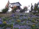
|
|---|
Baldy Lookout
(Click the image)
|
|---|
|
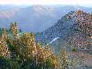
|
|---|
S from Big Baldy
(Click the image)
|
|---|
|
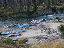
|
|---|
Grand Central Indian
(Click the image)
|
|---|
|
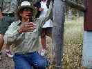
|
|---|
Vincent talks Cougar
(Click the image)
|
|---|
|
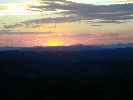
|
|---|
sunset at Big Baldy
(Click the image)
|
|---|
|
8/7/2005 Indian Creek RS Redux. (10.2 miles 15 ERM, drop 5,000'.)
The wind gently rocks the LO, shrieking through the few gaps in the banks of windows. Again, we enjoy sunny delight, this time with more golds and ambers. Not having extra water nor stove, we nibble on lunch goodies before suiting up for our big plunge back to the MF Salmon. First, it's time to place the window shutters back in place, wresting with the panels in the buffeting winds, which flatten the Spring-like wildflowers against the yellow lichen-stained Idaho granite. Sulphur flowers, Lupine, Paintbrush, Phlox, a tidy high mountain garden. Then, we begin the miles of downslope hiking. I feel a good measure of melancholy as we drift below the ridgeline and the lookout, fringed with a smile of watermelon snowfield (red-stained from algae, curious thing) and its fringe of wildflowers, slips from view. Oh, I don't like leaving these mountain treasures! It's more than the lookout, of course, for presently the lookout symbolizes leaving the Middle Fork Salmon, the Frank Church River of No Return Wilderness, in a mere three days.
We bump up to the ridgeline at about 9,300' and peer into the grassy verticality of what we now call Mountain Goat Bowl. Sure enough, there are seven of the white ghosts ambling and grazing on slopes too steep for us to walk. Five adults and two kids. It's already time to strip to shorts and continue the drop. We join fresh Cougar tracks as we descend, tracks of an elk or two, the ubiquitous deer, but the big Puma, lovely.
Out of the spring area we plummet, the crinkly leaves of Arrowleaf crunching under our bruised feet. We tank up at the tiny trough of Monkeyflower spring just above the junction at about 8200', the only good water until we reach the junction of the MF corridor trail and the Garden Creek Trail.
It's a lovely hike, except for the last three miles of the Garden Cr. Trail, which descends much too rapidly. And, it's accompanied by the eyesore of Pistol Creek ranchettes and subdivision. Thank the FS for the scenic easement (which "protects" the wilderness experience of the floaters) and the trail easement through the subdivision, but shame on the FS for not buying this precious bit of landscape when it had the opportunity and putting it back wild. I've heard tales about how there is a faction at the subdivision that considers itself 'ecologically sensitive.' Well, perhaps so, but this appears to be a Herculean exercise in cognitive dissonance.
Exhausted and with beat feet, we edge through a small corner of ranchette land and back into the wild, now "cruising" (more like hobbling) the last 1.7 miles to Indian Creek RS. Patters of rain cool us as we stumble across more Cougar sign, this time huge claws rake across and along the trail. Yikes. Covering prey? Marking territory? Covering scat? Whatever, it's not obvious to me as I stumble toward the anticipated rest stop of the RS.
Kathleen tells me she is continuing on to Little Creek GS, a mere 10+ miles down river. "Argh, and argh again" I groan, there is no way my fragile body will endure that additional abuse. I try to keep quiet, but say just enough to get Kathleen's adrenaline flowing. She spurts forward on the trail and I am left to careen along, admiring the cat tracks and the burble of the river.
At the RS, Ranger Rick is fielding questions from arriving floaters and feeding his adoptive pigeon. He pauses to pass out beer. After some conversation and the beer, the challenge of the trudge to Little Creek passes, and we settle into another evening of shared food and conversation with Ranger Rick, Clay (Summer Checker from Boundary Cr.), and Chastity (Native American Historical Interpreter). It is stimulating conversation, but my head lolls and rolls from the past three days of hiking.
8/8/2005 Goodbye Miles. (10.2 miles of hiking - Indian Creek RS to Little Creek GS.)
I find it difficult getting up and down from Ranger Rick's loft to heat tea and greet the day at Indian Cr. RS. Ohh, the aching muscles and the tired body. It is cloudy and the ground is damp from the overnight rain. The local Deer Mice and squeaking bats chirrup "hello" from their dark recesses in the main room as we pack the packs one more time.
We trundle down to the office to talk our last time with Vincent, Rick, Clay, and Chastity. Vincent becomes animated as he describes the Cougar tracks he saw down river, and how he kept an eye out for bears while picking raspberries, currants, huckleberries, and service berries, and about looking for meaningful bones for things he is making for the upcoming Fort Hall (Idaho) Festival. Clay is off to school in a few days, Montana bound. Chastity, Vincent, and Rick continue at the RS until the end of the month, then Rick is off to Kentucky to explore other aspects of life, making it unlikely folks will see this icon of the wilderness next year.
These are the first of the difficult good-byes for the day. The clouds generously persist as we totter to Indian Creek (goodbye to one of our favorite camps from two years ago), to Pungo Creek (goodbye to the pit house depressions), Aquinaldo Flats (one of the areas cooked by fires last decade), the luscious Teapot Creek crossing (cool stream filled with Lewis Monkeyflowers and buttercups), where we rest easily bruised feet and enjoy gorp one of the day. Then, on to Marble Creek for our next gorp and break, the clouds now long gone, and ol' sol burning our brains. The heat seems to concentrate the vanilla aroma of the P-Pines as we roll unsteadily into Lost Oak camp (across from Sunflower Flat HS, and thankfully vacant at present). Actually, we see few rafters (just two groups) and of course no hikers today.
We are inching, for the last time this adventure, along the familiar banks above the State Land camps, almost home. Long miles of goodbyes.
Now, I conclude the notes for today in the twilight, sitting on our veranda, and note how much the river has changed, the local sunset time has waned, how plant, animal, and river life have altered, and noting long goodbyes. Just after dark, two sweeping chevrons of Canada Geese whisk above, honking their melancholic "erronk!, erronk" for wilderness!"
River level is 1.81' and dropping. The temperature range appears to have been 55-92 F.
"The song of the river ends not at her banks but in the hearts of those who have loved her." Buffalo Joe
8/9/2005 Veranda Vamanos (Day 54!).
This is my last entry from the scenic and lovely veranda outside Little Creek Guard Station. The hoses are drained and stored, the propane is ready to be disconnected, the bags are mostly packed, awaiting only those few last minute morning items. Perhaps I should say "mourning" items?
I start the day by visiting State Land Camp Right and finally post that last "bears in the area" sign. Then, I remove the personalized signs from the bulletin board and under (for boater view) the bridge stating that "the guard station is open when the flag is up." I say goodbye to the grouse family, Scooterbee the Tree Squirrel, Lopper the Cottontail, and other residents that I can find. I hang out in the seldom-used hammock and enjoy the gurgle and burble of the MF Salmon before taking down the ties. Things are buttoned down and cleaned up, information lists are made for the next GS attendants. Yet, I am not ready to go. I don't exactly want to stay either, perhaps we can move on to another spot and begin to explore there? Ahh, but it is not to be because early tomorrow we fly out of the Frank Church River of No Return Wilderness and back to Challis, and from there start the circuitous route to Smog Lake and work, accompanied by inversions, traffic noise and congestion, rapacious righteous republicans, and horrendous geometric progression population explosion. Then there is the electronic cocaine of TV, other people's cell phones, machines everywhere. What a shock it must be.
But for now, Kathleen and I sit on the GS veranda and watch the river roll, local sunset progress, and the Night Hawks swoop and float, levitating on air, and relish in the being of being here.
"And this our life, exempt from public haunt,
Finds tongues in trees, books in the running brooks,
Sermons in stones, and good in everything." William Shakespeare, As You Like It
"Don't push the river -- it flows by itself." Fritz Perls, Gestalt Therapy Verbatim
The river level has dropped below 1.8', and is currently at 1.79' (757 CFS). The temperature range was 60-86, and we enjoyed several passing thunderstorms.

Epilog. How do we feel about our FS volunteer experience?Well, it was a deluxe delight to live and occasionally play in the Frank Church River of No Return Wilderness. Simply put, we volunteered to give something back to the public lands that we love. This, I hope we accomplished, because we worked very hard at doing so. We enjoyed our hikes to Little Soldier Mountain and Lookout (LO), Mahoney Creek LO, Marble Creek, Sunflower Flat Hotsprings, the W-E Forks of Thomas Creek loop, our multi-day adventure to Big Baldy LO. We enjoyed our zen-like musings on the "veranda" overlooking the MF Salmon, yet the time did drag, yet only at times. We are normally more peripatetic than we have been this Summer. Part of the issue for us is that we had the Little Creek Guard Station open more days and more hours than the Middle Fork District Office, and it was not possible to enjoy a break via a working float with the river patrol, which we greatly looked forward to. We would be gone too much from the GS, we were told.
We built over 370 feet of post and rail fence, digging post holes in the Idaho topsoil (90% rocks and 10% dirt). We hacked out lots of brush and old fence. We scraped and painted doors and other items. We almost daily watered the pasture. We made public contact whenever and hosted FS employees on their way through the area. A river trip break would have been most refreshing. At the time of this writing, we are still hoping to receive a "rain check" for a complete working (cleaning campsites, etc.) float of the MF Salmon (late next June would be terrific). Volunteers, like nature, thrive on diversity. "Hope Springs eternal!" quips Kathleen as I write these notes sitting on our veranda alongside the burbling clear waters. Yet, I am reminded it is August, and things just don't look like Spring 'round these parts.
Such is the sad state of the FS. Pruned, trimmed, clearcut by bushco and the so-called "conservatives," who conserve nothing wild, just their own grasp on elitist, abusive power and their own corporate welfare and windfall, at the expense of our public lands and all the fine FS ground workers, those that are left with a job that is. You, dear reader, might wish to know that our encounters reveal a good bunch of front-line workers, doing their best to steward the land, yet so awfully hampered by political appointees and terminal funding cuts of those operations and programs that serve the public and the public lands. For instance, those red trail lines on the official FS Frank Church Wilderness maps indicate trails that receive yearly maintenance, and the black lines indicate trails that receive work every-other year. In reality, it's every decade or every-other decade. I suspect a majority of the trails on the map can no longer be found on the ground. Our experience in the East Fork of Thomas Creek (8/1/05) is an example. Where once there were between four and six six-man mounted trail crews in the Frank Church, this year there is one person and a helper. Is it a bushco plan to starve the public lands of care they need, then say something like "well, it's in bad shape, so let's have private business take over?" The same is probably the goal for places like Little Creek GS. (Does this sound familiar, you in the public schools? Other institutions?) I might ask you, what have you done to let your congressperson know that you enjoy the opportunities for solitude, the clean water, clean air, and wondrous recreational opportunities possible on what is left of our public lands, especially the wild ones? What have you done to help thwart the chilling policies of abuse and neglect and privatization rammed by bushco?
"Anything else you're interested in is not going to happen if you can't breathe the air and drink the water. Don't sit this one out. Do something. You are by accident of fate alive at an absolutely critical moment in the history of our planet." Carl Sagan
It is in part this, planned and callous abuse by so-called conservatives that prompted us to volunteer, to do our little part to steward our wondrous and enchanting public lands. Please do your part - call your porkbarrel corporate lobbyist (AKA congressperson) and tell them to properly fund public agencies and get out of the corporate welfare business.
It's been a grand Summer, and I hope you get the opportunity to wrap yourself in an experience like this has been.
"All that is necessary for evil to triumph is for good men to do nothing." Edmund Burke
"Unless someone like you cares a whole awful lot, Nothing is going to get better. It's not." Dr. Seuss, "The Lorax"
"The ultimate test of man's conscience may be his willingness to sacrifice something today for future generations whose words of thanks will not be heard." Gaylord Nelson, former governor of Wisconsin, co-founder of Earth Day
"Let every individual and institution now think and act as a responsible trustee of Earth, seeking choices in ecology, economics and ethics that will provide a sustainable future, eliminate pollution, poverty and violence, awaken the wonder of life and foster peaceful progress in the human adventure." John McConnell, founder of International Earth Day
"We abuse land because we view it as a commodity belonging to us. When we see land as a community to which we belong, we may begin to use it with love and respect." Aldo Leopold
Summary - what we did as FS volunteers at Little Creek GS:
The giant fence project (all done with hand tools, of course):
370 feet of post and rail fence:
hand-dig 35 post holes in Idaho topsoil (90% rock and 10% dirt).
saw off tops from 35 posts.
attach 37 spans of log rails, 3 rails per span; pre-drill 210 nail holes in log rails (with brace and bit), hammer 210 8" spikes.
Remove old fence.
Stack posts and rails from old fence.
Clear brush and cut trees for new fence.
Public contact: we provided public contact an average of 6 days a week, open all day and night (more days and hours than the MF Ranger District office). Visited local campgrounds, cleaned airplane camps, maintained bulletin board.
Varnish outside doors: scrape and sand and varnish outside entry and screen doors.
Paint propane cart (wire brush and prep cart too).
Flood and sprinkle irrigate pasture nearly daily.
Whacked weeds and high grass around GS.
Cleared brush on path to water diversion for cabin and pasture. Rebuild diversion two times.
Rebuilt outhouse steps.
Hosted FS employees, including meals and a place to stay when needed.
Feed and monitor stock (two horses, three mules) until they ran away.
Cleaned and maintained GS.
Transported FS materials to and from Thomas Field.
Prepared for, then painted two gates and two benches.
We also did some lounging and some hiking, to:
Little Soldier LO
Mahoney LO
Marble Creek to Mitchell Ranch
Indian Cr. RS and back
Cameron Creek picto panel
Cougar Creek
Sunflower Flat HS
Sunflower HS/Hood Ranch
West Fk-East Fk Thomas loop
Big Baldy LO
As Frank Church noted in 1984, as his name was attached to the wilderness: "Honored as I am, the real meaning for me today is to reaffirm our magnificent heritage by preserving some 2.2 million acres of Idaho wilderness for ourselves, our children, and our children's children. For this I am eternally grateful... For the countless thousands who will enter and enjoy the River Of No Return Wilderness, it will open their eyes like an Idaho sunrise on a summer morning."
Will we return for another Salmon Sojourn? A Salmon Sojourn Dedux? Perhaps. Yet, for now, we are savoring our experiences in the Frank Church River of No Return Wilderness.
Animal/bird list, MF Salmon: Belted Kingfisher, Western Tanager,
Cedar Waxwing, Canada Geese, night hawk, flicker, Blue Grouse, Clarks Nutcracker,
crow, mourning dove, mallards, Redtail Hawk, Magpie, Chukar Partridge, Osprey, Kestrel,
Water Ouzel, merganser, Sandhill Crane, Wild Turkey, Redwing Blackbird, Golden Eagle,
Great Blue Heron, ruffed grouse, meadow lark, Mountain Bluebird and Pileated Woodpecker
(wow; on way to Little Soldier LO, later at the GS), Barn Swallow, Robin, Hairy Woodpecker,
Downy Woodpecker, Killdeer, Lazuli Bunting, Spotted Sandpiper, Cowbird, one of the warblers,
Black-chinned Hummingbird, Cliff Swallow, Golden Eagle, Wild Turkey, Red-wing Blackbird,
Rufous-sided Towhee, Song Sparrow, Junco, finches.
Deer, tree squirrel, ground squirrel, bear, elk, chipmunk, bighorn sheep, Golden-mantled Ground Squirrel, marmot, Cottontail Rabbit, River Otter (from our veranda!), Little Brown Bat, Mountain Goat (near Big Baldy), Deer Mouse.
Garter snake, Rubber Boa, Western Diamondback Rattlesnake, Gopher Snake, spotted frog.
Plant list: Bitterroot, Yarrow, Arrowleaf Balsamroot, Lupine, Skyrocket, Phlox, Indian Paintbrush, Penstemon (I call them firehorn Penstemon because the gaggle of proud blooms looks like the firehorns from an old-time fire house), Sego Lillys, Gromwel, cow parsnip, thimbleberry, Oregon grape, columbine, Cow Parsnip, Purple Fringe, Gentian, Wolly Mullein, Syringa (the Idaho state flower), purple aster, Mountain Globmallow, Western Pansy Violet, Fireweed, Horsemint, Heartleaf Arnica, Monks' Hood, Stickyleaf Geranium, one of the buttercups (Alpine?), Lewis Monkeyflower, Seep-Spring Monkeyflower, Sulphur Flower, California Corn Lilies, Pusseytoes.
No Middle Ground, A Wilderness Story. Chapter 1: A GEM of a day.
"Ahhh!" snorts G. Shrub as the four-seat helicopter with "Shrub Top Ranches, Stake out
your private piece of public land today!" emblazoned on the side rotors above the mixed fir
and pine forest, "If we can get a bit more corporate welfare, er - public assistance,
er - cascade up, trickle down, er - "small business" realignment of them obnoxious and
antiquated public land policies - why, we could be closing a deal on that little ranchette
along the banks of the Middle Fork River." "Sure thing" echoed the porcine passenger, a man
the lobbyists fondly refer to as "Snortin' Norton" because of the way he snorts and smirks
each time he succeeds in transporting huge amounts of public money into his accounts, "This
land is filled with decadent timber, not doing anybody any good, especially cousin "Chainsaw"
Dick who has the lock on area deficit timber sales" (a deficit to the public and future
generations, yet a boon to Dick and his minions). "And," continued Norton "this area isn't
used for the public good, just a bunch of those tax-evading river floaters, trail bums, and
eco-freaks use it, with an occasional card-carrying republican outfitter in the mix."
"Surely," notes Shrub, as the copter buzzes a group in a trio of blue and yellow rafts
bobbing through a minor rapids, a bit of clear water spraying over them, waving paddles
in what must certainly be a sign of approval for Shrub's flying skills "we can appeal to
the religious imperative of 'developing' this here piece of unused and currently worthless
land." "Why, there's nothing but profit from making something into a religious issue,
'cause as any thinking man knows, there's only tolerance and good will towards those that
look and live and think and develop like us, of the right religion." "Ya got that far right,
religiously speaking" winks Norton, "we can have these public lands in our private coffers,
where they will be well-cared for, and we can form a faith-based corporation, er - public
assistance do-gooder league initiative with a large portion of the windfall of public
assistance we get going to support clean water, say one quarter of one eighth of one
percent?" "Sounds good to me," agrees Shrub, "Since the decline of thinking and science
and the upsurging of religion and intelligent design of tunnel vision, we've pretty much
had our way with the once-public lands. It's a divine design, designed to rearrange the
public's morality to align with that of the almighty corporations." "As long as we keep
selling fear and more fear," chortles Snortin (whose real name is Gaylord) "none of these
red state voters will realize how we've built our dynasty one lie on top of another on top
of another. Isn't America the greatest place ever!"
"The trick to it all is to start out
with a lie so huge and deceitful and patently untrue (using his patented double speak)
that no one will believe you did so to form a platform for more lies and manipulations -
why the fear and more fear piled on top of fear mongering and lies was such a natural
accompaniment to creating our own faulty intelligence and then the "you're with us or
against us" mantra - my it's just like putting those Lincoln Logs together they fit so
well." "It's just a symphony of cash machines, all those pollution-producing companies
knockin' at our doors trying to pay us so they can write them their environmental
regulations like they want 'em," snorts Norton, then finishes with "and no one is
watching what happens to health, education, labor, environment, or public land policies
because we wave the flag of fear so well."
"It was a masterful manipulation of the truth,
the media, and most everything, the way we catered to the rightly religious and the war
mongers, those that benefit from war, so that we can pursue our privatization of these
worthless public lands and have the slogan-mimicking red staters support the demise of
their health, clean water, clean air, public lands, fiscal integrity, and way of
life - all so they can puff out their chests and say how wonderful it is to bomb
innocent people and saddle their grandchildren with our debt - all so we can engage
in full-scale corporate welfare while these same welfare artists re-write the laws
designed to protect those short-sighted enough to continue to vote for us." Shrub muses
"I only wished I had thought of flooding the schools with electronic games shrouded in
educational slogans, 'cause it's just the type of thing that teaches future voters to
think in three-minute bits or less - why, that and TV, the original electronic cocaine,
have created a whole generation or three unwilling to think beyond three minute bits - it's
just perfect for our campaign of lies and slogans instead of data and analysis."
"Well, enough of this hard work, working on Saturday sometimes, working hard," chuckles Shrub,
his shoulders yo-yoing up and down, "let's get on over to The Tiger Paw, sign of the orange
and black arches, where we can get the Oil Man's Special, GME (genetically modified
everything) burgers, Amerifries cooked in GME oil, and dusted with more GME oil and
slathered with that GME cheese in a caulking gun - oh, yummy, it makes a feller's ticker
just throb and race like a TV evangelist on his way to the bank, so luscious I call it a
"GEM" just so I can remember the name" he continues as he banks the leather-seated copter
toward the waiting hummer limo.
"Yeah, let's get the shock and awe shucks team to work on
designing our next series of slogans that will suffice for policy, concurrent with enhancing
the pork bellies of our corporate friends," notes Norton. "Just to finish a hard day working
and working," clicks Shrub "those there GEMs are good business because they will soon
contaminate all the surrounding acreages, and then everyone will have sterile plants,
enabling them to buy new seed from us each year - why it's an intelligent design for sure,
praise the lord of capitalism!" "My golly," notes Shrub, "I may disassemble, that means to
lie, a bit, but it's for the good of corporate America."
(author's note, Shrub meant to say "dissemble," but such minor inaccuracies are of
little consequence to someone who has taken the scientists off the scientific advisory
boards and replaced them with corporate/industry lobbyists.) To be continued.....
"Growth for the sake of growth is the ideology of the cancer cell." Edward Abbey, "Money, Et Cetera'' in A Voice Crying in the Wilderness
"Capitalism is the astounding belief that the most wickedest of men will do the most wickedest of things for the greatest good of everyone." John Maynard Keynes
"The superior man seeks what is right; the inferior one, what is profitable." Confucius
And, Frank Church speaks to the mental midgets of bushco. "The affluent society has built well in terms of economic progress, but has neglected the protection of the very water we drink as well as the values of fish and wildlife, scenic, and outdoor recreation resources. Although often measureless in commercial terms, these values must be preserved by a program that will guarantee America some semblance of her great heritage of beautiful rivers."
Senator Frank Church from Idaho
"Can we afford clean water? Can we afford rivers and lakes and streams and oceans which continue to make possible life on this planet? Can we afford life itself? Those questions were never asked as we destroyed the waters of our nation, and they deserve no answers as we finally move to restore and renew them. These questions answer themselves." Senator Ed Muskie of Maine, arguing for the passage of the Clean Water Act in 1972
"Do not burn yourselves out. Be as I am -- a reluctant enthusiast . . . a part-time crusader, a half-hearted fanatic. Save the other half of yourselves and your lives for pleasure and adventure. It is not enough to fight for the land; it is even more important to enjoy it. While you can. While it's still here. So get out there and hunt and fish and mess around with your friends, ramble out yonder and explore the forests, climb the mountains, bag the peaks, run the rivers, breathe deep of that yet sweet and lucid air, sit quietly for a while and contemplate the precious stillness, the lovely, mysterious, and awesome space. Enjoy yourselves, keep your brain in your head and your head firmly attached to the body, the body active and alive, and I promise you this much: I promise you this one sweet victory over those desk-bound men with their hearts in a safe deposit box and their eyes hypnotized by desk calculators. I promise you this: you will outlive the bastards." Edward Abbey
And, perhaps the best advice to all of us, yes even (especially) the elitist money belts at bushco is that which we give to the young, by the prescient pragmatist, Dr. Seuss:
He snapped, "I'm the Lorax who speaks for the trees
which you seem to be chopping as fast as you please.
But I'm also in charge of the Brown Bar-ba-loot suits
who play in the shade in their Bar-ba-loot suits
and happily lived, eating Truffula Fruits."
"NOW . . . thanks to your hacking my trees to the ground
there's not enough Truffula Fruit to go 'round.
And my poor Bar-ba-loots are all getting the crummies
because they have gas, and no food, in their tummies!"
"They loved living here. But I can't let them stay.
They have to find food. And I hope that they may.
Good luck, boys," he cried. And he sent them away.
"You're glumping the pond where the Humming-Fish hummed!
No more can they hum, for their gills are all gummed.
So I'm sending them off. Oh their future is dreary.
They'll walk on their fins and get woefully weary in search of some water that isn't so smeary."
And at that very moment, we heard a loud whack!
From outside in the fields came a sickening smack
of an axe on a tree. Then we heard the tree fall.
The very last Truffula Tree of them all!
The Lorax said nothing. Just gave me a glance . . .
just gave me a very sad, sad backward glance . . .
as he lifted himself by the seat of the pants.
And I'll never forget the grim look on his face
when he heisted himself and took leave of this place,
through a hole in the smog, without leaving a trace.
"But now" says the Once-ler,
"Now that you're here,
the word of the Lorax seems perfectly clear.
UNLESS someone like you
cares a whole awful lot,
nothing is going to get better.
It's not."
"SO . . .
Catch!" calls the Once-ler.
He lets something fall.
"It's a Truffula Seed.
It's the last one of all!
You're in charge of the last Truffula Seeds.
And Truffula Trees are what everyone needs.
Plant a new Truffula. Treat it with care.
Give it clean water. And feed it fresh air.
Grow a forest. Protect it from axes that hack.
Then the Lorax
and all of his friends
may come back."
Dr. Seuss, The Lorax
Map:


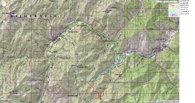
|
|---|
Topo map using my GPS tracks from the various hikes
(Click the image for the full-size image)
|
|---|
|
for a full-resolution map (wider coverage), click here. Caution - do not use this map or gps track for
navigating the route.
Links:

USGS river level gauge for the MF Salmon River At MF Lodge
Remote weather station near Little Creek GS
Map of little creek guard station (topo quest)
Kathleen's Article and photos of the Sojourn in the Winter, 2005 Utah Sierran (pdf file) - see page 12:
"Giving up E-mail and Learning to Love the U.S. Forest Service." Caution - el gordo gigabyte file! (10mb)
Great Rift Publishing: (Never Turn Back - Walt Blackadar, Idaho Paddling,
The Whitewater River Book - books by Ron Watters)
The Frank Church Wilderness (forest service, look for "users guide")
The Frank Church Wilderness (Ralph Maughan)
Canyons river outfitter group
South Fork of the Salmon Wild and Free: An On-line Book by Jerry S. Dixon
WV trip reports of the Frank Church Wilderness:
We finally floated the MF Salmon in 2007
Boundary Creek to the Flying B (2003)
Llamalot at the Middle Fork Salmon, The Sequel! (1998)
Llamalot at the Middle Fork Salmon? (1997)
Llama Lounging In The Crags:
Packing in Idaho's Bighorn Crags (1997)
| | | | |
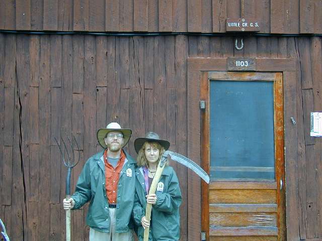
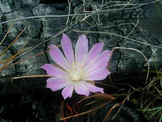
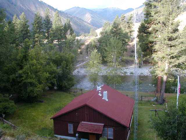
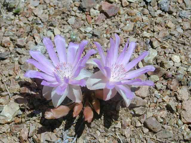
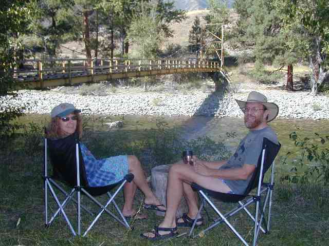
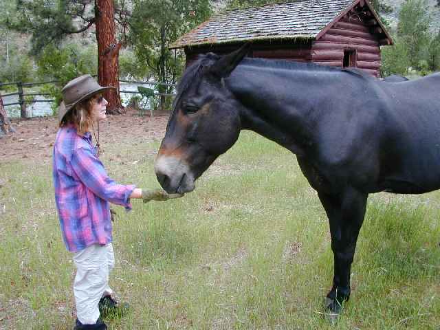
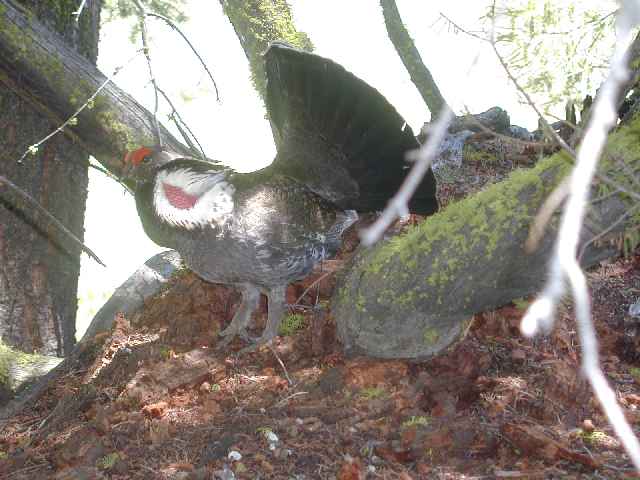


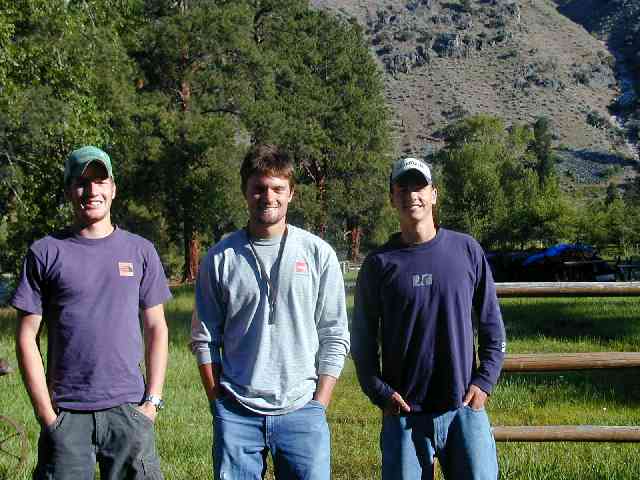
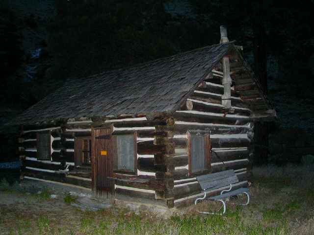
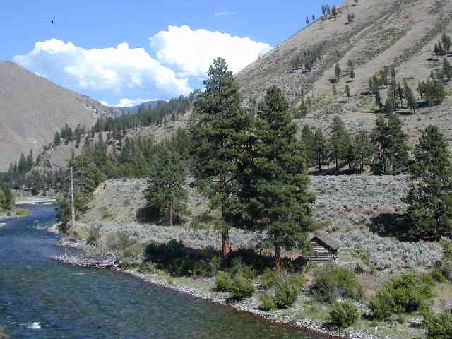
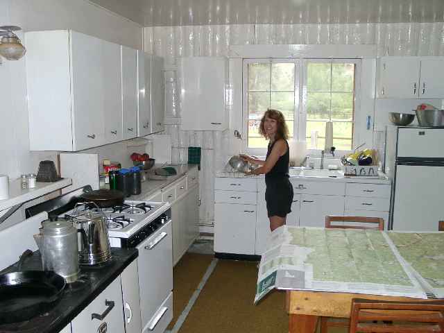

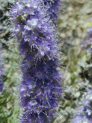
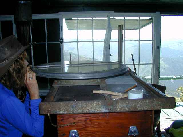
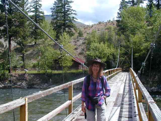
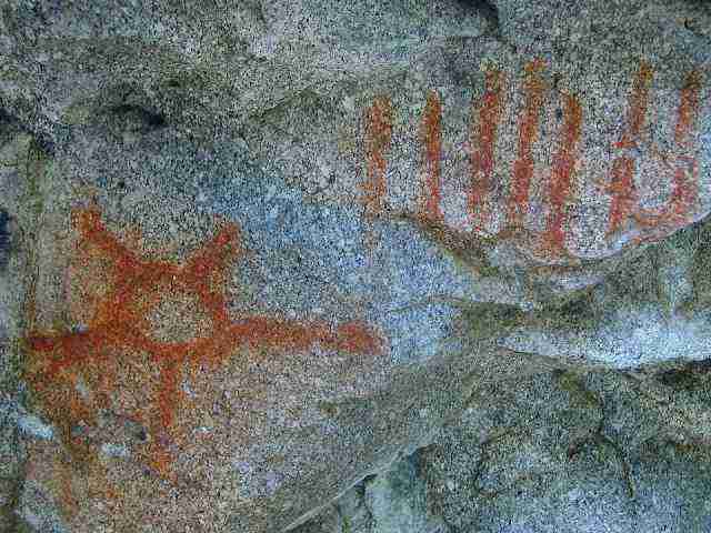
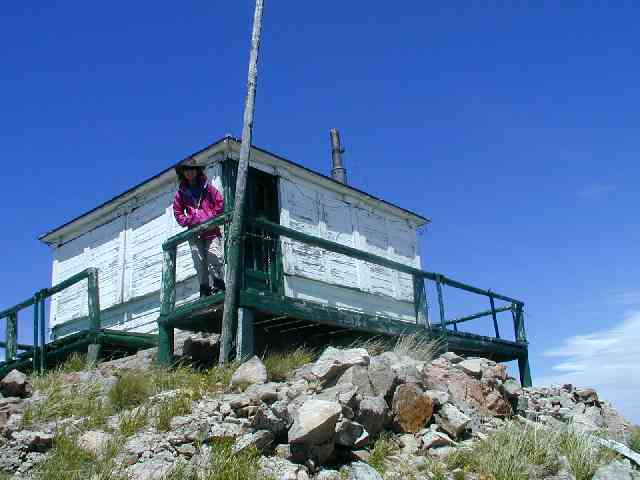
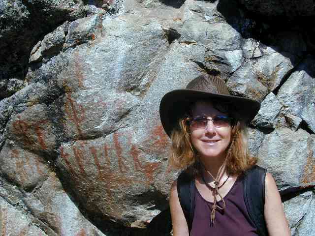

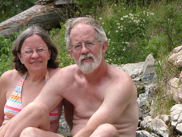
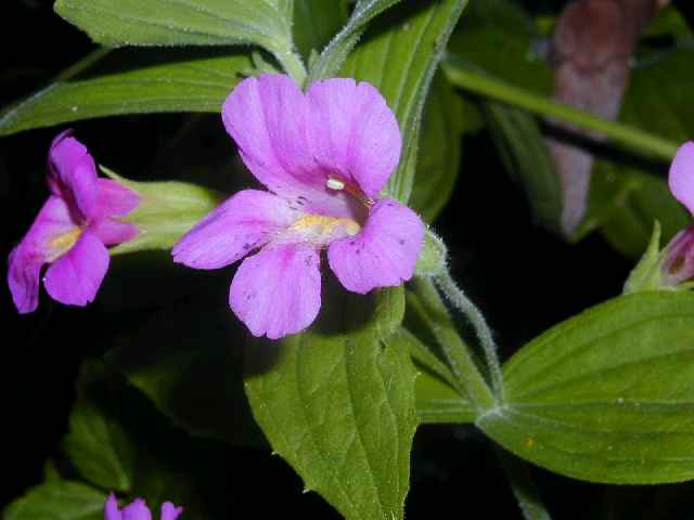
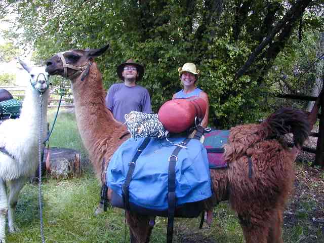
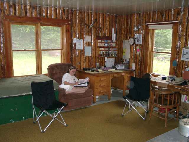


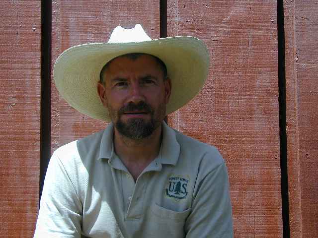
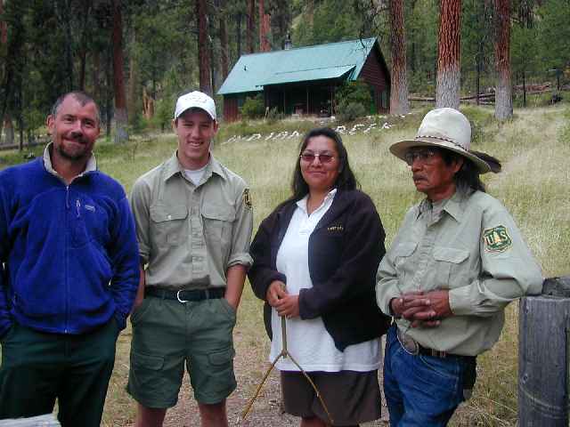
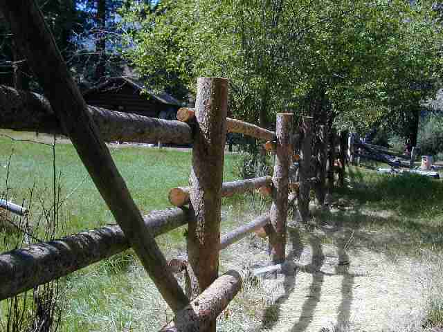
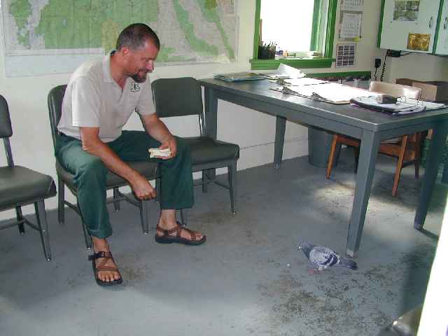

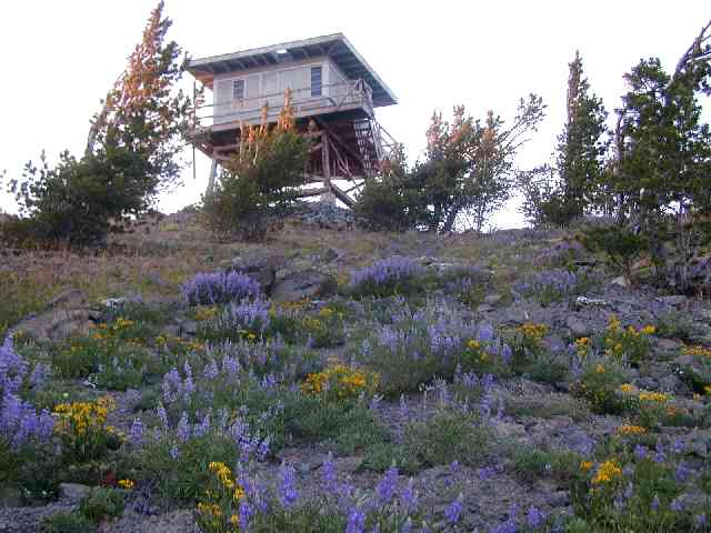
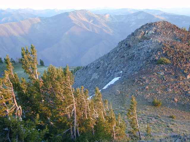
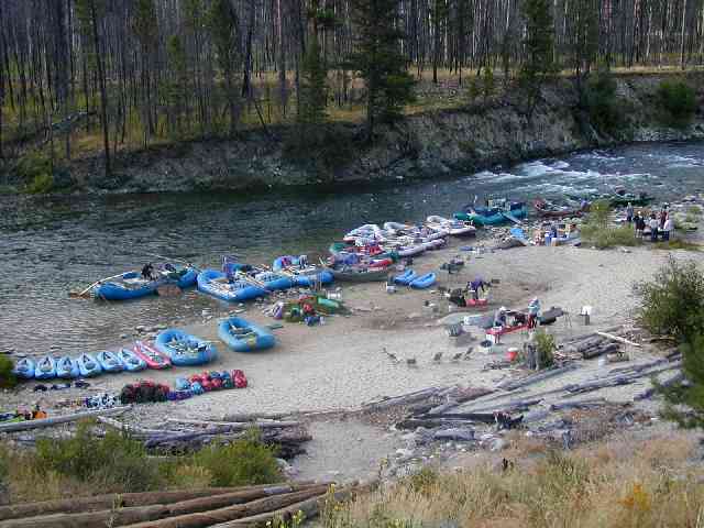

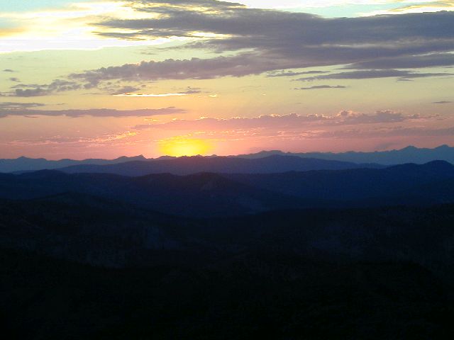


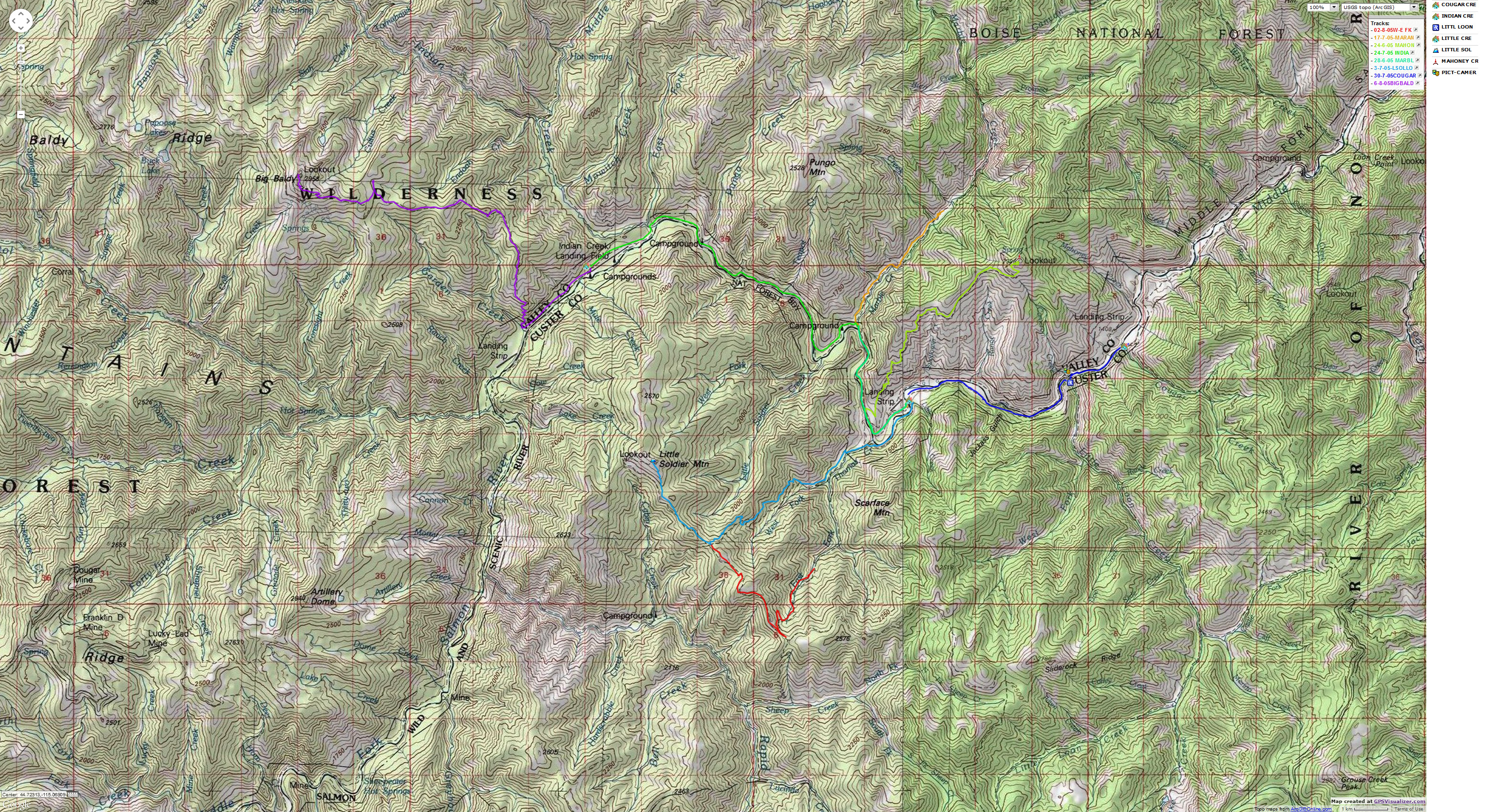