|
|---|
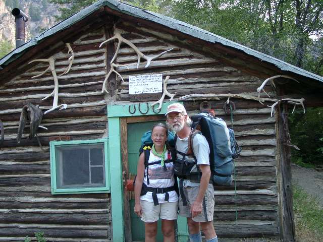
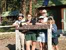
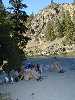
Boundary Creek Launch Ramp
(Click the image for a full-size view)
|
|---|
|
|---|
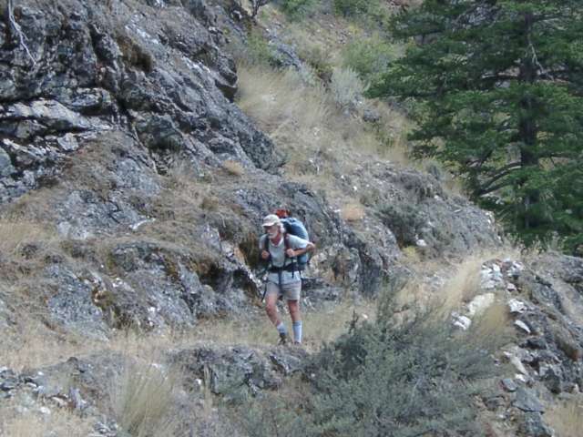
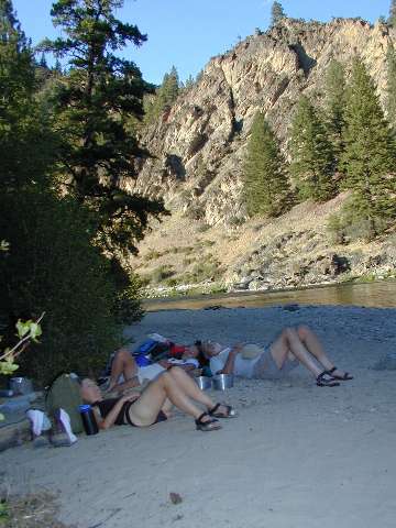
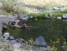
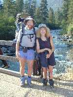
Kathleen enjoys Trail Flat HS
(Click the image for a full-size view)
|
|---|
|

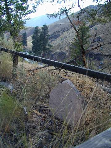
|
|---|
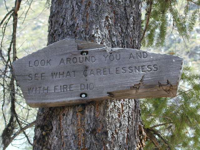
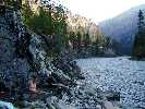
Sign near Artillery Creek
(Click the image for a full-size view)
|
|---|
|
|
|---|
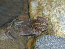
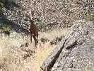
Middle Fork froggy
(Click the image for a full-size view)
|
|---|
|
|
|---|
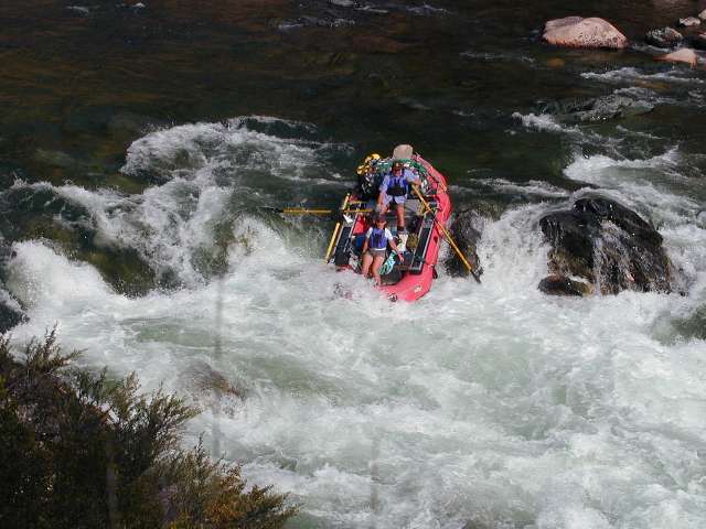
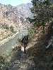
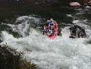
Pistol Creek Rapids
(Click the image for a full-size view)
|
|---|
|
|
|---|
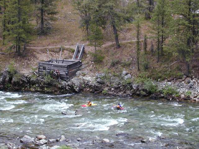
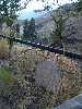
Powerhouse Rapids
(Click the image for a full-size view)
|
|---|
|

Place your browser on each thumbnail to see an
expanded explanation of each photo. Click the thumbnail to see a full-size, albeit compressed image.
There are 5 banks of photos grouped with the text sections.
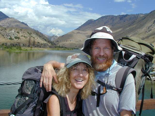
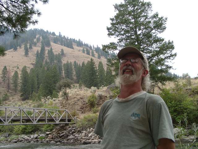
This is a report about a delightfully deluxe 12-day backpacking
adventure. We hiked from Boundary Creek TH to the Flying B, a grandfathered ranch in the Frank
Church River of No Return Wilderness, along the Middle Fork Salmon, the first river designated Wild and Scenic
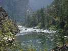
in the U.S. The above and below photos are poor depictions of this wondrous, amazing space.
Previous trip reports about the MF Salmon:
Llamalot at the
Middle Fork Salmon, The Sequel! (1998).
Llamalot at the Middle
Fork Salmon? (1997).
Background Info:
Click here for "South Fork of the Salmon Wild and Free," An On-line Book by Jerry S. Dixon, and published by the Idaho State University Outdoor Program. Designed & edited by Ron Watters; and from what is arguably the finest outdoor program! And, it's offered at no cost to you.
Click here to see Ralph Maughan's wilderness site. The site contains maps, photos, wolf info, and lots of good background info about Idaho wild lands.
The Idaho Conservation League
National Wild and Scenic River info
An on-line Book:
Click here for "South Fork of the Salmon Wild and Free," An On-line Book by Jerry S. Dixon, and published by the Idaho State University Outdoor Program. And, it's offered at no cost to you.
Books in print:
The Middle Fork: A Guide by Johnny Carrey & Cort Conley (1992) . Backeddy Books, Cambridge, ID.
River of No Return, by Cort Conley & Johnny Carrey (1978) . Backeddy Books, Cambridge, ID; ISBN: 0960356622
Trails of the Frank Church-River of No Return Wilderness, by Margaret Fuller (1987). Signpost Books, Edmonds, WA; ISBN: 0913140457
The Middle Fork and the Sheepeater War, by Johnny Carrey & Cort Conley (1980) . Backeddy Books, Cambridge, ID
THE TRIP: By Rob (Each day starts with a portrait from the day, followed by the daily report.)
Day 1: Spike It. (Boundary Creek Transfer Camp to Spike Creek, River Mile (RM) 0 to 5.1):
Commentary:
Through the trees and far below, Kathleen and I can see the mighty Middle Fork Salmon,
cascading the narrow canyon of its upper reaches. The mellow thunder wafts through the
Ponderosa Pines as we set up camp 1, somewhere upslope of Velvet Falls. We don't hear the
falls, which is the origin of their name "Velvet," for an upstream cascade masks the small
voice of the falls. The refreshing scent of the P-Pines wafts by too, a comforting reminder
that we are in the Frank Church, largest and wildest of the official wildernesses in the
lower-48 states, and for now,
somewhat safe from the bushites, who dream to sell or give everything public to
corporations so we can get on with complete corporate welfare.
The Day: We began the day with an early morning drive across the nuke-site desert of SE Idaho, headed toward the Challis FS office. There, we check in with Tommy G., Weedmaster for the Challis NF, and master of the trails as well. "All is go in the MF country," Tommy declares. "It's hot but as of now there are no fires blocking your path, just some reminders of who is in control, as fires burn near Stanley and in another place at the edge of the wilderness." Tommy has been of great help in determining trail conditions and the impact we would encounter from the fires of 2000.
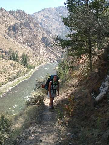
We continue the peaceful drive to Stanley, along the sinewy Salmon and past delightful yet unsullied hot springs (HS) and we arrive early enough in Stanley to enjoy a leisurely lunch. John shuttles us into Boundary Creek, and we note how smooth the roads are. John comments that "the FS only maintains the access to Boundary when fires loom." There are fires all around, and a nearby fire, the Boy Scout Fire, is curtailing our views of the MF country right now. We sail into the launch area to get drinking water, and watch what may be the last of the commercial groups to begin from Boundary this year sliding a big sweep boat down the polished logs of the launch and into the fledgling MF Salmon. I say ‘perhaps the last' because the river is at 2.13 feet and this is scarcely enough water to float rafts and people, especially considering the lavish logistics of commercial, and indeed most, rafters. The Spanish Armada would be considered under-prepared compared to most rafter groups. By the time we get to Indian Creek, most outfitters are ‘deadheading,' which means they are bringing gear and rafts down empty, and flying in customers to Indian Creek.
We fill our bwana bags with clear water and set out from Boundary TH in the deep trail dust, poofing along through a patter of rain and intermittent swirls of dust devils. The dust will diminish as the trail gets into real country.
There, there are the quiet waters of the MF Salmon - well, not so quiet after all, they roil along fidgety, a purposeful, frenetic, frenzy of flow toward the Main Salmon, the Snake, the Columbia, the Pacific Ocean. A long way for Salmon to run to native waters, and not currently possible with all the damnation of dams.
We plod along. Already we have enjoyed a full day, yet we find little in good camping, and eventually settle for a hillside camp high above Spike Creek. Ahh, but good clean water and a distant view of the MF, with the quiet whisper of Velvet Falls far below, we are in the Frank Church, and we feel we are home.
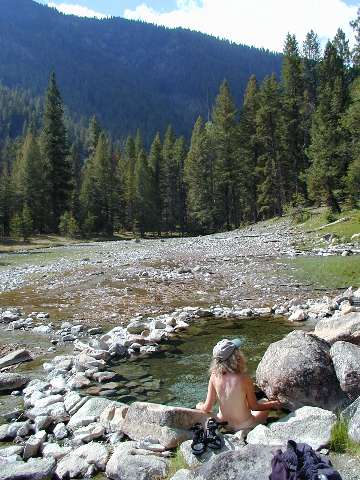
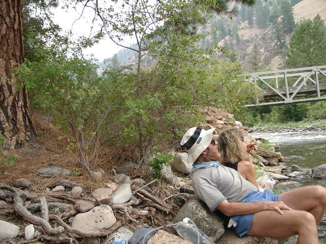
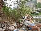
Day 2: HS Hoa (Trail Flat and Sheapeater HSs; RM 13.0):
Commentary: We slide into the pebble-lined delight of Trail Flat HS as a squall front moves through, dotting the packs with rare rain. Ahh, this one is just right I note, having visted the top pool (much too hot for my reptilian blood) and the riverside pool (much too cool, and for the same reason). Turning my boots upside down, and using them to cover clothes, we enjoy the quiet and bliss of the MF Salmon country.
The Day: We endure lots of scree-walking today, miles of it. Yet, we spend more time near the river than during Day 1, and note that parts of the trail would be underwater in moderately high flows. The smoke has mostly cleared, yet we keep the clouds, providing cooler temperatures.
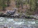
Back on the trail, we pass Power House Rapids, then during a pause at the Joe Bump Cabin, we meet FS folks Derek and Tyler, of the river patrol and Kelly from Boundary Creek, patroling along, and collecting litter too. We note that their raft is floating high in the water, suggesting they are going light to enable good floating. On we hike to Sheapeater HS and camp. We locate a terrific camp near the MF, yet away from the river rafter camp. We scamper over to the HS, hoping to enjoy a quiet soak before the rafters finish dinner. This quiet soak would wait until morning. One of the HSs is framed by old logs, and we learned that Tanner once built a cabin over the HS, although it later burned. Deer come out to play in the HS flats as we chat with a few rafters and the river patrol folks.
Day 3: Snag the Wag. (RM 19.1):
Commentary: Grouse and grouselettes snap bugs and rose hips from an old stump, so close I can see them blink. Across the MF, I watch in the fading light as a family of ducks makes its way upstream along the edge of the fast water in a river curve. Reaching the edge of the curve, I expect to see the ducks climb out on the bank and walk around the fast water to the next eddy. Up pops the head of the lead River Otter, followed by smaller heads. Yikes, I am a bit dismayed by the misperception, yet enthralled by the otters. They apparently do not share my excitement, and rolling smoothly, flip into the fast water and undulate around the bend like flushing a toilet.
The Day: Here we are, camped near the nettles near riverside and just down river from a rafter camp. We walked through burned areas of fires of yore, and it got very hot during the day. We wag our way along the trail, avoiding the snags. The cool and delicious waters of Artillery Creek revive us in this day which seems much longer than it was.
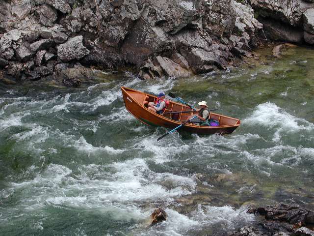
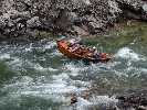
Day 4: Mudfest on the MF. (Pistol Creek Blow-out, Times Two; RM 21.4 + 6 miles dayhiking Pistol Creeks):
Commentary: Cold rain water pours out the top of my boots. The long grass, wild rasperries, and young Aspens of this fully-charred drainage are heavy with rain water. Walking past any folage deposits the rain in our boots. The chocolate fudge of Pistol Creek is growing darker, due to some land slump somewhere above. The once-clear waters of Pistol Creek look more like a frothy debris flow in California than a tributary of the MF.
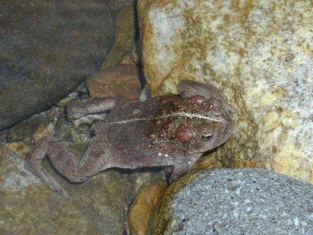
The Day: The drizzle starts as we sit eating lunch on polished rock bands high above the river, watching rafters and drift boats thread the S-turn of Pistol Creek Rapids. This show exceeds any video game I have seen. We take shelter in the lee of our rock perch and nap while the rain piddles out. Investigating the burned out rafter camp at Pistol, we encounter a red frog who seems smitten with Kathleen. We would like to camp beach-side but we are wary of being smitten by a huge Ponderosa ghost tree snag. After setting up camp, we enjoy a second lunch, then hike up Pistol Creek, in search of wiley HSs. Walking on the trail above the creek, we note that the waters are no longer clear, but more like milk chocolate. Soon, a dark chocolate fudge color rolls over. It begins to rain again, as we reach the forks of Pistol. Standing with noses against the deep smokey vanilla folds of a singed P-Pine, we attempt to escape the pounding rain. Smelling HSs, we are tempted to search on, yet the steady rain convinces us to squish our way back to camp.
Back in camp, I am considering walking back over the Pistol footbridge to get some clean water from the MF, when I notice that the water level of the MF appears lower, curious, then a flotilla of logs and debris coming through the mouth of the rapids. The rock cliffs containing the rapids prevent seeing upriver, but it is soon clear all is not right with the MF. Transparent MF waters turn a pea-green, then shades of chocolate, to where the nearly-black stripe of Pistol waters borders a mudshake on the MF. The MF would not clear for several days. Apparently, a double blow-out had occurred somewhere up Pistol Creek, and near Lake Creek on the MF, forming a new rapids. We later learned that a large blow-out had temporarily dammed the MF near Haystack Rapids, and that a land slide had blocked the road near North Fork, stranding rafters and shuttle folks.
The sun arrives briefly as we cook dinner. The low wisps of clouds are backlit by salmon pink hillsides, and all this to see while we sip tea on our river rocks alongside the MF mudfest.
Day 5: Grand Central Indian. (RM 26.2)
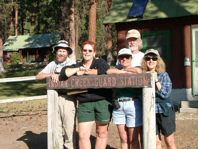
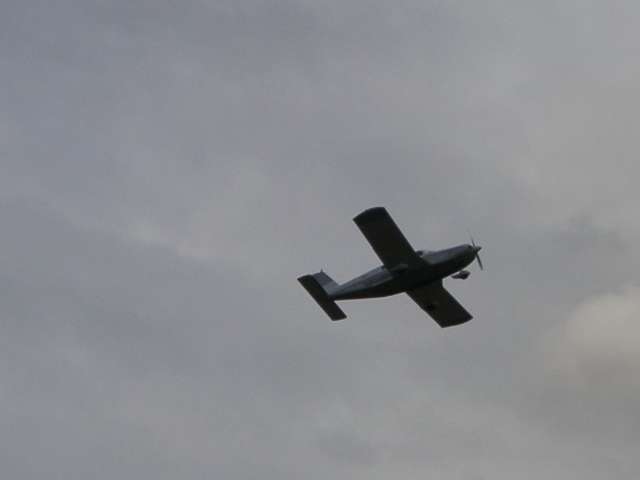
Commentary: Kathleen sips an ice-cold cola and I a beer while basking in the shade of the towering P-Pines at Indian Creek GS. Sheri passes red beans and rice as we lather tortillas with guacamole, lettuce, tomatoes, and things backpackers dream about. “Beyond deluxe!” I comment, while Kathleen mutters something about “fabulous.....muh gd!” With experiences and people so delightful, it’s no wonder we want to return again and again to visit the FS folks of the MF. As we talk about the wonders of the MF juxtaposed with the barbaric (my words) policies of the shrub, and what is happening to our public lands because of (shrub-sanctioned) corporate greed and corporate/multiple-abuse welfare, we survey the flurry of activity at the top of the Indian Creek boat launch, where commercial and private groups are bottle-necked due to the low river flows and the blow-outs of yore. “Indian Creek Field, a short mile of dirt track, is the busiest air strip in Idaho for part of July and August,” Sheri notes while logging in yet another Salmon Air charter. It is a busy place, and quite a shock stepping out from the wilderness to this Grand Central of the Frank Church and into Grand Central Indian.
The Day: No rain starts our day, just a Ponderosa vanilla-scented sunshine walk to the abhorrent ostentatious overdevelopment of Pistol Creek “ranch.” Ick. The new construction following the fires of 2000, which reportedly burned 19 of 28 structures, are bushleague icons of resource abuse, while the old structures were moderate and contained some charm. “Whew,” I sigh, as we finally get back into the trees and hike on to Indian Creek GS. Planes are flying with the first morning light, and it’s busy at Indian Field. The contrasts of today are extreme, wild and peaceful, developed and hectic.
We drop packs in the shade above the beach and strike up a conversation with the FS person keeping data on a clipboard. It’s Sheri H., River Manager for the MF. Sheri invites us to lunch after the next tide of flyers and rafters departs. Kathleen and I while away much of the mid-afternoon, drying boots and enjoying the shade of the GS.
Sheri tells us that no one is signed-up for the Indian Creek rafter camp, which is down river a bit over a mile. So, we hike there and enjoy showers and clothes washing, etc. using the clean waters of Indian Creek, apparently unaffected by recent rains.
About sunset, a perennially lost rafting group noses in. They have missed their first camp, then the GS (where they hoped to stock up on filtered water), and it looks like they will not make their assigned camp today. One boat looks flaccid, apparently damaged in the rock gardens of the upper MF, water leaks out of river bags, the rafters lack luster, each of which tells the story. They stay up on the back side of camp. Stereo wilderness music from Indian Creek and the MF masks all camp noise.
|
|---|
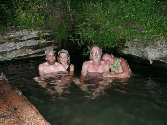
Sheepeater HS
(Click the image for a full-size view)
|
|---|
|
|---|
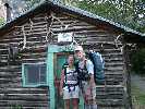
at Indian Cr. GS
(Click the image for a full-size view)
|
|---|
|

|
|---|
Bushpilot Gary B.
(Click the image for a full-size view)
|
|---|
|
|
|---|
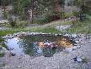
Sunflower HS
(Click the image for a full-size view)
|
|---|
|

|
|---|
Bruce motors along
(Click the image for a full-size view)
|
|---|
|

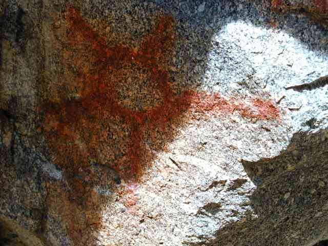
|
|---|
Native American Sun Picto
(Click the image for a full-size view)
|
|---|
|
Day 6: Sunflower Slog. (RM 32.6):
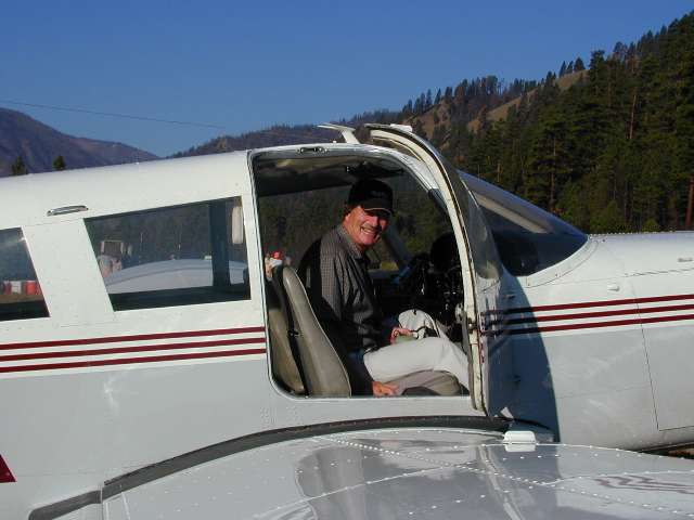
Commentary: I’m running, albeit briefly, as the third plane sputters, then dips onto the runway. I don’t want to miss our rendezvous with Bruce and Judy, flying in from Pocatello to join in on the next stretch - and, also they are bringing more food! It’s a good thing Kathleen and I got up early and headed back to the GS post haste, for it’s not yet 8 a.m. and here they are. Time for hellos and photos. Time to give up some trash and empty fuel bottles and unused food, get two new bulging food bags and more stove fuel. Gary B. is rarely a passenger, yet he is today as Bruce pilots the plane to Indian Field. Reunions can be good, and this one is excellent. Gary must return to work, yet we will see him again at the Flying B when he comes to cart out the four of us. Thanks for the goodies, Gary. Gary will be in our thoughts and with us in spirit as we travel farther down the MF Salmon.
The Day: Back at Indian Creek camp, we pack while Judy and Bruce finally get to breakfast. Then, it’s on the trail to Pungo Creek, to Marble Creek, with the growing heat of the day. By late afternoon, we officially declare it a slog. In our waning awareness, we remember to look for pictos beyond Marble Creek, and the sun images remind us that others might have baked here. At the terribly manicured MF lodge, we again rest our feet and contemplate the backtrack route on the other side of the MF and to the HS.
Ahh, yet as the hot water cascades onto my head in the cooling early evening air, I note that all is well in the Frank Church. Bruce, Judy, and Kathleen have recovered from the hot day, and we all rejoice that we have this river camp to ourselves - except of course for the visit from the rafters in the camp across the river.
Day 7: Cougar Crawl. (RM 40.4):
Commentary: Sean finesses the raft filled with packs and us land-based creatures across the MF, traversing the jade green waters near Sunflower HS with aplomb. We are grateful for the ferry, for this means we can hike the regular trail rather than the rocky bump route. Sean is a boatman for Middle Fork River Tours, a home-grown Idaho company that specializes in just this river. We met Kurt, the owner/captain at Indian Creek and we have witnessed the guides’ courtesy, organization, and ethics, as we have hiked along the MF, and believe they may be the company to join for your MF float. Nope, we don’t get any kickbacks, this is just our unfunded opinion.
click here for Middle Fork River Tours.
The Day: Back on the trail, we cross through the insult of the roadway between the MF lodge and Thomas Field and into the heaven of the Little Creek GS. The weedcrew and mules are here for lunch, and we also pause to eat and enjoy the shade. We skip visiting Hood Ranch, although we notice some suspicious activity above the river. It’s a small band of Big Horn Sheep, ewes and young, and they don’t seem at all concerned about us.
We continue past the Jackass Flat CG and into the heat of mid-day. On and on, yet we do find another picto North of Little Loon Creek. This is a dry stretch, mostly because of the intense heat.
We crawl into the Cougar Creek area and find an old patrol cabin, an old grave, remnants of once-tilled acres of wheat now baked dry and waving in the heat waves. Bruce herds an obliging gaggle of grouse nearly to camp. Judy repairs her trampled feet in the cool waters of Cougar, which we all enjoy yet remark that they are a poor second to the shower we enjoyed at Sunflower.
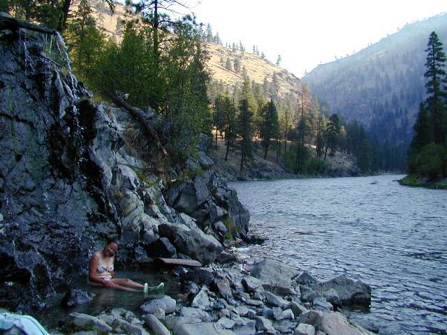
Day 8: Whitey Wipe-Out. (RM 46.2):
Commentary: Here we are, prostrate in the sand near the MF, at the rafter CG, yet without the rafters. Lethargic and perhaps dehydrated, we enjoy a sumptuous dinner by chef Bruce and enjoy the views. Whitey Cox lies in his grave on the bench above, near the HS named for him. The shadows grow longer, and the diffuse light allows the yellow lichen to glow on the ebony spires of Idaho hardhead rock. We listen to the burble of a raucous, restless river, wild and free, everything
the bushites cannot comprehend and try to eradicate or give to corporate welfare in not.
Yet, here we are, without the means for huge political donations, enjoying and reveling
in that which is currently public domain. To match brief thoughts about bushites, the wind
blows like hell’s blastfurnace, easily drying partially clean clothes swaying in the willows.
Bruce reads a passage from Carrey and Conley’s guide
to the MF, learning that Whitey’s first name is Elvis. Today, Elvis is certainly with us.
The sun sets locally behind the fishfin ridge and pleasant coolness floods over us. Bruce
announces that the HS water is “perfect bathtub temperature, a joy to finish the day” and
off we go for a peaceful soaking.
|
|---|
at Cougar Creek
(Click the image for a full-size view)
|
|---|
|
|---|
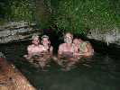
Whitey HS
(Click the image for a full-size view)
|
|---|
|
|
|---|
Whitey Cox beach
(Click the image for a full-size view)
|
|---|
|
|
|---|
Whitey Cox HS
(Click the image for a full-size view)
|
|---|
|
|
|---|
Views of the MF Salmon
(Click the image for a full-size view)
|
|---|
|
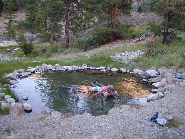
|
|---|
Loon Creek HS
(Click the image for a full-size view)
|
|---|
|
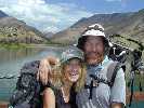
Day 9: Loon Lounging. (RM 49.3):
Commentary: The day begins with a shady soak in Whitey Cox HS. Ahhh, Idaho. The sweet vanilla aroma of the P-Pines drifts along on the warming breeze as we hike the few miles to the confluence of Loon and the MF. Cruising along, we see a spike deer and a doe, resting and watching. They look like lawn decorations, except that they bat their ears and blink intermittently. Ahh, we arrive at Look Creek and hide among the shadows of the stately trees, lounging on the tent tarp and enjoying the crisp, sparkling water of Loon.
Bruce decides to survey the Simplot air strip, a brief nothing perched on a side hill. We are thoroughly cooked when we return to Loon.
|
|---|
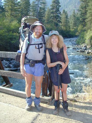
Rob and Kathleen at Loon Creek
(Click the image for the full-size image)
|
|---|
|
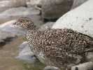
The Day: Along the way, we encounter hundreds of Chukar Partridges and several families of Spruce Grouse. These latter, stupid chickens, cluck along almost withing arm reach, harvesting gooseberries, currants, rosehips, thimbleberries, wild raspberries, huckleberries, and service berries (pronounced “sarviceberries” in Idahoan; “go warsh them there sarviceberries before the darn bears get ‘em all”). “They certainly have a fondness for sweets, no wonder they’re so plump,” notes Kathleen.
As we approach White Creek Bridge, the Chukars explode out from the plants at our feet. “Yoweee!” I exclaim, for it is a stark and startling contrast to the quiet trail pounding. The Chukars fly back and forth across the MF, yet prefer to run up hill and ‘chukar’ their presence for other Chukars and such.
It’s almost a lay-over day, and it’s lovely to avoid the tremendous and oppressive heat of mid-day. After a lavish dinner and some lounging, we hike to Lower Loon HS and join the textile texans in the log-lined 108-degree delight. Then, back down the trail we troop by headlamp, to relish a cool evening along the murmuring waters of Loon Creek.
|
|---|
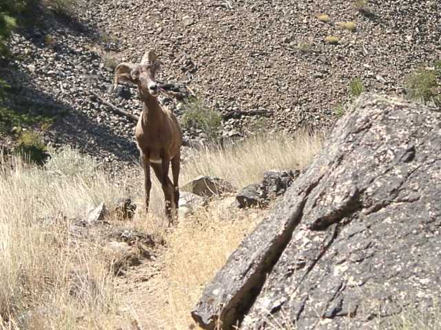
Big Horn ram
(Click the image for a full-size view)
|
|---|

|
|---|
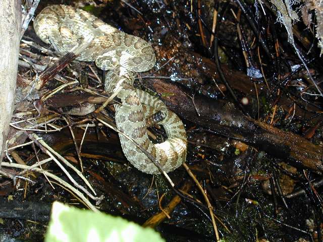
Mr. Buzzworm
(Click the image for a full-size view)
|
|---|
|
|
|---|
Tappan Cabin
(Click the image for a full-size view)
|
|---|
|
|
|---|
Judy surveys the MF
(Click the image for a full-size view)
|
|---|
|
|
|---|
in Tappan Falls
(Click the image for a full-size view)
|
|---|
|
|
|---|
Camas Cr.
(Click the image for a full-size view)
|
|---|
|
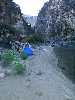
Day 10: A Pair of What?! (Aparejo!; RM 56.5):
Commentary: “A-pair-a-ho” I joke with the group as we filter the cool water of Little Aparejo Creek, warily watching Mr. Buzzworm, the Diamond Back Rattlesnake, as he gives us a snakey lick from his perch over the creek. Aparejo is a Spanish word for packsaddle, and we note how we feel like pack animals at times. As to Mr. Buzzworm, he was lounging in the trail, under the shade of the ash trees near the creek, when we so rudely tromped almost on him as we hiked in the coolness of the drainage. He squirmed up the bank, later falling in the creek, hid in a cavern under the bank (too cold for a reptile here), then took up residence on some branches above the creek. Through a leisurely lunch, we and Mr. Buzzworm eyed each other, wondering who would leave first. We did.
The Day: Bruce shows us the viewer and the photo of the Big Horn ram that must have been following Kathleen and me down the trail. We never saw this guy, but Judy and Bruce captured him on disk.
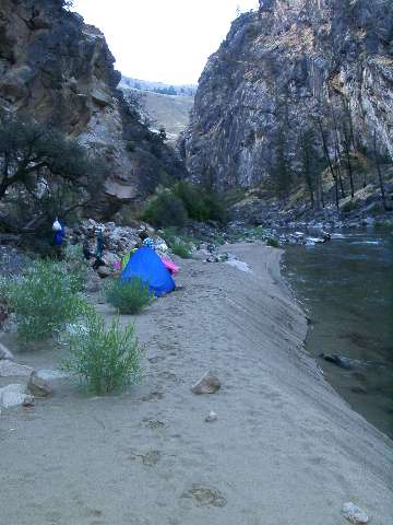
We look for a decent camping spot, then gravitate to the far end of the Tappan bench (Lower Grouse Creek river camp) with its lavish shade and access to the river and the frosty waters of Grouse Creek, not to mention the 1914 historical Tappan cabin. Rafters Aaron W., Bob H., and group generously share the camp with us, and we relish in a cool bath.
Day 11: Aparejo Revisited. (RM 63):
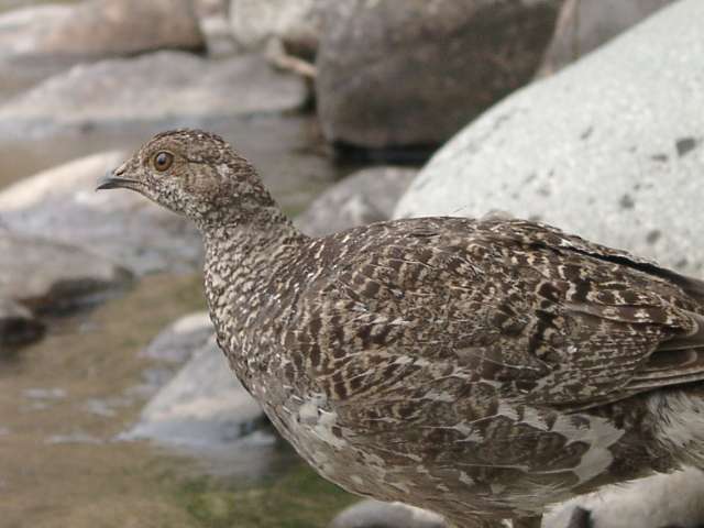
Commentary: I’m sitting under an odiferous P-Pine along Camas Creek. A haze of smoke recently blew in, apparently from down river, linked to fire somewhere down by North Fork. Two grouse peck for insects and “coo” at us a yard away. Kathleen is leaning against a large polished river rock, snoring gently. Looking up through the branches of the P-Pines, I wonder if this is what a Medusa head might be like. Judy and Bruce are luncheoning near the creek, sorting through well-traveled food bits. Judy finds a dome rock and declares it a ‘therapy rock’ not unlike the therapy balls she uses in her OT work. Ah, luxury. As Bruce gets up to stretch, a hummingbird zooms in and probes his hat, then his ear, finally working around his head and poking into his nose. Trying to remain steady, Bruce flinches at this last insertion, and the hummer is off.
The Day: This morning we got up and were on the trail early. Warming up, we paused above Tappan Falls (Class III+ to IV) to watch the group from Lower Grouse Camp run this rapid. Some of the group had ran through, yet we enjoyed watching Bob H. make a well-aligned run of the falls.
Now I’m writing from a soggy tent, perched on a slim and lovely sand bar part-way around Aparejo Point and across from Little Bear Creek. This delight is most likely only a camp every once in awhile. Yet, I do love the names and the features surrounding us, Aparejo, Little Bear, MF Salmon...... The rain is intensifying, yet it is nearly bed time anyway. The jade green of the MF slips noisily by outside the tent, peppered with rain.
|
|---|
camp at Aparejo
(Click the image for a full-size view)
|
|---|

|
|---|
therapy rock
(Click the image for a full-size view)
|
|---|
|
|
|---|
Cooing grouse
(Click the image for a full-size view)
|
|---|
|
|
|---|
on Bernard Bridge
(Click the image for a full-size view)
|
|---|
|
|
|---|
Bruce recoils
(Click the image for a full-size view)
|
|---|
|

|
|---|
flying out
(Click the image for a full-size view)
|
|---|
|
Day 12: Thundering Out. (RM 67.7):
Commentary: The tiny plane drops weightless,
then pivots right, slides left, floating unbridled in the process. Rain splatters off
the windshield, and I can see cloud stringers ahead, leaking out from some very low and
heavily pregnant cloud banks. Below glow the saturated greens of meadows and verdant tones
of grasses and firs, a contrast to the black pick-up-sticks and lonely ghost trees of the
crispy-fried hillsides. We are close enough to clearly see the water rolling over beaver
dams and whether the moose has antlers, and how big. Kathleen and I are flying with Gary B.,
following the path of Loon Creek towards Stanley, and sandwiched between low squalls and high
ground. I sneak a peek at Gary, and note that he is calmly checking instruments, watching
the moose, piloting with one hand. I find this reassuring, yet I have little enough small
plane experience to share the total Zen apparent in Gary. I can tell by the pressure applied
to my hand from Kathleen in the back seat, that she is a bit unsettled by this bumpy flight.
Oh, but the Frank Church, glorious wilderness unrolling all around us, the towering and
massive peaks and the ranging web of drainages, now we see more about what the fight is
for to retain tiny bits of wild country. So much country ravished by roads and multiple
abuse, so much more is abused by the blue smoke hoard of decimation (ATVs, etc.) than that
which supplies the clean water, clean air, solitude, digest of biodiversity, etc.... we will
continue to try to educate the ‘black hats,
the bushites, those with questionable intelligence.’ Of course, the best solution is to
immediately send this facinorous yegg back to texas, for a
permanent vacation. Yet for now we enjoy the here and
now of the MF Salmon country, and drink in the splendor while honoring Frank Church and
others with vision.
The Day: Kathleen and I gaze at ebony ghost trees near Warm Spring Creek. The area was thoroughly toasted in 2000, a part of wildfire ecology. To the SW, a craggy wall of chartreuse lichen-splattered Idaho batholith blocks the MF’s migration and is partly responsible, along with Warm Springs Creek, for the mormon ranch bench. A pattering of rain wafts by, replaced by sun, then cloud cover. It’s Day 2 of this MF adventure and filled with lasts we were hoping to avoid, last breakfast of the trip, last packing of the tent, last stretch of the MF Trail, etc., at least for now. Such a sumptuous diversity of experiences and country.
We have seen one set of backpackers over the 12 days, yet lots of rafters and plenty of small planes. We are on page 6 (of 9) of the MF river map and have crossed a variety of topo maps along the route. Down the bar we hike to the Flying B ranch to wait for the flight out with Gary B. The Flying B was barely saved from the fires of 2000, partly because of efforts of employees and the FS. There was probably a bit of luck there too.
We lounge on the ranch grass, enjoy a shower, eat a second lunch. About 7 p.m. Gary flies in between storm cells, and we all enjoy a fine dinner at the B, then hurriedly gather gear and head for the air strip. K and I fly out first, then Gary returns and flies with Judy and Bruce to Pocatello. As Kathleen and I board the plane, Bruce comes up to return a collapsible water bottle, and notes that it contains precious Grouse Creek water, a real treasure.
As I have noted in other MF reports, congratulations for making it to the end of this trip report. And, the best way I can think of to end this too-long report is with words from the Idaho Senator who shares the name of this grand country with a grand river (from a 1961 address by Frank Church to a graduating class in Idaho):
I never knew a man who felt self-important in the morning after spending the night in the open on an Idaho mountainside, under a star-studded summer sky. Save some time in your lives for the out of doors, where you can be witness to the wonders of God.
(As reported by Bethine Church, in Margaret Fuller’s book, “Trails of the Frank Church-River of No Return Wilderness.”)...
Middle Memories: (By Kathleen):
I’m clutching Rob’s hand. Pilot Gary’s serene countenance is at
least a little reassuring as we bounce broadly along
in the tiny plane through the thunderclouds/intermittent rain splashing on the window. I think of the legacy, the honor
given to Frank Church. Far below me is the largest Wilderness in the lower 48- the River of No Return/Frank Church.
Congress found it fit to rename it in honor of the Idahoan who labored his whole life to protect the innocent: children,
the poor, the trees/land/wildlife who have no voice, no power to fight off those who would devour them. These past
12 days have been a wondrous adventure. And overall, my feeling is that there is harmony here. People v. Nature.
The rafters, tourists, hikers. The river, trees, wildlife. How have such disparate elements managed to co-exist in a
mostly peaceful way? Did the government finally do something right??
We had set out at Boundary late in the afternoon down a dusty trail but
were startled 3 miles in by the sight
of a tourist. His soft cushy bed and elegant dinner await him back at the Lodge while we trudge on with our packs
filled to the brim with the Spartan fare of the backpacker. And the next 12 days will see that repeated again and again.
We encounter more people than I have ever seen on a backpack in a Wilderness. Not hikers (only 1 other group),
but rafters. We share most of our campsites with the rafting groups. Many of those we talk to seem to appreciate that
we too will experience wondrous sights, but at a pace we choose. The rattlesnake who grudgingly slides off the trail as
we pass but takes up residence at the creek where we stop for water hissing/rattling at us, keeping us at bay protecting
his turf. The 2 deer who have nested just above the trail, one peacefully grazing, the other resting, watching us go by. The
grouse Bruce herds through our camp. The hummingbird hunting nectar inside his nose and ear. Judy’s “therapy rock”.
Maybe not the adrenaline rush of shooting rapids, but soul satisfying nonetheless. The rafters/back country flying
students/Lodge visitors all have a different perspective. And I feel resentful that I must share this Wilderness treasure.
How jarring to be trudging along on the first afternoon with heavily laden packs only to encounter a student in a
backcountry flying class on a casual stroll down from his fancy room at the Lodge to snap a few pictures. The tourists,
the rafters, the constant hum of the planes overhead combine to disturb the serenity of this Wilderness. Eventually,
I accept I have to share this space and I finally begin to enjoy the “show”, and the camaraderie we experience. Sitting
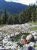
high atop the rocks at the Pistol Creek Rapids enjoying our lunch, we watch the kayaker with the purple helmet
somersault through the white water and emerge right side up sputtering and laughing all the way. I marvel at his awesome
attitude. And later while we’re scouting out a good campsite along the shore, this same kayaker calls to us. He’s made
friends with a small river frog and wants to make sure we too get that chance. I sit down by Mr. Frog for some quiet
bonding while the kayaker oars off to catch up with his group. I wave goodby and thanks. We seem to be after the
same thing, something intangible, unforgettable, real……There is harmony here.
Not all travelers are as self-assured. We also encounter some “lost souls” along the way. At our Indian Creek
Camp (we’ve dubbed it Paradise Island), the sand is soft and white, the water clear and cold. We’ve had showers,
done some laundry and just taken a few bites of our veggie/potato stew delight when the rafters roll up. “Is there water
here” “Yes”, we say thinking of the pristine rolling creek a few yards away. Turns out they were meant to be at the Guard
Station with the piped water and have missed their assigned camp stop. It will be dark soon and though not happy sharing
our private isle, we can see they’re tired, discouraged and need a welcoming hand. Turns out even their leader has not
gone down the River before. Hmmmm, a little foolhardy, I’d say. Later, I spy them holding hands around the campfire
praying…For deliverance?? We don’t meet up again and I hope they stayed safe and found what they had come for.
We’re all on our own kind of pilgrimage after all….Looking for the balance/the harmony
Not all the rafters are inept. Kurt’s commercial group, Middle Fork River
Tours, is top-notch. We meet him and some of his crew at the Indian Creek Guard Station and are impressed with their
expertise, courtesy and
love for the River and what they do. Later we meet up at SunFlower Hot Springs and the crew obligingly ferries us
across the water saving our bruised shins and sore knees another beating like they’d received the day before taking
the cross country route over the scree.
By far the best people experience was meeting the Rangers: Derek/Tyler
(Wilderness Technicians), Kelly
and friend - all doing their best to attend to the needs of the River/environment while balancing the demands made
by people on this fragile ecosystem. None liked what Bush et. al. were doing to destroy
this precious place. Being an
environmental activist (shouldn't we all be active in protecting our clean water, air, future?)
I sometimes forget the Forest Service is not just the political appointees who must toe the Bush-kill line
but real people working to preserve what they love and hating what the greed-mongers are doing to destroy the forest.
Spending the day with Sheri (the River Manager) at Indian Creek Guard Station was one of our best days. Ice cold
soda/beer and scrumptious burritos accompanied by fresh vegetables from her Challis home garden helped to loosen
our tongues. Soon life-stories spilled out. Sheri was set on a course to become a lawyer until she spent time out in the
Wilderness. There she found her place in the Cosmos and has never looked back. She knows the meaning of true
stewardship. The Frank Church is blessed to have such people working to keep it safe.
There is abundant evidence that even 100 years ago, not all the travelers
came to observe, enjoy and leave no
trace. Farmers/hunters/miners/speculators were here. The abandoned cabins, fences, buildings all show people were
here to live off the land, the water, the animals. Even today, some hope for such a living. The hunting lodge at Loon
Creek is one such operation. I can’t find it within me to really wish them well. Hides as trophies to hang in the family
room. Where is the joy, the pride in being responsible for one less animal gracing the Wilderness with its living presence??
Yet the River endures. It is low at this time of year. But even in these
12 days we have seen it change its
texture and color from deep brown and thick with sediment from the heavy rains back to clear and fast running.
Oh that such recovery could always be depended on! How long will this Wilderness last? Can we maintain the
balance? One Ranger talked of a hunter who has spent many a fall here insisting the Forest Service should install
flush toilets up and down the Trail. Sad to think that w/ all the earth gives, we keep demanding more. Finally it is
up to us - rafters, hikers, rangers, even hunters. Politicians are bought all the time by the highest bidders. How
about allegiance to a higher cause? The earth / life itself. The Frank Church River of No Return Wilderness - who
could place a money value on this jewel? Thank you, Rob. I love you and this place.
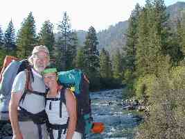
|
|---|
Bruce and Judy at Loon Creek
(Click the image for the full-size image)
|
|---|
|
| | | |
|