Text and photos © copyright by Rob Jones

With Kathleen Jones
Panasonic DMC-FZ200 camera
|
| |||||
|
| |||||
Salubrious: favorable to or promoting health or well-being
“You believe that reality is something objective, external, existing in
its own right… But, I tell you, Winston, that reality is not external. Reality exists in the human mind,
and nowhere else. Not in the individual mind, which can make mistakes, only in the mind of the Party…
Whatever the Party holds to be true is the truth….” - George Orwell, 1984 --- this is a prescient note to
people of the tea bagger and other ‘conservative’ persuasions as they repeatedly launch dogma-driven, obsurantist
attacks upon reason….
"Reality has a well-known liberal bias." - Stephen Colbert
"Water, water, water . . . There is no shortage of water in the desert
but exactly the right amount, a perfect ratio of water to rock. Of water to sand, insuring that wide, free,
open, generous spacing among plants and animals, homes and towns and cities, which makes the arid West so
different from any other part of the nation. There is no lack of water here, unless you try to establish a
city where no city should be." — Edward Abbey, Wilderness Reader
“The plural of "anecdote" is not "data". - unknown
Total trip miles hiked = 34.6 miles total;
ERM = 59.8 .
Maps:
ERM* = Energy Required Miles.
A mile is added for every 500' elevation gain or loss. It's a very serviceable method of
estimating energy required miles. And, see a study about the validity of using ERMs below.

![]() Click here
or on the image below for a map of the First Water TH to Black Top Mesa Loop.
Click here
or on the image below for a map of the First Water TH to Black Top Mesa Loop.
| ||||
![]() Click here
or on the image below for a map of the Peralta TH to Weavers Needle Loop.
Click here
or on the image below for a map of the Peralta TH to Weavers Needle Loop.
| ||||
![]() Click
here or on the image below
for a map of the Peralta TH to Miners Needle Loop.
Click
here or on the image below
for a map of the Peralta TH to Miners Needle Loop.
| ||||
Map Downloads: (Note: these are *.gpx downloads, not maps - until you use them in your mapping software.)
| ||||
| ||||
 |
 |
 |
 |
 |
 |
 |
 |
 |
 |
 |
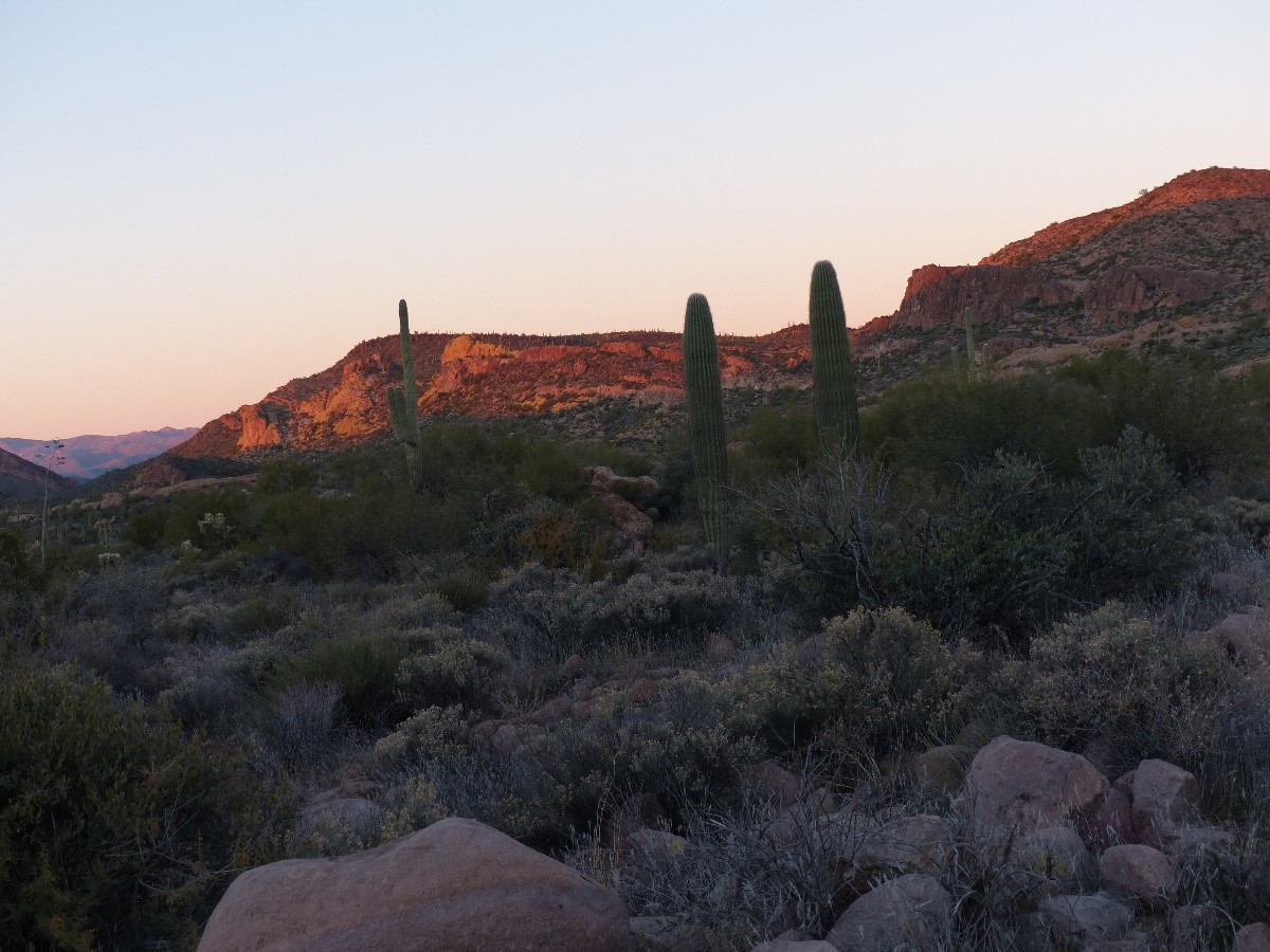 |
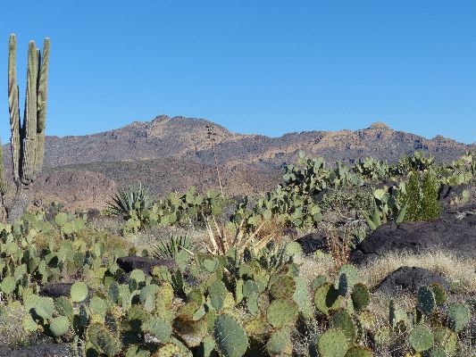
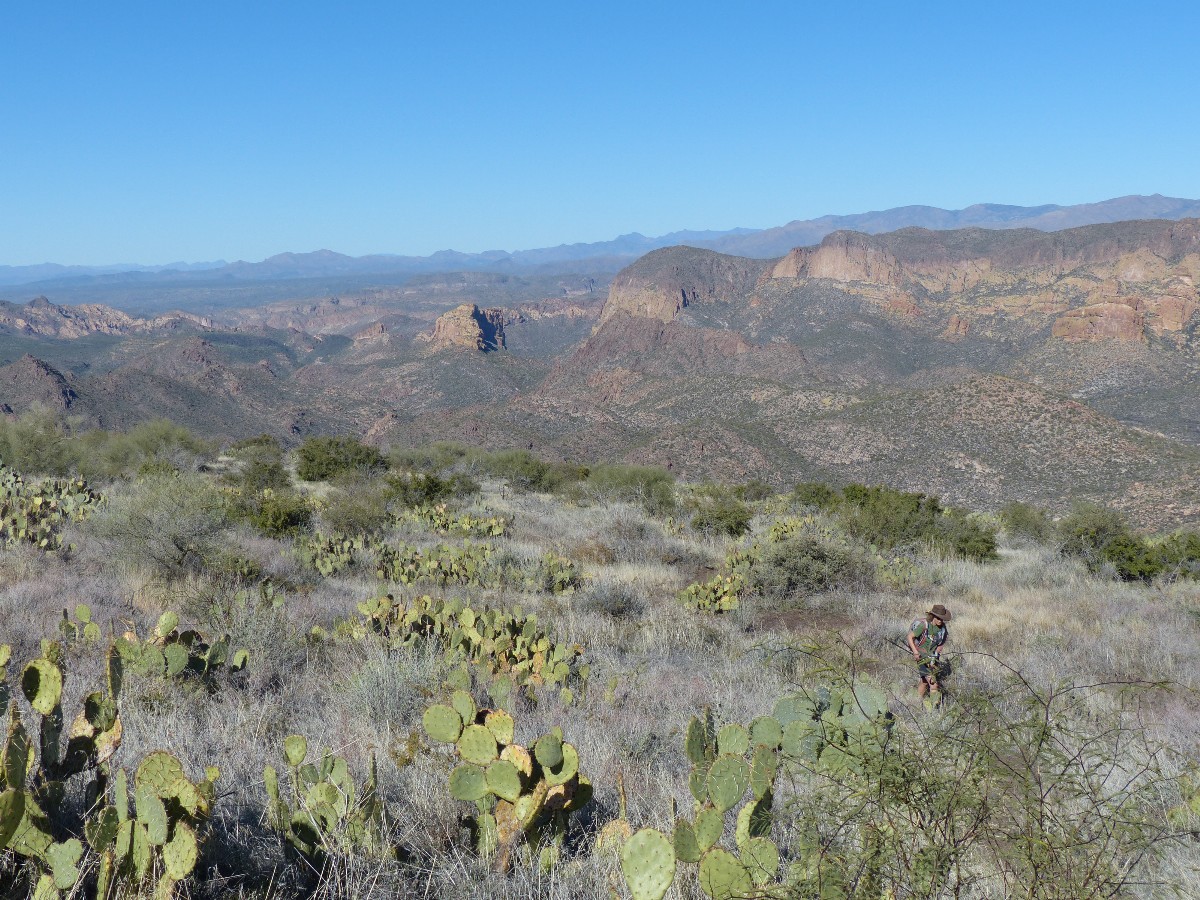
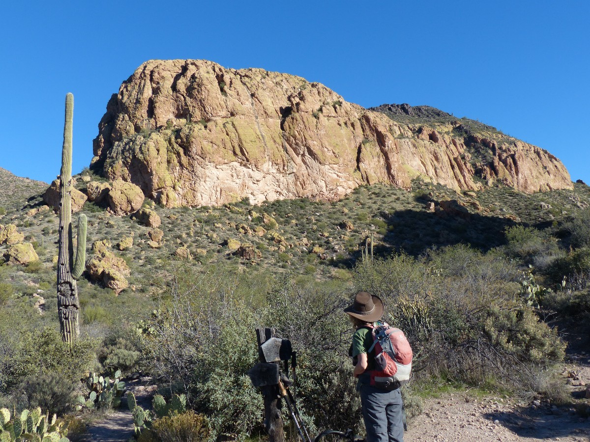
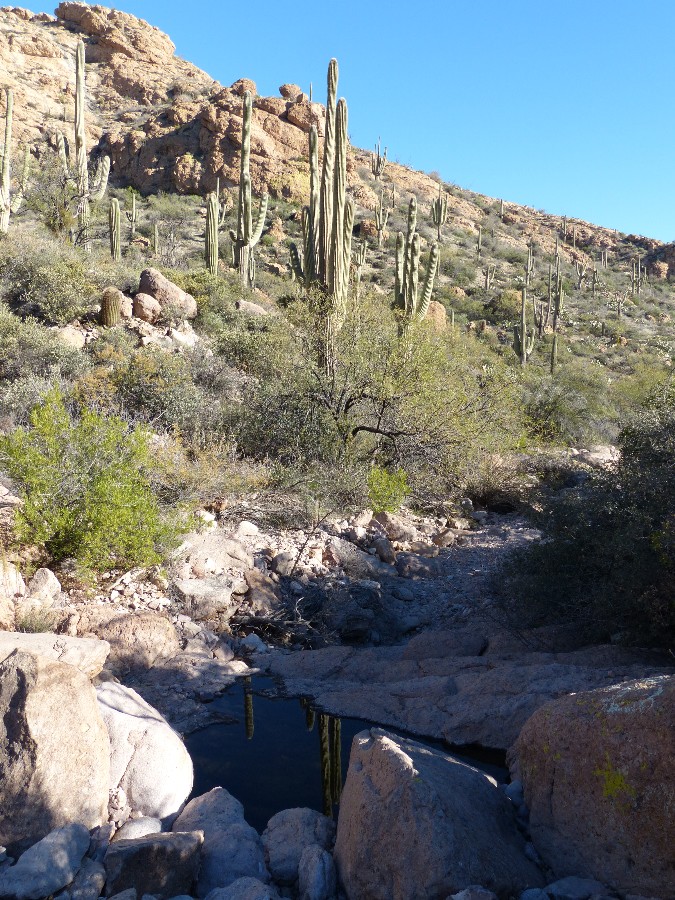
Day 1: Topping out on Black Top Mesa: Black Top Mesa from
First Water TH; 12.5 miles, up 2000', down 2000'; ERM = 20.1.
From First Water TH near Dutchman State Park, hike the Dutchman 104 trail to the
turn-off to Bull Pass. Turn onto trail 129 to Bull Pass. At the Pass, hike up the social trail to Black Top Mesa.
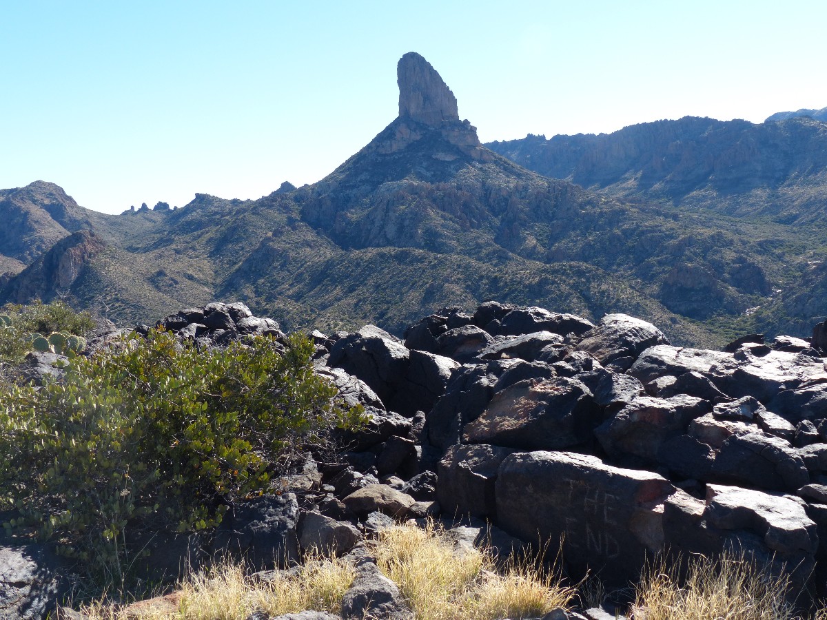
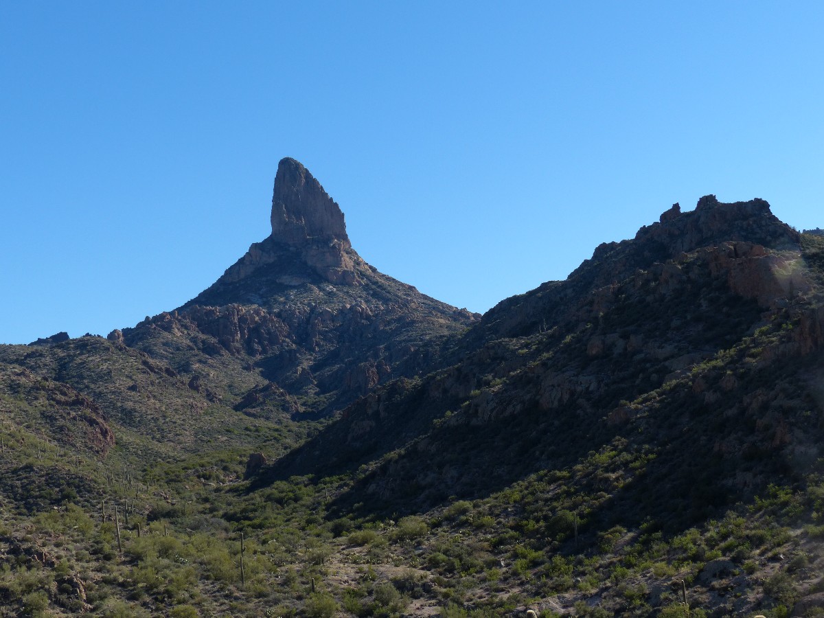
Tremendous vistas of Weavers Needle to the South and the Wilderness area to the North
pop into view as you mount Black
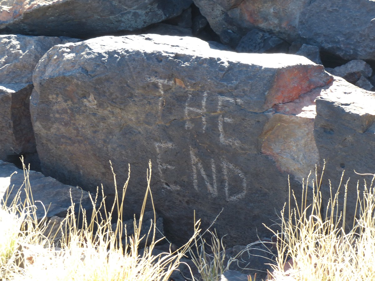
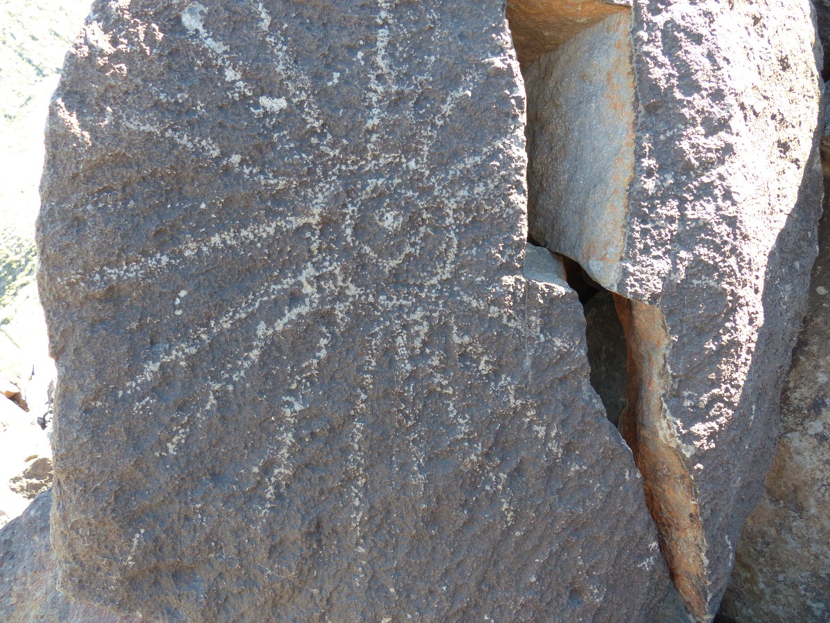
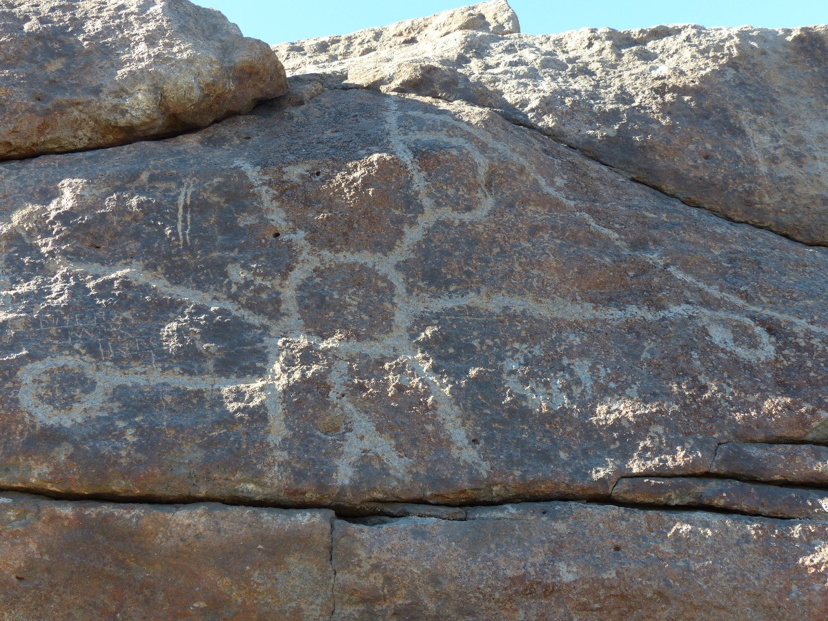
Top Mesa. Watch for petros (Spanish Hieroglyphs, so-called) on the edge of Black Top.
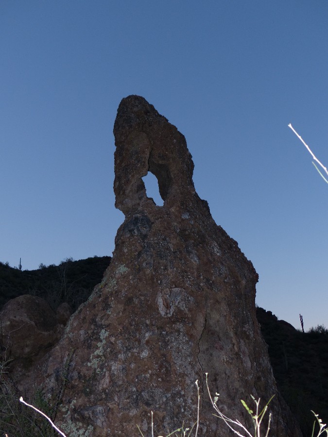
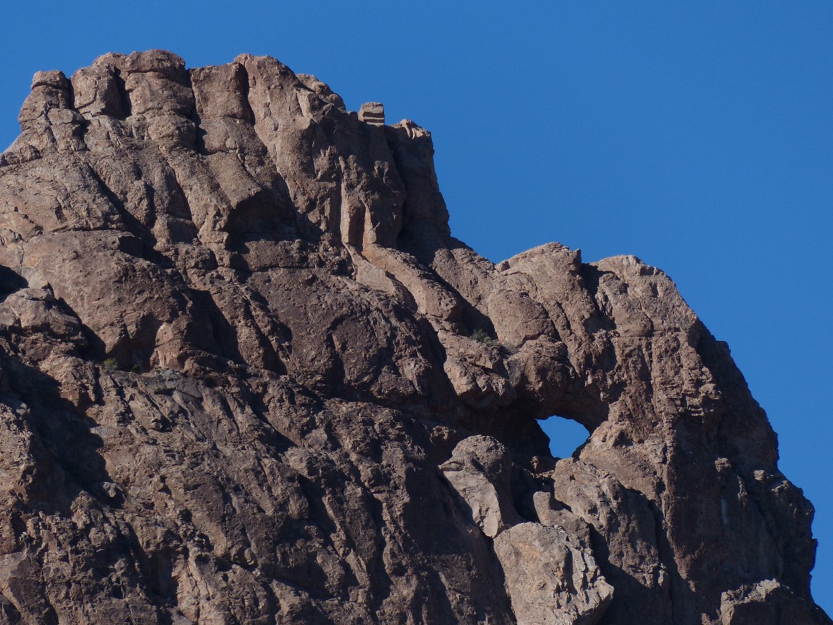
Look for Ojo de Caballo Arch high in the bluff to the West of Black Top Mesa - it's
in Palomino Mountain.
Loop back to the TH via the Black Mesa Trail 241 and the Second Water Trail 236.
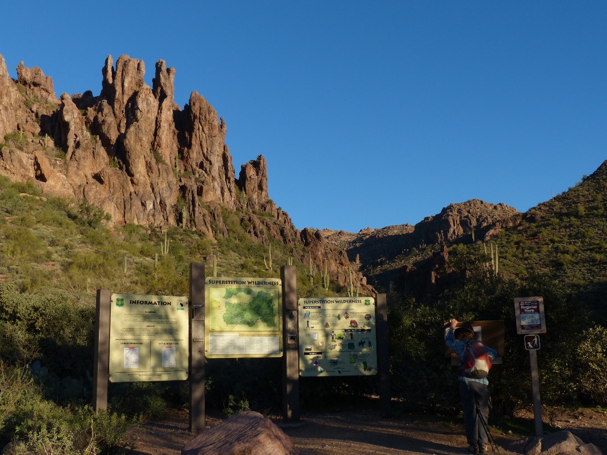
The buffy volcanics scrape the Eastern skyline as we drive to First Water TH
to start the quest for Black Top Mesa, for the so-called Spanish Hieroglyphs, for native rock and Saguaro Cactus.
It's pleasantly quiet at this usually busy TH as we start off on the Dutchman 104, the trail that roves from
North to South across the Wilderness, between this and the other busy TH, Peralta. After starting out with an
insulation layer, it's not long after we encounter the first water prior to Parker Pass that we are stripping
down to t-shirts and long pants. Ahh, glorious sun, shining through the Phoenix area haze (which seems thin
today - perhaps it's our slightly higher elevation?). The TH is at about 2300' and we'll be climbing to about
3400' on Black Top Mesa.
Pausing at the junction of the Dutchman with the Black Mesa Trail 241, we
enjoy an earned snack and ponder the route we took to the Ojo de Caballo Arch, high in Palomino Mountain,
during one of our first trips to this Wilderness. It's certainly not an obvious route, we muse. Continuing
on, and leaving the Dutchman to climb to Bull Pass, we get a distant view of the Ojo. It's high in the buffy
bluff-side of Palomino (look behind and up in the cliff as you climb the lower level of the pass).
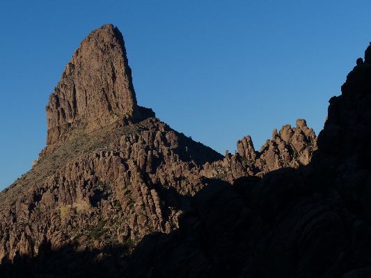
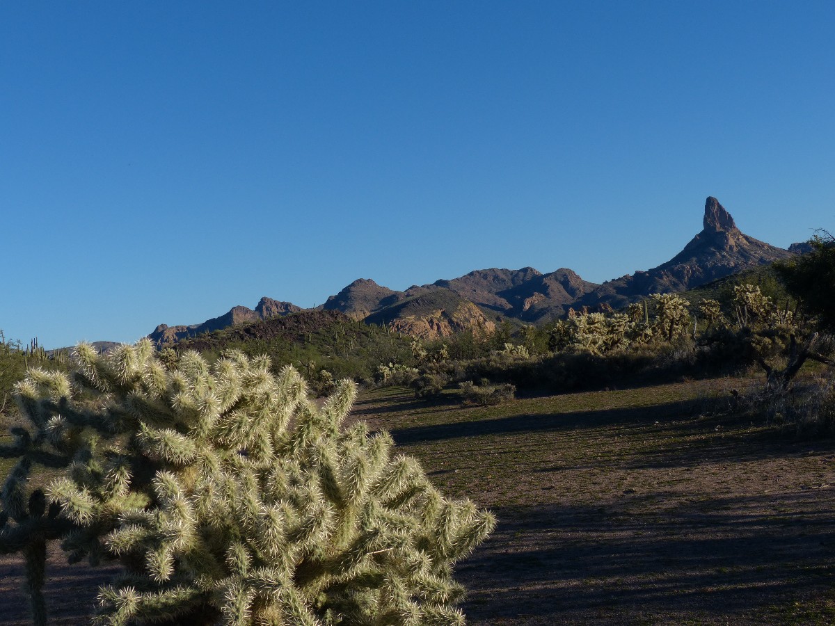
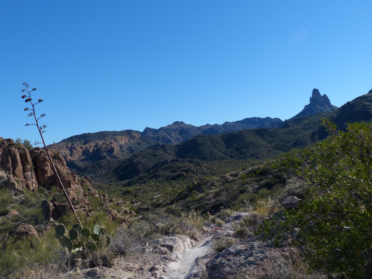
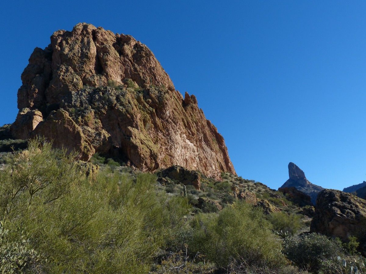
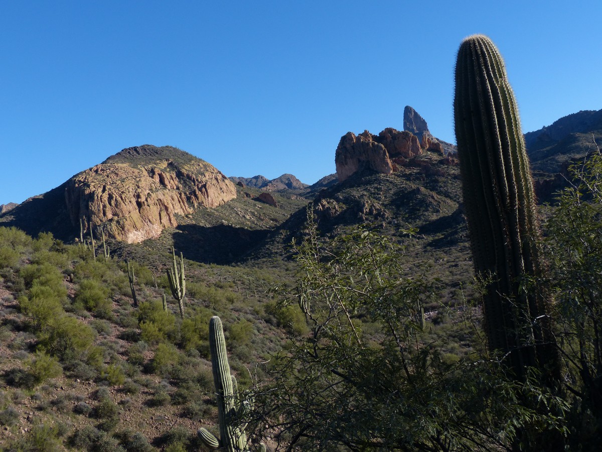
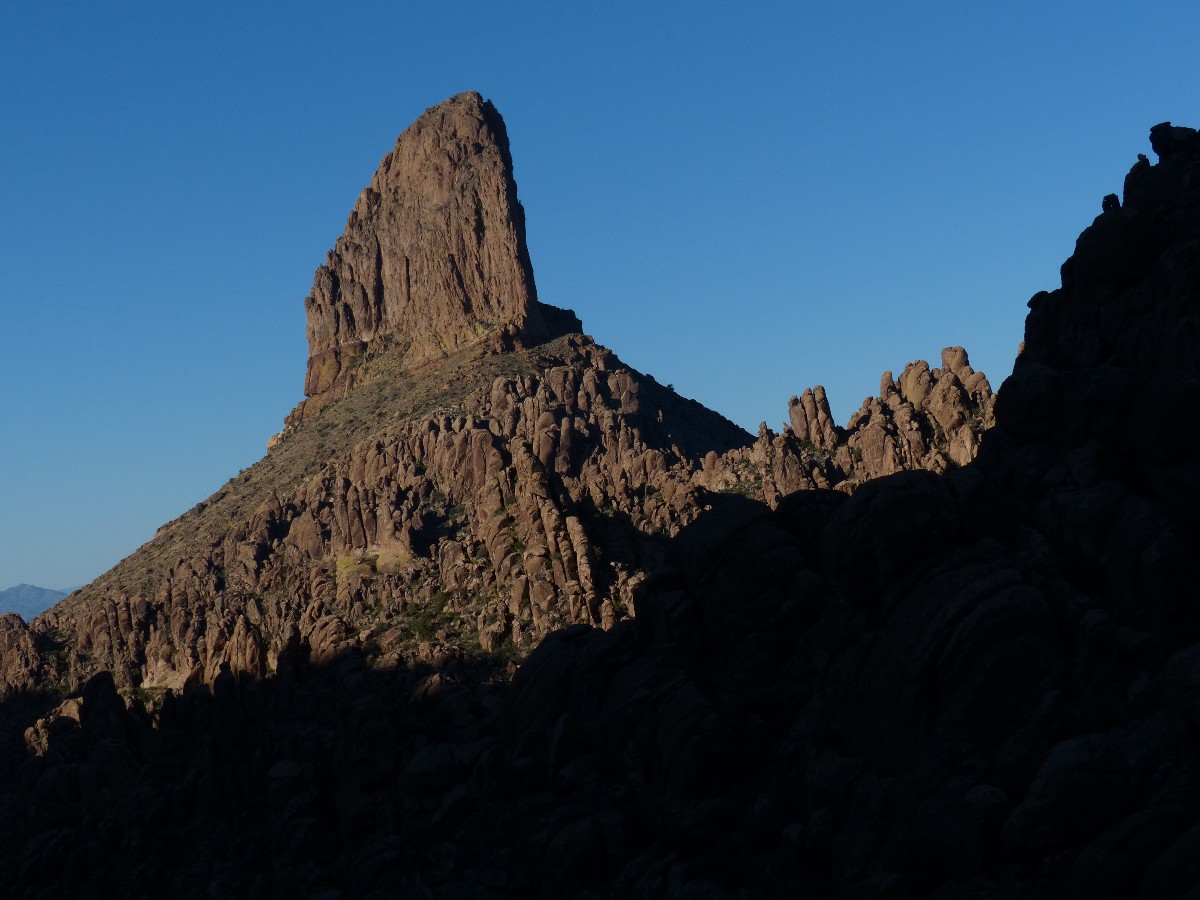
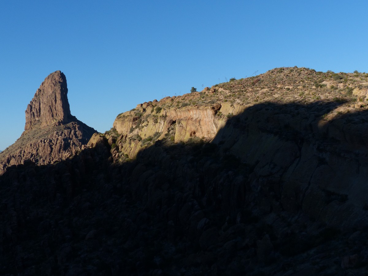
The alien-looking spire of Weavers Needle protrudes into view as we hike the
grassy incline of Black Top Mesa. Vistas improve. We search for the petros/hieroglyphs and find several -
yet wonder about their origin. Then, we find a bucket seat in the ebony lava and enjoy lunch looking over the
Superstition Wilderness domain.
Back at the Dutchman/Black Mesa Trail junction, we continue up the hill past
stately Saguaro. A rocky descent North from near the county line slows us some, and we're rounding the Second
Water Trail as dusk settle in and cold air slumps into the gulch. With somewhat bruised feet, we creep into
the TH surrounded by the wakening sounds of the crepuscular creatures.
| ||||
 |
 |
 |
 |
 |
 |
 |
 |
 |
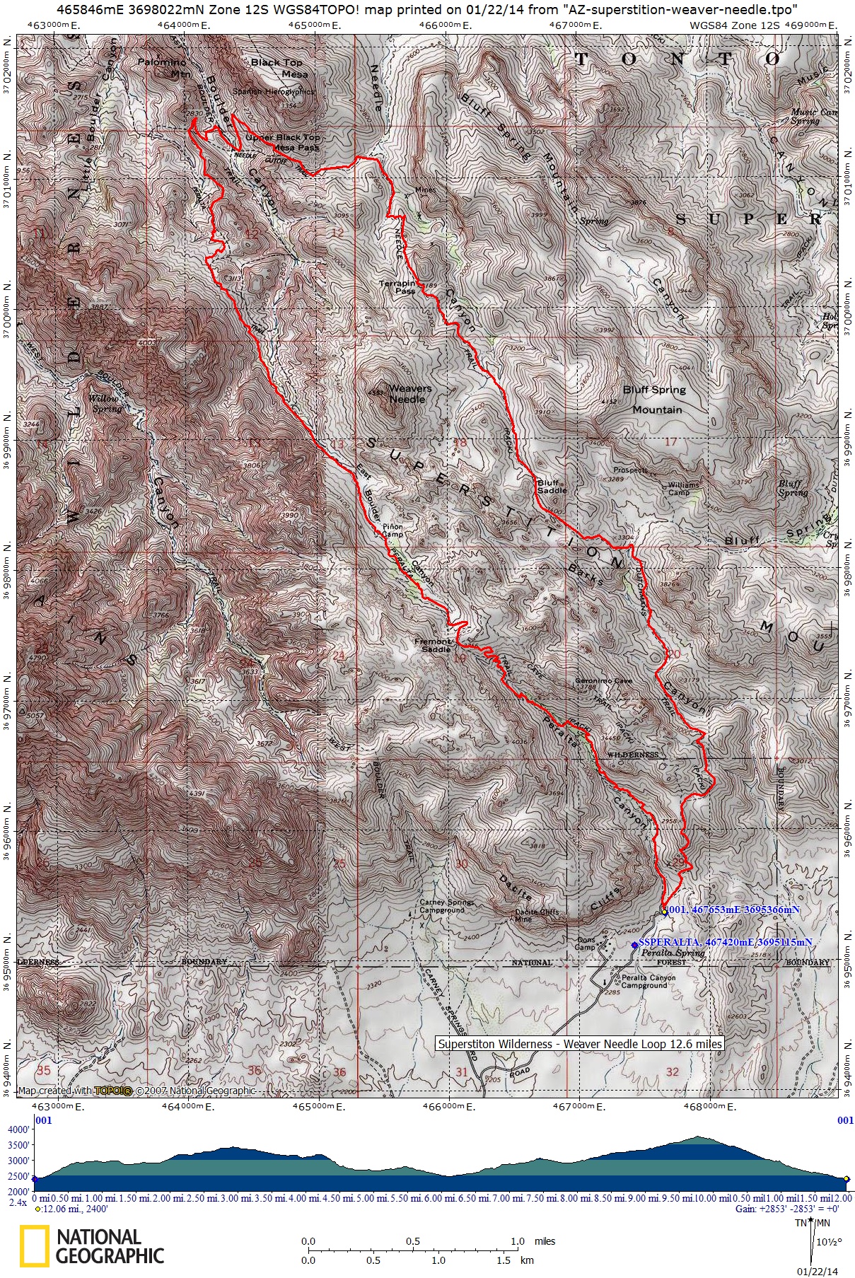
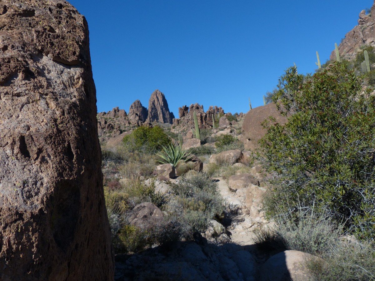
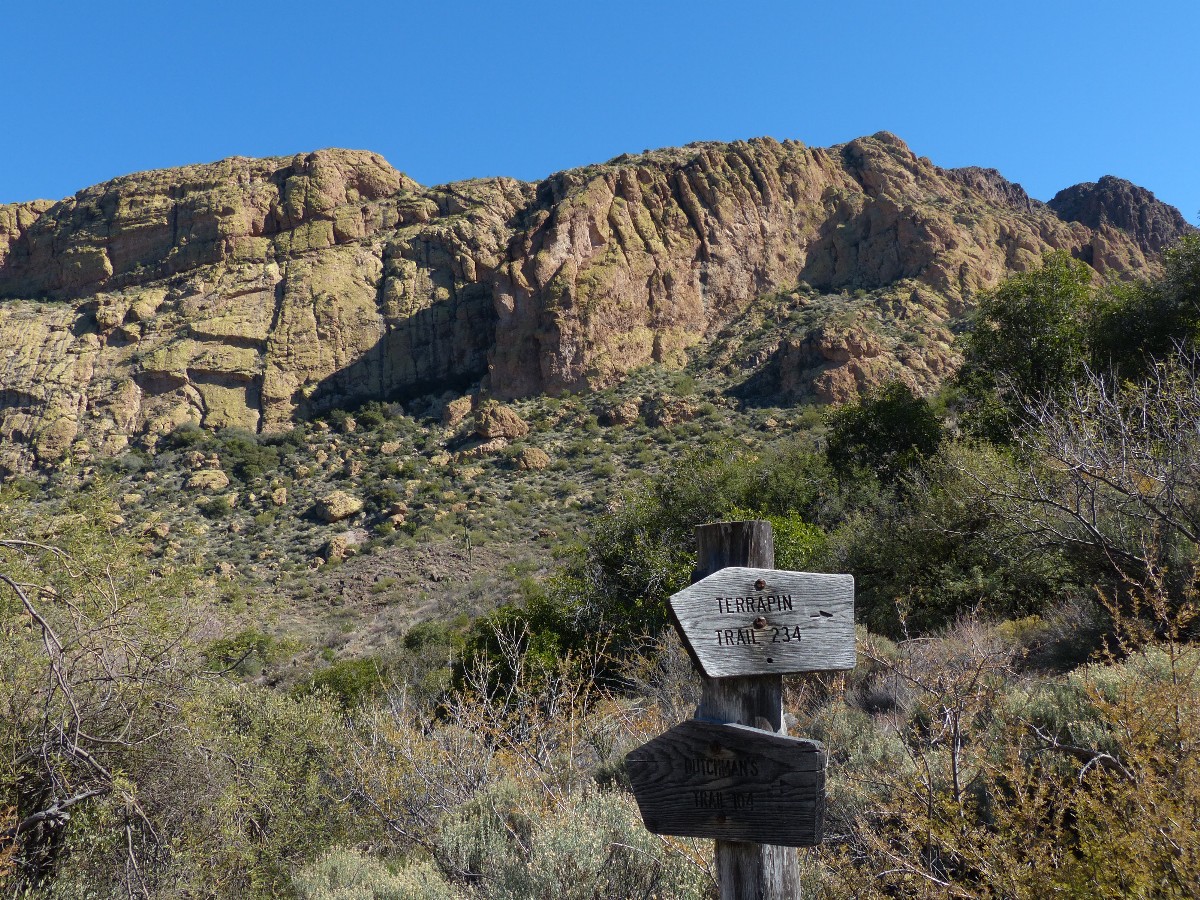
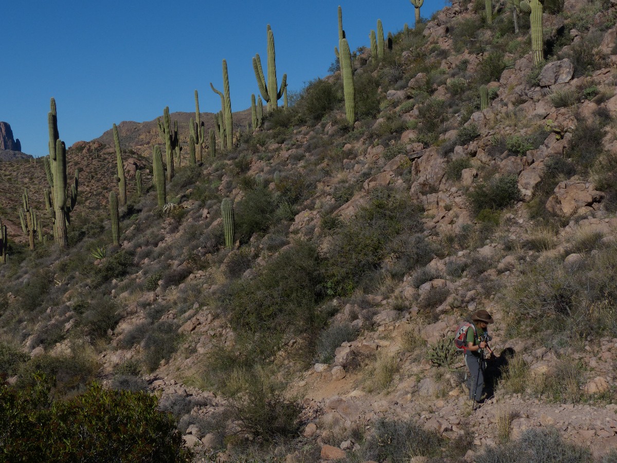
Day 2: Weaving around Weaver:
Weaver Needle Loop from Peralta TH; 12.6 miles, up 2800', down 2800'; ERM = 18.3.
Starting from the Peralta TH, take the Bluff Spring trail 235 to the Terrapin
Trail 234, and onto the dutchman trail 104 to where it meets the Peralta Trail 102 - which returns you to the
Peralta TH.
This hike loops around Weavers Needle and nearly links with the loop formed by
the hike to Black Top Mesa from the First Water TH.
We're up and on the road to Peralta TH early, knowing our plans include a
long hike around Weavers Needle. Along the way, we'll roll 2800' up (and down too), making this a hike that
hikes like a 23 mile jaunt. However, this is rocky terrain at times, and the ERM method, although very sound*,
while accounting for the topography, does not account for the texture of the topography.
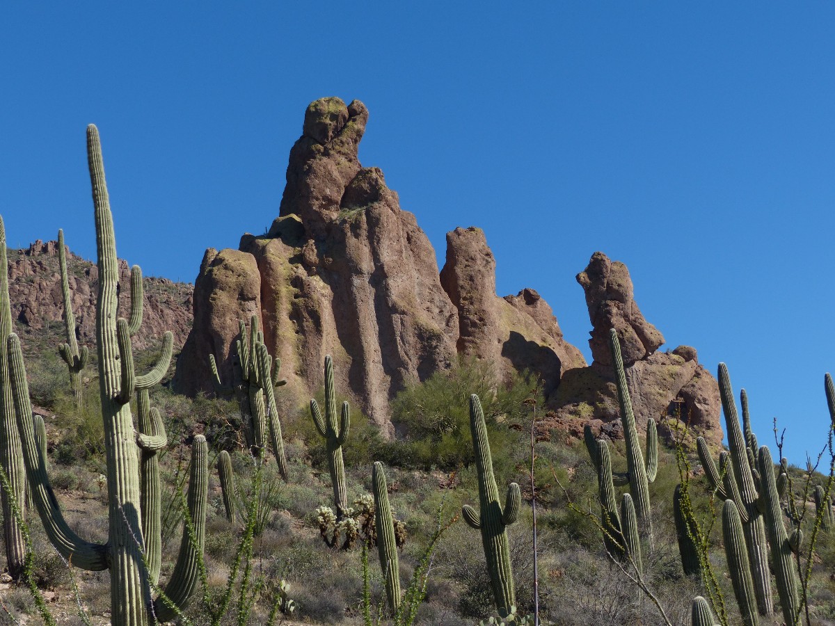
The South face of Black Top Mesa looks like an eco-friendly oreo cookie, with
a black top (basalt), a buffy center (the tuff), and a green colluvium bottom (cat claw shrubs and cactus on
talus), as we slip and walk down from Terrapin Pass to once again join Dutchman Trail as it scribes an arc
below Black Top before joining the Peralta Trail on the West side of Black Top. We're less than half a mile
from our lunch spot atop Black Top yesterday.
Climbing out of Boulder Canyon, we intersect the Peralta Trail and stop for a
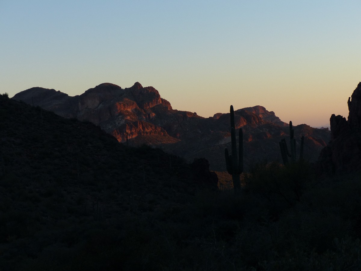
late lunch in view of the rufous and buffy cliffs of Palomino Mountain to the North. Shadows from the spiny
ridge to the West cast long fangs over the granite lowlands near the base of Weavers Needle. A few climbers
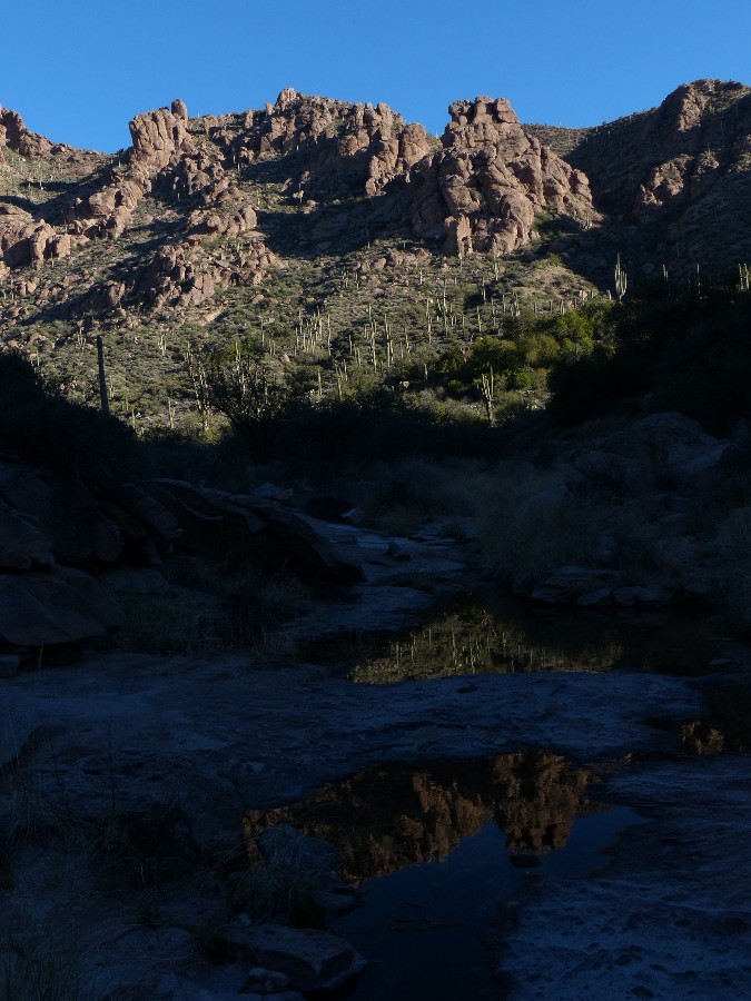
are setting up camp on polished granite (?) near the surprisingly well flowing water, preparing for or rejoicing
about a Weaver climb.
Once again it's approaching dusk, this time as we top out on Fremont Saddle,
to views down Peralta Canyon and a picket fence of Saguaro in the distance. Down. Past some minor arches and
more good country. To the TH, to dinner, to a discussion of today's Weaver roundabout.
| ||||
 |
 |
 |
 |
 |
 |
 |
 |
 |
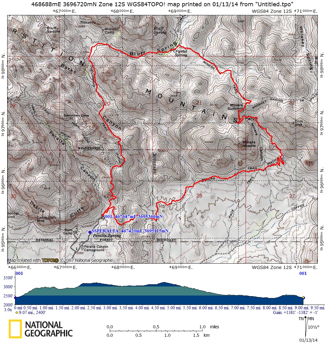
Day 3: Meandering Miners Needle 9.5 miles, up 1500', down 1500';
ERM = 15.5.
The start of this trip overlaps the start of the Weavers Needle Loop - as
taken from Peralta TH.
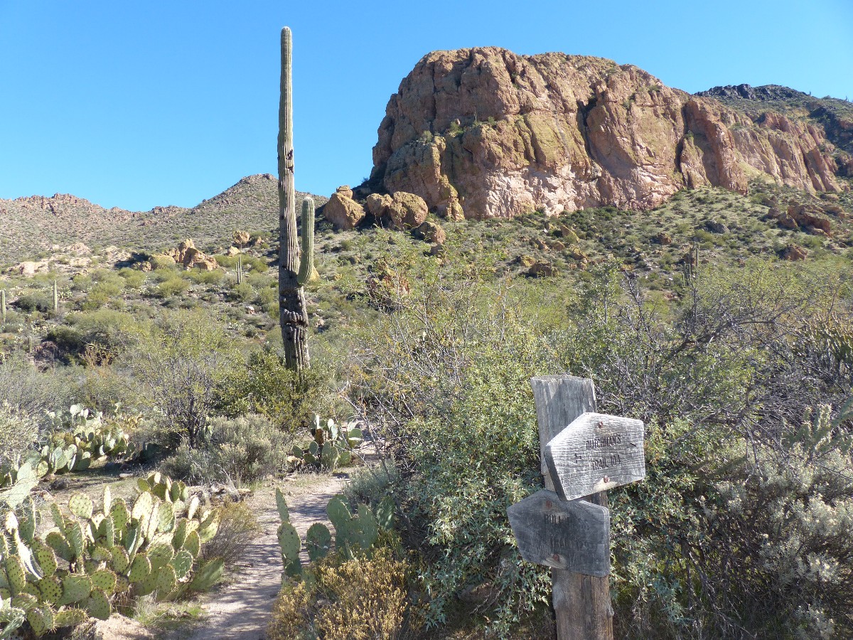
Start up the 235, Bluff Spring Trail, staying on it to where it intersects
the Dutchman Trail 104 near the turn-off to Bluff Spring. Stay on the 104 as is skirts the East side of Miners
Needle, then drops off the pass to the general area of Coffee Flat. Watch for the Baby and the Blanket feature
as you reach the foot of the pass.
Return to the Peralta TH on the 104.
Again, we're striding out from Peralta TH, hiking the Bluff Spring 235, in the
cool of the morning. The wind is cold as we clamber over the bluffy outcrop above the TH. Dropping into Barks
Canyon, we leave the breeze and most people behind. Glorious.
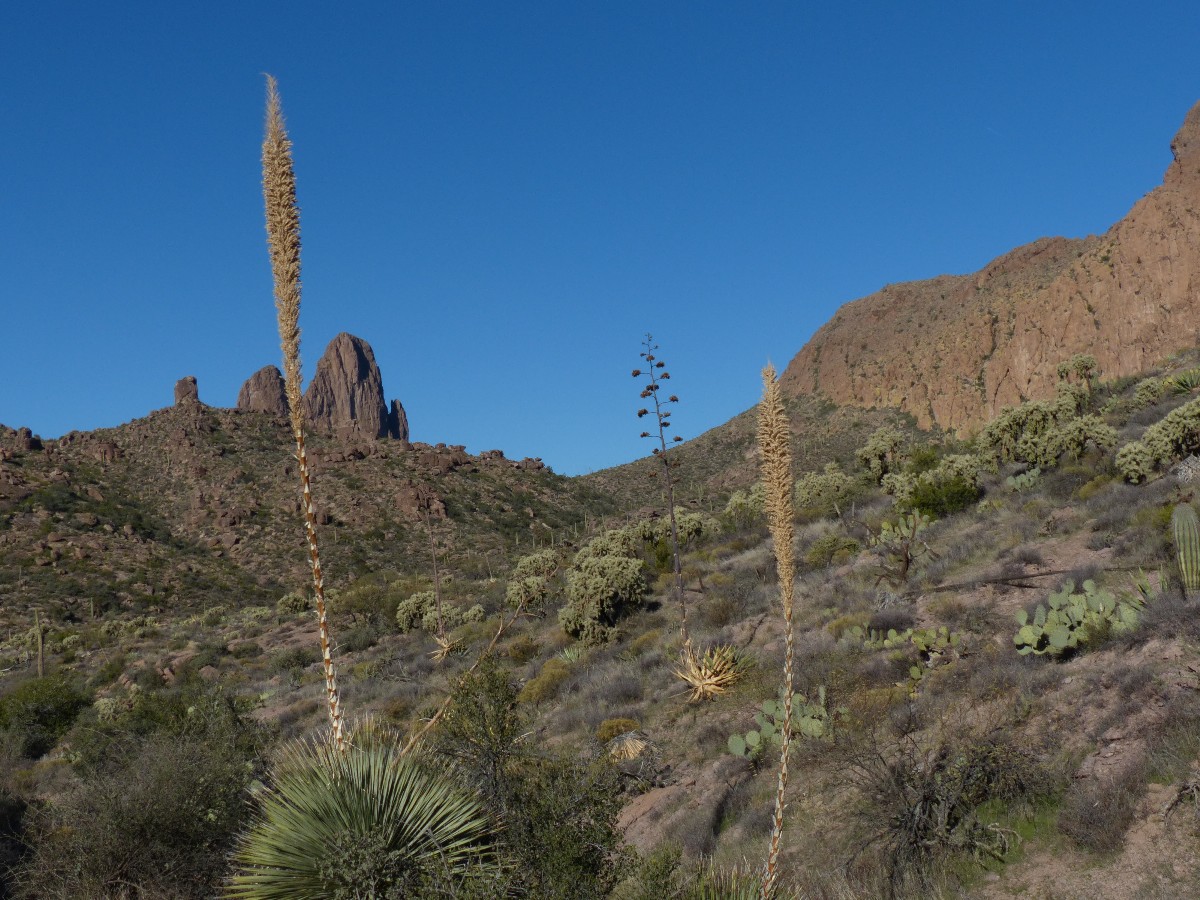
As we round Easterly on the 235, the flank of Bluff Spring Mountain glows yellow
in the morning light. Gorgeous. This is easy walking to the Dutchman 104 junction. The grade increases somewhat
and before long we are climbing to Miners Summit, where we find shade from a large hoodoo and eat lunch overlooking
Miners Needle and the open country stretching toward Coffee Flat. Far below, we see a phalanx of what we suspect
are scouts (they are, we discover later) and numbering a wilderness-unfriendly total of more than 20. The group
rattles to a halt in a short side-drainage, and we return to lunch. Al comes by with his puppy, and they sneak
past the scout clog as we watch with curiosity. Our turn comes next, and we find 15 scouts and about 6 leader-types
discussing water treatment in the side drainage. They assure us that they are breaking into two groups for camping,
although as I recall, the traveling/camping limit is 15 in this well-used wilderness.
On the way out to the flats, we pass the Baby and the Blanket feature. The baby
appears to be accompanied by a bear. Soon, the TH. This 9.5 mile loop seems tame compared to the previous two
loops. Yet, the Superstition Wilderness is enjoyed. And, we'll have some decent photos to remind us of that.
| ||||
Geology: (Lost Dutchman State Park info)
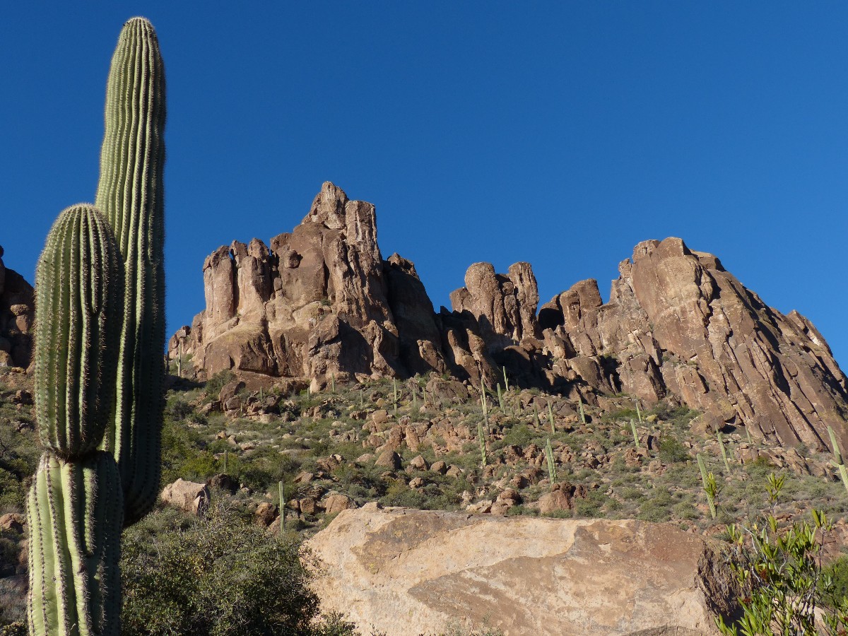
The Superstition Mountains are the result of intensive volcanic activity.
They are composed of welded tuff (volcanic ash cemented under extreme heat), breccia (rock fragments
cemented together with lava or welded turf), granite, dacite, basalt, and some conglomerate. A few gold
deposits pocket the surrounding areas. Some 25 million years ago, during the mid-Tertiary Period, volcanoes
in this region emitted about 2,500 cubic miles of ash and lava, the ash spreading as far south and northeast
as present day Florence and Roosevelt Lake. The volcanoes collapsed into their partly emptied magma chambers,
producing depressions or calderas. A subsequent up-thrust of thick lava within the largest of these calderas
and the forces of erosion have created the Superstition formations that we see at the park today. Thick,
alluvial fans spread outward from this eroding resurgent dome. The alluvial material is primarily tuff,
dacite, and decomposed granite.
*ERM: Energy Required Miles, are there data to support this
mileage adjustment?
Journal of Outdoor Recreation, Education and Leadership
Petzoldt first proposed his theory in his 1976 book “Teton Trails” to
help backpackers plan trips and calculate their energy needs on mountain trails. “Petzoldt defined one
energy mile as the energy required to walk one mile on the flat. He recommended adding two energy miles
for every 1,000 feet of elevation gain, so a person hiking one mile and 1,000 feet upward would use the
equivalent of three energy miles,” Phipps said.
Petzoldt’s energy mile theory was just a reflection of the mountaineer’s
“gut feeling,” Phipps said. The theory had never been tested in a laboratory before the study began in WCU’s
Exercise Physiology Laboratory in the spring of 2010, Phipps said.
To determine the validity of the theory, the study measured the energy cost
and perceived exertion for walking on flat ground, with and without a 44.5-pound backpack, and up an elevation
gain of 1,000 feet, with and without the backpack, through the collection of metabolic data, Phipps said.
Twenty-four student, faculty and staff volunteers, including 12 males and 12
females, went through four testing sessions as the research continued into fall semester of 2010. The study
results showed that the additional energy cost for ascending 1,000 feet ranged from 1.34 to 2.02 energy mile
equivalents, for an average of about 1.6 miles, compared to Petzoldt’s use of two energy miles for each 1,000
feet. The range revealed by the study was due to the “hikers” personal weight differences, Phipps said.
“It is remarkable that Petzoldt’s energy mile theory is so close to the actual energy cost measured during our
study,” Phipps said. “In the field of outdoor education, it’s important for leaders to include an estimation
of energy requirements during the planning of hiking trips.”
Phipps said the energy required for hiking up steep mountain trails would vary
for individuals and groups, and the variables of the trail would also factor in, but he recommends that
backpackers stick with Petzoldt’s idea of adding two energy miles for every 1,000 feet of elevation gain when
planning trips.
The Validity of Petzoldt's Energy Mile Theory, 2010
Authors: Maridy McNeff Troy, Maurice L. Phipps
Publication: Journal of Outdoor Recreation, Education, and Leadership
| ||
|
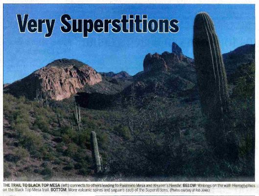
One of my Arizona Daily Sun articles was published while I was working
on this report - here it is; Very Superstitious (pdf)
(Click the image for the document) | ||
|---|---|---|
![]() map of the First Water TH to Black Top Mesa Loop.
map of the First Water TH to Black Top Mesa Loop.
![]() map of the Peralta TH to Weavers Needle Loop.
map of the Peralta TH to Weavers Needle Loop.
![]() Peralta TH to Miners Needle Loop.
Peralta TH to Miners Needle Loop.
Click here to: see a video from Black Top Mesa, Day 1. (14mb)
video from Weaver Needle to near Fremont Saddle, Day 2. (9.7mb)
Superstition Wilderness Backpack: "T" is for Tortoise (2010)
| |||||
| |||||
| |||||
| |||||
| |||||
 |
 |
 |
|
Wild Vagabond Main |
Trip Report Index  |
Caveat  |
|---|