Grand Canyon Trip Report - Nankoweap #4 / Nankoweap to Kwagunt / Kwagunt to Nankoweap / Climb Nankoweap Butte
(September 23 to October 4, 2017)
Text © copyright by Rob; and Photos © copyright by Rob

|
Nougat of Nankoweap, 2017:
Grand Canyon Trip Report - Nankoweap #4 / Nankoweap to Kwagunt / Kwagunt to Nankoweap / Climb Nankoweap Butte (September 23 to October 4, 2017) Text © copyright by Rob; and Photos © copyright by Rob |
|
Co-Adventurers: Annette Adams and Holly Button
Camera: Panasonic ZS-60
This report has improved photos.Total miles = 56.6 Total ERM = 120
|
| |||||
|
| |||||
|
| |||||
|
| |||||

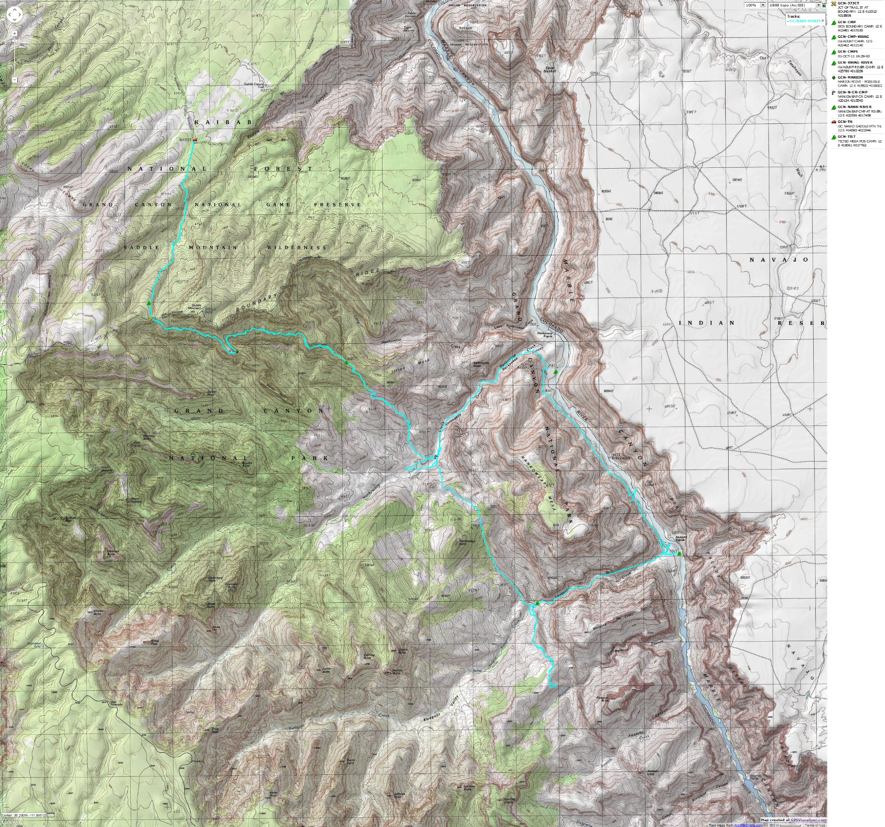
| ||||
for a full-resolution map, click here. Caution - do not use this map or gps track for navigating the route.
A note about new and improved! photos:
With this WV report I'm upgrading the quality of the main images. Not the thumbnails, which remain
low quality to enable fast page load times, but the main images that you see after clicking on the
thumbnails. Credit is due David Chasey, whom I met with his lovely wife Cindy thrashing through
the brush looking for pictographs in some unnamed obscure location. David worked as a professional
photographer and guided me through a way to improve image quality. He also repaired my well-traveled
Panasonic ZS-19, which I now use for day hikes. Thanks David!
You can see some of David's work at (click here)
Summary:
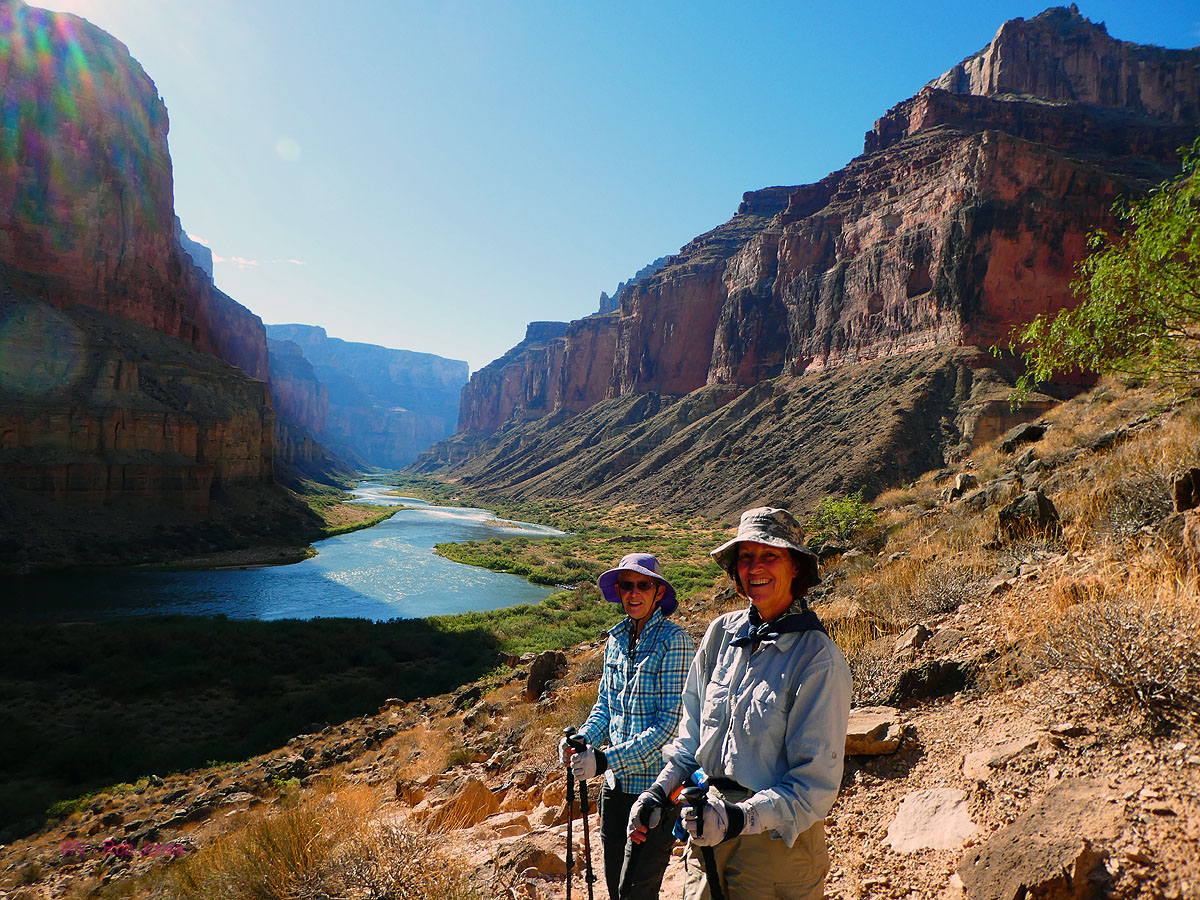
Annette, Holly, and I hiked a lollypop loop, a Nougat of Nankoweap, incorporating the Nankoweap Trail,
then a route over the Nankoweap Mesa-Nankoweap Butte saddle (part of the Butte Fault Route) into Kwagunt.
In Kwagunt, we hiked to the beach on The River (Colorado River) at the mouth of Kwagunt Kreek.
A Riverside route walk takes us back to the mouth of Nankoweap Creek, followed by a streamside walk
to the foot of the Nankoweap Trail. After a day of hiking to Nankoweap Butte and a day exploring
for ancient imprints, we hiked back to the trailhead via the Nankoweap Trail, pausing at the saddle
of Saddle Mountain before being blown out of the area.
| ||||
Day 1: Snow on the North Rim: Flatted out at Jacob Lake.
Annette comments that the tire pressure warning light is now "on."
"Yikes!" exclaims Holly as we roll to a dusty stop. Oh no, a flat tire in Holly's truck tire as we
drive the dirt toward the lower Nankoweap TH. And, Holly had just extolled the amazing characteristics
of her new 10-ply tires. Religionists would refer to a negative rapture, while we consider the
probabilities of something stabbing through this rugged tire on a fairly civilized road. We all
scramble to get the jack under the truck frame before all the hissing air escapes. We're not comfortable
continuing with no spare tire. So, we try for a repair at Marble Canyon, call Page (closed), finally we
call Jacob Lake where Mo says "Jeremy can fix that."
Snow swirls in the headlights as we climb up the North Rim, using a
similar route as the beefaloo escaping House Rock Valley for the North Rim. Now, the beefaloo stay
on the North Rim all year, fowling water sources, compacting soils, overgrazing; overpopulating an
environment to which they are not native; you know, acting like republicans on the land. They are stray
animals that have escaped from a breeding (with cattle) program in House Rock Valley and not bison (although
they look like bison). Exponential growth (of humans, beefaloo) is the ideology of the cancer cell.
We enjoy dinner in the Jacob Lake Lodge as the snow falls and the tire
is repaired, then decide to stay in the Lodge because it's late, windy, cold, and snowing. Nice.
Veggie burger with fries.
 |
 |
 |
 |
 |
 |
 |
 gcnankoweap2017-day2-8 On the return - Vermillion Cliffsweb.jpg |
 |
Day 2: Nanko Cache: To the FS/NPS border, and back. 7 miles; ERM = 15. Camp @ 6500'.
*ERM = Energy Required Miles.
A mile is added for every 500' elevation gain or loss. ERM was initially used in Trails of
the Tetons (long out of print) by Paul Petzold, founder of NOLS. It's a wonderfully
useful concept and application. Add one mile for each 500' up AND down to distance = ERM.
I use ERMs to calculate what the actual day is like. It's a very serviceable method of
estimating energy required miles.
Using ERMs does not account for the 'texture' of the route or
trail - that is, rocky, boulders, no trail, slimy mud, etc., yet does help approximate the route.
Estimated mileage and ERM for this trip - GPS trip total of 56.6 total trip miles; total ERM estimated at approx. 120.
The pack creaks, or perhaps it's my back, as we tote water, food,
storage tins up the monocline before losing this elevation dropping into the creek, then, regaining
and adding elevation, climbing up to the notch in Saddle Mountain to stash the cache before returning
to the TH. Along the way we spot a small red picto under an overhang, a fine location to observe the
drainage below.
A fire has incinerated swaths of the forest, including what was once a
lovely Pinyon-Juniper woodland camp at the TH. Ugly, dirty stuff. Perhaps it's longitudinally a good
thing, burning a mosaic of pygmy forest so that there is room for grasses and such? Yet today it's ugly,
dirty stuff. We camp down the road in a decent campsite and enjoy a warming fire, prelude to a cool night.
We're back on our schedule after the flat tire fiasco and the stay in
Jacob Lake last night. This morning we pack up as the sun rises on snow-dappled Ponderosa Pine at 7800'.
Back down to the Beefaloo Ranch/South House Rock Valley Road and 29 miles of decent gravel and dirt to
the trailhead for Saddle Mountain - Nankoweap. No misfortunes today and Annette is now building a fine
warming fire as we talk in anticipation about enjoying our own nougat of Nankoweap.
Chili with beans and crackers; three bean salad in a can, hot cocoa and beer.
 |
 |
 |
Day 3: Cool Camp #2: To the FS/NPS boundary.
(Day 1 of the backpack) 4 miles; ERM = 8. Camp @ 7600'.
Arriving back near the FS/NPS boundary, we search for a somewhat
clean and wind free camp. Not easy. As Holly points out, the wind scurries about, driven by the
heat along The River far below, then finds its way through this gap in the cliff bands, directing the wind to us.
We hike over to the Nankoweap vista to overview where we will be
hiking, to the extent we can see the route. Nankoweap Mesa and Butte, Chuar, a glimpse of the Little
Colorado drainage, a ranging view of spectacular country.
The cold evening prompts an early bedtime at 7600'.
Canned stew with crackers; peas; hot cocoa from the cache.
 |
 |
 |
 |
 |
 |
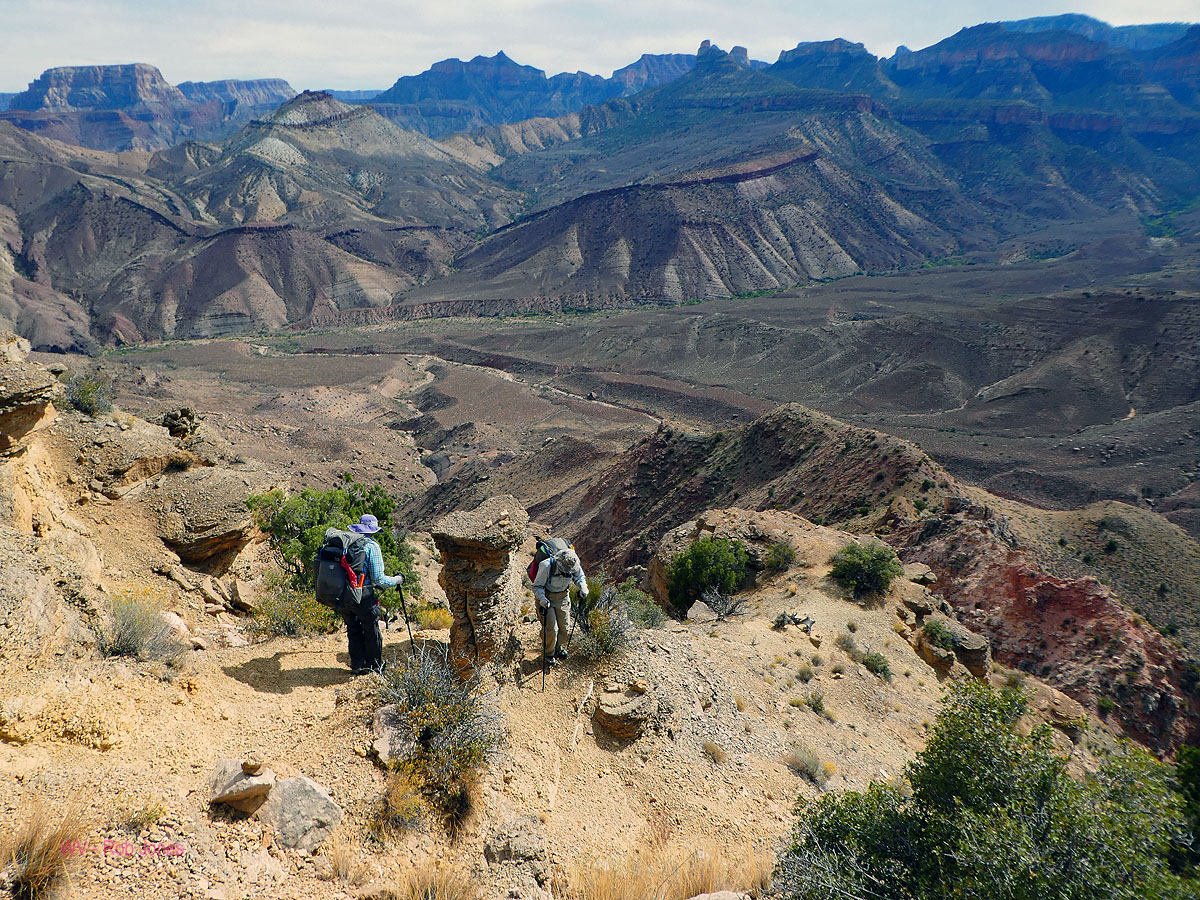
Day 4: Gnarly Nankoweap. Undulating To Nankoweap Creek. Nougat
of Nankoweap: 7.5 miles; ERM = 18. Camp @ 3500'.
The rolling contour continues past Marion Point and the behemoth
(relative) pack feels like it is getting heavier. Maybe I'm not drinking enough water? On and on,
undulating the gnarly Nankoweap. We study the route across the way to the divide between Nankoweap
and Kwagunt, part of the Butte Fault Route.
Link to a report about backpacking the Butte Fault Route
We'll need this visual memory because it's difficult to see the route
at close range, and this route is the prospect for tomorrow. The massive Desert Facade borders the
far side of The River in this section of Marble Canyon. Annette notices glimpses of this grand
escarpment as we work our way toward Tilted Mesa.
Down, up, undulate, then down to Tilted Mesa for lunch, then dramatically
down on rolley limestone rocks. High clouds fluff across the sky and it's a pleasant afternoon. Into the
Muav Limestone layer, down. As we roll onto the Nankoweap colluvium, I feel relief and hear the musical
sound of Nankoweap Creek. Quiet enough to hear the distant trickle of creek. Lovely. It's Eaarthly quiet
absent the air tour terrorists, which have returned to their fossil fuel stations in preparation to ruin some
natural quiet, air quality, and provide visual pollution to the wild sections of Grand Canyon National Park tomorrow.
As Bill McKibben has noted, we have altered our only Earth to such a degree
that it is no longer Earth and it's more proper to call it Eaarth. The book is "Eaarth, Making Life on a
Tough New Planet," 2010; Bill McKibben. We're getting a lot of help destroying our only home from the
drastically inefficient airline industry, including the nonsense of air terrorist tours over a region with
(potentially) remaining natural soundscape.
Quickly setting camp in a delightful clump of Cottonwood, I enjoy a bucket
bath far from the creek (so I can use a bit of soap) while Annette and Holly slip into a creek jacuzzi. Ahh.
Conditions are so much more hospitable than those up at the saddle, and we're lounging in shorts after sunset. Deluxe.
The lilting burble of Nankoweap Creek lulls us to sleep.
Cheesy Scalloped Potatoes, with corn, green onion, and chicken;
hot and sour soup; basil tuna. Wow, this sounds even better than it is.
 |
 |
 |
 gcnankoweap2017-day5-4 Step carefully on the incline web.jpg |
 |
 |
 |
 |
 |
 |
 |
 |
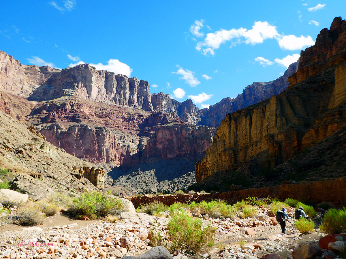
Day 5: Kwagunt Klimb. To Kwagunt Kreek:
4.5 miles; ERM = 9. Camp @ 3380'.
Another pour-off. And another. We've climbed up to the Nanko-Kwagunt divide
and into and out of rain, wind, and sun, traversing the shark fin and boulder slopes. The cheese-grater limestone
and the shark fin are so treacherous that I dare not set down the pack to adjust the rain cover. Just think what
this might do to your precious skin, I muse. Now, we're climbing around minor pour-offs on the route down
toward Kwagunt Kamp. Not a long journey, yet quite slow going because of the texture and topography of the
route. The gorgeous neapolitan banded shales, ebony plates, and grandeur is interrupted by over 48 turd-fondler
helicopters and 29 fixed wing air tour terrorists. Yes, Annette keeps count of these intrusive, wasteful
mauraders. More properly, they represent a bunch of corporate welfare artists, stealing the public resource
of natural quiet (socializing the loss) for Yuge corporate profits (privatizing the gain) and destroying the
soundscape of a wild area. Turd fondlers all. Dear Reader, did you know that Grand Canyon National Park was
originally acclaimed for its soundscape (meaning natural quiet) and that this was (emphasis on "was!") one of
the resources cited for preservation? Well, amoral immoral corporations and their people rule all. Yes,
I know that corporations are people with more free speech than anyone and more puppet repulsican (all of them)
and corporate democrats (too many of them) at their call to write legislation as they wish. Got to keep that
corporate welfare flowing. Just imagine, your next "tax break" will include paying your break to corporations
and the very, very (etc.) wealthy, while losing public services and land in the "bargain." One could say that
corporate welfare artists contribute. Yes! they contribute air pollution, noise pollution, to global climate
change and all the associated disaster and health costs, to the fattening of Americans and other people of
the Eaarth, and theft of our public lands. Horrid. Yet for now, we have a nougat of Nankoweap.
A storm gusts in as water is treated and tents are set, temporarily silencing
the air tour terrorists, hurrah.
A refreshingly quiet evening punctuated by roving bats is accompanied by a
pink sunset and the serene burble of Kwagunt Kreek.
Alfredo pasta, with peas, peppers, and chicken; hot and sour soup.
 |
 |
 |
 |
 |
 |
 |
 |
 |
 |
 |
 |
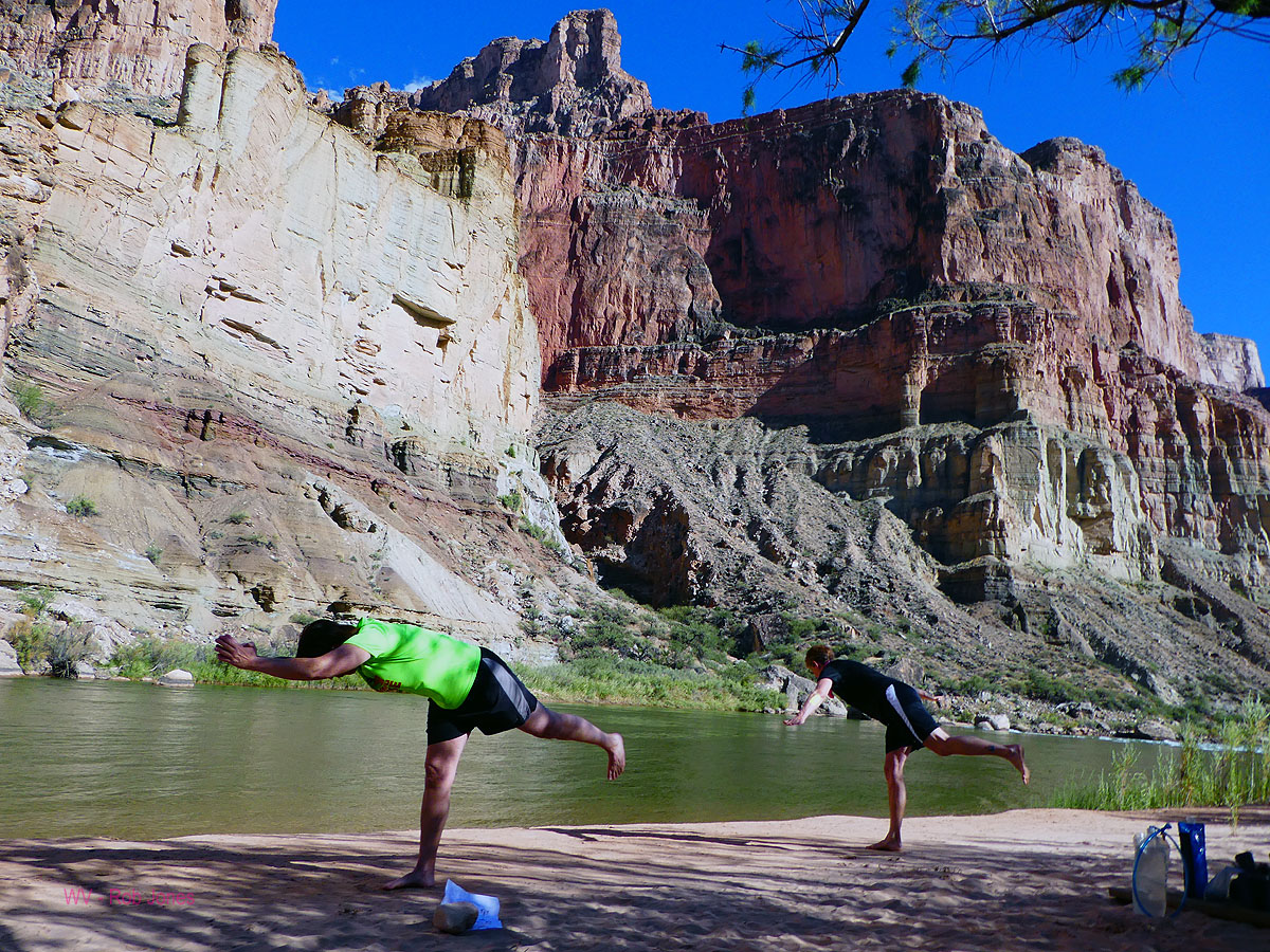
Day 6: Beach Bop: To Kwagunt Rapids Beach, The Land of Sand:
3.5 miles; ERM = 4. Camp @ 2769'. River mile 56.
Deluxe! Roving nude on the beach just downstream of Kwagunt Rapids.
All the clothes are washed and drying on the tamarisk. A spectacular place to watch The River roil and
roll as laundry dries and we lounge ecstatic on the sand under an invasive Tamarisk bush, beneath the
towering Canyon escarpment called the Desert Facade. There's something primordially primitive about beach
lounging in wild country. We have seen only one group of boaters, and no hikers since driving to the trailhead.
The intrusive turd fondling air tour terrorists are another, and an aversively ugly, matter. Canyon colors
range the hues from buff to salmon red, topped with the azure sky.
Awaiting the lunch boat bears no lunch or snacks, so we eat lunch and loll
away the afternoon on River time. The only issue is keeping sand out of things that do not do well in sand.
As dusk descends, a down River breeze prompts us to move up to the penthouse, a high camp overlooking The
River and Canyon, albeit we're still in the land of sand.
The day starts with the discovery that a rodent has chewed holes in the
Bronner soap and the sunscreen containers. What? Good thing my food, pots, etc. were safely ensconced
behind the chainmail of the rat sack. Never in decades have I had issues with rodentia chewing on a soap
container. Earlier today, we languish in camp, and head down Canyon as sunlight sweeps into Kwagunt Kamp.
We hike down the streamlet amidst golden light, this hiking is fabulous and a treat after the halting
progress to Kwagunt.
Parmesan pasta with corn, chicken, and onions; miso soup. (no food scow)
 |
 |
 |
 |
 |
 |
 |
 |
 |
 |
 |
 |
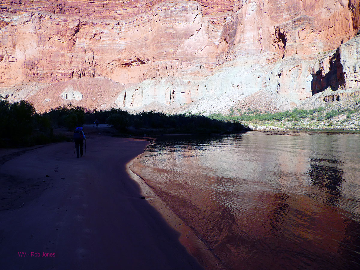
Day 7: Sidewinder to Nankoweap:
4.6 miles, ERM = 9. River mile 52.
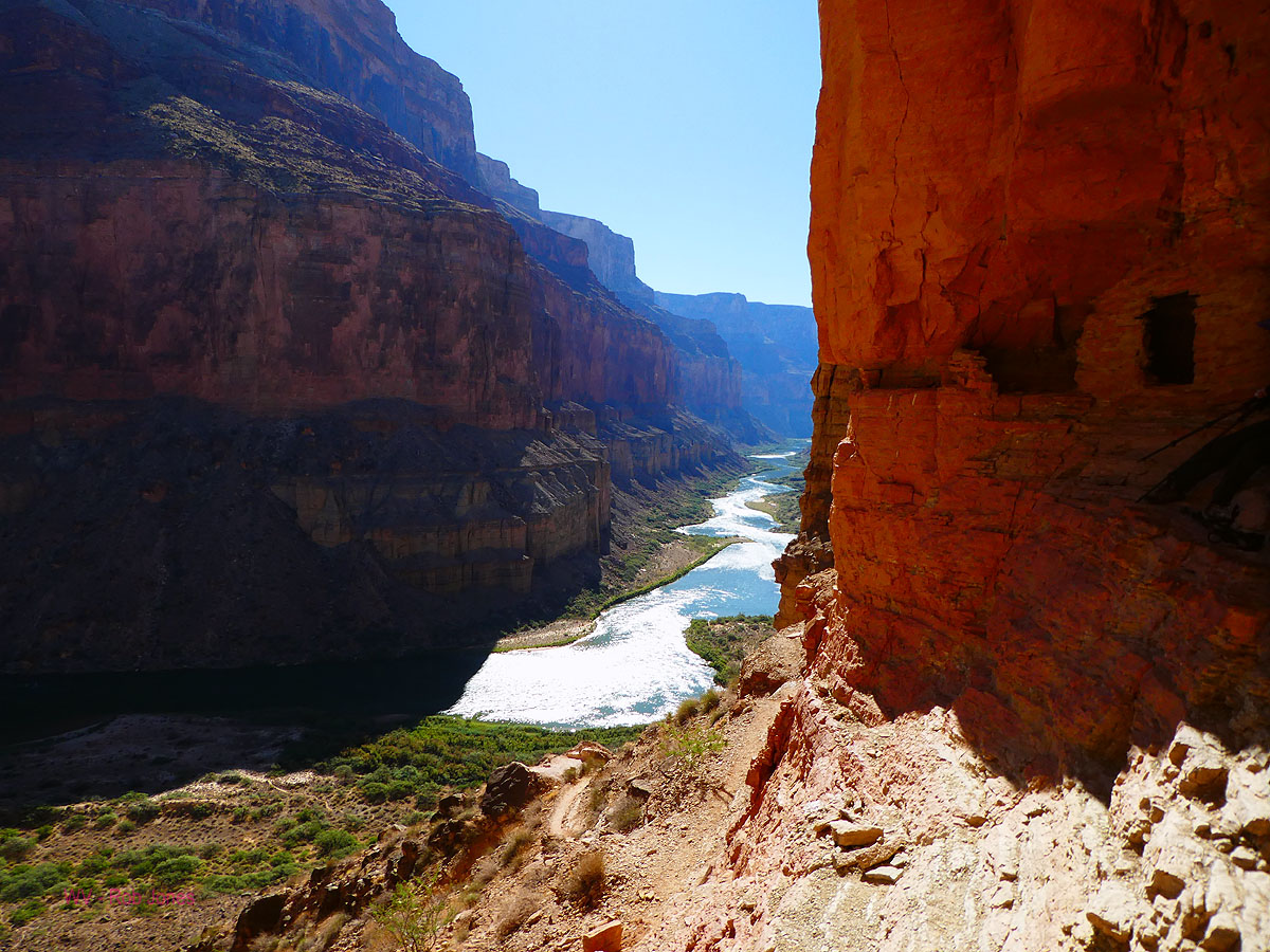
The faint route disappears on the angled shale, it's just not there.
Downslope movement or erosion has obliterated the boot-width way. Undulating through and around gulches,
it's a sidewinder to Nankoweap along The River from Kwagunt. Carefully edging across a good length of the
slope, a route reappears. The sun heats us and we find one of two drainages to The River for a cool water break.
Onward. A trio of science rafts motor past, followed by three chase boats.
We later learn that these scientists are bound for the LCR, Little Colorado River, to study Humpback Chubs.
We traverse more slope and limestone-studded dirt to lunch at the second dip to The River. Inching along,
we're getting close to the trail up to the Nankoweap granaries. It's been a good beating on a short stretch
of route. It's certainly not a trail.
Arriving at the first Nankoweap beach, we encounter an AZRA group and are
treated to beer by Matt and Ed. Amazingly, Matt and Ed are neighbors of Annette and Holly. And, this
association is good for extra cold beer, yippee.
A buffanelia on the beach rounds out the day, followed by River gazing
during dinner, under the watchful ports of the Nankoweap granaries high in the Redwall Limestone.
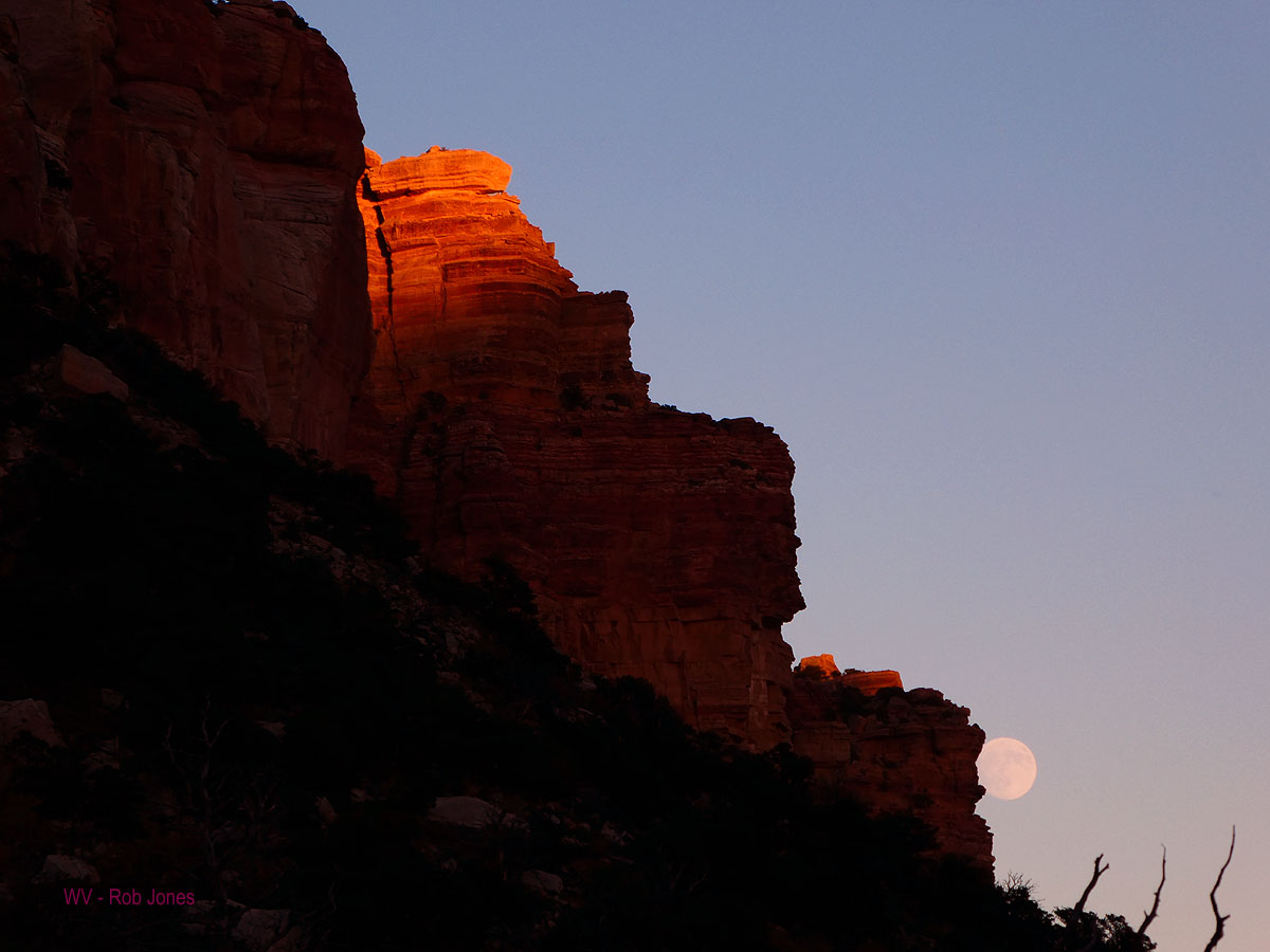
The half moon peeps into The Canyon from behind the Redwall downstream,
while little brown bats gyrate for insects.
We see four River parties today and no hikers.
As I get into the sand infested tent, a large and apparently friendly toad
hops out from the clothing bags to say "hello, where are all the juicy bugs?"
Jalapeńo cheddar potatoes, with green beans, green onions, beef; hot and
sour soup; 3 beers courtesy of AZRA, Matt and Ed (thanks!)
 |
 |
 |
 |
 |
 |
 |
 |
 |
 |
 |
 |
Day 8: Nanko Return. To Nanko trail camp: 5 miles.
ERM = 9. Camp @ 3500'.
I'm lounging against a polished boulder at the camp near the bottom
of the Nankoweap Trail, swilling the last beer from boater booty, and avoiding the intense sun. Ahh,
deluxe. We're back to the first in-Canyon camp, having concluded the loop around Nankoweap Mesa, via
the Nanko-Kwagunt divide, Kwagunt to the River, River-side to the Mouth of Nankoweap Creek, and up
Nankoweap Creek to this camp. The absence of solar load makes for a more hospitable afternoon as local
sunset arrives. Hurrah.
The day begins with a climb up to the Nankoweap granaries, where the
experience is fine and the sun wrong for photography. What sort of calamity or blight or drought or
war prompted people to store precious maize and such so far above anyplace suitable for farming? On
the way down from the granaries, we meet Jackie of Durango (boater), who offers Holly and Annette a fuel
can to replace the one back at Holly's truck (forgotten). It's a big, 16 net ounces, can and much appreciated.
We take the opportunity to also unload the garbage and beer cans acquired yesterday. Thanks Jackie.
It's searing hot as we pack and hike into Nankoweap drainage, meeting the
first hikers of the trip.
It seems to take a very long time to hike the few miles back to camp, even
repeatedly wetting bandanas and shirts. Yet, we arrive early enough for major creekside lounging and
catching up on this journal.
Cheddar Broccoli pasta, with mushrooms, green onions, and chicken; miso soup.
 |
 |
 |
 |
 |
 |
 |
 |
 |
Day 9: Nanko Butte: 5 miles. ERM = 17.
The nearly square cobblestones form a flat walkway, yet are angled
nearly 40 degrees with their geologic kin. We're walking up a side drainage to Nankoweap Creek, heading
for, looking for a route up to Nankoweap Butte. As we leave the creek in the early morning coolness,
we encounter a disabled deer with apparent muscle weakness (wobbling, jerking gait) and oddly stunted
antlers, which look like a cauliflower antler. He moves the minimum away from the stream as we progress
up canyon. On our return trip, we encounter him sprawled in the creek, apparently keeping cool.
Starting up a slope we find the grade very steep and the shark fin of
dark rock an obstacle over which we scramble, followed by more steep slopes. It's slow, halting progress
to the nose leading to Nankoweap Butte. And, now it's genuinely hot punctuated by fierce bursts of wind.
Then the quick climb to the top for a panoramic video.
Taking a different route down, the going is much easier. We slide off
the high point to the bluff top leading to the spring area of this Nankoweap tributary.
Back in camp, it's time to sprawl in the creek, treat water, and rehydrate
while awaiting local sunset.
All night an intermittent gale shrieks up, then down canyon, flapping the
tent and filling the rat sack with dirt and making sleep difficult. Fortunately, we're largely
protected by Cottonwoods, brush, the winding canyon walls.
Alpine Spaghetti; miso soup.
 |
 |
 |
 |
 |
 |
 |
 |
 |
 |
 |
 |
 |
 |
 |
 |
 |
 |
Day 10: Ruination. Explore for structures: 4 miles. ERM = 5.
The red on black pottery sherd glitters among the collection in the
Pack Rat midden. Yowee. It's helpful when these rodents gather artifacts. There's more interesting
stuff to see as we explore the benches of Nankoweap Creek. Outlines of structure foundations, a petro
boulder, coiled pottery, black on white, unglazed utilitarian pottery, lovely. Some sherds have the
remnants of rims, one where a handle might have been attached. Shard of glass, sherd (potsherd) of pottery.
The day is cooler and breezy.
As late afternoon approaches, the generous wind gusts return.
As the light fades across the crenulated walls of Tilted Mesa, we're
organizing equipment for an early morning start on the precipitous Nankoweap Trail.
As the last unlawful air tour terrorist ruins the natural quiet of this
supposedly "wild" area after sunset, the enthralling burble of Nankoweap Creek returns.
Scrambled eggs with orzo, and TVP sausage, mushrooms, peppers, green onion;
hot cocoa with Annette's Mexican spiced chocolate.
 |
 |
 |
 |
 |
 |
 |
 |
 |
Day 11: Nanko Up. To NPS/FS boundary and the cache:
7.5 miles. ERM = 18. Camp @ 7600'.
Orion watches over the Milky Way, after the nearly full moon has set,
and we are up in the night. On the trail at 6:15 a.m., we're up to Tilted Mesa about 9, where we pause
for a break as the aerial turd fondlers destroy the public resource of natural quiet. What a jarring
disruption of the solitude we are experiencing due to this intrusive, flagrant waste of resources and
fattening of America. Get out and hike, hike the Trail of Time on the South Rim (enjoy the natural quiet!).
Glide along in a wheelchair if you must. Get out of that infernal, polluting, flesh-flabbing flying tin
tourist can and be in nature. Gee, I consider, I'm channeling Ed Abbey. And rightly so.
The Canyon is vividly colored by the early light. Wonderful to observe,
yet we must keep moving forward.
On toward Marion Point for the next break. It's becoming a drag as we
contour, contour again before the final climb to the Park-Kaibab Forest boundary. Soon the cache is
located and tents set up. It's too cool and breezy for a proper bath, so a partial is enjoyed. Time
to break out the scrumptious treats; sardines and crackers, Mexican cocoa with Nido, Elk droppings
(chocolate covered almonds), peanuts in the shell, then dinner before heating a hot water bottle for
sleeping pleasure. As the old body cools, ancient joints and muscles groan and creak. Argh.
The moon peeks from behind the salmon-tinged Coconino Sandstone as
local sunset chills the high camp.
Day 12: Sand in your teeth. Down and Out, singing the song of Nankoweap:
4 miles; ERM = 8. Total miles = 56.6. Total ERM = 120.
Wind literally shrieks and howls, nearly all night, a freight train roar.
This gale rips tent stakes from the ground, flattens tents with its force, and imbeds sand and grit in everything.
When the tent is collapsing a second time, a pole pokes a hole in the canopy. Holly and Annette's tent is
periodically flattened by the gale and they have to get up to reorient it more into the wind. Horrible.
It's impossible to sleep. Daylight finally arrives and we pack while fighting
with the wind for our items, walk out, and go to the Marble Canyon Lodge for food and to dredge some of the dirt
from eyes and ears. The rest of the cleanup will take a week, including dredging clumps of sand from my ears.
Now, that's a Nougat of Nankoweap.
| ||||
Sites:
Click here to enjoy the first Nanko report:
Gnarly Nankoweap (2008)
here is the 2010 Nankoweap report - Chocolate Nougat Nankoweap (2010)
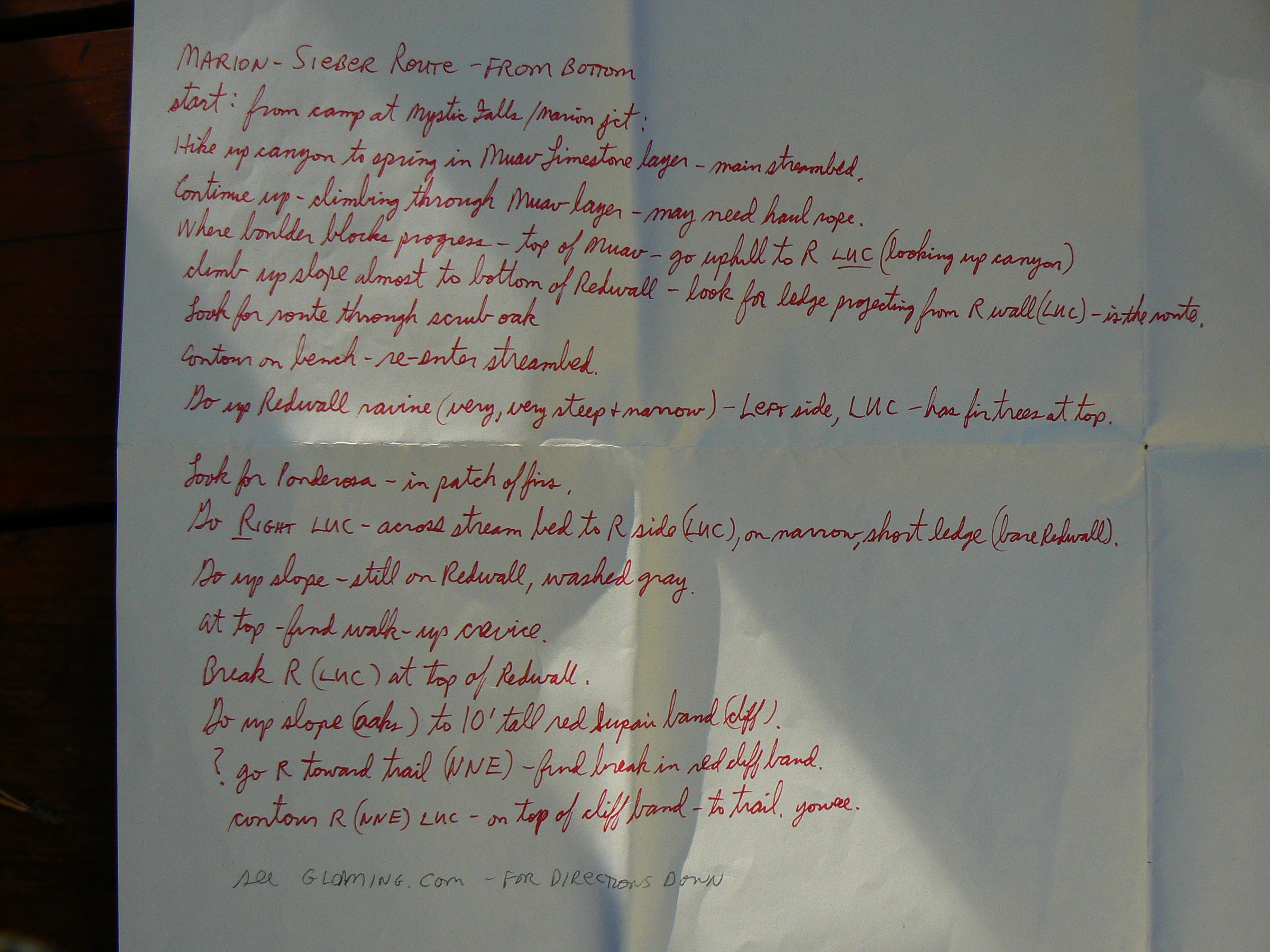
my attempt to describe the Marion-Seiber Route from the bottom
7 billion and counting - will anyone
survive?
World population clock - watch the number spin, geometrically,
and be frightened, very frightened.
Arithmetic, population, and energy - the geometric
function (youtube mini-lecture on math)
Maps:
| ||||
for a full-resolution map, click here. Caution - do not use this map or gps track for navigating the route.
Other WV reports about the Grand Canyon:
Click here or on the Looking Lizard to go to all WV reports about The Grand Canyon
| ||||
Related Links:
Steve's
excellent photos -
birds in flight, panoramas, etc.
the geology of the Grand Canyon by the NPS
| ||||
| ||||
| ||||
| ||||
| ||||
|
Wild Vagabond Main |
Trip Report Index  |
Caveat  |
|---|


