Hiking Northern Arizona 2008

More Day Hikes and Such in the land of P-Pines and Red Rock
Click on any of the below names to go to the report
(or scroll along so you don't miss the photos and links between reports):
bush Haiku, Long Canyon - Wet Beaver Wilderness, Scheurman Mountain, Apache Maid - Wet Beaver Wilderness, Dogie Trail - Sycamore Wilderness, Boynton Canyon Icehouse, Woods Canyon, Hot Loop Trail, Jacks Canyon, Loy Canyon, Huckaby Trail, Munds Wagon Trail, Bear Mountain, Schnebly Hill, Jim Thompson Trail, Wilson Mountain, Brins Mesa, Petrified Forest NP, Hermit Trail, Midgets of Mitten Ridge, Wilson Mtn. #2, Sterling Pass, Counterpoint to bush's war, A B Young Trail, Little Bear-Shultz Tank Loop, Mount Ellen N & S - Henry Mountains, Aubineau-Bear Jaw Loop, Kachina Trail Exploratory, Kachina Trail - upper TH, Waterline Trail, Bill Williams Lookout, Biking Around Mormon Lake, Pumphouse Wash Arch, Brin's Mesa Blinkers, Build an Alcohol Stove, Sharpshin at home
2008

(Photos and text © copyright by Rob)
Wandering where the trail fades
(Click the image to see a full-size version.)


bush Haiku
      This is a short poem made up entirely of actual quotations from george W. bush. These have been arranged, only for aesthetic purposes, by Washington Post writer, Richard Thompson. A wonderful Haiku poem like this is too good not to share.

MAKE THE PIE HIGHER

     I think we all agree, the past is over.
      This is still a dangerous world.
      It's a world of madmen and uncertainty
      And potential mental losses.

      Rarely is the question asked
      Is our children learning?
      Will the highways of the Internet
      become more few?

      How many hands have I shaked?
      They misunderestimate me.
      I am a pit-bull on the pantleg of opportunity.

      I know that the human being
      and the fish can coexist.
      Families is where our nation finds hope,
      Where our wings take dream.

      Put food on your family!
      Knock down the tollbooth!
      Vulcanize society!
      Make the pie higher!
      I am the Decider!

      Pass this on. Help cure mad Cowboy disease in the next election. As was noted in the 2007 sibling to this page, one of the buscho t-shirt messages was "We Need a President Who's Fluent In At Least One Language."

     See the case for impeachment of bush and cheney by a constitutional scholar. bush! the worst president in U.S. history - sponsoring the largest deficit and the most costly wars, and guilty of the transporting a major proportion of public funds into the largest corporate welfare in the history of earth. Then, there are the environmental/health risks that will haunt your kids into the next generation, along with that huge deficit. Very republican.

They must find it difficult, those who have taken authority as the truth; rather than truth as the authority.

     Click here to see the 935 lies of george W. bush, the "... quivering mountain of incompetence that is the official record of the Bush administration, all the false quotes and all the lie-strewn press conferences and all the squinty-eyed fabrications from Dubya, Colin Powell, Condi and Cheney and Rummy et al, that took place in the two years after September 11, 2001..."

And, let's all say the bushco pledge together. Ready, start: One Nation, under surveilance, our jobs outsourced, with welfare for corporations and the risks of capitalism for everyone else, with healthcare for politicians and nothing for humans, with war for the prosperity of Haliburton and the collapse of the middle class, waving the flag of fear while environmental protections are re-written by polluters, then passing it all along to faith-based initiatives which capitalize on geometric population growth! Amen.

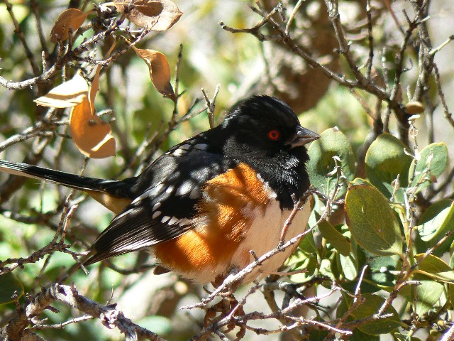
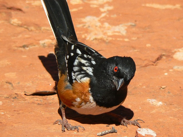
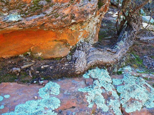
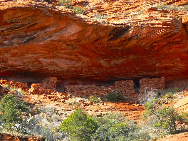
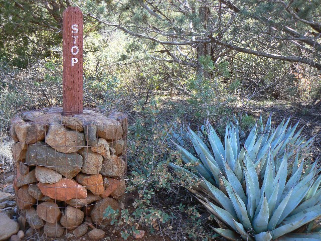
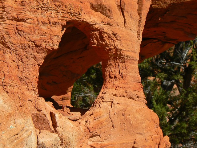
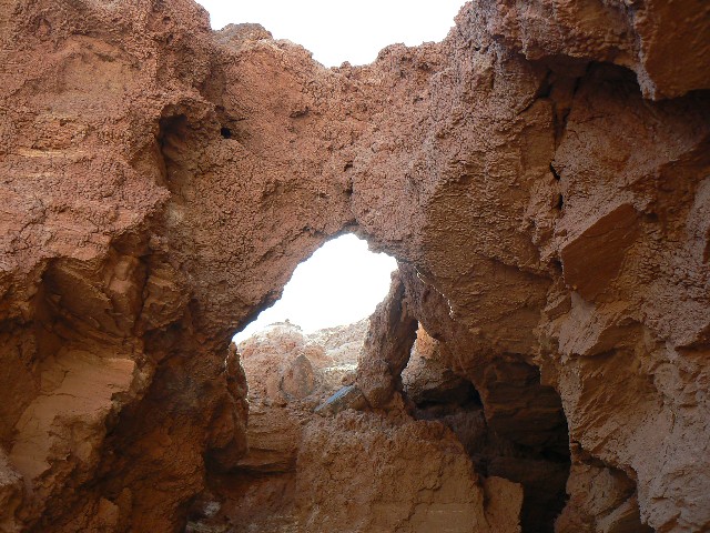
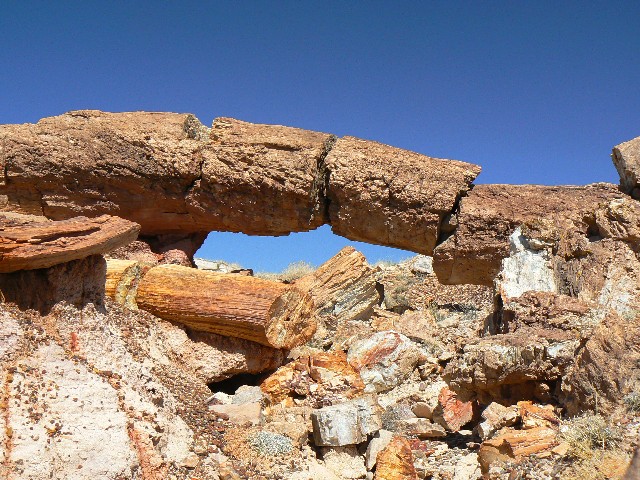
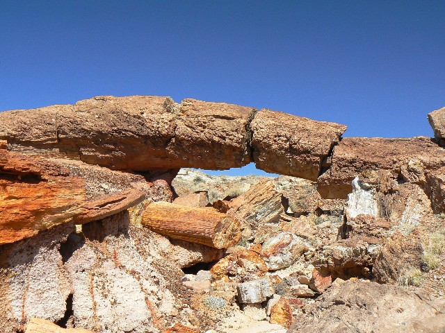
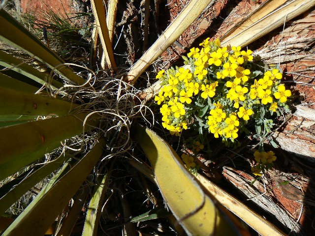
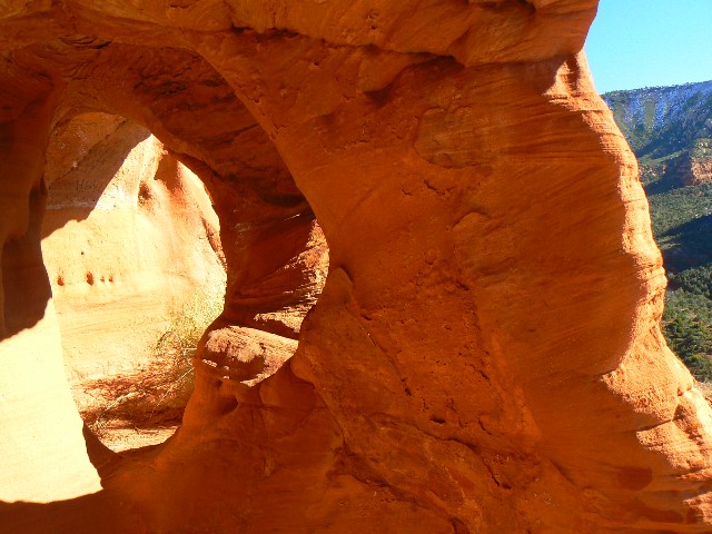
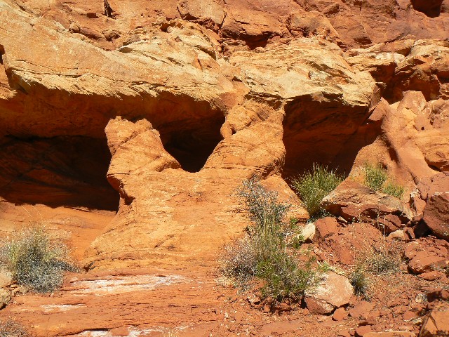
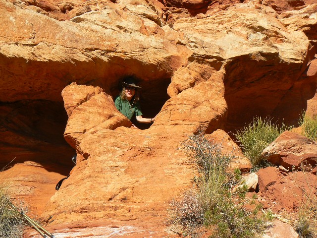
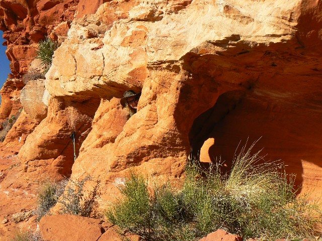
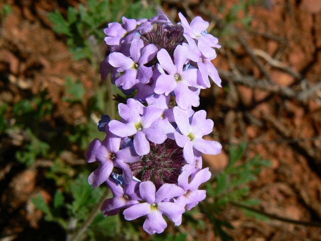
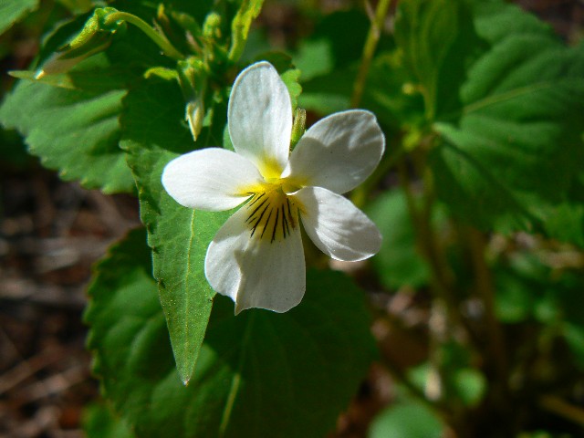
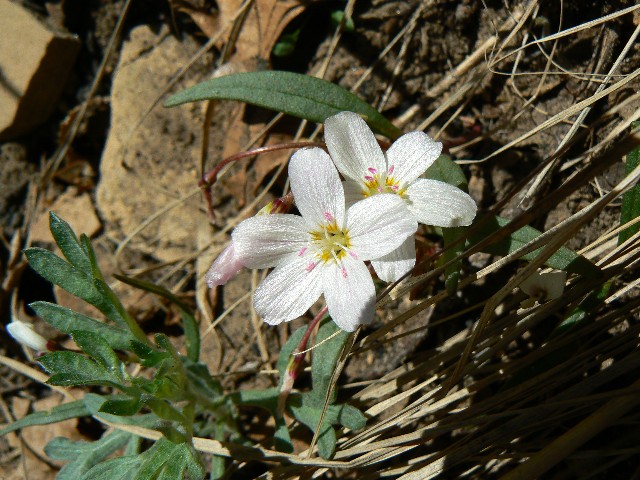
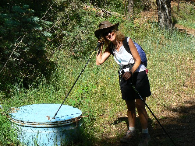
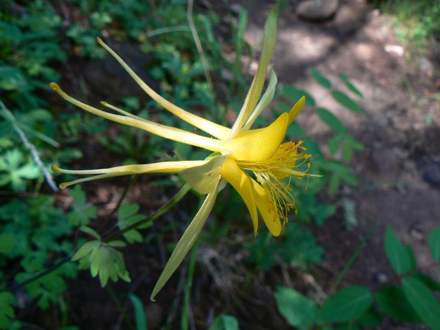
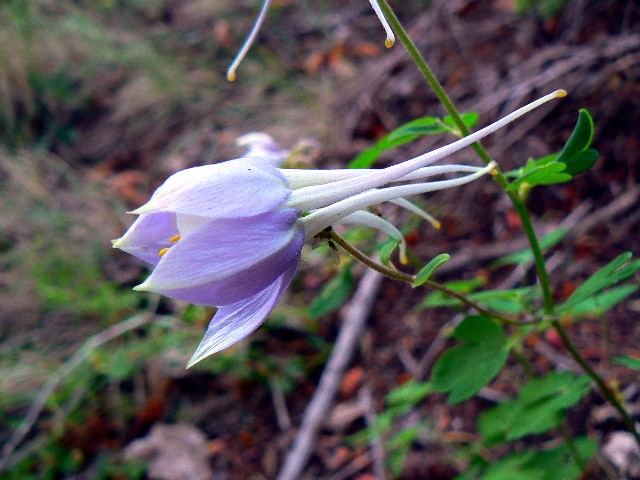
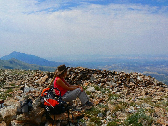
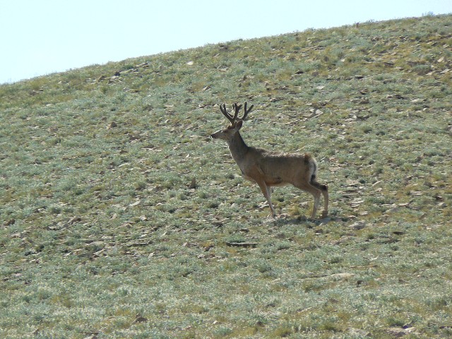
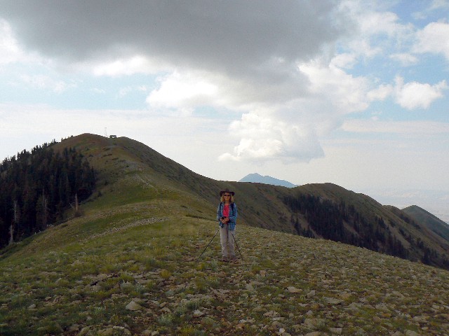
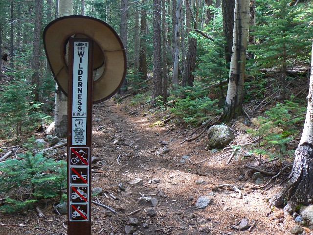
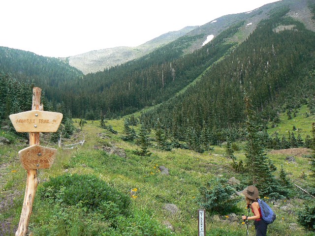
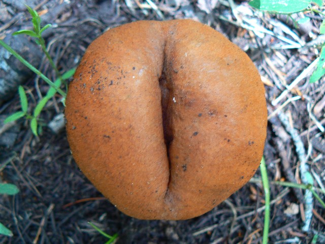
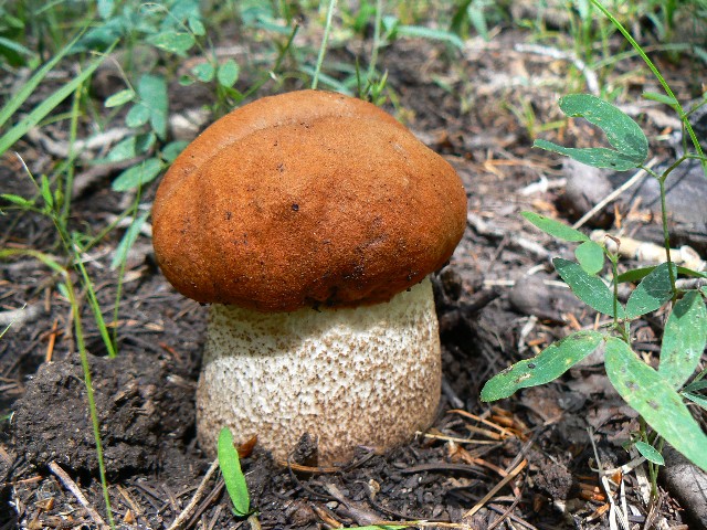
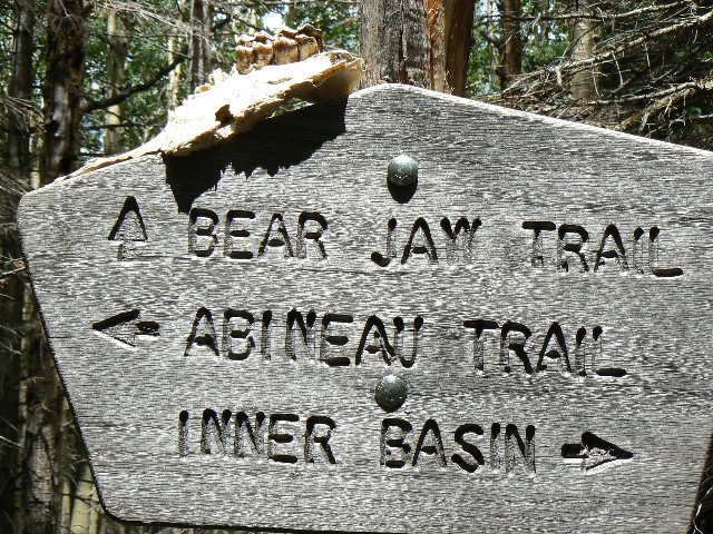
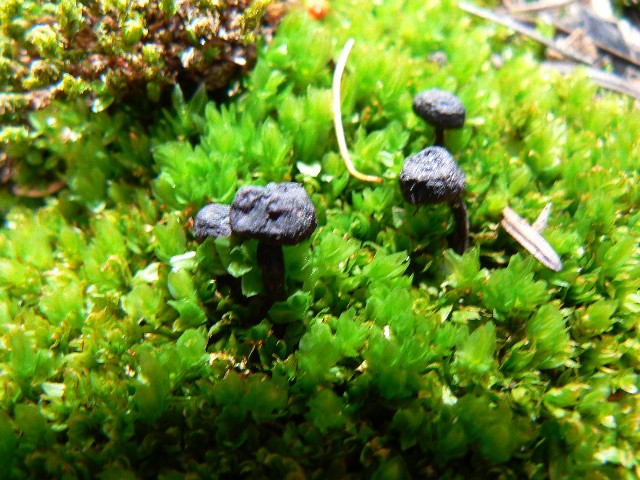
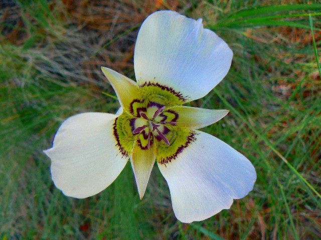
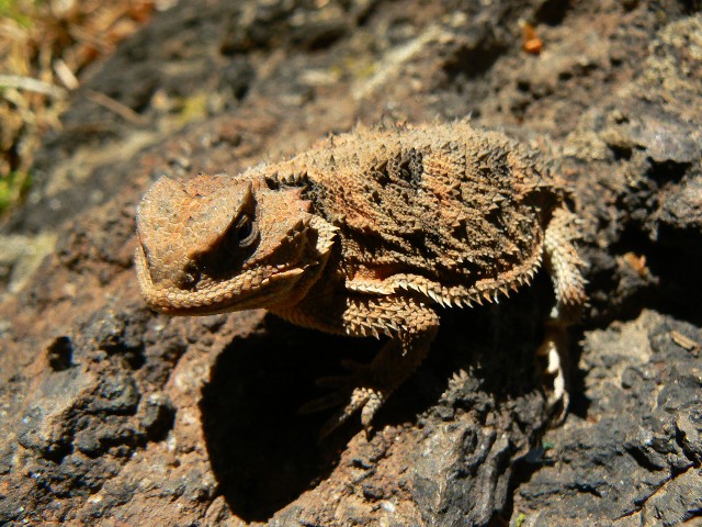
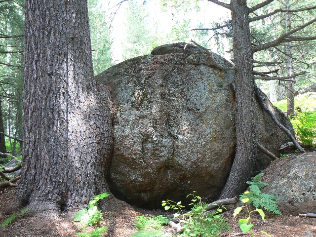
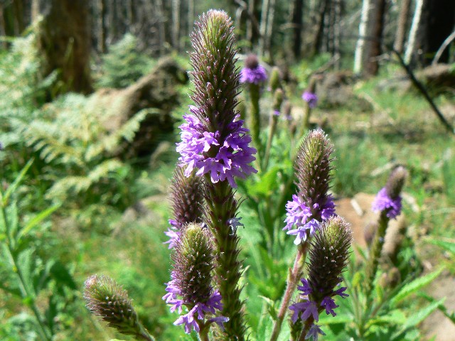
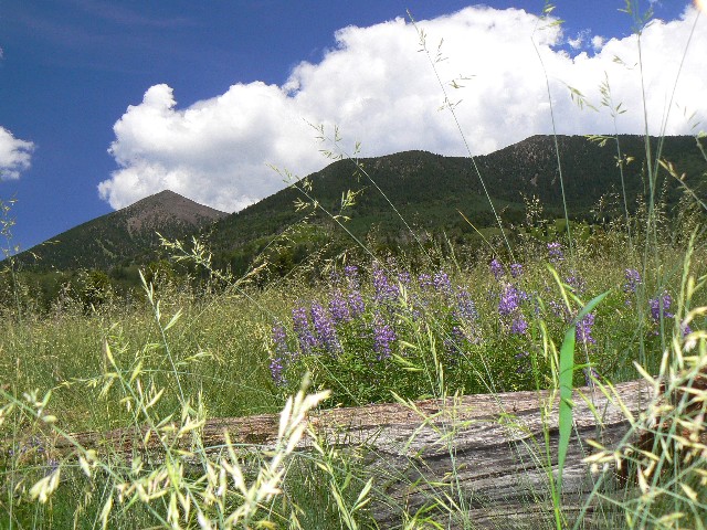
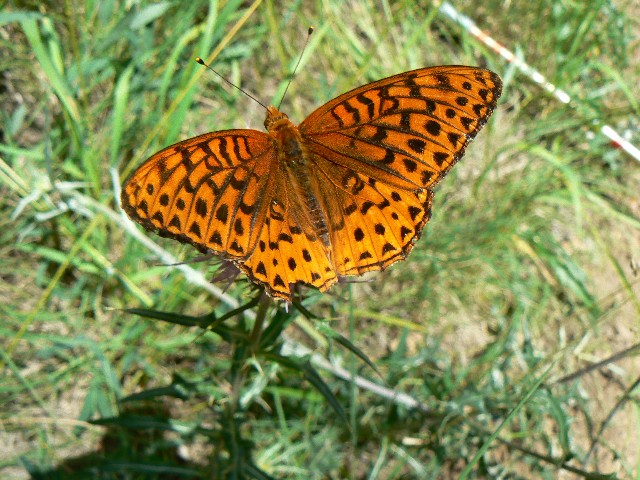
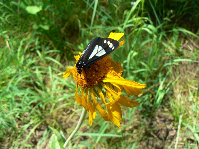
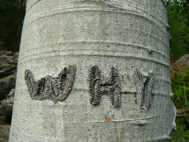
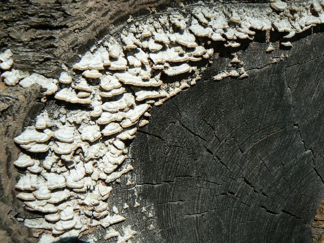
Please don't miss the photos scattered in and between each report.


      ERM, Energy Required Miles are determined via the Paul Petzold (one of the founders of NOLS) method of adding one mile to the estimated horizontal distance for every 500' elevation gained and/or lost. This allows one to compare hikes with varying terrain. A hike of 3 miles, gaining 5,000' to the top (and back!) of Mount Borah in Idaho is just not the same as strolling the glacier-scraped flatlands of the mid-east (e.g., Wisconsin).

A t-shirt statement about or quote from bushco will appear before each brief report: "You know, one of the hardest parts of my job is to connect Iraq to the war on terror." --George W. Bush, interview with CBS News' Katie Couric, Sept. 6, 2006

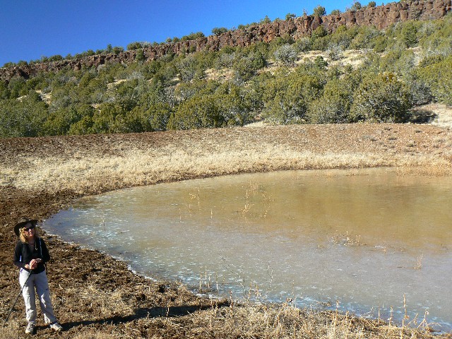
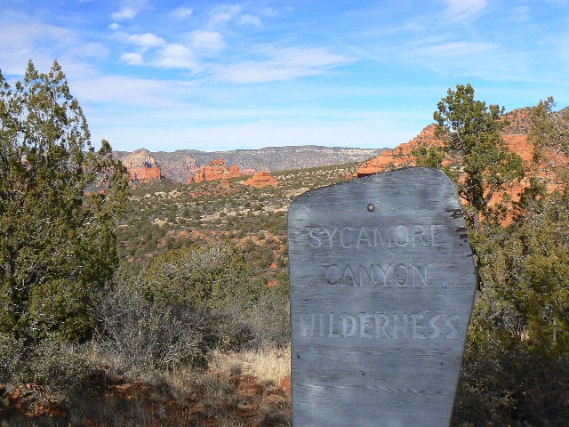
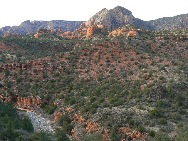
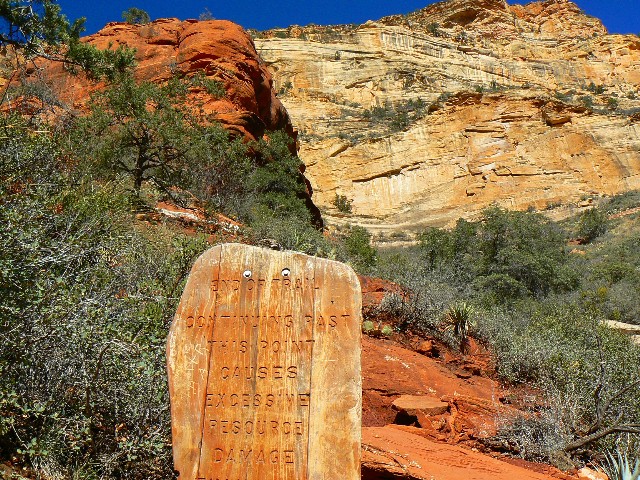
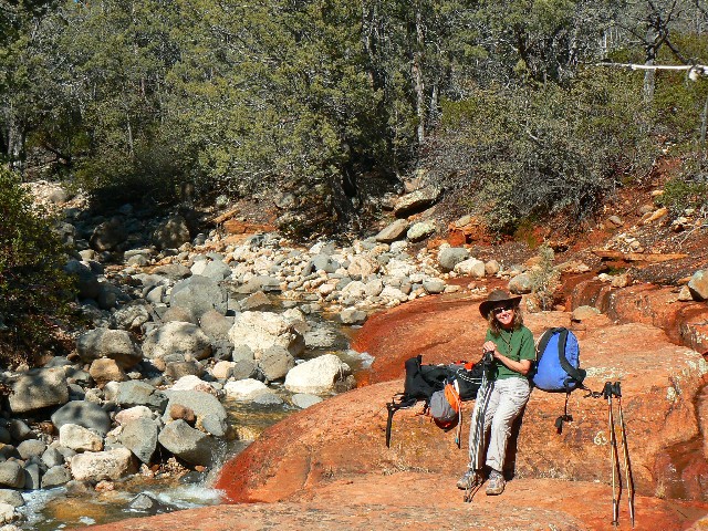
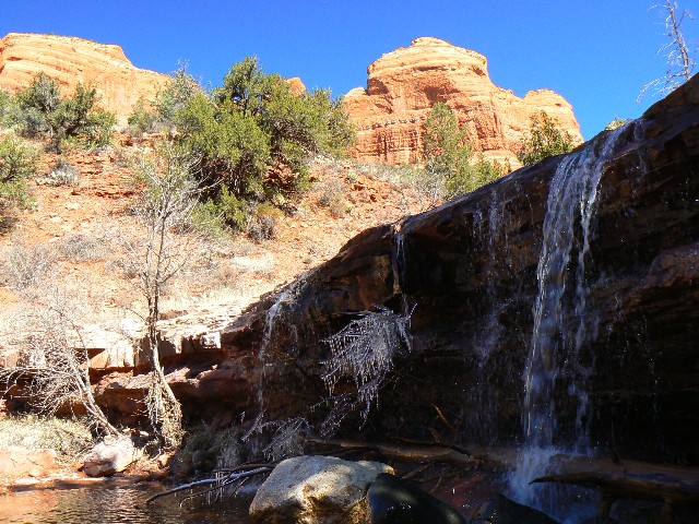
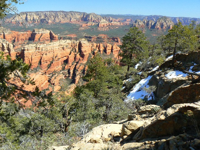
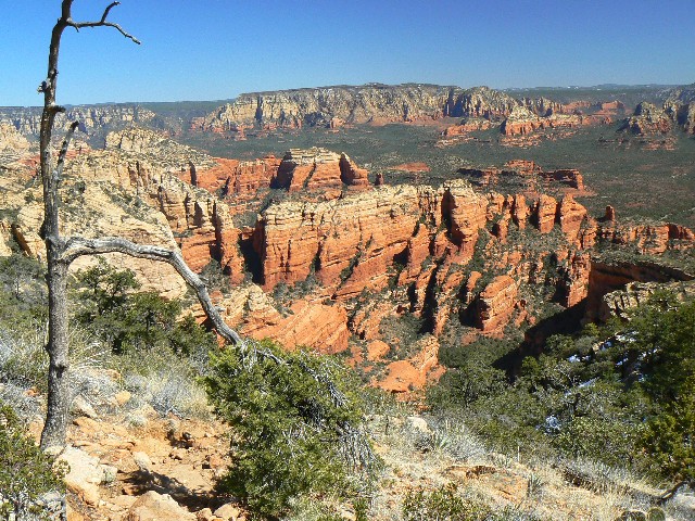
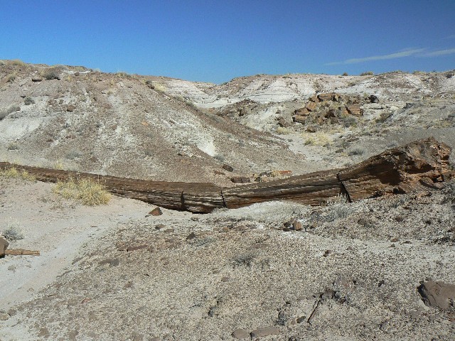
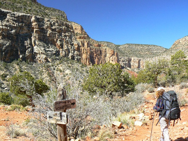
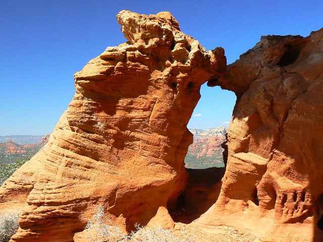
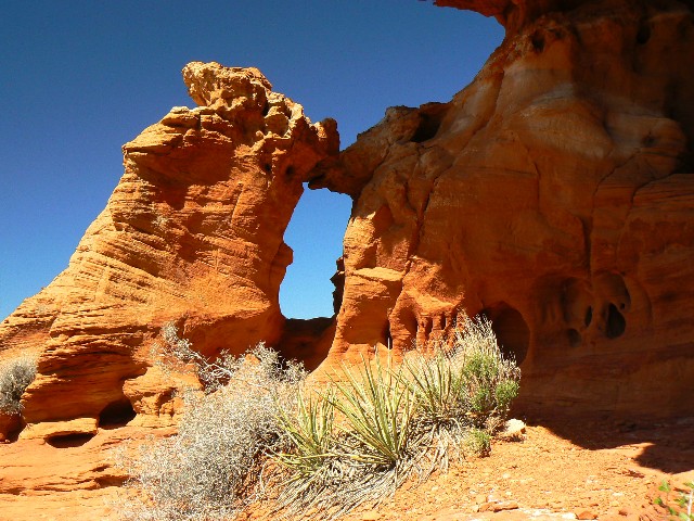
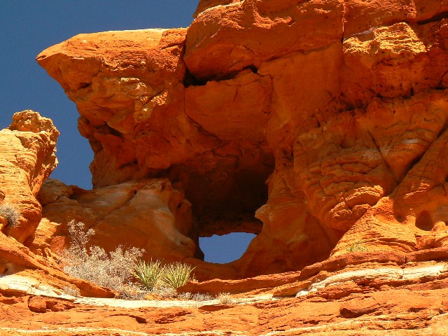
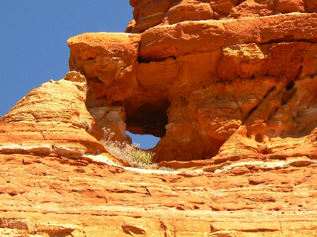
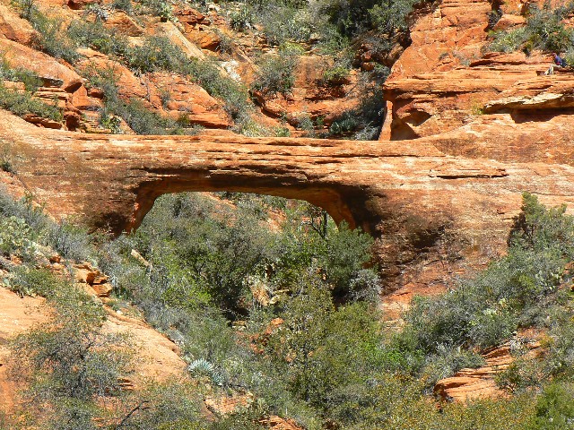
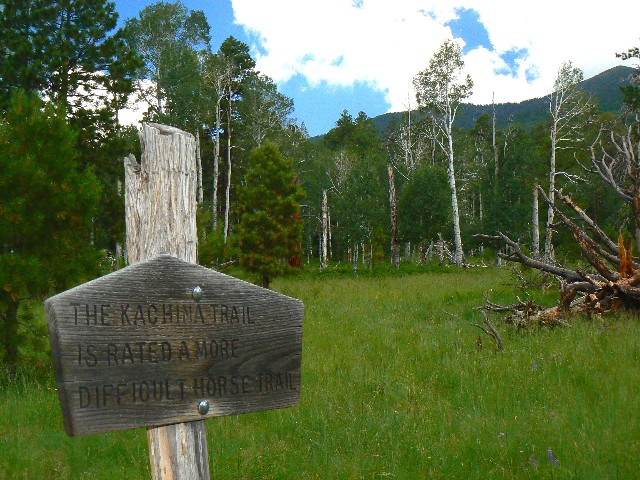
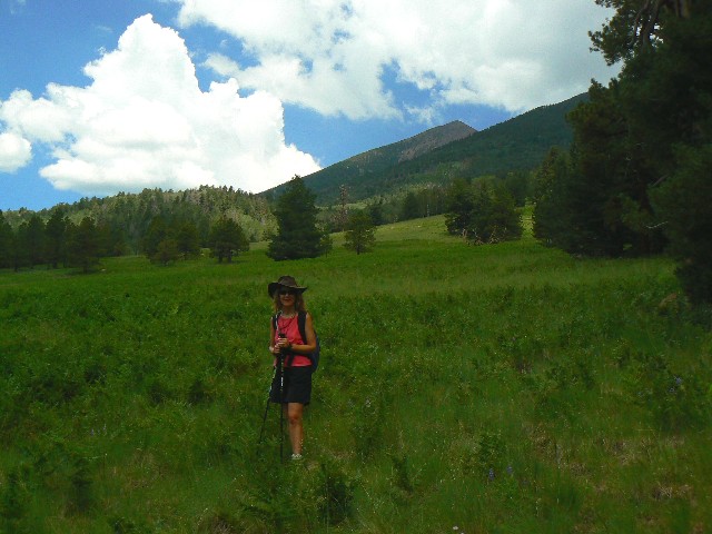
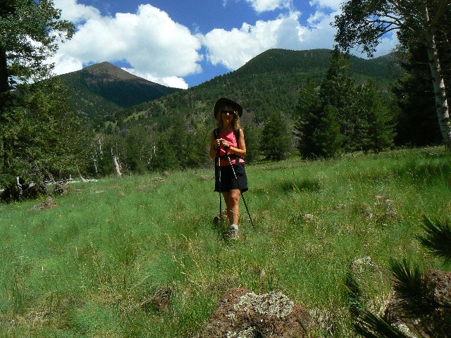
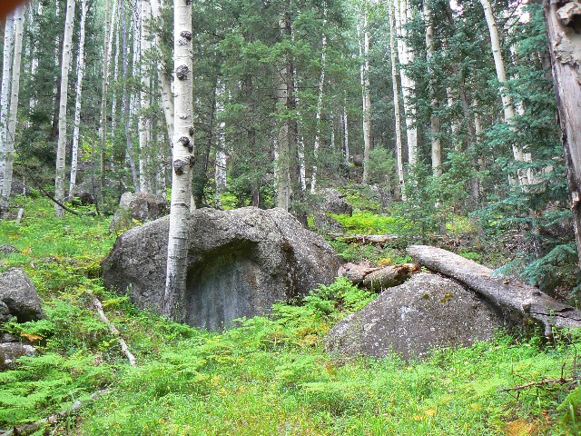
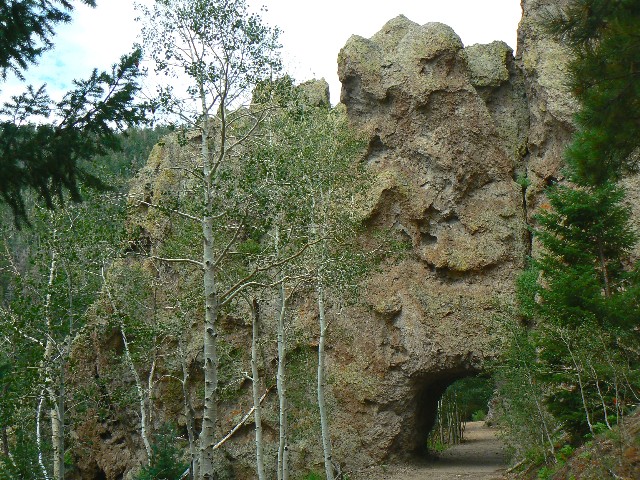
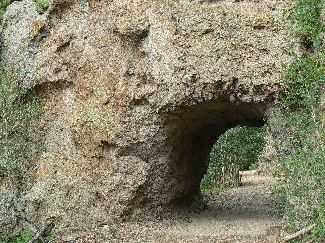
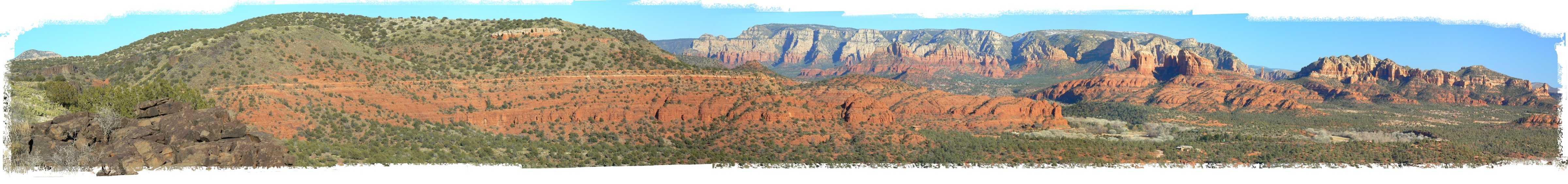
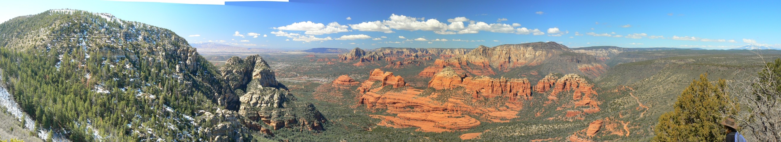
      Trip 1: Long Canyon - Wet Beaver Wilderness, early January (9 miles, 13 ERM, Energy Required Miles). 
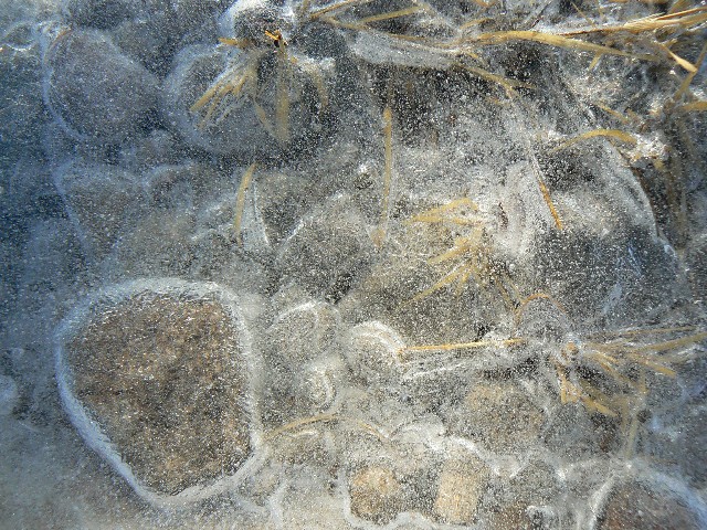
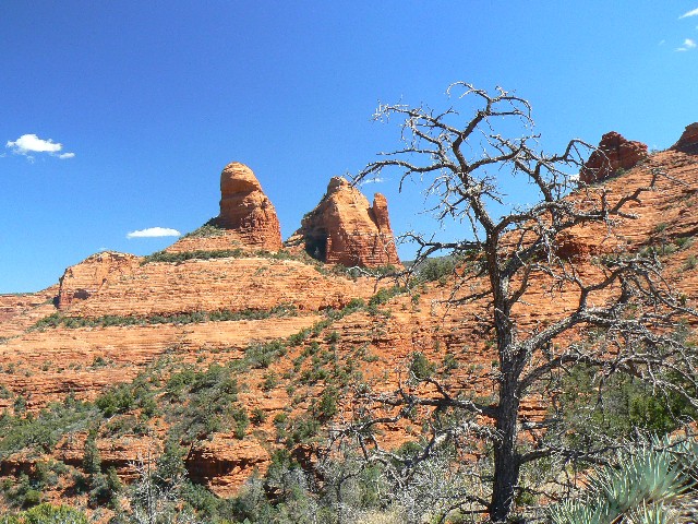
The snow is piling up on the Mogollon Rim, so we escaped to somewhere a bit warmer. It's quiet yet a bit breezy as we climb the rim to the tabletop above Wet Beaver Creek. Along the mesa we walk, the trail getting faint and poorly marked at times. Clay mud and grass stem 'boots' cling to our feet as we encounter sections of saturated ground. This trail continues toward Roundup Basin Tank to meet with the Bell Trail, many miles distant, so we stop when it's time for lunch, then begin our return.
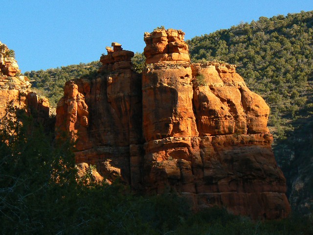
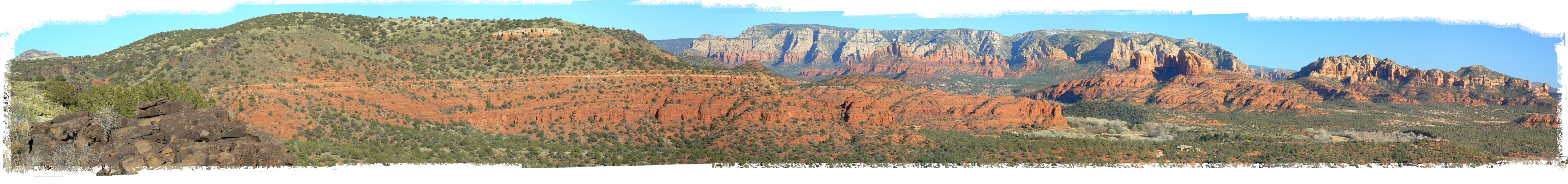
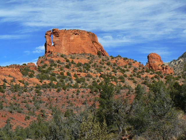
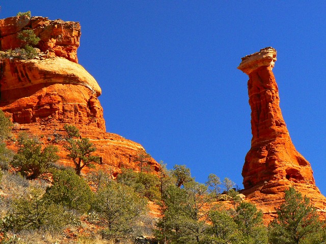
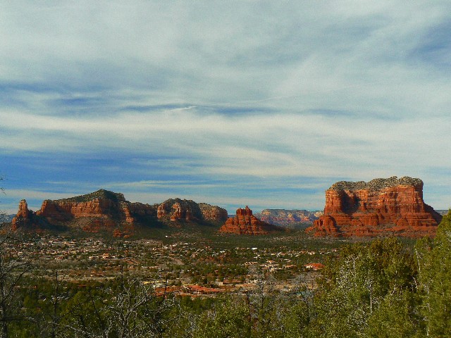
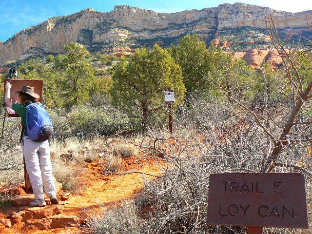
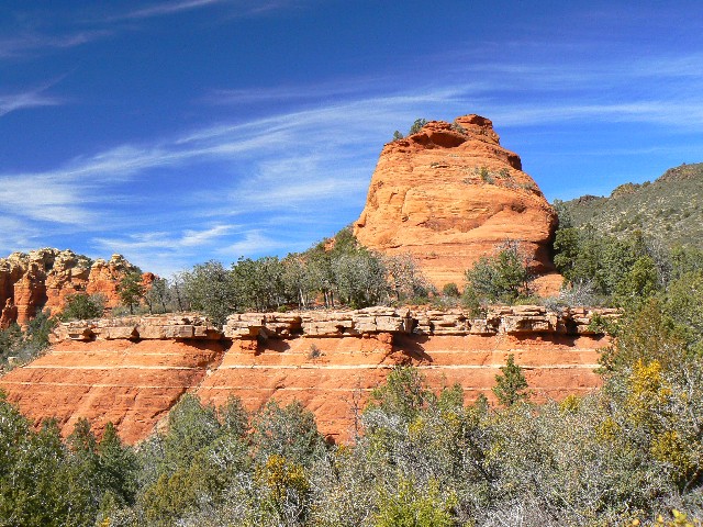
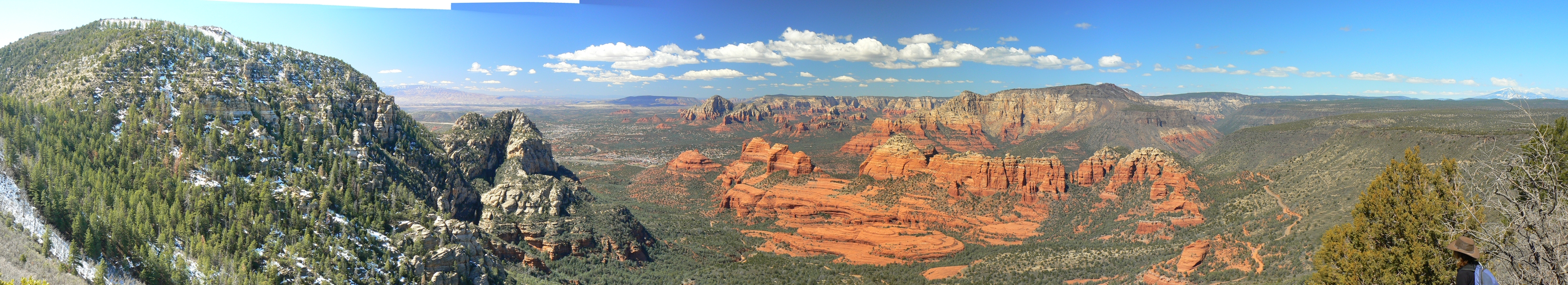
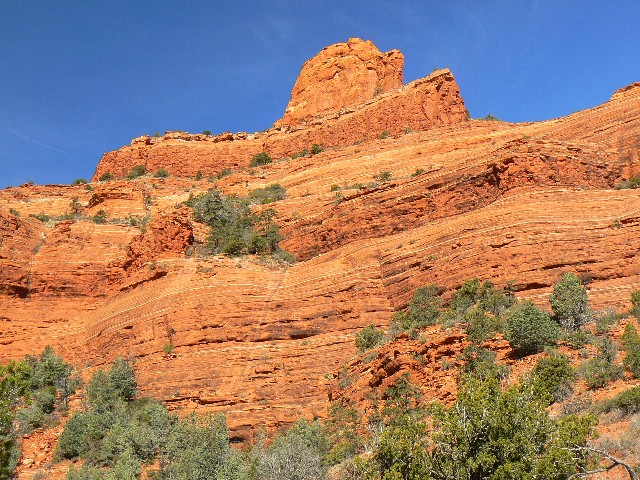
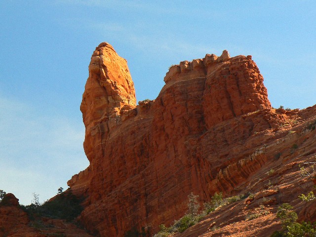
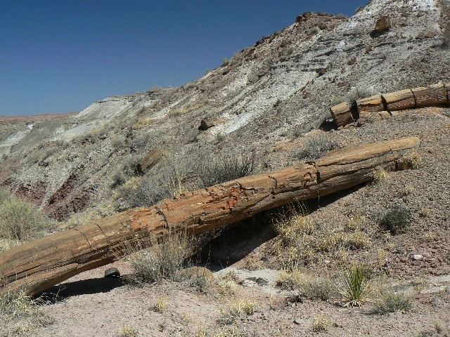
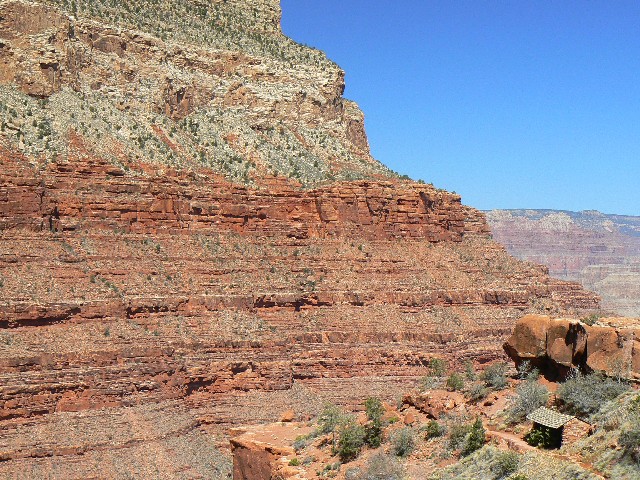
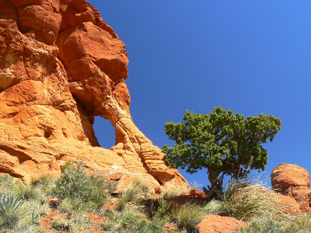
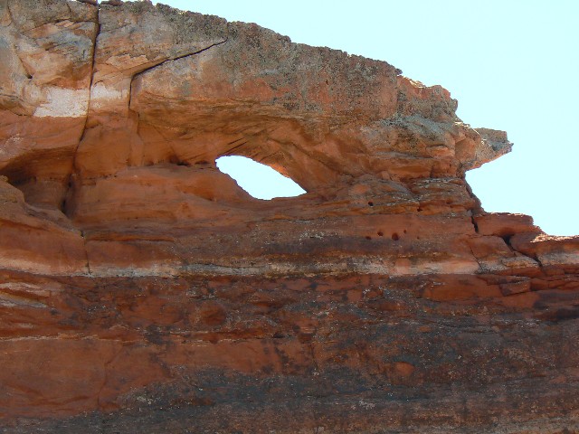
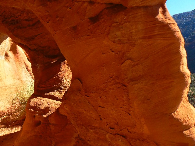
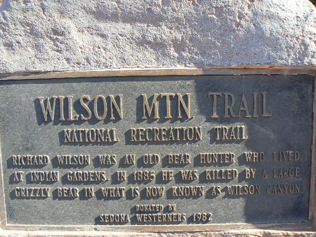
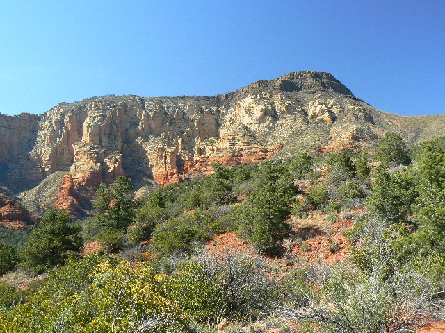
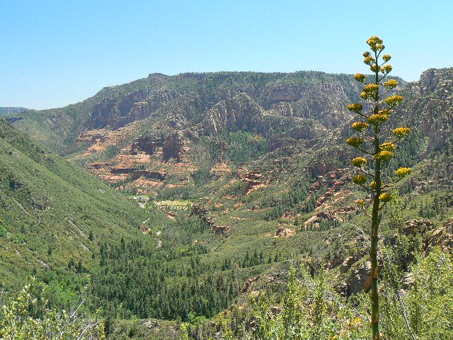
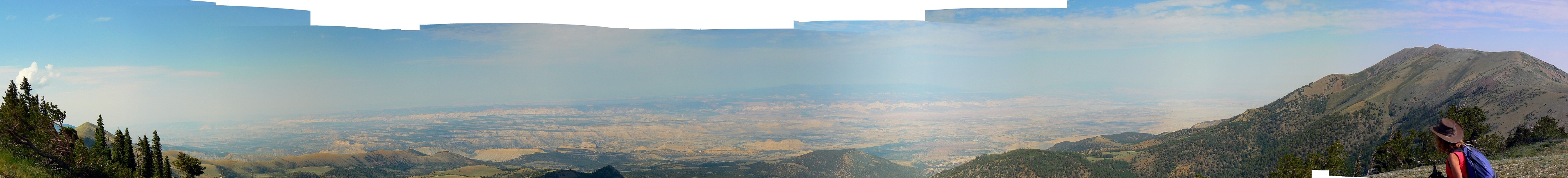
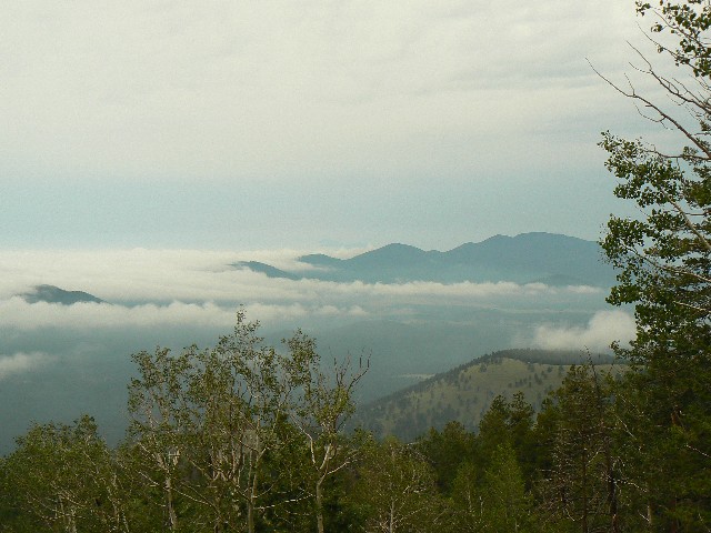
      The views to the West open up and the red rocks contrast with the white buttes and the black top of Wilson Mountain. Lovely.
      ERM, Energy Required Miles are determined via the Paul Petzold (one of the founders of NOLS) method of adding one mile to the estimated horizontal distance for every 500' elevation gained and/or lost. This allows one to compare hikes with varying terrain. A hike of 3 miles, gaining 5,000' to the top (and back!) of Mount Borah in Idaho is just not the same as strolling the glacier-scraped flatlands of the mid-east (e.g., Wisconsin).

Click here to go to our GPS route along the Long Canyon Trail - Wet Beaver. It will appear as a Google map on a USGS topo background.
      Wait for the topo maps to form under the route. You can change the scale (left side of map) and relocate the center of the map (use the "hand") as you wish. Use the drop-down box in the upper right to select other maps (e.g., aerial). Enjoy.

Columnar cliffs of Sheurman
(Click the image for a full-size view)
cactus skeleton
cactus skeleton
(Click the image for a full-size view)
Apache Maid Petro
Apache Maid Petro
(Click the image for a full-size view)
Apache Maid Tank
Apache Maid Tank
(Click the image for a full-size view)
Apache Maid Ice
Apache Maid Ice
(Click the image for a full-size view)
Apache Maid Clifs
Apache Maid Clifs
(Click the image for a full-size view)

And, another quote from bushco:"I'm the commander — see, I don't need to explain — I do not need to explain why I say things. That's the interesting thing about being president." —as quoted in Bob Woodward's Bush at War

      Trip 2: Scheurman Mountain, early January (6 miles, 10 ERM, Energy Required Miles). Kathleen and I are basking with few clothes on amidst the solar-heated boulders in the lee of the wind swirling around Scheurman Mountain. It's a chilly wind, and we are happy to be lounging in luxury for lunch.
      This is one of the most scenic of all the in-Sedona hikes. By visiting the various high points, one can gaze across the valley to the spires of the Red Rock/Secret Mountain Wilderness or the nearby sprawl squalor of high-rolling Sedona.

Click here to go to our GPS route to the various high points of Scheurman Mountain. It will appear as a Google map on a USGS topo background.
      Wait for the topo maps to form under the route. You can change the scale (left side of map) and relocate the center of the map (use the "hand") as you wish. Use the drop-down box in the upper right to select other maps (e.g., aerial). Enjoy.

      Below is a pano made from 18 overlapping photos taken from Scheurman Mountain. You may wish to scroll horizontally to see the entire pano. Enjoy.

View from Scheurman Mountain - Sedona (full-size image is 4802 pixels wide)
View from Scheurman Mountain - Sedona (968k; full-size panorama is 4802 pixels wide, 565 tall
(Click the image for the full-size panorama)

Click the image above for the full-strength view.
     For those wanting a smaller file (324kb), albeit not as lustrous an image, click here: Scheurman Mountain (Scheurman Mtn. is left to Sedona spires on the right - compressed

And, another quote from bushco: "My relationship with this good man is where I've been focused, and that's where my concentration is. And I don't regret any other aspect of it. And so I -- we filled a lot of space together." --George W. Bush, on British Prime Minister Tony Blair, Washington, D.C., May 17, 2007

      Trip 3: Apache Maid Tank, Wet Beaver Wilderness, mid-January (12 miles, 17 ERM, Energy Required Miles). The black basalt rock I step on sinks into the saturated earth as we wind along the open plateau toward the Apache Maid Tank.
      We begin our adventure with another hike of the Bell Trail, past the petroglyph boulder, then vere off toward Casner Butte and points beyond. It's a long hike - 12 miles with some elevation, and the wind buffets us as we roll back to the TH, nearing sunset.
      See the photos - above.

Click here to go to our GPS route along the Bell Trail, onto the Apache Maid Trail to the Apache Maid Tank. It will appear as a Google map on a USGS topo background.
      Wait for the topo maps to form under the route. You can change the scale (left side of map) and relocate the center of the map (use the "hand") as you wish. Use the drop-down box in the upper right to select other maps (e.g., aerial). Enjoy.

And, another quote from bushco:"One of my concerns is that the health care not be as good as it can possibly be." --George W. Bush, on military benefits, Tipp City, Ohio, April 19, 2007

      Trip 4: Looking for Doggie, Dogie Trail - Sycamore Wilderness, late-January (10 miles, 16 ERM, Energy Required Miles). The only tracks in the soft sand, puffed up by last night's frost action, are those of the trickster, Canus Latrans, The Coyote. They appear to be from an adult, then I pause. Smaller tracks join in - a young Coyote. Later, we see what we believe to be Javelina (piggly Peccary) tracks, followed by the roundish tracks of the Ringtail, or so we guess.
      The saturated reds of the sandstone knobs punctuate the deep blue sky. Eventually, we reach a decent view point where we can peer into Sycamore Canyon. Wow, sheer red walls of sandstone are offset by black columns of lava. Deep pools remain in some of the low spots in the canyon. Most are capped by a thin layer of ice. It is said that the temperatures in this canyon reach well above 100F during the Summer, but not today.
      As we crawl out the first few miles of dirt road interrupted by piles of rock, we note the change in the weather. By morning a steady rain will be falling, and flash flood announcements will be seen in the local newspaper.
      See the photo set below.

Click here to go to our GPS route over Sycamore Pass and into the Sycamore Wilderness on the Dogie Trail. It will appear as a Google map on a USGS topo background.
      Wait for the topo maps to form under the route. You will want to change the scale (left side of map) to get past the black background, and you may wish to relocate the center of the map (use the "hand") as you wish. Use the drop-down box in the upper right to select other maps (e.g., aerial). Enjoy.

      The War on Terror Is the Leading Cause of Terrorism. War on Iraq: It's official: A new report shows that the U.S. has made the world more dangerous -- not just for Americans, but for everyone. (by Kim Sengupta, Patrick Cockburn, The Independent UK) See this article here.

           Here's one of the first things we can do (click the below button to see):

Sycamore Canyon Wild.
(Click the image for a full-size view)
Sycamore Canyon Wild.
(Click the image for a full-size view)
Sycamore Canyon Wild.
(Click the image for a full-size view)
Sycamore Canyon Wild.
(Click the image for a full-size view)
Sycamore Canyon Wild.
(Click the image for a full-size view)
Sycamore Canyon Wild.
(Click the image for a full-size view)

And, another quote from bushco:"You never know what your history is going to be like until long after you're gone." ----George W. Bush, Washington, D.C., May 5, 2006

      Trip 5: Boynton Canyon Icehouse - Red Rock/Secret Mountain Wilderness, early February (6.6 miles, 8.6 ERM, Energy Required Miles). The mewing seems to come from near the vertical wall that forms the escarpment of Bear Mountain. Then again, it seems very close by. "Look! who's that guy?" exclaims Kathleen. I refocus to a closer distance, the brush right by the edge of the ice bowl slickrock where we are setting up for lunch. "Mew," something calls to me. Then he says "tow-hee - drink-your-tea," and the lazer red eye of the Rufous-sided Towhee jolts me into realization. Yes, here he is, emphasizinging that we are in his territory. What a delightful lunch visitor.
      See the photo set below for our avian visitor.
      We started out hiking around the restricted edge of the ghastly Enchantment Resort and Republican Stronghold. Republican, where a green belt is that very fat money belt around their waste. Exon, with it's tax-exempt status, has just posted a 40 billion (with a B!") dollar profit for 2007. Corporate welfare, juxtaposed with exposure to the whims of capitalism for everyone else. The "enchantment," what an awful intrusion into what was almost certainly an important Wintering area for local deer and such. No more, now the ground is paved and noise pollution reigns.
      Continuing, we enter more peaceful climes. The canyon turns and grows narrow, the high walls obscuring the sun during these low-angle days. Ice and snow accumulate on the walls and trail. In places, we are skating on sheets of ice.
      The temperature drops dramatically, and an extra shirt, vest, ear muffs, and wool gloves are just enough. Back into the sun at the high bowl at the end of the trail, we meet the Towhees and enjoy lunch, gazing one direction at the cliffs of Bear Mountain (West) and the lower terrain of Secret Mountain (North).
      Walking back down, we note several bits of ancient structure peeping out from the alcoves of this delightful canyon.
      See the photo set below.

Click here to go to our GPS route around the republican camp and into Boynton Canyon in the Red Rock/Secret Mountain Wilderness. It will appear as a Google map on a USGS topo background.
      Wait for the topo maps to form under the route. Enjoy.

Rufous-sided Towhee
Rufous-sided Towhee
(Click the image for a full-size view)
Rufous-sided Towhee
Rufous-sided Towhee
(Click the image for a full-size view)
In the ice house
In the ice house
(Click the image for a full-size view)
Ice fall in cliff
Ice fall in cliff
(Click the image for a full-size view)
End of the trail
End of the trail
(Click the image for a full-size view)
Spire near mouth of Boynton
(Click the image for a full-size view)

And, another quote from bushco:"As yesterday's positive report card shows, childrens do learn when standards are high and results are measured." --on the No Child Left Behind Act, Washington, D.C., Sept. 26, 2007

      Trip 6: Woods Canyon Not so Dry Beaver Creek - Munds Mountain Wilderness, early February (6.8 miles, 8.8 ERM, Energy Required Miles). Reclining on the crimson slickrock, we snack as water rolls out of Rattlesnake Canyon and meets the not-so-dry Dry Beaver Creek in a rushing cascade. (See photo set below.)
      We started out this t-shirt day trying to find the trailhead. It's buried in more sprawling construction of the city of Oak Creek. Sad.
      After negotiating some Klingon brush and fording a small tributary, we wander the quiet old road that lapsed into a trail. Water rushes through the basalt boulder-choked channel, providing a lovely backdrop to this, our first hike into the Munds Mountain Wilderness. It's terrific that these tiny wilderness areas have survived the assault of geometric population explosion.

And, another quote from bushco:"I fully understand those who say you can't win this thing militarily. That's exactly what the United States military says, that you can't win this military." --on the need for political progress in Iraq, Washington, D.C., Oct. 17, 2007

      Trip 7: Hot Loop Partial - Munds Mountain Wilderness, early February (7.8 miles, 13 ERM, Energy Required Miles). Passing Hot Loop Tank, the trail turns to muck. Stepping on the many lava mini-boulders only sinks the rock into the dark mud, followed closely by our boots. We are stalled out on the high flank of the mesa leading to Horse Mesa.
      Retreating, we find a tawny grass slope heated by the numerous ebony boulders, which provide a toasty lunch location. It's warm and quiet up on this section of the Hot Loop, a 16 mile jaunt from Jack Canyon. Some day, when mud has dried, we may tour this long loop.
      We wander down to the t-junction which returns to the TH. But, instead of returning to the TH, we drop down to where we were two days ago - the Woods Canyon section. You can see both tracks on the GPS route map below.
      On the way back to the TH, we note a decent image contrasting the Sedonish sprawl and splendor. See photo below.

Click here to go to our GPS routes into the Munds Mountain Wilderness of Woods Canyon, a portion of the Hot Loop, and along Jack Creek. It will appear as a Google map on a USGS topo background.
      Wait for the topo maps to form under the route. Enjoy.

Not so dry Dry Beaver Cr.
(Click the image)
Bell area from Hot Loop
(Click the image for a full-size view)
bush's brain activity
(Click the image for a full-size view)

Another quote from the prescient bushco: "There are some similarities, of course (between Iraq and Vietnam). Death is terrible." --Tipp City, Ohio, April 19, 2007

      Trip 8: Jacks Canyon - Mund Mountain Wilderness, mid-February (10.3 miles, 13 ERM, Energy Required Miles). I slip to a stop, looking down -- it's a big pussy cat track. Felis Concolor! Well over 3" in length, this track is obviously cat-like and absent any toenail marks. Scanning, there are more, some much older, some a bit smaller. I find a good impression and try for a photo (see the photo set below). Adding Kathleen's chapstick for scale, I snap another.
      Then, we continue on along the burbling Jacks Creek, crossing it a dozen times before declaring enough and drifting back down canyon for a lounging lunch near the burble (see photo below).
      Stretching and exploring a bit after lunch, I see the rootage (photo set) contrasted vividly with the bluish lichen and saffron sandstone. Lovely. It is a delightful stroll except for the first mile, which is along the City of Oak Creek sprawl and sprawl some more.

Click here to see our route along Jacks Creek into the Munds Mountain Wilderness. This map contains all three (so far) tracks into Munds Mtn. Wilderness - you may wish to change the scale (see "+" on left of map) to see more detail.

Cougar tracks in saturated sand.
track of the Cougar
(Click the image for a full-size view)
2.5
2.5" tube near Cougar track
(Click the image for a full-size view)
lounging lunch at Jack Creek burble
lunch veranda at Jack Creek
(Click the image for a full-size view)
Rootage near burbling Jack Creek
(Click the image for a full-size view)
Starting up Loy Canyon
(Click the image for a full-size view)
Ruin above Loy Canyon
(Click the image for a full-size view)

Another quote from the non-inclusive bushco: "And there is distrust in Washington. I am surprised, frankly, at the amount of distrust that exists in this town. And I'm sorry it's the case, and I'll work hard to try to elevate it." --interview on National Public Radio, Jan. 29, 2007

      Trip 9: Loy Canyon - Red Rock/Secret Mountain Wilderness, mid-February (7.5 miles, 10.5 ERM, Energy Required Miles). We try for a more remote venue given the busy Presidential weekend. Loy Canyon, that's the ticket, we believe.
      We bounce a bit of dirt road before we reach the TH for Loy Canyon, a place we have wondered about because it eventually leads to Secret Mountain, namesake of the Red Rock/Secret Mountain Wilderness. Secret Mountain is set back far enough that it is not visible from most of the valley, and, because it is part of the rim, not easily seen from above either.
      We start off in t-shirts and enjoy the stroll through the Alligator Junipers and Arizona Cypress. Along the way, I spy a large wall from an old structure - poised in an alcove under a swirl of sandstone. Beautiful. How does one get up there, I wonder? This exploration will have to wait while we explore the basics of the canyon.
      Nearing the base of the switchbacks, we enter a narrow refrigerator canyon and begin to encounter ice and snow. Soon, we are stopped by ice-coated steps and trail, believing it sensible to retreat to a sunny spot, enjoy lunch and explore another day. (See two photos above - map below.)

Click here to see our route along the bottom section of Loy Canyon - Red Rock/Secret Mountain Wilderness.

Another inspiring aspect to the bushco legacy: When Bush Took Office, Gas Was $1.46

      Trip 10: Huckaby Trail, early March (6.3 miles, 10.3 ERM, Energy Required Miles). Our first attempt at the Huckaby Trail, off the Midgley Bridge access, was a bust. Arriving at the frothy Oak Creek below the bridge, we found that there is no longer a foot bridge across the creek. One span of a foot bridge dangles limply in a side stream. Back up to the top and over to the Marg's Draw TH off the Schnebly Hill Road we go.
      Traversing around the foot of the Mittens ridge, we drop into Oak Creek drainage and bounce along it to the spot opposite our aborted attempt earlier today. Lovely and quiet.
      A cool wind blows up canyon, so we backtrack (the only possible way) and return to a scenic bench not far from Bear Wallow Canyon. A lovely lunch spot.

Click here to see our route along the Huckaby Trail.

Another quote from the non-inclusive bushco: "The solution to Iraq -- an Iraq that can govern itself, sustain itself and defend itself -- is more than a military mission. Precisely the reason why I sent more troops into Baghdad." --George W. Bush, Washington, D.C., April 3, 2007

      Trip 11: Munds Wagon Trail, to the Merry-go-round and Merry-go-round Arch; early March (8.6 miles, 14.6 ERM, Energy Required Miles). We are back at the Schnebly Hill TH for more exploration. This time it's the Munds Wagon Trail, which wanders in and out of Bear Wallow Canyon, essentially paralleling Mitten Ridge.
      After starting out with wool gloves and a couple of shirts, it warms as we reach the "Dangerous Slick Rock area and equestrian bypass." Tongues of ice curl across the slick stone and into burbling Bear Wallow Creek, a picture of desert perfection. Stepping lightly, we admire and continue.
      This delightful trail maintains much of its wild character, yet crosses and re-crosses (four times I believe) the dirt road choked with F-ing F-uschia jeeps and assaulting yellow hummers, wasting precious fuel and enhancing the national health crisis by enabling obesity. Why not hike this gentle trail through these Arizona Cypress and alongside this burbling brook? The w knows, but he is totally unintelligible when it comes to energy policy - except saying that big oil deserves all they can get.
      As we gain elevation, the Cow Pies (clusters of raised red slick rock) come into view below Mitten Ridge, then the Merry-go-round becomes prominent. Swinging around to cross the creek, we see a delightful archlette eroded into the sandstone below what appears to be a limestone cap, and base of the Merry-go-round.
      Continuing clockwise around the Merry-go-round, we climb to Schnebly Hill Road and the start of the Schnebly Hill Trail. Off to the West we see another arch, this one in a rock fin on the edge of the rampart of Mitten Ridge. Ah, I note, another future exploration. (See photos - and see the map below.)

Click here to see our route along Munds Wagon Road, to the Merry-go-round and Merry-go-round Arch.

Along Bear Wallow Creek - ice on the stream
Along Bear Wallow Creek
(Click the image for a full-size view)
dangerous slickrock
dangerous slickrock
(Click the image for a full-size view)
Merry-go-round Rock
Merry-go-round Rock
(Click the image for a full-size view)
Merry-go-round Arch
Merry-go-round Arch
(Click the image for a full-size view)
Mitten Ridge Archlettes
(Click the image for a full-size view)
Trail Stop
Trail Stop
(Click the image for a full-size view)

Another quote from the non-inclusive bushco: They Call Him "W" So He Can Spell It. --interview on National Public Radio, Jan. 29, 2007

      Trip 12: Bear Mountain - Red Rock/Secret Mountain Wilderness, March (6.5 miles, 14.5 ERM, Energy Required Miles). Snow lags along the North side of Bear Mountain, the side one looks at when touring to fabled Fay Arch. Puffing along, Kathleen and I are rising quickly through the reds of iron-rich sandstone, headed for the buffy-colored Coconino layer comprising the top of Bear Mountain.
      This is not a long hike, yet it is a good training preliminary for the upcoming jaunts into the big ditch, the Grand Canyon. With the North-facing trails of the South Rim of the GC still undergoing nightly freezing, crampons are highly recommended and slipping and dipping common. So, here we are, enjoying the sun near Sedona.
      The San Francisco Peaks shimmer blue-white in the bright sun shine. Good views surround us on Bear Mountain. And, the wind still contains a bit of a bite. So, we lilt off the top and find a sheltered area for lunch. Red Tail Hawks reel and screech as I drop off to nap, nestled in a hollow of slick rock.
      With about 2,000 vertical feet of relief, Bear Mountain provides a lovely vista and also an escape. (See three photos and a map below.)

Click here to see our venture up Bear Mountain - Red Rock/Secret Mountain Wilderness.

Bear Mountain View 1
(Click the image)
Navel of the Bear
Navel of the Bear
(Click the image for a full-size view)
Bear Mountain View 2
(Click the image for a full-size view)

Another quote from bushco: "Wait a minute. What did you just say? You're predicting $4-a-gallon gas? ... That's interesting. I hadn't heard that." --george W. bush, Washington, D.C., Feb. 28, 2008

      Trip 13: Schnebly Hill and Cow Pie View Arch, March (8.5 miles, 16.5 ERM, Energy Required Miles). As we bump up the Schnebly Hill Road, we think about hiking the parallel trail and how this trail experience surpasses this rock-studded bumpster of dirt. Off in the distance we can see Merry-Go-Round Rock. Ahh, nearly there. The road is closed near the Rock, and we begin hiking in shrill cold winds toward the TH.
      It is warming toward t-shirt weather as we walk the sun-drenched scrape of the old wagon road. Full sun is cherished today. Soon, we are near the edge of the rim and encounter banks of snow and fields of mud. Ick. Through the gate near Committee Tank and along the fence we trudge, stepping gingerly on basalt rocks. Twange goes the barbed wire fence. I stop and wonder. Kathleen says "It's just the wind knocking things around." "No," I say "something big, like an elk, bumped into it.? We walk a bit farther and here is the source of the "twange," an emaciated cow is tangled up in the fence, one foot wrapped between two strands, and another hung over the strands. Pulling too hard, I stop and whisper low tones. Kathleen says "We've got to help her, she's gonna get hurt!" Instead, I stand still, trying not to further panic this creature that must have stayed out on the range over the Winter. The cow stops pulling and is able to free the tangled foot. Good thing too, because we had no way to cut the wire and approaching the cow would have certainly made things worse.
      Wandering the plateau out toward Jack Point, we wonder about our hike directions. Finding some solar-heated polished basalt boulders, we pause for lunch and to consult the map. Humm, we passed our route somehow, and we never saw a marking.
      Following the map and GPS, we locate the corner where the trail from the Jack Canyon/Munds Mountain/Hot Loop trail swings around from the saddle. Tracing it back, I see with chagrin that we had walked right past the trail junction, hidden away under a snow bank. This diversion did give us the opportunity to explore the plateau a bit, and also visit the saddle on the way back.
      Back near the Merry-Go-Round Rock, I peel off the closed road and go cross-country to the base of the arch we have dubbed "Cow Pie View Arch," in honor of the redrock features called the Cow Pies just down the canyon. The scramble is a bust, because I am not too close to the arch and cannot get a photo. The best photo, I find, is from near the trail above the Merry-Go-Round Rock.

Click here to see our venture up Schnebly Hill Trail and to Cow Pie View Arch.

      Below is a pano of Munds Mountain (left) to Mitten Ridge to Merry-go-round Rock (lower right corner) to the Schnebly Hill Road. You may wish to scroll horizontally to see the entire pano. Enjoy.

View from Schnebly Hill - Sedona (full-size image is 3291 pixels wide)
View from Schnebly Hill - Sedona (2.1mb; full-size panorama is 3291 pixels wide, 600 tall
(Click the image for the FULL-size panorama)

Click the image above for the full-strength view.
     For those wanting a smaller file (480kb), albeit not as lustrous an image, click here: Munds Mountain is left to Mitten Ridge and Cow Pies (center) to Schnebly Hill on the right - compressed

And, as we approach the 5th anniversary of this needless, immoral, 100-year war, a t-shirt for the time says:No, Seriously, Why Did We Invade?

      Trip 14: Jim Thompson Trail and Steamboat Rock, mid-March (6.6 miles, 7.6 ERM, Energy Required Miles). The tank forms a terrific reflecting pool as we pause below Steamboat Rock along the Jim Thompson Trail. It was a relief to leave the tin can tourist swirl near Midgley Bridge and waltz into the more wild country.
      See the photo set below for Steamboat Rock.

Click here to go to our GPS route of the Jim Thompson Trail out of the Midgley Bridge area.. It will appear as a Google map on a USGS topo background.
      Wait for the topo maps to form under the route. Enjoy.

Steamboat Rock 1
Steamboat Rock 1
(Click the image)
Steamboat Rock 2
Steamboat Rock 2
(Click the image for a full-size view)
Steamboat Rock 3
Steamboat Rock 3
(Click the image for a full-size view)

And, another quote from bushco:"And so, General, I want to thank you for your service. And I appreciate the fact that you really snatched defeat out of the jaws of those who are trying to defeat us in Iraq." --George W. Bush, to Army Gen. Ray Odierno, Washington, D.C., March 3, 2008

      Trip 15: Wilson Mountain from Encinoso, mid-March (8 miles, 16.8 ERM, Energy Required Miles). The Redtail Hawk screeches as he undulates into the bottom of his Spring display dance, crimson tail feathers backlit by the mid-day sun. Near the trough of the undulation, we spot the Redtail female, lilting gracefully on the thermals bustling up from the heat of the Sedona area.
      We're soaking up the solar heat, lounging in a nook of black basalt on the Sedona Overlook on Wilson Mountain. Lovely. It's a bit hazy, however, and we are not certain how come.
      Returning across banks of snow and a little mush, we bump up to the high point of expansive Wilson Mountain, noting more flashing red. This time, it's not the red of Redtail, but the red of clay from fire retardant, apparently dropped on the fire that burned here not long ago. Many of the rocks, some ghost trees, are graced with the slury of red dropped from air tankers.
      It's too mushy to venture out across the East aspect of Wilson Mountain, so we leave that exploration for the future, and return to Encinoso. Terrific hike.

Click here to go to our GPS route from Encinoso to Wilson Mountain and the Sedona Overlook.. It will appear as a Google map on a USGS topo background.
      Wait for the topo maps to form under the route. Enjoy.

And, another quote from bushco:"I can press when there needs to be pressed; I can hold hands when there needs to be -- hold hands." --George W. Bush, on how he can contribute to the Middle East peace process, Washington, D.C., Jan. 4, 2008

      Trip 16: Brins Mesa loop - Red Rock-Secret Mountain Wilderness, mid-March (7.6 miles, 13.6 ERM, Energy Required Miles). The other-worldly vortex pull draws us to the top of the red slickrock overlook of Brins Mesa. Delightful views in the shadow of where we were yesterday, far above on the Sedona Overlook of Wilson Mountain. A warm breeze cools as we enjoy the first full day of hiking in shorts. Starting at Jim Thompson TH, we hiked up to Brins and out to this view point.
      Returning to the main trail, we continue over Soldier Pass and pause to eat lunch in view of the Soldier Pass Arches. Many think them caves, but some of them are arches.
      On to the sinkhole we wander, occasionally assaulted by loud yet still utterly unintelligible utterances from the F-ing fuchsia jeepers across the drainage - yet still much too close. Passing the sinkhole, we come upon a mormon (huge throng) of F-ing fuchsia jeepers, and I feel sad at the sight of mangled and now-black (once red slickrock) rock thanks to these supporters of terror (wasting oil where walking a short distance might cleanse the republican "soul").
      Another diversion has us returning on the slightly longer Jordan Trail.

Click here to go to our GPS route of Brins Mesa.. It will appear as a Google map on a USGS topo background.
      Wait for the topo maps to form under the route. Enjoy.

And, another quote from bushco:"Mr. Prime Minister, thank you for your introduction. Thank you for being such a fine host for the OPEC summit." --addressing Australian Prime Minister John Howard at the APEC Summit.
Later, in the same speech:
"As John Howard accurately noted when he went to thank the Austrian troops there last year..." --referring to Australian troops as "Austrian troops," Sept. 7, 2007

      Trip 17: Petrified Forest NP, searching for natural bridges, late-March (7.0 miles, 11.0 ERM, Energy Required Miles). Enjoying lunch, we are lounging with our backs to a polished petrified log larger than the trees around our house. Soaking up the delightful Spring sun and relishing the Wilderness of Petrified Forest National Park, we muse about having two rapid successes today - Keystone and then Chinde Natural Bridges bagged - then the confusion and disappointment in failing to find Onyx NB.
      The route to our lunch spot was a lilt along Lithodendron Wash. Following GPS coordinates gleaned from the web, then confirmed from a map, we find what appears to be a collapsed NB. Anyway, it is a spectacular petrified log. (Two photo sets below.)

Where is Onyx NB?
Where is Onyx NB?
(Click the image)
Mudstone NB -for how long?
(Click the image for a full-size view)
petropanel-lithodendron
(Click the image for a full-size view)

      We walk concentric circles, refigure the coordinates, re-examine the directions, test the breeze. Still no Onyx Natural Bridge. Has it collapsed?
      Two German hikers arrive, the first hikers we have seen all day. They have slightly different coordinates, reportedly obtained from someone who had visited the NB last year. Nope, these coordinates are no more productive than what we have.
      Giving up, we return via a petro panel, into the low-angle sunlight, which makes the occasional grasses lustrous in their buffyness.

Click here to go to our GPS route from Chinde Point to Chinde Natural Bridge. It will appear as a Google map on a USGS topo background.
      Wait for the topo maps to form under the route. Enjoy.

Chinde NB 1
Chinde NB 1
(Click the image for a full-size view)
Chinde NB 2
Chinde NB 2
(Click the image for a full-size view)
Chinde NB 3
Chinde NB 3
(Click the image for a full-size view)
Keystone NB 1
Keystone NB 1
(Click the image for a full-size view)
Keystone NB 2
Keystone NB 2
(Click the image for a full-size view)
Keystone NB 3
Keystone NB 3
(Click the image for a full-size view)

And, another quote from bushco:"In other words, he was given an option: Are you with us or are you not with us? And he made a clear decision to be with us, and he's acted on that advice." --George W. Bush, on President Pervez Musharraf, Crawford, Texas, Nov. 10, 2007

      Trip 18: Hermit Trail in the GC to Santa Maria Spring, late-March (6 miles, 12 ERM, Energy Required Miles). The delicate tinkling of water dripping into Santa Maria Spring provides a cool accompaniment to the hot red-hued Redwall of the big ditch. It's a lovely day and a perfect hiking temperature. We lounge on a solar-heated rock, snacking, and admire the natural quiet until it is destroyed by those air tour terrorists, wasting fuel and destroying our earth along with we less-elitist earth explorers.
      Earlier this morning, we learn there is still ice on the top sections of the main corridor trails, but not the more Southerly-facing Hermit. We ride the shuttle out, lurching along on the fractured old road, which is soon destined to close for massive repair.
      After lunch, we reluctantly haul ourselves out of the canyon and back to Hermits Rest. Then, the difficult part of the venture ensues - riding the crowded shuttle slowly back to the transfer point. Ahh, finally back, we reminisce about our first GC hike of the season. (photos below)

Click here to go to our GPS route from Hermits Rest to Santa Maria Spring. It will appear as a Google map on a USGS topo background.
      Wait for the topo maps to form under the route. Enjoy.

K passes Waldron Trail
(Click the image)
Redwall and Santa Maria
(Click the image for a full-size view)
Santa Maria Spring
Santa Maria Spring
(Click the image for a full-size view)

And, another quote from bushco:"You helped our nation celebrate its bicentennial in 17 -- 1976." --to Queen Elizabeth, Washington, D.C., May 7, 2007

      Trip 19: Midgets of Mitten Ridge, an Archuletta experience, late-March (5.0 miles, 9.0 ERM, Energy Required Miles). Tip-toeing across the slickrock spine of westernmost Mitten Ridge, a hurl of wind nearly rips my hat around my neck - I had it tied down firmly, or it would be sailing over Oak Creek. Yikes, I am awfully exposed, and the scenic vistas are tremendous. Now, this, I mutter, deserves the name "vortex." It feels like the vortex of money taken by republicans to bail-out private investment banks, leaving foreclosing home owners to fend for themselves. It's a vortex of corporate welfare and bail-out, with the risks of capitalism for everyone else.
      I started out on the Huckaby Trail from the Schnebly Hill TH, then went cross-country up the dirt of the trailing Mitten Ridge. Reaching the slickrock, I contoured around and nudged up between the two westernmost fins of Mittens. From here, the hunt for the archulettas ensued.

Mitten Ridge Proboscis 1
(Click the image for a full-size view)
Mitten Ridge Proboscis 2
(Click the image for a full-size view)
Mitten Ridge Proboscis 3
(Click the image for a full-size view)
Mitten Ridge Peeper-west 1
(Click the image for a full-size view)
Mitten Ridge Peeper-west 2
(Click the image for a full-size view)
Mitten Ridge Peeper-east 1
(Click the image for a full-size view)


      I have admired these archulettas for over a year, peering at them as we swirled down 89A, now far below. Tiny peep-holes shining like eyes in the dark. I wander over and find Mitten Ridge Proboscis Arch on the far East fin before the true Mittens. It looks like a pachyderm's proboscis, thus it's name.
      On the West end of this fin, I climb up into a Mitten Ridge Peeper and find there are two arches here. Above, you can see the top of the West Peeper in the left side of the "Mitten Ridge Peeper-east 1" photo.
      The Mitten Ridge Eyelet Arch is impossible to photograph from close in because the rock drops away preventing a vantage point - except far out in the bowl. I find that coming directly up the nose of this fin would have been just as adequate as the bowl route, but now my pack is back in the narrow saddle, so back I go, slinking along in the gale.
      Photos above and below. Map? Just below here:

Click here to go to my GPS route to the archulettas of Mitten Ridge. It will appear as a Google map on a USGS topo background.
      Wait for the topo maps to form under the route. You may wish to enlarge the map ("+" key on top left of map) to see the details of the route and the location of the arches. Enjoy.

Mitten Ridge Peeper-east 2
(Click the image for a full-size view)
Mitten Ridge Eyelet 2
(Click the image for a full-size view)
Mitten Ridge Eyelet 1
(Click the image for a full-size view)
Mitten Flower 1
Mitten Flower 1
(Click the image for a full-size view)
Mitten Ridge View
Mitten Ridge View
(Click the image for a full-size view)
Mitten Flower 2
Mitten Flower 2
(Click the image for a full-size view)

V-3 of Mitten Ridge overview - see center of photo
(Click the image for a full-size view)
V-3 of Mitten Ridge (V for Vreeland)
(Click the image for a full-size view)
V-3 of Mitten Ridge (V for Vreeland)
(Click the image for a full-size view)
V-3 of Mitten Ridge
V-3 of Mitten Ridge
(Click the image for a full-size view)
V-3 of Mitten Ridge
V-3 of Mitten Ridge
(Click the image for a full-size view)
V-3 of Mitten Ridge
V-3 of Mitten Ridge
(Click the image for a full-size view)

Synopsis and directions to the Mitten Ridge Arches:
Mitten Ridge Proboscis Arch
Mitten Ridge Peeper Arches (East Peeper and West Peeper)
Mitten Ridge V-3 Arch (V for Vreeland)
Mitten Ridge Eyelet Arch

(in the same area: Cow Pie Arch and Merry-go-round Arch)

Sedona area, Arizona

      This obscure yet obvious set of archulettas can be seen as you drive South on 89A, just North of the Sedona city limits. Look at the lower, Western, end of Mitten Ridge. You can see three of the arches as you wind down towards town. Alternately, you can drive up the Schnebly Hills Road to see the archulettas. However, to really get a good look, you must hike cross-country and scramble up the ridge.
      Drive about 0.3 miles South of the "Y" (junction of 89A and 179), on 179, in Sedona. Near the crossing of Oak Creek, turn East and go up the Schnebly Hill Road. Park at the Huckaby TH on the Schnebly Hills Road, about 0.9 miles up the Schnebly Hills Rd. Start hiking the Huckaby Trail, and hike it for just over a mile, to the highest point on the trail before you start dropping into Oak Creek. Turn East and begin hiking cross-country toward Mitten Ridge. You may find a route if you stay on the ridge. When you come to the slickrock, you have the choice of hiking over the nose, to the first high point and dropping down and to the South to the notch between the Western-most two bumps; or, contour carefully around below the Mitten Ridge Eyelet to the notch, then make your way along the South side to view the Eastern four arches. Mitten Ridge Eyelet is best viewed from the bowl to the North. You can get very near it on the ridge, but you are too close to photograph it.
      From East to West, the arches are:

Mitten Ridge Proboscis Arch (Eastern Mitten Ridge archultetta)
12 S 432274E; 3859144N WGS84; at about 5150'

Mitten Ridge V-3 Arch (V for Vreeland) About 100' West of Proboscis, and slightly lower in elevation, yet at the base of the fin containing Proboscis.

Mitten Ridge Peeper Arches, East and West (center set of Mitten Ridge archulettas)
12 S 432213E; 3859151N WGS84; at about 5100'

Mitten Ridge Eyelet Arch (Western most of Mitten Ridge archulettas)
12 S 432141E; 3859125N WGS84; at about 5150'

And, another quote from bushco:"I don't particularly like it when people put words in my mouth, either, by the way, unless I say it." --George W. Bush, Crawford, Texas, Nov. 10, 2007

      Trip 20: Windy Wilson, Wilson Mountain #2, from Midgley Bridge, early April (11.6 miles, 21.0 ERM, Energy Required Miles). The ghost P-pines clack together like voodoo chopsticks, propelled by the rampant wind. It's better than the gale swirling in the open bowl below First Bench, we note, where the wind is truly vicious.
      After a good climb up from Midgley Bridge onto First Bench, we continued up to Wilson Mountain and from there out to an overlook of Sterling Canyon. Nestled down in a cleft of volcanic boulders, we enjoy lunch and views to the area harboring Vultee Arch. Soon, we muse, another visit to Vultee is in order. (See the next report - because that's what we did, visited Vultee Arch.)
      The expansive table of Wilson Mountain has largely been burned to a crisp and is in the process of a recovery. Splashes of red from fire retardant contrast with the ebony of fire-baked trees.

Click here to go to our GPS route from Midgley Bridge to Wilson Mountain, and Sterling Canyon Overlook. It will appear as a Google map on a USGS topo background.
      Wait for the topo maps to form under the route. Enjoy.

Who Was Wilson?
Who Was Wilson?
(Click the image)
Wilson Mtn. from below
(Click the image for a full-size view)
Mountain garnish
Mountain garnish
(Click the image for a full-size view)

And, another quote from bushco: "All I can tell you is when the governor calls, I answer his phone." --George W. Bush, San Diego, Calif., Oct. 25, 2007

      Trip 21: Sterling Sterling Pass, early April (5.6 miles, 11.6 ERM, Energy Required Miles). The Hairy Woodpecker beats out a staccato Morse code in the legion of blackened ghost P-Pines as the trickling waters of Sterling Creek tinkle a muted background vocal. Soon, a chorus of woodpeckers joins in, a wondrous feature of crispified landscapes as this in Sterling Canyon.
      The trail begins a steep ascent, and tops out in the Coconino layers, and immediately plunges into shadowy folds of redrock and pines, many incinerated. What a lovely area, surrounded by natural quiet. It seems the air terrorists, so prevalent in the Sedona area, are slow to rise today.
      Views of Vultee Arch bring back memories of early arch-hunting days when we attempted to get the lay of the land around Sedona. Returning to the Coconino layers, we broast in the full sun and admire the redrock and whiterock spires and, once again, the natural quiet.

Click here to go to our GPS route over Sterling Pass to Vultee Arch. It will appear as a Google map on a USGS topo background.
      Wait for the topo maps to form under the route. Enjoy.

Flower along the way
(Click the image)
Vultee Arch
Vultee Arch
(Click the image for a full-size view)
Flower along the way
(Click the image for a full-size view)

      Counterpoints to bush's war:

      The war against Iraq is as disastrous as it is unnecessary; perhaps in terms of its wisdom, purpose and motives, the worst war in American history…. Our military men and women…were not called to defend America but rather to attack Iraq. They were not called to die for, but rather to kill for, their country. What more unpatriotic thing could we have asked of our sons and daughters…? William Sloane Coffin, Clergyman, Social Activist 1924-2006

      At its core, war is impoverishment. War’s genesis and ultimate end is in the poverty of our hearts. If we can realize that the world’s liberation begins within those troubled hearts, then we may yet find peace…What good has ever come from the slaughter of the innocents? Kathy Kelly, Peace Activist

     See the case for impeachment of bush and cheney by a constitutional scholar. bush! the worst president in U.S. history - sponsoring the largest deficit and the most costly wars, and guilty of the transporting a major proportion of public funds into the largest corporate welfare in the history of earth. Then, there are the environmental/health risks that will haunt your kids into the next generation, along with that huge deficit. Very republican.

     Click here to see the 935 lies of george W. bush, the "... quivering mountain of incompetence that is the official record of the Bush administration, all the false quotes and all the lie-strewn press conferences and all the squinty-eyed fabrications from Dubya, Colin Powell, Condi and Cheney and Rummy et al, that took place in the two years after September 11, 2001..."

And, another quote from bushco: "You know, when I campaigned here in 2000, I said, I want to be a war President. No President wants to be a war President, but I am one."" --George W. Bush, Des Moines, Iowa, Oct. 26, 2006

      Trip 22: A B Young Trail to East Pocket Knob FS Lookout, mid-June (6 miles, 11 ERM, Energy Required Miles). Yes! There's a long gap between the 21st and the 22nd daily report. And, here's part of the reason how come:

     See the report of the Hermit Hiatus. The first of a two-part GC adventure.

     See the report of the Escalante Escalade. The second of a two-part GC adventure.

     See the report of Dare to say Dark Canyon! Followed by exploration in the Needles District and Natural Bridges. A Molding Mudder of Muck report.

      Now, back to our missive about the A B Young Trail. The water ripples cool as we tip-toe on boulders across Oak Creek. A fine respite from the building heat in this canyon. Kathleen and I are both thinking that just perhaps it is too late in the season for an Oak Creek Canyon hike. Yet, on we go.
      The sun is starting to burn as we switch up to the rim. Then - where is the trail? It goes left, although the mostly-used path heads right to an overlook. It's cooler as we wander through the pines to the lookout. Colorful flags fly from the tower as we eat lunch in a welcome breeze. It's good to be back on the rim.

Click here to go to our GPS route A B Young to East Pocket Knob Lookout.
      It will appear as a Google map on a USGS topo background.
      Wait for the topo maps to form under the route. Enjoy.

Looking into Oak Creek
(Click the image)
East Pocket LO
East Pocket LO
(Click the image for a full-size view)
Agave - ready to flower
(Click the image for a full-size view)

And, another "misunderestimate" from bushco: Today, July 8th, 2008 marks 1895 days since bush positioned himself in front of a giant "Mission Accomplished" banner when he addressed the nation from aboard the USS Abraham Lincoln on May 1, 2003.
      And yet the US is still in Iraq, now longer than it was at war with Germany in World War II.

      Trip 23: Little Bear-Shultz Tank Loop, mid-July (10 miles, 15 ERM, Energy Required Miles). Lilting over the edge of the tank berm, there's precious and fairly clear water, reflecting Shultz, Freemont, and Doyle Peaks, with a hint of the spiritual Agassiz. We're on a loop hike from Elden Springs TH to this tank, then around and up the Sunset Trail to its intersection with the Little Bear Trail - then down the Little Bear to complete the loop.
      It's a dry day, and no monsoonal thunderstorms jump us as we roll along the loop trail. Flowers galore! Penstemon, Lupine, Columbine, assorted snap-dragons, and several I have no idea what they are.
      We luxuriate in lots of natural quiet too. Only one group of bikers, three horses, and three hikers are encountered during the 10-mile stroll. A climb of 1200' is enjoyed along the way. Views on the Little Bear include ranging scenes of East Flag, and on into the Big Rez.

Click here to go to our GPS route from Elden Springs to Shultz Tank, and returning on the Little Bear Trail. It will appear as a Google map on a USGS topo background.
      Wait for the topo maps to form under the route. Enjoy.

Kathleen listens for precious water
(Click the image)
Spotlight on a Columbine
(Click the image for a full-size view)
Shultz Tank reflects Mtns
Shultz Tank - full for a change
(Click the image for a full-size view)

And, another clueless quote from bushco: "Goodbye from the world's biggest polluter."
      --George W. Bush, in parting words to British Prime Minister Gordon Brown and French President Nicolas Sarkozy at his final G-8 Summit, punching the air and grinning widely as the two leaders looked on in shock, Rusutsu, Japan, July 10, 2008.

      Trip 24: Mount Ellen - North Ridge, Henry Mountains, utah. mid-July (Day 2, 7/13. Mt Ellen, 11,506' and North Summit 11, 522'; 4 miles, 8 ERM.).
      The night before: Lonesome Beaver! It's supremely quiet and we have not seen anyone but Mule Deer since leaving the laconic burg of Hanksville. Here in the connifers, it's even a bit cool at 8,000' up the Henry Mountains. It looks like rain, so we set up the tent. That large roll of memory foam we got at the thrift store envelopes luxuriously. The long road has been rocky - no wonder there's no one here.
      A fleet of crows swirl, bobbing down to earth to pick off some of the hoard of mormon crickets. Overpopulation, just like their namesake propagator humans, members of the utah state-sanctioned corporate religion.
      We're on our way to Mt. Ellen, humping over the higher North Summit along the way. Delightful vistas - but so murky because of the California fires - thousands were started, hundreds still burn.
      We pause at the summit, write a few notes in the mailbox journal, admire what we believe are the shards of the old heliograph station, and head down. After pulling out the folding chairs at Bull Pass, the hail, then the rain sets in. We cower in the truck, then make a try for the South Summit when the sun pops back out.
      Surprise, there's a conveyor belt of thunder clouds rolling up the South face of the South Summit and we get wet.
      Returning to the pass, we drive steeply down about 7 miles to McMillan CG and set up camp just before the afternoon monsoon arrives from the mountains. So far, we've seen one person since Hanksville.
     

View of S. Ellen (left) to Water Pocket Fold, to N. Ellen 
(full-size image is 4389 pixels wide, 472kb)
View of S. Ellen (left) to Water Pocket Fold, to N. Ellen (full-size image is 4389 pixels wide, 500 tall)
(Click the image for the full-size panorama)

      Trip 25: Mount Ellen - South Ridge, Henry Mountains, utah. mid-July (Day 3, South Summit; 3 miles, 7 ERM.).
      The trio of hat racks swivel their mule ears and tense. Huge buck Mule Deer pick forbs just up the ridge. We're back up from Bull Pass (10,500') and on the summit ridge to the South Summit (11,419').
      The hike starts out very steep then lolls along through tundra-like openness. Low flowers grace the hike. Clouds begin to boil, forming over our heads. A well-nourished marmot flattens his fatness against an igneous rock, perhaps from the core of the lacolith. These Henry Mountains were the last named mountains in the lower 48 states. According to lore, John Wesley Powell climbed out from the Colorado and saw them, naming them after a member of the expedition. Their geology is akin to that of the La Sals - lacoliths.
      A few drops plop and we head down, back to camp for a proper lunch before the thunder-bumpers arrive a few hours later. With a backdrop of rumbling that resembles giant horse hoofs on slickrock, I gaze west from 8400', across the Waterpocket Fold and Capitol Reef to the pregnant hump of Boulder Mountain/Aquarius Plateau. Sunset frames a heady P-pine aglow.

Click here to go to our GPS route climbing Mount Ellen - North & South Ridges, Henry Mountains, utah. It will appear as a Google map on a USGS topo background.
      Wait for the topo maps to form under the route. Enjoy.

Lonesome Beaver!
Lonesome Beaver!
(Click the image)
Another scenic toilet
Another Scenic Toilet
(Click the image for a full-size view)
Columbine
Columbine
(Click the image for a full-size view)
Mt. Ellen - North
Mt. Ellen - North
(Click the image for a full-size view)
Hat Rack 1
Hat Rack 1
(Click the image for a full-size view)
Hat Rack 2
Hat Rack 2
(Click the image for a full-size view)
Mt. Ellen South
Mt. Ellen South
(Click the image)
mormon Cricket
mormon Cricket
(Click the image for a full-size view)
McMillan Sunset
McMillan Sunset
(Click the image)

And, another clueless quote from bushco: "The economy is growing, productivity is high, trade is up, people are working. It's not as good as we'd like, but -- and to the extent that we find weakness, we'll move."
      --George W. Bush, Washington, D.C., July 15, 2008, as major bail-outs, wholesale corporate welfare, continues from investment banks to private mortgage companies, while the middle class experiences continuing major collapse and decreasing real wages.

      Trip 26: Aubineau - Bear Jaw Loop. late-July (7 miles, 15 ERM, Energy Required Miles).
      The angle is high as we ease along the slalom course of avalanche wreckage originating off the slopes of Mt. Humphreys high above. Once-stately fir are piled like pick-up-sticks in a tousle of mountain carnage. We're nearing the clearing where the Aubineau Trail meets the Aubineau Pipeline route. Flowers of all varieties and hues grace the opening slopes.
      "This looks like a Parry's Primrose!" I burst, as the unusual flower glows next to the trail. Kathleen notes that the "views to the North are forever - over rippling waves of cinder cones beneath roving clouds." To the South are the slopes of the highest peak in Arizona.
      An elk-trampled grass slope marks the spot where a once-upon-a-time spring has been captured by Aubineau, a turn of the century Flagstaff mayor. It's quiet and serene, yet the skies are darkening already, and it's still morning.
      We loaf down the pipeline road, past waving Columbines and moss banks containing pygmy mushrooms. Almost walking past the sign, we gather and head down the Bear Jaw, through dark forests of firs and white picket fences of Aspen. The diversity along this loop are amazing, and worth the 2,000' climb and descent.
      A pounding hail and thunderstorm swoops in as we remove boots and roll safely in the car. The road becomes a stream, and we stop under a big P-pine to try to avoid the hail. A few miles down the road, it's dusty again.

Click here to go to our GPS route of the Aubineau - Bear Jaw Loop. It will appear as a Google map on a USGS topo background.
      Wait for the topo maps to form under the route. Enjoy.

Aubineau-Bear Jaw Map
(Click the image)
Ahh - Wilderness!
Ahh - Wilderness!
(Click the image for a full-size view)
Fir bit of Topography
(Click the image for a full-size view)
Aubineau Avalanche Chute
(Click the image)
Humphrey View
Humphrey View
(Click the image for a full-size view)
Parry Primrose
Parry Primrose
(Click the image for a full-size view)
Alpine Bouquet
Alpine Bouquet
(Click the image)
Vertical Smile
Vertical Smile
(Click the image for a full-size view)
Toader
Toader
(Click the image for a full-size view)
Jaw Sign
Jaw Sign
(Click the image)
Pygmy Moss Patch
Pygmy Moss Patch
(Click the image for a full-size view)
Aspen Outlook
Aspen Outlook
(Click the image for a full-size view)

And, another quote from bushco: "I'll be long gone before some smart person ever figures out what happened inside this Oval Office." --George W. Bush, Washington, D.C., May 12, 2008. And, let's hope that bush and cronies 'take advantage' of some of those "persuasive techniques" (i.e., torture), and government-paid vacations (i.e., extraordinary rendition), while they are denied the basic safeguards they denied to others, while their phones are tapped; sentenced to a lifetime of public work (at minimum wage) to repair the damage they perpetrated on the constitution, while their wealth is transported (cascade down) to repair the environmental catastophies they presided over.... etc.

      Trip 27: Kachina Exploratory: meadows from Schultz Tank, late-July (7.5 miles, 11.5 ERM, Energy Required Miles).
      Somewhere up toward the boiling cumulus clouds the hawk cries - piercing and high in pitch. She sounds like a Redtail to me, but I don't see her. It's one of the cries of the wilderness, in this case, the Kachina Peaks Wilderness.
      We start at Schultz Tank and head up the Weatherford Trail, then branch off and soon enter the wilderness. Lovely. The feel of the land becomes more wild. Flowers more lush and vibrant.
      We had started a bit later than we had hoped, and decide to turn around before seeing enough - because the thunder bumpers are cooking. True to form, it begins to rain not long after we return to the TH. We'll be back to finish our exploration of the Kachina Trail - perhaps next time from the Friedling Prairie TH.

      Narrative above, photos below. Map? Just below here:

Click here to go to our GPS route from Schultz Tank TH to the Kachina Wilderness. It will appear as a Google map on a USGS topo background.
      Wait for the topo maps to form under the route. You may wish to enlarge the map ("+" key on top left of map) to see the details of the route and the location of the arches. Enjoy.

Left-over photo from Kendrick Mtn. hike
Left-over photo - Kendrick Mtn. hike
(Click the image for a full-size view)
Spreading in the Wilderness
(Click the image for a full-size view)
Rain brings out goo of all sorts
(Click the image for a full-size view)
trail for difficult horses
(Click the image for a full-size view)
Agassiz and boiling clouds
(Click the image for a full-size view)
Schultz Tank Scenic Toilet
(Click the image for a full-size view)

And, another clueless quote from bushco: "And I, unfortunately, have been to too many disasters as president."
      --George W. Bush, discussing flooding in the Midwest, Washington, D.C., June 17, 2008

      Trip 28: Kachina Peaks Wilderness: Kachina Trail from Snow Bowl Road. early-August (8 miles, 13 ERM, Energy Required Miles).
      A cloud of Lupine scent floats past as we make our way through the Hobbit Rock forest along the Kachina Trail. After starting at the upper trailhead, near the Snow Bowl, we are rolling through this delightfully mixed forest. Unusual for the peaks trails, The Kachina Trail's profile is generally downhill, but not radically so. Elevation difference from TH to TH, total, is about a thousand feet, albeit there is much rolling along the way.
      We stop at movement and photograph a Horned Lizard smiling from his lichen-covered perch. Later, butterflies and moths make use of the assortment of flowering forbs.
      Eating lunch on the same polished Aspen log as a few days ago (Trip 27), we watch the thunder heads steadily building - far into the five-digit altitude numbers. Watching this, we opt for hiking to the Freidlein Prairie TH another day, and roll back toward the upper TH.
      Back at the TH, I spy two bumper stickers with messages to the voting public. Want 4 more years of bushco? Then vote McCain - for 100 more years in Iraq and a continuation of the largest budget deficit ever by anyone - even beating out the spend and spend Ronny Reagan.
      I included both Kachina GPS tracks (to date) in the below map. The trail today is in red, while the track from Trip 27 is in green. Together, they show the route from near the Snow Bowl (upper TH) to the Schultz Tank TH. See below.

Click here to go to our GPS route of the Kachina Trail from the upper TH to Schultz Tank TH. It will appear as a Google map on a USGS topo background.
      Wait for the topo maps to form under the route. Enjoy.

Smiling Lizardo
Smiling Lizardo
(Click the image)
Hobbit Rock
Hobbit Rock
(Click the image for a full-size view)
Purple Frilly
Purple Frilly
(Click the image for a full-size view)
Agassiz View1
Agassiz View1
(Click the image)
Agassiz View2
Agassiz View2
(Click the image for a full-size view)
Butterfly1
Butterfly1
(Click the image for a full-size view)
Butterfly2 ?
Butterfly2 ?
(Click the image)
Why bushco?!
Why bushco?!
(Click the image for a full-size view)
fungal curve
fungal curve
(Click the image for a full-size view)
Kachina Terrain
Kachina Terrain
(Click the image)
a zero approval
a zero approval
(Click the image for a full-size view)
Earth pledge
Earth pledge - no bush repeat
(Click the image for a full-size view)

And, another "misunderestimate" from bushco: "One of the things important about history is to remember the true history."
      (See the recent set of war crimes from bushco below, then remember the true history during impeachment or prosecution of the cheney/bush gang of criminals.) quote above by --George W. Bush, Washington, D.C., June 6, 2008

      Trip 29: Waterline Trail, early-August (10 miles, 12 ERM, Energy Required Miles). The grade is constant as we pass yellow columbine and eye the shark-fin outcrops around the distant corner, partly obscured by the pines and fir. Rounding the corner we see the tunnel through this spine of rocks.
      This is a good week day hike. Today, the rain lurks and occasionally spits on us. And, we see no one else over the course of our 10-miler. One can continue walking to the junction with the trail from the Inner Basin, another 4 or so miles from where we turned around.
      On a bike ride yesterday, I spotted this sign along the road to Lake Mary. It's regrettable there is no humor at all in the criminal bushco gang actions, actions above and in arrogant disregard of the rule of law. See below.

      Suskind, in his new book: The Way of the World, asserts that the Bush White House ordered the CIA to forge a letter from Saddam Hussein’s Chief of Intelligence, Tahir Jalil Habbush, stating that alleged September 11 hijacker, Mohamed Atta, had received his training in Iraq.

(click here to hear a clip). bushco knowingly lied. It was not an honest mistake! bushco took the U.S. to war based on their own lies and fabrications. They knew there were no weapons of mass distruction. This is the true history.

      The Bush White House and the CIA were getting secret, direct reports from Saddam’s Chief of Intelligence in January 2003 that stated that Iraq had no nuclear weapons program since 1991. When the U.S. invasion started in March 2003, the Bush administration “resettled” the Iraqi Intelligence Chief in Jordan and paid him $5 million dollars in what could be considered “hush money.”
      After the Joseph Wilson and Valerie Plame expose in July 2003, that proved that Bush and Cheney were trying to destroy those who were uncovering their lies about Iraq’s weapons of mass destruction and so-called links to the September 11 attacks, a new plot was hatched to cover-up Bush’s bold-faced lies.

      Suskind explains the plot:
      "In the fall of 2003, after the world learned there were no WMD — as Habbush had foretold — the White House ordered the CIA to carry out a deception. The mission: create a handwritten letter, dated July, 2001, from Habbush to Saddam saying that Atta trained in Iraq before the attacks and the Saddam was buying yellow cake for Niger with help from a “small team from the al Qaeda organization.”
      "The mission was carried out, the letter was created, popped up in Baghdad, and roiled the global newcycles in December, 2003 (conning even venerable journalists with Tom Brokaw). The mission is a statutory violation of the charter of CIA, and amendments added in 1991, prohibiting CIA from conducting disinformation campaigns on U.S. soil."
      John W. Dean, who served as Richard Nixon’s White House Counsel, drew the connection on MSNBC between the new allegations and those that brought down Richard Nixon in 1974 just weeks after the House Judiciary Committee voted in favor of Articles of Impeachment.
      John W. Dean being interviewed by Keith Olberman stated:
      "I don‘t think people are looking at it too narrowly or Suskind is when I read his book. What happens when you tie that with a criminal conspiracy statute, 18 USC 371, which nailed countless people in Watergate for misusing the agencies and departments of government—that‘s where they‘ve got a problem.
      "That‘s where Nixon had a problem for telling the CIA to block the FBI for part of the Watergate investigation. Yes, it was obstruction but it was also defrauding the government. This is their real problem with that statute. ... "

Click here to go to our GPS route of the lower 5 miles of the Waterline Trail. It will appear as a Google map on a USGS topo background.
      Wait for the topo maps to form under the route.
      If you enlarge the map two clicks ("+" symbol on left side of map) - you can see the location of the tunnel. Enjoy.

Waterline tunnel
Waterline tunnel
(Click the image)
Waterline tunnel
Waterline tunnel
(Click the image for a full-size view)
Sign near Lake Mary
Sign near Lake Mary
(Click the image for a full-size view)

And, another quote from bushco: "Let me start off by saying that in 2000 I said, 'Vote for me. I'm an agent of change.' In 2004, I said, 'I'm not interested in change --I want to continue as president.' Every candidate has got to say 'change.' That's what the American people expect." --George W. Bush, Washington, D.C., March 5, 2008

      Trip 30: Bill Williams Lookout, mid-August (8 miles, 16 ERM, Energy Required Miles). The hoard of lady bugs coat and obscure the branch like return missionaries gorging on green jello in the a temple in Smog Lake, Utah. I've seen this type of lady bug collection on other peaks, and heard that rangers in Glacier NP close hiking routes because of conflicts with bears who are busy fatting up, slurping up the masses of protein conferencing on peaks. Interesting and amazing.
      We are hiking with Sue and Rich and the very informal Scalawag Club of Northern Arizona. Rich climbs the diminutive historic tower, where 'modern' communication towers now blockade the once-pristine vistas of surrounding P-Pine forests and open parks arranged below and extending into the haze.
      The forbs display their lushness all along the trail today. Despite going long into the Summer, we see lots of flowers showing their stuff. The trail climbs into a dark forest, ridges out, intersects the access road, then climbs to the lookout and all the other metal spires sprouting like chin stubble into the clear air.
      Our thanks to Jack Welch and the Scalawags for organizing this hike.

Click here to go to our GPS route up Bill Williams Mountain to the lookout. It will appear as a Google map on a USGS topo background.
      Wait for the topo maps to form under the route. Enjoy.

Lady Bugs Swarm The Peak
(Click the image)
Rich Gives The Sign
Rich Gives The Sign
(Click the image for a full-size view)
Sue & Rich enjoy the vista
(Click the image for a full-size view)

And, another quote from bushco: "I remember meeting a mother of a child who was abducted by the North Koreans right here in the Oval Office." --George W. Bush, Washington, D.C., June 26, 2008

      Trip 31: Bike around Mormon Lake: mid-August (30 miles, 35 ERM, Energy Required Miles). This is one of the routes I bicycle when not out working or hiking. See the map below (click on the link) to see the route.
      Rolling into the wind, I curve to the South and note some of those gorgeous Northern Arizona fluffy clouds, images reflected in the still waters of Upper Lake Mary. Along the side of the road bloom Navajo Blanket Flowers, Indian Paintbrush, Pepper Grass, Lupines, and a spread of yellow composites I have yet to learn to identify.
      A kettle of Turkey Vultures wheel above, gracefully riding thermals, sniffing for dead meat. You've heard of carrion luggage? This is the baggage of the vulture. Rolling the steps up above the lake, I too smell carrion, and know something about the kettle of vultures. Happily, I am soon past whatever odiferous rack of deer, elk, or such, and the P-Pine scented air returns, vanilla.
      I watch the Redtail Hawk riding the breeze near the hawk lookout near the East side of Mormon Lake. It's actually a pond this year. In recent years, there has been only a hint of water near the springs at the south and West sides.
      I am happy to get onto the even quieter back side of Mormon Lake, where cars are rare on week days.

Click here to go to my GPS route around Mormon Lake. It will appear as a Google map on a USGS topo background.
      Wait for the topo maps to form under the route. Enjoy.

Bumper sticker: McCain! Bush's third term.

      Pumphouse Wash Arch: Mid-October; 2.5 miles, 3 ERM.. The red of the maples glows against the pale sandstone walls and the dark polished basalt boulders in the wash. Light is fading as I search down this untracked country, through dry grass and over fields of rocks. Then, standing in a pool of water from the last rain - is Pumphouse Wash Arch.

     Directions: Drive South of Flagstaff, Arizona on I-17 to the Kelly Canyon exit (Exit 331). Turn right (West) and drive FR 631 for about a mile to the gravel pit. Stay to the left, above the pit, and continue as far as you dare drive on FR 631. Total distance to the end of the road is about 3 miles.
     Park and hike to the end of the road. Hike into a dry, gnarly ravine which empties in 200 yards into Pumphouse Wash. Turn left into Pumphouse, and hike the left shoreline, for about a mile. Watch for the arch where the canyon narrows just below a major side canyon (James Canyon) on your left (NE). The arch is in the streambed and usually has water surrounding it.
     The UTM coordinates for Pumphouse Wash Arch are approximately: 12 S 434407E 387787712N ; WGS84; at approximately 6000 feet in elevation. See the below map:

Click here to go to my GPS route to Pumphouse Wash Arch. It will appear as a Google map on a USGS topo background.
      Wait for the topo maps to form under the route. Enjoy.

Pumphouse Wash Arch 1
(Click the image)
Pumphouse Wash Arch 2
(Click the image for a full-size view)
Pumphouse Wash Arch 3
(Click the image for a full-size view)

And, another quote from bushco: "You work three jobs? … Uniquely American, isn't it? I mean, that is fantastic that you're doing that." -- bush to a divorced mother of three, Omaha, Nebraska, Feb. 4, 2005

      Brin's Mesa Blinkers: Mid-December; 6.5 miles, 7 ERM.. We've stopped to enjoy the view and lunch at the edge of the shelf below Brin's Mesa when we are reminded of the Brin's Mesa Blinkers - tiny peep holes - what appear to be capstone arches near a spire nearly directly across the canyon.

     We had escaped the looming coolness of the high country to rove the relative warmth of the Sedona area. Although I had on three light layers, the goal was met.

     The UTM coordinates for the Brin's Mesa Blinkers are approximately: 12 S 428937E; 3861704N; WGS84. See the below map:

Click here to go to my GPS route to Brin's Mesa Blinkers. It will appear as a Google map on a USGS topo background.
      Wait for the topo maps to form under the route. Enjoy.

Click here to go to the FS description of how to get to Brin's Mesa TH. Combine this with the Cibola Pass and Soldier Pass trails to form the loop in the above map.

Brin's Blinker 1
Brin's Blinker 1
(Click the image)
Brin's Blinker 2
Brin's Blinker 2
(Click the image for a full-size view)
Brin's Blinker 3
Brin's Blinker 3
(Click the image for a full-size view)

Another quote from the prescient bushco: "I think it was in the Rose Garden where I issued this brilliant statement: If I had a magic wand -- but the president doesn't have a magic wand. You just can't say, 'low gas.'" --George W. Bush, Washington D.C., July 15, 2008

      Build an Alcohol Stove. I have been toying with building a light weight alcohol stove for backpacking. My friend Bob G. got started first and built a very functional stove, based on the design of the Cat (food) Stove. We became interested in alcohol stoves after finding this comparison site:

     Find the lightest stove - based on your situation (click here). White gas stoves still reign as trip length and number of hikers increases.

     Assorted information about backpacking stoves (click here). Probably more than you thought you wanted to know.

     (click here) Here are my notes about white gas backpacking stoves.

      Bob G. and I built stoves based on this design:

     (click here) THE CAT FOOD CAN ALCOHOL STOVE: (A Lightweight version of the Tuna Can Stove) - by Roy L. "TrailDad" Robinson.

     If you cannot locate this cat food can stove link, get this MS Word file (htm file - click here).

      Here are our modifications to the Cat Stove:
      Use a paper punch or drill to open 10, 1/4" holes around the (Open end) top of the smaller can - rather than a church key (beer can opener). This allows more room for alcohol in the stove (so it doesn't leak out the vents).
      Make the stand to support the pot 1.75" above top of can stove. Keep in mind where you are going to pack this stand - will it fit in the pot?
      Make the opening in the large can 1.5" (not 1.75").
      Make holes in wind screen in one 90 degree quadrant (or 180 degree quadrant)- so the screen can be oriented away from any wind.
      You can roll the screen around most fuel cans and secure with a rubber band for travel - saves wear and tear.

      The stove in the below photos weighs 3 ounces (stove, stand, wind screen).
      In a test run, using 1.25 ounces of denatured alcohol, it boiled 4 cups of cool water in 12 minutes. The ambient air temperature was in the high 70Fs, and there was no wind. Altitude was 7,000'. I doubt the stove would have boiled the water if not for the wind screen and a tight-fitting lid on the pot.
      Your stove's performance may vary. Although some of the below photos show the stove on a wood deck - this was solely to get enough light to photograph the subject. Do NOT start or use this stove on any flammable (combustible, burnable) surface. The stove bottom and other parts get very hot.

components of stove
components of stove body
(Click the image for a full-size view)
components of stove
components of stove - all parts
(Click the image for a full-size view)
components of stove: body assembled
(Click the image for a full-size view)
outside-of-windscreen
(Click the image for a full-size view)
ready to go
ready to go
(Click the image for a full-size view)
ready for testing
ready for testing
(Click the image for a full-size view)

And, another quote from bushco: "Throughout our history, the words of the Declaration have inspired immigrants from around the world to set sail to our shores. These immigrants have helped transform 13 small colonies into a great and growing nation of more than 300 people." --George W. Bush, Charlottesville, Va., July 4, 2008. Don't we wish this were true. The population explosion crisis, coupled with the rush to use all the resources of our only earth as fast as possible (more footprints, larger and larger carbon footprints) will most certainly result in the end of nature - unless dramatic population reduction begins and a switch to renewable energy and a sustainable life style begins in earnest.

Despite what king george says or demonstrates, please show some restraint - Click here to see the effects of and what you can do about reckless population growth and consumption.

And, Click here for a link describing the relationship between population growth, consumption, and the death of nature.

Do you think you need all that stuff, all those "extra" children? The world and future generations (if there are to be many), do not. "Stuff" is not related to happiness, beyond meeting basic needs. Take a happiness survey here. Also, find out how sustainable your life-style is.

A world population of 3 billion may be sustainable, given sustainable resource use. A population of 6 billion (we passed this gargantuan number in 1999) certainly is not. We have most likely passed the "tipping point" and will probably get population reduction the christian george bush way - through wars over resources and religion. Start by reading Bill McKibben's "The End of Nature." Potential propagationists might start with "Maybe One."

      End Note to 2008: A Sharpshin at home.. We need all the big and small predators for intact ecosystems.

      We came home from a hike to see this guy snacking on our small deck. Actually, I believe it's a female, judging by her size.

Sharpshin Hawk
Sharpshin Hawk
(Click the image)
Sharpshin Hawk
Sharpshin Hawk
(Click the image for a full-size view)
Sharpshin Hawk
Sharpshin Hawk
(Click the image for a full-size view)

Sunrise on the Navajo Nation - home of Dine'
(Click the image to see a full-size version.)

Tune in again as trip reports are added.....

And - Click here to see The Archman's site on Utah and area arches.
Click here to see Ben's Scenic USA - Picture of the Day.
Click here to see Steve's excellent photos - birds in flight, panoramas, etc.
Click here to see the NOAA forecast for the high country.


Wild Vagabond Main   Trip Report Index   Caveat