(about 81 miles; ERM = 133.4)
Text and photos © copyright by Rob Jones

Co-participants: Dave Rumbellow & Rob
Total Trail Miles –> 81 miles. Total ERM = 133.4 (best estimate).
|
|
| ||||||||
Total Trail Miles –> 81 miles. Total ERM = 133.4 (best estimate).
|
|
| ||||||||
|
|
| ||||||||
| ||||
| ||||
Overview:
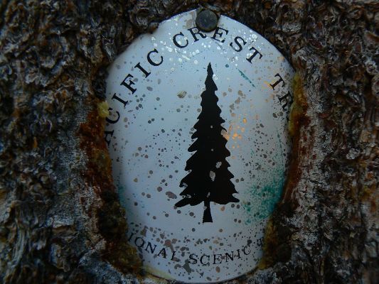
*This hike covers two sections, California J (part), and K of the PCT (Pacific Crest Trail).
That is, from Carson Pass to Donner Summit at I-80.
Dave and I first hiked part of the PCT during our
Jaunty Juggernaut hike of the John Muir Trail - see the report here. I used some of the
quotes used in the JMT report - because they seem
quite relevant to this current hike.
I kept notes of our distance and elevation gained and lost each day, using my
trusty GPS, and the most excellent Halfmile PCT maps (see links). I used the GPS data to estimate the ERM,
Energy Required Miles. The tracks that form the basis for the maps are from the durable Garmin Map 60cs,
now eight years old. Full credit is due Halfmile and his www.pctmap.net site for maps and tracks used to
design this trip.
I color copied the
Halfmile maps (link) on the water-worthy
Rite-in-the-rain paper (link - see paper 8511), double-sided.
Sending the maps for each section along with the resupply materials lessened pack weight. And, I've used the
Rite-in-the-Rain All-weather (lined) Journal #391 for field notes for many years. It's old-school, yet solid, durable,
and versatile beyond any of the smartest dumb phone (here's hoping technology in the form of cell coverage never
comes to special places like the PCT).
Here are my journal notes, some photos, and the daily data and trip maps (tracks
from my GPS), and links to the outstanding Halfmile maps, tracks, and waypoints -- promenading the PCT.
ERM = Energy Required Miles. A mile is added for
every 500' elevation gain or
loss. It's a very serviceable method of estimating energy required miles. ERM was initially used in Trails
of the Tetons (long out of print) by Paul Petzold, founder of NOLS. It's a wonderfully useful concept and
application. Add one mile for each 500' up AND down to distance = ERM. I use ERMs to calculate what the actual
day is like. It's a very serviceable method of estimating energy required miles. Remember, however, that the
ERMs are estimates because they depend on GPS satellite coverage and math functions.
Using ERMs does not account for the 'texture' of the route or trail - that
is, rocky, boulders, no trail, slimy mud, etc., yet does help approximate the route.
Notes - GPS miles. PCT mileage and mileage from my GPS are given each day. Mileages do not match because the GPS measures PCT and off-PCT distances. The ERM estimates come from elevation gain and loss figures from my GPS.
“PCT miles” reference the mileage from the Southern US border of the PCT, as specified in Halfmile's maps, a trail bible. See the links section at the bottom of this report for references.
Below is our plan for the PCT Promenade. Dave and I produced this draft and we ended up mostly following it. We changed some camps because of water or distance considerations.
| ||||
I suggest you start downloading the movies you wish to watch while reading
the narrative and perusing the photos - this way, the movies will pop up while you are enjoying the PCT Promendade.
Here are the two PCT movies:
Click here to: see a Movie of hiking North of Tinker Knob - Day 10.
Click here to: see a Movie of Susie Lake Outlet - Day 4.
Click here to: see a Movie of Grouse and chicks on the PCT - Day 10.
Click here to: see a Movie of Lake Aloha - Day 4.
Click here to: see a Movie of the American River and Yellow Monkey Flowers - Day 9.
Click here to: see a Movie of Dry Stretch Dripper - Day 9.
| ||||
 |
 |
 |
 |
 |
 |
Preliminary Days: Eleven (11)! transfers brings me to the musky
aroma of Mules Ears (a Wyethia) at Carson Pass. Hooray! I recall the missive I had written to myself for
retrieval at the Echo Lake PO last year, and how I read it after the package was returned with a full load of
disappointment about the broken trip (see the PCT 2012 report). Not this time. This time, we would complete
the trip as planned. At least that's the plan.
K and I leave Arizona via the SouthWest Chief (Amtrak) the night of July 11th.
Arriving in Los Angles, we have a nearly 3-hour wait, then bus it to Bakersfield and onto the San Joaquin (train)
and to Fresno, where we pause for a 7-hour lunch with friends Nancy and George Whitmore (yes, the George Whitmore
who was in the first group to climb The Nose of El Capitan in Yosemite - see links section). This epic lunch was
followed by good discussions and times with Gordon, and later a fine dinner with Gordon, Beth, and Don.
Early on the 15th, K drops me at Amtrak (San Joaquin again) and heads for girl
time at the beach. For me, Amtrak is followed by two more bus transfers to Truckee, where I rendezvous with Dave.
Avoiding those evil corporate airlines can take time.
The next morning, July 16th, Dave and I ride the TART, then the Emerald Trolley
to S Tahoe, then enjoy three hitch-hike transfers to Carson Pass. Whew, eleven transfers to nirvana, to the
Eldorado NF. Now, for the PCT Pygmy Promenade, 2013. Yippee.
 |
 |
 |
 |
 |
 |
 |
 |
 |
 |
 |
 |
 |
 |
 |
Day 1: (July 16) Lucky Eleven, or Stepping Across the Truckee:
Carson Pass to Meiss Cabin-Truckee River:
PCT mile 1078.6 - 1081.6 = 3.0 miles. GPS = 3.0; ERM = 5.0; camp @ 8400'.
Wow! Trail Angels at Carson Pass! After lucky eleven transportation
transfers to Carson Pass, scene of last year's debacle of PCT bail out, we grab our packs from the pick-up
(last hitch) and walk to the USFS visitor shack, where we are greeted by FS (Forest Service) volunteers who
offer fruit, salad, hard-boiled eggs, chips, dip, etc. Trail Angels! A few thru-hikers, lean and dirt-speckled,
are basking in the glorious Angel glow. I'm heartened by the number and dedication of gorgeous PCT women, gorgeous
girls with legs to their ass. Dave and I chat with the PCTers and envy their distance and grit.
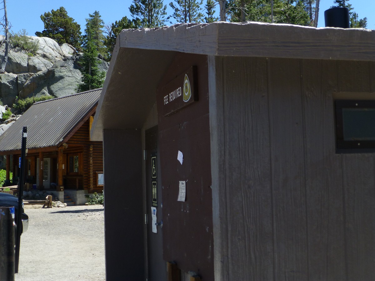
Finally, we're passing the scenic toilets of Carson Pass and climbing the volcanics
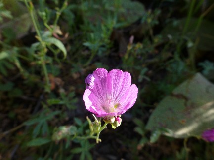
to drop into the Truckee River drainage, a young and tiny flow. Lilting through a mecca of wildflowers, we enjoy
the short jaunt to Meiss Cabin and Meadow. We'd planned a very short day, not knowing how long the hitch-hiking
might take. With good water and a pleasant knoll bounded by good scenery - we pause for the night.
Note: With the job-killing short-sighted restriction on funding public services
by nonthinking repulscians, the FS and others are increasingly turning to volunteers to perform the most basic of services,
which is often all that gets done. Having volunteered for the FS, as in the
Salmon Sojourn (link), we should all give something back to our
precious public lands, I greatly appreciate the FS volunteers at Carson Pass and other
places. Providing information and assistance, working the trails, etc. A pox on repulsicans and tea-baggers
everywhere, may your car disappear in a giant pot hole just before you die on the way to being refused service
at a for-profit hospital because there is insufficient funding for medics and traffic lights.
 |
 |
 |
 |
 |
 |
 |
 |
 |
Day 2: Igneous Borderline: South of Benwood Meadow:
PCT Mile 1081.6 - 1090.5 = 8.9 miles. GPS = 9.0; ERM = 16; camp @ 7600'.
The bowl is populated by gorgeous ground granite bedrock, while
the ridges are volcanic, with occasional spires. Walking the igneous borderline. Flowers choke the
slopes and explode where trickles of water roam. It's a lovely quiet day with no big climbs - although
we end the day with a 900' or so drop toward Benwood Meadow. First, we join the Tahoe Rim Trail, not far
from Meiss Cabin, then climb and drop to Showers Lake, then roll along, seeing no one until near camp. At
our intended camp, we decide to continue to the next water crossing to shorten our hike tomorrow. After all,
we've a resupply with which to wrestle at the Echo Lake PO. Along the way, we hear the exceedingly low
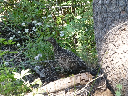
strumma-drumma of a grouse. One explodes near my feet as we descend toward Benwood, nearly producing cardiac arrest.
 |
 |
 |
 |
 |
 |
 |
 |
 |
 |
 |
 |
 |
 |
 |
Day 3: A Fine Time to Resupply, Lucille: To Lucille Lake:
PCT Mile 1090.5 - 1099.5 = 9.0 miles. GPS = 9.3 (off PCT, to Lucille); ERM = 13; camp @ 8200'.
From my polished granite perch, I'm looking down through a haze of marsh
mosquitoes at a thin slice of a gleaming Lake Lucille. Feeling the glow of a bucket bath on warm granite,
and almost no area mosquitoes, life is good in the Desolation Wilderness.
We start this warm day with more lilting through deep forest, meeting Maddy
and Dan, Vermonters, and Robert the German, on our way to tragically busy Hwy 50 and then up and over a bump
dotted with Summer cabins to a short drop to our resupply at Echo Lake PO, A porcine porcupine bristles at
the sound of so many motor-heads contaminating our public lands.
Lounging at the broken-down picnic table at Echo Resort, we various-length
PCTers chat about food and the trail and the way, the way to nirvana, the way to inner peace, just the way.
With a squashed-full bear can, new TP and batteries and soap and sunscreen, and, of course, lots of food,
and having eaten my snack sent down the line in the resupply box, Dave and I hoist decidedly heavier packs
and start the hot hike around Echo Lakes and into Desolation. Desolation? Desolation never looked nor smelled so good.
During the early morning light, a hummer flies under the tent fly, rousting me
from sweet dreams.
Note: The naming of Desolation Wilderness comes from the lack of trees
because of bedrock granite in many areas.
Today ends California Section J, and starts Section K of the PCT, at Echo Lake PO.
 |
 |
 |
 |
 |
 |
 |
 |
 |
| ||||
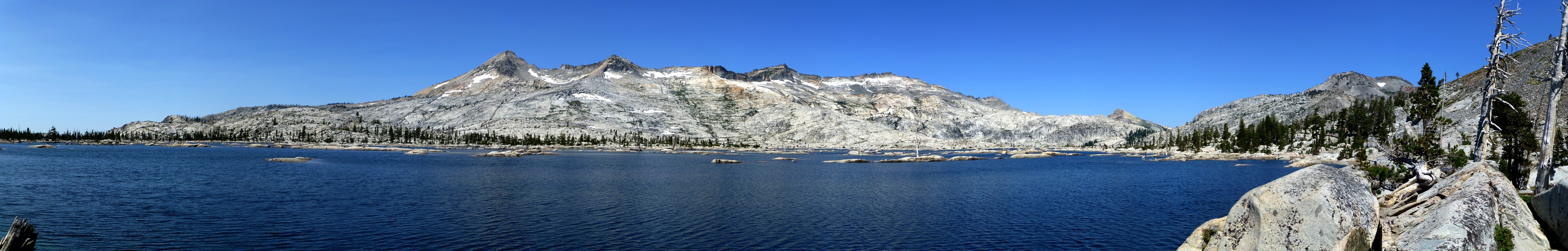
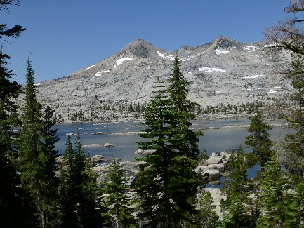
Day 4: Aloha Susie Q: Susie Lake Outlet:
PCT mile 1099.5 - 1103.8 = 4.3 miles. GPS = 4.8; ERM = 7.4; camp @ 7780'.
The Susie Lake water cascades musically near our bench camp. Views range
dramatically down canyon and indeed to mountains beyond Lake Tahoe. Dave and I are just below the Susie
Lake outlet - far enough from the trail and lake to provide a wild character to this busy wilderness.
Some of the cute and fast PCTers we met at Carson Pass blast past as we
lounge for a foot break. They've hitched into Tahoe, cleaned up, shopped, and recovered and returned as
we lilted along the trail. Looking fresh and scrubbed, they leave nothing but dust. We're all on a quest,
yet for what?
We start the day with the long contours along Lake Aloha. Hello and goodbye.
Indeed. Pyramid Peak. More flowers, Alpine Lily, Sierra Columbine, et al. Past Heather Lake to find Susie.
It's a very short day and we search awhile before finding this deluxe camp. A good day for laundry and bath
and gazing at cascades and vistas. Bug free enough for some nude lounging and writing. Deluxe it is.
 |
 |
 |
 |
 |
 |
 |
 |
 |
 |
 |
 |
 |
 |
 |
| ||||
Day 5: Hotel California: To Middle Velma Lake:
PCT mile 1103.8 - 1112 = 8.2 miles. GPS = 9.1; ERM = 15; camp @ 7940'.
"There's not plenty of room at the Hotel California - it's a crowded place,
and the room's a mess, and you can check out anytime you like, then leave." a paraphrase of The Eagles' song,
Hotel California.
Here a tent, there a tent, and a hammock over here. We consider the map and
see that it's three or more miles to water, then look (and look) for a tent spot. A bit after finding OK sites,
some youngsters move in at some very marginal sites - quite close. Yet, the heated smooth granite is good for
bathing and the water quality is adequate. Thunderheads build high over the Lake Tahoe area, yet it's a crisp
blue here.
The day starts with a climb to Gilmore Lake, where we are mobbed by flies
and mosquitoes. On to Dicks Pass (@9200') for a lounging lunch, where we meet Broken Toe (25-35 mile/day
average; trail name) and then Coyote and Road Kill - two cute female PCT hikers, before dropping off the
pass and to Dicks Lake. Along the way, we encounter a grouse and some marmots, and of course, lots of flowers.
We roll on to Fontanillis Lake, where we initially planned to camp, then mistakenly continue to Hotel CA.
It's busy and it's also lovely, with a surprisingly low bug count, given we are near water on three sides.
A squadron of mosquitoes swirls in near sunset, prompting us to hurriedly
clean up and get in the tents. Now, I'm writing these final notes in the nude (it's very warm - the sun
heated the granite and it's like a convection oven), awaiting sleeping bag time. The nearly full moon glares
and a Great Horned Owl announces himself. Good night from Hotel CA at Middle Velma Lake.
 |
 |
 |
 |
 |
 |
 |
 |
 |
 |
 |
 |
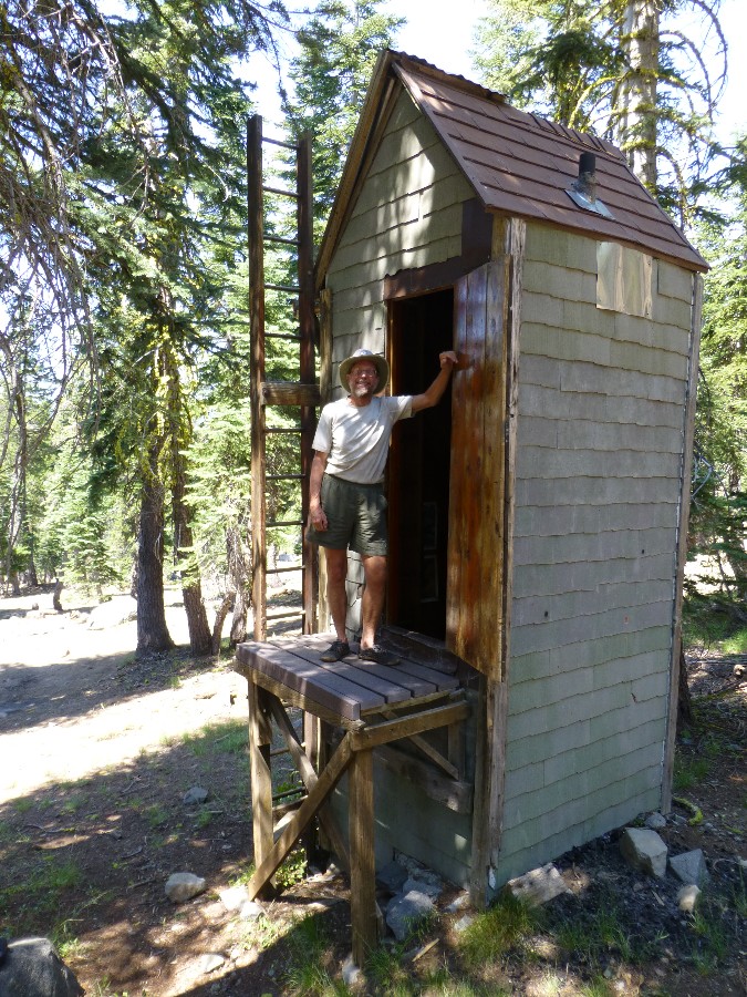
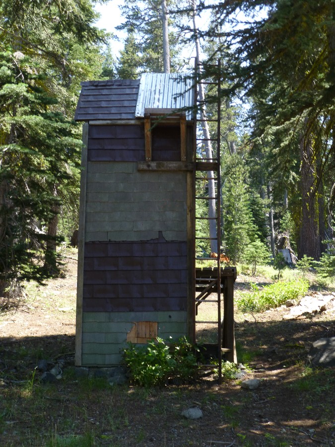
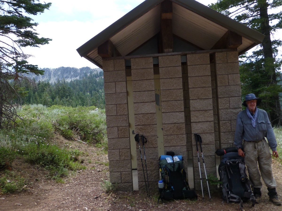
Day 6: Ludlow Lounge: To Richardson Lake, goodbye Desolation:
PCT mile 1112 - 1120.6 = 8.6. GPS = 8.7; ERM = 13; camp @ 7380'.
The mosquitoes usher us out of the Desolation Wilderness, here a quieter
realm - at least today. We roll along near the ridge connecting Lost Corner Mountain and then drop into
the Richardson Lake bowl after crossing a FS jeep road. There's also a road near the lake, but it's not
in use today - yahoo. We meet Happy Feet and Senor Guapo (handsome) and a few other hikers today. At
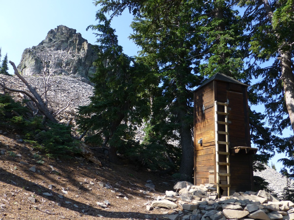
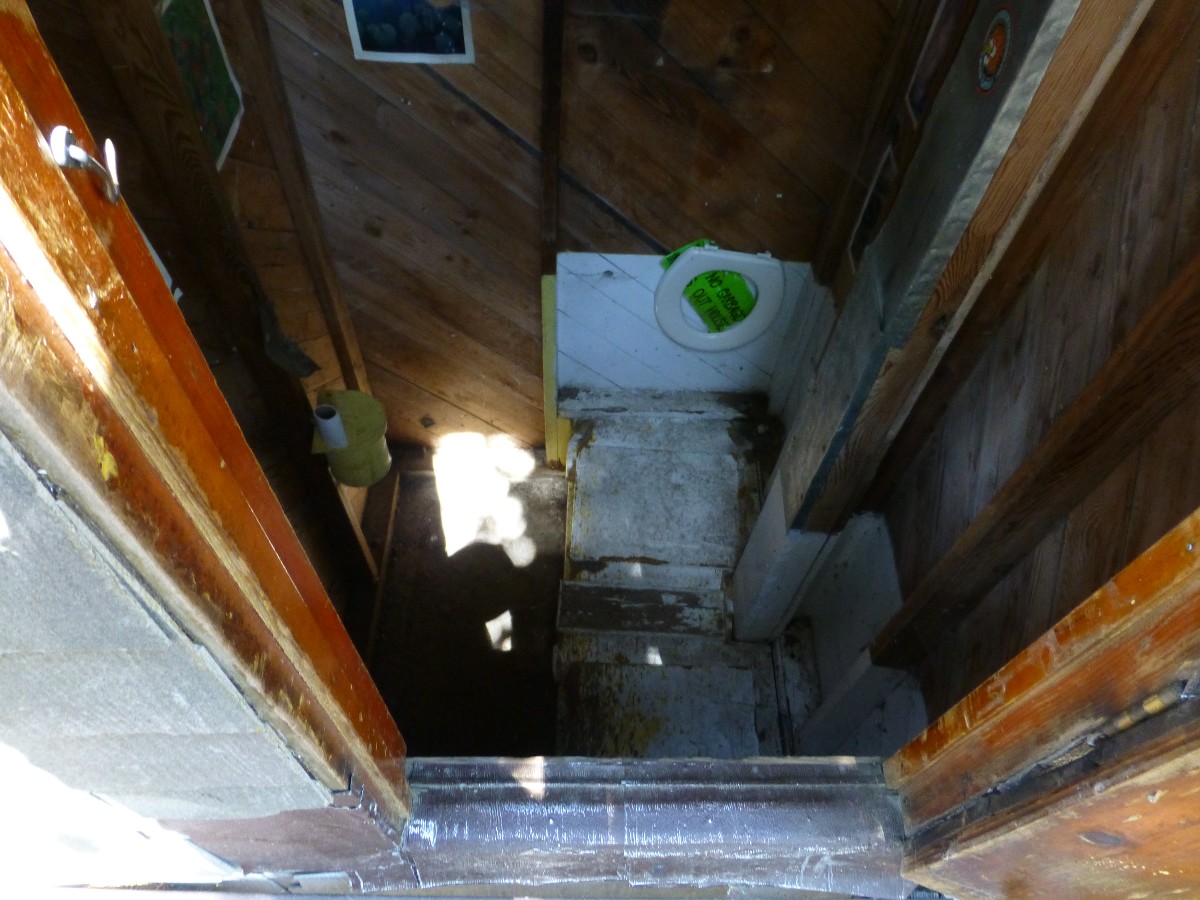
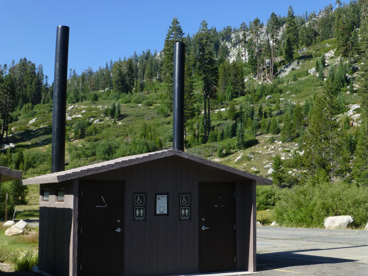
Richardson, Dave and I explore for the Ludlow Hut, which we find on the NE side of the lake. What a
scenic toilet! One must climb up a ladder - to a snow level door - then, surprise - one must climb down
a ladder inside the toilet hut to reach the toilet level. A puzzling design. We're here early - so we
lounge in bug-free tents after camp chores and a bath. Wondrous.
A pink fireball rises over Velma to start the day, as the oatmeal water
is heating. Gorgeous. Goodbye Hotel CA!
Day 7: Barker Bumper Cars. To North Fork Blackwood Creek:
PCT mile 1120.6 - 1129.2 = 8.6 miles. GPS = 8.6; ERM = 13; camp @ 7970'.
"Clang!" the car door of the elitist BMW slams into the parked Prius,
setting off an aggravated electronic chirping from the wounded Prius. Yikes, Barker Pass PCT TH is a
crowded place. It's just like bumper cars at the Idaho State Fair.
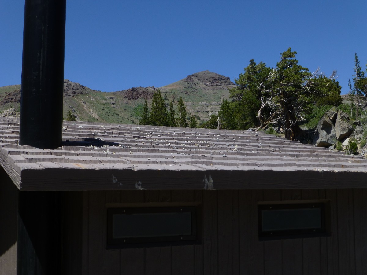
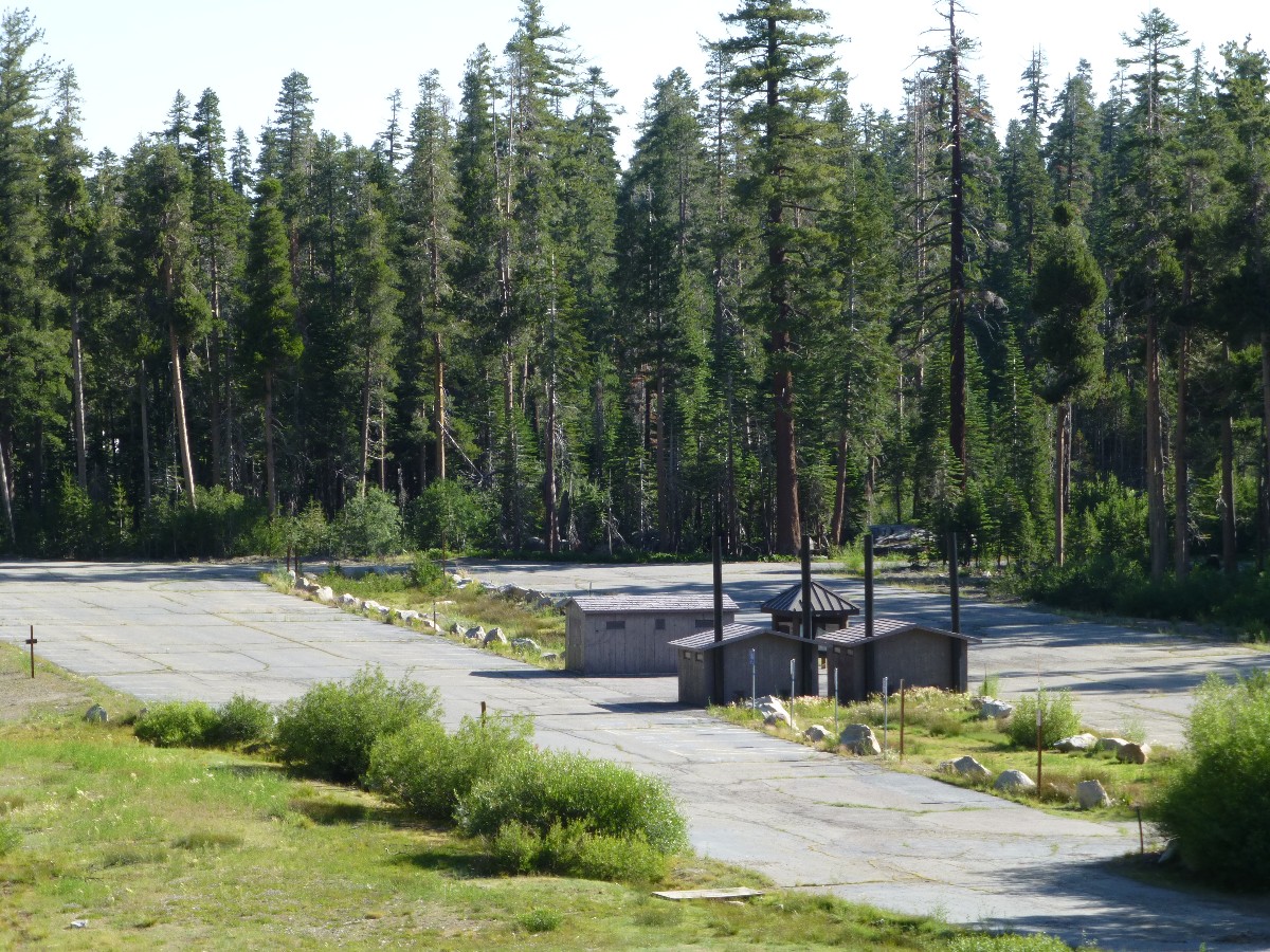
Despite the scenic toilet, this road crossing at Barker is a shock to
sensibilities, an exemplar of overpopulation. Dave remarks that this road crossing is a disappointment.
We meet Paul Bunion (a girl) section hiker and her Dad gives us a delicious apple.
Back on the trail, we continue to climb on powdery dusty trail (lots of
day hikers here) to a bit over 8000' before dropping to our lovely camp - just across from the trail, yet
with a distant bellow of jeeps terrorizing public lands East of Barker. Sad. The wind is crisp and this
is our coldest afternoon to date. We meet lovely Ida Y., Christie, and Margaret, day hiking in search of
the azure pimpernel and blue-throated swift. Ida offers to write to us about hiking in New Zealand and I
readily give her a web card for the WV.
We start off from Richardson Lake fairly early, slipping through big trees
forest with occasional meadows and streams choked with wildflowers, including Towering Larkspur over 7' tall.
Lovely. Then, there's Barker, shattering the ambient peace. Volcanics have replaced the granitics, at
least for now. Granite Chief waits ahead. Beckoning us North.
It's a down jacket and wool hat dinner. Then, we watch a pink shaft of
light stream through the pass near the Twin Peaks to the North, and then the salmon hue spreads to the East,
where we can see a slice of distant Lake Tahoe.
 |
 |
 |
 |
 |
 |
 |
 |
 |
 |
 |
 |
 |
 |
 |
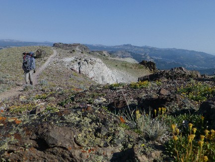
Day 8: PCT Crestival: To Five Lakes Creek; Granite Chief!
PCT mile 1129.2 - 1138.0 = 8.8 miles. GPS = 8.9; ERM = 13; camp @ 7400'.
Crestival! The terrain drops off both sides of the PCT. Yes, the
"Crest" in PCT. Entering the Granite Chief Wilderness and where the Tahoe Rim Trail departs East to town,
we bump on and off the Crest. Gorgeous views, yet poor lighting today because of cloud cover and some sort
of population-based smog. Still, it's a Crestival of vistas, Tahoe Lake views, flowers, geology - columnar
volcanics stacked horizontally like Paul Bunion's Woodpile (actually the name of a feature in utah). Then,
what?! Horrors of ski industry encroachment on our precious public lands. Towers, terrorization of terrain,
destroying precious meadows, mucking up views and ecosystems. The ski industry has a poor environmental record.
We meet Sean, later Chris and Carol hiking South and inquire about water on
the dry stretch beyond Squaw Creek. There's some hope - water is reported near Mountain Meadow Lake outlet.
Yahoo.
Dave and I plow along through in-trail Mountain Laurel on this quieter
section of the PCT after leaving the Tahoe Rim Trail and Barker Pass behind. Nearing Squaw Saddle, we
zig and zag on long switchbacks off the crest and to water and camp near Five Lakes Creek. Granite reappears
and the water is cold and fresh. We'll be enjoying another Crestival soon - yet for now it's camp amidst
the roving T-storms. Two deer race into camp - apparently surprised by our presence. Who's wilderness is
this? A duo of crepuscular owls hoot a missive back and forth across the canyon. Delightful.
 |
 |
 |
 |
 |
 |
 |
 |
 |
| ||||
Day 9: Granite Chief: To PCT Mile 1146:
PCT mile 1138 - 1146 = 8.0 miles. GPS = 8.0; ERM = 14; camp @ 7760'.
Yahoo, the water is clear and crisp at PCT mile 1146, the farthest North of the
rumored water sources in this stretch. It's an excellent day of hiking the Granite Chief Wilderness, despite
the insults of the mutilation of Squaw Peak by the moneyed ski corporation. "Corporations are vultures, my
friend," said Tadd Romney, 2012. Corporation, another unregulated "person" of often criminal intent and deed.
Corporate welfare? Most certainly. Welfare for corporations, rigged capitalism for everyone else. Above, the
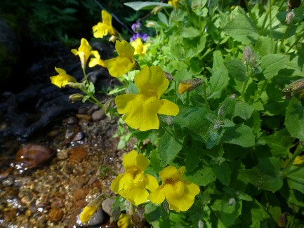
ridge of columnar volcanism of Tinker Knob glows as sunset approaches. Yellow Monkey Flowers line the burbling brook.
We start the day by losing altitude to the junction with the Whiskey Creek Trail,
then climb past the headwaters of the American River to pass under a chair lift and skirt to the East of Granite
Chief, after leaving said wilderness.
Then, we roll down past the outlet of Mountain Meadow Lake to this Northerly
water source. Starting quiet, the day is punctuated by groups of day hikers. Dave and I share camp with Karen,
Merium, Sarah, and a friend, junior high teachers from CA.
To help lessen the gription of evil corporations (is this redundant? evil corporation), I've been striving
to replace worn-out gear with stuff from American cottage businesses, for example, I'm packing:
ULA pack (utah)
TarpTent (Notch; CA)
Bearikade bear can (CA)
Caldera alcohol stove (CA)
Smartwools socks and wool hat
Platypus containers and hydration bag
AquaMira water treatment
Princeton Tec headlight
Thermarest neo-air mattress
Rite-in-the-Rain notebook (WA)
some other items are designed or constructed in the US (e.g., Marmot
Helium sleeping bag)
| ||||
 |
 |
 |
 |
 |
 |
 |
 |
 |
 |
 |
 |
 |
 |
 |
 |
 |
 |
| ||||
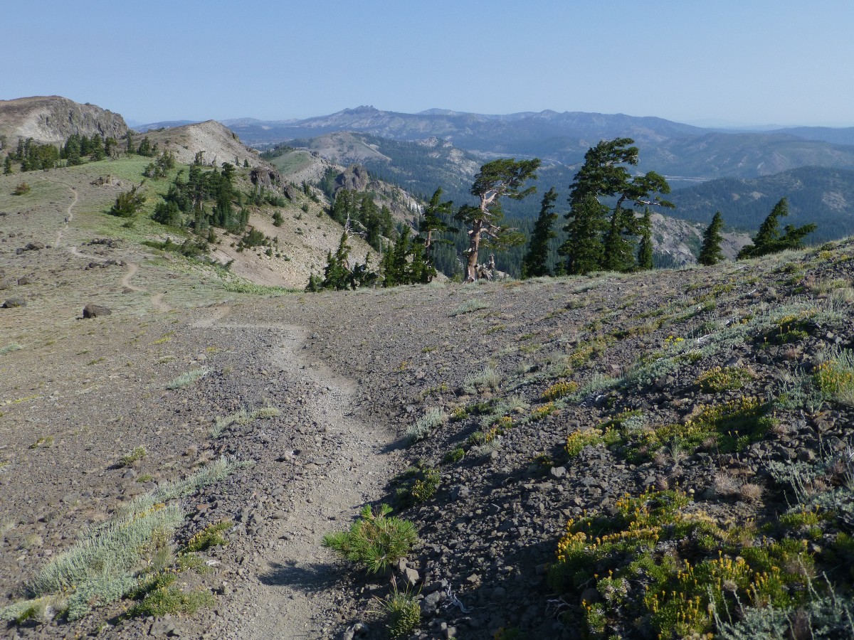
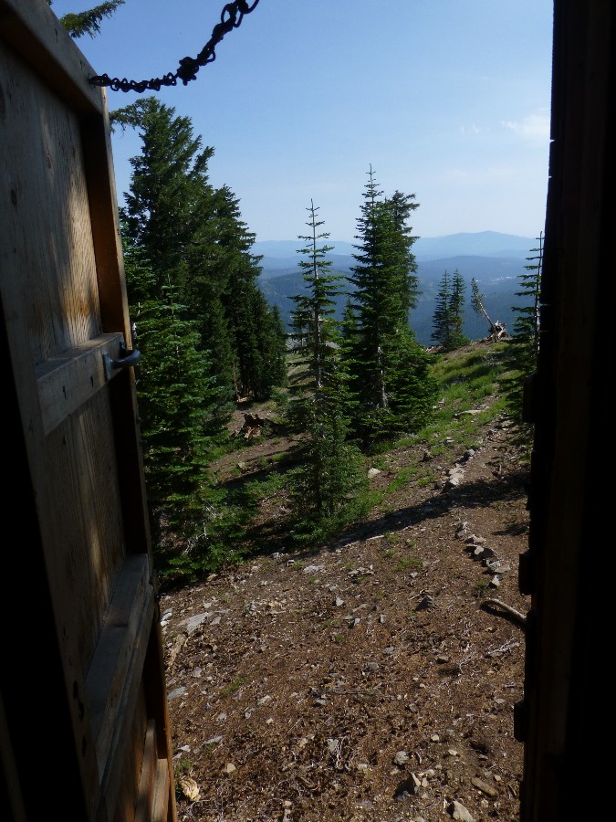
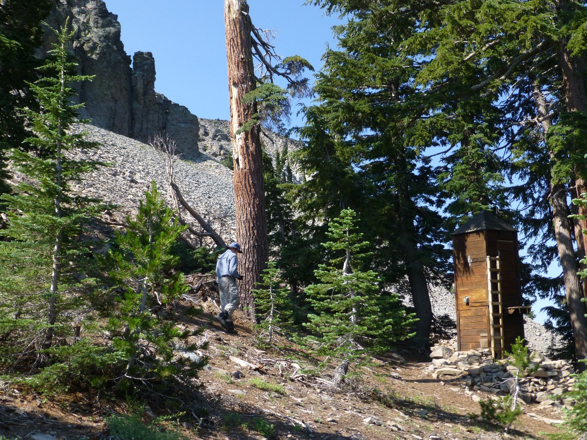
Day 10: PCT Crestival, Redux, The Vulcan Voyage:
PCT mile 1146 - 1156.7 = 10.7 miles. GPS = 10.9; ERM = 20; camp @ 7200'.
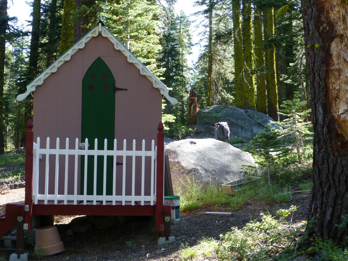
I'm climbing the ladder, then swinging open both half doors, then stepping
up on a narrow platform and into the Benson Hut scenic outhouse aside and astride Anderson Peak. Perfect.
It's time to use this facility, and photograph it too.
The day starts with a climb back to the crestival near Tinker Knob and walking
the Vulcan Voyage to Anderson and rolling on to the flank of Mount Lincoln, where we lunch with Shadowfax (trail
name) from the U.K. (Northern Scotland) and then roll down to Hwy 40, Donner Pass. No water - just a mud bog
near a ski lift. A kindly tourist gives us some water at the pass and we plod on, now on granite, into the
area between Hwy 40, Donner Pass, and I-80, Donner Summit. It's a cacophony of traffic and air noise (trains,
semi trucks, helicopters, jets, etc.) as we descend to the pass, yet seems quieter near our tiny pond near PCT
Mile 1156.7. There's just enough time to set camp, treat water and enjoy a bath before the building T-storms
let lose with a dribble. So, I'm writing these notes in the TarpTent, happy that this is the first rain of the
trip. The camp is fine, the water barely adequate.
Dave and I pop out of our tents to cook dinner after very little rain. The
saffron hue fades from the clearing sky on this last PCT 2013 night. As the air cools, traffic sounds from
I-80 intensify, but mostly it forms background white noise. Dave and I reminisce about wilderness, other trips,
and we wonder about the stalwart PCTers racing, galloping, plodding, limping toward Canada. Wondrous.
 |
 |
 |
Day 11: Climb to the Balcony: To Donner Summit, to Truckee:
PCT mile 1156.7 - 1159.3 = 2.6 miles. GPS = 2.7; ERM = 4.0; camp @ 6100' (Truckee Hotel).
It's deja vu all over again! Just like at the end of the PCT 2012, here it
is PCT 2013 and I'm sitting on the balcony of the Hotel Truckee, observing which women hike and bike vs.
which women are in love with their smart-ass phones. It's relatively easy to tell by their general shape.
I was here about this time last year, albeit under better conditions this year, having finished the trip as
planned. The scenery is certainly lovely.
I awake late to the sound of rain. What! A single cloud hovers aloft, bordered
all around by cerulean blue. Soon, Dave and I are strolling the short distance to Donner Summit and the I-80
Rest Stop, and a bit later we hitch a ride to Truckee (12 miles) and a shower and lunch and lounging. Tomorrow,
we're on Amtrak to Smog Lake, and from there, home.
To date: PCT mile 767 - 1159 = about 392 miles. From that August afternoon
hiking the JMT (John Muir Trail) in 2010, when I came to the understated intersection of the JMT and PCT at
about PCT mile 767 just West of Crabtree Meadows, I have wondered about - and indeed longed for - returning
to the PCT. I stood there, looking at the puny sign and said out loud "Yes, I will be back, back hiking the PCT!"
And today, at PCT mile 1159.3 I repeat the mantra.
And, so comes to an end our pygmy PCT promenade 2013 adventure, through two busy
wilderness areas and delightful country, wading through a diversity of wildflowers, hiking through good country
populated by granite and volcanic, and with most excellent camaraderie.
 |
 |
 |
 |
 |
 |
 |
 |
 |
 |
 |
 |
 |
 |
 |
 |
 |
 |
 |
 |
 |
Click here or on the PCT trail marker to go to all WV reports about The PCT, JMT, Sierra hikes
| ||||
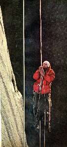
Click here to: see the First ascent of El Capitan, Argosy Magazine, 1959 (10 pages) 22 MB.
Marc Reisner (1993) Cadillac Desert: The American West and Its Disappearing Water, Revised Edition, Penguin Books
Common Adventure: A Brief Description, Definition, and Questions and Answers, By Ron Watters
Bill McKibben – suggested books include: Maybe One, Eaarth, The End of Nature
Pacific Crest Trail – Plan your hike site
Half-mile site: Pacific Crest Trail Maps and GPS Information - a terrific resource
Bear Boxes in the Sierra Nevada
Post Holer site - maps and resources for planning (PCT site)
About the PCT - has info about equipment (semi-commercial site)
The waypoints with numbers, e.g., 0955, indicate PCT mileage from the Southern US border.
![]() Link for the Half-mile site: Pacific Crest Trail Maps and GPS Information - a terrific resource
Link for the Half-mile site: Pacific Crest Trail Maps and GPS Information - a terrific resource
Section J, Sonora Pass to Echo Lake Resort (download zip files, then open in pdf or your mapping software)
![]() pdf file by Halfmile - maps for California section J of the PCT
(used with permission).
pdf file by Halfmile - maps for California section J of the PCT
(used with permission).
Section K, Echo Lake Resort to Donner Summit at I-80 (download zip files, then open in pdf or your mapping software)
![]() pdf file by Halfmile - maps for California section K of the PCT
(used with permission).
pdf file by Halfmile - maps for California section K of the PCT
(used with permission).
Click here to: see a Movie of hiking North of Tinker Knob - Day 10.
Click here to: see a Movie of Susie Lake Outlet - Day 4.
Click here to: see a Movie of Grouse and chicks on the PCT - Day 10.
Click here to: see a Movie of Lake Aloha - Day 4.
Click here to: see a Movie of the American River and Yellow Monkey Flowers - Day 9.
Click here to: see a Movie of Dry Stretch Dripper - Day 9.
Click here to: see a movie about Yosemite Glaciers (what's left of them).
movie about Yosemite Big Trees (again, what's left of them).
movie about Yosemite Wildflowers.
Scenic Toilets of Inner Earth: Scenic Scatology of the Wilderness Vagabond
We Are Breeding Ourselves to Extinction (click here for full article) or at:
Breeding ourselves to extinction?
More Truth Than Joke:
| ||||
| ||||
| ||||
| ||||
| ||||
| ||||
| ||||
| ||||
| ||||
| ||||
|
Wild Vagabond Main |
Trip Report Index  |
Caveat  |
|---|


