(about 136 miles)
Text and photos © copyright by Rob Jones

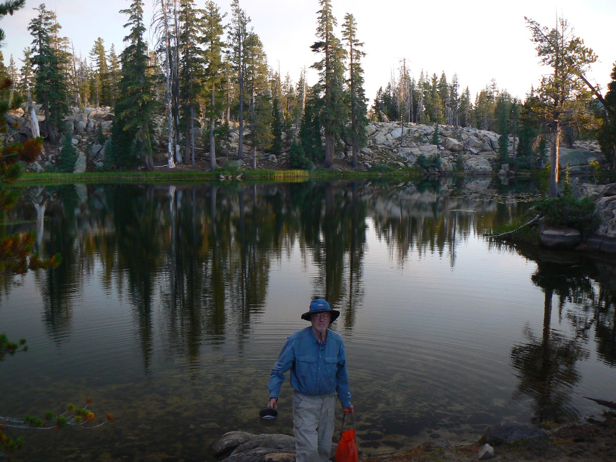
Co-participants: Dave Rumbellow, John Ladd, Chris Winter, Rob
Total Trail Miles –> 136 miles. Total ERM = 226 (best estimate).
|
|
| ||||||||
Total Trail Miles –> 136 miles. Total ERM = 226 (best estimate).
|
|
| ||||||||
|
|
| ||||||||
| ||||
| ||||
| ||||
Overview:
*This hike was designed to cover three sections, California I, J, and K of the PCT (Pacific Crest Trail).
That is, from Tuolumne Meadows in Yosemite to Donner Summit at I-80. Because of issues with storms and insufficient
participant buy-in, we hiked only section I and most of J.
Dave and I first hiked part of the PCT during our
Jaunty Juggernaut hike of the John Muir Trail - see the report here. I used some of the
quotes used in the JMT report - because they seem
quite relevant to this current hike.
We hiked about 136 miles, touring parts of the Yosemite Wilderness, Hoover,
Emigrant (very brief visit), Mokelumne and Carson-Iceberg Wildernesses, and from Tuolumne Meadows to Carson Pass.
Untouched were the Desolation and Granite Chief Wildernesses. Sigh.
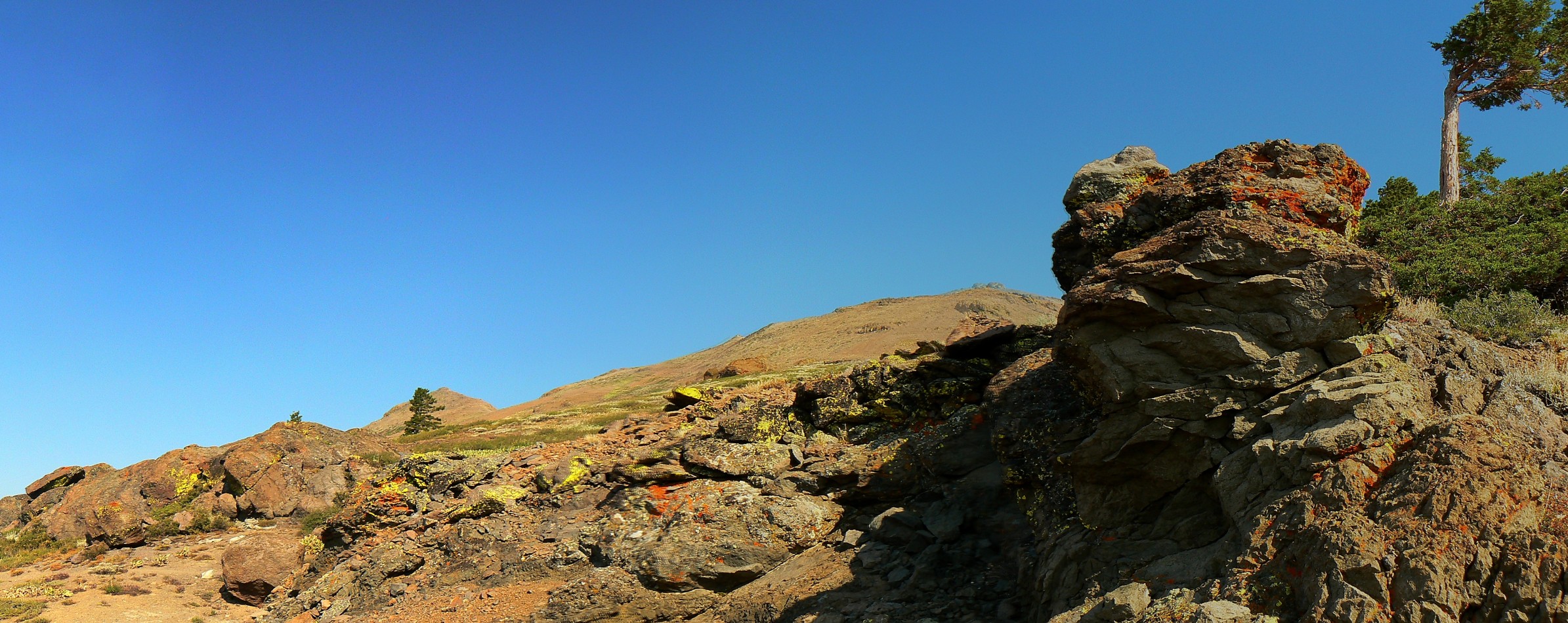
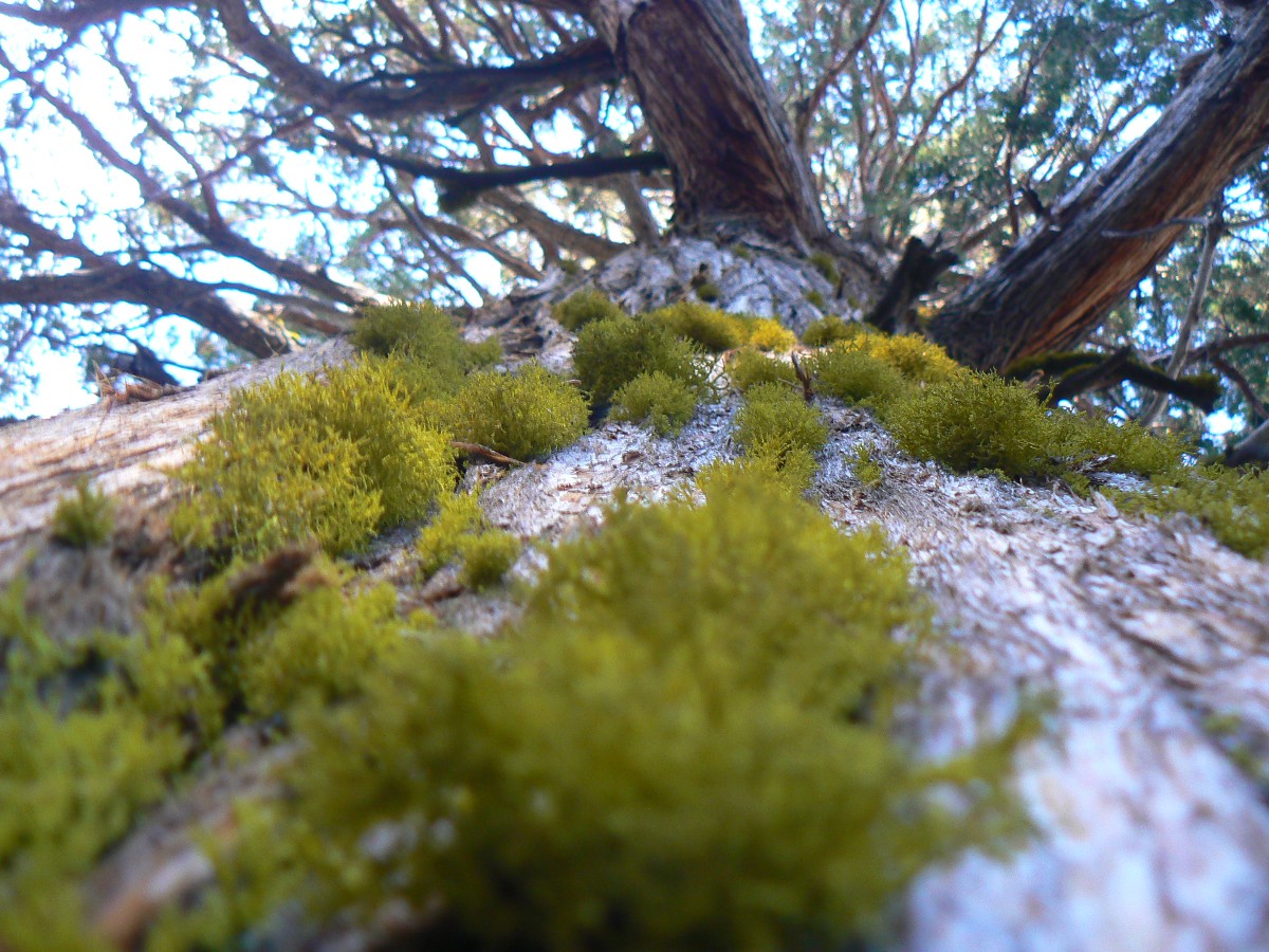
Going North from Tuolumne, the geology transitions from ice-sculpted granite to
volcanic spires and mounds. The jointed (cracked) granite was more easily carved out for lake basins, while the
glaciers rode over unjointed granite, forming the lip of the basins or cirques. Glaciers shot down the volcanic
canyons, and because of this mostly 'straight' shot and the porous nature of the rocks, there are few lakes in
volcanic country. This unequal water distribution challenged our hike plans at times.
I kept notes of our distance and elevation gained and lost each day, using my
trusty GPS, and the most excellent Halfmile PCT maps (see links). I used the GPS data to estimate the ERM,
Energy Required Miles. The tracks that form the basis for the maps are from the durable Garmin Map 60cs,
now seven years old. Full credit is due Halfmile and his www.pctmap.net site for maps and tracks used to
design this trip.
I color copied the
Halfmile maps (link) on the water-worthy
Rite-in-the-rain paper (link - see paper 8511), double-sided.
Sending the maps for each section along with the resupply materials lessened pack weight. And, I've used the
Rite-in-the-Rain All-weather (lined) Journal #391 for field notes for many years. It's old-school, yet solid, durable,
and versatile beyond any of the smartest dumb phone (here's hoping technology in the form of cell coverage never
comes to special places like the PCT).
Here are my journal notes, some photos, and the daily data and trip maps (tracks
from my GPS), and links to the outstanding Halfmile maps, tracks, and waypoints -- promenading the PCT.
I feel sad to report that my trusty Panasonic DMC-FZ7 has developed some focus
and resistance to changing modes (e.g., macro back to shutter-priority) issues after about 8 years banging around
in the backcountry. Some of the photos are not quite right. Other photos are contaminated by smoke from forest
fires and from haze (a republican word for smog).
ERM = Energy Required Miles. A mile is added for
every 500' elevation gain or
loss. It's a very serviceable method of estimating energy required miles. ERM was initially used in Trails
of the Tetons (long out of print) by Paul Petzold, founder of NOLS. It's a wonderfully useful concept and
application. Add one mile for each 500' up AND down to distance = ERM. I use ERMs to calculate what the actual
day is like. It's a very serviceable method of estimating energy required miles. Remember, however, that the
ERMs are estimates because they depend on GPS satellite coverage and math functions.
Using ERMs does not account for the 'texture' of the route or trail - that
is, rocky, boulders, no trail, slimy mud, etc., yet does help approximate the route.
“PCT miles” reference the mileage from the Southern US border of the PCT, as specified in Halfmile's maps, a trail bible. See the links section at the bottom of this report for references.
Below is our plan for the PCT Promenade. Dave and I produced this draft and we ended up mostly following it. We changed some camps because of water or distance considerations.
| ||||
I suggest you start downloading the movies you wish to watch while reading
the narrative and perusing the photos - this way, the movies will pop up while you are enjoying the PCT Promendade.
Here are the two PCT movies:
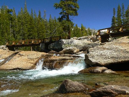
Click here to: see a Movie of Dave at three bridges - Day 1 - 1.7 MB.
Click here to: see a Movie of Tuolumne Falls - Day 1 - 1.7 MB.
| ||||
| ||||
First - a Brief Report by John Ladd:
Some brief thoughts about PCT California Section J
I’m usually a solo backpacker, but it was great to join Rob,
Chris and Dave partway into their planned trip. The plan was for me to head North with them,
but return Southbound as a solo trip (after I attended my niece’s wedding at Lake Tahoe near
my intended turnaround point).
On the Northbound leg, I had several nights of good stargazing
thanks to a moonrise many hours after sunset, resulting in quite dark night skies. As a city boy
(I live in the middle of San Francisco), dark night skies are a real treat. Aug 11 (night 2 for
me – 11 for the other hikers) was near the peak of the usual August meteor shower and at one point
I timed how fast they were coming – 15 visible meteors, some quite large, in 22 minutes.
I was able to keep my clothes and gear a bit drier in our big
deluge of Aug 14 than the rest of the group and decided to continue with my original plan to hike
as far as Echo Lake (near South Lake Tahoe). I think I was also less convinced that the rain would
continue, despite the advice of the locals. Our “Pineapple Express” events do dump rain almost
every day, but not necessarily on any given place. You can get drenched as we did on the 14th, but
a few miles away it is dry. I hoped for luck in this regard, and got it. The remainder of my trip,
both Northbound and my later return to Sonora Pass, was mostly dry.
The storm of the 14th was the most severe I’ve seen in the summer
Sierra. We often get very intense thunderstorms, accompanied by a big temperature drop, but this was
the longest, coldest intense storm I’ve experienced. It was really, really cold to just hunker down
and sit out the storm. In addition to the temperature drop (from the mid-70’s dropping almost
immediately to the low 50’s), the very cold rain, the hail and evaporation effects made it very
intense. (It was a good illustration why most hypothermia happens in the 50’s) The good news
is that most of my insulation layers stayed warm in my pack and I had my boots protected (wore Crocs
during the storm itself) so at least it wasn’t hard to recover.
My return route was much the same as the northbound trip, save for
the first day, where I came down Hawley grade, and then past Dardanelles Lake before rejoining the
Tahoe Rim Trail and then the PCT at Meiss Meadow.
Now, back to the PCT Promenade report by Rob:
 |
 |
 |
 |
 |
 |
Preliminary Days: It's Tuesday in Tuolumne Meadows backpacker camp
and we're about ready to start the promenade of the PCT (Pacific Crest Trail). Last Friday night, I board Amtrak
for Fullerton on the SouthWest Chief. Dave retrieves me from the Fullerton Station and we stay that evening with
his sister, Patricia, and her husband Devin, and enjoy a party that night at another Rumbellow, Christine, for
his 96-year old father and for Patricia.
The next morning, Patricia drops Dave and me off at the Long Beach airport, where
we meet Chris, rent a car and drive North to Gordon's house in Fresno. It's good to see Gordon, who hosts us.
A late dip in the pool brings memories of finishing the JMT (John Muir Trail), which I celebrated solo in this
very pool two years ago.
The next day, we meet George and Nancy Whitmore for lunch. Yes, the George who
was in the first climbing party to scale The Nose of El Capitan (see the JMT report and the links section for
info about this historic climb). We finish the day with more food at Gordon's, good talk and another pool dip.
Today, July 31st, George drives us to Tuolumne Meadows, we pick up our backcountry
permit, and set-up in the backpacker camp. Along the way, George points out the route up The Nose of El Capitan
that he and others in his climbing team pioneered over 50 years ago.
 |
 |
 |
 |
 |
 |
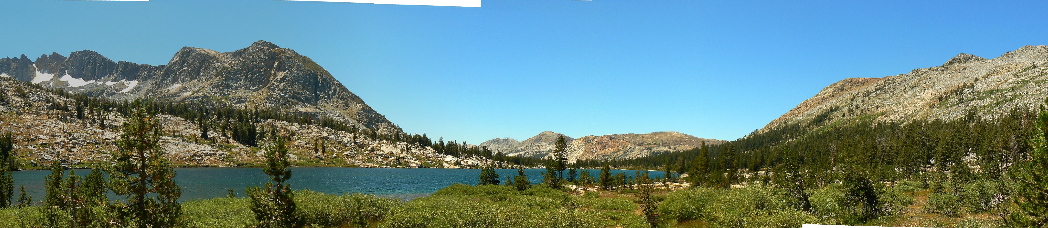
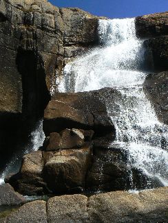
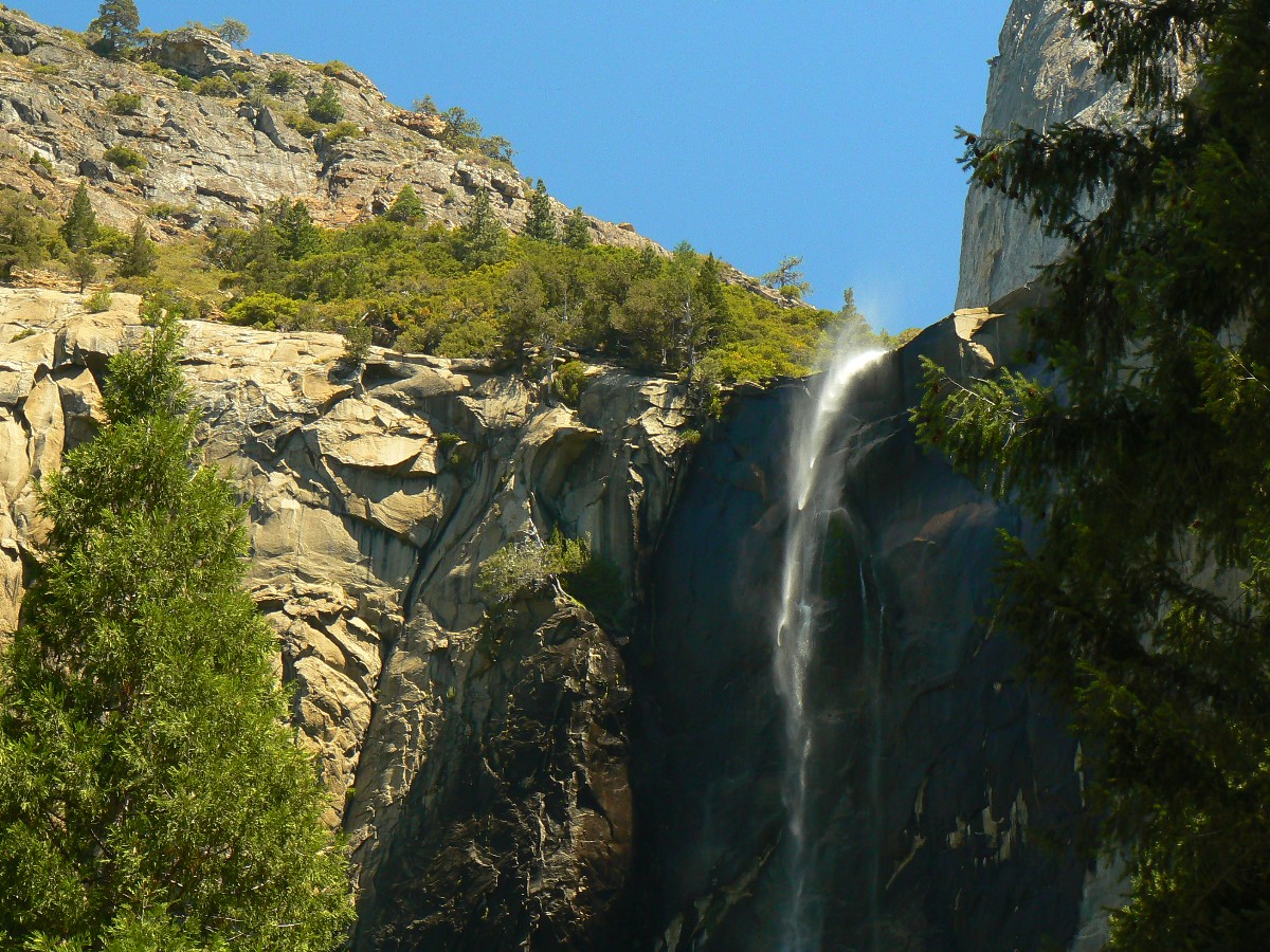
Day 1: Gorgeous Glen: Tuolumne to Glen Aulin Camp:
5.9 miles (PCT start mileage = 942.5; mileage at Glen Aulin = 948.4 miles from the Southern US border);
ERM = 9; camp at 7930'.
High Sierra water leaps from the polished granite raceway and into space,
falling and cascading and forming the Tuolumne Falls. Gorgeous. We're approaching Glen Aulin, site of one of
the outfitted High Sierra Camps, which is juxtaposed to a wilderness camp - a designated one, and where we're
headed for the first night of this promenade.
Leaving the Tuolumne backpacker CG (campground) mid-morning, we cross the Tuolumne
River and pass rows of dusty parked cars to the old Tioga Road, and then past Soda Springs and onto a well-powdered
trail, occasionally glimpsing Cathedral Peak skylined above the winding T River.
A horse and mule stroll past. No rider. Curious. The mule will not look directly
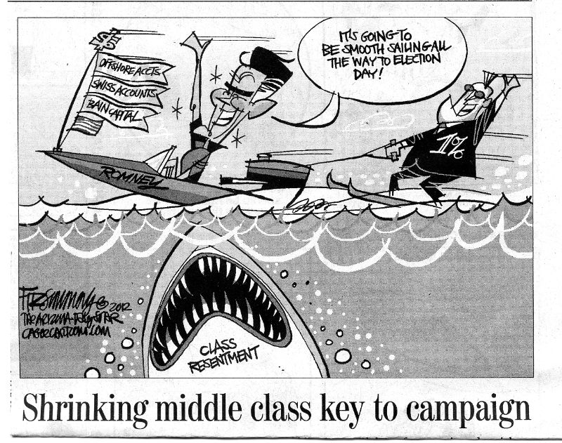
at us, and appears as guilty as R-money (romney) flip-flopping repeatedly and being caught at it. Certainly, this
mule is not guilty of exporting jobs oversees or hiding horseshoes in the Cayman Islands or in other off-shore
accounts, nor producing more children than the planet can sustainable support, yet, how come the "guilty" look?
It reads "Ranger" on the saddlebags. We gawk. Soon, a Ranger comes trotting down the trail, muttering about
mules and common sense. The mule had the sense to head for the barn.
Tourons dust along, carrying day packs of clothes, bound for the Glen Aulin
High Sierra Camp. And smiling. We smile too.
It's barely past sunset and I'm resting on a rib of polished granite, wondering
if it's 100 years old (religionist SD, self-deception, time) or less and how come religionists deny science and
try to remove it from schools and government agencies, and yet use hospitals, cell phones, cars, etc., all products
of science. Hypocrisy abounds. Icky. Then, I wonder, if they are so certain (yet wrong) about 'the truth,'
how come they don't help this world and leave now for the glory that awaits? Certain, yet wrong. Me, I'm
enthralled by the rapture of this gorgeous glen.
 |
 |
 |
Day 2: Rousing Return: to Return Creek: 8 miles
(PCT mile 956.4); ERM = 12; camp at 8570'.
Climbing out of the cold storage cold slump of Glen Aulin, the sun begins
to toast cold fingers. Cinnamon stick cedars refract the low-angle morning sun, red contrasting against
the deep blue of sky and white of polished granite. Delightful.
The trail gradually climbs, then climbs a bit more. Not much in the way
of water avails itself until we reach a meadow, where we find desert-quality pools. Skipping this water,
we continue past Elbow Hill and into the land of big fir blow downs. Cleared by government workers, it's
another reason to hike in August. At the McCabe Lake junction, we begin to drop to the confluence of
McCabe and Return Creeks (which runs through Virginia Canyon). Crystal water dashes and spurts through
flutes worn into granite bedrock. A mormon (huge throng) of scouts is camped right next to both streams
(the regs. say leave a minimum of 100' from water to camp, help preserve what's left of our amphibians
and other dwellers of riparian areas). Crossing over, we find a lovely park a bit above the low gulch,
hoping for continued dry (no condensation) and a warmer camp.
 |
 |
 |
 |
 |
 |
Day 3: Mirror Image Matterhorn: to Wilson Creek: 9.3 miles
(PCT mile 965.8); ERM = 16; camp at 9500'.
Mirror, mirror, Matterhorn. We're back up about the same amount and with
the same elevation profile as when we stared into the Matterhorn drainage from the ridge above
Virginia/Return/McCabe. Benson Pass is 600' above us as we camp high in the Wilson drainage.
The morning starts cool and warms quickly as we ply the switchbacks above
Spillers Creek. Over the ridge dotted with monarch Red Fir and cinnamon stick cedars and down to a flat
park before zigging to Miller Lake. More climbing and the Matterhorn comes into view as we drop 1100'+
to Matterhorn Creek and a restful lunch. After a brief lilt along the creek, it's a climb along Wilson
to PCT mile 965.8 and camp.
Thunder booms and clouds roll in, yet it rains elsewhere. I hurry dinner,
eating beans and potato rather than the Moroccan Couscous which requires soaking of the veggies. I hope
the clouds remain, capping the warmth and lessening condensation on the tent (none so far).
 |
 |
 |
 |
 |
 |
 |
 |
 |
Day 4: La Riviera of the High Sierra: to Benson Lake:
7.7 miles (PCT mile 973.5 to lake); ERM = 15; camp at 7590'.
The scimitar of Riviera beach at Benson Lake is being speckled by a spitter
of rain. The air is troubling calm as thunderheads prowl the sky. This, and I was hoping to do some laundry
on this somewhat shorter day. Drat.
We start the day climbing to what may be the high point (it's not) of this
section hike, 10,150' at Benson Pass. A Stellar's Jay cackles his Corvid call as I approach the pass,
welcoming one to a new drainage. This pass is followed by a drop to Smedberg Lake at about 9100', where
we encounter a bevy of babes who are on a layover day during a mule-supported walking tour from Tuolumne to
Twin Lakes. Then, rather than go down the lake outlet, the trail climbs back up to over 9500' before dropping
two thousand feet to Benson Lake. Big firs are stacked like pick-up sticks near the lake junction, and we've
talked to two groups who reported getting lost and hiking in circles for over an hour. We sail through the
tangle and find we have the Riviera to ourselves, sharing only with mosquitoes - who are mostly dispersed by
wind off the lake.
 |
 |
 |
 |
 |
 |
 |
 |
 |
 |
 |
 |
Day 5: Pilot Deer: To Stubblefield Canyon:
10.1 miles (PCT mile 983.3); ERM = 16; camp at 7768'.
Just after dark last night, two courting owls hoot and are silenced by booming
thunder followed by rain. Yet today dawns clear and the Benson Riviera is stunning. It's Sunday, August 5th,
so let's go to the cathedral of the pines.
The doe leads out, out of the remainder of the tree tangle blowdown, going
forward, going forward 40' and stopping to wait, piloting the route out. Pilot deer? No, she's waiting
for her still-spotted fawn, who just happens to be caught behind me in the tangle. It's a wet boot trip
after last night's rainstorm.
As soon as we're out of the tangle, we're climbing through more slots than
one sees in a Mexican bordello or a Las Vegas casino owned by the Chinese. Up and down, in and out, up and
down, in and out of low slots formed by granite walls to Seavy Pass before dropping to Kerrick Canyon; roll
down Kerrick to climb over another 1000' bump and down to Stubblefield Canyon. A mild number of mosquitoes
greet us at the close of an exhausting day. Tired feet, sore back and hip, assorted joint pains from the
downhill. We get to bed after 9p., a late night for the PCT. It's a lovely warm evening.
 |
 |
 |
 |
 |
 |
 |
 |
 |
Day 6: Saying Grace: To Grace Meadow:
11.0 miles (PCT mile 994.3); ERM = 17; camp at 8670'.
All say Grace - it's Grace Meadow and time to camp, enjoy a bath, drink an
extra liter of water, and enjoy the view of Keyes Peak and a long backbone of polished granite. And, I can
see Keyes and company out the door of my tent. Lovely, an alpenglow slides along these low peaks, marking
the end of a PCT day.
I start the day grinding out of Stubblefield and over Macomb Ridge Pass (at
about 8910') and then dropping into the Tilden Canyon area. Dave and Chris appear as I'm talking with Danny,
a young man wandering the PCT, perhaps the JMT.
Then, it's over to Wilma Lake to look for the patrol cabin. There's a intact
snow survey cabin yet only a cobblestone chimney remains of the patrol cabin. What happened? (I later learn
that an avalanche had wiped out the patrol cabin, perhaps built by the CCC.) With no more passes today, it's
a gentle walk up the Jack Main Canyon to Grace Meadow.
 |
 |
 |
 |
 |
 |
 |
 |
 |
 |
 |
 |
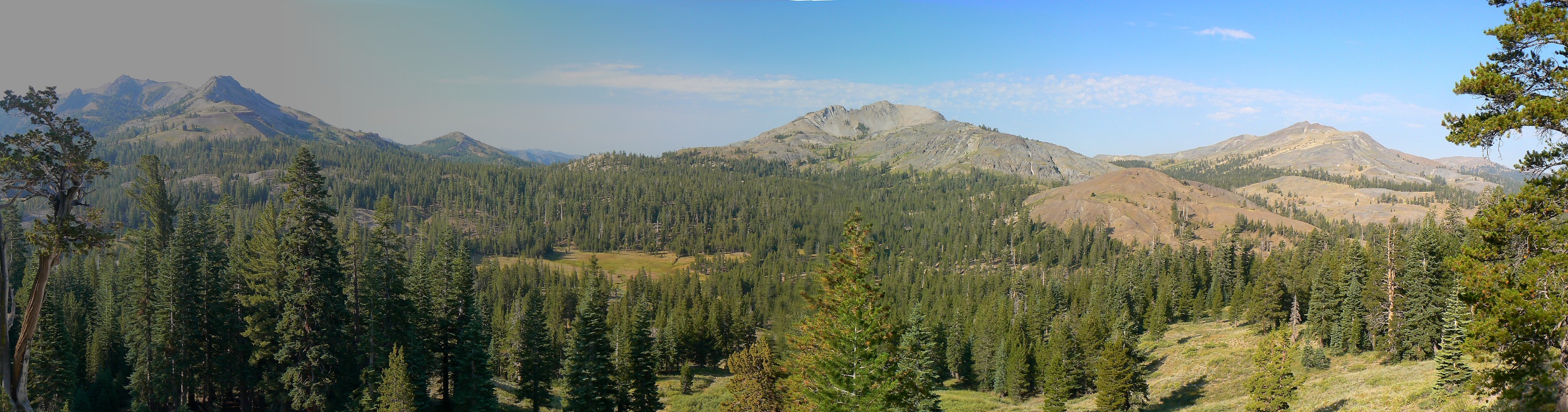
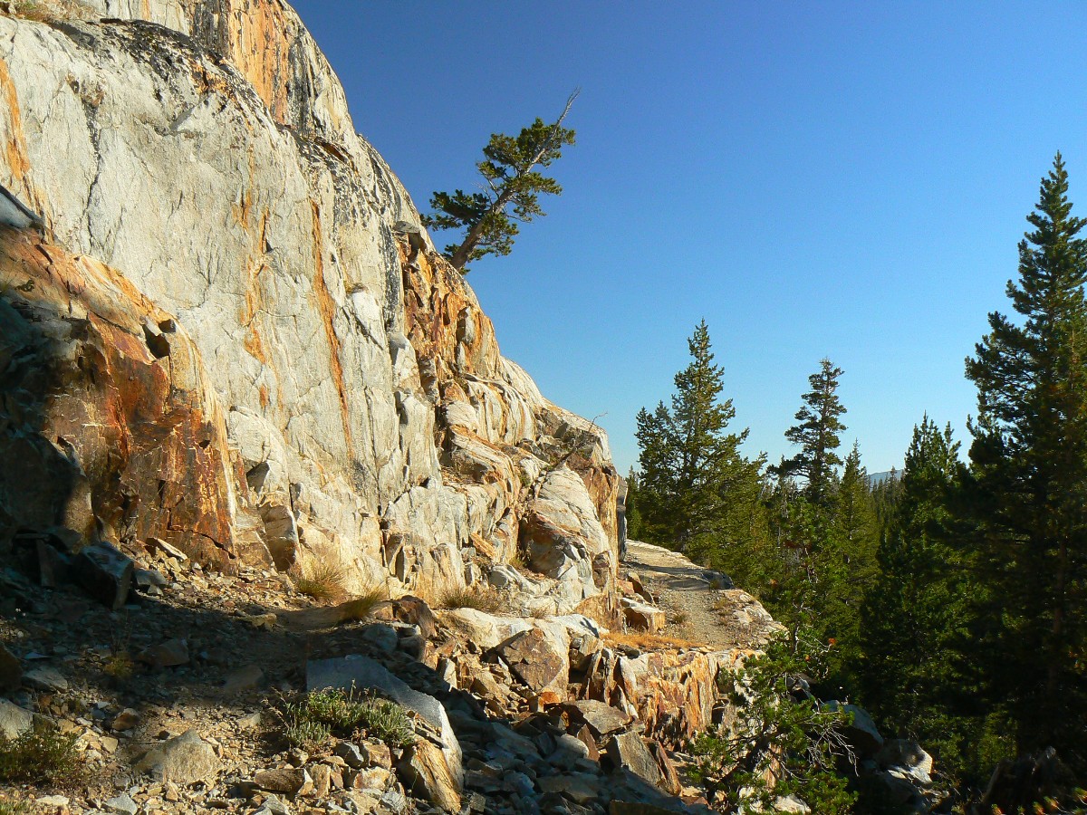
Day 7: Passing Mile 1000 of the PCT; or, Out of Yosemite Granite:
7.1 miles (PCT mile 1001.4); ERM = 10; camp at 8890'.
Crossing the Yosemite/Hoover Wilderness boundary above gorgeous Dorothy cirque
lake, the geology and distant topography change dramatically - almost as dramatic a change as the flip-flopping
of R-Money (romney), who changes his position and stated (usually erroneous) history on an almost daily basis.
Today's change is from the granite to volcanics, albeit the area we walk is
granitic today, the distant mountains are darker, more rounded and less craggy. Looking for camp, we pass
the 1000 mile PCT mark - a huge accomplishment for through-hikers, and a delight for we hiking this section.
We meet Ranger Greg, wilderness ranger, and a special education teacher too - interesting combination.
As we drop below Lake Harriet, we look for a camp a legal distance from water
and trail and find only mormon scout camps (not at all legal or ecologically correct). We move on and
discover a low ridge camp near decent water, which we share with froggies. A bath on a warm polished granite
rock, a good dinner of macaroni and orzo with hot and sour soup, and it's sunset in the Hoover Wild.
 |
 |
 |
 |
 |
 |
Day 8: A Walker in the woods: To foot of the ridge:
6.2 miles (PCT mile 1007.2); ERM = 9; camp at 8990".
Wham, clunk, bash - I come around a big granite boulder and three babes and a guy
are working the rock and dirt - improving the trail. It's Nate, Cavi, Heidi, and Carolyn of the Toiyabe NF,
toiling away on our precious public lands and earning high praise from many and short-changed by politicians one
and most and repulsicans one and all. It's a glorious day of walking the woods of West Walker, across the steal
bridge and into the edge of Walker Meadow, gazing at reddish volcanic mountains. Turning into Kennedy Canyon,
we're walking astride a stark volcanic ridge when we meet a talkative fishery biologist from the Fish & Game and
students from UC Davis. Again, it's three babes and a guy. Is there a pattern here? Soon, we arrive at a
crossing and the Halfmile North-bound water alert - next water after PCT mile 1007 is at 1018, nearly to
Sonora Pass. We camp and catch up on laundry chores, backflushing a frustrating Sawyer filter (failing after
less than 30 gallons?), and enjoying life in the mountains. Huge thunderheads build silently to the East.
The breeze nods the Yellow Monkey Flowers along the burbling brook and sunlight glances through a lodgepole forest.
 |
 |
 |
 |
 |
 |
 |
 |
 |
 |
 |
 |
 |
 |
 |
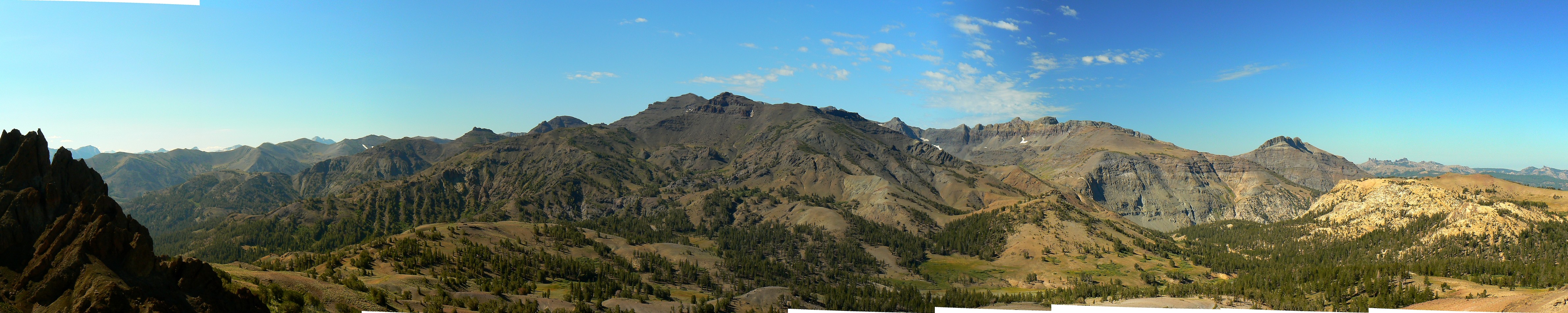
Day 9: Mountain High and Mixed Berry Pie: To Sonora Pass:
11.3 miles (PCT mile 1018.5); ERM = 20; camp at 9640'. Today ends Section I of the PCT.
The ranging views of Yosemite explode as a sea of mountains to the South.
Yowee. A Clark's Nutcracker chortles as we pass pygmy Lupine and gaudy Alpine Gold. Up early, we're
trudging up to the crest from Kennedy Canyon, on our way to the high point of the PCT, going North, since
Donahue Pass (in the JMT segment). Volcanics crunch under foot. Lovely. The grade is decent and we're
making good time on this waterless stretch to Sonora Pass.
There's little to stop the wind because most Whitebark Pine is pruned to 3'
or so tall, and there's plenty of wind. On and on, weaving from one side of the peaks to the other, even
crossing a diminutive snowfield below Leavitt Peak.
Saying farewell to the last of the Yosemite hinterland views, I feel a touch
of melancholy about leaving California Section I of the PCT. Through a narrow gap in the ridge, walking on
a tread of gravely volcanics, it's becoming a slog. Then, views of the Sonora Pass Road, Hwy 108, and soon
the long descent begins.
At the picnic area at the pass, we meet veteran PCT/JMT hiker, John Ladd,
who prepares a scrumptious and astounding dinner of Salmon, steak, a huge complicated and delicious salad,
and a very thick mixed berry pie. Extraordinary and yummy. John has also brought resupply boxes we mailed
prior to leaving for Tuolumne, and we repack the delightfully empty bear canisters, refill fuel bottles, and
etc. and etc. I am delighted that John will join us for the next section, PCT section J, to Echo Lake, about
76 miles.
Today ends California Section I of the PCT.
| ||||
 |
 |
 |
 |
 |
 |
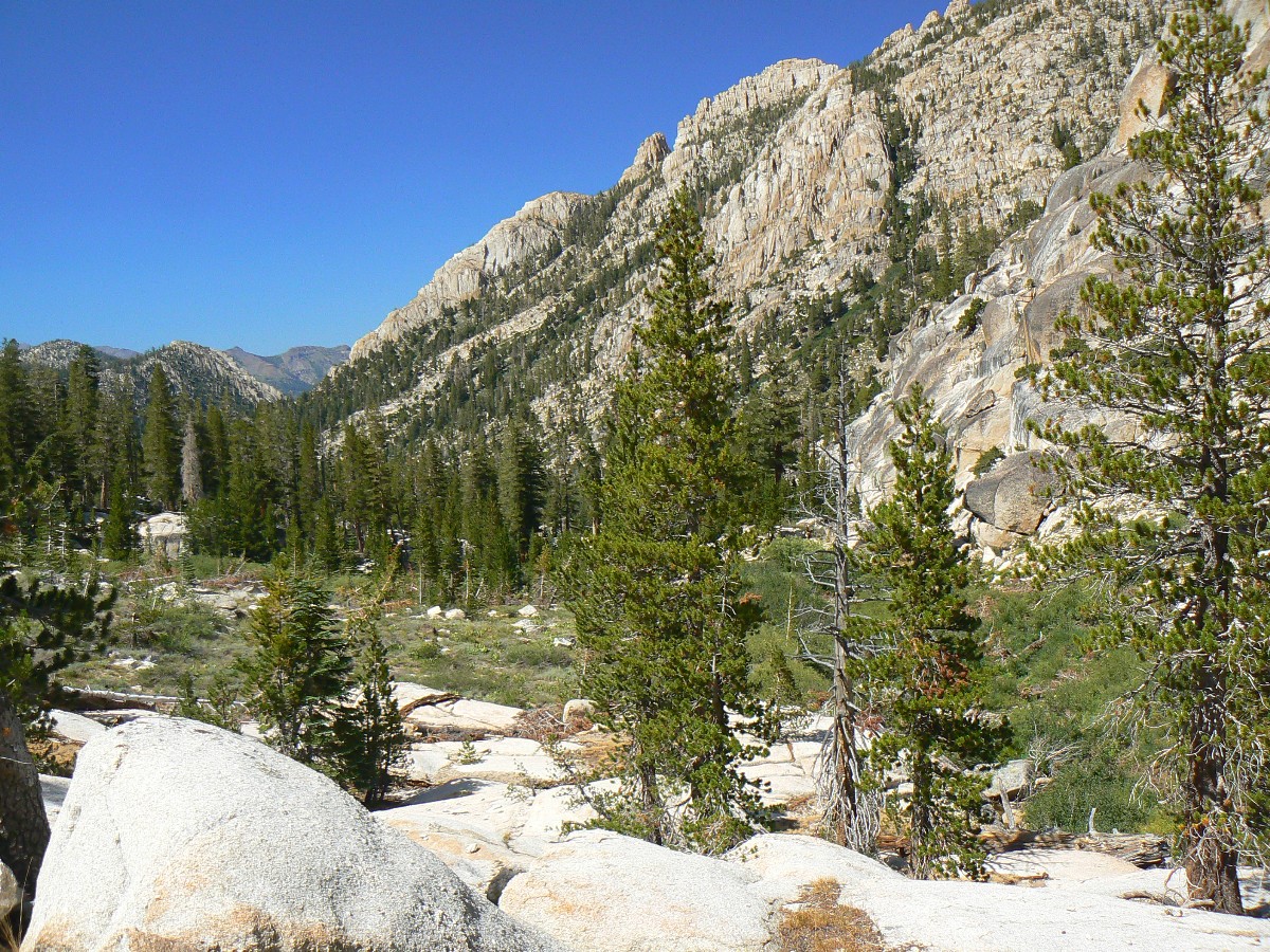
Day 10: Hoodoo Granite: To East Fork Carson:
Start California Section J of the PCT. 11.0 miles (PCT mile 1029.5); ERM = 20; camp at 8800'.
Still tasting an excellent John Ladd breakfast, we're climbing below and
above volcanic hoodoos, crossing streamlets adorned with a greater diversity of wildflowers than seen to
date. Five-foot Larkspur, Yellow Monkeyflowers, paintbrush, Arrowleaf Balsamroot, lupine, a crocus-type
purple guy, several unnamed composites, and more. It's a good climb to above Wolf Creek Lake, from where
we drop into granite and the E. Fk. Carson River. And enter the Carson-Iceberg Wilderness. Along the way,
we meet four lovely women gliding through the Wilderness and I get a photo of Jo, Zoe, and Alix as they tell
us about water availability and cows mucking up the wild country. It's a bit difficult to concentrate on
the maps with all that loveliness about.
Another stiff climb and we're at our destination, yet find tannin-colored
water that smells like old socks. A search improves the water some - yet we're too tired and it's too late
to hike the 3 miles to the next water, per the lovelies' report, and our newly-stuffed bear cans drag on our
progress. Our average mileage is more, about 11 per day, on this section to keep pace with John's
schedule - he needs to be at Echo Lake in 6 days.
The saffron light fades from the granite face and I'm still cleaning up
after dinner and writing these notes.
 |
 |
 |
 |
 |
 |
Day 11: Dinner Bell or Din of Bells? To Wolf Creek:
11.5 miles (PCT mile 1041); ERM = 20; camp at 8417.
The trampled meadow, furrowed with a muddy stream, surrounded by sage
(sign of overgrazing) rings with a din of bells. Cow bells. Horrid. Socialism of the worst kind, where
we pay for the destruction of our precious public lands through welfare ranching. What would happen if
ranchers were required to pay fair market value per AUM (animal unit month - set at about $1.60 per month
per cow and calf on public land, over ten times this on private land)? What would happen if hedge funders
had to pay their own bailouts? What about farm subsidies where corporations rape the treasury for unearned
cash? What about the unfounded tax exemptions lathered on big oil, where profits have been astronomical?
What about R-money paying far less than the tax rate for the common man? Truly uncommon. These repulsican
welfare artists would scream, that's what, and claim unfair actions. Really? Really.
The R-money/Ryan plan is to have the rich pay less than a 1% tax rate. Can you
say race to third-world status? Start chanting it now. For example - According to UNICEF, the United States
has an under-5 mortality rate of 8 per 1,000 live births, which makes the United States tied for
one-hundred-and-fifty-first in that category with Lithuania, Serbia, Slovakia, and the United Arab Emirates
(so much for the best health care in the world - unless you are an R-money), the three-yearly OECD Program
for International Student Assessment (PISA) report, which compares the knowledge and skills of 15-year-olds
in 70 countries around the world, ranked the United States 14th out of 34 OECD (Organization for Economic
Co-operation and Development) countries for reading skills, 17th for science and a below-average 25th for
mathematics (so much for American exceptionalism, lets privatize everything, (who needs libraries or public
health systems or public highways or those pesky inspectors from the CDC, EPA, FDA or USDA, etc.). This
way only the rich can access any chances for improving their lives. We're number one at racing to third
world status, NOW! Vote republican for a quick trip to the 13th century. Oh, but we'll continue to spend
more on the military than the next 26 countries, combined! War is the republican jobs plan.
We take the minimum old sock water as we set out today for water the babes
estimated at 3 miles distant. That's exactly where we find good water, 3 miles out from camp. Geology is
complicated today, with a volcanic dome erupting out of a bed of granite, and there are some columnar formations
in the dome. Wild. This is another worthless "gov-mnt" agency, the USGS, which, along with NOAA does nothing
for anyone (anyone rich, who have created wealth without using our roads, railways, airports, weather forecasts,
geological understanding, education, research base (NIH, CDC, USDA, NASA, etc.) or anything but their own
bootstraps - they have responsibility to no one, only responsibility to polish their own bootstraps, which
they will outsource to Mali) and lots for everyone else.
At about PCT mile 1036 we begin encountering the range maggots. Clouds build
and build above, followed by thunder, light rain, heavy rain, a sunny rain and clear skies. I hide under a
half-fallen red fir for most of the water works.
Now, after sunset, we're finally done with most chores and go to bed with
the musical din of bells, cow bells.
| ||||
 |
 |
 |
 |
 |
 |
 |
 |
 |
 |
 |
 |
 |
 |
 |
Day 12: Passing 100: To Eagle Creek:
14 miles (PCT mile 1055); ERM = 23; camp at 8520'.
I throw my pack in the mostly erect tent and shuffle in after it. Dave, Chris,
and I have made it to Eagle Creek, PCT mile 1055, and just as the storm that's been brewing all day pounces.
So, I'm writing these notes as the storm waxes and wanes.
It's been a long day, during which we three charge along, with several gorp
and foot breaks. John has other plans, and we're not sure where he will be tonight. Maybe we'll see him tomorrow?
Thankfully, the cows were peaceful and calm last night, and there was no din
of bells. We set off early, and the first bump is to uninspiring Wolf Creek Pass. Then, we climb out of
the Carson-Iceberg Wilderness to another, much higher pass near Tryon Peak. The swirling descent past Noble
Lake is dotted with volcanic hoodoos and ancient cinnamon-stick Incense Cedars. Lovely and picturesque.
Another climb takes us to Ebbetts Pass and soon, yikes, a big intrusion, Hwy 4.
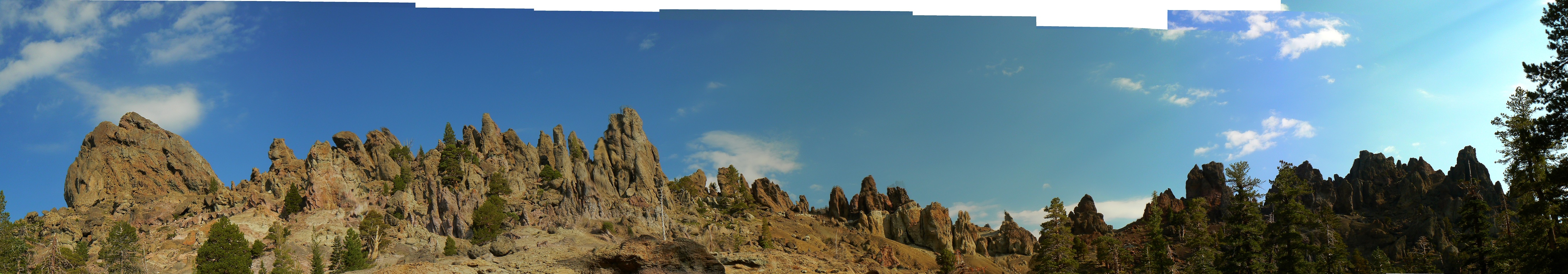
Beyond the highway, the path is wide for awhile, then reverts, narrower and narrower, as we leave deeply-jointed
granite climbing walls and a scatter of lakes and enter a land of unusual conglomerate spires made from angular
volcanic chunks. Along the way, we enter the Mokelumne Wilderness. And early today, we pass 100 miles (this
trip) on the PCT (starting mile marker at Tuolumne Meadows is about 942.5).
My feet are a bit sore, yet I'm feeling quite well, albeit a bit cool from the
prolonged rain storm.
Today, I met the two Judys - who tell me about water ahead and a Sierra Club
lodge near Donner Summit (Hwy 40). John strolls into camp at sunset, along with another drizzle. We share
this Eagle Creek camp with Shasta and Kathy and their two politely quiet dogs.
| ||||
 |
 |
 |
 |
 |
 |
 |
 |
 |
 |
 |
 |
Day 13: Magnificent Mangos - you can't fondle the Mango:
To Lily Pad Lake. 10.2 miles (PCT mile 1064.8); ERM = 17; camp at 7860'.
Kathy and Shasta give me two lovely, silky, orbs of delight. Magnificent mangos.
I'm soon thinking of a special golden-hair girl while fondling these luscious globes. Onward.
The early morning is a continuation of the black volcanic spires, with some views
enlisting 160 degrees. Toothy. Into big fir forest and back out to a low pass. A dawdling descent across an open
slope at mile 1060, where rain threatens and starts as we climb around a caldera-looking bowl to another low pass
and into the dark forest, where we hide from the heavy storms, which pass quickly. Soon, granite reappears and
we savor the prospect of lakes. Yikes, we cross two dirt roads near some tiny reservoirs before walking with
the sun to Lily Pad Lake. Yahoo, sun. Yet, the light has an orange tinge from smoke which floods the valley
to the North. Tiny bits of white ash appear on my tent. A forest fire somewhere, limiting photography.
A bath on a granite deck, leisurely dinner - accompanied by two gorgeous mangos,
a bit of clothes rinsing, and we make plans for an early and long day tomorrow.
Light fades as roving thunderheads grumble, yet thankfully stay away, and Lily
Pad Lk has a mirror surface. The air warms as storms quiet. Dave dips the water for tomorrow morning as Chris
writes notes and John heads farther along the trail. Red sky at night - we hope for tomorrow delight.
| ||||
 |
 |
 |
 |
 |
 |
 |
 |
 |
 |
 |
 |
 |
 |
 |
Day 14: Wet Nurse: To Carson Pass:
13.8 miles (PCT 1078.6); ERM = 22; camp at 8600'.
Argh - it's 10p. and I'm writing from the scenic, and more importantly, dry
Meiss TH toilet at Carson Pass. It's still drizzling some.
The morning starts well and we roll up out of the lake basin, across the Blue
Lakes Road and up the flank of The Nipple, two lovely mounds of geography and volcanic geology mimicking the
finest art form. Then, along the divide and into the trees to meet John. During this last lunch break, the
rain starts and gets harder and harder and harder, lasting 2 hours at high intensity. Hypothermia time. When
the rain lessens, we set out in a drizzle, climbing over Elephant Back and finally to Carson Pass. Bits of
the trail have washed out and the stream crossing prior to Elephant Back is truly exciting.
Under the eves of the FS info station, we cook dinner and have the first of
several discussions about what to do. John will go on. And the rest of us? Clouds continue, so Chris sleeps
under the eves, I'm in the scenic chalet, and Dave and John put up tents.
John later reports: I think the problem with the reports we got from the locals is that they assumed that we had gone through one of our normal brief August afternoon thundershowers, not the true drenching we got. They hadn't a clue what we had just been through. There was considerable trail erosion in localized areas on my return route. There was 1.36 inches of rain on Aug 14 at the nearest weather reporting station to us and a temp drop from 72 to 53 in 2 hours. That's a lot of rain. Total for all of the rest of August was only 0.24 inches and June and July had almost no rain at that station. Looks like some of the smoke we saw was caused by the Ramsey Fire, which started near Ebbetts Pass on Aug 11 and wasn't controlled until 10 says later.
 |
 |
 |
 |
 |
 |
Day 15: Early Exit: No More PCT - to Truckee, CA:
no miles.
It's a delightful blue sky morning at Carson Pass. John is packing to continue
to Echo Lake for the end of his segment hike. I'm advocating continuing to Echo. "Let's test out differing
projections about the weather pattern," I say. Dave is wavering, not wishing to endure more storms of yesterday's
magnitude, yet also not wishing to quit the trail. Chris wants to quit the PCT because more afternoon thunderstorms
are predicted. When a person refuses to participate in trip planning, there is little "buy-in" to the trip, and
quitting when one has 'no skin in the game' is easy.
A note to potential PCT and other hikers, if someone won't meaningfully engage
in the common adventure model (wherein each person contributes something of group value, actively doing things
to make the trip go well - see link) advise them to schedule their own solo hike or join an outfitted group
(commercial outfitter). An example is the Zion through-hike, where everyone who hiked was involved in trip
planning. Zig was unable to participate a great deal in trip planning (yet was involved enough to examine and
concur with the plans), yet took more than his share of responsibility to organize and complete the needed
shuttles, etc.
My friend, Ron Watters, summarizes the common adventure model:
"Every member of a common adventure group has responsibilities and contributes to the trip, whether
by helping with trip planning, buying food, loading vehicles or cleaning up after it's over.
No one goes for a free ride." (quote by permission from Ron Watters, Common Adventure:
A Brief Description, Definition, and Questions and Answers.)
Link to ----> Common Adventure: A Brief Description, Definition, and Questions and Answers, By Ron Watters
Part of this calamity is my own lack of mental preparedness for a solo hike.
Because of previous trip disappointments, I've somewhat reluctantly moved to solo equipment (no shared stove,
etc.), yet the remaining part is the mental one. Chip of the FS advises us to go toward Truckee rather than
Reno - more liberal people more likely to help hikers. I start trying to catch a group ride toward Truckee.
No success for 2+ hours. Just as I'm asking Dave for the last of his alcohol fuel to hike on (John won't
leave a resupply of fuel unless I catch him on the trail, and Echo does not sell this fuel), SD stops and
off we go on a 6-transfer misadventure to Truckee. Three hitch-hikes to Hwy 89, to 50, to 89, and three
public transports - the Tahoe Trolley and two TARTS, and we're at the Truckee Hotel.
Changing the Amtrak reservations is easy and at no cost, while changing
my plane reservation is very expensive and exemplifies how deregulation and private profit pale in comparison
to public systems. Reagan, bush, R-money were wrong and are bad for all but the very rich.
 |
 |
 |
 |
 |
 |
 |
 |
 |
 |
 |
 |
Epilog:
I'm lounging on the balcony of the Truckee Hotel, admiring the gorgeous
women who have obviously been riding bicycles rather than ATV/ORVs, have studied a diversity of trees rather
than a smart-ass phone, and I'm reviewing trail notes, and awaiting the California Zephyr (Amtrak). 136
miles on the PCT is a worthy accomplishment, despite the premature ending. It was planned as a Tuolumne
to Donner Pass hike, so what we hiked was a partial promenade. I hope to return to complete Section J
and many more.
Because of the time it took to get to the Tuolumne TH, and the wait for
a bit more reasonably-priced return to Arizona, I am gone from home for over three weeks, promenading the PCT.
Of course, there are many who deserve thanks for helping make this trip go
(as far as it did). Trail angels, all. They include (in chronological order): Dave Rumbellow for obtaining
the permit and constructing the hiking plan for the first section, and for his good trail cheer, John Ladd for
helping with the logistics (Sonora Pass resupply, fuel) and providing two terrific meals, Patricia Rumbellow
and Devin for hosting Dave and me in Newport Beach, Gordon Smith for hosting us in Fresno, George Whitmore for
transporting us to the Tuolumne TH, and Carrie Clark for getting us at the Smog Lake Amtrak station at 4a.m.
Thanks to all
As I'm reviewing these notes before starting constructing the WV web trip
report, the postmistress arrives, returning my resupply box from Echo Lake. In this box, I find a note
I wrote to myself, "Hi there - you made it! R." Well, I never expected to read this while sitting in
the house. Sad. Next time, I'll read a note just like this, sitting in the shade of a post office
(another terrific socialist idea) while eating the snacks sent down the line for resupply, in the midst
of a true PCT Promenade! Best wishes to all you explorers, promenading the PCT!
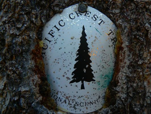
Click here or on the PCT trail marker to go to all WV reports about The PCT, JMT, Sierra hikes
| ||||
Click here to: see the First ascent of El Capitan, Argosy Magazine, 1959 (10 pages) 22 MB.
Marc Reisner (1993) Cadillac Desert: The American West and Its Disappearing Water, Revised Edition, Penguin Books
Common Adventure: A Brief Description, Definition, and Questions and Answers, By Ron Watters
Bill McKibben – suggested books include: Maybe One, Eaarth, The End of Nature
Pacific Crest Trail – Plan your hike site
Half-mile site: Pacific Crest Trail Maps and GPS Information - a terrific resource
Bear Boxes in the Sierra Nevada
Post Holer site - maps and resources for planning (PCT site)
Pacific Crest National Scenic Trail Website (FS, NPS, etc. site)
About the PCT - has info about equipment (semi-commercial site)
The waypoints with numbers, e.g., 0955, indicate PCT mileage from the Southern US border.
![]() Link for the Half-mile site: Pacific Crest Trail Maps and GPS Information - a terrific resource
Link for the Half-mile site: Pacific Crest Trail Maps and GPS Information - a terrific resource
Section I, Tuolumne to Sonora Pass (download zip files, then open in pdf or your mapping software)
![]() pdf file by Halfmile - maps for California section I of the PCT
(used with permission).
pdf file by Halfmile - maps for California section I of the PCT
(used with permission).
Section J, Sonora Pass to Echo Lake Resort (download zip files, then open in pdf or your mapping software)
![]() pdf file by Halfmile - maps for California section J of the PCT
(used with permission).
pdf file by Halfmile - maps for California section J of the PCT
(used with permission).
Section K, Echo Lake Resort to Donner Summit at I-80 (download zip files, then open in pdf or your mapping software)
![]() pdf file by Halfmile - maps for California section K of the PCT
(used with permission).
pdf file by Halfmile - maps for California section K of the PCT
(used with permission).
Click here to: see a Movie of Dave at three bridges - Day 1 - 1.7 MB.
Click here to: see a Movie of Tuolumne Falls - Day 1 - 1.7 MB.
Click here to: see a movie about Yosemite Glaciers (what's left of them).
movie about Yosemite Big Trees (again, what's left of them).
movie about Yosemite Wildflowers.
Panorama from above Sonora Pass (looking South) - Day 10 1.2mb
Pano from near Bull Canyon - Day 12 1.2mb
Pano of Mokelumne Wilderness volcanic spires - Day 13, 1.2mb
Pano of The Nipple - Day 14 712kb
Click here to see The Archman's site on Utah and area arches.
We Are Breeding Ourselves to Extinction (click here for full article) or at:
Breeding ourselves to extinction?
More Truth Than Joke:
| ||||
| ||||
| ||||
| ||||
| ||||
| ||||
| ||||
| ||||
| ||||
| ||||
|
Wild Vagabond Main |
Trip Report Index  |
Caveat  |
|---|