Teton Crestival Cruise 2016
Backpacking the Teton Crest Trail as a loop
And visiting:
Open Canyon, North Fork Granite, Death Canyon Shelf, Jedediah Smith Wilderness, Alaska Basin,
South Fork Cascade, Paintbrush Divide, Outlier Camp, Valley Trail, Bradley Lake, Death Canyon/White Grass TH
Total miles of 57.7; ERM = 103
August 22 to 28, 2016
Text and photos
© copyright by Rob Jones
 |
Co-participants: Jeremy Wright & Rob (Wild Vagabond)
Total Trail Miles –> 57.7
Total ERM = 103.
camera: Panasonic DMC-ZS19; Note - smoke from area fires made photography difficult

|
|---|
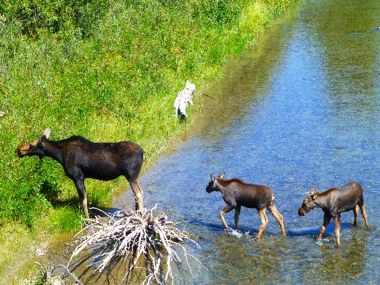
Moose along the Snake River, day 0
(Click the image for the full-size image)
|
|---|
|

|
|---|
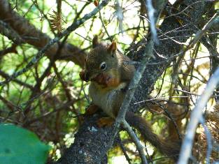
Pika, day 3
(Click the image for the full-size image)
|
|---|
|

|
|---|
Grand Tetons from the Moose Road, day 0
(Click the image for the full-size image)
|
|---|
|

|
|---|
Blue Grouse, day 2
(Click the image for the full-size image)
|
|---|
|

|
|---|
Melanistic (Black) Marmot, day 3
(Click the image for the full-size image)
|
|---|
|

|
|---|
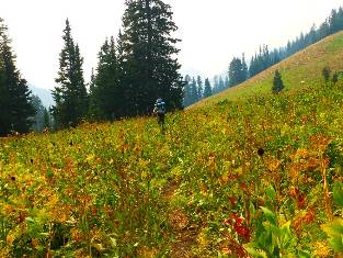
Jeremy hikes toward the Cathedral Group, near Spearhead Pk, day 4
(Click the image for the full-size image)
|
|---|
|

|
|---|
Solitude Lake, day 5
(Click the image for the full-size image)
|
|---|
|

|
|---|
Leigh Lake sunrise from Outlier Camp, day 6
(Click the image for the full-size image)
|
|---|
|
|
|---|
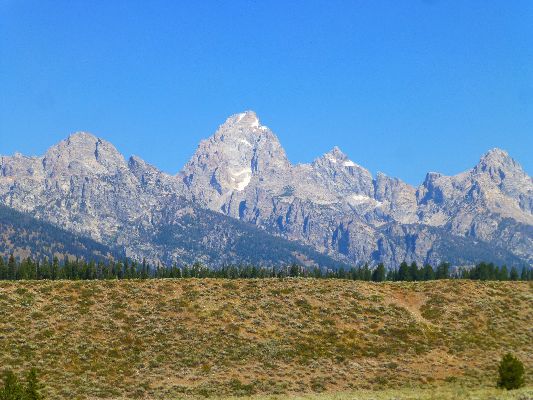
Movie - Day 0, Teton front from the Moose Road, 10mb
(Click the image to see the short video)
|
|---|
|
"Between every two pines is a doorway to a
new world". - John Muir
Author's note:
This report is about backpacking a loop up to and partially along
the Teton Crest Trail. Many now label this loop the Teton Crest. To clarify, the Teton Crest Trail
was described by Paul Petzoldt in "Teton Trails: A hiking guide to the Teton Range with stories,
history, and personal experiences," 1976. Petzoldt called it the High Adventure Trail, and it
travels along the crest from Teton Pass on the South to Lake of the Woods near the Reclamation Road
out of Flagg Ranch on the North. Long out of print, you can still find copies of Petzoldt's book via
the internet.
Yes, I've backpacked the entire Teton Crest, AKA High Adventure Trail, and
this was back in the 1980's with my good friend Stan S. It's a longer trek than the time allowed
this year. Maybe next year I'll again hike the Teton Crest. For now, I hope you enjoy this report
about the Teton Crestival Loop. WV
Prelim 1:
Drive a bit over 700 miles to the Swiss Mountain Motel in Thayne,
Wyoming. Argh. Dinner at Agave in Afton.
Again repack the pack.
Basic exhaustion.
Photos - Preliminary - Teton Crestival Cruise 2016
Prelim 2:
Miraculous morning. Moose Ponds near Jenny Lake:
5 miles. ERM = 6. Camp at 6400'.
We're up early and on the road to Grand Teton National Park, slithering
along the course of the Snake River into Jackson, WY.
Because of scheduling issues, our carefully crafted advance permit,
obtained in January, cannot be used.
We're at the backcountry office in Moose (inside the Park) 45 minutes
before it opens, and, what!? There's already a line of 30+ people waiting for permits. Our spirits plummet.
Amazingly, we get our permit, provided we wait a day to start.
Okay! We photograph the cow Moose browsing the willows along the banks of the Snake River with her twin
calves. Then, over to Dornans for a deli sandwich and gazing at the crystalline peaks while industrial
tourists ride flying decibel tin cans overhead, landing on an airstrip forced upon the Park by the selfish
chamber of commerce. Horrid. Yes, the chamber people and CEOs from all the major business chains that forced
this pustule upon the Park should be housed at the end of the runway. Here, they will enjoy the high decibel
sound of money. If something goes wrong with a flight, well what could go wrong?
Yet, the Tetons delight, appearing like they are a cardboard cutout,
pasted onto a robin egg blue background. Instant mountains. Formed of dramatic block faulting and
sculpted by glaciers, wind, water, freeze/thaw action. Gorgeous.
We go to Jenny Lake CG, and, continuing the miraculous morning, there are
sites available. Jenny Lake CG is woven among the moraines of glaciers that produced the U-shaped valleys
so characteristic of the Tetons. Just imagine a huge slab of ice, studded with rocks that serve as grinding
compound, sliding down Cascade Canyon, gouging out what will become Jenny Lake, then depositing the rocks
and such as the leading edge of the glacier melts, here in Jenny Lake CG. Amazing stuff.
After a partial setup of camp, we walk the Moose Ponds loop from the CG,
seeing a Bullwinkle and another cow Moose eating aquatic plants from the Moose Ponds.
Rounding out the loop toward the sagebrush flats, we encounter a very fresh
mound of berry-studded bear scat. Yowee! Living among the Bears, especially knowing that the Great Bear
(Grizzly; Ursus arctos) roams free here, makes one more observant and more alive. Of course, the most
likely Bear we might see is the Black Bear (Ursus americanus). Still, walking on the sound-muffling duff
of the Moose Pond loop through a dense coniferous forest heightens awareness.
As we roll across the sagebrush flats looping back toward camp, I muse about how
wonderful it is to be hiking the toothy Teton teeth with my good friend Jeremy.
It's a pleasant evening in Jenny Lake CG, and temps are mild.

|
|---|
pano of The Tetons - scroll L-R to view it all (4402 pixels wide)
(Image is very wide - scroll to view it all (4402 pixels wide) - Click
the image for the full-size image)
|
|---|
|
Photos - Preliminary 2 - Teton Crestival Cruise 2016
|
|---|
Movie 2 - Day 0, Mooses - in the Snake River, 3mb
(Click the image to see the short video)
|
|---|
|


|
|---|
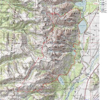
Map - Teton Crestival Loop, track is from my garmin, 1.3 mb
(Click the image to see the map)
|
|---|
|

 Right
Click (then save this file: "save link as..." in most browsers) on this Download link to get the GPX file from
my GPS - you can then open it in your mapping software. Note - that's a Right Click on this link.
You will get the track (not the map, only the track) for your software shown in the map above.
Naming the Tetons: Upon seeing the Teton Range from the West, French
trappers named the South, Middle, and Grand, Les Trois Tetons, meaning "the three breasts."
Naming Death Canyon: Death Canyon may have been named for a member
of the 1899 Bannon survey party who went into the canyon and never returned.
Day 1: Ruffed Up to Open Canyon. To lower end of Open Canyon camp zone:
4.5 miles. ERM = 9. Camp @ 7660'.
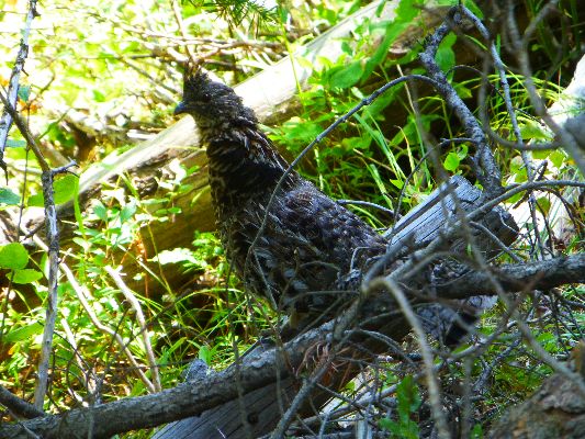
The Ruffed Grouse cackles, purrs, and ruffs and fluffs his neck feathers,
appearing larger than life.
We're walking the top of a moraine high above Phelps Lake, circling into Open
Canyon after climbing up to Phelps Lake overlook from the Death Canyon/White Grass TH. Then, what? downhill
on lazy switchbacks to near Phelps Lake before climbing into the maw of Open Canyon. Clear crisp water tumbles
off the side hills, where we desert dwellers pause in wonder, then wonder if we need more water, more? And,
deciding not to add weight to the porculant behemoths, we filter and drink some, leaving the remainder to find
its way to the sea.
Yes, Jeremy and my packs are like over 60% of the American public, overweight.
Our partners are burgeoning with Bear can, extra tarp, full rain gear, an assortment of warmer clothes, and
the typical hiking paraphernalia. Argh.
The day starts with more pleasant temps at Jenny Lake. We are besieged by CG
crawlers looking for a camp, and it's not yet 8 a.m. Over to the Death Canyon TH we trundle, bouncing the
rock-lined drainage road to near the Ranger Station and the start of the hike. One more repack of the pack,
a final visit to the scenic toilet, and we're hiking.
Back at Open Canyon camp, we cook over the knoll from camp and leave the
stuffed Bear cans there, stuffed with bug spray, deodorant, sun screen, toothpaste, etc. in addition to 7
days of food. It's a good place for the Bears to play soccer with the Bear cans, while we rest.
It's about 8 p.m. and I'm fading fast. Goodnight from Open Canyon camp
along the Teton Crestival Cruise loop.
|
|---|
Movie 3 - Day 1, Ruffed Grouse, 6mb
(Click the image to see the short video)
|
|---|
|
Photos - Day 1 - Teton Crestival Cruise 2016
Day 2: Midnight Marmot. To North Fork Granite:
7.1 miles. ERM = 16. Camp @ 8420'.
Jeremy yelps and I wake up all the way. I'd been slowly awakening to
the sound of something rhythmical, perhaps a crunching noise or a scratching, gnawing? "This giant rodent
is chewing my boots. Must be a Marmot, get away!" yells Jeremy. Midnight marmot.
Apparently searching for salt, the marmot chews up the top cuff of one of
Jeremy's boots. Despite being thumped on the nose, the marmot again tries sneaking back under the rainfly
of Jeremy's tent to get a tasty boot.
The orange light of morning paints bald granite teeth, preliminaries to the
crystalline teeth of the Cathedral Group, formed by dramatic block faulting. There are small wild fires in
the North segment of the Park, and smoke is occasionally swirling into the canyons. This smoke lowers the
quality of the photographs you see in this report.
Jeremy is cooking bacon, bean, and cheese breakfast burritos, hoping to draw
in the Bears from the neighboring canyons to our cook spot situated around the knoll from the tents. No
Bears show, but I do see old Bear scat nearby.
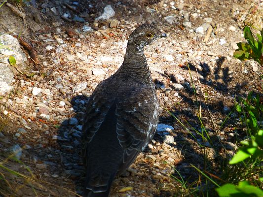
The trail (Blue) Grouse skitters along in bursts, nodding at times and
peering carefully at the strange creature with the pack rising above his head.
Jeremy stops when I remark on the campsite above us in a cove of pines.
Then, he points out that the campsite is currently occupied, in this case by a hefty Moose who is poking
her nose between pines for a better view, while continuing to lie down. I would have walked up to investigate
this camp if not for the warning. Now, that would have been a Moosely surprise.
Up to Mt Hunt Divide we plod, to 9710', where the wind is screaming and cold.
Dropping into the Granite drainage, it's a long way to water. The smoke
thickens and the views turn orange. Perhaps those fires are no longer small?
We've been walking among limestone today, which lessens when we get to the
junction with North Fork Granite Canyon. The sign announces it's 11.4 miles to the White Grass TH.
As we search for a campsite in the busy Upper Granite zone, we encounter
Moose #8 lounging in what could be a camp. We're reluctant to ask her about it.
After finding camp, we wash partially, using the bucket, then turn our
attention to dinner. While cooking bean burritos and scrambled eggs, bits of white ash float onto the
dinner cloth, apparently from a perhaps not too distant wild fire. Maybe a new, closer, fire has started?
It's feeling like the coldest evening so far. I'm going to bed to warm up the toes.
|
|---|
Movie 4 - Day 2, Blue Grouse, 5mb
(Click the image to see the short video)
|
|---|
|
Photos - Day 2 - Teton Crestival Cruise 2016
Day 3: Orange Sun. To Death Canyon Shelf:
5.2 miles. ERM = 9.5. Camp @ 9466'.
Jeremy's shorts stand up by themselves on a downed fir tree. Frozen.
It's a morning of a steaming pile, literally. The orange light begins filtering through the firs as
we eat breakfast wearing all the clothing we have and cuddling cups of cocoa.
After a preliminary packing up, I move into the orange sunlight streamside
to the North Fork Granite Creek to warm the ancient bones. Crisp, clear, very cold water flows over
and through glacially rounded granite mini boulders alongside a buffy forb hillside, the forbs of Sticky
Geranium, Cow Parsnip, Lupine, Paintbrush; grasses too. A doe deer makes her way through this alpine
meadow; buffy deer, buffy meadow. Gorgeous.
Marion Lake glows turquoise in the small cirque, bounded by sedimentary
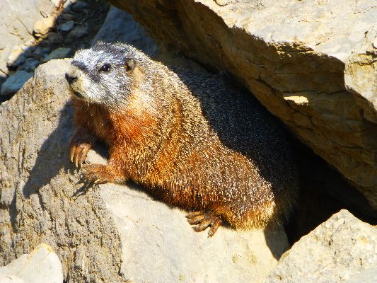
mountains. Black (Melanistic) Marmots and a distant Pika harvest grasses in the meadow. We stalk these
creatures for awhile, attempting photography. A bit more uphill and we're on the open limestone plain
of Spearhead Peak, in the Jedediah Smith Wilderness, and outside the Park until Fox Creek Pass and the
Death Canyon Shelf. A deluxe location for lunch, but for the smoke obscuring the toothy Cathedral Group.
Over Fox Creek Pass. Onto the Shelf. Back into the Park. Pika and
Yellow Belly Marmot rove amidst the limestone boulders. The cheerful looking Pika "eee-eeeks" at our
intrusion.
Finding decent water coursing across the Shelf, we consider heading for
the North end of the zone, as we had planned. Yet, seeing the campsite at the edge of the Shelf, almost
hanging in space, we opt to stay here.
A cold wind joins in for bath time, precious little bath - lots of cold,
and also for dinner. I have on 5 layers on the top and 3 on the bottom, and still the chill drives through
to the core. Shelf camping at 9500'.
The cozy bag is appealing, and bedtime is advanced to 8 p.m.
|
|---|
Movie 5 - Day 3 Yellow-belly Marmot, 5mb
(Click the image to see the short video)
|
|---|
|
Photos - Day 3 - Teton Crestival Cruise 2016
Day 4: Graupel and Hurricane. To South Fork Cascade Canyon:
11 miles. ERM = 19.5. Camp @ 8975'.
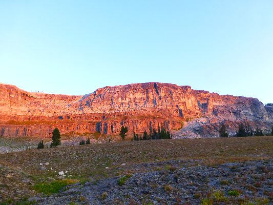
The light strikes the granite teeth askew, and colors the limestone cliffs
behind us on the Death Canyon Shelf. We lilt along, climb some to Mt. Meeks Pass and enter the Jedediah
Smith Wilderness. Late season flowers mark the way down the Sheep Steps into Alaska Basin, where the naked
granite is polished as smooth as your girlfriend's thigh. Lovely. The trail takes us on a tour of Alaska
Basin, then sprints up to Sunset Lake before the long haul up open slopes to Hurricane Pass (10,400').
We're back in limestone for this climb. North and South along the Teton Crest from the central Cathedral
Group of granite lie mountains of horizontally bedded sedimentary rock. The Cathedral Group is the section
that is block faulted upward, seeking the sky.
Clouds gather and form overhead as we inch to the pass. It's cold on top,
and there's a bit of graupel slicing past in the Arctic wind.
Ours is a very brief pause at the pass, and after adding several layers of
clothing, we launch into the South Fork Cascade, re-entering the Park. Soon, what's left of the
Schoolroom Glacier appears, it's bulk and namesake form ravaged by overpopulation and global warming (can
you say exponential population growth?!). Down near the first glacial tarns we finally stop for lunch, not
wanting to eat more than a snack in the Basin, wanting to get over Hurricane Pass before possible
thunderstorms, and not wanting to hike uphill on a full stomach.
The clouds spit a bit, then the sky calms as we loose elevation in the South Fork.
Cascading it is, frigid snowmelt bounces and burbles over rock shelfs,
seeking lower climes. Finding a fairly sheltering camp some distance below the group camp, we set about
camp chores. Twin deer from last year prowl the camp, their camp, and investigate Jeremy's satellite
texting unit and nibble holes in my handkerchief. As Jeremy is partaking in a bucket bath, the cold wind
returns and it takes external heat in the form of a hot water bottle to restore him enough to finish eating.
We can see our breath condensing as Bear cans are stashed and packs are hung.
|
|---|
Movie 6 - Day 4 from the Death Canyon Shelf, 9mb
(Click the image to see the short video)
|
|---|
|
Photos - Day 4 - Teton Crestival Cruise 2016

|
|---|
pano2 of The Tetons from Hurricane Pass, Day 4 - scroll L-R to view it all (4031 pixels wide)
(Image is very wide - scroll to view it all (4031 pixels wide) - Click
the image for the full-size image)
|
|---|
|
Day 5: Berry Good. To Outlier Camp, over Paintbrush Divide (10,700'):
11.1 miles. ERM = 23. Camp @ 8500'.
Huckleberry alert! We encounter huckleberries, wild raspberries, currants,
and thimble berries on the long drop to the intersection of the North and South Forks Cascade. These
succulent orbs entice and allure. It's difficult to keep going through this smorgasbord. The Pika Hotel
is also on this stretch, with several Pika busy gathering flowers and forbs for their Winter haystacks.
Pikas do not hibernate, and live off their haystacks, often covered by snow, all Winter.
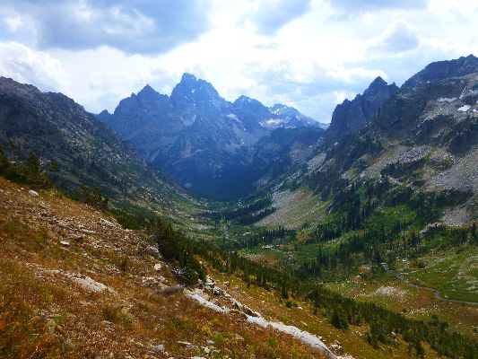
Just below 8,000', the trail starts up the North Fork of Cascade Canyon.
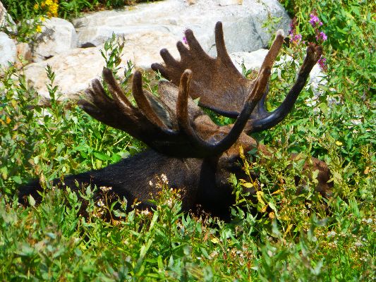
Up again we hike, on a stairway to heaven of granite slabs cut into steps. Two Bullwinkles are lounging
in the tall flowers not far below Solitude Lake (9022'). These sleek monsters ignore our climbing about on
boulders attempting to find a better vantage point discretely distant from their palmate headdresses.
The first of a series of threatening storm squalls sweeps upon us as we eat
lunch at Solitude Lake, an erratic (left here by the glaciers) Granite boulder serving as a backrest and
windbreak. Cold air spirals down from the cumulonimbus above. Burr. More clothing layers are added,
including the ever important wind shell.
Now, it's the long slog to Paintbrush Divide (10,700') on a well-graded trail,
accompanied by more squalls. Finally at the Divide, a few pellets of snow cruise past on the frigid gale.
Hurrying, we launch into Paintbrush Canyon on a scree slope trail. The pulsing storms threaten all afternoon,
yet produce only cold wind (thankfully).
Now, it's down, down to fresh water for lunch #2 on the tundra, and to remove
some of the clothing required at the Divide.
Before long, the Holly Lake junction arrives. However, it's a long series of
switchbacks before we find Outlier Camp. A bat, zipping skillfully among the firs, visits us as we cook
dinner in the crepuscular light.
|
|---|
Movie 7 - Day 5, Bullwinkles in upper N Fk Cascade, 10mb
(Click the image to see the short video)
|
|---|
|
Photos - Day 5 - Teton Crestival Cruise 2016
|
|---|
Movie 8 - Day 5, upper North Fork Cascade, 15mb
(Click the image to see the short video)
|
|---|
|
Day 6: Striding the Front Range. To Bradley Lake:
12.5 miles. ERM = 18. Camp @ 7025'.
The Service Berry (pronounces "sarvis" in the Intermountain West)
is the last of the typical Teton delectables Jeremy samples, and this along the edge of Jenny Lake.
Its pithy texture is offset by its sweet taste. This last orb of delight is enjoyed after the roll
down the remainder of Paintbrush Canyon.
Beginning to encounter throngs of day hikers is a bit of a jolt,
particularly the sight of a young woman making some unknown statement clad in shiny mirrored silver
leggings. Baked potato butt? Hot potato pants? We strive to properly categorize this vision, laughing
at our feeble efforts. Arriving at the boat dock area, the crowd increases as people disembark on the
lake landing to visit Hidden Falls and Inspiration Point, many apparently arriving by concession boat,
another type of industrial tourism. Around the SW end of Jenny, we leave almost everyone as we join the
Moose Ponds loop, taking it to the short road walk to the Lupine Meadow TH. Then, we drag significantly
uphill getting into position to roll back down to Bradley Lake. This is a lovely camp, at lake edge and
affording a view of what may be Mt. Wister and Veiled Peak across the lake. It's warm enough for a dip
in the lake, albeit a brief dip.
Photos - Day 6 - Teton Crestival Cruise 2016
Day 7: Circling the Crestival, the Sylvan Glide. To Death
Canyon/White Grass TH:
6.3 miles. ERM = 8. Camp - in a bed. Total miles of 57.7; ERM = 103.
The serrated conical form of Mt. Wister glows salmon in the morning
opening light, reflecting on the breast smooth Bradley Lake surface. Gorgeous.
Starting out, we immediately arrive at the ford of the Bradley Lake
outlet, where the old bridge has been removed (after it fell apart). It's a cold crotch-deep wade
early in the morning. Invigorating. Kudos to Congress and the stingy self-centered public for
inadequately funding public lands agencies, causing huge, YUGE (trumpish level) maintenance and program
backlogs. It's long been clear that the goal of the gop is to defund public agencies, causing public
frustration, then privatize the land or medicare or whatever, then extract money and charge fees only
the rich can afford. And, of course, eliminate the public from once public land - this and is too good
for them.
After passing Taggart Lake, we climb briefly out of the Beaver Creek
drainage and onto the sylvan glide. We don't encounter anyone until we reach the TH. Gliding mostly
on the contour through fir, pine, and Aspen forest, we complete the circle of Crestival in good spirits,
seeing only two mosquitoes all week.
Photos - Day 7 - Teton Crestival Cruise 2016
Epilogue:
Off to a chili verde burrito and to sleep in Evanston. The only sad
note to the Crestival is the arrival of Don Pedro's revenge, or possibly a dose of giardia or the
flu - yet where is the exposure? My gut is rebelling and causing a general downgrade in mood, post hike.
The next day is a day of driving and driving, skirting the parking
lot along the West slope of the Wasatch Front (Utah is the 7th most urban state because a large
percentage of the propagators live along this front), back to the Colorado Plateau, hampered by
the revenge, yet heartened by remembrances of the Teton Crestival Cruise.
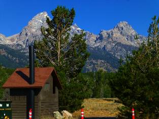
Photos - Scenic Toilets of the Teton Crestival Cruise 2016
.
|
|---|
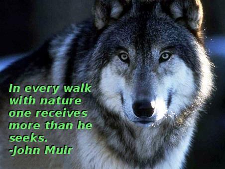
Sage words by Muir
(Click the image for the full-size image)
|
|---|
|
.

*ERM: Energy Required Miles, are there data to support this
mileage adjustment?
Journal of Outdoor Recreation, Education and Leadership
Petzoldt first proposed his theory in his 1976 book “Teton Trails” to
help backpackers plan trips and calculate their energy needs on mountain trails. “Petzoldt defined one
energy mile as the energy required to walk one mile on the flat. He recommended adding two energy miles
for every 1,000 feet of elevation gain, so a person hiking one mile and 1,000 feet upward would use the
equivalent of three energy miles,” Phipps said.
Petzoldt’s energy mile theory was just a reflection of the mountaineer’s
“gut feeling,” Phipps said. The theory had never been tested in a laboratory before the study began in WCU’s
Exercise Physiology Laboratory in the spring of 2010, Phipps said.
To determine the validity of the theory, the study measured the energy cost
and perceived exertion for walking on flat ground, with and without a 44.5-pound backpack, and up an elevation
gain of 1,000 feet, with and without the backpack, through the collection of metabolic data, Phipps said.
Twenty-four student, faculty and staff volunteers, including 12 males and 12
females, went through four testing sessions as the research continued into fall semester of 2010. The study
results showed that the additional energy cost for ascending 1,000 feet ranged from 1.34 to 2.02 energy mile
equivalents, for an average of about 1.6 miles, compared to Petzoldt’s use of two energy miles for each 1,000
feet. The range revealed by the study was due to the “hikers” personal weight differences, Phipps said.
“It is remarkable that Petzoldt’s energy mile theory is so close to the actual energy cost measured during our
study,” Phipps said. “In the field of outdoor education, it’s important for leaders to include an estimation
of energy requirements during the planning of hiking trips.”
Phipps said the energy required for hiking up steep mountain trails would vary
for individuals and groups, and the variables of the trail would also factor in, but he recommends that
backpackers stick with Petzoldt’s idea of adding two energy miles for every 1,000 feet of elevation gain when
planning trips.
The Validity of Petzoldt's Energy Mile Theory, 2010
Authors: Maridy McNeff Troy, Maurice L. Phipps
Publication: Journal of Outdoor Recreation, Education, and Leadership

Links and books:
Petzoldt, Paul; 1976; Teton Trails: A hiking guide to the Teton Range with stories,
history, and personal experiences. (Long out of print, but used copies can be found.)
How to use alum to clarify water prior to treating it.
Bill McKibben – suggested books include: Maybe One, Eaarth, The End of Nature
Maps:


|
|---|
Map - Teton Crestival Loop, track is from my garmin, 1.3 mb
(Click the image to see the map)
|
|---|
|

 Right
Click (then save this file: "save link as..." in most browsers) on this Download link to get the GPX file from
my GPS - you can then open it in your mapping software. Note - that's a Right Click on this link.
You will get the track (not the map, only the track) for your software shown in the map above.
Reports about bits of the Teton area:
Jackson Junket: Teton Touron or Continental Breakfast?
Jackson Loop Bicycle Tour:
Jackson to Colter Bay, to Grants Village, to West Yellowstone, to Ashton, to Victor, over Teton Pass to Jackson;
278 total miles;
June 23 - 28, 2014
Teton Crestival 2006!, Almost:
Or, Kundalini* Teton Loop:
String Lake to Holly Lake to Paintbrush Divide
to Solitude Lake to North Fork Cascade, and a premature out;
August 6 - 8, 2006
Teton Roundabout & Yellowstone Bicycle Loop:
Bicycling The Big Burn (270 miles in 4˝ days); August 12-16, 1989
Border Bop: Bicycling South to North Across The U.S.:
Nogales, Mexico to Carway, Canada; and back to Idaho; 2546 miles in 38 day; June 12 to July 19, 1985
(Route goes through Teton area.)
Related Sites:
Scenic Toilets of Inner Earth:
Scenic Scatology of the Wilderness Vagabond
We Are Breeding Ourselves to Extinction (click here for full article, pdf)
More Truth Than Joke:

|
|---|
in science we trust
(Click the image for the full-size image)
|
|---|
|

|
|---|
privatize public lands
(Click the image for the full-size image)
|
|---|
|

|
|---|
separation: church-state
(Click the image for the full-size image)
|
|---|
|
|
|---|
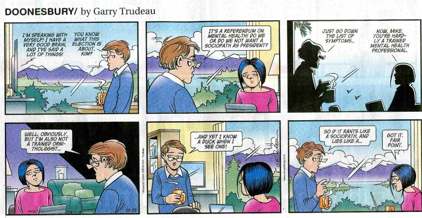
elect a sociopath
(Click the image for the answer)
|
|---|
|

|
|---|
gop health care plan
(Click the image for the full-size image)
|
|---|
|

|
|---|
death of democracy
(Click the image for the full-size image)
|
|---|
|
"What luck for the rulers that
men do not think". - Adolph Hitler

|
|---|
more precious than money
(Click the image for the full-size image)
|
|---|
|


