North Bass Nirvana:
- Backpacking the North Bass Trail / Wondrous William Wallace Bass / Harvey Butchart Natural Bridge
/ Shinumo Creek / Tapeats Narrows of White Creek / Redwall Canyon to start of Burro Route
September 27 to October 4, 2012
Text
© copyright by Rob Jones and Photos © copyright by Rob
|
 |

|
|---|
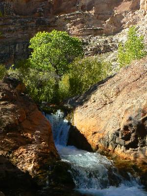
Sunny Canyon disposition - Day 7
(Click the image for the full-size image)
|
|---|
|

|
|---|
Redwall Canyon chockstone - Day 4
(Click the image for the full-size image)
|
|---|
|

|
|---|
Glowing Aspens on Kaibab NF - drive in
(Click the image for the full-size image)
|
|---|
|
|
|---|
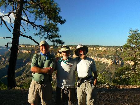
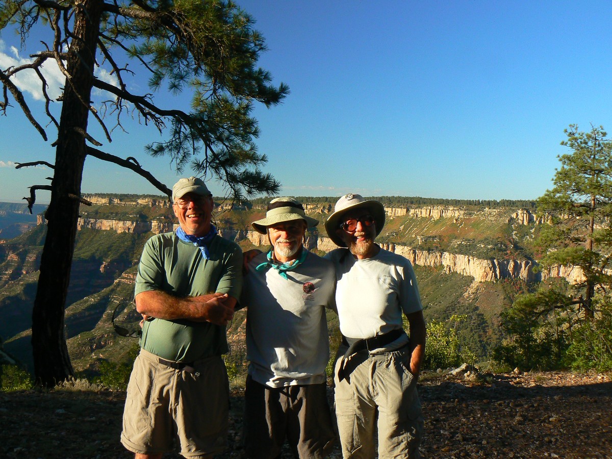
Steve, Zig, Rob - NB in back
(Click the image for the full-size image)
|
|---|
|

|
|---|
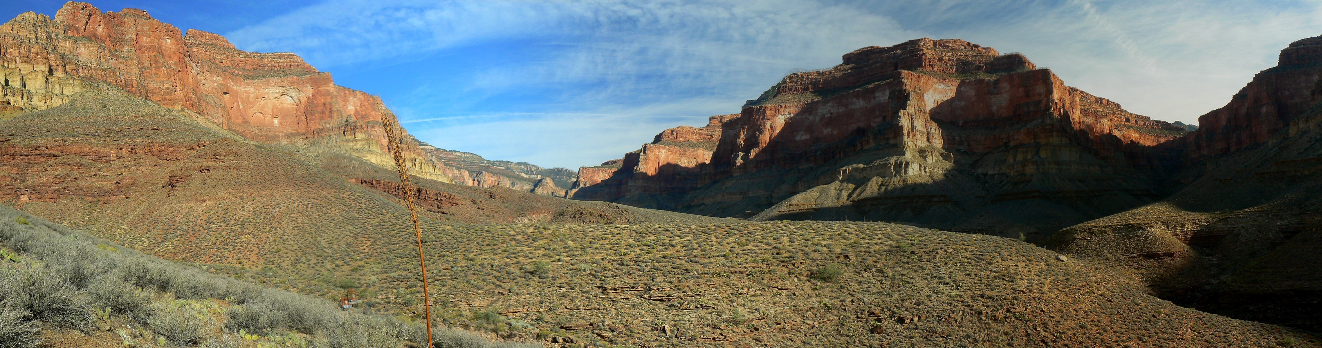
pano from Tonto bypass, Day 6 - scroll L-R to view it
all (4555 x 1200 pixels, 1.7mb)
(Click the image for the full-size image)
|
|---|
|
(There are - photos embedded in the trip narrative.)
Co-Adventurers: Zig Sondelski and Steve Cash
Nirvana An ancient Sanskrit term used in Indian religions to describe the profound peace of mind
that is acquired with liberation.
Also - Nirvana was an American rock band that was formed by singer/guitarist Kurt
Cobain and bassist Krist Novoselic in Aberdeen, Washington in 1987.
ERM - Energy Required Miles. A mile is added for every 500' elevation gain or loss.
It's a very serviceable method of estimating energy required miles.
Total trip - (per my GPS) of 37.7 miles and total ERM = 75.8.
Movies: You may wish to begin downloading the movies as you peruse the report - this way, they will pop up
to view (and you won't be waiting). The movies in the below list are also seen interspersed in the text. The movies are:
Click here to: see a Movie of the obstacle falls in Shinumo - 2mb.
Click here to: see a Movie of Shinumo Cr - 1.4mb.
Maps:


|
|---|
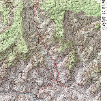
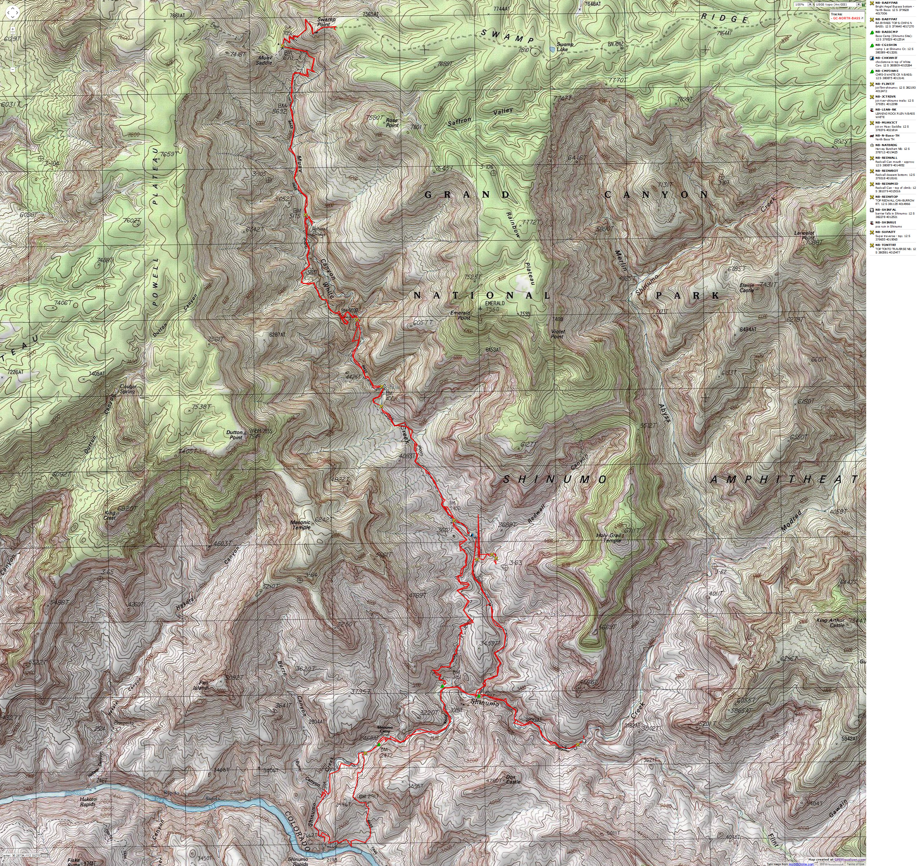
Map - GC: North Bass; 2012; 38 miles
(Click the image to see the map)
|
|---|
|
for a full-resolution map, click here. Caution - do not use this map or gps track for
navigating the route.
|
|---|
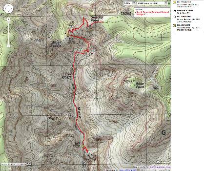
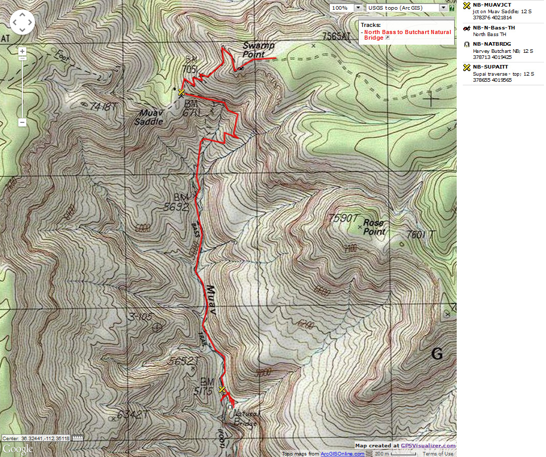
Map - GC: North Bass to Harvey Butchart Natural Bridge
(Click the image to see the map)
|
|---|
|
Summary: Three of us hiked from Swamp Point
(North Bass, NB, TH) to The River, then the Tapeats Narrows of White Creek, up Shinumo Creek
to the obstacle falls, and to the huge Harvey Butchart Natural Bridge. It's a country in
search of a trail, albeit the NPS and volunteers greatly improved sections of the existing or
historic trail about 6 years ago. Be prepared for slow going, this may be the most difficult
'trail' in the Grand Canyon.
Prologue Because of the understandable
desire of hikers to explore the NB (North Bass) during the Fall, and the limited number
of permits available, I've been unsuccessfully trying to get a NB venue for the past four
years. In the Spring, there is snow on the road or the road is impassable, cluttered with
down trees. By the time the road is cleared, it's too hot in The Canyon, making Spring a
less-preferred time to hike the NB. Fall hiking is also with issues, because, as noted,
most hikers want to hike in the Fall, and permits are limited, and an early snow storm can
ruin your day. Beware, wind and early snow can close the Swamp Ridge Road at any time.
The day has finally arrived as I rendezvous with Zig near
the North Kaibab Lodge, then together we bump the forest and park roads to Swamp Ridge and
finally to Swamp Point, where we meet Steve, who blazed up FR 22 from near Fredonia, AZ.
Today, September 27th, we have a permit to car camp at Swamp Point, and do so - enjoying
the vast views, which are abutted on the West by the imposing and glorious Powell Plateau.
Steve has brought some of that excellent California wine, and it lubricates our chat about
trips enjoyed and those that floundered. Steve is part of the "Cashorama" team of Dave and
Steve Cash - who provided resupply in that critical Southern portion of the John Muir trail
(see the
2010 JMT Jaunty Juggernaut report here and in the links section.)
Mini History - W.W. Bass: William Wallace Bass,
according to
Bob Ribokas: "William Wallace
Bass came to the Grand Canyon in 1884 for health reasons. He spent more than forty years
living at the Canyon and during that time did some prospecting, got married and became the
first person of European descent to raise a family at the Canyon. He is credited with
building a road from Ash Fork, Arizona to his camp, Bass Camp, on the south rim, a distance
of some 70 miles. He is a also responsible for the construction of both the North Bass and
South Bass trails, which he used to guide tourists into the Canyon and over to the north rim.
The trail was also used to haul asbestos out from his mine and to tend his garden near
Shinumo Creek.
The Bass Formation is named after William Wallace Bass."
See a Book partly about and by W.W. Bass: Adventures in the Canyons of the Colorado (1920)
North Bass photos - Day 1
Day 1: Shinumo Slog: TH to Shinumo Creek.
GPS miles 10.5; NPS miles 8.3. ERM = 20. Camp at 2800'.
The nearly full moon climbs above the clouds hanging in the
Shinumo gorge and the light washes over our camp alongside rushing, roiling Shinumo Creek.
Zig and I make it to the camp just before sunlight fades. Steve decides to stay on the
slickrock just before (upper, North end) the Tonto bypass goes above the Tapeats narrows of
White Creek. I give Steve most of my meager water and roll onto the bypass, which is like
a superhighway after the tedious boulder-hopping and brush-beating (we're getting the beating,
not the brush) over the 3+ miles of slow going.
At the start of the day - We start down the reworked trail
from the TH to the Muav Saddle and pause to visit Teddy's Cabin. Built as a patrol cabin (Teddy
did not sleep in it, but reportedly did sleep on the general site). Then down past flowing
Queen Anne Spring (Muav Spring) and down and down. Then, down brush-filled White Creek to a
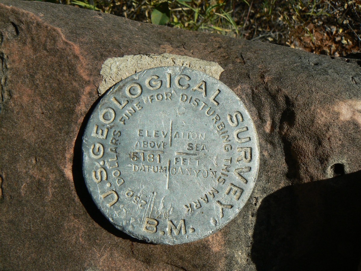
pour-off in the top of the Redwall Limestone (near BM 5175 marked on the King Arthur Castle
USGS quad; this is marked 5181 on the actual BM monument). This is the start of the Supai
Traverse, and affords most excellent views of the native grey to steely-blue color of the
Redwall in the narrows developing below (blushed a brilliant red by a patina of iron oxides
from the overriding Supai Formation). We hike up along the Redwall rim on a descent path and
then begin the slide of the Redwall descent. Argh.
Now, we're again in the creek bed, where we find an "N. J. Walker"
inscription and hand point to The River. Perhaps N.J. is related to W.W. Hawkins from the Powell
expedition? Continuing on, we encounter another pour-off/falls, this time in the Bright Angel
Shale, which is again passed on the right (West) before we return to White Creek from more dancing
with boulders. The struggle continues to the Tonto bypass, which like all good Tonto sections,
is atop the Tapeats SS.
Today, we find water at Queen Anne Spring, above and below the
Redwall descent - yet nothing from here to Shinumo. Groggy, tired muscles and feet, lots of small
scratches everywhere, it's time for bed.
The mnemonic goes like this (read down, use first letter of starting word as
a reminder - from the rim, down; with mixed layers near The River that do not follow this convention):
Know - Kaibab Limestone
The - Toroweap Formation
Canyon's - Coconino SS
History - Hermit Shale
Study - Supai Group (including the Esplanade)
Rocks - Redwall Limestone
Made - Mauv Limestone
By - Bright Angel Shale
Time - Tapeats SS
Know The Canyon's History, Study Rocks Made By Time.

|
|---|
|
Income gains at the top income dwarf gains in all other brackets
|
|---|
|
|
|---|
Movie of the obstacle falls in Shinumo Day 5 - 2mb
(Click the image to see the short video - 6mb)
|
|---|
|
North Bass photos - Day 2
Day 2: Bass-a-matic: To Bass (Shinumo) Camp :
1.3 GPS; 1.4 NPS, little elevation change.
1.3 GPS; 1.4 NPS, little elevation change.
I'm lounging native in the streamside willows and cottonwoods, occasionally
dipping or submerging in the burbling Shinumo Creek. Nirvana.
Zig, Steve, and I explore the relics of the new Bass Camp (about 100 yards
above the actual camp, which is marked as "Shinumo Camp - site" on the USGS quad) and find a USGS monument
and a couple of inscriptions, enjoy a shady lunch and a chat with Jane and Elizabeth, wandering rafters
camped at N Bass Beach, before the glaring sun prompts us to move creekside. It's a very warm day.
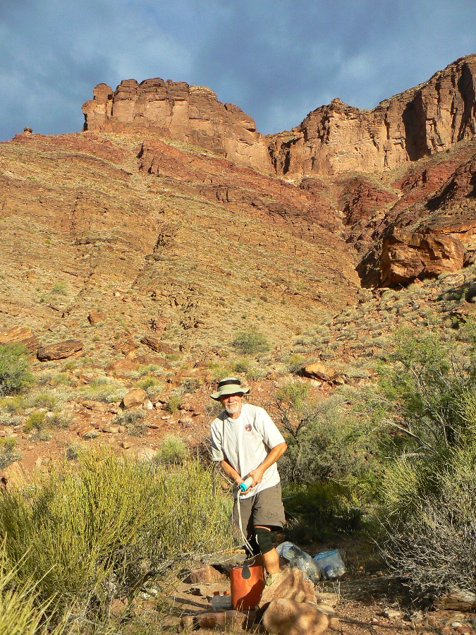
At the start of the day, Zig and I wake to a refreshingly cool morning
after a weltering start to the evening's nap. Starting to filter water, Zig's filter quits. Probably
a blocked check valve? - which we puzzle over until Steve appears on the Dox SS skyline. Harrah.
The sun hits us and we head downstream in Shinumo, donning water shoes
for the 7 crossings to Bass Camp.
Late afternoon - Lazily, the sunlight rotates. Another dip, another
daydream, and we consider hiking a loop to The River and reject it - thinking about the likelihood of
baking hot basement rocks roasting us like a convection oven or like pseudo religionists (that is,
republicans) who refuse to help the poor, the sick, any others - roasting and toasting in hell. You
know that part of the bible, like 700 instances or so, where helping others is commanded? As opposed
to the 7 or so times same sex marriage is mentioned. Yes, the a lord did mean to say those socialist
things. Anyway, it's better to await an early start tomorrow, regardless of the reason.
North Bass photos - Day 3
Day 3: River Rounder - to The River: gps mileage 5.9, ERM = 11. Camp
at White/Shinumo junction at about 2770'.
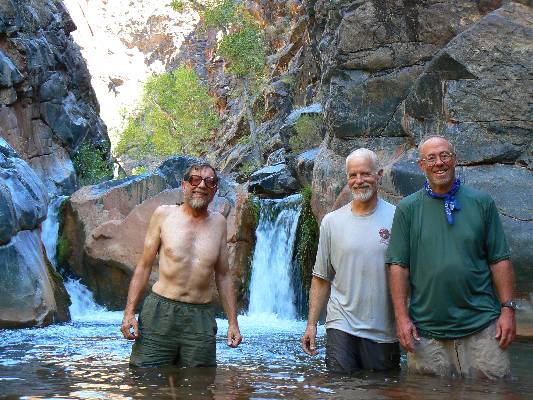
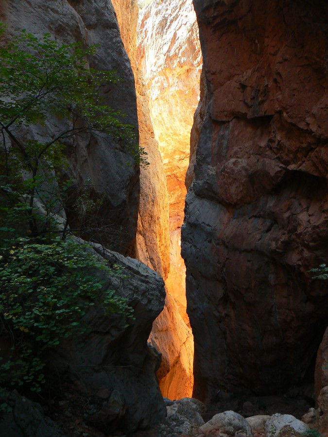
The roar of plummeting water fills the narrow gorge of Shinumo Creek. Yikes.
Deep in the basement rocks, Shinumo water is almost to The River. Going home? We inch out to the brink of
the falls and look down. Yikes. Back upstream, we climb out near the gauging station and intercept the low
trail and then follow it to The River. Dipping into The River, we have officially hiked the North Bass. Yahoo.
A rafter camp is here, yet empty of people, so we enjoy their chairs for a foot break and snack before climbing
back over the overland saddle to the Shinumo (Bass) camp, where we are almost packed up before the hot sun pounces.
Then, fully loaded (boots in pack), we hike the brush and stream crossings back to the foot of the Tonto bypass
trail and from there continue up Shinumo to where it meets White Creek to camp. We meet many of the rafters on
the trail, returning from explorations toward White Creek. As I was considering a stream crossing, I see
clothes scattered on a sunny slickrock. Closer inspection yields three nude women, one with a full body tan.
Dangling feet in Shinumo. Stream nymphs.
Finding a mostly shady spot is luxurious and we filter and treat water, bathe,
and enjoy some Canyon time.
Tapeats SS cliffs rise to the NE, Redwall and Supai glow towering up the gulch
of White Creek. A hot wind blows up from The River, making sweet dreams less likely, at least for the first hour or so.
North Bass photos - Day 4
Day 4: Redwall Ruckus. Day hike Tapeats narrows/White Creek to
Chockstone and to Redwall Canyon to Burro Route: gps miles of 5.3. ERM = 11. (poor gps signal at times).
The second dry falls looms. Above, a huge chockstone is wedged in the Tapeats
SS. Yikes. Zig and I are in Redwall Canyon, scouting a route to the fabled Burro Route, which rides the top
of the Tapeats SS back to above Shinumo Creek, below the Holy Grail Temple, and then up (above) Shinumo to the
Modrid/Merlin Abyss junction, where one gets off the Tapeats and to the stream (Shinumo Creek). Passage up
Shinumo from the Shinumo/Flint junction is reportedly blocked by a chockstone with twin falls (full of
water - unlike these in Redwall Canyon).
We start the day with a slow hike (brush, minor obstacles) up White to
where the Tapeats base is at stream level (start of Tapeats gorge) - from here, the next major canyon
on your right, going up, is Redwall. It's about 0.2 miles from the start of the Tapeats narrows to the
mouth of Redwall Canyon, yet beware, your gps will not work well here.
Up the second dry falls we climb and then hike out of the canyon to the
top of the Tapeats. It's hot up here, so we return to White and explore up it a bit to the chockstone and
massive, insurmountable falls at the end of the narrows. (The route around is in a tiny drainage to the
right of the falls.) There's only a trickle of water in White, yet enough to cause issues along the way.
Also along the way, we find a thief of time ruin - apparently pot hunted
or adopted by those who wrecked the walls. We spy a few pot shards.
We are back in camp in time for a bath, water treatment, dinner, and some
gazing at glowing Redwall before dark collapses.
I soak a bandana in cool Shinumo water and lay it across my chest to cool
in the bug tent. I've stripped the fly off the TarpTent and it's now a bug tent. The last of the fullish
moon climbs into the Cottonwoods and the burble of Shinumo sings a lullaby.
|
|---|
Movie of Shinumo Creek Day 5 - 1.4mb
(Click the image to see the short video - 9mb)
|
|---|
|
North Bass photos - Day 5
Day 5: The Twin Towers. explore Shinumo Creek:
gps miles of 2.7. ERM = 5. Camp #3 at Shinumo/White junction.
I'm ensconced in the willows and horsetails and cattails
Shinumo creekside while the dry roasting sun washes over the camp. A dip in the creek
keeps the core temperature reasonable.
The day starts with Zig going back up White to find his
sandals, which hopped out of his pack during yesterday's junket. Steve and I loaf a bit
in the morning coolness, then start wading, scrambling, and brushing and overlanding up
Shinumo to just beyond the junction with Flint, where all exploration up canyon is blocked
by twin towers of water falling on both sides of a huge chockstone. Lovely setting. Still
deep in shade, we soak up Canyon ambiance. Soon, Zig appears, wearing his wayward sandals.
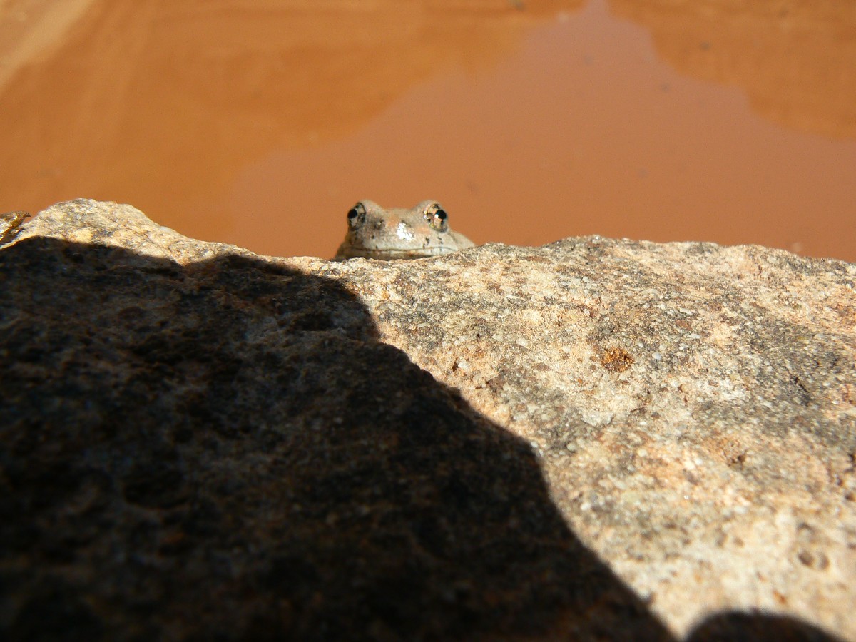
We see several trout and a big minnow or chub in the cool Shinumo water. The route passes
through what may be foundations built by ancients?
The camp, splendid camp, roasting lasts but 2 hours and
it's bath and dinner time, for the Tonto awaits tomorrow.
North Bass photos - Day 6
Day 6: Ledgemere. To top of Bright Angel bypass:
gps miles of 5.7. ERM = 10.7. Camp at about 4000'.
The Neapolitan walls shimmer, reflected in a cattail pool
coursing through depressions in the Bright Angel Shale. Glorious. The pools slip into a
gorge with falls.
We start early, retracing steps to the bottom of the Tonto
bypass, where we bid farewell to the lovely Shinumo Creek and start up what appears to be
Dox SS. As we climb, the sun invades the Canyon. At the trail junction with White Creek,
we walk down White to where the chockstone is lodged above the dry falls. Scenic. Then,
the trudge up White to the top of Bright Angel bypass, where we decide to camp after a short
hiking day.
There's water and some sort-of level slickrock on which to
camp. Luxurious languishing afternoon evolves into a cooler evening on the North Bass.
Bats flit in the amphitheater, water faintly trickles, and
an upcanyon breeze begins to cool, and the silhouette of rocks made by time grows less distinct.
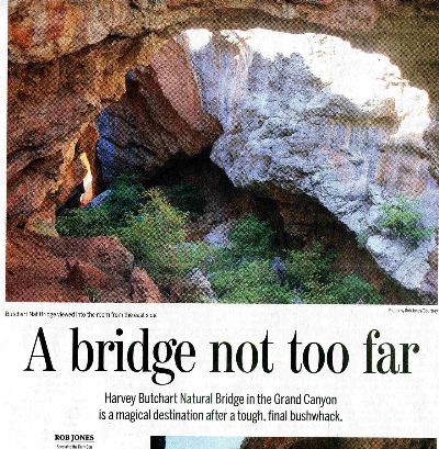
Day 7: Butchart Bash:
to Butchart Natural Bridge, and home. gps miles of 6.3. Total gps mileage = 37.7.
ERM = 16.7. Total estimated ERM = 75.8.
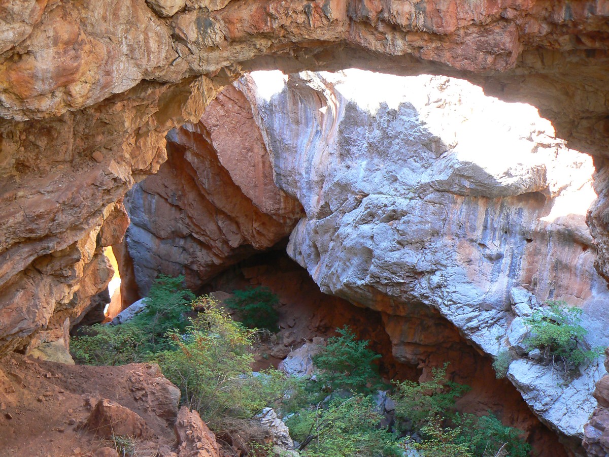
Zig and I are fighting through the nearly impenetrable brush - on
our way to access the sinkhole entrance to "the room" of Butchart Natural Bridge - an unofficial
name to this lovely NB. Attributed to recent discovery by Harvey Butchart (in about 1967) and
documented by Rich Rudrow a year or so ago, it's just "natural bridge" on the USGS quad, but surely
was known to Bass and White. Some in the NPS also know about it.
We're up early and on the route to the Redwall ascent, climbing
to the Supai, by the time the sun finds us. Then, the ranging Supai Traverse.
Nearing the North end of the traverse, I see vegetation growing
across what appears to be a side canyon drainage. What? Across? I walk over for a closer look.
Yow, there, below, in the slim slot of White Creek - is the natural bridge! Yippee.
Zig and I scout (from the traverse side) and then thrash to the
NB along the East side. Into the cavernous room we slide and scramble. Lovely. Fantastico!
Back on the trail, yes, finally trail, we huff to the TH - noting
the desiccated beefalo turds on the trail above Muav Saddle. It's time for the FS and NPS to host
a BBQ for employees and get rid of these non-native, invasive, not true bison spring and forage
destroyers.
Steve has beat us to the top and departed for the vertigo and
headache of Las Vegas - one of those cities, along with Phoenix and LA, that should not exist.
Good trip Steve.
As we dump a water bottle rinse over our heads, Zig notes that
his expectations have been far exceeded and is good to depart for home. We were thinking about
a day hike of the Powell Plateau tomorrow. Yet, we do not have a permit for the rim, so home we
go, enjoying fresh memory flashes of North Bass Nirvana.
The mnemonic goes like this (read down, use first letter of starting word as
a reminder - from the rim, down):
Know - Kaibab Limestone
The - Toroweap Formation
Canyon's - Coconino SS
History - Hermit Shale
Study - Supai Group (including the Esplanade)
Rocks - Redwall Limestone
Made - Mauv Limestone
By - Bright Angel Shale
Time - Tapeats SS
Know The Canyon's History, Study Rocks Made By Time.
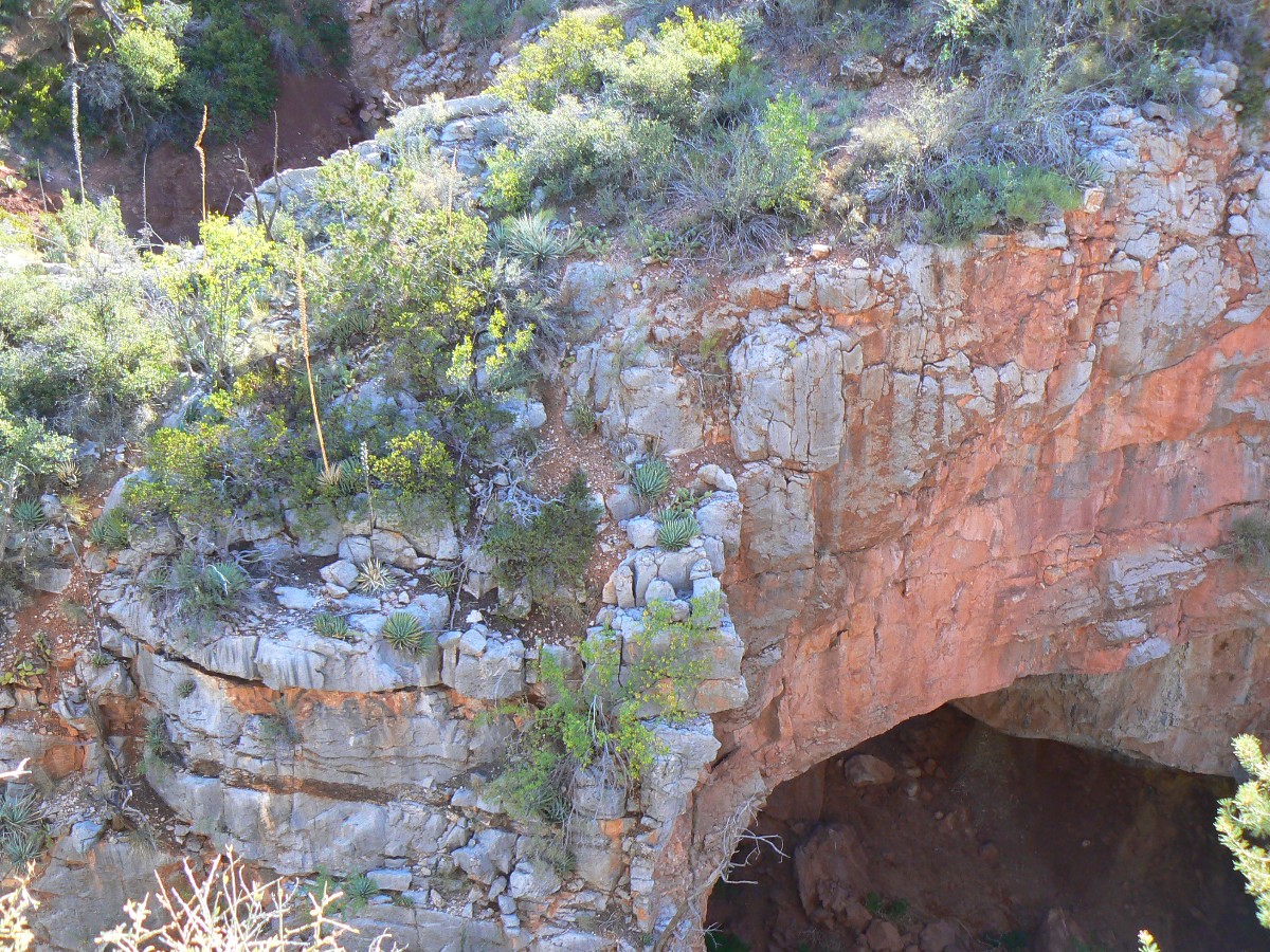
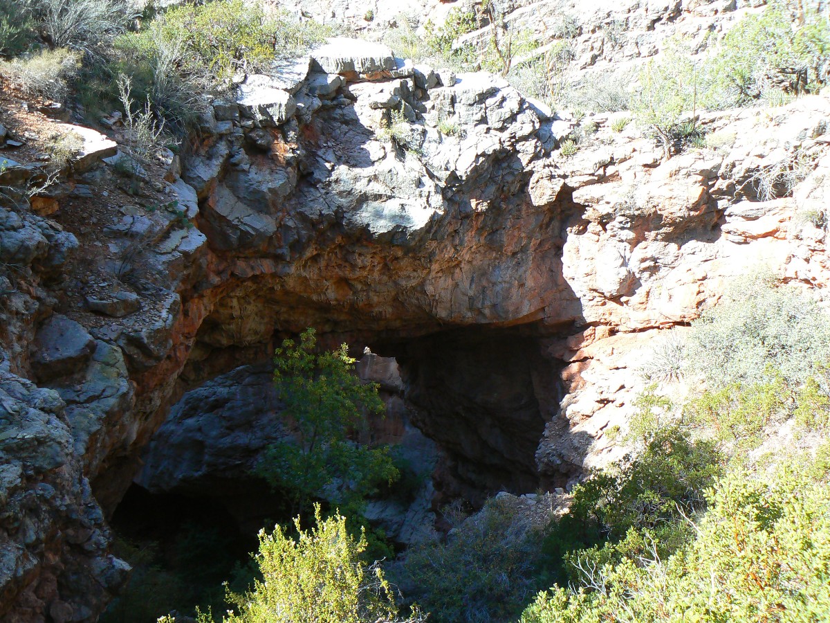
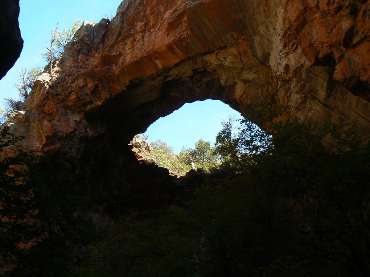
Harvey Butchart Natural Bridge on the North Bass
Butchart Natural Bridge
Muav Canyon, North Bass Trail, North Rim of the Grand Canyon, Arizona, USA
UTM coordinates: 12 S 378713 E 4019425 N; NAD 83/WGS84 datum
Sinkhole NB in Redwall Limestone. Top of NB opening is at approx. elevation of 5160'.
directions and photos by Rob Jones
Wilderness Vagabond
named by Rich Rudrow for Harvey Butchart, a prolific Grand Canyon explorer. Butchart reportedly documented this NB in 1967.
Driving directions:
Starting from Jacob Lake, Arizona, drive South on Arizona hwy 67 toward the North Rim of the Grand
Canyon for approximately 26 miles. Take a right turn (West) onto Forest Service road (FR) 22, just
past DeMotte Campground and the Kaibab Lodge. After a mile, turn hard left onto FR 270. Drive FR 270
for 2.2 miles, then turn right (West) and follow FR 223 for approximately 5.8 miles to FR 268. Drive
approximately 0.25 miles to FR 268B (goes left at fork), then approximately 0.7 miles to the Park Boundary.
Drive the rough Swamp Ridge Road 8.0 miles to Swamp Point and the TH for the North Bass Trail.
Note that
these roads are not all well-marked or maintained. The Swamp Ridge Road is especially slow-going and prone
to closure by snow and falling trees. This route to the TH climbs to over 9000'- keep this in mind. You
will need an NPS permit to camp in the park, which you entered at the start of the Swamp Ridge Road.
Hiking directions:
This hike loses (and gains coming out) 2300' in elevation. It is about 2.7
miles to the NB, one way. It is partially on trail and partially in brush, sometimes nearly impenetrable
brush. Wear long pants and take care. The last 600' to the sinkhole presumed to form the NB is in very
thick brush. The route down into the "room" at drainage level is dangerous because of lose rocks and steep
angles.
Starting at 7500' at Swamp Point, the North Bass TH, hike the trail down
through the Kaibab, Toroweap, and Coconino layers to Muav Saddle over 0.8 miles. Take the right fork of
the three-way junction at the saddle to see Teddy's Cabin (named after Teddy Roosevelt). Our NB is to the
left at the junction. (The center trail climbs to the Powell Plateau.) The trail continues into Muav
Canyon, through the Supai layer, here in the streambed (brushy, no longer a trail). After about 2.6 miles,
the route reaches the top of the Redwall Limestone (actually a native grey color when not stained by oxides
from the Supai Formation) and a series of increasing ghastly dry falls. You are near BM 5175 marked on the
King Arthur Castle USGS quad; this is marked 5181 on the actual BM monument.
From the top of the dry falls in the Redwall, the Supai Traverse (trail)
goes right (West). (It is suggested that you hike the Supai Traverse for about 600' to get a view of where
the NB might be in the narrow yet deep canyon, and determine a possible route through the brush on the other
side of the canyon. The axis of the NB is parallel to the main creekbed. Return to where the traverse climbs
out of the creekbed.) The NB route goes left, East side of canyon, scrambling along a boulder then entering
thicker and thicker brush as one works toward the side drainage and then to the sinkhole beyond it. Stay back
from the canyon edge and take your time. This 600 feet is slow going.
At the sinkhole, you have arrived at Butchart Natural Bridge. Enjoy the view.
Travel into the canyon bottom is possible yet not recommended.
Bob' Arches explains the canyoneering route into the room below Butchart NB.
Bob's review of Butchart NB (click here)
click here to -- Link to the Arizona Daily Sun article about Harvey Butchart Natural Bridge... or click on the below image for the pdf.
|
|---|
Arizona Daily Sun (newspaper) A Bridge Not Too Far (pdf)
(Click the image for the full article; pdf)
|
|---|
|
Links:

Book by W.W. Bass: Adventures in the Canyons of the Colorado (1920)
NPS North Bass Trail description - pdf
Bob Ribokas' North Bass Trail description - excellent info
Maps:
|
|
|---|
Map - GC: North Bass; 2012; 38 miles
(Click the image to see the map)
|
|---|
|
for a full-resolution map, click here. Caution - do not use this map or gps track for
navigating the route.
|
|
|---|
Map - GC: North Bass to Harvey Butchart Natural Bridge
(Click the image to see the map)
|
|---|
|
Panos:
Click here to: see a pano from Tonto bypass, Day 6 - scroll L-R to view it
all (4555 x 1200 pixels, 1.7mb)
Movies:
Click here to: see a Movie of the obstacle falls in Shinumo - 2mb.
Click here to: see a Movie of Shinumo Cr - 1.4mb.
Books:
Eaarth : making a life on a tough new planet, McKibben, Bill,
Time Books, 2010.
Maybe one : an environmental and personal argument for single-child families, McKibben, Bill, Simon & Schuster,
1998.
The end of nature, McKibben, Bill, Random House, 1989.
A River Runner's Guide to the History of the GRAND CANYON,
Crumbo, Kim, JOHNSON BOOKS 1880 South 57th Court, Boulder, Colorado, 80301
1994.
Other WV reports about the Grand Canyon:
Click here or on the Looking Lizard to go to all WV reports about The Grand Canyon
|
|---|
Looking for All Wilderness Vagabond trip reports about the Grand Canyon?
Click the image to go to All WV reports about The Grand Canyon
|
|---|
|
Related Links:
Ben's Scenic USA - Picture
of the Day.
And - John Muir Trail
– Hiking the Jaunty Juggernaut.
And - Click here to see The Archman's site on
Utah and area arches.
Ben's Scenic USA - Picture
of the Day.
Scenic Toilets of Inner Earth
the geology of the Grand Canyon by the NPS
the geology of the Grand Canyon by Bob Ribokas
More Truth Than Joke:

|
|---|
vote republican
(Click the image for the full-size image)
|
|---|
|
|
|---|
personhood or freedom?
(Click the image for the full-size image)
|
|---|
|

|
|---|
RNC - crazy never sleeps
(Click the image for the full-size image)
|
|---|
|
|
|---|
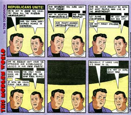
repulsicans unite
(Click the image for the full-size image)
|
|---|
|

|
|---|
better off now?
(Click the image for the article)
|
|---|
|
|
|---|
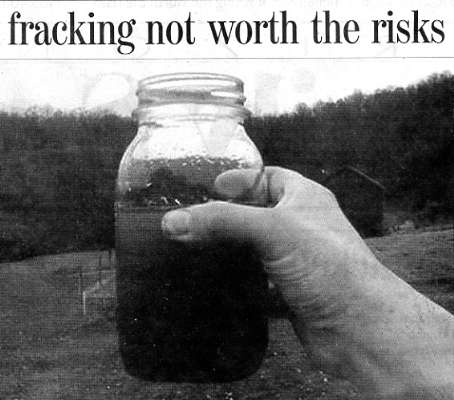
little benefit to fracking
(Click the image for the article)
|
|---|
|


