Hermit Hiatus Redux:
Hermit Rest / Hermit Creek (Hermit Rapids)/ Monument Creek (Granite Rapids)/ Salt Creek / Tonto to Indian Gardens /
out Bright Angel Trail / Four Sisters Natural Bridges
(May 3 - 8, 2012)
Text
© copyright by Rob Jones and Wynne Geikenjoyner; and Photos © copyright by Rob and Wynne
|
 |
|
|---|
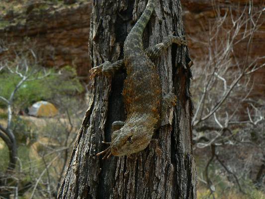
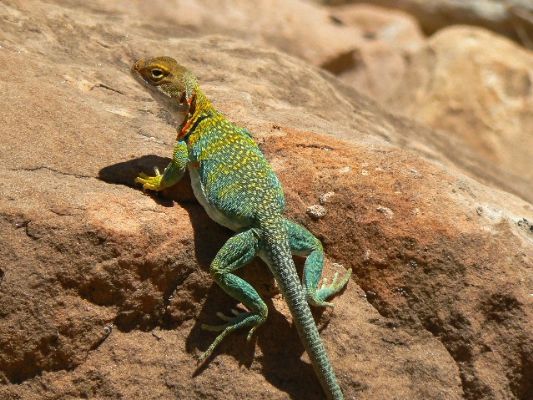
I'm Mr. Spiny, and I approve this trip report
(Click the image for the full-size image)
|
|---|
|

|
|---|
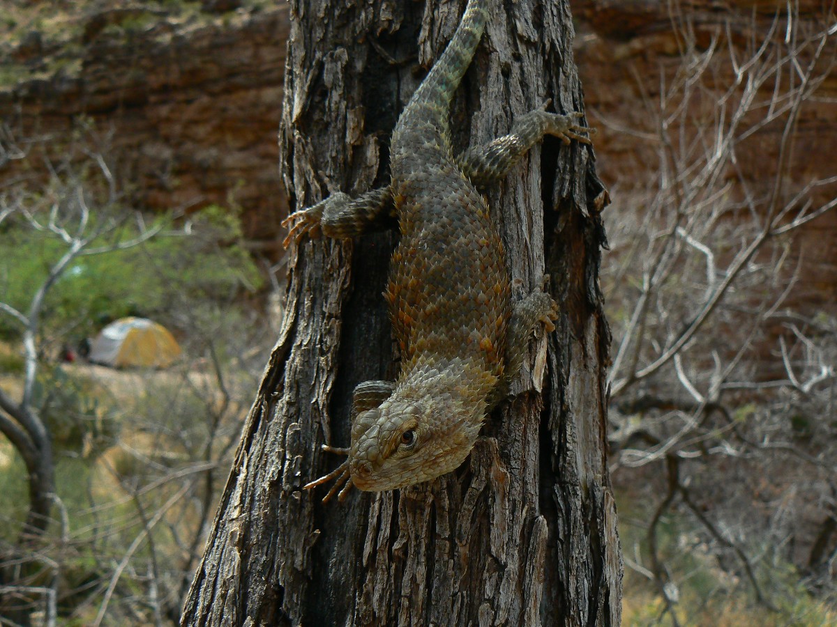
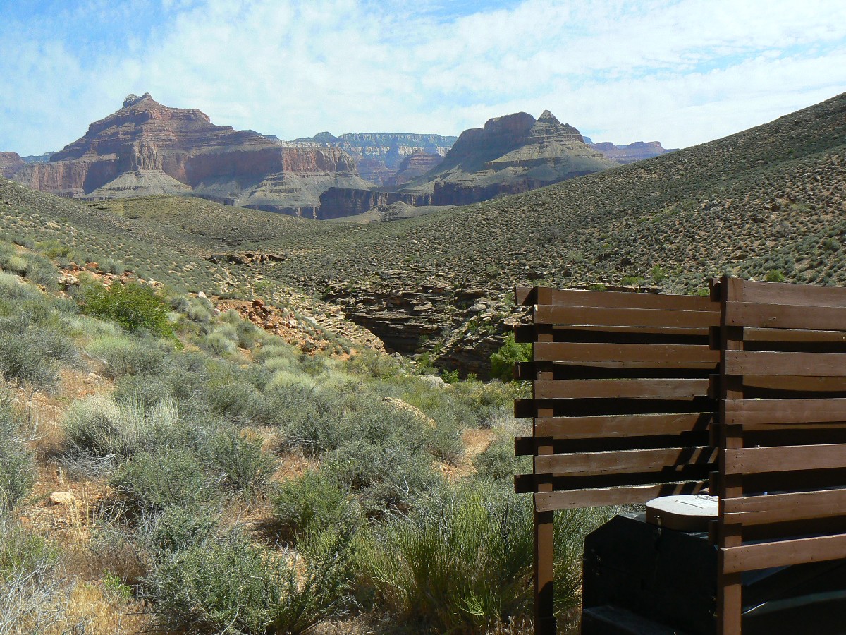
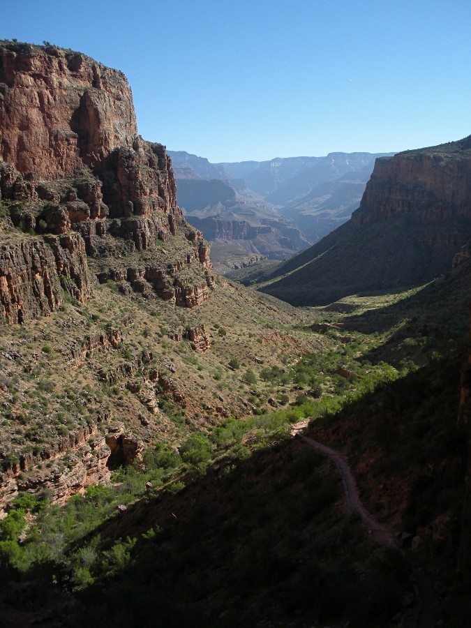
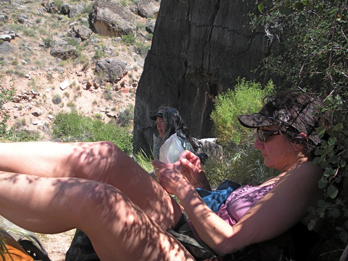
Along the Tonto - Day3
(Click the image for the full-size image)
|
|---|
|
|
|---|
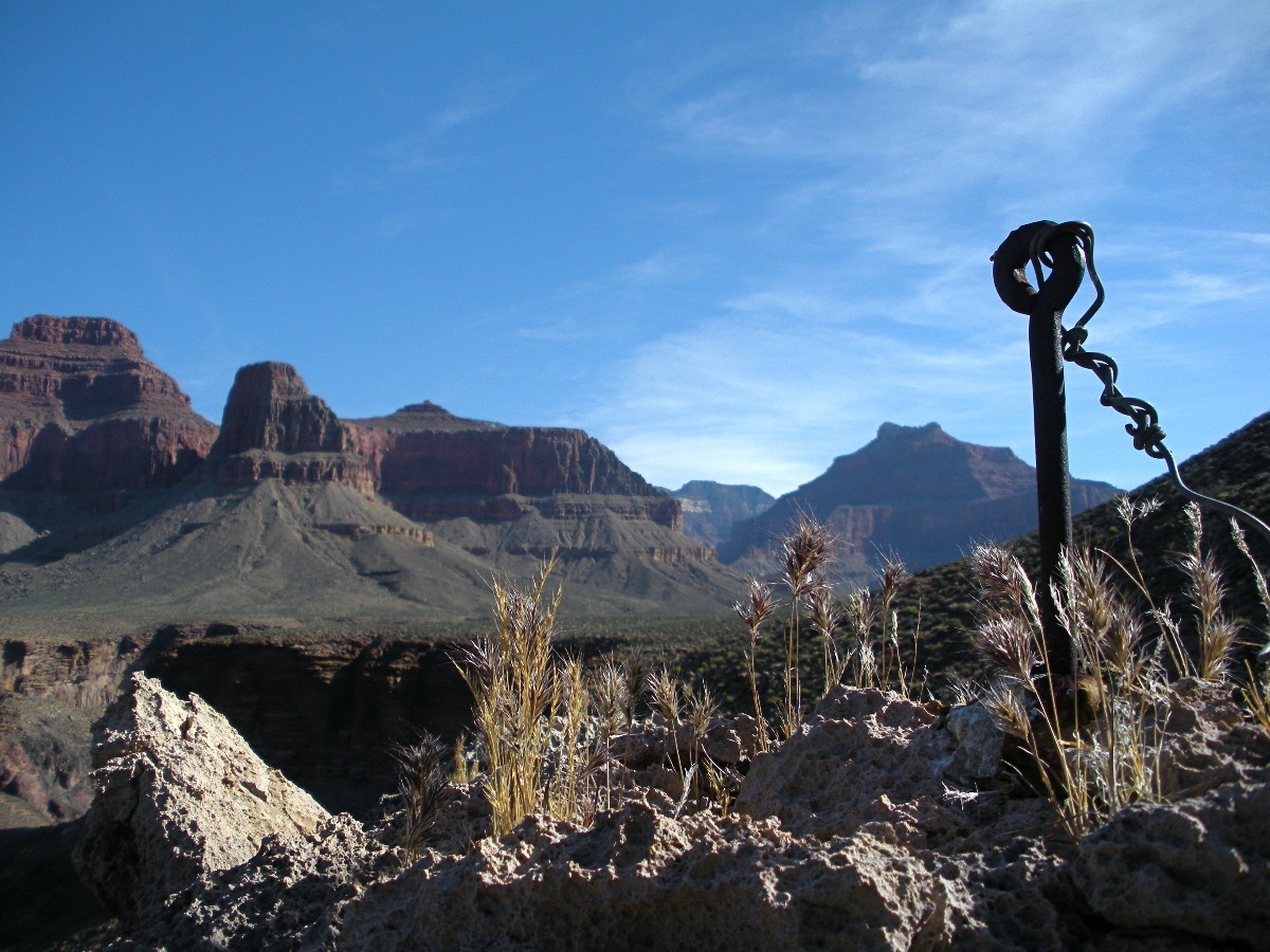
At Salt Creek - Day5
(Click the image for the full-size image)
|
|---|
|
|
|---|
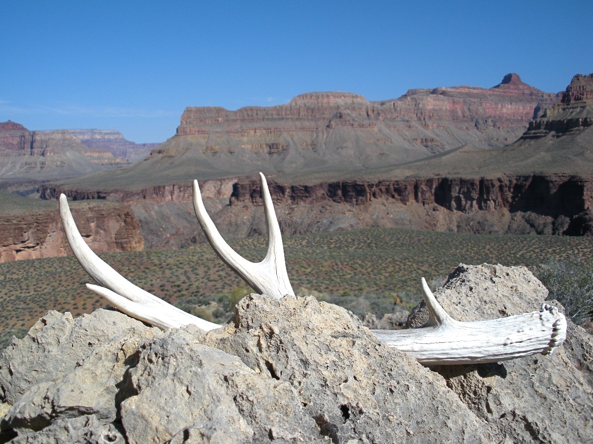
Four O'Clock - Day 6
(Click the image for the full-size image)
|
|---|
|

|
|---|
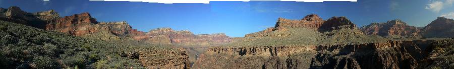
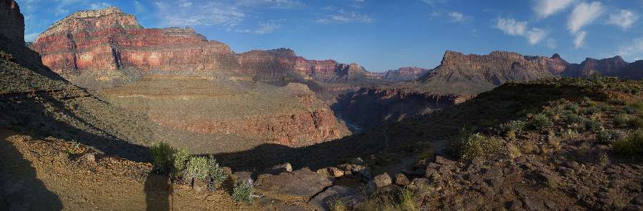
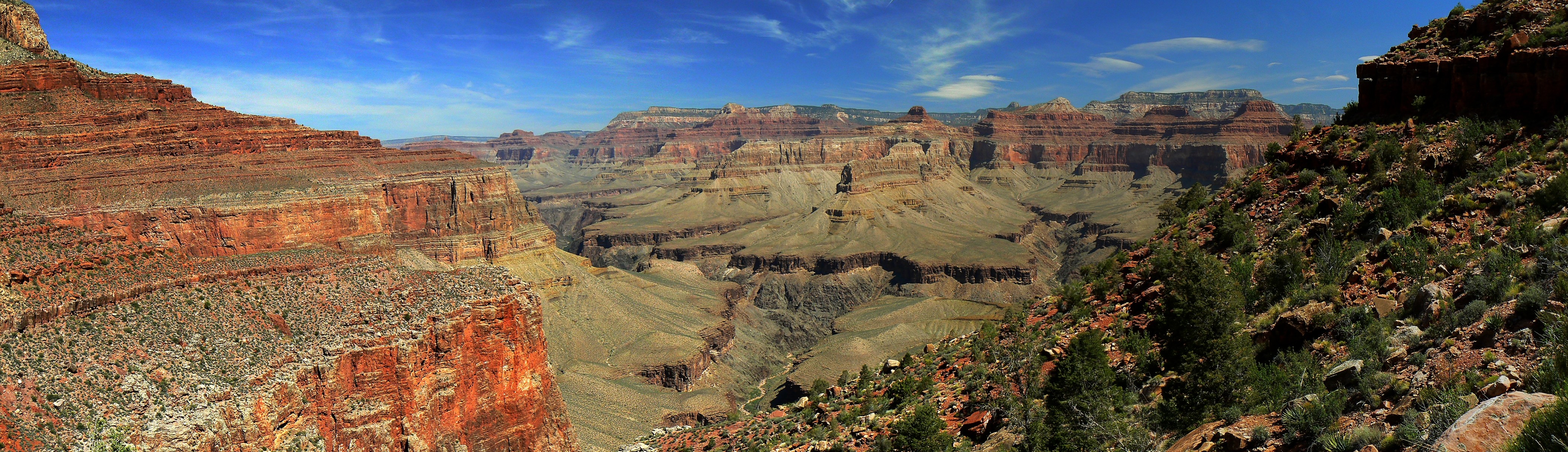
pano from top portion of the Hermit Trail - scroll L-R to view it
all (4168 x 1200 pixels, 2.1mb)
(Click the image for the full-size image)
|
|---|
|
(There are - photos embedded in the trip narrative.)
Co-Adventurer: Keith Thompson
Redux - brought back, revisited.
Hiatus - a break or interruption in the continuity of a work, series, action, etc. As in, our 'work' of roving the GC in all its grandness.
In Anatomy, a hiatus is a natural fissure, cleft, or foramen in a bone or other structure. This is one big ditch.
ERM - Energy Required Miles. A mile is added for every 500' elevation gain or loss.
It's a very serviceable method of estimating energy required miles.
Total trip - (per my GPS) of 33.7 miles and total ERM = 62.2.
Click here to go to the original Hermit Hiatus trip report (2008)
Jump directly to the guest report by Wynne G. (click here)
Movies: You may wish to begin downloading the movies as you peruse the report - this way, they will pop up
to view (and you won't be waiting). The movies in the below list are also seen interspersed in the text. The movies are:
Click here to: see a Movie of a Hermit Creek burble 6.0 MB.
Click here to: see a Movie of Hermit Rapids Day 2 - 9mb.
Click here to: see a Movie of narrows in Monument Cr. Day 3 - 2mb.
Click here to: see a Movie of Granite Rapids - Day 3 - 6mb.


|
|---|
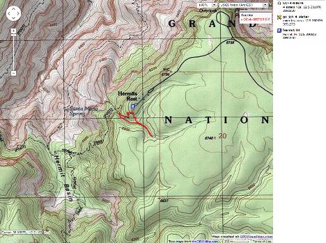
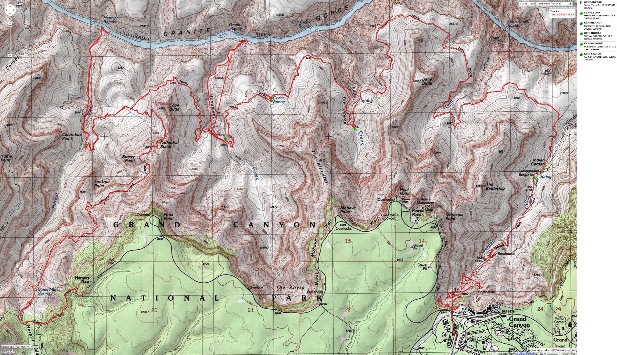
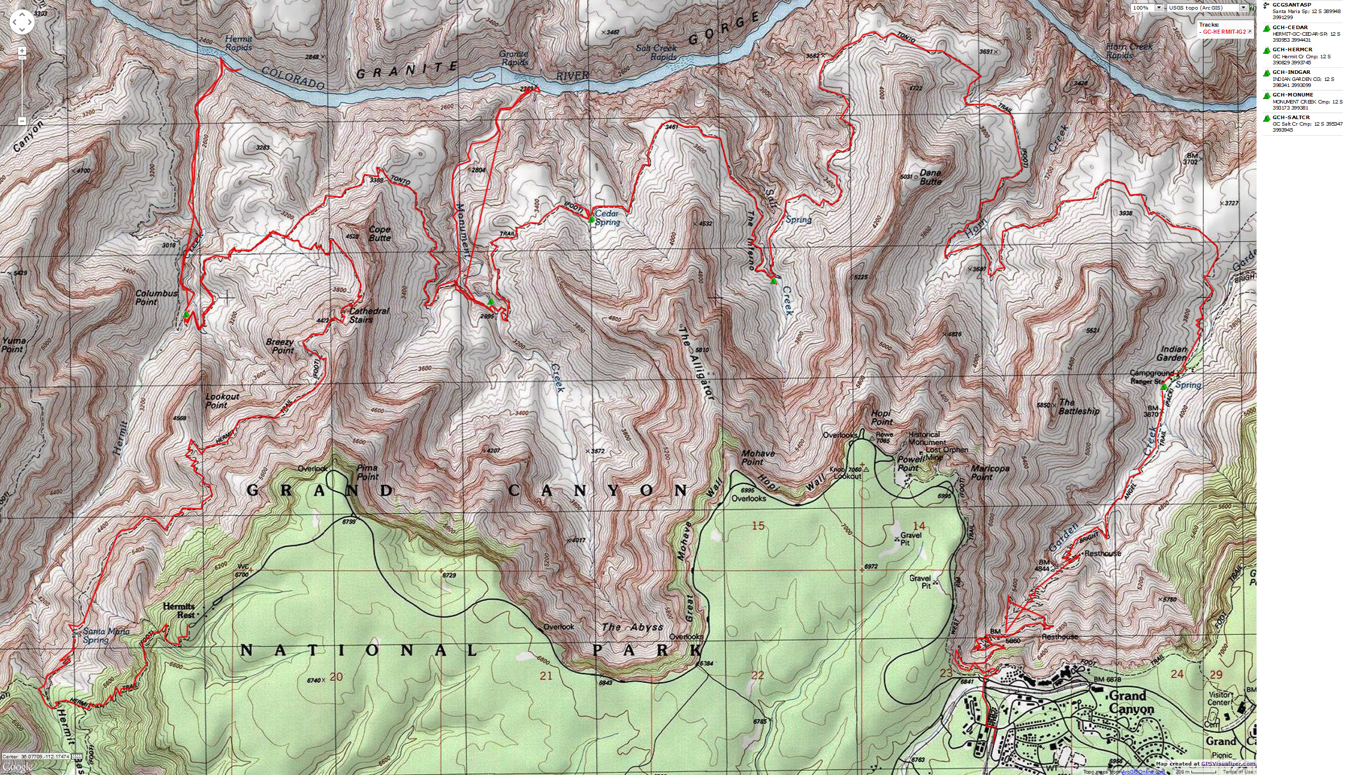
Map - GC: Hermit to Indian Garden, out BA; 2012; 34 miles
(Click the image to see the map)
|
|---|
|
for a full-resolution map, click here. Caution - do not use this map or gps track for
navigating the route.
Do you want to save the map for wandering the Hermit Trail and Tonto, 2012? -- Right Click (then save this file: "save
link as..." in most browsers) on this Download link to get
the GPX file from
my GPS - you can then open it in your mapping software. Note - that's a Right Click on this link.
You will get the track for your software shown in the map above.
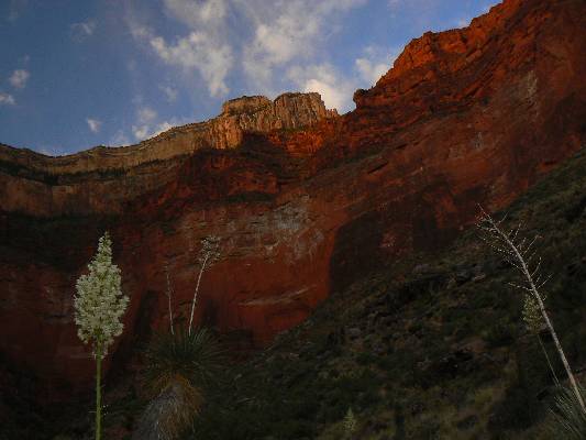
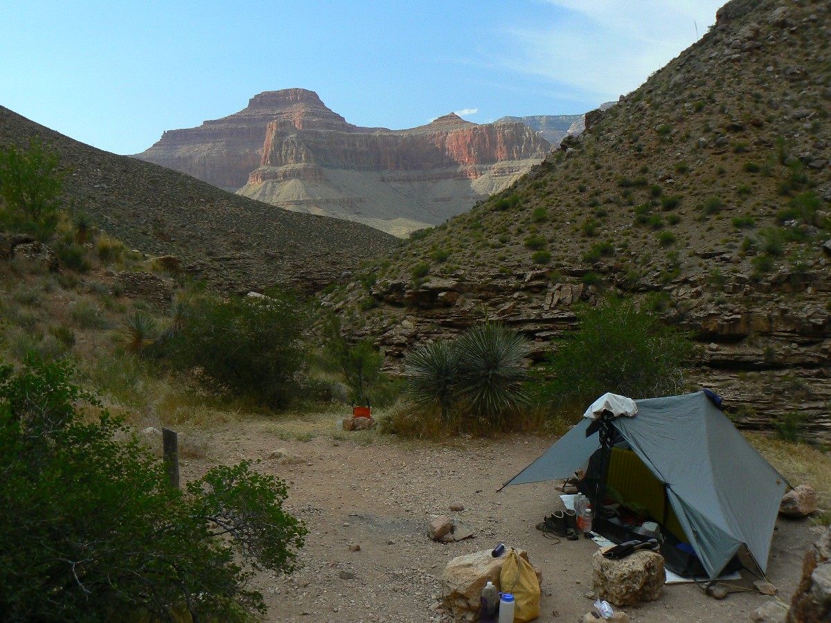
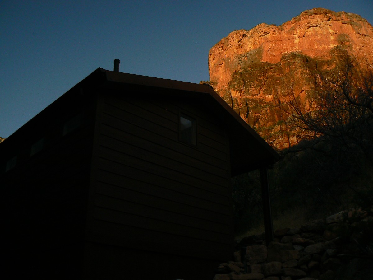
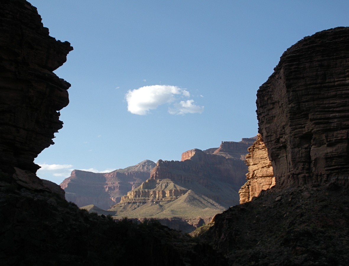
Day 1: The Hermit. Redux: Hermit Rest to Hermit Camp.
8.0 miles; ERM = 17; camp at 3,000'.
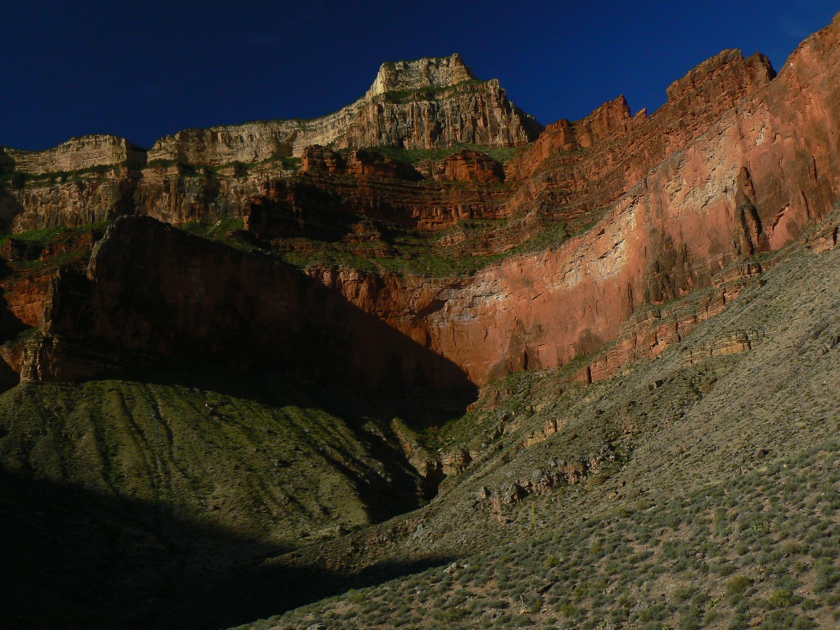
The Redwall glows, its sheer face presenting obstacles to passage. We're hiking
early, and the low-angle light adds relief to the tiers of rocks forming this Grand Canyon. Keith and I are heading
down through the assortment of rocks made by time, the Kaibab Limestone, the Toroweap, Coconino SandStone (SS),
Hermit Shale, Supai and Redwall, and now we've made it to the Tapeats SS.
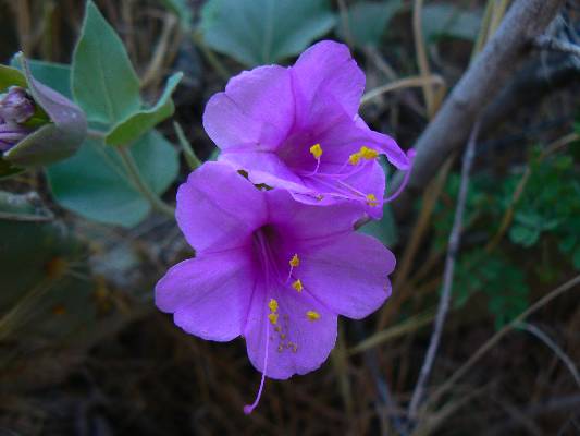
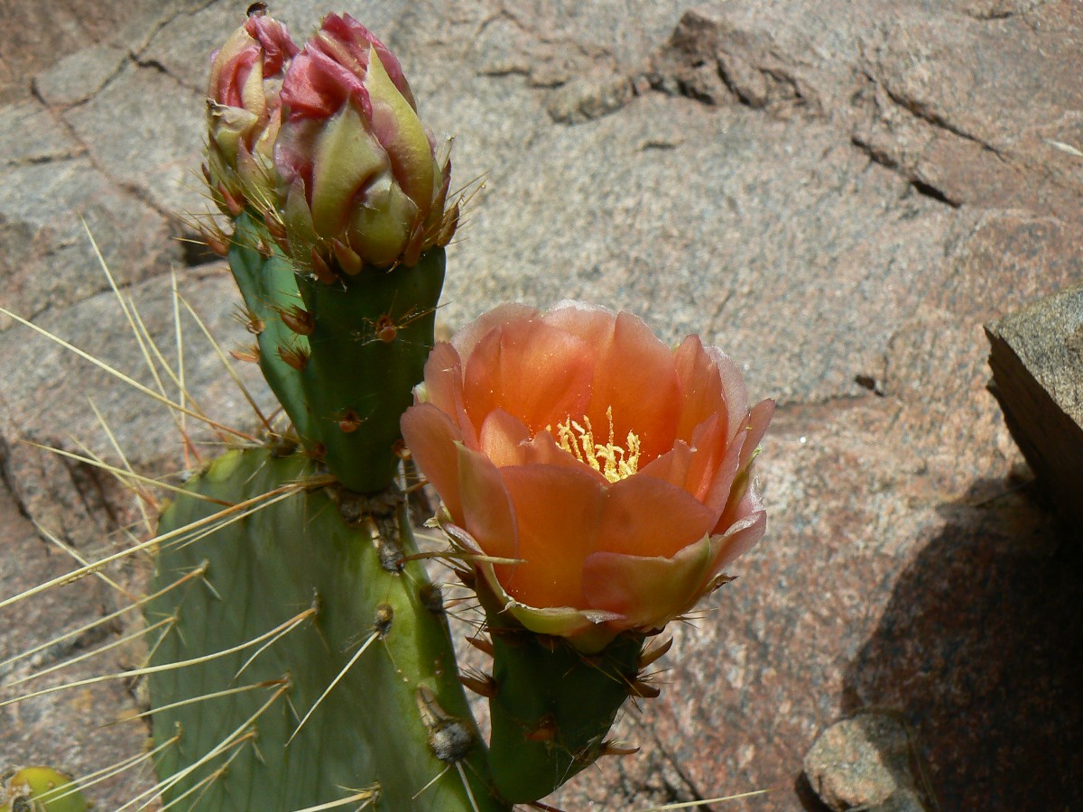
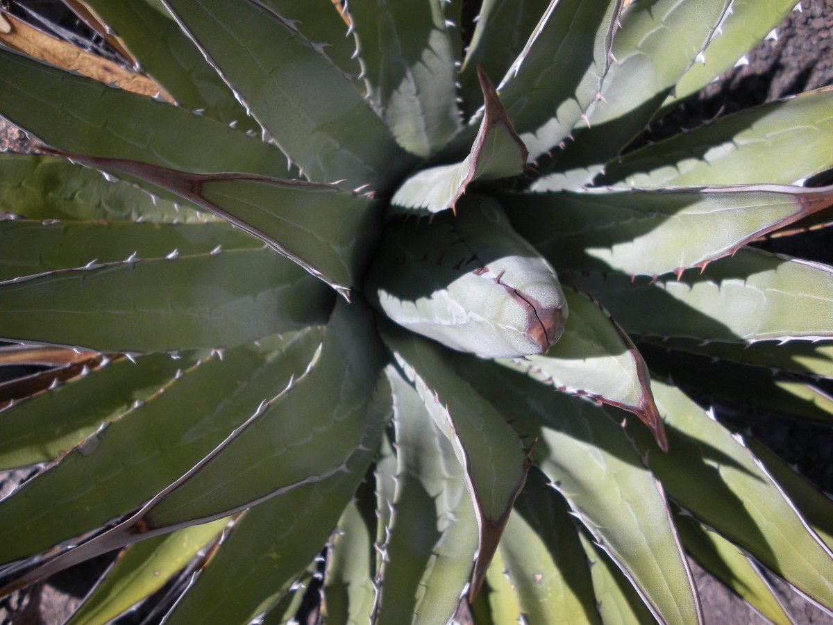
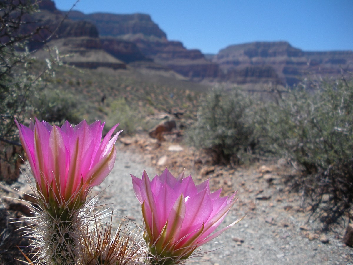
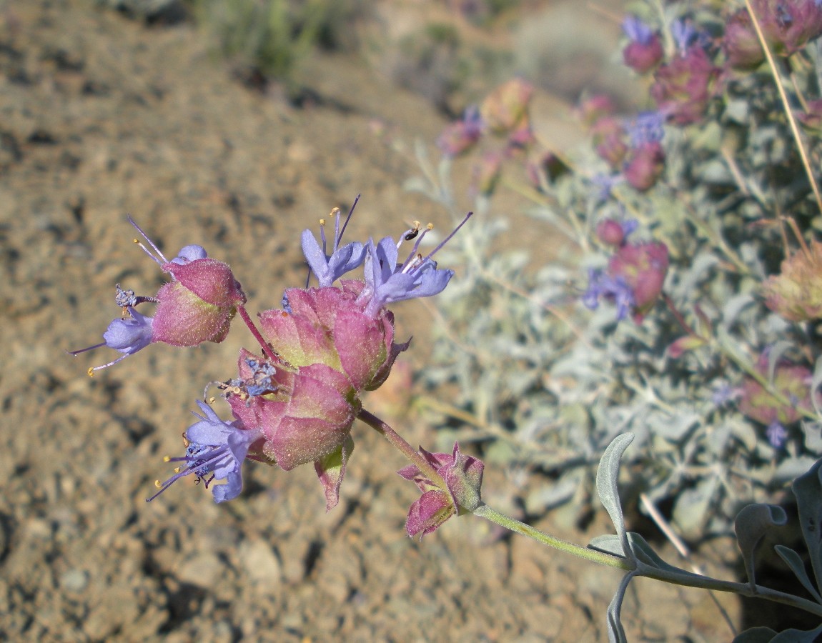
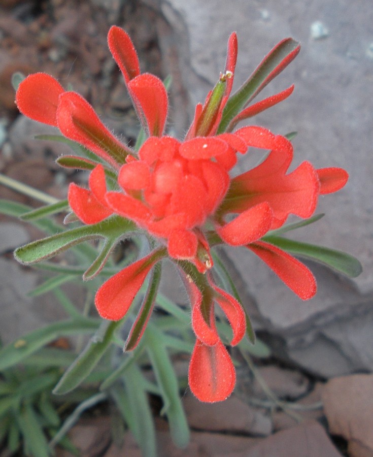
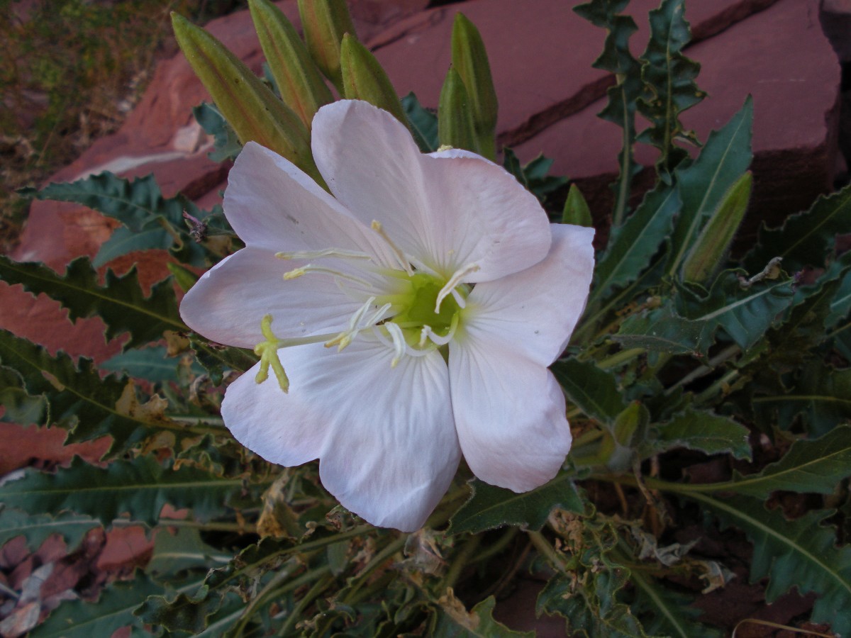
The cactus bloom in a kaleidoscope of colors and a few yellow Brittlebush dot
the greenish-gray of the Tonto Platform.
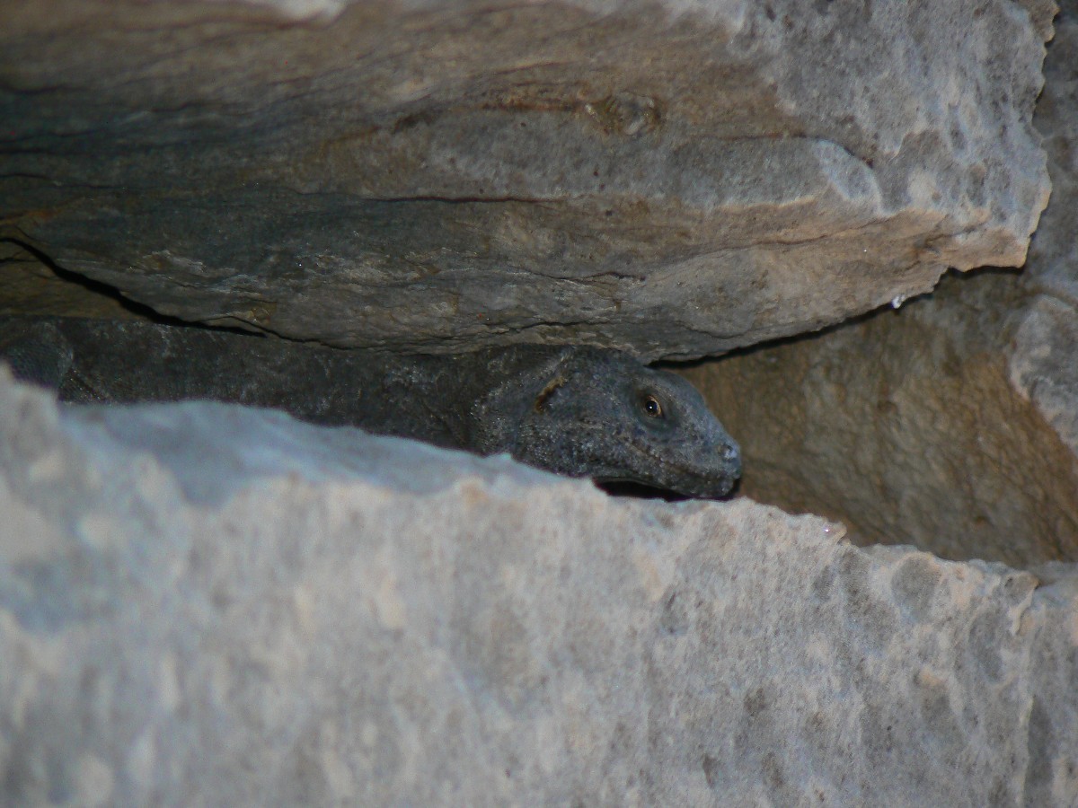
Camped in the slight overhang camp, a curious or territorial Spiny Lizard
visits while we await local sunset. A rinse by pouring Hermit water refreshes.
Froggies chortle and Hermit Creek burbles and sleep descends as quickly as
the graph line of income disparity in the U.S. escalates.
The mnemonic goes like this (read down, use first letter of starting word as
a reminder - from the rim, down):
Know - Kaibab Limestone
The - Toroweap Formation
Canyon's - Coconino SS
History - Hermit Shale
Study - Supai Group (including the Esplanade)
Rocks - Redwall Limestone
Made - Mauv Limestone
By - Bright Angel Shale
Time - Tapeats SS
Know The Canyon's History, Study Rocks Made By Time.

|
|---|
|
Income gains at the top income dwarf gains in all other brackets
|
|---|
|
|
|---|
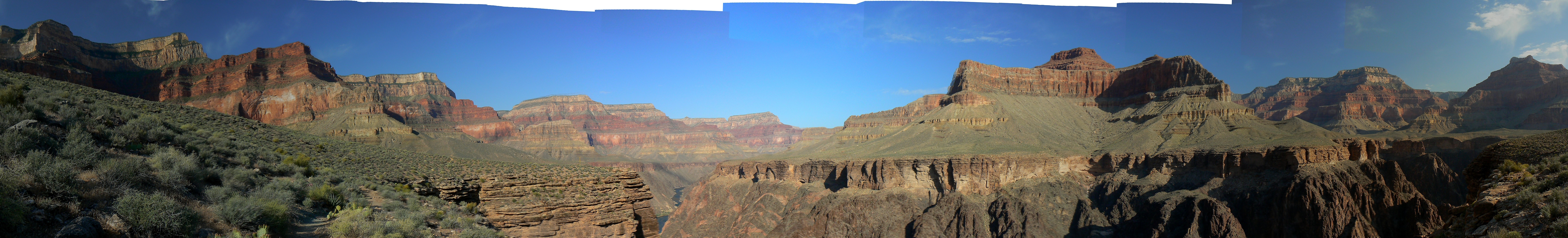
pano from the Tonto Platform near Indian Garden - scroll L-R to view it
all (7889 x 1200 pixels, 2.4b)
(Click the image for the full-size image)
|
|---|
|
Hermit Hiatus Day 1 photos by Rob

|
|---|
Movie of a burble in Hermit Cr. Day 2 - 6mb; note Natural Quiet
(Click the image to see the short video - 6mb)
|
|---|
|
Day 2: Take Me To The River : Hermit Rapids day hike. 2.7 miles; ERM = 4.7.
The jade-green Colorado hurries into Hermit Rapids, pulling a sheen onto the
surface of the tongue leading to a duo of massive standing waves. Keith and I have hiked from camp down the
geology tour of Hermit Creek, past and through the great unconformity - a non-nexus of rock missing millions
of years of rock history, past the stunning integration of Zoroaster Granite, mica (muscovite), quartz, and
schist that looks extruded from a pastry paunch. Wow.
Over the rapids' thunder, the destructive horror of
air tour terrorists decimates the natural quiet of this precious Canyon. Experience the canyon at 150
decibels and from half a mile high and share your efforts to hasten climate change, your noise and air and
visual pollution with those seeking natural quiet. No, on second thought, be the selfish republican and
keep it all for yourself, all your noise, smog, visual clutter.
A delightful breeze accompanies local sunset, punctuated, once again, by
the Froggy Canyon Choir.
Hermit Hiatus Day 2 photos by Rob

|
|---|
Movie of Hermit Rapids Day 2 - 9mb
(Click the image to see the short video - 9mb)
|
|---|
|
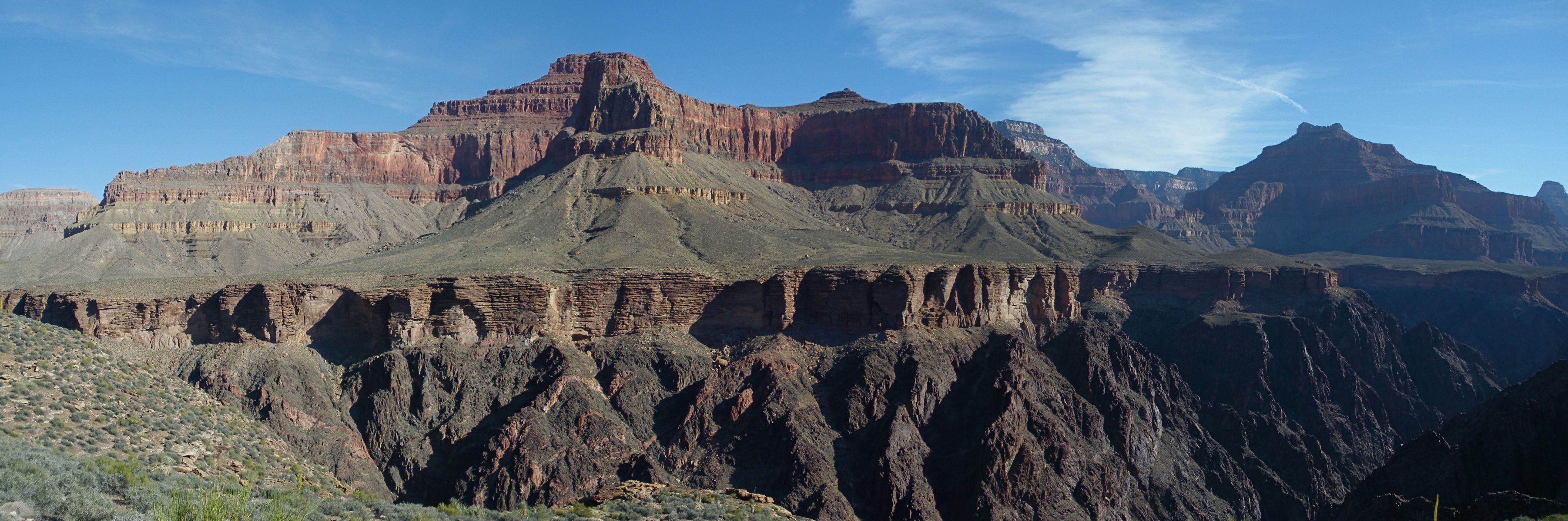
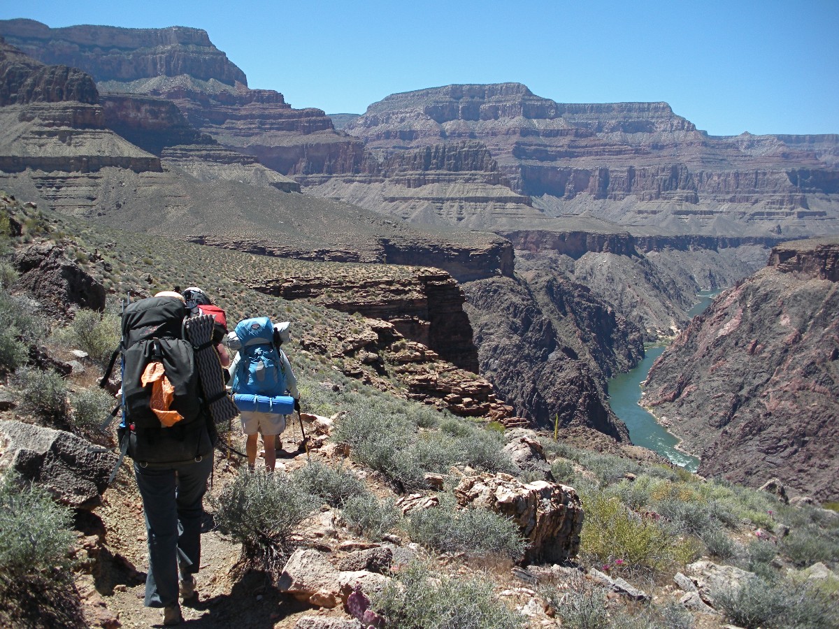
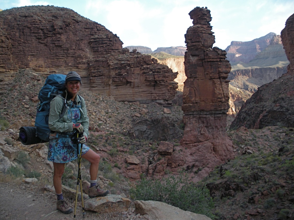
Day 3: Monumental Granite Rapids: 6.7 miles; ERM = 12.
Rapid River noises growl and echo off the polished ebony schist laced with
squiggly pink Zoroaster Granite, beckoning one to hike out of the sun-baked land and into the riparian zone
of shade and River water-cooled air. Ahh. Tamarisk, scourge of The River system, yet today provides
luscious shade, drawing in a duo of motor rafts from Grand Canyon Rapids Co., with lunch, and jolly clients. Lovely.
Up before 4a., Keith and I are tramping up from Hermit a bit after 5a.,
relishing the morning coolness. Early colors sharpen the day. Into sun for a stretch, then back into
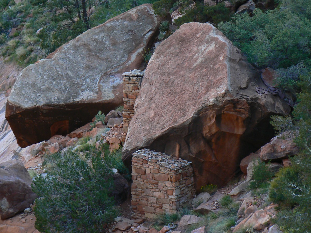
shadows in Monument Canyon. Slipping into the canyon, we meet the departing NPS archeologists and two from
the Museum of Northern Arizona, who have been excavating (and then hiding) a Puebloan-era storage structure.
Someday, it will appear on the NPS archeology link.
Karen, Wynne, Cynthia, Laura, and Angie, four Flag women and one now from
Durango, lilt gracefully into Monument from Salt Canyon, adding a distinctly more glamorous aura to this
rocky place. And scientists too, what a contribution to this ancient place. They set up camp not far from
where Keith and I are camped, and we don't mind their proximity. Gentle burble of female voices join the burble
of spring water and occasional whisk of wind and froggy song to provide a wholly pleasing background to the
starkness of rock. Delightful and deluxe.
Keith enjoys the overhang shade while I walk to The River and Granite Rapids.
A most excellent place to invest some River time.
Commercial aircraft, which McCain and other 'money is a green belt' republicans
and a few misguided demos, such as H. Reid, are deaf to, hearing only the cash registers which have replaced
their hearts (a la cheney, the heartless one), thunder overhead, disturbing amphibians and others of the Eaarth
(see Bill McKibben, Eaarth). Sad. Peace eventually returns, yet flinches at the prospect of air tour terrorists.
Are commercial flights the second coming of hell, with helicopters the first?
Frogs and toads croak and trill as last light fades.
Hermit Hiatus Day 3 photos by Rob

|
|---|
Movie of narrows in Monument Cr. Day 3 - 2mb
(Click the image to see the short video - 6mb)
|
|---|
|

|
|---|
Movie of Granite Rapids - Day 3 - 6mb
(Click the image to see the short video - 6mb)
|
|---|
|
Day 4: Salt Siesta: 3.8 miles; ERM = 6.8.
"Clack! Clack!" the shiny black Corvid stabs his thick bill into the Salt
Creek shallow pools. He's not drinking, I wonder. "Clack! Clack!" then bill up. Raven, fishing for Canyon
Tree Frog pollywogs. Amazingly adaptable, the Raven may endure with ants and rats when republicans and
religionists have totally destroyed the Eaarth. No, not the republican rats, the rodent rats.
Keith is enjoying a Salt Creek siesta, napping under a sheltering Tapeats SS
ledge, while I treat water and make these journal notes.
We hike the leisurely lilt from Monument to Salt in the cool morning. I pause
at Cedar to investigate the spring (running fine) and the pour-off into the abyss (nice reflection pools).
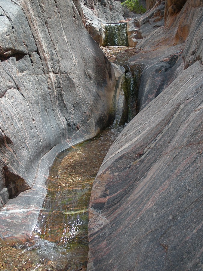
At Salt, we explore down canyon to the Schist free-fall, enjoying the thin
ribbon of water sluicing the polished black schist intermingled with pink Zoroaster Granite. Lovely.
Since leaving the lovely ladies and the REI (large group) throng in Monument,
we've encountered only Freddy and Debbie of LA, walking a double permit of 11 days. Steadfast.
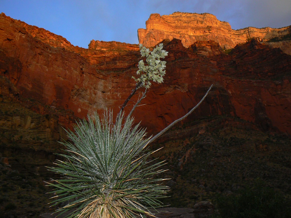
Redwall glows as sunset fades in a peaceful Canyon, finally free of air tour
terrorists (a bit more restriction to their flight time, say 24-hours of flight free natural quiet, please).
With calm and quiet air, Salt Creek camp perches at a fine vantage point for 360 degree Canyon ambiance.
Hermit Hiatus Day 4 photos by Rob
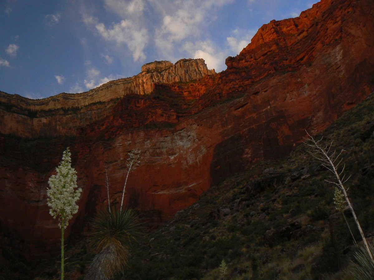
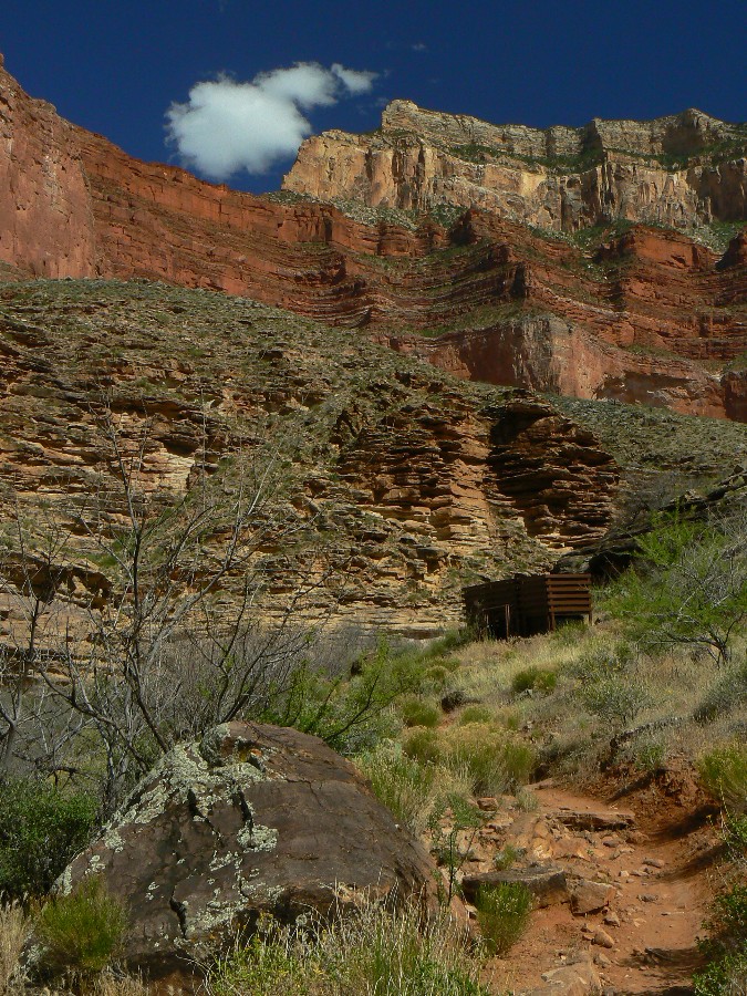
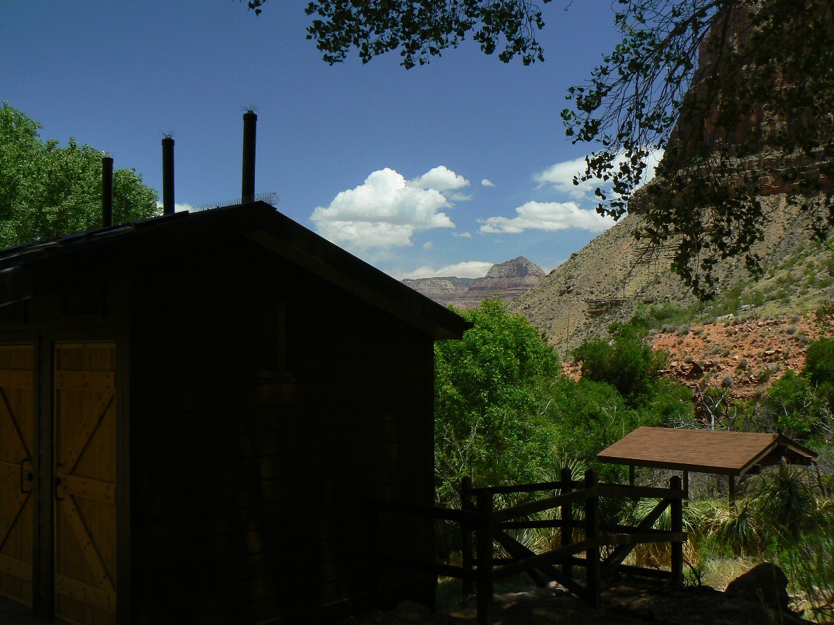
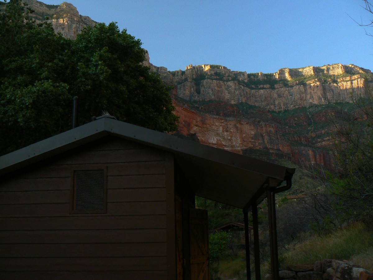
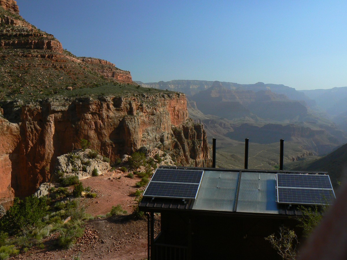
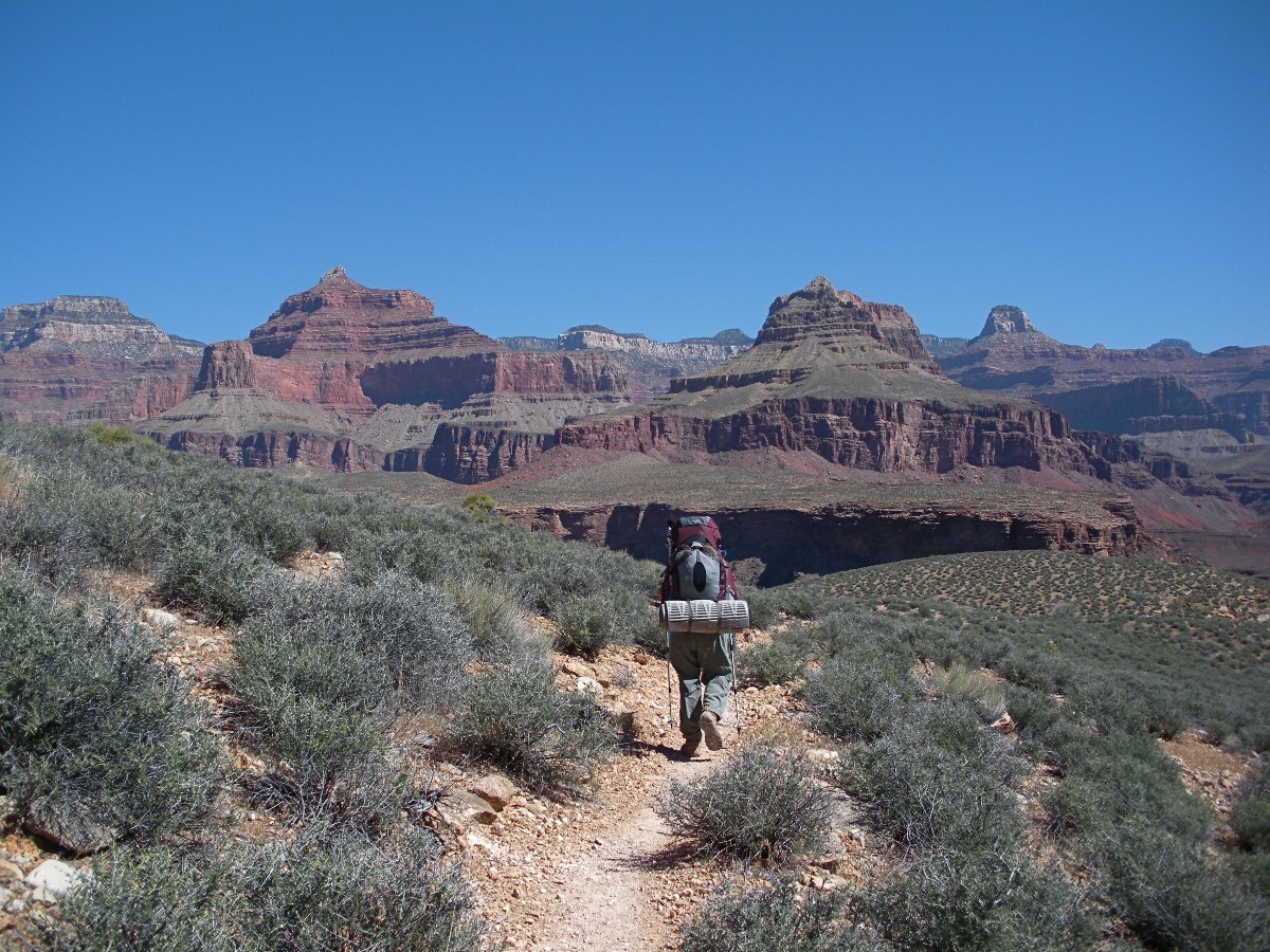
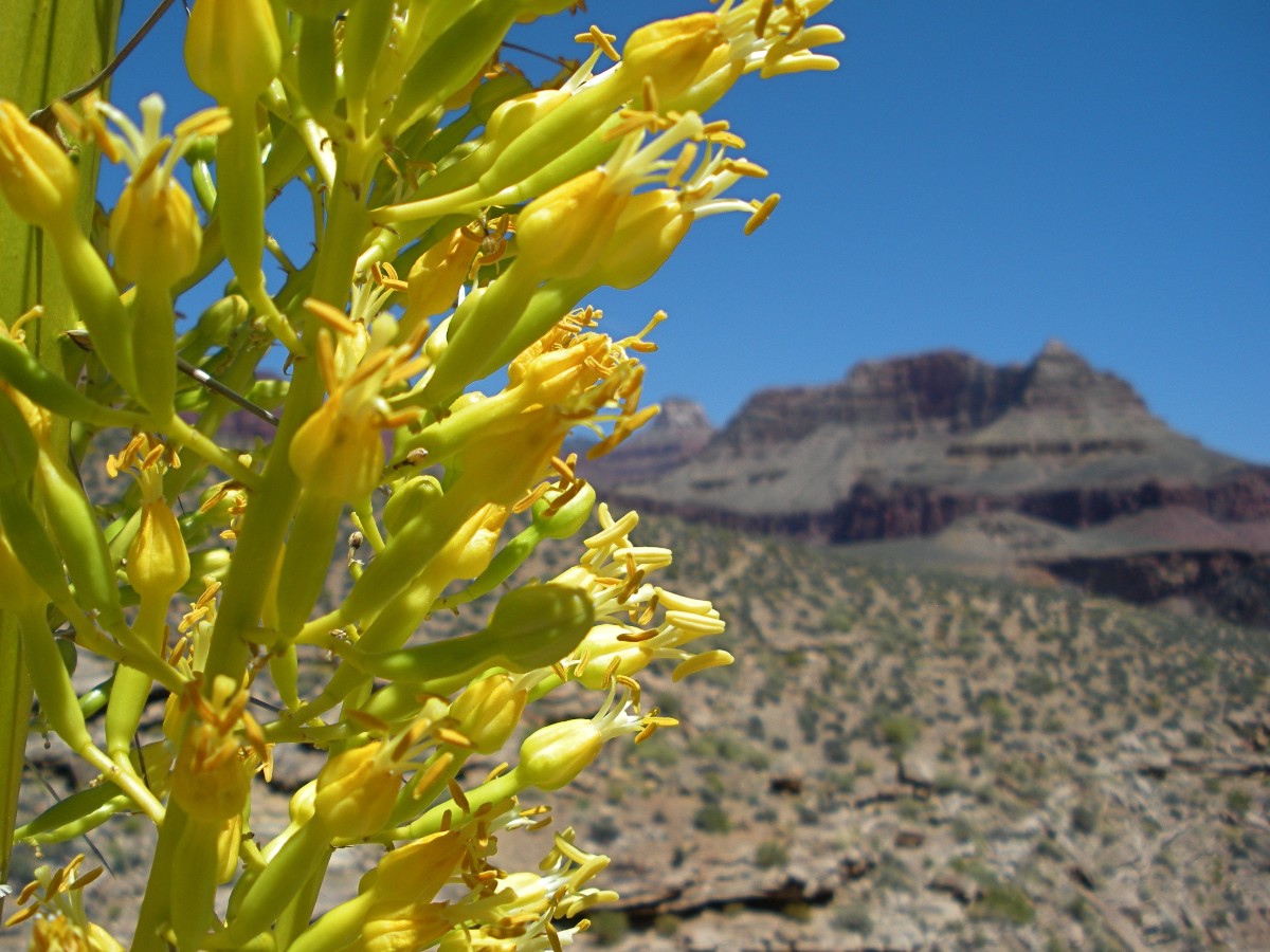
Day 5: Garden Glide: To Indian Garden. 7.3 miles; ERM = 10.5.
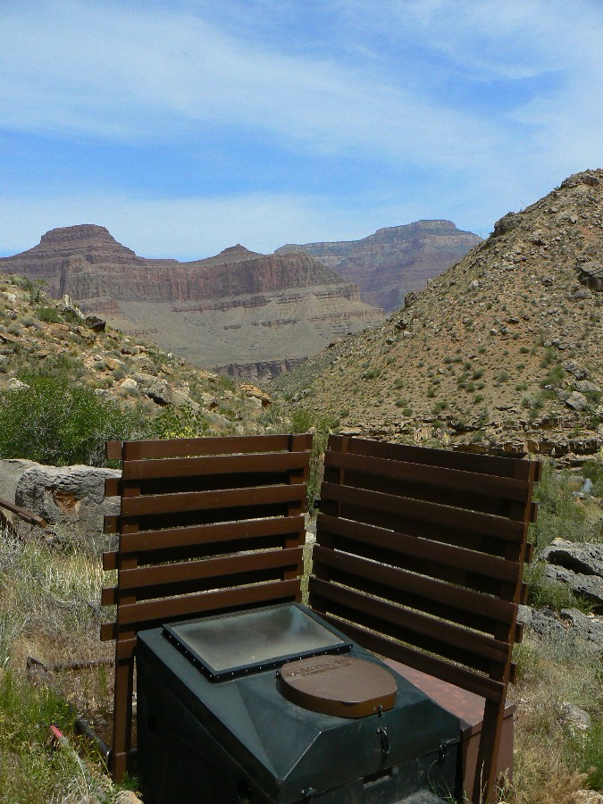
The solid shape of The Battleship comes into view as I approach Horn Creek and its
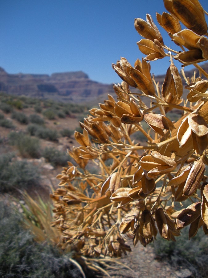
scenic toilet. Rolling along the morning Tonto, downriver views delight, punctuated by ready to bloom stately stalks
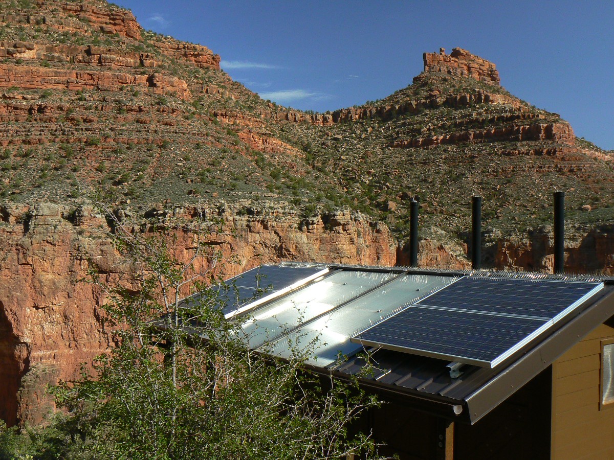
of agave (Century Plant). It's still relatively cool, and it's a quiet roll to Horn, realm of radioactive water.
What does one do with radioactive water? How come we're building more nuke reactors rather than practicing
reasonable population control?
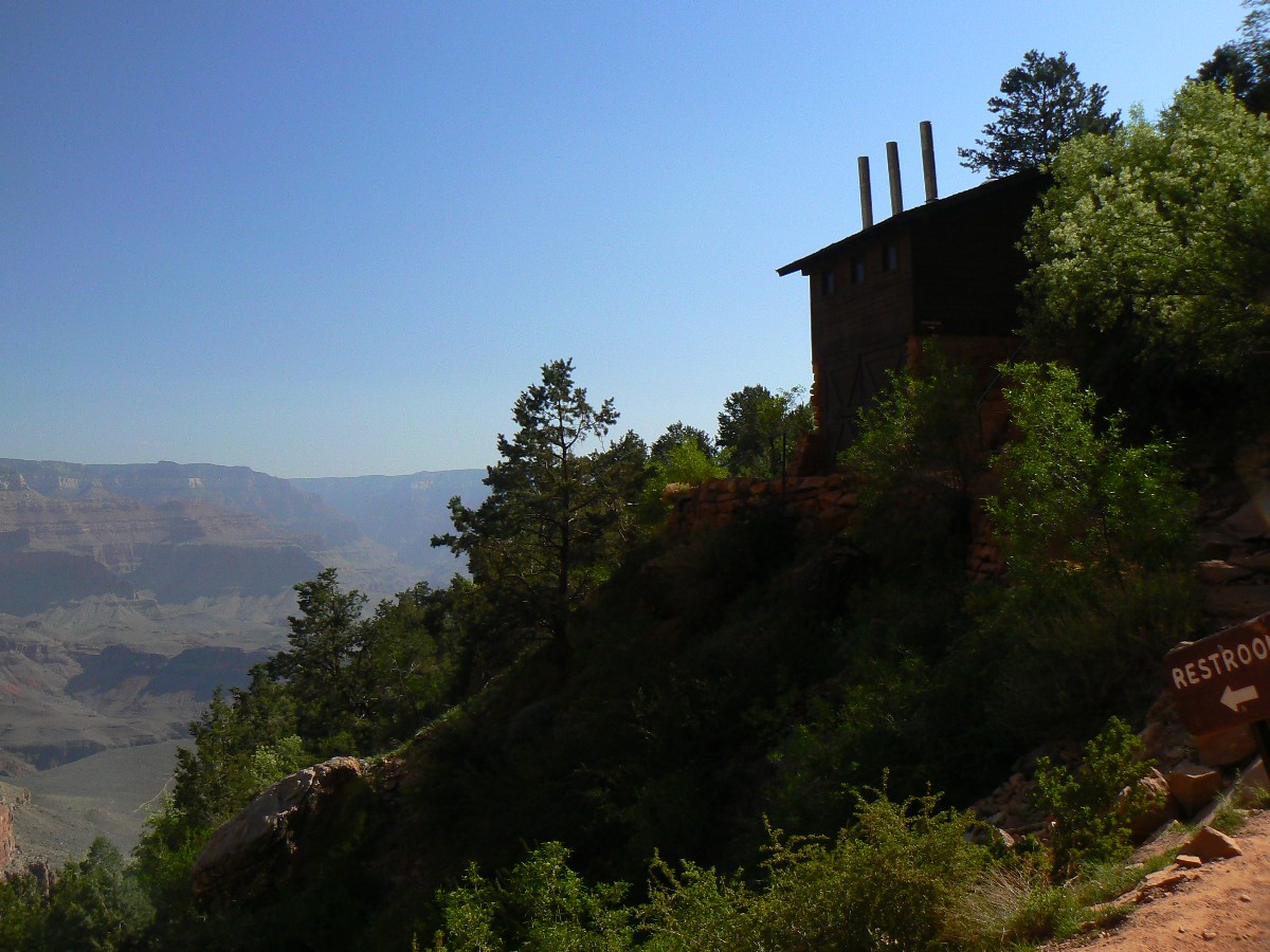
Seeing one hiker today, so far, we enter the touron-infested realm of Bright Angel
Trail and then Indian Garden (IG). New scenic toilets await. Yahoo. And glorious crystal clear and cool water
from the North Rim. Yummy.
We meet Ranger Erika (whom I missed meeting on the last hike) and listen to Ranger
Elyssa talk about ancestral Pueblo People who ranged into the GC.
Cooling rapidly, the saffron light fades from the Canyon walls.
Hermit Hiatus Day 5 photos by Rob
Day 6: Over The Top: To the Backcountry Office. 5.2 miles; ERM = 11.2.
Total trip (per my GPS) of 33.7 miles and total ERM = 62.2.
Up and on the trail, onto the dusty BA (Bright Angel), passing blooming four o'clocks.
Chugging away on the graded switchbacks, reversing the mnemonic about rocks made by time, passing ancient art work,
enthusiastic students who have earned a trip to The Grand Canyon (congratulations), wranglers expounding on their
view of canyon lore.
It's cool on top as Keith and I stroll to the Backcountry Office, then to retrieve
the shuttle vehicle. And, then fond goodbyes - to Keith, to The Canyon. We'll meet again. Redux.
The mnemonic goes like this (read down, use first letter of starting word as
a reminder - from the rim, down):
Know - Kaibab Limestone
The - Toroweap Formation
Canyon's - Coconino SS
History - Hermit Shale
Study - Supai Group (including the Esplanade)
Rocks - Redwall Limestone
Made - Mauv Limestone
By - Bright Angel Shale
Time - Tapeats SS
Know The Canyon's History, Study Rocks Made By Time.
Hermit Hiatus Day 6 photos by Rob
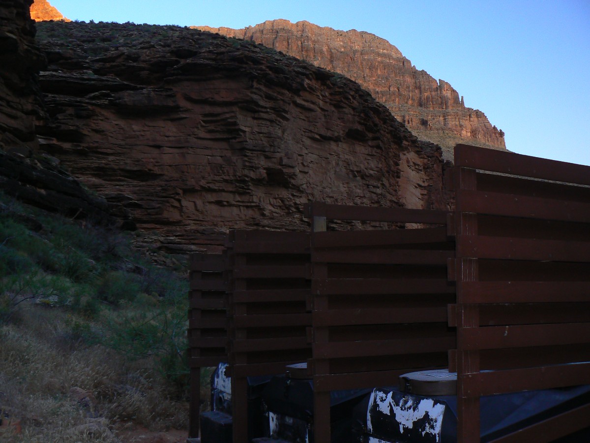
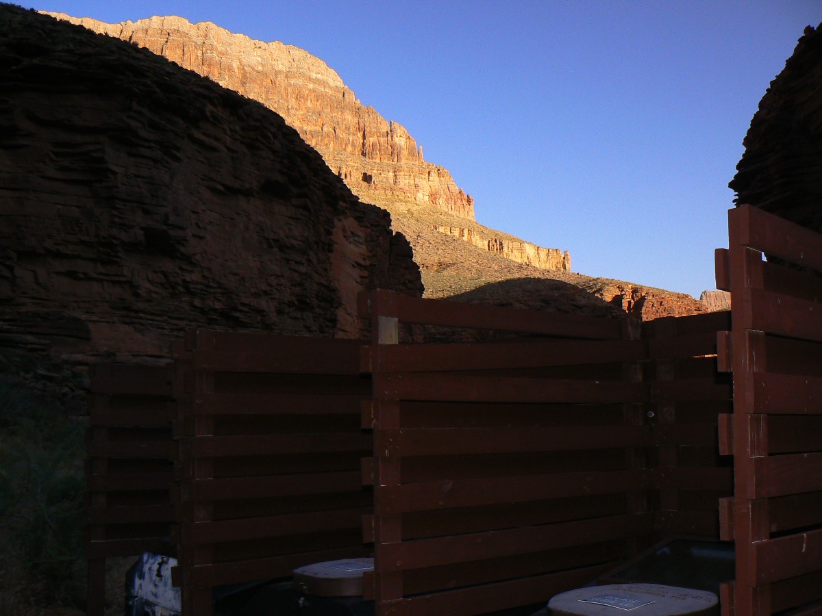
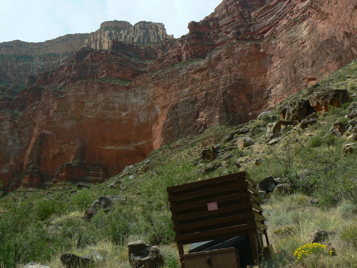
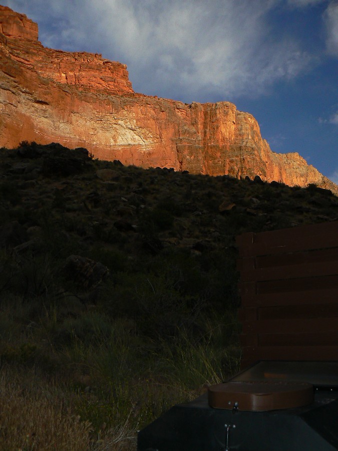
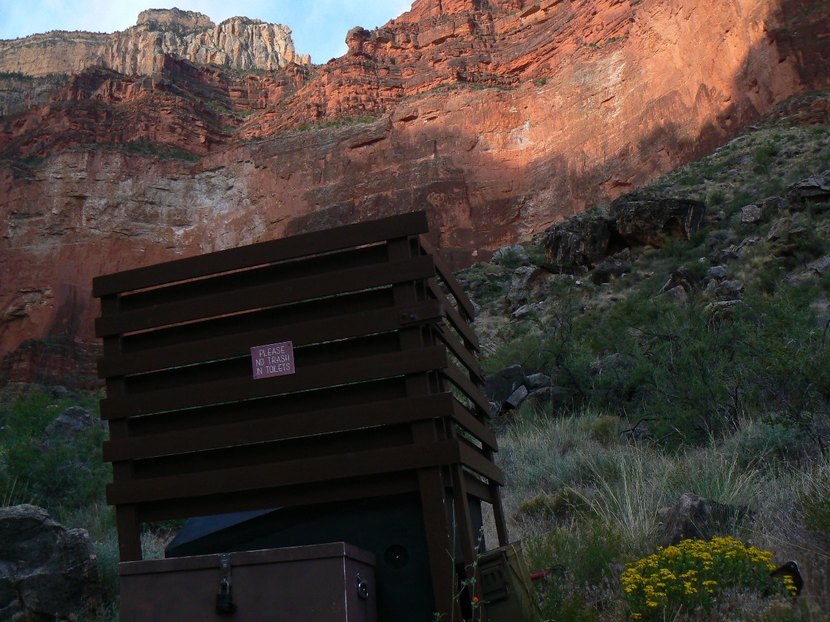
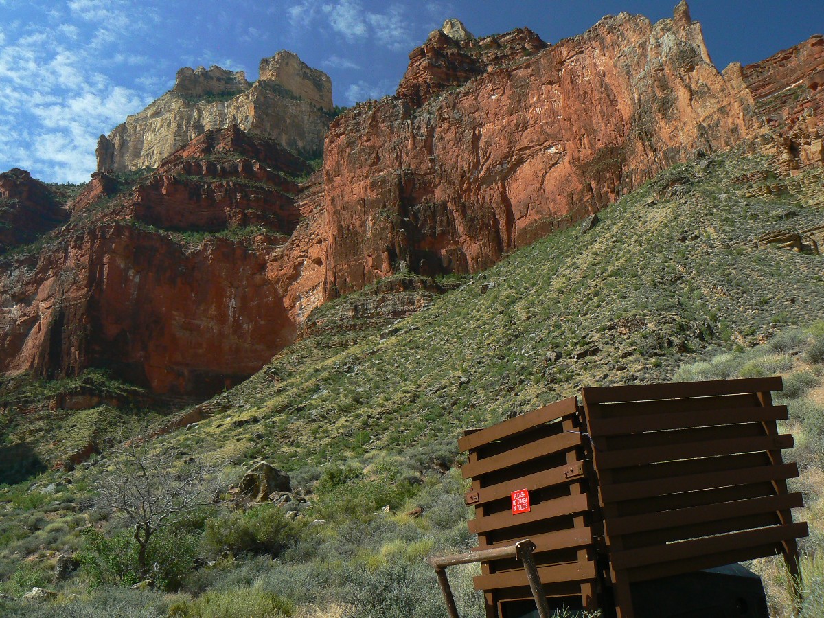
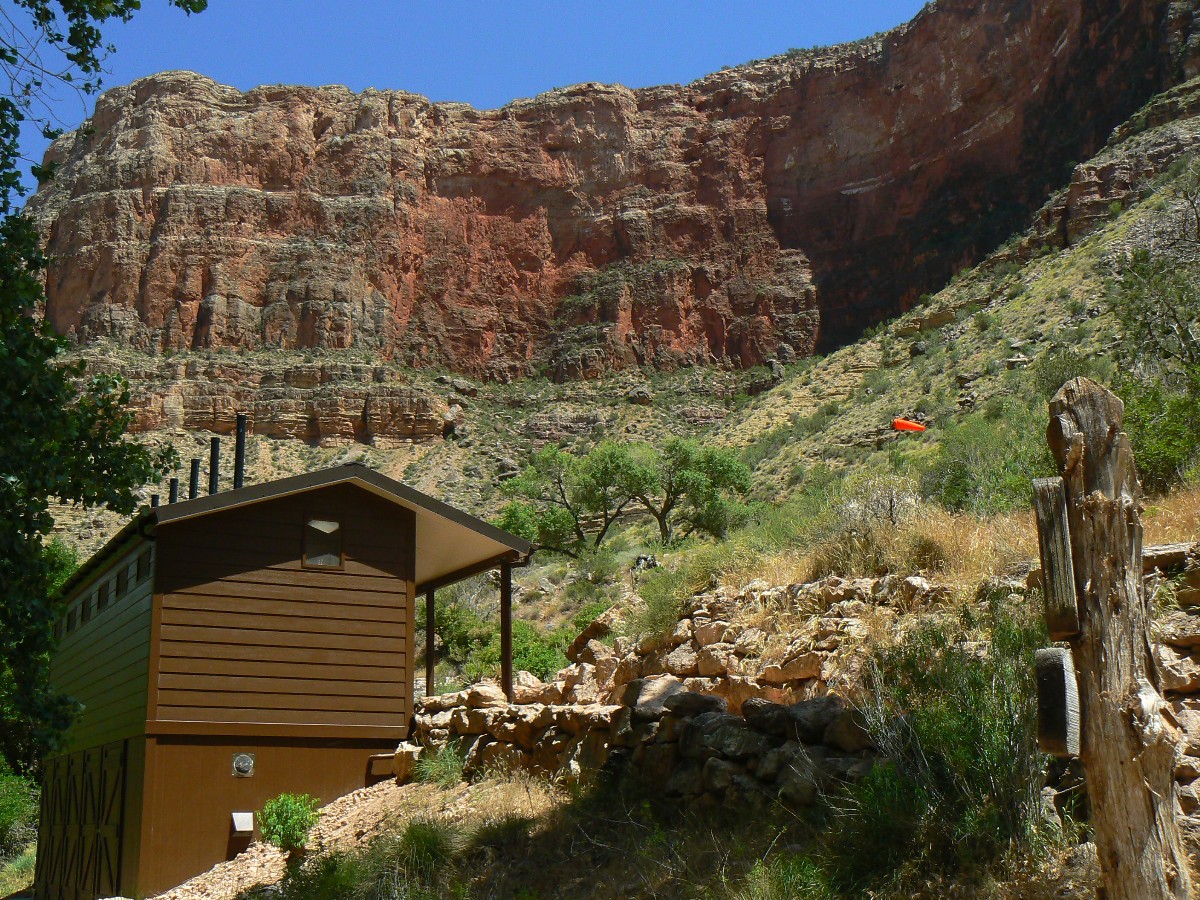
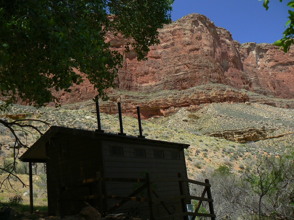
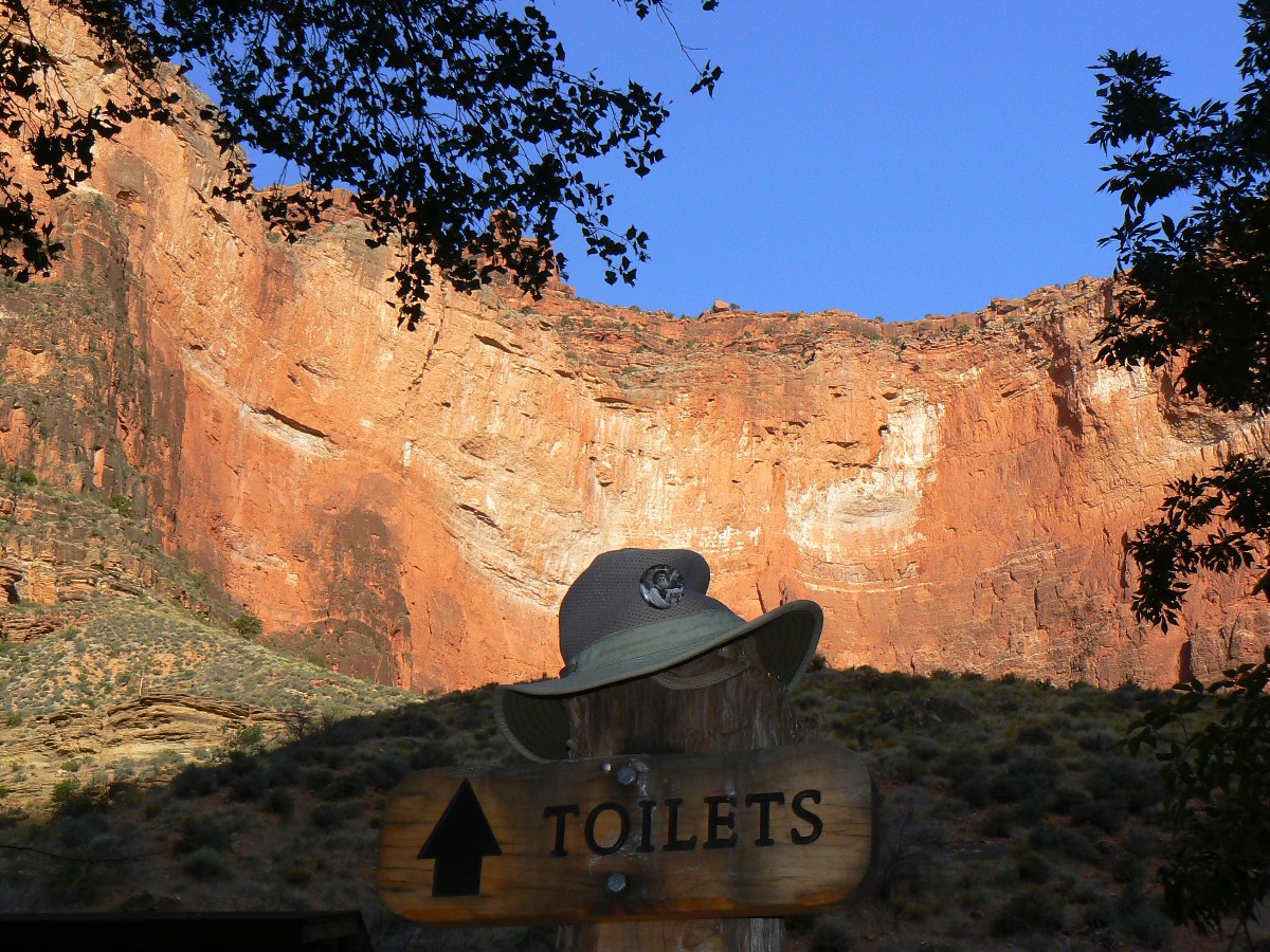
Scenic Toilets of the Hermit Hiatus - photos by Rob
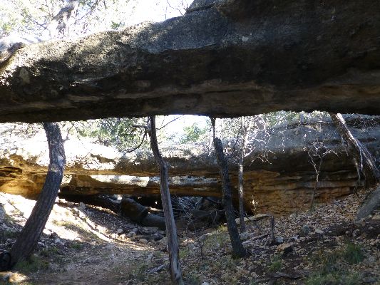
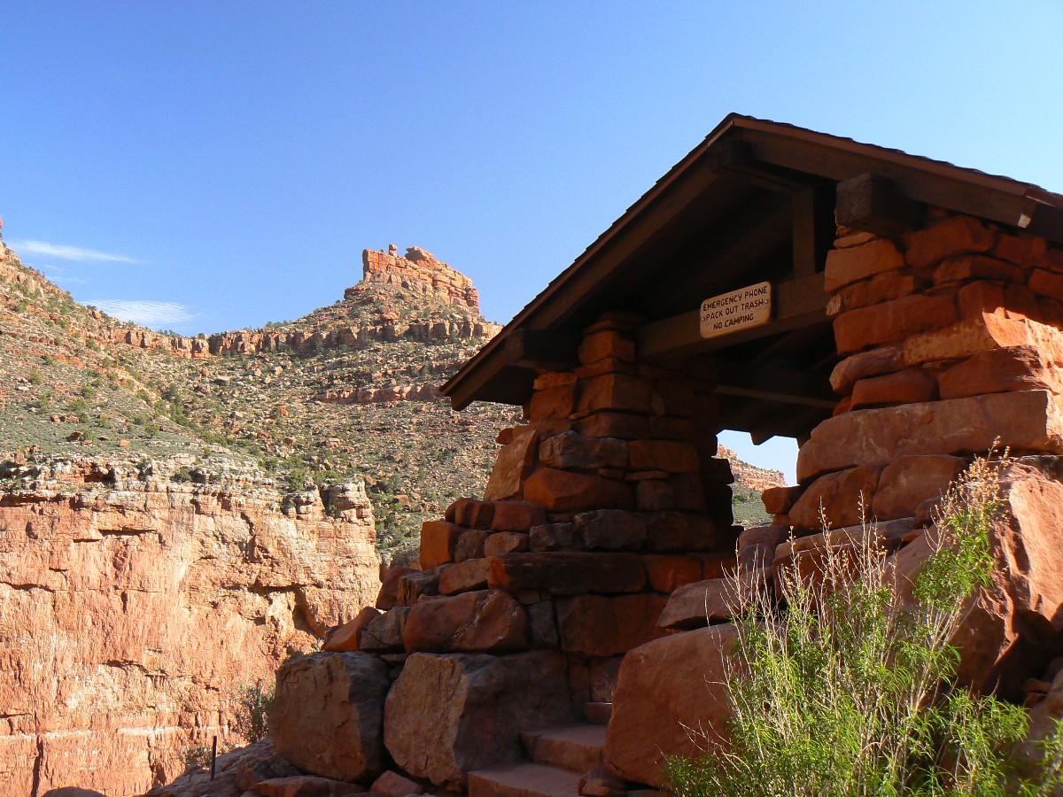
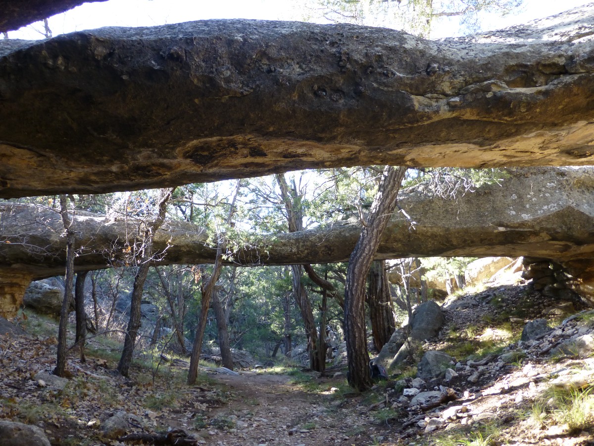
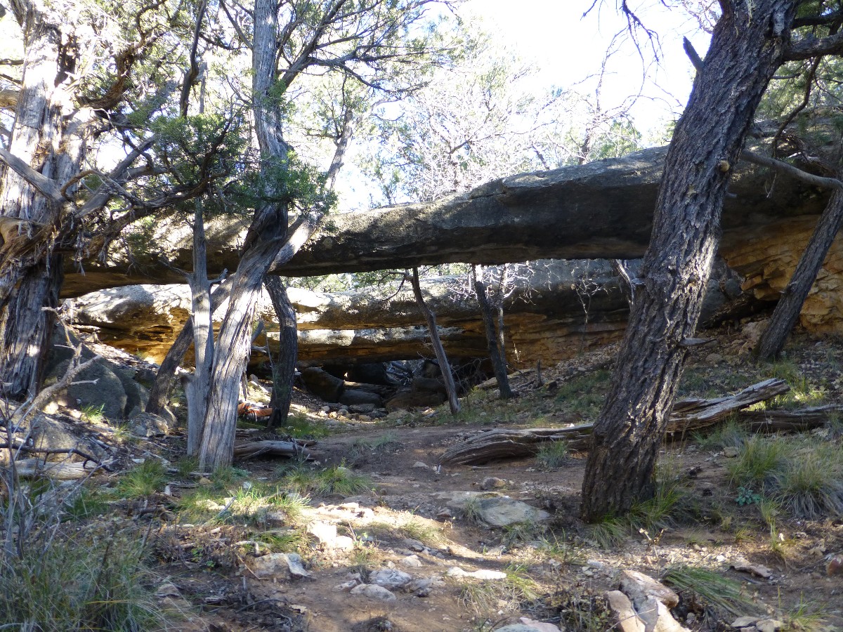
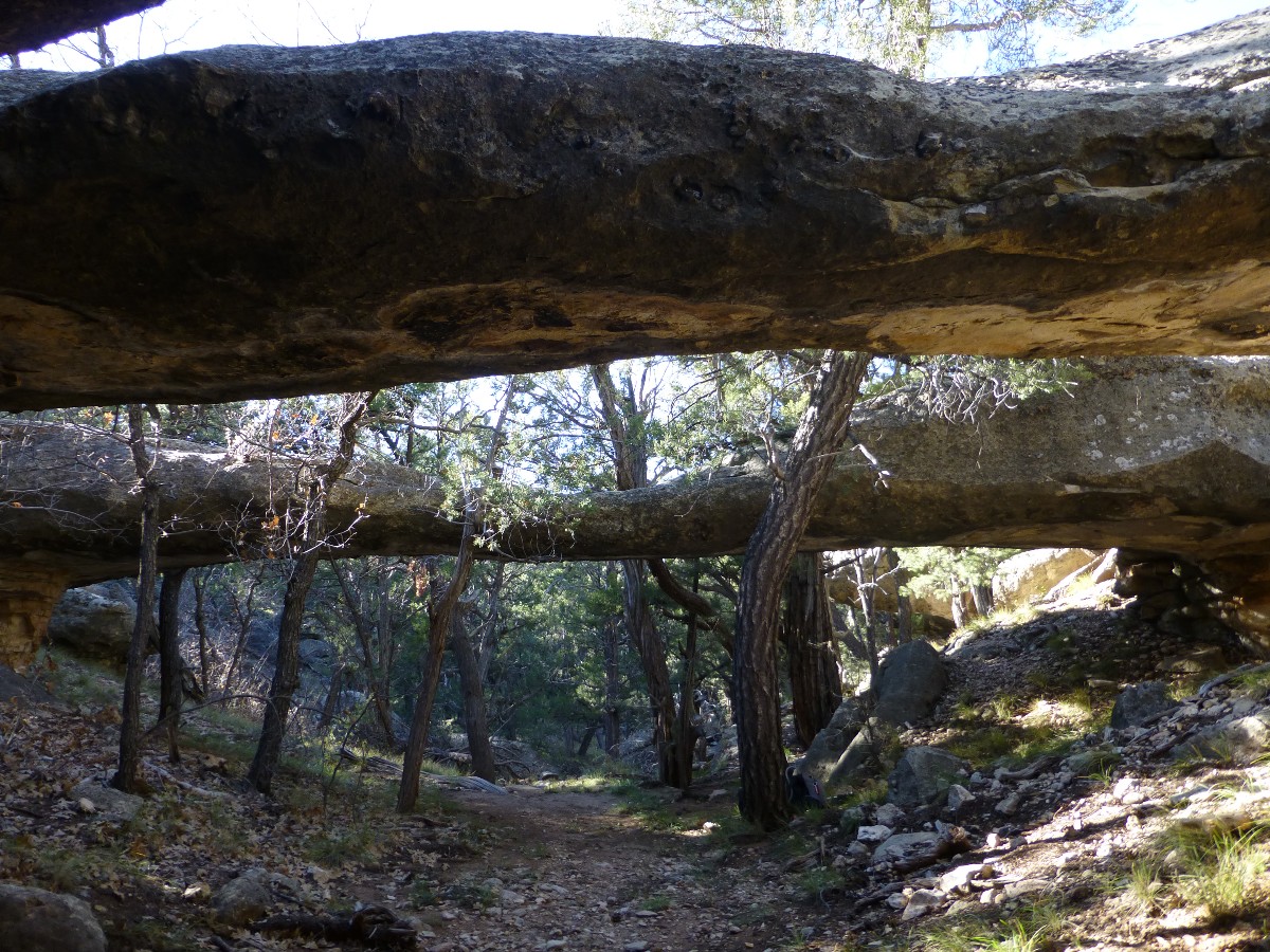
Four Sisters Natural Bridges: Found during a day hike off the Hermit Trail.
These gorgeous NBs (natural bridges) were apparently a common feature of the Hermit's
(Boucher) tourist mule rides because the old trail is rumored to have entered and exited The Canyon via the canyon just
below the top portion of the current Hermit trail, the quarter mile near the TH. Here is a video and some photos depicting
The Four Sisters. Apparently, some call these girls the Three Sisters. Yet, there are four NBs, and Three Sisters is
the name of a series of spires in Monument Valley. It's not easy to photograph all four of The Sisters in one image,
so I included a video so you can see for yourself. Better yet, take a day hike to Dripping Springs from Hermit's Rest,
and visit The Sisters on the way back.
Also see the info sheet by Emily Davis, Interpretive Ranger at the GC, and the person who told me the general area
in which to look for the Four Sisters.
Ranger Emily told me about the Four Sisters NBs - here is some info (click here for pdf)
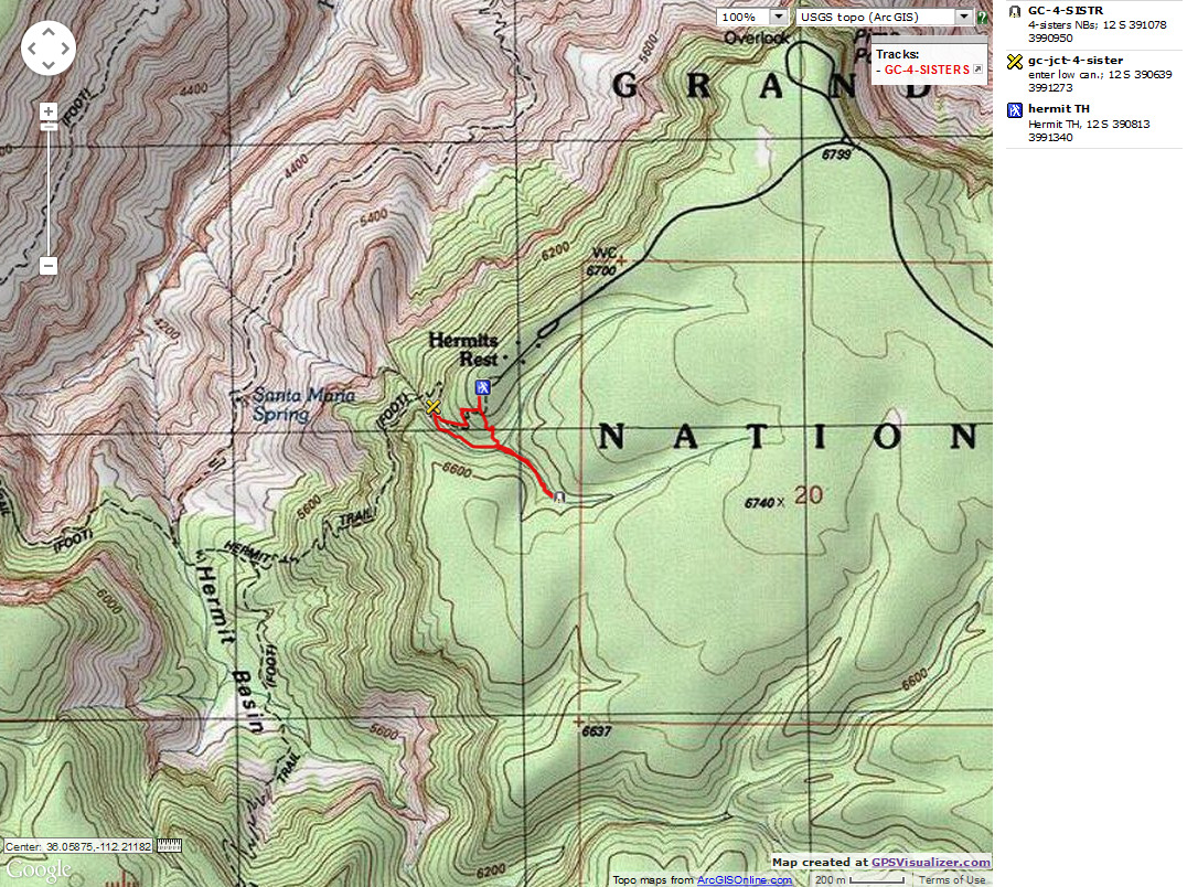
Brief directions - Four Sisters NBs: Walk one quarter mile
down the Hermit Trail, starting measurement at the TH sign. Watch for the low canyon off to your left, going down.
As the trail gets to an easy access, drop into this low canyon and walk up canyon for 0.4 miles, taking the
right canyon at the first branch, and the left canyon at the second branch. NBs span the low drainage.
A more direct way back to the trail can be hiked from the first fork you took going up canyon - just hike North
up the side of the canyon and back to the main trail (see map) - or return the way you came. The whole loop is
about a mile.
Four Sisters Natural Bridges- by Rob
|
|---|
On another trip, I found the Four Sisters - here is the movie (mp4; 27mb)
here is the movie (mp4; 27mb)
|
|---|
|
|
|---|
Map - GC: Hermit to Four Sisters NB
(Click the image to see the map)
|
|---|
|
Four Sisters Natural Bridges -- Right Click (then save this file: "save
link as..." in most browsers) on this Download link to get
the GPX file from
my GPS - you can then open it in your mapping software. Note - that's a Right Click on this link.
You will get the track for your software shown in the map above.
-- End of Rob's Report --

|
|---|
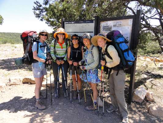
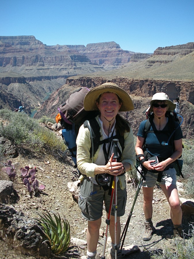
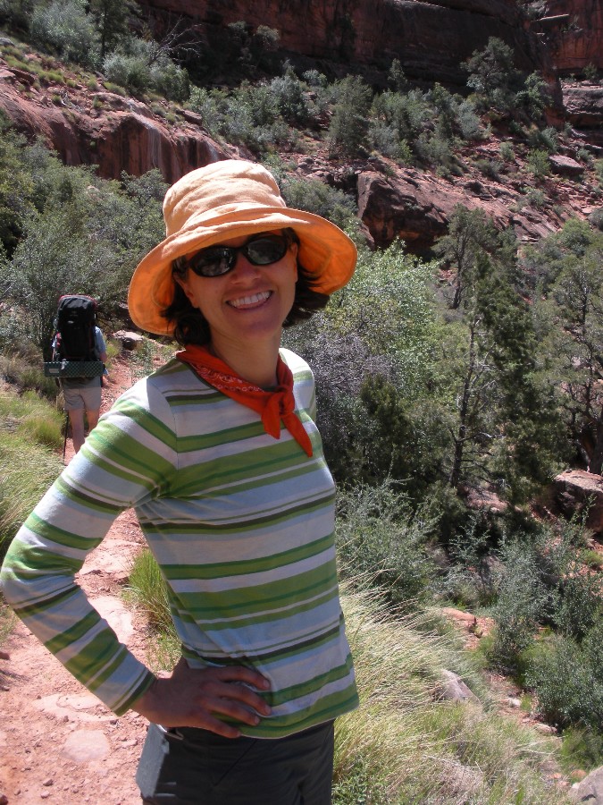
Monumental Women - Laura, Angie, Karen, Cynthia, Wynne
(Click the image to see Karen's photo)
|
|---|
|
Guest Report - by Wynne Geikenjoyner
Indian Garden to Hermits Rest
What a great start to a journey: hiking with 4 energetic, inspirational women,
descending the Bright Angel trail in the early morning hours with dramatic light. Our route was in the opposite
direction of Rob's and Keith's, heading westward and down-river for 4 days. We paused after our descent for
water and late breakfast snacks in Indian Gardens, then headed westward along the Tonto Trail for 7+ additional
miles. Being a quick-paced hiker, Karen took the lead. Along our first day's route, I decided we must be
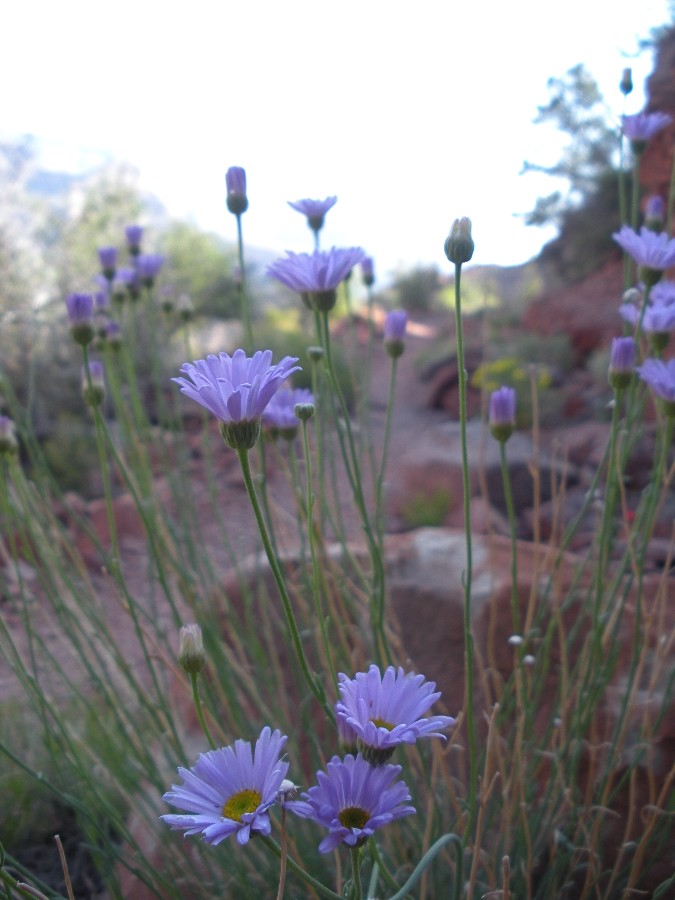
witnessing peak flowering season with so many beautiful cacti and perennial blooms at nearly every turn. We
paused in the shade of Horn Creek for a spell before continuing on. The Tonto level is striking for its
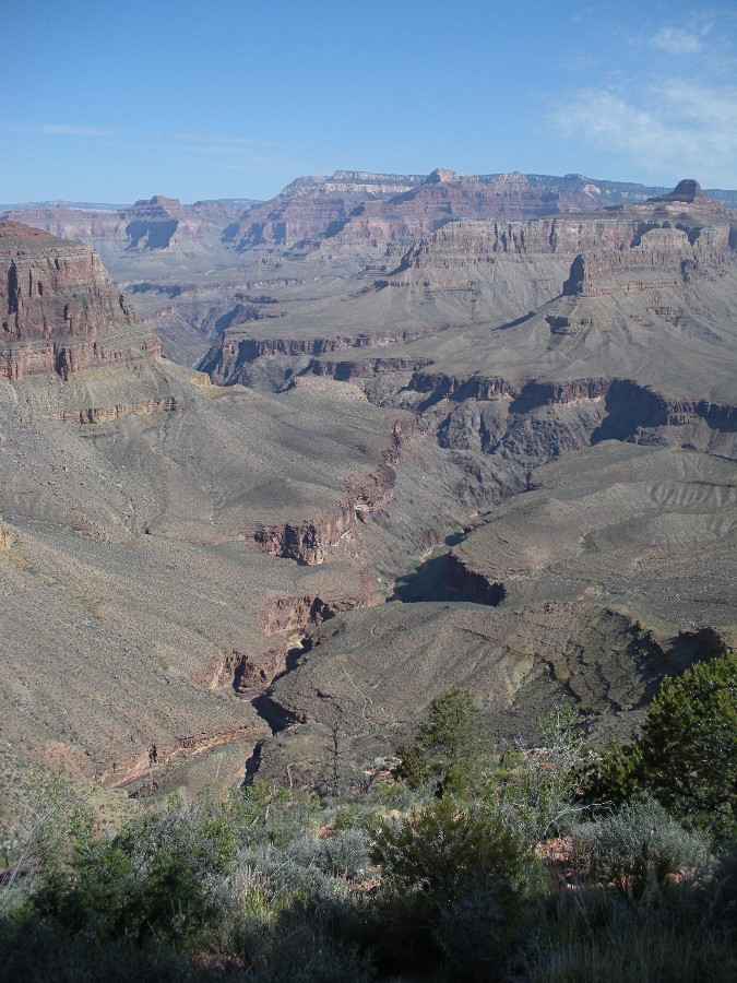
expansive views to the canyon rim above and the narrower gorge below, and the views down to the emerald waters
of the Colorado were stunning and clear. Our group was chipper and kept a good pace even as the heat of the
day crept upward. We arrived at our camp in Salt Creek in the early part of the afternoon and relaxed in the
shade of a large boulder, chatting, napping, and passing the warmest hours, then sat around our camp stoves
talking and laughing until dark.

|
|---|
pano from Day 5 on the Tonto - scroll L-R to view it
all
(Click the image for the full-size image)
|
|---|
|
photos by Wynne and Group - Day 1
Our second day's walk was a brief one, less than 4 miles from Salt Creek to
Monument Creek but we still left early to enjoy the cooler hours, and arrived at our 2nd camp with many hours
of daylight remaining. It was here that we met Rob! We quickly set up camp then gathered a few sundries to
walk down to the river and marvel at the magnificent Granite Rapid. We watched 2 parties navigate the tumultous
waves with ease, We met up with Rob again, who offered treats he received from one of the river trip groups, and
shared collective dreams about future backpack trips. After Rob departed, we each set up spots of shade to relax
for a few hours, almost hypnotized by the river. Another river party arrived to camp for the night and offered us
water for our hike back to camp which we gratefully accepted.
photos by Wynne and Group - Day 2
On our third day, our party split up, some choosing to relax in Monument Camp
beside the creek or in the shade of cliffs, others hiking first up canyon to take in the ampitheatre views and
encounter a Grand Canyon pink rattlesnake (Crotalus oreganus abyssus), then also to explore the slot canyon
between camp and the river. It was a peaceful day to relax the mind and body and soak up the mysteries of
the canyon.
|
|---|
pano from the last day, from the Hermit Trail - scroll L-R to view it
all
(Click the image for the full-size image)
|
|---|
|
photos by Wynne and Group - Day 3
For our fourth and final day, we arose and packed up early. The
temperatures were comfortable with a gentle breeze, permitting a relatively easy climb out of Monument Creek
and toward the junction with the Hermit trail. Our goal was to reach the top of the Red Wall before we ran
out of morning shade, and were successful. We all paused in our last major block of shade to snack before
continuing upward, stopping again for a very short rest at Santa Maria spring, then plodding up the final
and steepest part of the ascent to complete our journey at Hermit Trailhead. Success and happiness for all,
capped off with a lunch at the lodge before we each departed this amazing place. Many thanks to these
wonderful women for sharing the experience, and to Rob for putting together this blog!
-- End of Wynne's Report --
Links:
Click here to go to the original Hermit Hiatus trip report (2008)
Maps:
|
|
|---|
Map - GC: Hermit to Indian Garden, out BA; 2012; 34 miles
(Click the image to see the map)
|
|---|
|
for a full-resolution map, click here. Caution - do not use this map or gps track for
navigating the route.
Do you want to save the map for wandering the Hermit Trail and Tonto, 2012? -- Right Click (then save this file: "save
link as..." in most browsers) on this Download link to get
the GPX file from
my GPS - you can then open it in your mapping software. Note - that's a Right Click on this link.
You will get the track for your software shown in the map above.
|
|
|---|
Map - GC: Hermit to Four Sisters NB
(Click the image to see the map)
|
|---|
|
Four Sisters Natural Bridges -- Right Click (then save this file: "save
link as..." in most browsers) on this Download link to get
the GPX file from
my GPS - you can then open it in your mapping software. Note - that's a Right Click on this link.
You will get the track for your software shown in the map above.
Panos:
Click here to: see a pano from top portion of the Hermit Trail - scroll L-R to view it
all (4168 x 1200 pixels, 2.1mb)
pano from the Tonto Platform near Indian Garden - scroll L-R to view it
all (7889 x 1200 pixels, 2.4b)
Movies:
Click here to: see a Movie of a Hermit Creek burble 6.0 MB.
Click here to: see a Movie of Hermit Rapids Day 2 - 9mb.
Click here to: see a Movie of narrows in Monument Cr. Day 3 - 2mb.
Click here to: see a Movie of Granite Rapids - Day 3 - 6mb.
On another trip, I found the Four Sisters Natural Bridges - here is the movie (mp4; 27mb)
Books:
Eaarth : making a life on a tough new planet, McKibben, Bill,
Time Books, 2010.
Maybe one : an environmental and personal argument for single-child families, McKibben, Bill, Simon & Schuster,
1998.
The end of nature, McKibben, Bill, Random House, 1989.
A River Runner's Guide to the History of the GRAND CANYON,
Crumbo, Kim, JOHNSON BOOKS 1880 South 57th Court, Boulder, Colorado, 80301
1994.
Other WV reports about the Grand Canyon:
Click here or on the Looking Lizard to go to all WV reports about The Grand Canyon
|
|---|
Looking for All Wilderness Vagabond trip reports about the Grand Canyon?
Click the image to go to All WV reports about The Grand Canyon
|
|---|
|
Related Links:
And - Click here to see a Grand Canyon
River Archeology Virtual Tour.
Scenic Toilets of Inner Earth
the geology of the Grand Canyon by the NPS
the geology of the Grand Canyon by Bob Ribokas
Ranger Emily told me about the Four Sisters NBs - here is some info (pdf)
On another trip, I found the Four Sisters - here is the movie (mp4; 27mb)
More Truth Than Joke:

|
|---|
vote republican
(Click the image for the full-size image)
|
|---|
|

|
|---|
who helped pull your bootstraps?
(Click the image for the full-size image)
|
|---|
|

|
|---|
understanding entitlements
(Click the image for the full-size image)
|
|---|
|

|
|---|
teathered capitalism
(Click the image for the full-size image)
|
|---|
|

|
|---|
tea bagger nihilists
(Click the image for the full-size image)
|
|---|
|


