VIP service project at Bright Angel and Havasupai Garden, 2021 /
VIP is Volunteer In Park
(November 9 - 15, 2021)
Text © copyright by Rob; and Photos © copyright by Rob Jones, Craig Payne, Jon Beck

|
Havasupai Garden Hurrah!
VIP service project at Bright Angel and Havasupai Garden, 2021 / VIP is Volunteer In Park (November 9 - 15, 2021) Text © copyright by Rob; and Photos © copyright by Rob Jones, Craig Payne, Jon Beck |
|
Co-Adventurer VIPs: Barbara Boehme, Zig Sondelski, Jon Beck, Craig Payne, Bill Jones, and me
NPS Rangers: Kate P., Jeff S., Betsy, and Todd N. Ed F., NPS Packer, and Chris
at the wastewater treatment plant also made this project possible.
Permanent Volunteer in The Canyon: Sjors
This volunteer service project was supported by the NPS people who put the "Service!" in NPS. Thanks for your stewardship of our precious public lands.
camera: Panasonic DMC-ZS70
Note: the opinions in this report are not necessarily those of the NPS or my fellow VIPs.
| ||||
|
| |||||
|
| |||||
|
| |||||
|
| |||||
|
| |||||
| ||||
ERM = Energy Required Miles. A mile is added for
every 500' elevation gain or
loss. It's a very serviceable method of estimating energy required miles. ERM was initially used in Trails
of the Tetons (long out of print) by Paul Petzold, founder of NOLS. It's a wonderfully useful concept and
application. Add one mile for each 500' up AND down to distance = ERM. I use ERMs to calculate what the actual
day is like. It's a very serviceable method of estimating energy required miles. Remember, however, that the
ERMs are estimates because they depend on GPS satellite coverage and math functions.
Havasupai Hurrah? Havasupai Hurrah? Yes, the name "Indian Garden"
has been replaced with "Havasupai Garden," representing a modicum of sensitivity about place names and deference
to the Native people who long inhabited this lush area. The title is an acknowledgement that before this was a Park,
it was an important land to Indigenous People, and still is.
Overview: We six VIPs invested @ 223 hours in support of our public
lands, specifically those below the Rim in Grand Canyon National Park. In this report, there's a list of tasks
accomplished during this tour. We worked at BA (Bright Angel) and HG (Havasupai Garden) campgrounds during this
tour. Ranger Kate P. was our NPS contact in organizing this project. I served as the civilian organizer. Other NPS people
deserve recognition in addition to Kate, including Ranger Jeff (BA, Bright Angel), Ranger Betsy (HG, Havasupai Garden),
Sjors (permanent VIP at BA), Todd N. from the NPS volunteer office, Chris of the wastewater treatment plant, and Ed F.,
NPS packer and mule wrangler. To all, thanks for putting the "Service!" in NPS.
Using ERMs does not account for the 'texture' of the route or trail - that
is, rocky, boulders, no trail, slimy mud, etc., yet does help approximate the route.
See more information about ERMs at the end of this report.
You may see a complete list of VIP reports, mixed in with other Canyon
adventure reports, at
Click here to go to all WV reports about The Grand Canyon
| ||
|
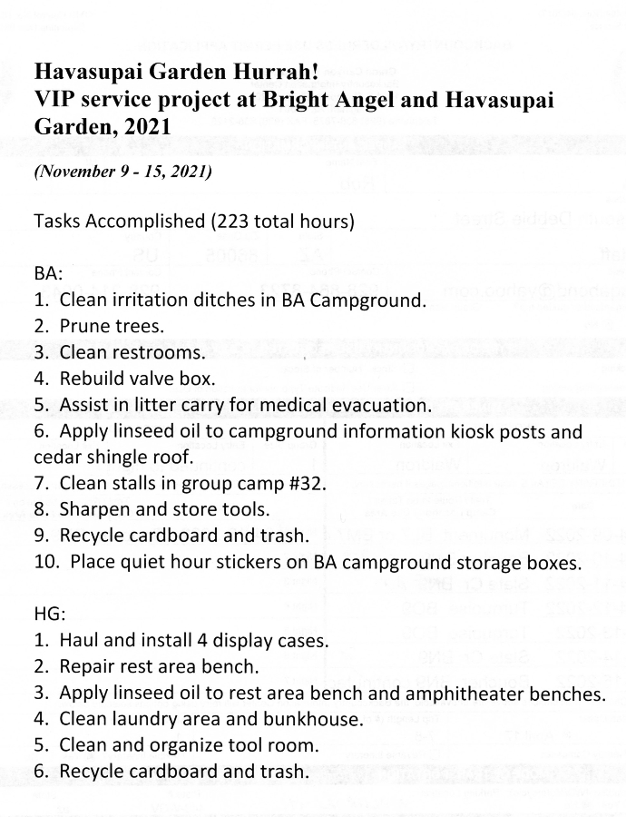
List of Tasks Accomplished 11-2021 VIP
(Click the image for the document) | ||
|---|---|---|
Grand Canyon Panorama Project - by Larry Wieland, South Kaibab and Bright Angel Trails! You can see the area we hiked by visiting this site. There are many options - click on the spheres to go to a panorama from that point. There are several panoramas taken from the Tipoff, for instance. Options also include: Add geology or topo map. A super series of panos and supporting geology maps. Start with the below link, use the geology map, move around to another pano. Superb. Grand Canyon Panorama Project - index of the South Kaibab Trail panoramas (link here).
 |
 |
 |
 |
 |
 |
 |
 gc-vip-11-2021-BA-Craig8 Zig-Barbara-Bill litter carry w.jpg |
 |
 |
 |
 |
 |
 |
 |
 |
 |
 |
 |
 |
 |
 |
 |
 |
 |
 |
 |
Day 1: Sheepishly to BA, via the South Kaibab. Trailhead at 7260',
River @ 2400', camp @ 2480'. 8 miles, ERM of 17.7.
All us VIPs arrive for an early meeting at the BIC (Backcountry Information Center) in
Grand Canyon National Park. Banana boxes are tossed about and we begin filling them with goodies. These boxes will be
toted into The Canyon by the NPS mules, guided by Ed F. and his fellow NPS packers. Banana boxes are used because they
fit across the Black Bridge (South Kaibab Bridge) when in the mule panniers. Other boxes are too wide and the mules and
packers don't like this, don't like it at all. Imagine trying to sort out a traffic jam of 1,000 pound mules in the middle of the
Black Bridge! Yikes. Perhaps worse than the traffic jams and gridlock created by the overpopulation of students at NAU in
Flagstaff. Did you know that the Black (Kaibab) Bridge was constructed so that mules can not turn around on the bridge?
We are able to pack each box so that it's very close to the same weight, doesn't make noise to spook the mules, and so the
contents don't shift around either. We adjusted the items so that the boxes going to HG (Havasupai Garden, formerly Indian
Garden) are within a tenth of a pound of the same weight. Excellent.
Tim Wilson joins us and supplies bagels, coffee, donuts. Thanks Tim! We would
comment many times how we'd like to have Tim along on this jaunt, because of his work ethic, yes, and also to help us sort
out puzzling geology seen along the way. Tim would be with us if not for other obligations.
Bill and I take the boxes over to the Pack & Fly while the rest of the group heads to The
Canyon, most going in via the SK (South Kaibab) Trail.
We find that Craig has waited to hike in with us when we return to the BIC. Super.
Craig and I mask up for the MAGAvirus and ride the NPS shuttle bus to the South Kaibab Trailhead. Bill drops into The Canyon
on the BA Trail
Down into The Canyon, the wind is accompanied by sporadic sprinkling as the grand
panorama spreads out on both sides of the unseen River. Spectacular! This vista demands more than "Grand." Dropping into
The Canyon always feels like going home to me.
As we approach The Tipoff we see Jon, Barbara, and Zig enjoying the Tipoff scenic
toilet vista amidst the visual splendor that is the Tonto Platform. Jon, Craig, and I ease on down the trail to the mushroom
rock near the actual Tipoff for lunch, while Barbara and Zig continue down, down through what appears to be the rusty red
Hakatai Shale of the GC Supergroup. The River churns below and the deep roiling growl reverberations surround us as we
peer into part of BA Camp and across The River at the North Rim and rocks made by time.
Four or five Bighorn Sheep are lilting among the steep metamorphic basement rocks,
including two big rams and at least two ewes. Deluxe. They are several switchbacks above the tunnel to the SK Bridge and
put on quite a show tip-toeing gracefully across the exposed basement rocks.
Rolling into Bright Angel, BA, Campground we find that Sjors has reserved the group
camp with the historic mule stables for our use. Thanks Sjors. We rove up and down to Phantom Ranger Station (RS) organizing
tools and checking in with the Rangers. Ranger Kate P. is our primary NPS contact and organizer and Ranger Jeff S. is at Phantom
RS and always helps us during our projects.
Drastically, we discovered that the NPS mules and our food boxes will not arrive until
tomorrow. What? It seems that, unbeknown to us, the packer schedule now alternates with a Tuesday, then a Wednesday
start. Being lucky, we are on a Wednesday start week. Argh. Bill and Craig were risk averse enough to pack extra food in their
packs while the rest of relied on the typical schedule. We all manage, with help from Sjors and Ranger Kate.
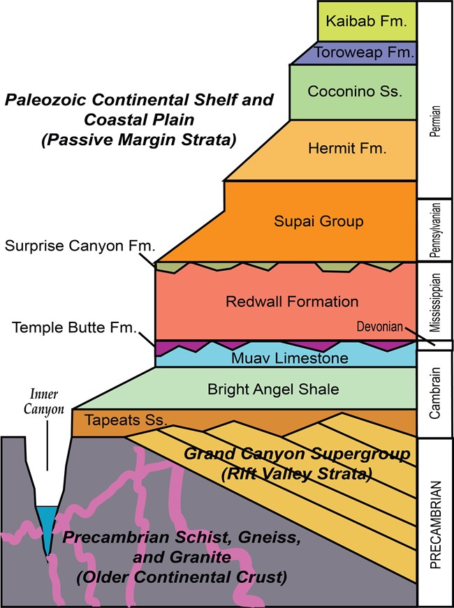
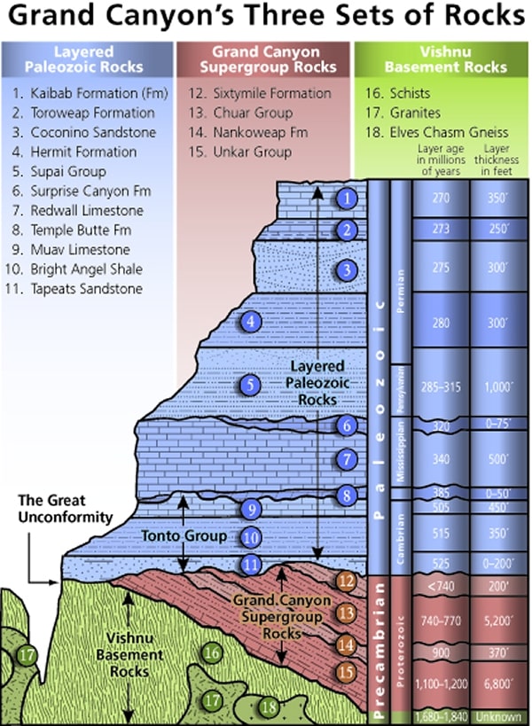
Mnemonic for the basic GC layers - Know The Canyons History, Study Rocks Made by Time
Know - Kaibab Limestone
The - Toroweap Formation
Canyon's - Coconino SS
History - Hermit Shale
Study - Supai Group (including the Esplanade)
Rocks - Redwall Limestone
Made - Mauv Limestone
By - Bright Angel Shale
Time - Tapeats SS
Know The Canyon's History, Study Rocks Made By Time.
Check the links section for lots more geology stuff. Here are versions of this basic schemata:
| ||||
| ||||
| ||||
 |
 |
 |
Day 2: Ditching BA.
3 miles.
The CCC: It was 1933 and severe economic depression challenged the
confidence of the people of the United States. One in four people was unemployed. Many were homeless. Serious drought
gripped large areas of the West and Midwest. The nation’s leaders felt that the economic and social problems demanded
immediate action. Franklin Delano Roosevelt was sworn into the presidency on March 4. He called Congress into emergency
session on March 9, introduced legislation for the Civilian Conservation Corps (CCC) on March 27. By the end of 1935 the CCC
employed more than 500,000 men at over 2,650 camps in every state. The creation of the CCC was a model of speediness -
something we do not see today because the repulsicans in the Senate will not advance bills. The CCC program became the most
popular of Roosevelt’s New Deal programs.
Grand Canyon National Park’s first CCC contingent arrived on May 29, 1933. CCC crews worked on the South Rim, North Rim,
and in the inner canyon until 1942. Companies 818, 819, 847, 2543, 2833, 3318, and 4814 served not only at Grand Canyon, but
a few companies also under-took projects near Tucson and Phoenix, Arizona during the winter months. The original purpose of
the CCC was to put young men to work on worthwhile conservation projects that would benefit the country. Early in its existence,
however, the program added emphasis to teach “the boys” skills and trades.
Civilian Conservation Corps at Grand Canyon: North Rim and Inner Canyon Projects. Company 818 worked on the higher
and cooler North Rim during the summer months. Projects completed included buildings, fences, and roads. The crews also helped
fight forest fires when necessary. The men moved to inner canyon areas such as Phantom Ranch during the winter months. Today’s
Bright Angel Campground at Phantom Ranch sits on the footprint of the Company 818 camp. More challenging projects included a
number of inner canyon trails. The Ribbon Falls Trail, a half-mile (0.8 km) spur off the North Kaibab Trail, still leads hikers to a beautiful
waterfall. Part of this trail leads to Upper Ribbon Falls - about a mile from the crossing of Bright Angel Creek. Even more ambitious
was the nine-mile (14 km) Clear Creek Trail (1933-36). (paraphrased from an NPS brochure)
We're up fairly early and ready to meet with Kate and Sjors for a quick
safety talk before battling Bermuda Grass and other intrusions into the BA Campground ditches. These ditches
were not on the bar alongside Bright Angel Creek when the CCC (Civilian Conservation Corps) occupied the area,
nor were the big trees. The CCC did plant some of the trees when they rotated out to World War II, and the ditches
were later initially dug by an NPS Ranger Dave P. (not sure of the last name). For more than three decades, Sjors
has planted trees and kept the trees growing to shade exhausted hot campers at BA Campground. Otherwise, campers
at BA Campground would be raisins drying in the sun. Hurrah for Sjors. All GC hikers owe a debt to Sjors for more than
30 years of volunteering in the bottom of The Canyon.
Hack, hoe, pull, chop, tug through the grass and weeds in the ditches that
supply water to the big and the developing trees in the campground. Zig and Barbara work the streamside channel,
Craig, Bill, Jon, and Kate work the middle ditch, and Sjors and I struggle through the aorta of the rockside conduit.
Because our food boxes wouldn't arrive until late afternoon, Ranger Kate cooks
a delightful meal of rice, beans, yams, broccoli, and cauliflower, topped with white cheddar cheese for late lunch.
Superb and yummy.
We finish a bit over half of the ditch project by late afternoon, then go to greet
wrangler Ed and the NPS mules. Yahoo, our banana boxes full of yummy delights (food!) have arrived. We've been
eating well, and now we can really eat. Also in the banana boxes are new "Succulents of Arizona" books for the BA and
HG visitor libraries donated by India H.
After organizing the food and cooking dinner, there's little daylight left.
The opportunity for a shower opens, and Zig, Bill, and I take advantage
of it. Wonderful.
Returning to camp via headlamp, the sky is blanketed by the first billion
stars. Yowee.
Day 3 Photos - Havasupai Hurrah!


Day 3: Copper Morning. 3 miles; 3.5 ERM.
The Great Blue Heron stalks imperceptibly forward toward unseen
prey in one direction, downstream. Upstream, Bright Angel Creek glows copper, backed by a salmon-hued butte.
It's a glorious morning in a spectacular work site. Welcome to BA Camp. The glow spreads. I reposition to downstream
and downlight so that the Heron shows up in the meager morning crepuscular symphony of Canyon light. Time for a
brief video of Heron and company. Lovely.
We VIPs are finishing the ditch project. More pull, tug, hoe, cut the encroaching
grass and such. Finishing the basic ditch work, we turn our attention to other tasks, some of which are presented late in
the morning. Trimming mesquite and cat claw acacia. Rebuilding the valve box, once again. Cleaning restrooms. A test
run and final watering of the year will wait until tomorrow so that it can be done carefully and completely.
Zig, Barbara, Craig, and I head to Phantom Ranch cantina for dinner. Even though
it lacks the ambiance of an inside the cantina family style meal, it's quite good out on the picnic table. Sad, the (mainly
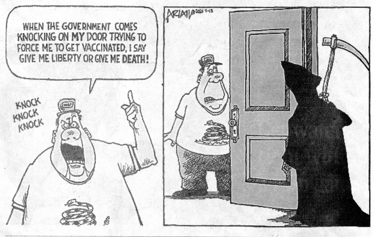
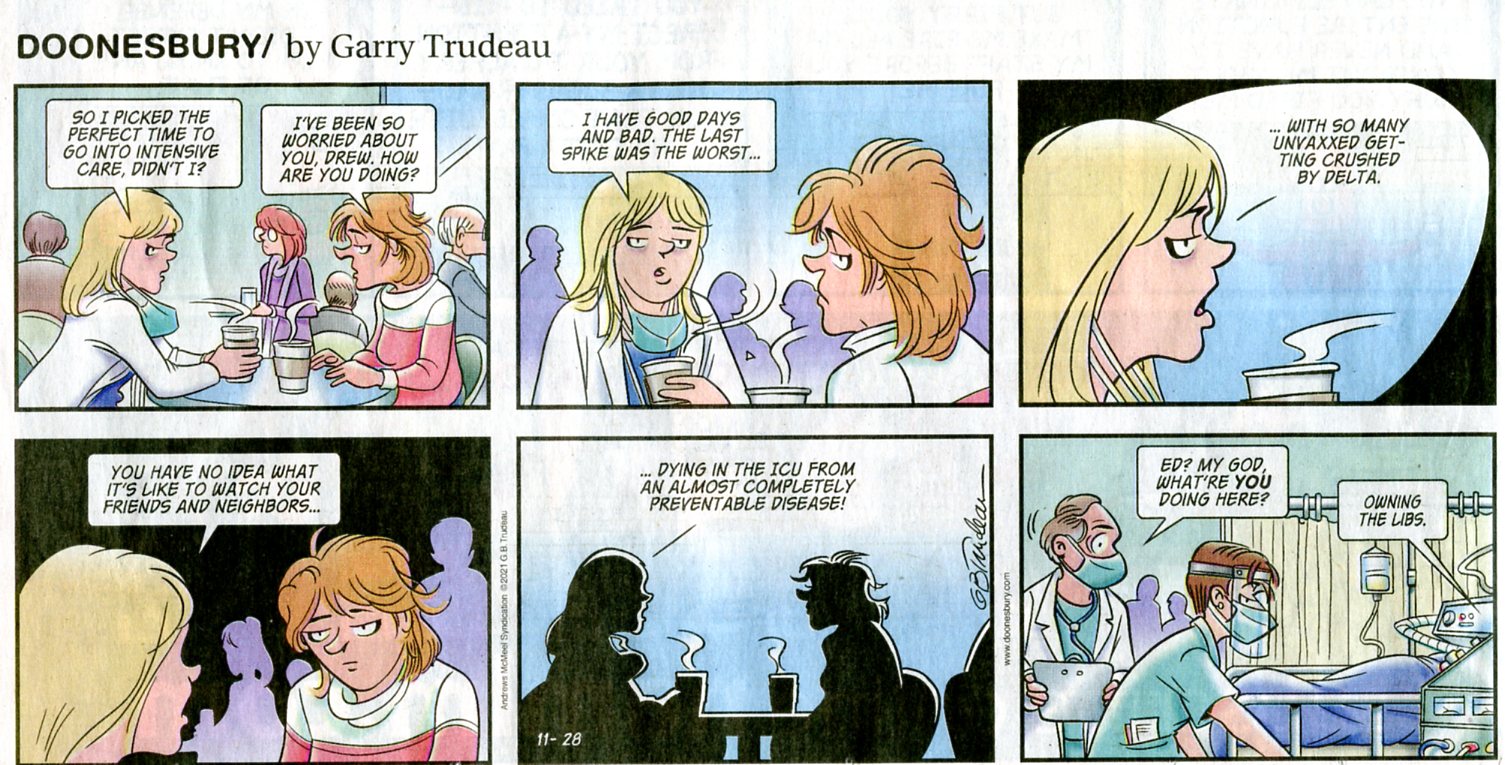
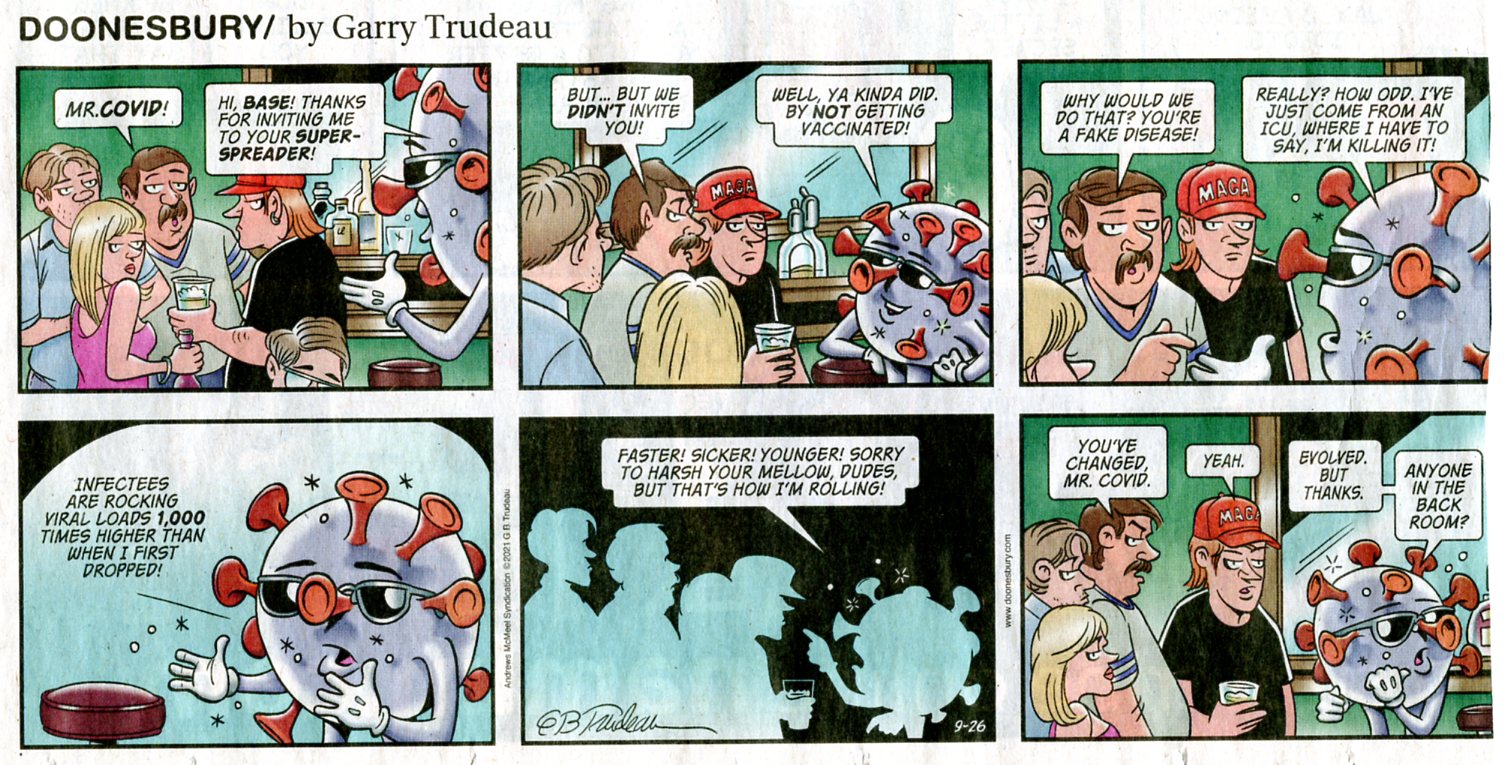
repulsican) anti-vaxers are prolonging the high death rates, providing vectors for successive mutations of the crafty
MAGAvirus, increasing health care and hospitalization costs, spurring damage to social and economic structure (restricted
or closed restaurants, etc.), and such. The antithesis of patriots. "Repulsicans" is the appropriate description and name
for these science-denying hypocrites. It seems to be a race to win the Darwin Award for freedumb, and I suspect the toll
will be a million dead by the end of the year. I don't mind these freedumb tyrants killing themselves, that's their choice.
But, I am very angry about how their lack of community and common decency is killing others and our country. This
thing, MAGAvirus, could be mostly over by now if repulsicans (and a few other science deniers) helped deal with this
public health crisis rather than making it political. Cell phones, OK; vaccines, No; on and on. I'm certain the MAGAvirus
pandemic will morph into an endemic, much like the flu, although much more lethal. We will be dealing with this killer for
many years, if not until global climate change finally snuffs out all human life and most of everything else. Acedia,
everyone? Or just banal ennui?
The cool air drifts down canyon along Bright Angel Creek as the background
burble of the tumbling water provides natural white noise to cover the unnatural clamoring of big city campers.
 |
 |
 |
Day 4: Litter Bugs . 4 miles, 6 ERM.
The day dawns cooler. Just another day in paradise.
And then - a test flush! People are positioned along the course of the ditch to rake out debris
before it clogs the system and water overflows into campsites. Success. Everyone is elated at finishing this huge task.
So, we celebrate with an Ice cream social at noon behind the Ranger Station, provided by
Ranger Kate. Thanks Kate!
Zig and I return to reinforcing the valve box lid.
Barbara and Jon continue cleaning of the restrooms. Bill, who is the only one to bring painting
clothes, is linseed oiling the campground information kiosk and the beautiful cedar shake roof (roof by Mike Hayes, VIP). Craig is
working on food storage boxes.
Then, the call for assistance from Ranger Jeff. A hiker with possibly broken ankles (yes, both
of them) needs assistance several switchbacks up the South Kaibab Trail. So, we rendezvous in front of the Phantom Ranger Station,
fit helmets, tote the litter and pad up the trail. Sjors, Kate, Chris from Phantom Ranch, and we VIPs meet Jeff on the SK Trail and
transfer the hiker to the litter, then begin the slow, arduous journey to the helipad. Switching out regularly, it's still a very difficult
descent. We're happy that we're going down and not up the seemingly countless switchbacks. The helicopter sweeps in as we
cross the SK Bridge. Finally, we reach the helipad and stretch backs and arms and legs and all the connecting parts. Whew.
I am not posting litter bug photos because of privacy issues.
Then, back to finish the oiling and cleaning and repairing before total collapse. Yes, we're
now in the crepuscular hours, and my body is in a state of collapse as dark collapses.
 |
 |
 |
 |
 |
 |
Day 5: Miner's Delight. 8 miles, ERM of 11.5. Camp @ 3800'.
We're up and organizing the last tools to return before cleaning up and
packing. Then Barbara, Zig, and Bill head out for the BA Trail climb to HG. Jon, Craig, and I begin clawing our way up
what appears to be the Miner's route until getting on the actual route. It's not easy to start on the actual route, such
that it is. It's steep and loose and I find a big unanchored rock that pulls out and leaves me briefly in midair before
sliding down the slope, contributing some skin to the substrate. Cheese grater. Ouch.
As noted, we then get on the actual route and the purchase improves.
Up at the saddle near the top of the basement rocks, we find a scenic spot
for a footnote and a snack before continuing on to the base of the Tapeats Sandstone, and from there up to the Tonto
Platform. The historic trail contours until it finds the current day Tonto Trail. Along the way, we enjoy another lunch
on the smooth ledges of a side canyon. This is an excellent place for photographing a footnote to The Canyon.
Hiking West on the Tonto in the gathering shade of big walls, we hike to the BA
Trail. Now, we're hiking the super highway, deep in the dust, up to the Havasupai RS. Feeling like coming home, we ease
into what's now called Havasupai Garden, to the Bunkhouse. The other VIPs arrived before Jon, Craig, and I and are at
work organizing for our next priority project, installing new display cases in the HG rest area along the BA Trail. Heavy
units, it takes four of us to tote a display case from the tool shed to the rest area. We return with an old case. One of
the aging Cottonwood trees had previously dropped a large branch on the information kiosk, smashing its roof and
damaging or burying some of the benches. Because of the danger to hikers, the splendid shade trees were cut down.
Back at the HG shop, we look for tools and materials, then retreat to the HG
Bunkhouse for dinner and to bake brownies. Yummy.
 |
 |
 |
 |
 |
 |
Day 6: HG, hurrah. 3 miles, ERM of 3.5..
We're up to clear skies and one of the best work sites in the world.
Spectacular. Red light creeps up the Redwall to the West. Gorgeous.
Today's the day for building a shelf on which to place the heavy display
cases while anchoring them to the kiosk. It's a work jig. First, the shelf, or jig must be leveled and adjusted for
height. It's a long process, yet well worth it for the quality of the ensuing work and the ease of installing cases
2, 3, and 4. This absorbs much of the day.
We do pause for a 10 o'clock feeding, followed by a 1 o'clock feeding,
where we enjoy scratch made soup by Ranger Betsy. Thanks Betsy.
During all this, Jon is rehabilitating a bench and Bill and Barbara are applying
linseed oil to the amphitheater benches and, later, the rest area benches.
More brownies are baked in honor of India's (a renowned VIP) birthday and
because they are super yummy and because we can.
| ||||
 |
 |
 |
 |
 |
 |
 |
 |
 |
Day 7: Out of it. Out of The Canyon via the Bright Angel Trail.
4.5 miles. ERM of 11.
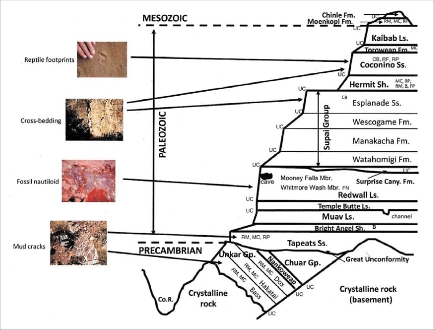
About 300 million years ago, the small pre-amphibian trudges across
the shifting dune, forming diagonal tracks as she slips the crest, her tracks later immortalized in the Supai Formation
of what is now The Grand Canyon. Eons later, researchers wonder "are these the oldest known footprints?" This is as it
is written in the time almanac of repetitive seas and deserts, building limestone and cemented sand dunes (sandstone),
mudstones and shale, over and over. Then the plain becomes a plateau as it is pushed steadily skyward, driven up by
tectonic plates, one grinding (subduction) under the other, vertically lifting what would become the Colorado Plateau
over a mile above sea level. Somehow, the strata of what will become The Canyon remain mostly horizontal. Amazing stuff.
The last morning as a group of us as VIPs is punctuated by laughter, good cheer,
and cleaning up the bunkhouse. Then, it's out into the cool air for the abrupt climb to the South Rim. It's a mere 4.5 miles
and 3,000 feet of elevation gain to the South Rim and we churn away to warm up.
Ed F., NPS packer, and Junior the Mule dust past as we climb the BA Trail to the Rim.
Junior is one of my favorite mules whom I met on a previous VIP jaunt. He's calm and unperturbed by equine squabbles,
says Ed. We exchange pleasantries and compliments about each other's work and personal demeanor. Ed exhibits the best
of old West manners and so does Junior as they haul dirt for the trail crew.
Up. Up into and through the Redwall, then into the Supai formation, where we
find the 313 million-year old fossilized tracks of a proto-lizardo preserved in a small boulder trailside to the BA. Interesting.
Farther on, there is the rock art of Indigenous residents hidden under the protective cap of what appears to be a Coconino
Sandstone boulder. Fascinating. Up through the Coconino, closer to the Rim. The top two limestone layers, Toroweap and
Kaibab are surmounted, and we're into the sun, passing more pictographs, finally breaking out on the Rim. Out of it. It's
surreal on the rim.
"I measure your health by the number of shoes and hats and clothes you have worn out."
Ralph Waldo Emerson"Under the desert sun, in the dogmatic clarity, the fables of theology and the myths of classical philosophy dissolve like mist. The air is clean, the rock cuts cruelly into flesh; shatter the rock and the odor of flint rises to your nostrils, bitter and sharp. Whirlwinds dance across the salt flats, a pillar of dust by day; the thornbush breaks into flame at night. What does it mean? It means nothing. It is as it is and has no need for meaning. The desert lies beneath and soars beyond any possible human qualification. Therefore, sublime."
Ed Abbey
| ||||
*ERM: Energy Required Miles, are there data to support this
mileage adjustment?
Journal of Outdoor Recreation, Education and Leadership
Petzoldt first proposed his theory in his 1976 book “Teton Trails” to
help backpackers plan trips and calculate their energy needs on mountain trails. “Petzoldt defined one
energy mile as the energy required to walk one mile on the flat. He recommended adding two energy miles
for every 1,000 feet of elevation gain, so a person hiking one mile and 1,000 feet upward would use the
equivalent of three energy miles,” Phipps said.
Petzoldt’s energy mile theory was just a reflection of the mountaineer’s
“gut feeling,” Phipps said. The theory had never been tested in a laboratory before the study began in WCU’s
Exercise Physiology Laboratory in the spring of 2010, Phipps said.
To determine the validity of the theory, the study measured the energy cost
and perceived exertion for walking on flat ground, with and without a 44.5-pound backpack, and up an elevation
gain of 1,000 feet, with and without the backpack, through the collection of metabolic data, Phipps said.
Twenty-four student, faculty and staff volunteers, including 12 males and 12
females, went through four testing sessions as the research continued into fall semester of 2010. The study
results showed that the additional energy cost for ascending 1,000 feet ranged from 1.34 to 2.02 energy mile
equivalents, for an average of about 1.6 miles, compared to Petzoldt’s use of two energy miles for each 1,000
feet. The range revealed by the study was due to the “hikers” personal weight differences, Phipps said.
“It is remarkable that Petzoldt’s energy mile theory is so close to the actual energy cost measured during our
study,” Phipps said. “In the field of outdoor education, it’s important for leaders to include an estimation
of energy requirements during the planning of hiking trips.”
Phipps said the energy required for hiking up steep mountain trails would vary
for individuals and groups, and the variables of the trail would also factor in, but he recommends that
backpackers stick with Petzoldt’s idea of adding two energy miles for every 1,000 feet of elevation gain when
planning trips.
The Validity of Petzoldt's Energy Mile Theory, 2010
Authors: Maridy McNeff Troy, Maurice L. Phipps
Publication: Journal of Outdoor Recreation, Education, and Leadership
Links:
|
| ||
|
List of Tasks Accomplished 11-2021 VIP
(Click the image for the document) | ||
|---|---|---|
| ||||
Related Links:
Panorama Project: South Kaibab Trail
Panorama Project: Bright Angel Trail
You may see a complete list of VIP reports, mixed in with other
Canyon adventure reports here.
Oldest known footprints in the Grand Canyon found
the geology of the Grand Canyon by Canyon Dave
Falter - we've used up our chances, Earth is now Eaarth by Bill McKibben
Other WV reports about the Grand Canyon:
Click here or on the Looking Lizard to go to all WV reports about The Grand Canyon
| ||||
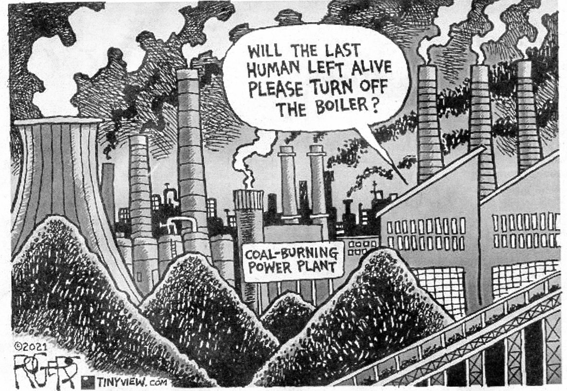
More Truth Than Joke:
| ||||
| ||||
| ||||
| ||||
| ||||
| ||||
| ||||
|
Wild Vagabond Main |
Trip Report Index  |
Caveat  |
|---|