(November 18 - 22, 2020)
Text © copyright by Rob; and Photos © copyright by Rob Jones of the WV

|
Grand Canyon /
Vicissitudes of Vishnu: Horseshoe Rounder / Horseshoe Mesa / Hance Creek / Red Canyon / Hance Rapids / Cottonwood Creek / Grandview Trail
(November 18 - 22, 2020) Text © copyright by Rob; and Photos © copyright by Rob Jones of the WV |
|
Co-Adventurers: Solo hike
Total miles = 34.5 miles; ERM of 60.5; ERM = Energy Required Miles (see full description below).
camera: Panasonic DMC-ZS70
|
| |||||
|
| |||||
|
| |||||
| ||||
| ||||
.
.
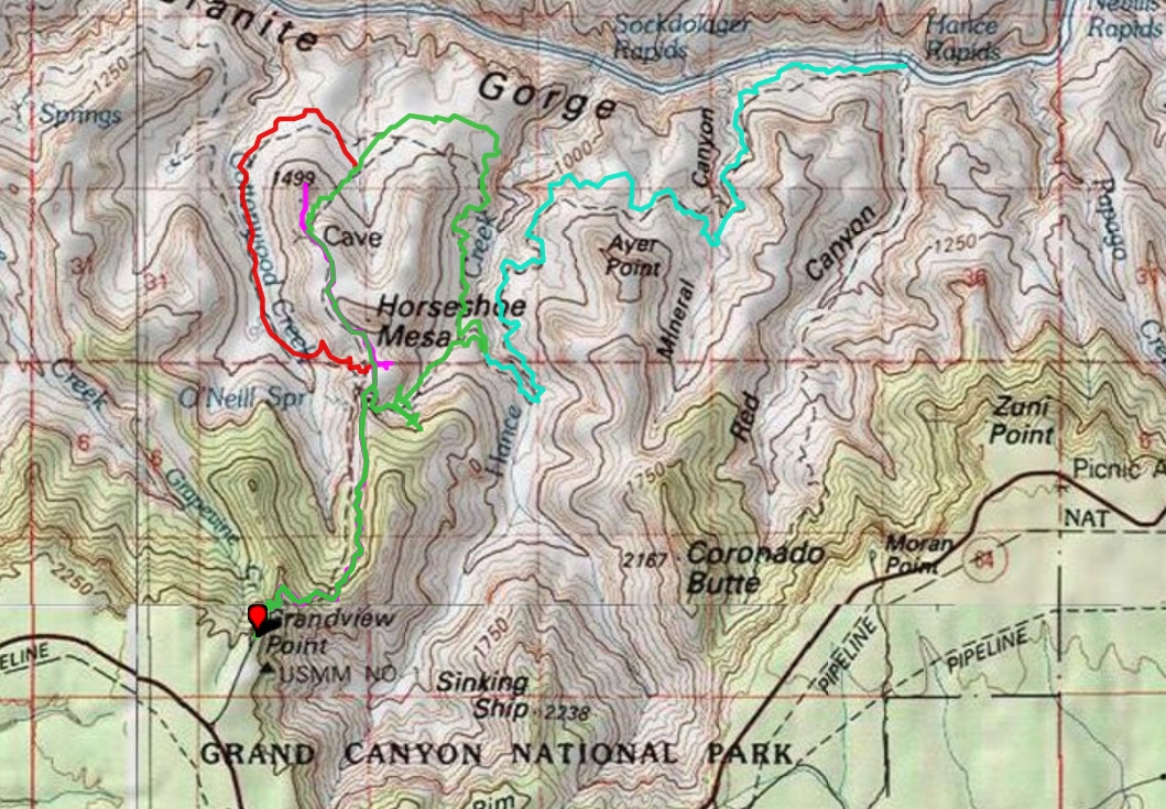
Vicissitudes of Vishnu map ----> click for a JPG map.
Whole route in pdf----> click for a pdf map (large file,
decent for printing).
Another
version of the map can be found here.
This web version can be enlarged and may be more useful than the above maps, assuming that
it works for you. ----> click here for the GPS visualizer map - and roam at will.
Summary:
Vicissitudes as in changes. For this report, the changes in Vishnu from
varying vantage points. Changing lighting, shadows, silhouette, profile, you know, the basic meaning of vicissitude. Not
the ominous aspect of vicissitudes, at least not until the last day.
Background: Grandview Trail was originally constructed in 1892 to
haul uneconomical copper ore out of The Canyon on pack mules from the Last Chance Mine. Mining tourists was
easier and more profitable.
Preliminary: Ranger Dean reports "Its mostly open down there, good
thing that hiking the Corridor was your last choice." It's an auspicious start to this wait list (last minute) adventure. Yes,
there're issues, concerns, and problems with a Corridor request. The MAGAvirus and difficulties at the BA (Bright Angel)
wastewater treatment plant have resulted with the BA Campground being half open. With decent weather, Cottonwood
Campground is full most nights, making a Corridor permit currently quite rare. I prefer a permit plan that travels more wild
country, and end up with the permit hiked in this report. Additionally, it doesn't require a shuttle, something else severely
impacted by the MAGAvirus.
MAGAvirus rages out of control, no help from the trump administration: A
quarter of a million Americans have died so far of the MAGAvirus, with infection and death rates skyrocketing while trump
plays golf and argues with election officials over baseless claims of voter fraud.
Day 1: Cleatage of the Horseshoe. To Horseshoe Mesa:
5 miles, ERM of 14. Three miles and a drop of 2600' to the Mesa to camp @ 4800'. Followed by a plunge through
the Redwall Limestone past two historic adits to Page/Miners Spring and back. And, back on the Mesa, topped off
with a hike through the group camp and out onto the East side of the Horseshoe.

![]()
Three map versions for your scrutiny: (the first version is fastest to load, the pdf version is good for
printing, and the third map is
a web-based map that can be enlarged. You can change the base map (topo, etc.) and move across the route. It will probably stop working
at some point and this is the reason I added the first two map formats.)
A saunter around Horseshoe Mesa as a preliminary to a social distancing Turkey
Day. Visiting Horseshoe Mesa, Hance Creek, Mineral and Red Canyon, The River, and Cottonwood Creek.
It didn't have to be this way, but trump has always been concerned only with helping
himself, his political future, and funneling public money into his private coffers. The hell with honor or integrity or abiding
by his oath to protect the American people. Don't believe this? Take a look at South Korea, or even Senegal, who had less warning than the
trump administration about the virus threat. S Korea and Senegal acted, with a national plan and consistent science-based messaging,
organizing needed material and equipment and enlisting people to help,
requiring mask wearing, initiating social distancing and rigorous contact tracing and subsequent needed isolation of those
infected. The S Korean and Senegal economy is doing OK, kids are mostly back in school. Australia followed the science and recently
declared they were covid-free. We are bogged down, quite literally wading in
MAGAvirus, with the highest per capita infection and death rates in the world. That's right, highest in the world, largely
because of trump. Sad. And repulsicans still refuse to act, abandoning states to fight for supplies. We're Number One! The repulsican
version of America First. Treasonous. Deplorable.
The destruction caused by the repulsican cabal is an excellent reason to hike The Canyon.
Day1 photos: Vicissitudes of Vishnu


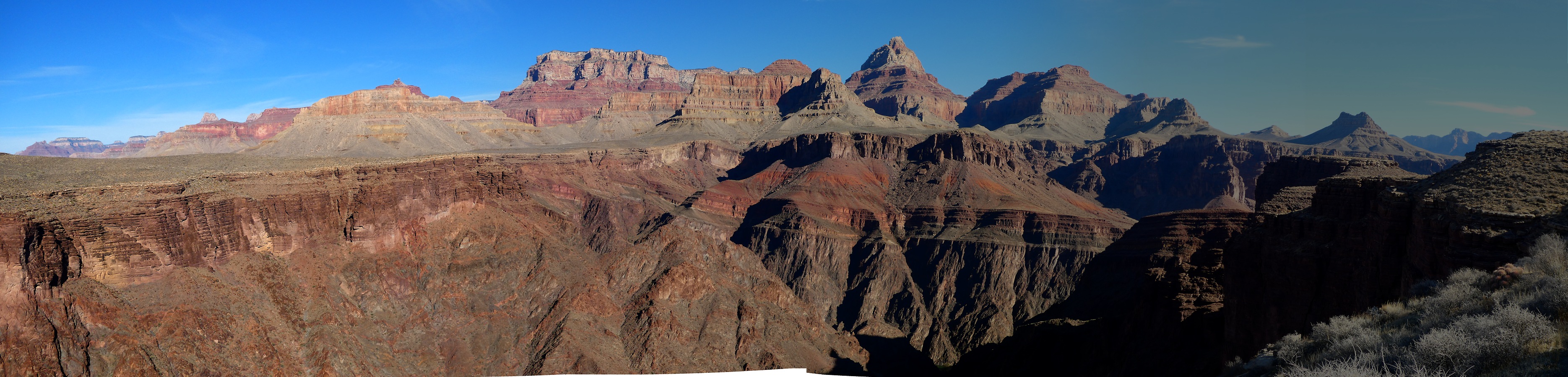
Viewed from Grandview Point, one can easily see how come this Mesa is called
Horseshoe. Extensions of the mesa sweep around to form the sides of the shoe. There's an outcrop of Supai Formation
rock at the front end of the shoe that forms the cleat, the traction part of a specialty horseshoe.
With 5 liters behind my neck, I'm keeping the big weighty bolus close in for proper
balance, I suck in the load lifter straps to snug up the bulbous bladders and set off at 7400' and from Grandview Point,
into The Canyon. Yahoo.
There're short stretches of snow up high, so I walk flat-footed, Idaho style, to
maintain my balance. When you strike the heel first, it's easy to slip, so walk flat-footed to stay upright. After a quick
inspection looking over the rim when I arrived, I see a clear trail and walk the Microspikes back to the Subie Subaru. Not
bad at all.
Its a quiet trail, initially meeting a few day hikers, then two guys coming out from
Tanner, then natural quiet prevails. Lovely.
Down, down the at times heavily armored trail (armored by stacking rocks to cover
the surface of the trail) through the two top limestone layers, through the Coconińo Sandstone, and into the more hospitable
Supai Formation. This trail was built with expedience, not smart planning because the goal was the movement of copper
oar over as short a distance as possible from mine below to the rim. Better, yet longer routes were available, yet disregarded.
The pack is weighing me down some as I ease past the old miner cookhouse walls
on the mesa. There are signs posted about radiation dangers in the abandoned adits and tailing piles. Yes mining is good
for you and your public lands, not. Dread.
A cavorting male Tarantula crosses the trail and disappears under a rock. Cute guy.
He's out patrolling for willing females.
The Mesa rests on the Redwall Limestone, which probably accounts for its being sort-of flat.
And the wind is howling as I try to determine which campsite affords the best wind
shelter for the tent. Meager, yet I find a spot that looks like it will work. A duo of junipers are intertwined, forming a decent
windbreak, as long as the wind continues to blast from the NW. I sit down for lunch to check it.
After setting up the tent and emptying most of the pack I drop down the steep and
narrow trail to Page/Miners Spring, finding it somewhat dribbling between the slabs of Muav Limestone that fell over the
historic spring reportedly constructed by miners. This spring, like many other GC springs, leaks out where the Redwall
transitions to Muav Limestone. It's not flowing sufficiently to dilute the arsenic, and perhaps never does, so I dip a liter for
bath water and call it good enough.
Back at camp, I talk with three young women, the only others on the Mesa tonight.
Dinner preparations take some care because of the wind blasts. Be careful to quickly cover the pot (sand, grit), anchor down
everything, use the windscreen for the stove so it and the heat don't blow away
It's been a warm day, yet it cools as the stars pop. The dastardly wind continues in
bursts, adding industrial cooling. It turns into a hurricane, coming from various directions, causing issues all night and only tapering off at sunrise.
| ||||
The Grandview Trail:
Unlike other GC trails which "began as animal traces or Native American paths,
and followed natural features such as fault lines or creek beds, the Grandview Trail was constructed almost entirely out of
human willfulness to overcome the environment. Miner Pete Berry constructed the trail primarily for utilitarian purposes - to
get ore out and supplies in to his mining operations at the Last Chance Mine on Horseshoe Mesa as quickly as possible, using
the most direct route, to maximize economic productivity. Though the trail was later used for tourism purposes, Berry
constructed the trail to be efficient and durable, not to blend into the natural environment or be aesthetically pleasing or comfortable.
Despite Berry’s efforts to overcome it, the natural landscape of the Grand Canyon,
such as its steep slopes and sheer cliffs, still dictated where and how the trail was constructed. Berry and his employees built
the trail entirely by hand from July 1892 to February 1893.
The trail ends at the former site of Last Chance Mine. The trail had to be durable to
support the daily mule trains hauling ore and supplies to and from the Last Chance Mine. Today Grandview Trail is noted for
its craftsmanship and durability, which helped it survive over many years of disuse during the 20th century
Berry and his workers constructed most of the trail using log cribbing, cobblestone,
and wooden bridges. The log cribbing and cobblestone tread are unique among trails at the Grand Canyon. The log cribbing
supports sections of the trail or, in places where the ground is unstable or otherwise incapable of supporting a trail, is used
as part of the trail itself. For these sections builders laid native logs of juniper or ponderosa pine in a cross-hatched pattern
and filled them in with rubble, thus forming either a foundation or part of the actual trail, to keep it from washing out.
The trail also features portions of hand-laid cobblestone made from local sandstone
throughout most of the Coconino formation and the switchbacks below through the Supai Formation. The stones were held
in place by huge iron spikes or large rocks. The cobblestone provided a stable surface for mule trains carrying heavy loads of
copper ore, helping to give them traction and ensuring the trail would not wash out easily. There is also an eight-foot-long
wooden-beam bridge and several sections of sandstone retaining walls. Because of the steepness of this direct route to
Horseshoe Mesa, they created 31 switchbacks along the upper trail.
The modern Grandview Trail to the mine site is 6 miles roundtrip, though it is very
steep, dropping 2,600 feet very quickly. There is no water anywhere along the trail, and it does not reach the Colorado River,
although it does link up with the Tonto Trail." ASU Grand Canyon History, https://grcahistory.org/sites/rim-to-river-and-inner-canyon-trails/grandview-trail/
Grandview Trail description - pdf (NPS)
Grandview Trail and the Last Chance Mine: "The Grandview land claims were also favorably situated for Grand Canyon tourism, and their federal reacquisition somewhat more complicated. As early as 1891, prospectors Pete Berry, Ralph Cameron, and several other partners used a combination of federal and territorial land laws to gain control of a copper deposit and a trail they built into the canyon from Grandview Point to access the mine. Pete Berry also claimed and patented a 160-acre homestead near the head of the trail. All of these claims were sold to William Randolph Hearst in 1913. In order to reclaim these properties, the National Park Service employed laws of eminent domain (condemnation) in 1939, igniting a legal battle with the well-known newspaper magnate." ASU Grand Canyon History, https://grcahistory.org/history/who-owns-the-grand-canyon/
Last Chance Mine: "At the end of the Grandview Trail, in an area where
the Hopi once gathered blue copper ores that they used for paint, Euro-American entrepreneurs would establish one
of the few successful mining operations at the Grand Canyon. Here, on Horseshoe Mesa, Pete Berry and his partners
including Niles and Ralph Cameron and Ed Gale, established Last Chance Mine to more fully exploit these productive
copper veins. From 1893-1907, eight to ten mules steadily made about a trip and a half each day, from Horseshoe Mesa
to Grandview Point and back. Each mule hauled 200 pounds of sorted copper ore up from the mine, and food and othe
r supplies back down the steep trail. Ore carried out of the mine was stored at the rim until a significant pile had been
accumulated, then transported to the nearest railroad."
from ASU Grand Canyon History,
https://grcahistory.org/history/logging-mining-and-ranching/mining/last-chance-mine/
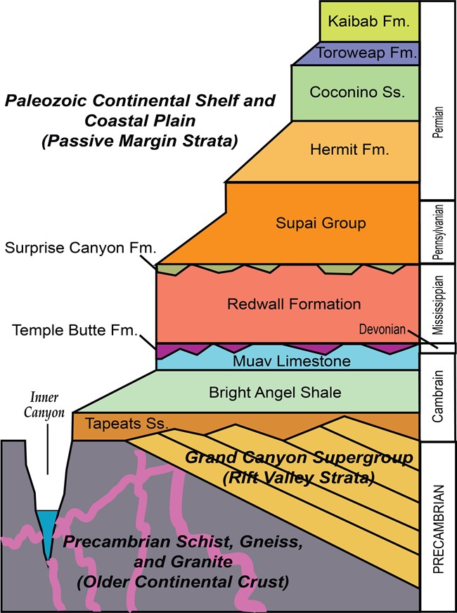
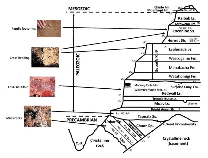
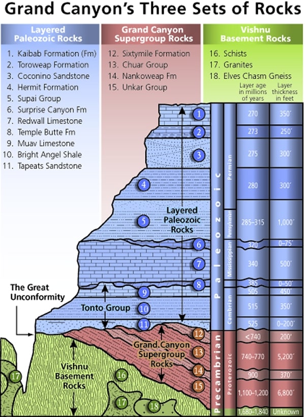
Mnemonic for the basic GC layers - Know The Canyons History, Study Rocks Made by Time
Know - Kaibab Limestone
The - Toroweap Formation
Canyon's - Coconino SS
History - Hermit Shale
Study - Supai Group (including the Esplanade)
Rocks - Redwall Limestone
Made - Mauv Limestone
By - Bright Angel Shale
Time - Tapeats SS
Know The Canyon's History, Study Rocks Made By Time.
Check the links section for lots more geology stuff. Here are versions of this basic schemata:
| ||||
| ||||
| ||||
the geology of the Grand Canyon by the NPS (23mb pdf file)
Grand Canyon Panorama Project - by Larry Wieland, Grandview and Horseshoe Mesa area. You can see the area I hiked by visiting this site. There are many options - click on the spheres to go to a panorama from that point. There are several panoramas taken from the Mesa, for instance. Options also include: Add geology or topo map. A super series of panos and supporting geology maps. Grand Canyon Panorama Project - Grandview Trail (link here).
 |
 |
 |
 |
 |
 |
 |
 |
 |
Day 2: Hanceward. Enhanced Canyon. To Hance Creek via the middle, historic trail off the Mesa.
5.5 miles, ERM of 8.5. Camp @ 3680'.
Out to the end of the Shoe I hike for a footnote to Vishnu and a distant River. The wind is
winding up for another hale gale. Out on the point I meet John and Jordan, who hiked down Grandview Trail and want to see The
River and the basement rocks before trundling back to the top. John notes the immense starscape he saw last night from a Park vista,
more stars than he has ever seen. He's from New Orleans.
Snack #2 is enjoyed under a mesquite tree alongside the dry drainage near the Mesa/Tonto
junction, probably in the same place as during the
Grapevine Galleria, Redux hike (link here).
Sipping the remnants of the packed in water, I'm looking forward to the good supply at
Hance Creek. I'm looking up at the ends of the Horseshoe, several hundred feet of Redwall Limestone rising from the Tonto Platform.
Once around the nose, its lilting an enjoyable Tontour to Hance Creek.
Gorgeous Cottonwood Trees in Fall foliage grace the view into Hance Creek, much of which
is already dark. Canyons so deep you can see the stars at noon.
I get to Hance and explore among glowing Cottonwood Trees down canyon a ways.
Local sunset arrives suddenly at 2:30p. as the sun plops behind the Redwall. Yikes, there's not much to the hiking day this time of year.
Solitude, natural quiet, and later a dark sky filled with stars, planets, and the Milky
Way enhance Hance. Maybe that was its original name, "enhanced?" Super. A sliver of moon grows a bit each night, decreasing
the visible starscape.
I've seen no one since dropping off the Mesa this morning. And, I've heard no intrusive
noise beyond that of high altitude commercial aircraft. Delightful.
Half a packet of instant potatoes, spam single, two cheese sticks, soup. Maybe 1/2 or
less cup dried bean flakes. Excellent.
By six o'clock it's dark and cool air drifting down canyon is trending toward cold. It's
already much colder than throughout last night. The good aspect is the absence of wind. Hurahh.
 |
 |
 |
 |
 |
 |
 |
 |
 |
 |
 |
 |
| ||||
Day 3: Hakatai Hump: Tontouring East. To Red Canyon. 13 miles,
ERM of 18. Camp again at Hance Creek, 3680'.
The night and morning are calm, quiet, lovely. Raging wind, air tour terrorists,
cackling people, buzzing electronics, all graciously absent.
It's a cool morning and the down jacket is put into action, awaiting the sun and
for the couscous, raisins, mandarins, Nido, milk powder, protein powder, and sugar to fully come to fruition. Yummy.
Dead still, the desert evokes an uninterrupted contemplation improbable in the
intrusive top world. A world recently consumed by lies, superstition, exclusion, hate groups, racism, trashing and
despoilment of public lands, intolerance, anti-public policy actions, and a despicable denigration of science that will
harm the Eaarth forever going forward. Briefly, the cult of repulsican trump. Questions for the day, perhaps the decade,
"should republican supporters be allowed to visit public lands? Do they want to?" Argument: they advocate selling or
giving public lands over to corporate welfare, so apparently republicans don't value them. So why should they visit?
Apparently, republicans want cow burnt lands, wildlife murdered for cows or forced out by habitat degradation, trampled
and fouled riparian areas, toxic mine brew and dust, roaded and paved "open space," and corporate "keep out unless you're
here to clean up our mess" no trespassing signs on what was once public lands. The republican corporate cult nurtures the
green, money; money, greed, exclusion, and starts with the seven basic "skills," branching out as more destructive technologies
become available. To a republican, a green belt is a money belt. Being human is a choice, so is voting republican.
Birds arrive. The sun glances over the nameless butte upstream in Hance
(Enhanced) Creek, and it's time to roll into today's Tontour.
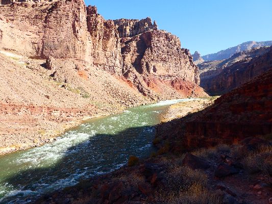
The growl of The River emanates from the jade green spotlight at the depths of
Hance Canyon. The canyon is dark, The River light, and above all reigns the vista of Vishnu. It's a wonderful vista of Vishnu
et al., from Tontouring the Tonto around Ayers Point.
Around the bend below Ayers Point I hike before dropping through the ancient
beachfront that is the Hakatai Shale into Mineral Canyon. There will be a good deal more elevation loss to the present
beachfront where Red Canyon meets The River at 2600 feet in elevation.
Across The River, the Hance asbestos mine and nasty tailings can be seen.
A squadron of Pińon Jays chitter over my head in formation. Individual flyers appear
to take turns barrel-rolling in formation. Synchronized.
The lower floor or Mineral Canyon appears to be Shinumo Quartzite, toppled by a
ebony band of diabase sil or conglomerate.
Picking my way through the tedious Tapeats boulder-strewn landslide field leads to the Red
Canyon beach. Sadly, Red Canyon is not flowing, at least not down here at River level. I rinse my shirt in The River and hang
it to partially dry while I enjoy lunch. Hance Rapids fidget and swirl, providing lots of foreground noise. It's part of natural
quiet, although it's pretty loud. Across The River is an angled intruded dike of what looks like basalt, a diabase sil?
Knowing that the route back to camp is more difficult, going up, I hesitate to lounge
too long at The River.
High clouds obscure the sun, and I wonder what the weather holds.
I meet the only people I see today and they report they're going to Nevills Rapids,
beyond Red Canyon. Humm, it's after 4p and these guys have over 6 miles yet to go. Sunset is about a quarter after five and
it's dark thirty before six. I suggest stopping at Red Canyon, perhaps Mineral Canyon if they have enough water. They claim
that they have lots of water. I note that they also have a full-size guitar and other stuff hanging off the outside of their packs.
I don't want to be doing chores in the dark, so I wish them well and hustle to camp.
I get water, perform a quick body rinse, erect the tent (I took my poles, which
double as tent poles), and get organized for dinner before the light goes out.
Cooking and writing in the dark, the clouds peel away and the stars pop as the surface
heat leaves. Seven p.m. and it's quite chilly. Time to star gaze a bit, then retreat to the fluffy bag.
| ||||
Hakatai Shale: The Hakatai, which is part of the Grand Canyon Supergroup, is regarded by many as the most colorful formation in the Grand Canyon, varying from purple to red to brilliant orange due to oxidation of iron bearing minerals contained in its rocks.
Diabase Sill: An intrusion of igneous rock into existing rock which spreads along bedding planes in a nearly horizontal sheet.
Hance Rapid: "named after famous Grand Canyon tour guide and storyteller John Hance, is located where Red Canyon intersects with the Grand Canyon at Colorado River Mile 77. Hance Rapid is a powerful whitewater rapid formed by debris from flash floods that tore through Red Canyon. This side canyon is composed of red Hakatai Shale, with dark shafts of volcanic rock called diabase cutting through it. Whereas normally the Colorado River would eventually wear down the large boulders deposited at the mouth of the canyon, the volcanic rock is much harder than the soft shale. Therefore the diabase boulders eroded very slowly, and as the river plunged over them it hit the shale with greater force and eroded it even faster than normal. This differential erosion rate helped make Hance Rapid the biggest river drop along the Colorado River in the Grand Canyon; during normal water levels it falls 30 feet. It can be seen from Lipan Point on the South Rim, which is accessible from Desert View Drive, to the east of Grand Canyon Village." ASU Grand Canyon History, https://grcahistory.org/sites/colorado-river-corridor/hance-rapid-and-canyon/
The Tonto Trail begins at the base of the New Hance Trail, "just west of the
mouth of Red Canyon at the Colorado River. It immediately climbs away from the river atop the emerging metamorphic
schist for a few miles until reaching above the Tapeats Sandstone within the Bright Angel Shale just east of Hance Canyon.
At this level, the trail begins its consistent pattern of heading side drainages and rounding mesas overlooking the river for
80 miles or more before ending abruptly at Garnet Canyon, about ten miles west of the South Bass Trail."
more at ASU Grand Canyon History, https://grcahistory.org/sites/rim-to-river-and-inner-canyon-trails/tonto-trail/
Tonto Trail: Grandview to South Kaibab Trail - pdf (NPS)
 |
 |
 |
 |
 |
 |
 |
 |
 |
Day 4: Cottonwood Cozy. To Cottonwood Creek and a bit more.
5.5 miles to the Cottonwood/Tonto crossing and then another mile of exploring out on the Tonto and down
Cottonwood drainage. Total of 6.5 miles, ERM of 7.5.
I'm rounding the nose on the Tonto, leaving Hance, when I encounter Tanner of
Tusayan, and a wildland fire fighter, and then John, a classical pianist from Tucson. Both conversations are excellent.
Trundling on, I stop for an early lunch #1 in the drainage near the middle route off
the Mesa and find that conditions agree with a place that affords partial sun because it's not super warm today. The morning
started on the cool side of the thermometer. I position the Snickers bar on a sunny rock so it doesn't shatter when bitten.
Yikes. Good thing it's sunny, with a Robin egg blue background to the ubiquitous Vishnu Temple.
One of the fantastic things about being on the Tonto Platform is the feeling of being
out amidst the buttes and temples. It's a spacious aura, one unlike the Canyon views, which, though stellar in their own right,
don't typically have the openness, the around surround views available when Tontouring. This also means that there's less
shade, albeit this is not an issue today.
Continuing on, it's not far to Cottonwood Creek and camp area. The canyon is ablaze
with the Fall gold of blushing Cottonwood Trees. Gorgeous. I stumble around, forgetting to take off the pack, while
photographing these lovelies before local sunset dims the glory.
The Vishnu view has been temporarily replaced with that of Dunn Butte, Angels Gate,
and the Western edge of Wotons Throne. It's a fair exchange.
I explore down canyon and don't like the cold air slump feeling, so I plod uphill to
where the spring disappears and find a decent spot off the trail and affording a good view. This makes for an excellent
footnote to the afternoon.
The amazing natural quiet prevails once again and there's a feeling of calm
karma along with it. It's absolutely lovely to be inside the air tour terrorist-free no fly zone.
As the sun sets on Angels Gate, the Canyon coolness drifts down canyon.
Dark certainly arrives early today.
 |
 |
 |
 |
 |
 |
Day 5: Red Sky Morning. 4.5 miles, ERM of 12.5. To Grandview Point @ 7400'.
Total = 34.5 miles; ERM of 60.5
A pink glow spreads across the upper levels of what is Angels Gate.
Down Eaarthward, the muted shimmer of Cottonwood Trees fills the foreground in the early twilight. It's warm
because a salmon-tinted cloud dome now encapsulates The Canyon. Oh oh. What does this portend? Some of
the clouds hang mammatus, looking like they could udder the Eaarth. Certainly, the Eaarth around these parts
needs a good soaking, yet I am one who does not like hiking in the rain, or when It's snowing. The Gate goes dark.
A phalanx of Canada Geese honks Westward below the dome. I decide that rather than explore this morning, I'll
hike up to the Mesa and watch conditions along the way. It's a scrabbly trail at times, probably another remnant
of the brief mining era.
On the Mesa, I again see John, who is heading for the top, then Tucson.
He had camped in the nook I am considering for tonight. Then again, it's a cool wind blowing across the Mesa. The
vicissitudes of Vishnu now includes swirling clouds and an aura of poor weather in addition to the revolving, now
muted, views I've enjoyed during this excursion. I eat an early lunch in the nook, finding it insufficient at blocking
the now significant wind. Sure, I'd be okay, yet I also have the option of climbing out and enjoying the topside
benefits. Humm, a difficult choice. Then again, there's the unwelcome wind. And the clouds.
The vicissitudes of Vishnu win the internal discussion, and I hike out of
The Canyon.
| ||||
 |
 |
 |
 |
 |
 |
 |
 |
 |
.
*ERM: Energy Required Miles, are there data to support this
mileage adjustment?
Journal of Outdoor Recreation, Education and Leadership
Petzoldt first proposed his theory in his 1976 book “Teton Trails” to
help backpackers plan trips and calculate their energy needs on mountain trails. “Petzoldt defined one
energy mile as the energy required to walk one mile on the flat. He recommended adding two energy miles
for every 1,000 feet of elevation gain, so a person hiking one mile and 1,000 feet upward would use the
equivalent of three energy miles,” Phipps said.
Petzoldt’s energy mile theory was just a reflection of the mountaineer’s
“gut feeling,” Phipps said. The theory had never been tested in a laboratory before the study began in WCU’s
Exercise Physiology Laboratory in the spring of 2010, Phipps said.
To determine the validity of the theory, the study measured the energy cost
and perceived exertion for walking on flat ground, with and without a 44.5-pound backpack, and up an elevation
gain of 1,000 feet, with and without the backpack, through the collection of metabolic data, Phipps said.
Twenty-four student, faculty and staff volunteers, including 12 males and 12
females, went through four testing sessions as the research continued into fall semester of 2010. The study
results showed that the additional energy cost for ascending 1,000 feet ranged from 1.34 to 2.02 energy mile
equivalents, for an average of about 1.6 miles, compared to Petzoldt’s use of two energy miles for each 1,000
feet. The range revealed by the study was due to the “hikers” personal weight differences, Phipps said.
“It is remarkable that Petzoldt’s energy mile theory is so close to the actual energy cost measured during our
study,” Phipps said. “In the field of outdoor education, it’s important for leaders to include an estimation
of energy requirements during the planning of hiking trips.”
Phipps said the energy required for hiking up steep mountain trails would vary
for individuals and groups, and the variables of the trail would also factor in, but he recommends that
backpackers stick with Petzoldt’s idea of adding two energy miles for every 1,000 feet of elevation gain when
planning trips.
The Validity of Petzoldt's Energy Mile Theory, 2010
Authors: Maridy McNeff Troy, Maurice L. Phipps
Publication: Journal of Outdoor Recreation, Education, and Leadership
.
Links:
Link to all WV trip reports about The Canyon (WV)
Grandview Trail description - pdf (NPS)
Tonto Trail: Grandview to South Kaibab Trail - pdf (NPS)
Grand Canyon Panorama Project - Grandview Trail (link here)
the geology of the Grand Canyon by Canyon Dave
the geology of the Grand Canyon by the NPS (23mb pdf file)
Falter - Has the Human Game Begun to Play Itself Out on this Eaarth? by Bill McKibben
Other WV reports about the Grand Canyon:
Click here or on the Looking Lizard to go to all WV reports about The Grand Canyon
| ||||
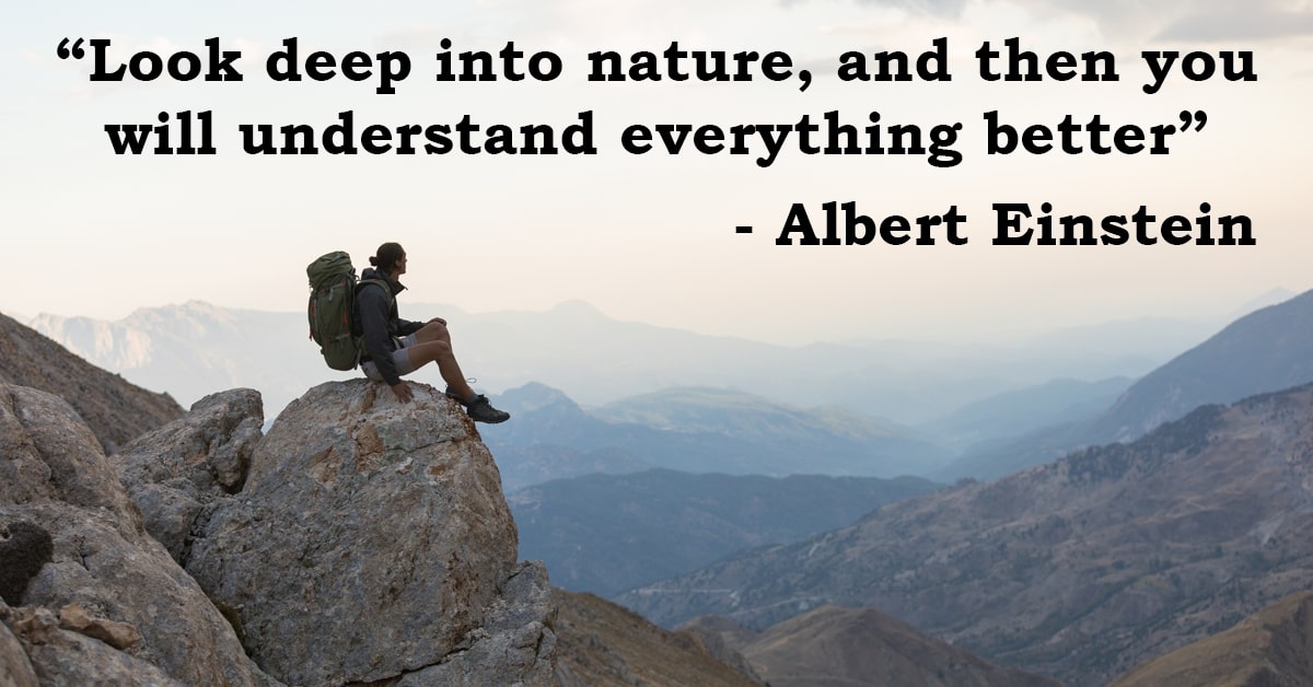
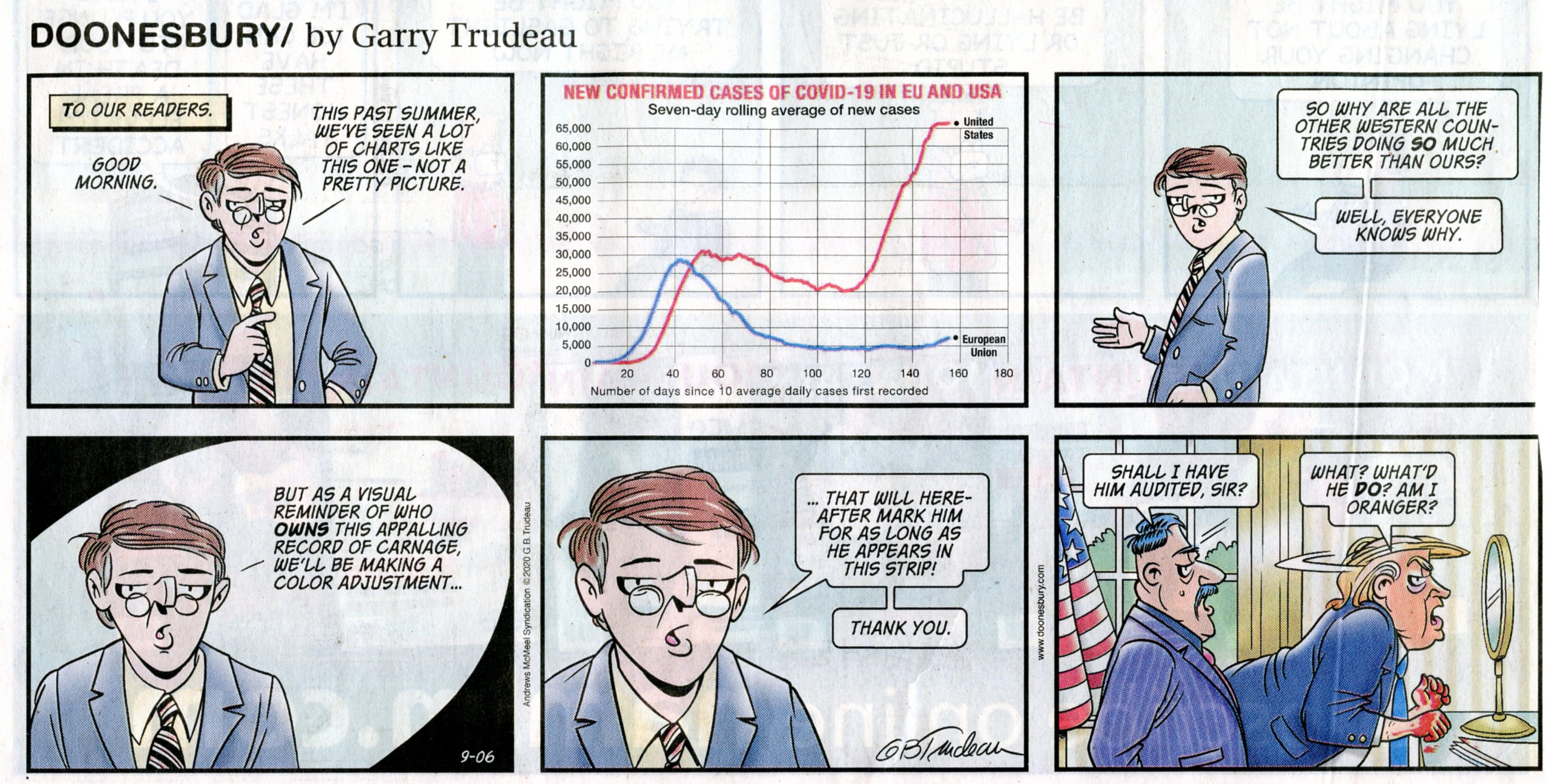
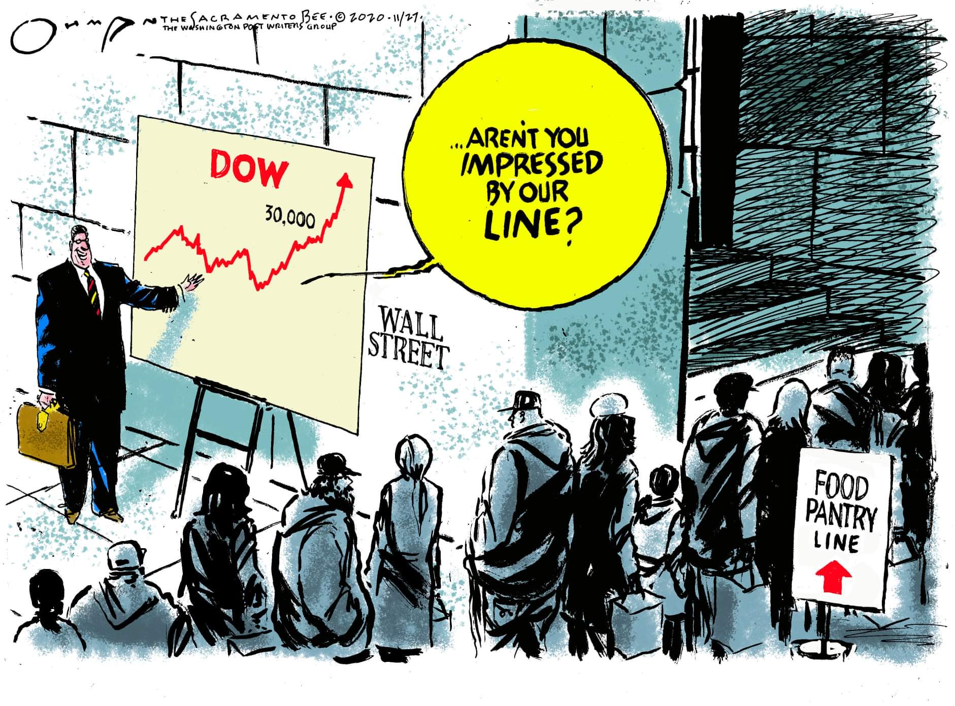
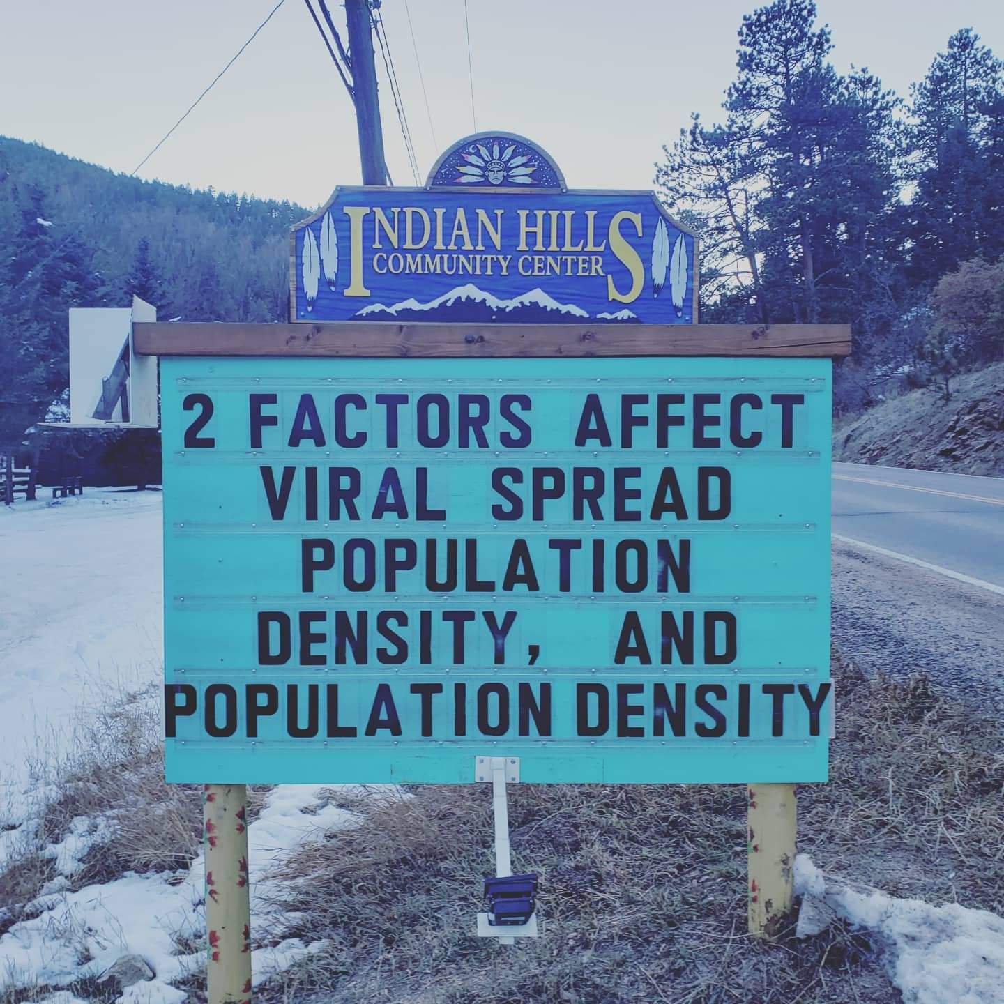
More Truth Than Joke:
| ||||
| ||||
| ||||
| ||||
| ||||
| ||||
| ||||
| ||||
| ||||
| ||||
| ||||
| ||||
|
Wild Vagabond Main |
Trip Report Index  |
Caveat  |
|---|


 w.jpg)


