non-management of beefaloo on the North Rim of the Grand Canyon
Text and photos © copyright by Rob Jones

Co-adventurers: George & Nancy Whitmore (first segment); Kathleen (second segment)
Camera: Panasonic DMC-FZ200
|
| |||||


|
| |||||


|
| |||||


| ||||

|
| |||||
|
| |||||
|
| |||||
| ||||
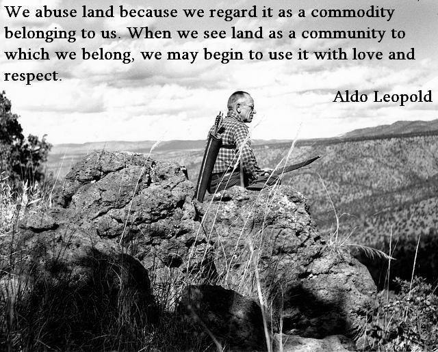
"Only a mountain has lived long enough to listen objectively to the howl of a wolf...We reached the old wolf in time to watch the fierce green fire dying in her eyes... There was something new to me in those eyes - something known only to her and the mountains. I was young then, and full of trigger-itch. I thought that because fewer wolves meant more deer that no wolves would mean hunter's paradise, but after seeing the green fire die, I sensed that neither the wolf nor the mountain agreed with such a view."
- Aldo Leopold
| ||||
ERM* = Energy Required Miles.
A mile is added for every 500' elevation gain or loss. It's a very serviceable method of
estimating energy required miles. And, see a study about the validity of using ERMs below.
Summary: First segment, May. I was traveling
to the North Rim to collect the cache buckets left during the Snomageddon frolic in the Kanab
Creek Wilderness and decided to hike and investigate a bit while there. I talked with my friend,
George Whitmore, and he asked about the beefaloo on the North Rim. We teamed up to inspect the
damage wrought by beefaloo during this segment, exploring the beefaloo carnage on the Powell Plateau.
Second segment, September. Kathleen and I obtained a reservation
for the North Rim CG (campground) and enjoyed some of our traditional hikes while there.
| |||||
| ||||
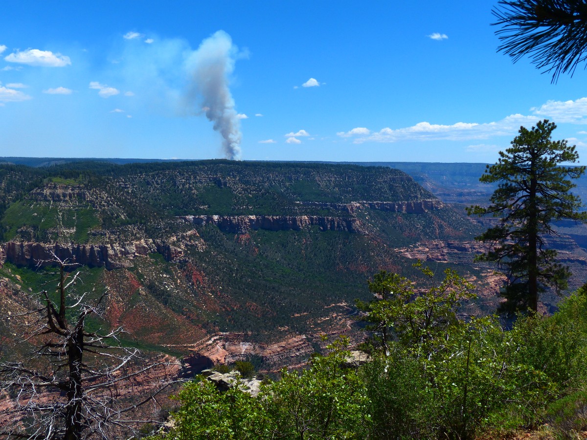
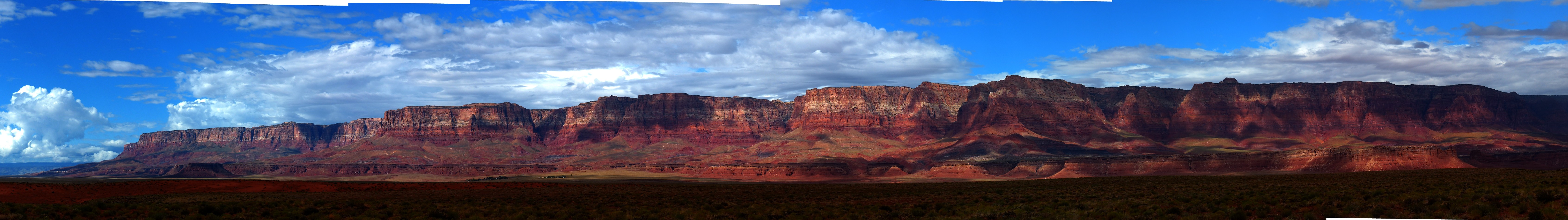
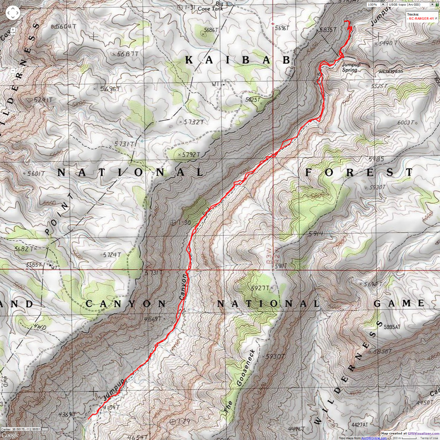
May 22nd and 23rd. The Ranger 41:
To Lower Jumpup Springs. 10 miles, ERM = 15.
"Reality has a well-known liberal bias."
Dropping toward Kanab Creek Wilderness on FR (forest road) 427 and 423, my eyes
and lungs protest. Smoke from the Slide Fire just South of Flagstaff? Yikes. Damn tea-baggers, sequestering
public land agencies and not the bloated military, which spends more than the militaries of the next 21 nations,
combined. No money, so funds are shifted to fighting fires from thinning and other preventive activities --
and conditions for catastrophic fire get worse and worse. Selfish tea-baggers, a scourge to democracy everywhere.
Subsidies and corporate welfare to big oil and big pharma and the uber-wealthy is OK, yet properly funding
the stewardship of our public lands is not? Socialize the loss, privatize the gain seems to be the motto of
tea-baggers.
Dropping below 6000', the air clears some. The road ends at Jumpup Cabin and
the TH (trailhead) for the Ranger #41. I've seen only one FS (forest service) vehicle (the only vehicle) since
leaving Jacob Lake.
I've hiked most of the Ranger a couple of times, yet not the part that travels
from Jumpup Cabin to the Esplanade level. I found the road to the cabin in surprisingly good condition and
soon I parked near the cabin and enjoyed coyote calls while setting up camp and eating dinner. The next morning,
I hiked past Upper Jumpup Spring, saw some pictos, and down the canyon to the Esplanade. It spit some rain
while I ate lunch under an overhang in the upper Esplanade layers, so I decided to return to the rim rather than
explore down to Lower Jumpup Spring. Gorgeous country.
The Upper Jumpup Spring water burbles magically into the cement trough. 1950
it says in the cement. A cast-off wood trough rots in the deep shade of Boxelder Trees. A tiny oasis. I'm
wondering, "where is the trail down canyon?" It continues through the Boxelders. I take a turn and wow -
pictos under an overhang and a smidgeon of pueblo wall too. Down canyon, I'm soon beset by wind-whipped rain.
It passes. There's not much left of the Ranger 41 in most of this canyon. Vestiges exist on some of the
low benches. After 5 miles, I am at the Esplanade and the junction with the Jumpup-Nail #8 coming from Sowats
Point.
I lounge under an Esplanade overhang and enjoy part of an early lunch.
The rain spits but mostly it holds off while I'm sheltered by the overhang, then starts as I walk back toward
the cabin. A bit more hiding from rain, a second snack.
Driving back to FR22, the main road in this area, it starts to rain,
which turns to snow as I approach the turn toward Sowats Point. What?! Again? It seems my visits to Sowats
have often been accompanied by snow
(Snowmageddon in Snake Gulch trip, 2014 (click to go to trip report) from earlier this year). Thunder booms and
lightning cracks, nearly simultaneously, as I start down the track to Sowats Point. The boom/blast are so close
I hop in the truck seat, clearing the cushion. Soon, more snow, then some rain and I am slithering toward the
Point. Oh no, slippery Sowats Road again?! Yes, I take it very slowly so as not to coat the entire truck with
mud. 4x4, low range, lock in the hubs, slither, try to avoid rutting the roadbed, wrestle with some pinons that
have fallen across the road, argh. The snow changes back to rain, then stops. Yet, the damage is done, I note,
as I slither to the good camp area short of the Sowats TH, feeling happy to be off the road. The sun comes out
as I fiddle with the tarp, set-up the tent, and enjoy a shower. I have seen not a person today.
| ||||
 |
 |
 |
 |
 |
 |
 |
 |
 |
 |
 |
 |

| ||||
May 25th. Sowats Point to Esplanade:
pick-up cache from Snowmageddon in Snake Gulch and Fishtail Frolic: Kanab Creek Wilderness.
6.8 miles; ERM = 14.
Alternately sipping mango tango (a la Wendy L.'s recipe - spiced rum
and green tea peach mango) and decaf coffee laced with milk, I'm slipping into Canyon rim time after a
cache container retrieval hike and a hot shower. I gained some shower water by draining the ice water
from the cooler this morning - although I'm carrying 12 gallons for the days ahead. I left the cooler
water heating in the solar shower bag while I was out hiking today.
The day starts cool with me snuggled in my fat Marmot (not the standard
backpack bag, the Helium, but the Aiguille (named for a needle-shaped rock)) and wondering if I could nap
just a bit longer. Up, I leave the good camp in place and walk to the Jumpup-Nail #8 TH and call Kathleen.
Surprise, I get through, connecting somewhere via Utah, as evidenced by the time on the phone. The report
is that the Slide Fire is growing. Yes, I suspect as much because I can smell it here. (Later, after
learning about the Galahad Fire, I realize that this may have been the fire I smelled.)
Down the ball bearing steep slope through the Coconino SS (sandstone) -
yet it's rollers of limestone from above that provide the slip and slide. Yowee. I meet Steve of NV, who
hiked near but not to the Slide of Susurrus in Kanab Creek. "Not on the map," he says. Many luscious
things are not. Perhaps this is how come they are still luscious? See the Slide in the below video -
not to be missed.
I find the two 5-gallon cache buckets left during the
Snowmageddon in Snake Gulch trip, 2014 (click to go to trip report)
and pile all together before going in search of pictos and ruins. A cowboy ruin and faint
pictos are all I find. Now, the trudge back up 1800' and back to camp, with the ungainly buckets that are
crammed into the top of my pack thumping me in the head on the steep parts. It's cloudy, breezy, almost
cool, and the cheddar-potato soup is ready - so, I must go.
here is what Steve missed - Slide of Susurrus
| ||||
 |
 |
 |
 |
 |
 |
 |
 |
 |
May 26th. Rendezvous Day:
To East Rim views of Saddle Mountain Wilderness.
May 27th. Swampster:
To Swamp Point, start the search for beefaloo and their devastation.
What a difference! Today, I coast out from Sowats in
2WD and add nothing to the 200 pounds of dried mud clinging to the Ranger. Lovely. It
tries to rain as I investigate the crow's nest FS lookout at Dry Park, yet the spittle
is feeble. Back on FR22, I hit pavement at Hwy 67 and go to Demotte CG. Then, to the
store, from where I leave what I hope will be a message from the pay phone for George and
Nancy about a camp spot I've found on a rim FR, where I set up my tent as a territorial marker,
then set off to explore the views into Saddle Mountain Wilderness and the vista toward the cleft
that is Marble Canyon of The Colorado. Back at the camp spot, I see that Nancy and George have
arrived. Yahoo - tales wash into sunset, surrounded by a fleet of Yellow-rump Warblers hopping
and dining and ignoring us.
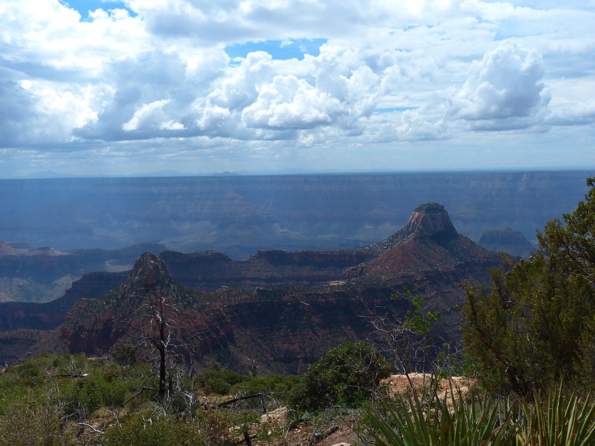
The views are suddenly there, like a postcard, only so much better.
Nancy, George, and I have made it to Swamp Point, where vistas range to the near of Powell Plateau,
the depth of North Bass, the corrugated crenulations of the South Rim, the distant volcanic lumps
of the San Francisco Peaks. Beyond. Glorious.
Today, we're up to a cool morning above 9,000', which warms rapidly
with the intense sun. Off we start on our quest to reach Swamp Point TH and CG. We slowly sail to
Swamp Point. No down trees, no mud or huge puddles. Hooray. Thanks FS/NPS fire crews for clearing
the way, and recently too. And, perhaps the most terrific vehicle camp, per views, in the area.
Rich and Allyson are there with their camper van.
Rendezvous and Swampster Day photos


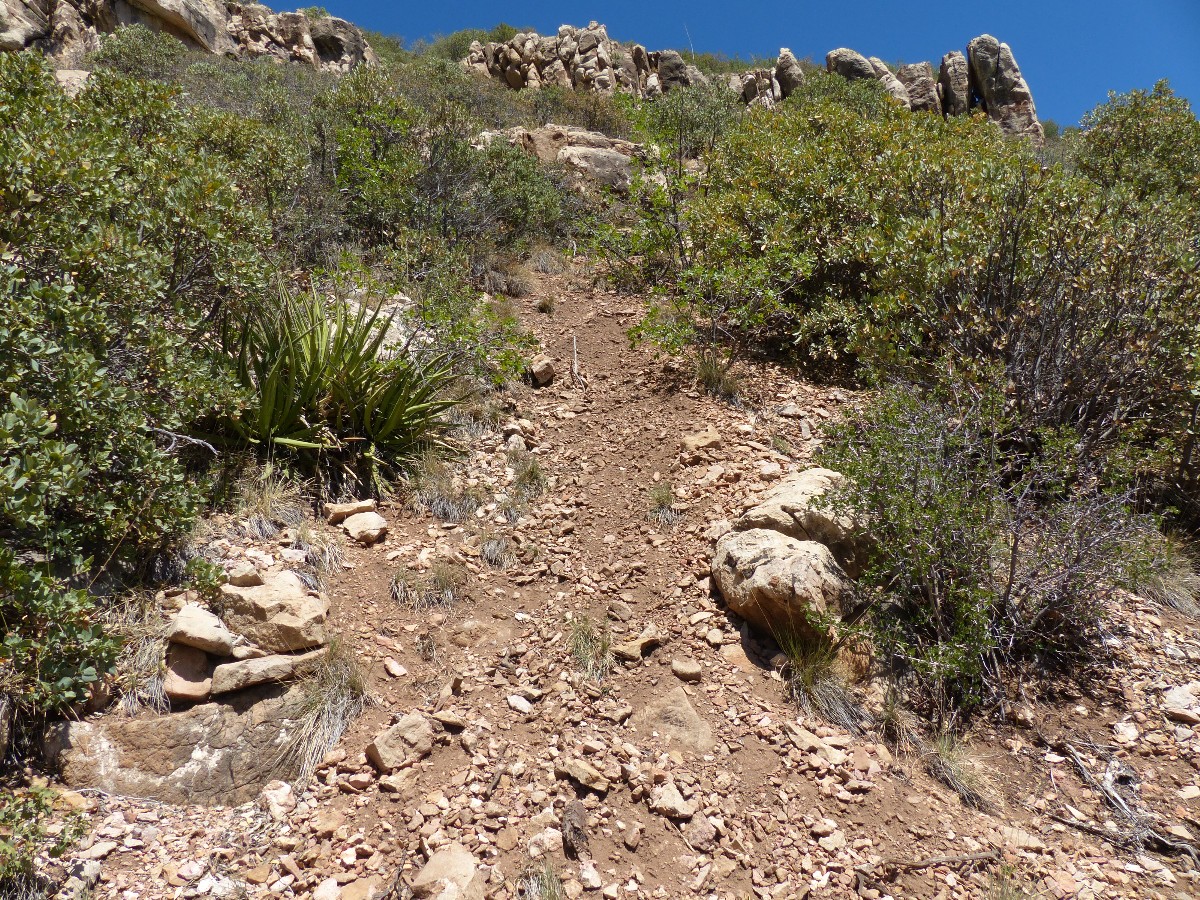
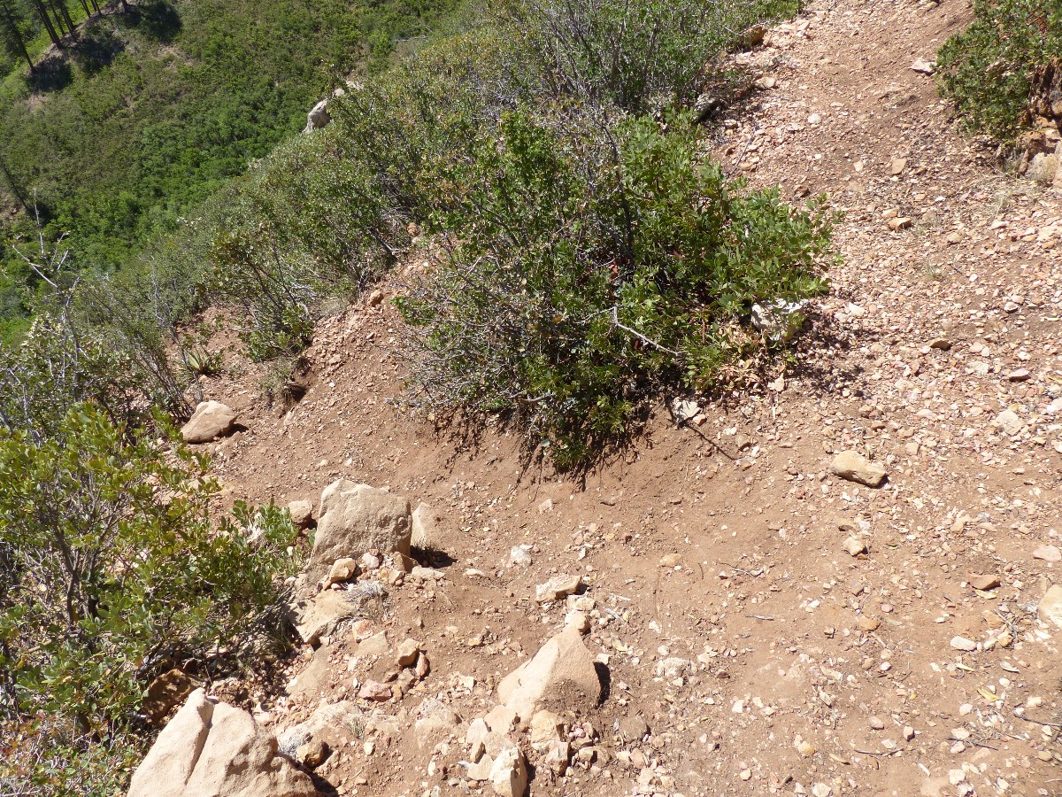
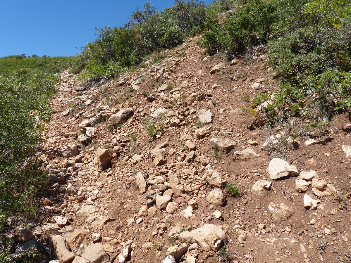
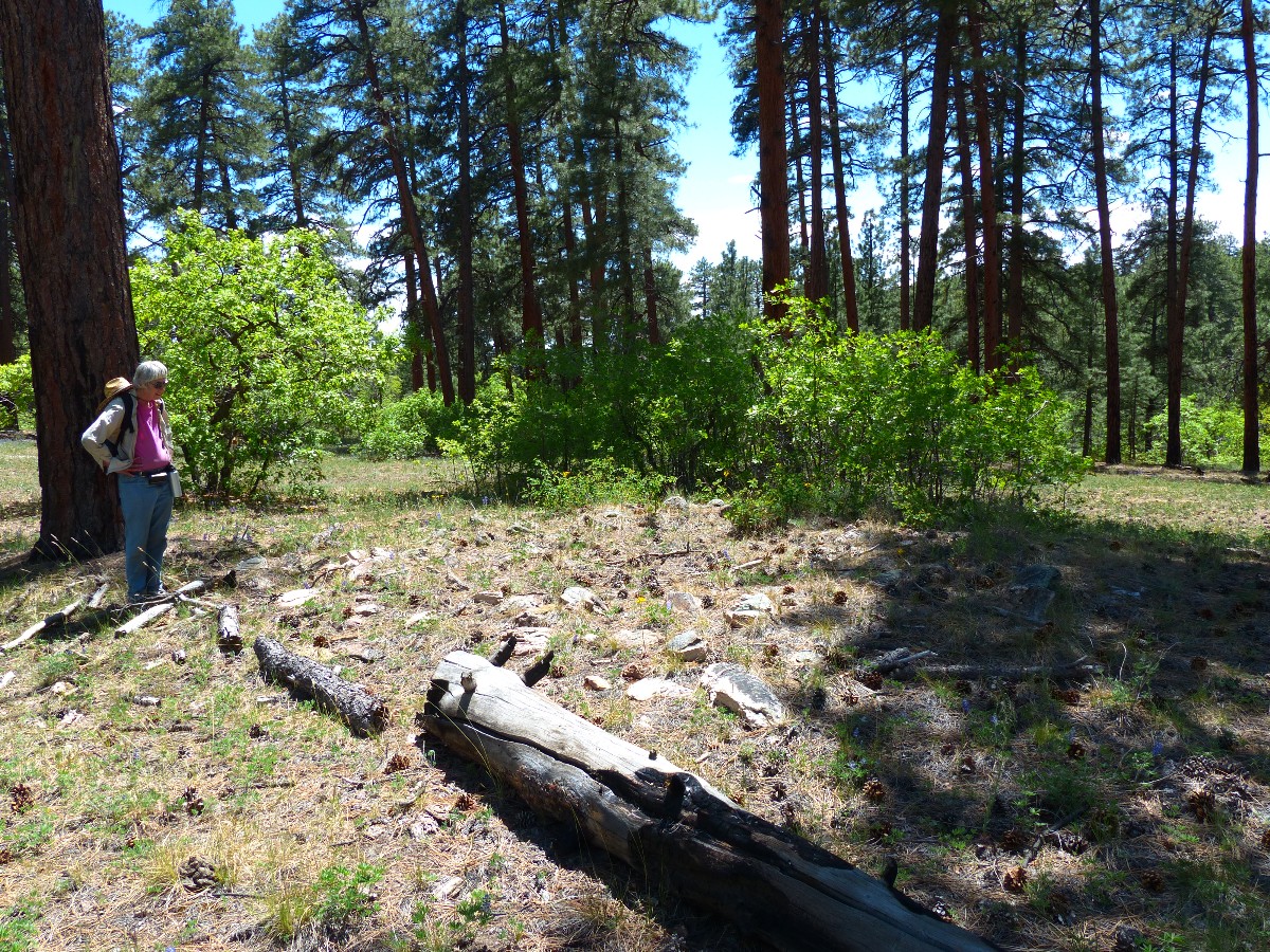
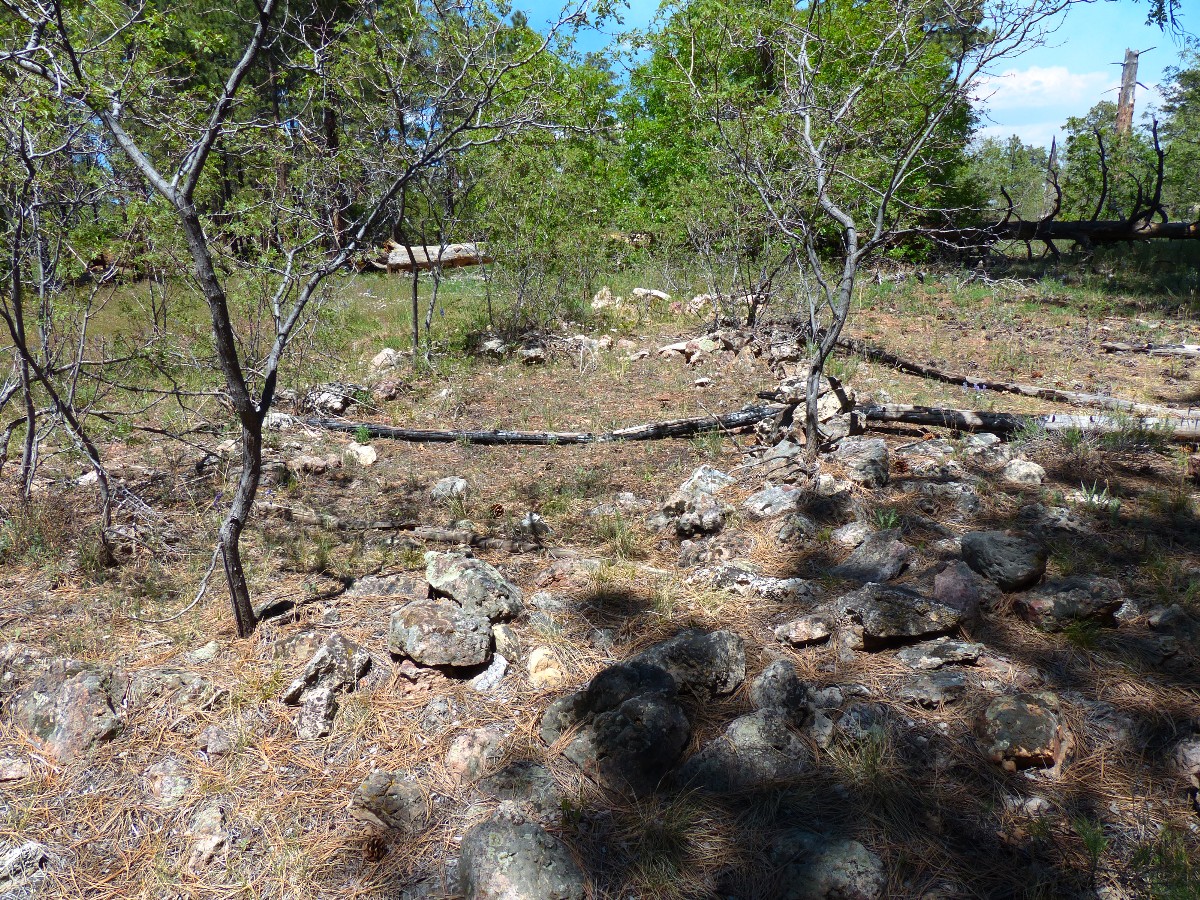
May 28th. Bane of Beefaloo. Beefaloo rampage on the Powell Plateau:
To Swamp Point, start the search for beefaloo and their devastation. 10. miles; ERM = 18.5
There, again, disgusting beefaloo dung dropped dead center in the ancient
surface ruin on Powell Plateau. Deplorable beasts, introduced by greed, incompetence, and apathy, with some
accident thrown in. Abandoned in place by profiteers, and like miners and petroleum developers everywhere,
again leaving the mess for the public to clean up. And, these mutants have damaged the trail from the TH to
the Muav Saddle (Wayne Ranney reports that the word "Muav" is of Paiute origin and the word means "saddle."
So the term "Muav Saddle" is redundant. Muav Limestone was first described and named from Muav Canyon and not
this saddle. In the present area, Muav Limestone - is found much farther down the North Bass). Beefaloo bust
the edge of the trail tread, and stomp downhill, creating erosion chutes down the fall line. Do they help open
the trail, as some beefaloo cheerleaders suggest? No. There is no evidence of this. They are creating erosion
paths which are/will result in the demise of the trail. Will the beefaloo cheerleaders come to repair the trail,
fence the springs and ponds, keep beefaloo out of archeology sites? No. Yet, they will try to force the NPS,
FS, BLM to cater to these invasive mutants, and the fish and game will cheer them on (it's all about $ and the
hatred of predators to them).
We start the day by hiking to Queen Anne Spring and then Teddy's Cabin, before
climbing the beefaloo-ravaged trail to the Powell Plateau. Once on top, there is a trail along the East side
to Dutton Canyon, where we see the largest concentration of surface ruins (there are undoubtedly many others we
do not see). Already at over 5 miles out, we opt to head back, knowing more archeology sites are scattered about,
most likely each containing a multitude of beefaloo dung. What do you think happens to our precious archeology
during this massive dung dropping? Stomping, trammeling, smashing, and trashing. We trip over a couple of more
sites on the way back. The Galahad Fire flares into sight across the North Bass bay as we walk the plateau and
we wonder if we might be spending extra time at this most excellent camp. Humm, maybe it's this fire I have been
smelling?
Yes, I believe it is time to get the beefaloo off the North Rim. Yes, I
strongly support the protection of actual bison in their native habitat. My letter to the scoping process
about the beefaloo can be seen below.
 |
 |
 |
 |
 |
 |
 |
 |
 |
 |
 |
 |
 |
 |
 |
 |
 |
 |
| ||||
May 29th. East Rim Views:
We stopped along the Swamp Ridge road to inspect the beefaloo carnage at Swamp Lake.
Beefaloo trampled the fence designed to keep them out of half the lake. They mucked up both sides of the failed
enclosure. Standard fencing does not work with beefaloo. What will other wildlife do with beefaloo fouling their
precious water sources?
On the way out from the Park, just leaving the Swamp Ridge Rd, we
encounter a caliente of FS Hot Shots heading to the historic Kanabowits Cabin area. They report that
they going to manage the Galahad Fire a bit more. We're moving to one of those vista view sites overlooking
the House Rock Valley area East of Hwy 67 - land from where the mutant beefaloo escaped several years ago.
 |
 |
 |
 |
 |
 |
September 4th. Transept:
3 miles, ERM = 3.5.
There they are, beefaloo barnyarding the meadows just inside Grand
Canyon NP. Sad, hiding from their predators (hunters) and mucking up the precious water sources on the
North Rim. Regrettably, they are not avoiding wolves because there are no wolves here (yet).
The rain we encountered while entering the Park has stopped by the time
we eat at the North Rim deli and begin setting up camp. I enjoy a walk along the Transept Trail, resplendent
with views into The Transept and the North Kaibab.
It's cool enough this evening that we are treated to the bellicose intrusion
of whinehogo heating fans and generators. Oh, the joy of natural quiet - long ago auctioned off to corporate
welfare artists in the Grand Canyon
 |
 |
 |
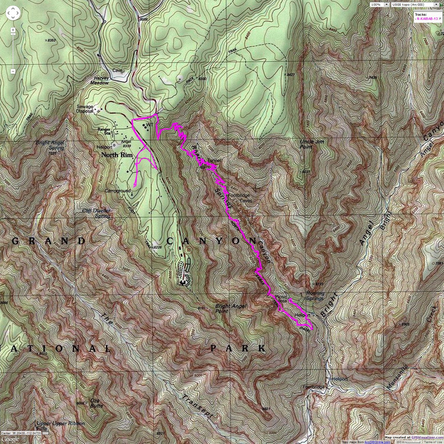
September 5th. North Kaibab Trail to Roaring Springs:
13 miles, ERM = 25.
The North Kaibab Trail is swaddled in rolling mist as
we approach the TH from the CG, boiling through the Arizona Trail-North Kaibab gap. Scenic.
Mystical. The rains have made the recently-maintained trail a delight, with no dust and soft
treading. Down, past the Coconino Overlook, through the Supai Tunnel, over the Redwall Bridge,
along the edged-into the cliff section through the Redwall and to the Roaring Springs rest area,
Kathleen and I drop 3,000' in elevation over the 6+ miles from the CG. North Kaibab! It's also cooler
today because of the passing storm front, and we enjoy the walk out too. By afternoon, however, the soft
trail has been stomped out by mule traffic, and there is an abundance of mule steps to negotiate.
| ||||
 |
 |
 |
 |
 |
 |
 |
 |
 |
| ||||
| ||||
September 6th. Rest and Walhala:
1 mile, ERM = 1.5.
Today we tour the sights along the way to Cape Royal.
We enjoy terrific views of Unkar Delta - and reminisce about backpacking the Escalante Route
across The River. Delightful country. The Walhalla Ruins make me wonder if this is what the
Powell Plateau ruins may have looked like prior to the scourge of the beefaloo.
| ||||
 |
 |
 |
 |
 |
 |
 |
 |
 |
 |
 |
 |
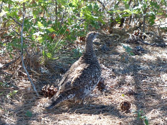
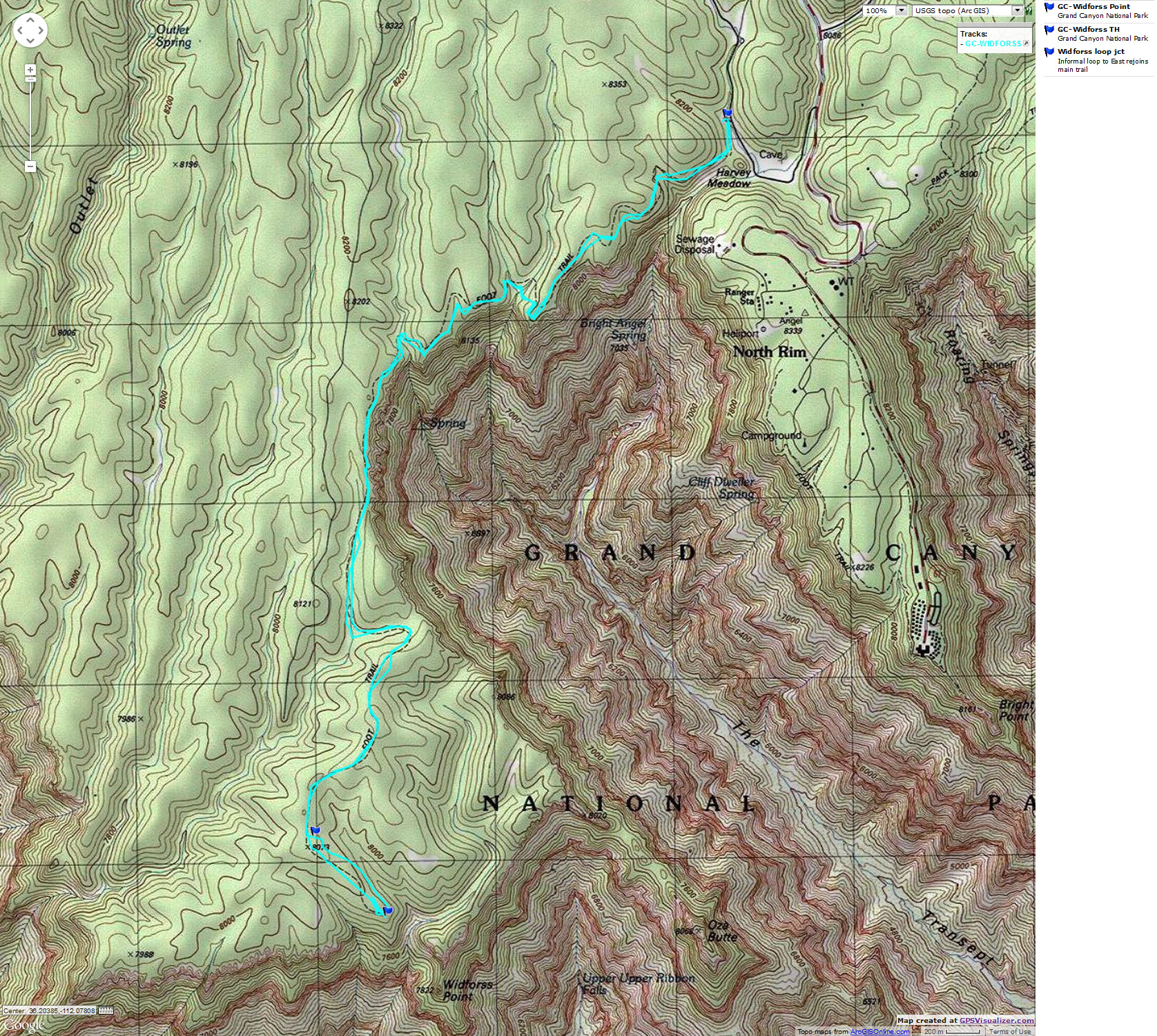
September 7th. Widforss:
10+ miles, ERM = 11.5.
"Now the hungry lion roars,
And the wolf behowls the moon."
My umbrella riding high in my day pack, we are on the rolling
highlands to Widforss Point. This is a terrific jaunt with Canyon and forest views. The humidity
is high after another round of evening rains. The timing is excellent because we've endured only
very brief daytime dribbles. This is the same hike where we shot a video of a blue (Sooty) grouse.
It's a wonderful cruise to the overlook of Widforss Point, which
affords sweeping views of the South Rim. One can easily see the South Kaibab Trail as it skirts
around the foot of the Redwall, headed for the Tonto Platform. Other South Rim features are laid
out for the careful observer.
Thunder heads build as we hike back toward the TH. The rains come
as we are back in camp getting ready to walk to the showers. Certainly, we've made good use of the
Outfitter Wing during this outing. The evening is cool enough to enjoy a fire while waiting for billions
and billions of stars to appear.
How lonely is the night without the howl of a wolf.
| ||||
 |
 |
 |
| ||||
During the first segment of this report, I visited the Powell Plateau and Swamp Lake to see what beefaloo impacts could be observed. Here is what I saw and my comments to the scoping process for possible management of beefaloo on the North Rim:
Beefaloo are causing significant resource damage to:
1. trails - creating erosion paths down the fall line, cutting across
trails and switchbacks, destroying the edge of trail tread. This damage, in my opinion, is far in excess
of any I have seen caused by elk or deer. Beefaloo are huge, and they are busting the trail tread, creating
erosion ditches, straight down the fall line.
2. archaeology - we found several surface ruins on the Plateau - all
with trammeling from beefaloo, all containing beefaloo dung (a sign about who was there).
3. Swamp Lake and water sources - trampling.
4. so-called "standard fencing" - destroying it, e.g., at Swamp Lake,
where beefaloo fur was knotted on barbs where the barb-wire fencing strands had been pushed apart. Beefaloo
tracks and trampling on entire previously wet surface of Swamp Lake.
5. Vegetation - a barnyard like atmosphere is found in many shady verandas
under the Ponderosa Pines. Beefaloo dung everywhere. There's lots of dung in the Swamp Point Camp, on the
trails, on the Powell Plateau, etc. Dust predominates in many of these barnyard areas.
6. Sense of well-being on the North Rim. Having been caught on my
touring bicycle in Yellowstone Bison traffic jams, I'm wondering about the safety issue of hikers encountering
these beefaloo in the open forests and meadows of the North Rim. Dangerous. Public safety issues should be
considered.
Should the public support Bison in Grand Canyon National Park? It seems
many are getting ahead of the evidence/science. Are these creatures beefaloo or bison? I believe this
question should be answered first. National Parks have the mission of stewardship for NATURAL resources, not
as public service cowboys and cowgirls for a hybrid invasive species.
Physical characteristics are necessary but insufficient to warrant
support of a barnyard of beefaloo in a national park, or on public land anywhere. I'd like to see the science
and I support obtaining it before moving to the next question.
A related question is - what size herd is essential to ensuring
viability of the herd (that is, enough genetic diversity to prevent inbreeding, etc.) and is this number
too large for the forage and water and living space on the Kaibab Plateau?
Alternatively, does the public want a barnyard type of atmosphere
on the North Rim? I do not. Currently the Powell Plateau and Swamp Ridge resemble a barnyard. Beefaloo
are becoming more concentrated in the Park to avoid hunters. Is a beefaloo-burnt landscape already evolving?
Should the public support the concept of managing the herd size to fit the
available land base? Given the possibility that these are genetically bison (I still want to see the science,
not opinions), I support natural management of the herd by reintroducing wolves. No wolves, no bison. Here
I agree with some of the beefaloo cheerleaders, wolves are critical to the natural management of bison.
"Everyone is entitled to his own opinion, but not his own facts." Should the public support the concept of using sportsman hunting outside the
park and (NPS) culling within the park as a way to move the herd seasonally in and out of the park?
The protection of seeps, springs and archeological resources is required.
One recommended decision process:
"We listened for a voice crying in the wilderness.
And we heard the jubilation of wolves!" “There are, of course, several things in Ontario that are more
dangerous than wolves. For instance, the step-ladder."
I agree, as long as wolves do the culling inside the park, and ideally,
outside the park as well.
This will require an agreement with the AZ fish and game that they will
not harass wolves. Provisions should be established to cancel grazing rights and fine and exclude from public
land ranchers and others who harm wolves.
Yes, I agree, however, standard fencing does not seem to work up to
the task. It seems unreasonable to attempt to fence the large number of archeology sites, especially because
many have yet to be documented.
In my days of living in the Yellowstone area - ranchers built some hefty
fences to try to keep the bison out of their haystacks, with limited success. Standard fencing seems a poor
solution to protecting springs/water sources and does not address what to do about other beefaloo impacts to
archeology, trails, etc.
1. Are these beefaloo or bison? Not bison - get them totally out of the
park and off all public lands. Return them to private land where trophy hunters can engage them for beefaloo
brisket. (End of decision tree - remove beefaloo.) Hosting a BBQ.gov for those who put the "Service!" in
National Park Service is a fine idea. Employees from other public land agencies should be invited, yes even
those predator-haters from the AZ game and fish.
2. If bison, will wolves be reintroduced to the Plateau? If no, then the
bison must go because there is not a feasible control mechanism that works within the Park.
I realize that the AZ game and fish do not see predators as important or essential, because they are
basically lobbyists for the hook and bullet special interest crowd and actively try to exterminate (or prevent
the reintroduction of) predators who made the game species what they are. This is not natural management,
not stewardship. It is a public service lobby for a special interest group. The public is subsidizing the
eradication of animals/processes essential to wildlife ecology via animal control activities. Where are the
tea-baggers - they should be raging against this type of government overreach.
No wolves, no assurance of no harassment by AZ fish and game, ranchers, federal entities? End of
decision tree - remove beefaloo/bison.
*ERM: Energy Required Miles, are there data to support this
mileage adjustment?
Journal of Outdoor Recreation, Education and Leadership
Petzoldt first proposed his theory in his 1976 book “Teton Trails” to
help backpackers plan trips and calculate their energy needs on mountain trails. “Petzoldt defined one
energy mile as the energy required to walk one mile on the flat. He recommended adding two energy miles
for every 1,000 feet of elevation gain, so a person hiking one mile and 1,000 feet upward would use the
equivalent of three energy miles,” Phipps said.
Petzoldt’s energy mile theory was just a reflection of the mountaineer’s
“gut feeling,” Phipps said. The theory had never been tested in a laboratory before the study began in WCU’s
Exercise Physiology Laboratory in the spring of 2010, Phipps said.
To determine the validity of the theory, the study measured the energy cost
and perceived exertion for walking on flat ground, with and without a 44.5-pound backpack, and up an elevation
gain of 1,000 feet, with and without the backpack, through the collection of metabolic data, Phipps said.
Twenty-four student, faculty and staff volunteers, including 12 males and 12
females, went through four testing sessions as the research continued into fall semester of 2010. The study
results showed that the additional energy cost for ascending 1,000 feet ranged from 1.34 to 2.02 energy mile
equivalents, for an average of about 1.6 miles, compared to Petzoldt’s use of two energy miles for each 1,000
feet. The range revealed by the study was due to the “hikers” personal weight differences, Phipps said.
“It is remarkable that Petzoldt’s energy mile theory is so close to the actual energy cost measured during our
study,” Phipps said. “In the field of outdoor education, it’s important for leaders to include an estimation
of energy requirements during the planning of hiking trips.”
Phipps said the energy required for hiking up steep mountain trails would vary
for individuals and groups, and the variables of the trail would also factor in, but he recommends that
backpackers stick with Petzoldt’s idea of adding two energy miles for every 1,000 feet of elevation gain when
planning trips.
The Validity of Petzoldt's Energy Mile Theory, 2010
Authors: Maridy McNeff Troy, Maurice L. Phipps
Publication: Journal of Outdoor Recreation, Education, and Leadership
Click here or on the Looking Lizard to go to all WV reports about The Grand Canyon
| ||||
Books:
Eaarth : making a life on a tough new planet, McKibben, Bill,
Time Books, 2010.
Maybe one : an environmental and personal argument for single-child families, McKibben, Bill, Simon & Schuster,
1998.
The end of nature, McKibben, Bill, Random House, 1989.
Important Links:
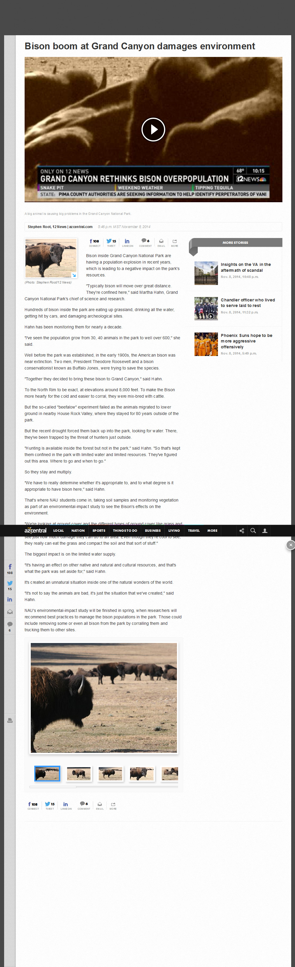
Chanel 12 news (click for jpg copy of text): Bison boom at Grand Canyon damages
environment Stephen Root, 12 News, azcentral.com, November 8, 2014
the geology of the Grand Canyon by the NPS
the Geology Song - Fossil Rock Anthem
| |||||
| |||||
| |||||
| |||||
| |||||
| |||||
| ||||
|
Wild Vagabond Main |
Trip Report Index  |
Caveat  |
|---|


