Endearing Escalante 2008
Hole-in-the-Rock, or in
your head?
Red Breaks, Peek-A-Boo & Spooky Too, Fence Canyon Arches, Zebra Canyon,
Little Jumbo, Chock Nut, and the Vreeland Pillars Arches
November 17-22, 2008
Text and photos
© copyright by Rob Jones
|
|---|
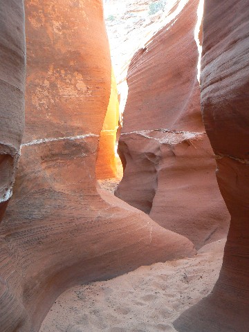
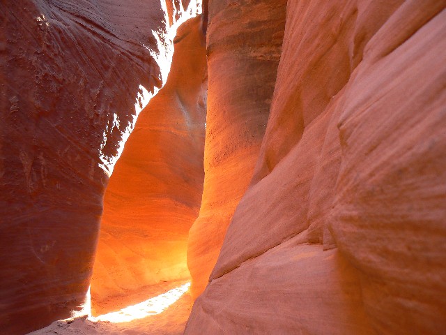
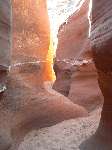
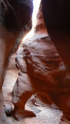
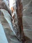
Lambent Spooky Light
(Click the image for the full-size image)
|
|---|
|
|
|---|
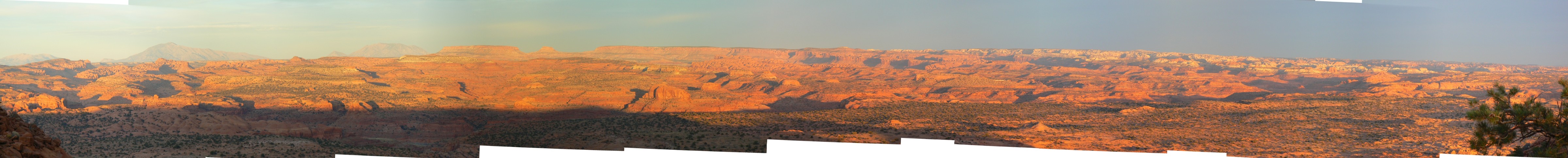
Egypt (Fence Canyon) Pano
(Image is very wide - scroll to view it (4862 x 485; 556kb) - Click
the image for the full-size image)
|
|---|
|
 |
ERM = Energy Required Miles.
A mile is added for every 500' elevation gain or loss. It's a very serviceable method of
estimating energy required miles.
Maps:


|
|---|
Map - UT: Escalante: Red Break; 10.6 miles
(Click the image to see the map)
|
|---|
|
|
|---|
Map - UT: Escalante: Fence Can Arches; no track; 7.5 miles
(Click the image to see the map)
|
|---|
|
|
|---|
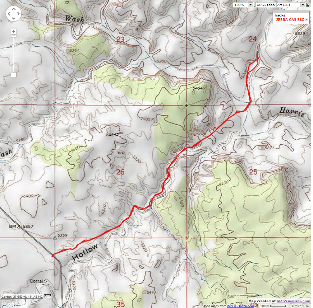
Map - UT: Escalante: Zebra Canyon; 6 miles
(Click the image to see the map)
|
|---|
|
|
|---|
Map - UT: Escalante: Jumbo Arch 6 miles
(Click the image to see the map)
|
|---|
|
Day 1: Cottonwood quagmire
Drive the 250 to Escalante and meet Bob and Craig at
the GSENM headquarters. Obtain some very basic information, then drive to the cold sump
known as Harris Wash TH. Frigid.
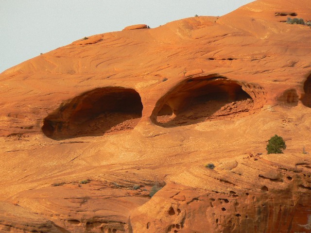
On the drive to the NM, and passing into dreaded utah
from the sewage pond stopper, I think about Azut Arch, and begin scanning the cliffs.
What? - a hole in the cliff top. I walk up and take a photo, thinking this is something
new. It is to me, yet is well-known to others as Skylight Arch.
Turn your face to the sun and the shadows fall behind
you. Maori proverb.
The only difference between a rut and a grave is the depth.
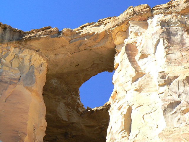
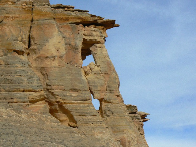
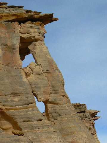
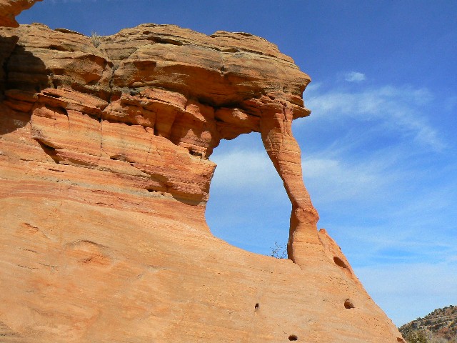
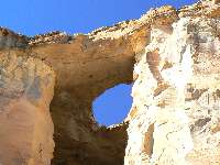
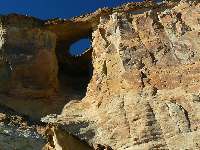
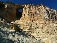
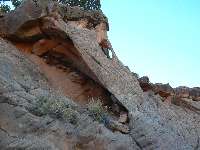
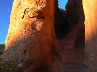
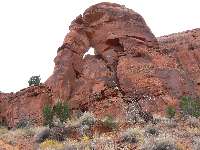
Skylight Arch Directions:
This arch is in utah, but not by much.
This 50 foot arch is located alongside Hwy 89, just North
of the Arizona/Utah border. The car park for this arch is in utah, at milepost 1.7.
The mileposts are measured from the Arizona/utah border West of Page, AZ, and count up
along Hwy 89 to Kanab, utah. For reference, the car park is at approximately
12 S 0447261 E; 4097265 N; WGS 84, on the North side of the road. Park in the car park,
and look SW, in the top of the sandstone cliffs for this lovely. The arch is at the
approximate GPS coordinates of 12 S 446811 E; 4096922 N; WGS84. The arch is of the
"caprock" variety, and it is in more durable Dakota Sandstone, which caps the softer
Entrada SS.
MP 1.7 (utah) car park is at approximately
12 S 0447261 E; 4097265 N; WGS 84.
Skylight Arch: 12 S 446811 E; 4096922 N; WGS84.
Vreeland reference V8-26
Click here for the NABS description of the arch.
Click here for a TopoQuest map.
|
|---|
Skylight Arch 1
(Click the image for a full-size view)
|
|---|
|
|---|
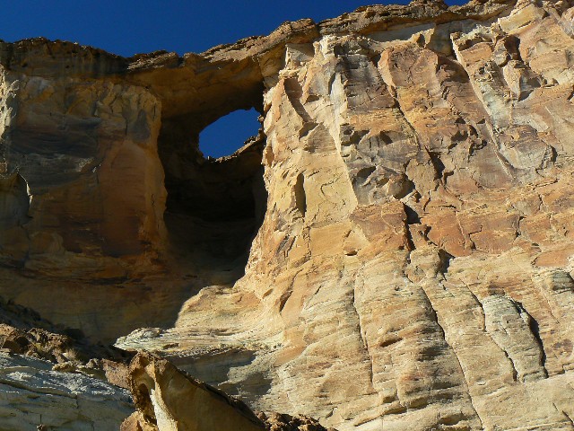
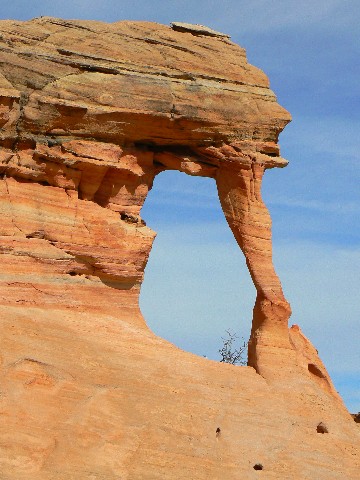
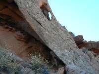
Skylight Arch 2
(Click the image for a full-size view)
|
|---|
|
|
|---|
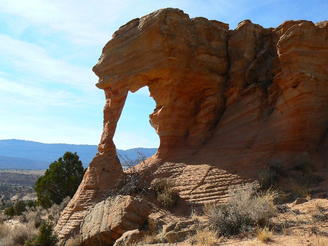
Skylight Arch 3
(Click the image for a full-size view)
|
|---|
|
(There are - More photos below the trip narrative.)
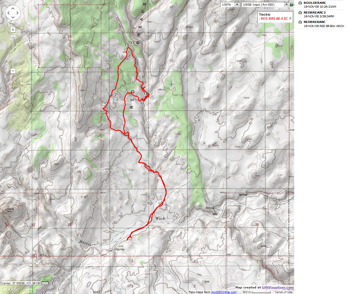
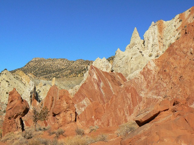
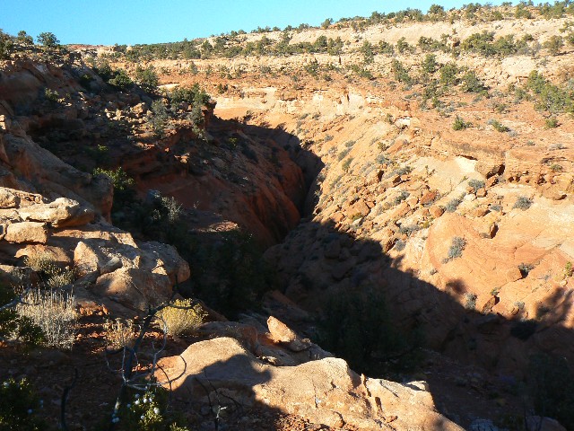
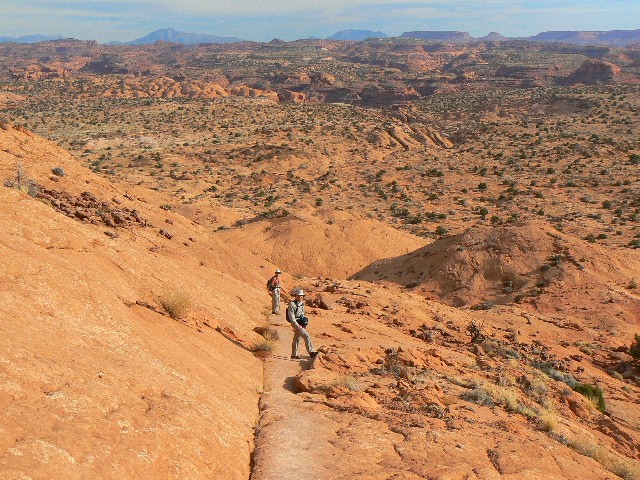
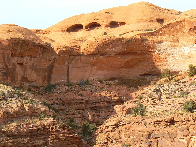
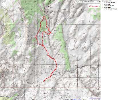
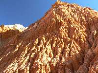
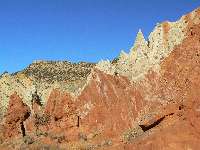
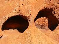
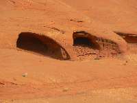
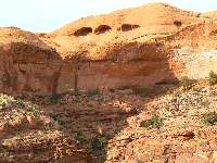
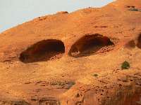
Day 2: 11-18-08; Red Breaks Break-out:
10.6 miles; 16 ERM.
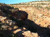
Bumping over the breaks at the foot of a huge monocline,
we're on track for the unphotographed "Boulder Arch." We are nearing Red Breaks Canyon,
off Harris Wash. Ahead, I see a band of rocks. Another canyon to cross, which we have
been doing all day as the washes ripple off the monocline. Stymied. We won't be crossing
this time. The arch is 500' away, yet we are separated by a canyon so deep you can see the
stars at noon (Anke Summerhill).
Stars at Noon
"....Canyons so deep you can see the stars at noon,
it's a paradise I'm thinking of.
Feeling complete as I'm held within these walls,
and the river gently sings her lullaby."
Stars at Noon, by Anke Summerhill,
from: Slickrock and Sagebrush,
Songs for Utah Wilderness, available from SUWA.
Click here to go to SUWA's site.
We continue parallel to the abyss and find a route down
along with two minor arches along the way. We find lovely narrows up and down canyon. And,
in each direction we are stopped by climbing chokestones. A canyoneers' paradise.
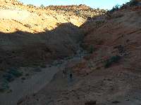
The cold air is slumping into Harris Wash as we hike back
to camp. Two stars are already out. Coyotes serenade as water bottles freeze.
|
|
|---|
Map - UT: Escalante: Red Break; 10.6 miles
(Click the image to see the map)
|
|---|
|
|
|---|
Pumping Away?
(Click the image for a full-size view)
|
|---|
|
|---|
Along Cottonwood Rd.
(Click the image for a full-size view)
|
|---|
|
|
|---|
Along Cottonwood Rd.
(Click the image for a full-size view)
|
|---|
|
|
|---|
Red Break Arch 1-1
(Click the image for a full-size view)
|
|---|
|
|
|---|
Red Break Arch 1-2
(Click the image for a full-size view)
|
|---|
|
|
|---|
Red Break Arch 2-1
(Click the image for a full-size view)
|
|---|
|
|
|---|
Red Break Arch 2-2
(Click the image for a full-size view)
|
|---|
|
|---|
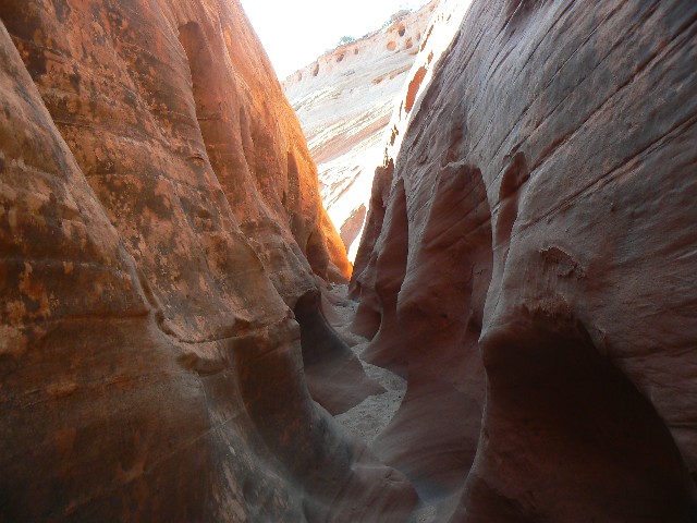
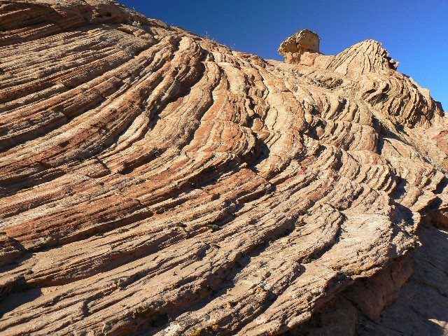
Red Breaks 1
(Click the image for a full-size view)
|
|---|
|
|
|---|
Red Breaks 2
(Click the image for a full-size view)
|
|---|
|
|
|---|
Red Breaks 3
(Click the image for a full-size view)
|
|---|
|
|
|---|
Red Breaks 4
(Click the image for a full-size view)
|
|---|
|
|
|---|
Red Breaks 5
(Click the image for a full-size view)
|
|---|
|
(Photos and the second rest of the trip continue below.)
|
|---|
Peek-a-boo Natural Bridge1 - panorama
(Image is very tall - scroll to view it (640 x 1021; 95kb) - Click
the image for the full-size image)
|
|---|
|
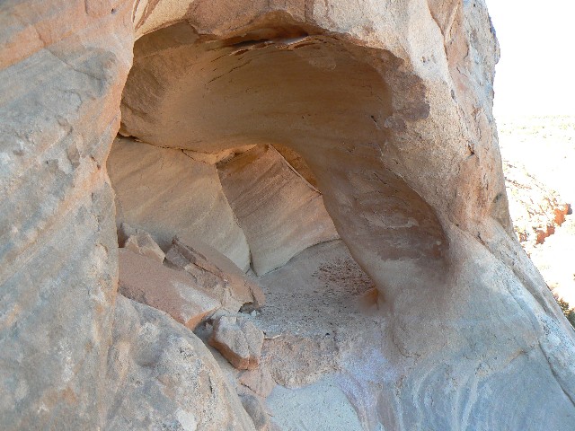
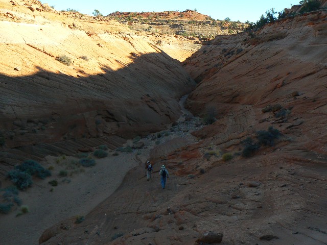
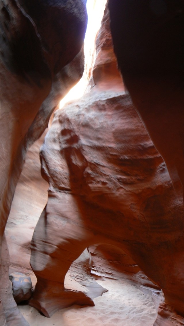
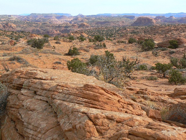
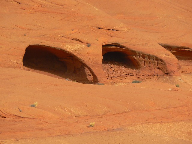
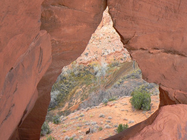
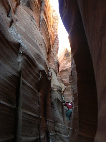
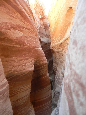
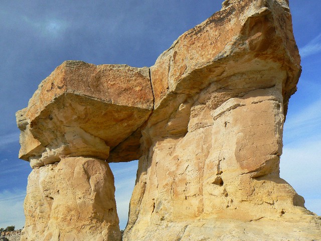
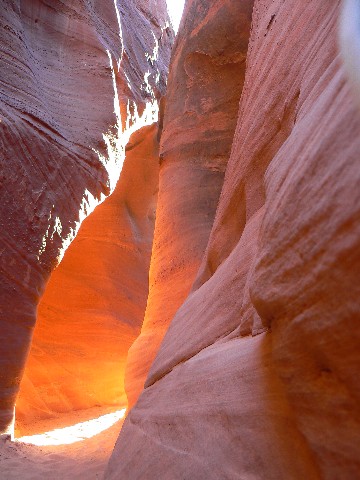
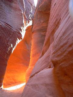
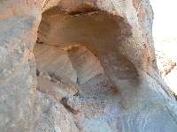
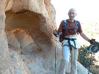
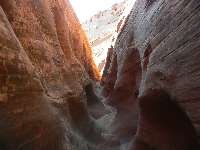
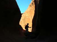
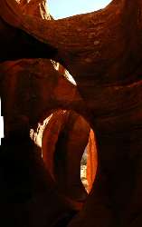
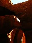
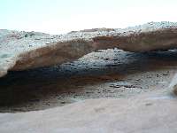
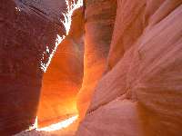
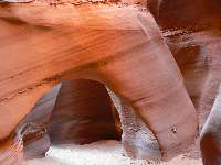
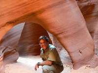
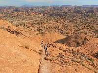
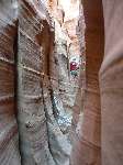
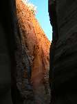
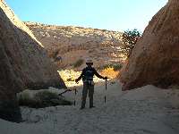
Day 3: 11-19-08; Beek-A-B00 and Spooky too.
3 miles; 4 ERM.
The moqui steps lead into a notch in the sandstone and
the display of natural bridges. Squirming over and through the sandstone pit, I'm directly
beneath the NBs. Arch-worthy. We slither through another NB upcanyon from the main event.
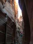
Continuing up this glorious slot, we climb out into a sandy
wash, then we lilt over to the head of Spooky Gulch. Suddenly, a slot. The canyon funnels
into an abrupt slot, and we follow. So narrow that my bulimic bulk grinds against the
rough walls. Not really room for the camera. On we grunt until we reach a perhaps
climbable chockstone. Yet, what lies around the bend? What if we cannot get down the next
obstacle, and are then stranded because this one, the one in front of and below us is
insurmountable? Yikes.
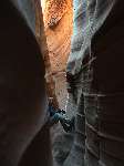
Backtracking, we take the route just above the canyon to
its mouth and head back into the dark, slithering canyon. Now, it's even more narrow, and
I have to hold my camera in front and squeeze around the sinuous turns. We arrive back at
the base of the obstacle. Well, there were no other hazards. I head back to the mouth of
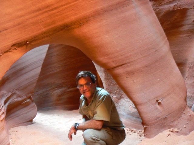
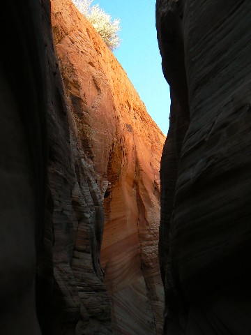
the canyon and photograph the glow entering the restricted void. Lambent!
On the way out toward the trailhead, we tour up Dry Fork
Coyote and notice a small wall arch. Miles of walkable narrows here. Again, two stars
are out when we reach the rim.
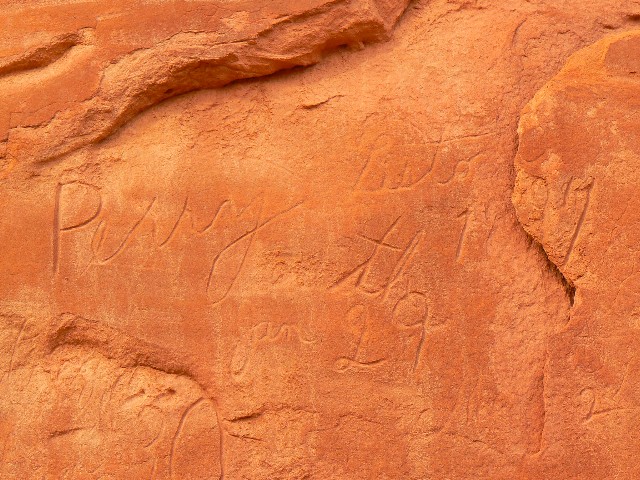
The Hole road is terrible. Teeth shaking, kidney stones
grinding, common sense shaking washboards. Perhaps this is what happened to bushco?
All common sense and inquisitiveness and thought shaken out by religious imperatives,
inserting religion into policy, separating thought from government? Prophetic.
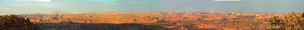
In the dark, we shake out to Egypt amidst swirling poof dust,
over corrugated roads, and boulder-strewn washes along the way to this TH for Fence Canyon.
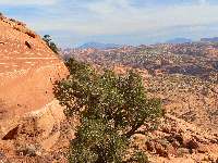
It's warmer and more pleasant, and, as we discover in the morning, there are views of the
Escalante country galore. See pano.
|
|---|
Spooky Gulch Natural Bridge - panorama
(Image is very tall - scroll to view it (640 x 1134; 120kb) - Click
the image for the full-size image)
|
|---|
|
|
|---|
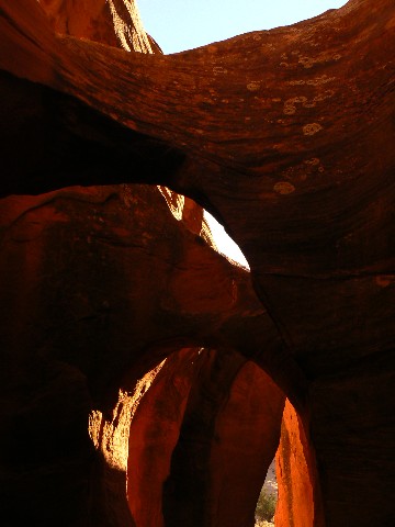
Entrance to Peek-A-Boo
(Click the image for a full-size view)
|
|---|
|
|---|
Peek-A-Boo NB - see pano too
(Click the image for a full-size view)
|
|---|
|

|
|---|
Second Peek-A-Boo NB
(Click the image for a full-size view)
|
|---|
|
|
|---|
Dry Fork Wall Arch 1
(Click the image for a full-size view)
|
|---|
|
|---|
Dry Fork Wall Arch 2
(Click the image for a full-size view)
|
|---|
|
|
|---|
Glowing Spooky Gulch
(Click the image for a full-size view)
|
|---|
|
|
|---|
Spooky Gulch NB - see above pano
(Click the image for a full-size view)
|
|---|
|
|
|---|
Spooky Gulch NB - see above pano
(Click the image for a full-size view)
|
|---|
|
|
|---|
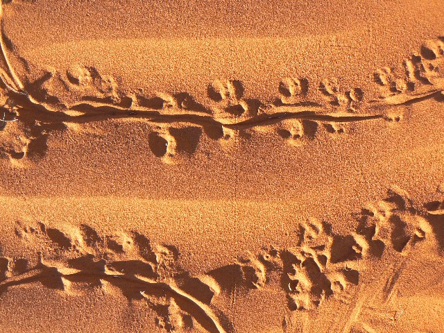
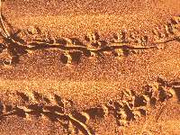
Evening Tracks
(Click the image for a full-size view)
|
|---|
|
(There are - More photos below the trip narrative.)
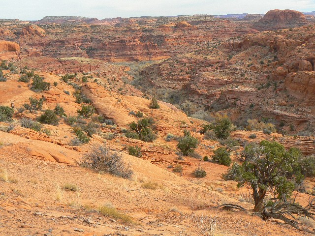
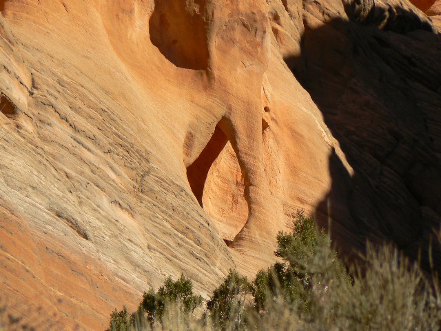
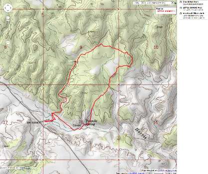
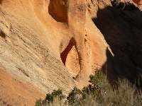
Day 4: 11-20-08; Fence Canyon Arches.
7.5 miles; 14 ERM.
The alcove arch glows orange in the tremendous sweep of
petrified sand dune called the Navajo SS layer. Lustrous! I try to steady the camera,
bracing it against the top of my hiking pole for this long short across the North arm of
Fence Canyon. Bob and I sit on the abrupt edge of this gorgeous canyon and estimate, very
roughly, the arch coordinates.
We started out after the searching sun, skittering across
the Southern horizon, warmed camp. Down the slickrock bowl we hike, admiring the steps cut
by horsemen of old, recently scarred by seasoned mules. It is truly amazing that a horse or
mule can walk here, down this angled slickrock and into Fence Canyon.
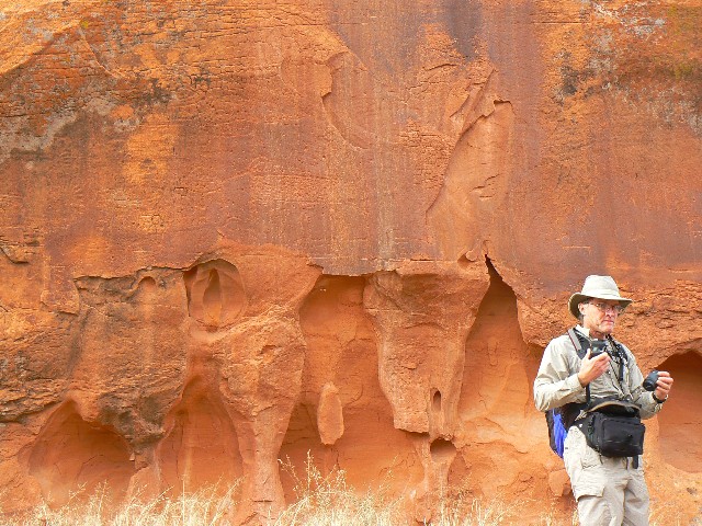
Water is trickling down both arms of Fence, providing desert
music as we reach the level immediately above the Escalante River and view the ancient and
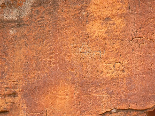
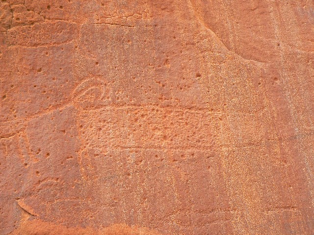
cowboy glyphs. Graphic and Deluxe. We sit on the old foundation for the line shack burned
in the cattle elimination of 1990 and watch the plumes of silt bloom in the river. Not a good
source of wholesome water, in contrast to Fence Canyon.
Heading back toward the TH, Craig spots another arch, which
seems to disappear as one walks toward it. We dub it Fence Canyon Disappearing Arch, a new
find.
Out of character for us, we return to camp in time for a
shower in the daylight. Despite the piercing breeze, it is enjoyed.
Directions to the arches: North Fence Alcove Arch and North Fence
Disappearing Arch:
(utah, Escalante Grand Staircase NM, Hole-in-the-Rock Road):
It's 16.3 miles from the tarmac (Hwy 12) to the side road
leading to the side road (NE)
leading to Egypt TH, and 10 more bumpy miles to the Egypt TH. One follows the route off
the rim and hikes about 2.5 miles along the left (West) edge of Fence canyon, taking care
not to enter the Canyon proper until nearly to North Fence. The old horse trail is not as
easy to follow as one might think. When the trail starts off the left side heading down
into Fence Canyon, watch carefully across the canyon (N Fence) for the arch in a series of
three small alcoves at the top of a huge head of Navajo SS. The rough coordinates may help.
Actually getting to the arch is another, complicated, project I have yet to attempt.
North Fence Alcove Arch Viewpoint: 12 S 483152E 4162763N; WGS84.
North Fence Alcove Arch (very rough estimate): 12 S 483250E 4163150N; WGS84.
North Fence Disappearing Arch: 12 S 483303E 4162741N; WGS84.
|
|
|---|
Map - UT: Escalante: Fence Can Arches; no track; 7.5 miles
(Click the image to see the map)
|
|---|
|
|
|---|
Start - Fence Canyon
(Click the image for a full-size view)
|
|---|

|
|---|
Start - Fence Canyon
(Click the image for a full-size view)
|
|---|
|

|
|---|
Horse steps 1
(Click the image for a full-size view)
|
|---|
|
|
|---|
Horse steps 2
(Click the image for a full-size view)
|
|---|
|

|
|---|
Midway - Fence Can.
(Click the image for a full-size view)
|
|---|
|
|
|---|
Midway - Fence Can.
(Click the image for a full-size view)
|
|---|
|
|
|---|
N. Fence Can. Alcove Arch 1
(Click the image for a full-size view)
|
|---|
|
|
|---|
N. Fence Can. Alcove Arch 2
(Click the image for a full-size view)
|
|---|
|
|
|---|
N. Fence Can. Alcove Arch 3
(Click the image for a full-size view)
|
|---|
|
|
|---|
Cowboy Glyph
(Click the image for a full-size view)
|
|---|
|

|
|---|
Bob & Fence Can. Glyphs
(Click the image for a full-size view)
|
|---|
|
|
|---|
Fence Can. Glyph
(Click the image for a full-size view)
|
|---|
|
|
|---|
Fence Can. Glyph
(Click the image for a full-size view)
|
|---|

|
|---|
Disappearing Arch 1
(Click the image for a full-size view)
|
|---|
|

|
|---|
Disappearing Arch 2
(Click the image for a full-size view)
|
|---|
|
|
|---|
Disappearing Arch 3
(Click the image for a full-size view)
|
|---|
|
|
|---|
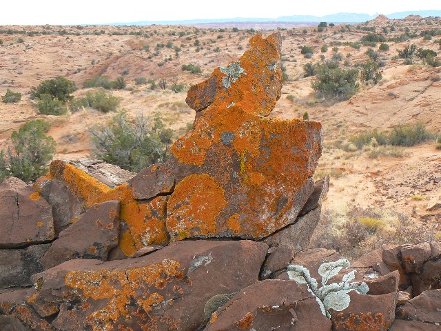
Lichen Coyote
(Click the image for a full-size view)
|
|---|
|
|
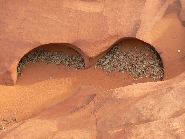
|---|
Sandstone Bra
(Click the image for a full-size view)
|
|---|
|
(Photos and the remainder of the trip report continues below)
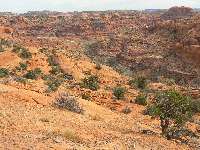
Day 5: 11-21-08; Zebra Zone. 6 miles; 7 ERM.
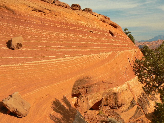
The striped walls shimmer near the glow above, closer to
the low-angle sun. Twisting and turning, Zebra canyon lives up to its name in swirls and
stripes. It's a short canyon, and it's difficult to tour it all because of climby spots,
but well worth the effort. As in many journeys, it's the trip that compliments the
destination. Buttes reminiscent of the area near The Wave compliment the hike. Variegated
crossbeds of Jurasic sand grace the teepees and buttes.
It was worth the teeth shaking from the 10 miles exiting
from Egypt and then along the road to approx. 7.8 miles South of the tarmac, to park near
a fence and cattle guard. Out here, all should guard against cattle, which have cow burnt
the land, albeit perhaps having the glory of a research-base NM has helped some despite
the prolonged drought.
We camp not far off the road and dark collapses cold upon us. A fire helps, but the water jugs inside the truck freeze. I take my water baby to bed with me tonight (hot water bottle), and sleep well.
|
|---|
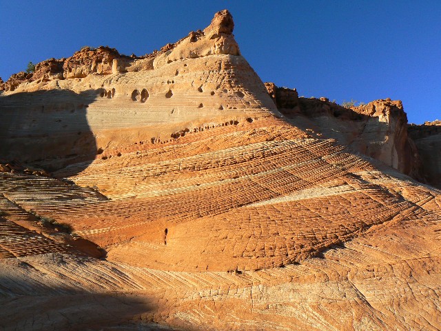
Zebra Can. 1
(Click the image for a full-size view)
|
|---|
|
|---|
Zebra Can. 2
(Click the image for a full-size view)
|
|---|
|

|
|---|
Zebra Can. 3
(Click the image for a full-size view)
|
|---|
|
|
|---|
Zebra Can. 4
(Click the image for a full-size view)
|
|---|
|
|
|---|
Zebra Can. 5
(Click the image for a full-size view)
|
|---|
|
|
|---|
Zebra Can. 6
(Click the image for a full-size view)
|
|---|
|

|
|---|
Zebra Can. 7
(Click the image for a full-size view)
|
|---|
|
|---|
Zebra Can. 8
(Click the image for a full-size view)
|
|---|
|
|
|---|
Earlobe Arch
(Click the image for a full-size view)
|
|---|
|

|
|---|
Zebra Can. sign
(Click the image for a full-size view)
|
|---|
|
|
|---|
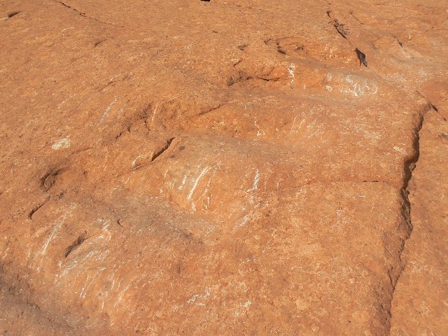
SS Swirl 1
(Click the image for a full-size view)
|
|---|
|
|
|---|
SS Swirl 2
(Click the image for a full-size view)
|
|---|
|
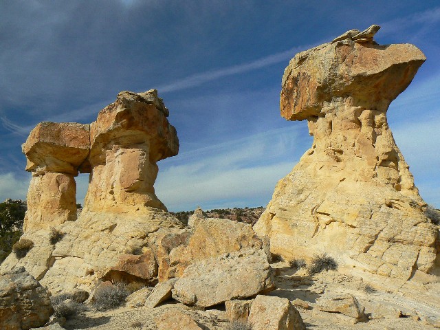
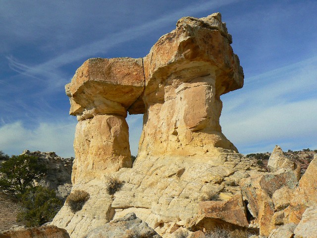
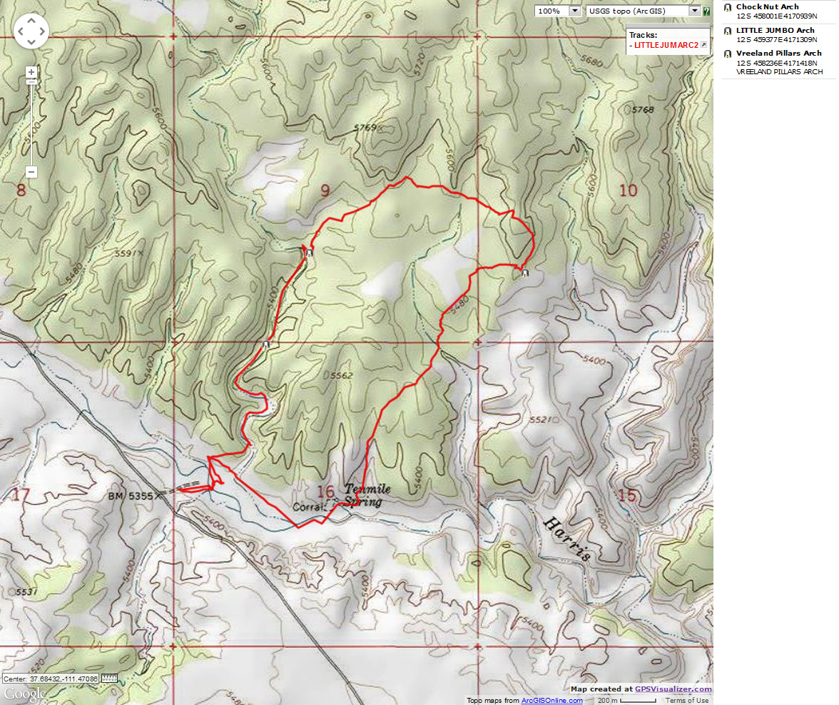
Day 6: 11-22-08; Jumbo Pillars. 6 miles; 7 ERM.
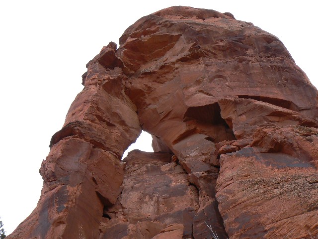
The walkable narrows abruptly stop at the dry falls. Looking up, I see the Vreeland Pillars, a small capstone arch perched above the slot. Bob and Craig have started their drive North, attempting to avoid the provo parking parade caused by those attending the holy war between the University of Utah and byu (Utah trounced the sinners from provo, whose mission it is to send all inhabitants of Earth into extinction - caused by their lemming-like population rates).
I retrace my route a short distance and climb out of the low slot below the Pillars. Tremendous. Then, using the coordinates from the WAD, I hike peacefully crosscountry toward Little Jumbo. Earlier, on the way up the canyon, I found another arch, one I called Chock Nut Arch. So, today is shaping up to be an archdom day.
Avoiding the occasional healthy patches of cryptobiotics, I climb over a low plateau and arrive at the coordinates. No arch. No arch in view. What next? Disappointment. Perhaps my arching day is finished? I stroll South and see Little Jumbo after 0.13 miles. Lovely.
Deciding to cut back towards the main wash rather than retracing the route, I head off toward the general track where I had first started up the arch wash. It's a good hike until one encounters the tamarisk-choked main drainage.
I had been pressing the hike in order to drive back mostly in the daylight. About the time I reached the Southern end of the Cottonwood Rd., dark caved in and my Escalante days were near an end.
Little Jumbo, Chock Nut, and Vreeland Pillars Arches - directions:
(utah, Escalante Grand Staircase NM, Hole-in-the-Rock Road):
It's 4.5 miles from the tarmac (Hwy 12) to the side road
leading to the wash for the Jumbo Arch loop. Park on the East side (not too far from a corral
on the West side) and walk down a brief track and across the main wash. Once you have fought
your way through the tamarisk in the main wash, and are on the bench above the wash, walk
down canyon and turn left (N) at the next wash coming in from the N. The distance from the
car park at the main road and this turn is about 1/3 of a mile. Walk up the wash and note
Chock Nut Arch (named for the chock rock in the center of the arch) on your left as you walk
up canyon. In about two miles from the car park, you go into a walkable narrows which soon
end at a dry falls. Retrace your steps a hundred yards or so from the falls and look up
about 50' for the Vreeland Pillars. You can scamper out here, and, after admiring the VP,
set a course cross country for Little Jumbo. You encounter a low plateau (which you can
scramble over), and you may scramble down easily near Little Jumbo. See the map for general
layout and GPS coordinates. Return the way you came, or set a course to the left of the
nearby teepes, and you may meet an old horse trail that returns you to the main wash
(Alvey Wash) and back to the mouth of the Chock Nut Arch wash.
Carpark approx. at: 12 S 457461E; 4170131 N; WGS84. (4.5 miles South of Hwy 12)
Chock Nut Arch at: 12 S 458001E; 4170939N; WGS84.
Vreeland Pillars Arch at: 12 S 458236E; 4171418 N; WGS84.
Little Jumbo Arch at: 12 S 459377E; 4171309 N; WGS84.
The WAD lists the wash as Harris Wash. It is Alvey Wash.
The WAD lists incorrect GPS coordinates for Little
Jumbo. More accurate coordinates are listed above.
|
|
|---|
Map - UT: Escalante: Zebra Canyon; 6 miles
(Click the image to see the map)
|
|---|
|
| | | | | | | | |