(Click the image for a full-size view (11k); Photo by Rob)
|
|
|---|
|
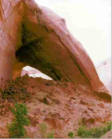
Mysterious Nemo Arch (A hiker is standing under the arch)
(Click the image for a full-size view (11k); Photo by Rob) |
*"
Amazing Space" is a title I borrowed from Gregory Aplet's recent article, Amazing Space, (1998) in Wilderness, a magazine published by The Wilderness Society. The article is about Gregory's participation in the inventory of unprotected wild lands in Utah, including the Escalante country, that several citizen environmental groups are conducting. He wrote "It was exhilarating. What grabbed me most was the super-human scale.... we found ourselves in canyons with 1,000-foot-high walls - landmarks anywhere but Utah; virtually nameless here. When we emerged into open country, we could look out for miles in any direction and see no sign of human impact." Pg 27.Following and preceding Clinton's designation of the Grand Staircase-Escalante National Monument (GSENM) in 1996, conservationists across the U.S. have tried to gain official wilderness designation for this "gift from God," the Escalante country. Given the clamor from the extreme right-wing politicians, it's important to keep in mind that the GSENM is less than 10% of the BLM public land in Utah. Official wilderness designation seems far too little to ask.
Night 1: Elk Obstacle: Friday night found me negotiating the luge-run around the high shoulder of Boulder Mountain, far above the distant sunset-tinged Circle Cliffs, the Capitol Reef country, and the remote mountains bobbing above the magenta/purple sea of convoluted slickrock. Peeling off the Southern flank, leaning the pick-up into a corner, and... Yow! Elk prancing across the road, hopping fences, and ignoring me as they lounged under the Ponderosas and grazed. I saw the grazers before I saw the shadowy prancers on the road, setting the stage for an elk obstacle course. Stately and graceful, it's always a treat to see elk at close range. Opening the window, I could smell their musty elkness.
I continued, into utter dark and down the Hole-in-the-Rock road to the Sooner Rocks, where I threw together what camp I needed for the remainder of the night, and enjoyed the blazing stars for a few moments as the bumping road settled out and sleep slipped in.
Day 1: Hole in one: Bicycling to the Hole-in-the-Rock (10 miles, round trip). I set up the screen tent and lounged in lizard heaven while I ate breakfast and the sun warmed the rocks.
From the Entrada Sandstone billows of Sooner Rocks, I drove to where the road gets more seriously rough, near the top of Davis Gulch, and began riding my bike to the Hole-in-the-Rock. Davis is about 50 miles from pavement, along the Hole-in-the-Rock road. As I continued the gradual descent along the plane, I noticed some of the cactus in bloom, and the yuccas preparing to. A little lower, a little hotter. I passed a plaque commemorating Hole-in-the-Rock Arch. The arch is high in the face of Fiftymile Mountain, the Straight Cliffs, and served to guide the pioneers as they forged the route that wanders along the path of the present road. They were traveling to a ford of the Colorado River and on to propagate the area near Bluff, Utah. The arch would later serve me well.
After 5 miles of mild mountain biking, I arrived at the cleft in the rim called Hole-in-the-Rock. It was quiet at the TH, so I hid my bike and headed into the rock cleavage. Cool in the cleavage, I enjoyed lunch as bird twitters softly echoed and lizards scampering around the rocks. Below I could see the deep blue waters of Lake Foul, the Big Sewage Pond, the Corps of Wrecklamation Pork Barrel Centerpiece, where Silt Happens! My relative solitude was burst by a bovine on a tour boat a few hundred feet below, shouting "uwanahana en dwan!! blahn ugh yoiu canse roacks en such!!!" over a bull horn, and providing needed clarity to this playland of mechanized scoundrels.
Have you read any of the literature concerning the pollution created by outboard motors? A recent study was halted when the EPA threatened to fine researchers if they dumped the water they used to test motors. What does this mean for the motors on boats in our public waterways??? Do not use a 2-cycle motor on water or in the air. Better, use a muscle-powered vehicle. Well, back to our story.
Quiet returned and I continued down the crevice to the pond. Iwas grateful that the choppy waters kept most boats in the distant raceway, but this meant that it was a bit cool for a swim. Would you swim in this pond?
Nearing the top of the crack on my return, I encountered a toddler, then another, then about 50 more, swirling around the entrance to the hole. I had seen only boys. Genetic engineering in Southern Utah? It was too busy for me, so I hopped on my bike and began the return ride. A few of the monstrous Mormon Assault Vehicles (suburbans and such) roared by, then it was just the skittering lizards, the reeling vultures, and me.
Day 2: Amazing Space: Davis Gulch, Nemo Arch via the overland route (12 miles, round trip). There are two ways to get into Davis, the difficult slot or the overland route. Because I had forgotten my webbing (rope) I opted for the overland route. It's early morning as I begin crossing the developing narrows of the gulch, headed across carmel-colored Navajo Sandstone dumplings, rolling toward the stock trail which reportedly careens off the rim and enters Davis Gulch about 3/4 of the way to where the pond now lingers.
It is an unchartered journey overland to the historic cattle entry to the gulch. I found that trying to stay in visual contact with the gulch was a bad idea, too much rolling and rounding over the sandstone pillows. So, I headed west, toward the low bench, and found the route easier. Eventually, I located the route in, feebly marked by two cairns - it helped to do some compass-sighting to ascertain where I was, and when to head back toward the canyon edge. The historic cattle trail provides an easy entry to the gulch, although there is, and was, little to it. Just a route pecked into the sandstone here, a bit of brush piled-up there, and you're down. There's precious water in the gulch, and ponds created by desert beaver. I rested, put on river sandals, and began the thrash upcanyon for a mile or so to Nemo Arch. A lush contrast has been created by the beaver ponds: sandstone and cactus and lizards and scorpions, border willows and reeds and frogs and crayfish. The beavers provided punji sticks (willows cut sharply at an angle) to keep my eyes on the route, so I had to pause to enjoy this amazing place.
Nemo Arch jumped into view. It's a massive monument to Everett Ruess. Ruess wandered the Escalante country in 1934. His burros were found at the foot of the cattle-trail entry to Davis Gulch, but Everett was never found. Everett left a few "Nemo" (no one) inscriptions, one near Nemo (Bement) Arch. I own a few of his block prints. The blocks were resurrected by SUWA several years ago after they were found in Everett's Uncle's gazebo. Ruess sold his art and worked piecemeal to finance his wanderings throughout the Colorado Plateau and the Sierras. See the Wild Activist Links and help SUWA keep this country the way Everett saw it.
Everett wrote "Once more I am drunk with the lust of life and adventure and unbearable beauty. I have the devil's own conception of a perfect time; adventure seems to beset me on all quarters without my searching for it...." Everett Ruess, Vagabond for Beauty by W.L. Rusho, 1983, Peregrine Smith Pub., Salt Lake, Utah.
It was sunset in the canyon, so I hurried back to the route out of Davis, beginning the long jaunt across rock hummocks to the unmarked but remarkable TH. My return trip was easier and took less time because I kept closer to the west bench. As the light faded, I oriented by the Hole-in-the-Rock Arch and Fiftymile Point. Dehydration and dark greeted me as I floundered onto the dirt Hole road, happy that there was extra water and goodies in the pick-up. It's awfully peaceful out here in this amazing space.
|
|---|
|
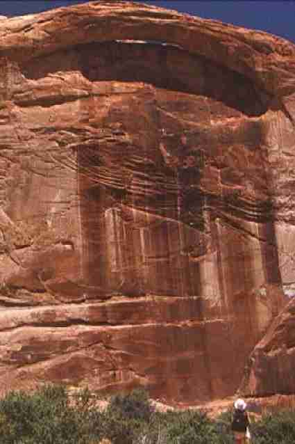
Wall Arch in 50 Mile
(Click the image for a full-size view (19k); Photo by Rob) |
Day 3: Fiftymile Fling: Fiftymile Creek to the sewage pond (9 miles, round trip). A Leopard Lizard joined me as I put on boots at the unmarked TH into 50-mile. One starts directly below Cave Point of Fiftymile Mountain. Is this really the route? Looking out across the glare of the sun on the rock, I wondered.
The canyon quickly became more interesting as it developed into increasingly higher rust-stained Navajo Sandstone walls. After passing a dry fall, and joining a few side canyons, the walk became a true canyon hike. A stream developed as I dropped deeper. Cottonwoods, then... wow! An arch high in the wall. It's not on the map, but it's wonderful. And there is a petroglyph surprise, somewhere in the area, I'm not saying exactly where. I ate lunch in the large alcove near the arch, then I continued down canyon. I saw beaver ponds, so seemingly out of place in the desert. A lovely sweeping overhang of the canyon brought delicious coolness to the heating day. Then, I encountered slack water. The canyon narrows significantly, and I could not see if this was a short stretch of water, or what. I waded in a bit to confirm that the turquoise water did stink like the sewage pond. It quickly got deep enough that further travel would require swimming.
Returning back up the canyon, I discovered a scrawling inscription that reads "E. Reus Hunters, LCC 1935, FB, RS, HC, AT. HS. June 6." This scrawl was apparently made by a party looking for the missing Everett Ruess. Faded, almost imperceptible petroglyphs are nearby.
I returned up the canyon, taking a different (east) fork out of the canyon. I nearly stepped on a Faded Midget Rattlesnake curled up in a tight nearly-perfect circle, fitting in the footprint of a long-gone cow. I lurched to a stop and said "Hey, you almost stepped on a snake!" I still doubted that it really was a snake, until I waved my handkerchief at the snake and it wiggled off, hissing and waving goodbye with its tail. "Yikes" was my only printable response.
I visited the lovely Cave Spring after returning to the pick-up. Then, I arrived back at camp after dark, and I ran over my basking black shower bag, terminating my hopes for a hot shower. I did enjoy a lovely fire with dinner, however.
|
|---|
|
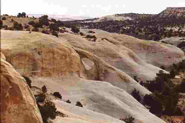
Cedar Arch
(Click the image for a full-size view (13k); Photo by Rob) |
Day 4: Not real Idahoans: I took my time packing. As I did, I heard two vehicles approaching on the Hole road. They stopped somewhere just out of sight in Sooner Wash. There was the banging of a car door, then silence, and then two engines started and off they drove. Quiet returned. About 15-minutes later, the same engine noises returned. This time, the vehicles pulled into my side track and stopped. A banging door was followed by a woman's voice "hey there, anyone?" I replied. Quiet returned. A few minutes later, the vehicles came up the track and parked in my camp area. One woman got out of each vehicle and prepared for a hike. I went over to talk with them, noting the 5B-Idaho license plates. My first comment was "Do you live in Hailey?" Somewhat surprised, they replied, "yes, we've been there a long time." "If you hadn't said something, we would have parked in the track down by the road." I noted "But you're not from Idaho." The tall one said, "how did you know that?" I told them that I did not believe a real Idahoan would park in a track, regardless if they thought no one was on it, and that few, if any real Idahoans, would drive into someone's camp and not say hello and inquire about the propriety of parking there. This comment was met with an icy Californian stare. A novice detective could have discerned their true origin.
I drove up the Hole road, gradually gaining elevation on the plain and noting that some of these cactus were now blooming (they were not when I started down the road, several days ago). I visited Mano and Metate Arches in the Devil's Garden area, then took a side-route into the town of Escalante, in a quest to find another arch and a natural bridge. Look in the Allen book for precise directions (see "Too Soon For Sooner" trip report for a book reference). Finding Cedar Arch and Covered Wagon Natural Bridge was a fine way to end a lovely trip. Next time, I would remember the rope and waders for the Davis Gulch slot and other routes in this Amazing Space.......
|
Wild Vagabond Main |
Trip Report Index  |
Caveat  |
|---|
|
|
|---|
|
Cedar Arch
(Click the image for a full-size view (13k); Photo by Rob) |