PCT miles = 259.8 miles. (273 total hike miles)
ERM (Energy Required Miles) = 405.3
Text and photos © copyright by Rob Jones

|
| |||||
|
| |||||
|
| |||||
|
| |||||
.
“There are some good things to be said about walking. Not many, but some. Walking takes longer,
for example, than any other known form of locomotion except crawling. Thus it stretches time
and prolongs life. Life is already too short to waste on speed. I have a friend who's always
in a hurry; he never gets anywhere. Walking makes the world much bigger and thus more interesting.
You have time to observe the details. The utopian technologists foresee a future for us in which
distance is annihilated.To be everywhere at once is to be nowhere forever, if you ask me.”
"Estranged from Beauty –
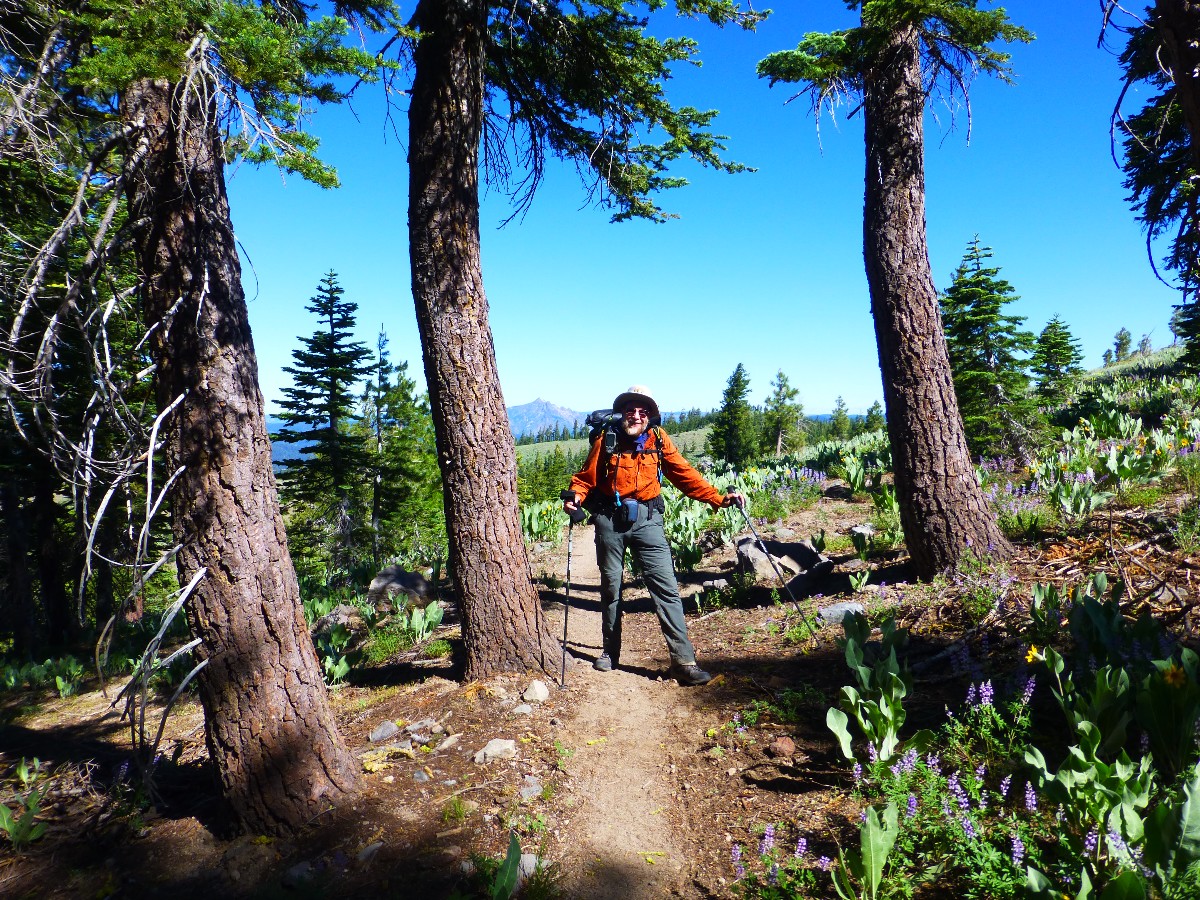
Solo Hike
Camera - Panasonic DMC-ZS19
none can be –
For Beauty is Infinity –
And power to be finite ceased
Before Identity was leased."
Background: So far, prior to this trip, I hiked from PCT
mile 702 at Kennedy Meadows South to PCT 1156.7 at Donner Summit, a distance of about 455 miles.
With the present excursion, the total will climb to 715 miles (about 27%) of the PCT, making it
a Pygmy PCT Promenade. 715 gorgeous miles rambling on our precious public lands, along the Pacific Crest Trail.
I got into hiking the PCT, in segments, following the Jaunty Juggernaut
hike of the John Muir Trail - See the various PCT and JMT reports here --->
All Wilderness Vagabond trip
reports about the PCT, JMT, Sierra hikes I used some of the quotes from the JMT report - because
they seem quite relevant to this current hike.
I kept notes of distance and elevation gained and lost each day, using my
trusty GPS, and the most excellent Halfmile PCT maps (see links). I used the GPS data to estimate the ERM,
Energy Required Miles. The ERM data came from the durable Garmin Map 60cs, now
over ten years old. Full credit is due Halfmile and his www.pctmap.net site for maps and tracks used to
design this trip. The Halfmile app is available free, and it will calculate the data for determining ERMs as well.
I color copied the Halfmile maps on the water-worthy Rite-in-the-rain
paper (paper 8511), double-sided. And, I've used the Rite-in-the-Rain All-weather (lined) Journal #391 for
field notes for many years. It's old-school, yet solid, durable, and versatile beyond any of the smartest dumb
phone (here's hoping technology in the form of cell coverage never comes to special places like the PCT).
I have to confess that I have started writing journal notes in the dumb-ass phone because the text is easy to export
once I get home.
Here are my journal notes, some photos, and the daily data and trip map,
and links to the outstanding Halfmile maps, tracks, and waypoints.
ERM = Energy Required Miles. A mile is added for
every 500' elevation gain or
loss. It's a very serviceable method of estimating energy required miles. ERM was initially used in Trails
of the Tetons (long out of print) by Paul Petzold, founder of NOLS. It's a wonderfully useful concept and
application. Add one mile for each 500' up AND down to distance = ERM. I use ERMs to calculate what the actual
day is like. It's a very serviceable method of estimating energy required miles. Remember, however, that the
ERMs are estimates because they depend on GPS satellite coverage and math functions.
Using ERMs does not account for the 'texture' of the route or trail - that
is, rocky, boulders, no trail, slimy mud, etc., yet does help approximate the route.
There is additional information about the valididy of using ERMS at the end of this report.
Notes - GPS and PCT miles. PCT mileage is given each day. The ERM estimates come from elevation gain and loss figures from my GPS.
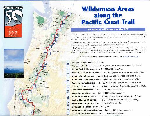
“PCT miles” reference the mileage from the Southern US border of the PCT, as specified in Halfmile's maps, a trail bible. Also note that the trail (PCT miles) has been reconfigured following a re-measurement of the trail by Halfmile and crew. This and re-alignment of the trail means mileage numbers in this report and in the maps do not necessarily match old guide books, maps, or reports. See the links section at the bottom of this report for references.

![]() for the wonderful Halfmile maps for section L, California, Donner Summit to Sierra City, click here. Fairly large
pdf file.
Visit pctmap.net for waypoints, tracks,
more maps -- for the entire PCT. A super resource.
for the wonderful Halfmile maps for section L, California, Donner Summit to Sierra City, click here. Fairly large
pdf file.
Visit pctmap.net for waypoints, tracks,
more maps -- for the entire PCT. A super resource.
section M, California, Sierra City to Belden, click here.
section N, California, Belden to Burney Falls, click here.
| ||||
Preliminary - driver:
Body trembling like a manic sewing machine, I flop on the welcome bed at
Wildflower Village in Reno while the room spins. Too much caffeine over too many miles (700) over too many
hours (up this morning at 2 a.m.) to enable all the driving. Argh. And, now I'm in Reno, thanking Pat for
driving me from the Reno Airport where I dropped off the rental car, and depositing me at the Wildflower,
and also upgrading my room from the hostel to a private room. Thanks Pat!
After frantic and at times tedious and frustrating preparations, I'm
finally approaching the PCT.
Resupply boxes to Sierra City, Belden, Drakesbad (in Lassen Volcano NP),
Old Station, and traveling stuff to Burney Falls State Park. Car rental, Wildflower and Green Gables
room reservations, Amtrak, airlines, and find out about a taxi to Burney, the Burney Express to Redding,
the RABA in Redding to the Redding Airport, and such. Whew.
After fluffing the bag, checking the pack, and eating more of my huge
traveling lunch, I crash into bed and sleep through to the morning light.
 |
 |
 |
| ||||
Day 1: Gravitating to Grubb:
PCT 1156.7 at Donner Summit to 1160.8 near Peter Grubb Hut. 4.1 miles. ERM = 5.0. Camp @ 7840'.
Gazing at Castle and Basin Peaks while eating a pinto bean, potato, and green
pea dinner accented with red miso soup is a fitting end to a long day of travel transfers and a short hike.
The wind is enough to scatter the probing mosquitoes and also send my windscreen into the Foxtail Pines.
Walking a short distance off my highpoint, I can see the roof of the Peter Grubb Sierra Club Hut and the
adjacent scenic toilet.
The day starts with another ride with Pat, this time to the Amtrak Station
where I catch the bus to Truckee. The bus because the train is many hours delayed with air conditioning issues.
In Truckee, I repack the backpack, put the traveling clothes and duffel
for the pack in a box and mail the box to Burney Falls.
Then, its a short walk to the I-80 freeway ramp where I wait for half an
hour until a helpful runner woman gives me a ride to the Donner Summit Rest Area, where I will continue to
hike the Pacific Crest Trail (PCT).
I'm eating lunch at the rest area where I meet Topo (trail name), a PCT
through hiker. He's the first of about 20 hikers I see on the short jaunt today because it appears I've
joined into the middle of the PCT surge.
Somehow in the transfers today, I've lost the bite valve from the Platypus
hydration tube. I buy Steve's, convincing him that I need it more and he's on his way to the TH. Thanks
Steve, and his friend Mark!
The assortment of wildflowers is most excellent, with the way sporting Mule
Ears, Lupine, Larkspur, Paintbrush, flax, and others I cannot name. Shadows of snowbanks lurk among the pines,
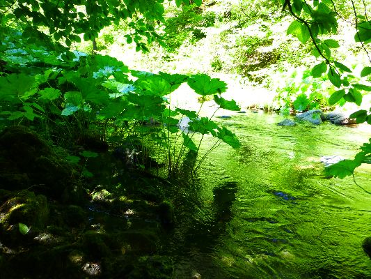
and don't crowd the trail. Water and mosquitoes flow through Round Valley near the Grubb Hut.
Goodnight from Day 1 of PCT 2016, today near Round Valley and the Peter Grubb Hut.
 |
 |
 |
 |
 |
 |
 |
 |
 wPCT-2016 day1-9 Corn Lily in Round Valley and Castle Pk.jpg |
Day 2: Lazing to Lacey:
11.5 miles. ERM = 19.5. To Lacey Creek at PCT 1172.3. Camp @ 7540'.
Mary Poppins is stretched out along the White Rock Creek bridge,
stretching downward dog in the sun. Gorgeous and sleek. 13, from Australia, is enjoying snack #1.
It's been a glorious romp through dark forests and open boggy snowmelt-fed meadows. I cross several
brief snow fields on the way to 8,000' on this wind swept day. I meet Jess, hiking South to Kennedy
Meadows and we chat about hidden hot springs in Idaho. A hot spring soak would be enthusiastically
enjoyed today, with its ripping breeze. The wind continues to build throughout the day, and it's
quite raw when I reach the partially protected nook of Lacey Creek.
I meet Jack (trail name is John Deer) of Seattle at Lacey Creek,
and also discover 13, Mary Poppins, and Prince lounging here. The next water is rumored to be 7
miles distant, and, well, this is where I planned to camp anyway. Chores lapse into early evening
and it becomes downright cold before 7p, and this prompts early tent time with a hot water bottle.
To journal, to read a bit, to allow some body recovery. The mind has recovered due to several miles of walking meditation.
 |
 |
 |
 |
 |
 |
 |
 |
 |
Day 3: Bald Ridge Bump:
12.4 miles. To campsites above Jackson Meadow Reservoir. PCT Mile 1184.7. ERM = 19. Camp @ 6440'.
The pointed distant spire atop a cathedral of rocks (Sierra Buttes)
provides a backdrop for the yellow lichen speckled black basalt dotting the open ridge of the well
named Pacific Crest Trail. Safe Bet from England ranges along the crest and steadily slips into the
big Jeffrey Pines, White and Red Firs. A few switchbacks down and I stop to chat with Shamrock from
Wyoming at the Mules Ear Creek junction.
It's a lilting type of day, with generous downhill segments. Shamrock
and I hike to the reservoir road where we enjoy a lengthy lunch at what appears to be Pass Creek before
continuing up to Bald Ridge Creek and then the camp area in the cleft of forested knobs, apparently an
old log deck staging area. It's a terrific camp until a throng of PCT hikers muscle in and grunt and
camp much too close.
 |
 |
 |
 |
 |
 |
Day 4: Sierra City Cinnamon Sticks:
To Sierra City, PCT mile 1195. 10.5 plus some road walking. ERM = 17. Camp @ 4200'.
This ends the first segment of this pygmy PCT prominade.
The woodpeckers clack in the cinnamon stick red Incense Cedars,
the early sunlight glinting through the assorted trees, fir, pine, a few oaks.
Milton Spring tumbles and burbles in the background. It's an
idyllic spot for a foot break and snack #1.
It's a day of losing elevation and testing
C. Hart Merriam's life
zone theory. Down through the vegetation
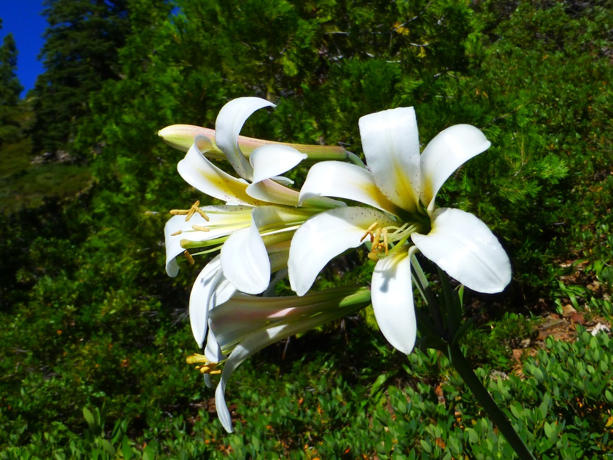
zones the trail drifts past white lilies (Washington Lilies) and cinnamon cedars.
The trail climbs incomprehensibly as it nears the Yuba River, apparently
so the trail can access an arching footbridge over the frothing green jade of the Yuba at a set of falls.
As the PCT crosses Hwy 49, I again encounter Mary Poppins and Prince,
who spent last night in Sierra City and are now back on the trail.
start walking the busy tarmac, and soon get a ride, although I was
walking against traffic.
I don't see Shamrock, so go to the store and retrieve my resupply box
and spend an hour or more cleaning the filter with vinegar (to purge the filter of calcium carbonate),
repacking a huge larder of food for the next 8 days, and snacking on sardines and crackers sent with
resupply items, and mailing a few items home before checking out the church grounds, enjoying a cold
shower, and eating a burger with horseradish cheddar at the store (the Red Moose closed at 2p) before
more texting, map study, recharging phone and solar sheet battery, while talking with Mike, Tree Top.
Now, it's time for bed on the slopping yet wondrous church dirt parking
area, serenaded by a nearby tumbling stream.
 |
 |
 |
 |
 |
 |
 |
 |
 |
Day 5: Quarrelsome Quartzite:
To Summit Lake, PCT 1209. 14.2 miles + 1.7 road walk = 15.9 miles. ERM = 26. Camp @ 7050'.
More tippy uneven quartzite rules the up escalator of the 3,000' elevation
gain from Sierra City to the contour below the Sierra Buttes, argh. The heavy behemoth backpack makes the
trek more arduous. Starting off, perpetual switchbacks make the rise from Hwy 49 go well. I spy the FS
lookout perched on the butte highpoint and realize that this is the point on the spire I've intermittently
seen since way back in the section North of Donner Summit. Wow, what a dramatic location for a fire lookout.
I meet Gizzy near the hiking trail to the lookout, where the PCT finally
starts to roll rather than lurch uphill. One of the glorious views today is of Deer Lake, and an increasingly
distant Sierra Buttes, and a foreground of Mule Ears, Arrowleaf, Paintbrush, Scarlet Gila, Lupine, et al.
I continue, feet feeling the effects of the resupply pack, and stop at the intended 1209 camp.
Two Pack, from Australia, carries snow to cool his beer to camp. Camino
also joins us, and now there are four of us, including Mike, AKA Tree Top, in the 1209 camp. A squadron
of mosquitoes joins us just prior to bedtime.
 |
 |
 |
 |
 |
 |
 |
 |
.jpg) |
Day 6: Lassen Looking:
To PCT Mile 1221.3, West Branch of Nelson Creek. 12.3 miles. ERM = 19. Camp @ 6350'.
From the first switchback on the West flank of Gibraltar, Lassen Peak
protrudes into the distant haze, covered with a white mantle, luring on the surging throng of PCT hikers,
through and sectional. It's a long distance to Lassen, I muse. A thundering cohort of down gradient
switchbacks later I reach the West Branch of Nelson Creek and see delightful clear and cold water. Where
to camp? Not wanting to crowd together with the Morning Kidd group, I look uphill in this hilly terrain
and meet Checkmate from Australia. Continuing to look, I find a sub basement where it is a bit private.
A bit of work and I have camp, then find water access, filter water, set up the TarpTent, take a chilly
partial bath, and review maps for tomorrow and jot these notes while dinner cooks, lasagna. It's still
warm and pleasant at 6 p.m. Surprisingly, it's nearly mosquito free, at least so far.
The day starts with breakfast near Summit Lake, then rolling terrain above
Gold Lake and to crystal Jamieson Creek for a water break before proceeding to A-Tree Spring for lunch.
As I'm lounging near the dirt road by A-Tree, a spike deer comes loping hurriedly down the road, apparently
heading for the PCT. As he turns toward the trail, he sees me for the first time and locks his front legs,
skidding and raising dust on the road. Then he bounds up the road cut and heads North on the PCT. My
camera is just out of reach.
Following the path of the deer, I climb up the East flank of Gibraltar
in the gathering heat, yet sprinkled with luscious shade from the big firs. A group of volunteers with
the PCT Association is working on the trail tread. Thanks volunteers! One volunteer tells me that there
was once a bee tree near the spring, so it was called B-Tree. That tree fell down, so the name was
changed to A-Tree. Oh, the arcane origin of many local features everywhere.
At the ridgeline, another volunteer tells me of decent cell coverage,
so I send out a copy of the journal to date for safe keeping, and do some texting with Kathleen. There's
not sufficient coverage for a call. Overload, sporting a kilt, comes along and we chat about the abundance
of flowers. Then, on to the downhill where today's tale began.
 |
 |
 |
 |
 |
 |
 |
 |
.jpg) |
 |
 |
.jpg) |
Day 7: Altered to Alder:
To 1234.9, Alder Spring. 13.6 miles. ERM = 20. Camp @ 5900'.
The musty odor of Mule Ears blends with the aroma of Horse and another
mint as I drift toward Whisky Spring below the PCT. It's a hot day and water sources are becoming a bit
more thin. There's a spike deer also seeking the spring and our paths converge until he sees me and
bounds away. The water is crisp and clear and surrounded by tall purple Monk's Hood flowers.
Back on the PCT and shuffling along, I see another FS Fire Lookout, this
time on Pilot Mountain. It's close enough that the climb is tempting, yet not that tempting.
I continue to a paved road crossing, the Quincy La Porte Rd., where I
stop for lunch #2 and meet O.G., who hiked the PCT in 1981, and is doing so again. We chat about Eric
Ryback, who hiked and wrote about the PCT in 1970. I recall meeting Eric when he gave a presentation
at the ISU (Idaho State University) Outdoor Program Office.
Not far now, and I reach the side trail to Alder Spring, where I meet
Old Salt and we chat awhile. Amazingly, Shamrock arrives, having enjoyed a zero day in Sierra City.
It's great to again see Shamrock. However, Shamrock moves on along the PCT for a few more miles and I
return to camp chores, getting good spring water and filtering it, rigging a passable bear tree, erecting
the tent, and a bit of washing up.
Two young men join me in camp as the sun lowers into gold lighting, and
we enjoy a far ranging discussion. Loflo is an environmental planner, and he shows me his terrific fire
photo from when he was running from the Chimney Fire down by Lake Isabella. It's a delight talking with
Elliott (Loflo), who has a range of ambitions to help ease our environmental problems and a refreshing
attitude in these days of trumpmania, where bullying and antisocial behavior are rewarded.
Also joining us is Blake,
who does not yet have a trail name.
| ||||
 |
 |
 |
 |
 |
 |
 |
 |
 |
 |
 |
 |
Day 8: Fowler Furlough
To North Fowler Creek. PCT Mile 1242. 7.6 miles. ERM = 11. Camp @ 4800'.
I'm stretched out lizard-like in the TarpTent after a short day on
the PCT. Camped on an old forest road, it's been mostly quiet. This seems to be the only camping
possibility near the delightful burble of North Fowler Creek. As I carefully walk the steep trail to
the creek, I step over a fragrant stair step cut into a log across the trail, Cedar. Earlier, I saw
two ATVs, and the road appears to get little use. Hearing that the throng is headed to the Feather
River, I opted to mostly stay on my plan. Also, I hope that it's somewhat cooler here than down at
3500' near the Feather River. Besides, I feel like I need some extra sleep and to recharge. It was a
very warm night at Alder Spring and I didn't sleep well.
Along the jaunt today, I spy a distant tower and dig out the phone to
find enough signal for a call to Kathleen. Wonderful. It's mostly a fir forest walk today, although
I do get a view of the lookout on Pilot Mountain, and of course the view over Fish Creek from the short
ridge just prior to the Fowler Peak TH.
The Mules Ear and other flowers are beginning to crinkle dry at this
elevation. The sun is hot and there's little breeze. Yet, it's just right in my shady makeshift camp for shorts only.
Earlier today, I talk awhile with Space Cowboy, who turned 69 on the trail.
So, I cook dinner and shorten the tube on the in-line filter in the attempt
to lessen the crimping off of the flow when it's in the pack. Typical sawyer, the old filter craps out
just as I am packing to hit the PCT. So, I scramble to get another system working on the eve of departure
and all I can find is another sawyer, drat. This said, it's working fine so far. I backflushed it with
vinegar in Sierra City.
Day 9: Fabulous Feather. To Bear Creek:
PCT Mile 1250.5. 8.5 miles. ERM = 15. Camp @ 3540 '.
From the ranging switchbacks high above the Middle Fork Feather I hear
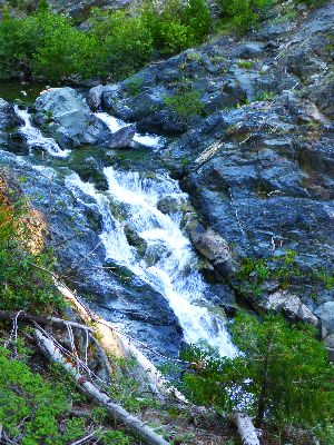
rapids and rumbling water. Glorious. Another 2000' to drop and I am on the longest footbridge on the PCT,
arching over the rocky canyon. There's a tempting jade green bowl of crisp water just downstream and
under the bridge. I pause to enjoy and consume snack #1. The trail continues on broad switchbacks, this
time going up, lined with poison oak and punctuated with sort-of look alike Alder. It's hot here in the
low country. The crossing of the Feather is at about 3500'.
Pausing in the cool cleft of one of the forks of Bear Creek, I meet Cow
Girl from the Czech Republic and Lone Ranger and his dog Scruffy. Scruffy is keen to fetch most anything,
and to lounge in the cold stream water. He smells vaguely of skunk and Lone Ranger reports that he happened
to be near a skunk when it was frightening by a car. The result was an unhappy and odiferous doggy.
I had originally planned to camp at Bear Creek, and stop to evaluate the
camp area. It has the ambiance of a poorly maintained FS toilet, so I filter water, fill the bucket, and
hike up the hill to another previously used area to camp. Getting water from Bear, there's an idyllic photo
to be had of clear water coursing between elephant ear fronds. I meet Golden Boy with his gold pants and
St Nick wearing a straw hat.
Mosquitoes mob me during a bath, the worst of the trip so far.
I'm finishing the day with breakfast scramble and orzo, the roil of Bear
Creek in the cleft below as backdrop music.
 |
 |
 |
 |
 |
 |
.jpg) |
 |
 |
 |
 |
 |
| ||||
Day 10: Bucks Lake Bonanza! To Haskins Valley Summer Home Area Retreat,
with the Williams:
PCT Mile 1161. 10.5 miles. ERM = 17. Camp @ 5200'.
I've refilled the water bladder from ice cold Lookout Spring after a
continuous push up mostly gradual yet continuous switchbacks to over 6500' and nearly 7 miles, when what
do I see? Amazing. At first, it looks like a political campaign sign. I look again to see.... A sign
about generous hospitality at the Williams' cabin in the Bucks Lake area. Trail Angels, indeed. There's
also a note about cell service at Lookout Rock and a phone number. So, I call and am invited to lunch, shower,
laundry, camping, excellent. Considering the decent cell coverage, I call Kathleen, Stan, and Jeremy, then
move along the PCT.
The remainder of the hike to Bucks Lake Recreation Area is a mild elevation
loss through firs, Sugar Pines, and an assortment of wild flowers.
Getting to the road, I call and very soon I'm riding to hospitality cabin
with Nancy, to the Honker Pass cabin.
Now, I'm lounging in a camp chair, wearing loaner clothes, waiting for the
laundry to dry, having enjoyed a delightful lunch and deluxe shower with actual hot water. Yowee.
Day 10 - PCT 2016 photos


Day 11: Honker Pass. To Clear Creek:
PCT Mile 1275.2. 14.2 miles. ERM = 22. Camp @ 6230'.
The sky is a muddy gray as the sun begins to make itself known to us
hikers sleeping cowboy (and cowgirl; no tent) style on the deck of Honker Pass cabin. Canada Geese
take the cue and honk as they pass overhead on their way between lake and meadow. Fitting.
Breakfast is pancakes, eggs, fruit, coffee, tea, scrumptious.
Terry drops off the first hiker group at 8 a.m., and that's the last
I see of this group. In fact, the only hikers I encounter until camp are two South-bound rigged
capitalism supporters.
At the second crossing of the Bucks Lake Road, I see Coppertone has
set up chairs and he is hosting hikers. He makes a delicious rootbeer float. Starting up the next
uphill section, back to near 7,000', Coppertone has advised that there is good cell coverage, so I check
in with the Braatens to ease my stay in low-lying Belden Town tomorrow.
I hike steadily up to views of not quite so distant Mt Lassen and the
obviously glaciated Silver and other pocket lakes, apparently bordered by moraines. Well-polished
granite grinds under the boots and lines the lake basin. More rolling near the crest, tallying more
ERMs. Finally, the trail starts dropping, and I camp where it crosses well-named Clear Creek.
White Walker and wife and two others slip into camp across the
creek as the light angle lowers.
 |
 |
 |
 |
 |
 |
Day 12: Gettin on Down to Belden Town:
PCT Mile 1284. 8.8 miles. ERM = 16. Camp @ 2220'.
The downhill continues, through manzanita-choked hillsides, on and on.
Views of Lassen far and granite outcrops close. It started out as a very cool morning at Clear Creek,
cool enough to use gloves, which I keep on to below 4000'. At which elevation the poison oak begins to
thrive. Going on down to Belden Town.
Finally in Belden, sort-of, I walk near the train tracks to the Belden
Town Resort, where everyone seems to try to drive the noisiest vehicle, many with trump stickers.
Coincidence? Noisy and trump? Redundant! I do understand working people's frustration with the
republican party, which has promised benefits to them and delivered only to the rich, corporations,
and big banks. But trump?! Arrogantly more of the same, with pathological overtones. Can you spell
narcissistic psychopath? These are the voters who want to fund war, particularly religious war,
corporate welfare, and giving their votes to moneyed interests rather than funding infrastructure
improvement to inessential things like municipal water systems, etc. Yikes. I return my cash to my
pocket and await a more deserving establishment. But first, I treat the Belden water; because to too
many corporate welfare is more important than public safety.
Brenda Braaten arrives with a truck load of resupply packages for the
waiting PCT surge at the resort. Most are happy, and only one has to wait for the next delivery, later
on today. So far, I'm the only hiker staying in the Braatens' Little Haven hiker hut. Brenda takes me to
the Haven and shows me the routine and I invest the remainder of the afternoon repacking the food bag and
sorting equipment from the bucket that I shipped to Little Haven. Of course, there's a shower and such in
there too; vinegar flushing the filter, other stuff. And eating, lots of eating whatever comes to close and
is sucked into my gullet.
Late afternoon and I'm catching up with journal notes while Brenda goes to
collect more hikers from near the resort. Tenure and Boy Pockets arrive at the Haven about 7p.
The North Fork Feather, dammed every possible way, rumbles as background
sound when the frenetic traffic pauses on Hwy 70. I lie in a comfy bed, a mere couple of thousand feet
above the rising ocean and prepare for a lovely evening.
This respite marks about halfway through the trip miles and days.
 |
 |
 |
 |
 |
 |
Day 13: Chipping Away to Chips Creek: PCT Mile 1293.1. 9.1 miles. ERM = 15. Camp @ 4790'.
Boy, you gotta carry that weight
Carry that weight a long time
Boy, you gonna carry that weight
Carry that weight a long time
I never give you my pillow
I only send you my invitation
And in the middle of the celebrations
I break down
Boy, you gotta carry that weight
Carry that weight a long time
Boy, you gotta carry that weight
You're gonna carry that weight a long time
"Boy, you gotta carry that weight, carry that weight a long time"...
(Beatles, Abbey Road) - courses through my head as I slog up along Chips Creek, leaving noisy Belden Town
behind and traveling in the early coolness, toting extra weight after the resupply. Brenda B. drops me
off at the Hwy 70 Rest Area a little after 6 a.m. and I chip away at the elevation gain out of low town.
The trail will climb back up, over 7,000', yet I'll chip off about 2,500' today.
I encounter Cupcake, from Japan, and we chat awhile.
I had planned a short day, not knowing what to expect from Belden Town
and the trail up. I'm in Myrtle Flat camp before 10 a.m. and decide not only is it much too early to
camp but that this camp is too close to the trailhead, judging by the slob camper "developments." So, I
chip away to a crossing of Chips Creek and evaluate the map, which shows substantial elevation gain to
the next camp noted by Halfmile.
Looking around, I spy two jacuzzis in clear running Chips Creek, one giant
and one person-size. Cedars, maples, and Ponderosa shade the camp.
I'd like to pile up more miles, yet I'm anchored by airfare at the Burney
end, so might as well enjoy. Swirling in the mini-jacuzzi and basking dry on the polished granite seals
the decision.
Besides, I'm extra tired because the trains, passing within 600' and feeling
much closer, woke me pretty much like clockwork, every hour, in Belden. Otherwise, it was a fine night.
 |
 |
 |
 |
 |
 |
Day 14: Cold Spring Slog. To Cold Spring:
PCT Mile 1302.9. 9.8 miles. ERM = 17. Camp @ 6490'.
A minty fresh aroma wafts past as I nibble gorp #1 on the ridge near
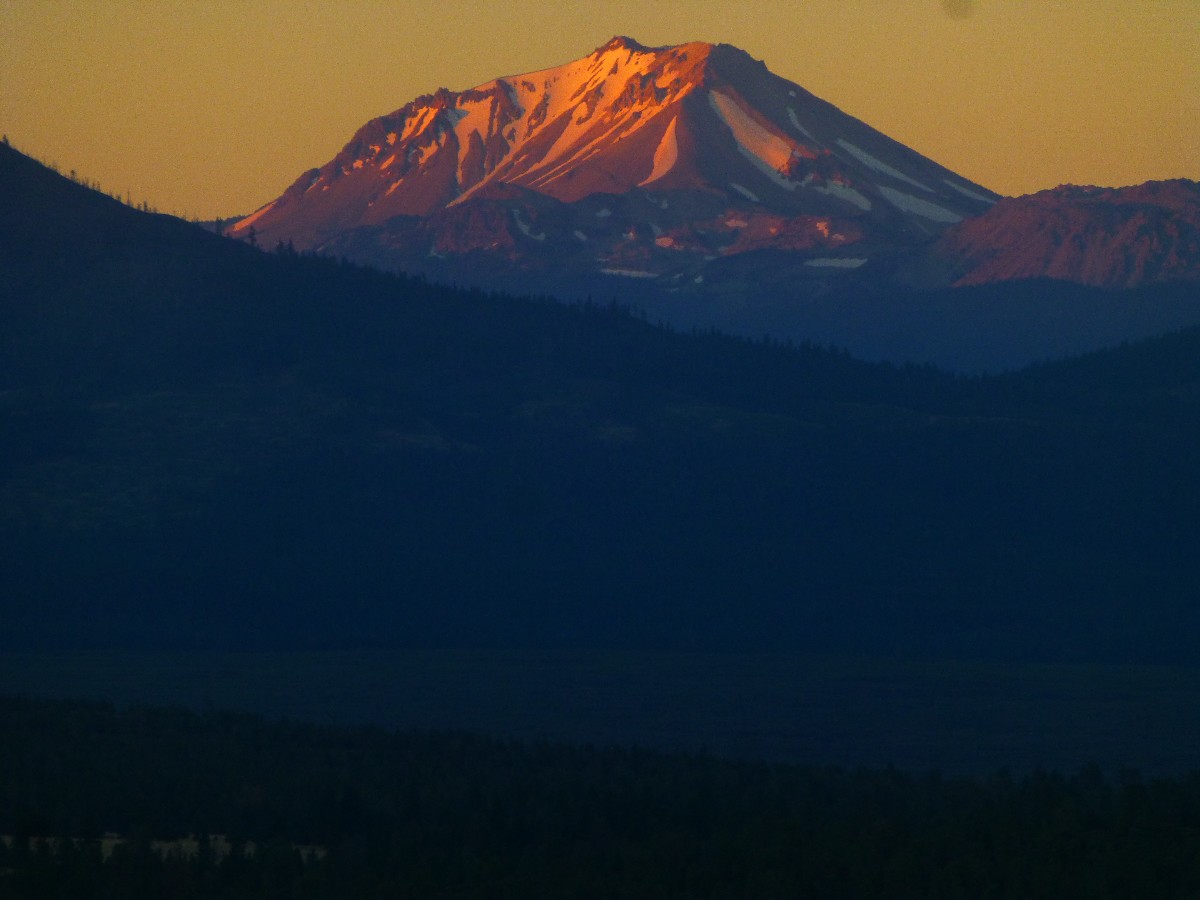
the Frog Mountain Trail junction, enjoying ranging views to a somewhat closer Lassen Peak (10,457') and
a more distant snowy mountain that appears to be Mt Shasta. Yoweee. Mt Shasta, once a nondescript shadow
in a soup of pollution and humidity is becoming easier to see.
The day starts with a slippery crossing of Chips Creek and a riparian rip
through brush that has reclaimed the trail. Then, a precipitous climb, gaining elevation to over 7,000'
at the first gorp location. A short series of switchbacks down and I arrive at Frog Spring, delicious water
surrounded by Yellow Monkey Flowers. A gradual down and the PCT crosses a dirt road heading to Milkhouse
Flat. This is the low spot for awhile, and I slowly start gaining altitude to well-named Cold Spring. A
good place to stay because the water is excellent, the camping good, and the next water is 8 miles farther.
The only detraction is the proximity of the lightly traveled Humbug Road. Ah Humbug.
As I'm setting up camp, I see someone who appears to have on a Forest Service
hat. It's Cupcake from Japan. We take a few photos, and Cupcake limps up the PCT, striving to get to the
halfway to Canada mile before stopping to rest his damaged knee. The PCT midpoint is now measured at Mile
1330.1, near the North Fork Feather River. It's getting closer.
I try a bucket bath, yet fall off my bath rock when the depth of the cold
from Cold Spring water hits my head, causing instant shock.
| ||||
 |
 |
 |
 |
 |
 |
 |
 |
.jpg) |
Day 15: Carry-on To Carter Creek:
To PCT Mile 1315.5 + 0.4 down Carter. 12.6 PCT miles, 13 total. ERM = 20. Camp @ 6450'.
Here's looking at Lassen once again I toast with my hiking poles; this
time with a foreground of toothy black basalt. Phallic spires jut skyward along the trail.
The day starts cool, cool enough to wear gloves for the first mile as I
climb to Humbug Summit, followed after more rolling elevation gain and loss by Humboldt Summit as the
volcanics become bare surface rock. The Butte County high point trail leaves the PCT just over 7,000'.
Water choices are somewhat constrained today because all of them are off trail, down side canyons. This
is one of the drawbacks of volcanic terrain, it's rare and difficult to locate water sources. Sort of
like along much of the Arizona Trail.
I stop at the trail to Robbers Spring, yet mostly to rest my shoulders and
feet and don't really contemplate the steep 0.3 miles to water. At a bit over 10 miles, I stop for lunch
and a recovery break at the side trail to Little Cub Creek. Most hikers get their last water here and continue
on to Soldier Creek in around 13 miles. I carry on to Carter Creek.
There is a good deal of contradictory information about water in Carter Creek.
Some report that it's a 0.7 mile walk to water.
I think about leaving the pack at some small dusty camps alongside the PCT
and bringing back water. Instead, I drop into the Carter drainage, finding the going easy after a few hundred
feet. I encounter a British hiking babe, sporting spectacular hiking equipment, and she reports that good
water can be found directly below the campsites. She is correct. Filter water, enjoy a bath, find and rig
a food hanging tree, cook dinner, general chores, and with journaling, time expires at Carter Creek. The
only visitor is a doe deer.
 |
 |
 |
 |
 |
 |
 |
 |
 |
Day 16: Soldiering On. PCT Midpoint. To Soldier Creek:
PCT Mile 1325.5. 10.0 miles + 0.4 out of Carter Creek = 10.4. ERM = 16. Camp @ 5620'.
A comforting view of Mt Lassen finally revolves into view after climbing
above 7500' out of Carter Creek. Volcanics are everywhere. Walking the ridge, I find the Butt Mountain
Trail, and soon a view of Butt and Lassen. Now, the PCT drops gradually nearly all the way to Soldier Creek,
passing through some sections where above head high Manzanita crowd and occasionally obscure the trail.
It's a thrash at times.
I meet Hike On and Foxfire who spend quite a bit of the year hiking long
trails, and the remainder in Florida. They talk about all you can eat pizza in Chester, and I start dreaming
about a chilli verde burrito wrapped up in a pizza.
During a lunch break, I meet Southbound Riser, who adds insight about
Drakesbad, Burney Falls, and other places I've yet to encounter. Riser teaches high school when not on the trail.
I pass a doe deer inspecting the old PCT Midpoint marker. Because of
remeasuring and trail rerouting, the midpoint has moved and I'll pass it tomorrow. The last I heard, the
PCT Midpoint is 1330.
I greet an assorted group of what appear to be PCT through hikers at the
junction to a seep down a side drainage and no one says a word. So, I inquire about the water and receive
a near monosyllabic reply "haven't tried it yet." Assuming it's rudeness, I move over to the next shade for
a snack. Realization arrives as I watch the lose group not interact; they are probably dehydrated, exhausted,
and nursing an assortment of ailments after months and miles on the PCT.
The Soldier Creek water is good and the camping limited because of the
topography, yet I find a spot on the hillside under a towering cedar and near the creeklette where I can
squeeze in the TarpTent. It's a good thing that this tent is not a wide body model.
Soldier Creek provides enough background burble to mask the sound of hikers
talking in the main camp below.
Halfmile reports that the PCT Midpoint is now 1320.66, so I indeed passed
the midpoint today.
 |
 |
 |
 |
.jpg) |
.jpg) |
Day 17: Blown Over With A Feather. To North Fork Feather River:
PCT Mile 1338.2. 12.7 miles. ERM = 20. Camp @ 4998'.
The slanted sun glows gold though the fir and cedar, heralding morning at Soldier Creek.
Soon, I'm on the trail down to Soldier Meadow, bordered by odiferous
P-Pines (Ponderosa Pines; smelling of vanilla), then some surprising uphill to Hwy 36, which goes to Chester.
Just across the highway, bonanza! Piper's Mom, a Trail Angel from the Chester area, has set up a hiker
salvation zone, complete with coolers containing iced drinks, snacks, and a bit of fruit. Wonderful! Thanks
Piper's Mom. Here, I meet Swedes Happy Feet (Lina) and Bird Nerd (Henrik) and Blinky who just returned to
the trail from an overnight in Chester. We give ratings to recent towns, and it appears that Chester has
the highest rating and Belden the lowest, no surprise here.
Among the helpful laminated notes about camping behind the church in Chester
and such, there's a long soliloquy about hikers stalked for hours by a Cougar near Stover Spring. Strange
goings on indeed.
Continuing on to Stover Spring, I pause for another break and to refill the
water jug. The next section rolls across the flats as it becomes quite warm. I'm happy to see the trail
heading down to the North Fork Feather because I'm feeling the effects of the heat. Well, knock me over with
a feather, the North Fork Feather.
There are good camps on the South side of the river, and they are already
in the shade, yahoo. Considerations of Domingo Spring, reportedly the best water on the PCT, evaporate.
Me, I'm looking forward to finally arriving at Drakesbad.
 |
 |
 |
 |
 |
.jpg) |
Day 18: Lassen at last. To Drakesbad and Lassen Volcanic NP:
PCT Mile 1347.8. 9.6 miles +2 miles walking to geyser, around Drakesbad =11.6 miles. ERM = 17. Camp @ 5680'.
Cool air chills the camp at North Fork Feather as it drifts down canyon.
It's cool enough to keep my hands in my pockets as I climb out of the Feather drainage and toward a forested ridge.
I meet Swiss Monkey as he peruses the Thompson Trail Angel box. He obtained
his trail name by climbing up into trees to retrieve a stuck bear bag.
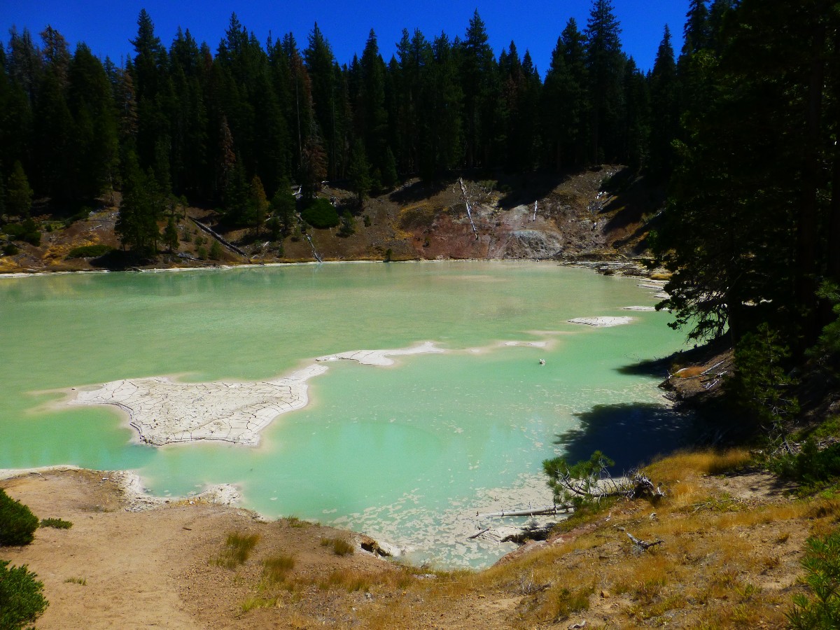
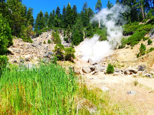
Sulfur aroma wafts through the forest and I see I'm at the trail junction to
the Terminal Geyser, actually a steam vent. Of course, it's time to explore to this steam vent. It would be
a geyser if conditions were right. It throbs and spits but doesn't spurt. Continuing on, Boiling Lake can be
heard hissing and plopping, then smelled, then seen. It's akin to a big mud pot. Minute shades of
Yellowstone NP, bringing back all sorts of pleasant memories. Smell/odors are the most distinct prompts of
memory, perhaps because they are so unique.
Soon, I reach a series of junctions, and take the Drakesbad way each time,
arriving a bit late for PCT lunch, which is served buffet style after the resort guests have finished. I'm
able to join in for lunch after the cook refreshes the buffet, and it's an adequate lunch.
Storm Chaser, engineering physicist, is there and we talk about clouds and
community infrastructure.
Hannah is also on the porch, and I discover that she owns the camera I found
on the way to Drakesbad. We talk about volunteer opportunities in The Canyon (Grand Canyon NP) and I give
here a WV web card so she can check out the previous VIP (Volunteer In Park) trip reports.
Then, I get my resupply box and walk the half mile or so to the NPS campground
to register and set up camp.
The sorting of meals and equipment seems daunting, so I hang my food in a tree
(because mice get in the bear boxes and wreak havoc), gather items and return to Drakesbad for a lovely hot
shower and a PCT meal - served after the guests have finished. Each PCT meal is a little different than the
next because we PCT hikers are essentially enjoying leftover items. Tonight, I have pork roast and bacon
potatoes with some green salad and pecan pie. Delightful. I stay awhile writing notes and hoping that my
camera battery will charge.
Returning to the campground just after sunset, the hint of wood smoke sets
the stage for a lovely evening.
| ||||
 |
 |
 |
 |
 |
 |
 |
.jpg) |
 |
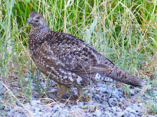
Day 19: Lazing in Lassen. A zero day:
Hike 3 miles from CG to Drakesbad and back several times.
The morning Grouse, hen and chicks, peck at high seeds as I walk
to Drakesbad for breakfast and laundry. It's a fine morning in the land of Lassen Peak, one of the
largest plug dome volcanoes anywhere. Lassen reportedly last erupted in 1915, and this helped spur
the creation of the park. Out of destruction, like a phoenix, a park arises?
I enjoy breakfast with Pensioner, who is again on the PCT.
Laundry, sorting supplies and food, deciding what equipment to carry on
to Old Station to mail home (such as the device to charge the camera battery), and such, and a good
deal of lounging fills the day. Good thing too, because it's a day to stay out of the sun and in the shade.
I'm lured into eating lunch at Drakesbad after seeing PCT hikers with
plates of chicken and sundries. The scrumptious nature of the food is enhanced by discussion with Dead
Man and Pilgrim.
The Drakesbad people allow me to use their land based phone to hear the
latest from Kathleen, and to give her an update. Things are good on the Colorado Plateau. Comforting.
While sorting through the food, and backflushing the filter with vinegar,
I meet the vivacious Wonder Woman and we enjoy a ranging discussion in the shade of the big firs in the
campground. There is little doubt that this trail name fits. She relieves me of some of the excess
food and a partial fuel canister. Did I mention that Wonder Woman wears an Eaarthly tiara?
Again, it's back to Drakesbad for dinner and to deposit extra items in
the hiker box.
| ||||
 |
 |
 |
 |
 |
 |
Day 20: Hotter Than A Hat Trick. To Hat Creek near Northern Border
of Lassen Volcanic National Park:
PCT Mile 1363.0. 15.2 miles + 0.4 to Hat Creek. ERM = 21. Camp @ 6150'.
The ground appears to be moving. Am I losing it? What? Hundreds of tiny
froggies hop across the mud flats of Soap Lake and successfully thwart my efforts to photograph them. I shadow
the froggies, then decide to have a snack under a spreading pine, where there is pleasing shade. I can
vaguely see Lassen Peak through a picket of burned ghost trees across the lake.
Earlier, I stop at the Ranger Station near Lower Twin Lake to investigate
the scenic toilet. There I unfurl the umbrella because it is hot and getting hotter. Soon, I'm in the
extended burn area, reportedly burned in 2012. The alternate route through the Cluster Lakes area is a
poor option today. I'd looked fondly at this route on my HalfMile maps, and it's disappointing to not
be headed into this lake basin. So, I trundle along in the gathering heat, walking volcanic sand tread
with little elevation change since climbing out of the Drakesbad-Warner area, up to and across Flatiron
Ridge, where glaciers have polished the fairly flat lava flows. Interesting stuff. The desolate terrain
rolls on in the sun, over low moraines, with an occasional glimpse of a forested cinder cone or a hazy
Lassen Peak.
PCT hikers, and soon I, am lounging in living tree shade along an
unexpected creeklet near the Cluster Lakes Trail North junction at PCT Mile 1360.9. Refreshing. This
turns out to be the outflow from Badger Flats Spring.
Back on the trail, another 2 miles and 0.4 off trail to the South to Hat
Creek, bumping over small moraines, to a refreshing and large stream. The trail to this fine camp heads
South right at the boundary marker for Lassen Volcanic NP.
Tired. It's sunset when I finish filtering water, setting up the tent,
washing, and soaking dinner. And, it's dark as I finish these notes, accompanied by the rustle of Hat Creek.
| ||||
 |
 |
 |
 |
 |
 |
 |
 |
 |
Day 21: Mounting Moraines. To Subway Cave:
PCT Mile 1375.0. 12 miles + 0.4 Hat Creek, 0.4 Subway = 12.8 miles. ERM = 16. Camp @ 4350'.
Clear crisp water of Hat Creek tumbles over basalt boulders, foreground
to another view of now more distant Lassen Peak. An excellent and cool place for snack #1 and a foot break.
It's a day of rolling moraines, dozens of small moraines. Terminal moraines?
It's growing beyond warm as I veer off the trail to the Old Station Post
Office. The lovely PO people distribute cookies, pear tomatoes, and apples with your resupply box. Lovely indeed.
Out in the parking lot, I sort through equipment and food, deciding what
to send home and what to carry. I send out some of the warm clothes and rain gear. It doesn't appear
it will be anything but hot for a week. Legend comes up to me and starts with "Hey! No homeless
people are allowed here."
I attempt to hitchhike the four or so miles to the rest of Old Station,
and encounter surface christians, who believe standing in a church makes them a christian; as much as
standing in a garage makes me a car.
Proclaiming otherwise, their behavior marks them as standard selfish religionists. It's like trumpamania,
thinking the behavior is an aberration and that moderation will occur soon (hah! suckers).
I'm charging the solar collector battery while I finish a deli sandwich at
the Old Station Gas and Fill-up and write these notes. Soon, I'll continue to nearby Subway Cave, where I
plan to spend the night before launching off on the dry dry dry section.
Subway Cave, cool and comfortable. It's a lava tube. Perhaps this is
the place to pitch a tent? Cool, dark, quiet - except for visitors.
Space Cowboy is camping at Subway Cave, having developed knee issues. It
seems like a number of PCT hikers are dropping out with knee problems; not surprising - because of the
pounding over the past 1400 miles. MAGA, make america great again (the most awful trail name ever), walks
up and intrudes into our conversation, telling us how great trump is. He reports he is a business major.
"At a public university?" I ask. "Of course," says the maga. "Isn't this a lot hypocritical?" I ask,
"and wouldn't you be more comfortable in a private university or at trump u?" "No, you should see the
art of the deal, where trump made so much money by taking over a public project (non sequitur?)." Or,
the time trump ripped off thousands of underwater mortgage holders and claimed he was so smart (yet has
no compassion at all for the many who lost homes and more, yikes). Or the many years he has paid no taxes,
not supporting our troops, the basic social fabric. What!? How is this something of which to be proud?
I decide my time is wasted with maga, who is in training for psychopathology or at least sociopathology,
just like his purported mentor. So, I go to visit Subway Cave.
Later, I again encounter Space Man, celebrating his birthday today. Happy
birthday Space Man. Ahhh, to be in my 30's again.
It seems I am spacey too, perhaps my brain is more baked than usual?
Earlier today, I walk away to the deli without my hiking poles, then suddenly remember them during a bite
of a sourdough sandwich. Yikes.
Night closes as the air finally cools. I washed my shirt and have been
drying it by wearing it. Evaporative cooling.
 |
 |
 |
 |
 |
 |
 |
 |
 |
Day 22: Lost Creek Found. To beyond Lost Creek Spring Trail, on Hat Creek Rim:
PCT Mile 1383.7. 8.7 miles + 2.5 to water = 11.2. ERM = 15. Camp @ 4750'.
I'm being chased from shade pool to pool by a hot roaster of sun.
I get up early and hit the trail not long after it is light. Probably
not early enough because I have the umbrella deployed by 9 a.m.
Along the way, I see scenic toilets coupled with Lassen Peak and then with
Mt Shasta. Picturesque. I'd like to linger, but the long trail demands attention today, as it grows hot,
seriously hot.
The vista off the rim is dramatic, looking like some giant geologist puttied
a fairly flat lava flow onto the landscape. Actually, it's the result of ancient faulting where the whole
rim block was pushed straight up.
The Lost Creek route, which plunges dramatically down the lava escarpment
into a side canyon, comes into view by late morning. What to do? I have nearly 3 liters of water and it's
about 7 miles to the fabled Cache 22, Forest Road 22. There is a rumor floating along the PCT that someone
is stocking Cache 22 with water, yet these are not first hand reports. What if a hiker gets to FR 22 and
there is no water? What if that hiker is me? Not feeling like playing the stock market, I continue along
the PCT to where there are some sizeable trees for shade, partially set up camp and then return to the Lost
Creek route with all the empty bottles. It's almost a trail, yet very steep as it descends 400' to lovely
water. This venture takes almost 2 hours from my camp 0.7 miles beyond the route marker. And now I have
8 liters of good water. I'll need a lot of it tomorrow. I'm sipping some of it as the sun chases me among
the P-Pines.
This is as far as I have been from water on this venture; and I will be
farther away tomorrow.
 |
 |
 |
 |
 |
 |
Day 23: Cache 22 or Catch 22??
To PCT Mile 1394.6. 10.9 miles. ERM = 14. Camp @ 3990'.
I'm sitting in the brush arbor of Cache 22, sipping a little Trail Angel
water and contemplating the catch 22 of it all. To lug lots of heavy water or not? No, not radioactive water.
And, as I feared, there is little water in Cache 22. I've 5 liters, about 10 pounds, in the pack. I can
certainly feel its presence. And, it's getting very hot already at 9:30 a.m. I've hiked about 7 miles, yet
there is more to hike to make reaching water tomorrow an easier venture.
To start the day, I get up in the dark and prepare for an early go on the PCT.
There are billions and billions of stars since the waning of the moon. As soon I can see the trail tread,
I'm trundling along on this uplifted bench of lava.
The early pink of sunrise tickles the summit of Lassen Peak. Shasta is also
visible, to the North, yet is shrouded in smog or fire smoke.
As I step into the shade of some oaks, a snake slithers the trail. Yikes.
It's a gopher snake, and he mutters a hiss at being disturbed.
Continuing past the old fire lookout location, now a communication facility,
I call Kathleen and later Stan for quick updates. 4G on the Hat Creek Rim, where is the absurdity in this?
After Cache 22, I unfurl the umbrella and endure the heat for a few more
miles until I find a shady loafing place that will also make a good camp near the edge of the escarpment.
Curiously, the guthook app shows a camp location in high cheat grass and thoroughly exposed to the searing
sun. Certainly not good enough for today.
Hiding from the sun is not all that fun, yet perhaps better than being out
in it. The heat-driven wind screams through the tops of the pines and junipers along the edge of the fault,
and is curiously quiet up to 7' off the ground. Although my appetite is nil, I fantasize about a Coppertone
rootbeer float.
 |
 |
 |
 |
 |
 |
 |
 |
 |
Day 24: From Hell to Low Water. To Crystal Lake Fish Hatchery:
PCT Mile 1404.8. 10.2 miles. ERM = 13.8. Camp @ 2920'.
The trail lazily contours through oaks and the limp needle pines,
Ghost or Digger Pine, slowly dropping off the low ridge. I see the blue roof of a large maintenance
building through the trees. Good, I say to myself, water soon, the end of this hellish Hat Creek Rim.
Then, what!, there's a white pelican, no, three of them, on top of the roof. Huh? Erase that. It must
be part of Baum Lake, and I'm lower than I thought.
With the dip of the cup, the desiccated dryness ends on a small creek
above Crystal Fish Hatchery. My tissues soak up the refreshing water like a true camelid.
Peter Pancake, a SF community college math teacher, drifts into the riparian
area and tanks up while pausing for a break. Then, the trail calls and off we go.
I wander to the Baum Lake Trail parking and scenic outhouse to see Pelicans
and Osprey plying their trade. I chat with some locals and receive a beer, and it nearly flattens me. I
stumble to a side road and the Crystal Lake Fish Hatchery, where I find deep shade (marvelous!), a table,
and water in the scenic outhouse. Why would I move beyond this oasis to something sun-drenched yet more remote?
It's the shade under the mature maples lining and arching over the old time and now dry fish runs that hold
the allure. A hatchery person comes by and I ask about camping (OK). Soon three deer visitors join me. I
watch a crafty Osprey fly through the vehicle gate of the hatchery, under the restriction wire, grab a fat
trout, then bump around until finding its way out. It flies the fish aerodynamically, head first into the
flight direction.
The day starts with early views of Lassen and Shasta from the rim. Soon,
the PCT trails off to the lava fields below, where the trail texture is sometimes problematic. It gets
better as erosion has provided more dirt. The umbrella is in play by 9 a.m., as I weave through what may
have been meadows, now monocultures of cheat grass.
Back to this morning, near the hatchery, I'm feeling lazy, and with a sour
stomach. Heat? Foul water? The only unfiltered/untreated water I've used is a tiny bit from Cache 22.
Argh, it has to be 100%.
Jam, from Korea, is the only hiker to join me at this lovely camp. We talk
and watch a fat cat and a clever Osprey sneak fish from the fish raceways.
 |
 |
 |
 |
 |
 |
 |
 |
 |
 |
 |
.jpg) |
Day 25: Burney Falls Dead End. To Burney Falls State Park:
PCT Mile 1416.5. 11.7 miles + 2 seeking information. ERM = 14. Camp @ 2940'. 259.8 PCT Miles. Total ERM = 405.3.
Pelicans row slowly through the cool morning air, huge bills folded body
close for flight. A Night Heron tries to stay in the Canada Goose formation, yet is promptly dropped, like
a tricycle rider from a bicycle peloton, as the honkers loop back toward the meadow. Ibis and Cormorants float
the air toward Baum Lake as the night gives way to morning, necks and feet awkwardly extended. It's pre-dawn
at the Crystal Fish Hatchery.
It's a gorgeous start to the day. The trail rolls gently through oak woodlands,
offering little in extended views. I do get a glimpse of Lake Britton, once the Pit River.
I arrive in Burney Falls State Park and things start to go amiss after a quick
look at the falls. There is no cell coverage, so I cannot call Dave, the Burney taxi guy. The pay phone works
only with an mci plan. NO; coins or credit cards or other phone cards will not work. The hiker/biker site is
in a general remote area (far from services such as toilets), nearly on Hwy 89 (noisy), with two tables for
everyone, without water and exposed to anyone who wishes to have your equipment. The general store is generally
absent much to eat but snacks and soft serve ice cream. And, it's hot. It feels like a dead end. And, I feel
crappy after eating junk, being baked while trying to get information, and avoiding water that probably should
be filtered. I find myself thinking about returning to Crystal. This is not the way I wanted to close out a
pygmy PCT promenade.
After a shower, some Eaarthly cooling, a celebratory beverage, and late into
the night discussions over wine and such treats gleaned from the hiker box with Walking Home and ClimbHigh,
albeit feeling anticlimactic, the completion of the pygmy PCT segment seems much better. Hooray.
 |
 |
 |
 |
 |
 |
 |
 |
 |
The Aftermath:
Day 26: Deceleration:
The falls water blasts horizontal as it collides with the plunge pool,
producing evaporative cooling of 20 or more degrees below the ambient temperature. Lovely. I'm walking
around the Burney Falls Loop after Renee of the Park office allows me to call taxi Dave (Edith, who I had
earlier met at the store, had called and scheduled a ride for tomorrow) and to leave a short note for Kathleen.
Thanks Renee. Thanks Edith. This narrow riparian area hosts plants not seen just a few hundred feet away
because of the cooler temps and the moisture.
Then, I discover that there IS WiFi broadcast from the visitor center. How
come no one told me about this when I asked? It's a weak signal, yet sufficient to accomplish some texting.
I enjoy another ice cream and a nap and more discussion with ClimbHigh and a
shower before a bit more late night talk with Sprinkler and Neobob while the full slate of stars appear.
 |
 |
 |
 |
 |
 |
Day 27: Bumping to Burney:
I'm sitting in a refreshingly cool Anna's Country Kitchen chewing
a spinach and mushroom omelet and watching the Burney Express start its noon route to Redding. I'll
be on the early express tomorrow. I'm in Burney, having packed and rode down to Burney with Dave the
taxi man. I visit the farmers market in tiny Burney for some tamales and pluots. A visit to the local
supermarket fattens the pack.
 |
 |
 |
 |
 |
 |
 |
 |
 |
 |
 |
 |
 |
 |
 |
Day 28: The Day of No Responsibility. (August 4th) Lapsing into Day 29:
The debacle starts out well, with competent, on-time rides on the Burney
Express and RABA city buses in Redding. Good going on public transportation.
When we get to the profit motive in transportation, as in health care, you,
the consumer, are responsible for whatever negative things happen, and corporations are there merely to
collect profits. Perhaps a modicum of service will occur along the way, but this is optional.
American Airlines delays their flight to San Francisco. They land as far
as physically possible from my take-off gate to Phoenix. I miss the flight to Phoenix. I'm directed back
outside (rather than through the post-screening corridor) and have to go through the TSA checks again.
Some of my gear is confiscated because they do not understand what it is. Arriving late in Phoenix, the
next flight is not until the next morning. I'm offered a $5 discount on a hotel, United (I flew United
to Phoenix) saying that it is American's fault. By the way, American Airlines' customer service is closed
down, so tough. Kathleen helps with a late ground shuttle and I barely make it to this transportation.
Later, I discover that American Airlines, not being able to leave my backpack (in duffel) twirling on the
baggage carousel until it disappeared, instead left it outside overnight in the rain. Thanks a lot. And,
thank you ronny reagan and his followers for deregulating this profit for nothing airline business. It's
been a downward spiral of fewer consumer protections ever since.
Epilog - The long and winding road:
It takes awhile to get over the exhaustion caused by the air non-transport.
Not the hike, the transport. It's a sad epitaph to a delightful Pygmy PCT Promenade.
Another lilting cruise on the PCT enjoyed. Now, I have hiked from PCT mile
702 at Kennedy Meadows South to 1416.5, the turn-off to Burney Falls State Park. Approximately, this is
715 miles (about 27%) of the PCT, making it a Pygmy PCT Promenade. 715 gorgeous miles rambling on our
precious public lands, along the Pacific Crest Trail.
| ||||
| ||||
.
*ERM: Energy Required Miles, are there data to support this
mileage adjustment?
Journal of Outdoor Recreation, Education and Leadership
Petzoldt first proposed his theory in his 1976 book “Teton Trails” to
help backpackers plan trips and calculate their energy needs on mountain trails. “Petzoldt defined one
energy mile as the energy required to walk one mile on the flat. He recommended adding two energy miles
for every 1,000 feet of elevation gain, so a person hiking one mile and 1,000 feet upward would use the
equivalent of three energy miles,” Phipps said.
Petzoldt’s energy mile theory was just a reflection of the mountaineer’s
“gut feeling,” Phipps said. The theory had never been tested in a laboratory before the study began in WCU’s
Exercise Physiology Laboratory in the spring of 2010, Phipps said.
To determine the validity of the theory, the study measured the energy cost
and perceived exertion for walking on flat ground, with and without a 44.5-pound backpack, and up an elevation
gain of 1,000 feet, with and without the backpack, through the collection of metabolic data, Phipps said.
Twenty-four student, faculty and staff volunteers, including 12 males and 12
females, went through four testing sessions as the research continued into fall semester of 2010. The study
results showed that the additional energy cost for ascending 1,000 feet ranged from 1.34 to 2.02 energy mile
equivalents, for an average of about 1.6 miles, compared to Petzoldt’s use of two energy miles for each 1,000
feet. The range revealed by the study was due to the “hikers” personal weight differences, Phipps said.
“It is remarkable that Petzoldt’s energy mile theory is so close to the actual energy cost measured during our
study,” Phipps said. “In the field of outdoor education, it’s important for leaders to include an estimation
of energy requirements during the planning of hiking trips.”
Phipps said the energy required for hiking up steep mountain trails would vary
for individuals and groups, and the variables of the trail would also factor in, but he recommends that
backpackers stick with Petzoldt’s idea of adding two energy miles for every 1,000 feet of elevation gain when
planning trips.
The Validity of Petzoldt's Energy Mile Theory, 2010
Authors: Maridy McNeff Troy, Maurice L. Phipps
Publication: Journal of Outdoor Recreation, Education, and Leadership
.
| ||||
.
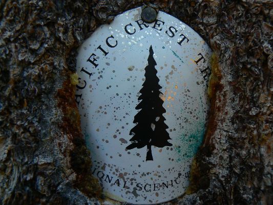
Click here or on the PCT trail marker to go to all WV reports about The PCT, JMT, Sierra hikes
| ||||
Half-mile site: Pacific Crest Trail Maps and GPS Information - a terrific resource
Pacific Crest Trail Association
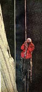
Click here to: see the First ascent of El Capitan, Argosy Magazine, 1959 (10 pages) 22 MB.
Marc Reisner (1993) Cadillac Desert: The American West and Its Disappearing Water, Revised Edition, Penguin Books
Bill McKibben – suggested books include: Maybe One, Eaarth, The End of Nature
The waypoints with numbers indicate PCT mileage from the Southern US border.
![]() for the wonderful Halfmile maps for section L, California, Donner Summit to Sierra City, click here.
Visit pctmap.net for waypoints, tracks,
more maps -- for the entire PCT. A super resource.
for the wonderful Halfmile maps for section L, California, Donner Summit to Sierra City, click here.
Visit pctmap.net for waypoints, tracks,
more maps -- for the entire PCT. A super resource.
section M, California, Sierra City to Belden, click here.
section N, California, Belden to Burney Falls, click here.
Scenic Toilets of Inner Earth: Scenic Scatology of the Wilderness Vagabond
We Are Breeding Ourselves to Extinction (click here for full article) or at:
Breeding ourselves to extinction?
More Truth Than Joke:
| ||||
| ||||
| ||||
| ||||
|
Wild Vagabond Main |
Trip Report Index  |
Caveat  |
|---|


 of Little
Tree runing from the Chimney Fire near Lake Isabella.jpg)


